In General
History
Route's 29 and 79
Route 59
Route 66
Route 75

In General
History
Route's 29 and 79
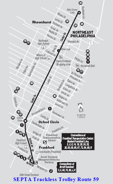
Route 59
Route 66
Route 75
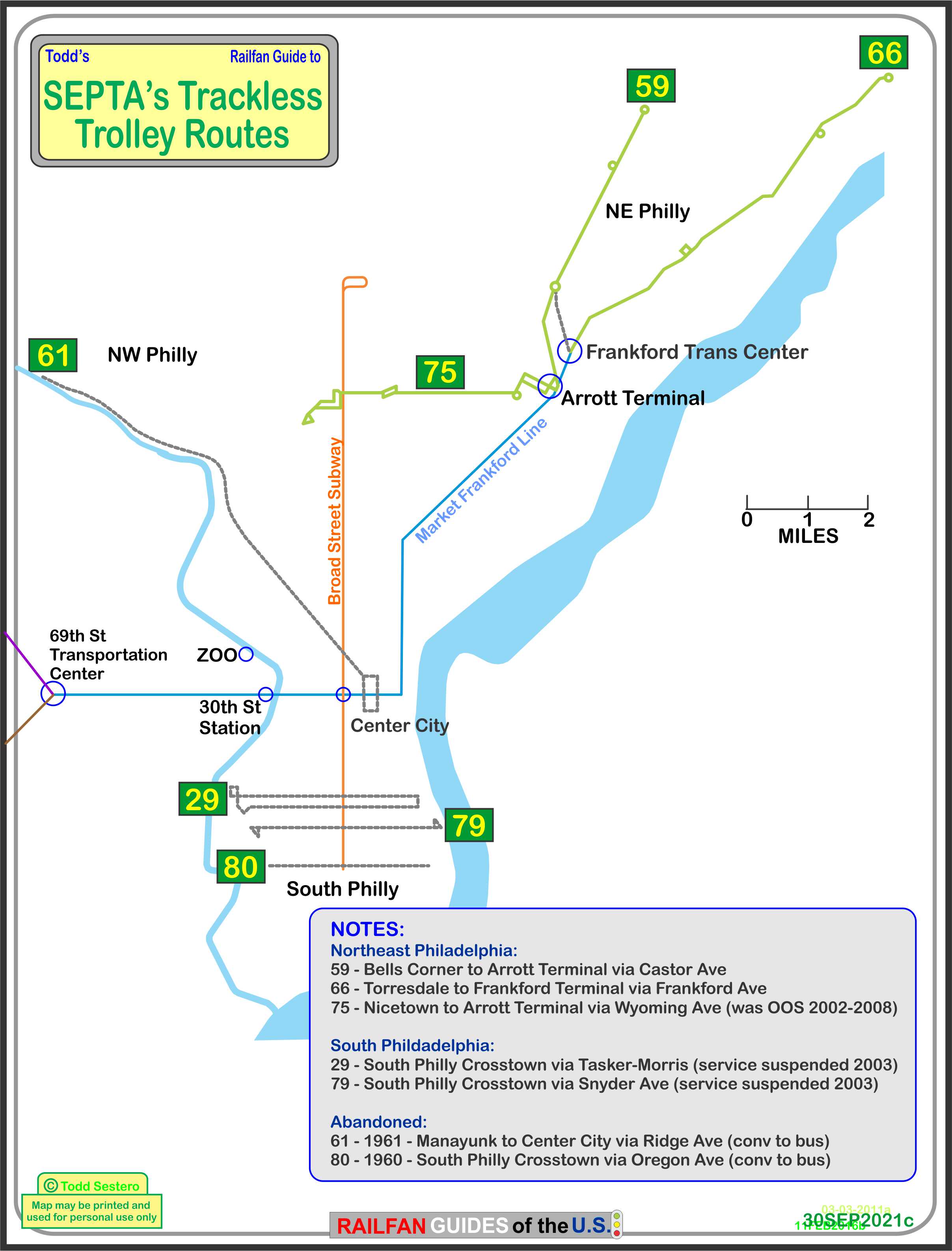
The above map in PDF format is
here
Map of past and present Trackless Trolley Routes in Philadelphia
Only the NE routes are currently in operation
The blue and orange lines are subway lines
Most of the above information was gathered from
the Philly Traction group on Yahoo, Elliot F, Jon Bell's page, and some from
http://www.phillytrolley.org/. The Lines The 59 route has a mid-route loop, or
turnaround called the Alma Loop at Bleigh Ave. There also used to be an
emergency turnaround at Hellerman St, but was eliminated due to the fact that
the new TT's can operate off wire if necessary. Up until the 90's,
several runs a day would terminate at the Alma Loop and head back to Arrot.
From Elliot F also comes that in the 50's, 60's ,and early 70's, the 59 route
also operated skip-stop service, which would speed up service by skipping every
other stop.
The 66 line runs in northeast Philadelphia,
and connects to the Market-Frankford subway line at the Frankford Transportation
Center. Originally, the line was put into service in 1955 with trackless
trolleys replacing busses. Service was discontinued in 2003 with busses
doing the duty until 2008. This route is unique in the United States, in that along Frankford
Avenue, there are two sets of wires so that SEPTA can use the "inner" set for
express busses during rush hour, shown by the gray line in the map below.
Route 66 has three loops in service, City Line loop at the end of the line, the
Gregg St loop, just south of Linden Ave, and the loop at Cottman and Ryan
Avenues. This route also had an emergency turnaround at Welsh Rd, but was
removed for the same reason as the loop on the 59 route was removed. The
loops are shown below.
I don't have any books on the subject, and info on the internet is hap-hazard...
if anyone wishes to contribute and share their wealth of knowledge, contact info
is at the bottom of the page.
Currently, SEPTA has three trackless trolley lines
operating: 59, 66, and 75. The three lines use 38 brand-spanking
new T-T's received on June 1st, 2008. The T-T's were built by
New Flyer Industries.
Two other lines, 29 and 79, are not currently in service because SEPTA has
been reluctant to order additional busses to support these lines.
It also looks like most of the wires are down.
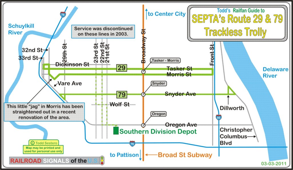

The current map for bus route 29, South
Philadelphia Crosstown..... slightly different than the trackless trolley
routing.
The current Route 79 map, also called the
South Philadelphia Crosstown.... The routing is the same as the trackless
trolley route.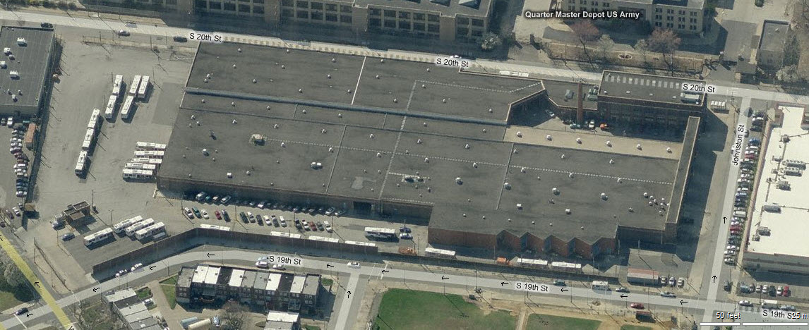
The Southern Division's Depot, looks like the
wires are all down from up here.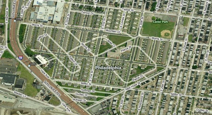
Fortunately, Bing still has the old road
layout in their system, showing you how the roads used to be at the west end of Route
29.
 The Bells Corner loop at the end of the line.

Photo of #817 by Davidt8 (from Google) from
January 2010, in the 7300 block of Frankford Ave. It's a far cry from the
T-T's of days gone by.
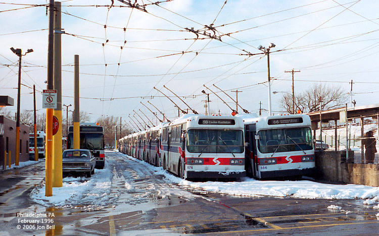
A double line of Trackless Trolleys sits
at the Frankford Depot on a snowy day in 1996.
Photos courtesy Dr. Jon Bell, Presbyterian College, Clinton SC, Thanks Jon!
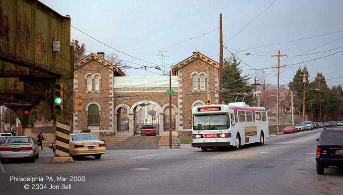
A Route 66 T-T passes the entrance to the Cedar Hill cemetery just before returning
to the Frankford Terminal - at the left is the end of the Frankford elevated structure.

For more info:
http://en.wikipedia.org/wiki/SEPTA_Route_66
 The loop at Cottman and Ryan Avenues.
 The Gregg St loop.
 The City Line loop.
Route 75
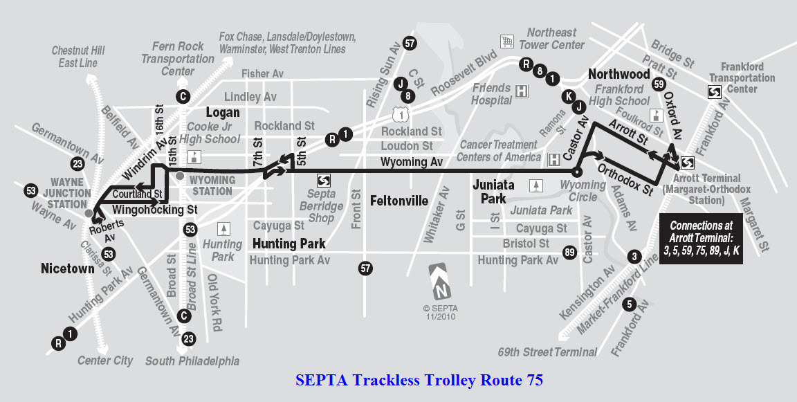
 Route 75 loop at Wayne Junction.... Nice commuter rail stop here.
 The "loop" at Arrott Terminal, the eastern end of Route 75.
Disclaimers:
I love trains, and I love signals. I am not an expert. My webpages reflect what I find on the topic of the page. This is something I have fun with while
trying to help others.
Please Note: Since the main focus of my two websites is railroad signals, the railfan guides are oriented towards the signal fan being able to locate them.
For those of you into the modeling aspect of our hobby, my
indexa page has a list of almost everything railroad oriented
I can think of to provide you with at least a few pictures to help you detail your pike.
If this is a railfan page, every effort has been made to make sure that the information contained on this map and in this railfan guide is correct. Once in a while,
an error may creep in :-)
My philosophy: Pictures and maps are worth a thousand words, especially for railfanning. Text descriptions only get you so far, especially if you get lost or
disoriented. Take along good maps.... a GPS is OK to get somewhere, but maps are still better if you get lost! I belong to AAA, which allows you to get
local maps for free when you visit the local branches. ADC puts out a nice series of county maps for the Washington DC area, but their state maps do not have the
railroads on them. If you can find em, I like the National Geographic map book of the U.S..... good, clear, and concise graphics, and they do a really good job
of showing you where tourist type attractions are, although they too lack the railroads. Other notes about specific areas will show up on that page if known.
Aerial shots were taken from either Google or Bing Maps as noted. Screen captures are made
with Snagit, a Techsmith product... a great tool if you have never used it!
By the way, floobydust is a term I picked up 30-40 years ago from a National Semiconductor data book, and means miscellaneous
and/or other stuff.
Pictures and additional information is always needed if anyone feels inclined to take 'em, send 'em, and share 'em, or if you have something to add or correct.... credit
is always given! Please be NICE!!! Contact info is here
Beware: If used as a source, ANYTHING from Wikipedia must be treated as being possibly inaccurate, wrong, or not true.
SEPTA HOMEPAGE
RAILFAN GUIDES HOME
RAILROAD SIGNALS HOME
NEW FEB28/2011, FEB11/2016, SEP16/2019, OCT01/2021
Last Updated: 01-Oct-2021