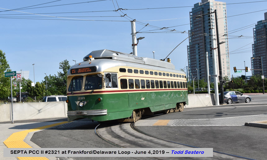
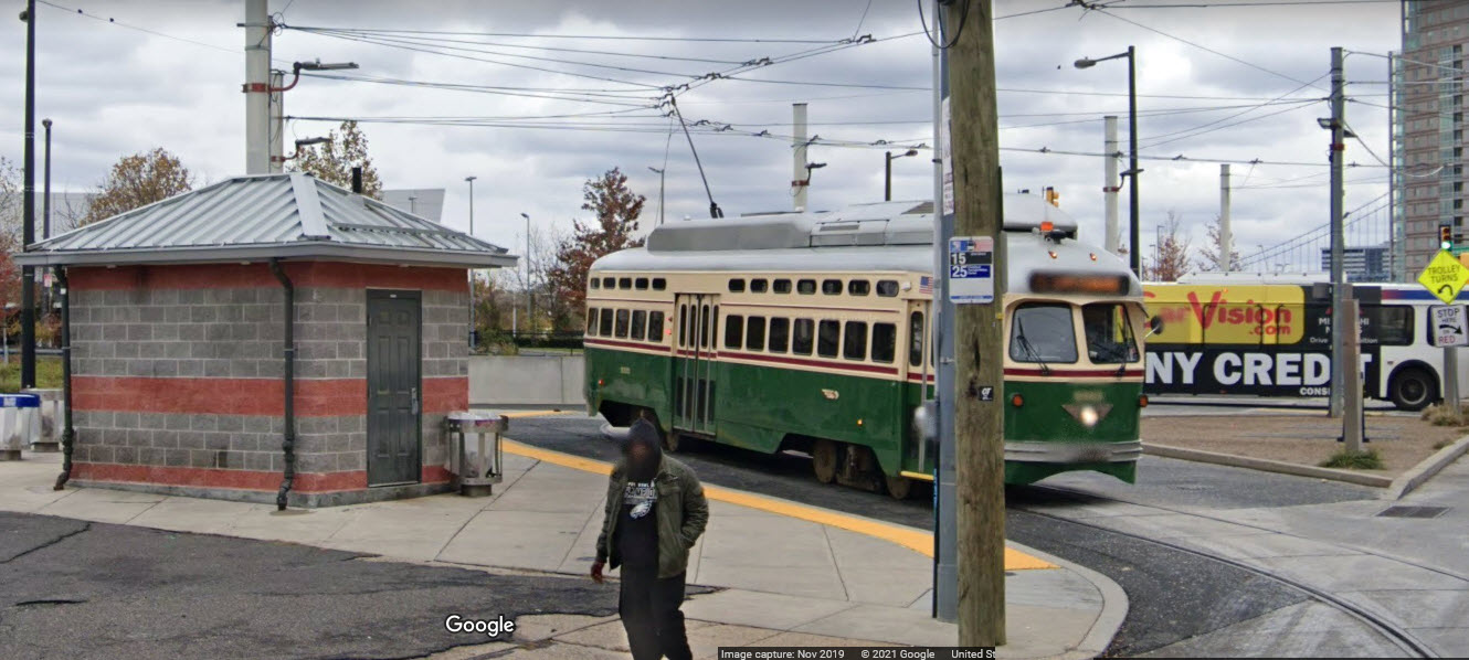
The #15 Streetcar line uses up-dated PCC cars, dating back to 1947
- the work being done around 2009. They were upgraded with a
new electronic control system, taking a seat away right behind the operator, new
LED lights all over, widening of the center door, an ADA compliant wheelchair
lift, and air-conditioning. Work on the PCC's cost around $1.3 mil for
each car. The 17 cars were originally built by the St. Louis Car Co, rebuilt by the
Brookville Equipment Co, and carry the designation "PCC II".
The photo at the top of the page was
taken in July of 2005, shortly after being placed back into service, when they
were being used on the Surface Subway lines.
The line returned to service after a
13 year hiatus. SEPTA spent a reported $100 million on fixing up the line
and the cars, including some new trackwork and overhead lines. Buses were
used in the interim for service on the 15. The line re-opening was delayed
by a fight with residents along 59th street, which is needed to gain access to
the Callohill depot, which is where they operate out of.
SEPTA continues to receive criticism
over it's use of money to restore streetcar service, when opponents say the
money could be used for extending other lines or used elsewhere for something
more practical or income producing. Apparently, returning streetcar
service to the #15 line hasn't produced anything significant in the way of
neighborhood renewal or anything of that order.
In the continuing saga of on and off trolley service on the number 15 line,
SEPTA has decided to suspend trolley operations as of Sunday, 1/26/2020, for
maintenance of the cars and street/road work, and continue for the majority of
2021. Bus service will be substituted.
Due to the fact that the #15 line crosses a good portion of Philadelphia,
there is no ONE place for you to gain access to it.
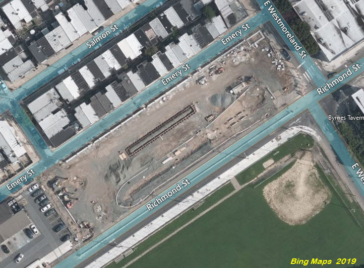
-- Let's start off with the NE side along Richmond Street and Girard Avenue.
For folks coming south out of (say) New Jersey on I-95, take exit 25, this will
dump you out on Allegheny Ave, a half a block off of Richmond St at one end of
the new loop for the end of the line.
If you're going NB on I-95, take the same exit, #25, and take a left on
Westmoreland, this takes you up to Richmond St at the other end of the new loop.
According to Railway Preservation dot com, the classic 1913 Callowhill
shops building is the oldest surviving facility of its kind on the SEPTA system.
One area of the facility remains for streetcar maintenance, while the remainder
has been converted for bus use.
The streetcar servicing part of the facility is on the north end, adjacent to Callowhill.
Streetcars enter off of 58th St. There are 7 tracks entering the barn, 6 coming out.
According to Google Maps, the building is 465 feet wide. It's 2 miles
from 30th Street Station, as the crow flies.
Beautiful trackwork at Callowhill and 59th, altho not all of it is used anymore....
Other Aerial Shots
Fancy track work "that used to be" at Girard Ave and Haverford/60th St:
Aerial shots where they caught a PCC car in action....
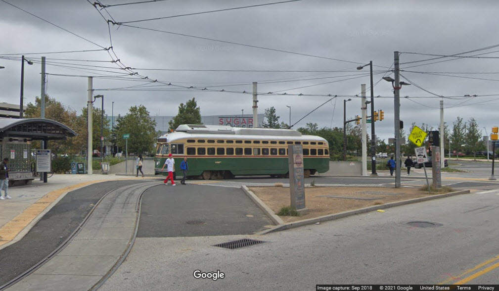
The following pictures ARE NOT from the #15 line, but are from 2005 when they were
first placed into service and SEPTA ran them on the Surface Subway lines.
At the 40th St Portal.
At the Elmwood Depot, where the fan trip originated from.
Rear view of the rebuilt cars, while at the 40th Street portal.
Inside the rebuilt PCC cars, on a fan trip taken in July 2005.
GPS Coordinates: 39.97538, -75.19298
This bridge goes over the Schuylkill River, adjacent to the Philadelphia Zoo,
and one end of it is tucked away under the Amtrak's Northeast Corridor.
photo by Mike Szilagyi, 2008, via phillytrolley.org
Girard Ave over CSX
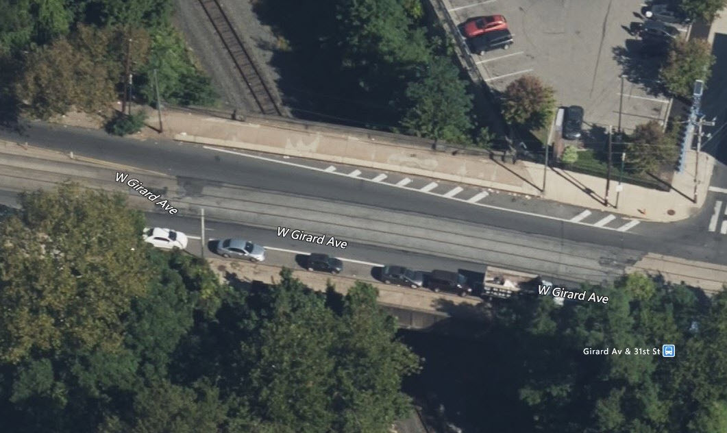
GPS Coordinates: 39.97508, -75.18710
Technically, I guess this is a bridge since it is going over the CSX.
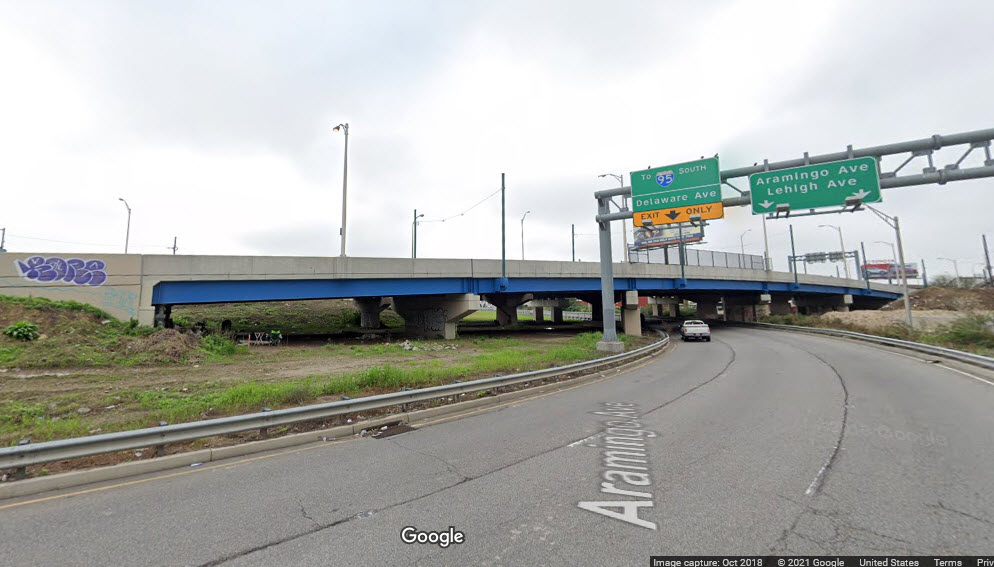
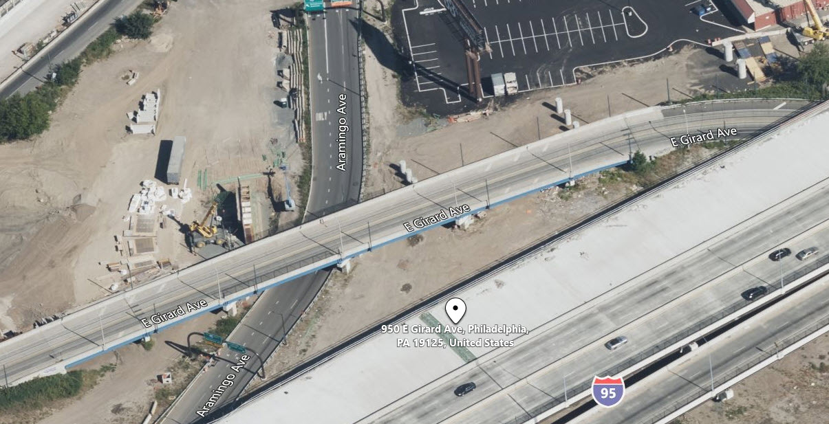
Girard Ave over Aramingo Ave
GPS Coordinates: 39.97311, -75.12185
Another road type overpass.
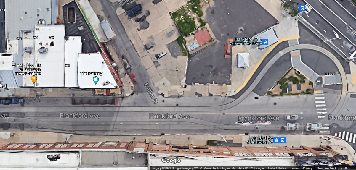
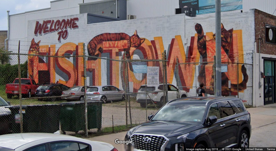
Just off of Girard Avenue, at the intersection of Frankford Ave and Wildey
St, sits this sign welcoming people to Fishtown, an
area in NE Philadelphia, as seen in one of the pictures above.
Disclaimers:
I love trains, and I love signals. I am not an expert. My webpages reflect what I find on the topic of the page. This is something I have fun with while
trying to help others.
Please Note: Since the main focus of my two websites is railroad signals, the railfan guides are oriented towards the signal fan being able to locate them.
For those of you into the modeling aspect of our hobby, my
indexa page has a list of almost everything railroad oriented
I can think of to provide you with at least a few pictures to help you detail your pike.
If this is a railfan page, every effort has been made to make sure that the information contained on this map and in this railfan guide is correct. Once in a while,
an error may creep in :-)
My philosophy: Pictures and maps are worth a thousand words, especially for railfanning. Text descriptions only get you so far, especially if you get lost or
disoriented. Take along good maps.... a GPS is OK to get somewhere, but maps are still better if you get lost! I belong to AAA, which allows you to get
local maps for free when you visit the local branches. ADC puts out a nice series of county maps for the Washington DC area, but their state maps do not have the
railroads on them. If you can find em, I like the National Geographic map book of the U.S..... good, clear, and concise graphics, and they do a really good job
of showing you where tourist type attractions are, although they too lack the railroads. Other notes about specific areas will show up on that page if known.
Aerial shots were taken from either Google or Bing Maps as noted. Screen captures are made
with Snagit, a Techsmith product... a great tool if you have never used it!
By the way, floobydust is a term I picked up 30-40 years ago from a National Semiconductor data book, and means miscellaneous
and/or other stuff.
Pictures and additional information is always needed if anyone feels inclined to take 'em, send 'em, and share 'em, or if you have something to add or correct.... credit
is always given! Please be NICE!!! Contact info is here
Beware: If used as a source, ANYTHING from Wikipedia must be treated as being possibly being inaccurate, wrong, or not true.


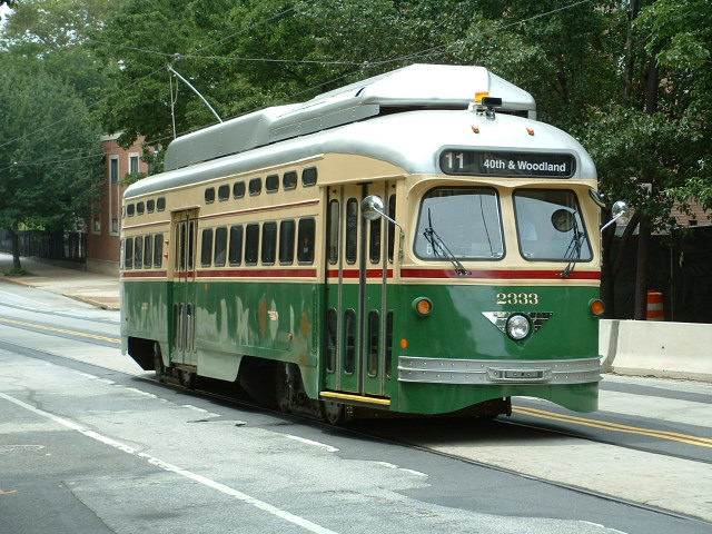
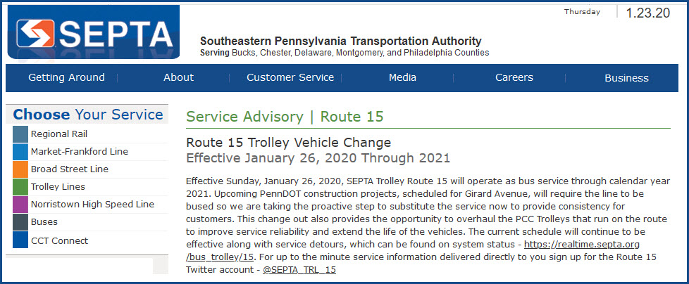
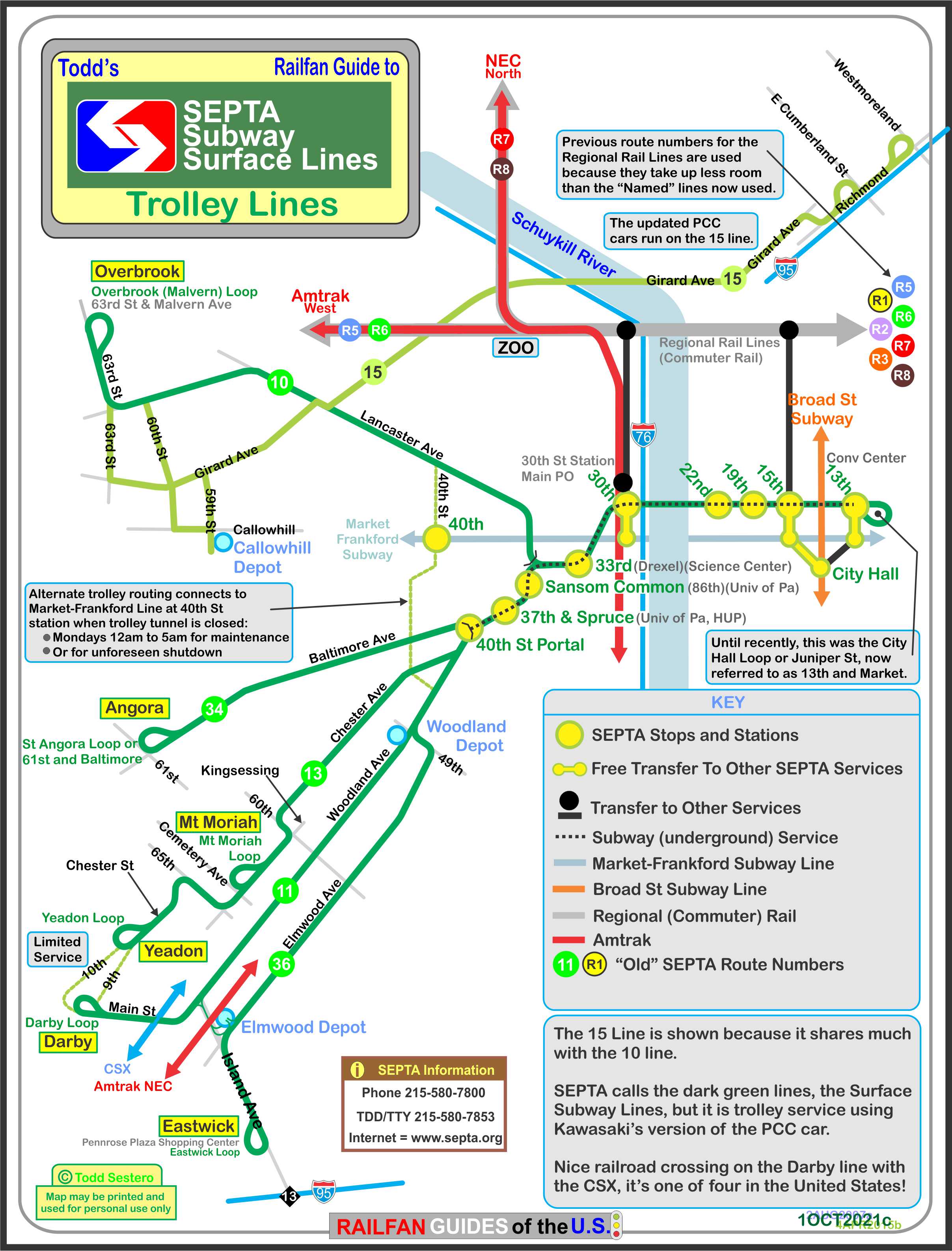

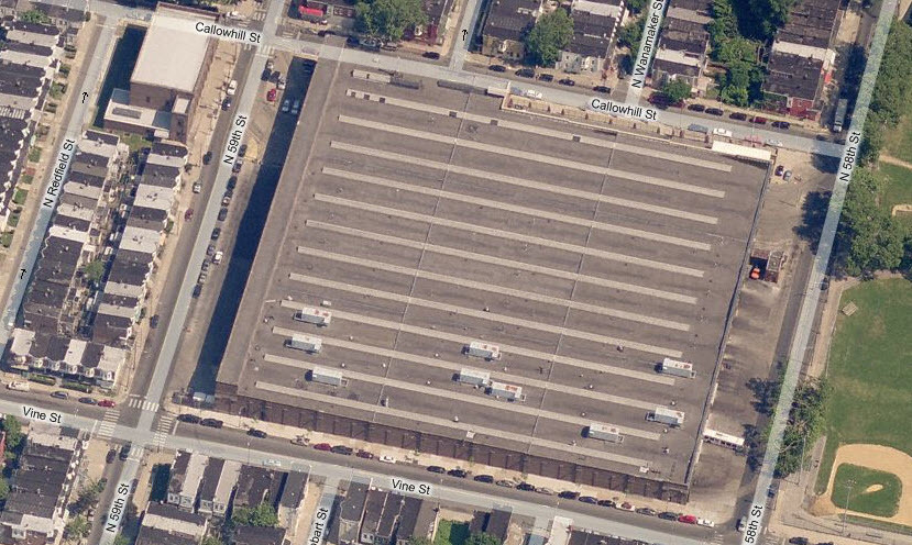
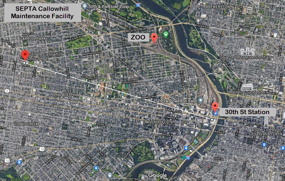

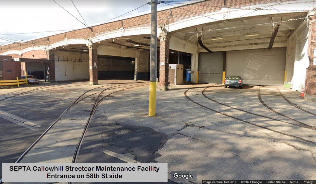
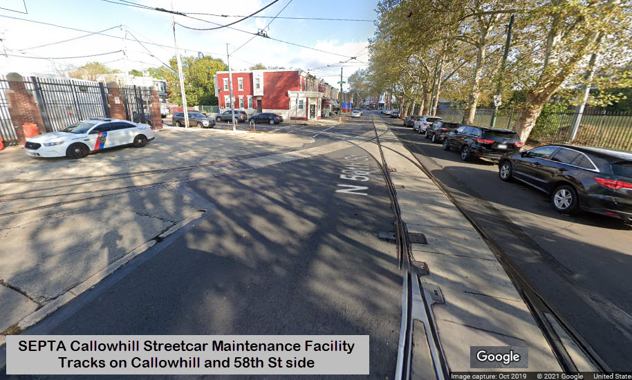

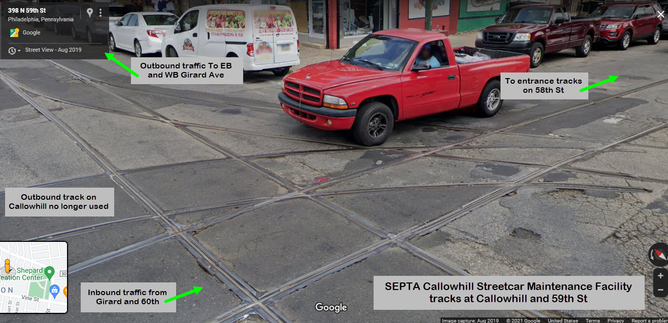
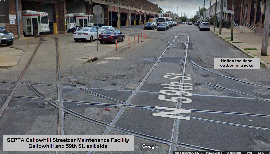
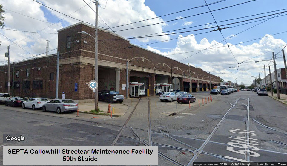
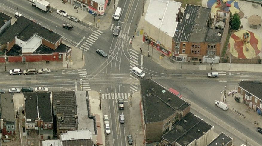
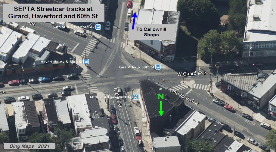
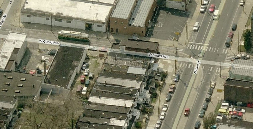

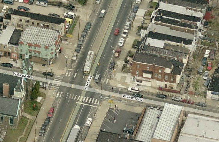
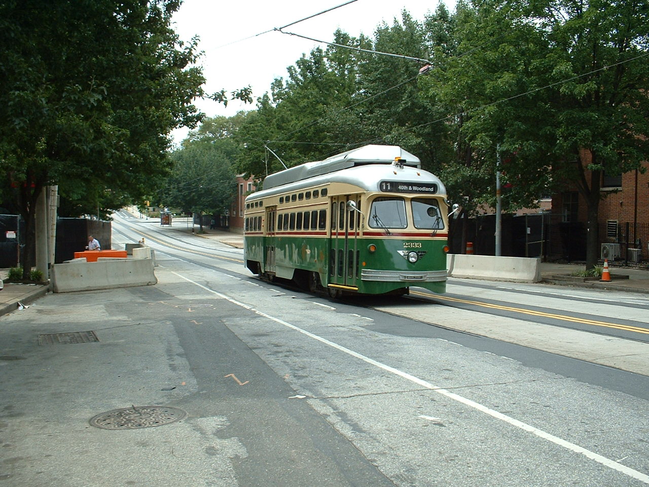
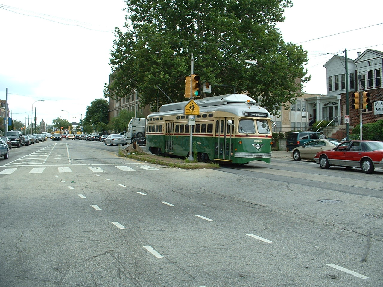
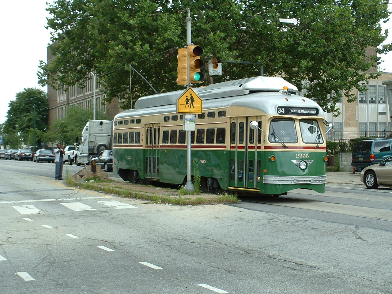

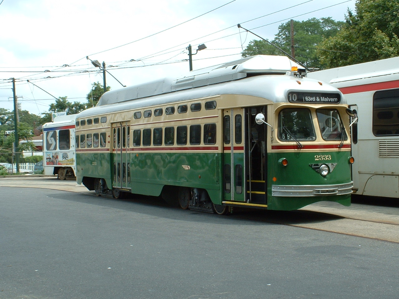
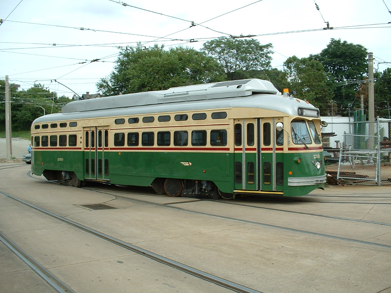
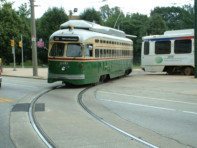
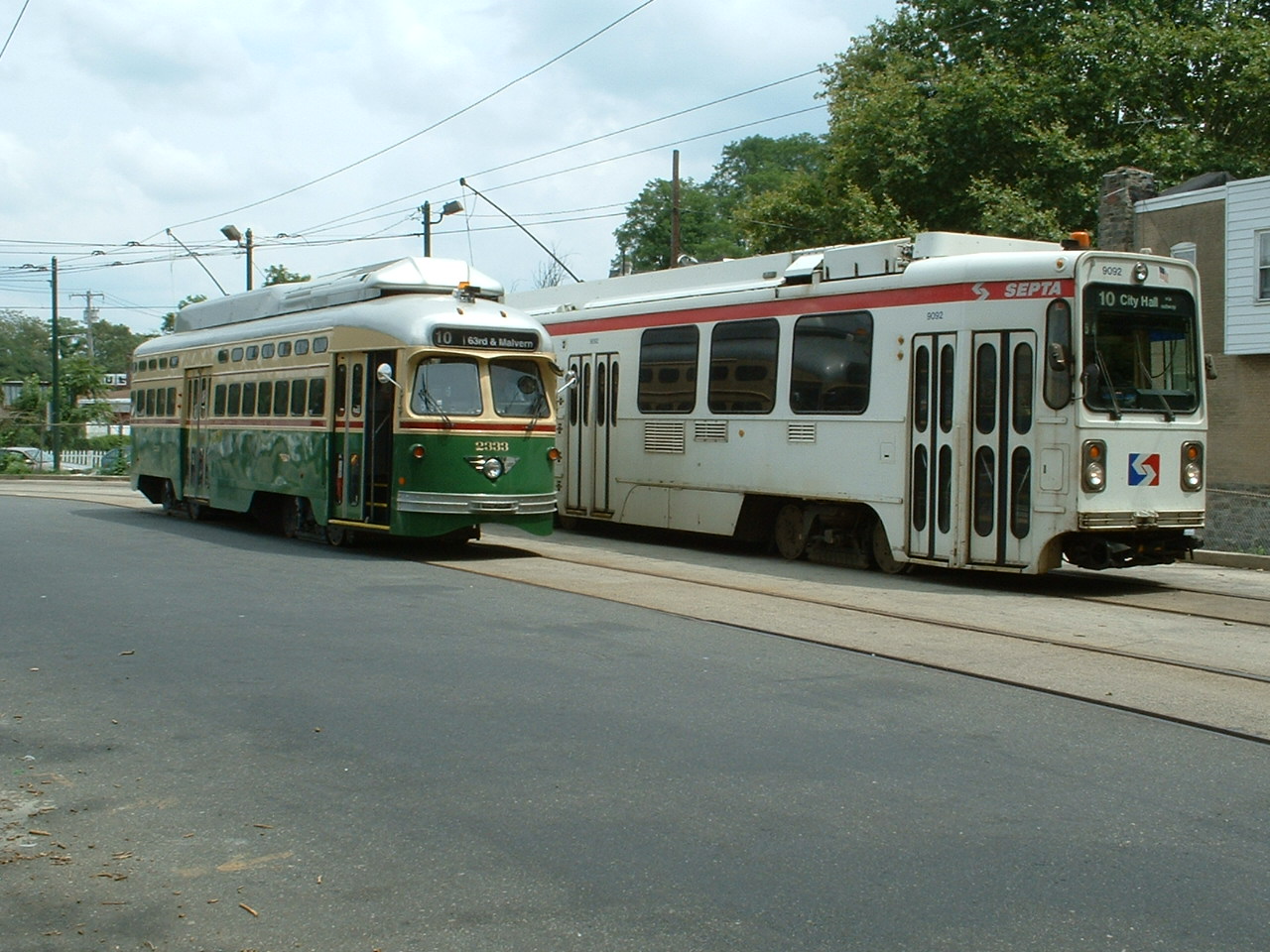
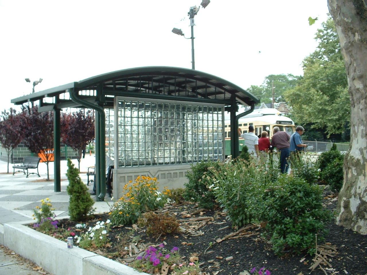

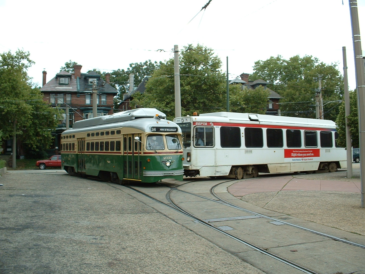
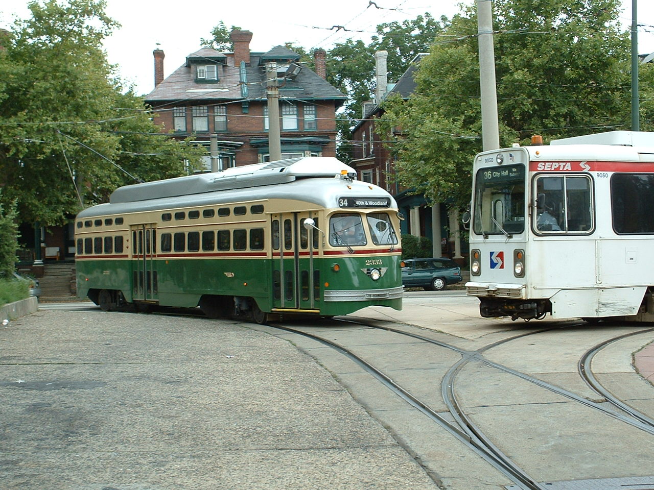
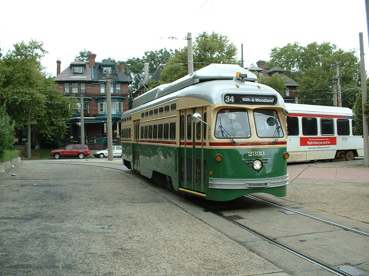
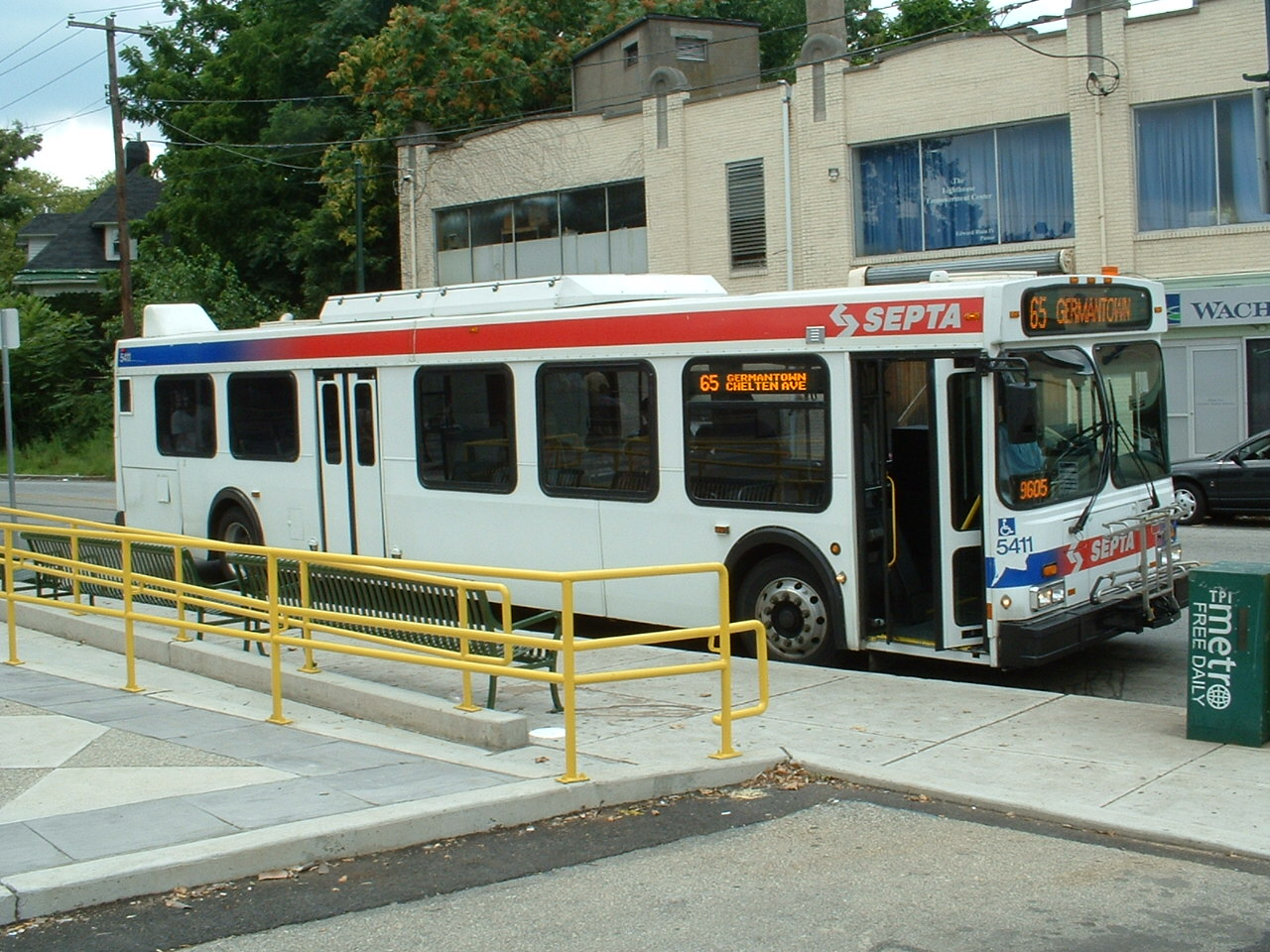
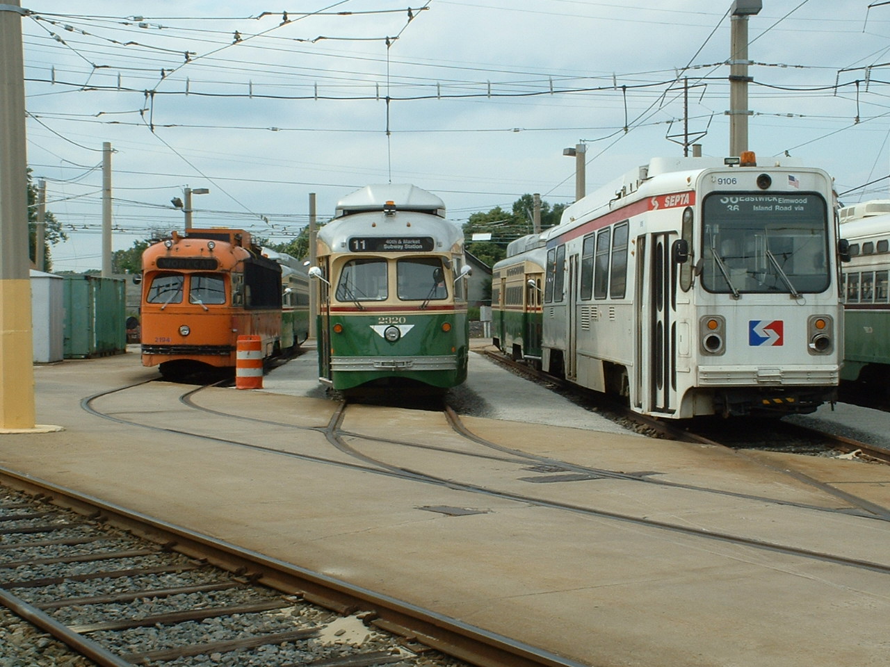
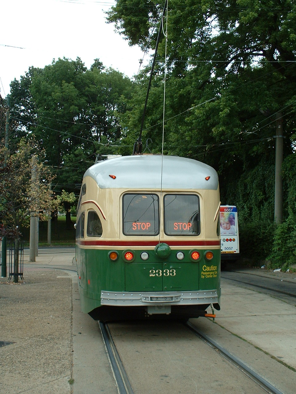
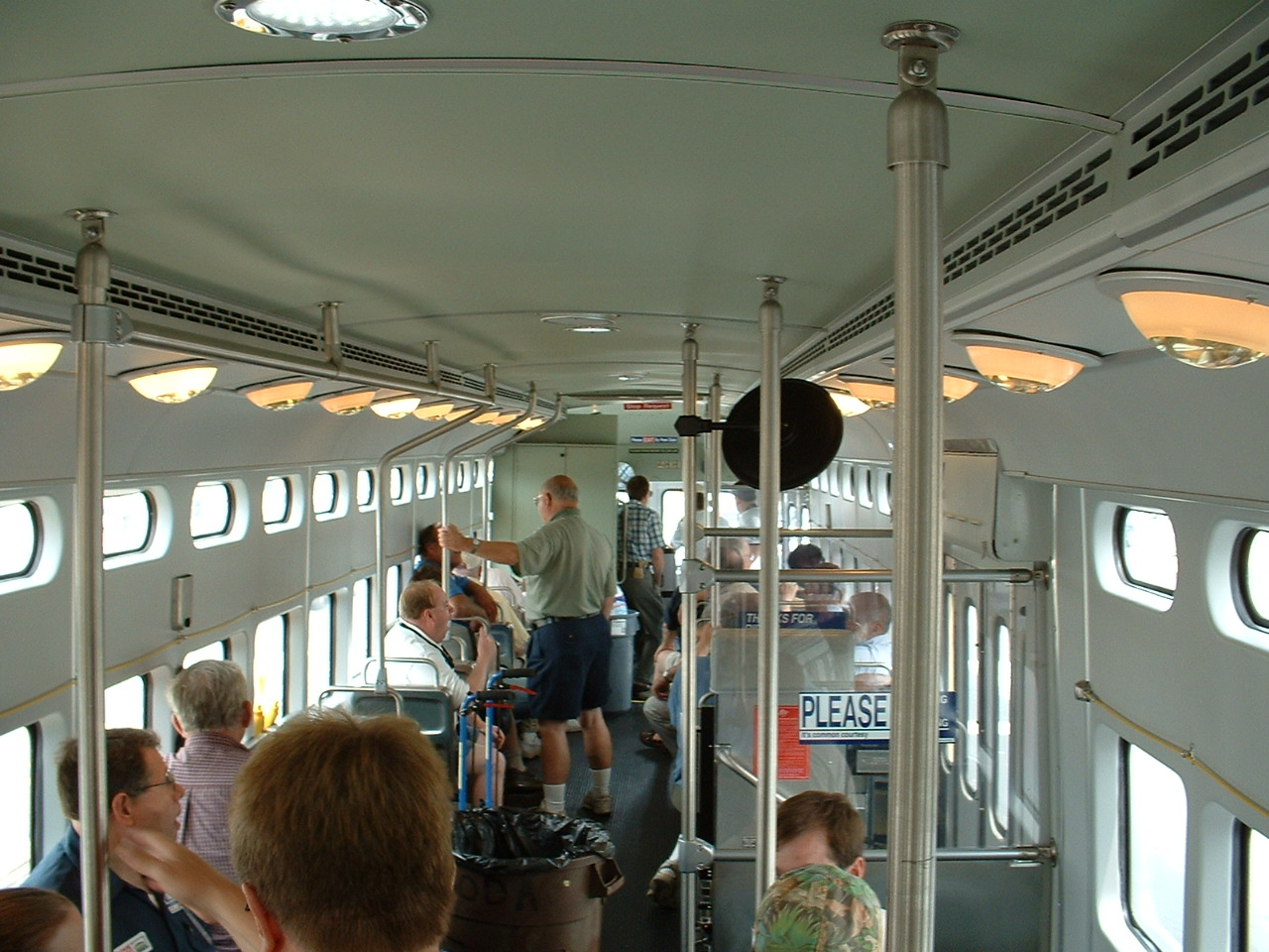
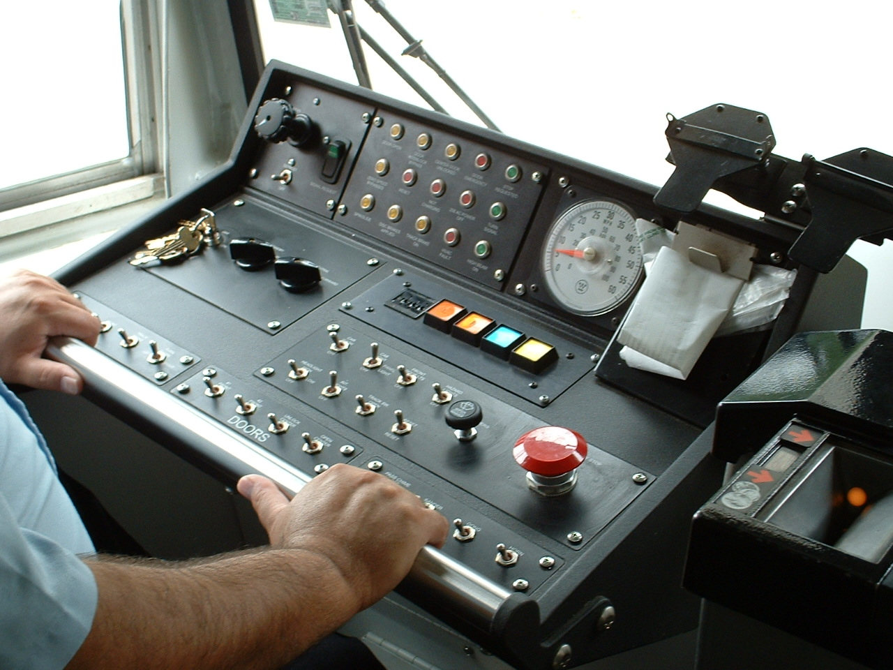
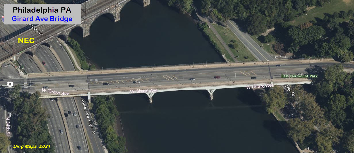
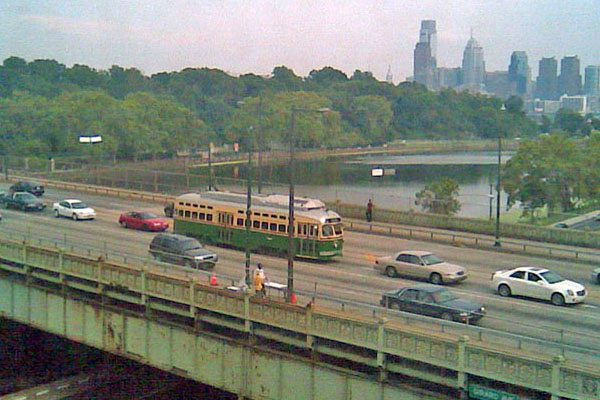 photo by Mike Szilagyi, 2008, via phillytrolley.org