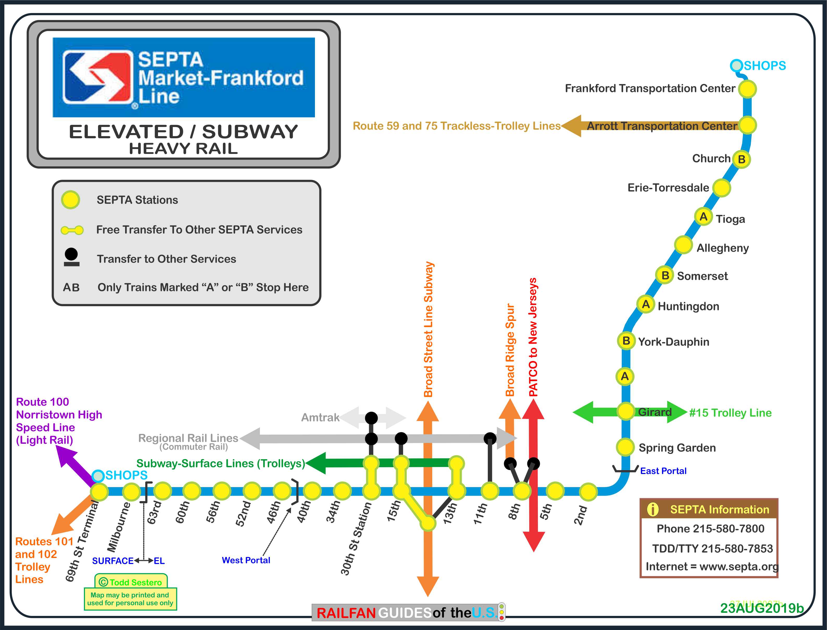
From Wikipedia at : The Market–Frankford Line begins at the
69th Street Transportation Center, in Upper Darby. From
there it is elevated over Market Street until 46th Street, where it
curves north and descends underground via a portal at 44th Street.
At 42nd Street, the tunnel returns to the alignment of Market Street.
At 32nd Street, the tunnel carrying the
Subway-Surface lines joins the MFL tunnel. The MFL tracks
are in the center and the trolley tracks are on the outside. 30th
Street station consists of an island platform between the two
innermost tracks for Market–Frankford Line trains, and outboard
"wall" platforms for Subway–Surface route 10, 11, 13, 34, and 36
trolleys. After passing beneath the Schuylkill River, the next
stop to the east for Market–Frankford Line trains is at 15th Street;
Subway-Surface trolleys also have stations at 22nd Street and 19th
Street. 15th Street is the central interchange station for the
MFL, Subway-Surface trolleys, and
Broad Street Line. The Subway-Surface tracks end in a loop
beneath 13th Street at Market just after crossing above the Broad
Street Line.
Though it now tunnels in a straight line
directly beneath Philadelphia City Hall, prior to 1936, the original
MFL trackage between 15th and 13th Street stations separated and
looped around the foundation of City Hall (eastbound trains around
the south side returning to be westbound trains from the north
side). Parts of that original alignment can still be seen from
subway-surface cars as they pass south of City Hall en route to 13th
Street station (as well as the bridgework in the ceiling of the
southbound platform of the City Hall stop on the Broad Street line).
The Market Street tunnel continues east to Front Street and then
turns north, where it rises in the median of I-95. The rail
line and freeway share an elevated embankment for about 1/2 mile (0.8
km), including Spring Garden station (which replaced Fairmount
station on the Frankford Elevated). The line then heads under
the southbound lanes and over Front Street on an elevated structure
that turns northeast onto Kensington Avenue, which merges with
Frankford Avenue, which the line follows to its end. Just
north of Pratt Street, a curve to the north brings the line to its
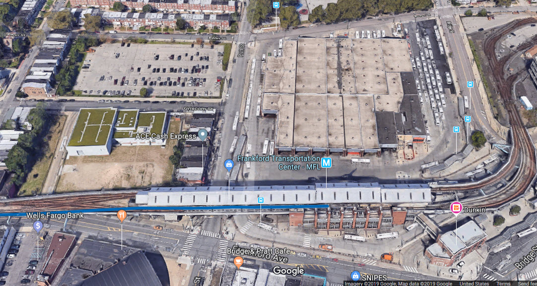
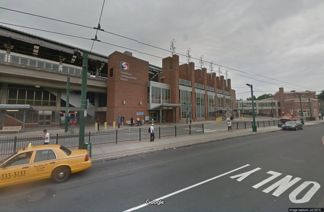
current terminus at the Frankford Transportation Center, which
replaced the original Bridge-Pratt Streets terminal.
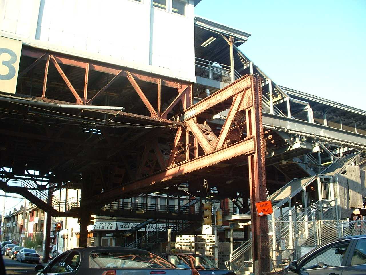
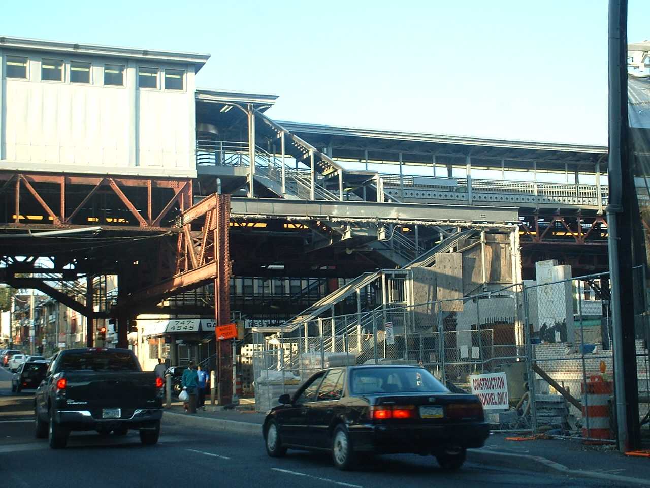
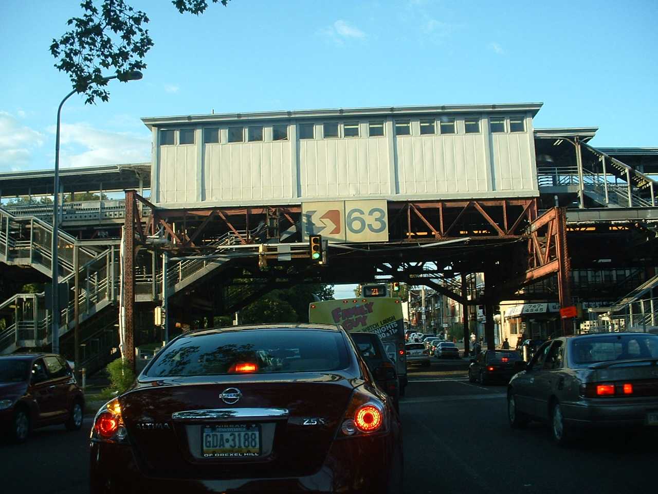
The 63rd St Station, looking north on 63rd Street. From 2007.
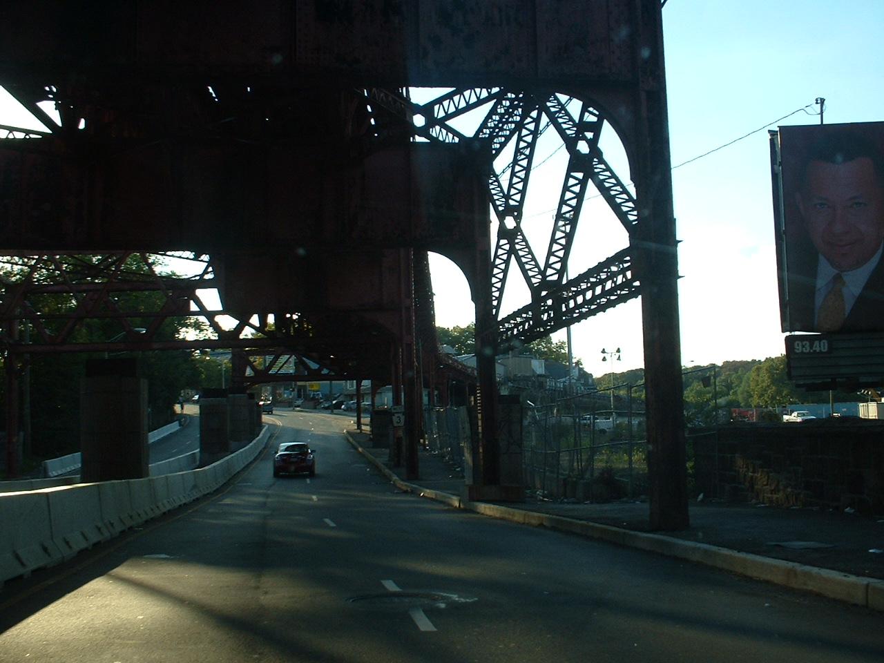
Under the EL portion just before it curves off to the right and becomes a surface critter. From 2007.
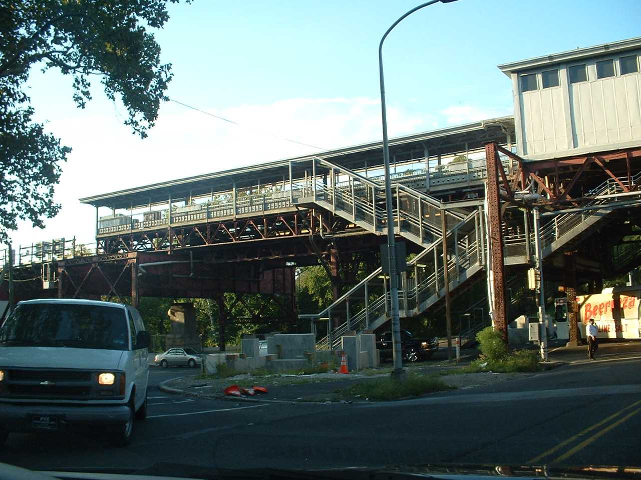
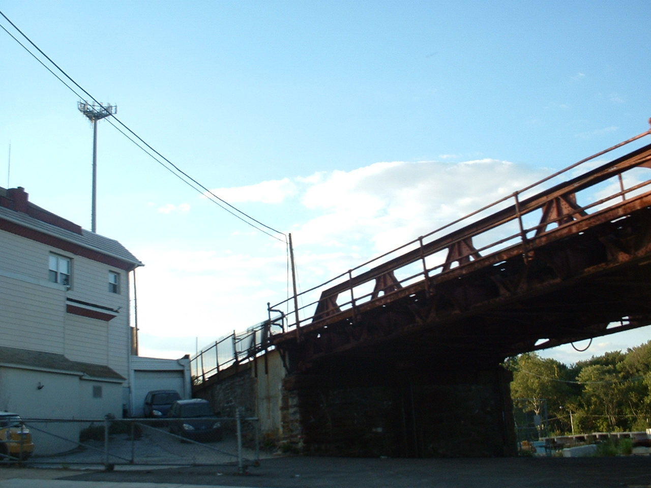
The transition from EL to ground level. There is
a spot between a couple of row houses where you can walk thru and grab some
pictures as they come by, and you are up close and personal...... From 2007.
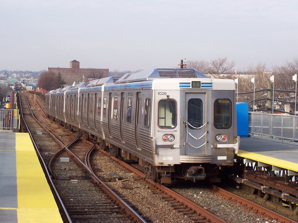
Train leaving the 52nd St station, headed west towards the 69th
St Transportation Center. Photo by Adam E. Moreira, from Wikipedia.
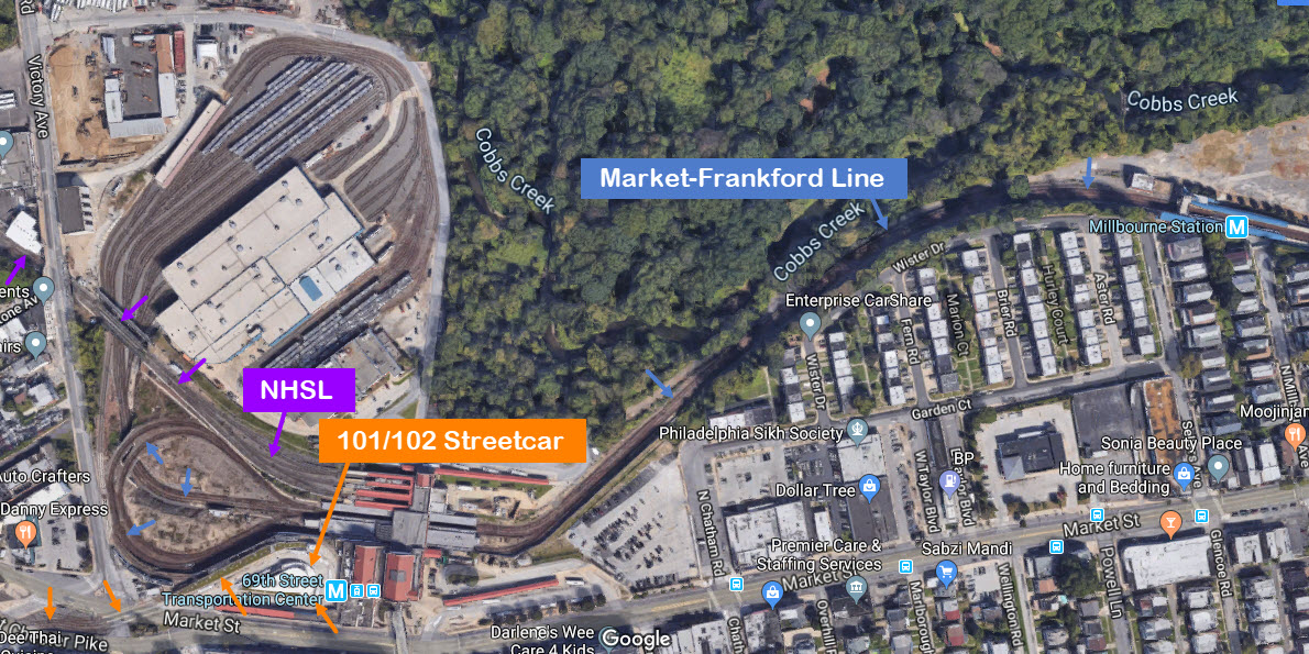
There are two major Transportation Centers on the line, and they are both at the ends.
The 69th Street Transportation Center is at the south end,
while the Frankford Transportation Center sits at the north end.
The 69th St TC is shown below, and handles the Market-Frankford line; the
Norristown High Speed line, which is a third rail powered light rail system; the
101 and 102 streetcar lines; and busses in two different locations, on either
side of the main building. I have a separate page for the center
here.
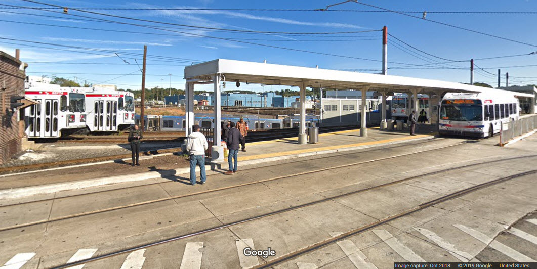
Here is a Google Streetview from West Chester Pike adjacent to the streetcar and
bus loop, you can see them plus a passing M-F train.
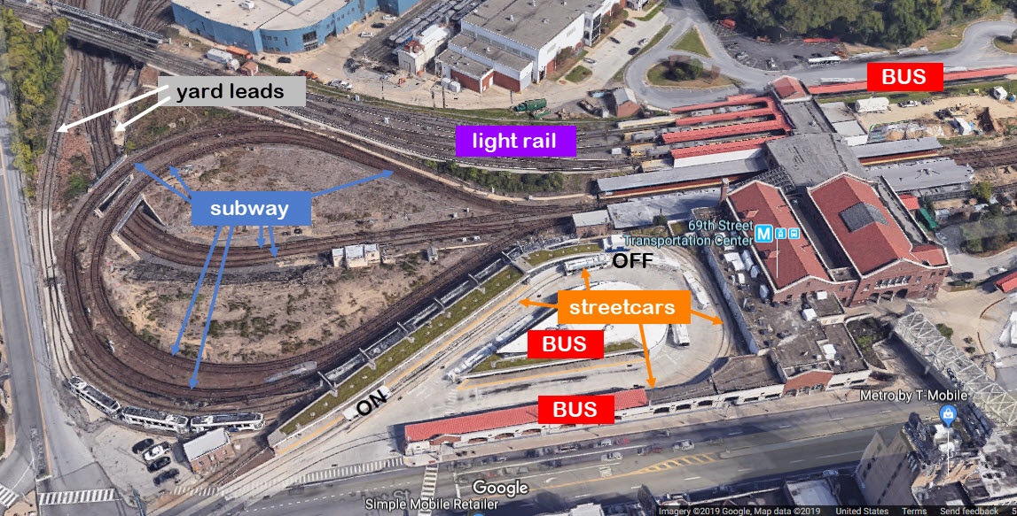
Here is a close-up of the loop and yard leads, which runs up the middle of the
loop. The Market-Frankford trains don't waste any time at the stations, so
you don't have any time to dawdle, but they are frequent enough that you don't
have to wait long for the next one to come. This makes it nice for
photographing the trains.
The Frankford TC is shown below.
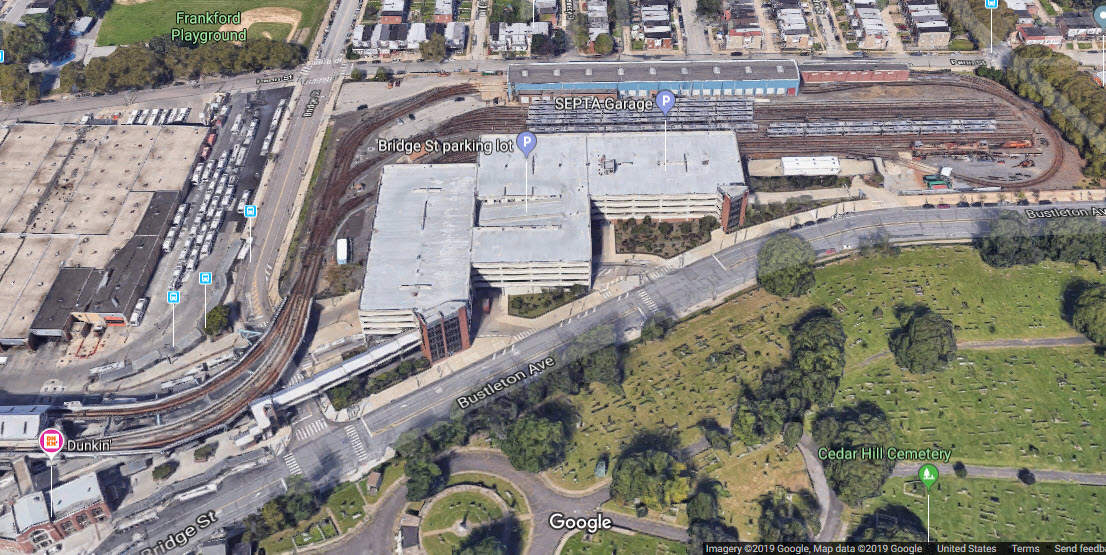
Located to the north of the station is a second yard for the trains, and great
pictures can be had from the parking garage. While there is not as much
variety here as at 69th street, the transit fan will still be able to spend a
lot of time here taking pictures. It does not seem as tho the trackless
trolleys are using the bus depot here, for on a visit in July 2019, we noticed a
number of breaks in the overhead wire in the yard.
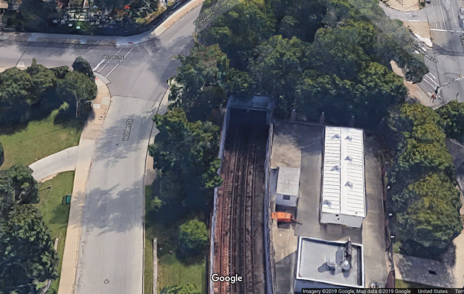
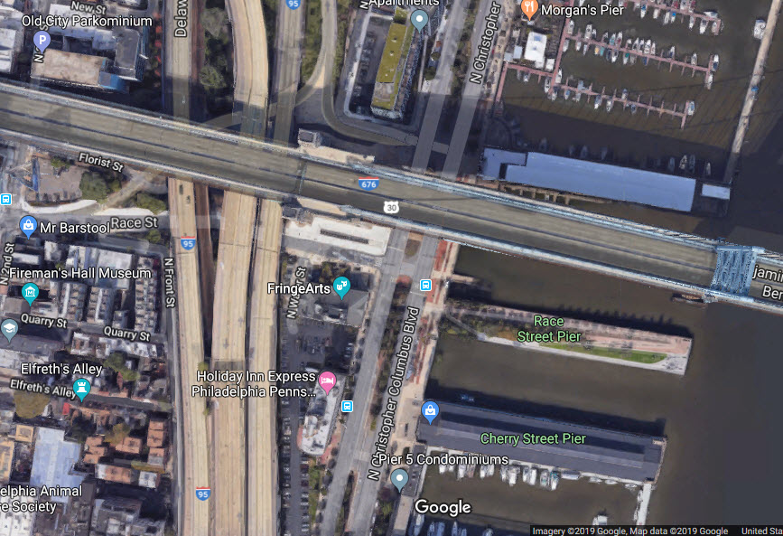
There are two of them on the line. This is where the trains
emerge from the tunnel that takes them below the city center. The
southern (or more correctly, western) portal is between the 46th and 40th Street
stations. The eastern/northern portal pops trains out in the middle of I-95
adjacent to and under the Benjamin Franklin bridge.
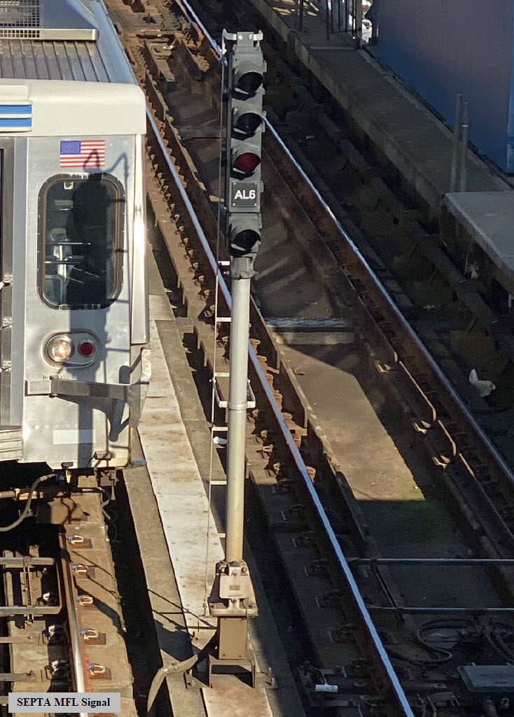
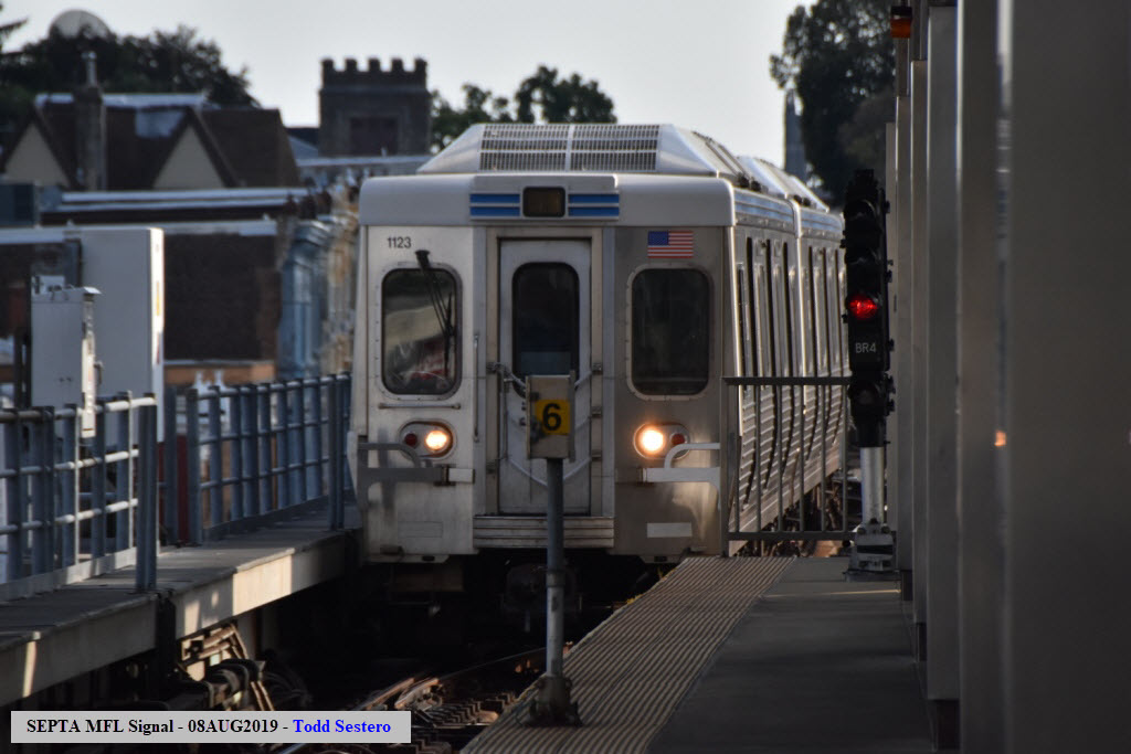
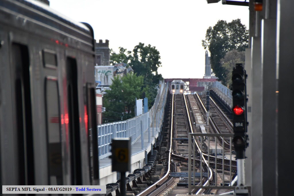
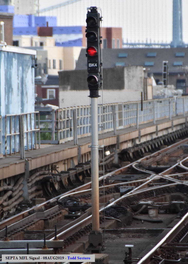
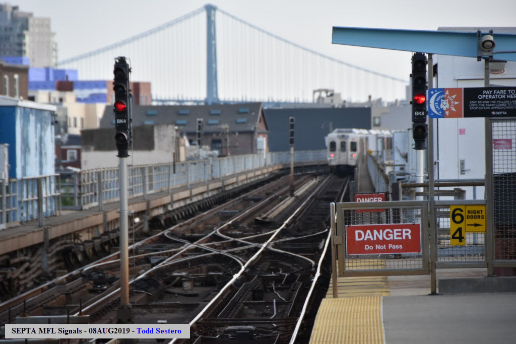
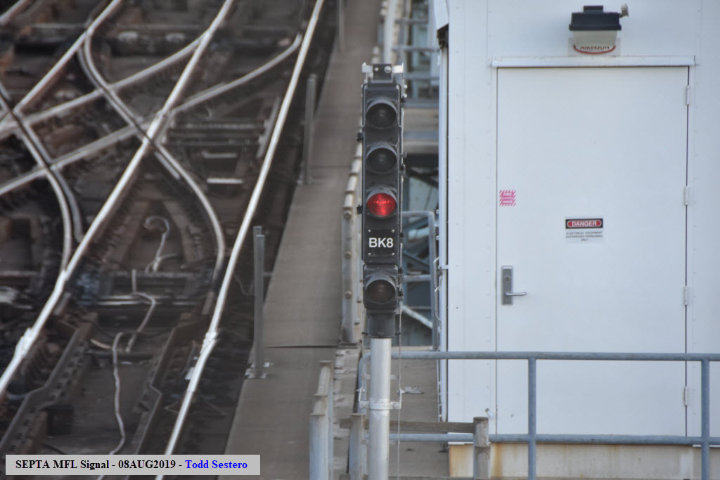
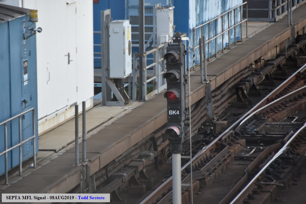
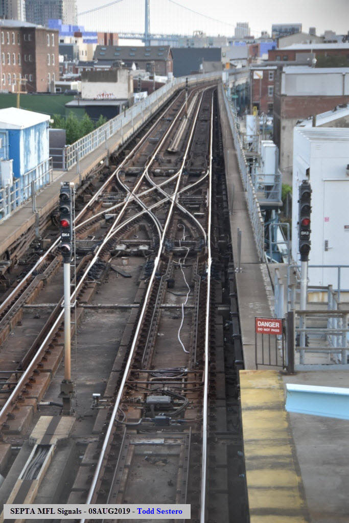
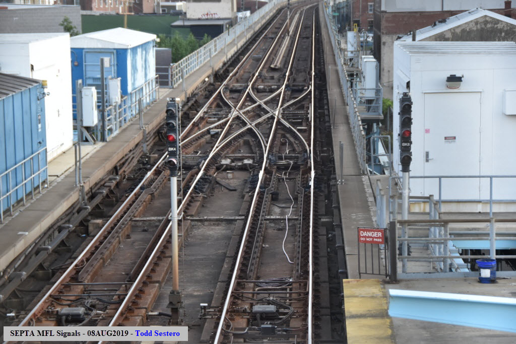
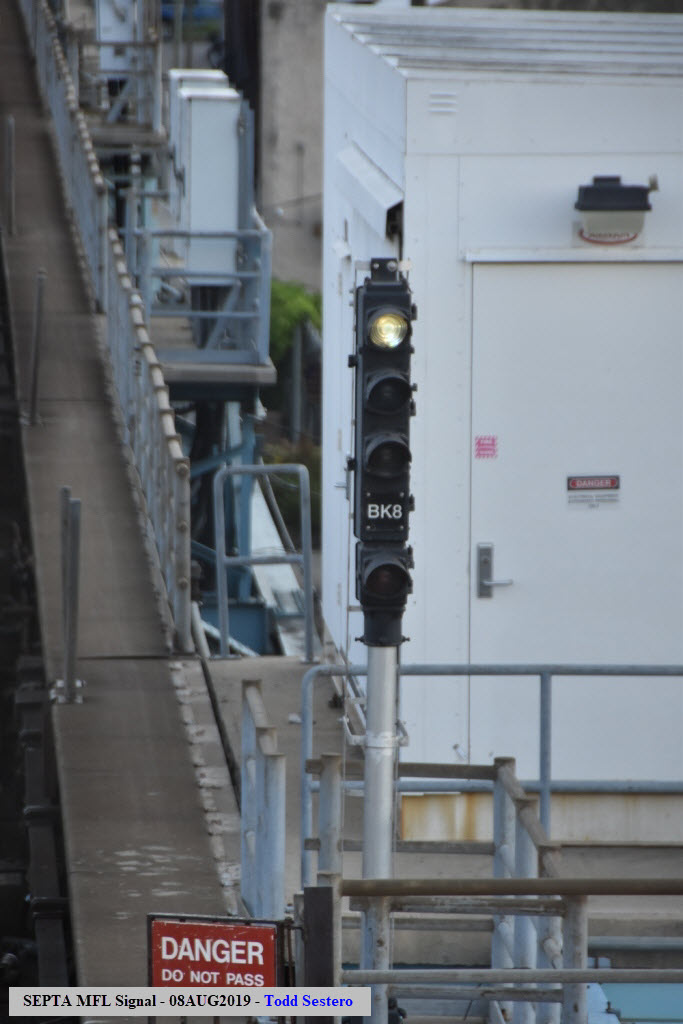
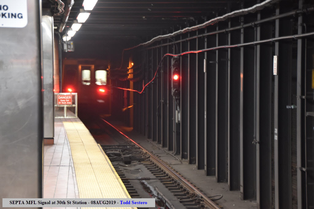
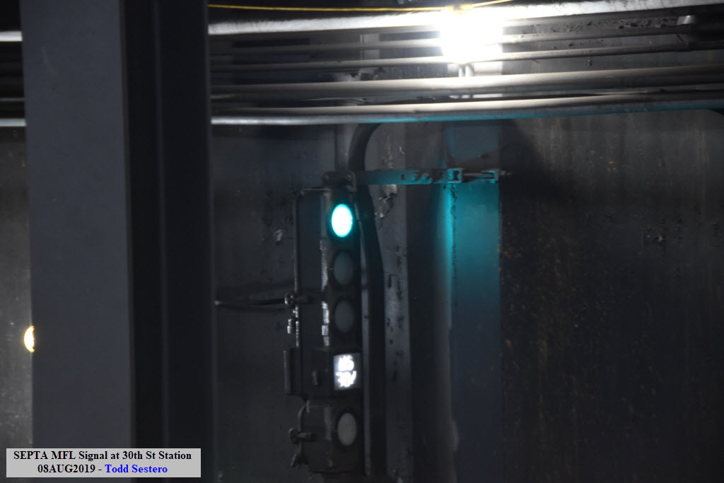
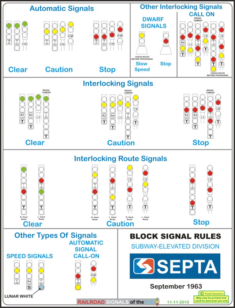
Signals on the Market-Frankford line are a four aspect configuration: Lunar over
green over red in a three stack signal head and a yellow in an attached single
box head on the bottom.
-- Lunar: Normal operation displays lunar
-- Green/blue: “Clear Block” to the next signal
-- Red: Stop
-- Yellow: “Call On” generally used when there is a track down in the interlocking.
It can also be used if there is a disabled train which is dropping the track to
allow for a rescue train to roll up to recover it.
The signals appear at interlockings only, as the Market-Frankfort Line uses cab
signaling, compared with systems like New York, where they also have intermediates.
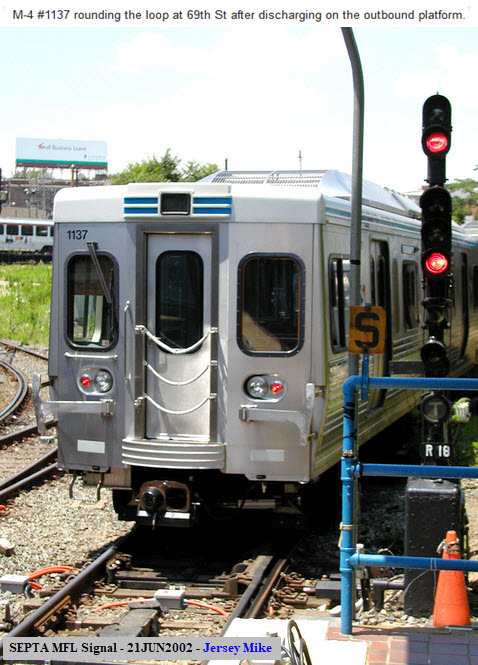
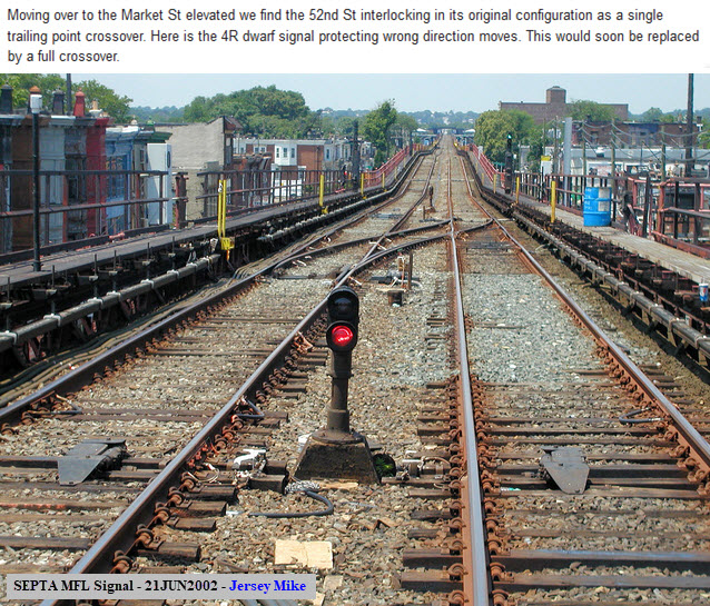
Here we have a couple of pictures from the turn of the Millennium by Jersey Mike:
Here is a signal chart from 1963, however, it is not accurate for the current signals....
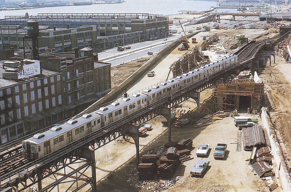
Construction of I-95 in May 1976 shows the original
elevated structure and new portal built as part of
the line's relocation project. This view of
the Market–Frankford Line was taken from the Ben
Franklin Bridge in 1978, during the construction of
I-95. The new portal, which redirects the line
into the middle of the highway, is under
construction. Picture by
Oanabay04,
from Wikipedia. I don't usually include
links to authors bio's, but this one is humorous! :-)
Disclaimers:
I love trains, and I love signals. I am not an
expert. My webpages reflect what I find on the topic of the page.
This is something I have fun with while trying to help others.
Please Note: Since the main focus of my two websites is railroad
signals, the railfan guides are oriented towards the signal fan being able to
locate them. For those of you into the modeling aspect of our hobby, my
indexa page has a list of
almost everything railroad oriented I can think of to provide you with at least
a few pictures to help you detail your pike.
If this is a railfan page, every effort has been made
to make sure that the information contained on this map and in this railfan
guide is correct. Once in a while, an error may creep in :-)
My philosophy: Pictures and maps are worth a
thousand words, especially for railfanning. Text descriptions only
get you so far, especially if you get lost or disoriented. Take
along good maps.... a GPS is OK to get somewhere, but maps are still
better if you get lost! I belong to AAA, which allows you to get
local maps for free when you visit the local branches. ADC puts
out a nice series of county maps for the Washington DC area, but their
state maps do not have the railroads on them. If you can find em,
I like the National Geographic map book of the U.S..... good, clear, and
concise graphics, and they do a really good job of showing you where
tourist type attractions are, although they too lack the railroads.
Other notes about specific areas will show up on that page if known.
Pictures and additional information is always needed if anyone feels
inclined to take 'em, send 'em, and share 'em, or if you have
something to add or correct.... credit is always given! BE NICE!!! Contact info
is here
Beware: If used as a source, ANYTHING from Wikipedia must be treated as
being possibly being inaccurate, wrong, or not true.