RAILFAN
GUIDES
of the
U.S.
Todd's Railfan Guide to
SEPTA's DARBY TRANSPORTATION CENTER
In General
Getting Here
Map
Pictures
SEPTA HOMEPAGE
RAILFAN GUIDES HOME
RAILROAD SIGNALS HOME
Location / Name:
Darby PA, a suburb of Philadelphia
What's Here:
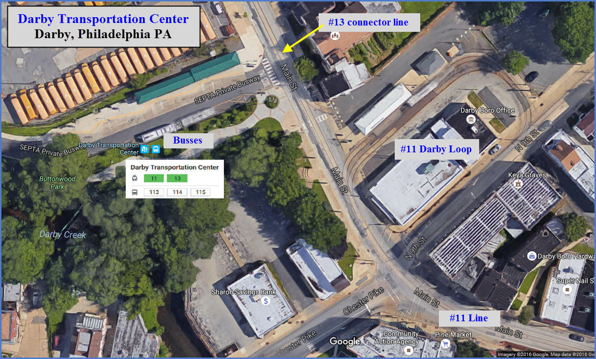
#11 Trolley Line Loop
#13 Trolley Line connector
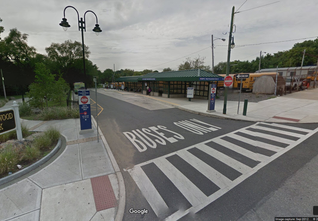
Bus Depot
Data:
GPS Coordinates: 39.919129, -75.262376
County: Delaware
ZIP: 19023
Phone AC: 610
About 5 miles SW of Philadelphia
Settled about 1654, and inhabited by the Quakers early on
Access by train/transit:
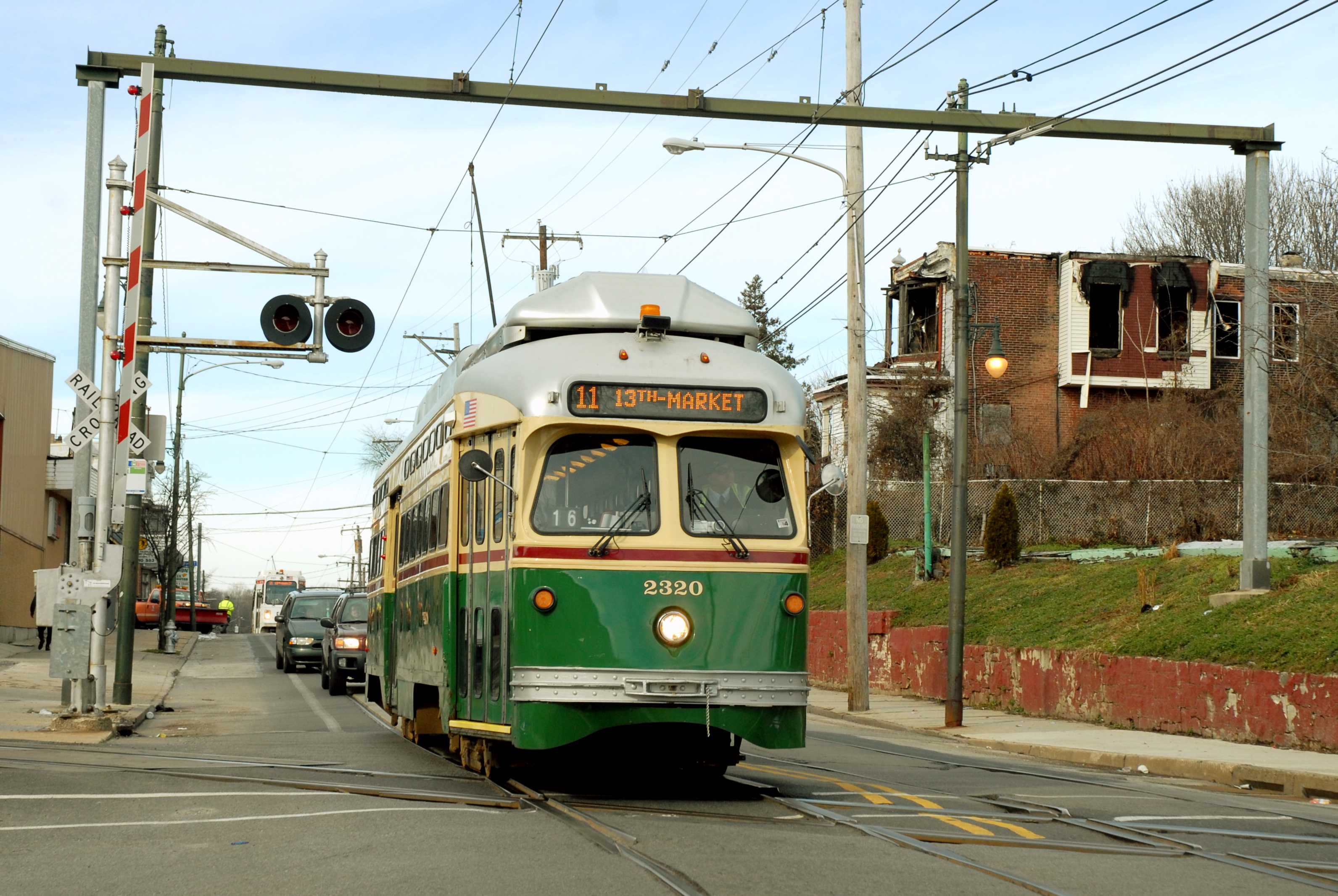
SEPTA #11 Subway Surface Trolley Line
Bus lines: 113, 114, 115
The Scoop:
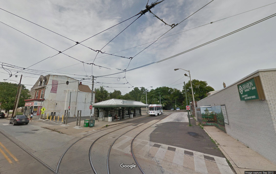
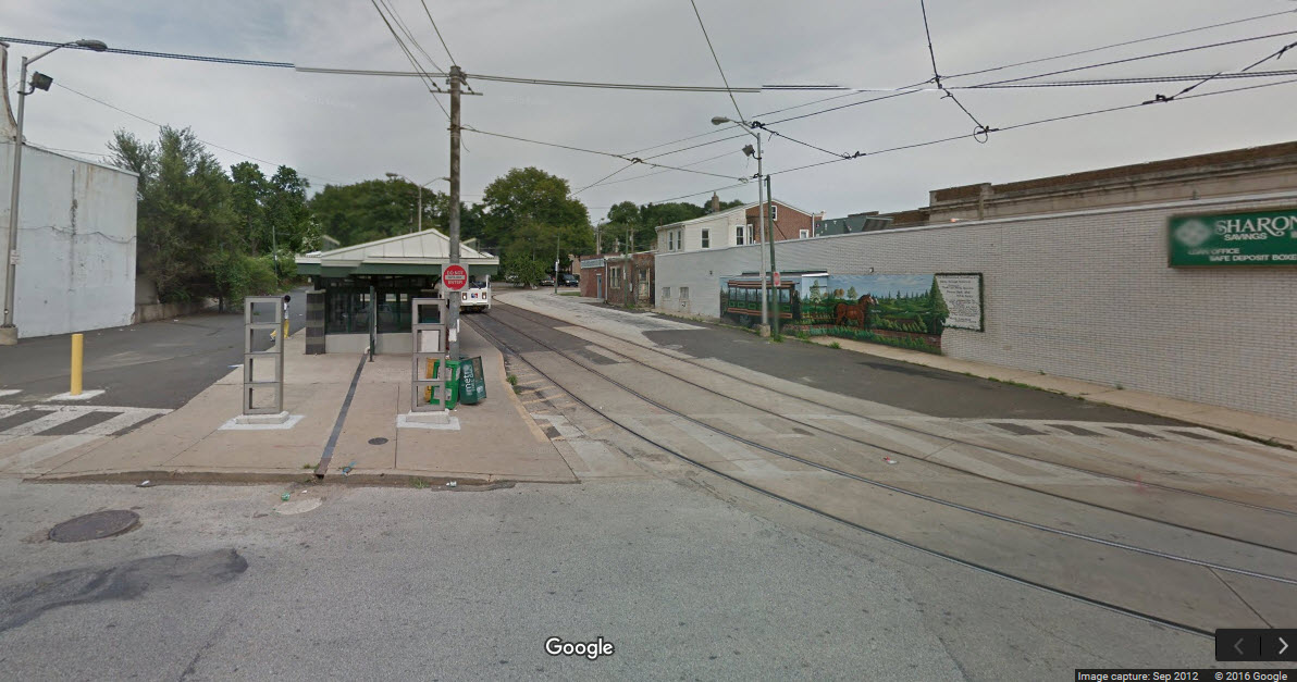
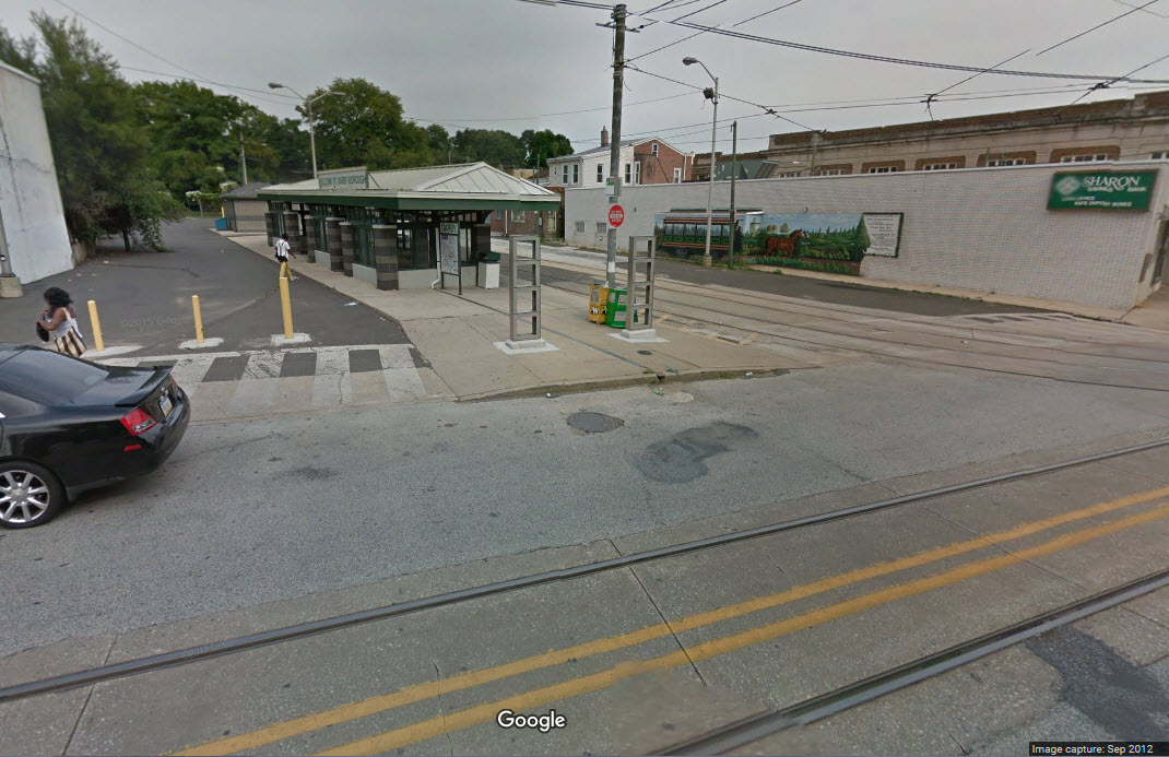
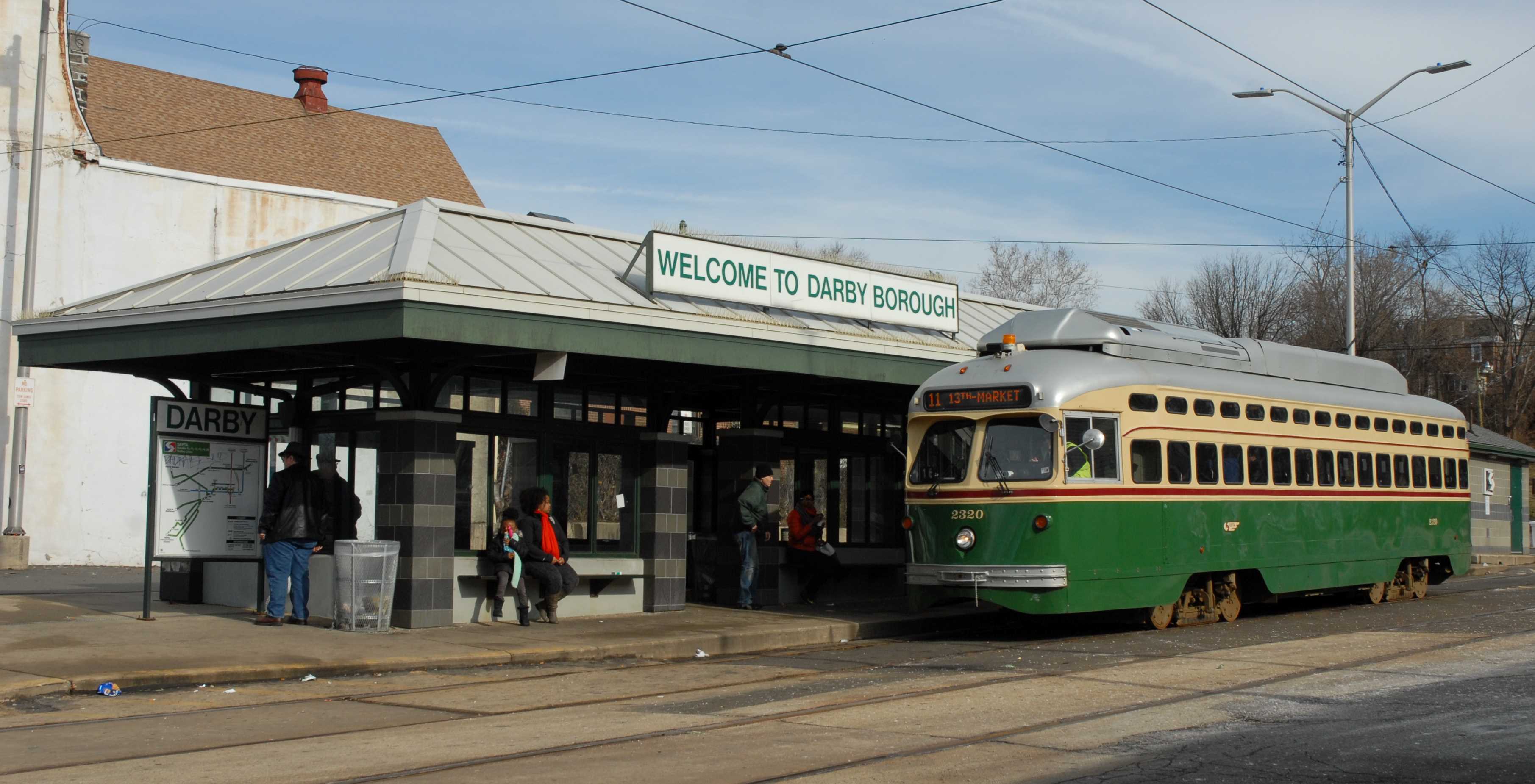
The Darby Transportation Center isn't quite on the scale of 69th Street or the Frankford Transportation Center, but it nevertheless, is an interchange point between the #11 trolley line and a few of the local busses. It provides a nice relief from the hustle and bustle of its bigger brothers. Transportation Center, BTW, is a SEPTA term.
The trolley's are on one side of Main Street, and the busses are on the opposite side. The trolley loop is for the #11 trolleys.
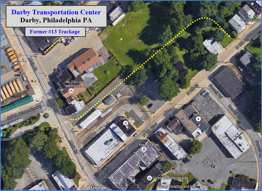
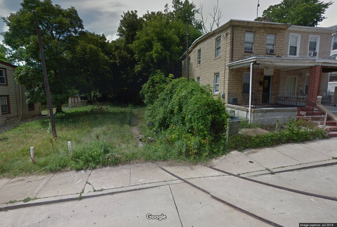
The #13 line ended at the Yeadon Loop. From there, the #62 shuttle used to travel back and forth. The loop for the shuttle has been "removed", part of the switches going in off of Main St and 9th St are still in place. The track is supposed to still be in place too, altho covered up with asphalt and dirt.
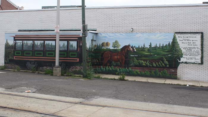
There is a nice mural of an early horse drawn streetcar which adorns the adjacent building while you're waiting to catch a trolley.
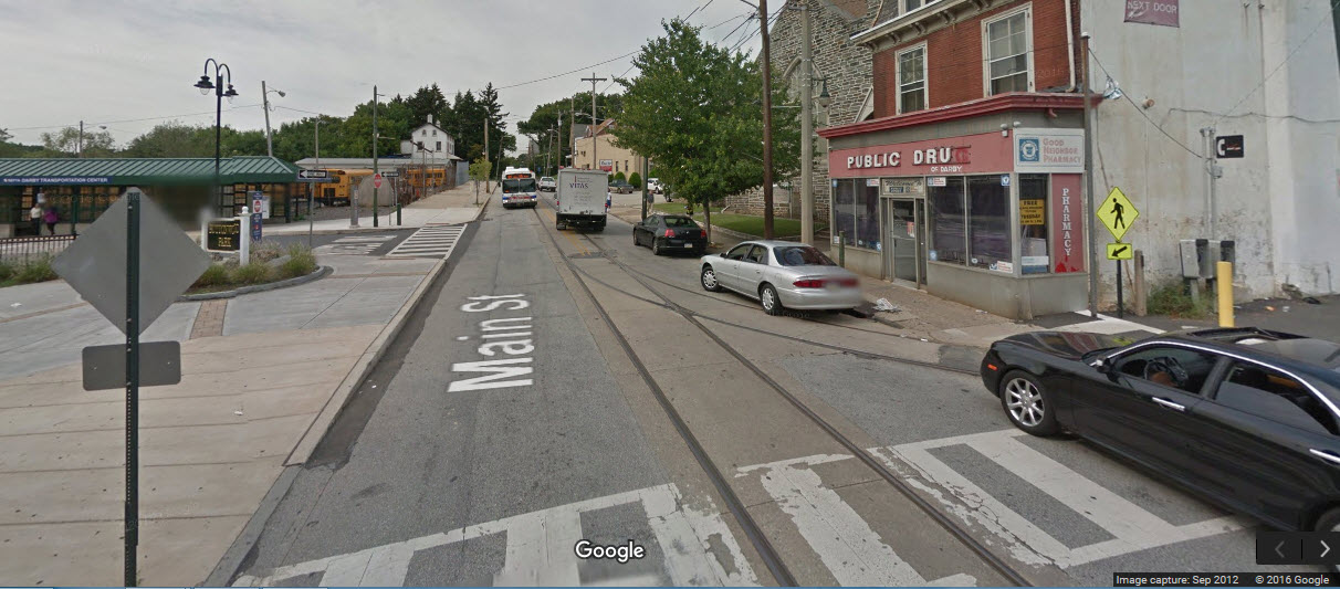
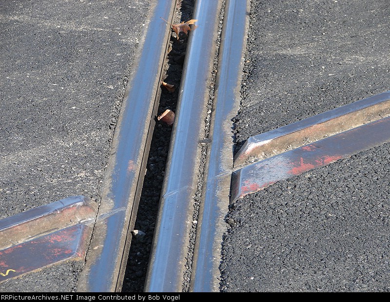
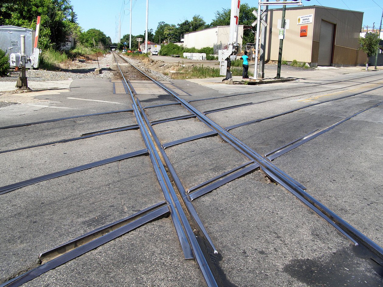
Not too far away on Main Street is a grade crossing between the trolley tracks and the main CSX freight line between Baltimore and Philadelphia. Fairly unique.
Acknowledgements:
Thanks to John Engleman, John Buxton, Jersey Mike, Bob Vogel, and Google for their help, pictures, and maps.
Websites and other additional information sources of interest for the area:
https://en.wikipedia.org/wiki/Darby_Transportation_Center
http://www.septa.org/maps/station/darby.html
http://www.septa.org/schedules/trolley/pdf/011.pdf
https://en.wikipedia.org/wiki/SEPTA_Route_11
https://en.wikipedia.org/wiki/SEPTA_Route_13
http://www.septa.com/schedules/trolley/index.html
http://www.mediaborough.com/community/public-transportation-media-and-surrounding-area
http://www.dvrpc.org/reports/11012.pdf
Aerial shots were taken from either Google Maps or www.bing.com/maps as noted. Screen captures are made with Snagit, a Techsmith product... a great tool if you have never used it!
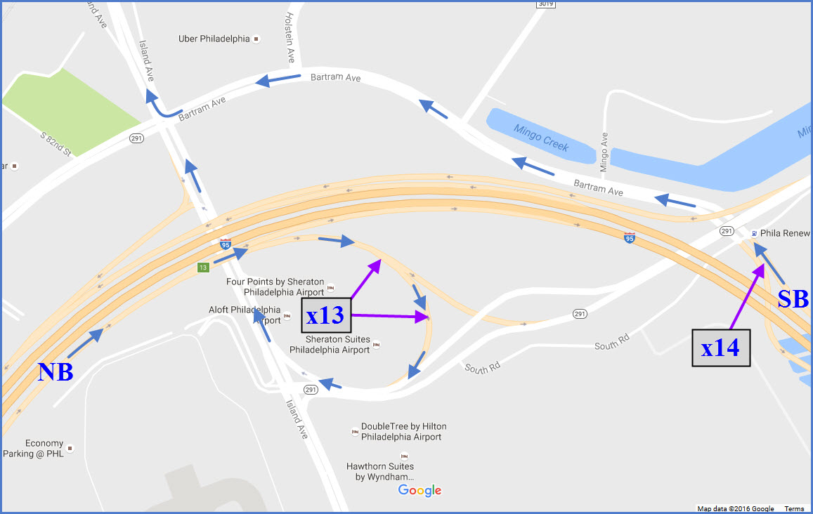
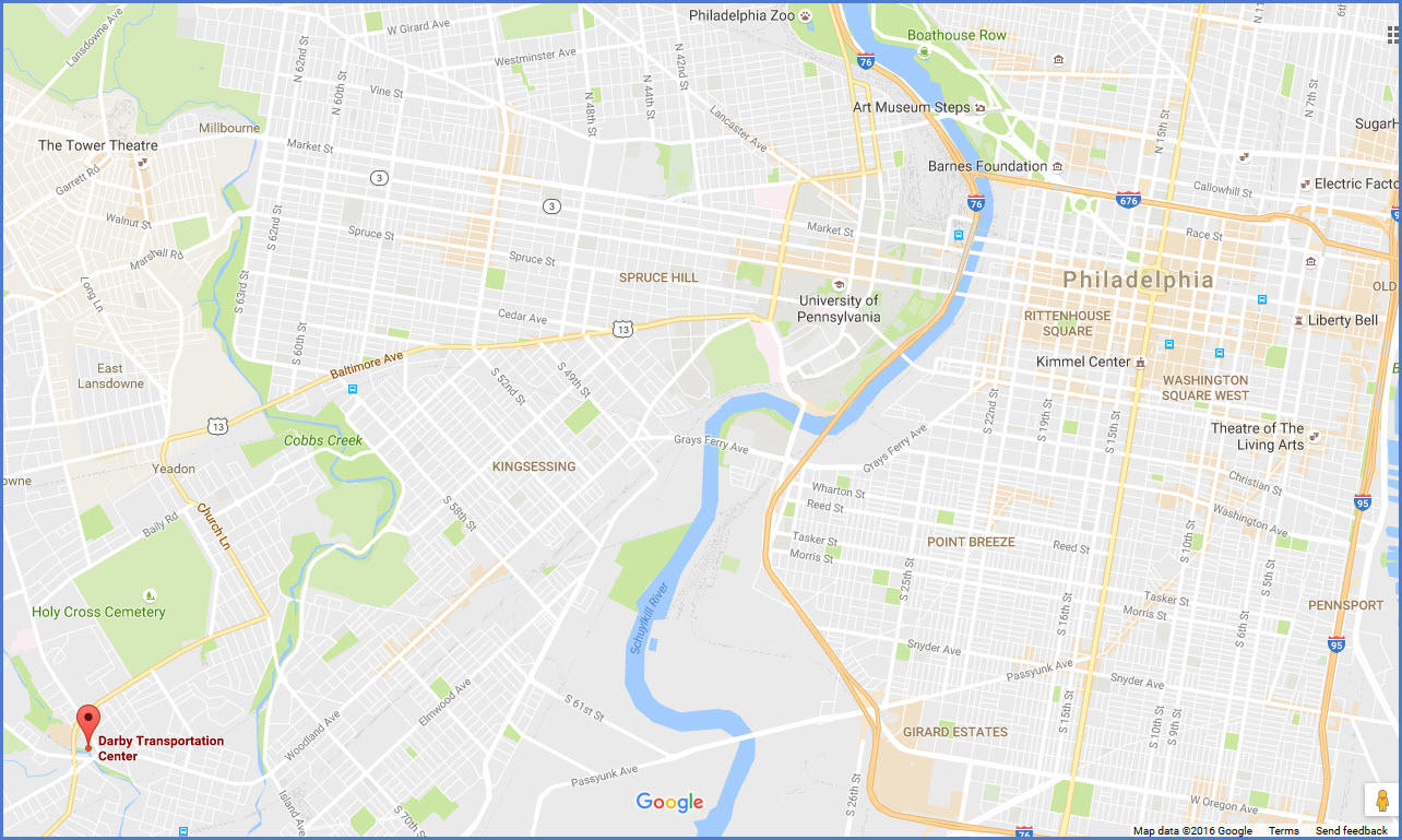
Exit 13 from northbound I-95 will dump you off on northbound Island Ave. Island Ave will get you "in the mood" for taking pictures, as the #36 line subway surface trolley comes down the middle of the street, with a loop near I-95. Continue up Island Ave, about 1.8 miles from the interstate, till you pass the Elmwood Shops on your right, and go under the SEPTA commuter line, and then prepare yourself to take a left turn onto Main St. The Transportation Center is about 3/4 of a mile "up the road" from there.
If you're SB on I-95, you would take exit 14, which will dump you off onto Bartram Blvd, which you take over to Island Ave and then take a right.
If yer coming in from downtown, Woodland Ave would probably be the best, and it also gives you the opportunity to take additional trolley pictures.
From additional areas west of Darby: Landsdowne Ave, Springfield Rd, and McDade Blvd all converge in Darby at pretty much near the same point near the TC. Landsdowne Ave actually turns into Main St.
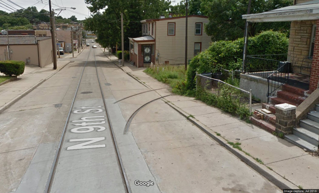
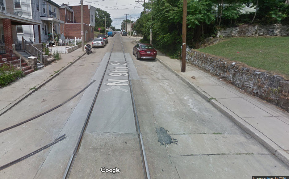
The #62 shuttle switch on Main Street.
The #62 shuttle switch on 9th Street:
Over on the bus side.
The picture below is a little further down Main Street, where it crosses CSX, picture by Jersey Mike, 2016.
A couple of pictures of the grade crossing tracks, where the streetcar tracks are raised slightly above the railroad tracks, and the streetcar flanges ride over the CSX rails.
 Jersey
Mike
Jersey
MikePictures of the pedestrian crossing gates are here, along with others.
A couple of oldies.....
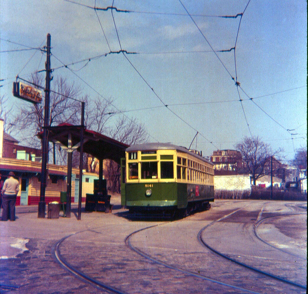 1955
1955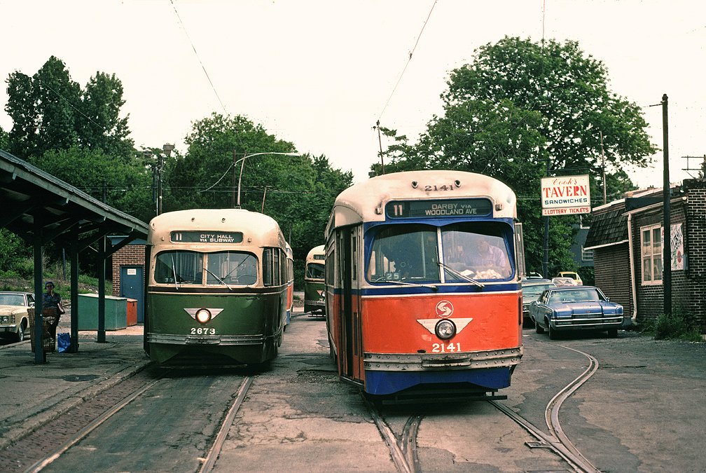 1976
1976Disclaimers:
I love trains, and I love signals. I am not an expert. I do these pages because I love spending my time doing them - although I do a reasonable amount of research to make sure the information presented is accurate! :-) :-)
Please Note: Since the main focus of my two websites is railroad signals, the railfan guides are oriented towards the signal fan being able to locate them. For those of you into the modeling aspect of our hobby, my indexa page has a list of almost everything railroad oriented I can think of to provide you with at least a few pictures to help you detail your pike.
If this is a railfan page, every effort has been made to make sure that the information contained on this map and in this railfan guide is correct. Once in a while, an error may creep in, oooooooops, oh well! :-)
My philosophy: Pictures and maps are worth a
thousand words, especially for railfanning. Text descriptions only
get you so far, especially if you get lost or disoriented. Take
along good maps.... a GPS is OK to get somewhere, but maps are still
better if you get lost! I belong to AAA, which allows you to get
local maps for free when you visit the local branches. ADC puts
out a nice series of county maps for the Washington DC area, but their
state maps do not have the railroads on them. If you can find em,
I like the National Geographic map book of the U.S..... good, clear, and
concise graphics, and they do a really good job of showing you where
tourist type attractions are, although they too lack the railroads.
Other notes about specific areas will show up on that page if known.
BTW, floobydust is
a term I picked up 30-40 years ago from a National Semiconductor data
book, and means miscellaneous and/or other stuff.
Pictures and additional information is always needed if anyone feels
inclined to take 'em, send 'em, and share 'em, or if you have
something to add or correct.... credit is always given! BE NICE!!! Contact info
is here
Beware: If used as a source, ANYTHING from Wikipedia must be treated as being possibly being inaccurate, wrong, or not true.
RAILFAN GUIDES HOME
RAILROAD SIGNALS HOME
NEW
10/20/2016
Last Modified
23-Oct-2016