In General
Getting Here
Maps
Pictures
Signals
Floobydust
RAILFAN GUIDES HOME
RAILROAD SIGNALS HOME
Location / Name:
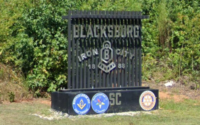
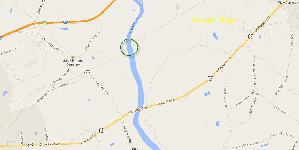
Blacksburg SC, Cherokee County
What's Here:
Cool Wooden Trestle
Norfolk Southern
Data:
GPS Coordinates: as needed
Phone A/C: 864
ZIP: 29702
Population 2010: 1,848
Access by train/transit:
None
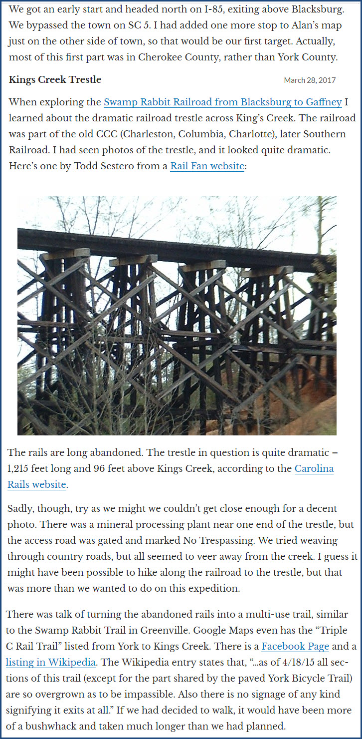
The Scoop:
This guide is all about signals and a bridge.
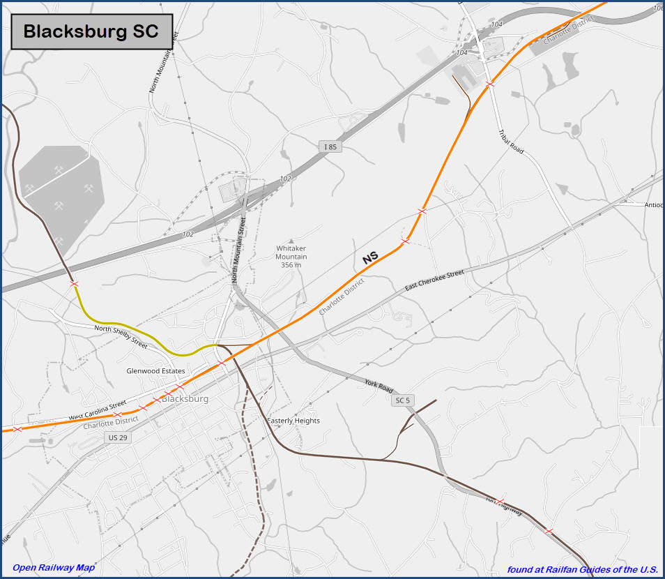
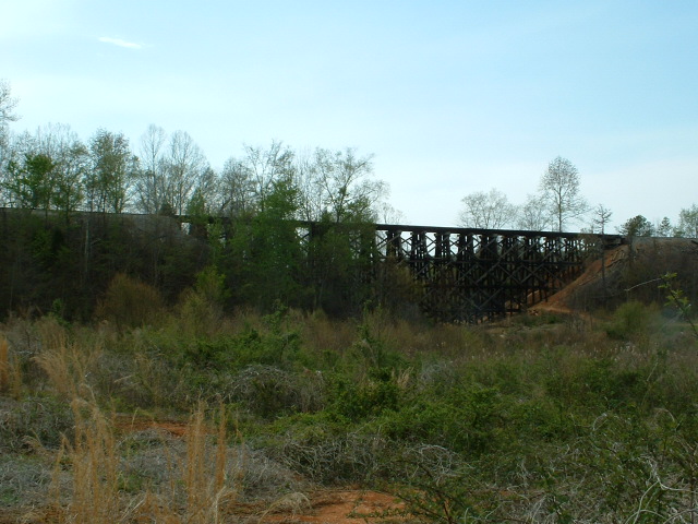
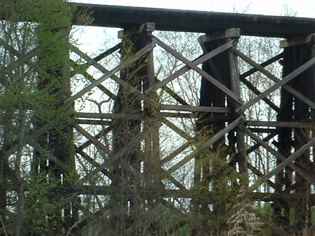
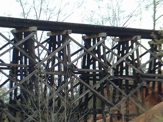
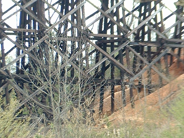
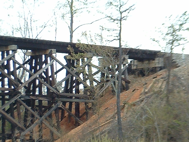
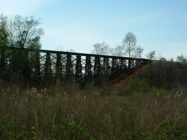
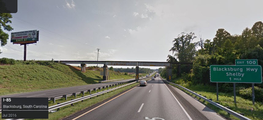
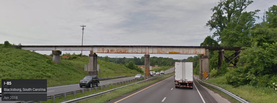
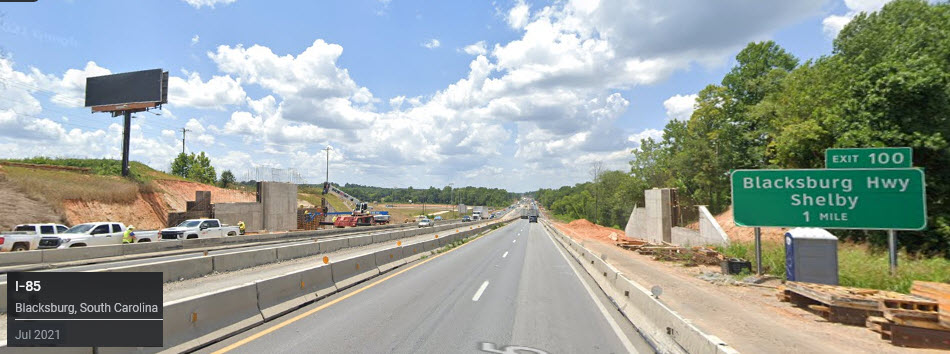
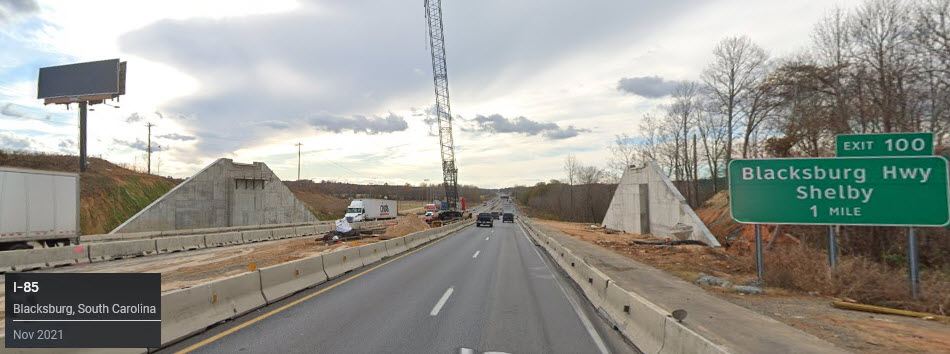
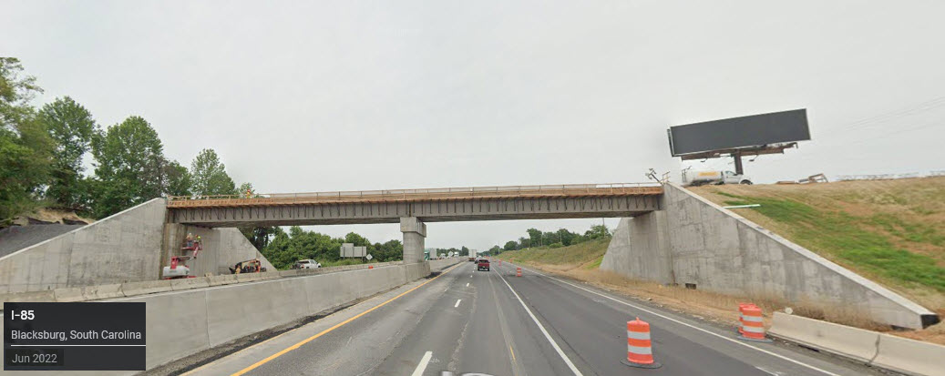
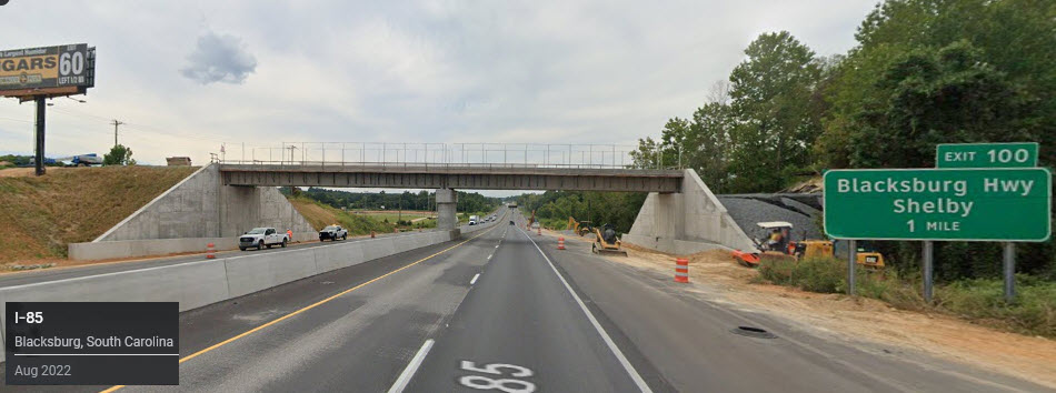
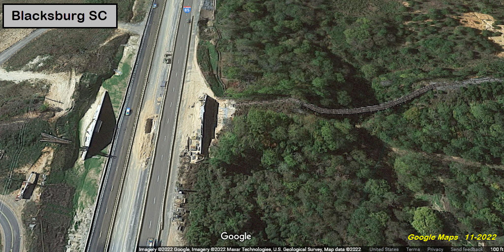
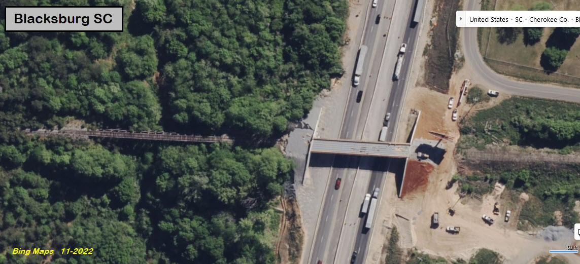
The bridge that started this guide is a wooden trestle that can be seen from I-85. The track over it is in the process of being taken up, and the bridge leading to the trestle over I-85 has been removed.
Both Norfolk Southern and CSX are replacing legacy signals at a rapid pace (remember, this was originally written in 2013), witness the changeover in Altoona PA and Baltimore MD. Not only are PL and CPL signals quickly disappearing, but older colorlight and searchlight installations as well. Classic colorlight signals such as those employed by the Southern and the C&O are being replaced too, in favor of the "darth vader" type installations on all (no maintenance required) aluminum structures.
November 2022 update: Mike informs me that all of track between Blacksburg and Shelby NC has been taken up. The Bridge over I-85 was replaced with a new structure for a planned rails-to-trails project. A few miles north on the NS main in Grover NC, NS did a recent turnout change. Track was changed from equilateral to high speed for TK1 - signal aspects were also modified. NS did the same at Sewell as well - Sewell is north of Kings Mountain NC. Thanks Mike!
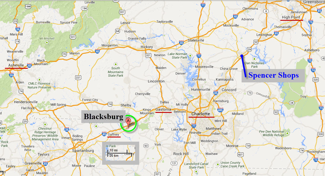
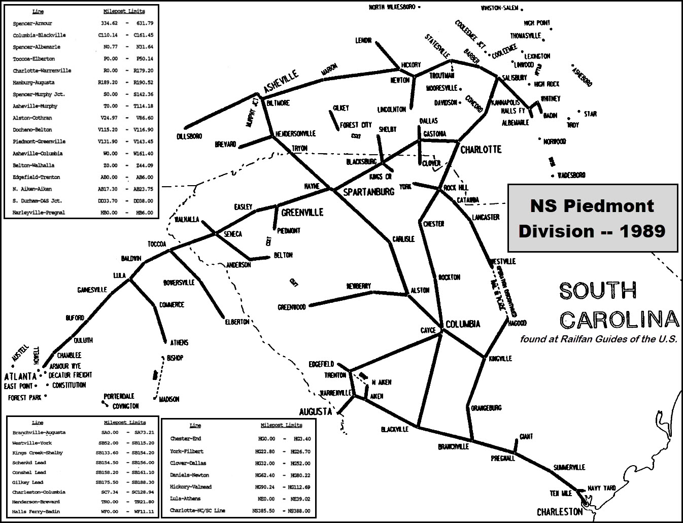
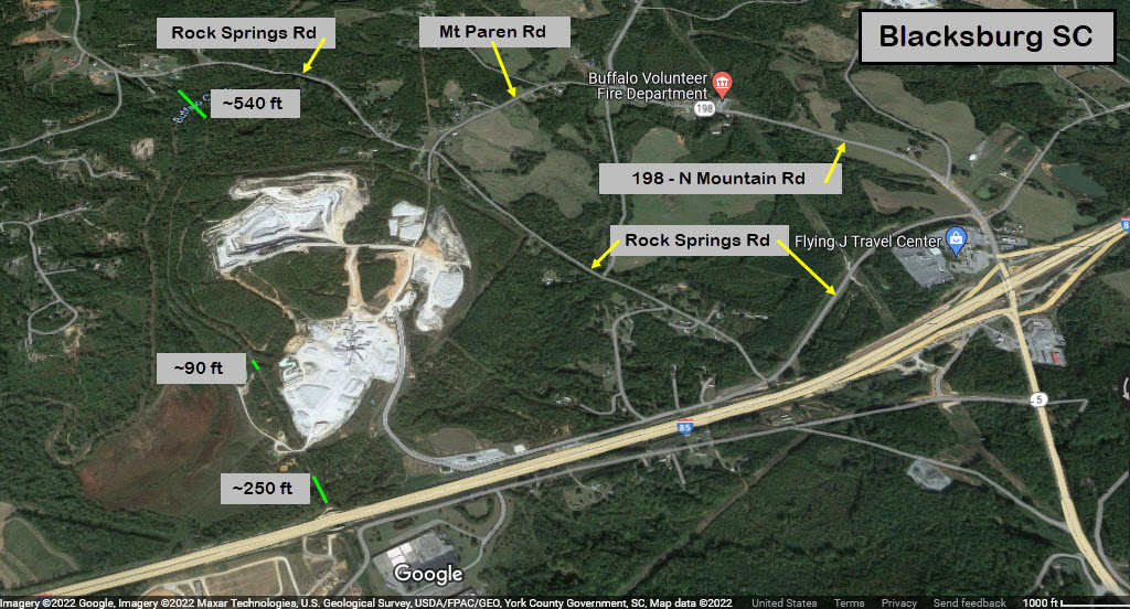
The I-85 corridor is home to a vast array of items of interest to the railfan. If we look at the area map below, you have the Southern Rwy Spencer Shops museum up the road, as well as Charlotte, Gastonia, Highpoint, and Ashville to name but a few.
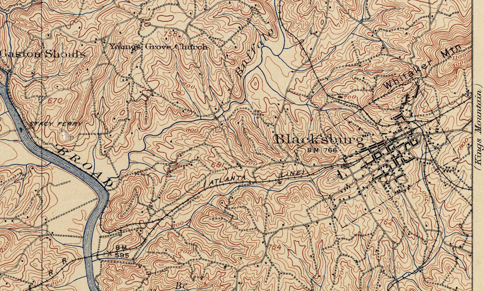
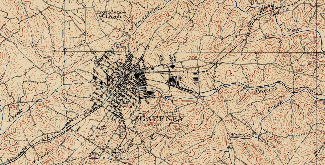
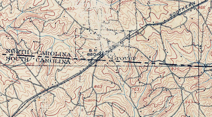
The main North-South line going through here used to the Southern Railway's Atlanta Line. This can be seen on the USGS maps at the bottom of the page.
Short History (from Wikipedia):
In the late 19th century the Black family, headed by John G. Black, a Confederate veteran, was living in the area and persuaded the C.C. & C. Railroad Company to lay track through the town and build a depot. The town soon became known as "Black's Station" in honor of John G. Black and was incorporated as Black's Station town in 1876. The legal town was renamed "Blacksburg" in 1888.
Major John F. Jones of Massachusetts came to live in Blacksburg when hired as superintendent of the C. C. & C. Railroad. He donated his own money to build a school, hotel (the Cherokee Inn), and several other buildings in Blacksburg. He lived in Blacksburg until 1922, when he was appointed the South Carolina Internal Revenue Collector by the President of the United States.
In the 1890s large amounts of iron ore were found in the area, and many people hoping to make a fortune from mining it flocked to the town. Blacksburg became a boom town, and hotels and saloons were built for the new visitors. The town went by the name "Iron City" for a short time. Because of the "iron rush" the town became quite wealthy. It installed the first electric street lights in upstate South Carolina and perhaps in the entire state. The town was renamed in 1888 as "Blacksburg" but still holds the nickname of "Iron City". end Wiki
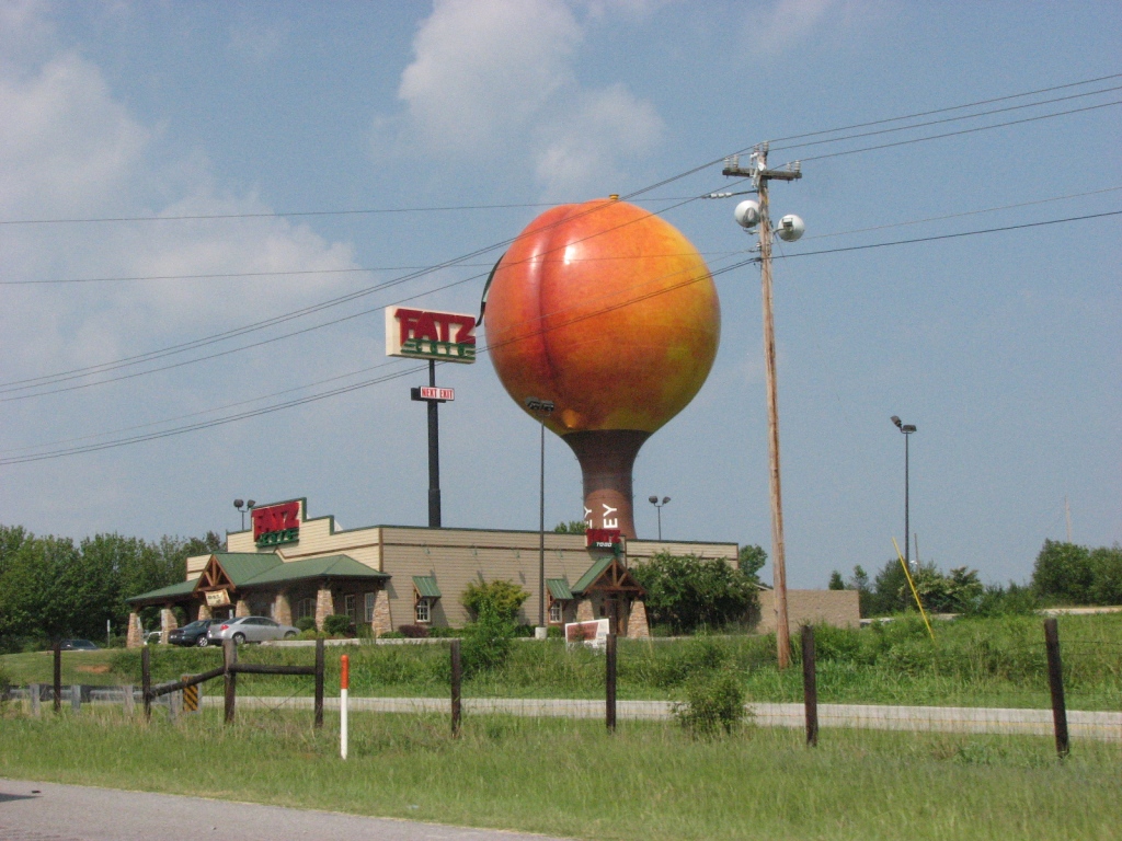
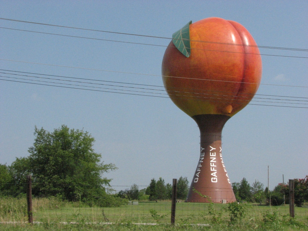
Gaffney gets a mention because of the cool water tower (and food, and gift shops, AND great peaches) located there :-)
Also, if you're traveling thru, South Carolina usually has the cheapest gas prices on the trek between Atlanta and Raleigh.
Acknowledgements:
Many thanks to Mike Falls for taking the pictures he took, and for taking the time to email them to me with the background information.
Denver Todd
Google Maps
Wikipedia
Open Railway Map
Bing Maps
Websites and other additional information sources of interest for the area:
https://randomconnections.com/exploring-western-york-county-part-one/ Nice tour of Cherokee County by Tom and Laura
https://railfanguides.us/nc/grover/index.htm
Getting to Blacksburg is easy via I-85. Depending on whether you're traveling north or south on the interstate, you have two exits for Blacksburg. Exit 100 for northbounders will put you on the Blacksburg Highway. Southbounders would want to take exit 102 for Mountain St.
GPS Coordinates: 35.135012, -81.530986
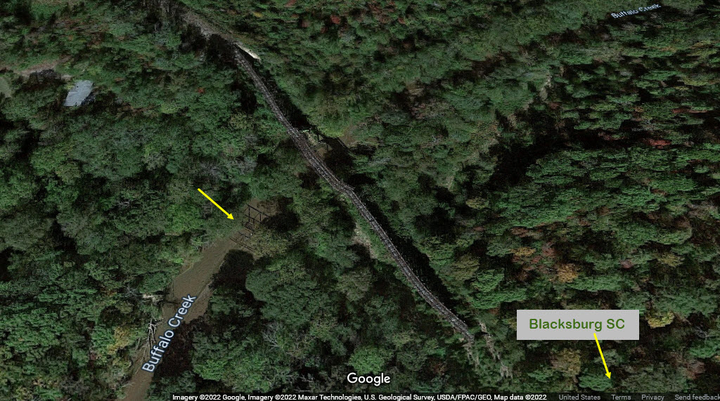
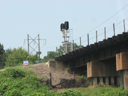
Although this wooden trestle is very easy to see from the interstate, access to it is very difficult. There is a road going down to the bridge, but it is on private property and gated. Another road that parallels the interstate gets you close, but there is a barbed wire fence between you and the bridge, along with a briar patch of "sticky" bushes! Ouch. I know from personal experience trying to get close-ups. These pictures are from April 2007, before I had a fairly decent camera.
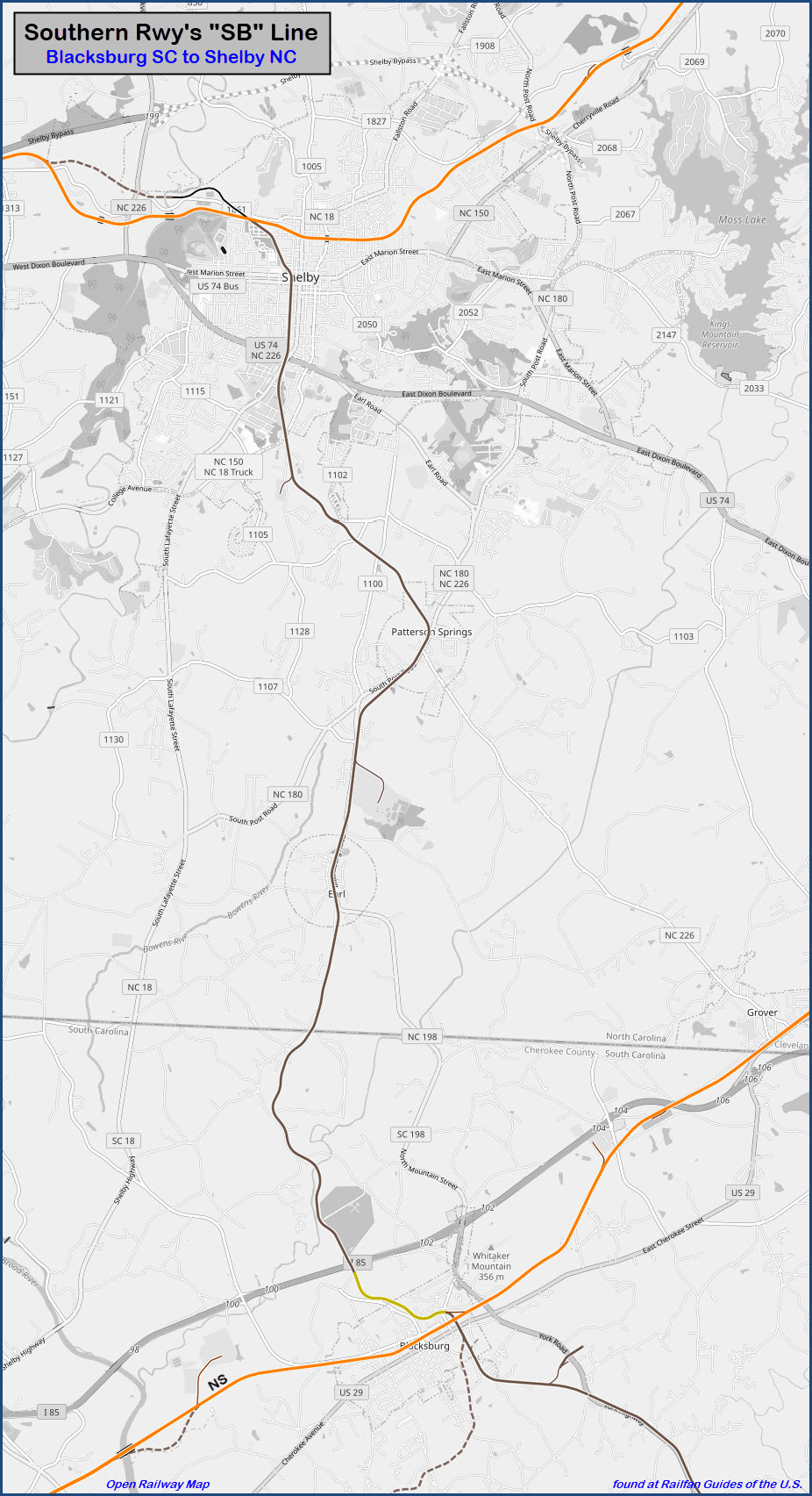
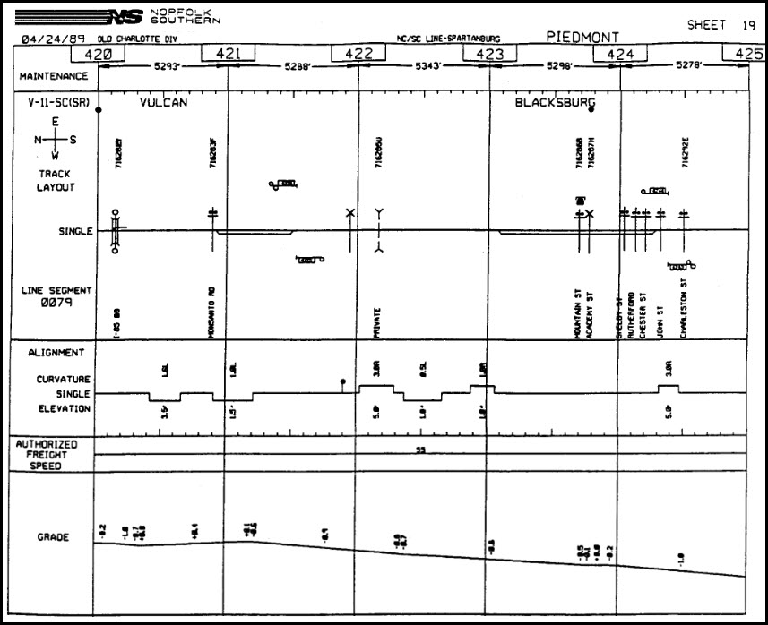
The track was once the Southern Railway's "SB" Line. The line ran from Kingville SC to Marion NC. Carolina Coastal used to use the portion from Kings Creek to Blacksburg. The rail bed beyond Kings Creek was ripped up years ago, as was the track past PPG in Shelby (MP 160) towards Marion. This line was known for using a "spacer" car between two engines due to the weight limitation of the curved trestle over Buffalo Creek, about half a mile west of this location. (Thanks to Mike for this information, and more is on his pages)
BTW, York Highway (SC 5) follows the tracks pretty nicely on it's way over to Kings Creek.
From Tom and Laura's website mentioned above:
And here is the interstate portion of the bridge.....
Not sure (yet) what they are doing - if they are rebuilding the line, or making a rail trail...
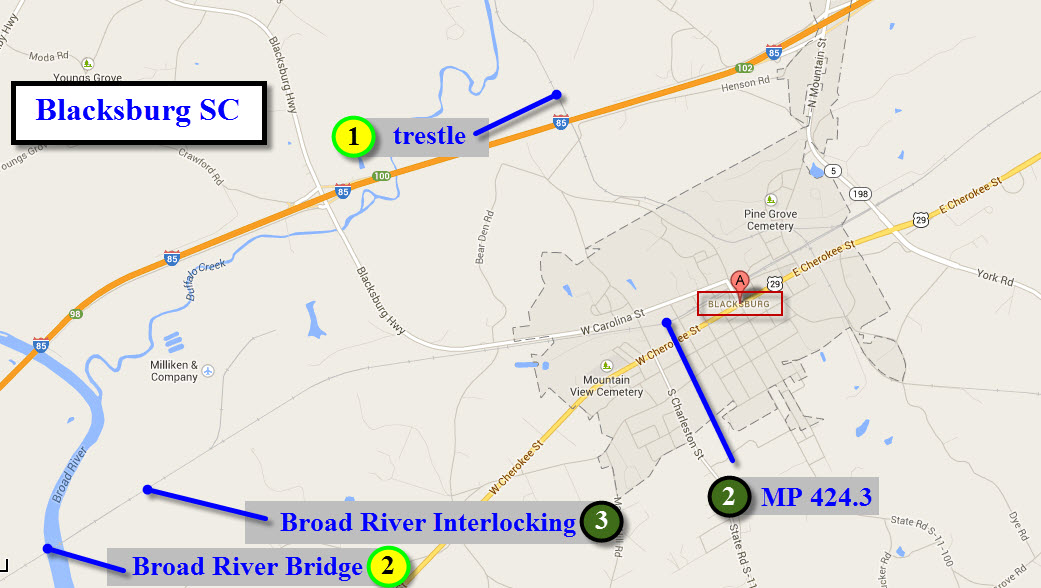
There are three trestles in close proximity of Blacksburg along this branch:
Below, in the aerial view of the trestle over Buffalo Creek, we can also spot signs of another (steel?) trestle pointed to by the yellow arrow:
This is the ~90 footer adjacent to the quarry:
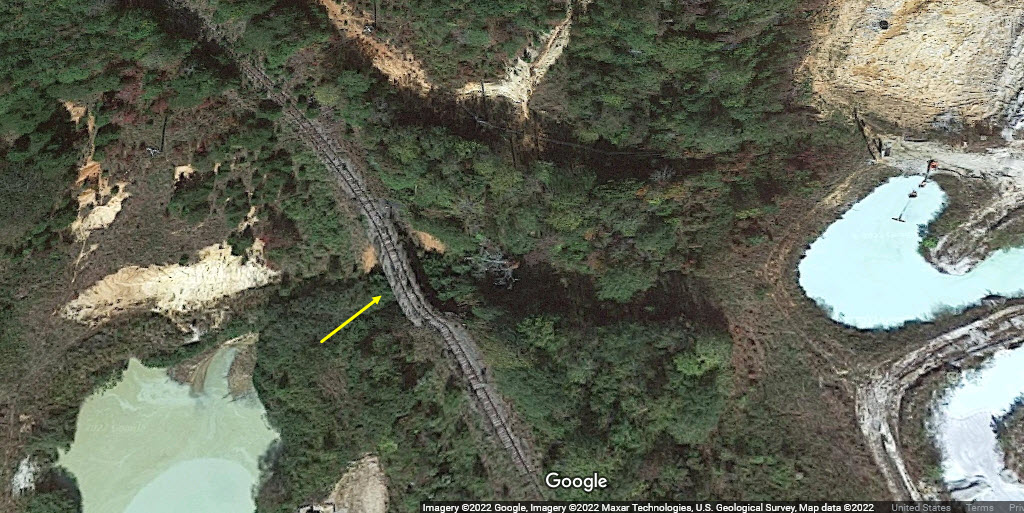
GPS Coordinates: 35.104214, -81.574615 (center of bridge)
This location is inaccessible by car, only a healthy hike along the river will get you here. The property surrounding the right-of-way is private property, marked as such if you come in from any other direction other than the river.
 found on the internet
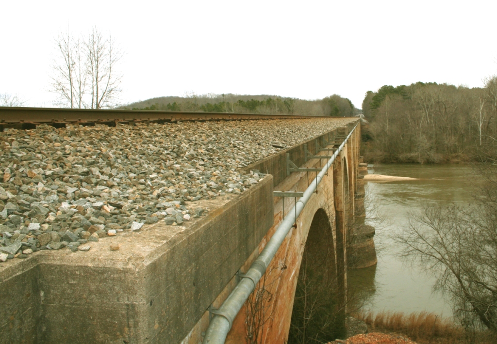 found on the internet
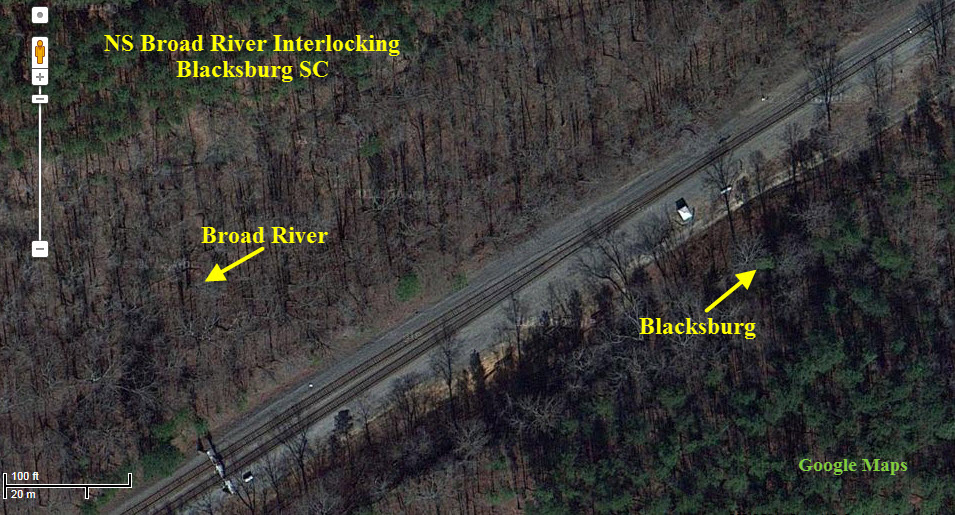
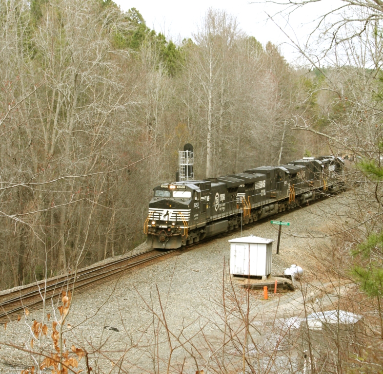
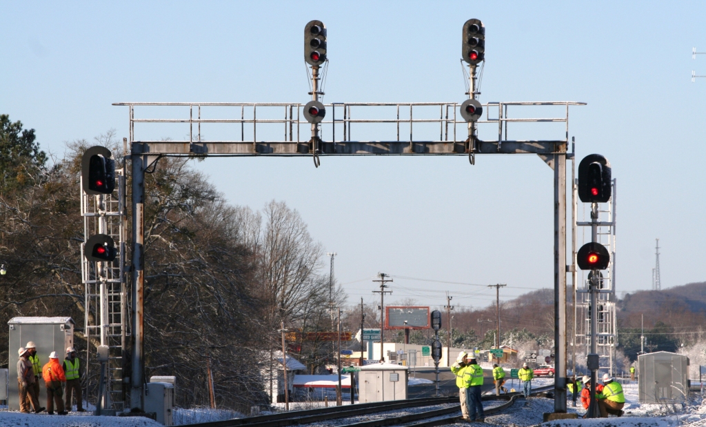
GPS Coordinates: 35.170719, -81.446697
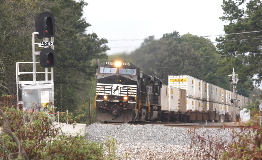
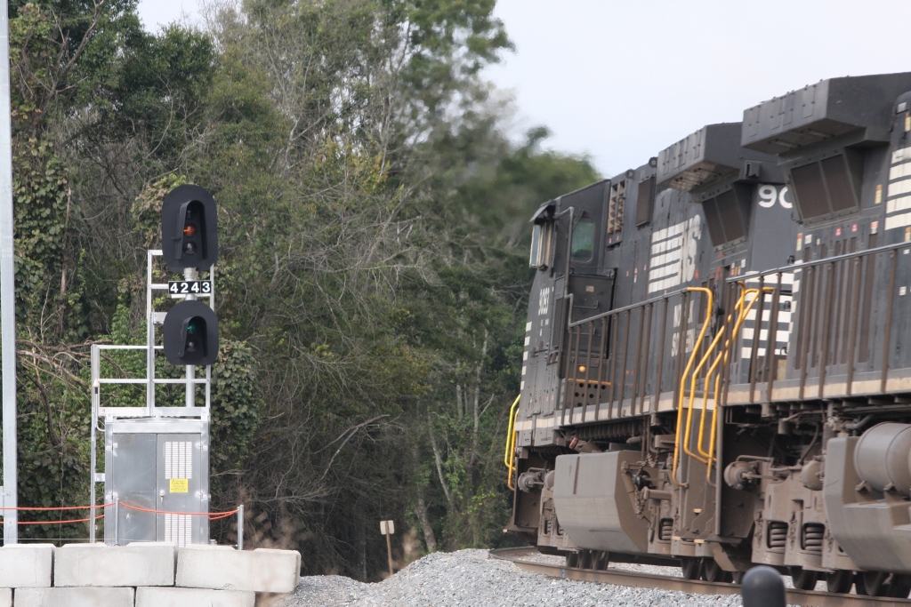
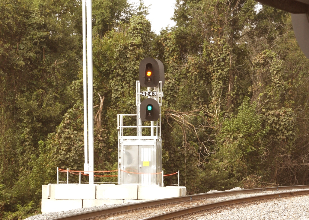
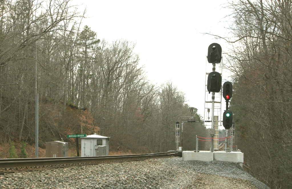
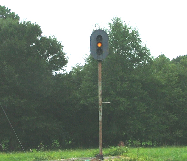
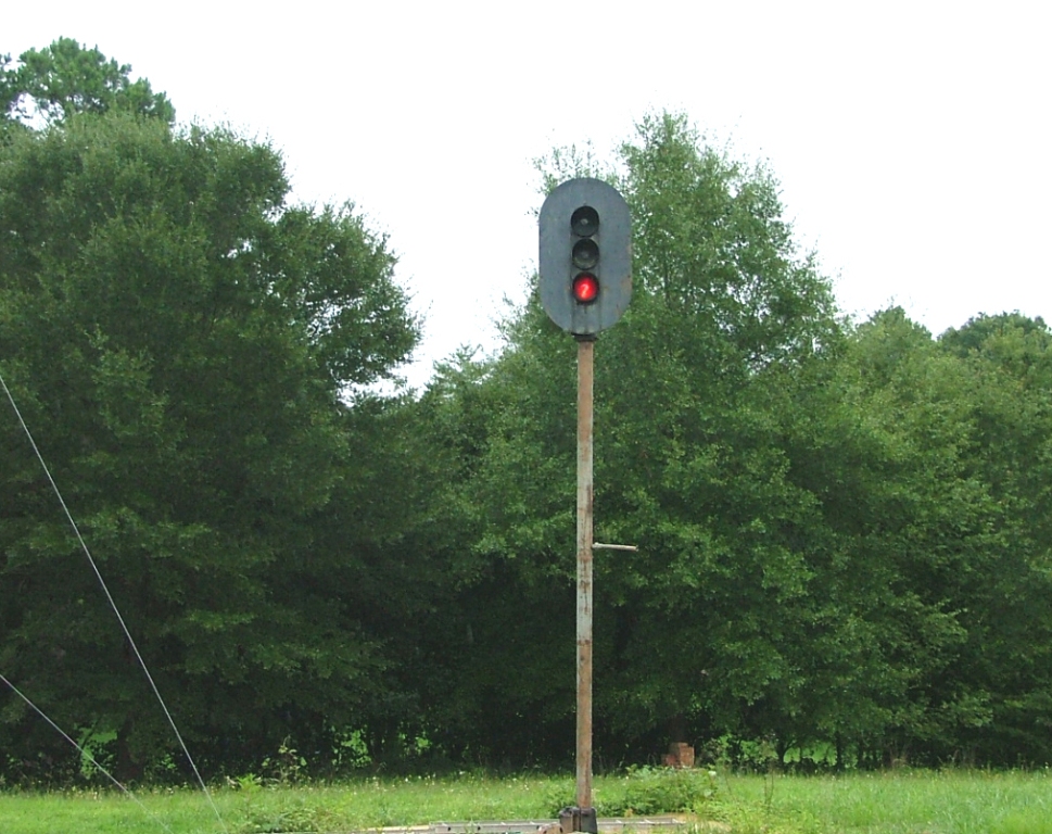
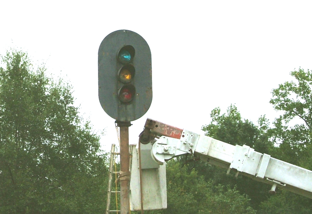
The signals here at Grover were cut over on Sunday, February 17th, 2013. For most of us, I'm sure it's a rare opportunity when you get to see both sets of signals lit at the same time. Grover is just over the state line in North Carolina, about 5 miles north of Blacksburg.
 Mike Falls
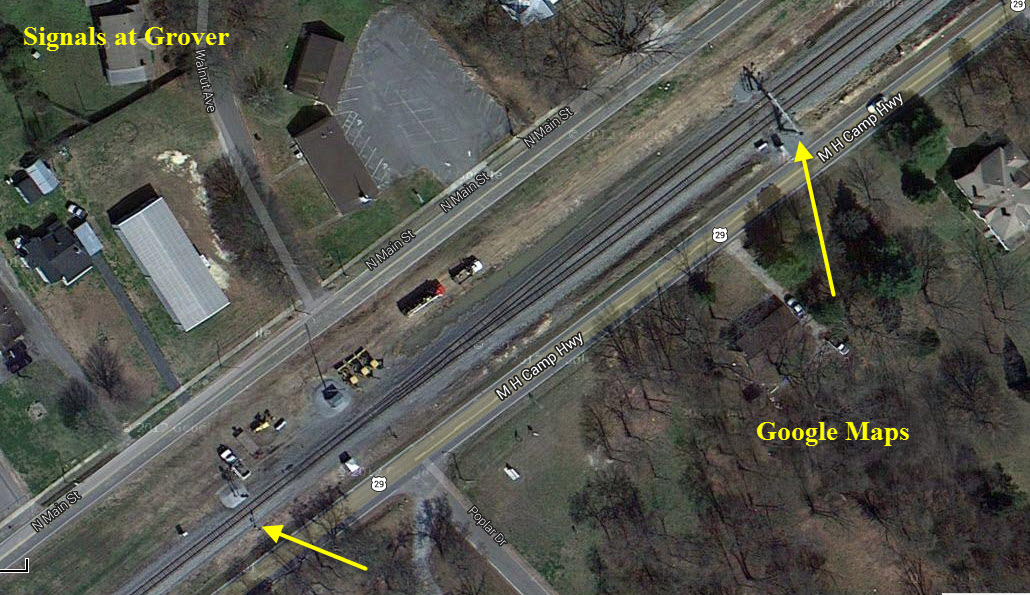
Before and after shots. Wouldn't you love to have the offset signal!
All pictures by Mike Falls
GPS Coordinates: 35.106949, -81.569346
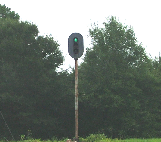
 found on the internet
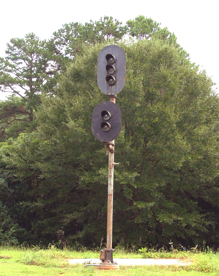
Mike's colorlight signal in his back yard.
About 8 miles south of Gaffney, you will pass under the former Clinchfield bridge with a new set of "darth vaders".
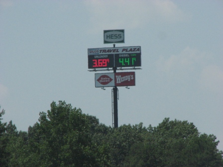
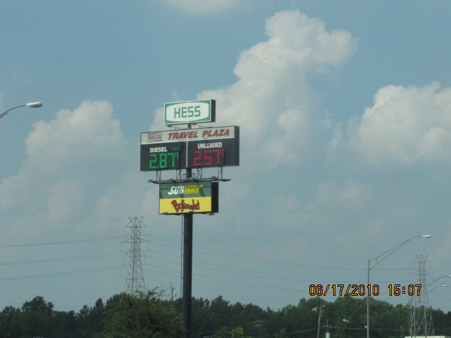
The left one was taken in 2008, and altho it's about the same as the norm in 2013 (on the east coast, anyways), this was a very steep and expensive spike with the average being well under 3 bucks! "Normal" prices returned, as can be seen two years later in the right photo. And really, diesel is a by-product of the refining process to get gas, so who is getting screwed with the extra 70 cents a gallon on the left, and who is making a horrendous profit? And yes, I take pictures of everything :-) :-) (in mid 2019, the price for gas here in Baltimore got down to around $2.30 a gallon!!!)
Courtesy of the University of Texas Library, click here for their index page.
From the University of Texas' collection of vintage USGS maps, the top two are from the 1907 Gaffney Quadrangle, the bottom one is from the 1906 Kings Mountain quadrangle.
Disclaimers:
I love trains, and I love signals. I am not an expert. My webpages reflect what I find on the topic of the page. This is something I have fun with while trying to help others.
Please Note: Since the main focus of my two websites is railroad signals, the railfan guides are oriented towards the signal fan being able to locate them. For those of you into the modeling aspect of our hobby, my indexa page has a list of almost everything railroad oriented I can think of to provide you with at least a few pictures to help you detail your pike.
If this is a railfan page, every effort has been made to make sure that the information contained on this map and in this railfan guide is correct. Once in a while, an error may creep in :-)
My philosophy: Pictures and maps are worth a thousand words, especially for railfanning. Text descriptions only get you so far, especially if you get lost or disoriented. Take along good maps.... a GPS is OK to get somewhere, but maps are still better if you get lost! I belong to AAA, which allows you to get local maps for free when you visit the local branches. ADC puts out a nice series of county maps for the Washington DC area, but their state maps do not have the railroads on them. If you can find em, I like the National Geographic map book of the U.S..... good, clear, and concise graphics, and they do a really good job of showing you where tourist type attractions are, although they too lack the railroads. Other notes about specific areas will show up on that page if known.
Aerial shots were taken from either Google or Bing Maps as noted. Screen captures are made with Snagit, a Techsmith product... a great tool if you have never used it!
By the way, floobydust is a term I picked up 30-40 years ago from a National Semiconductor data book, and means miscellaneous and/or other stuff.
Pictures and additional information is always needed if anyone feels inclined to take 'em, send 'em, and share 'em, or if you have something to add or correct.... credit is always given! Please be NICE!!! Contact info is here
Beware: If used as a source, ANYTHING from Wikipedia must be treated as being possibly inaccurate, wrong, or not true.
RAILFAN GUIDES HOME
RAILROAD SIGNALS HOME
2007-0414ATLnc
NEW SEP16/2013, SEP17/2013, JUN13/2017, SEP30/2019, OCT25/2020, NOV27/28/2022, DEC01/2022
Last Modified 01-Dec-2022