Location / Name:
Suburban San Juan PR
What's Here:
the Tren Urbano Metro System
Data:
GPS Coordinates: as needed
Phone A/C: 787
ZIP: 009xx
Access by train/transit:
the Metro System itself
Airport: Express Bus Route E40 leaves from Piñero Station and goes directly to Muñoz Marín Airport by way of the Mall of San Juan.
The Scoop:
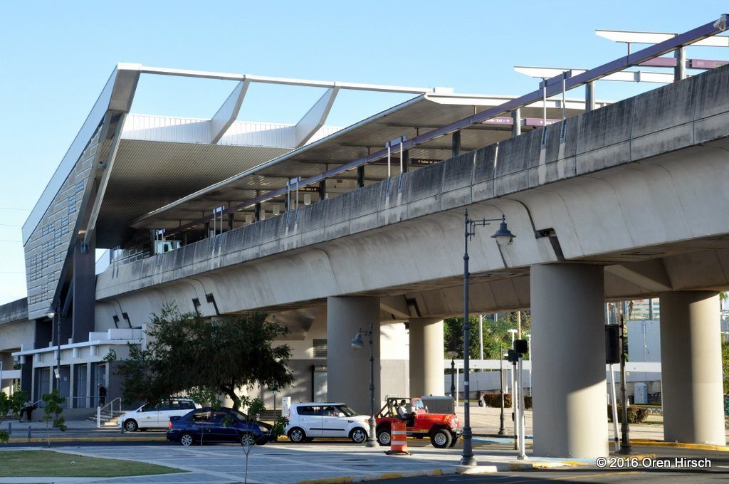
The Tren Urbano is the Caribbean's first
rapid transit system! In English, Tren Urbano
means Urban Train.
From Wikipedia The system is 10.7 miles (17.2km long).
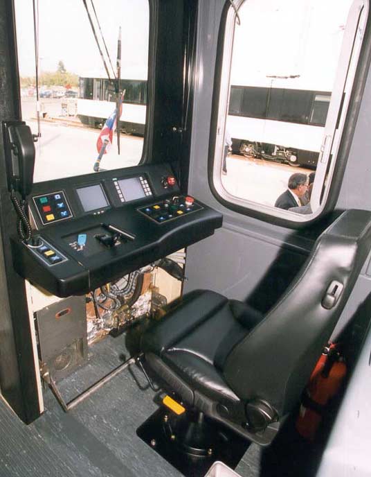
It is a fully automated system that runs off of a 750VDC third rail.
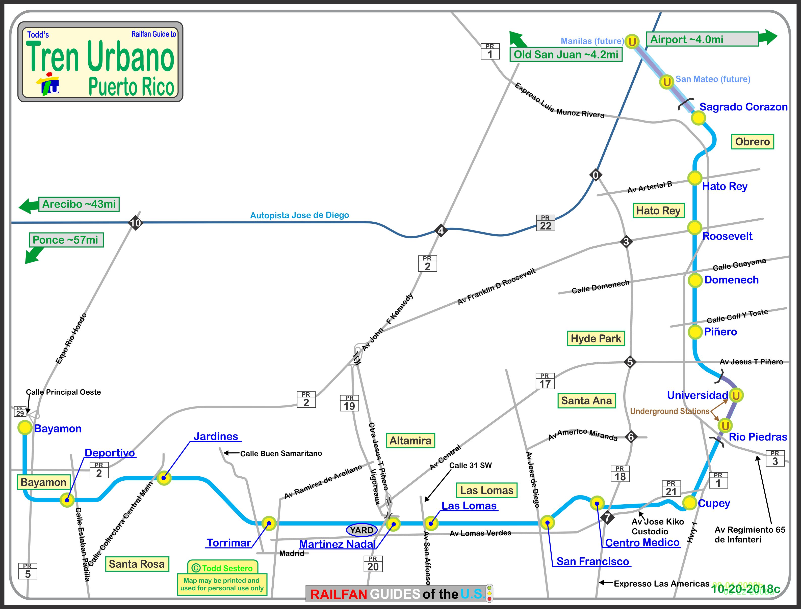
The system serves the metropolitan area of San Juan, which also includes
the municipalities of Bayamon and Guaynabo, but does not actually come
into the center of San Juan.
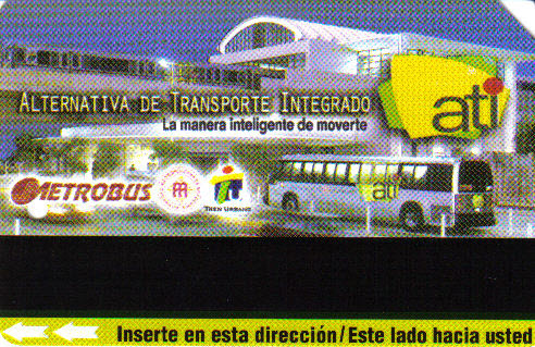
The Tren Urbano complements other forms
of public transportation on the island such as a public bus system, taxis,
water ferries and shuttles. The entire mass transportation system has been
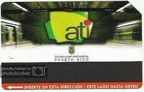
dubbed the Alternativa de Transporte Integrado
(Integrated Transportation Alternative) or “ATI”.
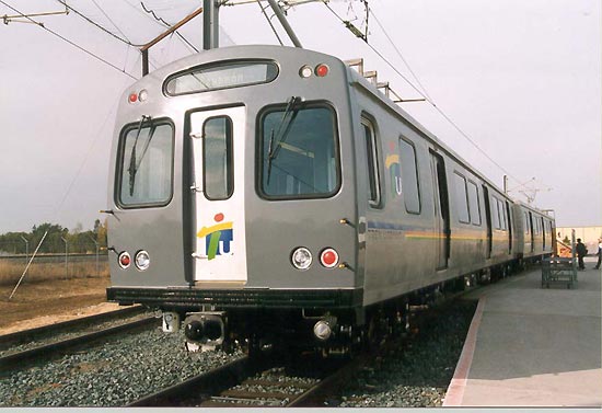
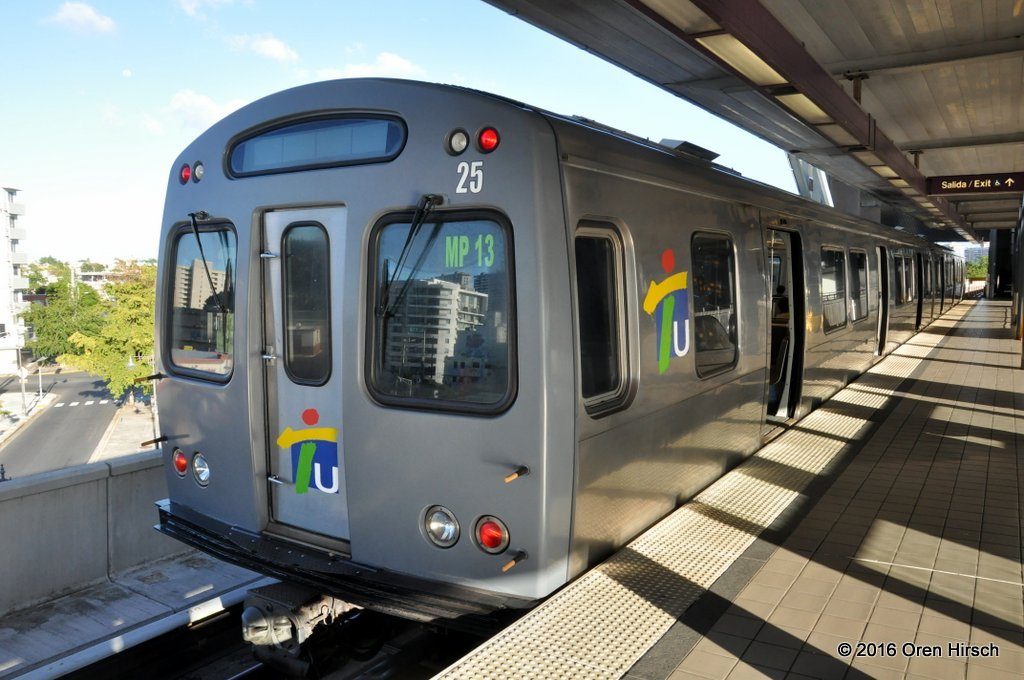
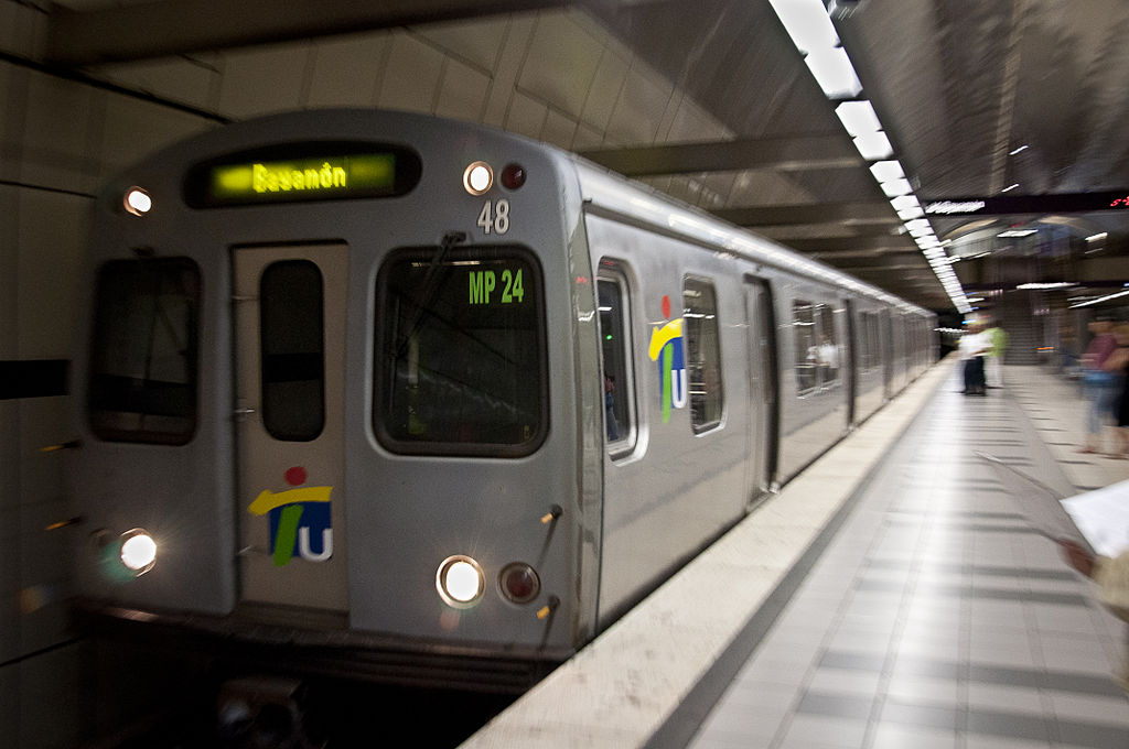
As with many other heavy rail/metro systems (Baltimore and Miami for instance),
a "single railcar" is actually two permanently connected cars -
neither of which can operate without the other because systems
between the two are shared - commonly called a "married
pair". The system has 74 cars. A single married pair
is used off peak hours, with two married pairs used during the rush hours.
Construction took about 6 years, and cost approximately 2.28 Billion US
dollars. The system officially opened for weekend trips on
December 19th, 2004, and was free until April 2005, when weekday service
was added. Revenue service started on June 6th, 2005. Ridership
has not been as high as expected, and as a result,
fares were cut in half to try to lure more people to ride the system.
If we look at the destinations the system DOES NOT serve, such as San Juan
OR Old San Juan, Santurce, the Airport, and important suburbs like Catano,
Toa Baja, Carolina, Toa Alta, Canovanas, and Trujillo Alto, one can see
why ridership may not be what was expected.
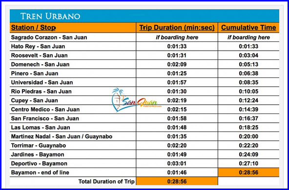
Tren Urbano operates six days a week, 365 days a year. The system
begins operations at 5:50am and runs uninterrupted until 11:30pm.
The Integrated Transit Authority (ATI) points out that the frequency
of the trains at peak times is 8 minutes and 16 minutes off peak.
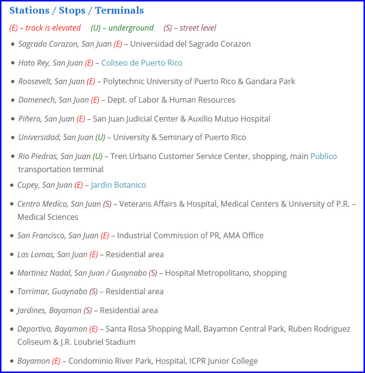
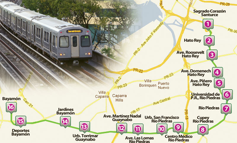
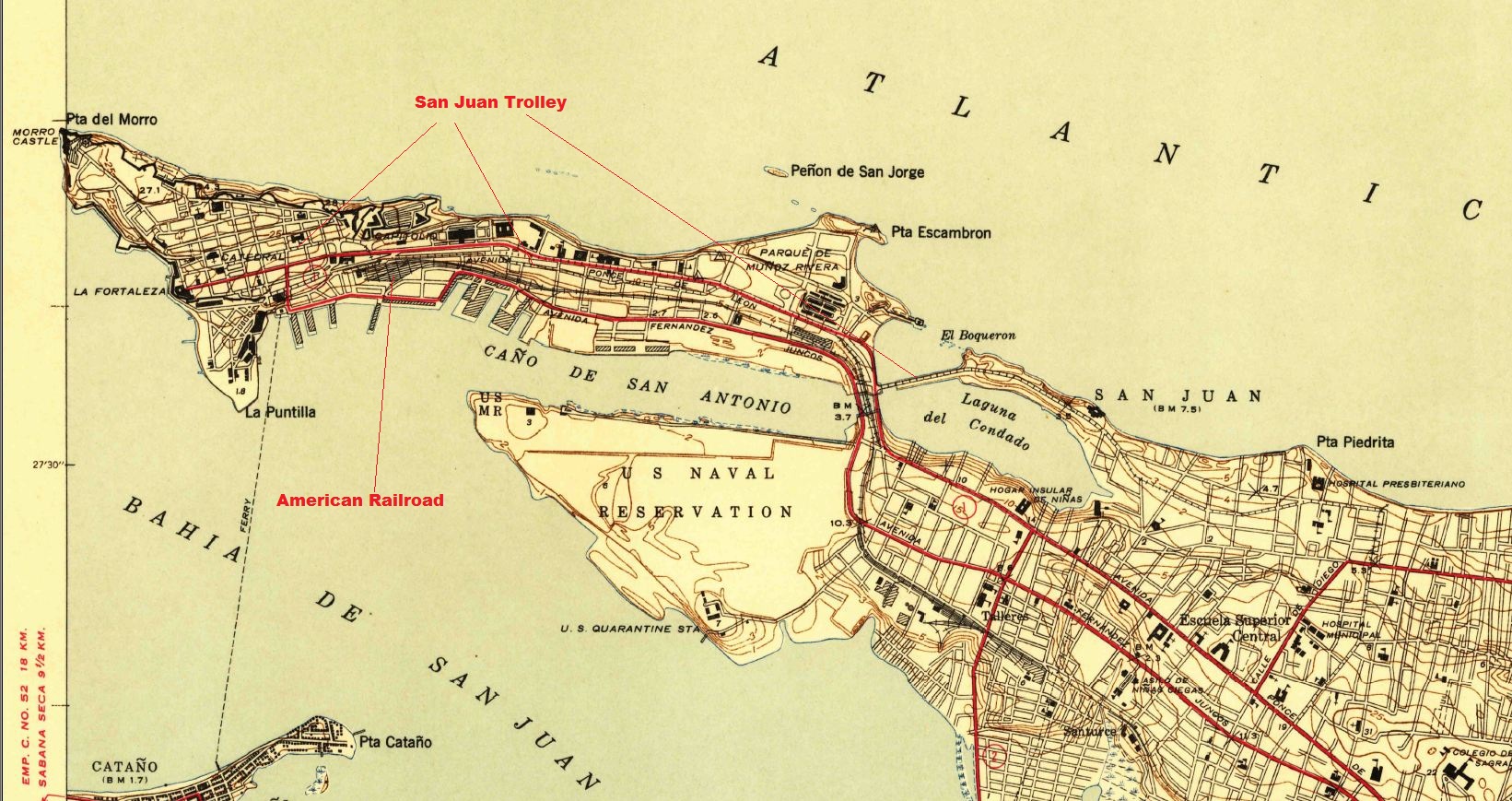
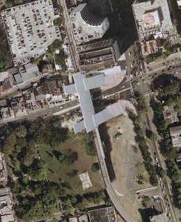
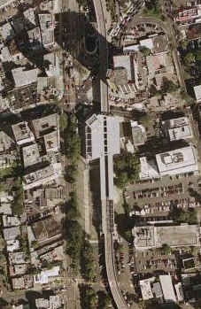
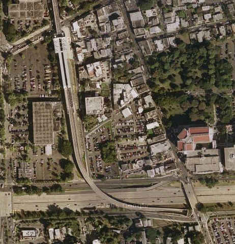
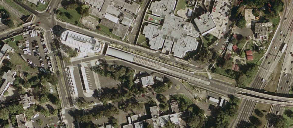
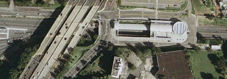
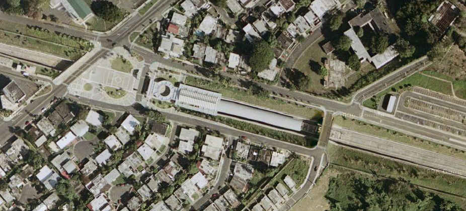
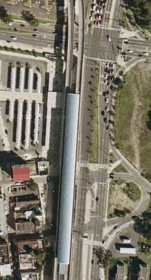
Tren Urbano is currently made up of a single rapid transit route, consisting
of 16 stations - 10 of which are elevated, four are at grade or in open
cuttings, and two are underground. It goes mostly through suburban
areas. All stations are designed to handle three married pairs.
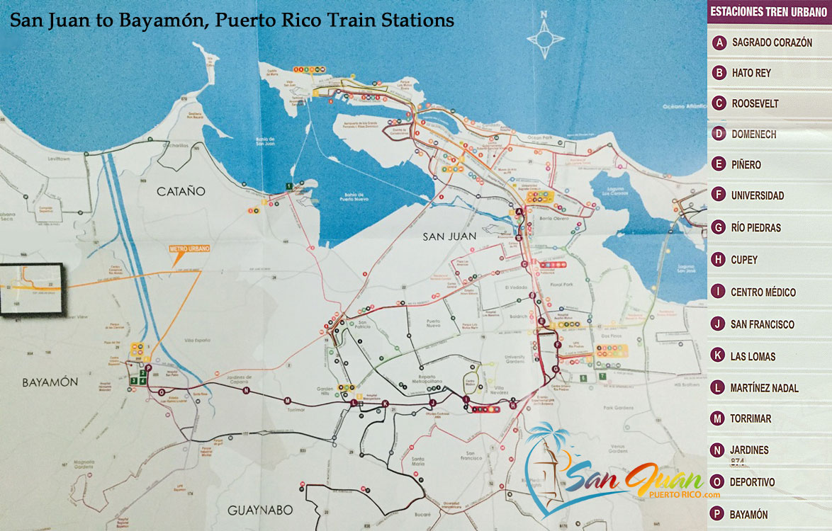
The stations in the system are:
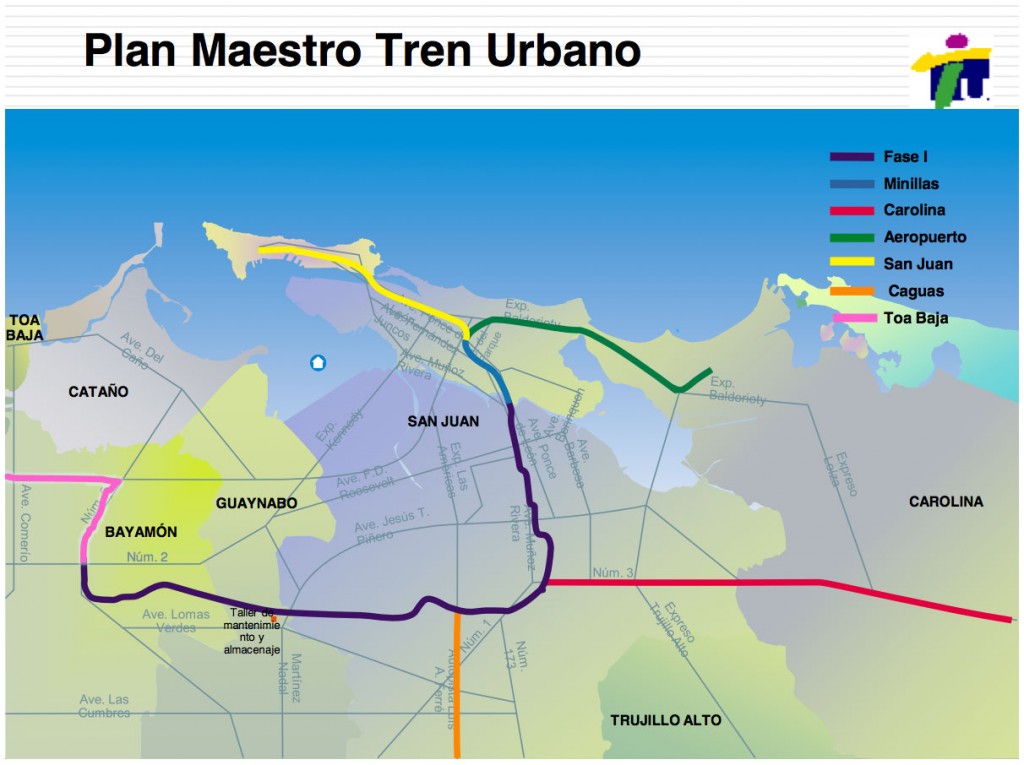
Minillas (Phase 1A) Planned ←
San Mateo (Phase 1A) Planned ←
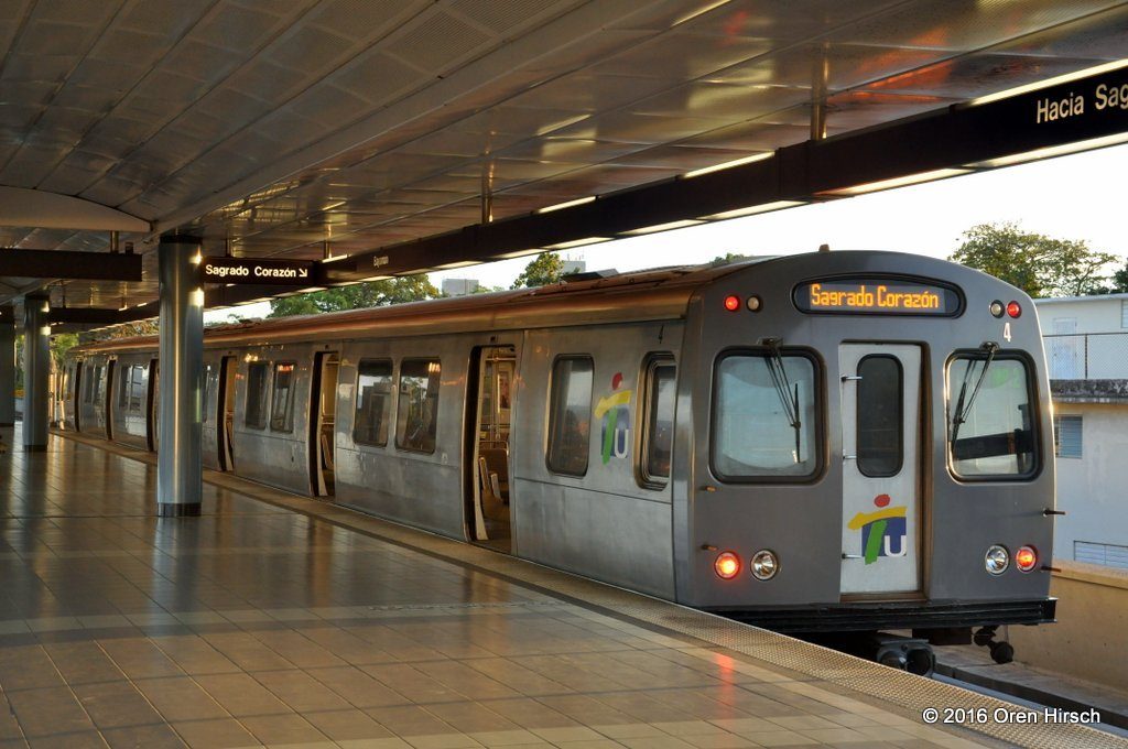
Sagrado Corazón (Sagrado Corazón) (360 parking spaces)
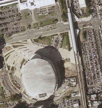
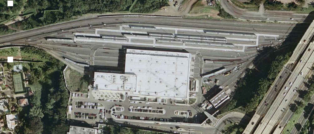
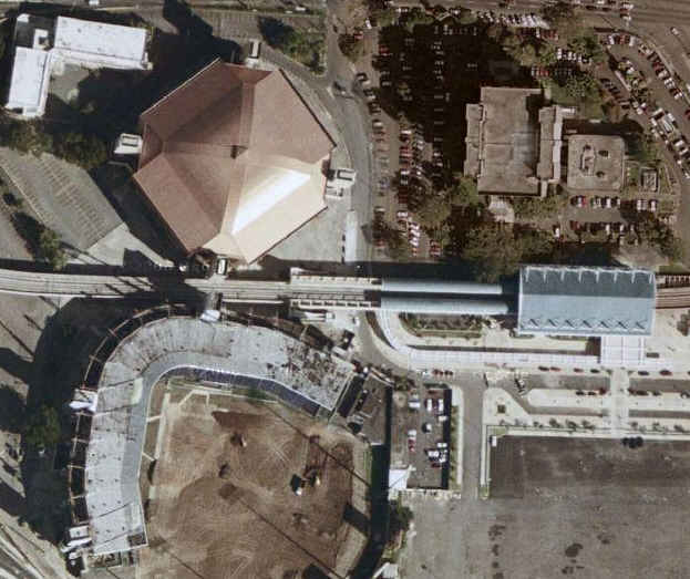
Hato Rey (Golden Mile / José Miguel Agrelot Coliseum)
Roosevelt (Roosevelt Ave. and Ponce de León Ave.)
Domenech (Hato Rey)
Piñero (Hato Rey)
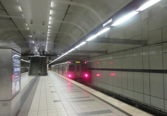
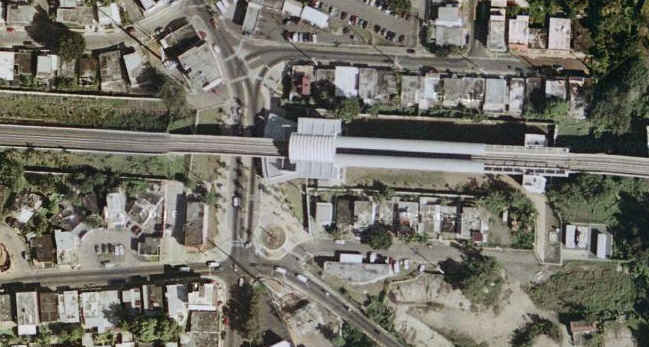
Universidad (University of Puerto Rico at Río Piedras)
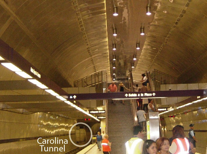
Río Piedras (Río Piedras)
Carolina (Phase 2) Planned ←
Cupey
Centro Médico (Puerto Rico Medical Services Administration and University of Puerto Rico, Medical Sciences Campus)
San Francisco (535 parking spaces)
Las Lomas
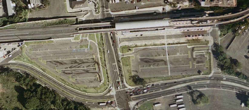
Martínez Nadal (1,200 parking spaces)
Torrimar (Guaynabo) (45 parking spaces)
Jardines (128 parking spaces)
Deportivo (Juan Ramón Loubriel Stadium and Coliseo Rubén Rodríguez)
Bayamón (Bayamón) (400 parking spaces)
The Tren Urbano does not travel directly to Luis Muños Marín International Airport,
however, there is an expedited bus route. Express route E40 leaves from
Piñero Station and goes directly to Muñoz Marín Airport by way of the Mall
of San Juan. In this way, passengers who are arriving or
who are going to take a flight can use the Tren Urbano service.
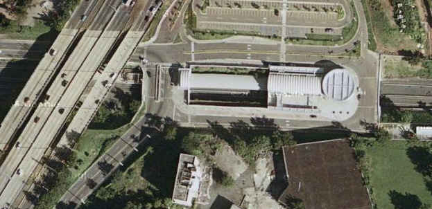
Each of the 16 stations boasts unique artwork and architectural style. A
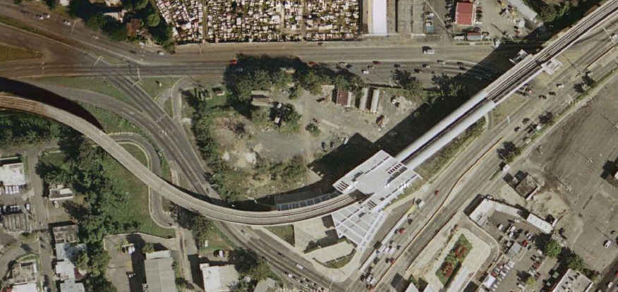
maintenance depot and operations control center is located halfway along
the route, between the Martínez Nadal and Torrimar stations.
Bicycles: In order to take a bicycle on a train, you must apply for a Bici-Pass
permit at Río Piedras station between 10:00am and 6:00pm. Further
requirements are: attendance of a course dealing with the rules for taking
a bicycle on the train, be 18 years or over (or have permission from a
parent, guardian or representative), and provide an ID-size photo.
Users must sign the rules form as a commitment to comply.
The return of Steel Wheeled Transit:
In 1967, proposals were made for the construction of a rapid rail transit system to serve the city of San Juan. In 1971, the major T.U.S.C.A. study—funded jointly by
the Puerto Rico Planning Board and the U.S. federal government— recommended an islandwide, elevated transit system and new community development program. That proposal
would have traversed and also served the San Juan Metro Area, connecting it with the rest of the island without the necessity of highway construction. However, it was
not until 1989 that Puerto Rico’s Department of Transportation and Public Works officially adopted a proposal to begin design and construction of a rail system for the
San Juan metropolitan area. The ridership demand for such a system had to be forecast using a mathematical model prepared by a team of transportation planners and
engineers. By 1992, various alignments of the proposed system were considered, but the final design chosen served only certain parts of the metro area, and not Old San
Juan. The name "Tren Urbano" (Urban Train) was chosen for the system. In 1993, the Federal Transit Administration (FTA) selected it as a Turnkey Demonstration Projects
under the Intermodal Surface Transportation Efficiency Act of 1991. During 1996 and 1997, seven design-build contracts were awarded for different segments of the Tren
Urbano Phase 1 system. A number of companies shared the tasks for building the Tren Urbano including Siemens AG which was granted a concession to design and build the
line and its rolling stock, and to operate it for the first five years. The company won a contract which was a “first” for North America in the scope of the work which
it involved, and which was awarded in July 1996. (from the first link below)
History:
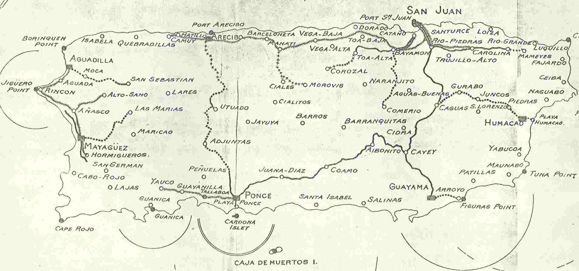
Railroads have a long history in Puerto Rico. Construction on the first began near the close of the 19th century when the island was a Spanish colony. In that time,
a loop railway was created which traveled around the edges of the island. However, with colonization by the United States, American automobile companies
monopolized the transport market to the detriment of railway development. The development of highways caused the populations in urban areas to grow. The increase
of so many people in so little space with the majority of them dependent on cars, forced the government to develop plans for public transport to ease the congestion.
In the late 19th century while the island was under Spanish rule, regional rail systems were begun in Puerto Rico. The railroad continued to be in use under US rule for
most of the first half of the 20th century and played a key role in the transportation of people and goods throughout the island. The railroad systems of the period
also played a vital role in the sugarcane industry. From 1901 to 1946 San Juan had a street tramway network known as “Trolley” de San Juan operated by the Porto Rico
Railway, Light and Power Company with more than 20mi of tracks and ran between San Juan and Santurce. During its heyday, it was the most modern electric streetcar
system in Puerto Rico, rivaling New York and Toronto and transported nearly 10 million passengers a year. Today there are plans to bring back the tram to the heart
of San Juan to complement the Tren Urbano. During the 1950s, an industrial boom, due in part to development programs such as Operation Bootstrap, led to the downfall
of agriculture as the principal industry on the island. During this decade automobiles became more widely available. Newer, and more efficient roads and highways
along with the closure of sugarcane mills displaced the need for rail transportation. It was not long that it was realized that an alternative means of mass
transportation was needed in addition to the public bus system to alleviate the severe traffic situation that was being created, especially in the San Juan
metropolitan area. (from the first link below)
Acknowledgements:
ferrocarrilespr.rogerseducationalpage.com
Oren Hirsch
Denver Todd
Moebiusuibeom-en
Google Maps
Wikipedia
Websites and other additional information sources of interest for the area:
https://en.wikipedia.org/wiki/Tren_Urbano
http://mapa-metro.com/en/puerto-rico/san-juan/san-juan-tren-urbano-map.htm
http://quepasa.pr/train-stations/
https://sanjuanpuertorico.com/san-juan-puerto-rico-train-tren-urbano/
http://orenstransitpage.com/transit-photography/caribbean/puerto-rico/tren-urbano/
Looks like Oren is one of the few with pictures of the system....
http://ferrocarrilespr.rogerseducationalpage.com/?p=1576
http://ferrocarrilespr.rogerseducationalpage.com/?p=2214
Specific page on the Streetcars of San Juan Excellent page!
http://ferrocarrilespr.rogerseducationalpage.com/ Excellent resource on the trains of Puerto Rico
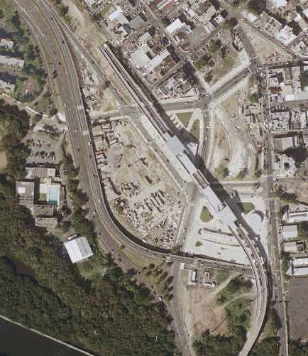
Maps
the above map in PDF form is here
Expansion Alternatives:
Other rail maps of Puerto Rico
The two maps, above and below, come from:
http://ferrocarrilespr.rogerseducationalpage.com/
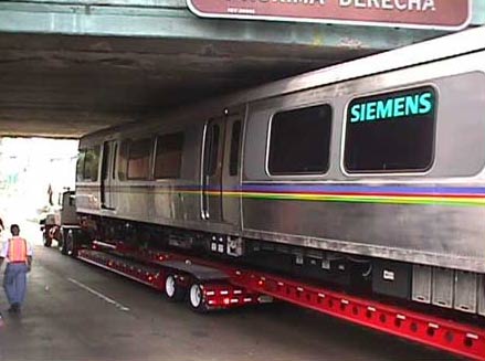
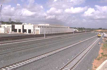
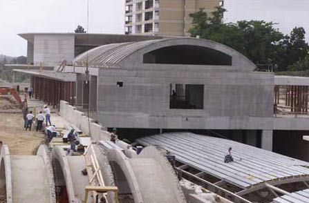
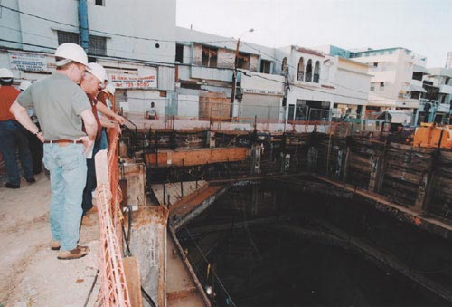
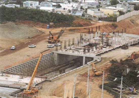
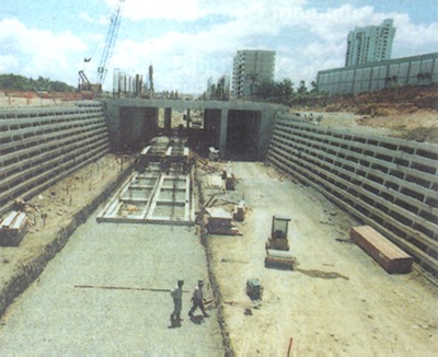
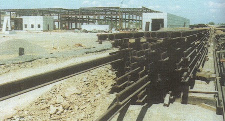
Construction Photos
Here are a few pictures of the construction I found on the Tren Urbano website.
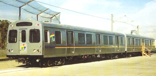
Post Construction Pictures
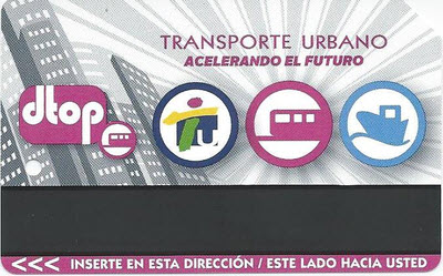
Tickets
I'm not coming up with a whole lot of pictures of the tickets used on the system.....
 2008?
2008?
 2012
2012
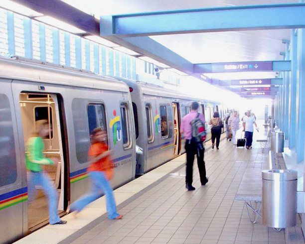
Pictures
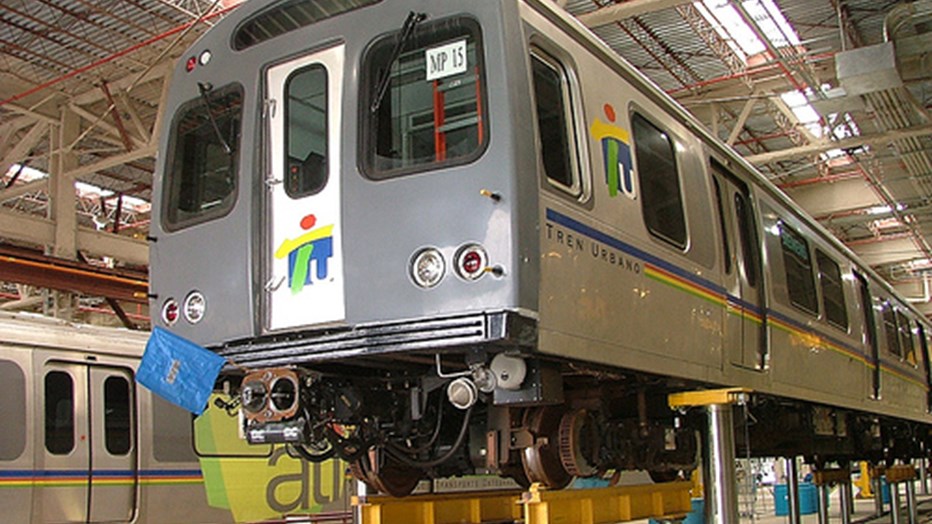
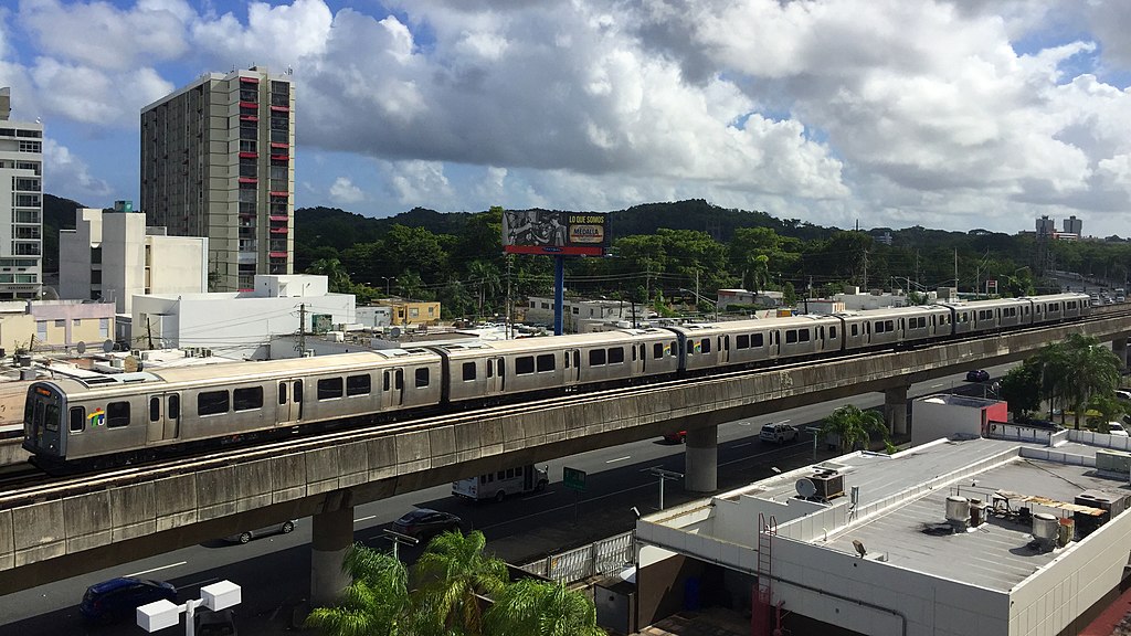 photo by Moebiusuibeom-en, 2016
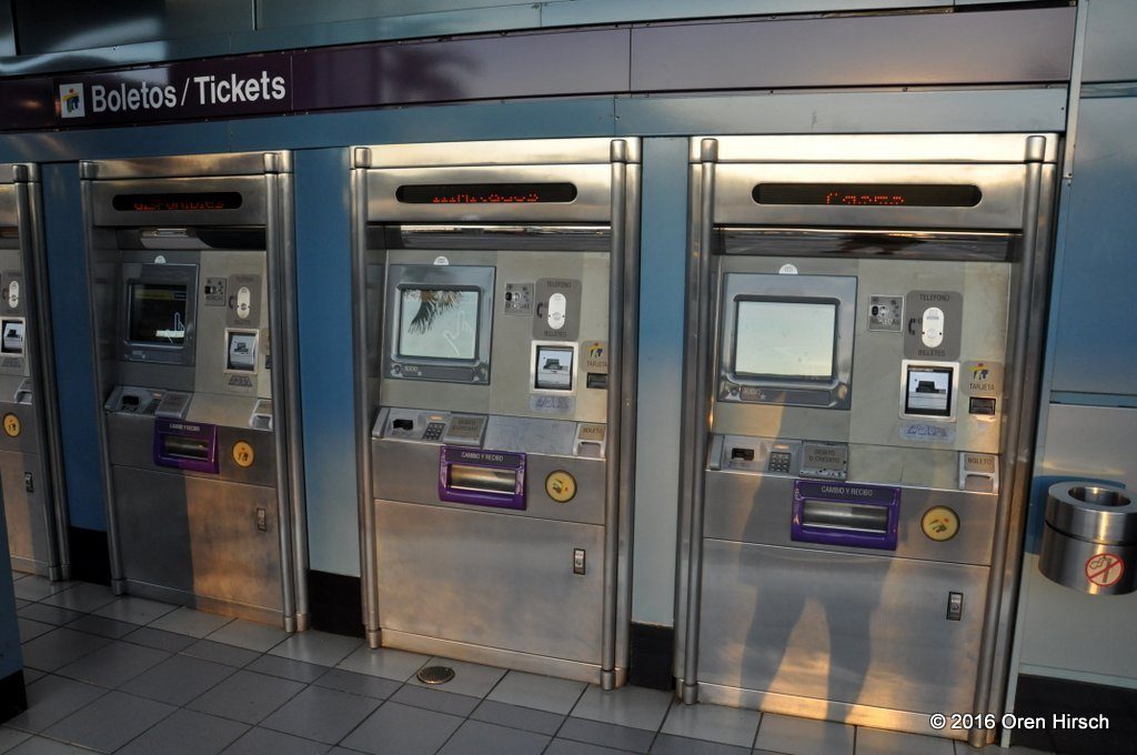 TVM's - Ticket Vending Machine's
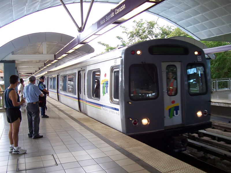
Station by Station
Sagrado Corazon
Hato Rey
Roosevelt
Domenech
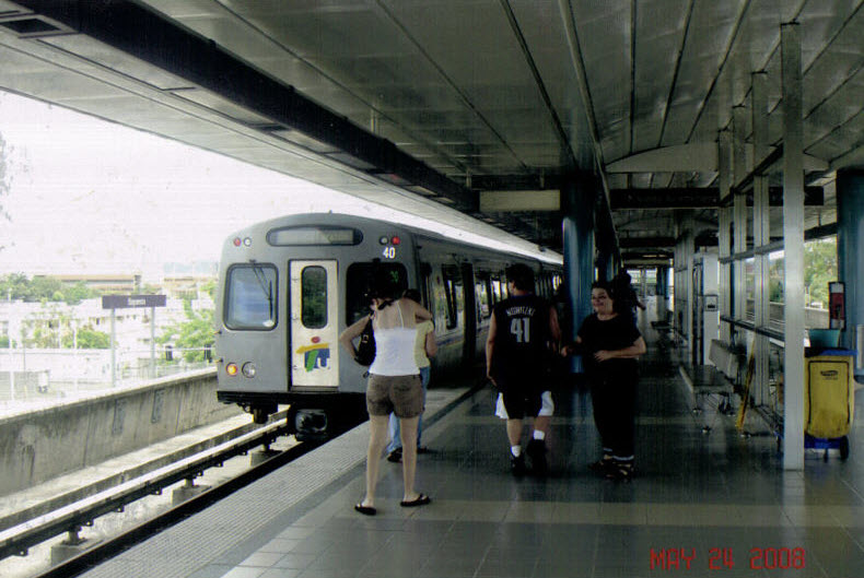
Pinero
Universidad (underground)
 from Trip Advisor
Rio Piedras (underground)
https://www.flickr.com/photos/vxla/5302664638/ picture source via Wikipedia
Cupay
Centro Medico
San Francisco
Las Lomas
Martinez Nadal
The Shops
Torrimar
Jardines
Deportivo
Bayamon
Disclaimers:
I love trains, and I love signals. I am not an expert. My webpages reflect what I find on the topic of the page. This is something I have fun with while
trying to help others.
Please Note: Since the main focus of my two websites is railroad signals, the railfan guides are oriented towards the signal fan being able to locate them.
For those of you into the modeling aspect of our hobby, my
indexa page has a list of almost everything railroad oriented
I can think of to provide you with at least a few pictures to help you detail your pike.
If this is a railfan page, every effort has been made to make sure that the information contained on this map and in this railfan guide is correct. Once in a while,
an error may creep in :-)
My philosophy: Pictures and maps are worth a thousand words, especially for railfanning. Text descriptions only get you so far, especially if you get lost or
disoriented. Take along good maps.... a GPS is OK to get somewhere, but maps are still better if you get lost! I belong to AAA, which allows you to get
local maps for free when you visit the local branches. ADC puts out a nice series of county maps for the Washington DC area, but their state maps do not have the
railroads on them. If you can find em, I like the National Geographic map book of the U.S..... good, clear, and concise graphics, and they do a really good job
of showing you where tourist type attractions are, although they too lack the railroads. Other notes about specific areas will show up on that page if known.
Aerial shots were taken from either Google or Bing Maps as noted. Screen captures are made
with Snagit, a Techsmith product... a great tool if you have never used it!
By the way, floobydust is a term I picked up 30-40 years ago from a National Semiconductor data book, and means miscellaneous
and/or other stuff.
Pictures and additional information is always needed if anyone feels inclined to take 'em, send 'em, and share 'em, or if you have something to add or correct.... credit
is always given! Please be NICE!!! Contact info is here