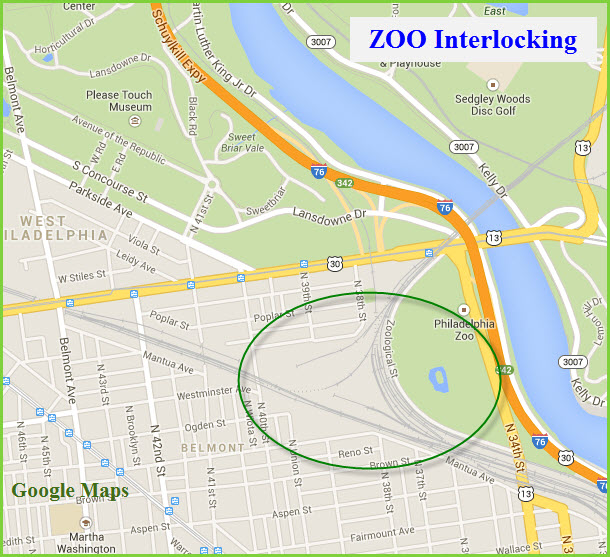
Location / Name:
Philadelphia PA, Philadelphia County
Note: Philadelphia County and the city of Philadelphia share the same
geographical boundaries, in other words, they are the same.
What's Here:
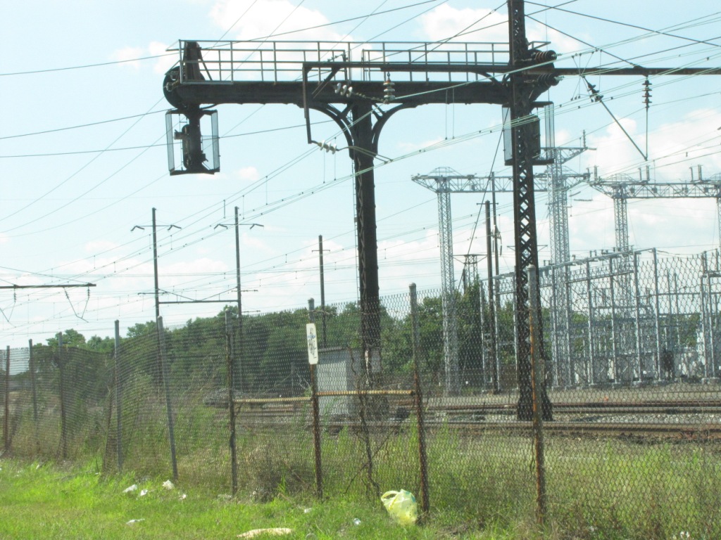
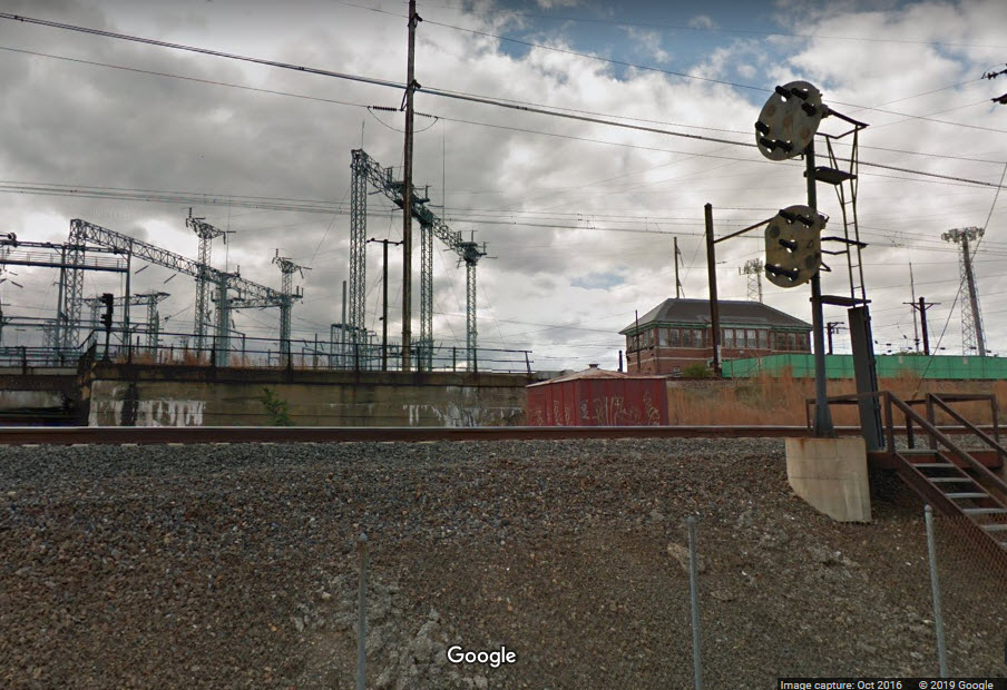
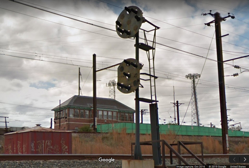
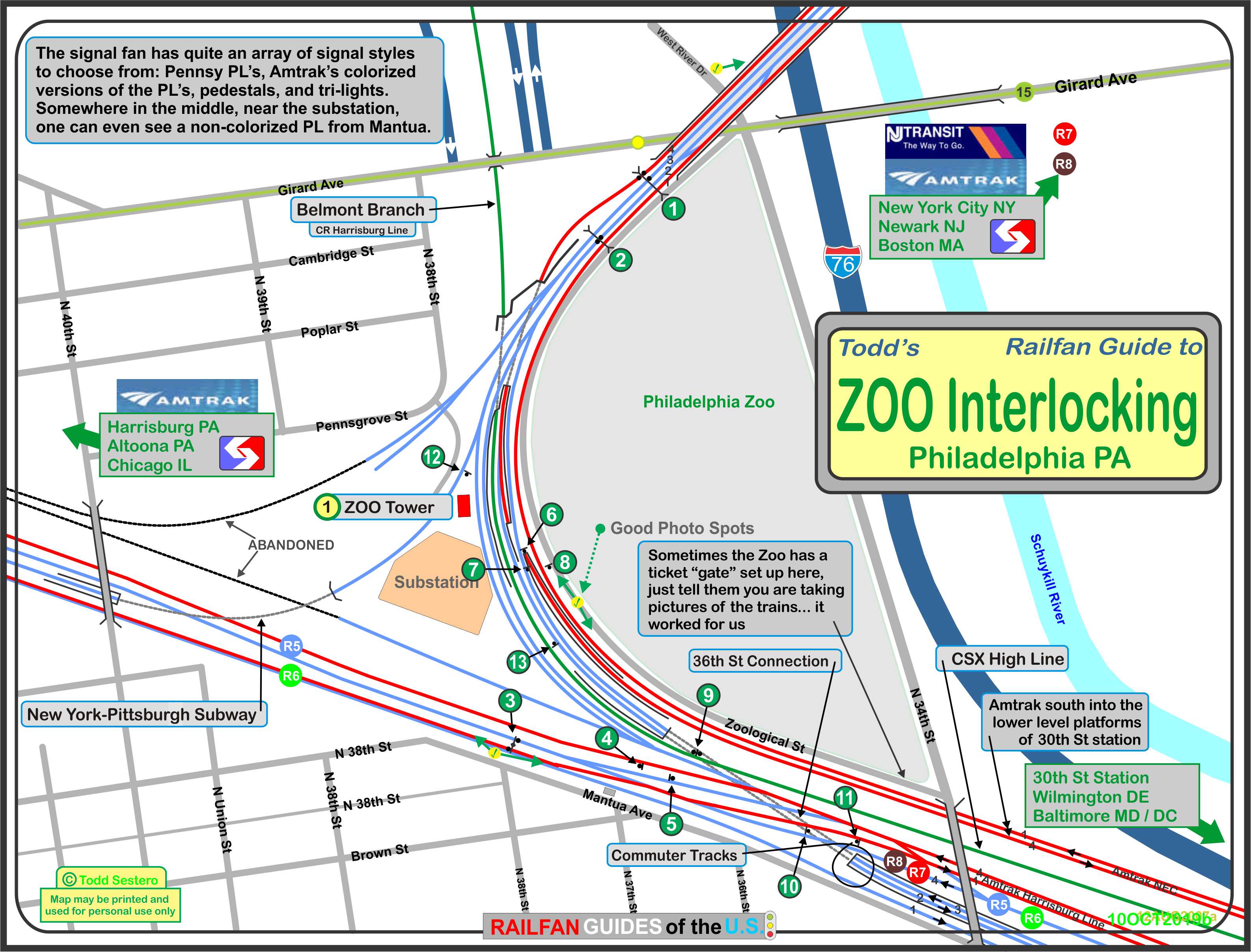
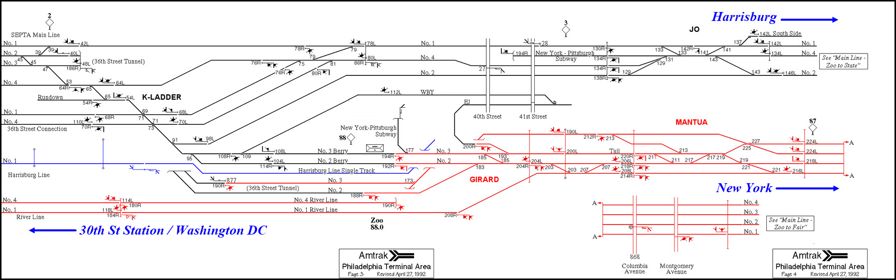
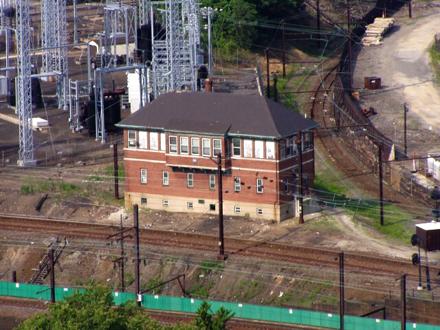
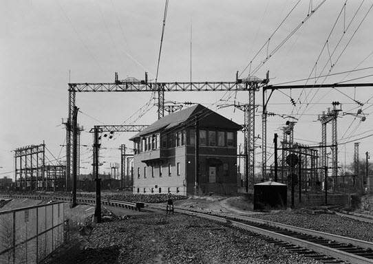
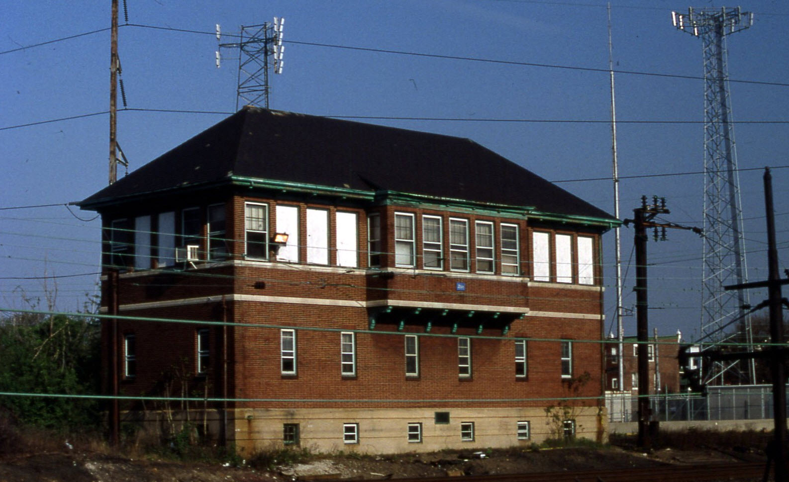
Zoo Tower
Wye
Plenty of signals of almost all types except searchlights and B&O CPL's
Access by train/transit:
None directly, #15 trolley line is very near
The Scoop:
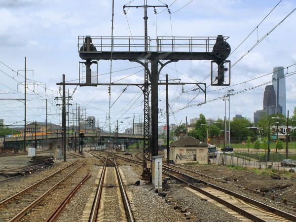
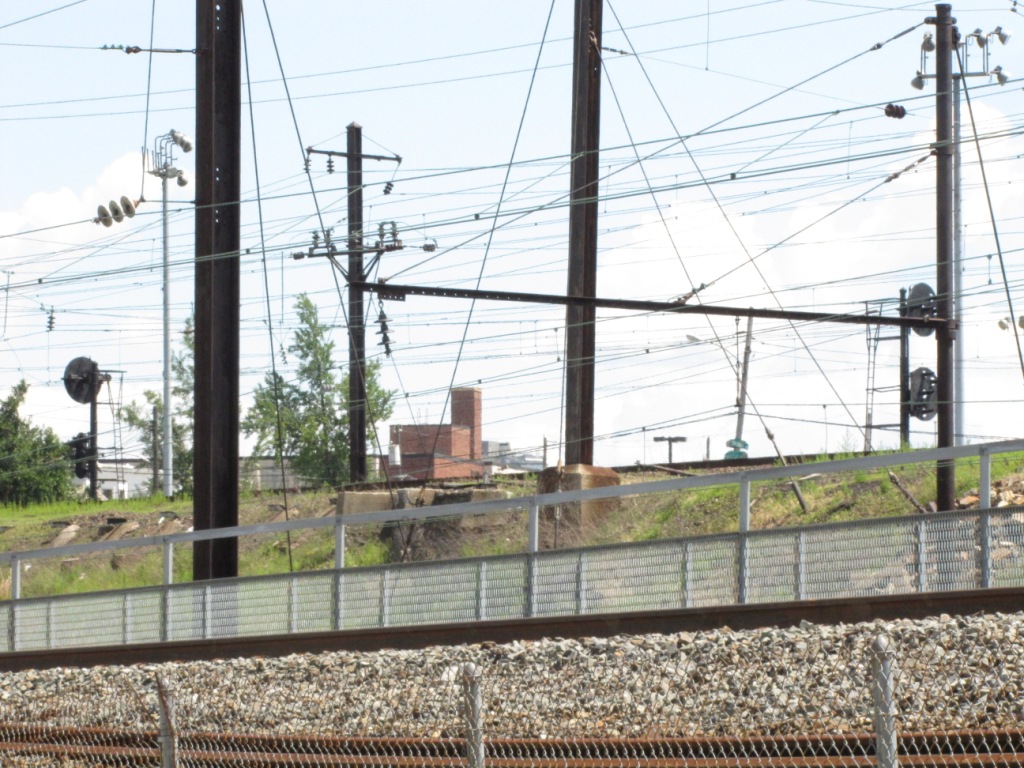
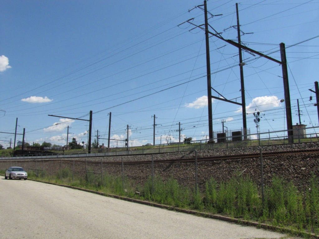
ZOO is a most interesting place to
visit. During the rush hour, there is enough going on here to keep the
most avid railfan quite busy so that he will not be able to photograph all of
the activity!
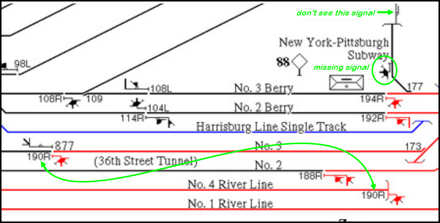
There are a number of good vantage points for photography, as noted with the green arrows.
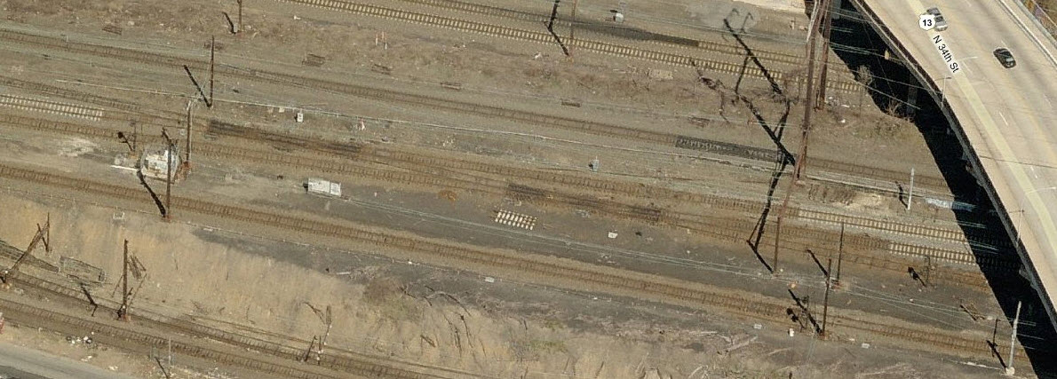
Off 34th St, on the top of the map, is
a fairly good spot for trains going over the Schuykill Bridge, but decent
pictures can only be had of trains on the closest track because of the
angle. There is sufficient space just on the other side of the bridge from
Girard to park, and there are no signs along there preventing you from doing
so.... at least for now. Beware shooting from here, as we saw evidence of
a homeless "shelter" off under the trees.... just make sure you don't "go it alone"
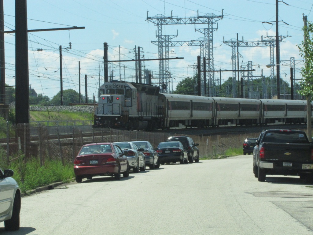
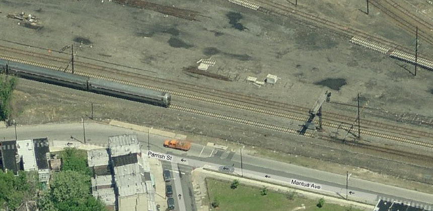
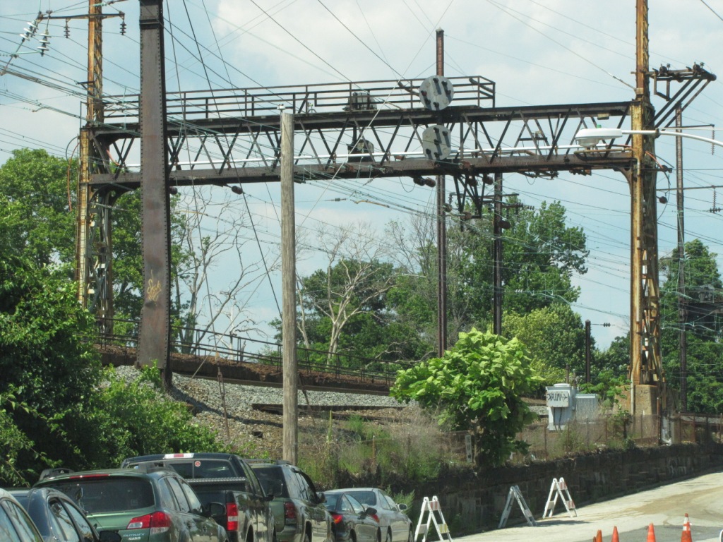
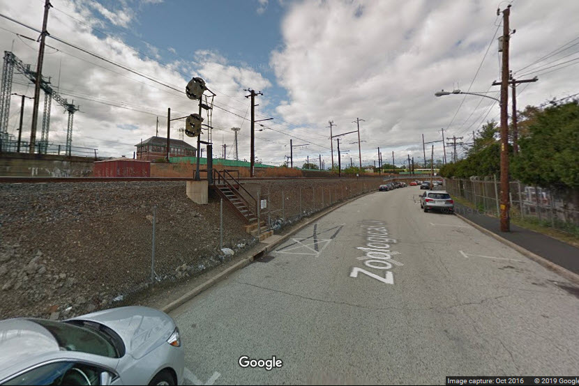
Another good spot is on the backside
of the zoo, along Zoological St. Sometimes, during the high season, they
set up an impromptu gate to charge for parking. We were able to convince
the girl at the gate not to charge us, and she didn't seem to have a problem
with it when we said we were going to take train pictures. The street is
one way going NB towards Girard. Amtrak frequents the track right next to
the street. An SUV with their pop-up tailgates make for easy railfanning
from here. CSX comes rolling thru here, on the 2nd or 3rd track over....
we caught an inbound and outbound in less than an hour spent at this side of ZOO.
Pictures could be had from the 34th St bridge, but you'll need a ladder. :-)
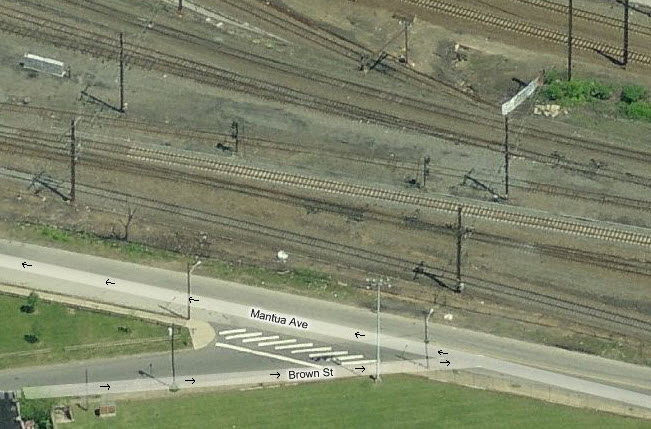
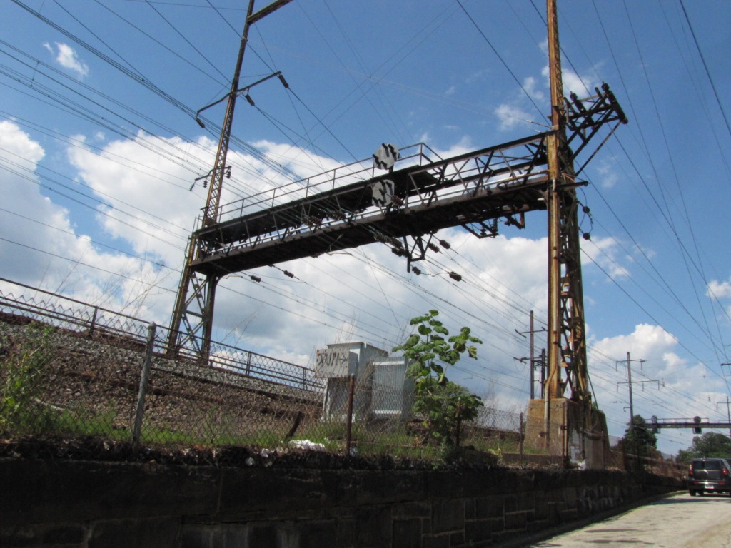
Fairly nice pictures can be taken from
Mantua Ave, but again, a ladder would be nice to get over the fence.
Unfortunately, the pole line gets in the way in places. Of notable note
along this stretch, are a couple of Pennsy PL's on a modified cantilever bridge, so noted
on the map.
The signal bridges at the top of the map on Amtrak tracks are all colorized PL's.
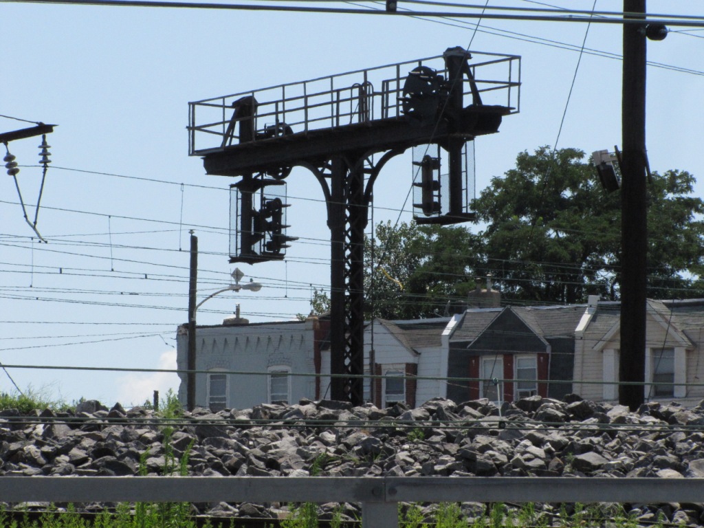
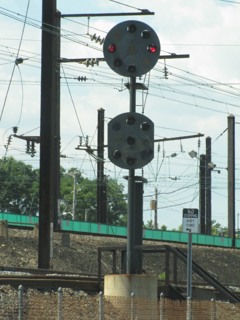
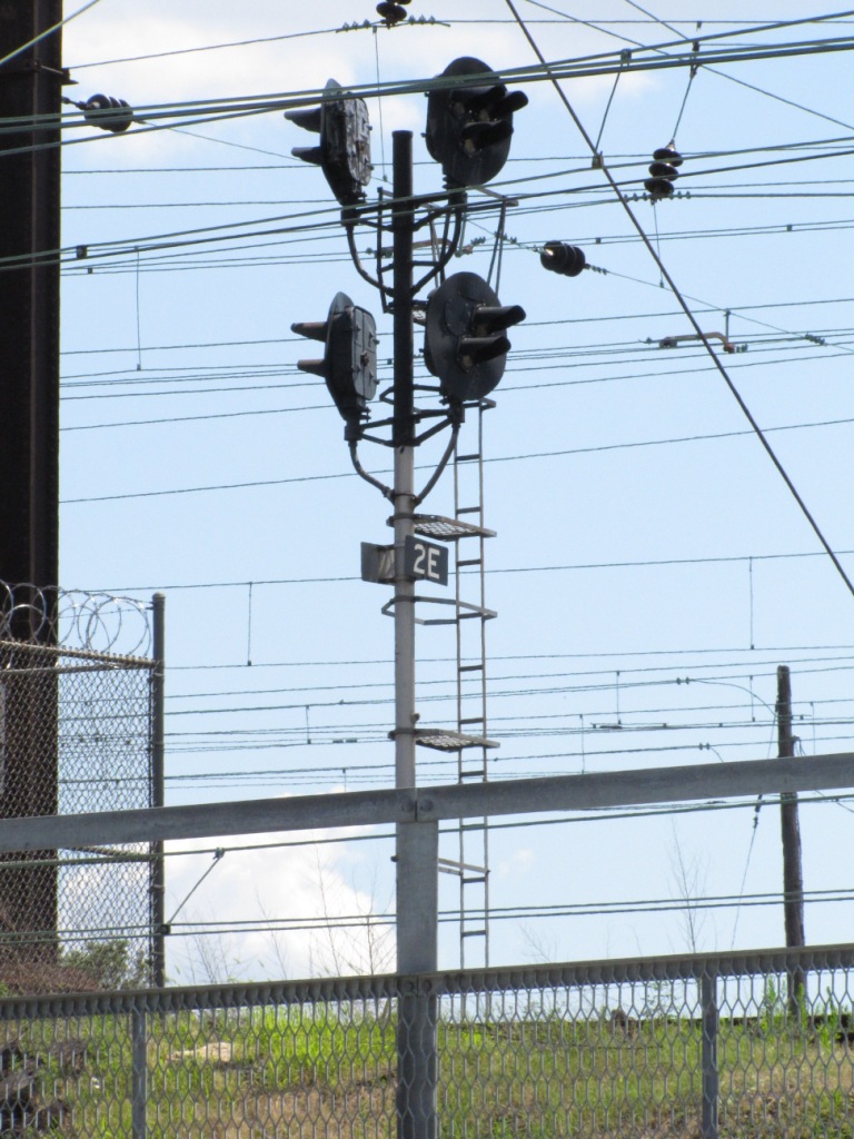
A couple of pedestal signals are
present, mostly along the tracks adjacent to Zoological St, as well as a PL
dwarf, but that probably disappeared when the double-slip switches were
replaced.
I saw one tri-light, or as others would have me say, triangular
shaped color light signal, on the 3rd track over from Zoological St,
however, it has been replaced by CSX with a standard colorlight signal.
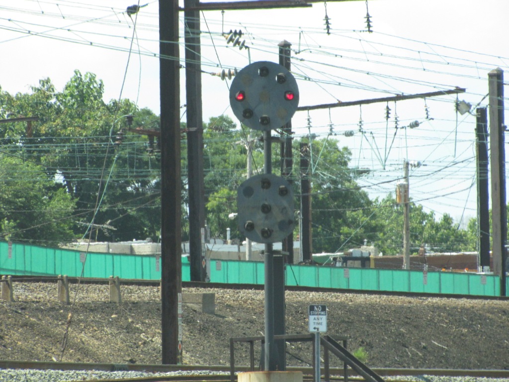
And buried somewhere in the middle of the wye I did see (still) an all yellow PL.
Acknowledgements:
Denver Todd
Jersey Mike
LK
Google Maps
Bing Maps
U.S. Department of the Interior, National Park Service
From Zoological Drive, you only have a good vantage point for trains heading up the
Corridor, unless you have a truck you can stand on top of :-)
34th Street
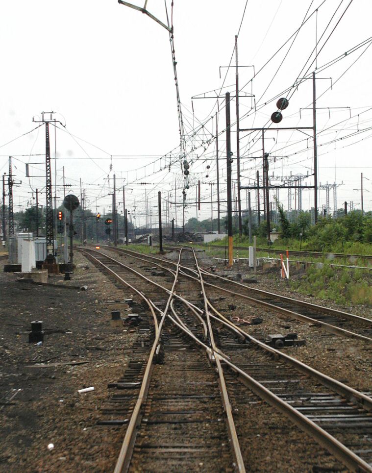
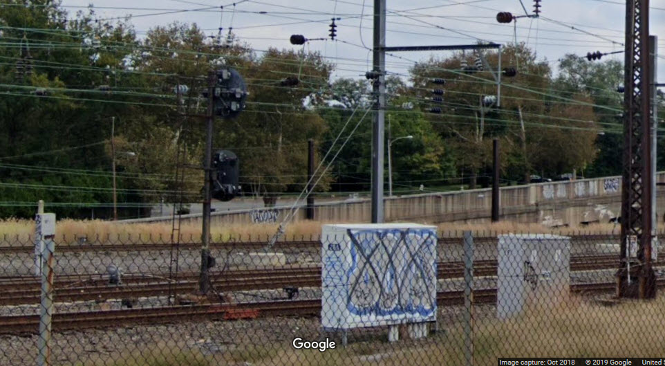
Taken from underneath 34th St and
looking west, comes this great photo of the track, signals, and overhead wire
work. No-one knows who took the picture, but it was passed on to me by Tim
Vermande, and it's location identified by local railfan. Many thanks to
both of them. Note the double-slips are aligned for a move on the track the
photographer is in the middle of. Great stuff! This shot may have
been taken out of the rear window of a commuter train, as there are a couple of
fuzzy spots in the picture, and the height above the tracks is about right.
I'm not sure when, but the double-slips have been removed since I first created
this page in 2012, as can be seen in the more recent aerial view.
Double-slips are uncommon outside station areas.
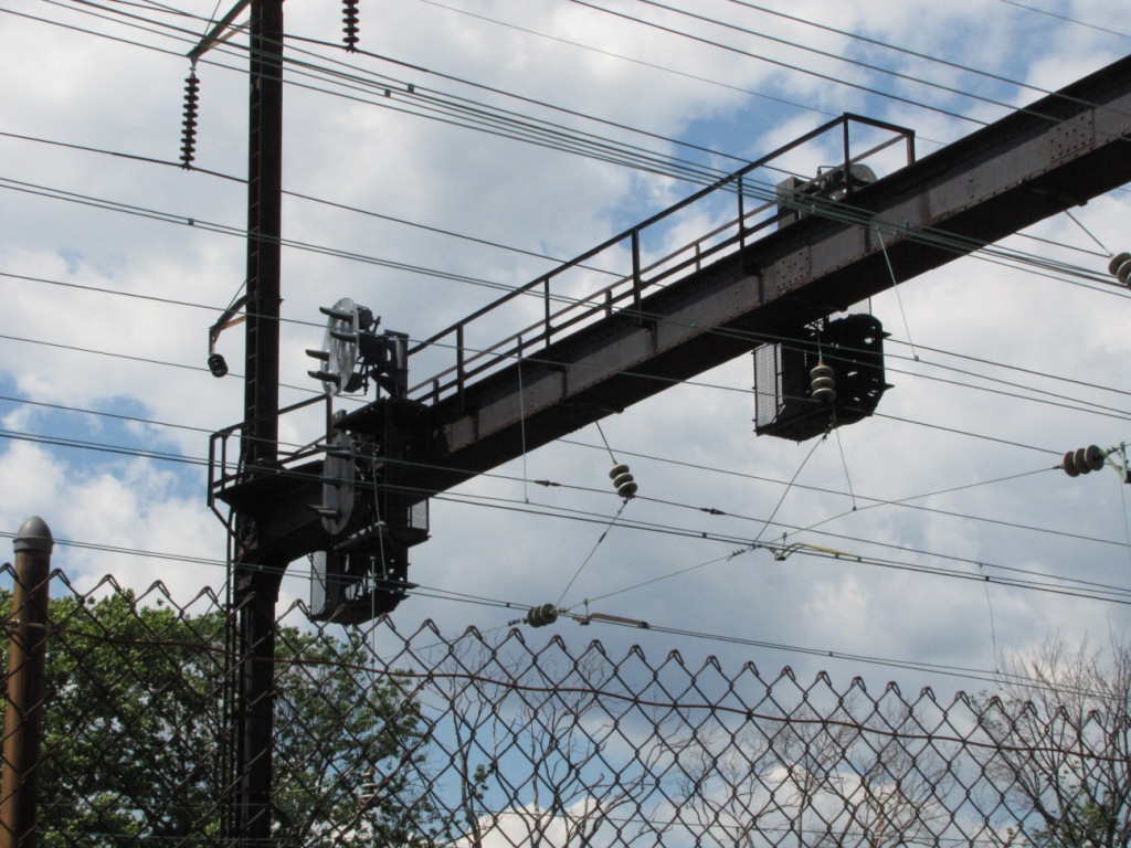
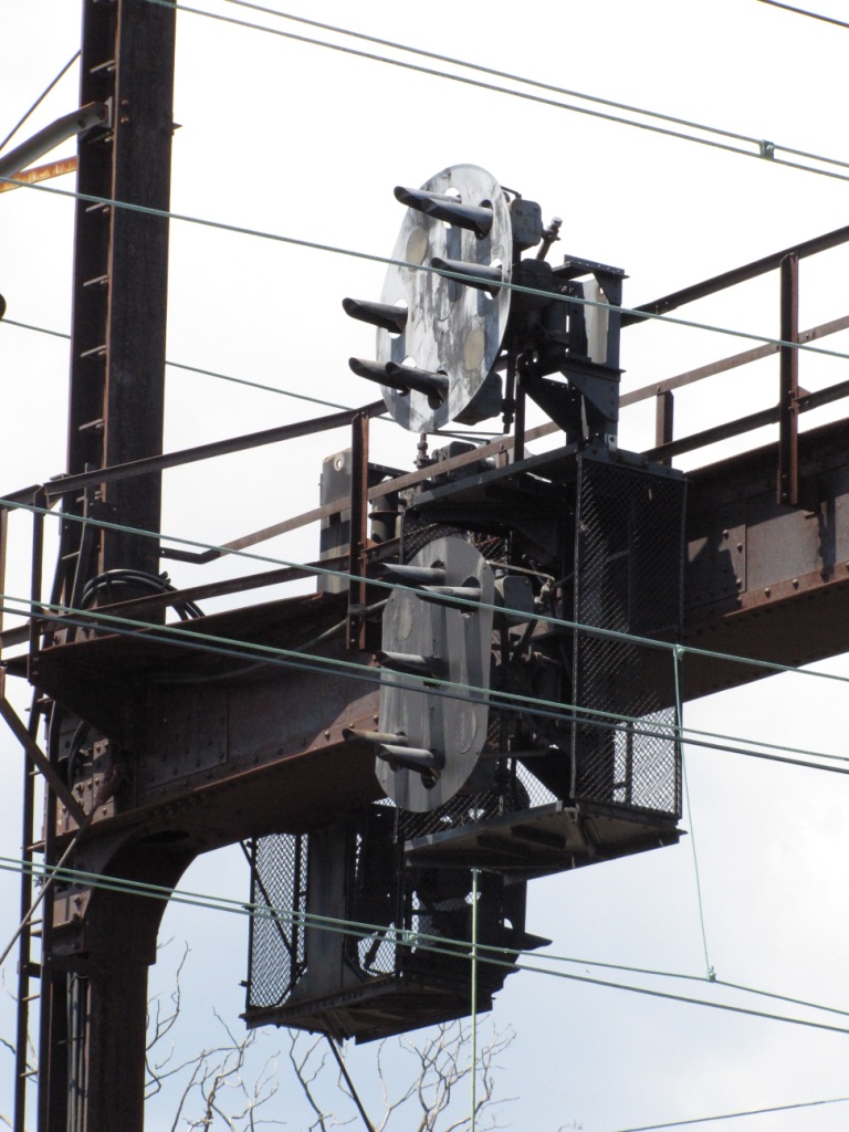
Seven PL signals can be seen in this
photo, one of which you may not see right off the bat because it is directly
behind another (the one displaying stop). The dwarf is difficult to see in
the aerial shots, if not impossible.
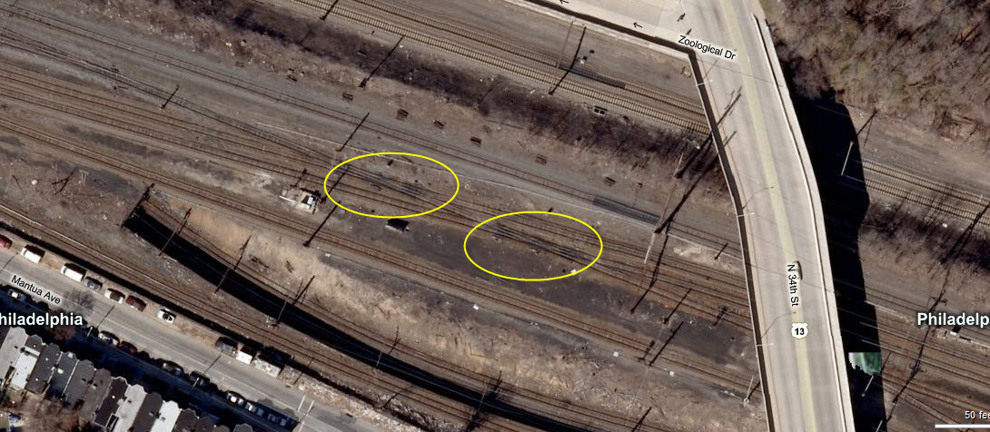
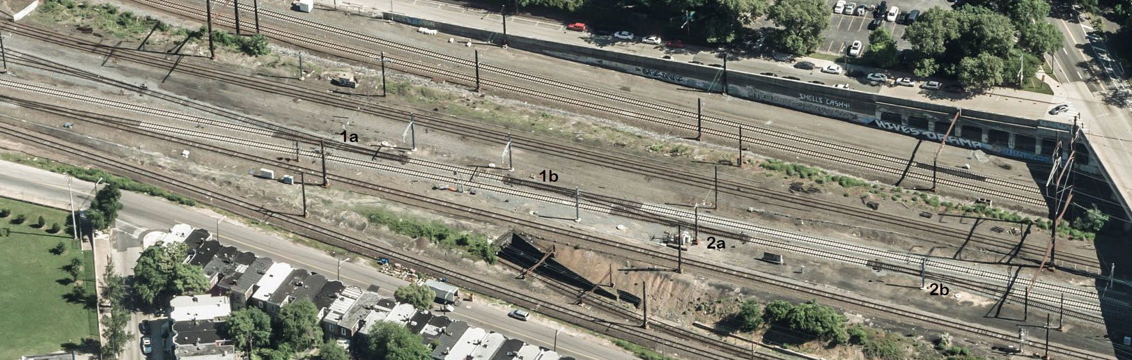
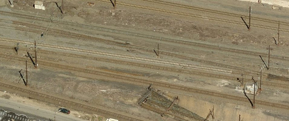
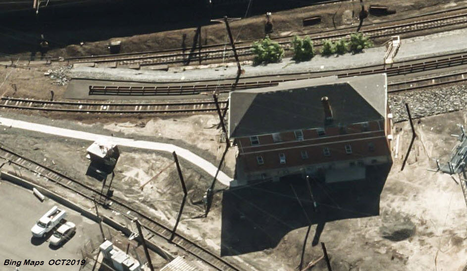
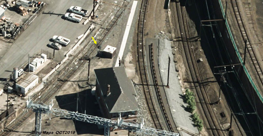
Below are two aerial shots from Bing Maps which highlight the double slip location.
The circles highlight the two double-slip crossovers.
Below is an aerial view from Bing Maps that shows the double-slips are no
longer with us, both having been replaced with a pair of switches.
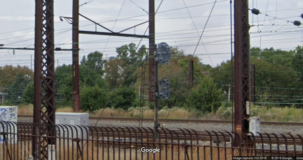
High over the tracks on a modified version of a bracket post,
is the signal that is displaying APPROACH (lights on the 45).
The signal displaying STOP (a horizontal row of lights) is the
right one of the two that can be clearly seen, and the dwarf should be almost
directly across from it on the tracks that appear lighter because of the newly
installed concrete ties.
The signal with its back to us is on the right, notice (in the
ground level picture above) the lower head does not have a background. The
signal displaying CLEAR (a vertical row of lights) is on the left.
This is the last signal bridge before the tracks cross the
Schuylkill, or, the first set of signals encountered as you're heading SB.
There are two SB signals and one NB set. Since the Amtrak drawing above
was done in 1992, it looks like they have added a NB signal for track 4.
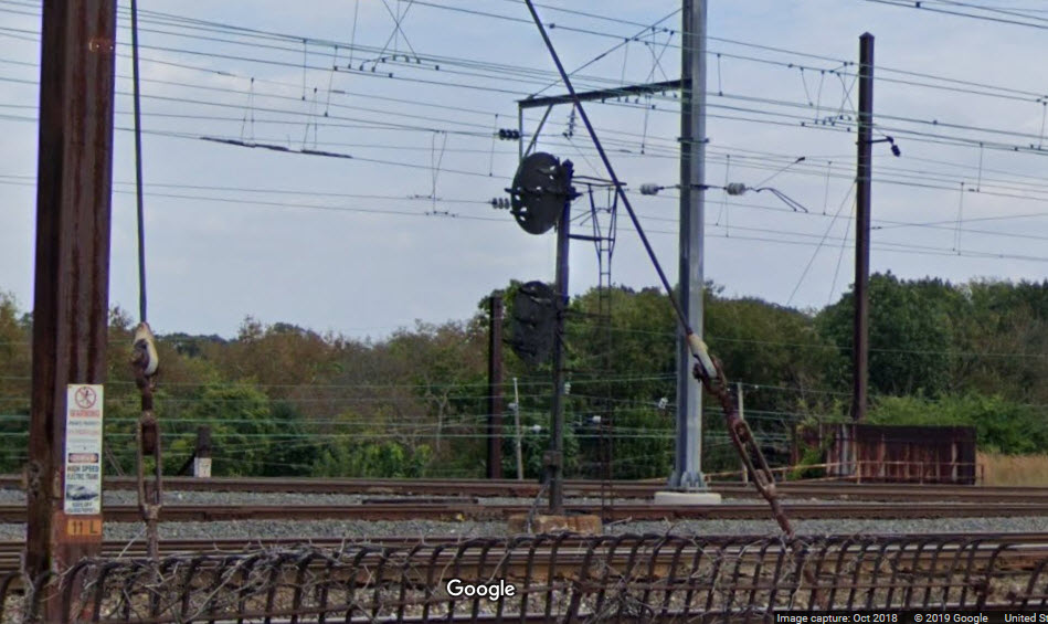
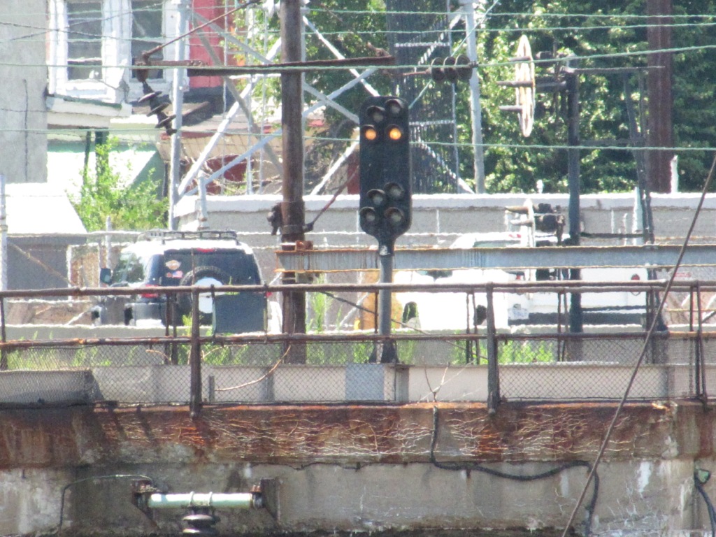
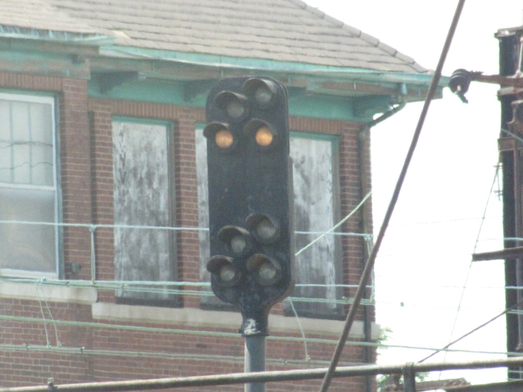
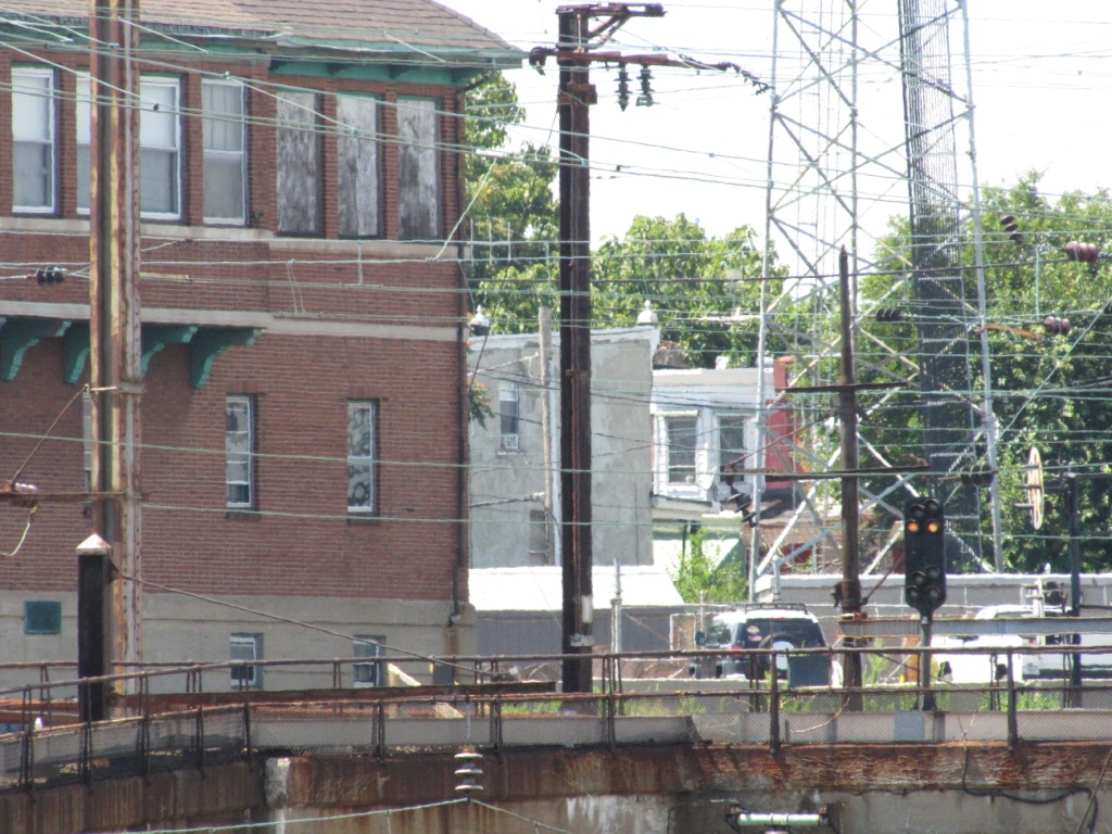
Signals 204L and 204R
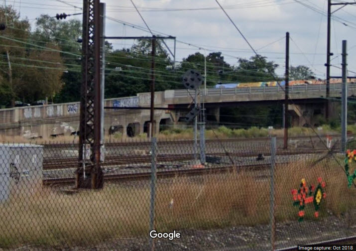
Second signal bridge after crossing the river. It has one NB and one SB Set of signals.
Signals 78L and 86R
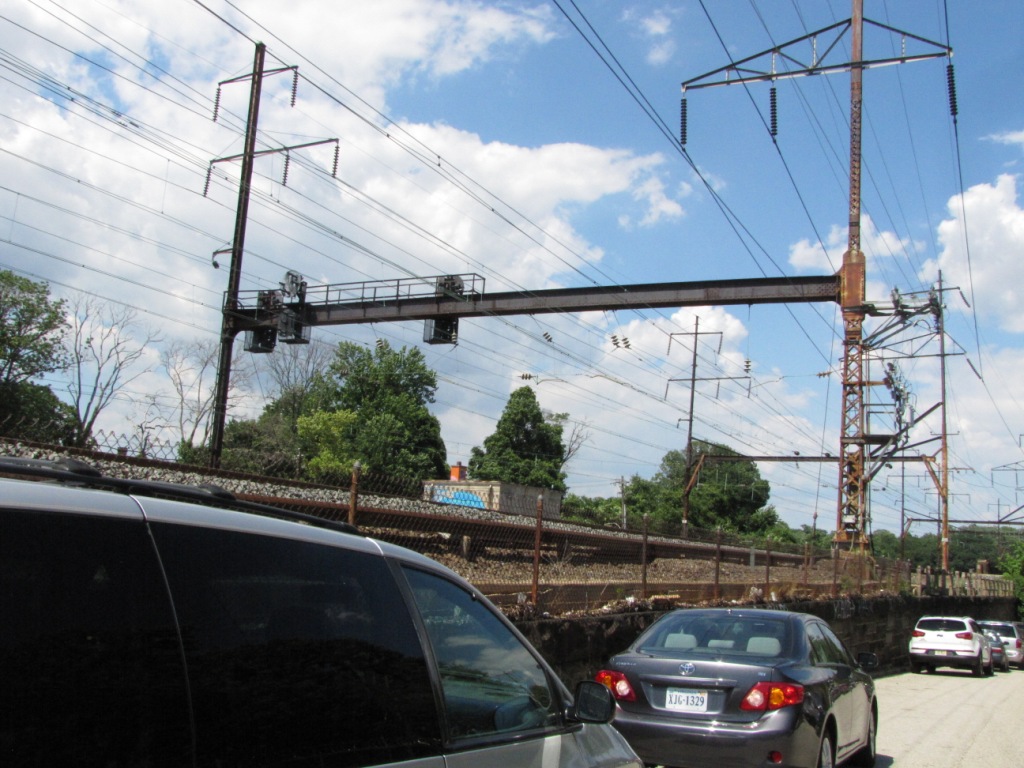
Signals on a cantilever bridge, alongside Mantua Ave.
The first picture is taken from the Zoo drive, and the second one
was taken from Mantua.
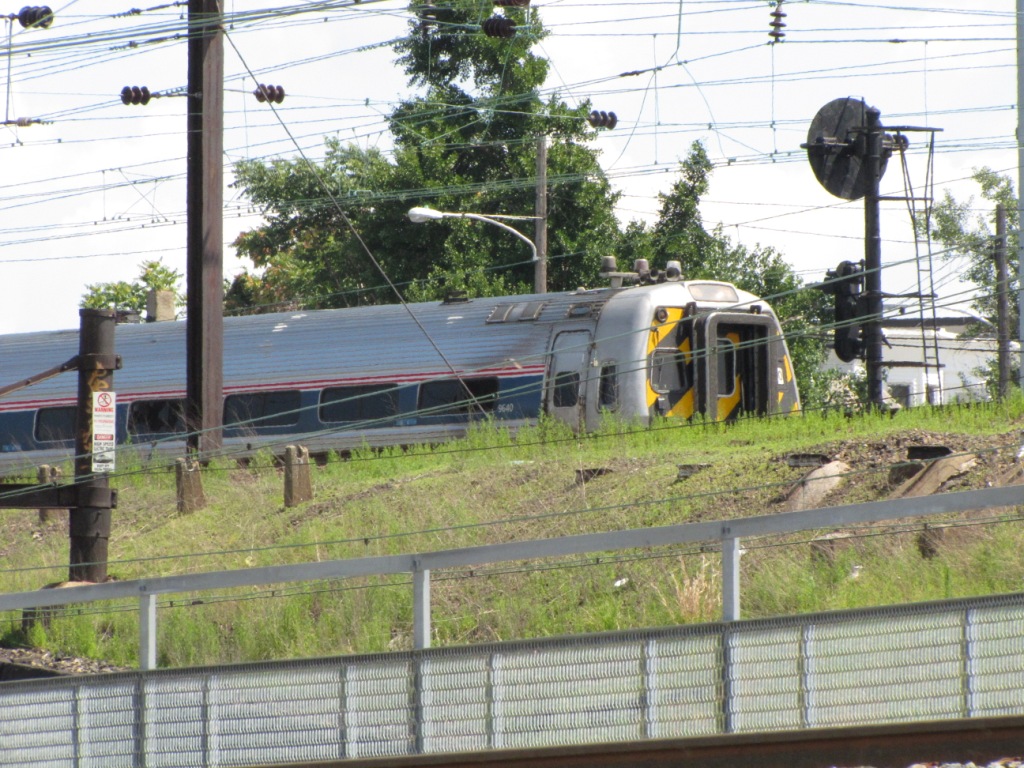
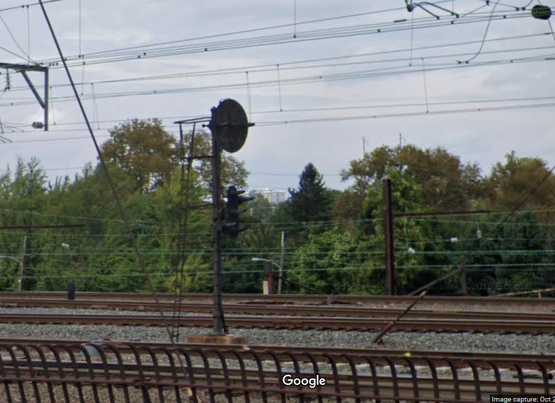
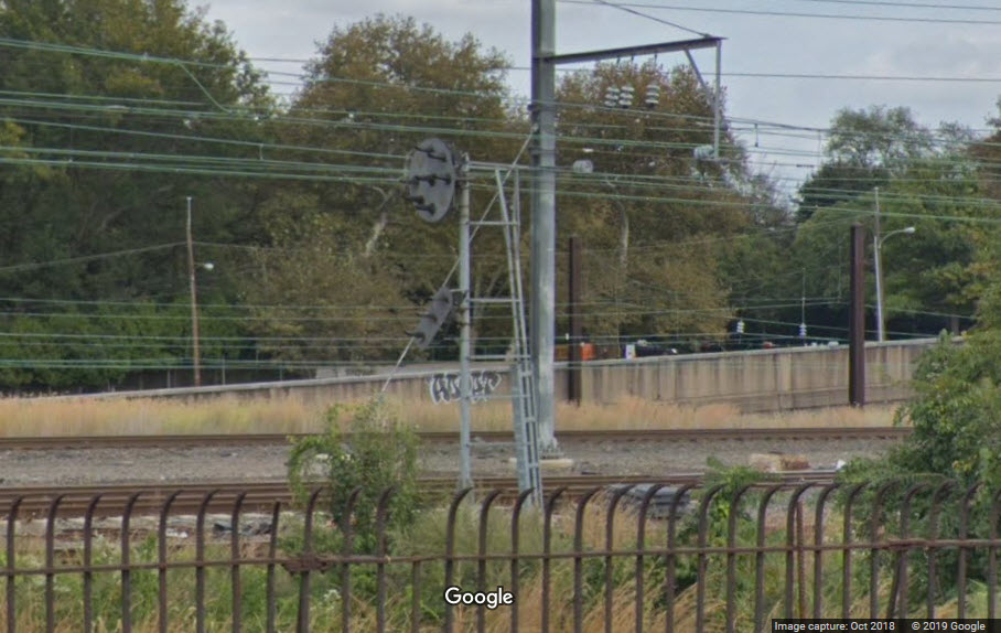
Inbound Commuter PL
Outbound Commuter PL
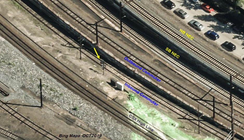
The shot below shows signal location 5, along with location 4 and the new colorlight at location 9 at the far left.
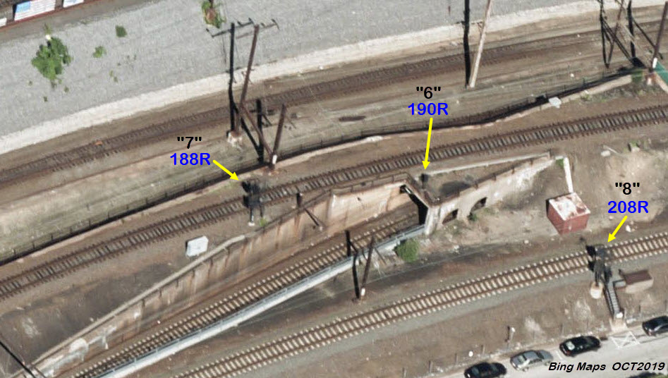
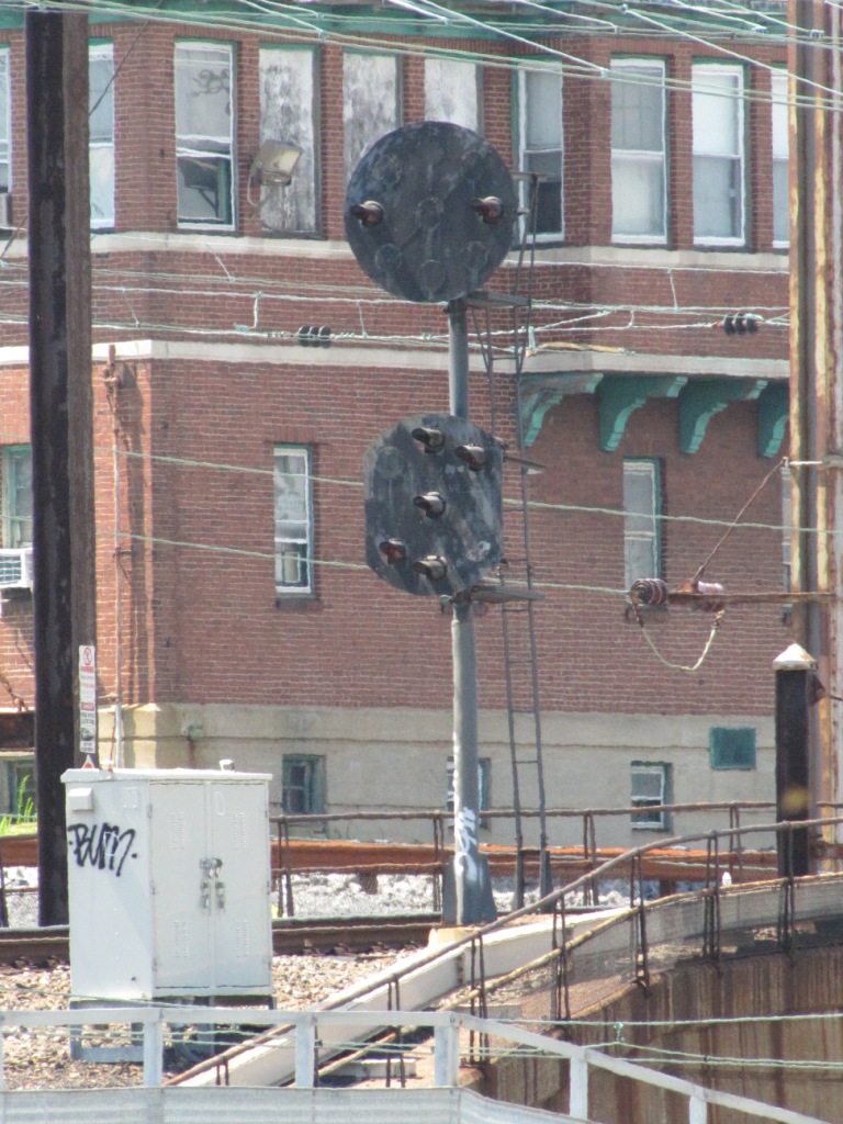
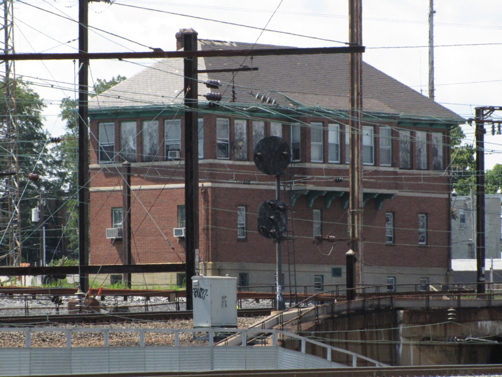
Signal 190R - NB Pedestal
Placed over the portal to one of the short tunnel is this Pennsy Pedestal
signal for NB reverse move NEC trains.
The 1992 Amtrak drawing has a few problems with it as noted, there could be more....
Signal 188R - NB PL
A NB signal for NB commuter trains, placed fairly far in advance of a crossover.
In the aerial view above, we can see signals 6, 7, and 8 pretty clearly.
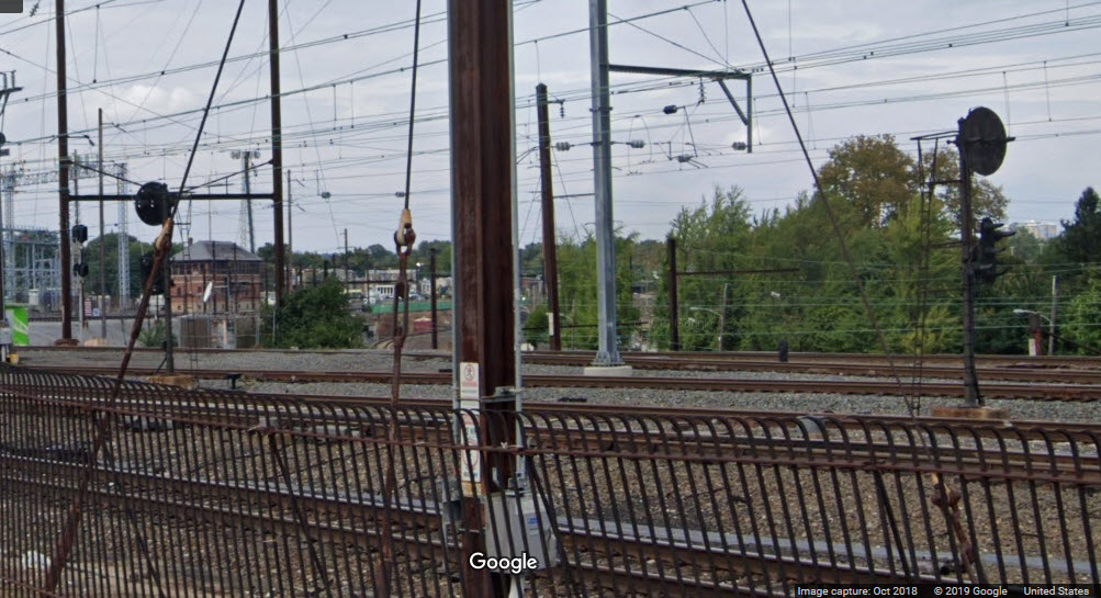
Signal 208R - NB PL
This is one of the few signals you can get close to, it is for NB NEC Amtrak trains coming out of 30th St.
From this location, you can also see signals at my locations 6 and 7.
EB/WB Colorlight
This is a CSX signal for the high-line, and is a new signal installed as part
of CSX's aggressive replacement program, most of which in the Philadelphia area
are B&O CPL signals. The signals that used to be here were "trilight"
style colorlight signals, probably placed here by Conrail as a replacement of
the PL signal that used to be here.
These two pictures, as well as all the 76xx series pictures were taken on 7/16/2011.
Outbound PL
Inbound PL
NB New York-Pittsburgh Subway PL
This signal does not appear on the 1992 Amtrak drawing, not sure why, it has been here forever.....
It is however, seen in the background of one of the pictures of the pedestal signal at location 6, signal 190R.
Inbound Commuter PL
Disclaimers:
I love trains, and I love signals. I am not an expert. My webpages reflect what I find on the topic of the page. This is something I have fun with while
trying to help others.
Please Note: Since the main focus of my two websites is railroad signals, the railfan guides are oriented towards the signal fan being able to locate them.
For those of you into the modeling aspect of our hobby, my
indexa page has a list of almost everything railroad oriented
I can think of to provide you with at least a few pictures to help you detail your pike.
If this is a railfan page, every effort has been made to make sure that the information contained on this map and in this railfan guide is correct. Once in a while,
an error may creep in :-)
My philosophy: Pictures and maps are worth a thousand words, especially for railfanning. Text descriptions only get you so far, especially if you get lost or
disoriented. Take along good maps.... a GPS is OK to get somewhere, but maps are still better if you get lost! I belong to AAA, which allows you to get
local maps for free when you visit the local branches. ADC puts out a nice series of county maps for the Washington DC area, but their state maps do not have the
railroads on them. If you can find em, I like the National Geographic map book of the U.S..... good, clear, and concise graphics, and they do a really good job
of showing you where tourist type attractions are, although they too lack the railroads. Other notes about specific areas will show up on that page if known.
Aerial shots were taken from either Google or Bing Maps as noted. Screen captures are made
with Snagit, a Techsmith product... a great tool if you have never used it!
By the way, floobydust is a term I picked up 30-40 years ago from a National Semiconductor data book, and means miscellaneous
and/or other stuff.
Pictures and additional information is always needed if anyone feels inclined to take 'em, send 'em, and share 'em, or if you have something to add or correct.... credit
is always given! Please be NICE!!! Contact info is here
Beware: If used as a source, ANYTHING from Wikipedia must be treated as being possibly being inaccurate, wrong, or not true.

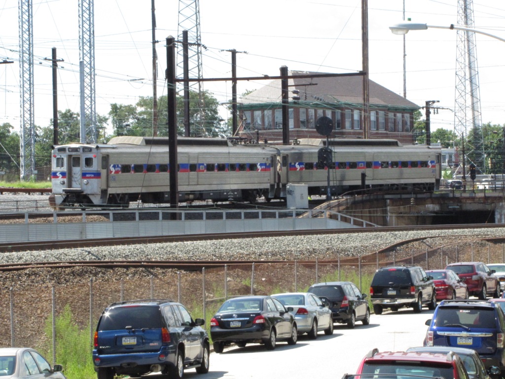 Taken from Zoological Street.
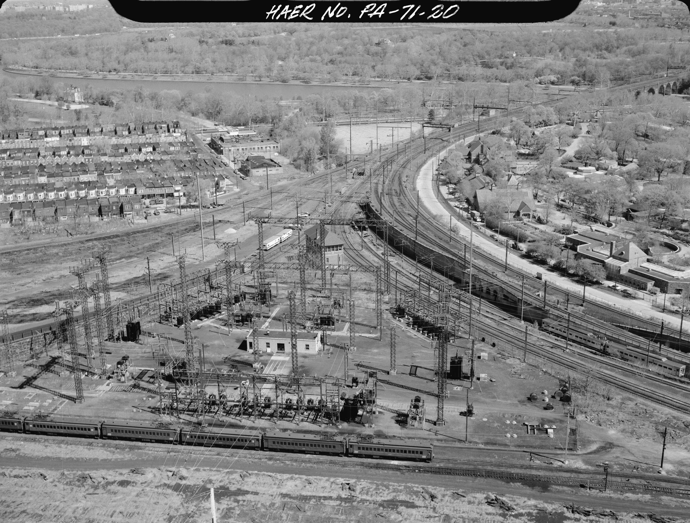 U.S. Department of the Interior, National Park Service