Note: Distances and Directions are referenced to 30th St Station in Downtown Philadelphia
If you know of a station that is not listed here, please let me know
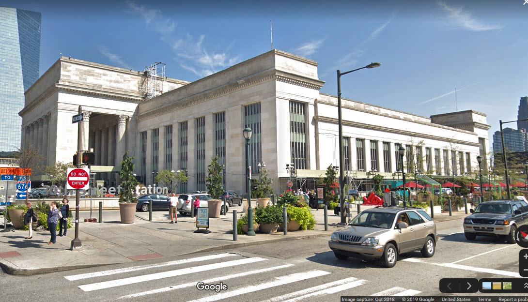
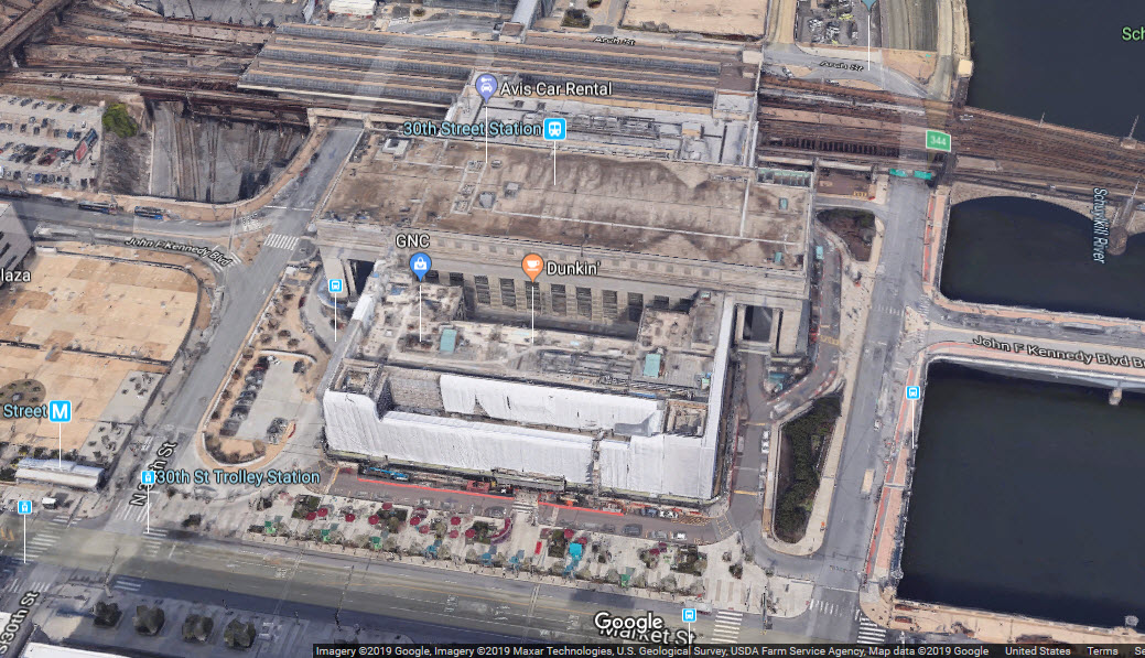
30th Street
GPS Coordinates: 39.955770, -75.181966 Location: 30th Street Station is the reference for all other locations for the Philly guide Address: 2955 Market Street, Philadelphia PA 19104 Built: 1932/1933 Status: Active Owning Railroad(s): Amtrak Secondary Railroads: SEPTA and New Jersey Transit History: PRR/PC/Amtrak Activity: Very High, especially during rush hours Railfan Access: by train, streetcar, subway, driving, walking, etc https://en.wikipedia.org/wiki/30th_Street_Station
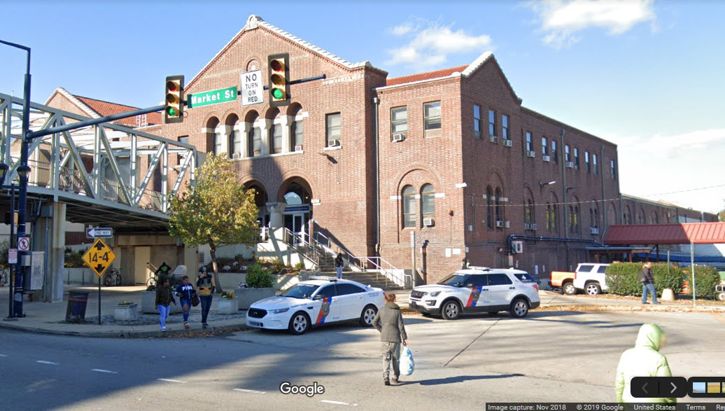
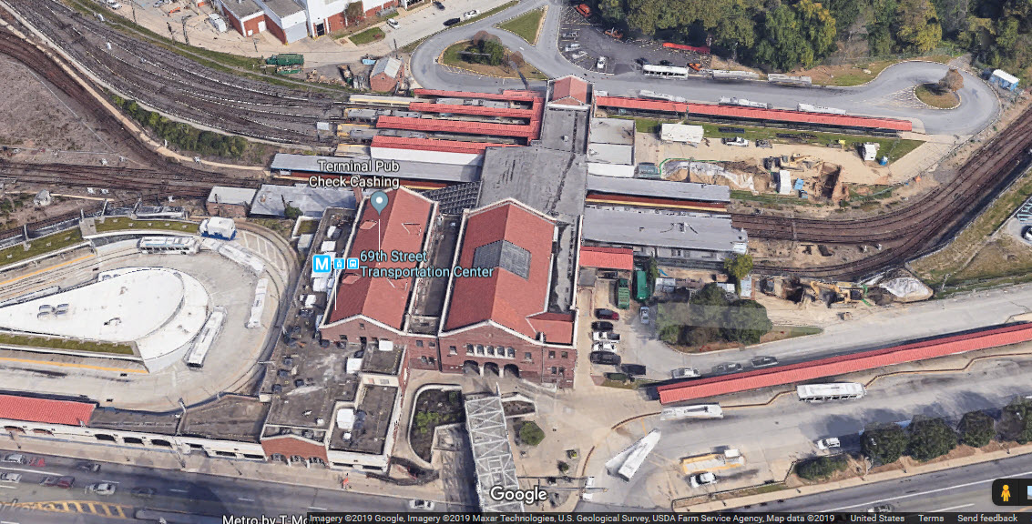
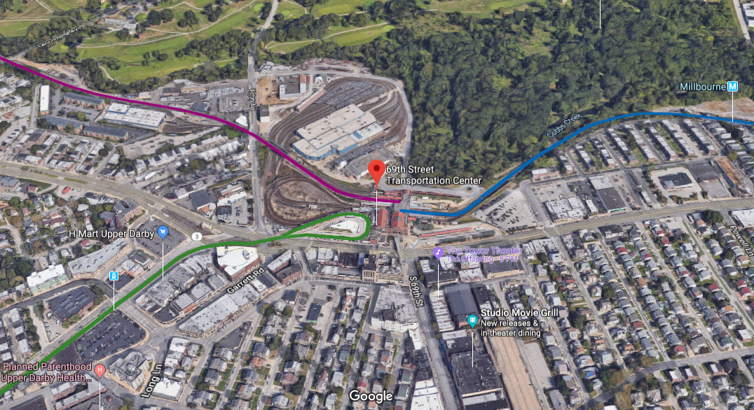
69th Street Terminal
GPS Coordinates: 39.962177, -75.259175 Location: 4.2mi west Address: 6901 Market Street, Upper Darby (Philadelphia) PA 19082 Built: 1907 Status: Active Owning Railroad(s): SEPTA Secondary Railroads: none History: Formerly known as the 69th Street Terminal (1907–2011) Activity: High, very high during rush hours Railfan Access: by streetcar, subway, driving, walking, bus
The 69th Street Transportation is more of a collection of stations and platforms than a single building. https://en.wikipedia.org/wiki/69th_Street_Transportation_Center
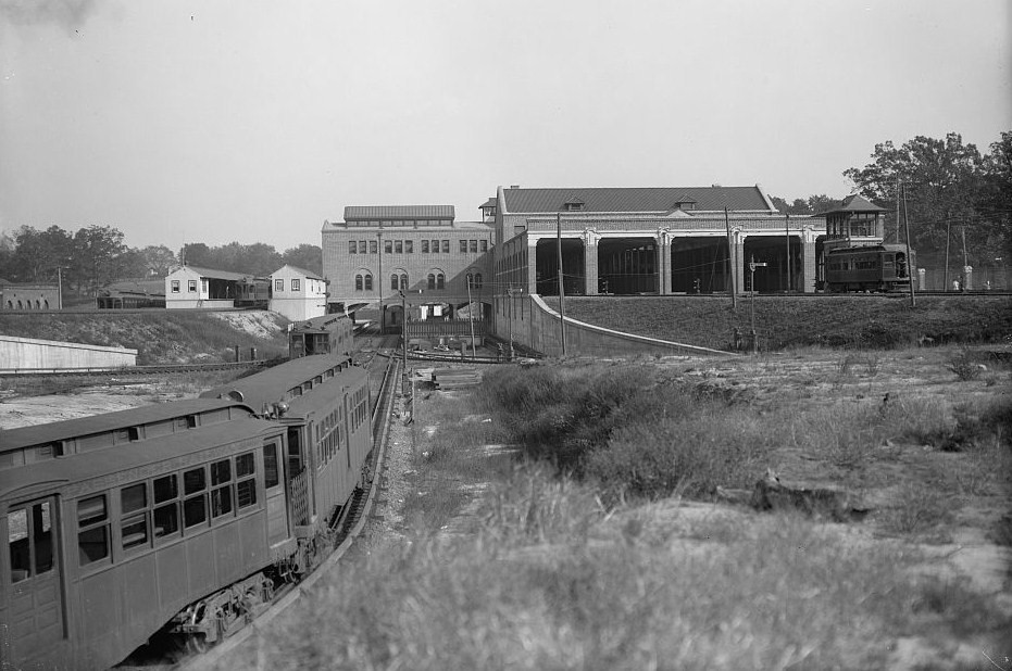
1908
SEPTA Fern Rock Transportation Center
GPS Coordinates: 40.041298, -75.135033 Location: 6.3mi NNE Address: 900 Nedro Avenue, Philadelphia, PA 19141 Built: 1992 (Commuter station), 1956 (Subway station) Status: Active Owning Railroad(s): SEPTA Secondary Railroads: none History: This new station replaced the former Reading
stations Fern Rock and Tabor, respectively located north and south of the new station. Activity: High Railfan Access: by train, Broad Street Subway line, driving, bus
The Broad Street Subway line ends here, their shops is located here, easy transfer between systems. https://en.wikipedia.org/wiki/Fern_Rock_Transportation_Center
SEPTA Jefferson Station
GPS Coordinates: 39.952507, -75.157862 Location: 1.2 mi east, underground Address: 12th and Filbert Streets, Philadelphia PA 19107 Built: 1984, replaced the Reading Terminal Status: Active Owning Railroad(s): SEPTA Secondary Railroads: none History: formerly the Market East Station, name changed September 4, 2014 Activity: High, very high during rush hours Railfan Access: by train, streetcar, subway, driving, walking, bus https://en.wikipedia.org/wiki/Jefferson_Station_(SEPTA)
photo by li2nmd, 8/2019, via Google
photo by Coemgenus via Google
North Broad Street Station
GPS Coordinates: 39.992320, -75.154507 Location: 2.5 mi NE Address: 2601 North Broad Street (near Lehigh Avenue), Philadelphia, Pennsylvania Built: 1928/1929, in use till the mid 1960's Status: Inactive as railroad depot Owning Railroad(s): Reading RR Secondary Railroads: none History: Activity: n/a Railfan Access: by commuter train (N Broad station,
see below for the lines), subway (Broad St line - N Philadelphia station), driving, walking, bus https://en.wikipedia.org/wiki/North_Broad_Station
Reading Terminal
GPS Coordinates: 39.953240, -75.158856 Location: 1 mi east, corner of Market and 12th Address: 1115-1141 Market Street, Philadelphia, PA 19107 Status: Inactive as railroad depot Owning Railroad(s): Reading RR Secondary Railroads: none History: Activity: n/a Railfan Access: by streetcar, subway, driving, walking, bus https://en.wikipedia.org/wiki/Reading_Terminal
SEPTA Stenton Station
GPS Coordinates: 40.060417, -75.178908 Location: 7.2 mi north Address: 6725 Vernon Road between Ardleigh and Blakemore Streets, Philadelphia PA 19119 Built: ??? Status: Active Owning Railroad(s): SEPTA, On the Chestnut Hill East line Secondary Railroads: none History: former Reading RR station Activity: Medium Railfan Access: by train, driving, walking, bus
photo by Adam Moss via Google
SEPTA Suburban Station
GPS Coordinates: 39.954124, -75.166784 Location: 3/4 mi east, underground Address: 16th Street and JFK Boulevard, Philadelphia PA 19107 Built: 1930 Status: Active Owning Railroad(s): SEPTA Secondary Railroads: none History: Built by the PRR to replace the original Broad St Station, HQ for the PRR 1930-1957 Activity: High, very high during rush hours Railfan Access: by train, streetcar, subway, driving, walking, bus https://en.wikipedia.org/wiki/Suburban_Station
photo by Lucius Kwok, via Google
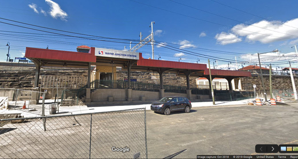
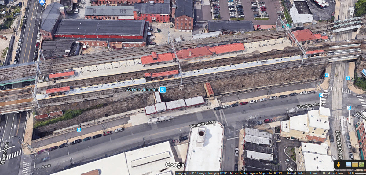
SEPTA Wayne Junction Station
GPS Coordinates: 40.022366, -75.160033 Location: 4.8 mi north Address: 4481 Wayne Avenue near Windrim Avenue, Nicetown, Philadelphia PA Built: 1881, rebuilt 1900, electrified 1931 Status: Active Owning Railroad(s): SEPTA Secondary Railroads: B&O till 1958 History: Reading RR Activity: High, very high during rush hours Railfan Access: by train, #75 trackless trolley, driving, walking, bus
The Chestnut Hill East Line splits off to the west here.
Last station before the Fox Chase Line splits off the SEPTA Main Line at Newtown Junction. https://en.wikipedia.org/wiki/Wayne_Junction_station
Disclaimers:
I love trains, and I love signals. I am not an expert. My webpages reflect what I find on the topic of the page. This is something I have fun with while
trying to help others.
Please Note: Since the main focus of my two websites is railroad signals, the railfan guides are oriented towards the signal fan being able to locate them.
For those of you into the modeling aspect of our hobby, my
indexa page has a list of almost everything railroad oriented
I can think of to provide you with at least a few pictures to help you detail your pike.
If this is a railfan page, every effort has been made to make sure that the information contained on this map and in this railfan guide is correct. Once in a while,
an error may creep in :-)
My philosophy: Pictures and maps are worth a thousand words, especially for railfanning. Text descriptions only get you so far, especially if you get lost or
disoriented. Take along good maps.... a GPS is OK to get somewhere, but maps are still better if you get lost! I belong to AAA, which allows you to get
local maps for free when you visit the local branches. ADC puts out a nice series of county maps for the Washington DC area, but their state maps do not have the
railroads on them. If you can find em, I like the National Geographic map book of the U.S..... good, clear, and concise graphics, and they do a really good job
of showing you where tourist type attractions are, although they too lack the railroads. Other notes about specific areas will show up on that page if known.
Aerial shots were taken from either Google or Bing Maps as noted. Screen captures are made
with Snagit, a Techsmith product... a great tool if you have never used it!
By the way, floobydust is a term I picked up 30-40 years ago from a National Semiconductor data book, and means miscellaneous
and/or other stuff.
Pictures and additional information is always needed if anyone feels inclined to take 'em, send 'em, and share 'em, or if you have something to add or correct.... credit
is always given! Please be NICE!!! Contact info is here
Beware: If used as a source, ANYTHING from Wikipedia must be treated as being possibly being inaccurate, wrong, or not true.

 1908
1908

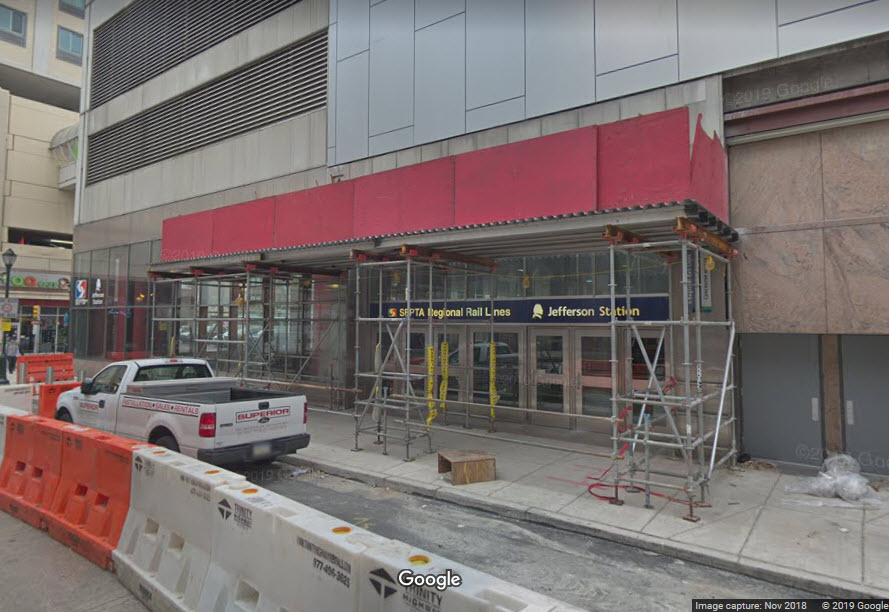
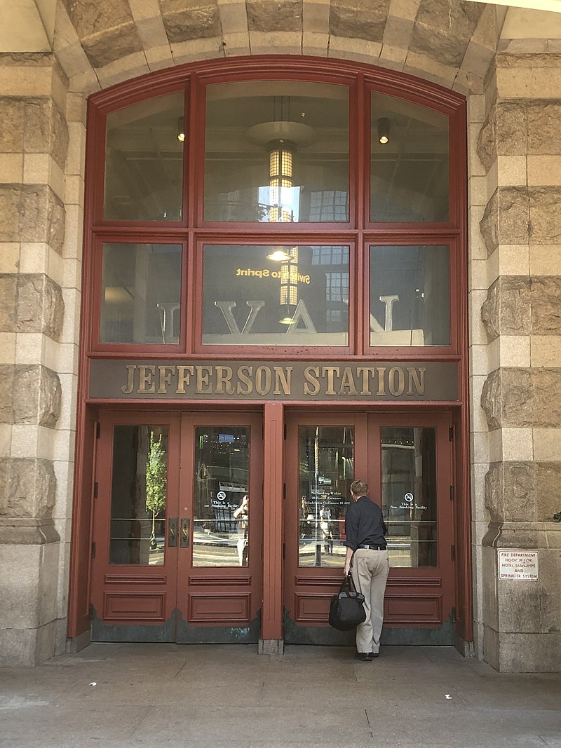 photo by li2nmd, 8/2019, via Google
 photo by Coemgenus via Google
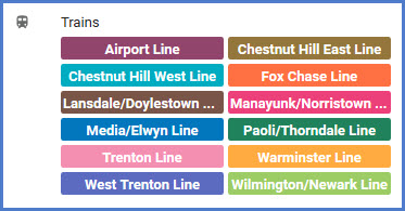
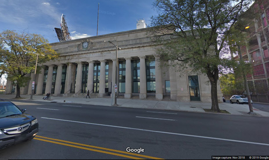
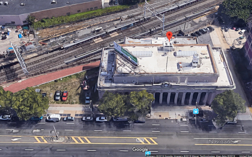

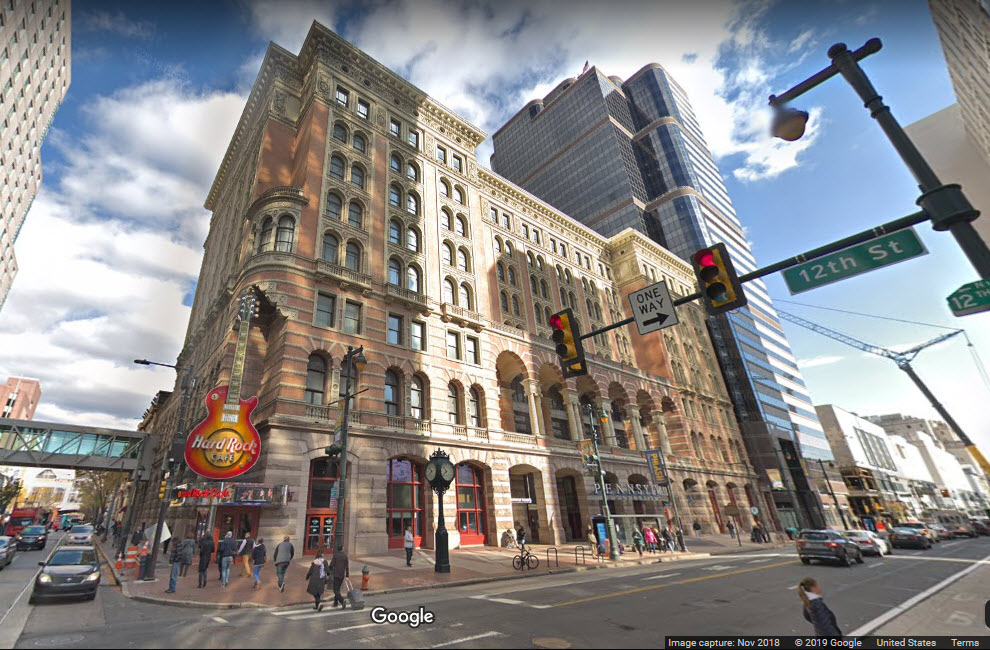
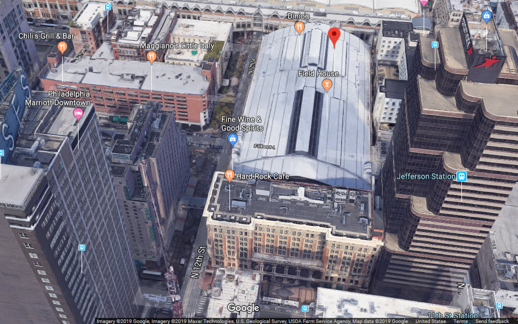

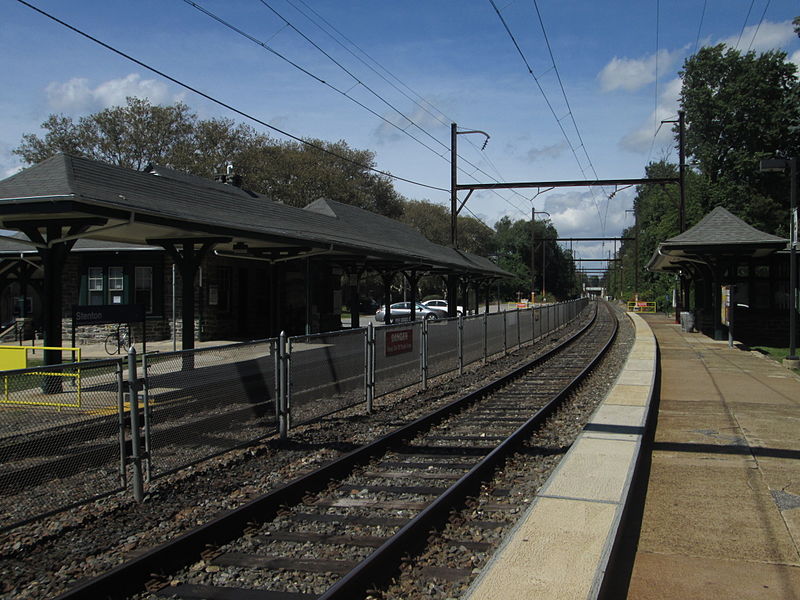 photo by Adam Moss via Google
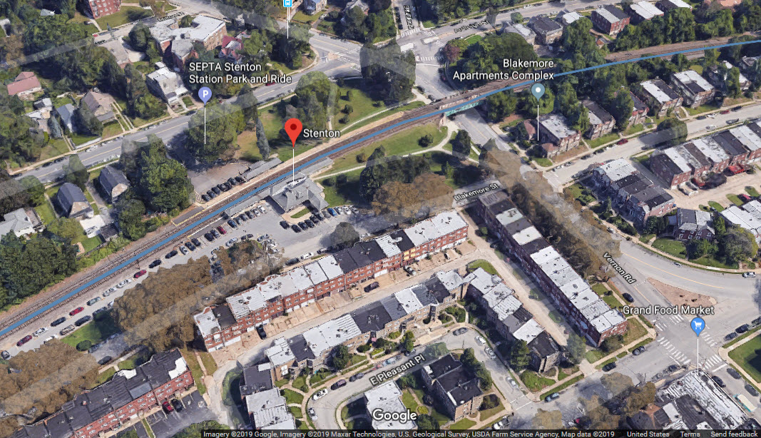
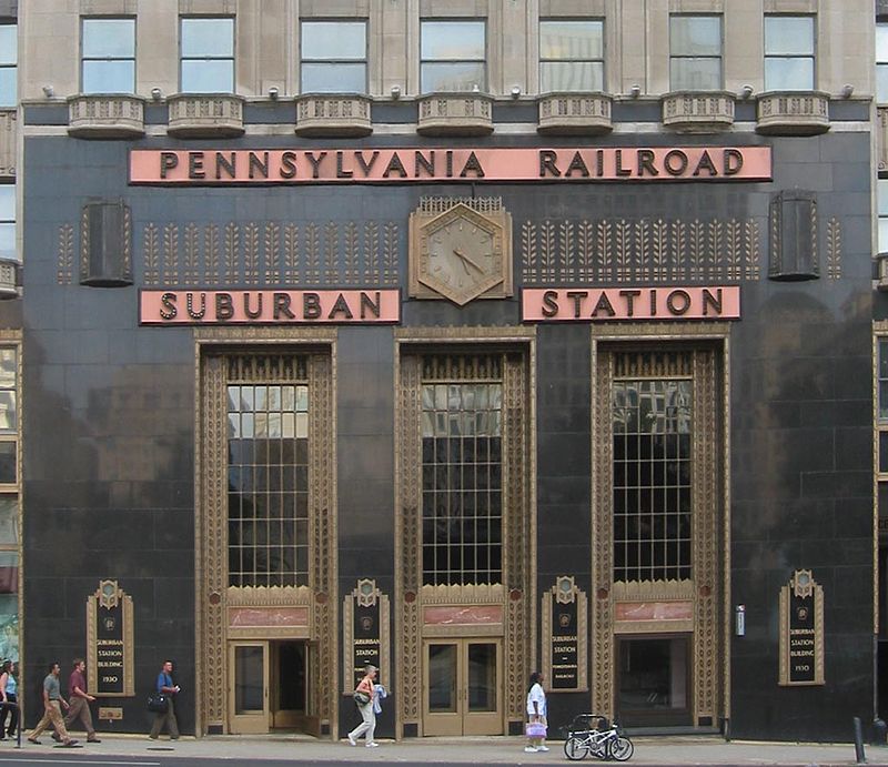 photo by Lucius Kwok, via Google