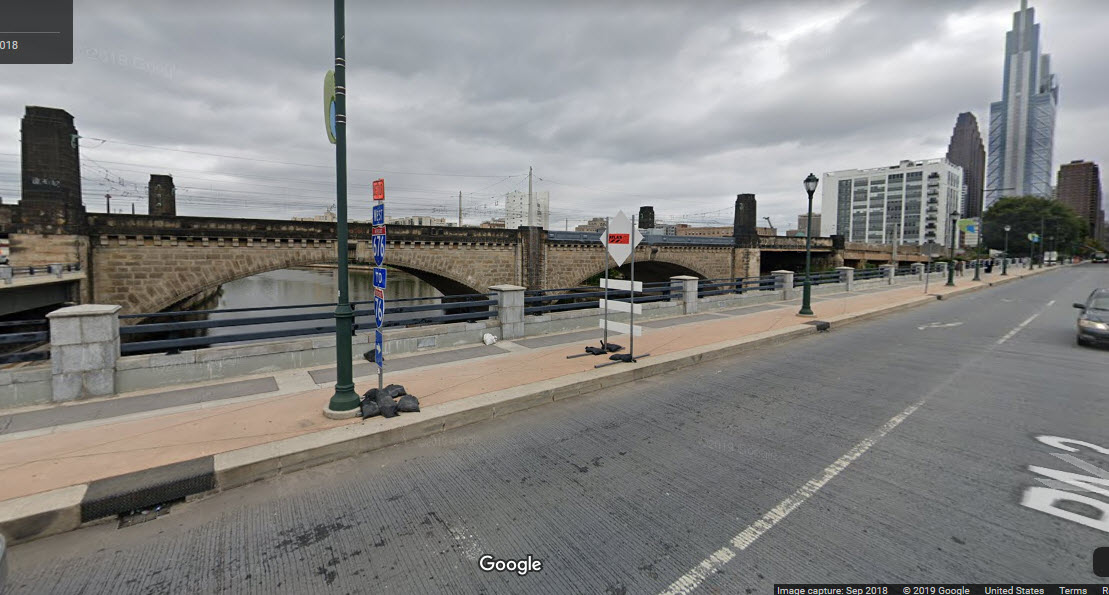
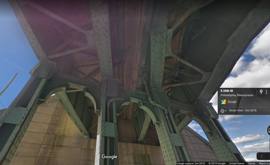
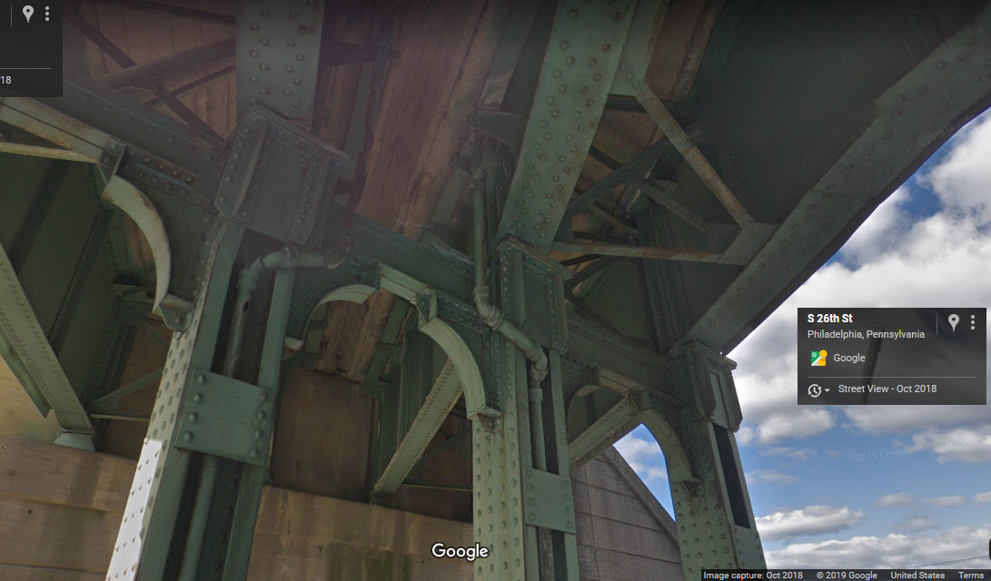
the High Line
CSX/freight
GPS Coordinates: 39.956102, -75.184758 (over JFK Blvd)
0.1 mile West
One of the premier railroad attractions of Philadelphia is the former PRR
High Line that takes freight thru the (almost) downtown area of the city, on
a structure that is about 50-60 feet high, and stretches for 1.5 miles on an
elevated structure of one form or another.
The first set of pictures are from the S St overpass, which goes over the North
East Corridor, and under the High Line. If you are traveling by train,
the University City commuter station is just on the other side of the
High Line.
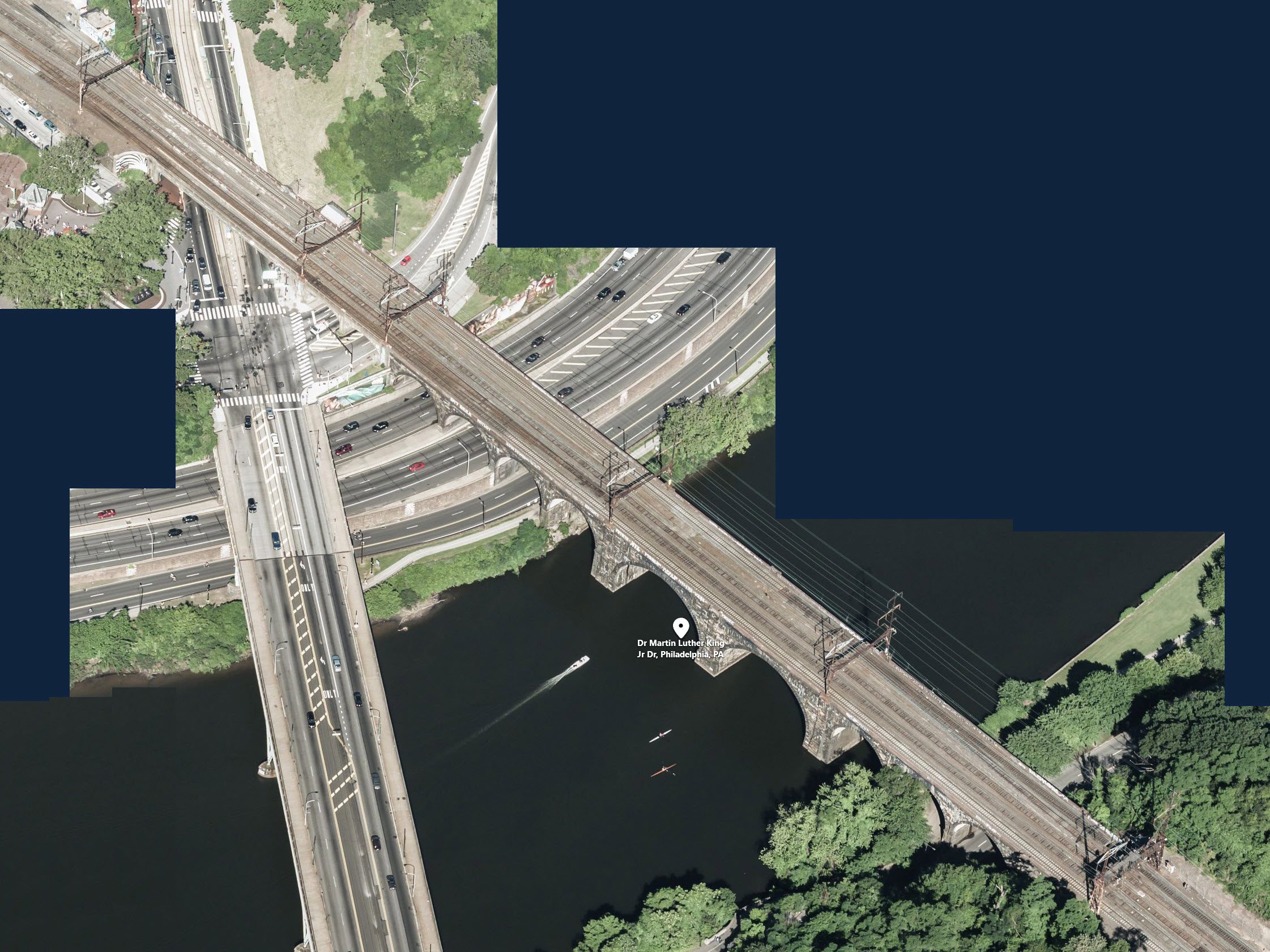
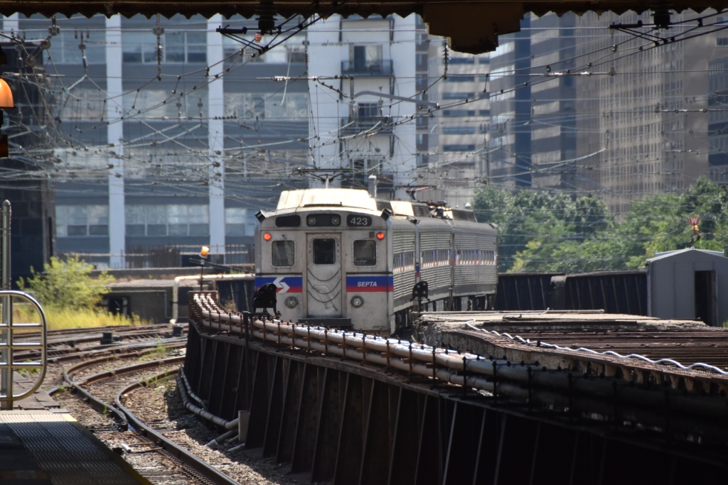
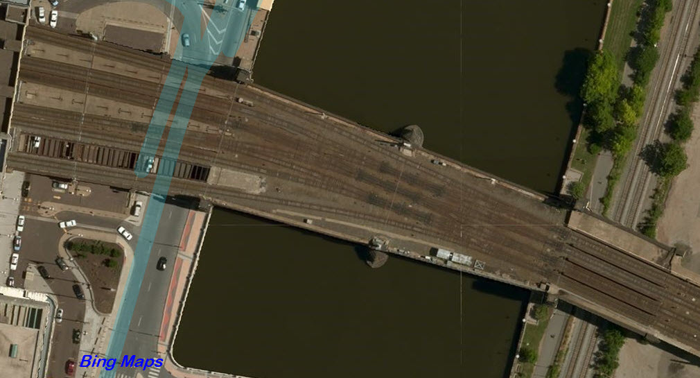
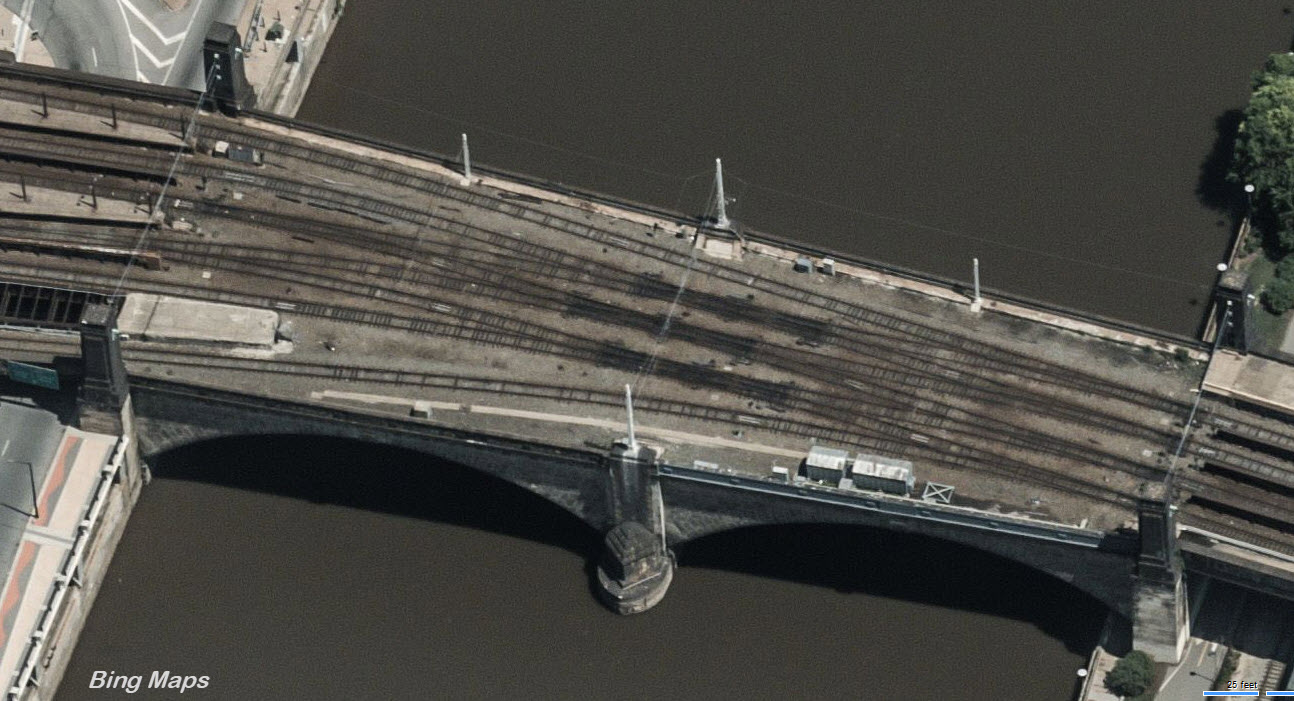
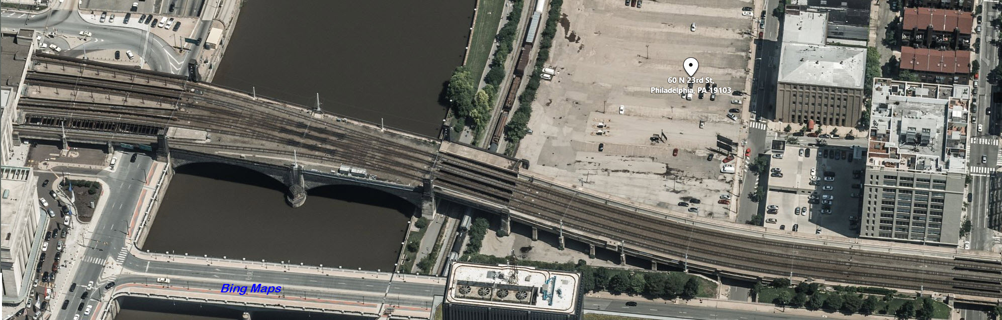
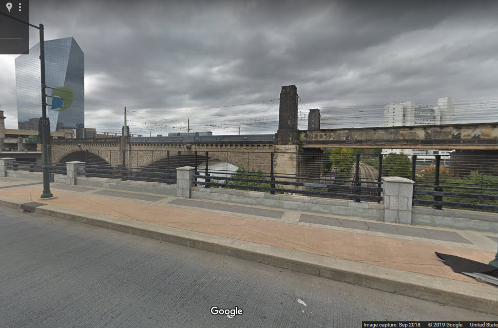
Amtrak's Schuylkill River Bridge
Amtrak/SEPTA/NJT/regional commuter and intercity passenger trains
GPS Coordinates: 39.976377, -75.193867
1.56 miles NW
Also featured in the aerial photos is the Girard Ave bridge, which the #15
trolley runs on
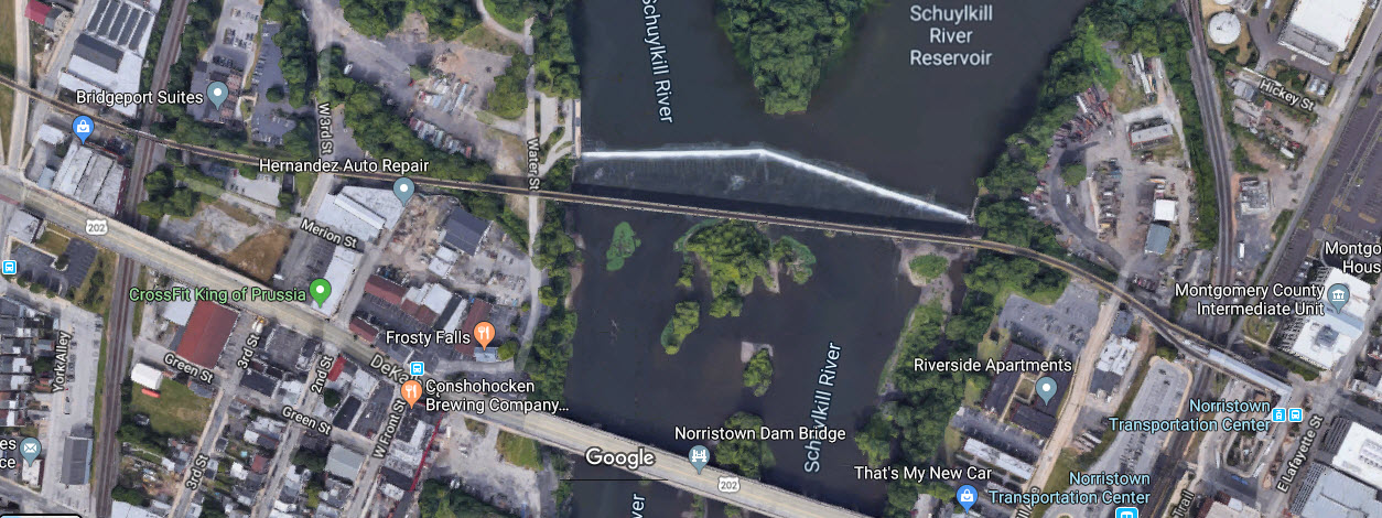
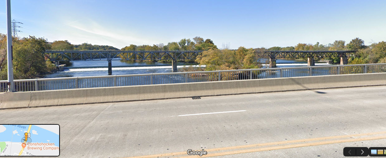
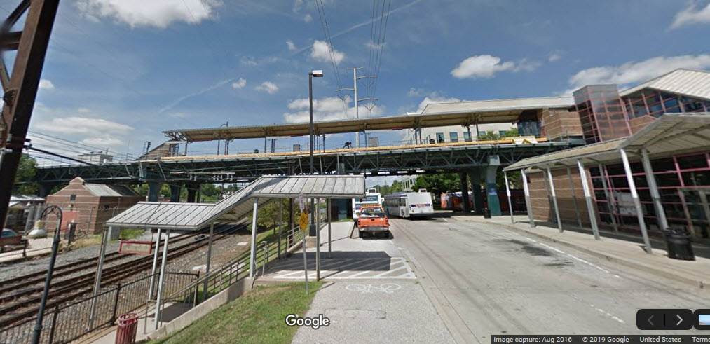
This trestle is a single track structure that extends from the southern shore of
the Schuylkill, and crosses the river into Norristown, where the end of the line
station is also elevated.
Trains leaving the 30th Street Station, and heading "east" towards Suburban Station and
the Reading commuter lines need to cross the Schuylkill, and this bridge is how it's done.
This bridge is only used by SEPTA regional commuter trains, so you will not
see any Amtrak, NJT, or freight equipment using this route. One exception
was in 2018 when SEPTA had their new cars in the shop to rework the trucks and
half the fleet was out of service, so SEPTA used equipment from MARC, NJT, and
Amtrak.
The bridge also contains interlocking for the 30th St Station, including three
double-slips, and is signaled with Pennsy dwarfs and pedestal signals.
In the first picture, we see a train getting ready to cross the river just after
exiting 30th St Station.
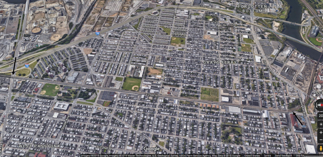
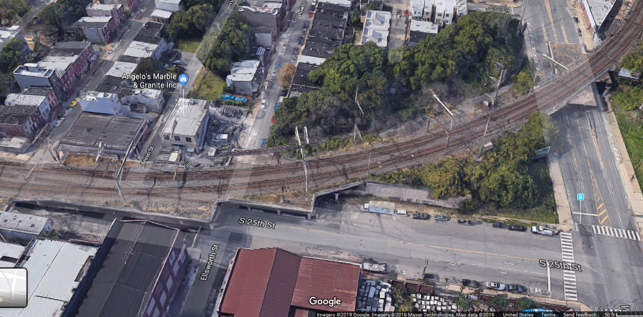
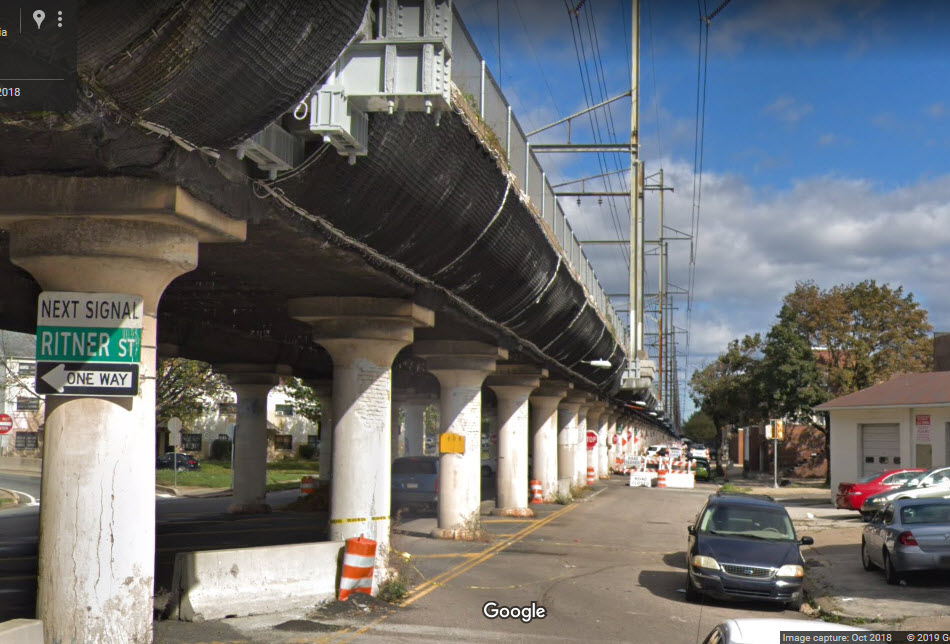
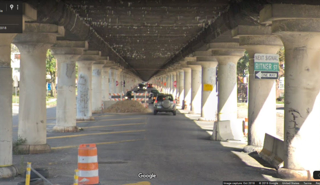
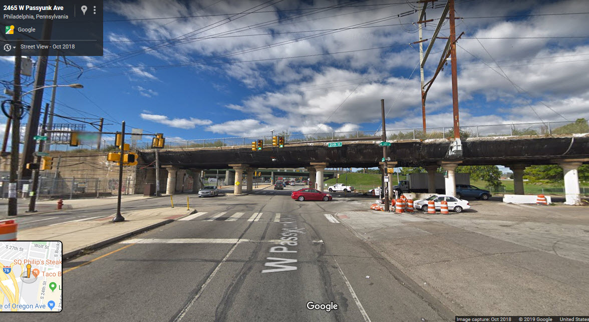
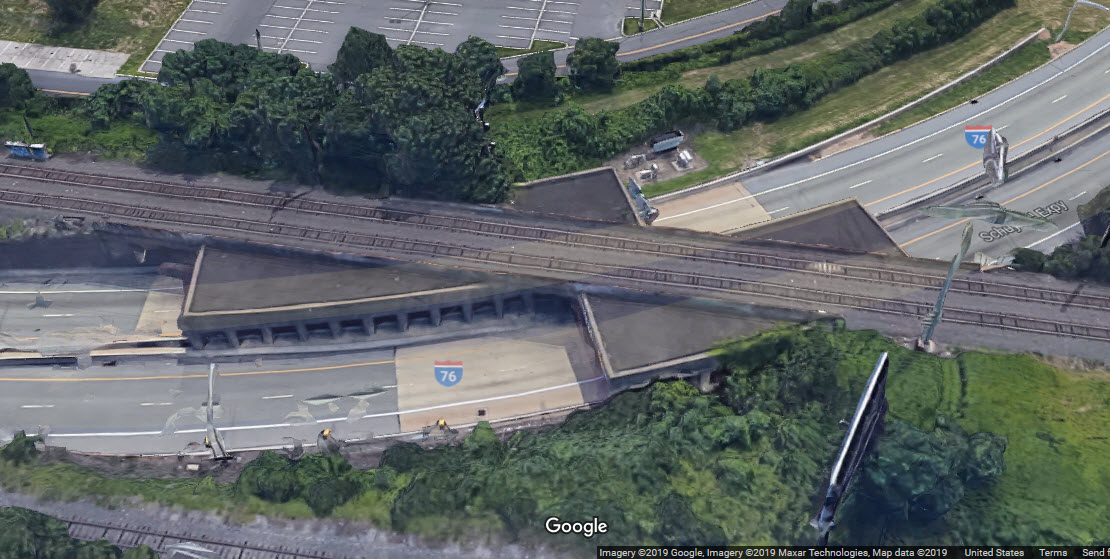
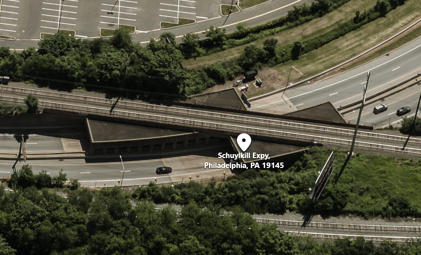
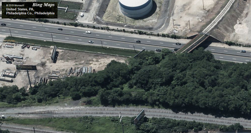
the 25th Street Viaduct
CSX
GPS Coordinates: 39.939079, -75.185226 (north end)
1.08 mile South, on the east side of the Schuylkill
This viaduct carries freight traffic over south 25th Street in South Philadelphia.
Traffic using this viaduct is going into or coming out of Greenwich Yard, which
then crosses the Schuylkill and can go onto the High Line or head south to
Baltimore via the old B&O Main. The viaduct is 1.33 miles long.
It still has the old Pennsy catenary structure standing over the right-of-way,
they now carry a 500KV transmission line. Someone with a drone could get
nice pictures as a train is coming out of Greenwich Yard.
Arrows point to the two ends of the viaduct in the aerial view below.
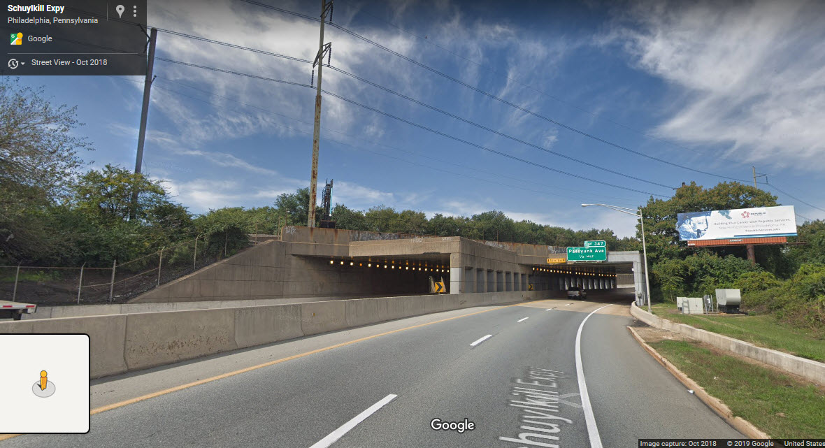
The southern end of the viaduct crossing Passyunk Avenue.
The south end of the trip (not the viaduct tho) crosses over the Schuylkill Expressway with this
overpass, because I-76 is on a curve going thru here.
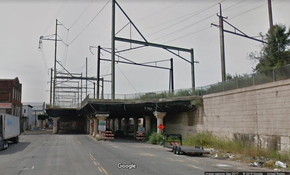
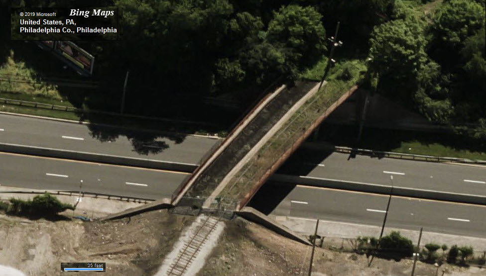
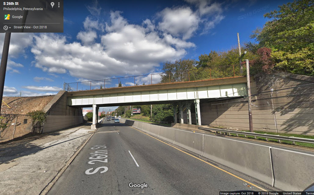
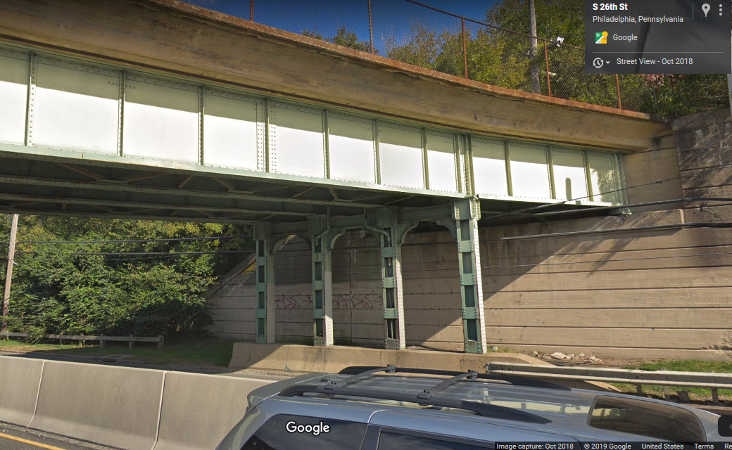
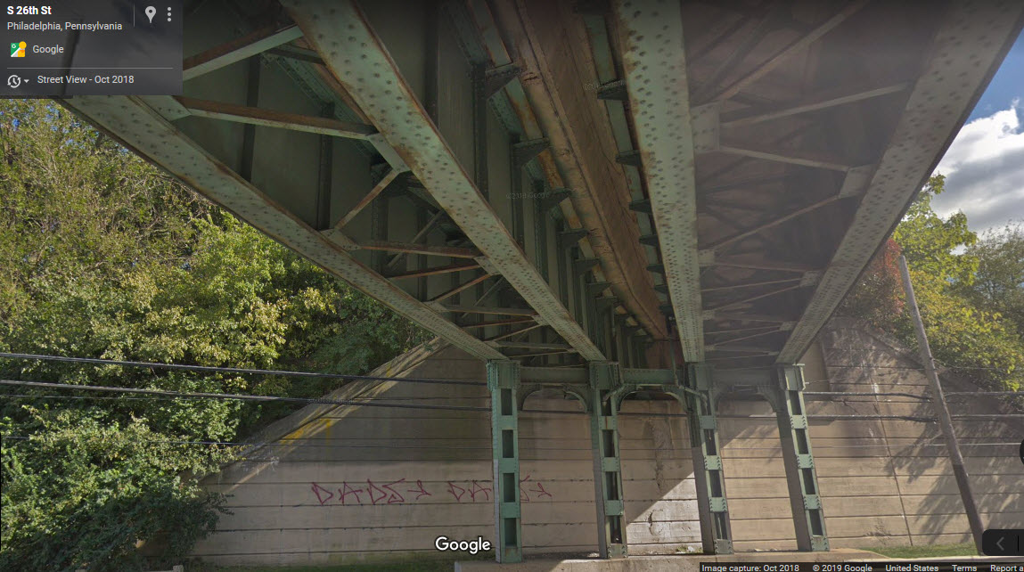
26th Street Bridge - Abandoned
Former PRR/Penn Central
GPS Coordinates: 39.915901, -75.191785
2.83 miles South, on the east side of the Schuylkill
I include this bridge because it is an interesting tribute to the way bridges
used to be made. It is of all riveted construction, and utilizes gussets on the
gussets. I guess it costs more then it is worth to remove, so we are lucky
to have this around to take pictures of for modeling purposes. The bridge
used to carry traffic to a petroleum storage facility siding on the other side of 26th Street in South
Philadelphia. It is a double track bridge, but in its final years,
there was only one track on it.
I love trains, and I love signals. I am not an expert. My webpages reflect what I find on the topic of the page. This is something I have fun with while
trying to help others.
Please Note: Since the main focus of my two websites is railroad signals, the railfan guides are oriented towards the signal fan being able to locate them.
For those of you into the modeling aspect of our hobby, my
indexa page has a list of almost everything railroad oriented
I can think of to provide you with at least a few pictures to help you detail your pike.
If this is a railfan page, every effort has been made to make sure that the information contained on this map and in this railfan guide is correct. Once in a while,
an error may creep in :-)
My philosophy: Pictures and maps are worth a thousand words, especially for railfanning. Text descriptions only get you so far, especially if you get lost or
disoriented. Take along good maps.... a GPS is OK to get somewhere, but maps are still better if you get lost! I belong to AAA, which allows you to get
local maps for free when you visit the local branches. ADC puts out a nice series of county maps for the Washington DC area, but their state maps do not have the
railroads on them. If you can find em, I like the National Geographic map book of the U.S..... good, clear, and concise graphics, and they do a really good job
of showing you where tourist type attractions are, although they too lack the railroads. Other notes about specific areas will show up on that page if known.
Aerial shots were taken from either Google or Bing Maps as noted. Screen captures are made
with Snagit, a Techsmith product... a great tool if you have never used it!
By the way, floobydust is a term I picked up 30-40 years ago from a National Semiconductor data book, and means miscellaneous
and/or other stuff.
Pictures and additional information is always needed if anyone feels inclined to take 'em, send 'em, and share 'em, or if you have something to add or correct.... credit
is always given! Please be NICE!!! Contact info is here
Beware: If used as a source, ANYTHING from Wikipedia must be treated as being possibly being inaccurate, wrong, or not true.
NEW APR14/2014, repaged OCT6/2019 Last Modified
27-Oct-2019

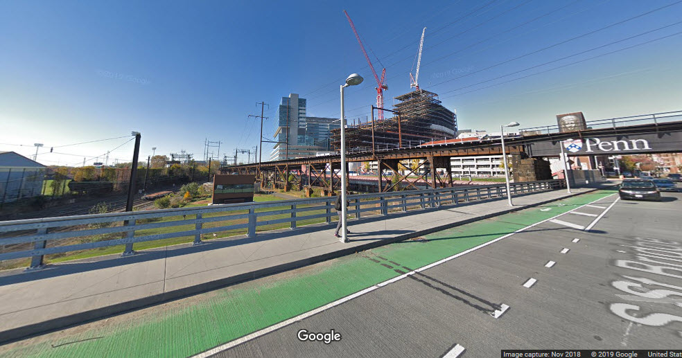
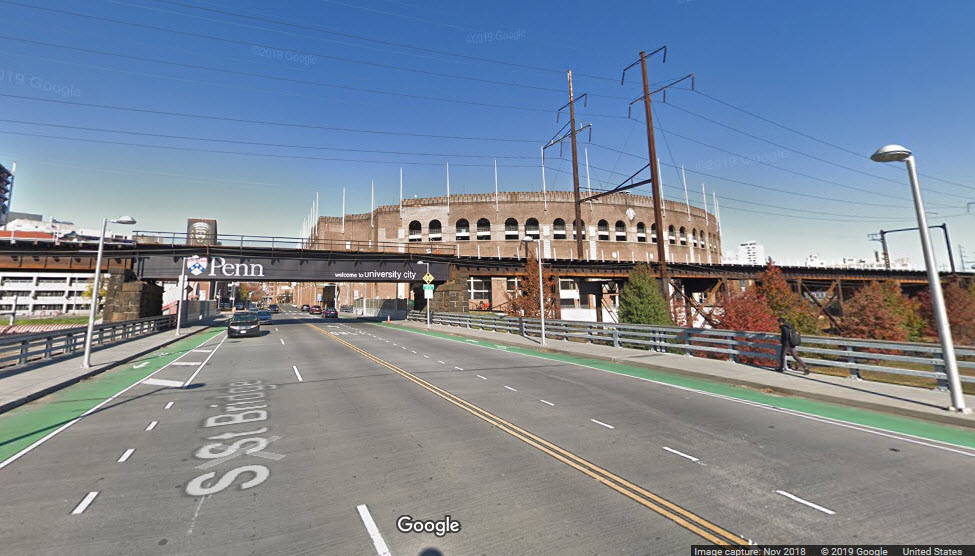
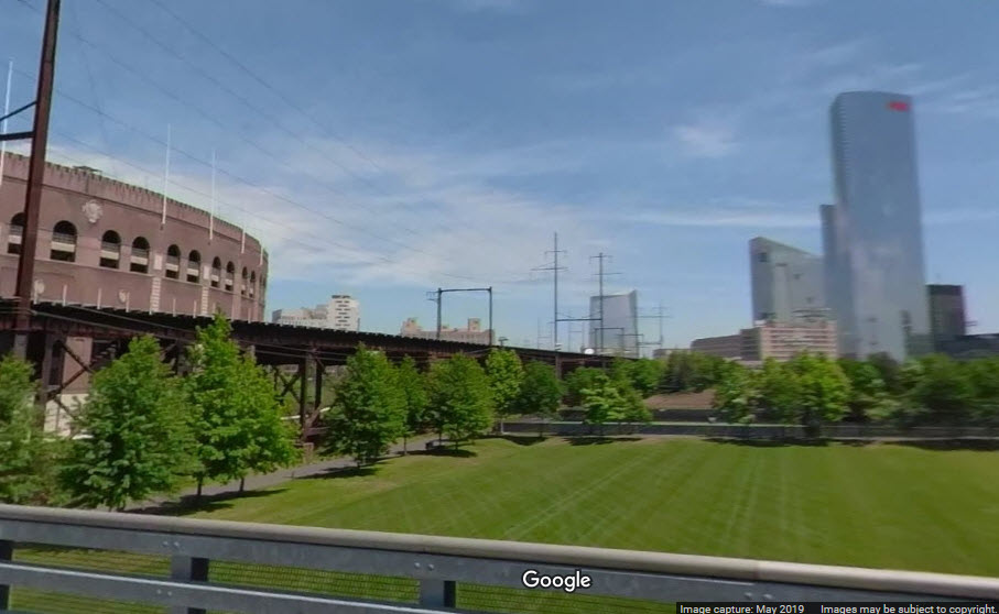
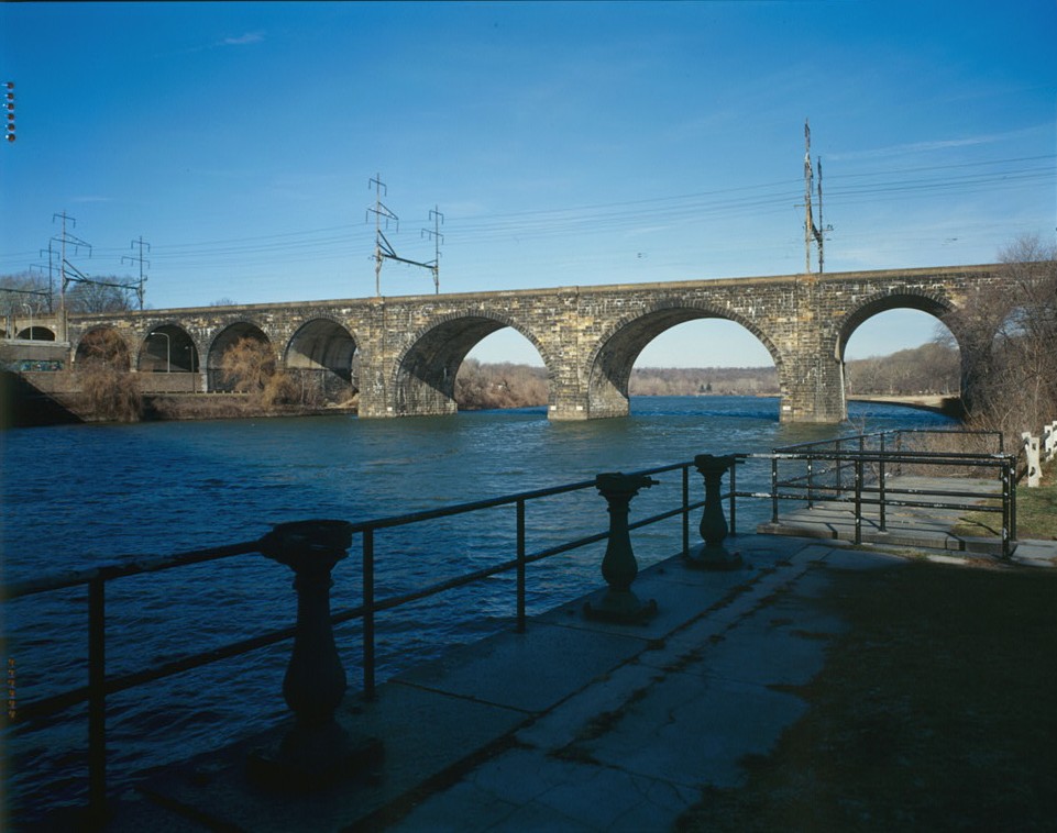
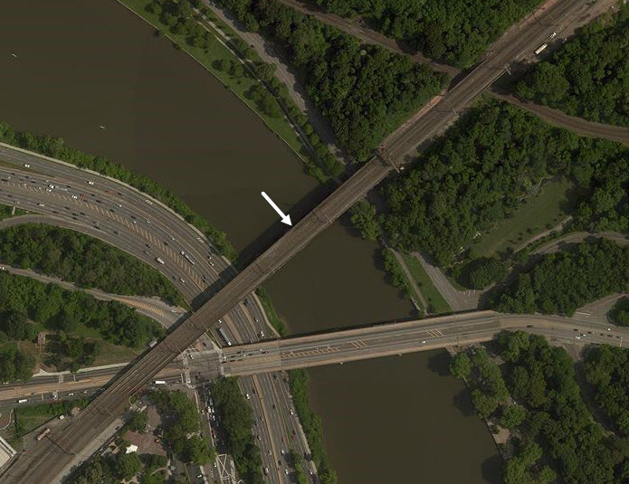
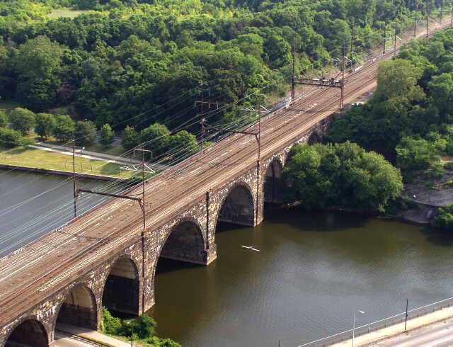 photo by John P. Almeida