![]()
In General
Getting Here
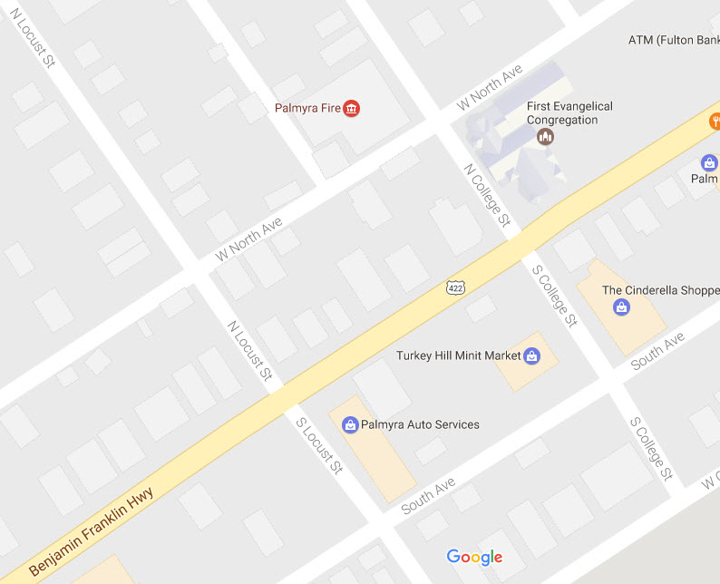
Map
Sights
Signals
Fire & Police
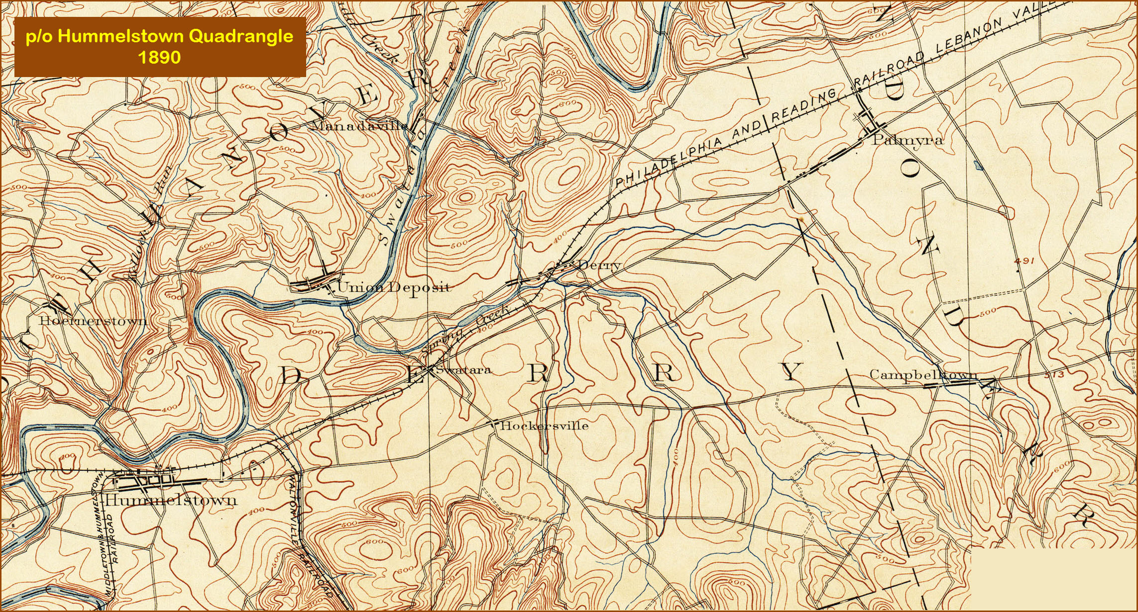
USGS Maps
RAILROAD SIGNALS HOME
Location / Name:
Palmyra PA, Lebanon County
What's Here:
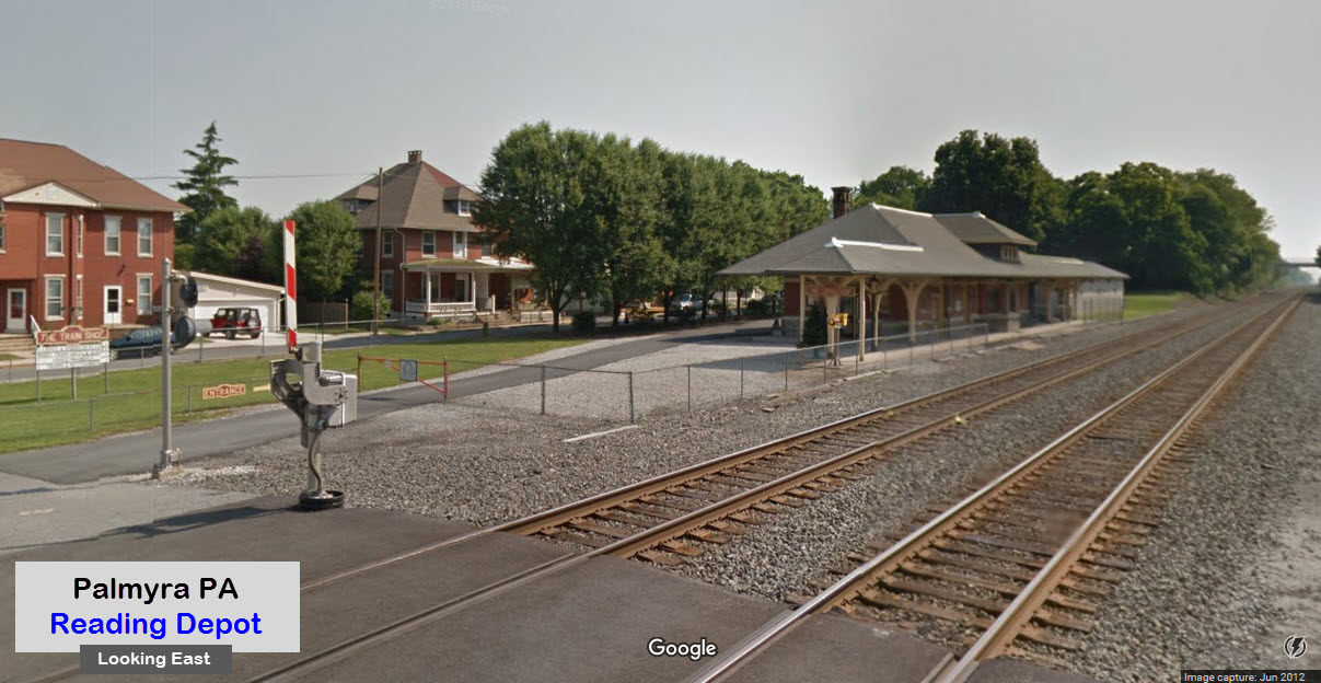
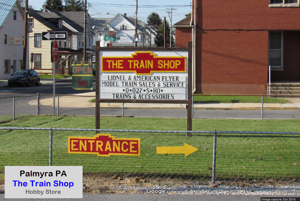
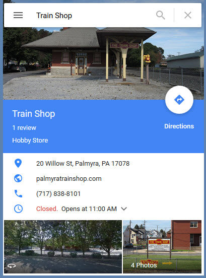
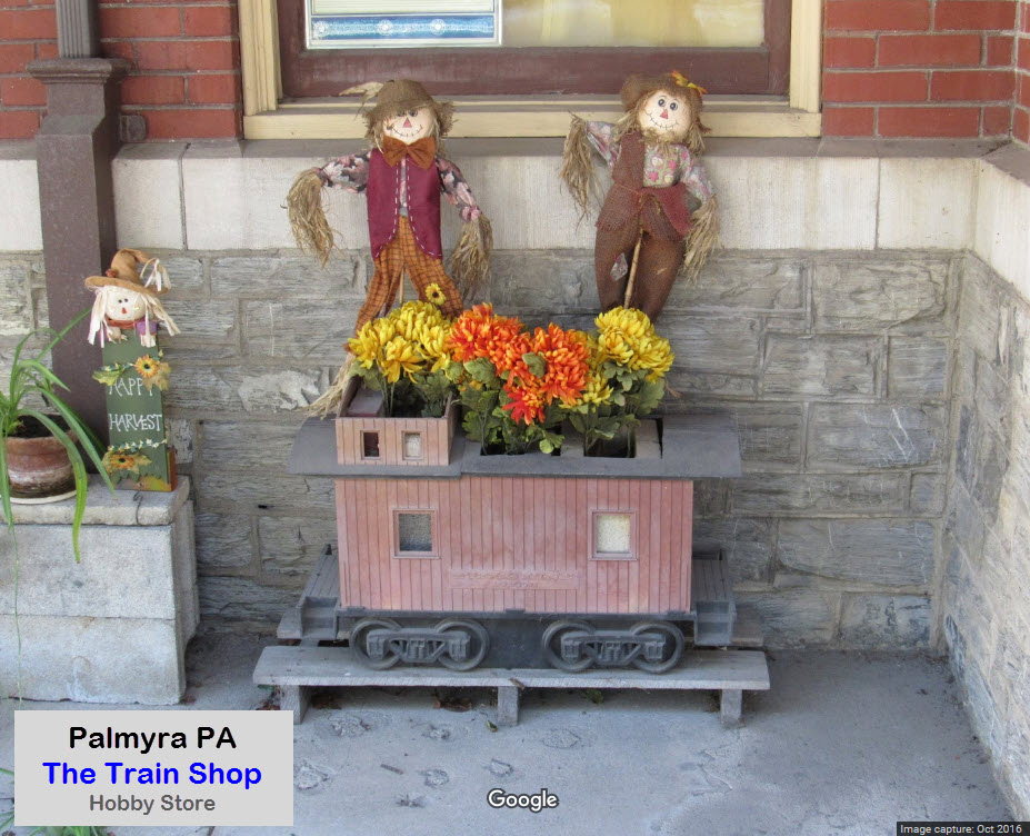
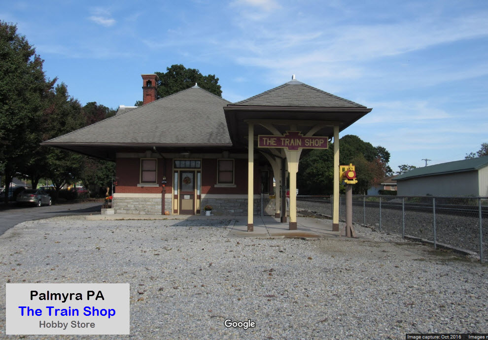
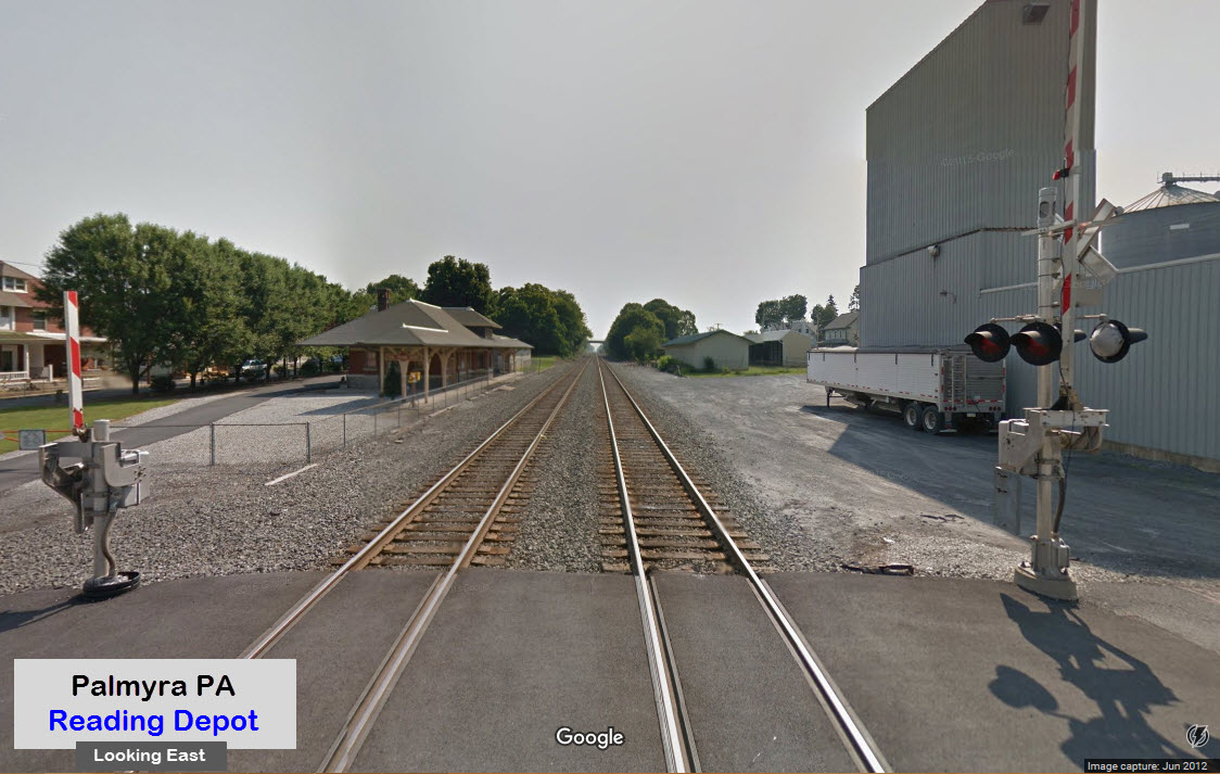
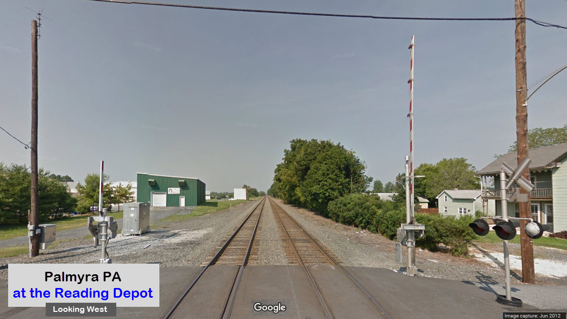
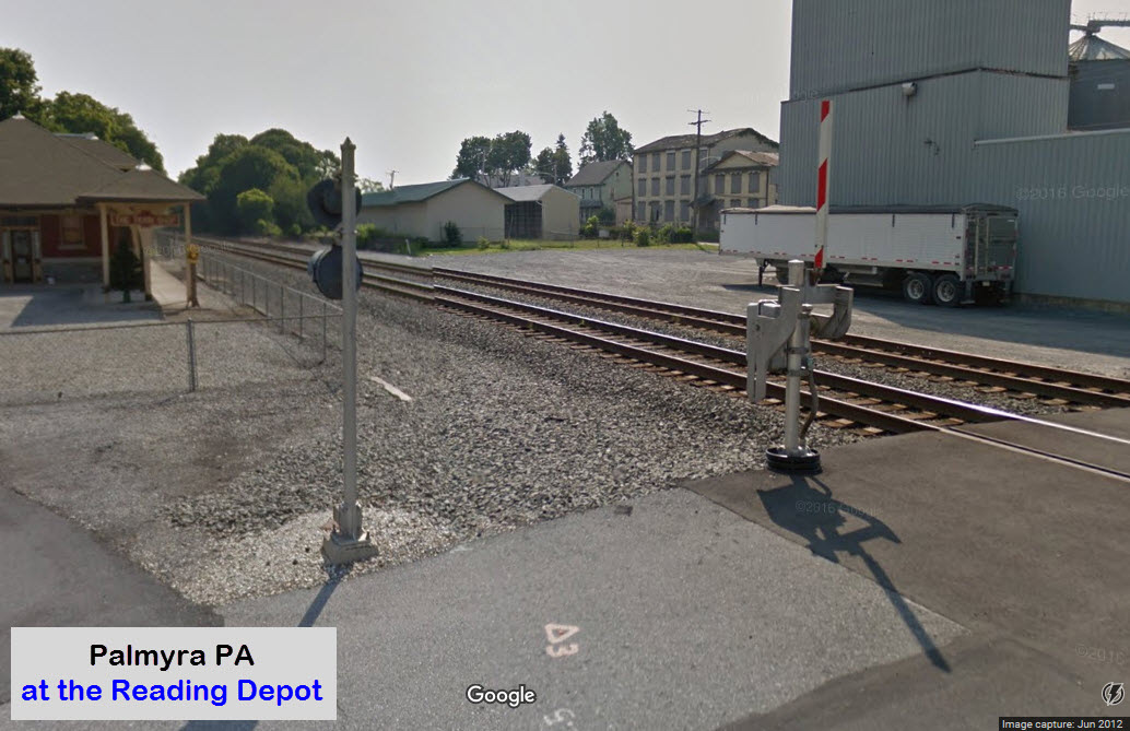
former Reading Depot
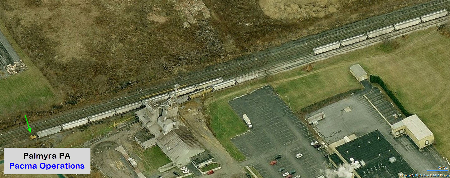
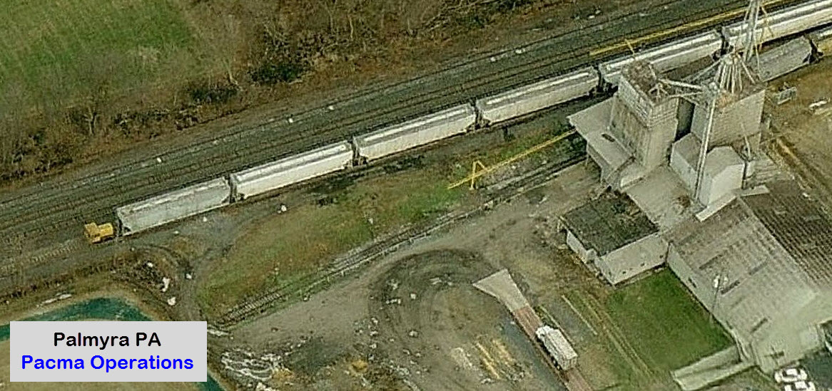
Pacma Grain - Industrial Engine
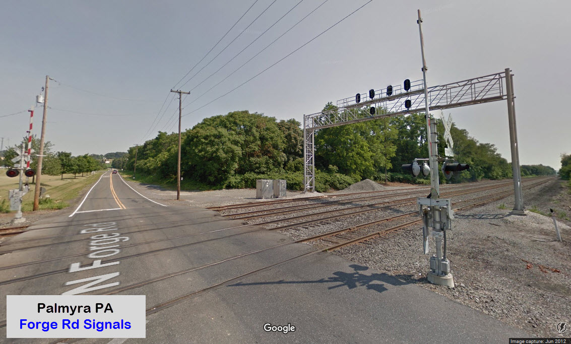
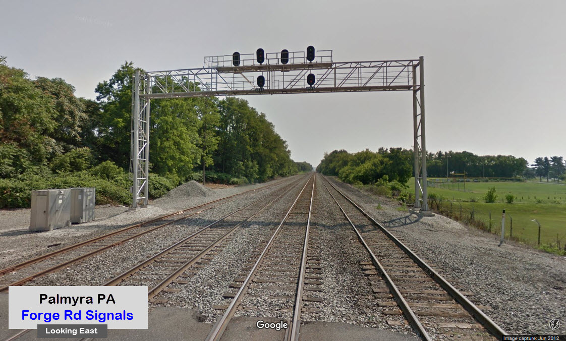
Signal Bridge
The Middletown and Hummelstown RR is about 13mi away
Data:
GPS Coordinates: as needed
ZIP: 17078
Area Code: 717
Access by train/transit:
None directly
Closest stations are:
Harrisburg PA ~17mi
Middletown PA ~13mi (at the Harrisburg International Airport)
The Scoop:
Palmyra is another one of the oodles of railroad towns in Pennsylvania, currently located on the Norfolk Southern mainline between Philadelphia and Harrisburg. What brings the railfan here is the former Reading RR depot, now The Train Shop, and a small industrial operations known as Pacma, which handles grain.
Also, at the east end of town at the Forge Road crossing is a set of colorlight signals for both directions on a signal bridge spanning 4 tracks. Coming out of the parking lot for the Train Shop, is a NO LEFT TURN sign, that lights up when the crossing gates are activated.
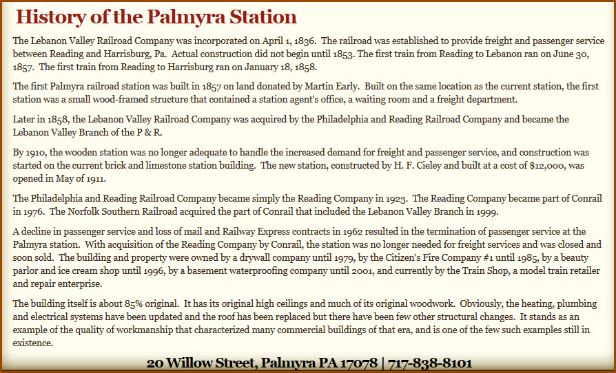
From Wikipedia comes the following bit about transportation in Palmyra: The demand of greater speed and tonnage of goods being moved prompted the building of the Union Canal. Completed in 1827, the Union Canal connected the Schuylkill River at Reading to the Susquehanna River at Middletown. The canal passed just north of Palmyra, and the settlement’s citizens benefited from the increased traffic. The canal was later widened to allow larger boats to pass through in 1849. The Age of Steam also came to Palmyra in 1857, as the first locomotives ran through the settlement on the Lebanon Valley Railroad in that year. Two years later, the Lebanon Valley Railroad merged with the Philadelphia and Reading Railroad to form the Reading Railroad. The growth of rail traffic signaled the end for the Union Canal, and for the Berks and Dauphin Turnpike as a toll road.
Acknowledgements:
None So Far
Websites and other additional information sources of interest for the area:
http://www.palmyrapa.com/
https://en.wikipedia.org/wiki/Palmyra,_Pennsylvania
http://palmyraborough.org/
http://www.mhrailroad.com/
http://www.palmyratrainshop.com/
Aerial shots were taken from either Google Maps or www.bing.com/maps as noted. Screen captures are made with Snagit, a Techsmith product... a great tool if you have never used it!
US422 is Main St, and it runs east-west, going to Harrisburg to the west, and Reading and Philadelphia to the east. I-83 and I-81 can be caught in Harrisburg, I-95 in Philadelphia.
Map
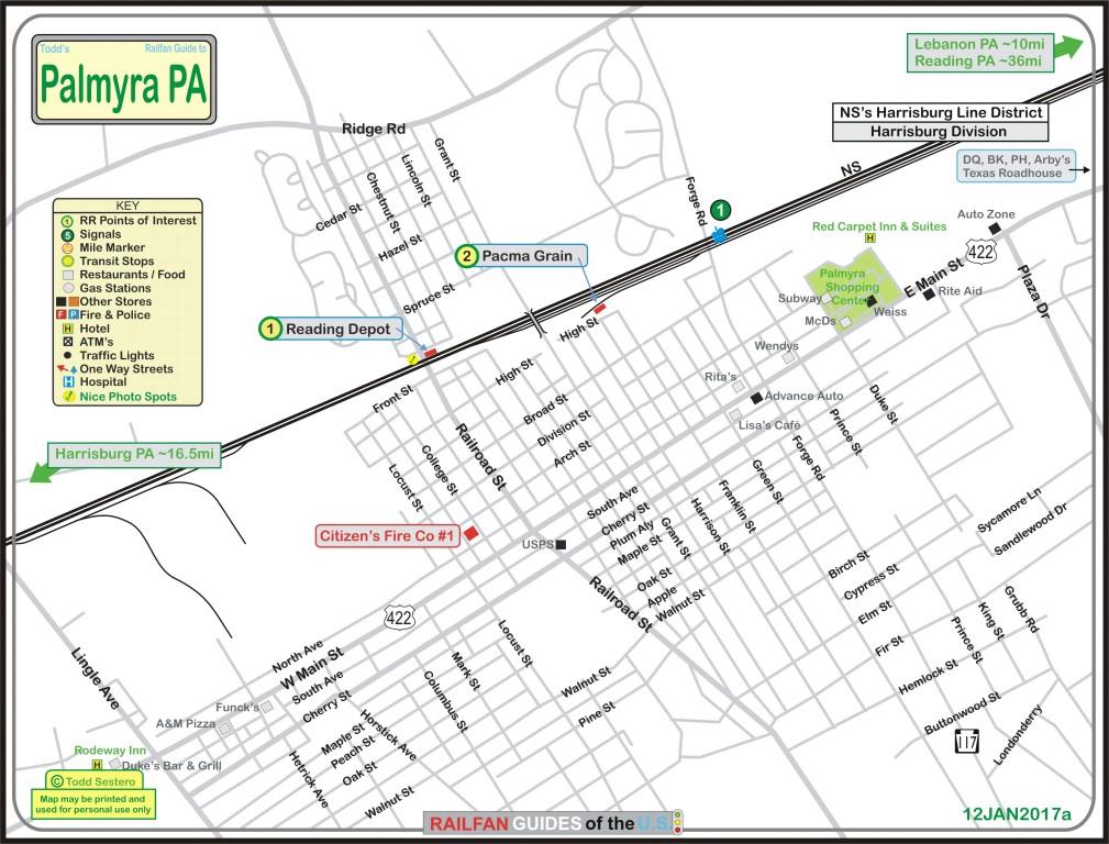
Click here for the above map in PDF format
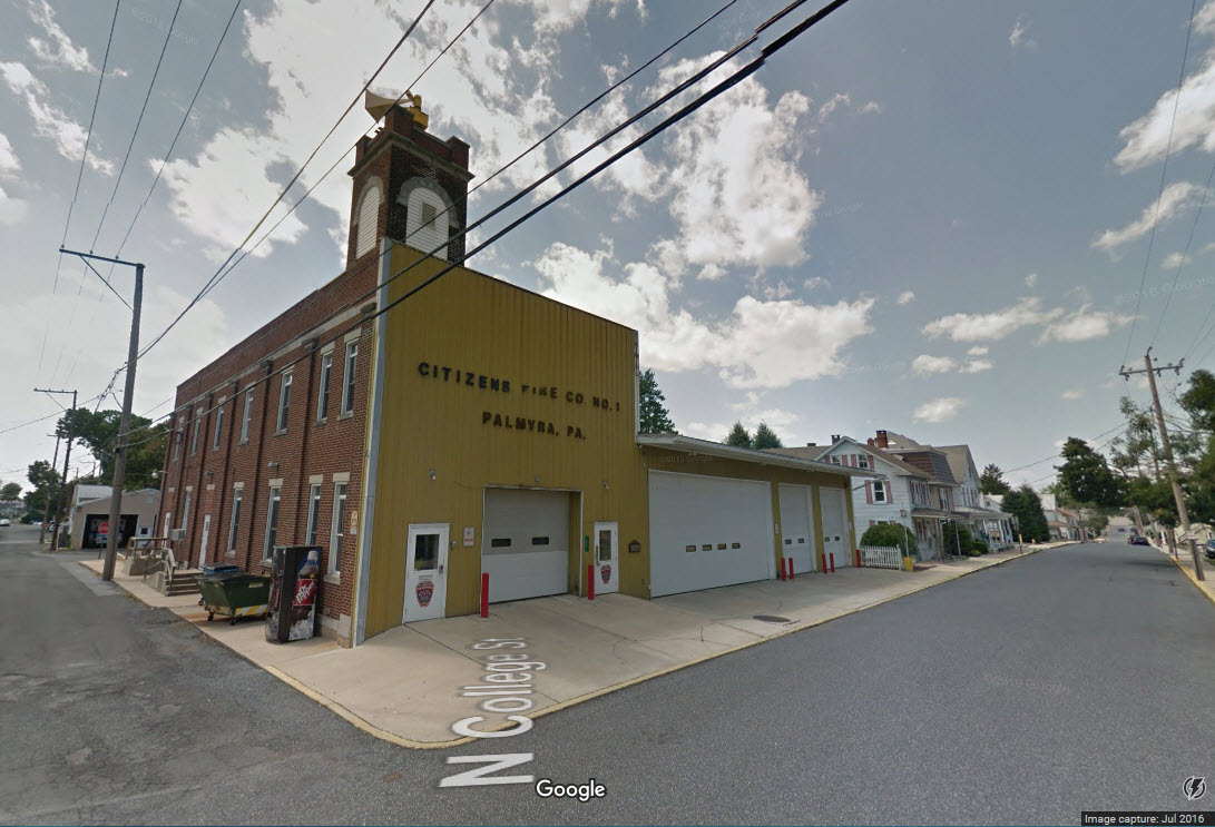
Citizens Fire Co No. 1
Courtesy of the University of Texas Library, click here for their index page.
Disclaimers:
I love trains, and I love signals. I am not an expert. I do these pages because I love spending my time doing them - although I do a reasonable amount of research to make sure the information presented is accurate! :-) :-)
Please Note: Since the main focus of my two websites is railroad signals, the railfan guides are oriented towards the signal fan being able to locate them. For those of you into the modeling aspect of our hobby, myindexa page has a list of almost everything railroad oriented I can think of to provide you with at least a few pictures to help you detail your pike.
If this is a railfan page, every effort has been made to make sure that the information contained on this map and in this railfan guide is correct. Once in a while, an error may creep in, oooooooops, oh well! :-)
My philosophy: Pictures and maps are worth a thousand words, especially for railfanning. Text descriptions only get you so far, especially if you get lost or disoriented. Take along good maps.... a GPS is OK to get somewhere, but maps are still better if you get lost! I belong to AAA, which allows you to get local maps for free when you visit the local branches. ADC puts out a nice series of county maps for the Washington DC area, but their state maps do not have the railroads on them. If you can find em, I like the National Geographic map book of the U.S..... good, clear, and concise graphics, and they do a really good job of showing you where tourist type attractions are, although they too lack the railroads. Other notes about specific areas will show up on that page if known.
BTW, floobydust is a term I picked up 30-40 years ago from a National Semiconductor data book, and means miscellaneous and/or other stuff.
Pictures and additional information is always needed if anyone feels inclined to take 'em, send 'em, and share 'em, or if you have something to add or correct.... credit is always given! BE NICE!!! Contact info is here. Beware: If used as a source, ANYTHING from Wikipedia must be treated as being possibly being inaccurate, wrong, or not true.
RAILFAN GUIDES HOME
RAILROAD SIGNALS HOME
NEW
1/18/2017
Last Modified
18-Jan-2017