In General
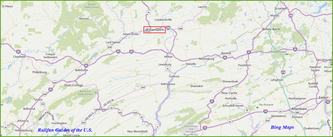
Getting Here
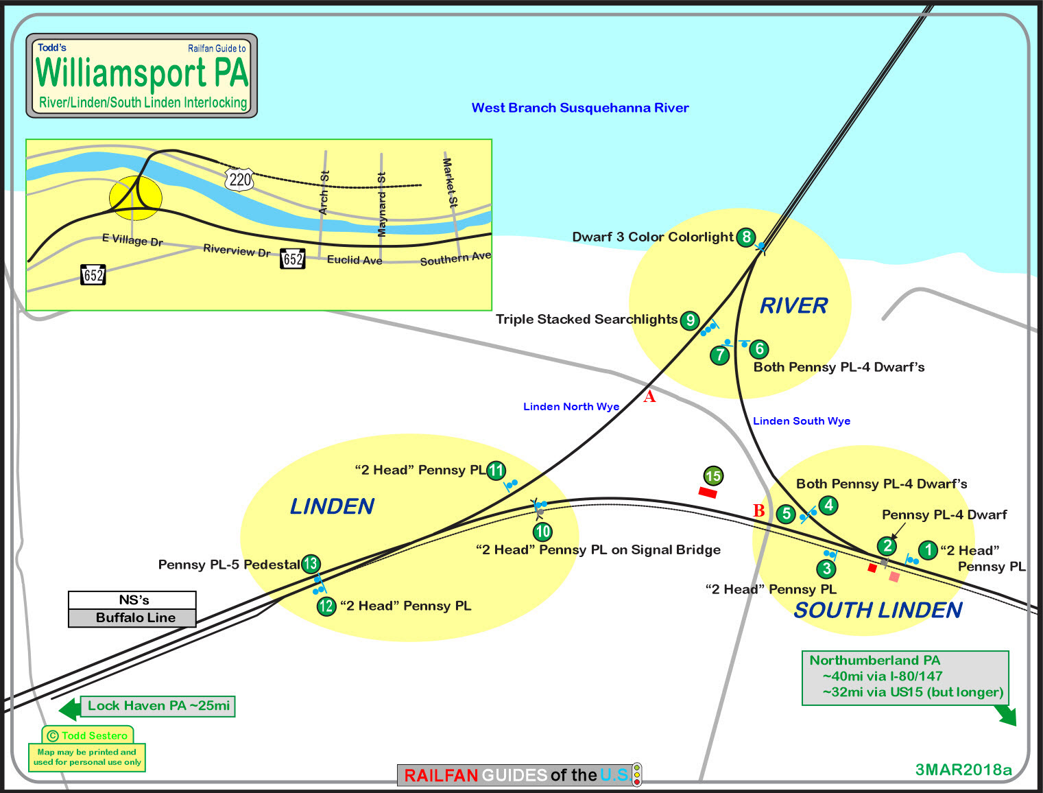
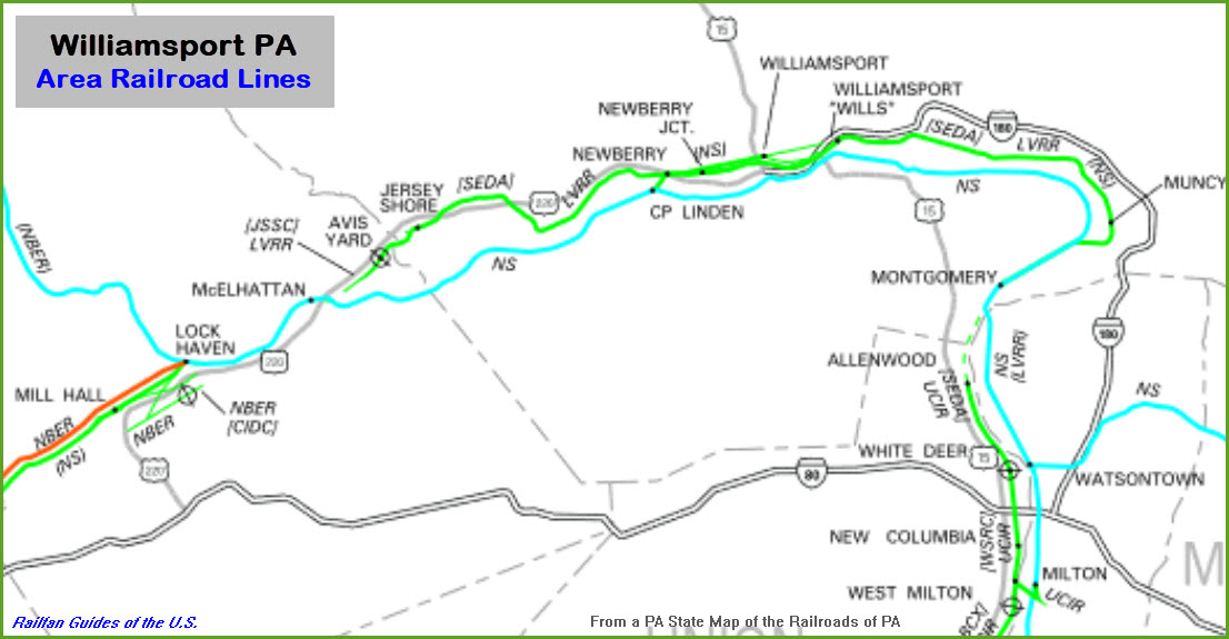
Map
Pictures
Signals
Floobydust
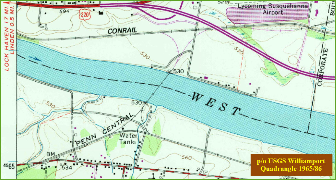
USGS Maps
RAILROAD SIGNALS HOME
Location / Name:
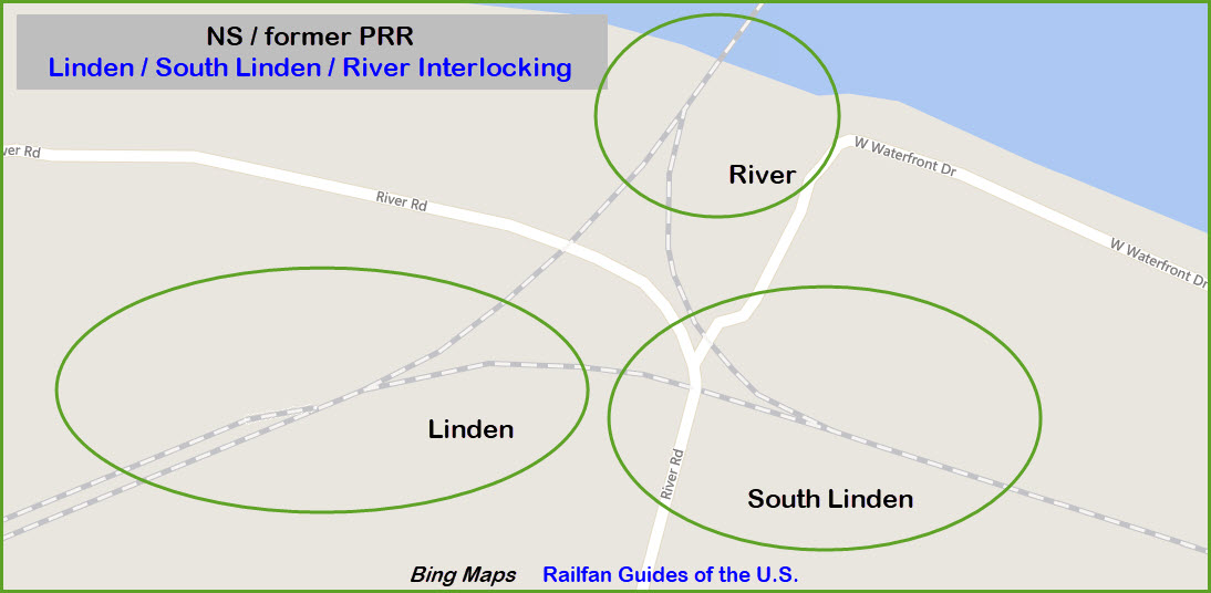
Nisbet/Susquehanna Township (across the river from Williamsport) PA
What's Here:
Three former Pennsy Interlockings and a wye + siding, now NS
Data:
GPS Coordinates: 41.221398, -77.111044 (River Rd grade crossing)
Phone A/C: 570
ZIP: 17702
Access by train/transit:
None
The Scoop:
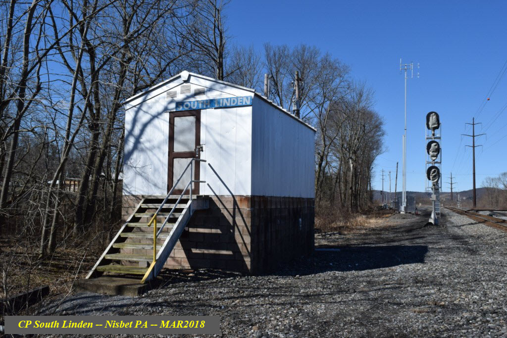
This page is ALL about signals. This is a large page picture-wise.
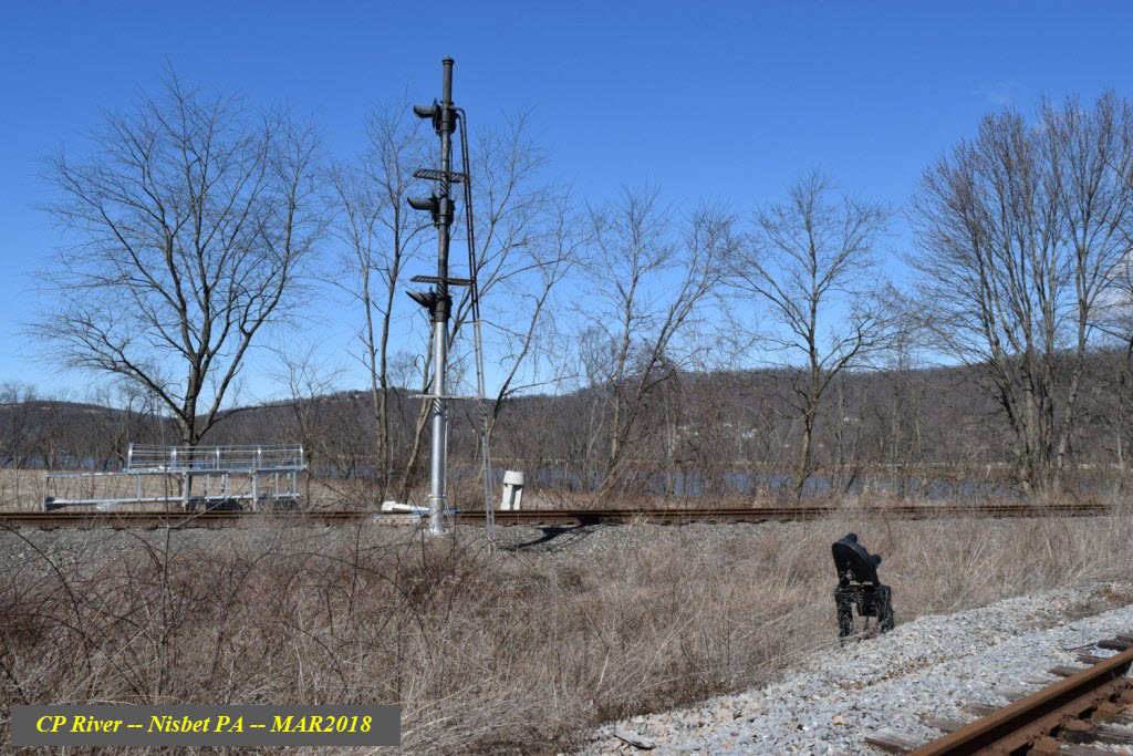
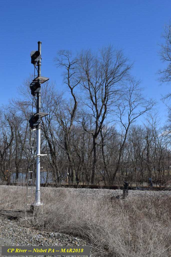
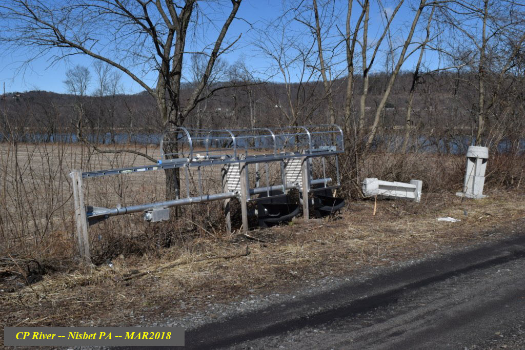
Signals, which of as March 2018, are ready to be replaced. During a visit on 4MAR18, it was noticed that one new colorlight signal is already in place (OK, 2 if you count the dwarf on the bridge :-), but the rest, so far, are still laying on the ground, along with their associated bases.
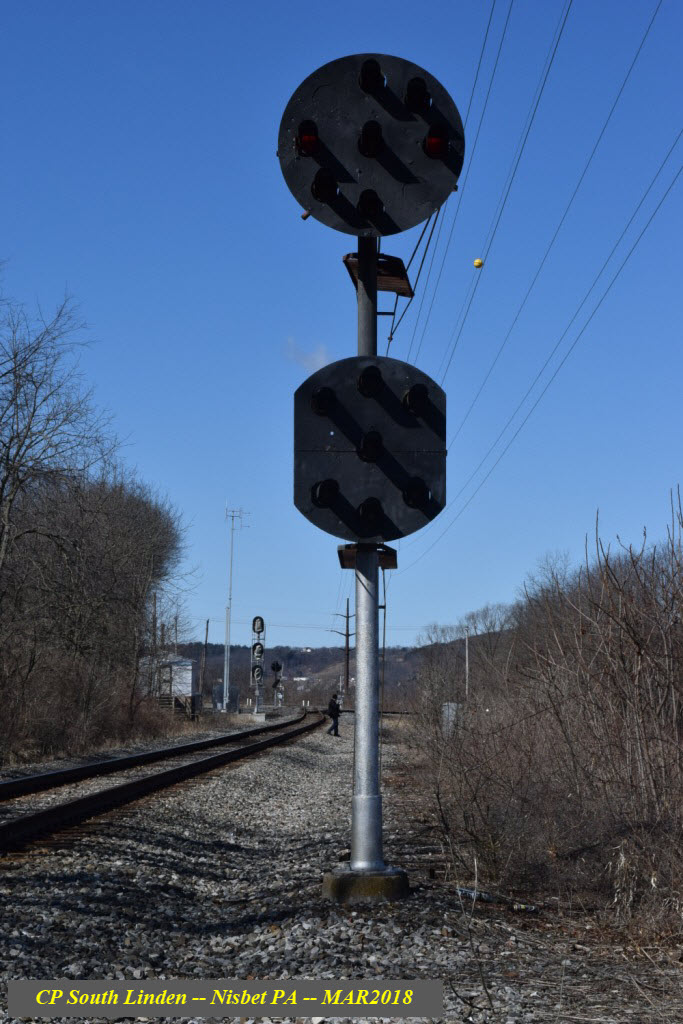
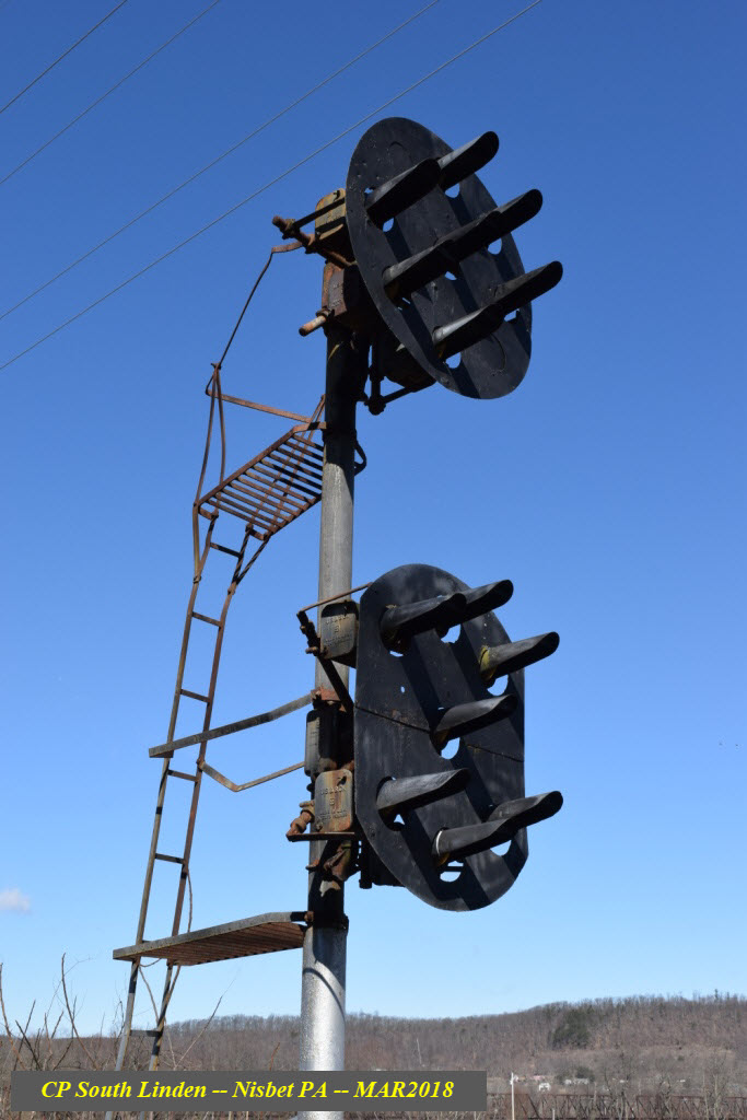
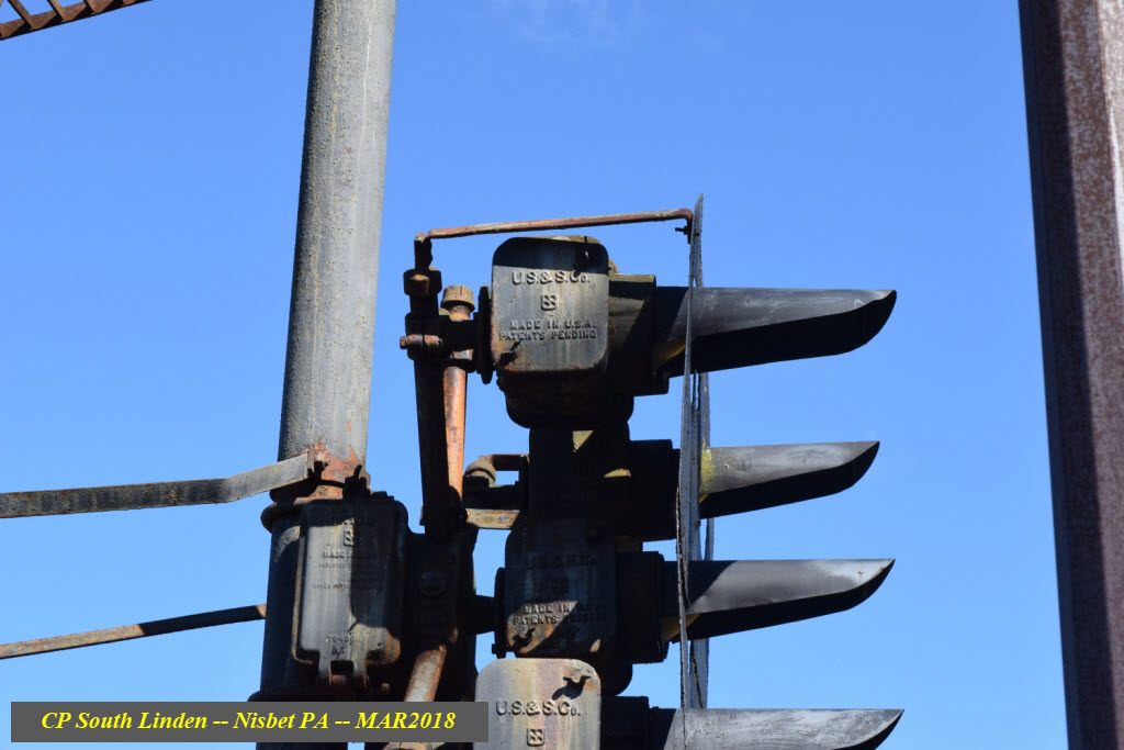
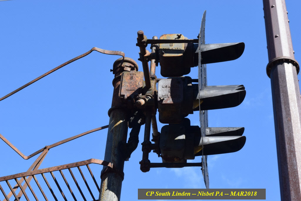
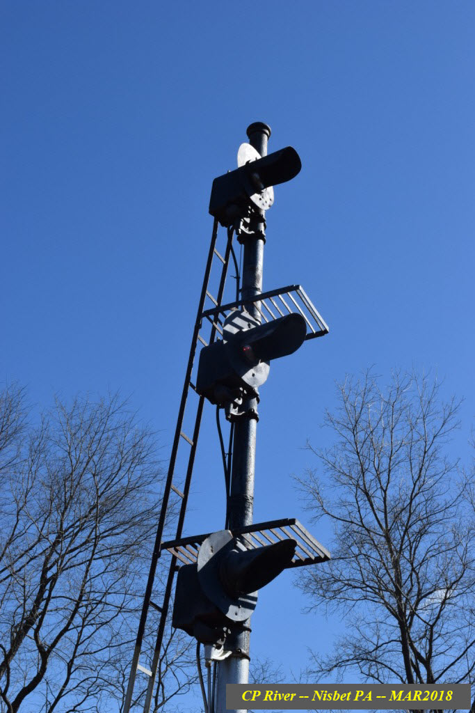
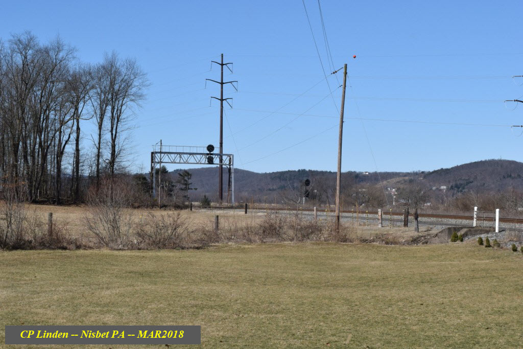
Here on the east coast, I doubt you will find as interesting an interlocking left with such an assortment of different signal types, altho three of them are variations on the Pennsylvania RR PL (Position Light) signals. One of the signals, on the bridge, on the northern SB approach to River Interlocking, has already been replaced. The lone triple stacked searchlight signal was probably a replacement during the Conrail era, not quite sure where they would have gotten them from, even back then, since we are smack in the middle of hardcore PL territory. Also, the PL signals here are of the "red-eye" variety, except for the dwarfs.
While you're wandering around taking pictures, if you keep your eye open, you may find all sorts of "little" treasures to make your visit more interesting. Some of this will show up down in the floobydust section.....
Acknowledgements:
Jersey Mike
Dave Malohn
Jim Appleman
Denver Todd
Google Maps
Bing Maps
Websites and other additional information sources of interest for the area:
http://prr4ever.blogspot.com/2006/10/06-10-14-photos-buffalo-line.html
https://en.wikipedia.org/wiki/Lycoming_Valley_Railroad
https://en.wikipedia.org/wiki/Buffalo_Line
http://www.nshr.com/LVRR.html
Getting to the Williamsport area is fairly easy, unless you're coming from Philadelphia :-(.
I-80 is the closest E/W interstate, which is south of Williamsport.
I-81 is the closest N/S interstate, it is to the east.
Use US 220 on the west side of town, or I-180 on the east side to come up from I-80.
US 15 will bring you down from western NY state.
I-81 south to I-80 west, then I-180 north will bring you down from the Scranton and central NY areas.
From NYC, yake I-80 west.... isn't that easy?
From Philadelphia, it's going to be a tough ride, follow your GPS, there are many ways.....
From out west, like Pittsburgh, I-76 to I-99 thru Altoona and State College to I-80 and US 220 east will get you here.
From East Broad Top, take US 522 north to US 522/22 thru Mt Union at Lewiston, and go west to I-99.....
From Harrisburg, take US 22 on the eastern shore of the Susquehanna till you have to cross over and get on US 15 at Duncannon. Headed to Northumberland, where you will once again cross the river to jump on PA 147, and take that till it runs into I-180. It's a long and winding route, but the most direct one. They are in the process of building a highway to bypass the Northumberland trek, and it will probably come off US 15, cross the river, and meet up with the lengthened I-180.
From DC and Baltimore, take I-83 out of Baltimore in Towson, go around Harrisburg to the east till 83 meets up with I-81, head west 1 exit to US-22, and head north.
Courtesy Jersey Mike
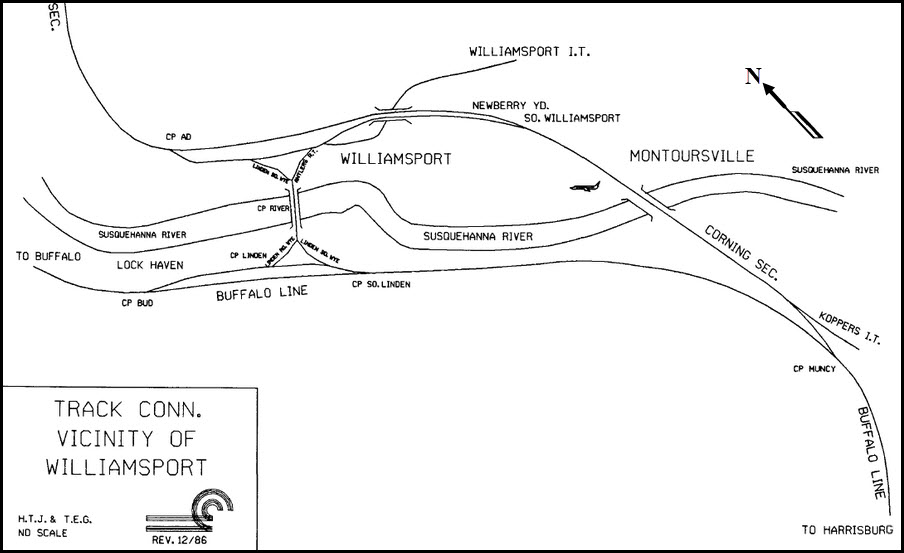
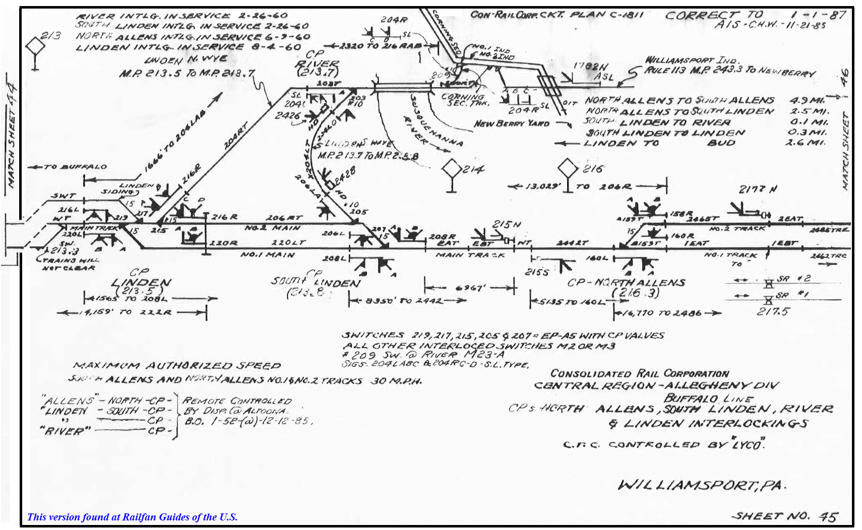
Conrail Track Map Courtesy Dave Malohn
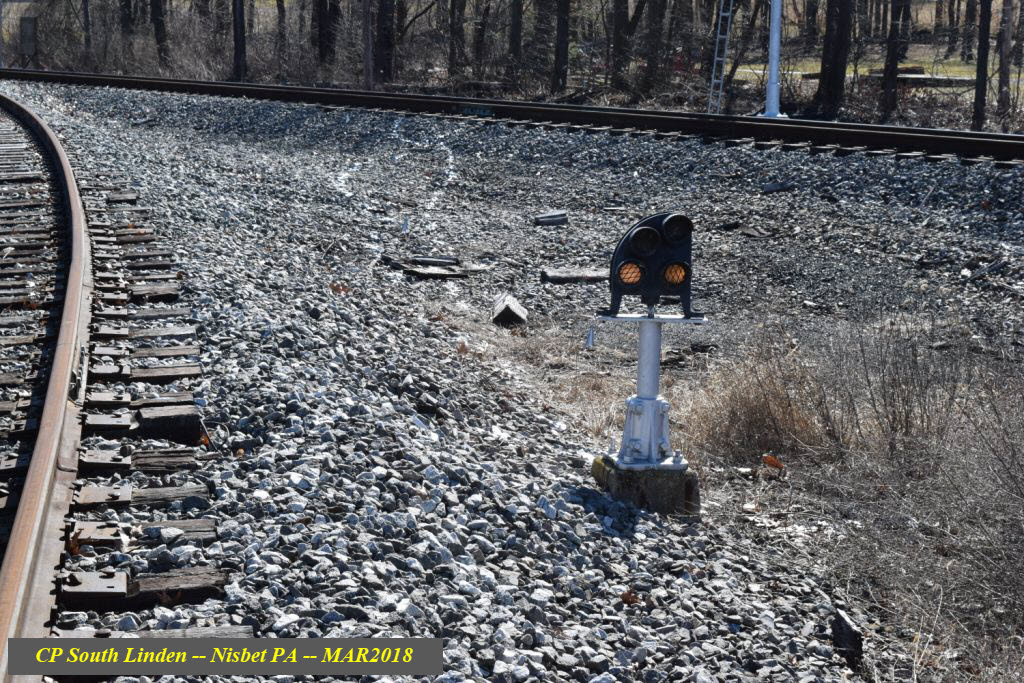
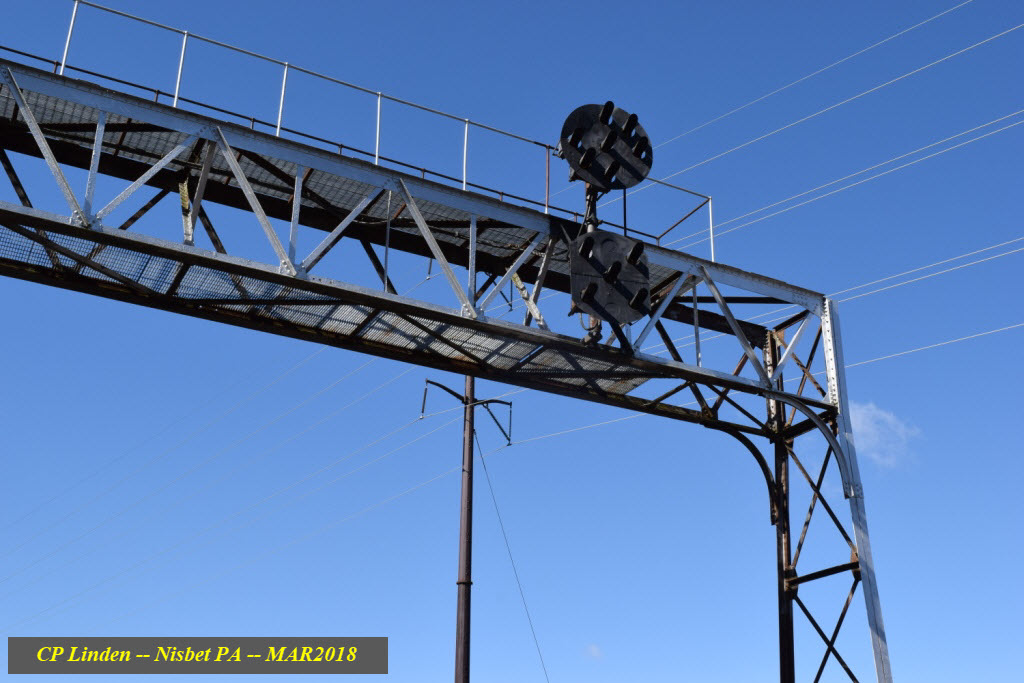
And one of the new signals in place......
This signal was removed years ago when the second track was taken out. Would not have known about the existence of this dwarf PL if it hadn't been for this picture.
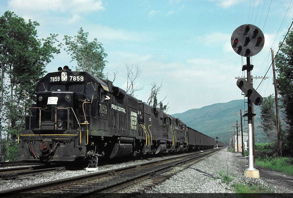 Photo: Jim Appleman, 1977
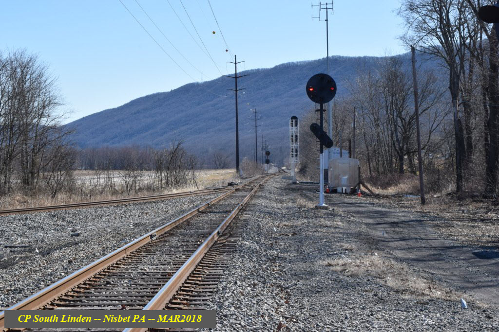

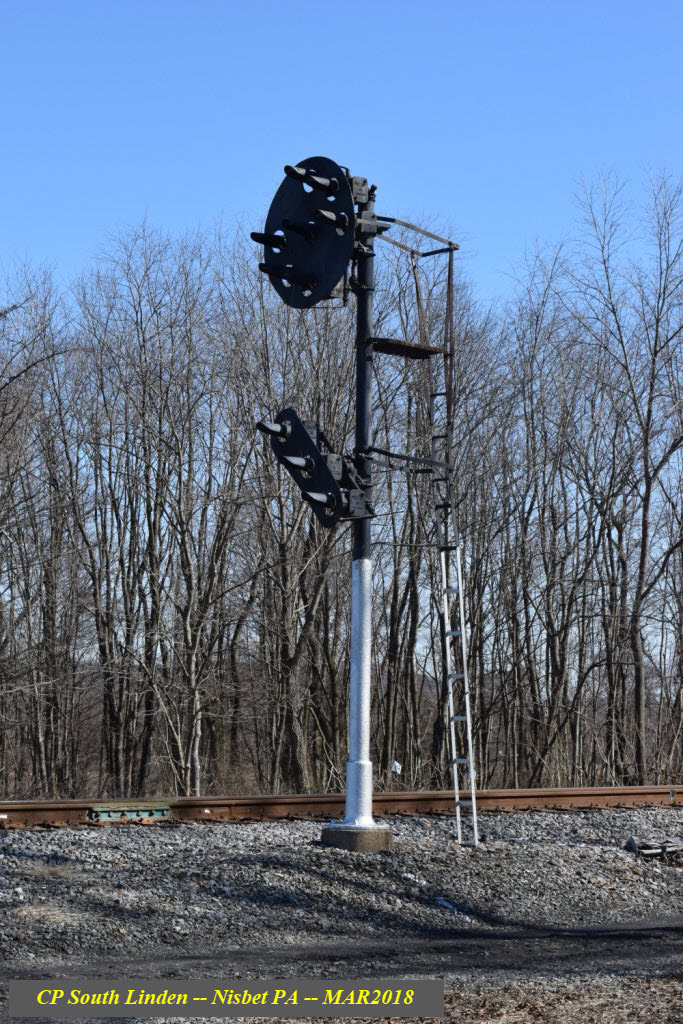
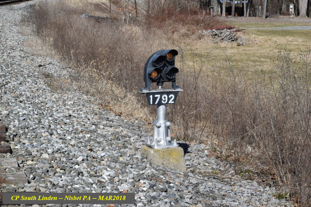
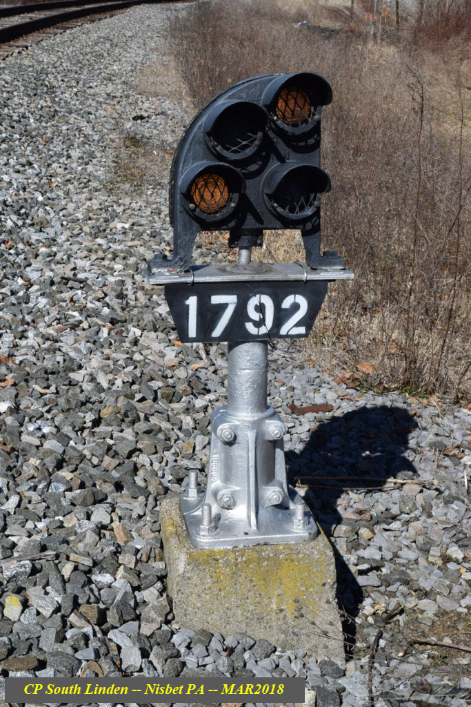
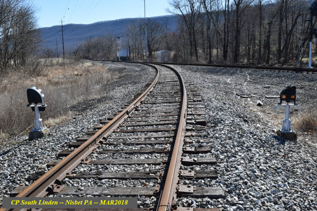
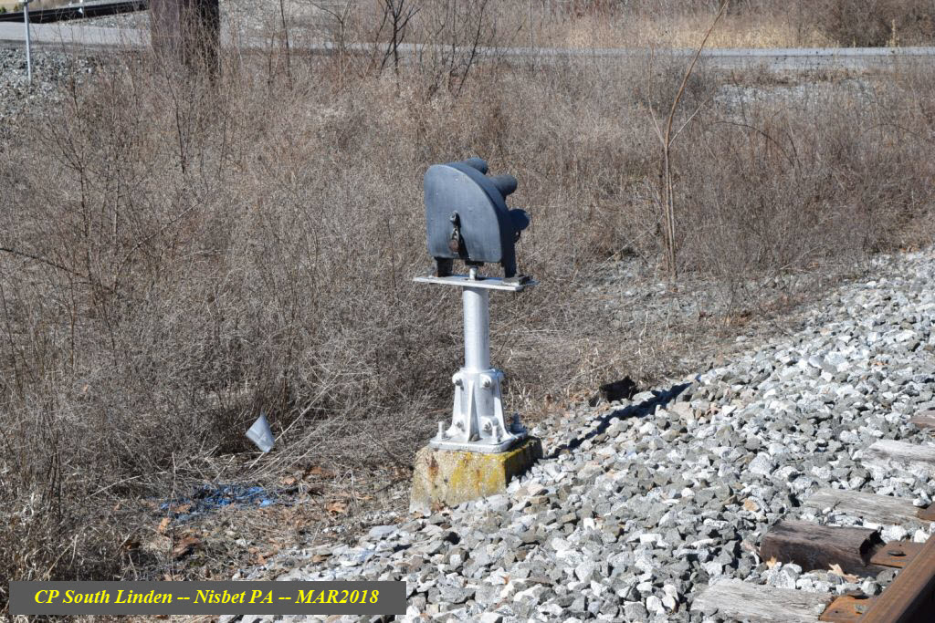
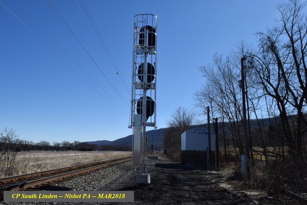
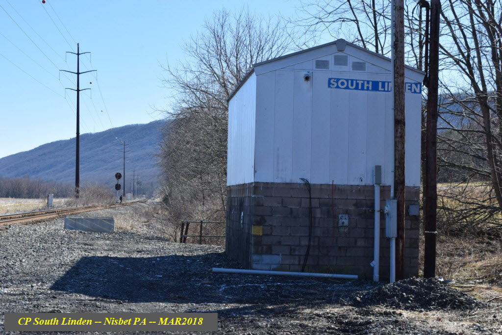
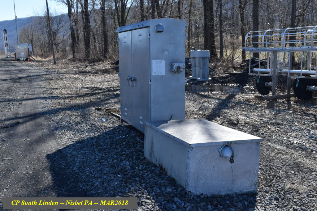
South Linden Interlocking in general
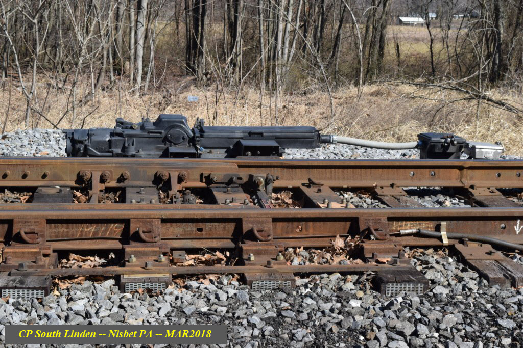
The only remaining air operated switch machine, been laying in the grass like this for about 10 years.....
Anyone want to do a recovery??? :-)
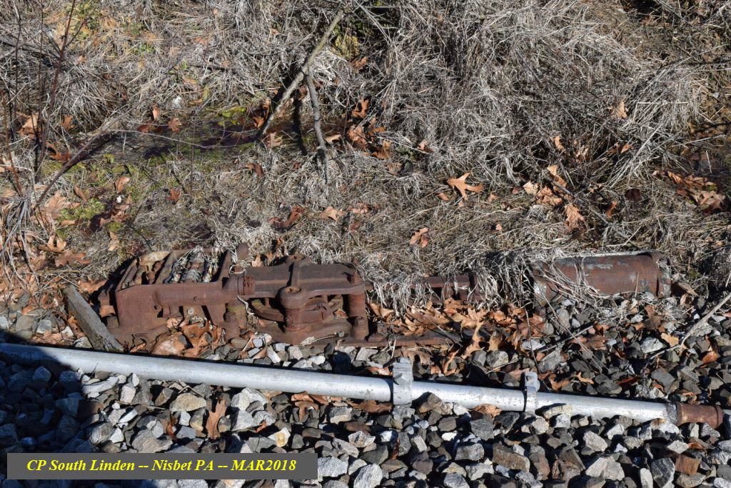
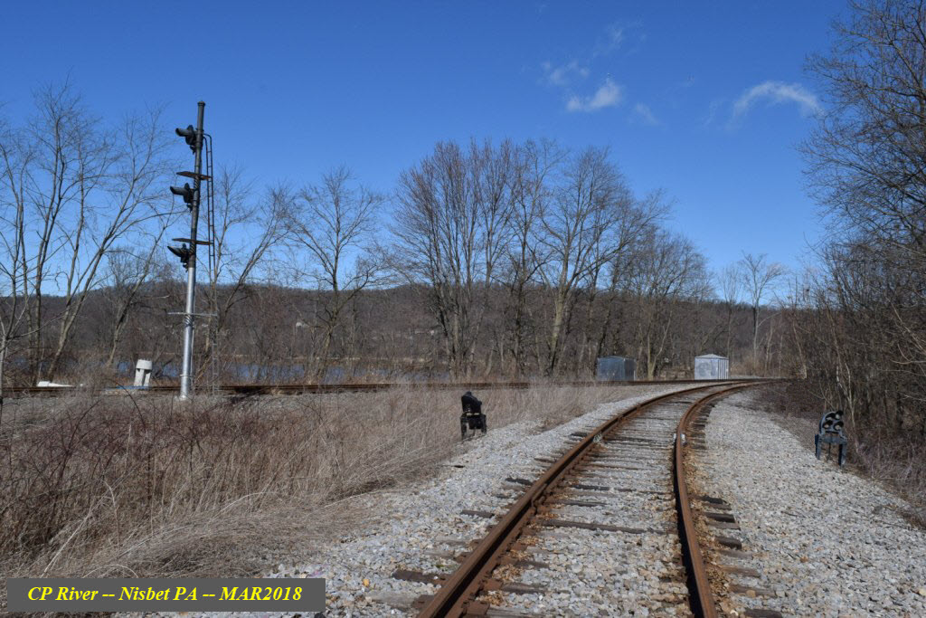
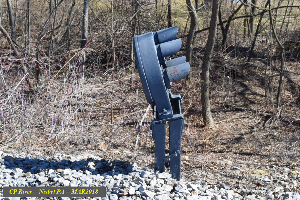
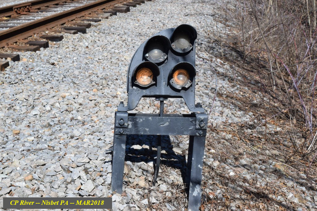
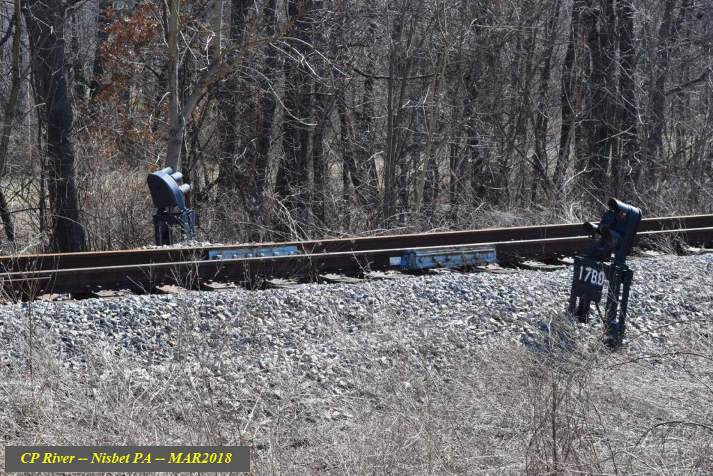
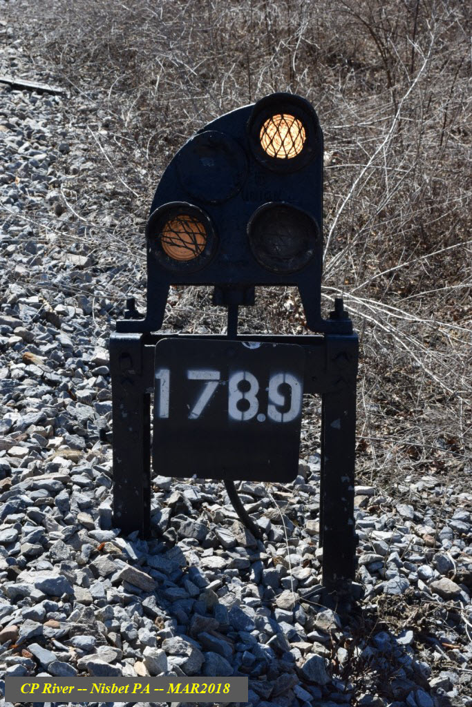
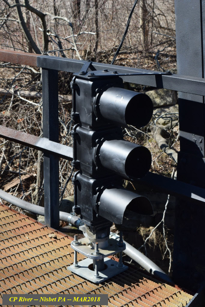
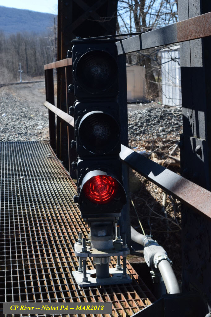
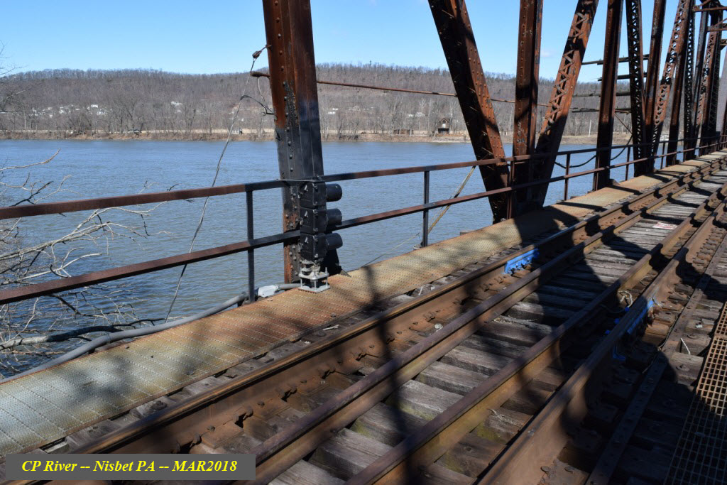
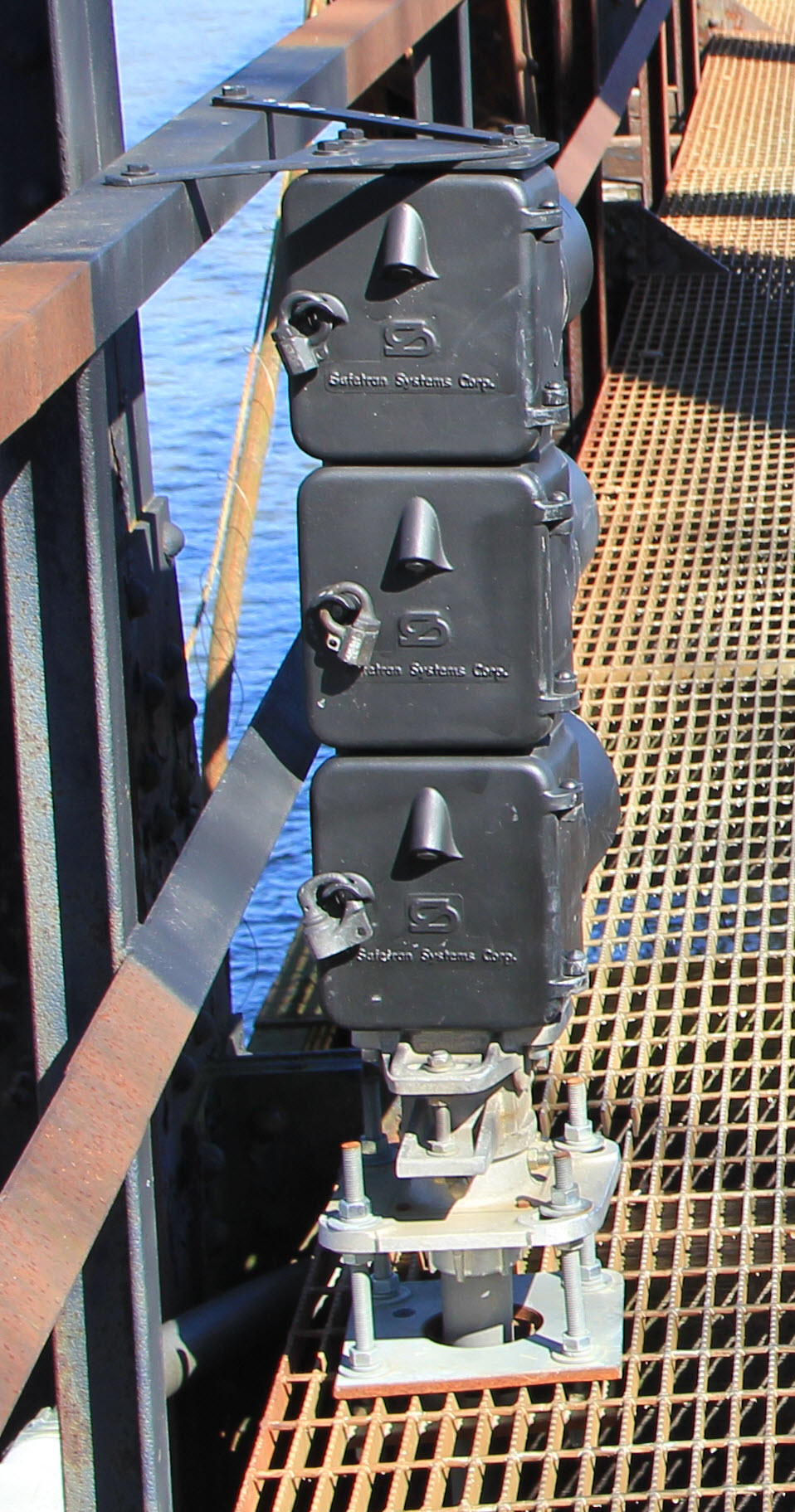 Photo courtesy Jersey Mike
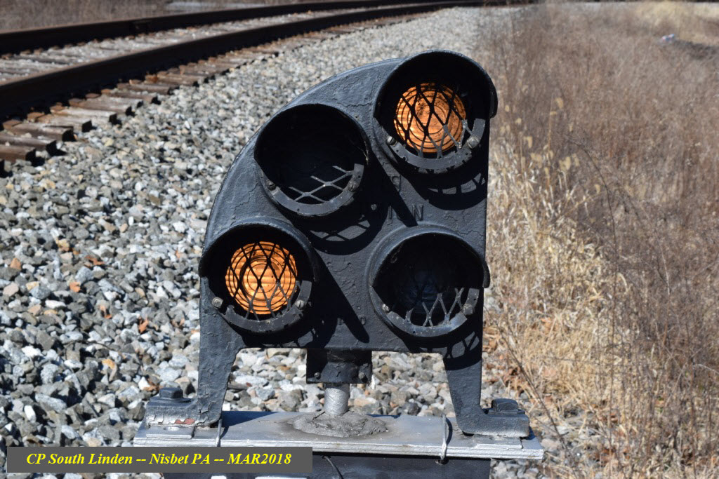
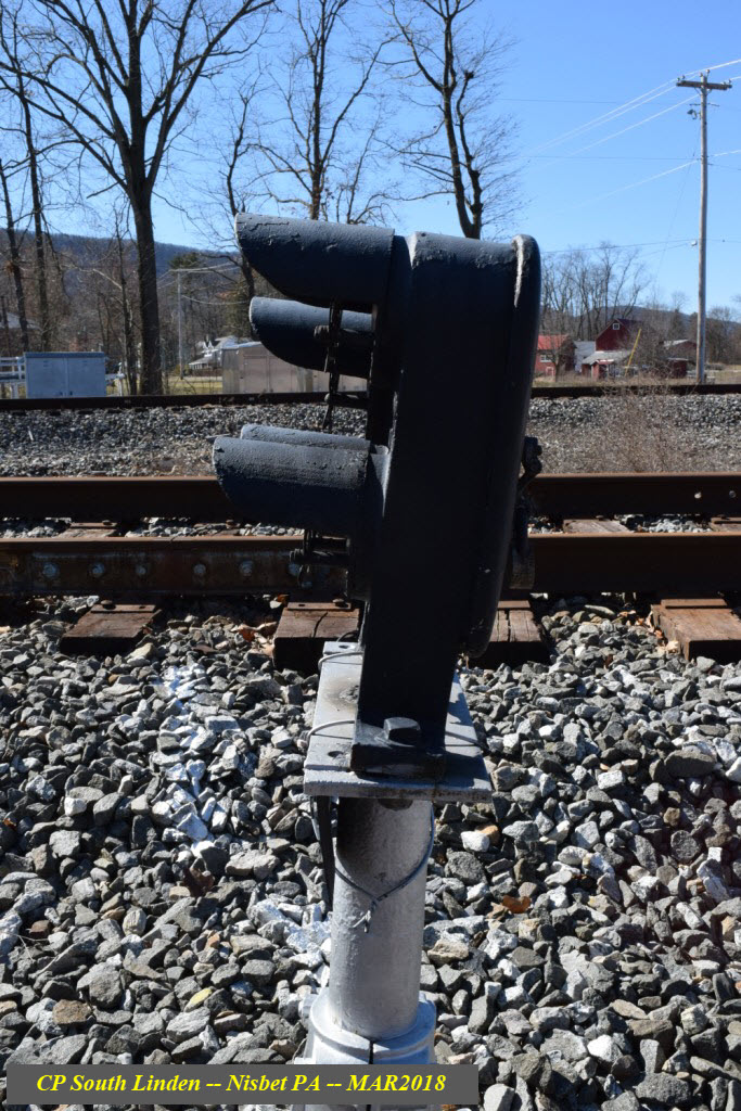
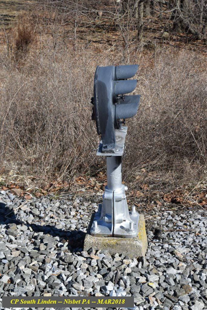
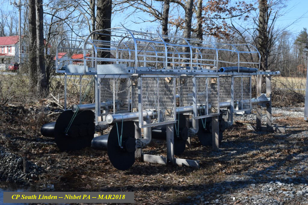
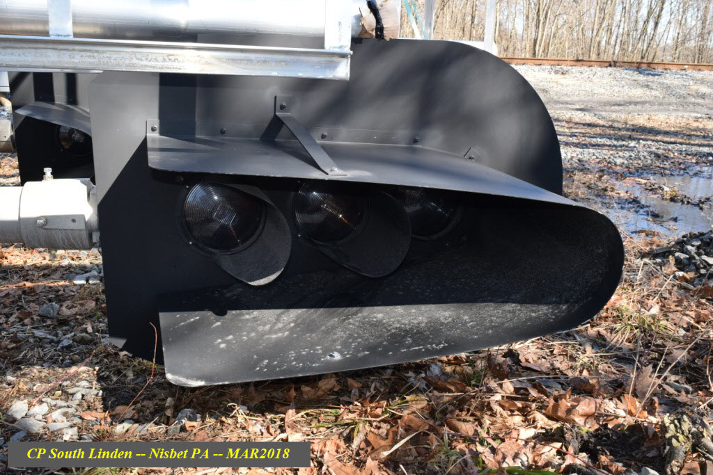
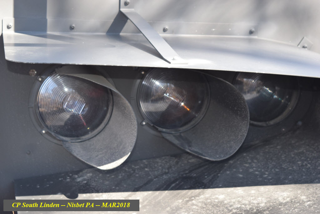
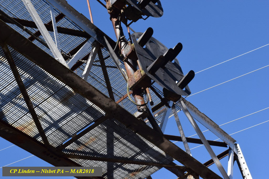
Interesting assortment of hoods, the signals are GRS SA's......

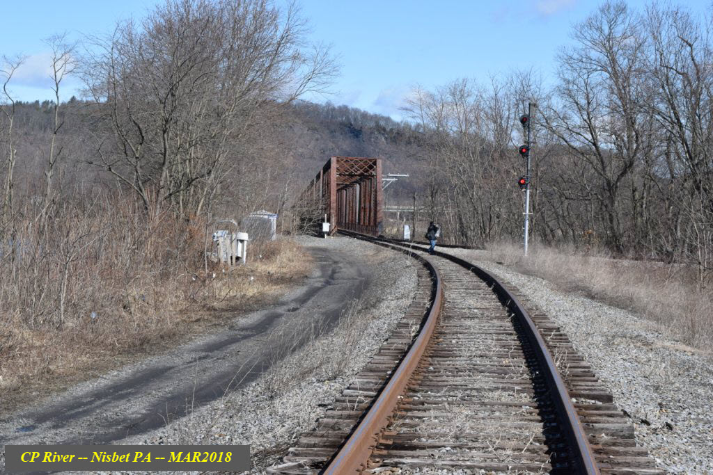
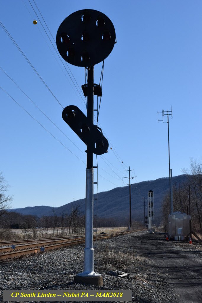
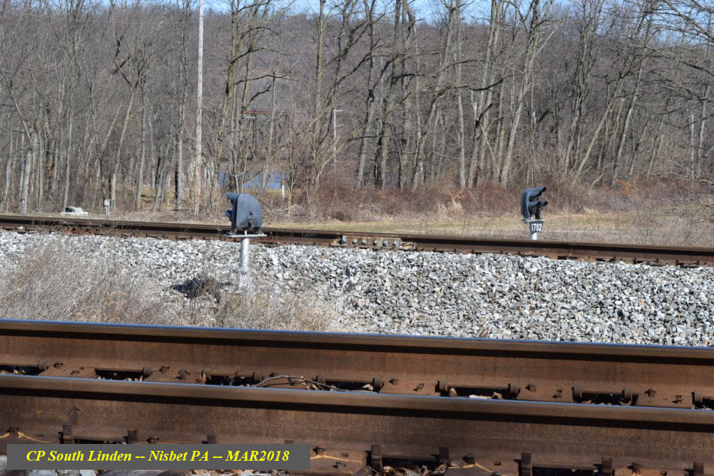
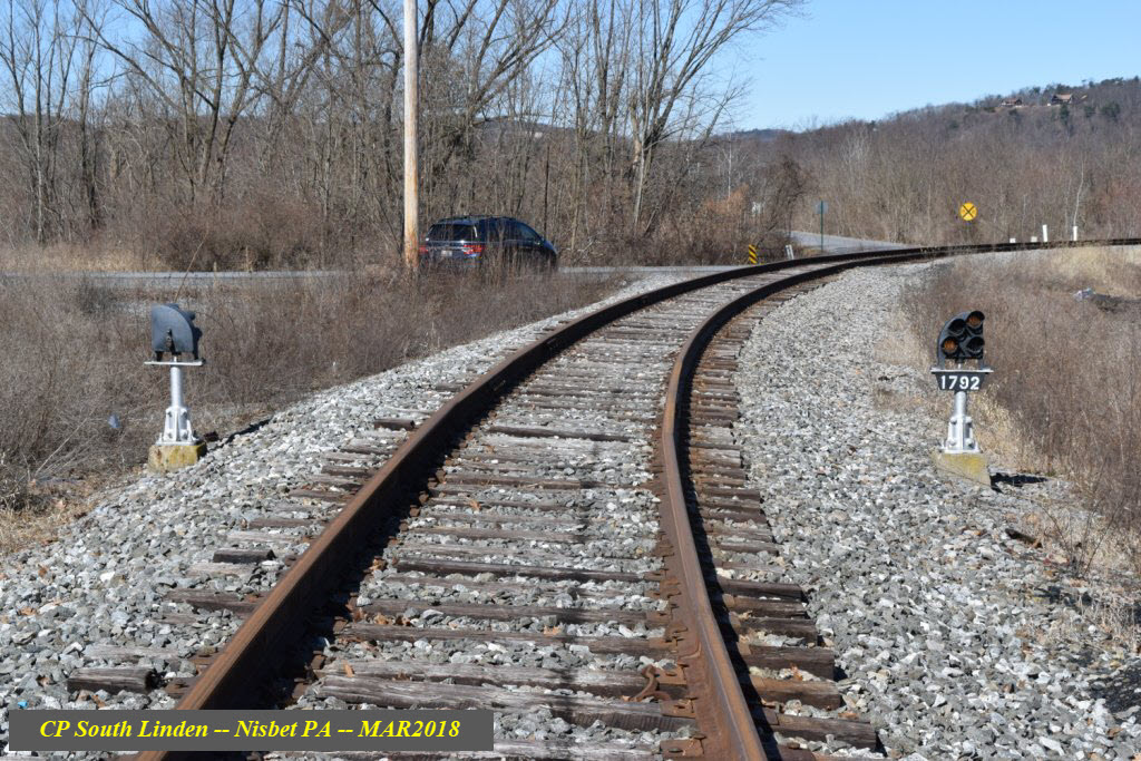
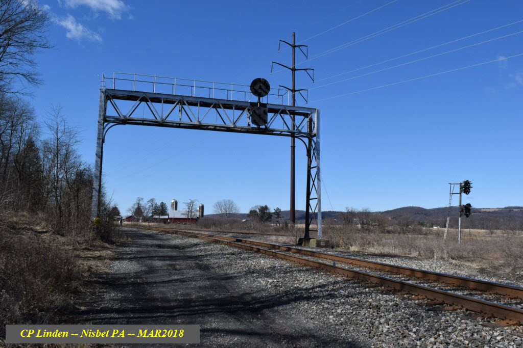
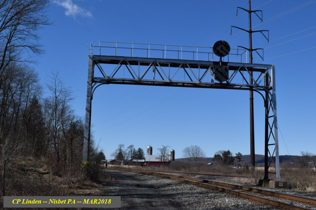
The only signal bridge among the three interlockings, there used to be two tracks that went underneath it. If you stand below the bridge, you can see evidence of where the other signal used to be. The signal still in place was signal 216R and was on No. 2 Main. The one removed was 220R on No. 1 Main. See the Conrail track diagram above for more info.
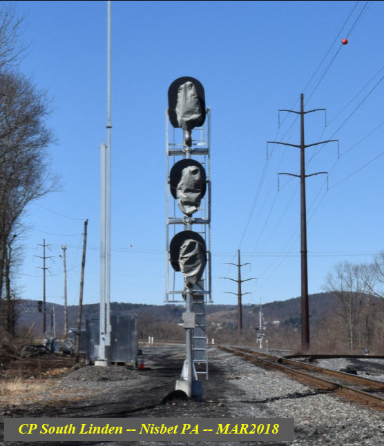
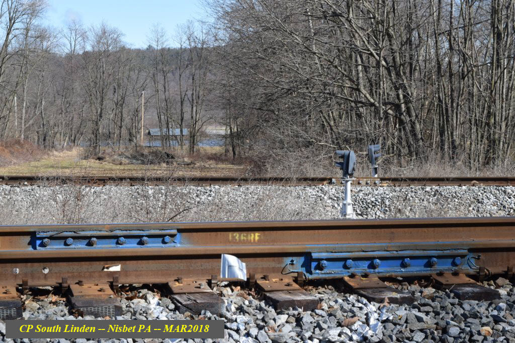
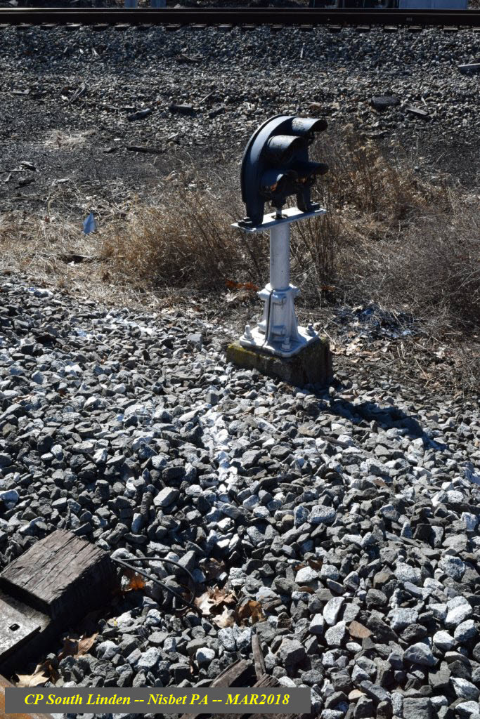
 From South Linden
It would be interesting to find out how the background got bent-up, my bets are on it being dropped :-)
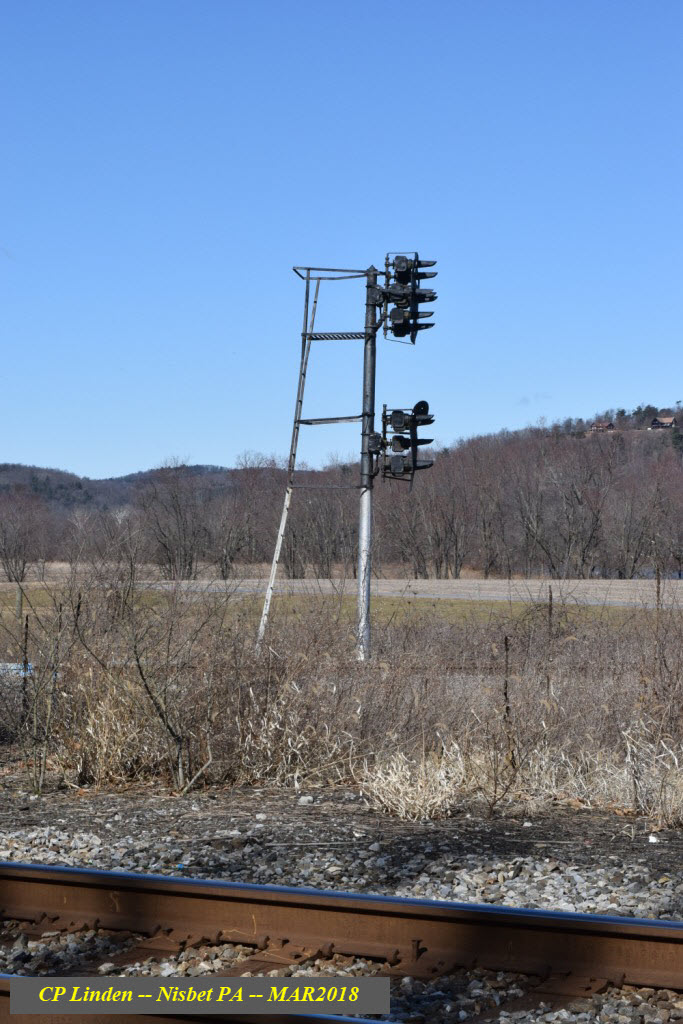
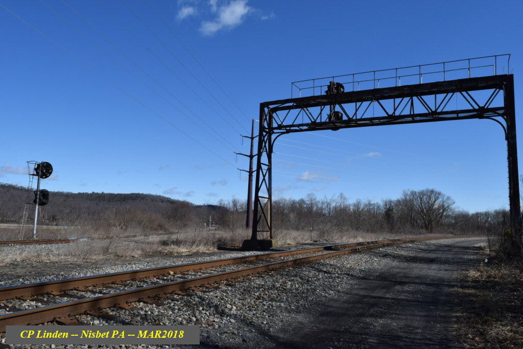
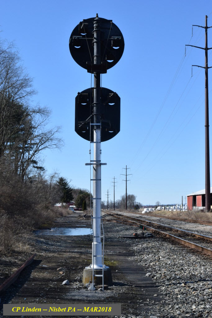
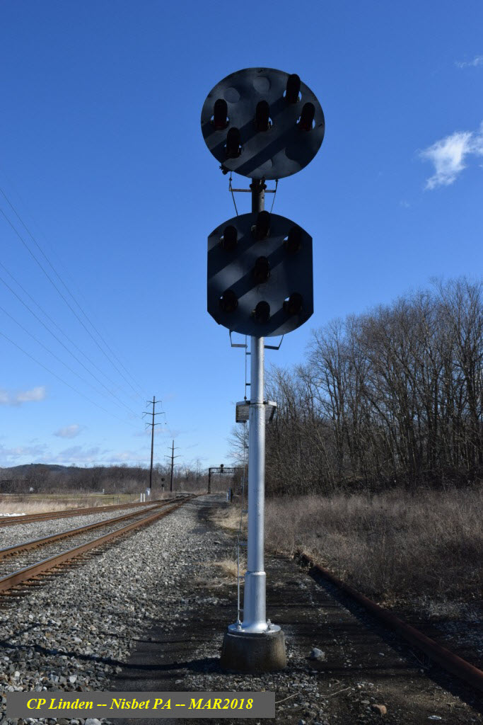
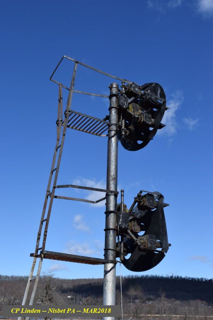
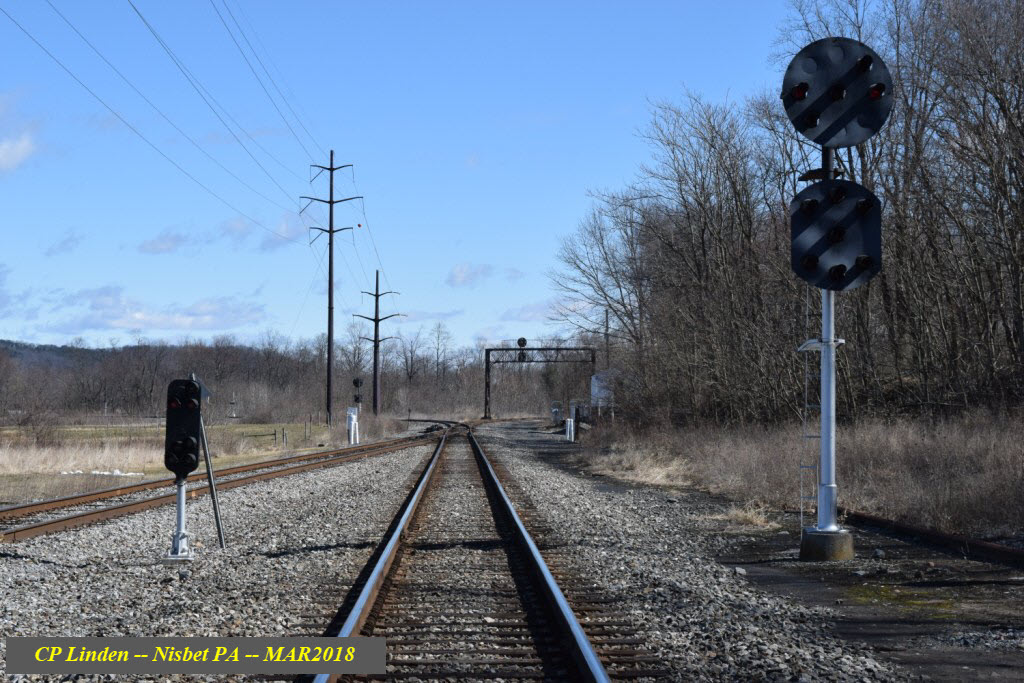
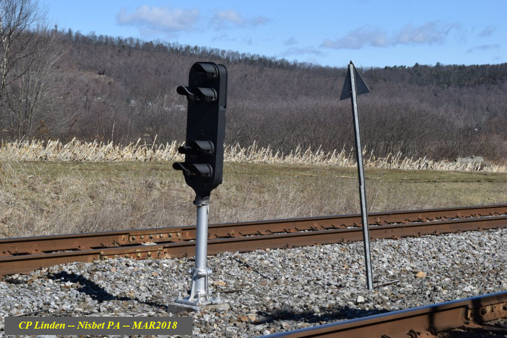
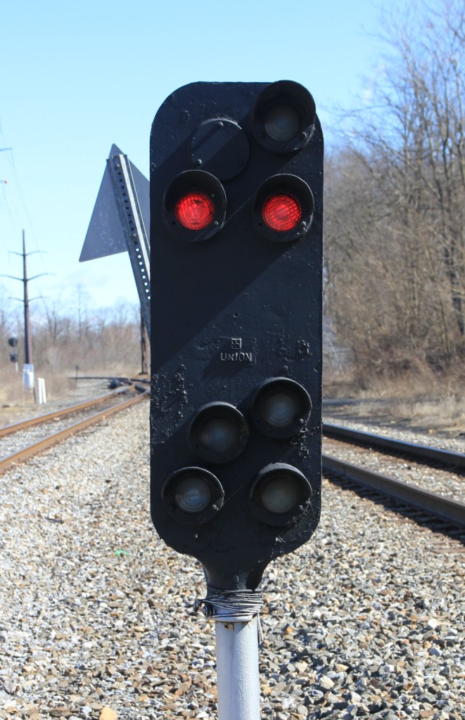 Photo courtesy Jersey Mike
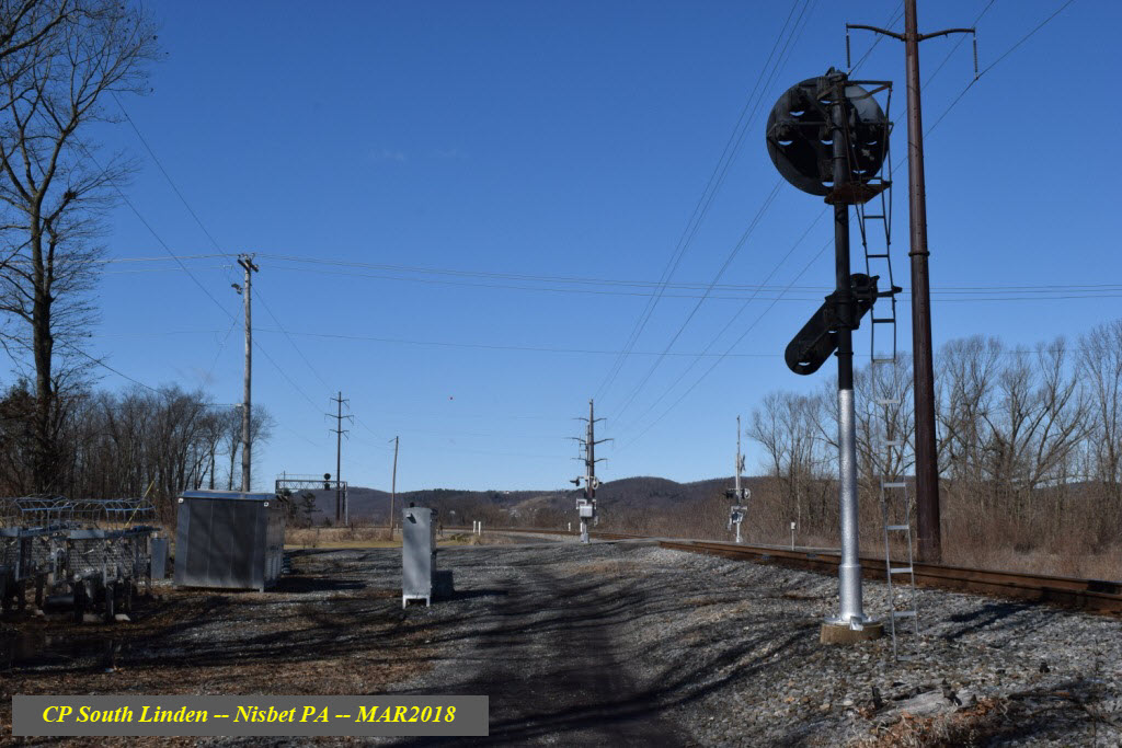
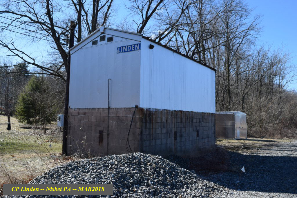
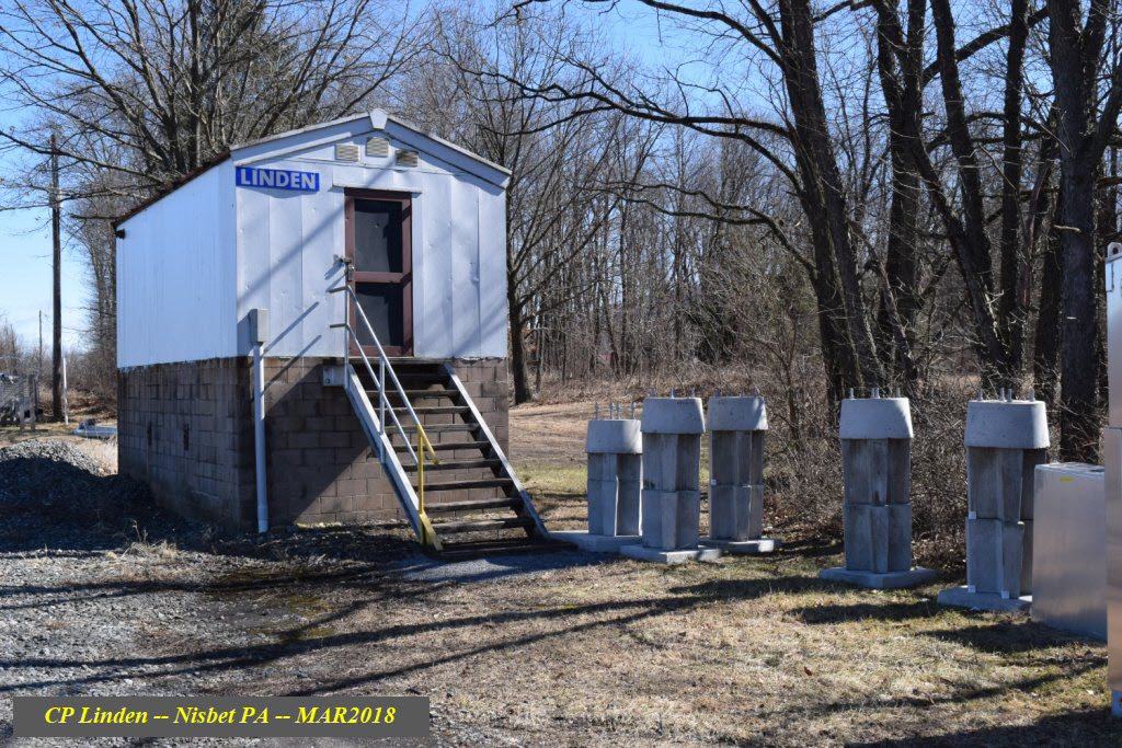
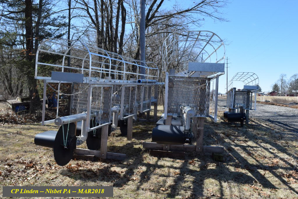
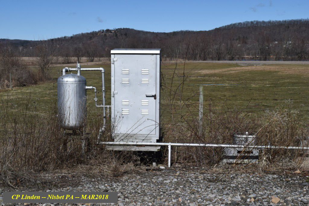
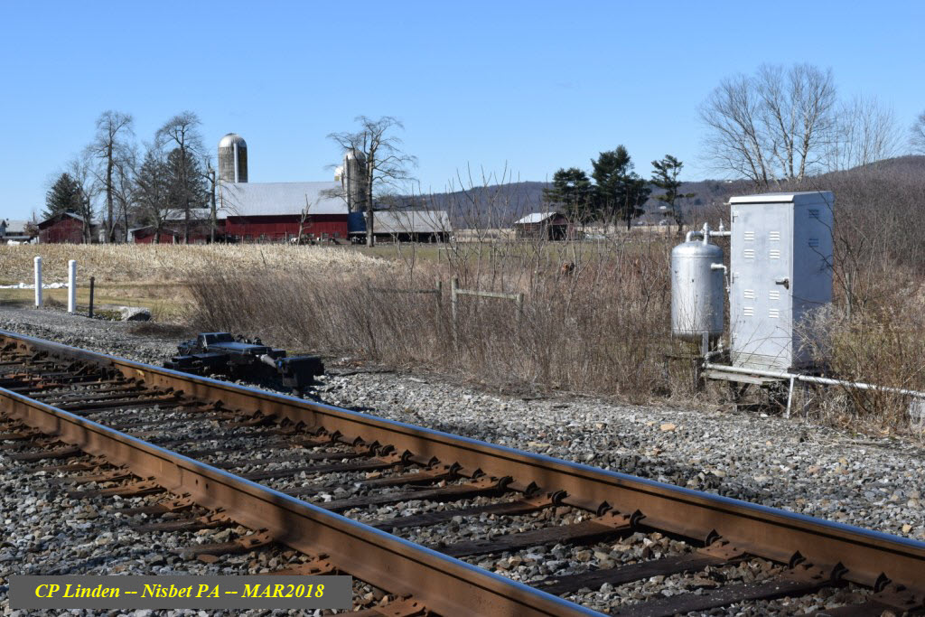
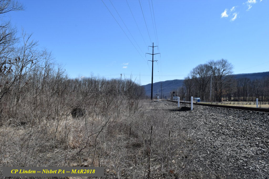
CP Linden in General
Everything for this interlocking is still on the ground as of early March 2018.
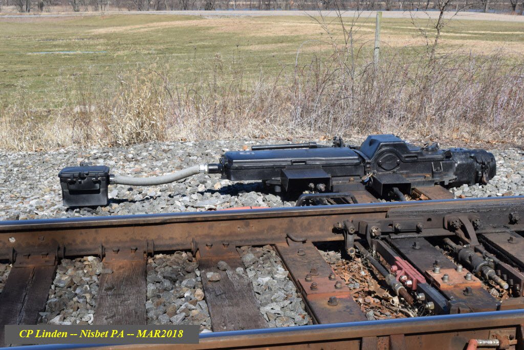
Switch machine for the Linden to River interchange track.
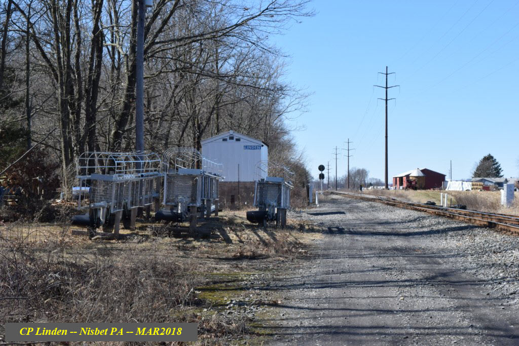
The air plant for the three interlockings - hasn't been in service for about 10 years or so. The equipment cabinet contained the air compressor. There is still a two inch or so pipe going all the way down to South Linden, where one of the old switch motors is still sitting on the ground.
Interesting way for the cables "to get to the other side" :-)
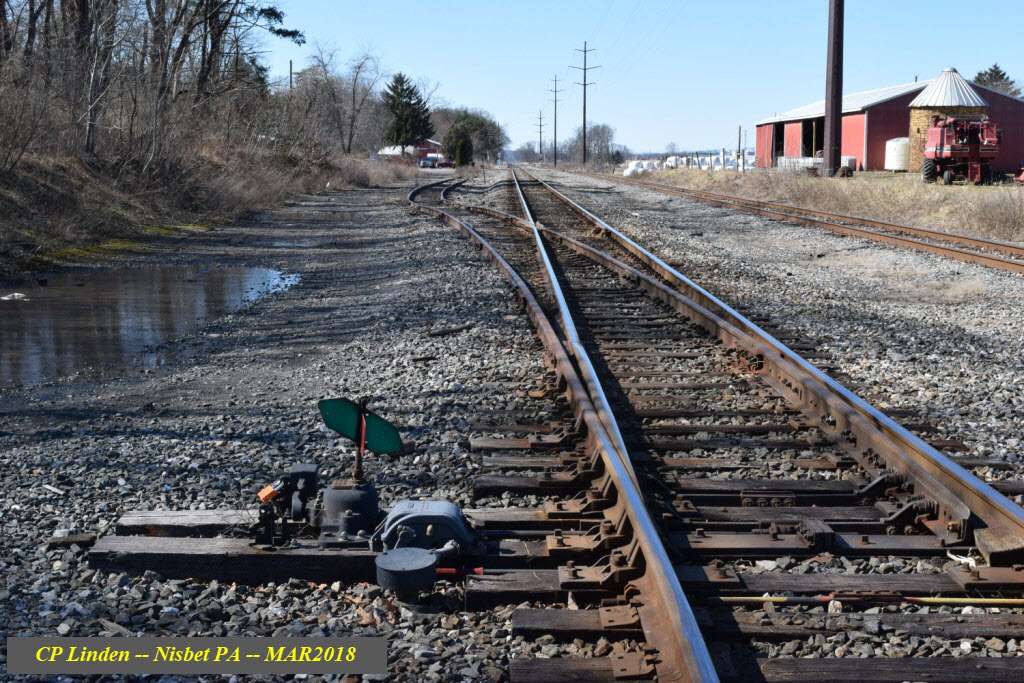
A manual throw switch for a very short siding that goes down to the next road, Kennedy Lane.
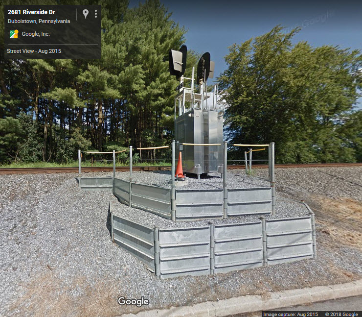
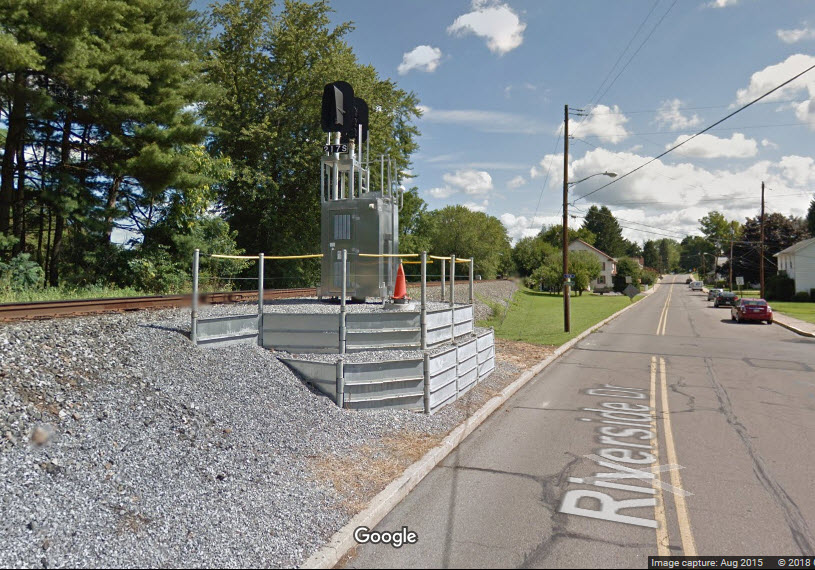
This is typical of the signals that NS is installing in place of the Pennsy PL intermediate signals, from Google Streetview.
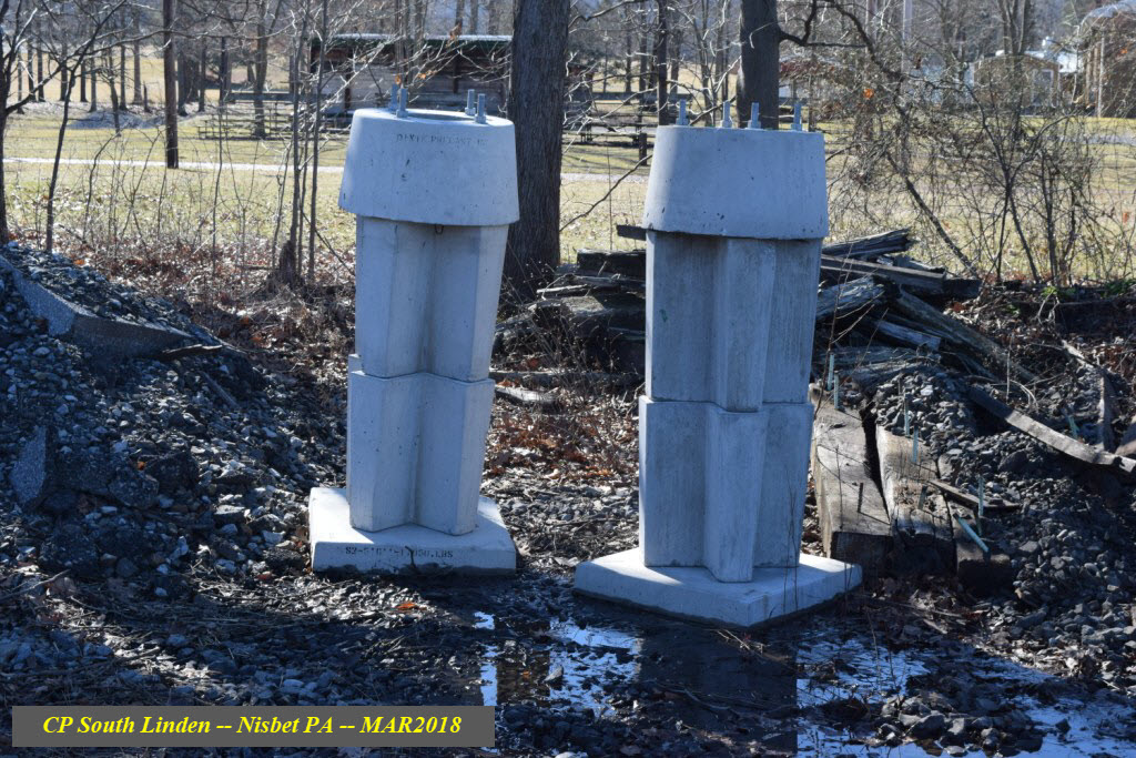
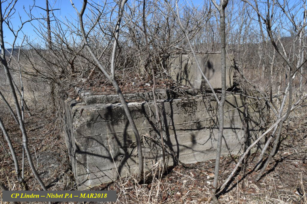
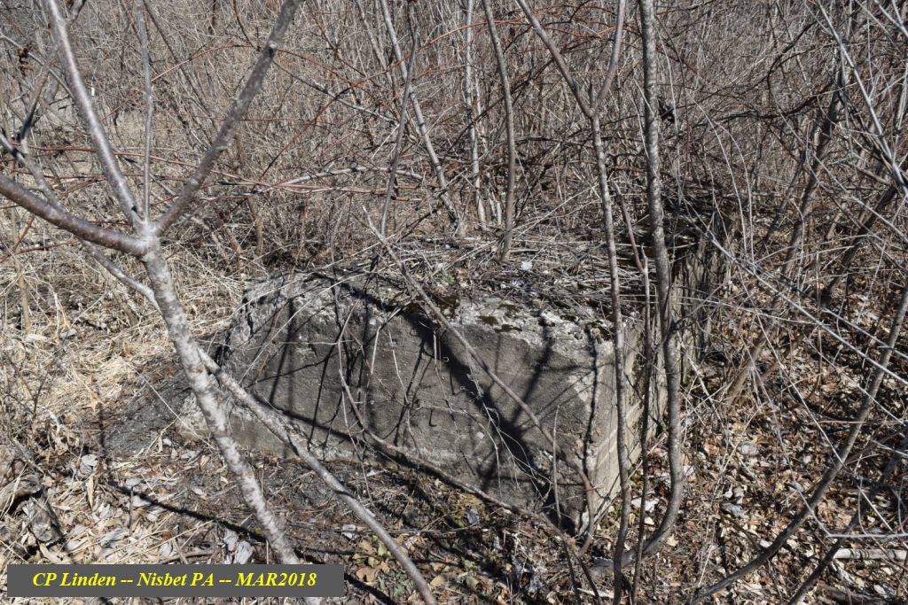
Unsure what exactly sat on top of this concrete base, but there was at least an enclosure because there are two 8" (or so) square holes in the top where cables would have passed thru.
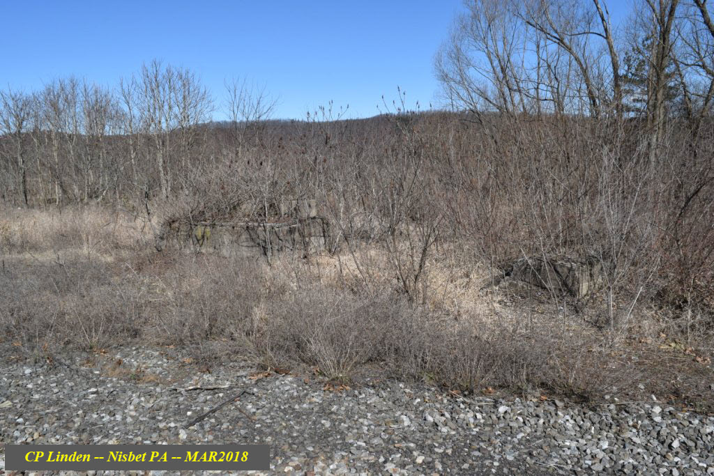
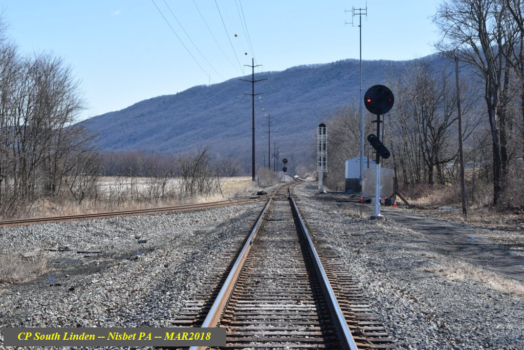
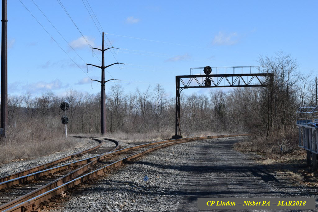
 Looking towards S Linden
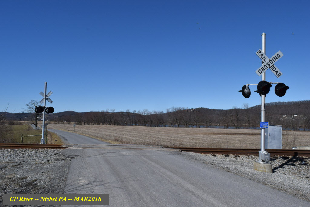
Grade Crossing At "A", River Road

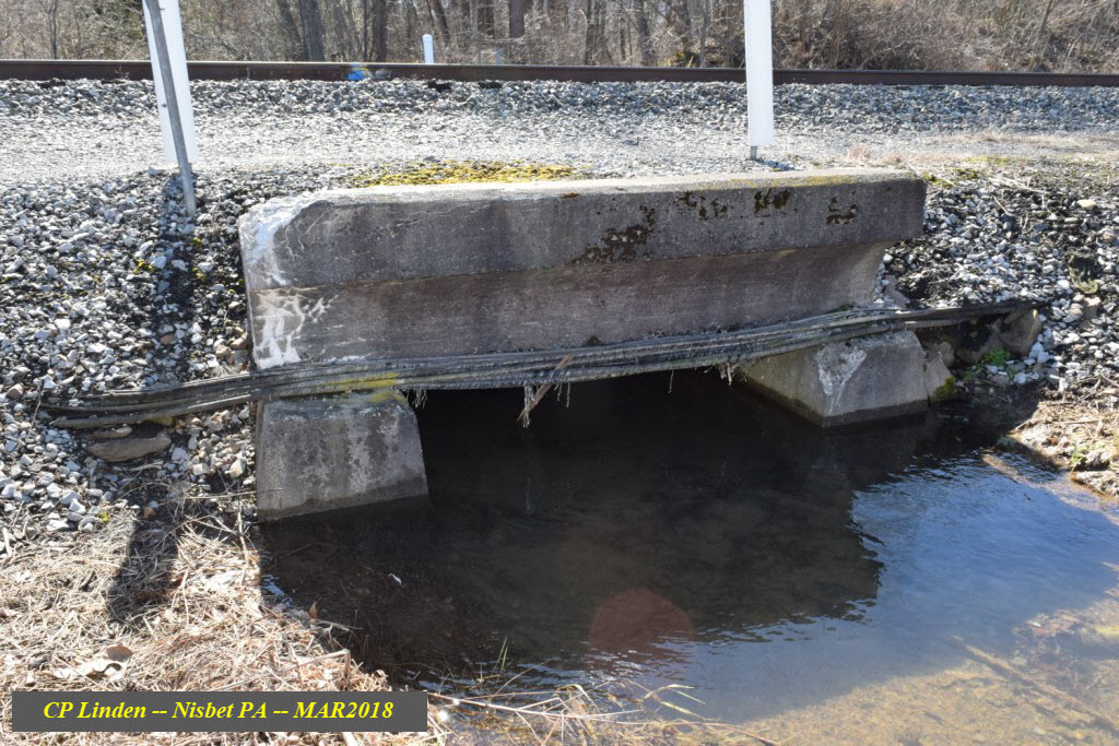
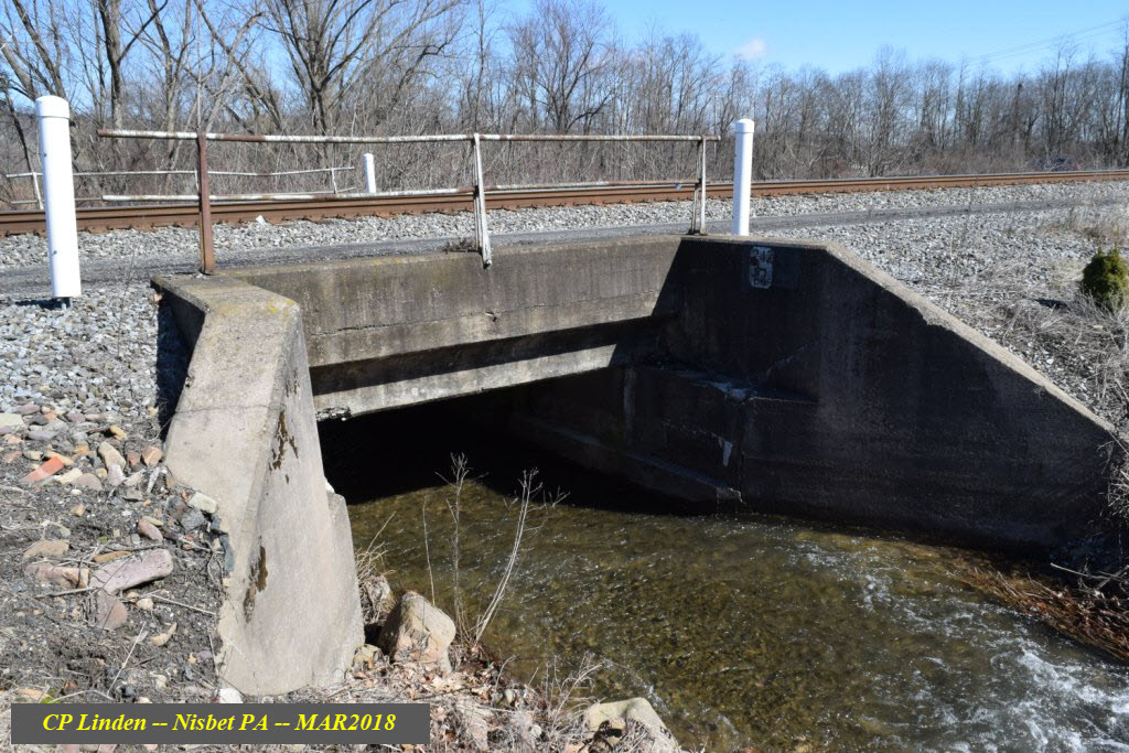
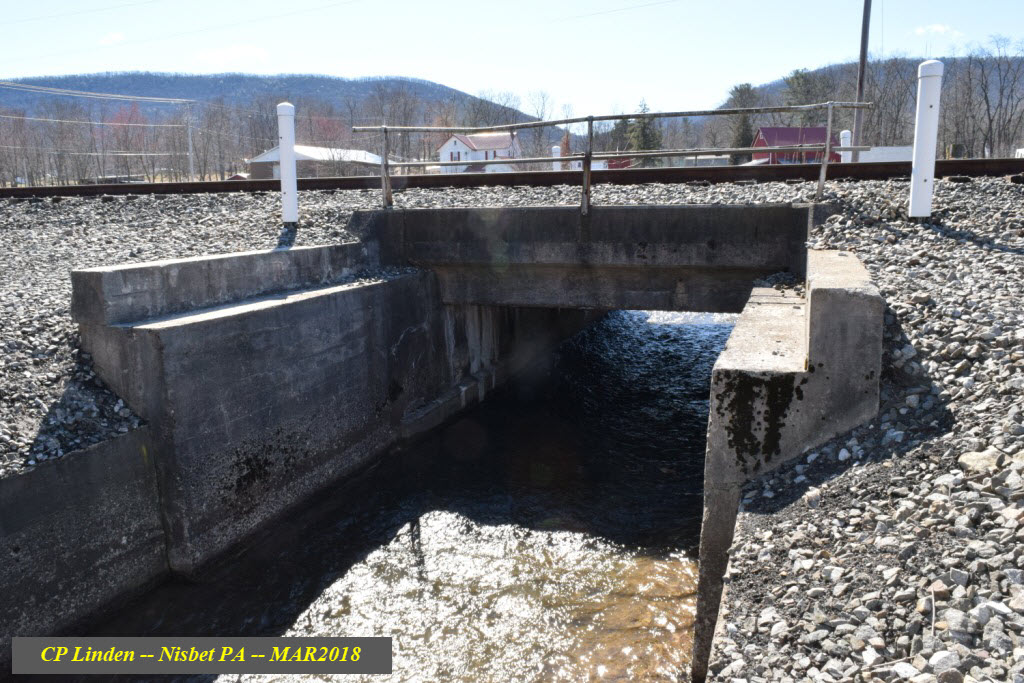
Culvert under the CP Linden end of the wye
Courtesy of the University of Texas Library, click here for their index page.
Found elsewhere on the internet.....
Disclaimers:
New format 10/26/23: Please check out my disclaimer page for my standard dribble and contact info here
RAILFAN GUIDES HOME
RAILROAD SIGNALS HOME
NEW 01/01/2014, APR26/2024
Last Modified 26-Apr-2024