
In General
Getting Here
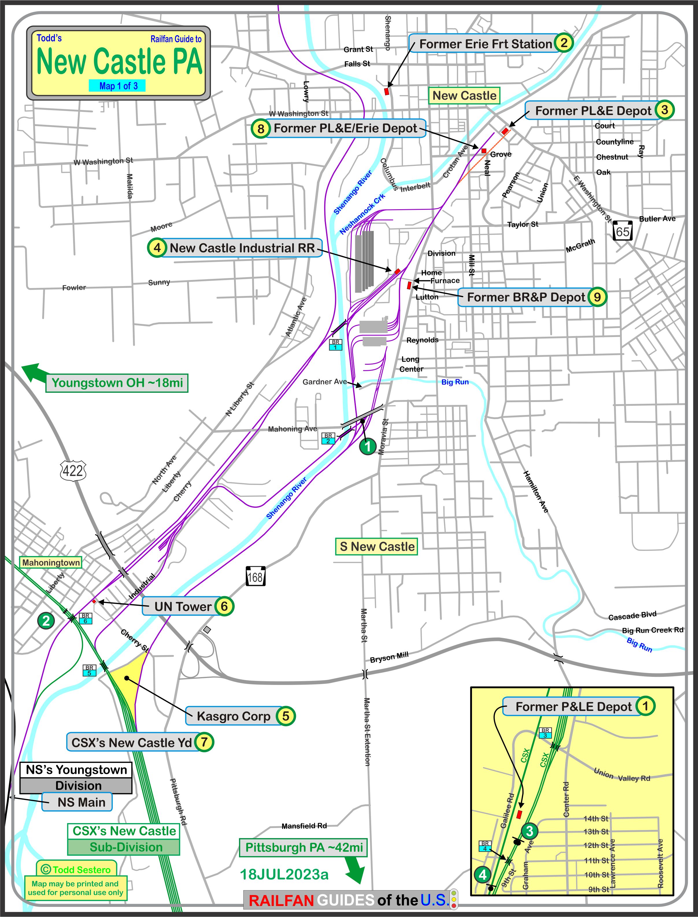
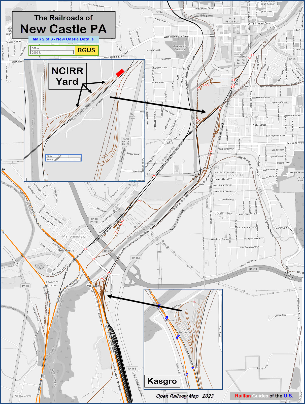
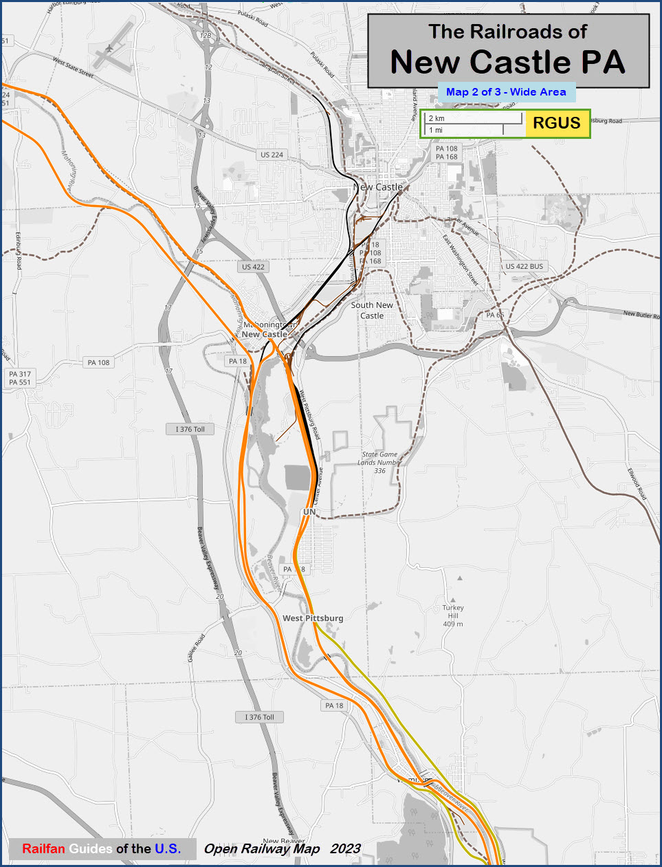
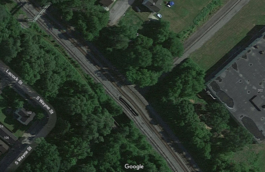
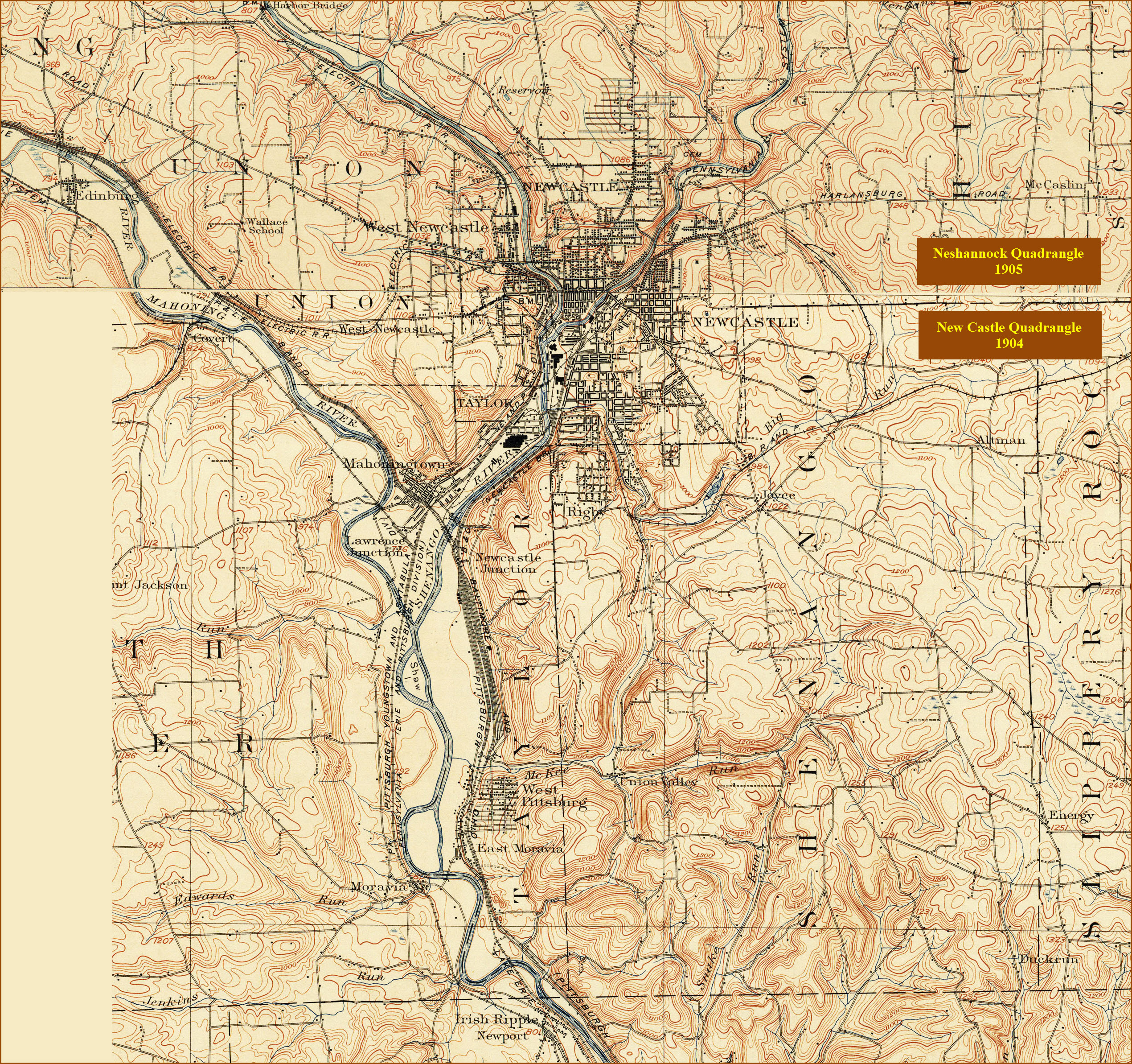
Maps
Sights
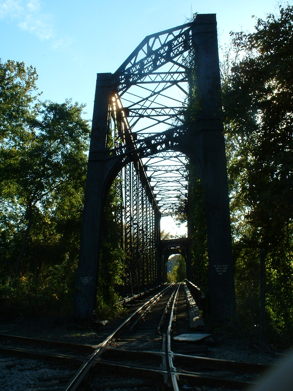
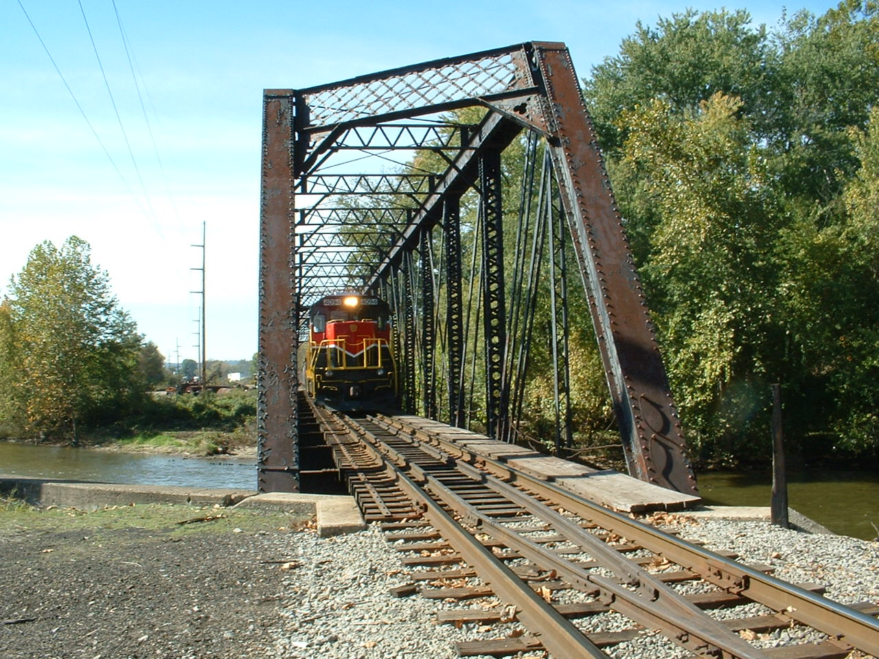
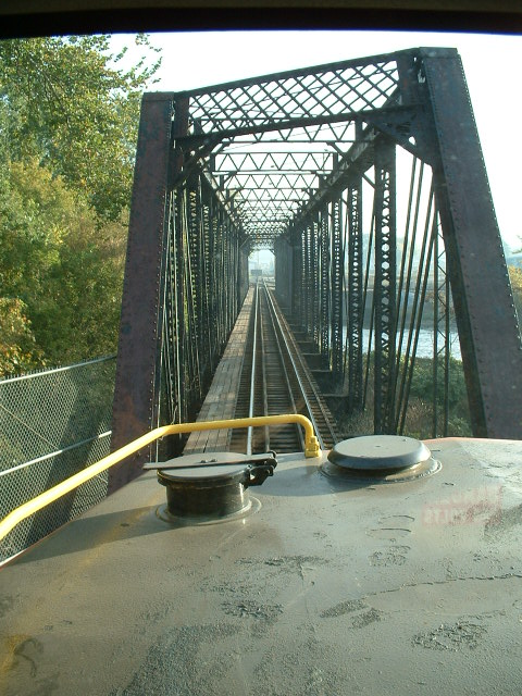
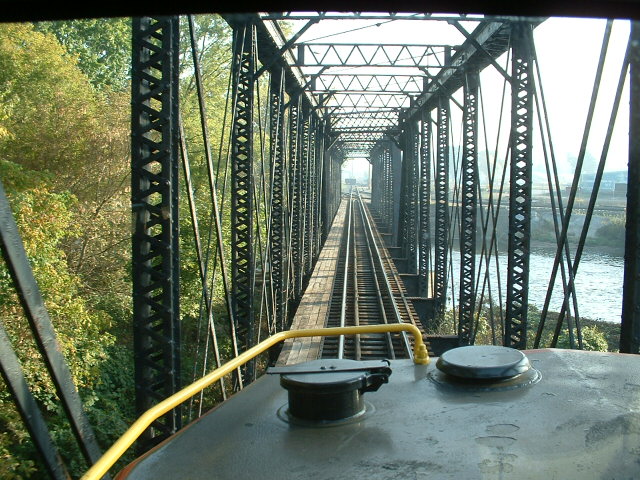
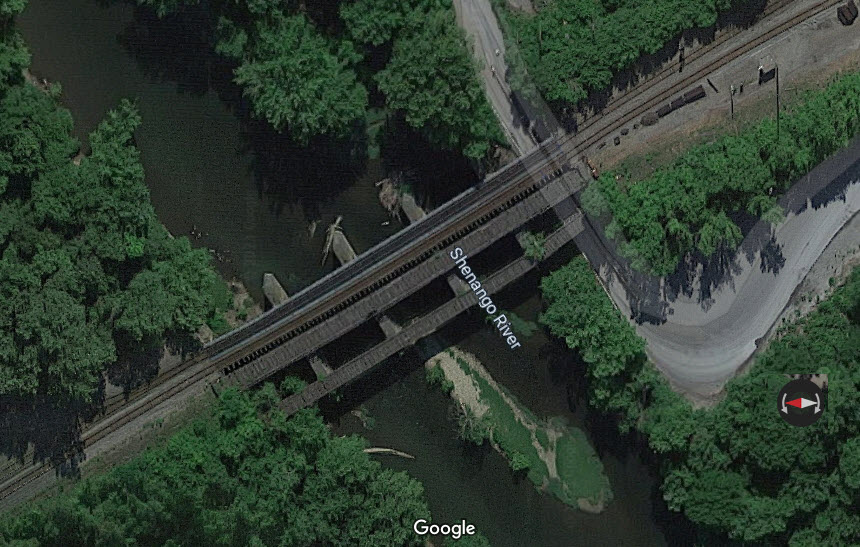
Bridges
Signals
Floobydust
USGS Map
RAILROAD SIGNALS HOME
Location / Name:
New Castle PA, Lawrence County
What's Here:
Three Vintage Railroad Stations
CSX New Castle Yard
Kasgro
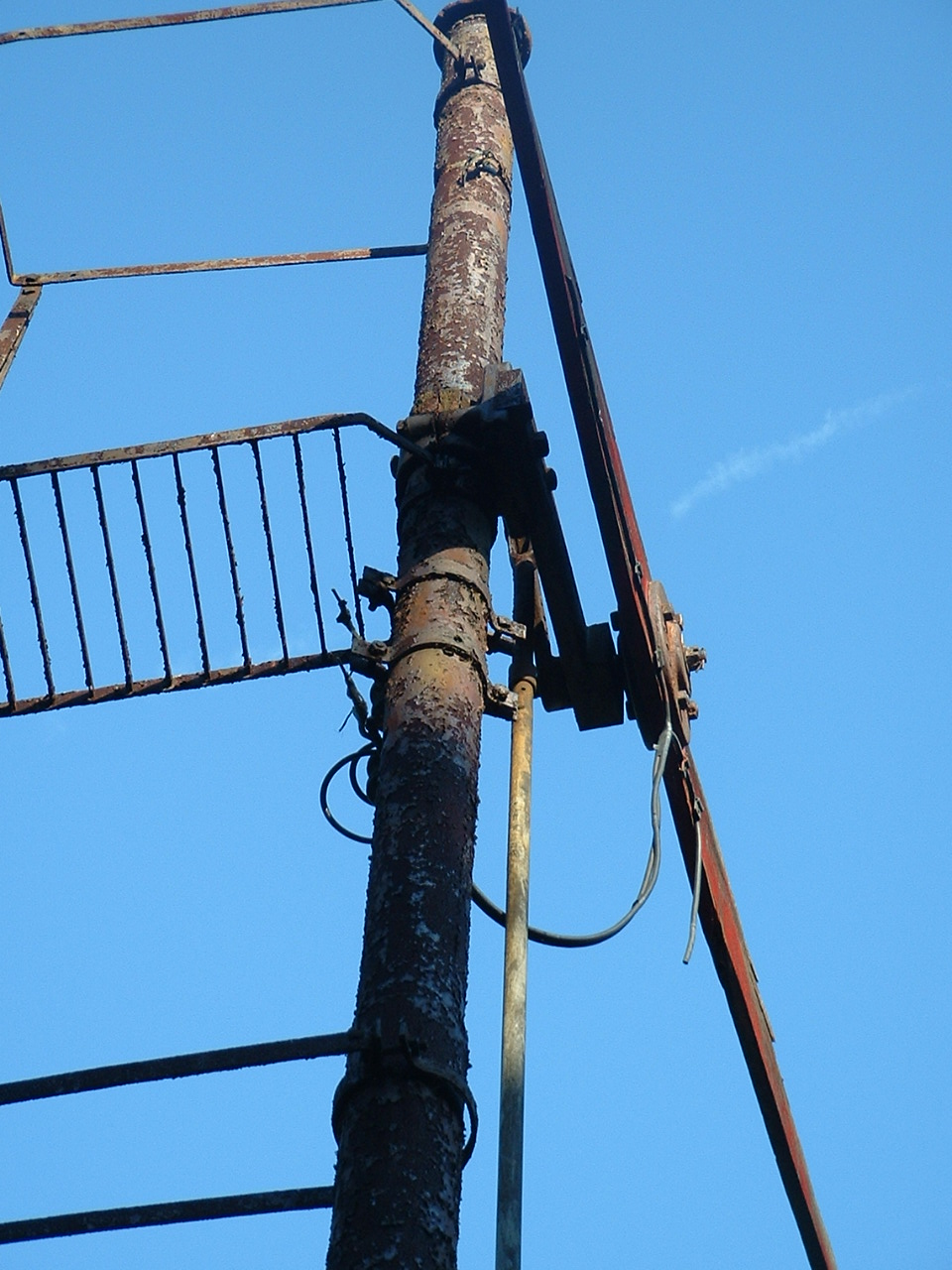
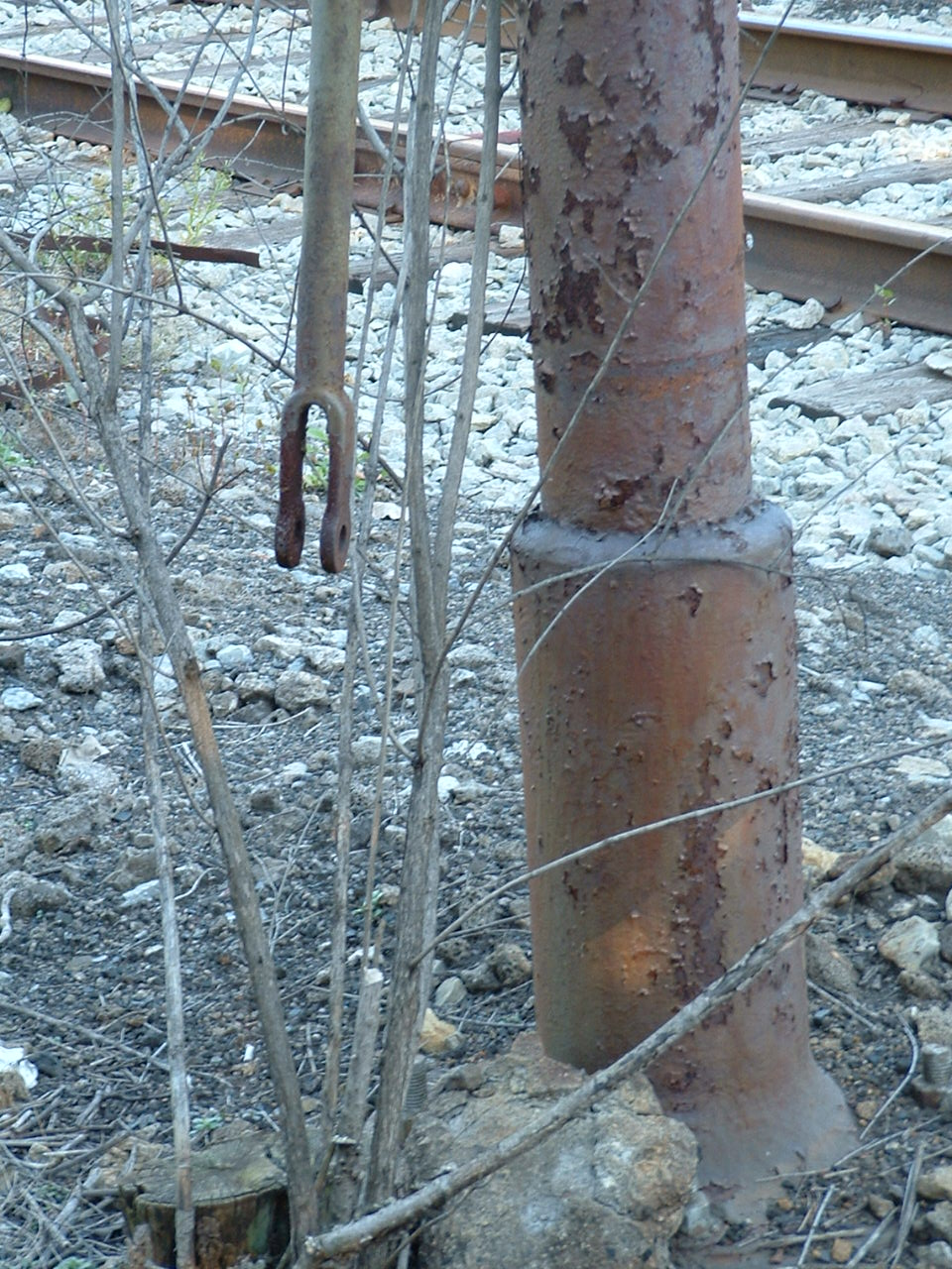
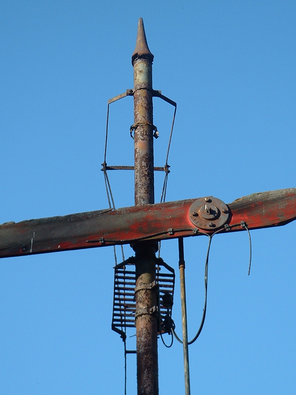
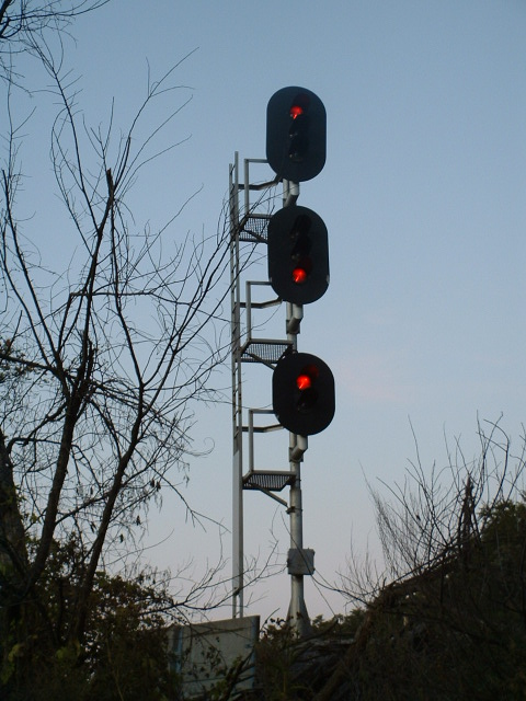
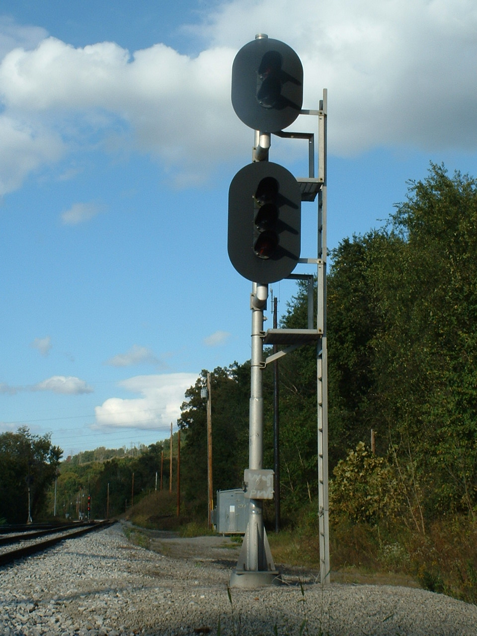
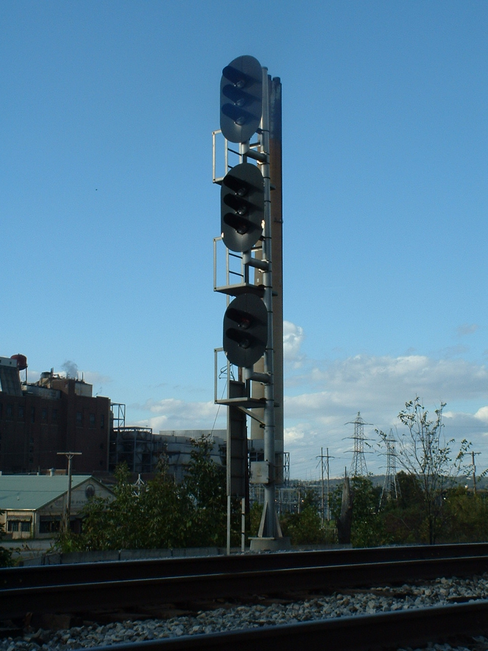
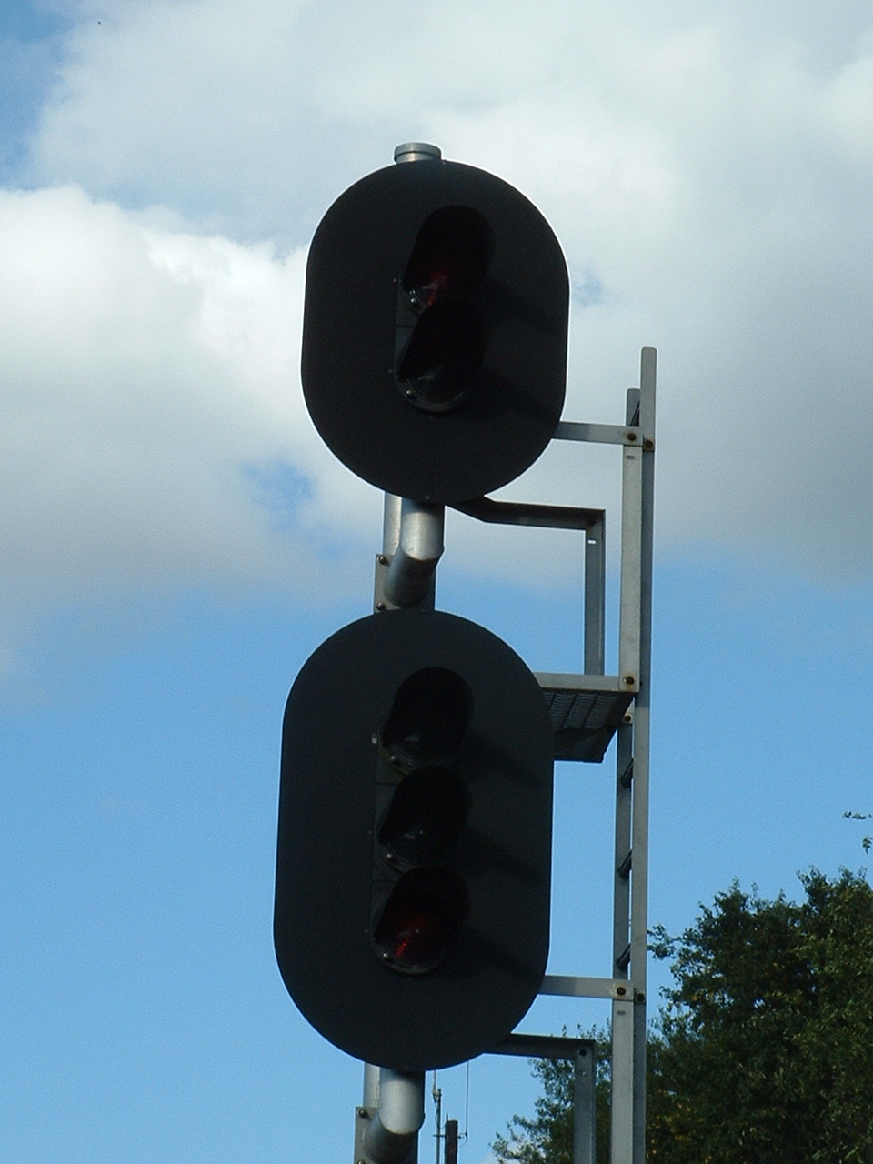
Tilting Target Signal
Data:
GPS Coordinates: The center of town is at: 40.99985, - 80.34730
Phone A/C: 724
ZIP: 16101
Access by train/transit:
None
The Scoop:
Nestled in the northwest corner of Pennsylvania is this cool little town of New Castle.
Back in 2004, I had the opportunity to visit New Castle for a week because of business. The company I worked for had a field engineer living here, and he serviced stuff in Cleveland, Pittsburgh, and Youngstown - I came here to fill in for him for the week. The trip here also very nicely coincided with the Railfest in Altoona on the weekend before the visit, and the EBT Fall Spectacular on the other side of the trip... and no, I did not pick the week :-) I was lucky to be able to spend the day on Friday chasing trains instead of doing the boring work thing, and was able to go for a cab ride to boot!
New Castle is a busy little spot in NW PA, and has a bunch of stuff for the well-rounded and ambitious railfan to take in, including:
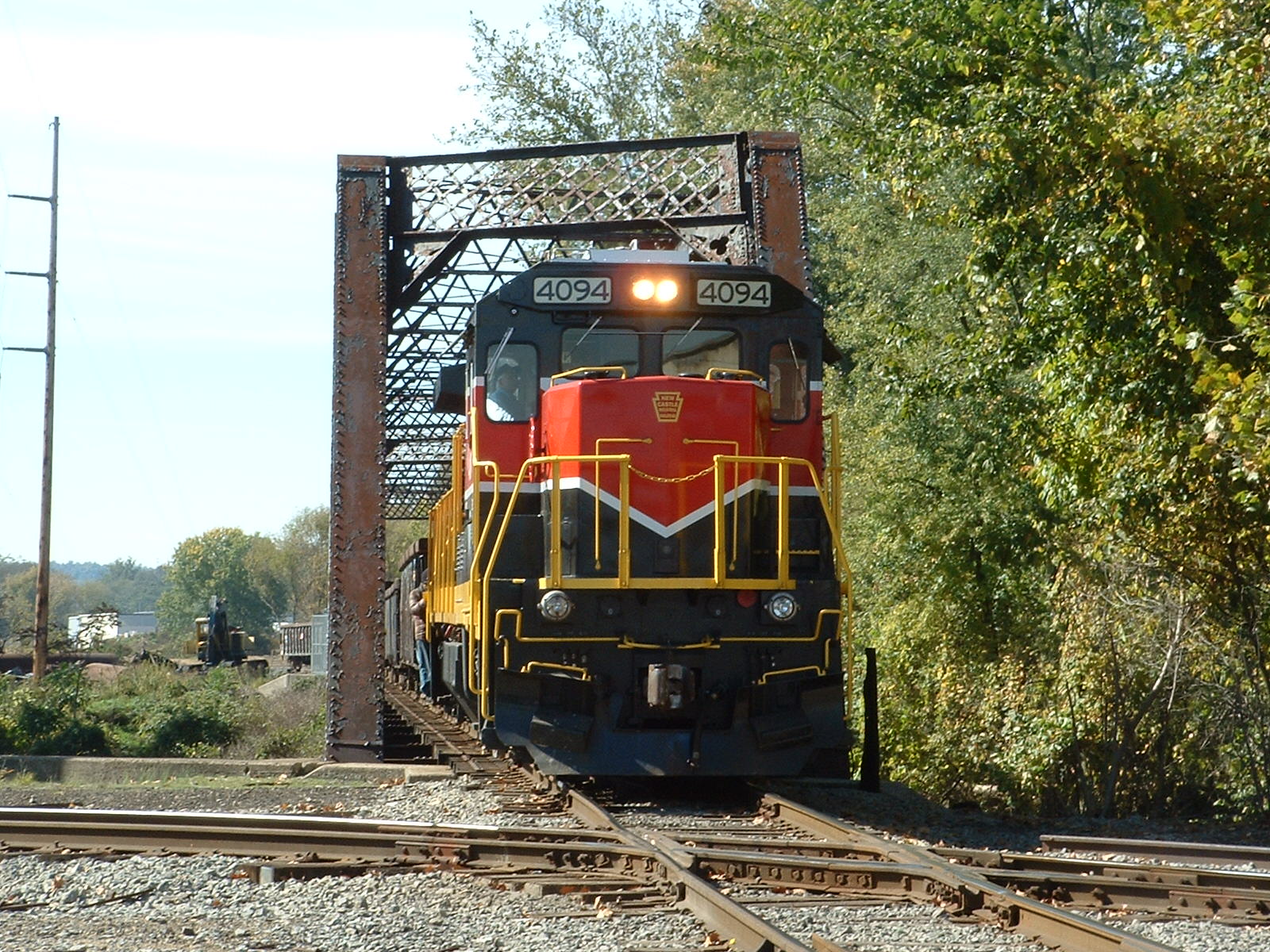
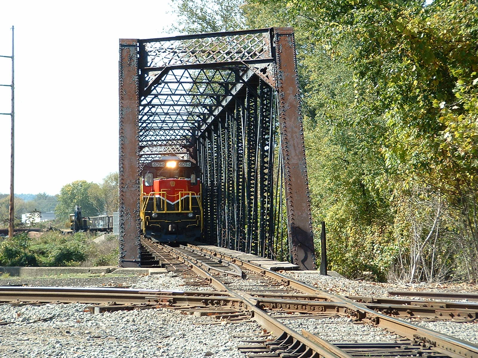
-- The New Castle Industrial RR
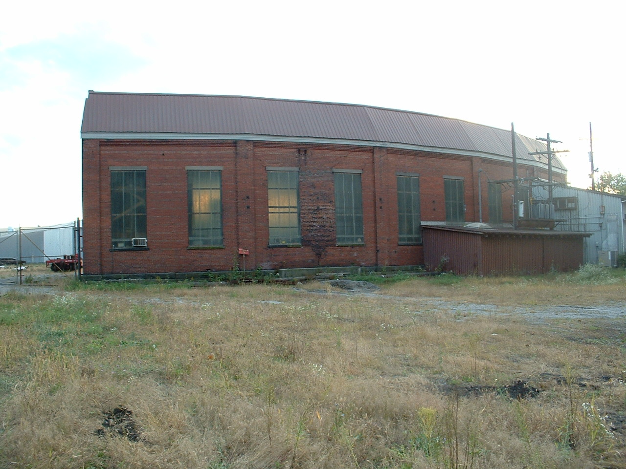
-- Former Erie RR Freight Station
-- Former P&LE Depot
-- Former B&O Depot - The Beaver Lawrence Railroad Historical Society ("down" in West Pittsburgh)
-- CSX's New Castle Yard
-- Through freights on CSX, they go thru their yard
-- Through freights on the Norfolk Southern, a hair to the west
-- Kasgro - a supplier of large load freight cars
Please note: There are plenty of opportunities for taking pictures and having them posted on this page if you feel so inclined, as I could use good recent pictures of the signals, depots, and bridges. Thanks. Credit is always given!
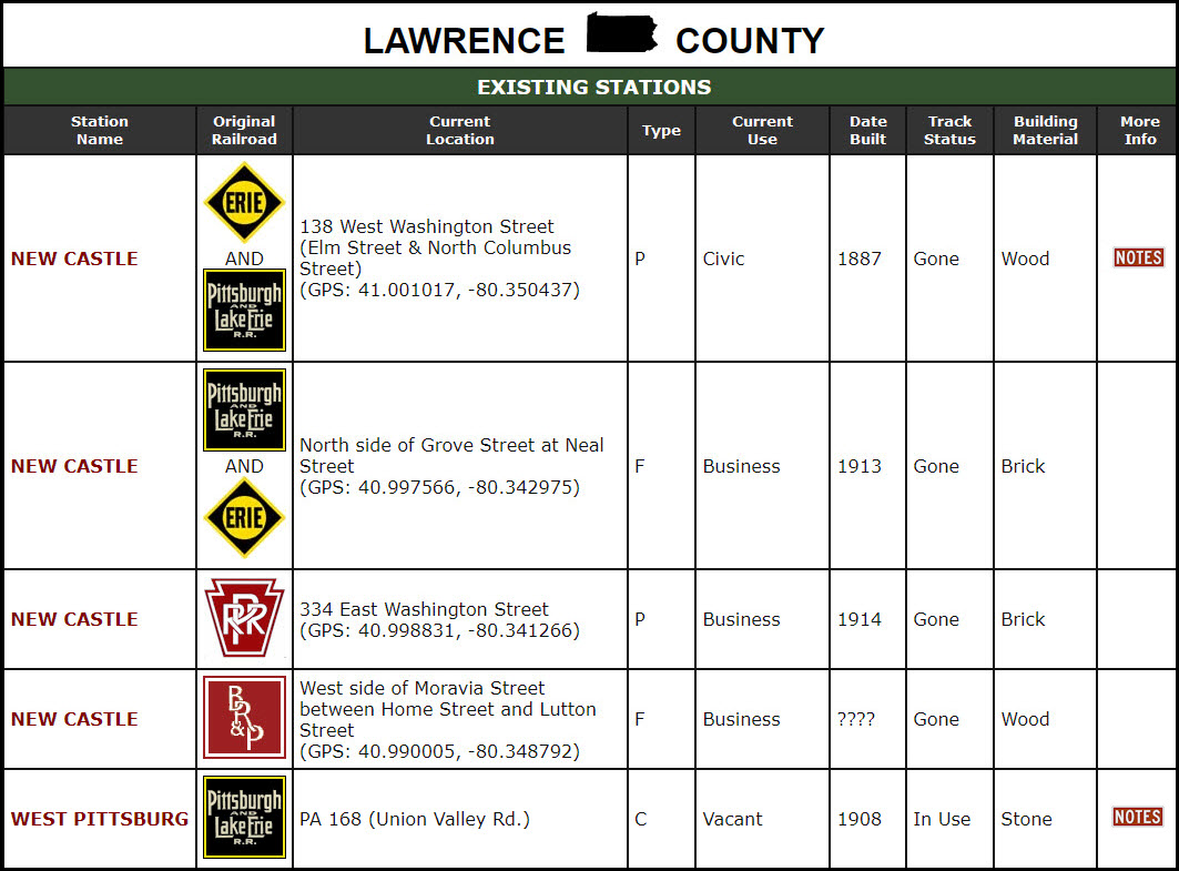
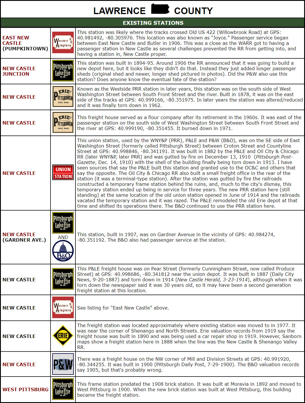
Here are the stations listed by west2k.com for the New Castle area (edited for clarity):
Acknowledgements:
Steve Raith
west2k.com
Denver Todd
Websites and other additional information sources of interest for the area:
http://www.angelfire.com/pa2/beavervalleyjunction/index.html Beaver Valley Junction NRHS
http://www.angelfire.com/film/prrpics/BVJCpages.html another Beaver Valley Junction NRHS page
http://hawkinsrails.net/shortlines/ncir/ncir.htm the New Castle Industrial RR website
https://www.west2k.com/pastations/lawrencepa.shtml lists the depots of Lawrence County, where New Castle resides
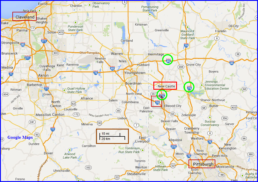
New Castle is roughly 45 miles NW of Pittsburgh via I-376, 15 miles east of Youngstown, and about 95 miles east of Cleveland via I-76 and I-80
From Pittsburgh northside, take I-79 north to exit 99, US 422 (New Castle Rd), and head west for about 12 miles to downtown.
Otherwise, I would shoot up I-376, which brings you almost to downtown New Castle.
From the Cleveland area, its I-80 east to exit 1, I-376, and head south. Remember, heading east on I-80, we've just entered Pennsylvania!
From the Buffalo/Batavia area, take I-90 west to exit 22, I-79, at Erie, and head south on I-79 to exit 99, US 422.
From Binghamton or Scranton, take I-81 south till you hit I-80 (exit 151 at Hazelton), and head west on I-80 till you reach I-376 as above.
From Harrisburg and west via the Pennsylvania Turnpike, you can get off at either I-376 (prefered) or I-79, and go north on both.
You could also go there via US 322, up to I-80 thru the State College area, but I don't know if it is a viable alternative unless you know someone there or want to get pictures around that area.
From Baltimore and DC, it's I-70 (and I-270 if coming out of DC) to the PA Turnpike at Breezewood, and head west to I-376.
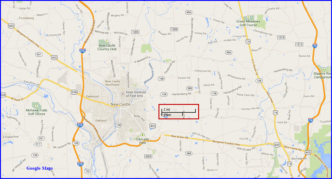
Maps
The above map in PDF format is available
here
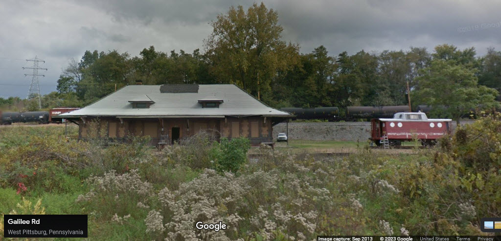
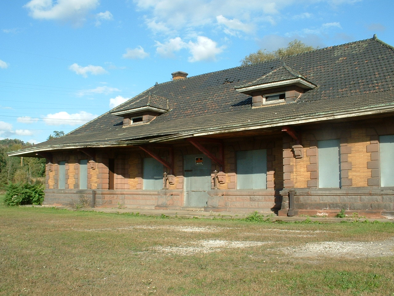
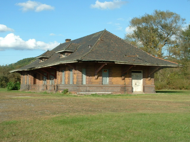
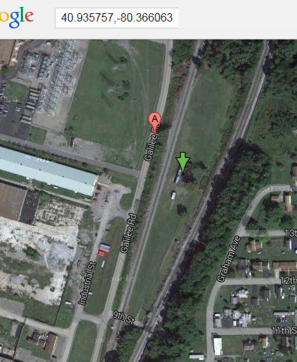
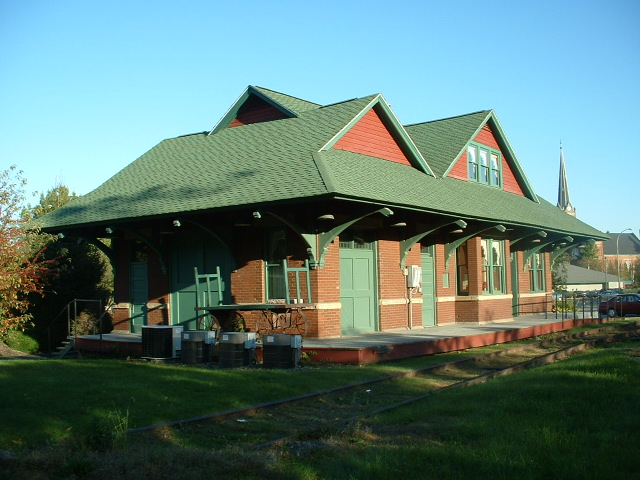
GPS Coordinates: 40.935757, -80.366063
805 9th Street, West Pittsburg PA, 16160-0405
Shame on me, I didn't write down the specifics of these depots, as I had a guide show me all of them and told me "stuff" about them.... this one was built by the P&LE, but was also used by the B&O, The CSX (ex B&O) tracks run along and above the depot on a fill.
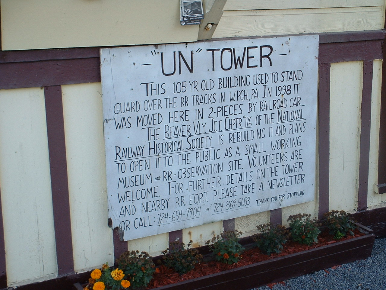
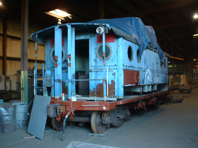
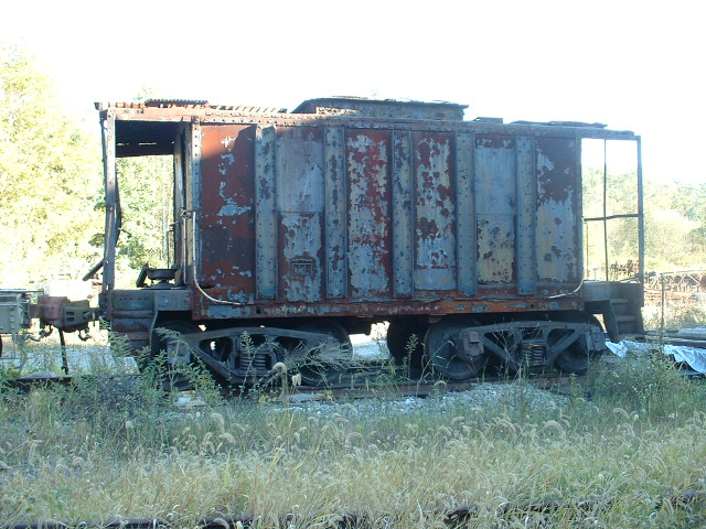
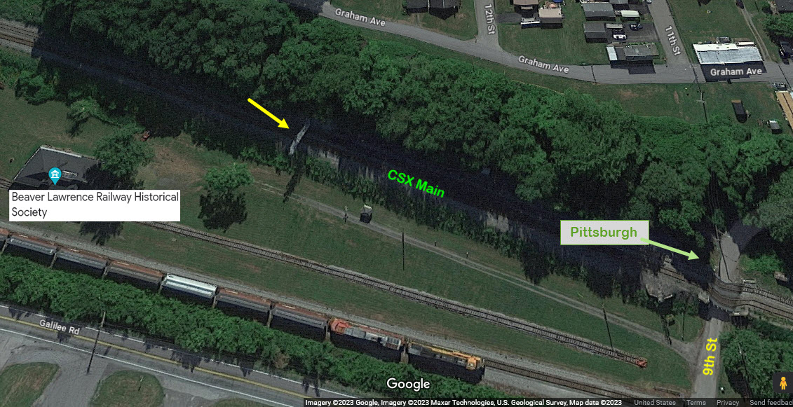
This depot is a restoration project of the Beaver Valley NRHS, scuze me, the Beaver-Lawrence Railway Historical Society. They are no longer affiliated with the NRHS, and stand alone in their mission to bring you historical railroad "stuff" from the western Pennsylvania area. They took possession of the depot in 2005, and using the 4 acre grounds to put their collection on.
From the BLRHS website: The Pittsburgh and Lake Erie Railroad's West Pittsburg Station was built by W.F Trimble & Sons at a cost of $32,544.54. Opened in 1907, the 32' x 85' sandstone block and brick building had a tile roof with glass tile in the center that let light into the main waiting room. The glass tiles were painted black during World War II to prevent the station from being easily seen from the air at night.
In addition to the main waiting room (which was for men only), the interior included a women's waiting room, men's and women's toilets, ticket office, baggage room, storage closet, and a coal bin.
Passenger service to the station ended in the early 1960s, thereby rendering it obsolete. Shortly thereafter the P&LE sold the station and approximately 4.5 acres of property to Ben Panella, a West Pittsburg business owner. Mr. Panella used the building for storage and later rented it to another business.
In 2004 Mr. Panella began talking with us about selling the building and property for use as a railroad museum. Within a year an agreement was finalized and the station was ours.
My pictures below are from 2004, before any of this got underway; the Google Streetview screenshot is from 2013/10 years old.

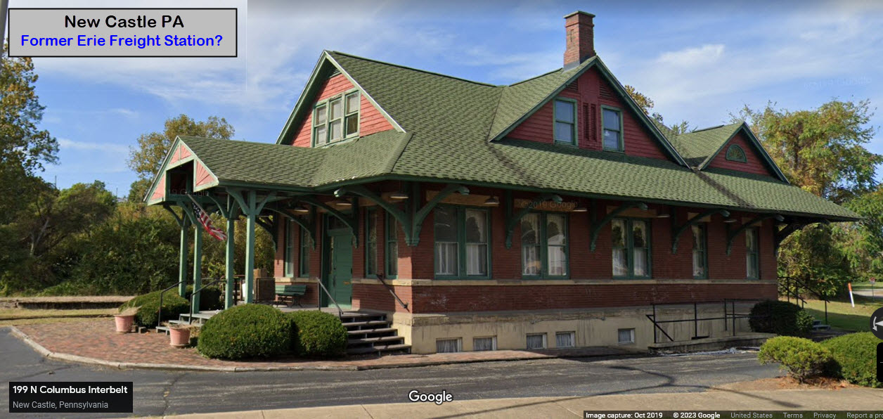
GPS Coordinates: 41.00106, -80.35039
Habitat for Humanity, 138 W Washington St, New Castle, PA 16101, or, 199 N. Columbus Interbelt
According to the list of stations in New Castle, it looks like this was an Erie RR Freight Depot, judging from the fact it lists that freight station as being near the corner of Shenango and North - Shenango is now the Columbus Interbelt in the downtown area.
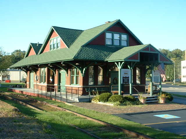
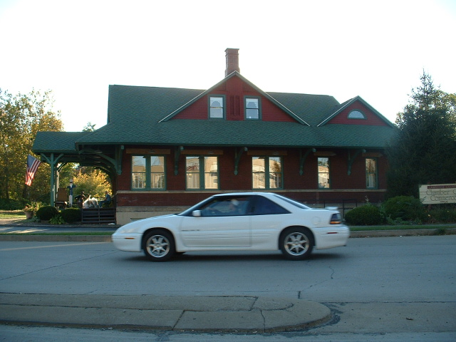
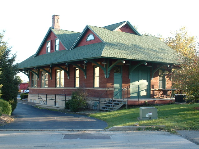
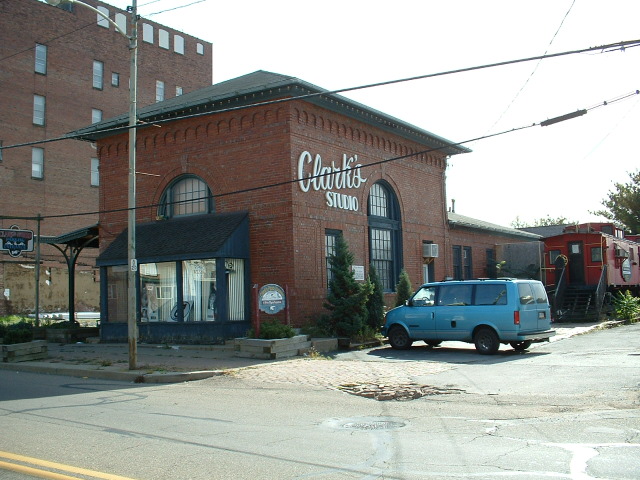
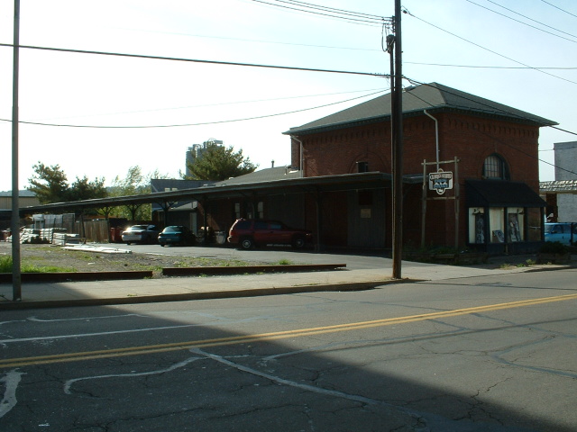
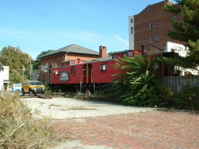
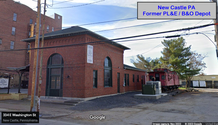
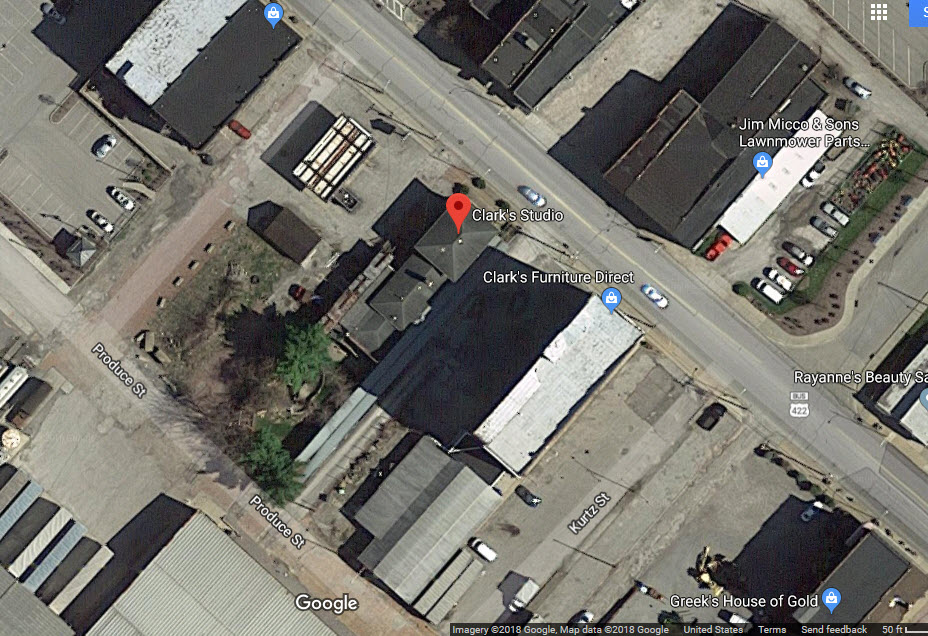
GPS Coordinates: 40.99885, -80.34127
334 E Washington St, New Castle, PA 16101
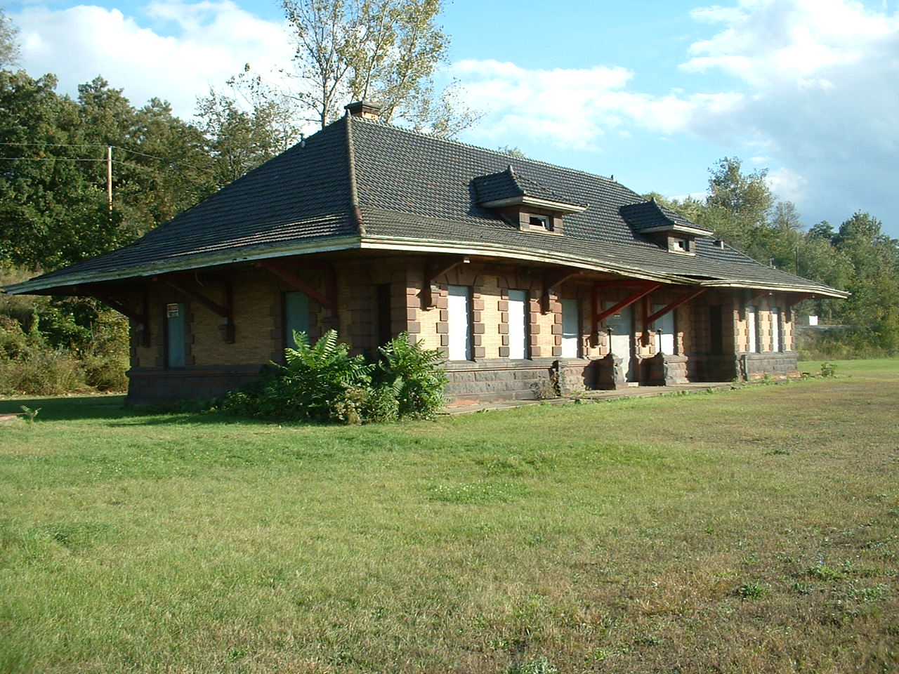
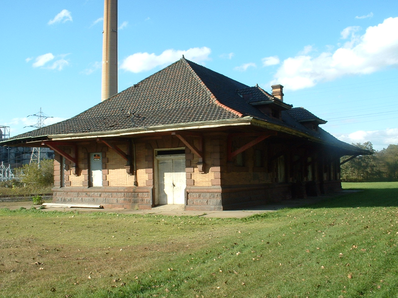
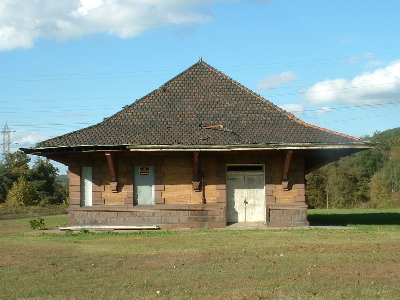
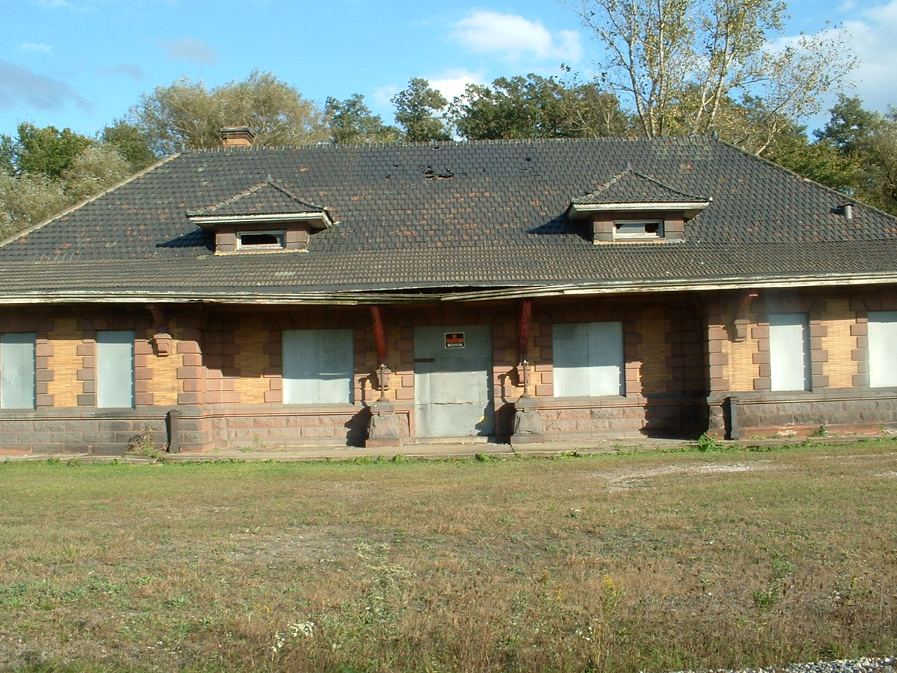
This former PL&E Railroad depot, also used by the B&O, it was owned by Clark's Studio (a photography studio), but judging from the sign out in front of it from Nov 2022, looks like it might be a micro-brewery.

 All from 2004
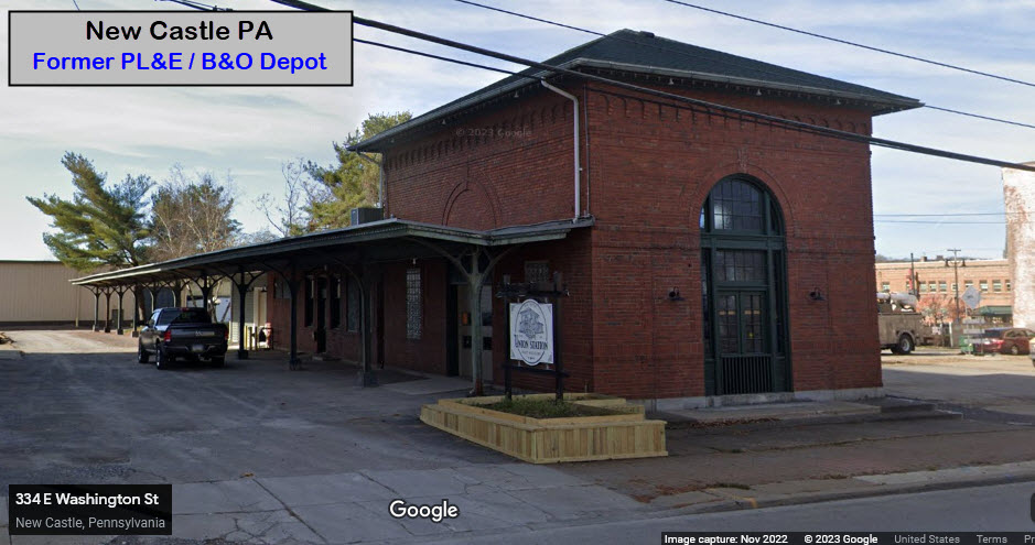
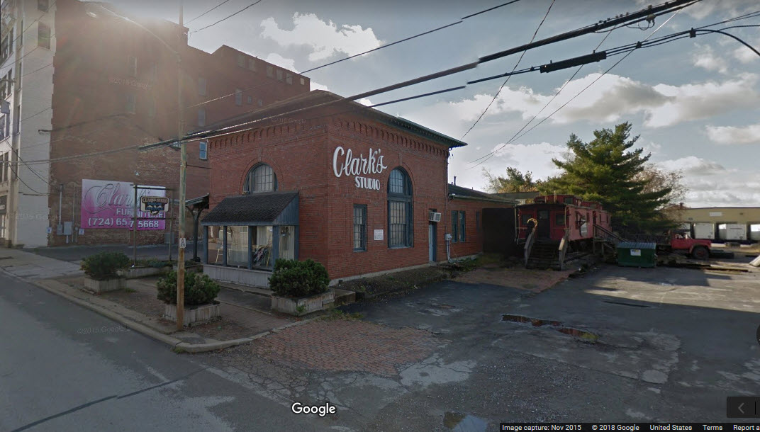 in 2015
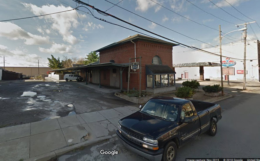
GPS Coordinates: 40.990840, -80.349284
702 Moravia St, New Castle, PA 16101
724-654-4449
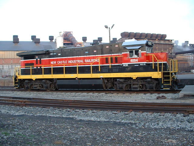
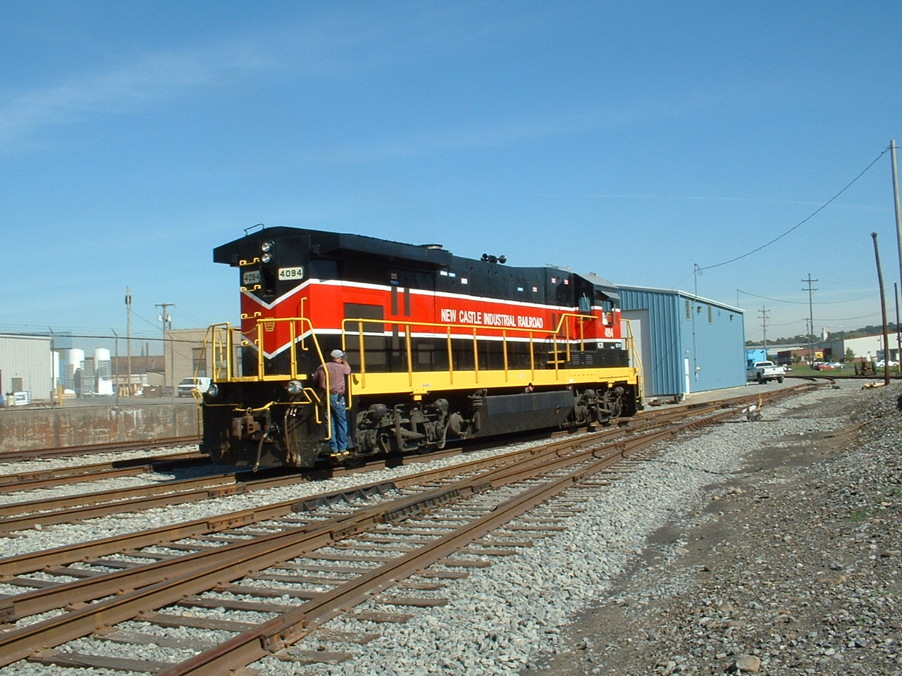
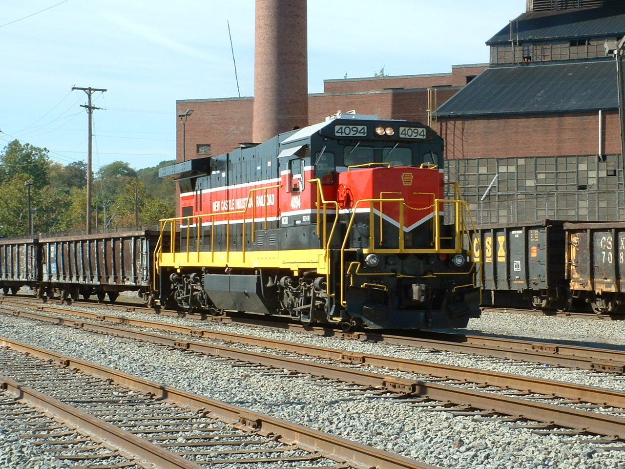
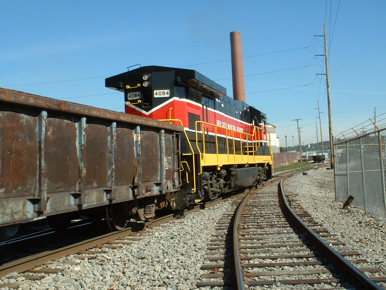
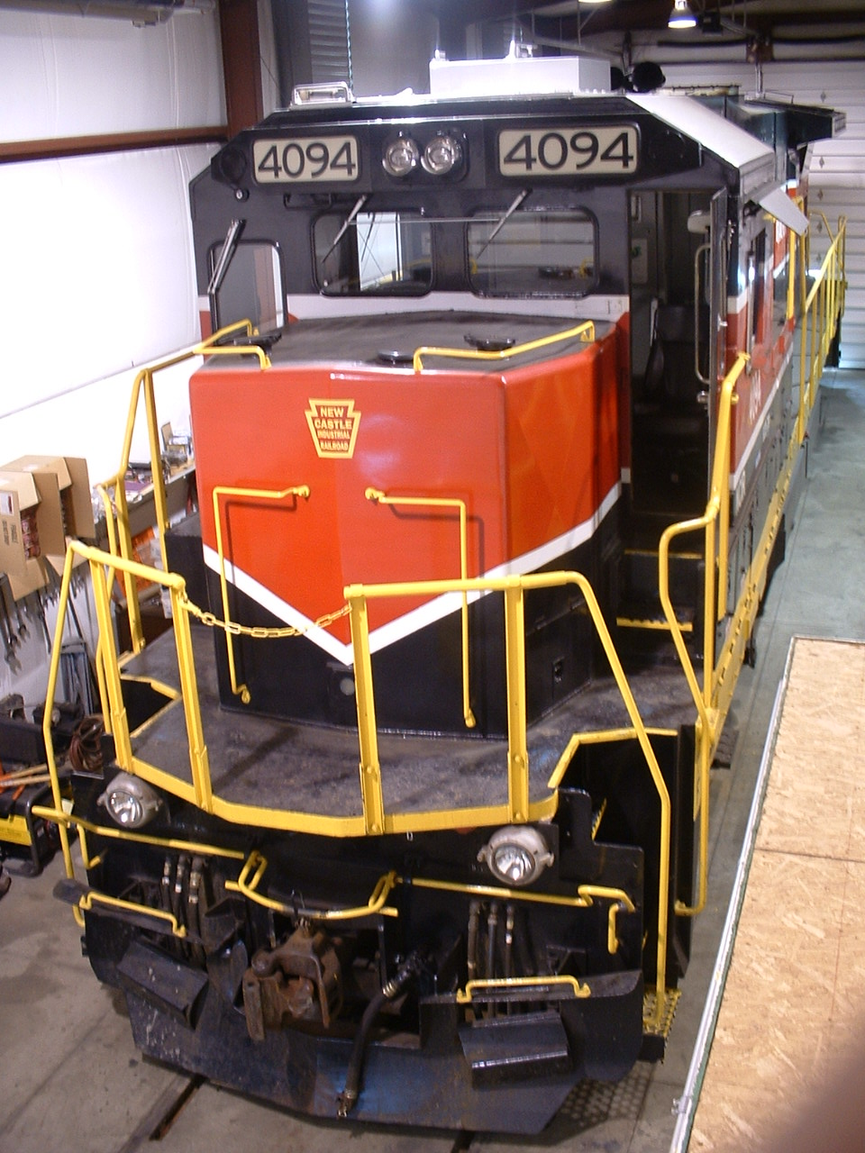
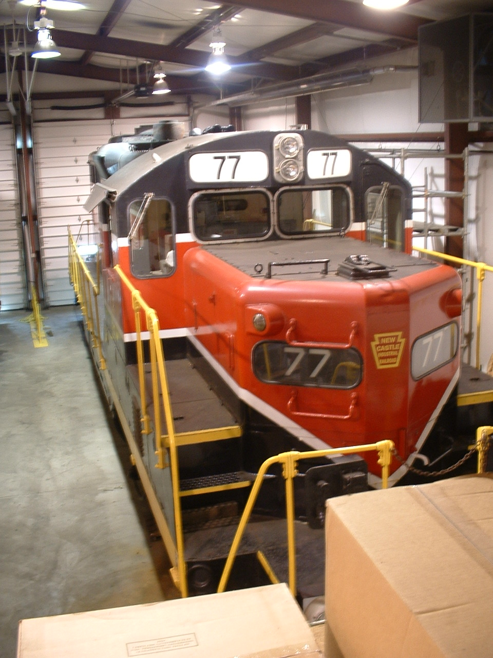
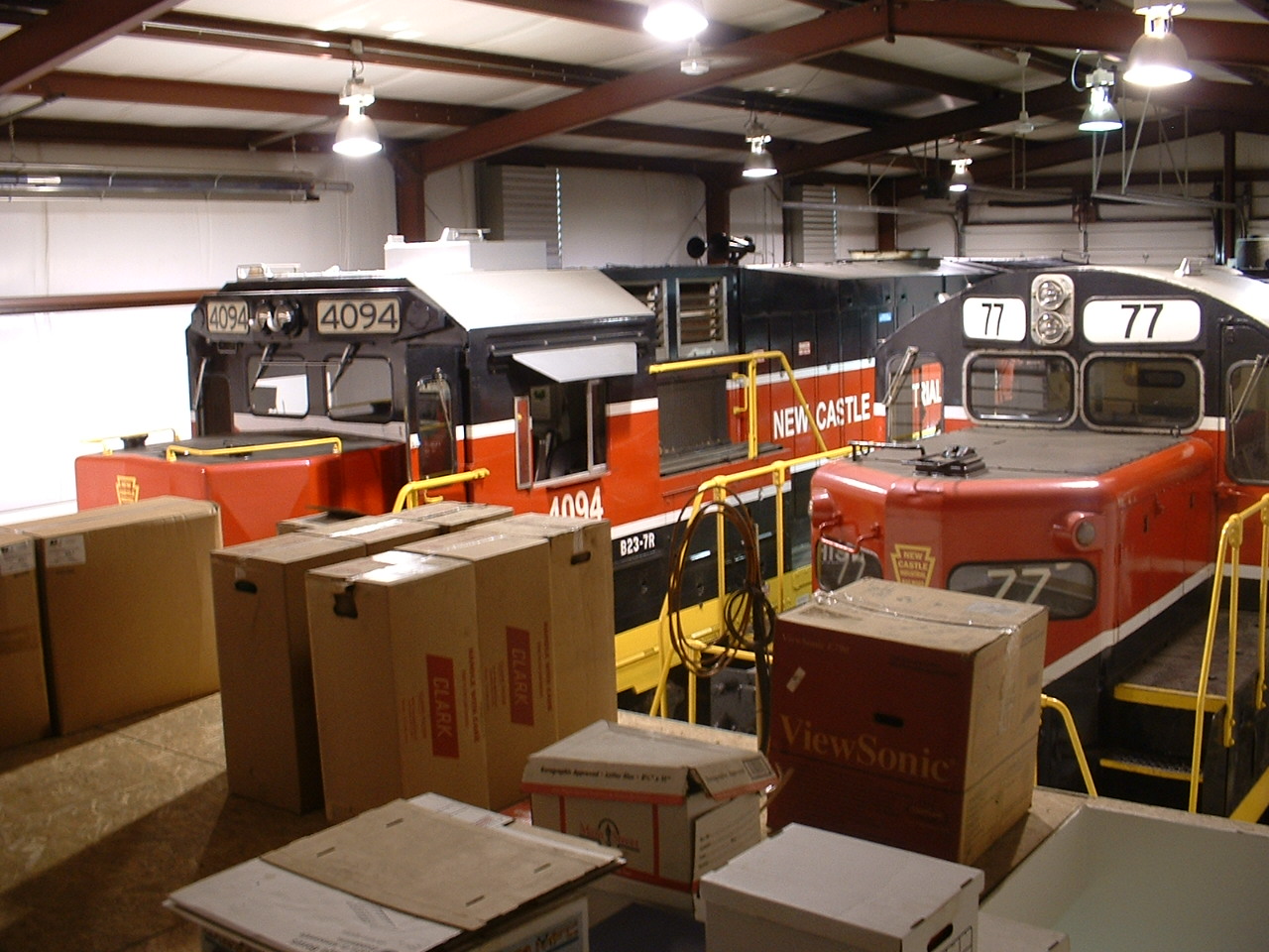
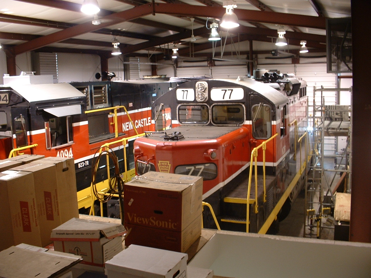
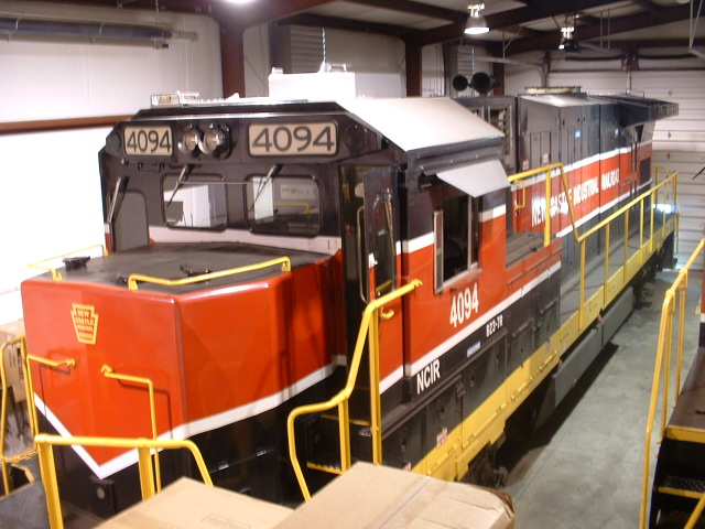
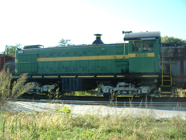
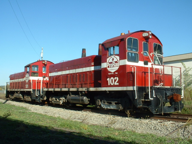
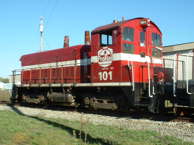
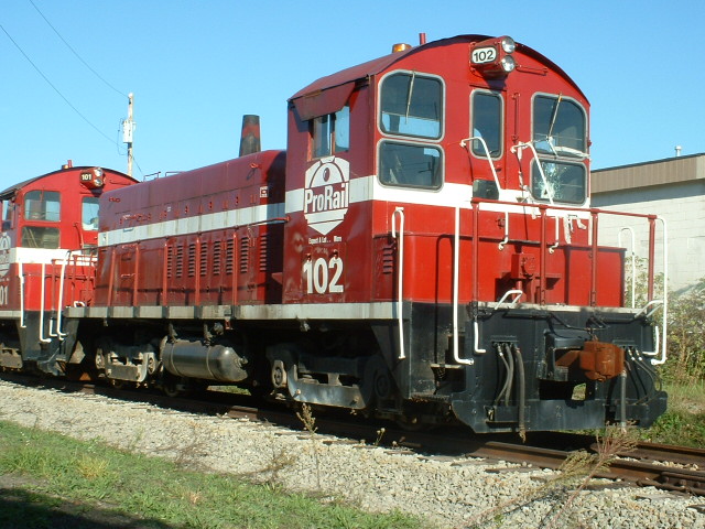
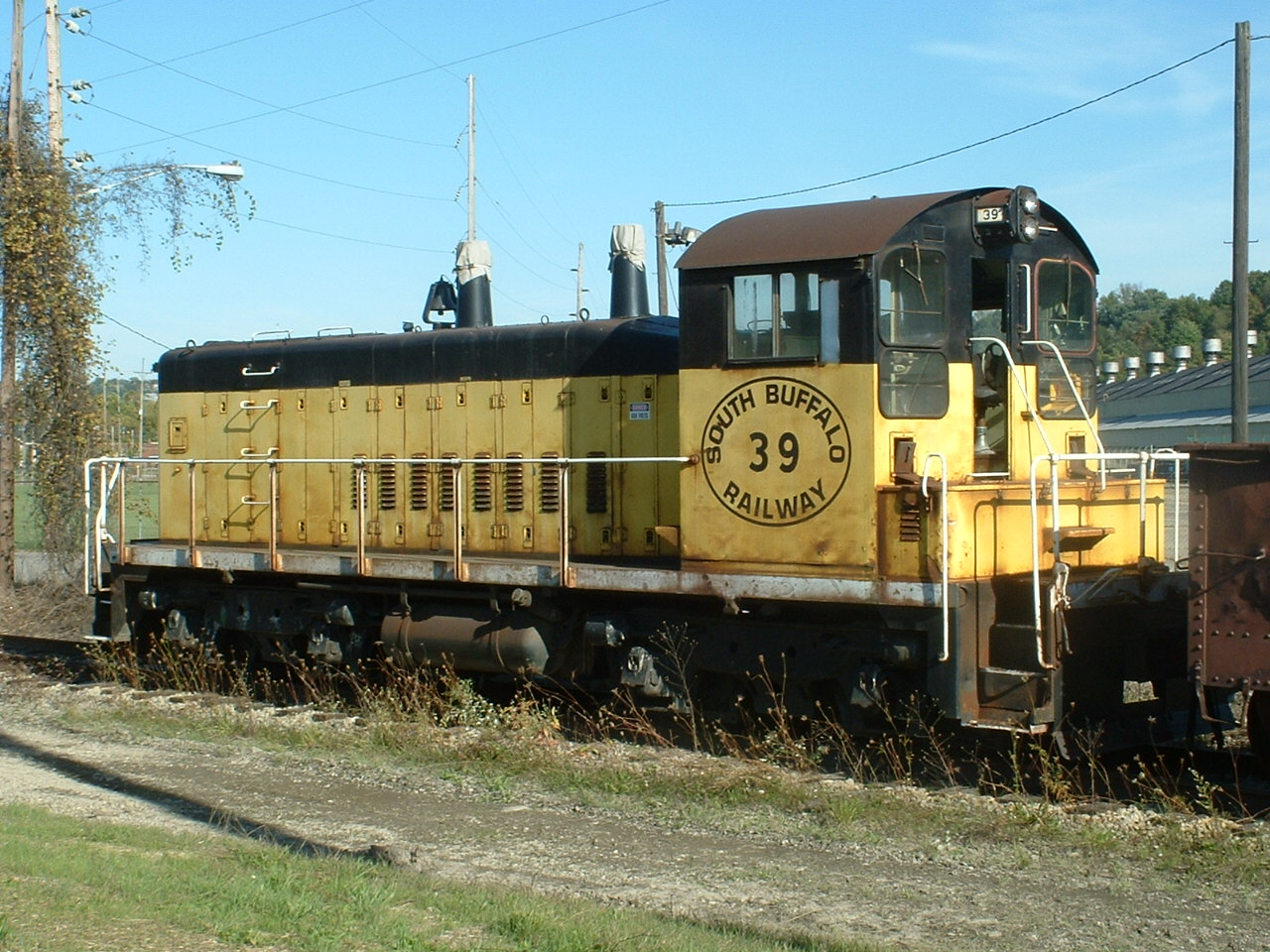
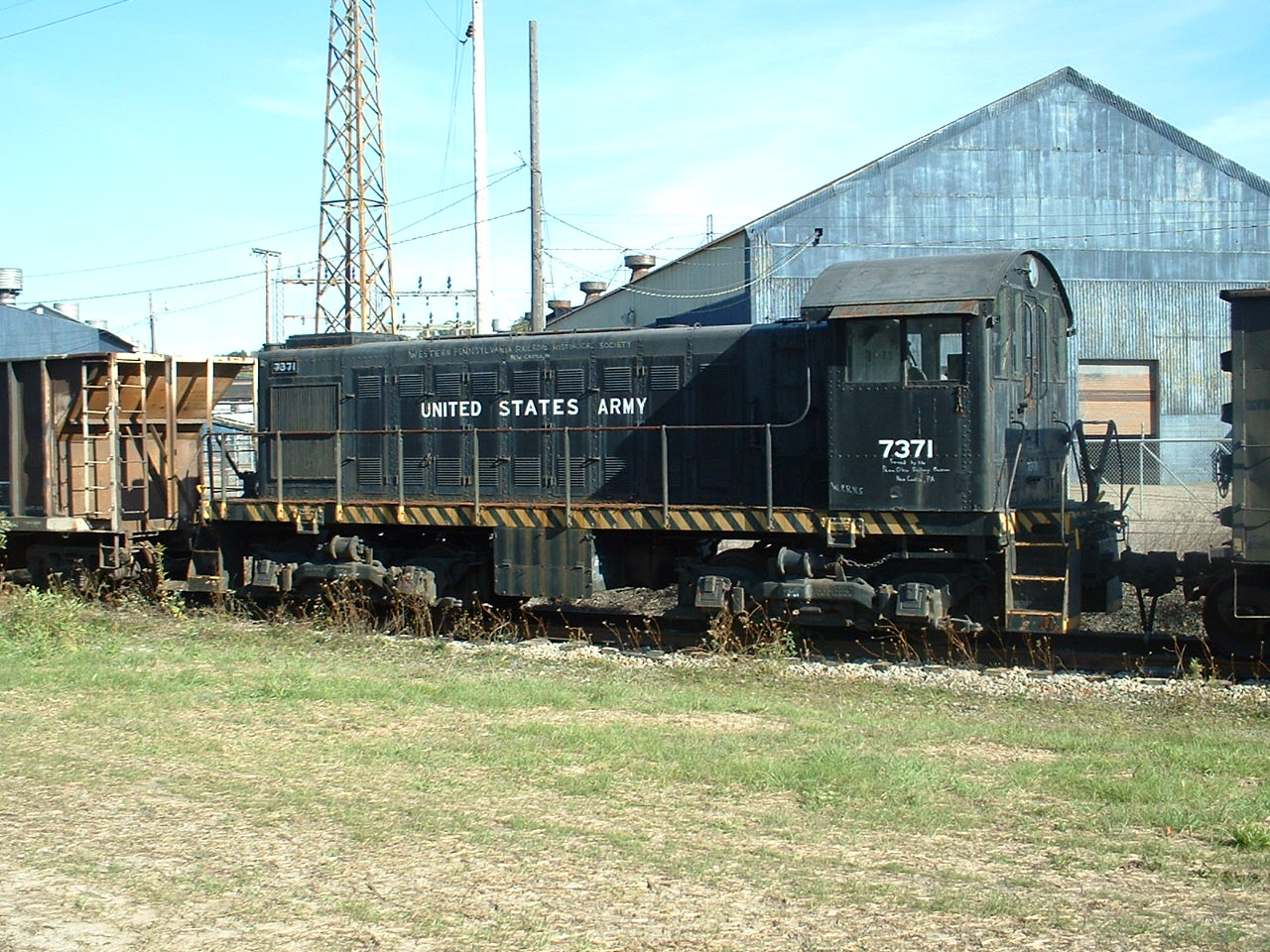
A shortline railroad serving the industries of New Castle, the railroad was formed in 1991.
Photos not taken by me, as well as the screenshot above, come from http://hawkinsrails.net/shortlines/ncir/ncir.htm
Current Engines
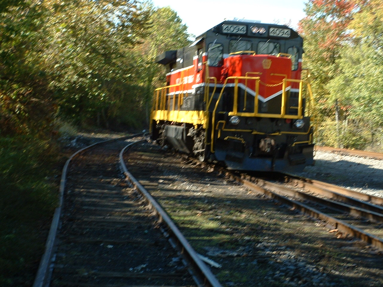
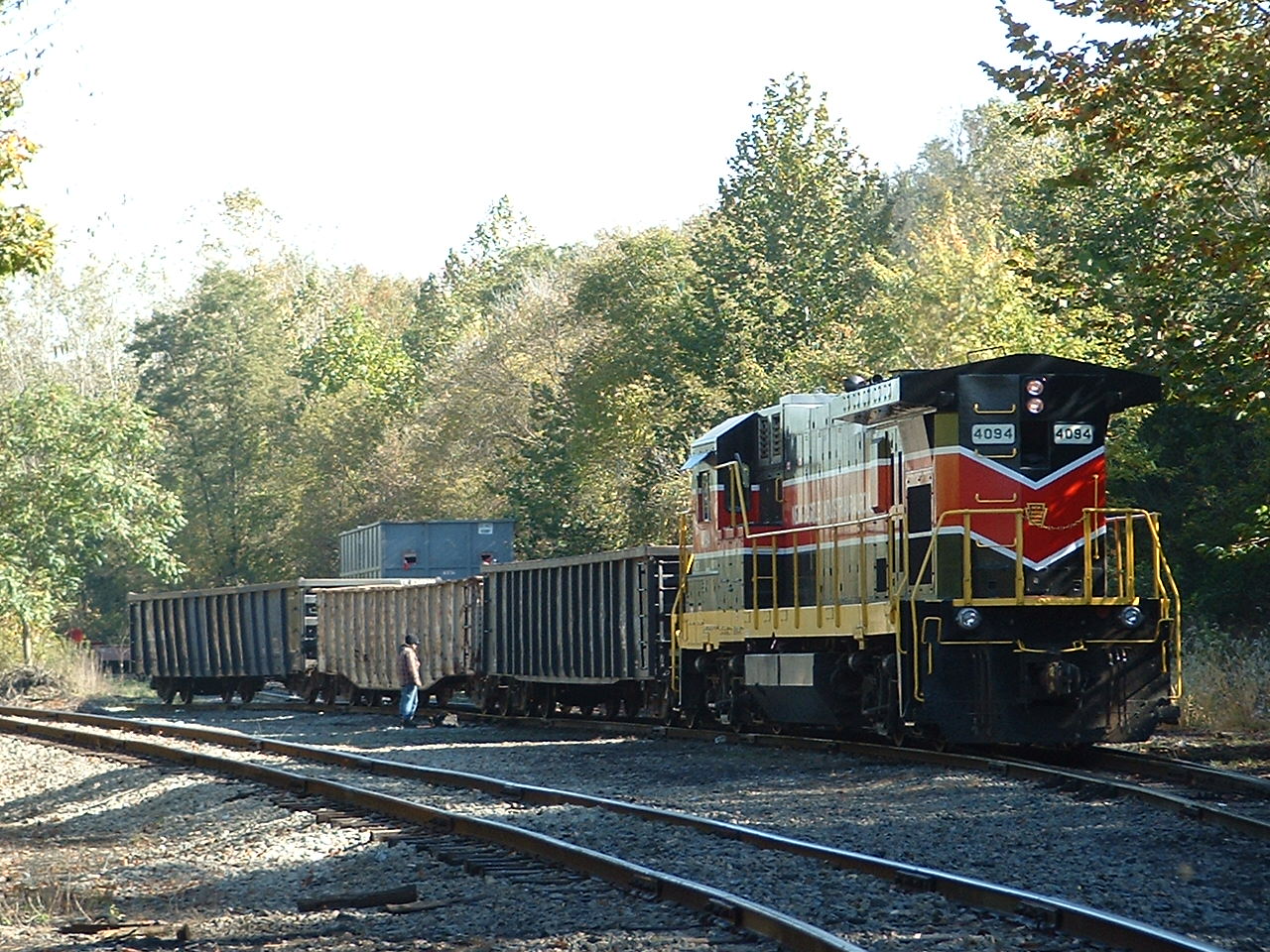
According to RWH, again, from the above web page, they have three engines. Looks like they got rid of, maybe, GE #4094.
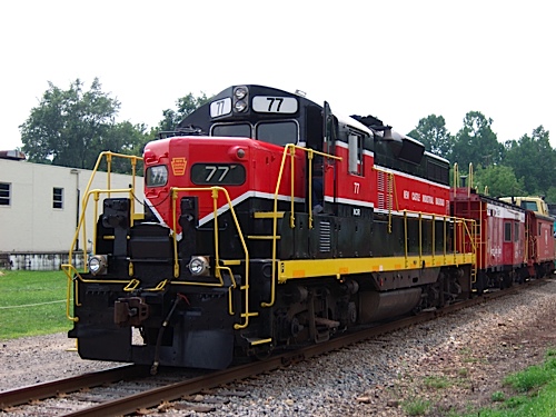
#77 is an EMD GP-9, built in 1954. It was built for the Bangor & Aroostook as #77 before the NCRR acquired it.
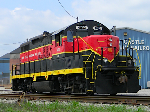
#4032 is an EMD GP-9RM, built in 1956. It was built for the Canadian National as #4517, and was also Ohio Central #4032 before coming to the NCRR.
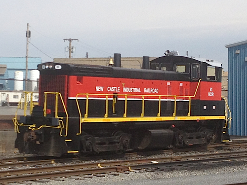
#41 is an EMD SW-1500 built in 1968. It was originally Frisco #327, then BN #32, then BNSF #3412 before coming to the NCRR.
Back in 2004


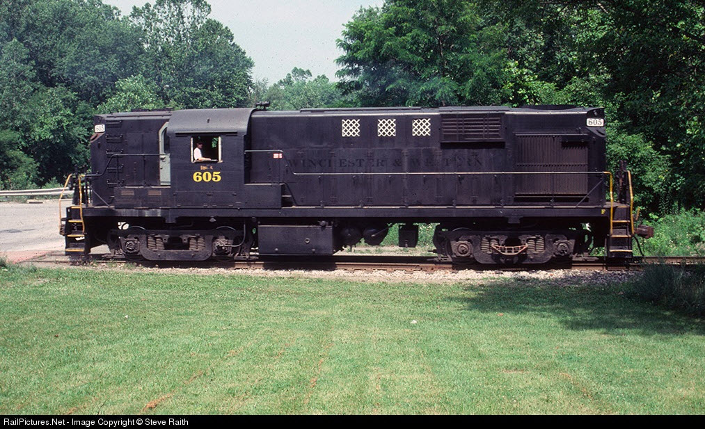 Picture of Alco RS-11 (AKA: DL-701, my fav Alco!) #605 - a former Wilmington & Western unit, from June 24th in Mahoningtown, 1998 by Steve Raith
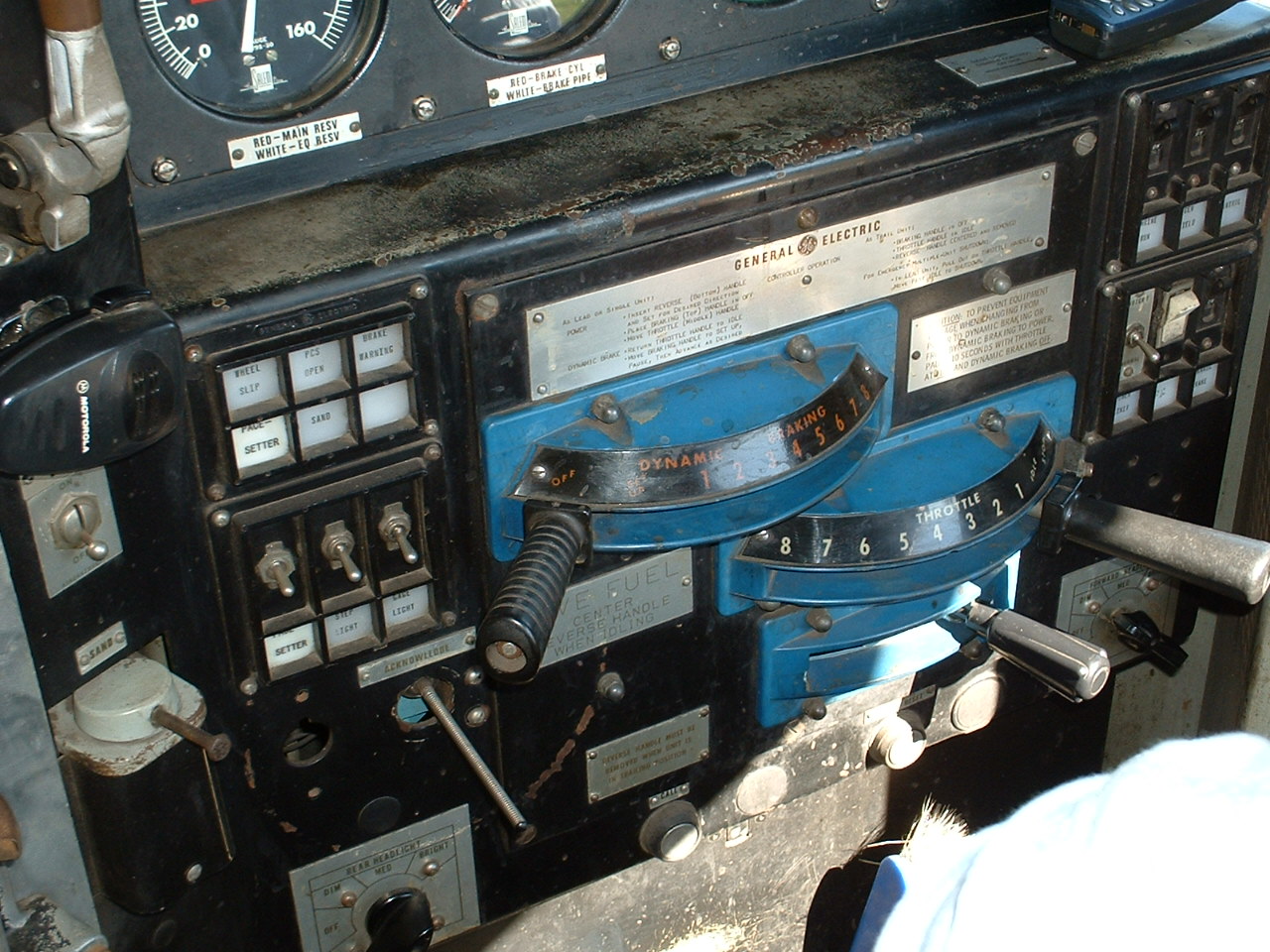
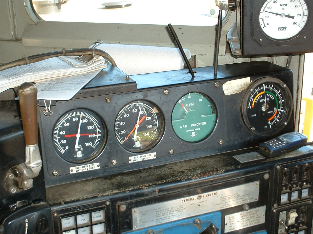
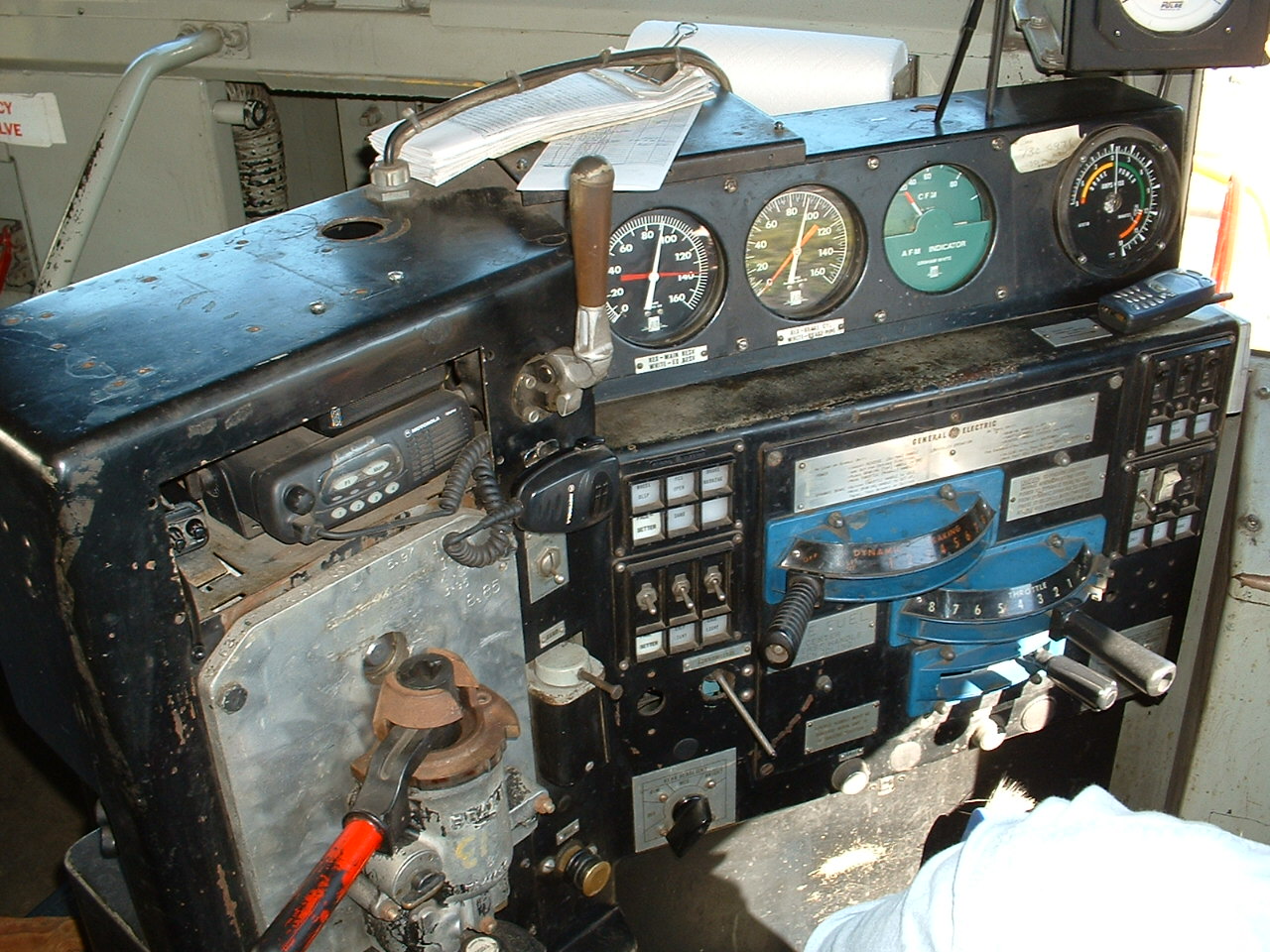
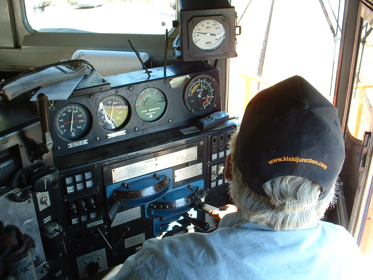
Cab Ride
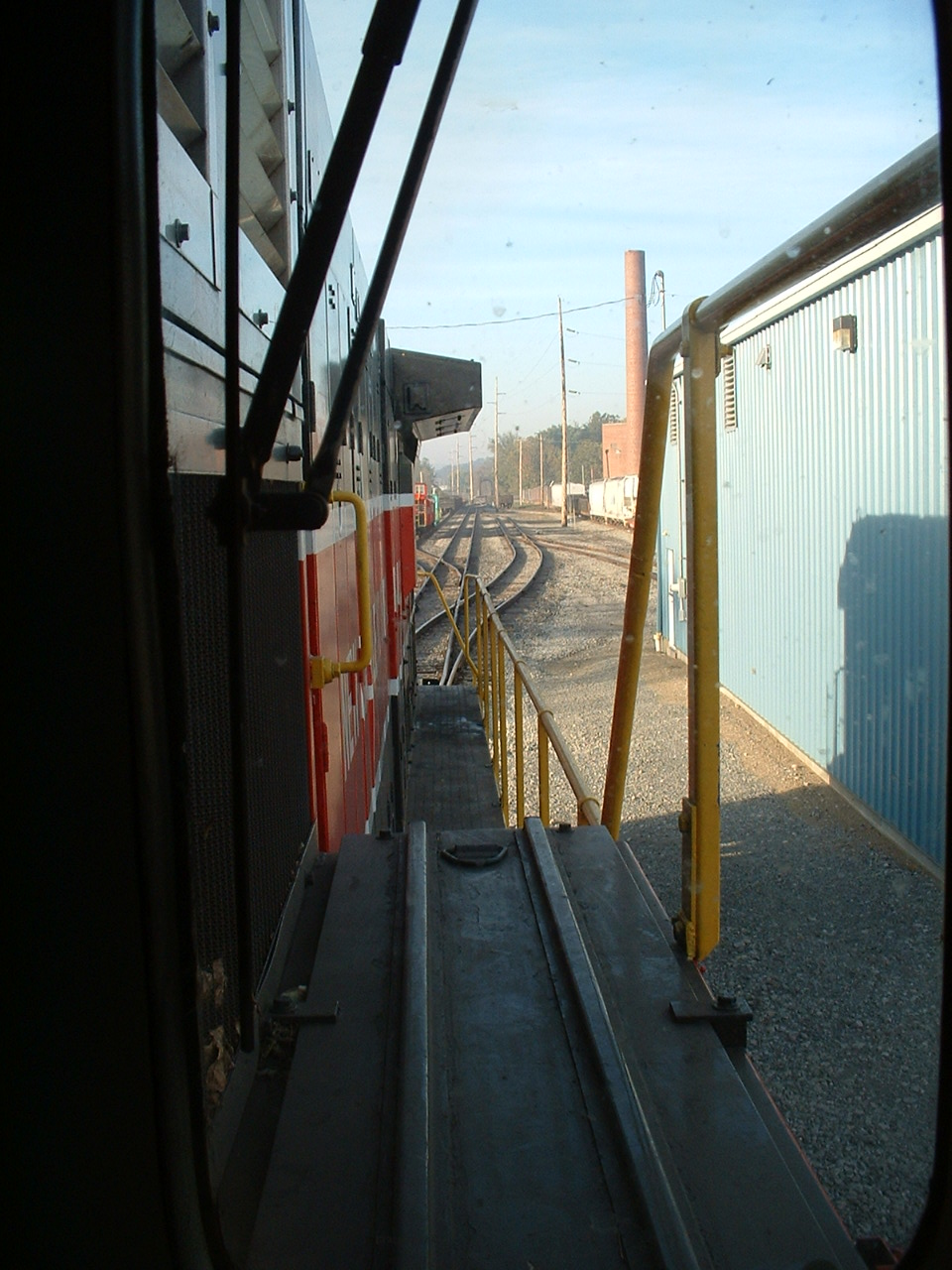
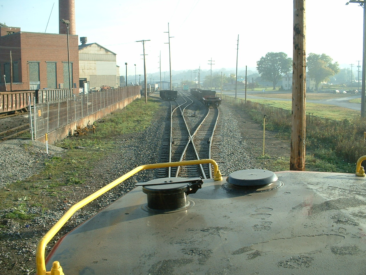
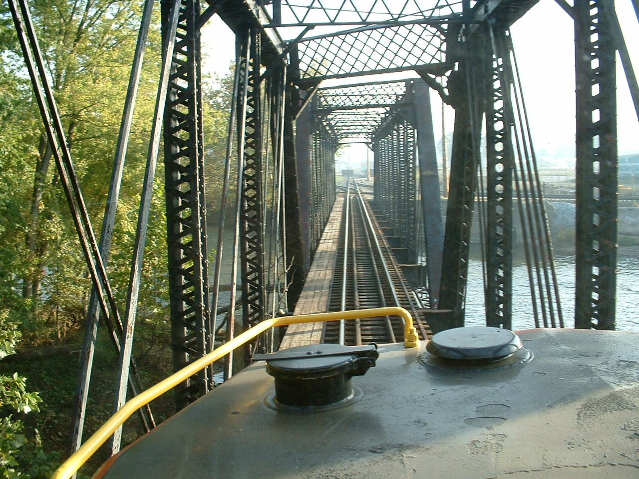
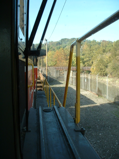
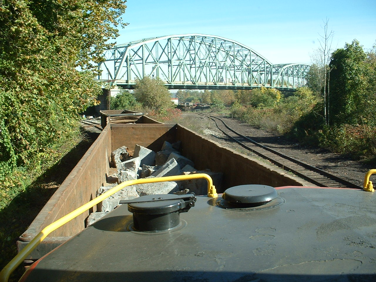
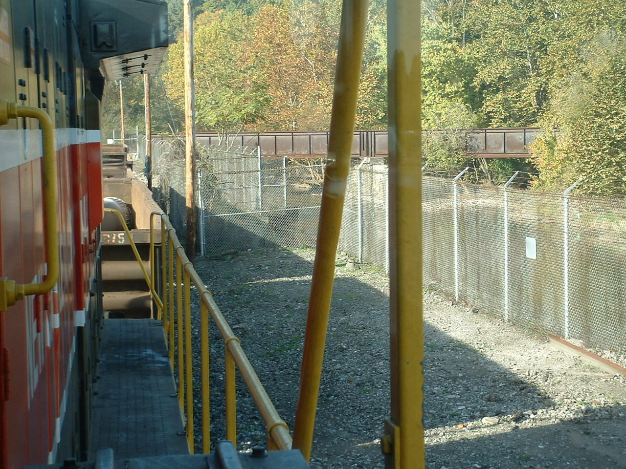
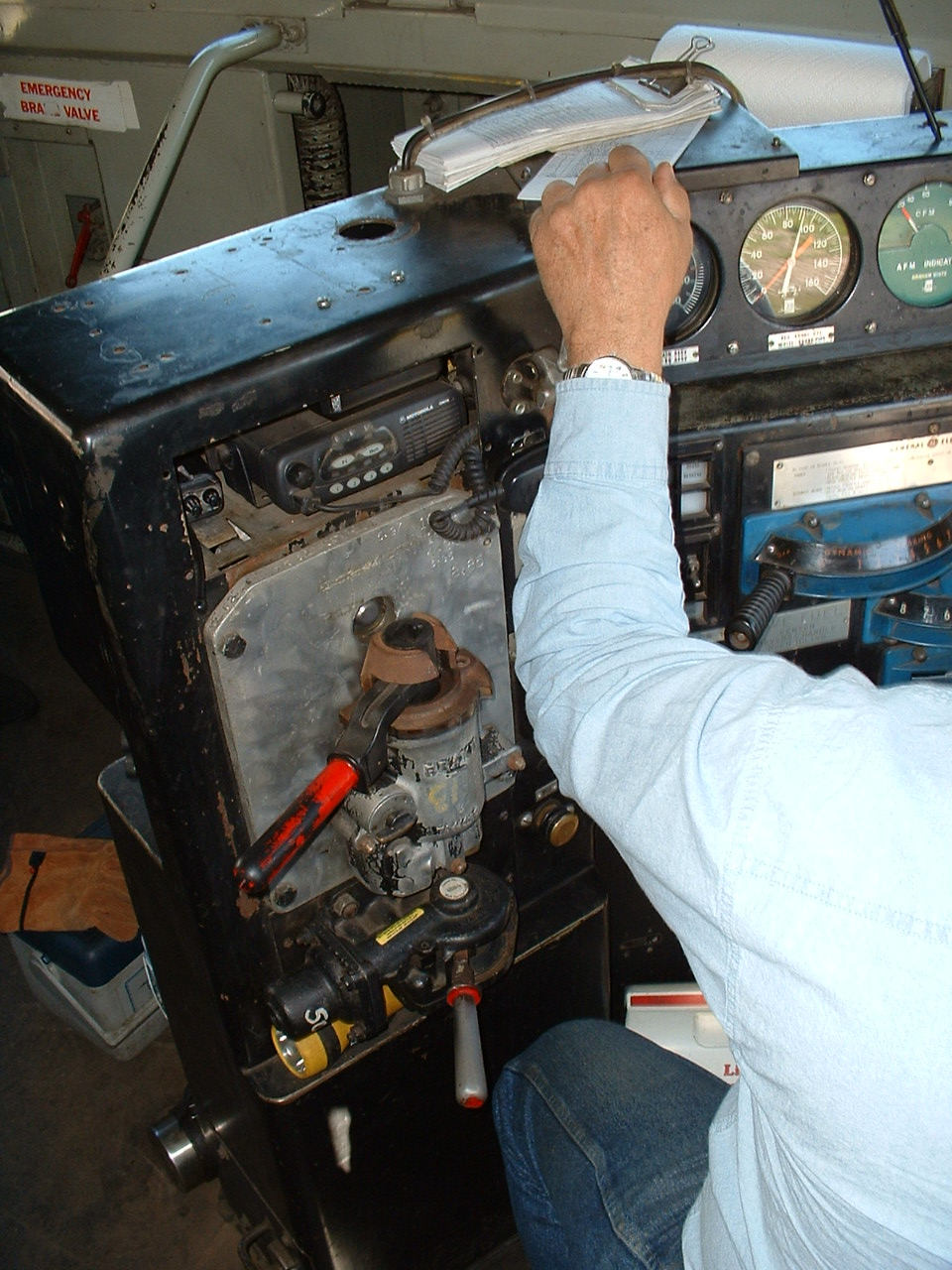
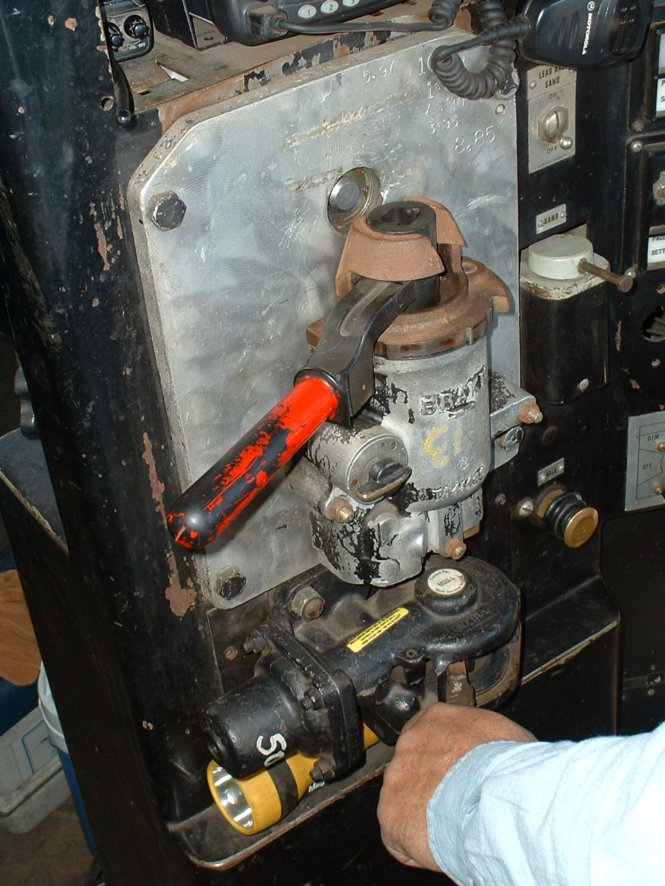
The folks at the New Castle RR are pretty darn railfan friendly, as can be witnessed from the fan trips they run, pictures of one can be found on the link above on Hawkins Rails. I was lucky enough to be able to come back at their invite for one on Friday before heading back home, via Orbisonia and the EBT Fall Spectacular!

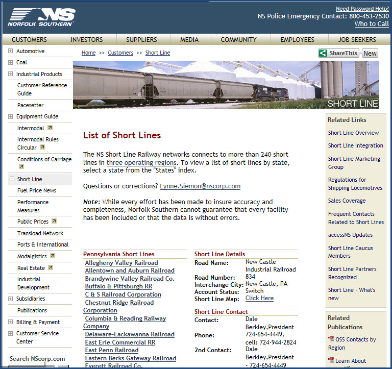
The above comes from: http://www.nscorp.com/nscportal/nscorp/Customers/Shortline/shortline-directory.html?showshortlinedetail=true&road=NCIR&state=PA
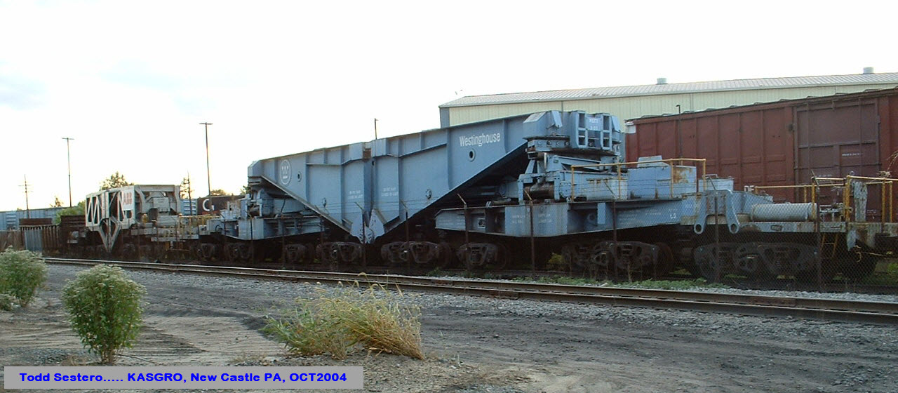
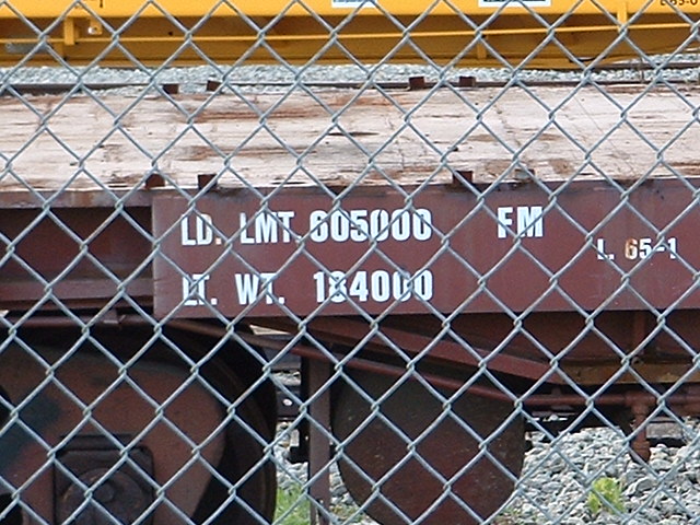
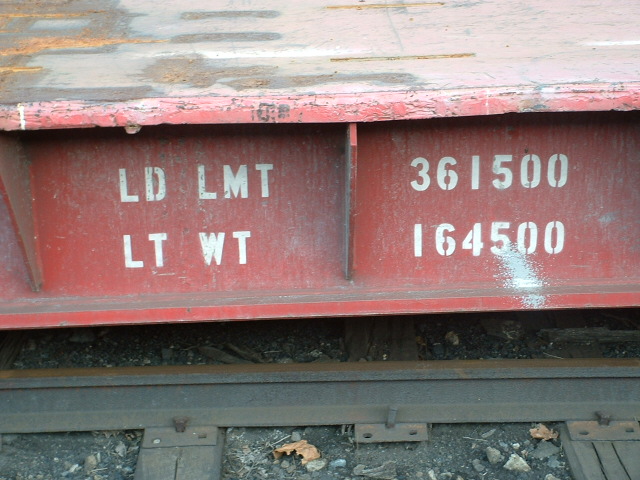
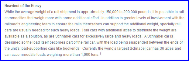
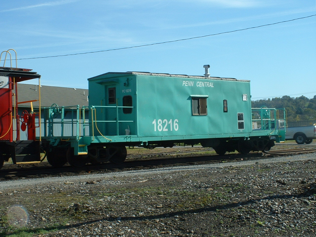
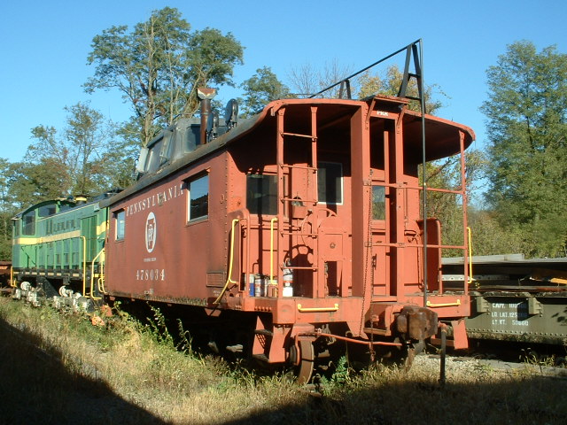
Kasgro has one business - to move large things by rail. They have almost every conceivable "flat-car" and more for moving those large loads. Fortunately for them, there is a lot of spare trackage to be had in New Castle, for you will find their stuff stored all over the place.
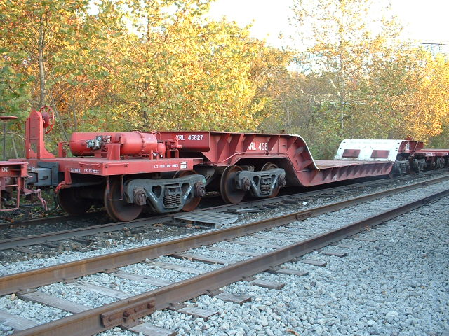
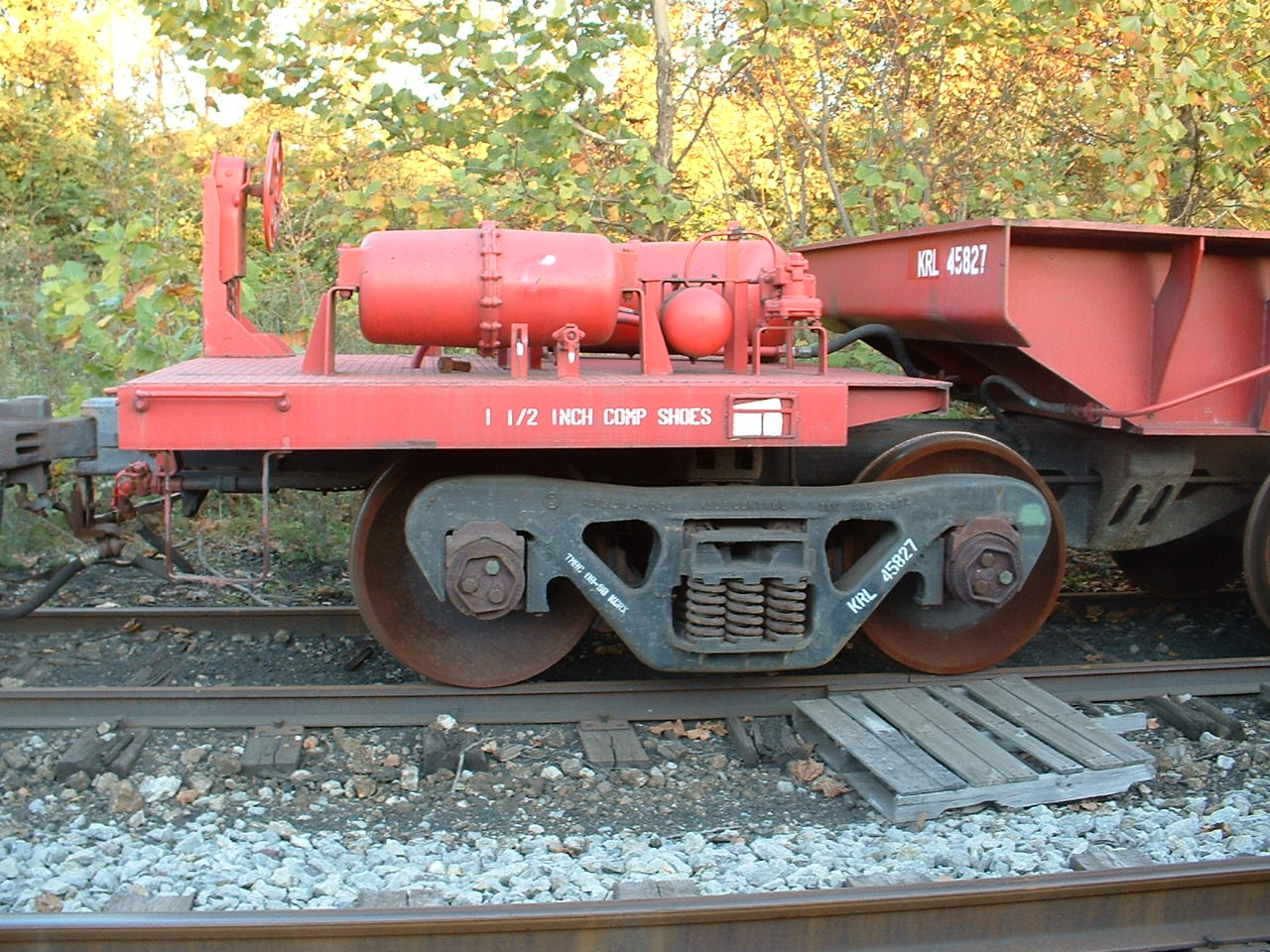
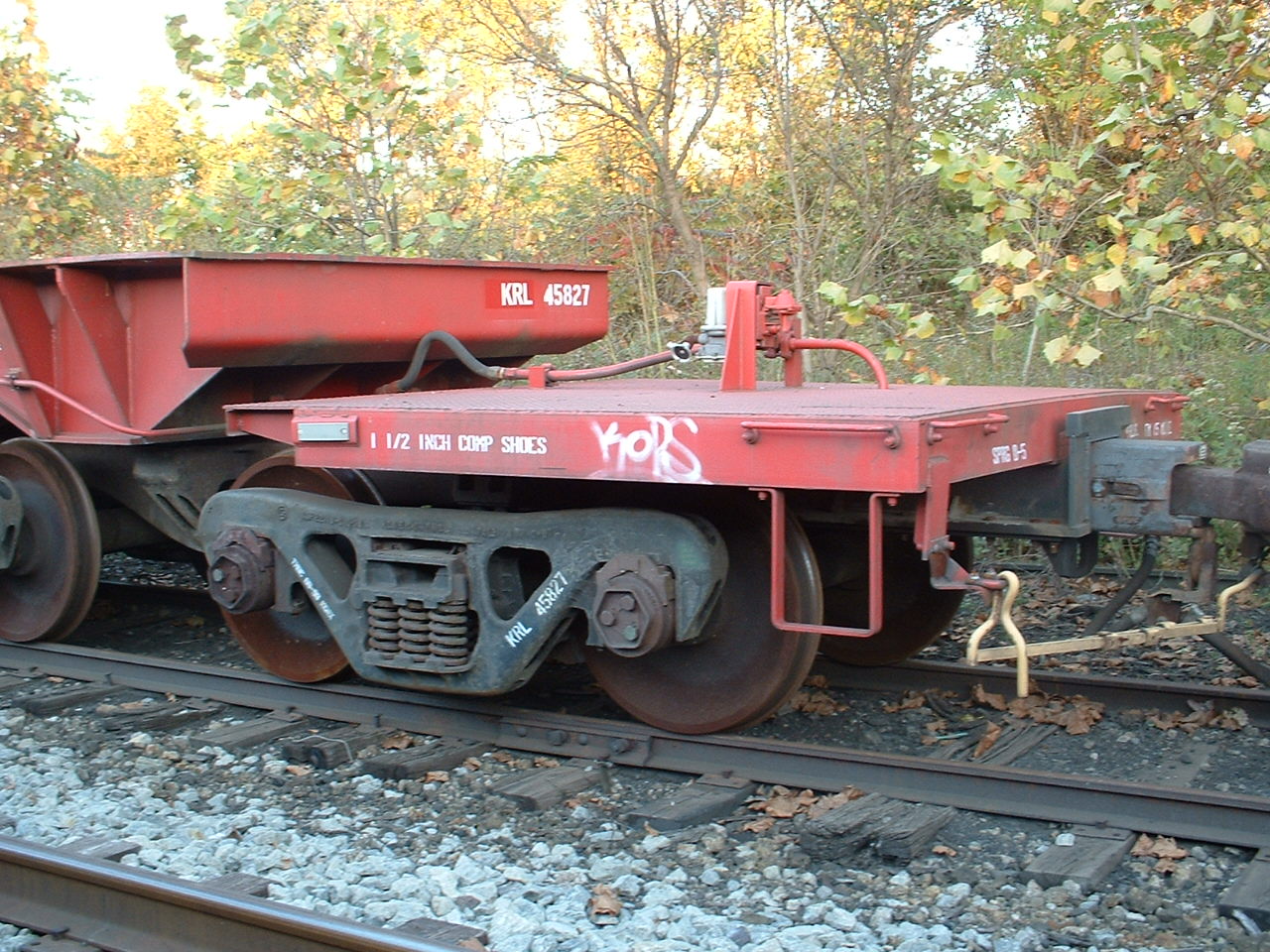
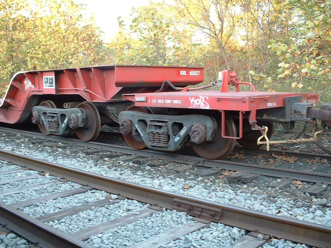

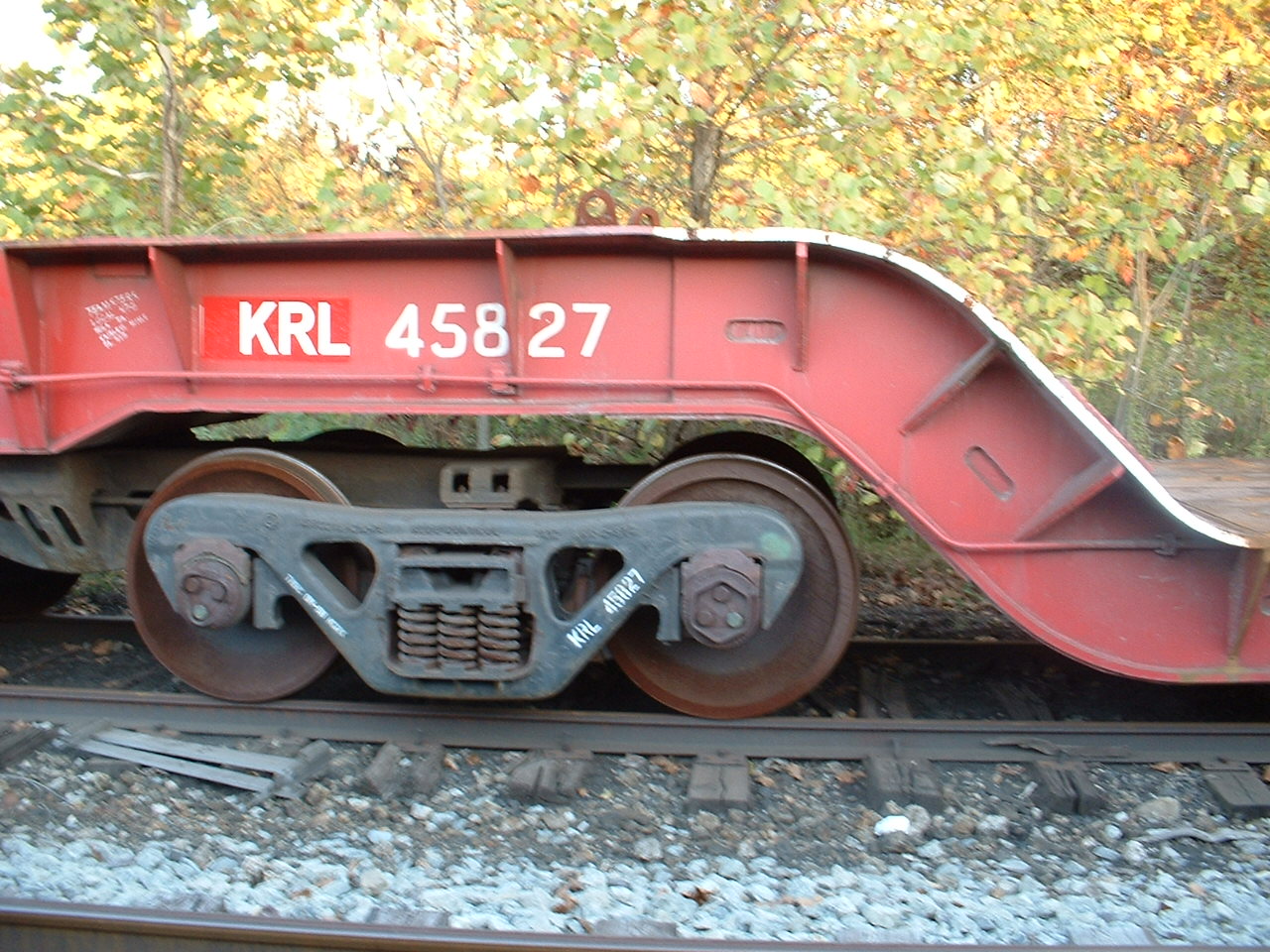
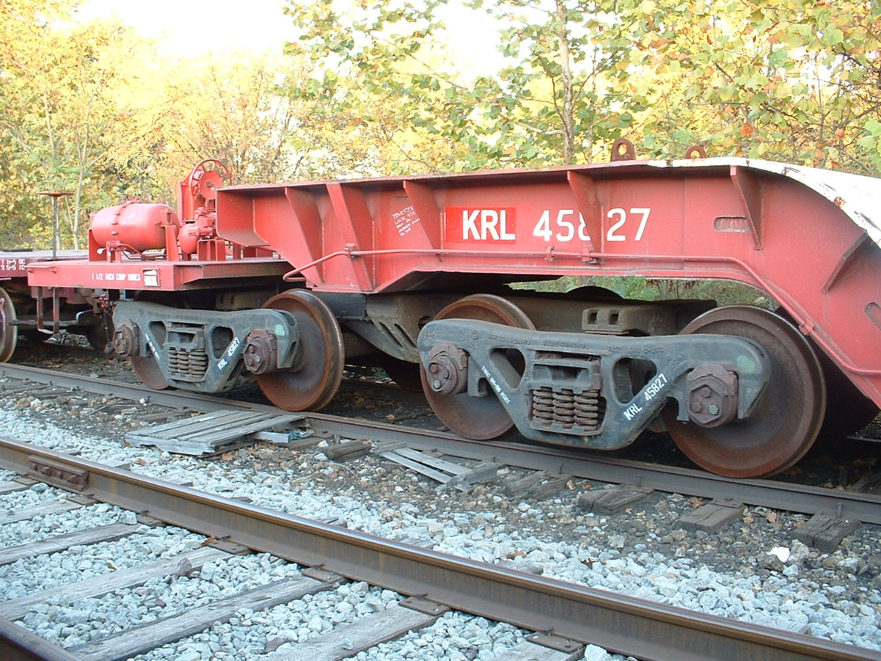
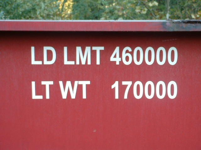


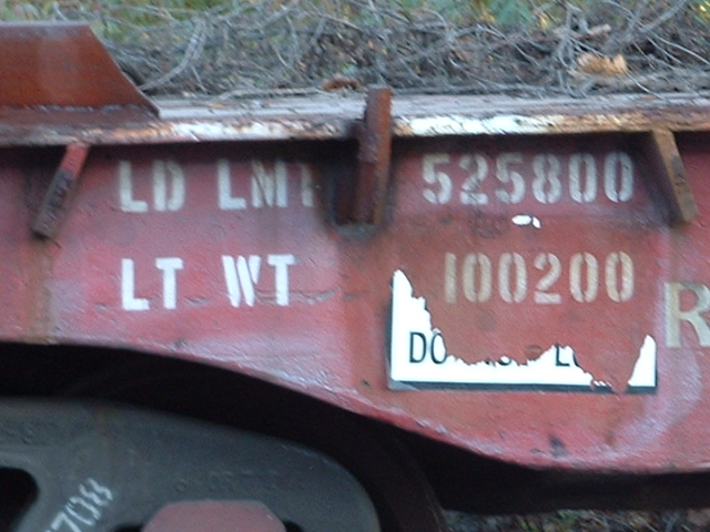
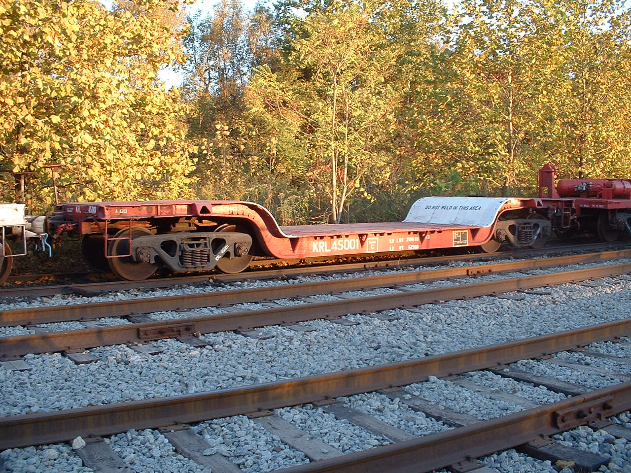

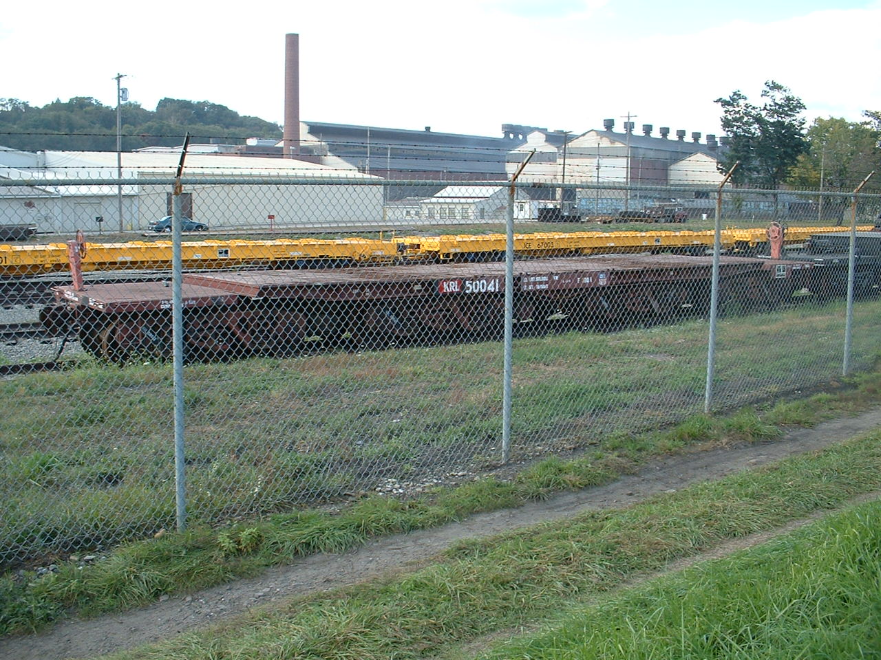


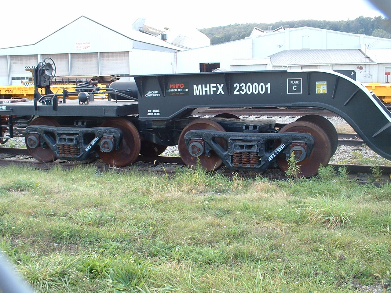
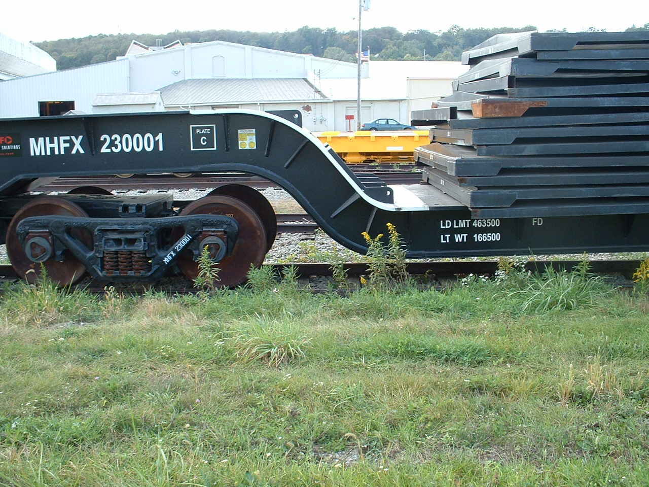
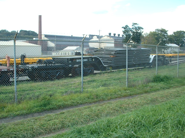
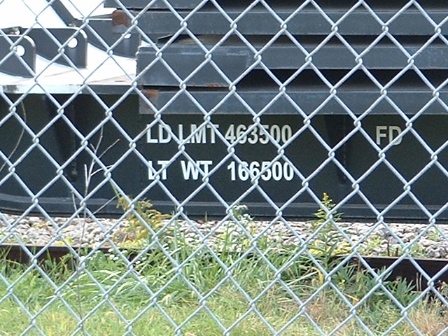
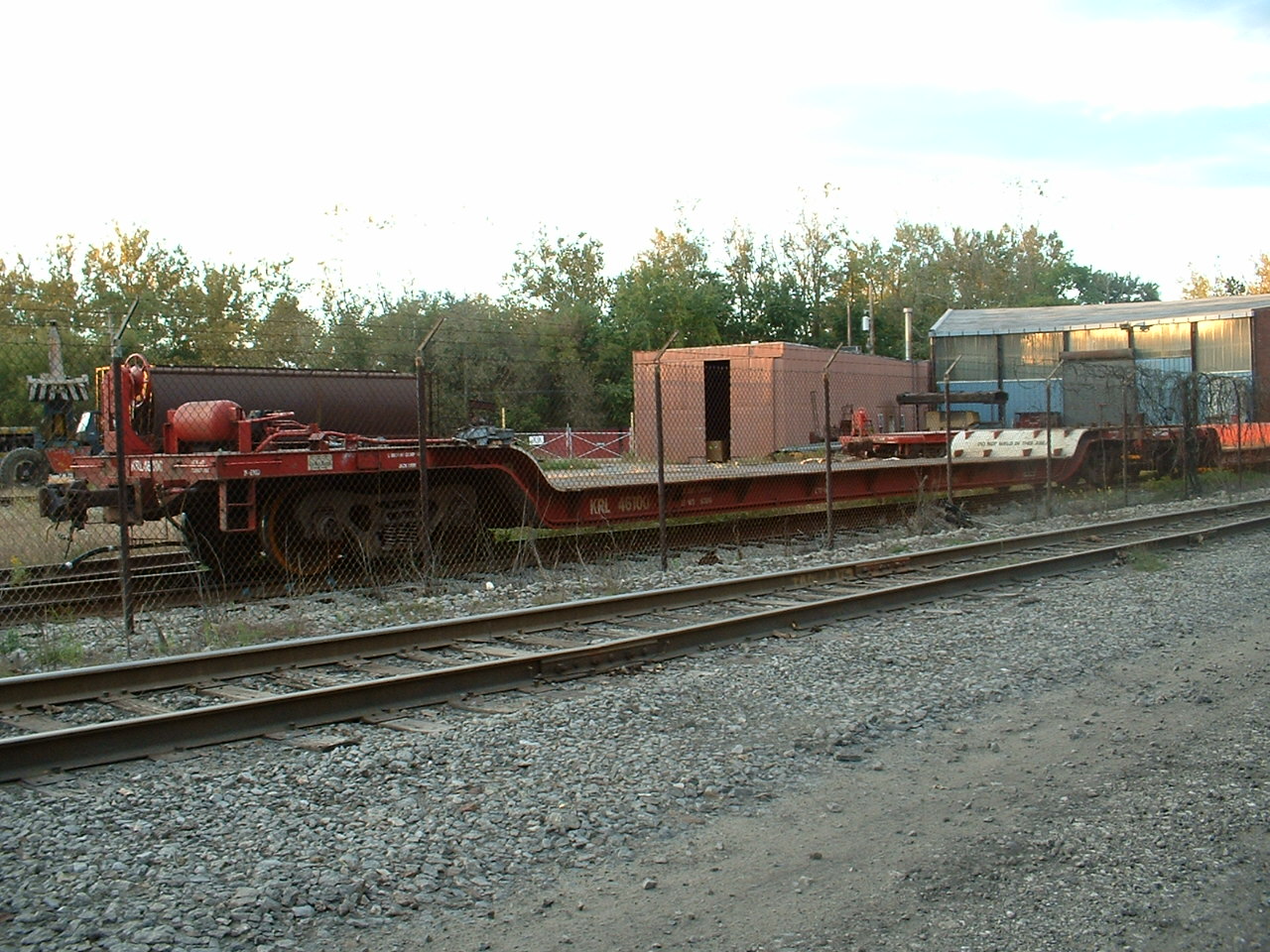
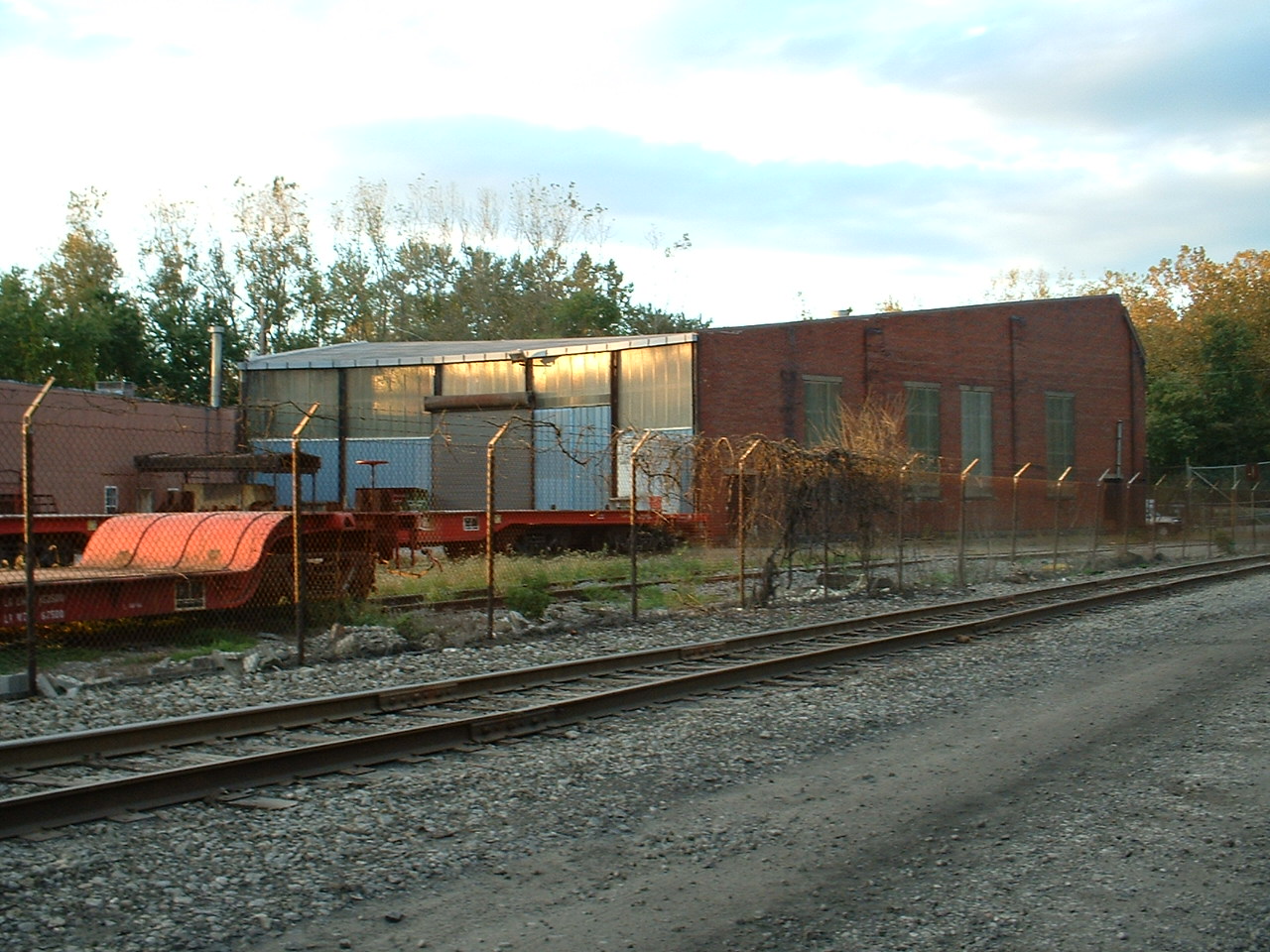
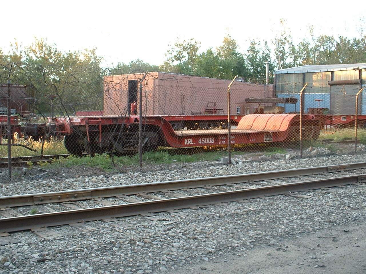
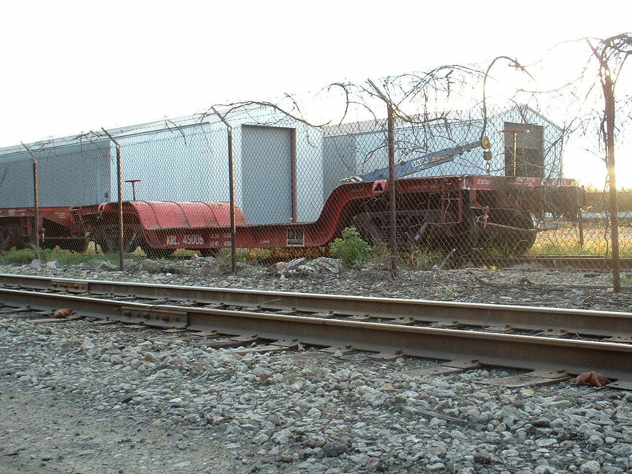


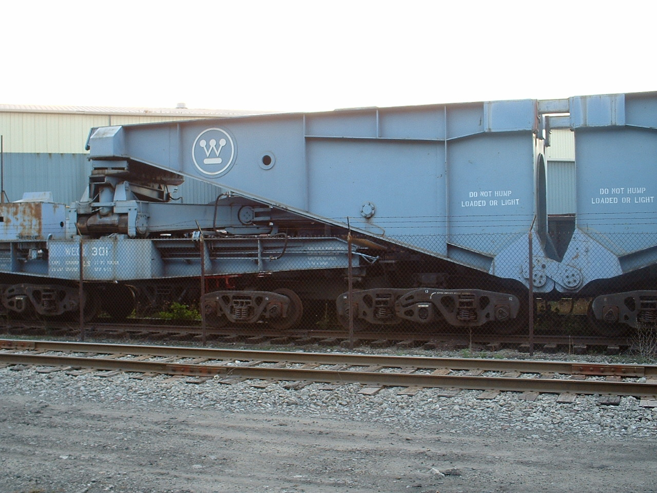
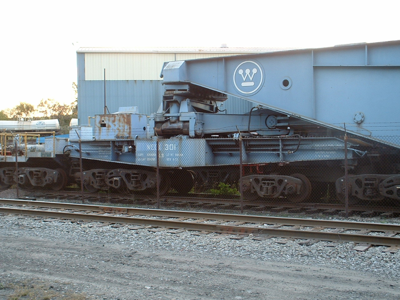
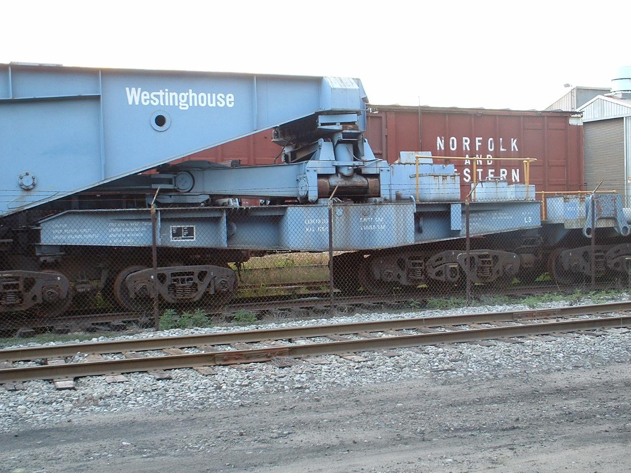
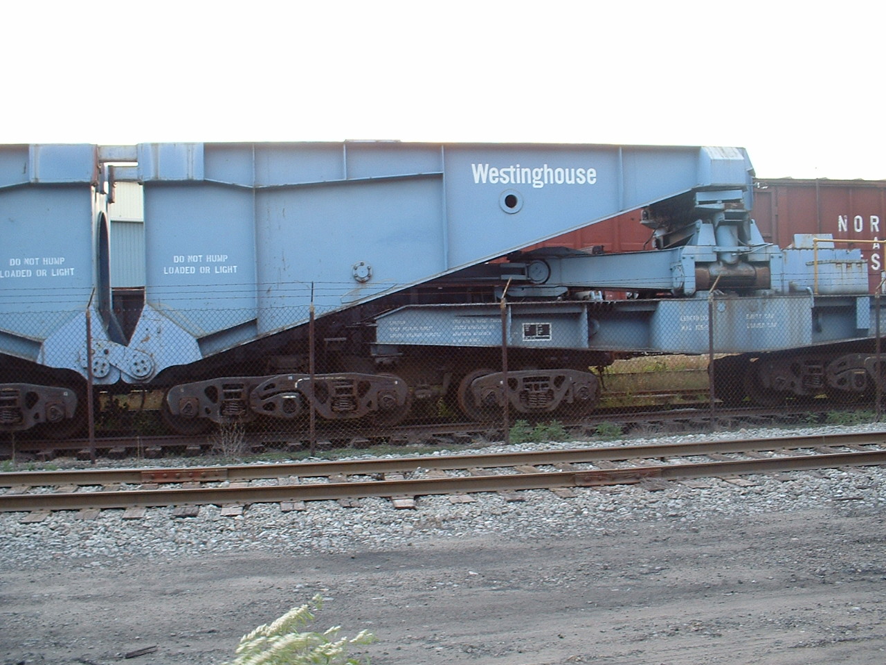
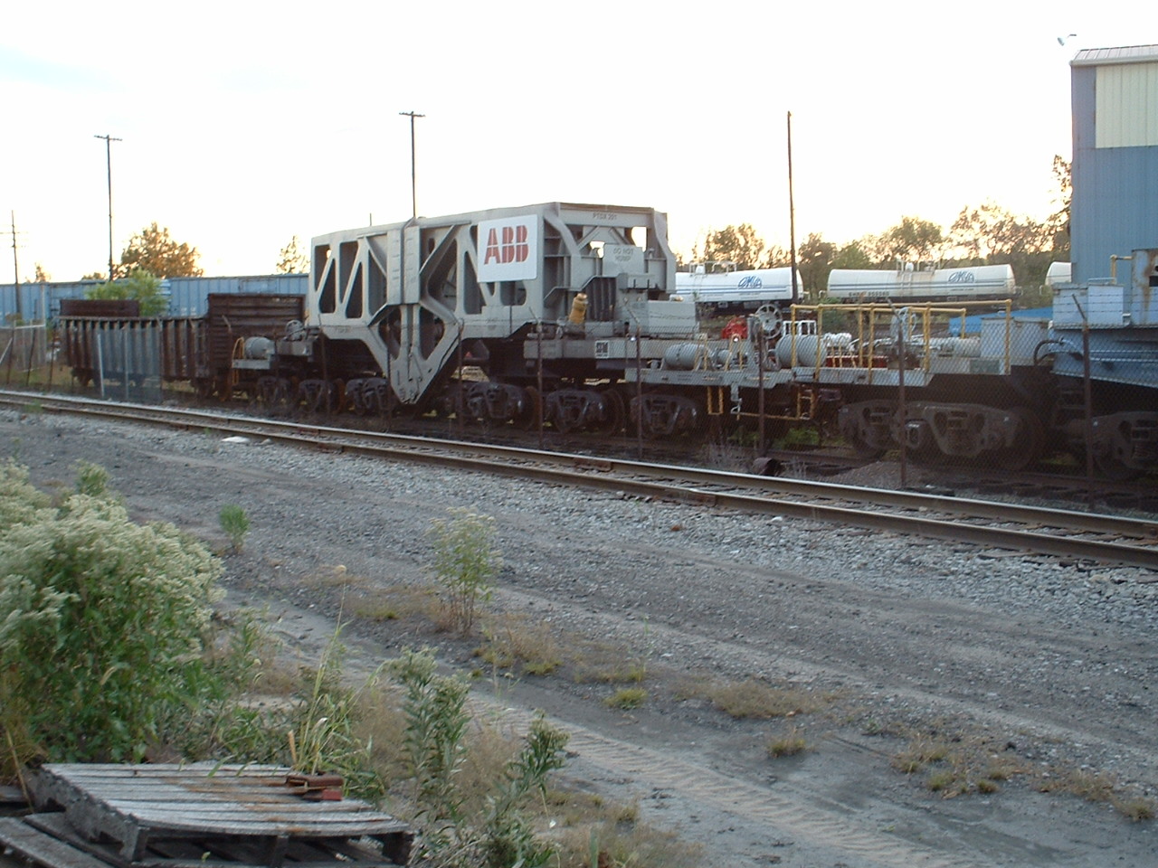
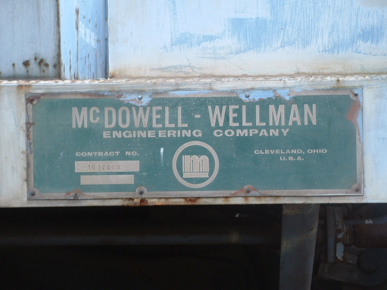
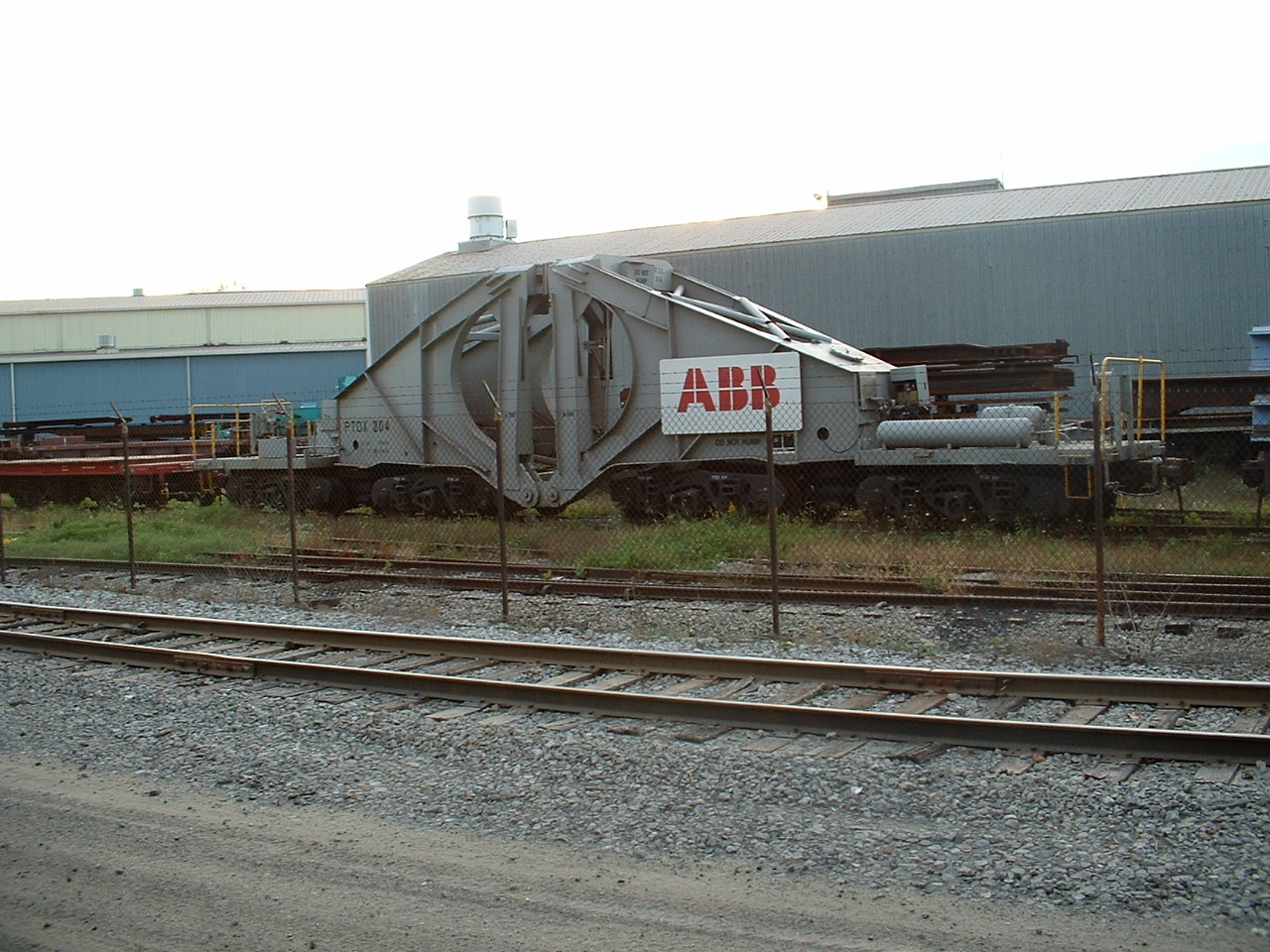
The cars above are a special breed of cars known as Schnabel Cars.
You can find models of these in HO, and (not so accurate renditions cause they would be frickin huge) in O scale.
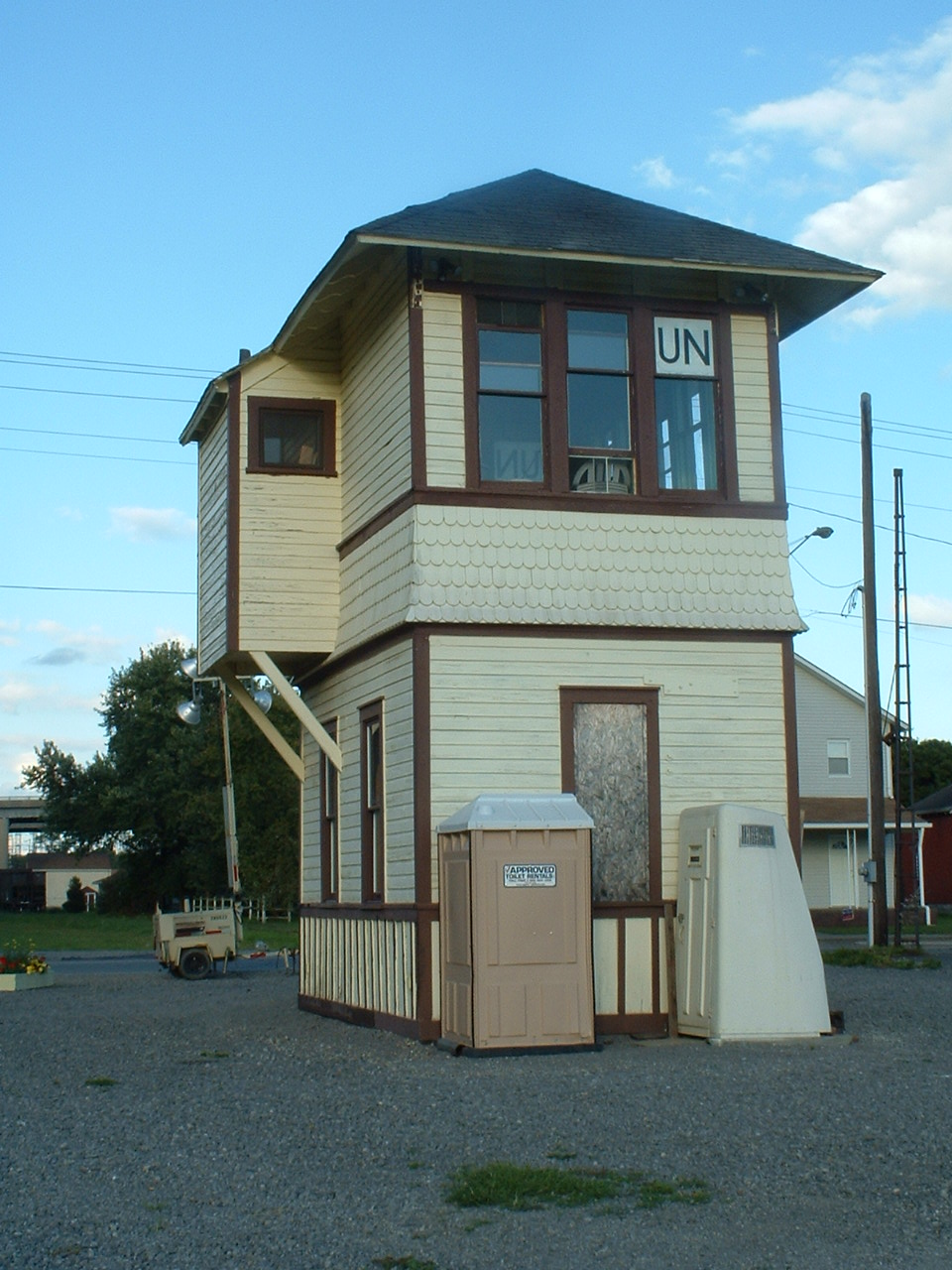
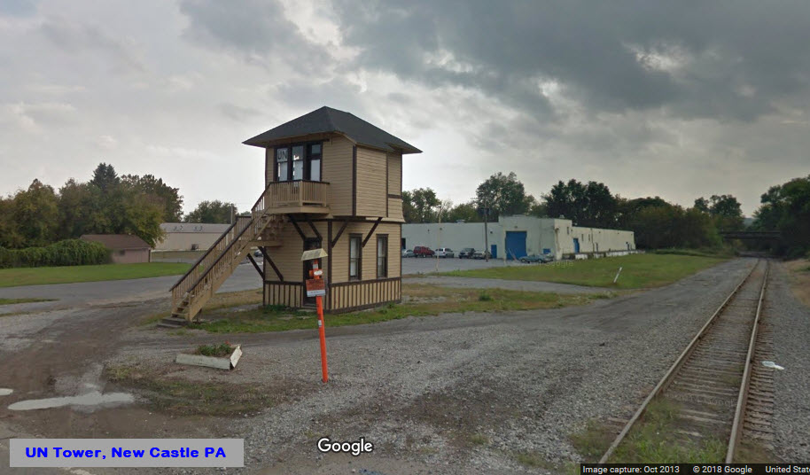
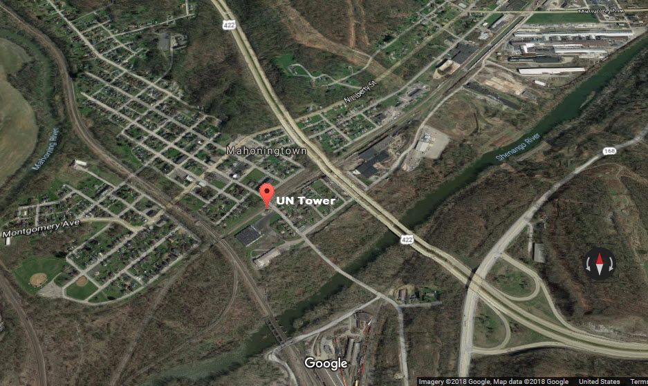
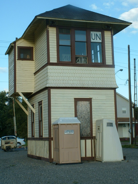
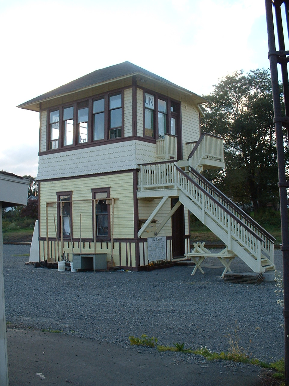
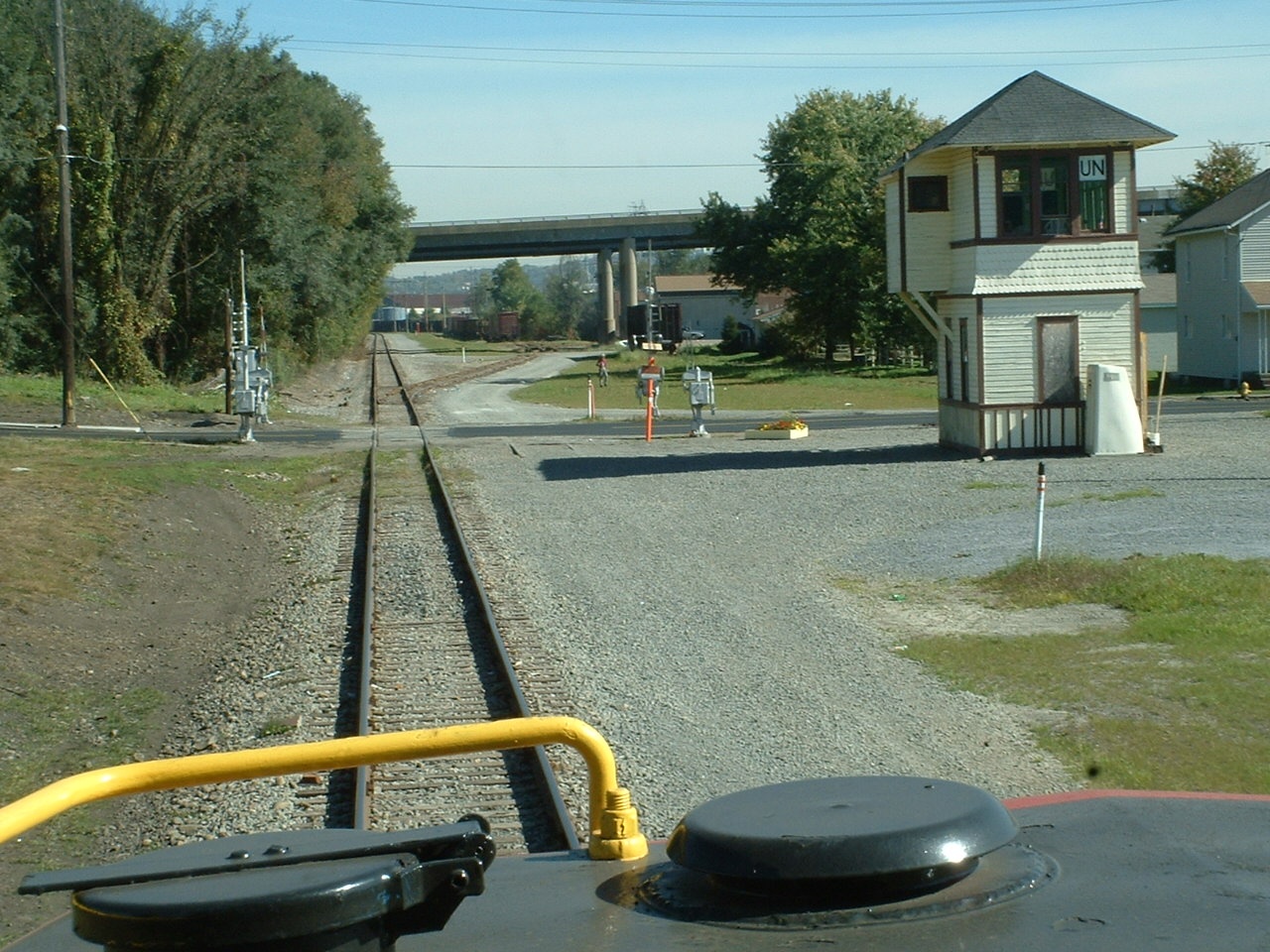
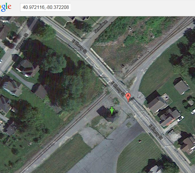
GPS Coordinates: 40.972117, -80.372264
201 East Cherry St, Mahoningtown PA, 16102
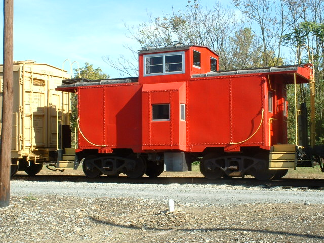
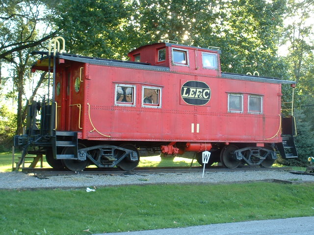
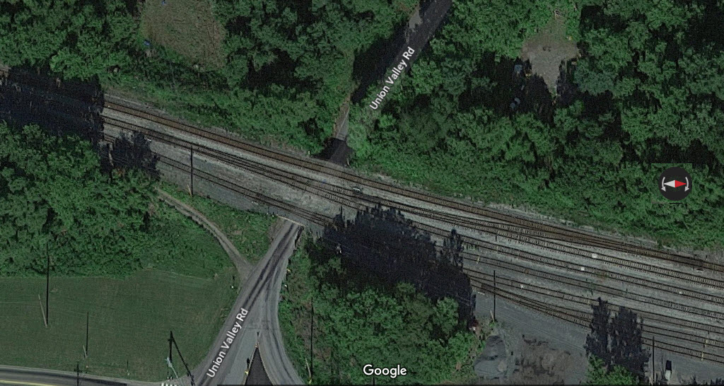
UN Tower used to be in West Pittsburg near Union Valley Road, and was moved here in 1998 (according to the sign). Restoration of the tower was completed in 2005, a year after I was there.
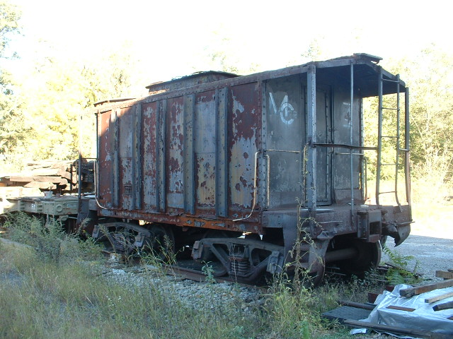
I'm guessing the BVJHS is also saving all of the other engines and rolling stock I saw while running around town?
 2004
2004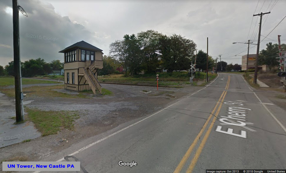


Most of it is a former B&O RR yard, and it may also include trackage from the P&LE yard that paralleled it, don't know for sure tho. The GPS coordinates are for the center of the yard, the south end coordinates are below with the signals.
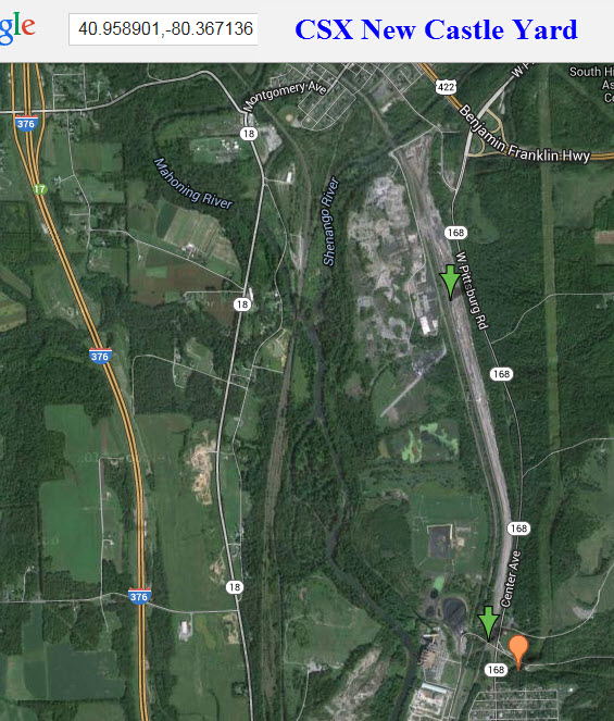
GPS Coordinates: 40.99754, -80.34299
221 Grove St, New Castle PA 16101
I'm pretty sure the warehouse was not part of the original structure. At least you can still see where the tracks were! :-)


GPS Coordinates: 40.99003, -80.34880
914 Moravia St, New Castle PA, 16101
This station, or freight shed sits across the tracks from the shops of the New Castle Industrial RR, at Moravia and Furnace Streets. According to the west2k website, this was a BR&P built structure.


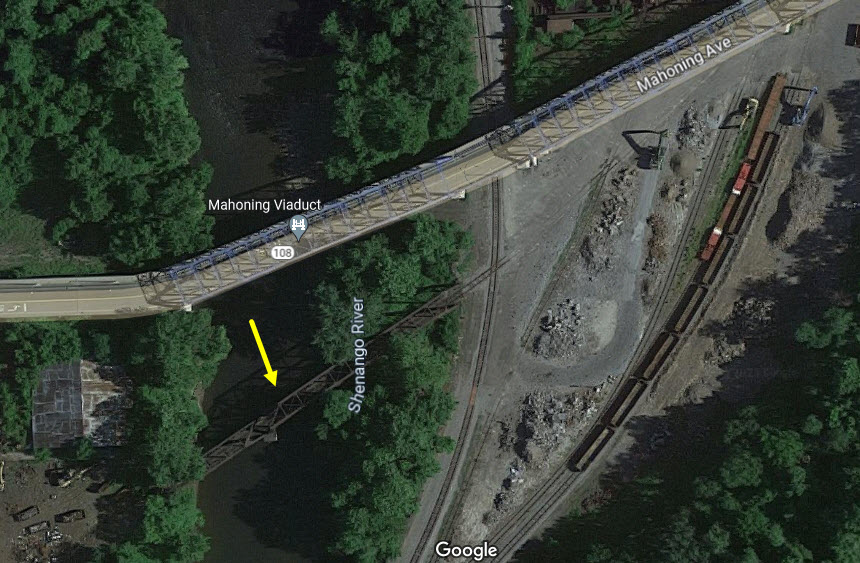
GPS Coordinates: 40.98770, -80.35376
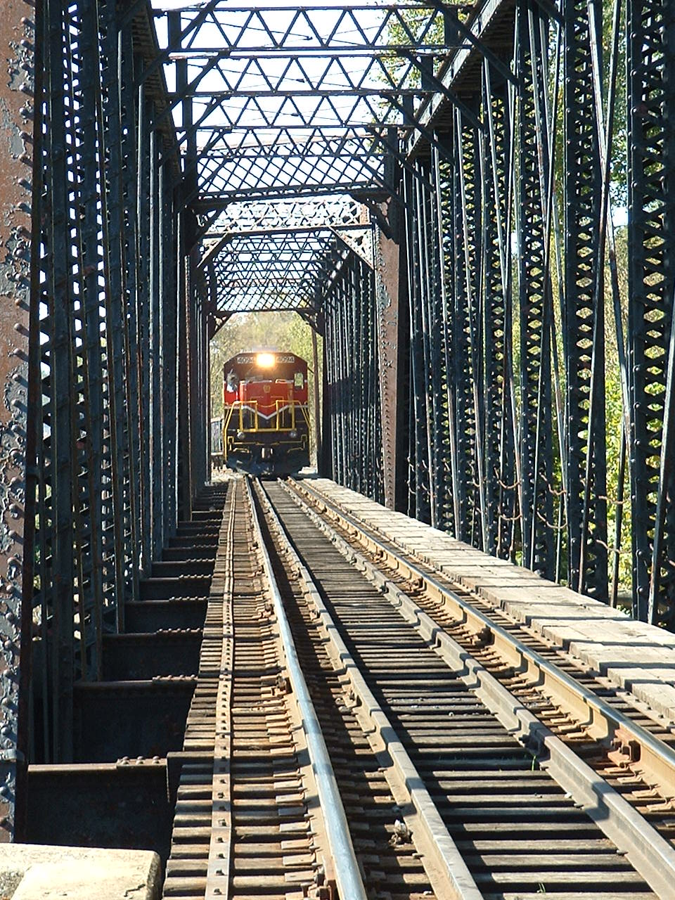
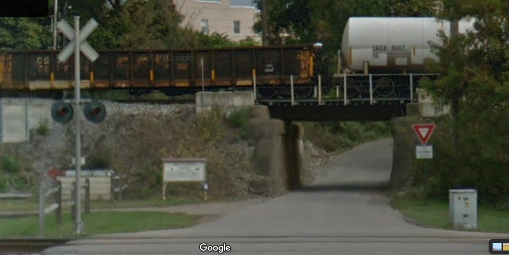
The pictures I took also show up under the NCIR section above, as do more pictures of the bridge with their freight crossing it.
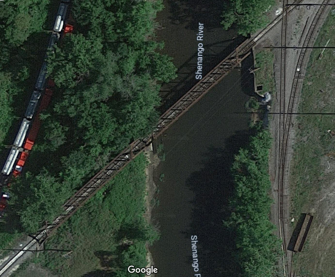
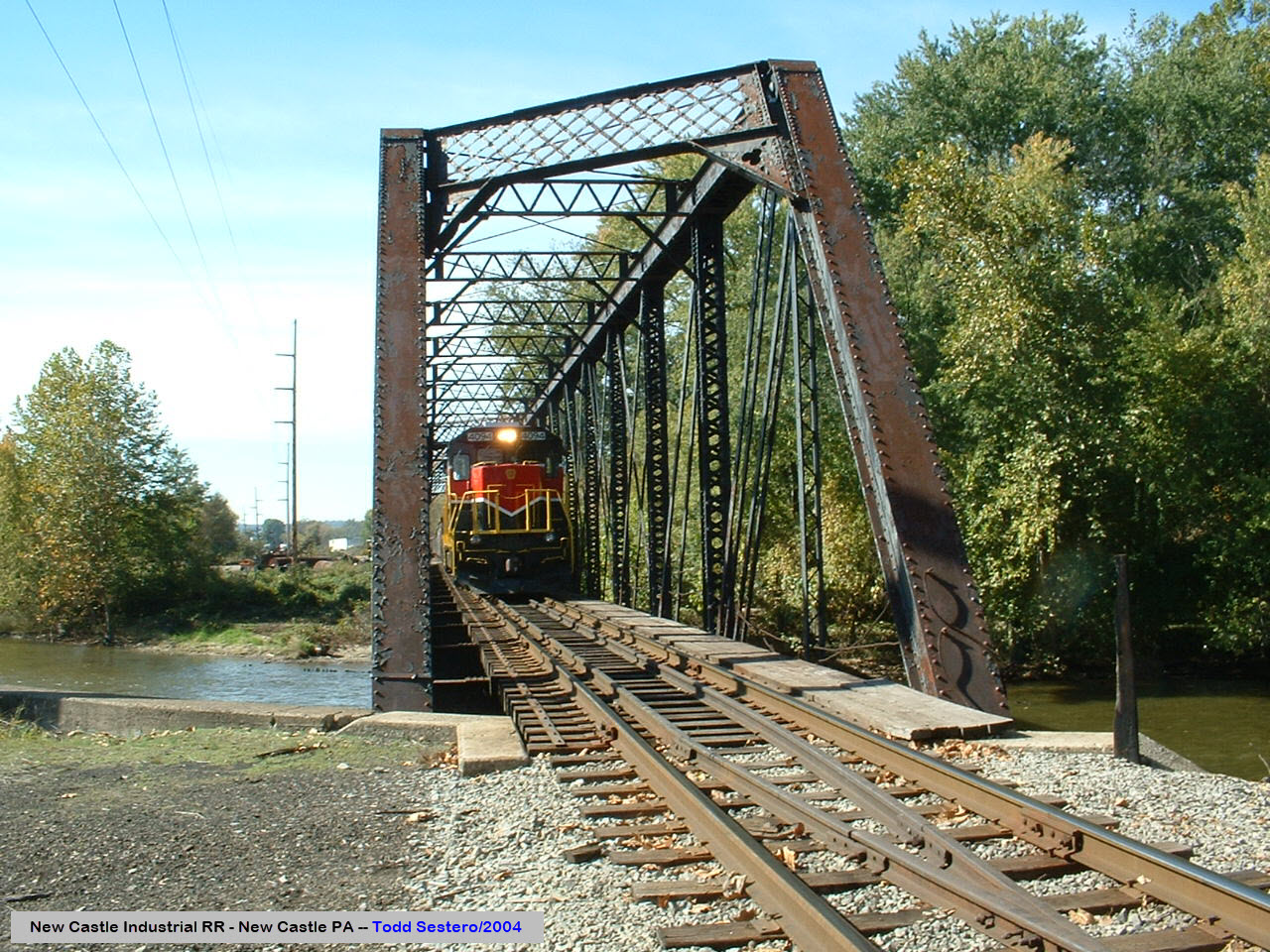
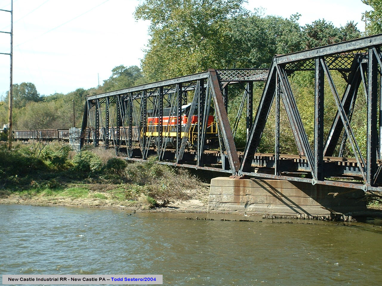
GPS Coordinates: 40.99003, -80.34880
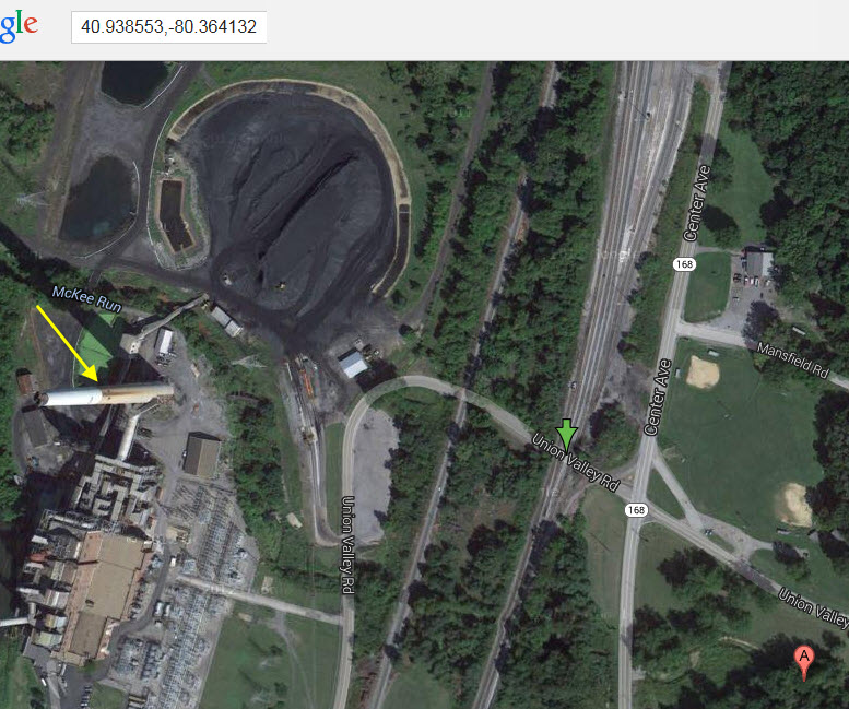
GPS Coordinates: 40.93855, -80.36417
GPS Coordinates: 40.93397, -80.36661
GPS Coordinates: 40.96837, -80.37169
GPS Coordinates: 40.97110, -80.37393
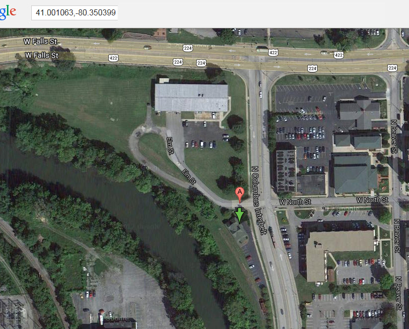
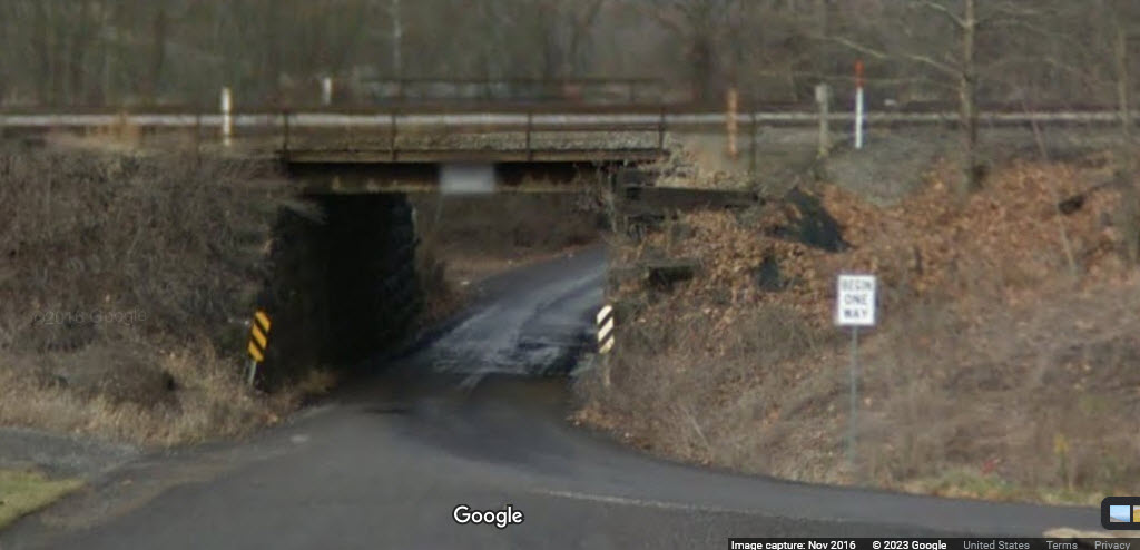
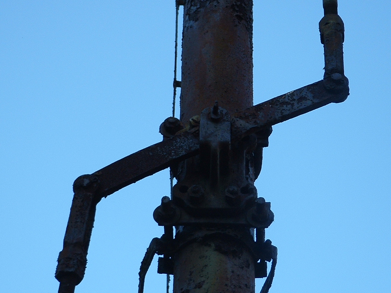
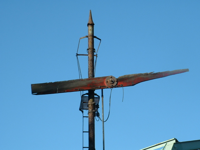
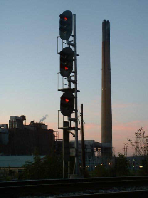
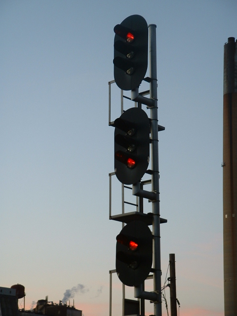
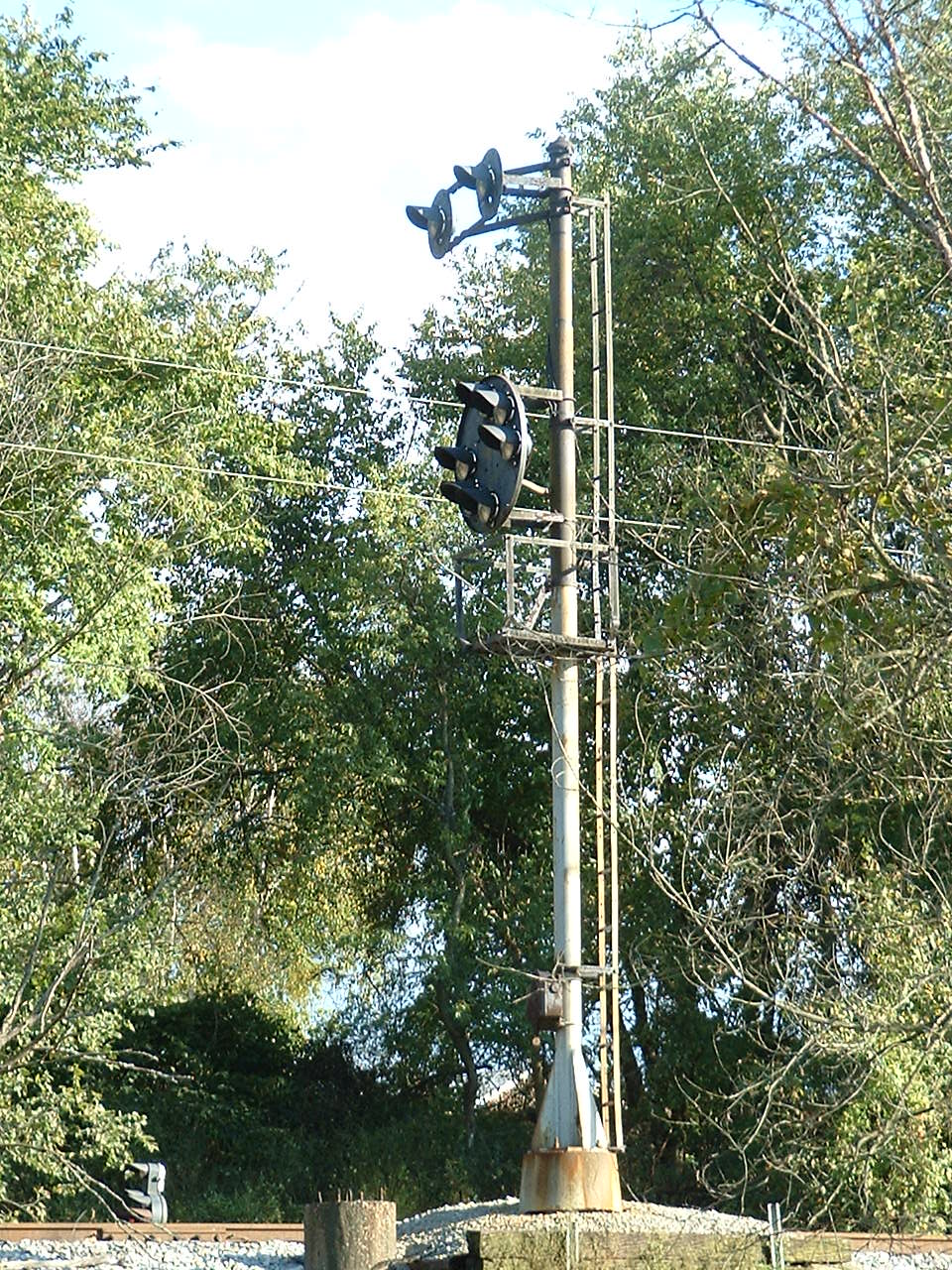
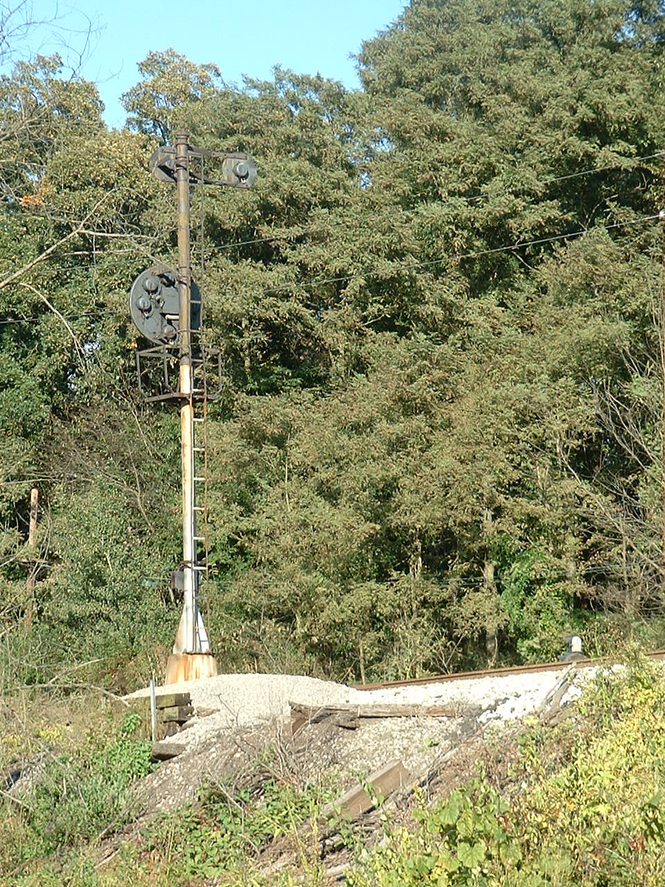
Getting in here to get pictures was no easy task, but I had a local railfan as a guide. Access (the yellow arrow below) was down a slope (Gardner Ave) that was formerly used by the streetcar system. Keep in mind, these pictures are 20 years old, the signal may not even be around anymore.
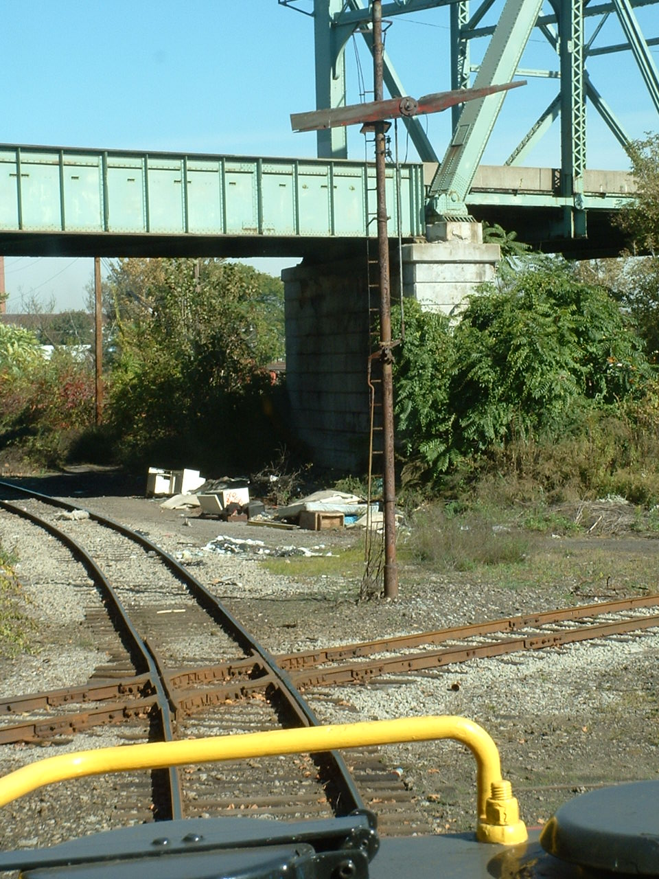

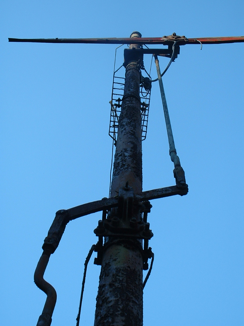
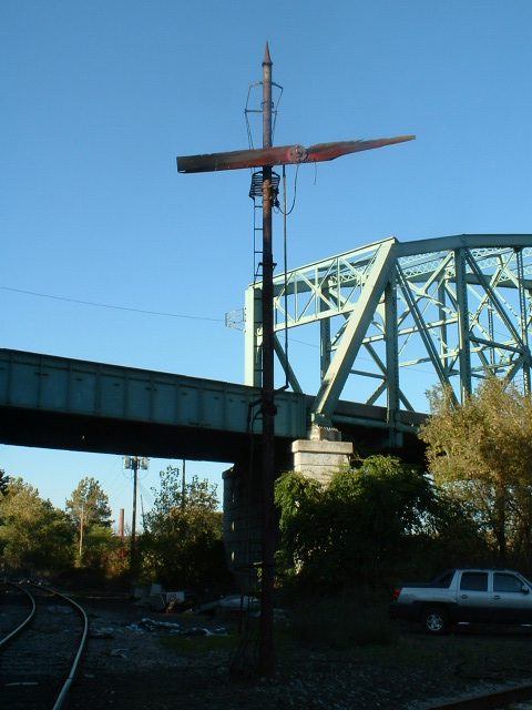
The green arrow below is actually pointing towards the position the picture on the left (above) was taken from.
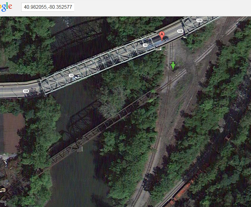
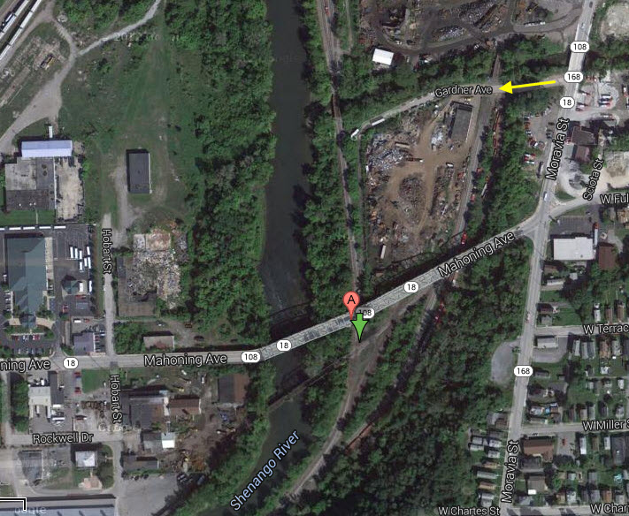
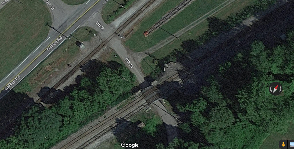
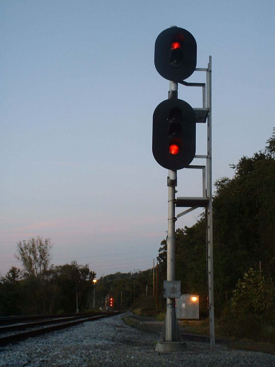
These signals were seen from the southern end of the yard, I think, judging from the tower (yellow arrow) in the background. Looks like, from the (crummy) aerial shot, these signals have been replaced, cause that looks like a signal bridge or a cantilever..... remember, 20 years..... :-)
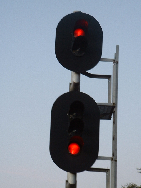
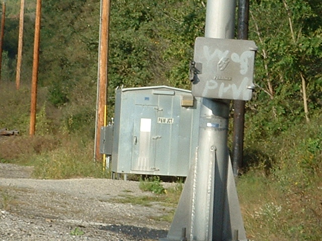
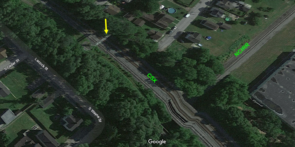
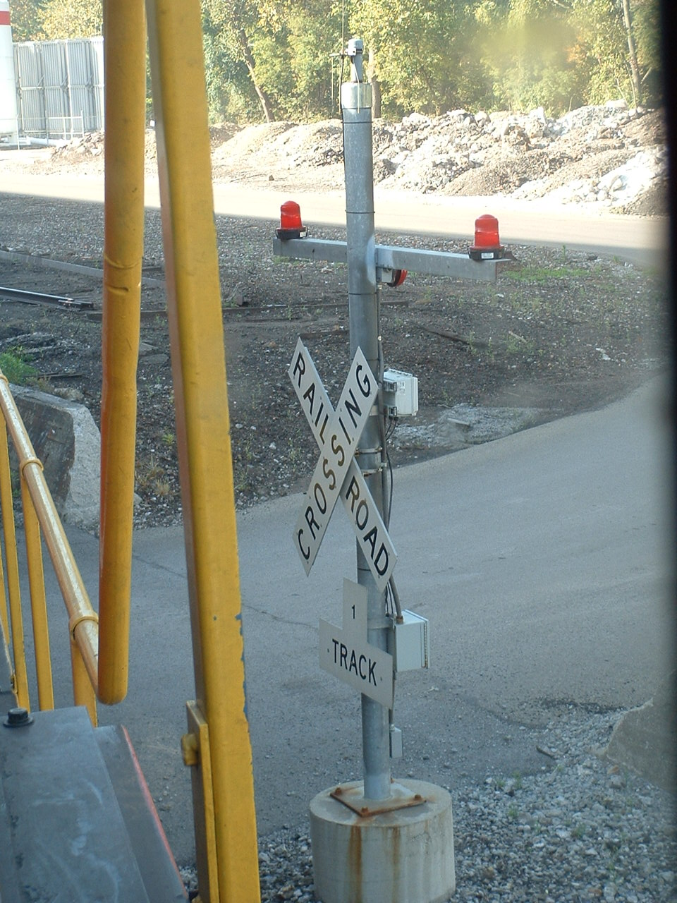
At a crossing on one of the many private grade crossings we passed......
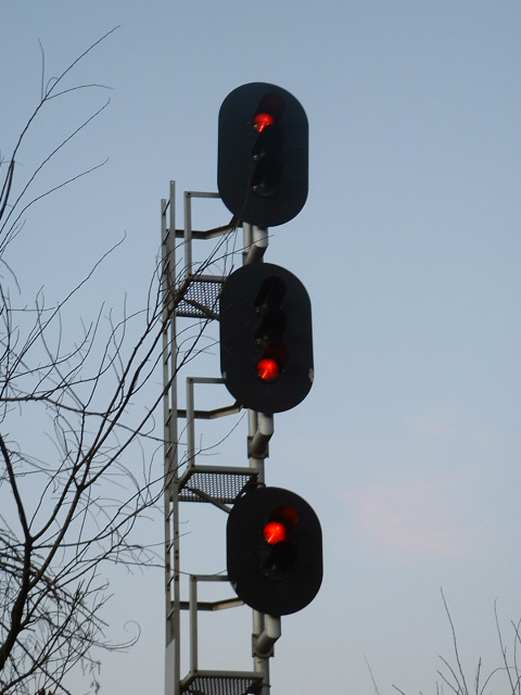
Don't remember where I came across them, dunno if they're still around!
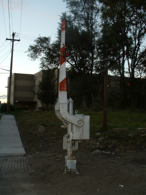
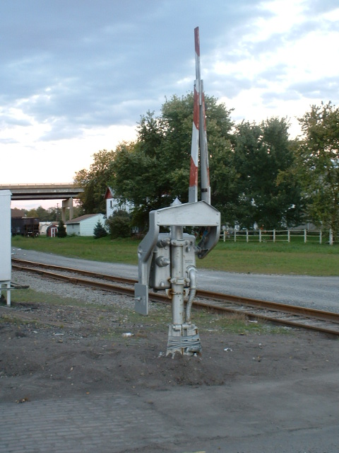
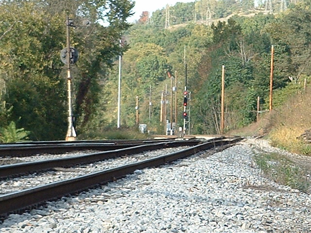
I didn't have that much time to hang around and wait for pictures, this is really all I got, especially considering my digital camera, back in 2004, was about as simple and cheap as they came.
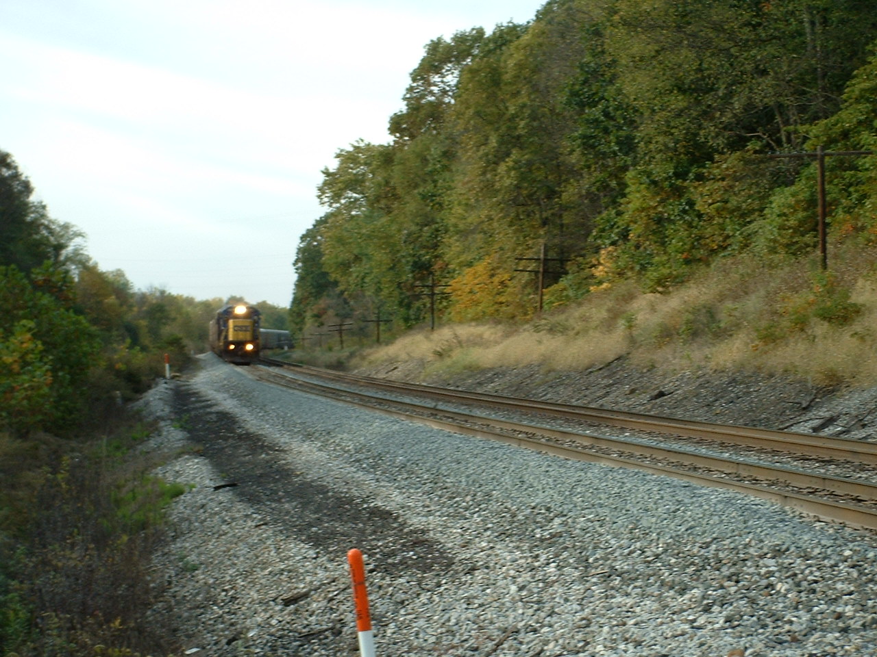 A SB CSX freight, south of the yard.
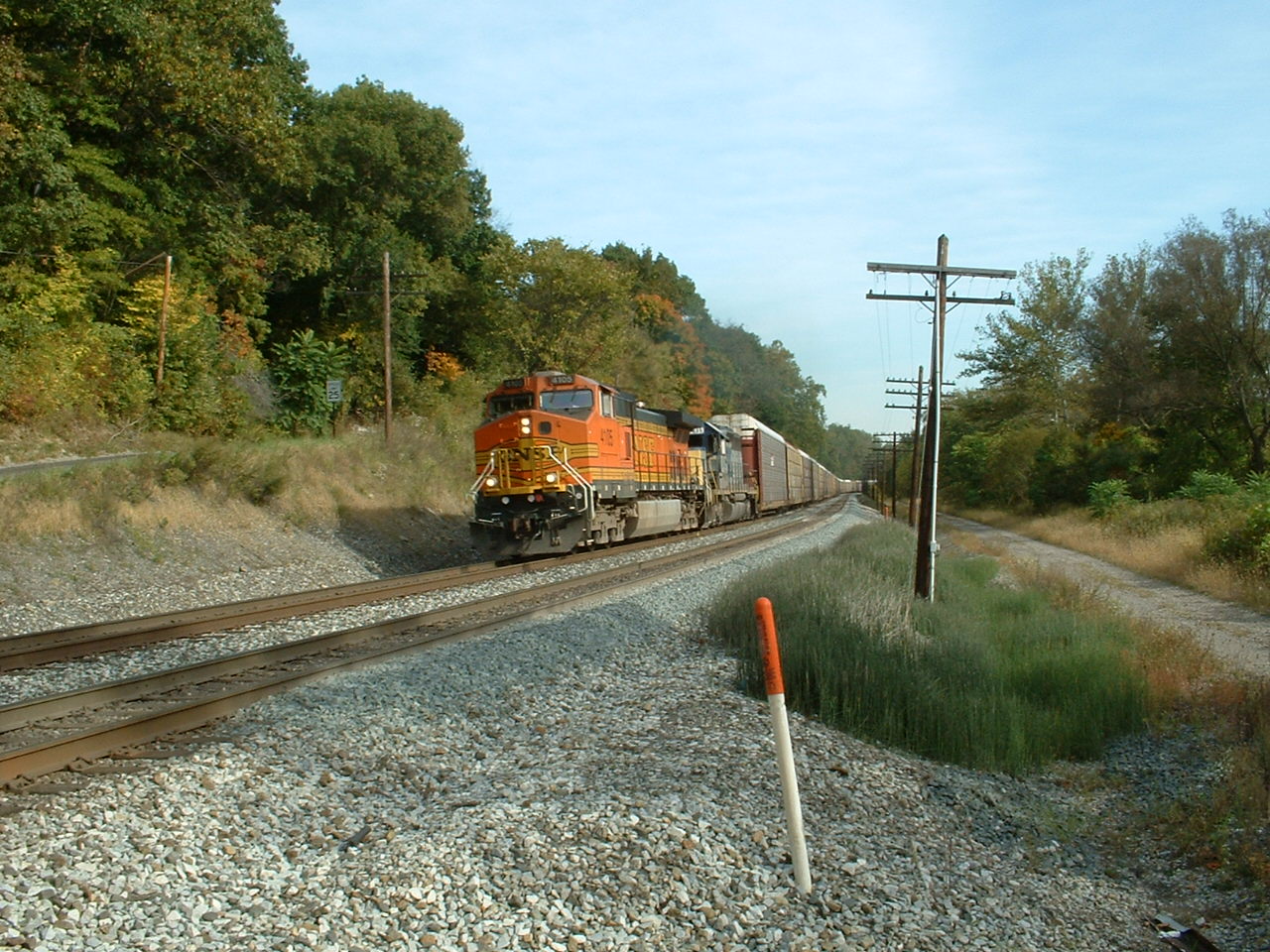 A NB NS freight.
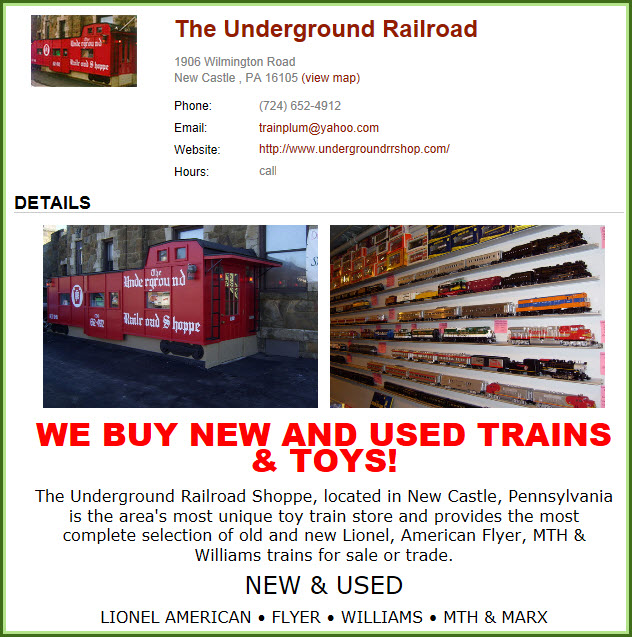
Hobby Shop - The Underground Railroad
1906 Wilmington Rd, New Castle PA 16105
724-652-4912
http://www.undergroundrrshop.com/
NEW
11/16/2013, AUG07/2016, JUN06/2020, JUL09/10/2023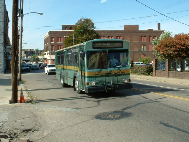
Local bus - out of service
Even in 2004, these were rare!
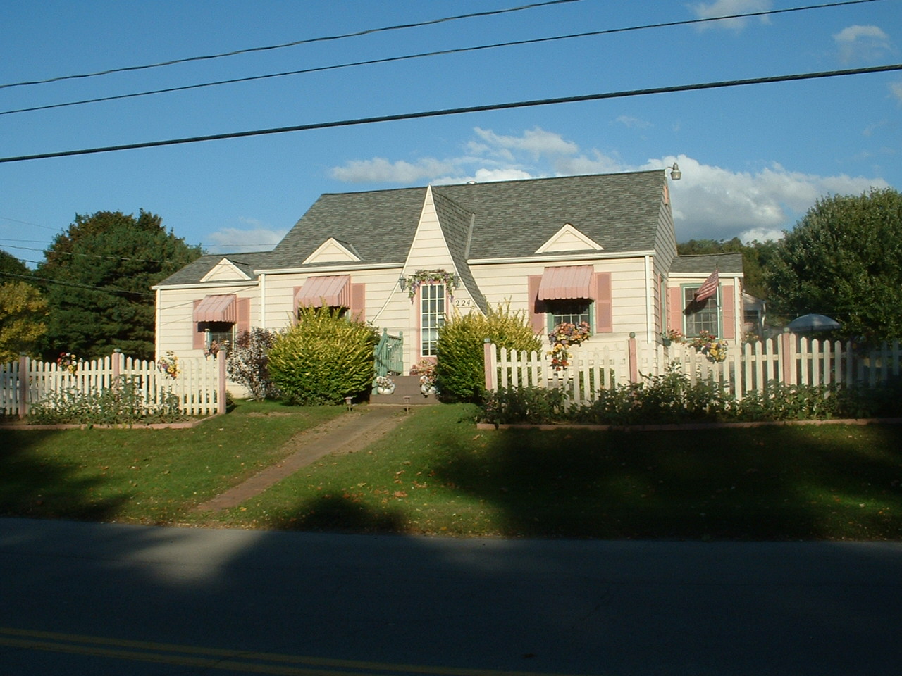
The look of this house "peaked" my interest :-)
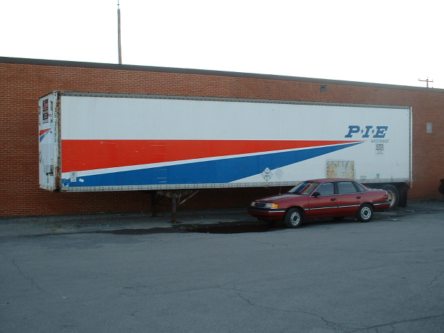
Again, even in 2004, not many of these left around either after the merger - Pacific Intermountain Express
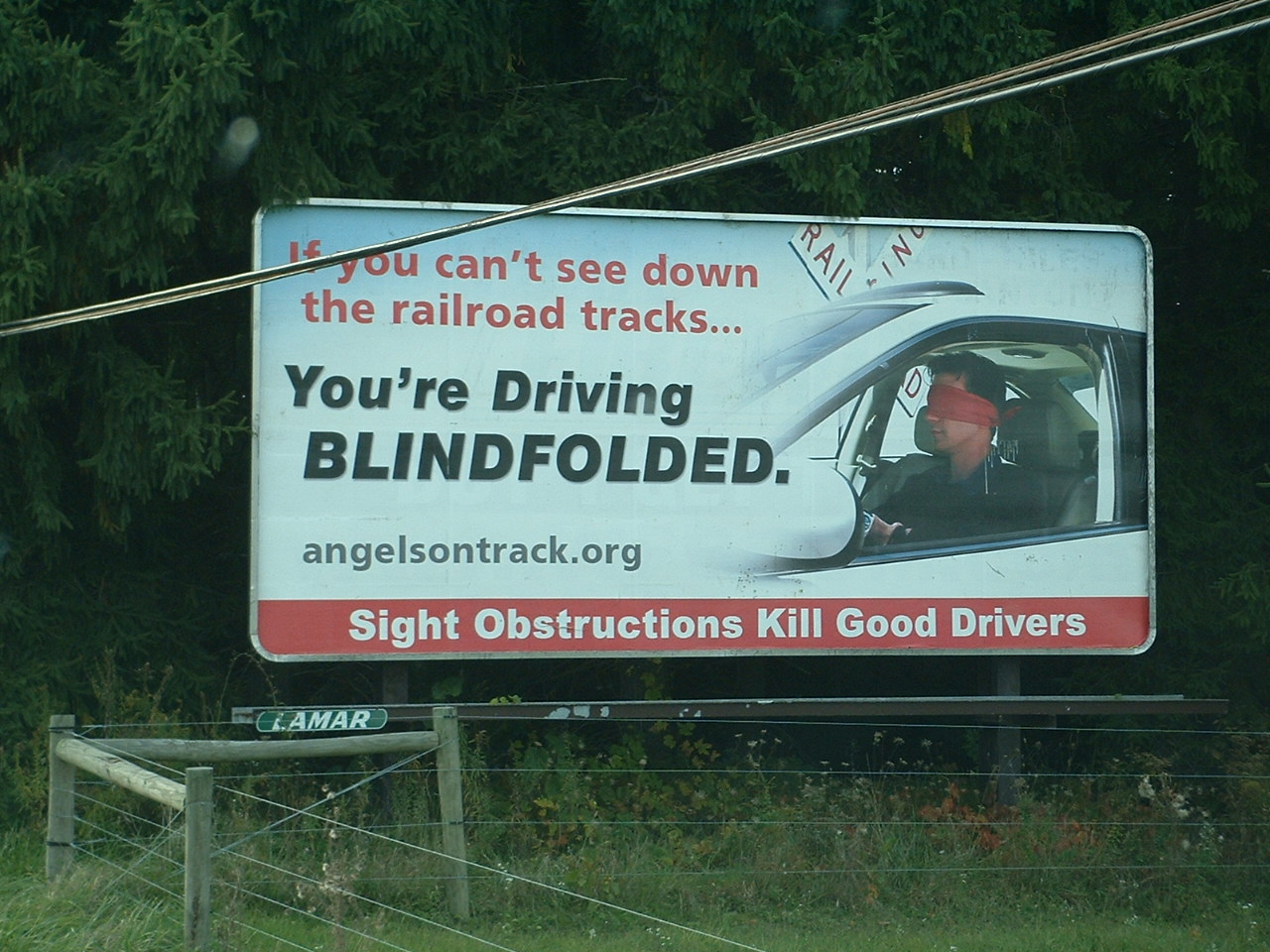
Billboard seen around town, only one I ever saw for this "cause":
Disclaimers:
I love trains, and I love signals. I am not an expert. My webpages reflect what I find on the topic of the page. This is something I have fun with while
trying to help others.
Please Note: Since the main focus of my two websites is railroad signals, the railfan guides are oriented towards the signal fan being able to locate them.
For those of you into the modeling aspect of our hobby, my indexa page has a list of almost everything railroad oriented
I can think of to provide you with at least a few pictures to help you detail your pike.
If this is a railfan page, every effort has been made to make sure that the information contained on this map and in this railfan guide is correct. Once in a while,
an error may creep in :-)
My philosophy: Pictures and maps are worth a thousand words, especially for railfanning. Text descriptions only get you so far, especially if you get lost or
disoriented. Take along good maps.... a GPS is OK to get somewhere, but maps are still better if you get lost! I belong to AAA, which allows you to get
local maps for free when you visit the local branches. ADC puts out a nice series of county maps for the Washington DC area, but their state maps do not have the
railroads on them. If you can find em, I like the National Geographic map book of the U.S..... good, clear, and concise graphics, and they do a really good job
of showing you where tourist type attractions are, although they too lack the railroads. Other notes about specific areas will show up on that page if known.
Aerial shots were taken from either Google Maps or www.bing.com/maps as noted. Screen captures are made
with Snagit, a Techsmith product... a great tool if you have never used it!
By the way, floobydust is a term I picked up 30-40 years ago from a National Semiconductor data book, and means miscellaneous
and/or other stuff.
Pictures and additional information is always needed if anyone feels inclined to take 'em, send 'em, and share 'em, or if you have something to add or correct.... credit
is always given! Please be NICE!!! Contact info is here
Beware: If used as a source, ANYTHING from Wikipedia must be treated as being possibly being inaccurate, wrong, or not true.
RAILFAN GUIDES HOME
RAILROAD SIGNALS HOME
Last Modified
12-Jul-2023