In General
Getting Here
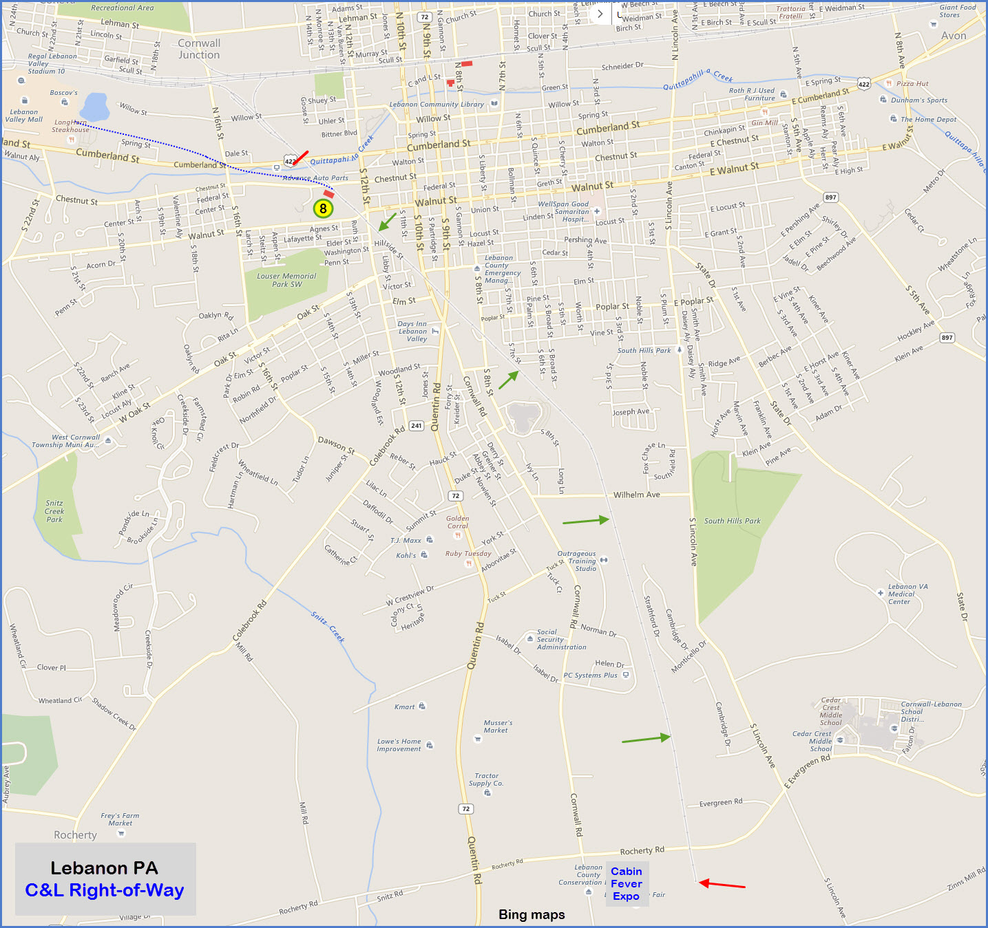
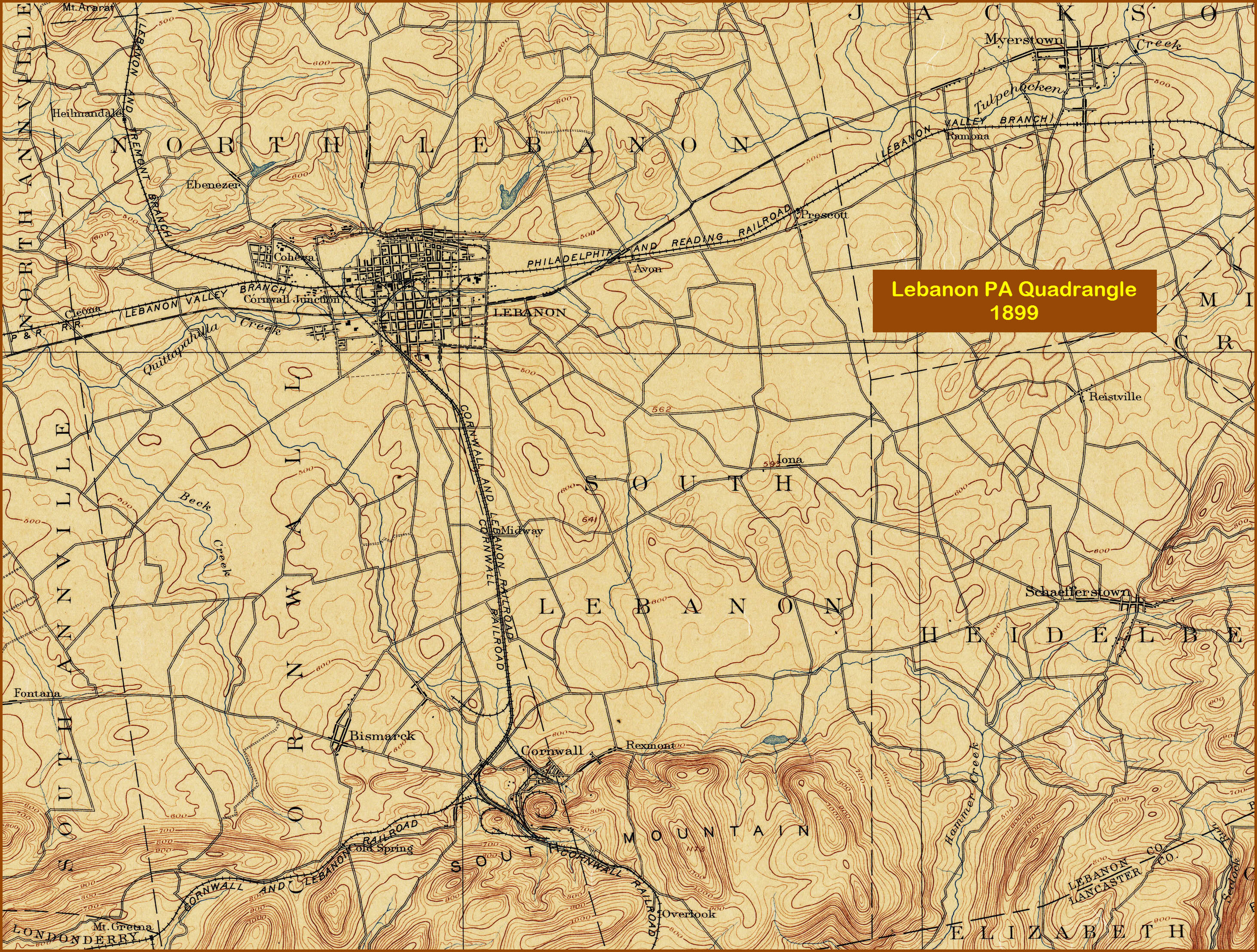
Map
Sights
Signals
Fire & Police
Floobydust
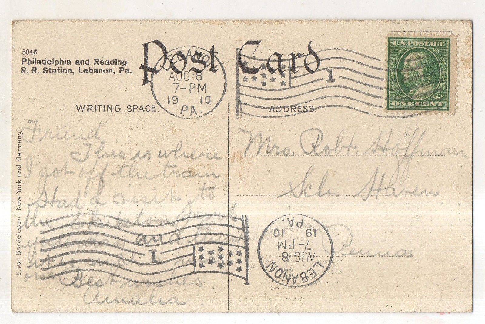
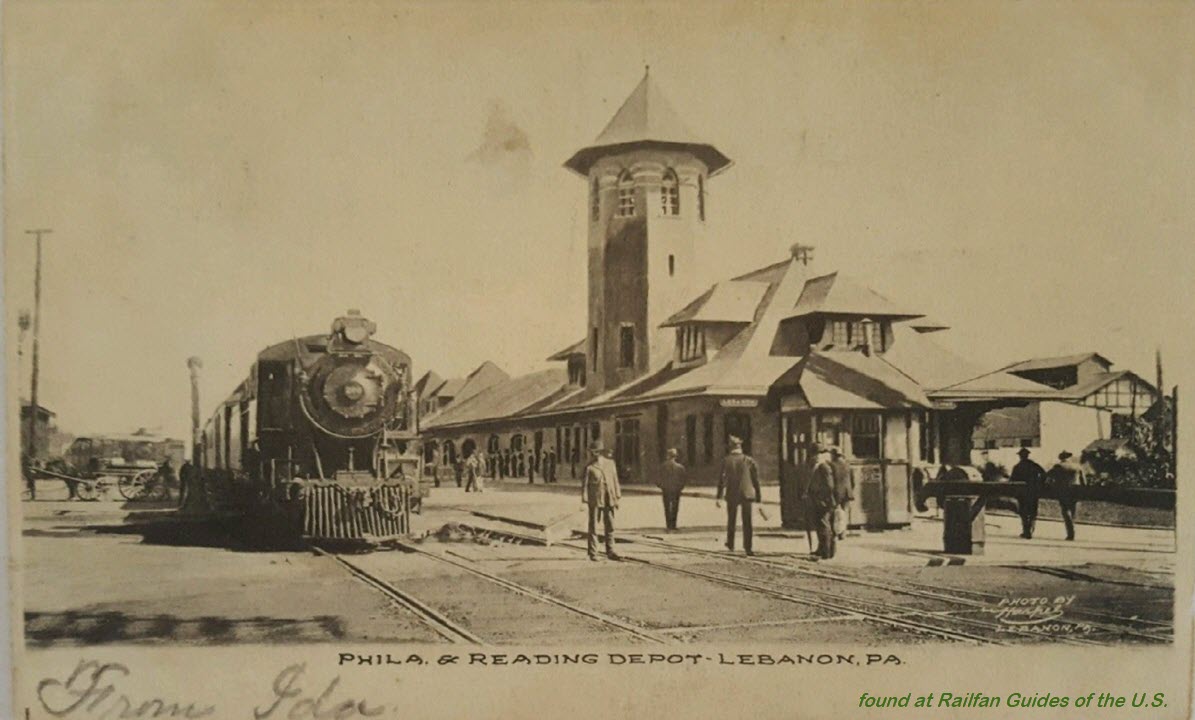
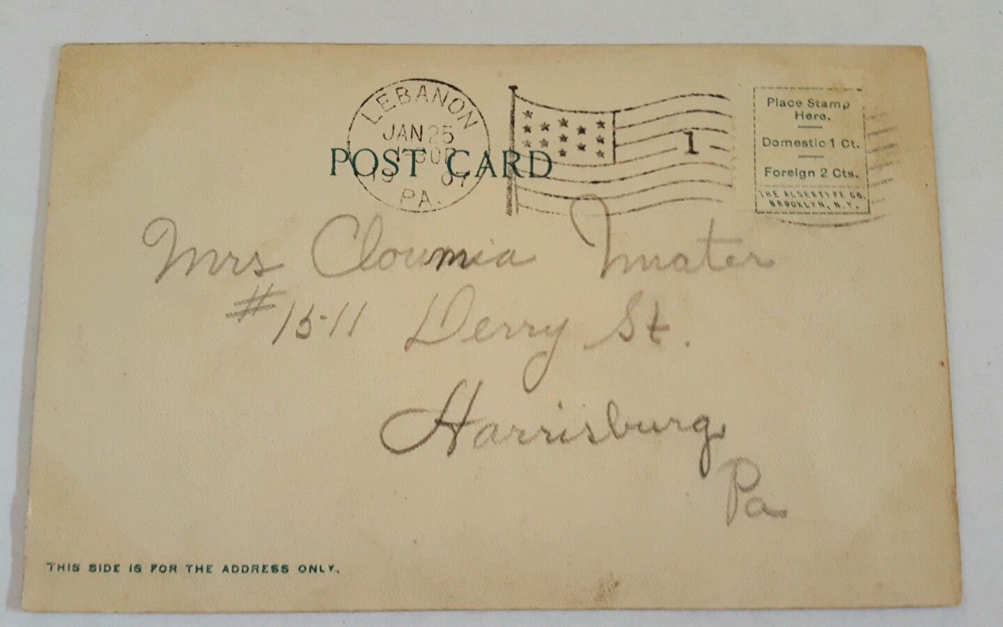
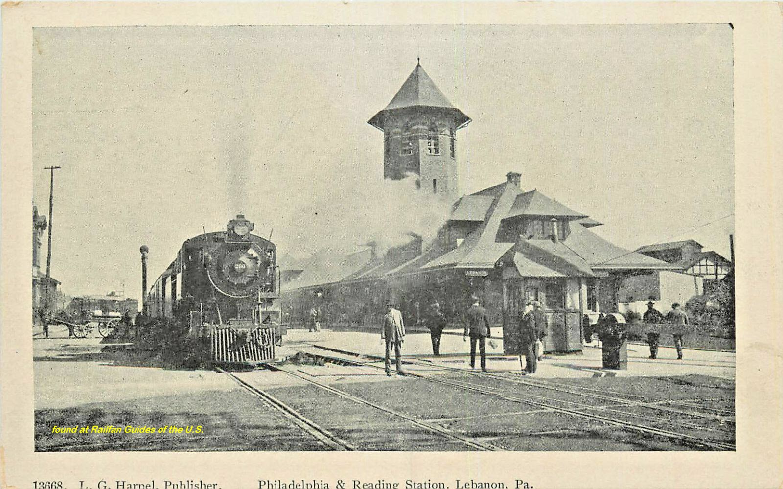
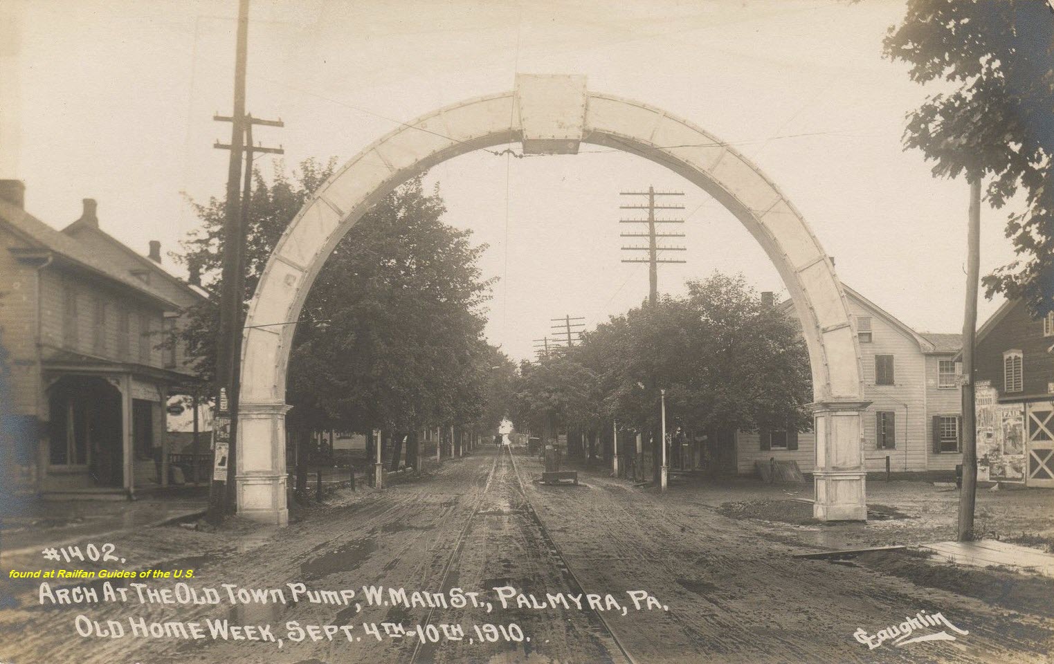
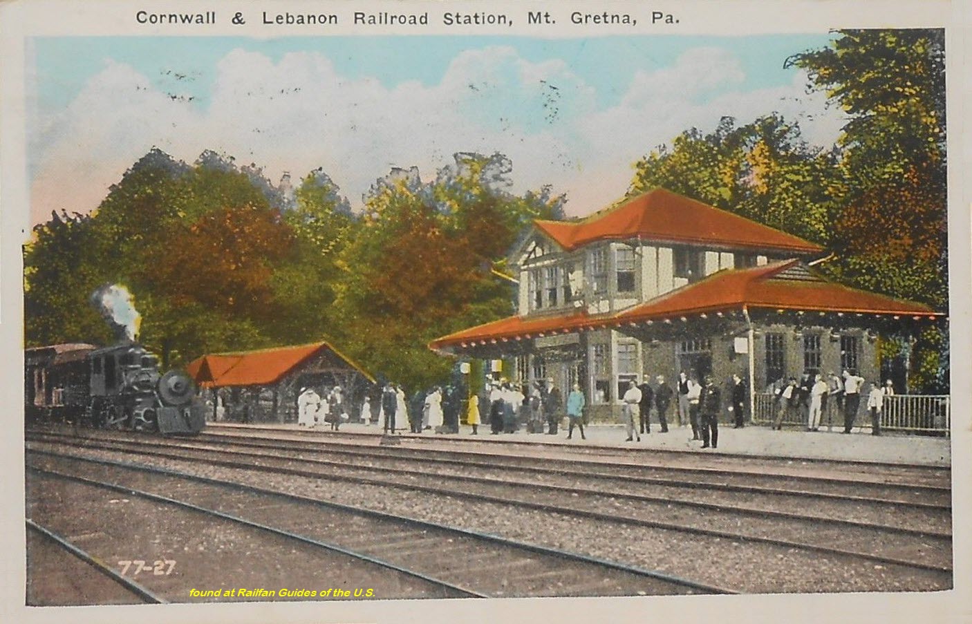
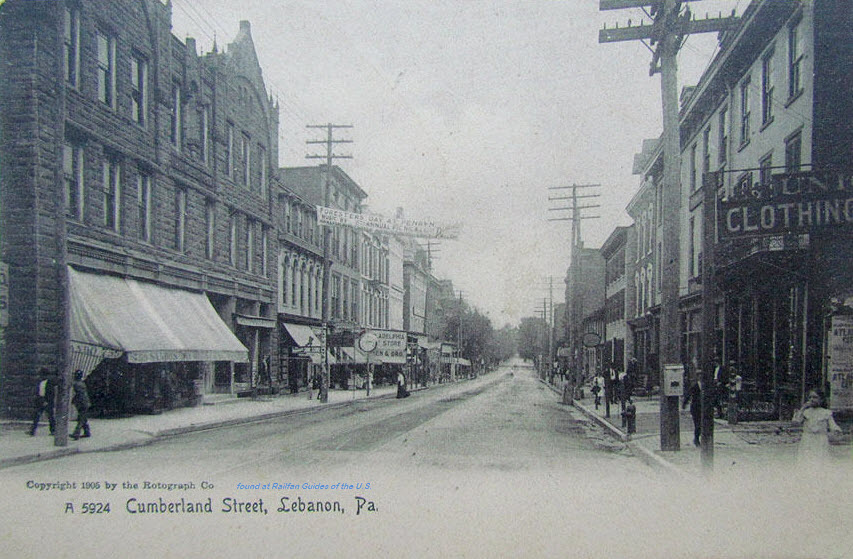
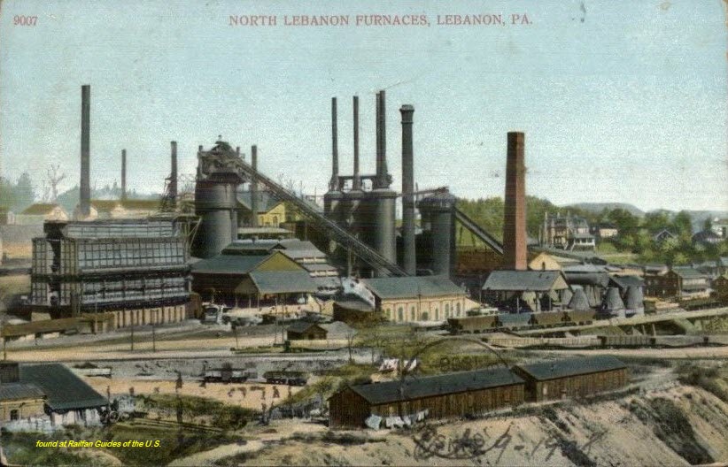
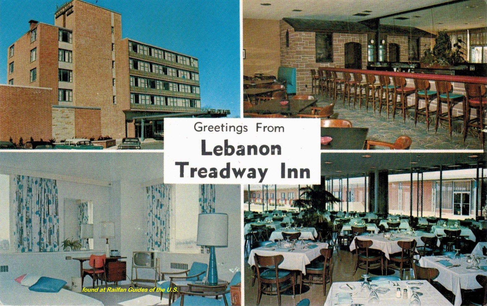
Postcards
USGS Maps
RAILROAD SIGNALS HOME
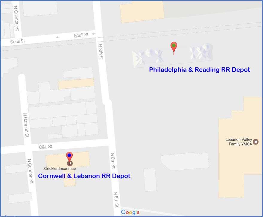
Location / Name:
Lebanon PA, Lebanon County
What's Here:
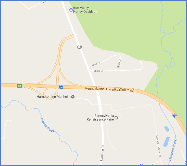
Former Philadelphia and Reading RR Depot
Former Cornwall & Lebanon RR Depot
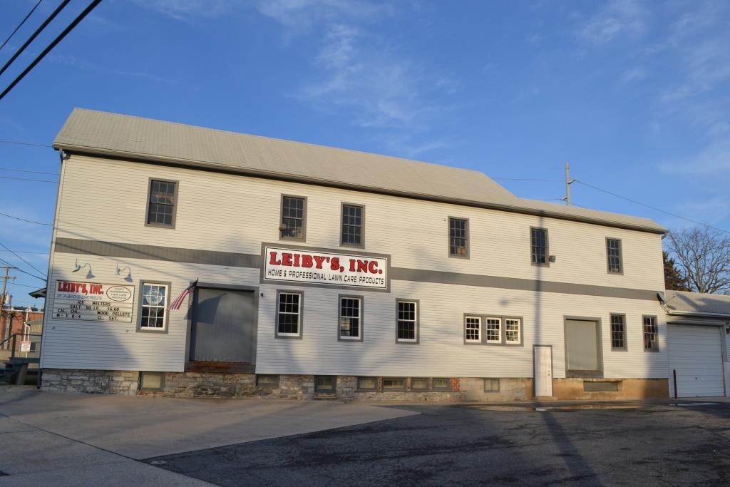
Former Freight Station
The Cabin Fever Expo
The Union Canal Tunnel (Park)
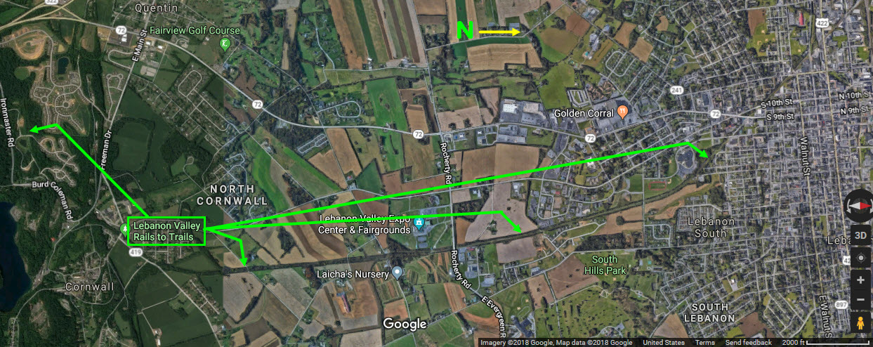
North end of the Lebanon Valley Rail-Trail
Data:
GPS Coordinates: 40.343309, -76.425047 (at 8th St and the NS Grade Crossing)
ZIP: 17046 (at the train stations)
Area Code: 717
Access by train/transit:
None
The Scoop:
Lebanon is one of oodles and oodles of railroad towns in Pennsylvania. What sets it apart from most, is that for a small town, it happens to have two very beautiful and uniquely styled railroad stations, in addition to a still standing freight station.
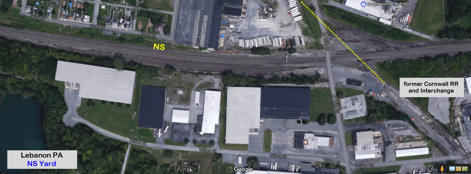
Norfolk Southern runs through town on their double tracked mainline, running west into the former Reading RR's Rutherford yard, and then beyond that, west to Chicago, Ohio, and the rest of the country via the Rockville Bridge and Altoona. Other railroads calling Lebanon home were the Reading RR, the Cornwall & Lebanon RR, the Cornwall RR, Conrail, and the Philadelphia & Reading RR.
If you look, you will find all sorts of reminders of the former right-of-ways that used to wind their way through town - like the freight shed that doesn't sit square with the street (people were staring at me, and staring at me, and staring at me the other day while I was taking pictures of the building! :-). I wonder what was so hard to believe that someone wants to take a picture of an old building? If they only knew!
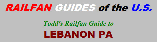
What else is around? Hershey is a few miles to the west, and Harrisburg PA is a few miles west of there. The Rockville bridge is on the north side of Harrisburg, along with the fast paced NS (former Pennsy) mainline to Pittsburgh. Scranton PA and Binghamton NY are 3 hours or so to the north via I-81. Eastern PA and Philadelphia is not too far to the east. You are not very far from oodles of interesting railroad stuff to see!
Acknowledgements:
Warren T. - Long time resident of Lebanon - Thanks!
Websites and other additional information sources of interest for the area:
http://www.cornwallrailroad.com/history.html
https://en.wikipedia.org/wiki/Cornwall_%26_Lebanon_Railroad_Station
http://home.dejazzd.com/jmattern/brief.htm
http://digital.hagley.org/islandora/object/islandora%3A2166833
http://www.cabinfeverexpo.com/
https://en.wikipedia.org/wiki/Lebanon_station_(Reading_Railroad)
https://en.wikipedia.org/wiki/Union_Canal_(Pennsylvania)#Preservation
Getting to Lebanon is fairly easy via either I-81, I-78 or I-76 - the Pennsy Turnpike, alto the turnpike can be expensive, something like 38 bucks from the Ohio border (as of early 2017). So a lot of guys from Ohio and west will come in via I-80 and then come down I-81. I think if I were coming from the west or north using I-81, I would get off at I81 exit #90 (instead of going a little farther east on I-78), which is PA72, and takes you right into Lebanon.
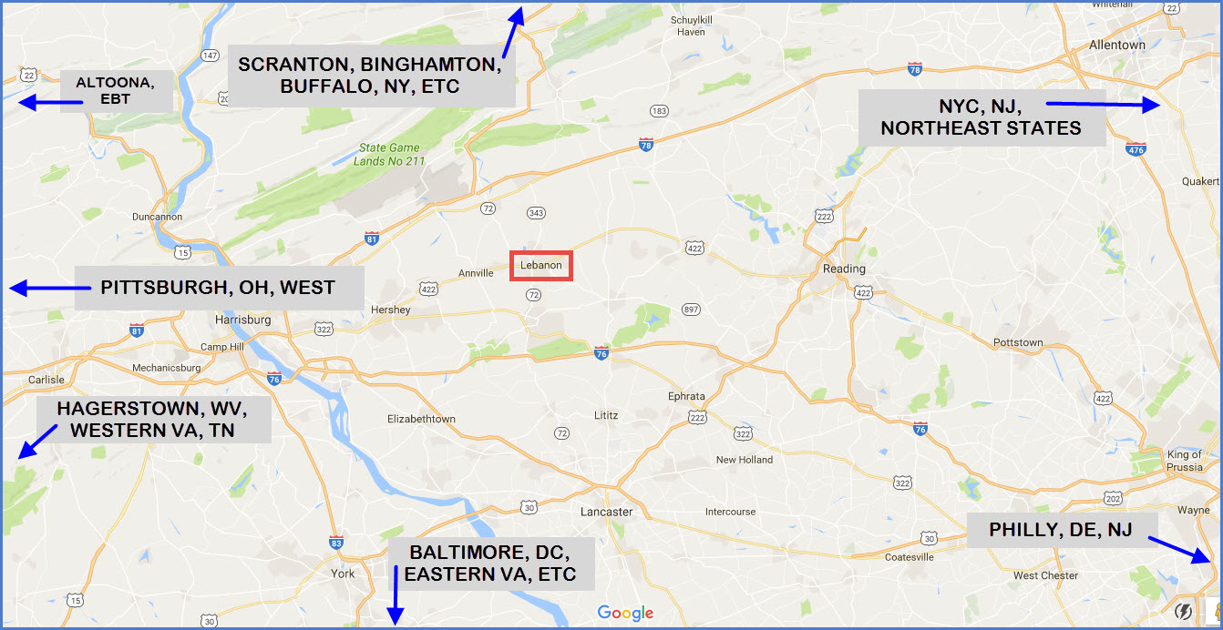
There are plenty of hotels around any of the interstate exits, I-76 #226, or I-78 #6, or I-81 #90, and plenty in Lebanon.
The Pennsy Turnpike exit also drops you off RIGHT NEXT TO the Pennsylvania Renaissance Faire. Personally, I prefer the PA Faire over the MD Faire, even tho it is farther away from me and more expensive.
GPS Coordinates: 40.342305, -76.425361
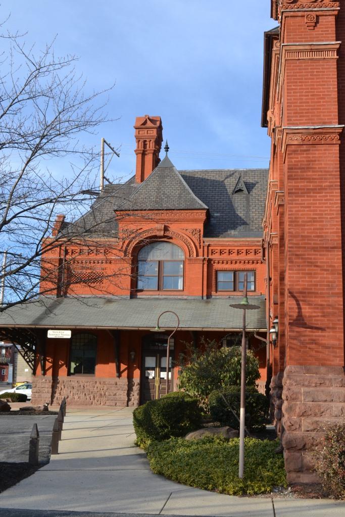
161 N. 8th St at C&L St, a block away from the NS main line.
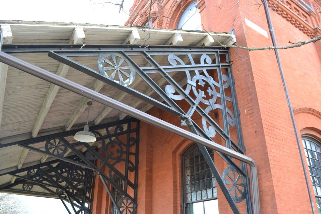
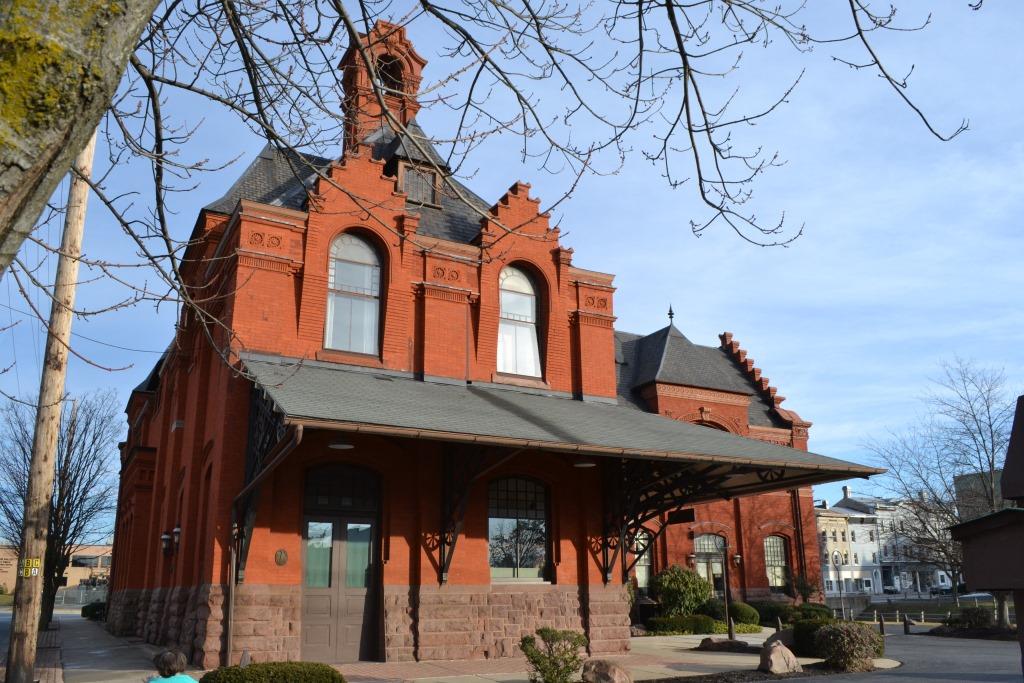
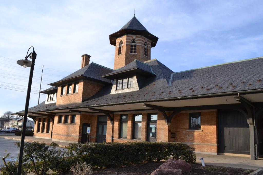
From Wikipedia: The Cornwall & Lebanon Railroad Station, also known as the Pennsylvania Railroad Station, is a historic railway station located in Lebanon, Lebanon County PA. It was designed by George Watson Hewitt and built in 1885, by the Cornwall & Lebanon Railroad. The building was expanded in 1912. It is a two-story, brick, brownstone, and terra cotta building in an eclectic Victorian style reflecting 17th-century Flemish, Romanesque, and Chateauesque influences. It features a broad porch roof with ornamental iron brackets. The Cornwall & Lebanon Railroad opened in 1883, and was acquired by the Pennsylvania Railroad in 1918. It was added to the National Register of Historic Places in 1974.

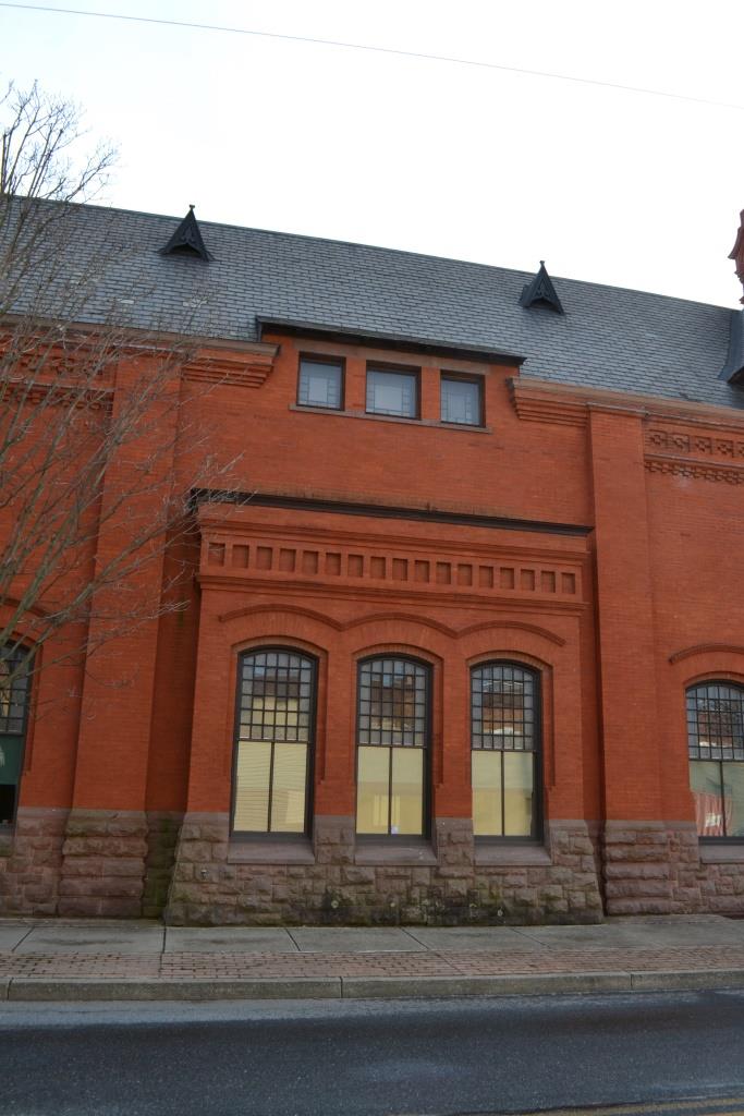
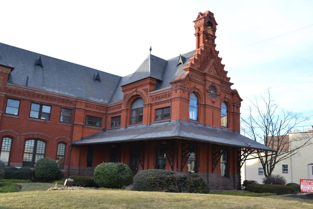

GPS Coordinates: 40.343181, -76.424252
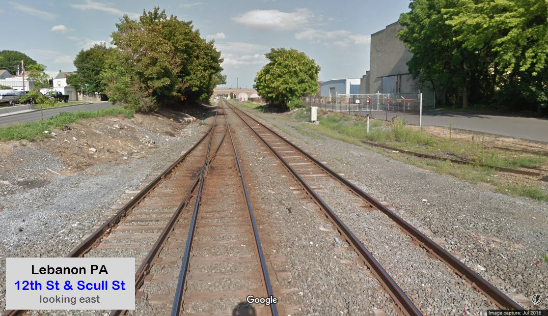
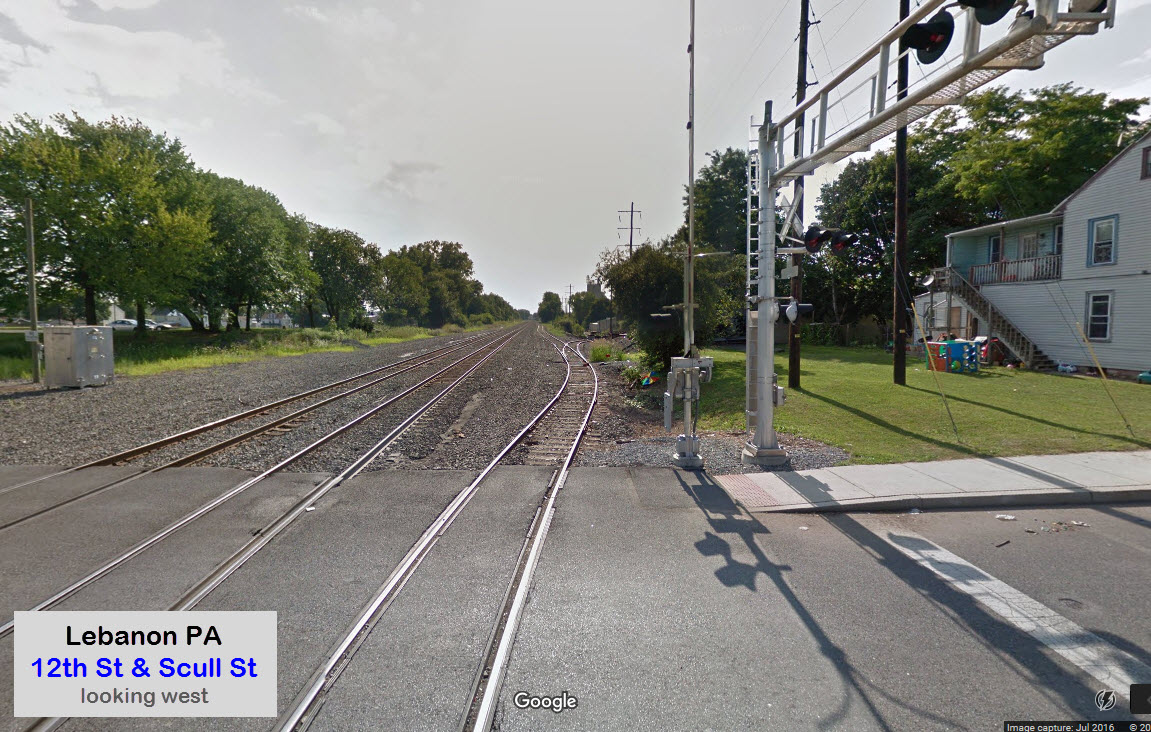
250 N. 8th St at Scull St, on the (now) NS main line.
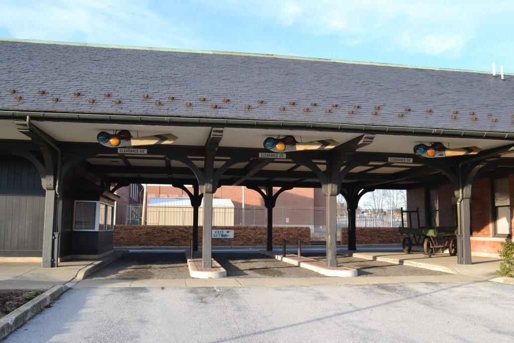
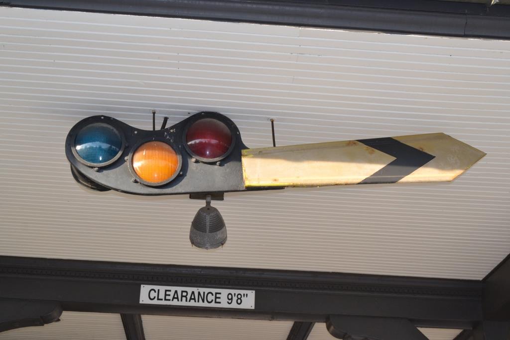
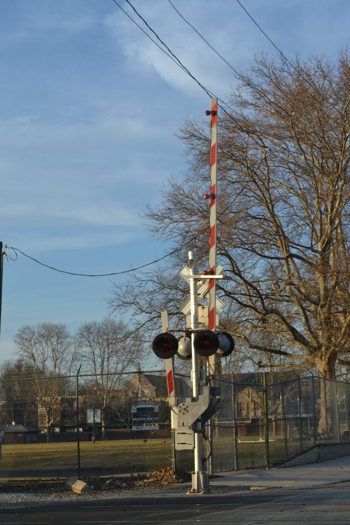
I don't know anything about the semaphore spectacles over the three incoming traffic lanes, but is definitely a unique "thing". The red and green lenses can be lit. Would love to have been able to see this station in it's heyday to see everything operating as it was designed!
Brief history of the Cornwell RR from one of the above references: The railroad was started in 1850 by William Coleman who formed a partnership with George Dawson Coleman and created the North Lebanon Railroad Company (Rhoads/Heilman 2000). In 1870 the name was changed to the Cornwall Railroad Company (Kercher 1969). It had a long and prosperous existence until the concentrator plant was moved from Lebanon to Cornwall in 1962 (Kercher 1969). This move caused raw iron ore traffic to dry up, and the Cornwall Railroad lost its number one source of revenue. In 1964 the Reading Railroad took over operation and leased the line until 1968 when they bought it from Bethlehem Steel.
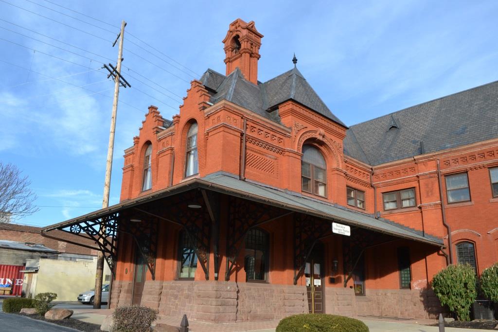
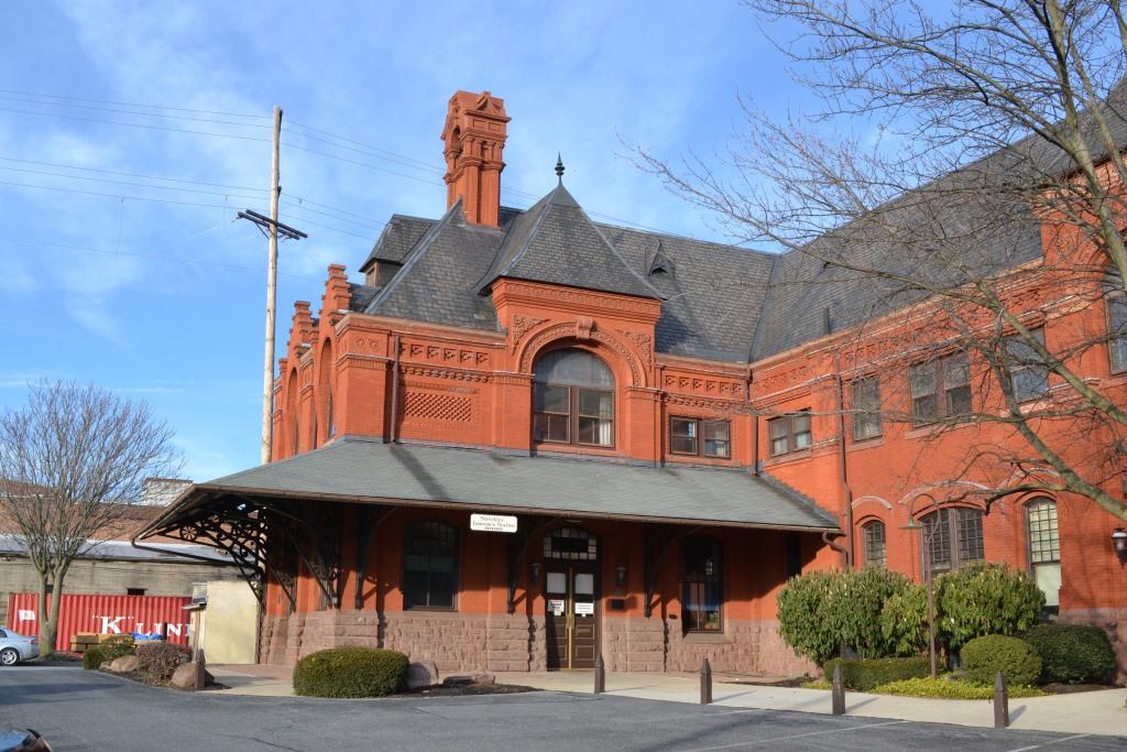
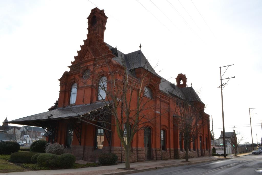
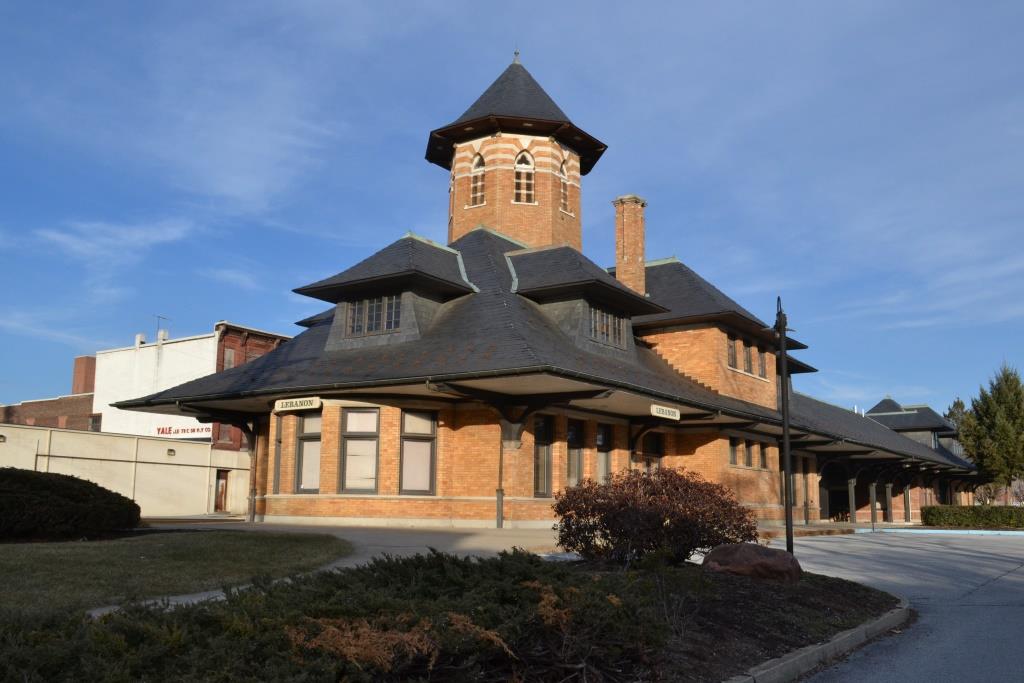
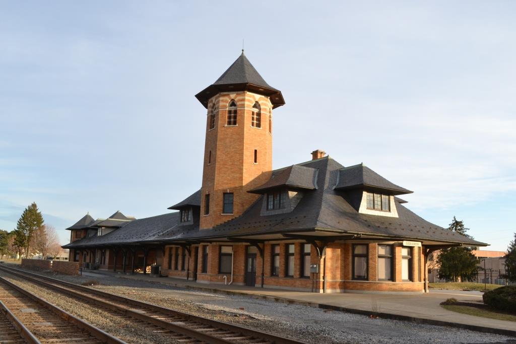
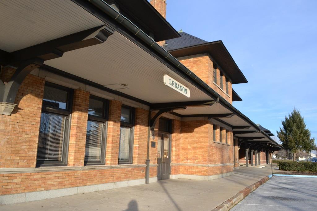
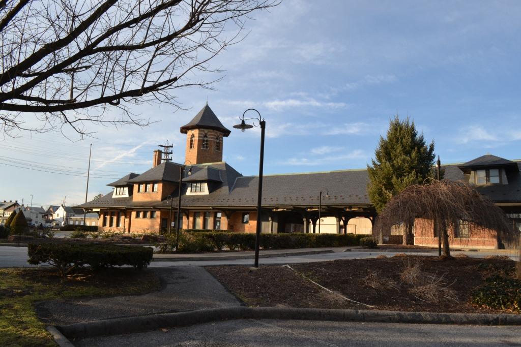
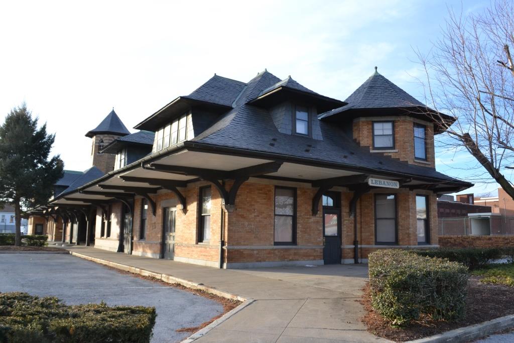
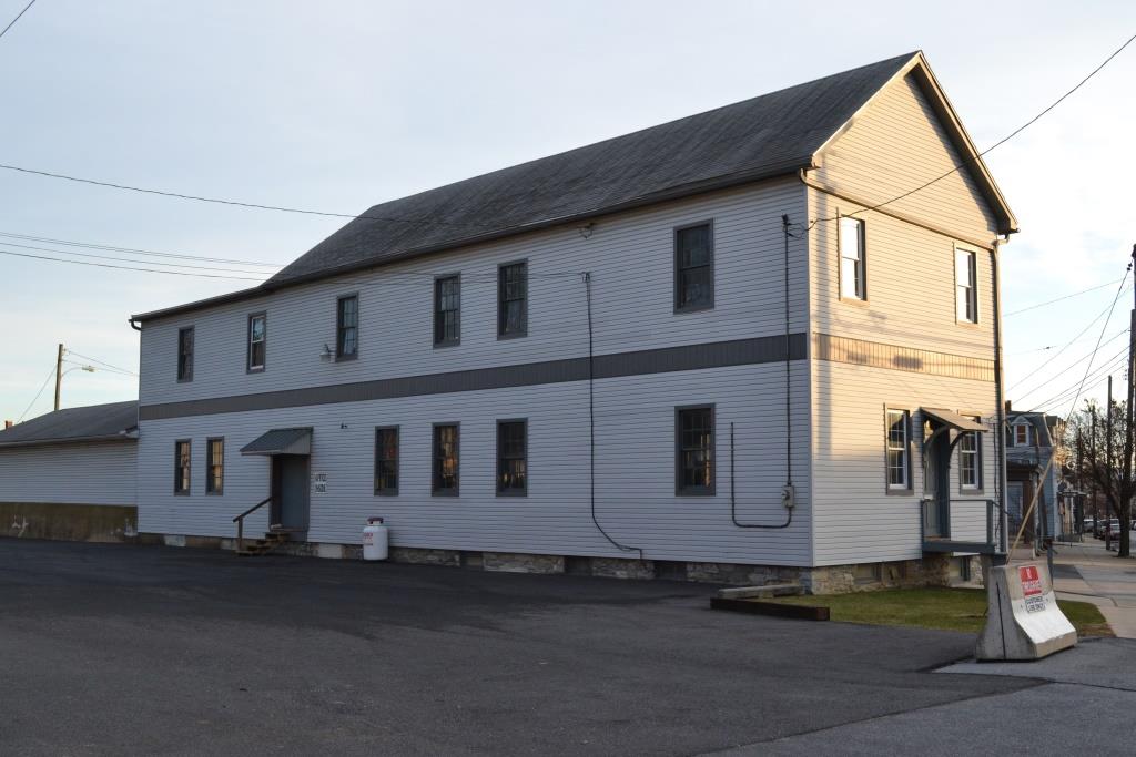
From Wikipedia: The Lebanon station, also known as the Reading Railroad Station, is a historic train station in Lebanon PA. Designed by the Wilson Brothers & Company in the Shingle Style and built by the Reading Company in 1900, it consists of two sections connected by a large overhanging roof. The smaller section is a 1-1/2 story, rectangular structure that contained a baggage room, telegraph office, and yardmasters' office. It measures 55 ft 6 in by 32 ft 6 in. It has a hipped gable roof with bellcast hipped gable dormers and a two-story octagonal tower. The larger section is a two-story structure measuring approximately 80 ft 6 in by 32 ft 6 in and contained men's and women's waiting areas and restrooms. It features a large octagonal tower rising 70-80 ft above the station and has a hipped gable roof with hipped gable dormers and a semicircular bay. The station was added to the National Register of Historic Places in 1975.

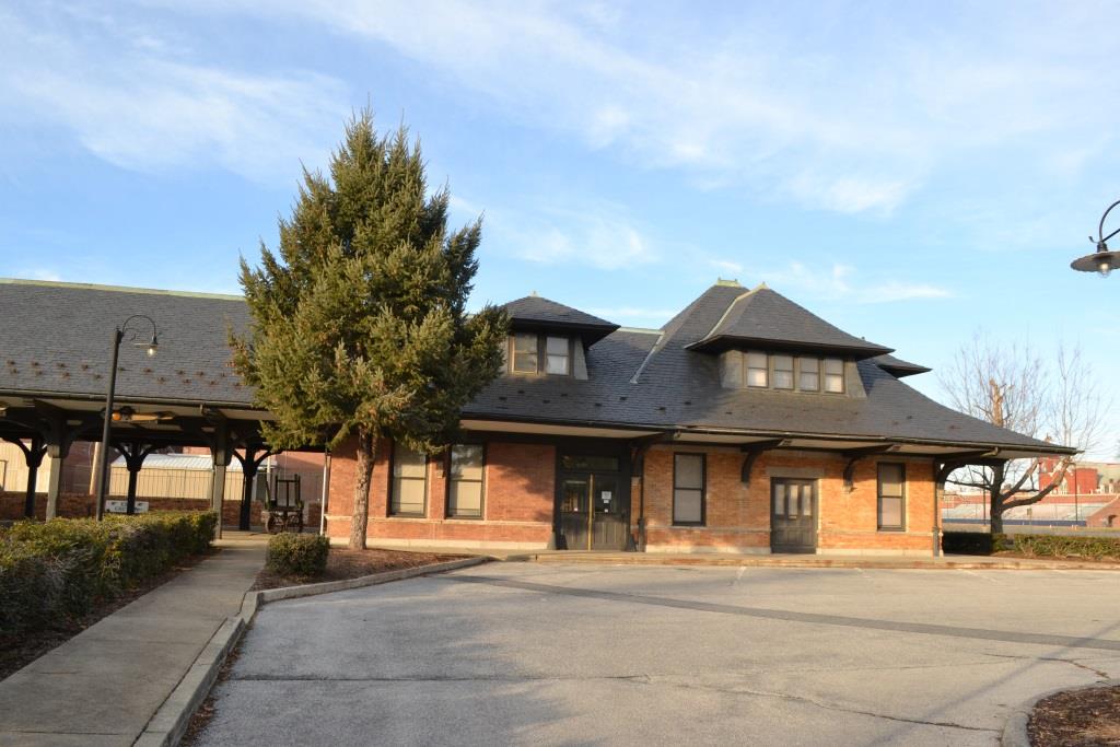
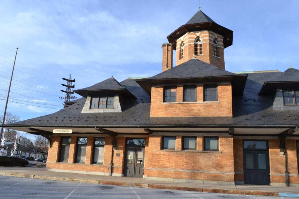

GPS Coordinates: 40.348930, -76.422619
610 N. 7th St at Water St,.

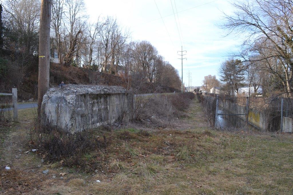
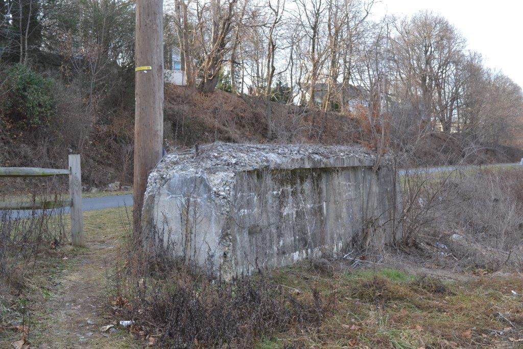
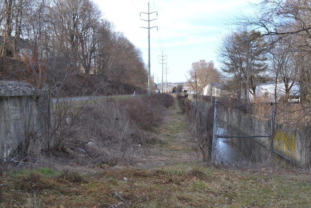
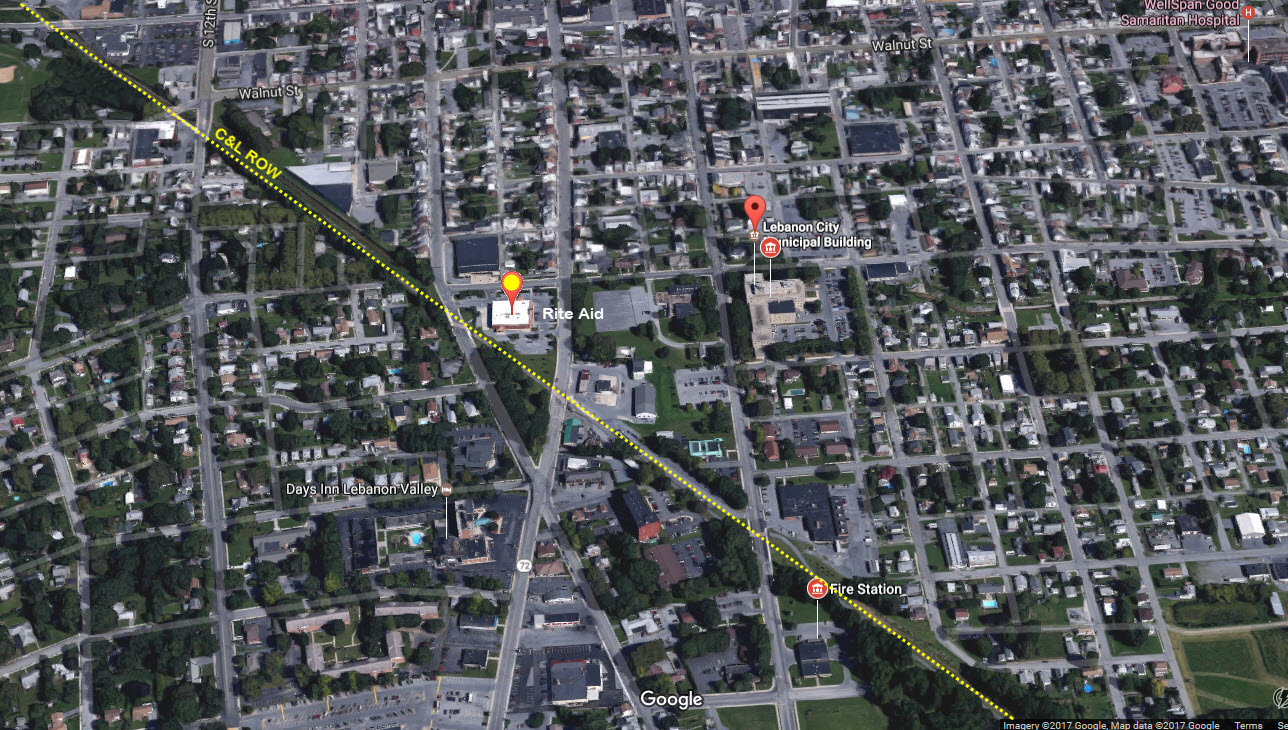
Most people probably won't even give it a thought as to why there is such a nice straight-a-way for the power line to come through town, or why a nice hikey-bikey train exists. But as soon as I saw "it" I knew what used to be here, and confirmed it once I got home. These views are from where 9th and 10th Streets come together by the Rite-Aid, which would have the railroad coming thru the south end of their property if still around. It would be interesting to find out what the concrete was used to support? Most of the right-of-way has been converted into a trail, and they have even rebuilt one of the bridges.....
Warren T. of Lebanon wrote me and told me that the concrete abutment remnant was for a bridge on the old Hershey Transit/Interurban line that used to run between Hershey PA and Lebanon. The bridge allowed the interurban cars go over the Cornwall & Lebanon RR.
The trail continues south into Elizabethtown PA, some 20 miles south, where the Cornwall RR caught up with the Pennsy line between Harrisburg and Philadelphia. At about the halfway point, the trail name changes to the Conawago Recreation Trail, at 40.198567, -76.560984. The south end of the trail is on N Market St at 40.164258, -76.641051, a mere 735 feet from actual still in use trackage. From the air, you can still see the route the railroad took thru the countryside.

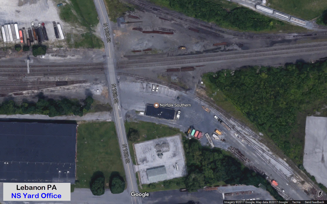
GPS Coordinates: 40.341790, -76.439896 (Yard Office)
GPS Coordinates: 40.302736, -76.412227
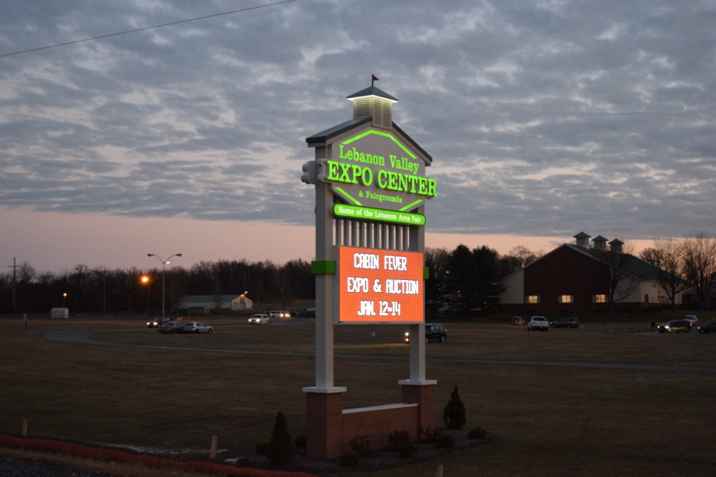
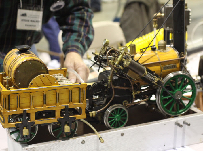
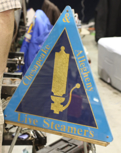
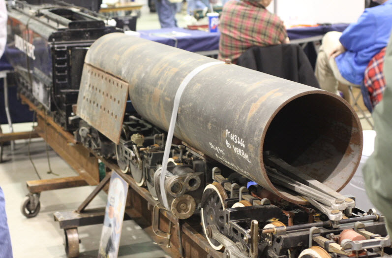
The Cabin Fever Expo is held about two miles or so south of Lebanon. For many years, it was held at the fairgrounds in York PA, but in 2015, they returned to having it at the Lebanon Valley Expo Center, off Rocherty Road and PA72. 2017 was the 21st year for the show!
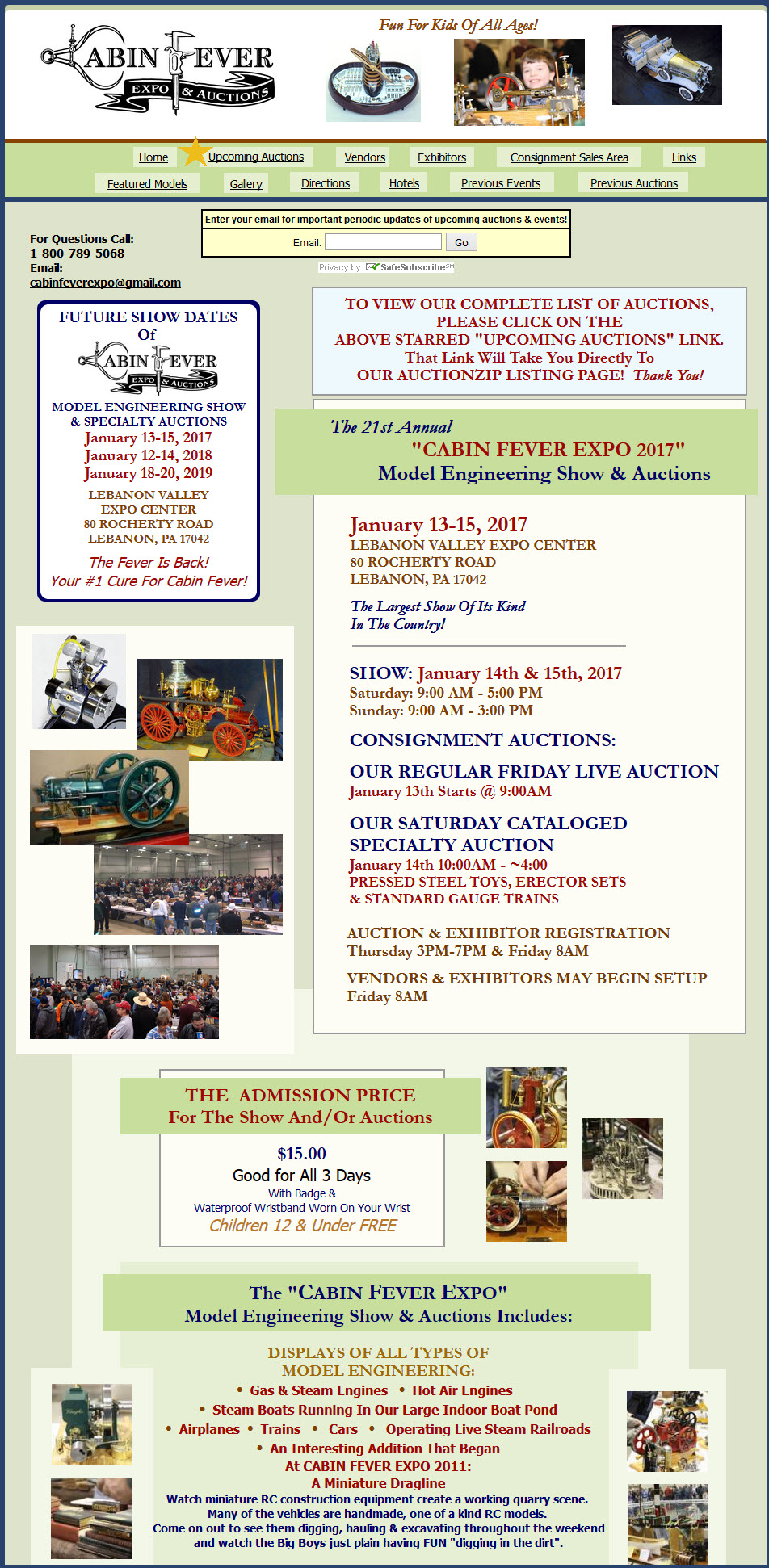
If you are even mildly interested in models of any kind, this is the show to attend. People come from as far away as Michigan to attend, many from Ohio even make a (long) day trip out of it. It is billed as the largest show of it's kind in the United States.
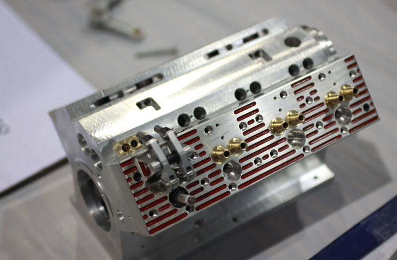
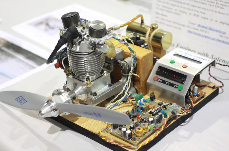
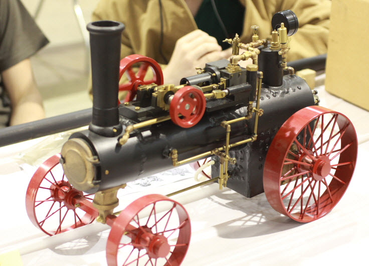
You will see almost anything here, be it trains, steam engines, diesel trains, electric trains, parts for them, track for them, 1/4" scale live steam, stationary steam engines, planes, boats, ships, submarines, R/C trucks and cranes, wood models, even operating Lego "steam powered" models, carousels and other amusement park equipment, miniature tools for 1/12 scale dollhouses, operating miniature Gatling guns that shoot 22's, operating gasoline powered V8's that are 10" long with custom made spark plugs and distributors, miniature stuff, sub-miniature stuff, full size stuff, machining equipment, CNC stuff, and especially tools! Tools rule! Several auctions are held on Saturday and Friday. The folks from Village Press in Traverse City MI are always set up in a prominent place too - they print most of the magazines that support this hobby!
BE FORWARNED THO, if you are coming ONLY on Sunday.... Come early, and be prepared to either wiz thru the place at a really quick pace, or miss half the show. If you come on a Saturday, getting thru the whole event is still a demanding day because of the variety of things to do and see. Most exhibitors and vendors that have decided to stay for the Sunday show start to pack-up around 10-11, and the halls are about half empty by noom. But if you get there at 2:30, and expect to see anything, you will be severely disappointed, because there is NOTHING left to see except for very, very few vendors and a pile of dirt! My only other suggestion is to avoid the hamburgers at the Eatery, they're not very tasty :-)
Personally, I preferred the show back in York, mainly because it was closer and quicker to get to, but after listening to many a fellow that traveled from Ohio, I stopped complaining! :-) However, most of them also preferred having the show in York.
Below is part of their homepage. Pictures are off their website from the 2010 show.
 2018
2018
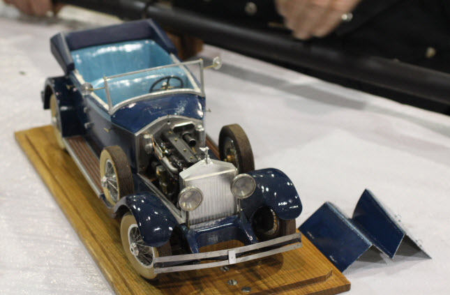
Probably one of my favorite was this model of a (better than Smithsonian quality) 1928 (I think) Packard!!! Everything operates.
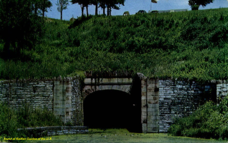
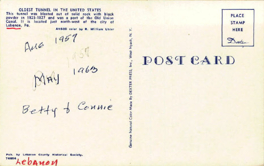
GPS Coordinates: 40.350855, -76.463179
The Union Canal was begun in 1792, but not completed until 1828 and required a tunnel to connect Quittapahilla Creek to Clarks Run. The tunnel required two years to build, for a tunnel that was only 792ft long - that's about 15ft a week! More on the Wikipedia page.


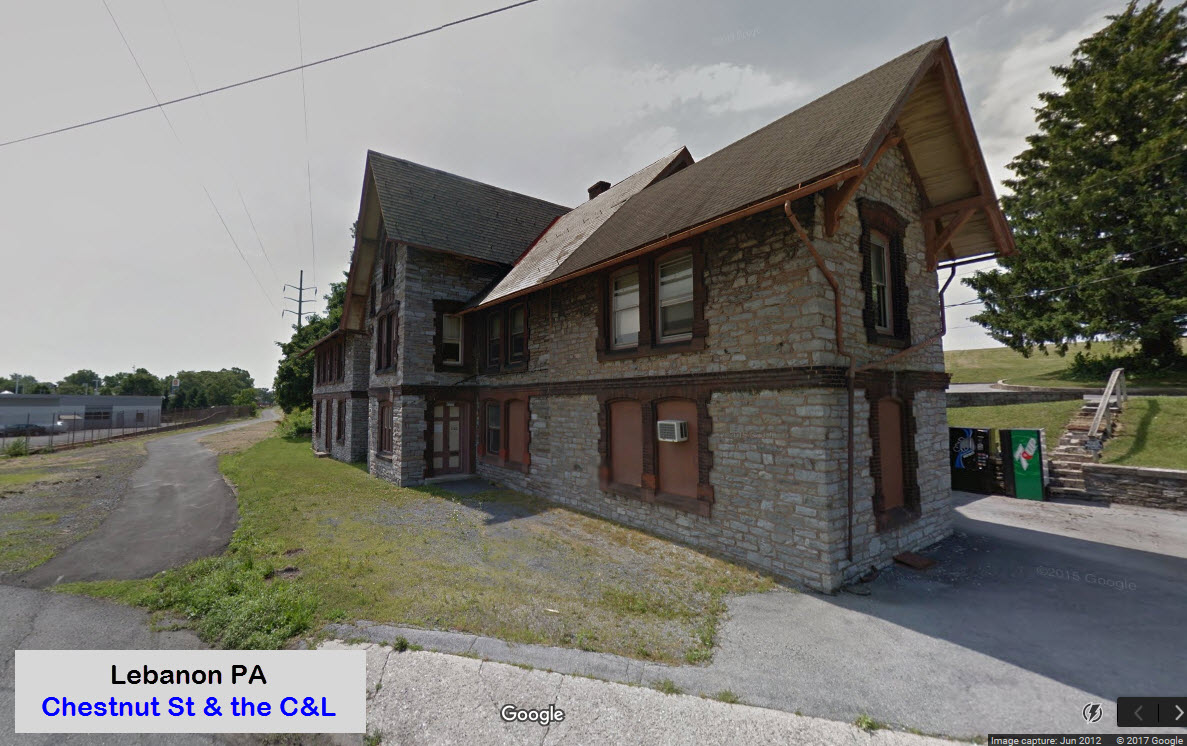
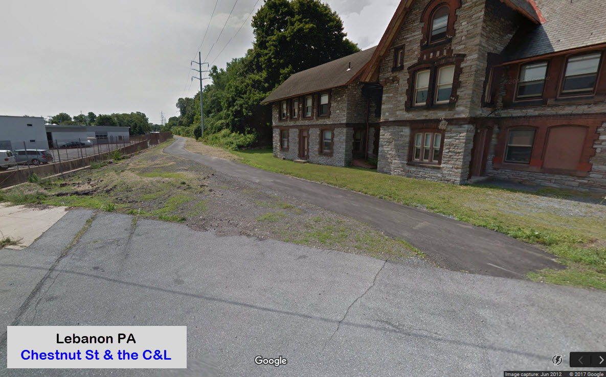
GPS Coordinates: 40.337120, -76.433064
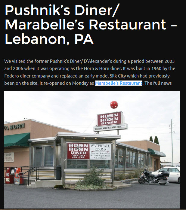
This building sits on an angle along the former C&L right-of-way on Chestnut St by 12th St. Other than the fact that it sits right next to the tracks, and is on an angle matching that of a former interchange track. Warren T. wrote me in July 2019 to tell me that it was a former railroad office building.
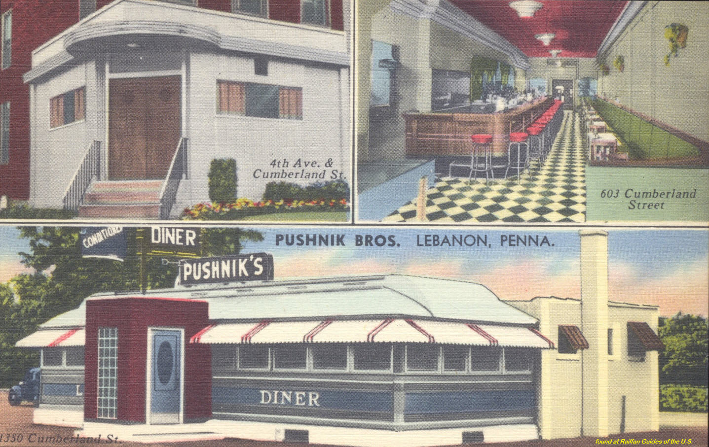
How did I find this building? Down in the postcard section, there is a diner called Pushnik's. So I Googled it. It came up, but so did another restaurant, Marabelle's, that replaced it, and it was on Chestnut St. So I went to see if it was still around, and I came across this building where the restaurant was supposed to be. Maybe......


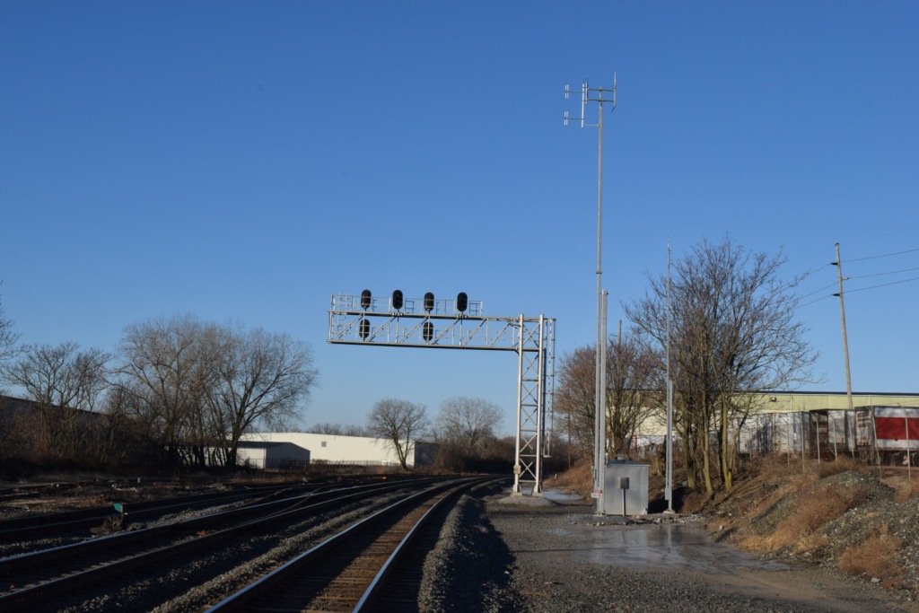
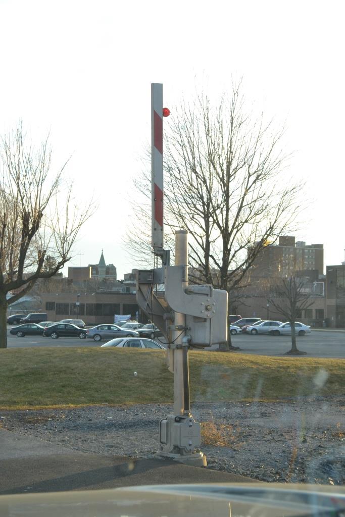
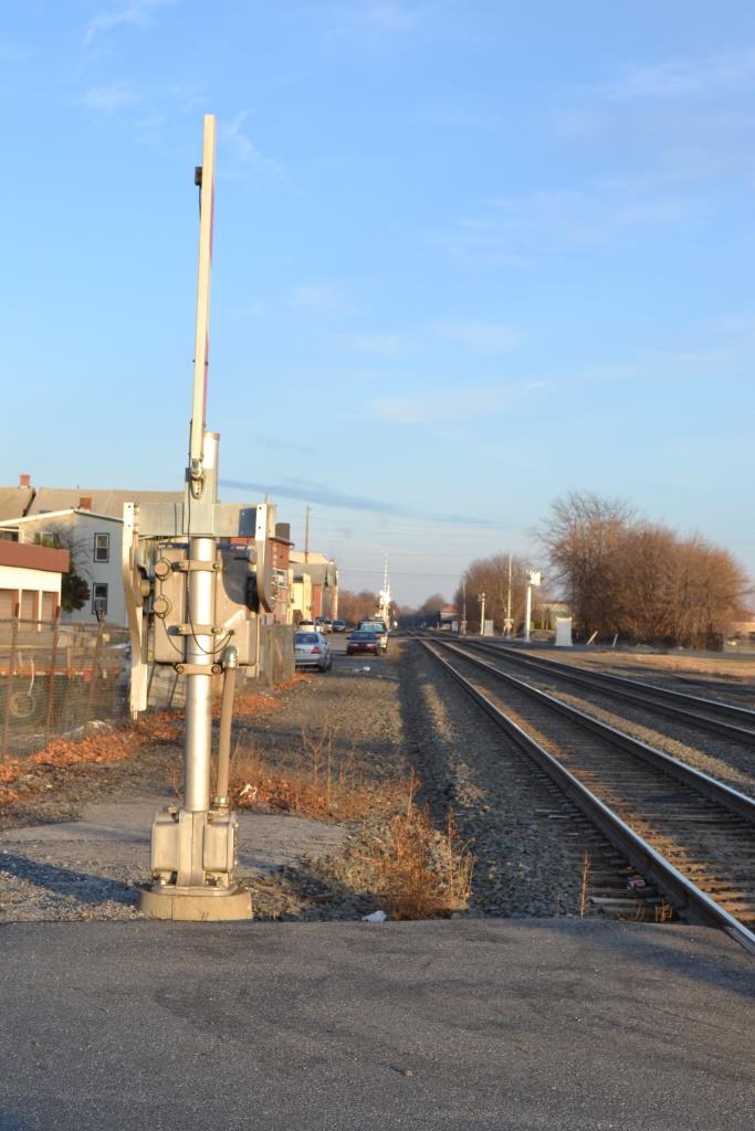
There are two sets of wayside signals in town, one is at the 16th Street crossing, and the other is off of West St and Leslie Ave on the east side of town, looks like parking and accessibility is good, but I didn't have the time while here the other day.... I stopped in town after visiting the Cabin Fever Expo.
GPS Coordinates: 40.342206, -76.441084
 2018
2018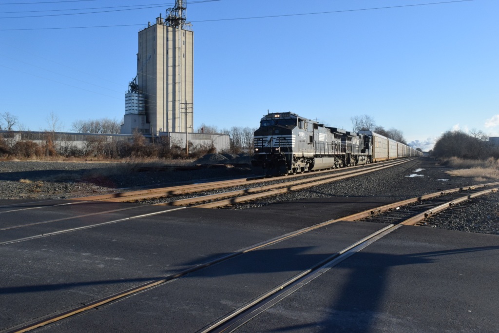 2018
2018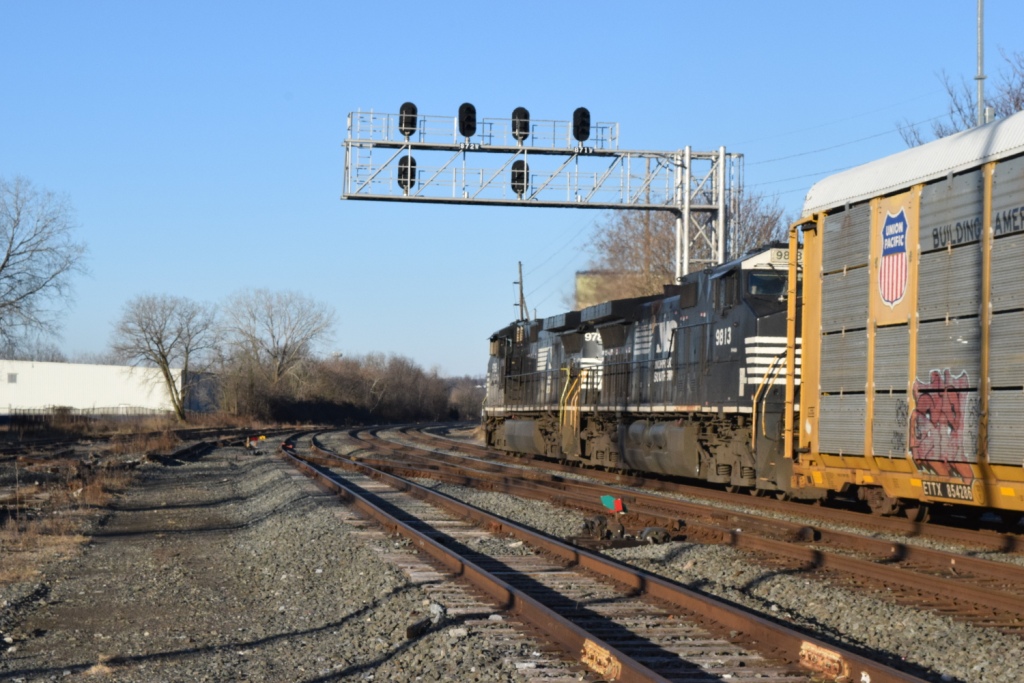 2018
2018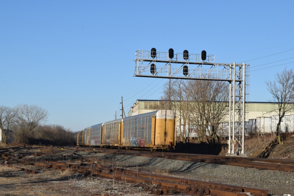 2018
2018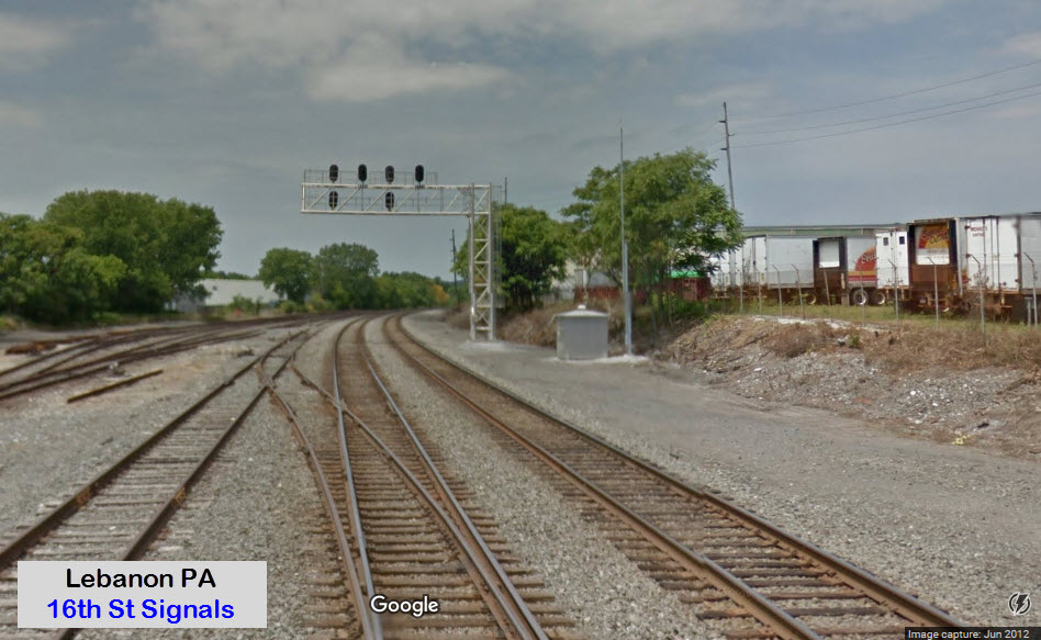 Looking west
 Looking east
 EB/WB Colorlight Signals
GPS Coordinates: 40.348594, -76.375904
Green arrows point to the signal locations, yellow arrows are the crossovers.

 2018
2018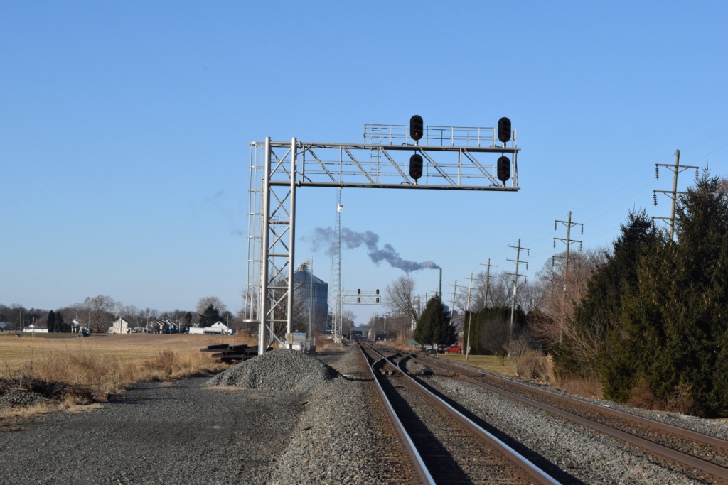 2018
2018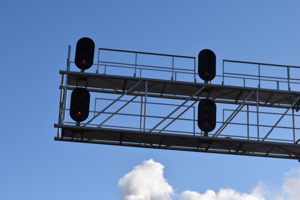 2018
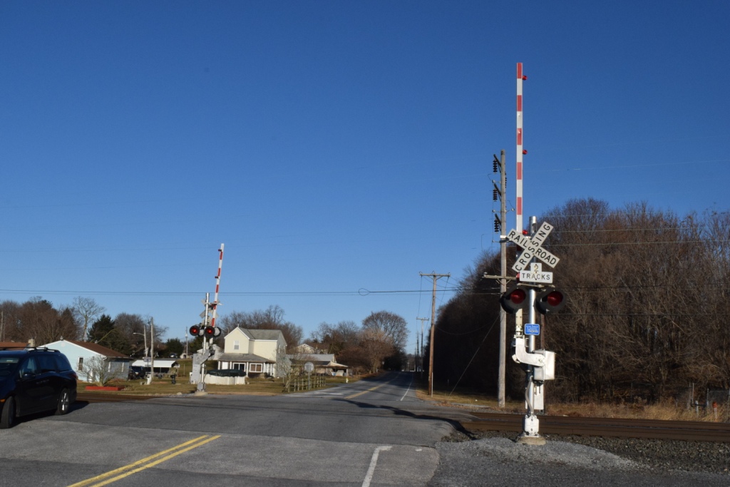
2018 Grade Crossings
 Most of the grade crossings are as shown in the first two pictures at 12th St & Scull St, standard cantilever installations.....
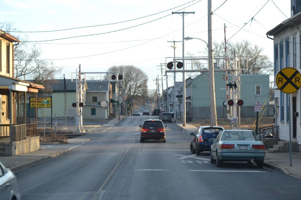
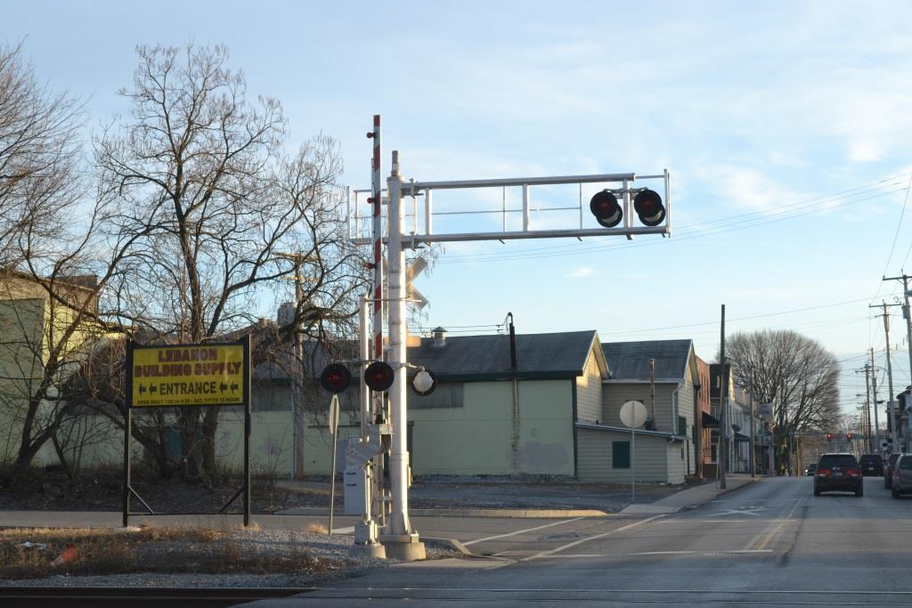
Most of the other grade crossings are protected by standard crossing gates, with the addition of pedestrian gates. Some are mounted by themselves, others are mounted to the main crossing arm.


 2018, adjacent to the east side signals
And last but not least, one of the many hand-man signals around town, LED style, with those annoying beepers.

Fire Stations
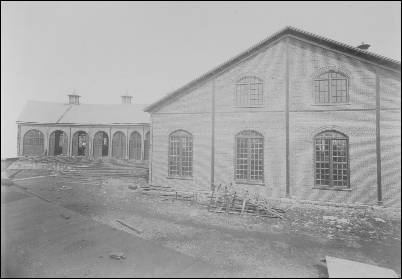
The Cornwall & Lebanon roundhouse
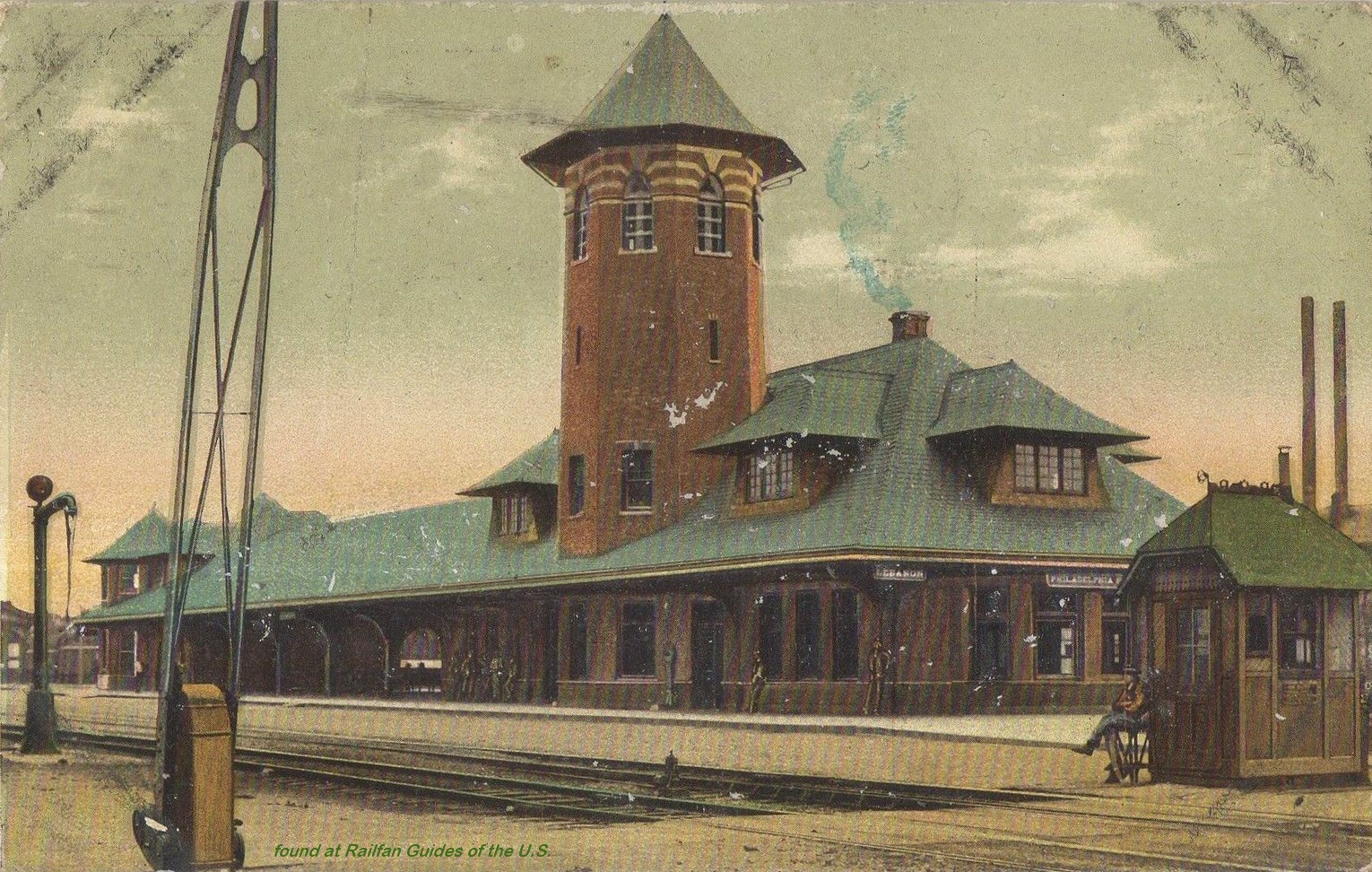
From the Hagley collection listed above, picture from sometime between 1890 and 1910.
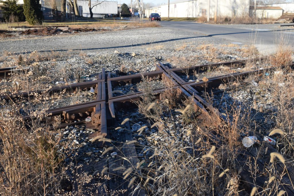
An old "still-in-place" diamond over off of Willow St near the 16th St grade crossing.
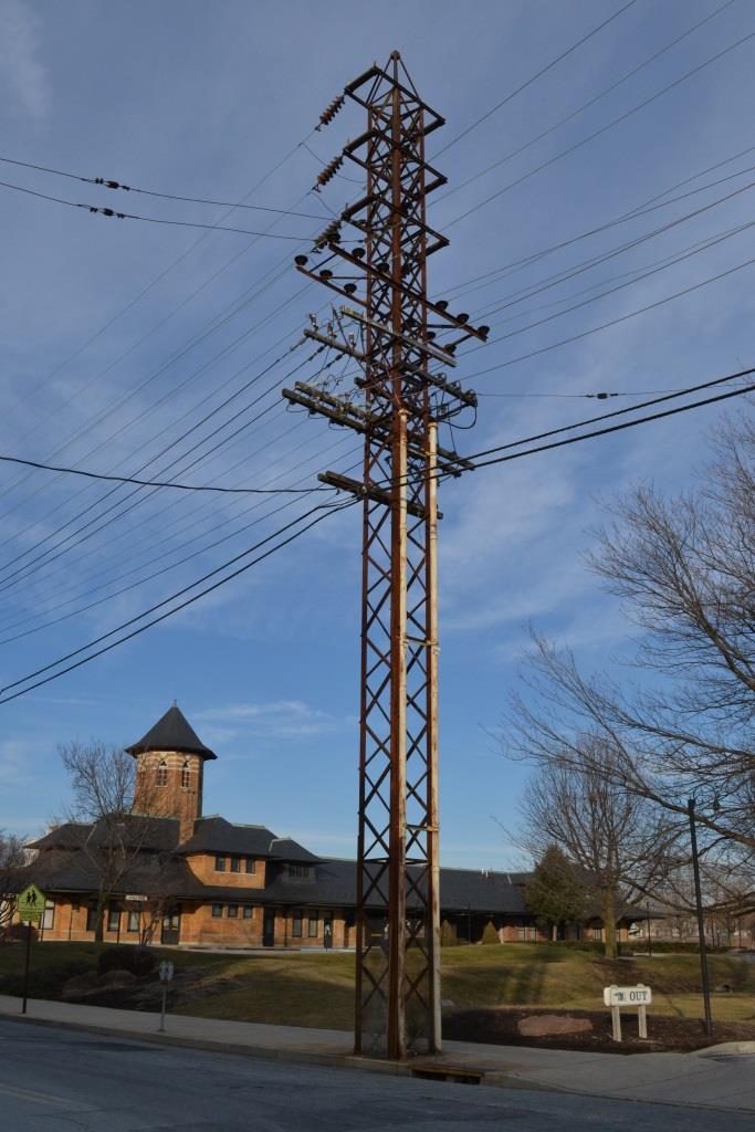
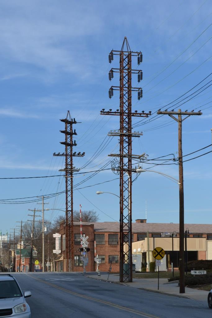
Interesting power towers (poles) adjacent to the P&R depot.

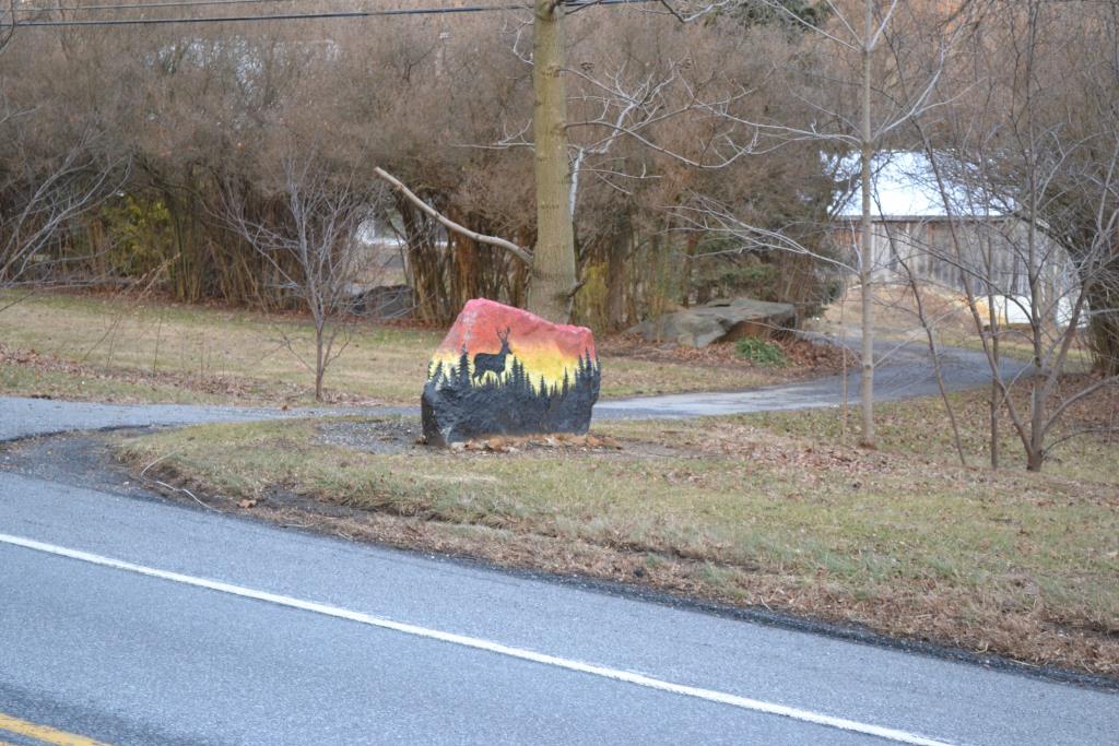
South of town, on PA72 heading south towards Mt Hope, is this decorative use for a rock, probably unearthed during digging for a foundation.......
These were found on EBay.....


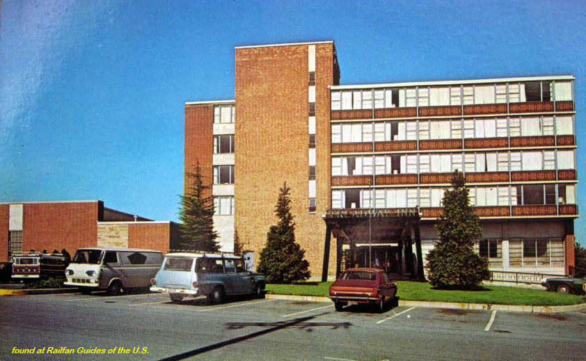


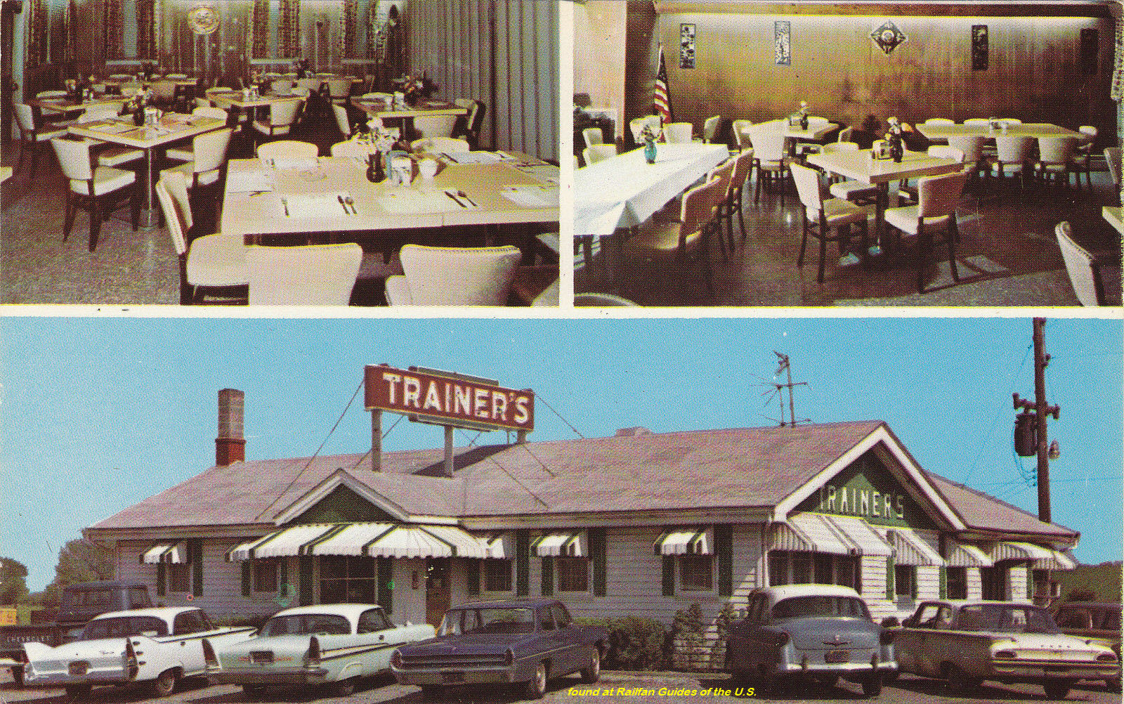
 The Trivet is still here today as the Relax Inn
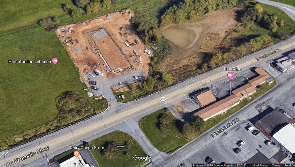 And across the street in goes a Hampton Inn
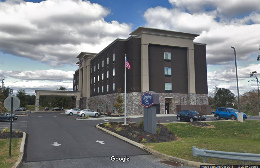
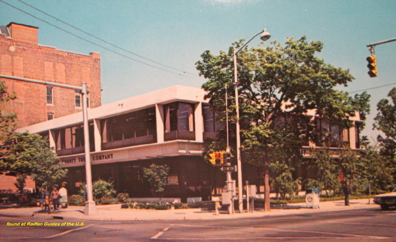
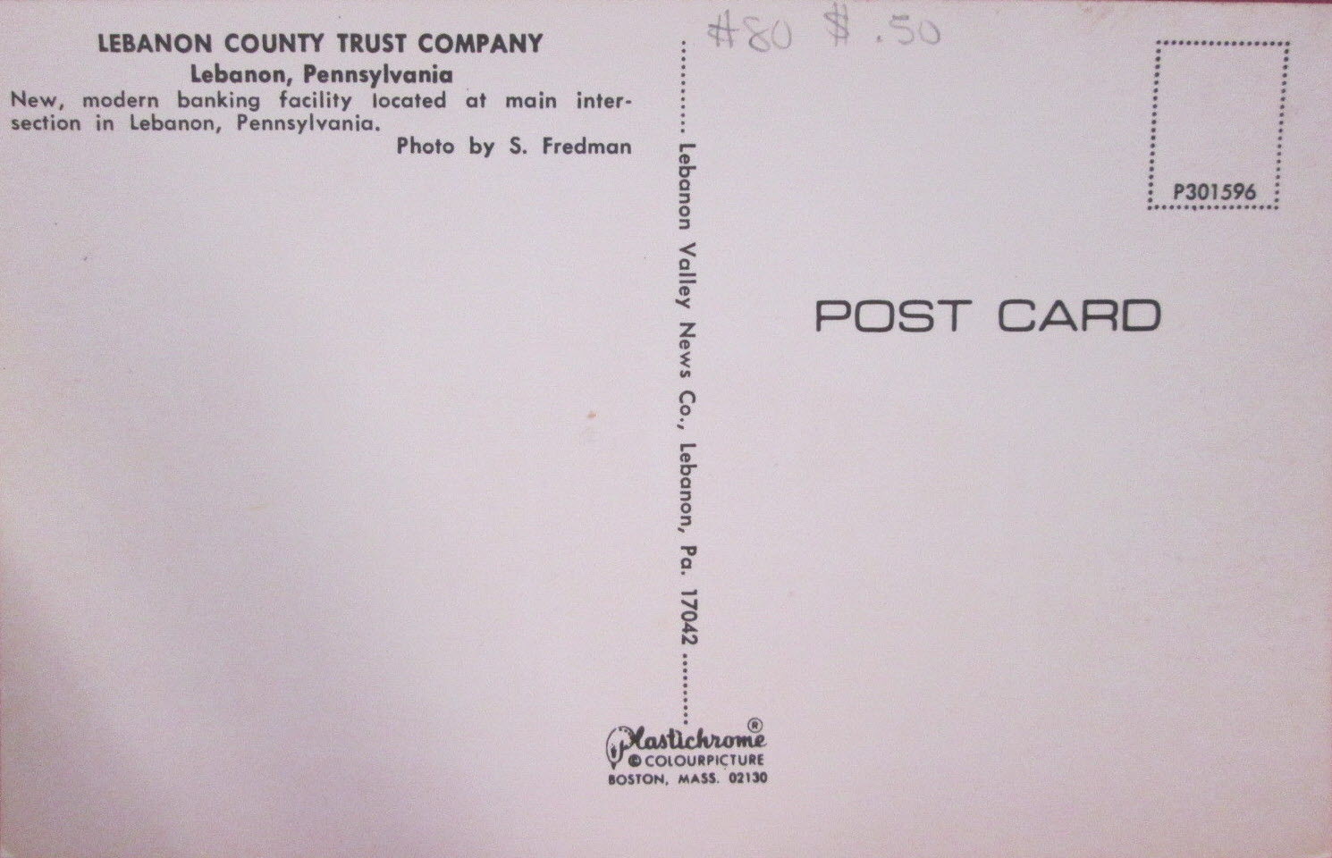
The Lebanon County Trust Co is now a Wells Fargo bank, at the corner of 8th and Cumberland, 809 Cumberland St, Lebanon, PA 17042

 A little north in Jonesboro
Courtesy of the University of Texas Library, click here for their index page.
Disclaimers:
I love trains, and I love signals. I am not an expert. I do these pages because I love spending my time doing them - although I do a reasonable amount of research to make sure the information presented is accurate! :-) :-)
Please Note: Since the main focus of my two websites is railroad signals, the railfan guides are oriented towards the signal fan being able to locate them. For those of you into the modeling aspect of our hobby, my indexa page has a list of almost everything railroad oriented I can think of to provide you with at least a few pictures to help you detail your pike.
If this is a railfan page, every effort has been made to make sure that the information contained on this map and in this railfan guide is correct. Once in a while, an error may creep in, oooooooops, oh well! :-)
My philosophy: Pictures and maps are worth a thousand words, especially for railfanning. Text descriptions only get you so far, especially if you get lost or disoriented. Take along good maps.... a GPS is OK to get somewhere, but maps are still better if you get lost! I belong to AAA, which allows you to get local maps for free when you visit the local branches. ADC puts out a nice series of county maps for the Washington DC area, but their state maps do not have the railroads on them. If you can find em, I like the National Geographic map book of the U.S..... good, clear, and concise graphics, and they do a really good job of showing you where tourist type attractions are, although they too lack the railroads. Other notes about specific areas will show up on that page if known.
Aerial shots were taken from either Google Maps or www.bing.com/maps as noted. Screen captures are made with Snagit, a Techsmith product... a great tool if you have never used it!
BTW, floobydust is a term I picked up 30-40 years ago from a National Semiconductor data book, and means miscellaneous and/or other stuff.
Pictures and additional information is always needed if anyone feels inclined to take 'em, send 'em, and share 'em, or if you have something to add or correct.... credit is always given! BE NICE!!! Contact info is here. Beware: If used as a source, ANYTHING from Wikipedia must be treated as being possibly being inaccurate, wrong, or not true.
RAILFAN GUIDES HOME
RAILROAD SIGNALS HOME
NEW
1/16/2017, 03/18/2018
Last Modified
27-Jul-2019