In General
Getting Here
Map
Pictures
the Crossing
Support Equipment
the Signaling
Nearby SEPTA Stuff
CSX Signals
Floobydust
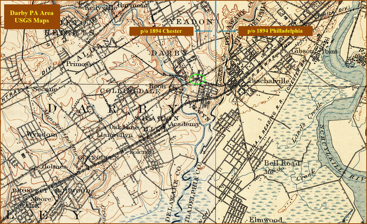
USGS Maps
RAILFAN GUIDES HOME
RAILROAD SIGNALS HOME
Location / Name:
Darby PA, Delaware County, Suburban Philadelphia
What's Here:
One of three Railroad/Trolley Crossings in the U.S.
Nearby:
Darby Transportation Center
Elmwood Maintenance Facility/Shops
Woodland Maintenance Facility/Shops
40th St Portal
Data:
GPS Coordinates: 39.917786, -75.255663
Phone A/C: 610
ZIP: 19023
Access by train/transit:
SEPTA Subway Surface Trolley Line #11
The Scoop:
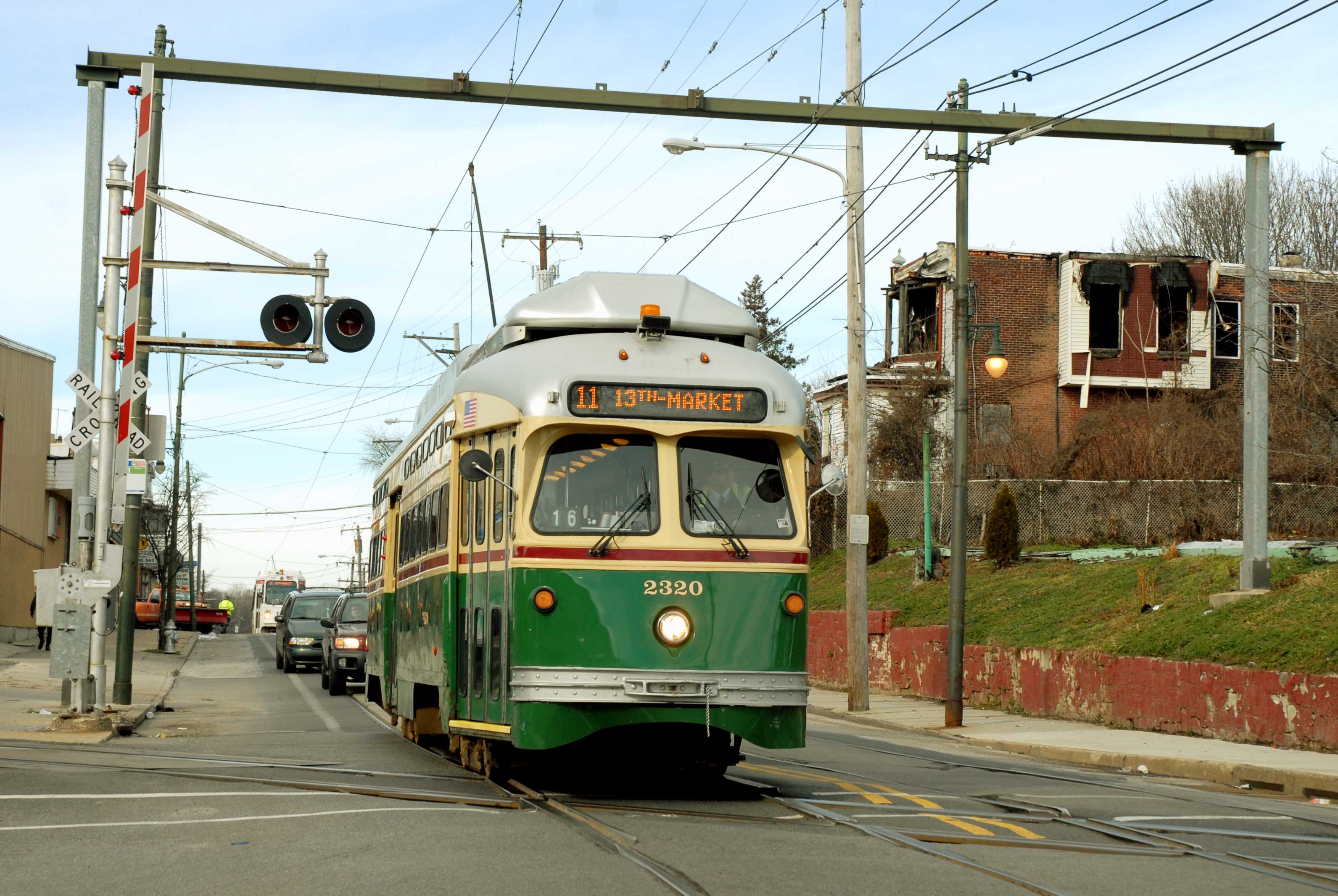
This unique grade crossing, on Woodland Ave in Darby, is one of only three crossings between a trolley line and a mainline railroad in the United States.
Up until the end of passenger service on the B&O into the area in 1958, when this used to be a 2-track mainline for the B&O, there used to be a watchtower located here.
John and I stopped here on a Thursday in early October 2018 for an exhaustive examination of the crossing (We have passed thru here on many, many occasions prior to this over the past 50 years), hoping to take advantage of the Thursday/Friday pick-up in traffic. However, wouldn't you know it with our luck - CSX was doing track work about a mile south of our location, which meant that traffic was stopped (being a single track line at this point). We did manage to catch some MOW equipment plowing over the crossing however, and I think the ballast regulator "did the detection equipment in", for the gates went up while he was in the middle of the street, came back down, and were now stuck down. John made a call to the 1-800 number, and a guy showed up in less than 5 minutes to unpick a relay that got stuck. So that was out excitement for the day! :-)
PLEASE NOTE: This IS NOT a real good neighborhood, PLEASE make sure you railfan here with at least one other buddy. Altho we never experienced anything bad over the course of standing around at the crossing for about two hours at two different periods, no-one ever gave us any problem - that doesn't mean it can't happen, altho I'm sure they see enough of "us" around here from time to time. I did notice that the locals do seem to have trouble with eye contact, and of those that did manage a glance, we got precious few smiles from anyone. I needed change for getting on the streetcar here, and went into the J&J Food Market, and had no problem, as the Hispanic guy working in there was pleasant and talkative.

Acknowledgements:
John Buxton
Chris Rinaldi
FL92002
Websites and other additional information sources of interest for the area:
https://www.youtube.com/watch?v=1mQDV_0ktpM Video of NB Q438 from cherry picker bucket by FL92002
http://position-light.blogspot.com/2016/01/
Exit 13 (NB), or exit 14 (SB) off of I-95, for Island Ave. Take Island Ave north about 1.8 miles, till you pass the Elmwood Shops on your right, go under the NEC (North East Corridor), and hit Woodland Ave. Take a left and travel about 1,700 feet, or about 1/3 mile.
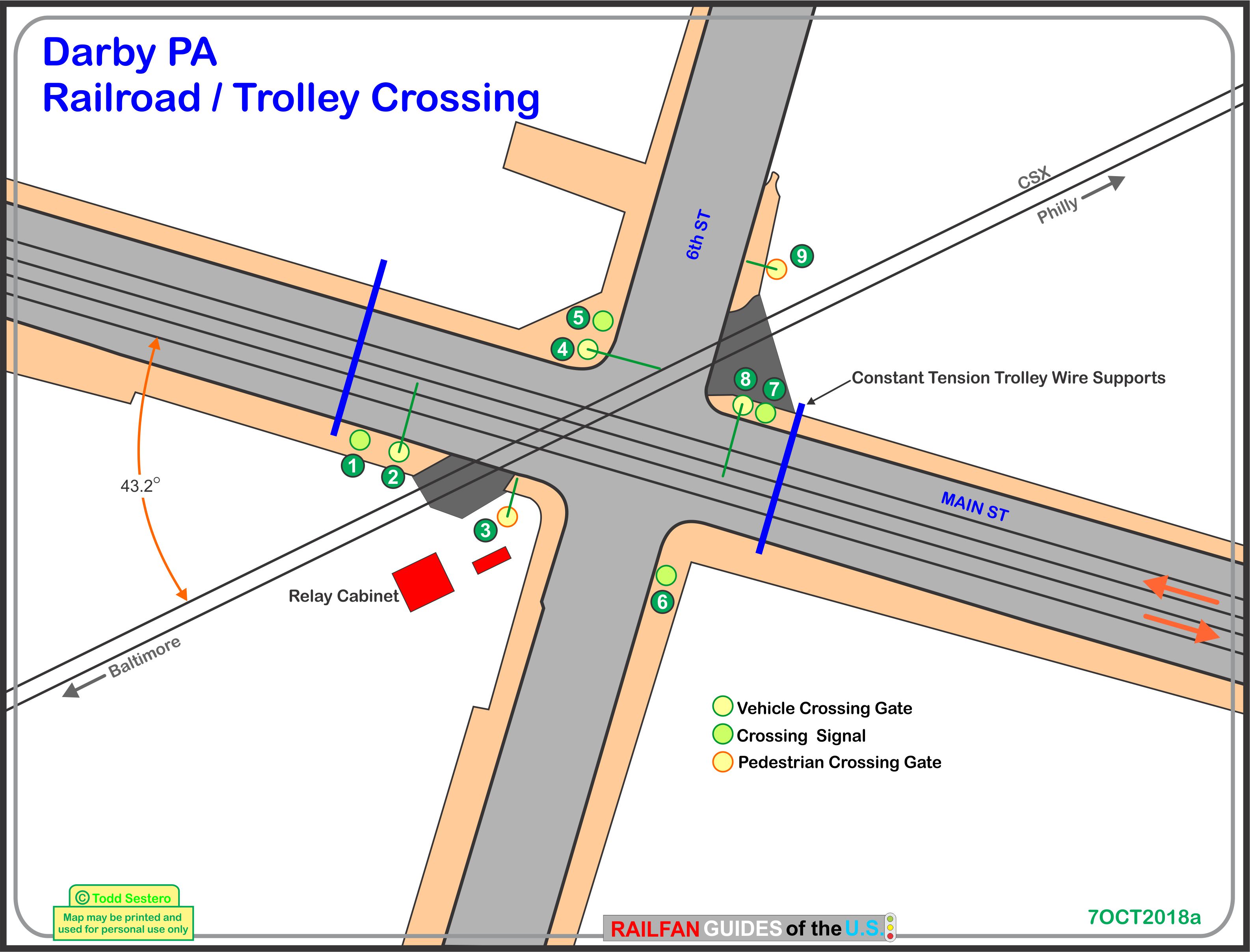
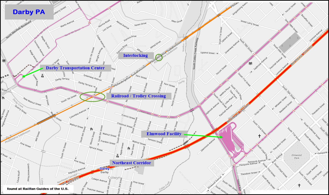
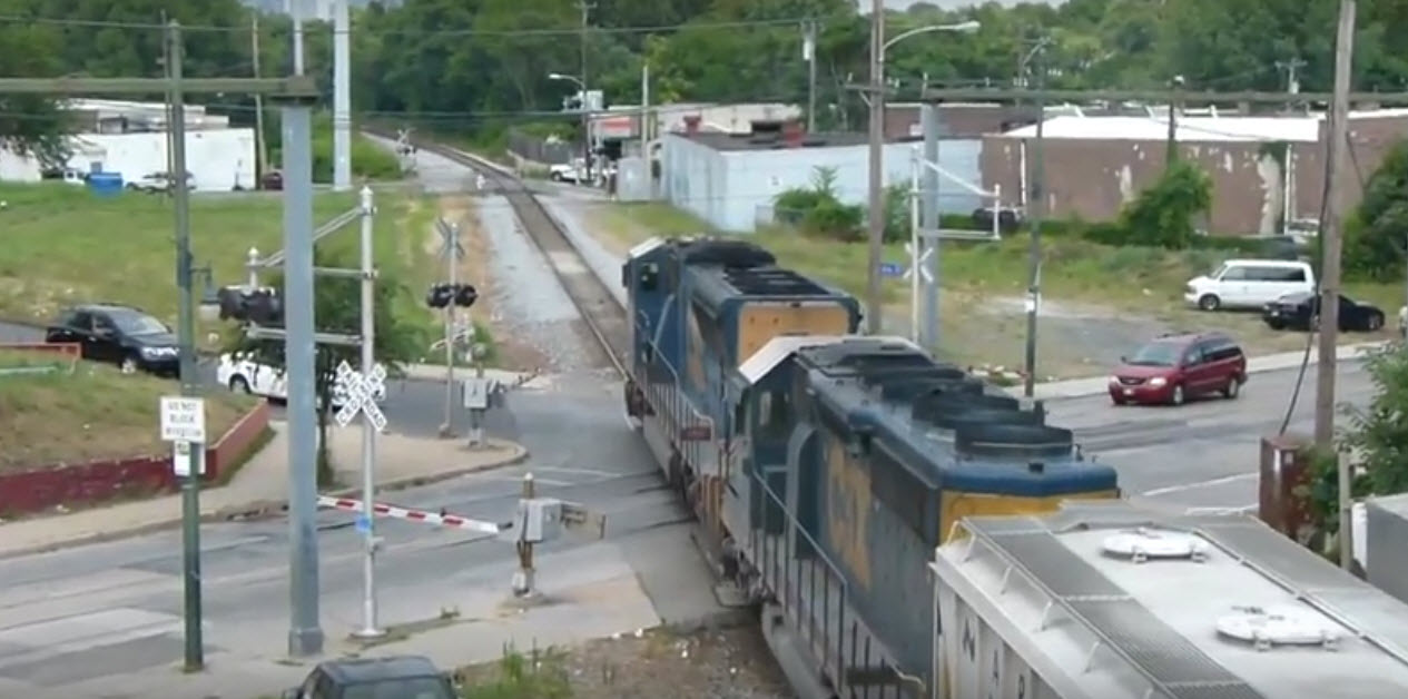 photo by FL92002
These guys were hard at work about a mile south of the crossing, that's why we didn't see any freights.
Compare my pictures from October 2018, with the picture at the bottom from Jersey Mike, and you will notice that either CSX or SEPTA has been around and really strengthened the trackwork at the crossing, substantially.....
If you are wondering how the trolley crosses the tracks (and no, it's not a chicken joke :-), the trolley wheels ride in a typical "U" shaped rail. The bottom of the flangeway is aligned with the top of CSX's rails. This way, when a trolley crosses CSX's track, the wheels ride over the train tracks on the flanges. In the picture below, the red line indicates where the trolley rail would be aligned with the top of the train rail.
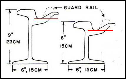
Derails??? I've never heard of any here, probably due to the fact that since the crossover for the two sides of the truck happen at different times, only one wheel is out of the "U" rail at any one time, with the other three keeping the truck aligned to prevent a derail.
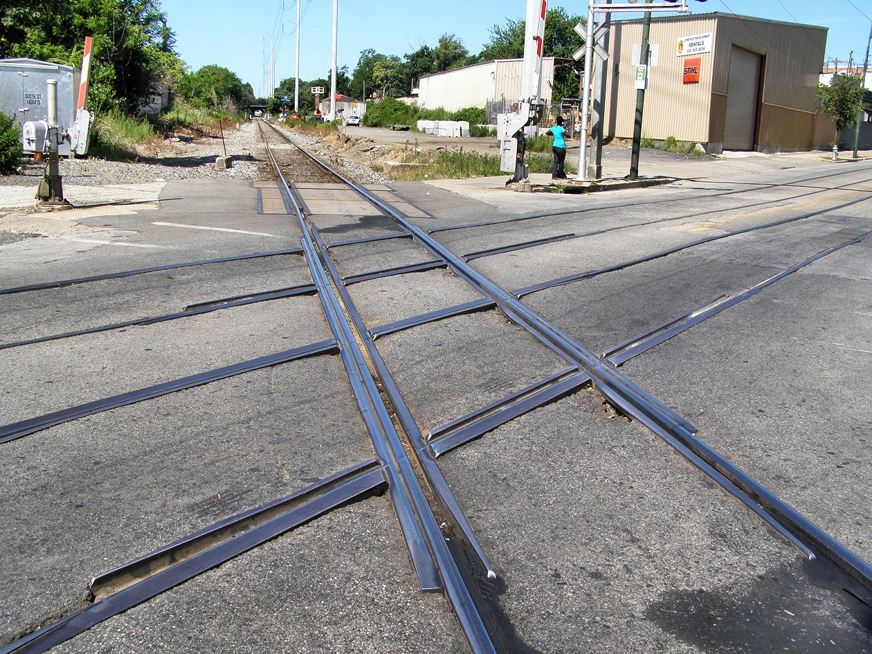 Jersey Mike, 2016
The signal guy showed up in about 5 minutes after John called the 1-800 number for the stuck gate.....
99% of the #11 Line is standard ole single trolley wire, like every system had "back in the old days". Here at the railroad crossing however, they need to keep the trolley wire as straight/level as possible going over the railroad tracks, so they erected two poles so they could string a support wire for the trolley wire.
The
The
The
Nearby SEPTA Items of Interest
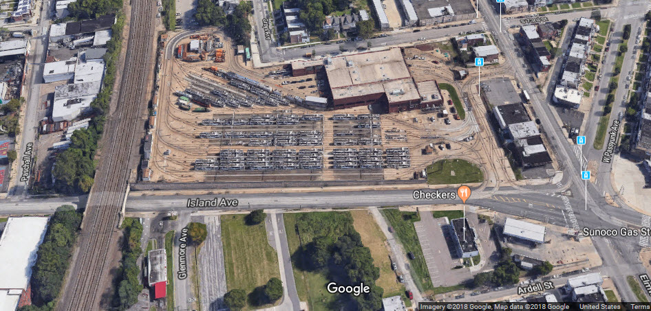
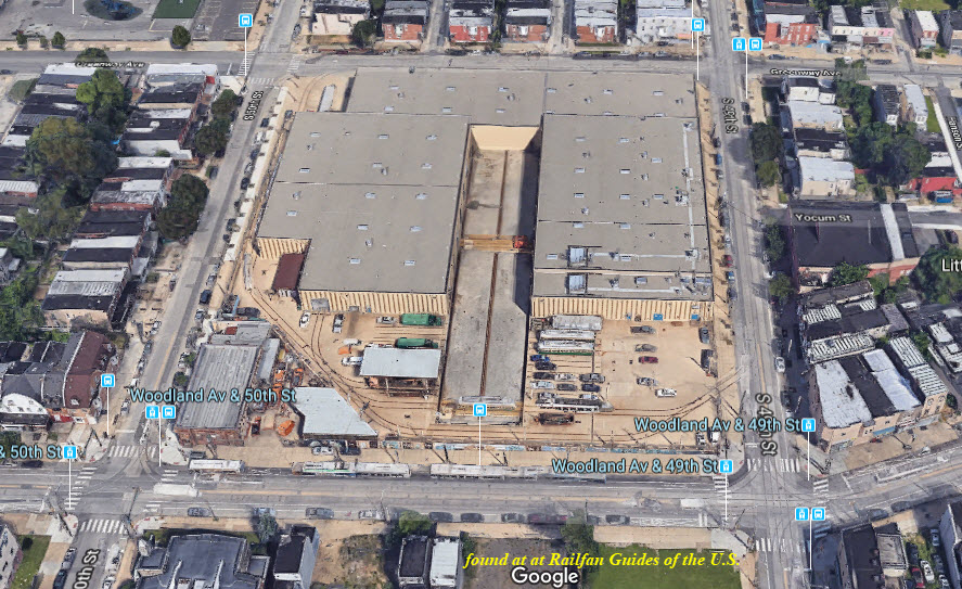
One of the many maintenance facilities SEPTA has in Philadelphia, this one is easy to get pictures of from the surrounding sidewalks, except for the far back where the Northeast Corridor provides the rear "fence". It is busy here ALL the time! Easy access because it is located right on Island Ave.
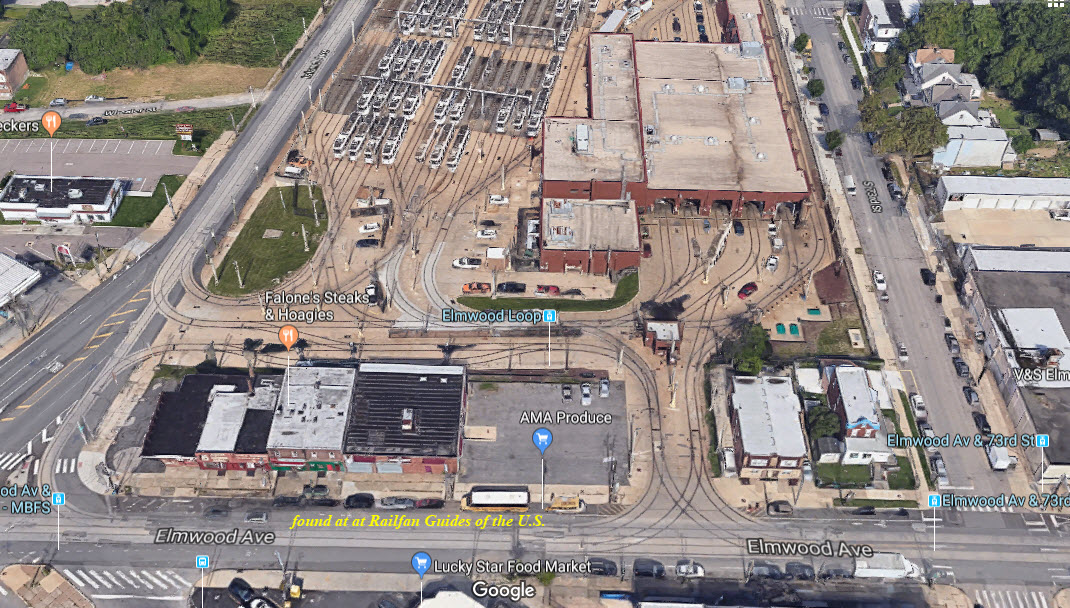
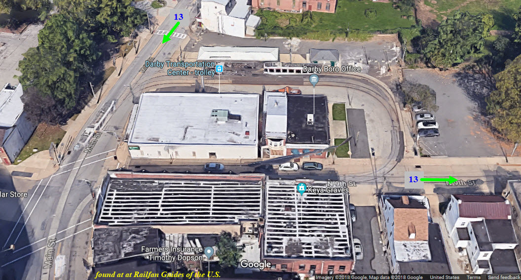
The transportation Center is the end of the line for the Subway Surface #11 line. 13 Line cars travel on the tracks with the green arrows to get to and from their route.
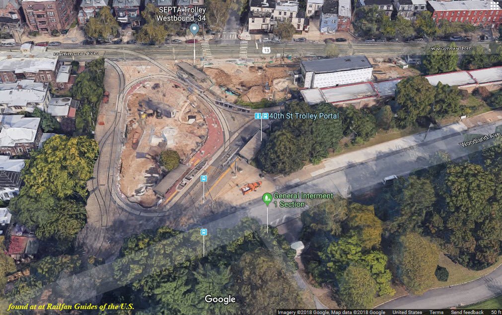
This is where the Subway Surface Lines come out of the ground to run on the surface. Pretty cool now that they just got done remodeling the entire loop, complete with a pretty nice restaurant that overlooks the loop, called the Trolley Stop Station.
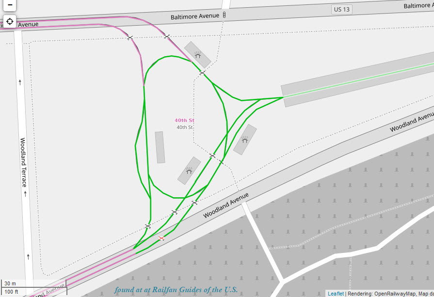
Two tracks merge down into one for the travel west (geographically south).
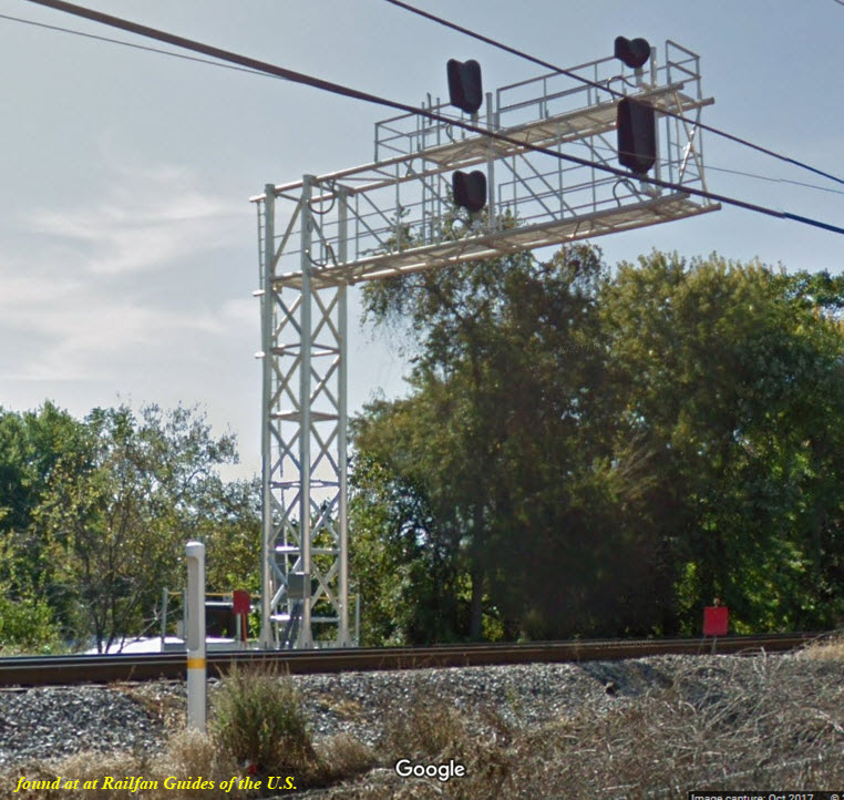
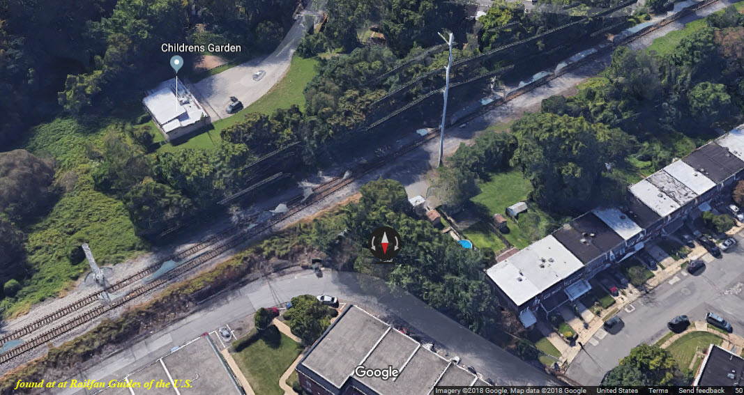
North of this location, looking towards downtown Philly, the single track goes to two tracks, and we have a 3x3 colorlight signal for EB traffic.
A two aspect signal.
 Jersey Mike, 2016
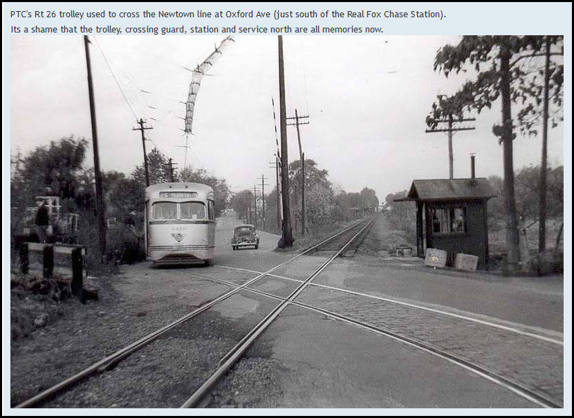
There used to be at least one other trolley/railroad crossing in the Philly area, the Newton Line at Oxford Ave in Fox Chase.
What's a BELL SYSTEM you may ask (below)? Back before we had the giant telecoms of today like Verizon, we had AT&T, AKA: the Bell System. Around the mid- Atlantic area, there were four of them, the C&P (Chesapeake & Potomac) Telephone Company of Maryland, Virginia, West Virginia, and DC. Not sure what it was here in Philly, but it was still a Bell System company. It was in the days when the phone company OWNED all of the equipment, including the phones in your house, and you rented the phones. And you paid extra for touch-tone! Imagine that!!! On January 8th, 1982, the U.S. broke up the AT&T conglomerate, and it ended the above excellent service the company provided. Just try to get Verizon of Comcast to come out and fix anything, or, look how shabby every installation is. Under AT&T rule, they had a set of standard procedures that every installer followed, called the BSP's, or, Bell System Practices. There was not one aspect of putting in anything that was not covered and didn't have a procedure. I was lucky to have worked for them in the early 70's, and still have a few of them around, cool books, but they are now a lesson in history....
https://en.wikipedia.org/wiki/Breakup_of_the_Bell_System
Courtesy of the University of Texas Library, click here for their index page.
Disclaimers:
I love trains, and I love signals. I am not an expert. My webpages reflect what I find on the topic of the page. This is something I have fun with while trying to help others.
Please Note: Since the main focus of my two websites is railroad signals, the railfan guides are oriented towards the signal fan being able to locate them. For those of you into the modeling aspect of our hobby, my indexa page has a list of almost everything railroad oriented I can think of to provide you with at least a few pictures to help you detail your pike.
If this is a railfan page, every effort has been made to make sure that the information contained on this map and in this railfan guide is correct. Once in a while, an error may creep in :-)
My philosophy: Pictures and maps are worth a thousand words, especially for railfanning. Text descriptions only get you so far, especially if you get lost or disoriented. Take along good maps.... a GPS is OK to get somewhere, but maps are still better if you get lost! I belong to AAA, which allows you to get local maps for free when you visit the local branches. ADC puts out a nice series of county maps for the Washington DC area, but their state maps do not have the railroads on them. If you can find em, I like the National Geographic map book of the U.S..... good, clear, and concise graphics, and they do a really good job of showing you where tourist type attractions are, although they too lack the railroads. Other notes about specific areas will show up on that page if known.
Aerial shots were taken from either Google or Bing Maps as noted. Screen captures are made with Snagit, a Techsmith product... a great tool if you have never used it!
By the way, floobydust is a term I picked up 30-40 years ago from a National Semiconductor data book, and means miscellaneous and/or other stuff.
Pictures and additional information is always needed if anyone feels inclined to take 'em, send 'em, and share 'em, or if you have something to add or correct.... credit is always given! Please be NICE!!! Contact info is here
Beware: If used as a source, ANYTHING from Wikipedia must be treated as being possibly being inaccurate, wrong, or not true.
SEPTA HOMEPAGE
RAILFAN GUIDES HOME
RAILROAD SIGNALS HOME
NEW 10/05/2018
Last Modified
09-Oct-2018