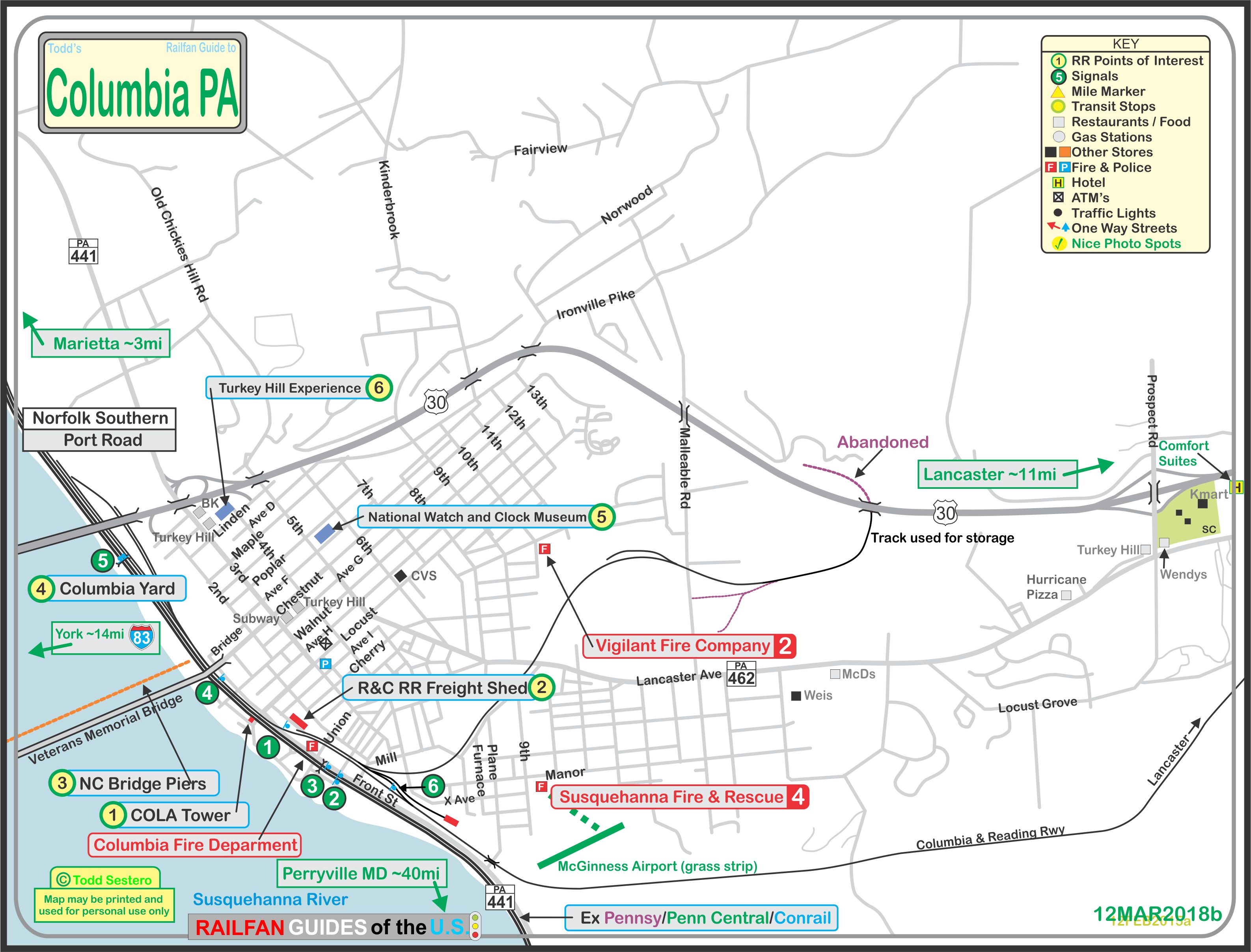
What's Here:
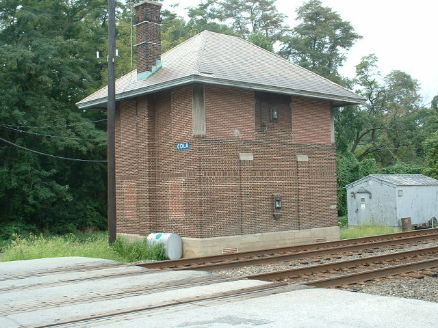
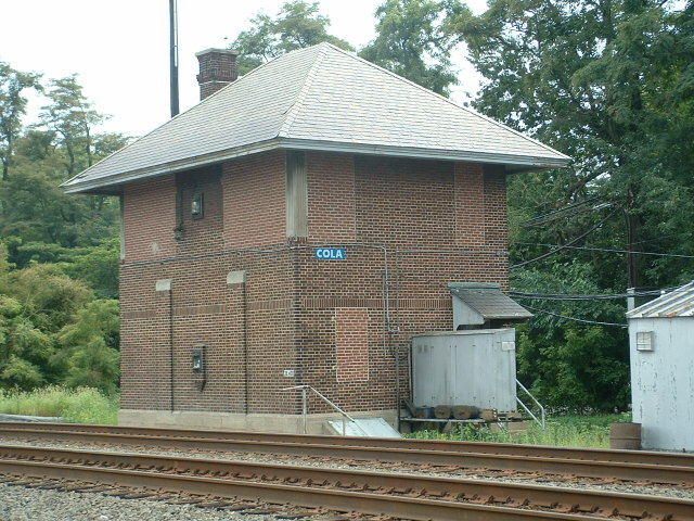
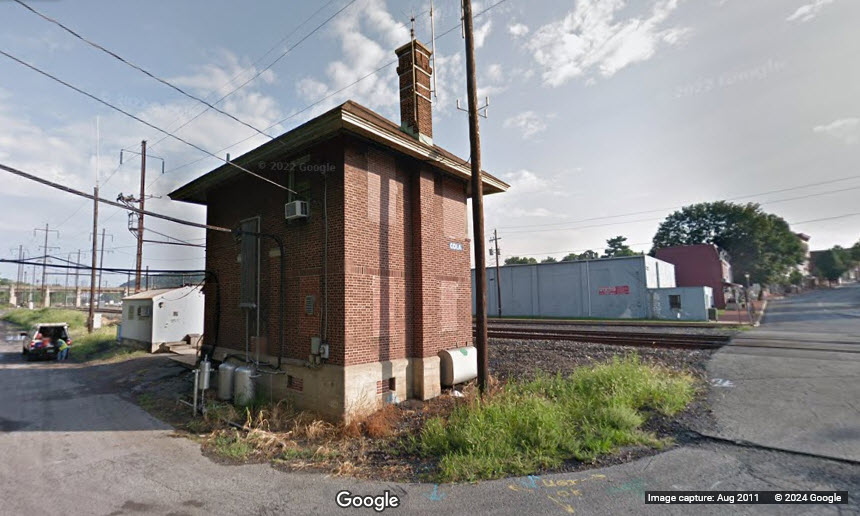
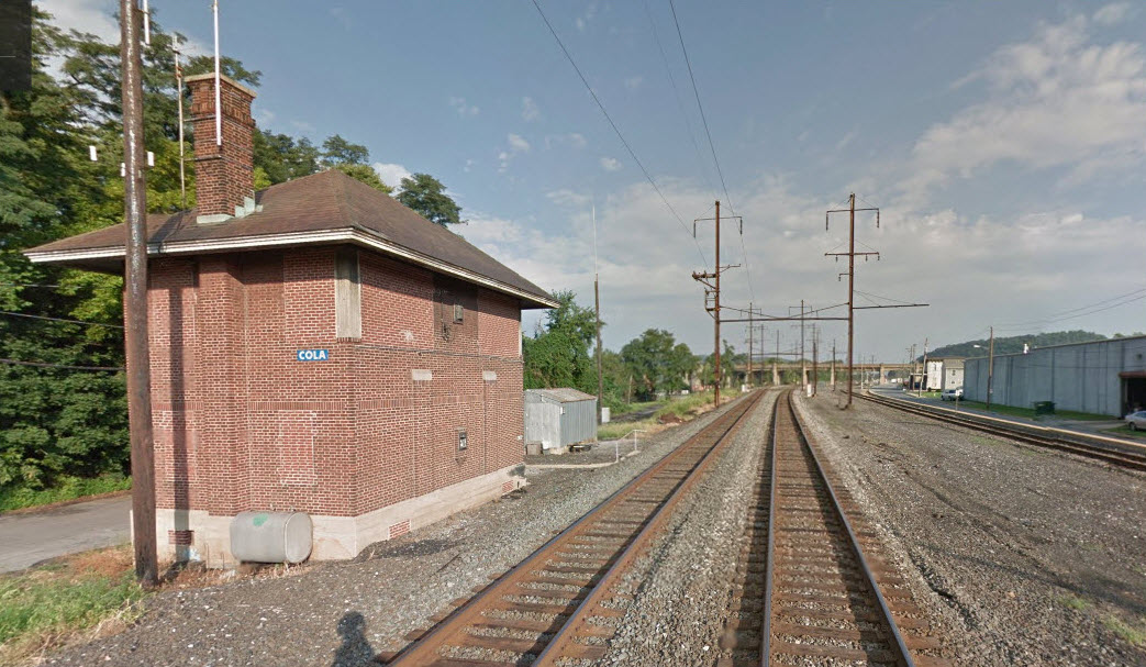
COLA Tower (closed)
Small NS Yard
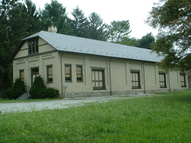
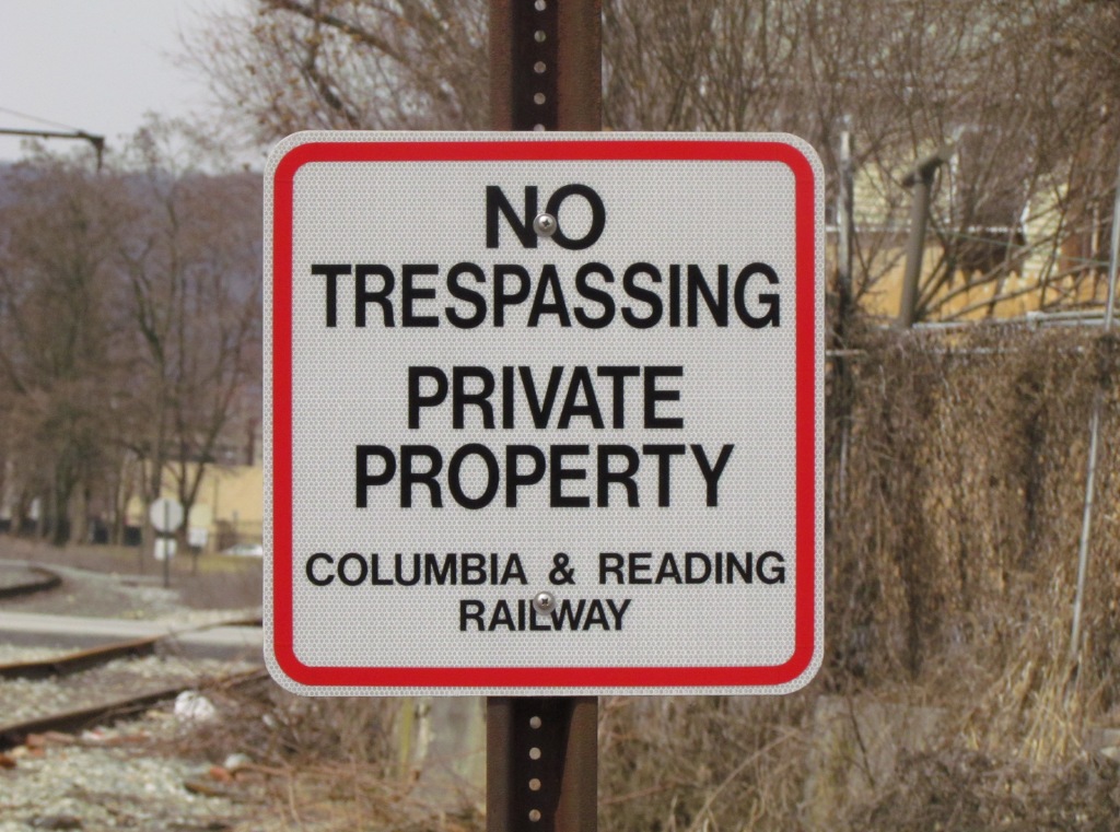
Columbia & Reading Rwy engine house
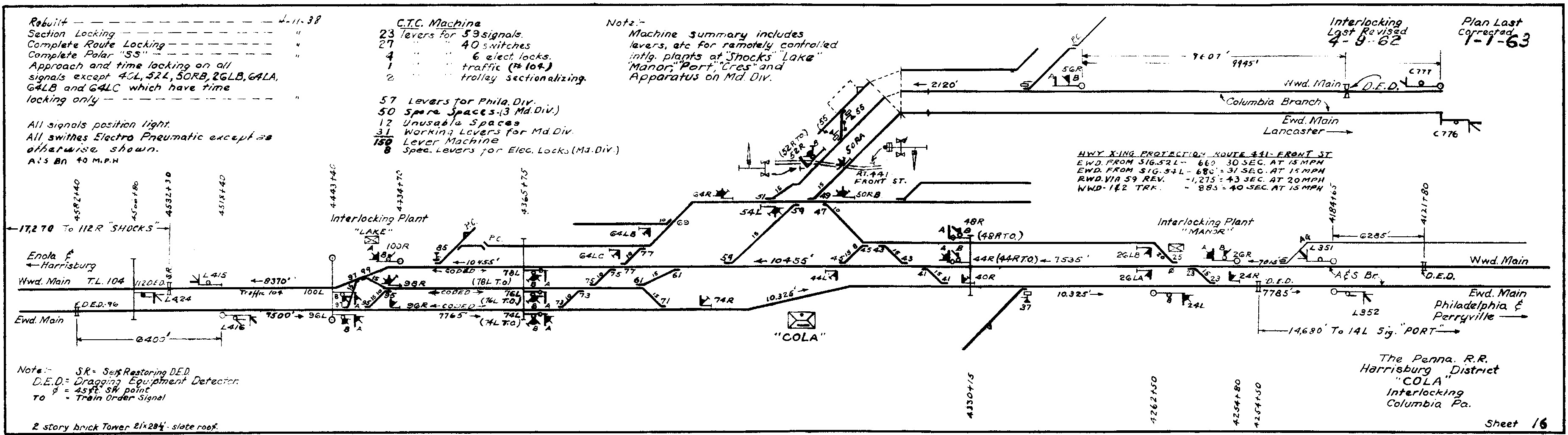
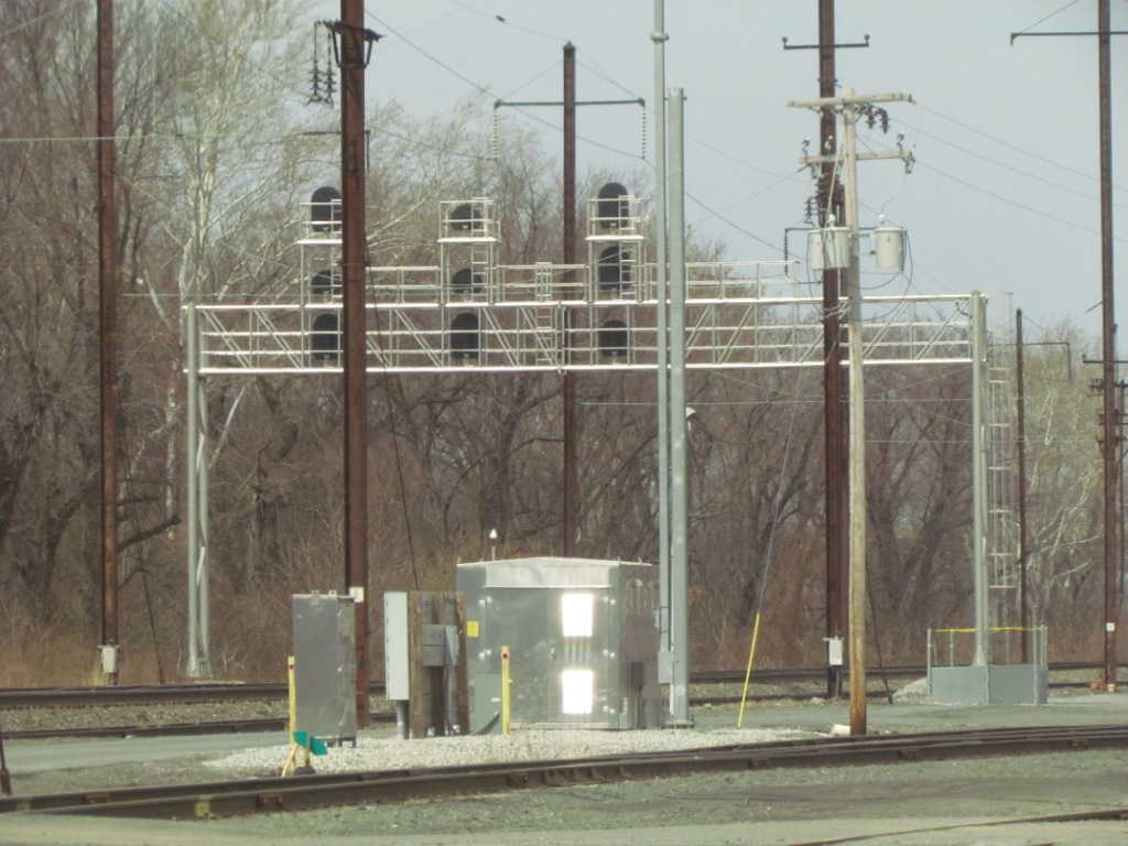
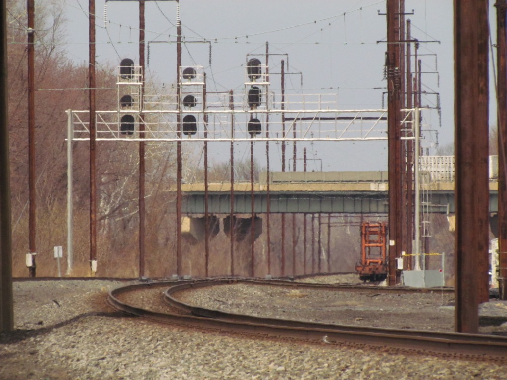
Signals and Interlocking
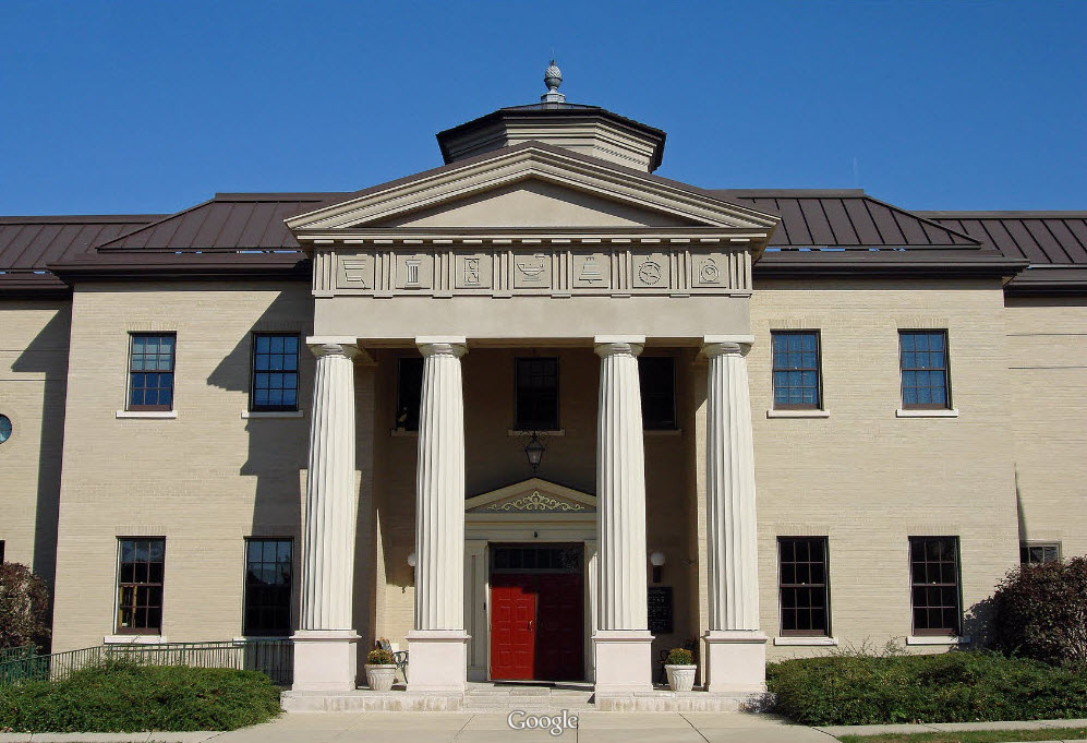
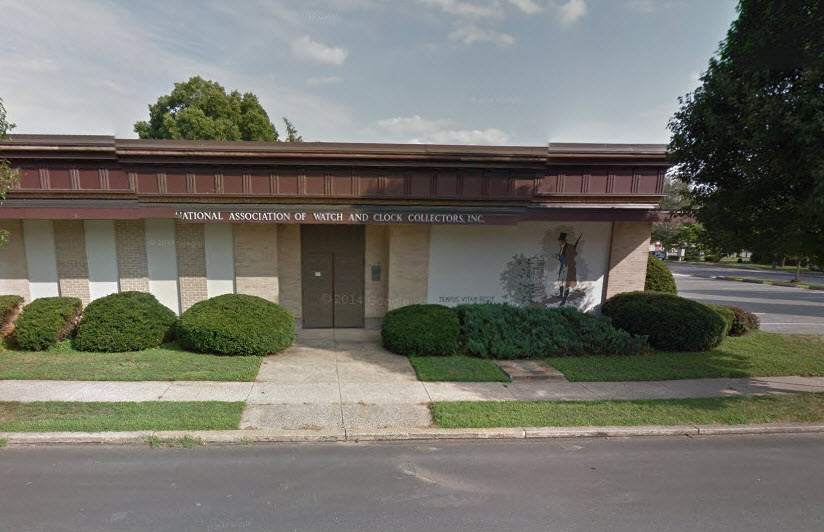
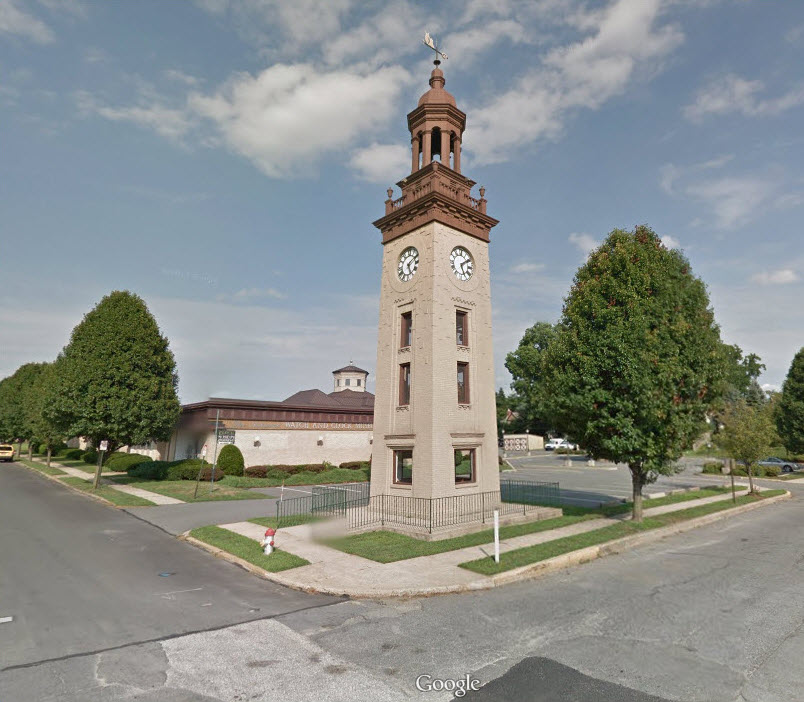
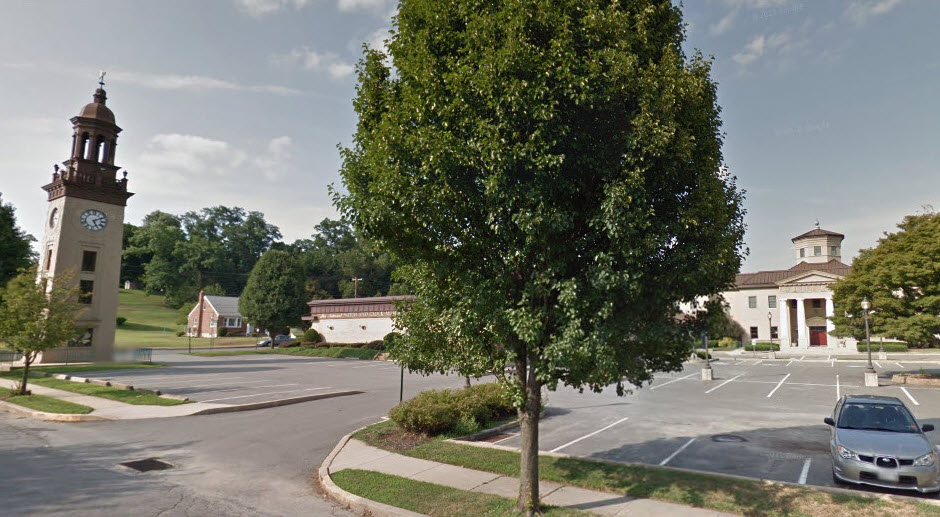
National Watch and Clock Museum
the Turkey Hill Experience (think of: a visitors center for the Turkey Hill Dairy Stores)
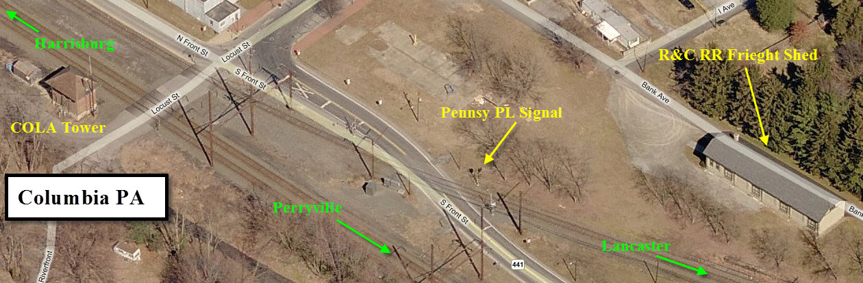
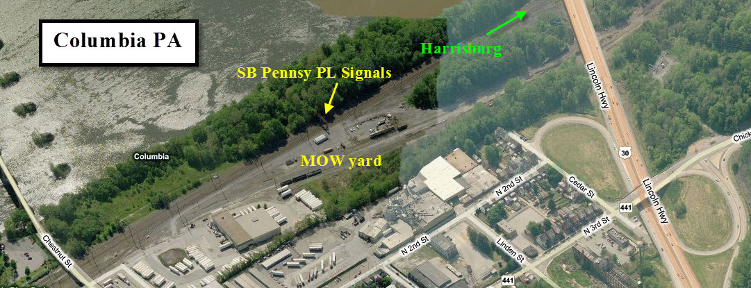
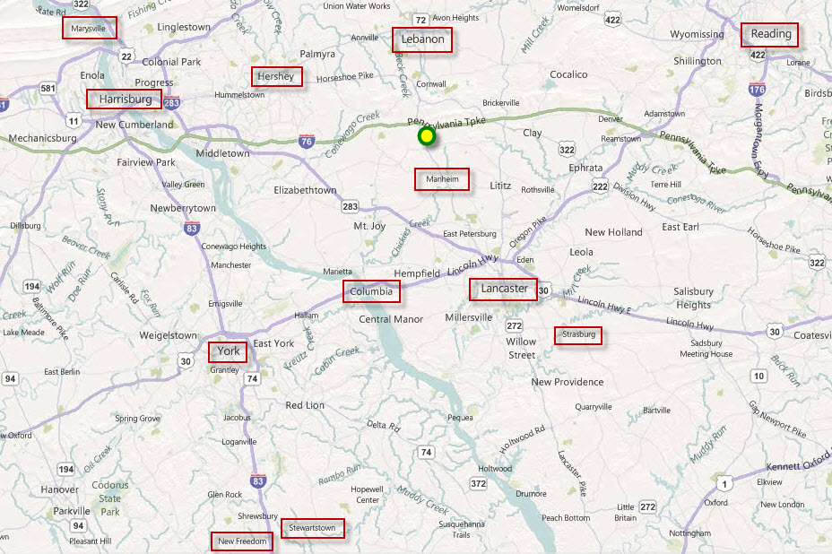
Columbia is a midway point on the railroad between Harrisburg PA and Perryville MD.
It is conveniently located off US30 between, about halfway between York PA and Lancaster PA.
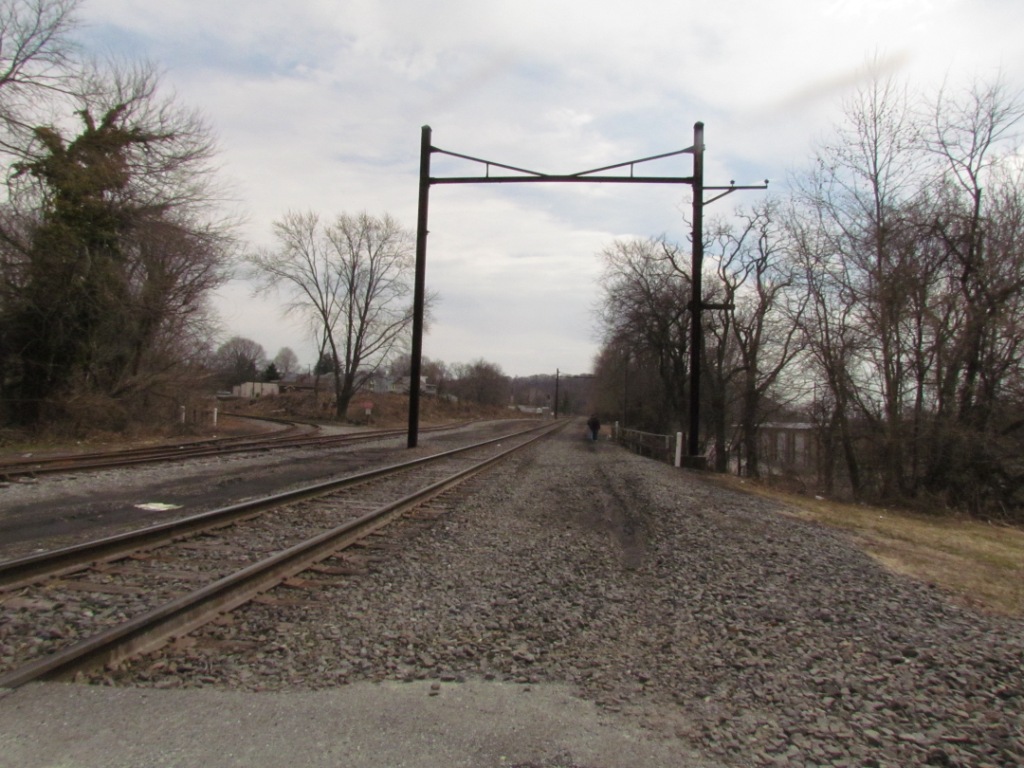
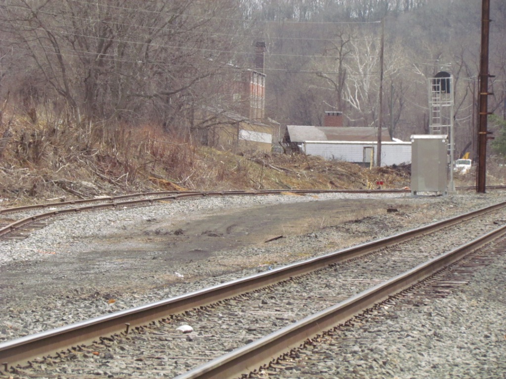
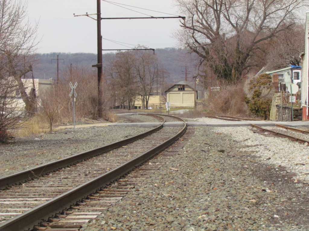
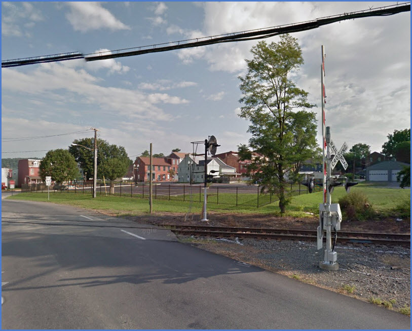
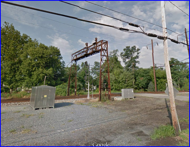
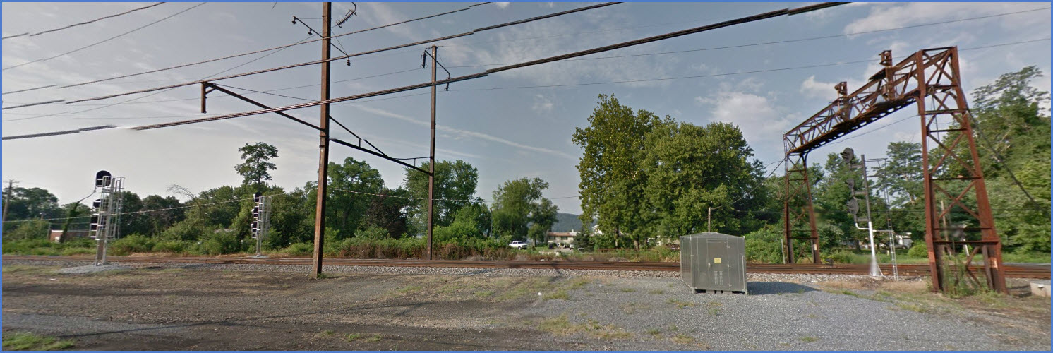
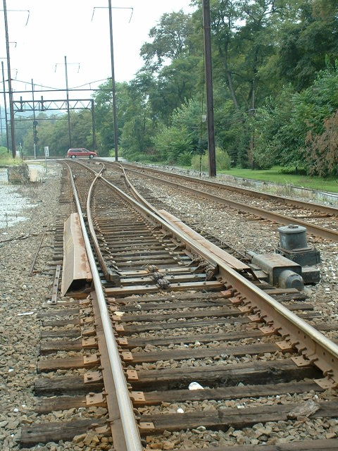
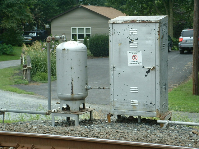
Located here are the old Pennsy COLA tower, a small MOW yard, the branch coming over from Lancaster, an old freight shed, and a few signals.
Columbia is the largest town on the Port Road and is located at Milepost EP38.4. There is quite a bit of railroad “stuff” in and around COLA interlocking,
including an MOW yard and office, COLA tower (vacant, but still standing), and the connection to the Columbia Secondary, which runs to Lancaster. There is
also a small shortline railroad in town, the Columbia & Reading Railway.
Since Amtrak still doesn't like Norfolk Southern trains on the corridor during daylight hours, you will not get the chance to see to much moving during the
daytime. Sometimes you can find a number of people at the Perryville station in the evenings waiting for Port Road traffic to start coming down from
Harrisburg, and continuing on to Baltimore.
Acknowledgements:
Abram Burnett
Denver Todd
pennsyrr.com
michaelfroio.com
Google Maps
GPS Coordinates: 40.02968, -76.50595
Locust St and Riverfront
Various info I have come across:
In the April 1972 ETT Cola control began at Tome, 4.5 miles from Perryville, plus 10 more interlockings between there and Cola, and 3 interlockings to the west (Lake,
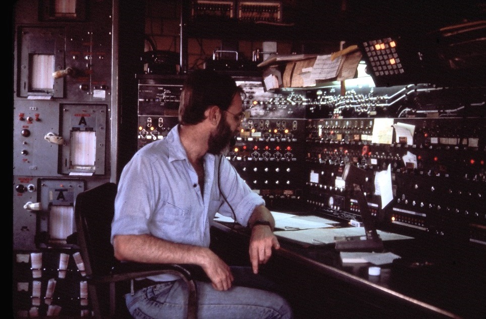
Shocks, and Jeb). I don't know when Cola closed, but it would have been in the late '80's. And yes those machines to the left print out the readings from the hot box
detectors in the field. (from OnBlock)
I believe COLA controlled from SHOCKS to CRES interlocking after PORT shut down (from Out_Of_Service)
Former PRR interlocking tower in Columbia, PA. COLA was one of the larger CTC plants on the PRR with control stretching up and down the Enola Branch.
Interlocking was re-signaled in 2011.
(from http://wikimapia.org/6765066/COLA-Interlocking-and-Tower )
Below, a picture from the last days of operation of the tower.... too bad they feel it
necessary to throw everything away when they decommission one :-(
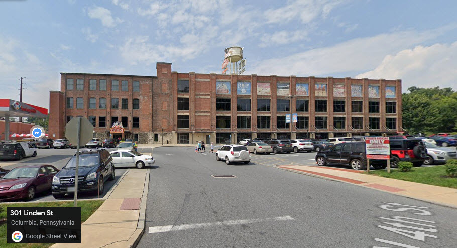
GPS Coordinates: 40.03774, -76.50798
301 Linden St, Columbia PA 17512
717-684-0134
Turkey Hill is a regional manufacturer of ice cream and ice tea/lemonade.
Tours of how they make ice cream and their famous tea, with tasting
opportunities available for an extra fee. They also have a chain of
7-11 type convenience stores/gas stations. You can see the building as you
pass on US 30. Their ice cream is one of my favorites!
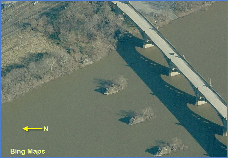
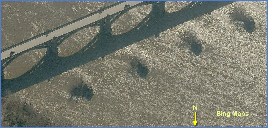
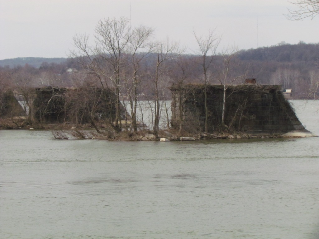
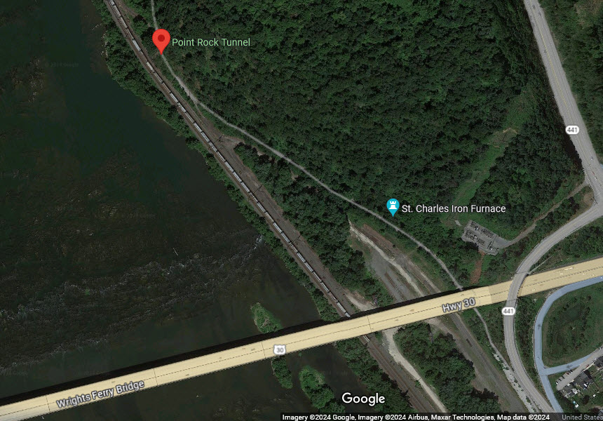
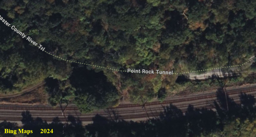
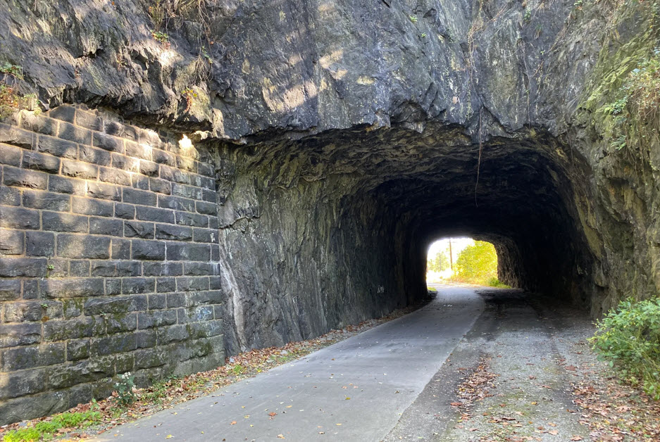
This tunnel sits on the former right-of-way of the original alignment of the railroad passing through Columbia.
From the uncharteredlancaster.com page: A popular stop along the Northwest River Trail
north of Columbia is the 180-foot Rock Point Tunnel. The tunnel was constructed between
1850-1851 for the original Pennsylvania Railroad Columbia Branch. The railroad was built
on a tight shelf along the Susquehanna River’s east bank between Columbia and Chickies
Rock. When it came to Rock Point, the railroad had little choice but blast through.
What little land remained between mountain and river was barely wide enough to
accommodate the canal already in place. The curved tunnel was built by blasting
through solid rock. This type of stone doesn’t require a lining, which gives
the passage a unique appearance. Later in the early 1900s, to minimize grades
and increase capacity, the Pennsylvania Railroad completed its new “low grade”
in 1906. This new alignment cut through the Susquehanna River on a fill between
Point Rock and Chickies Rock, creating Kerbaugh Lake between the new and old
grades and bypassing Point Rock Tunnel. end unchartered
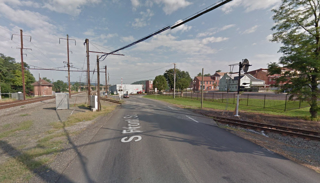
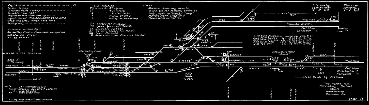
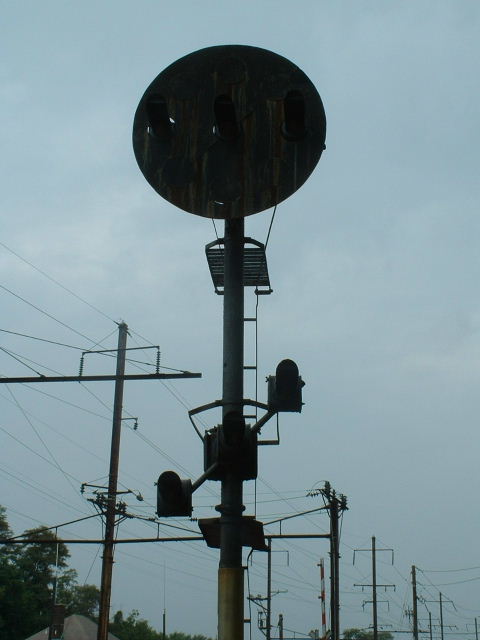
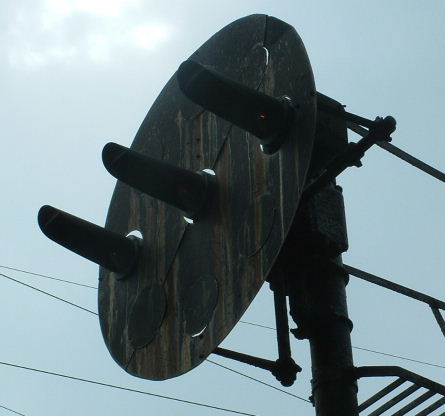
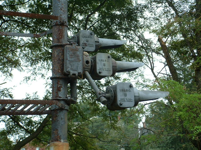
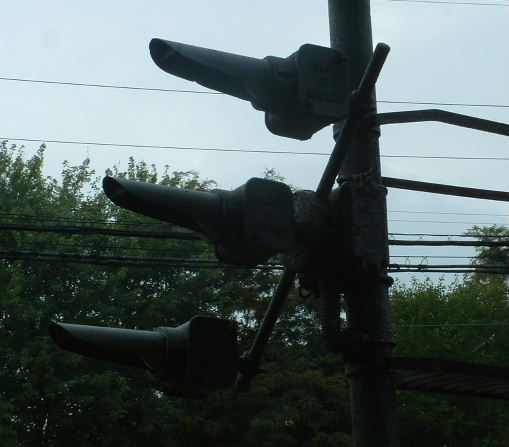
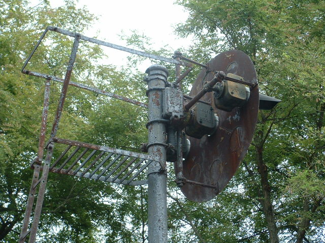
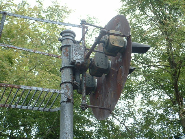
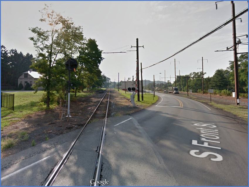
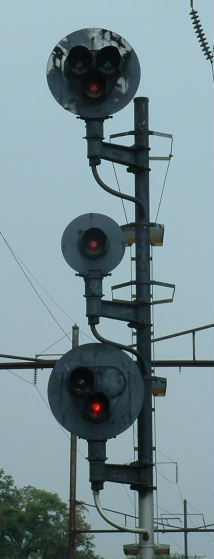
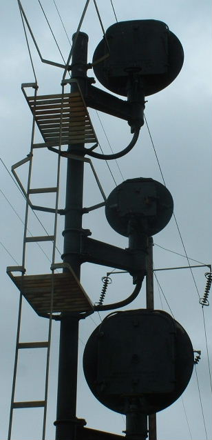
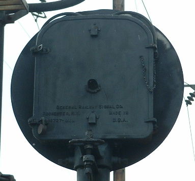
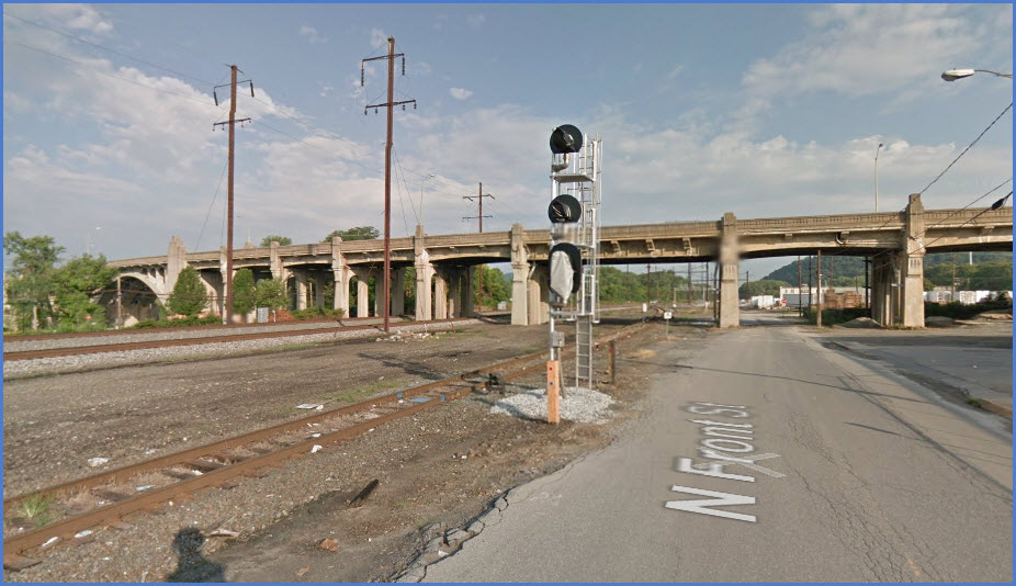
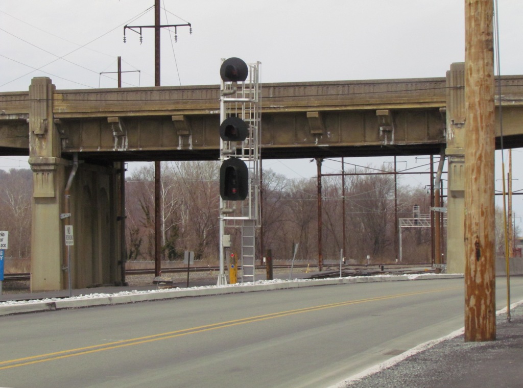
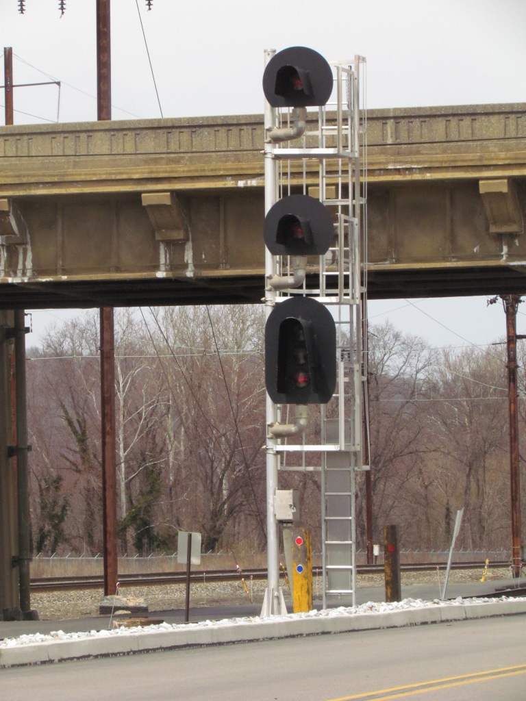
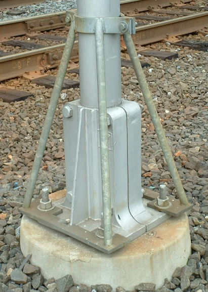
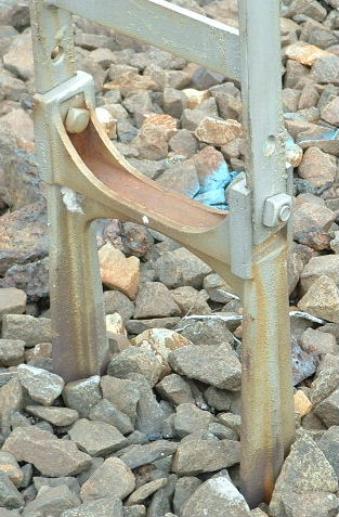
There are few signals in Columbia remaining today....
All of the Pennsy PL signals have been replaced by standard colorlight or "tri-lights" :-(
You can see from the signal plans above and below that Columbia at one time had way more signals than it does today!
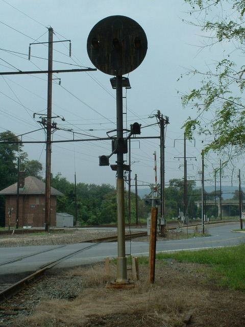
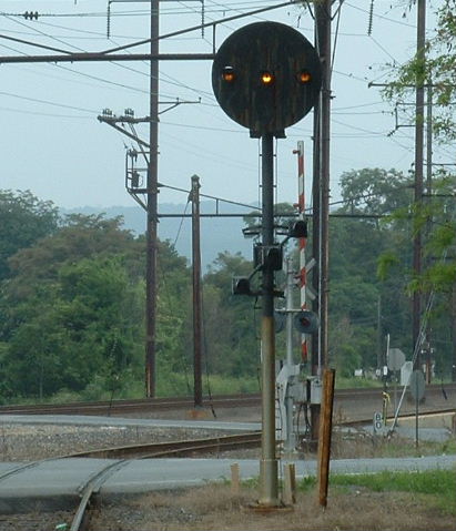
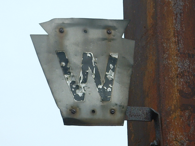
Pennsy PL signal
This signal was for trains coming off the Columbia Secondary, which comes from
Lancaster.
The signal was removed around 2015 or so?
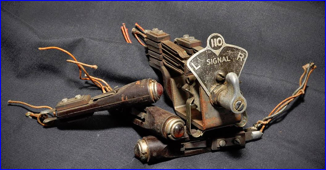
This was sent in to me by my good friend, Irving Itzkowycz, who was the chap that pulled this switch out of the CTC panel, great story!:
Bob and Jim Gambler were two old towermen (or "block operators," to use Pennsy-speak) at "CD" Columbia, Pa. They were brothers and had hired
in the 1940s. In the last years of the tower, Bob worked the second trick and Jim worked the midnight shift, as I recall. I spent many, many, many nights
in that tower with them. They were good workers.
Bob always said his favorite lever on the massive machine was the 110 lever, because that's where he "got rid of" trains. When westbound trains reached
the 110 signal at Shocks Mills, Pa, Bob had had already handled them for nearly 50 miles, from Perryville MD, through 15 interlockings on the old 1938 CTC machine,
and when he gave them the 110R signal, they were someone else's problem.
When CD Columbia was closed in 1986, and the machine was junked, I got the 110 lever and the three indication lamps for Bob, intending to mount them on a small metal
plate and light the indication lamps with a small power supply, so that he could play with his "favorite lever" in his retirement. But before I got
the job done, Bob died.
So the 110 lever has languished almost three decades in my basement. But at last I have found a young man who lives just a stone's throw from the 110 signal at
Shocks Mills, and this young man has a first rate railroad collection, with all pieces in impeccably restored condition. So guess where the 110 lever is
going...? At least it will be close to home again, and in appreciative hands.
A Little History
The following "stuff" comes from the fellow who helped out with the information on the switch above... many thanks for providing the insight!
The present brick tower was built shortly after the railroad went to those stupid one and two syllable names, instead of telegraph calls, in the late 1930s.
The original CD (which stood for "Columbia Dispatcher") was in the station, across the street from the tower and about one city block upstream (east of
town and near the foot of the inclined plane of the Philadelphia & Columbia RR. It was a shop and engine house and housed the "Columbia Despatcher"
after the railroad got Telegraph in the 1850s (they had it at least by 1857). About 3/4 mile or so east of the present depot in the town. I have been out
to the area of the old "Columbia Depot," and there is nothing there now except a field.
The building is circa-1860 and is still standing. Now occupied by (I think) a small electrical manufacturing plant (small motors, or some such.)
After the stone depot was built in town (still existing,) the Division Headquarters of the PRR's Frederick Division was there, and "CD" was the call
for the Train Dispatcher. Also... the wooden tower which was destroyed in the 1936 flood existed, I think, to handle the diamonds of the York, Hanover &
Frederick Branch, which crossed the Low Grade at that point. That would explain the rodding which came out of it.
After the Low Grade was built, there was a wooden structure several hundred feet west of present "Cola" tower. It's name was "LG-42." It was
a Train border Office and Manual Block Station only... not an interlocking. All it did was block trains on the A&S Low Grade, and handle Train Orders
for such trains.
After "42" went away, there was another structure in the exact same spot. That structure was (I think) called "CD" and it had rodding coming
out of the base, so it was an interlocking of some type. It was demolished by the St Patty's Day Flood in 1936. It was set back on its foundation
temporarily until they got the new "Cola" thingie built.
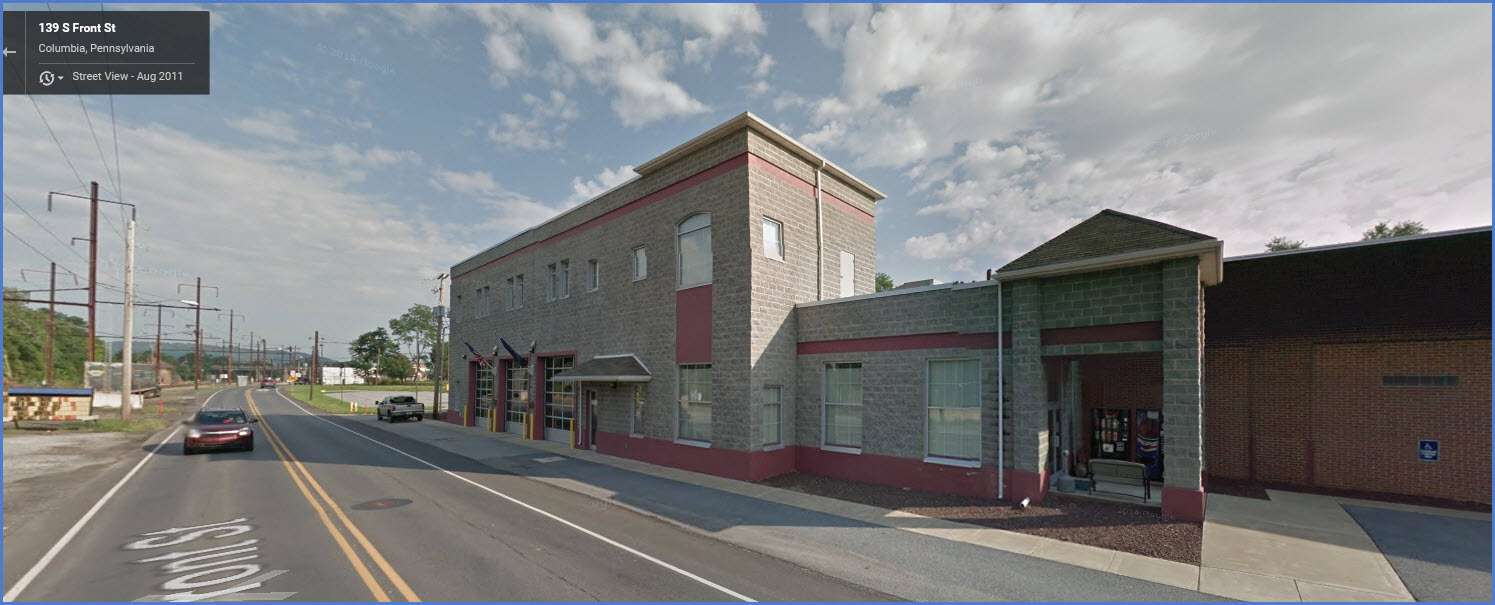
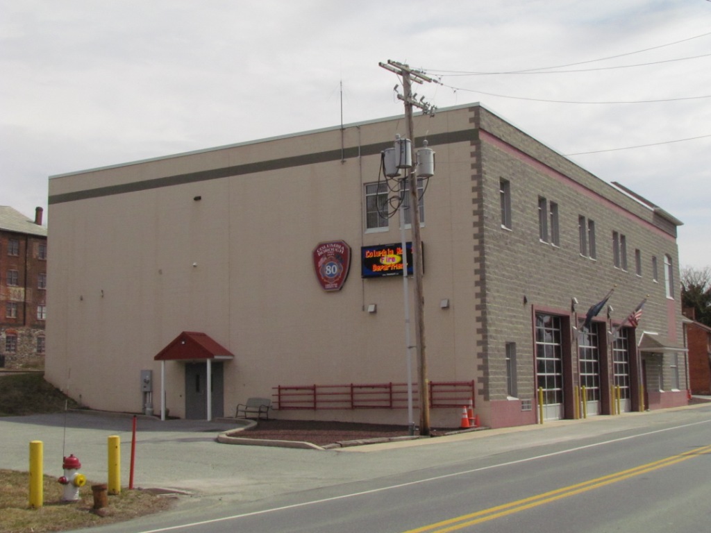
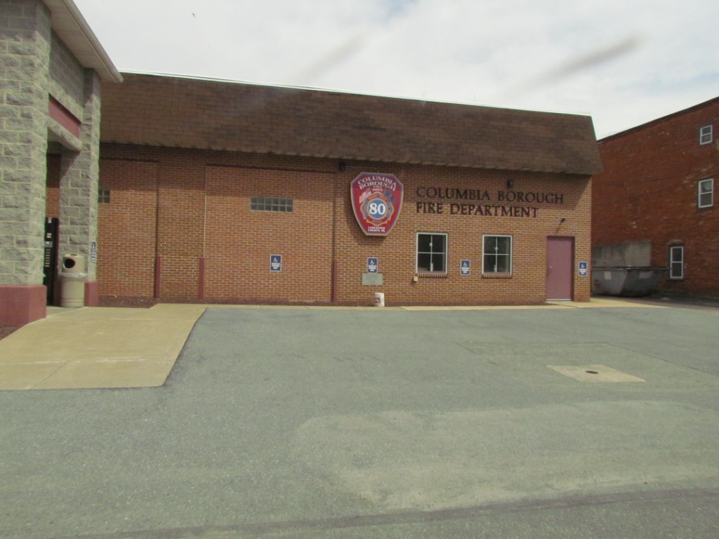
137 S Front St, Columbia, PA
(717) 684-5100
This is conveniently located right on Front St across from the tracks, between COLA tower and the signals at location 2.
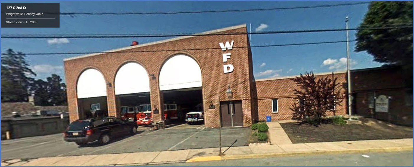
The Wrightsville Fire Department
If you take the Veterans Memorial Bridge across the river into Wrightsville, there is a fire station just off the bridge.
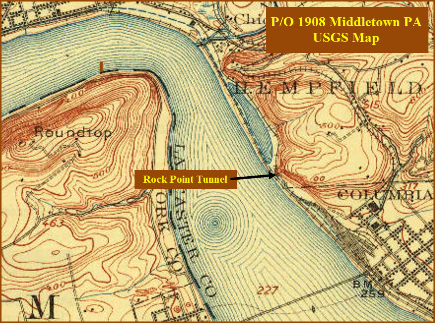
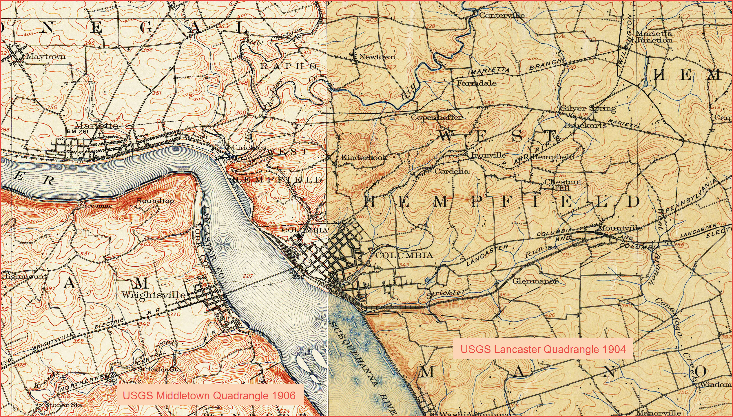
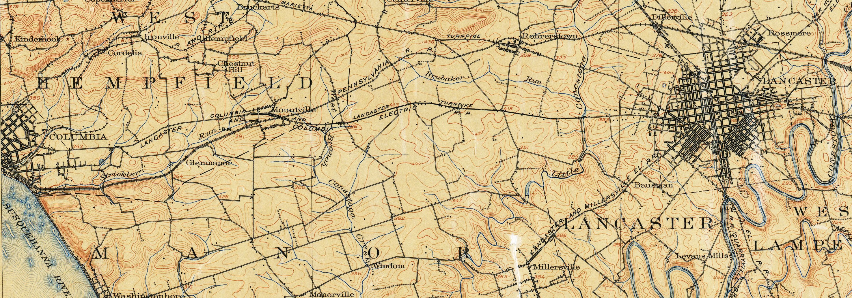
Middle map - from a 1902 USGS map of the Lancaster Quadrangle
Darn if Columbia wasn't right on the line between two adjacent Quadrangle maps! :-(
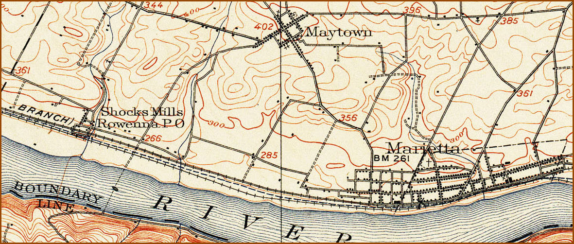
The bottom map also comes from the Middletown Quadrangle.....
I found these maps and more at the University of Texas library website: here
Disclaimers:
New format 10/26/23: Please check out my disclaimer page for my standard
dribble and contact info here
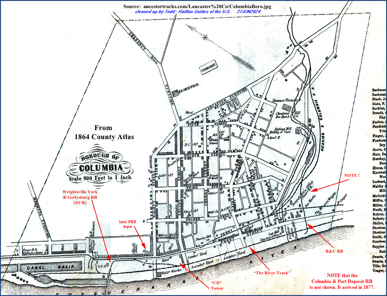
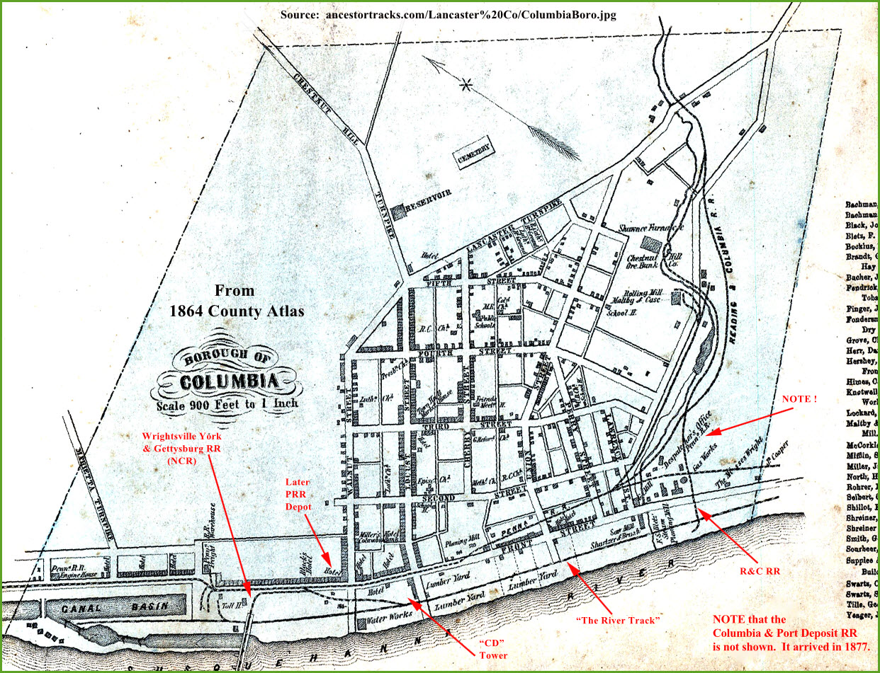 This is the above map before I cleaned it up