In General
Getting Here
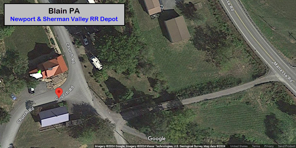
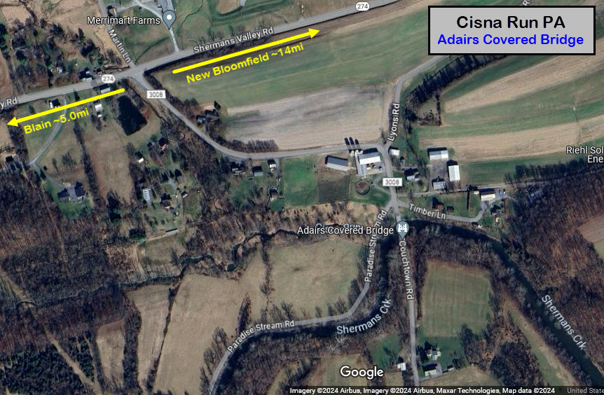
Map
Sights
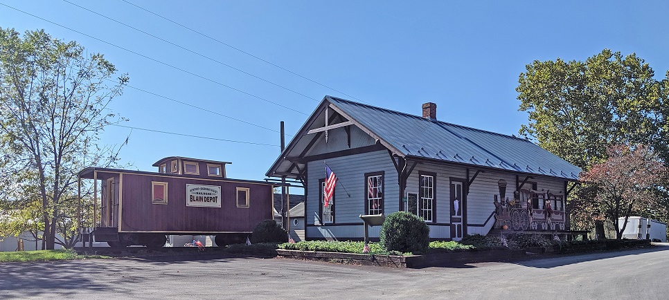
Blain Depot
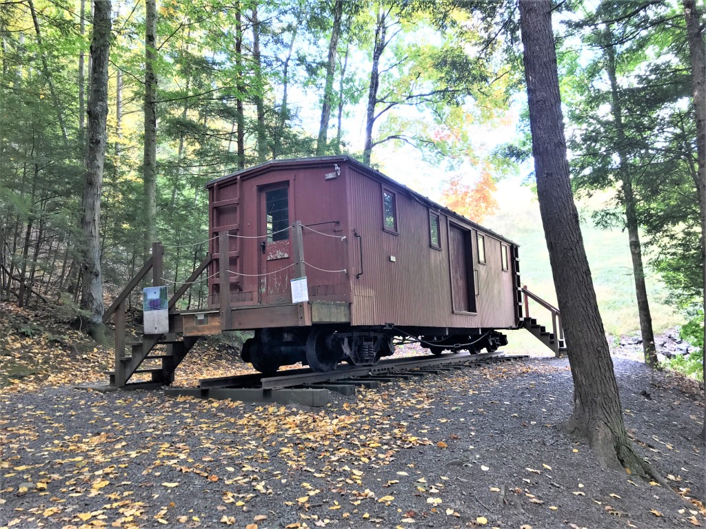
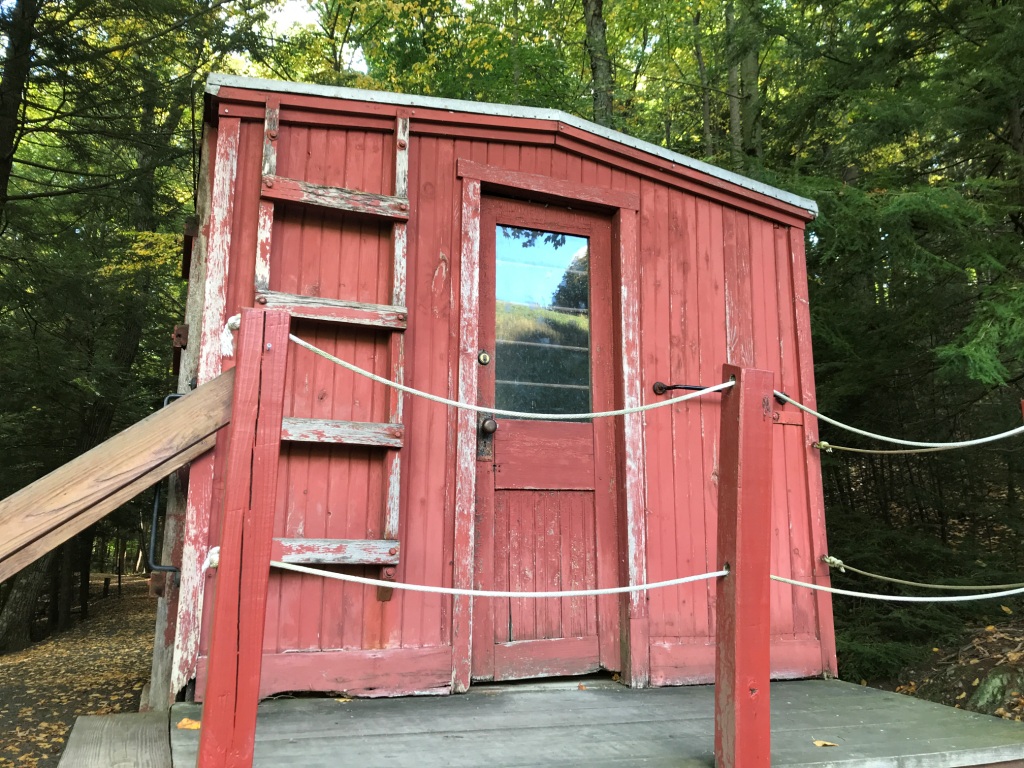
NSVRR Waycar
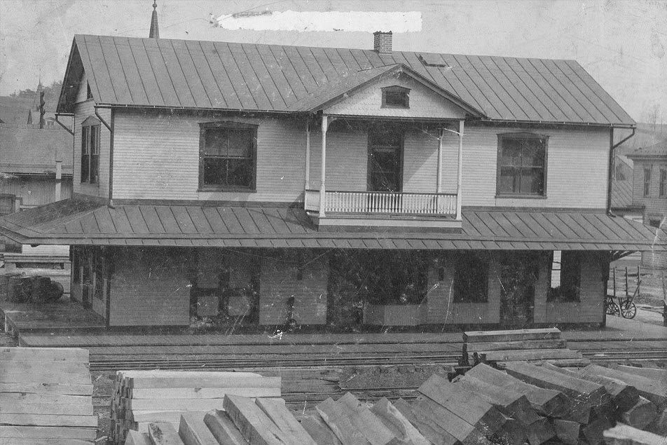
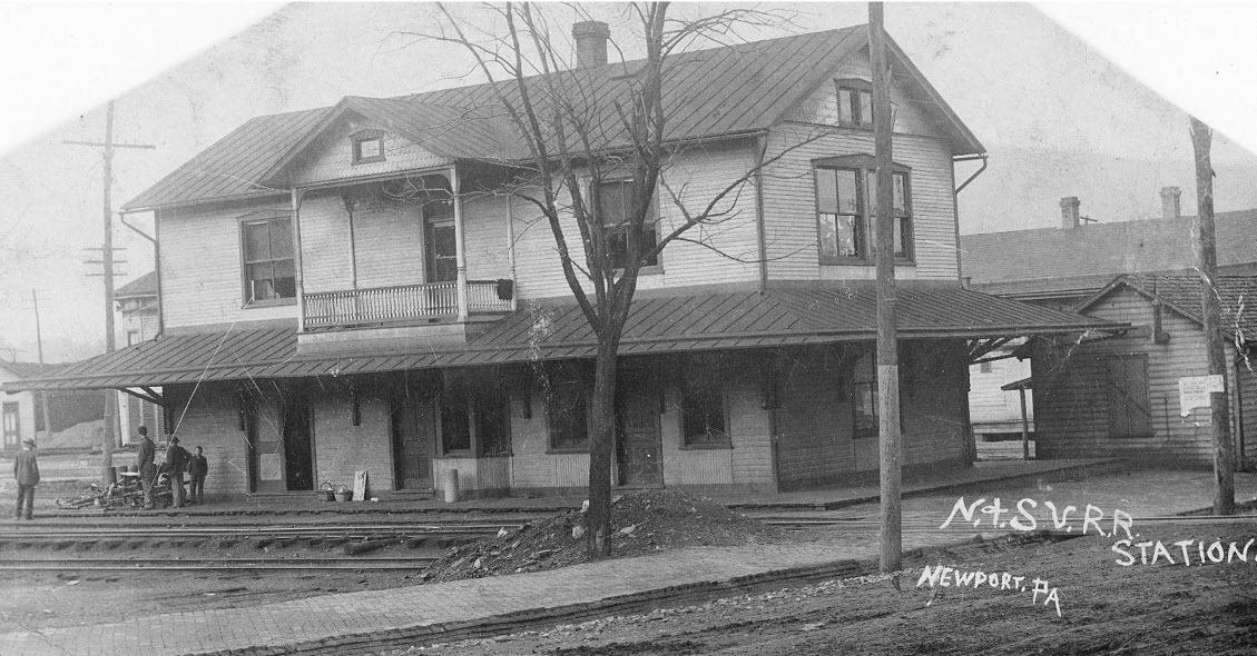
Newport Depot
Steam Locos of the NSVRR
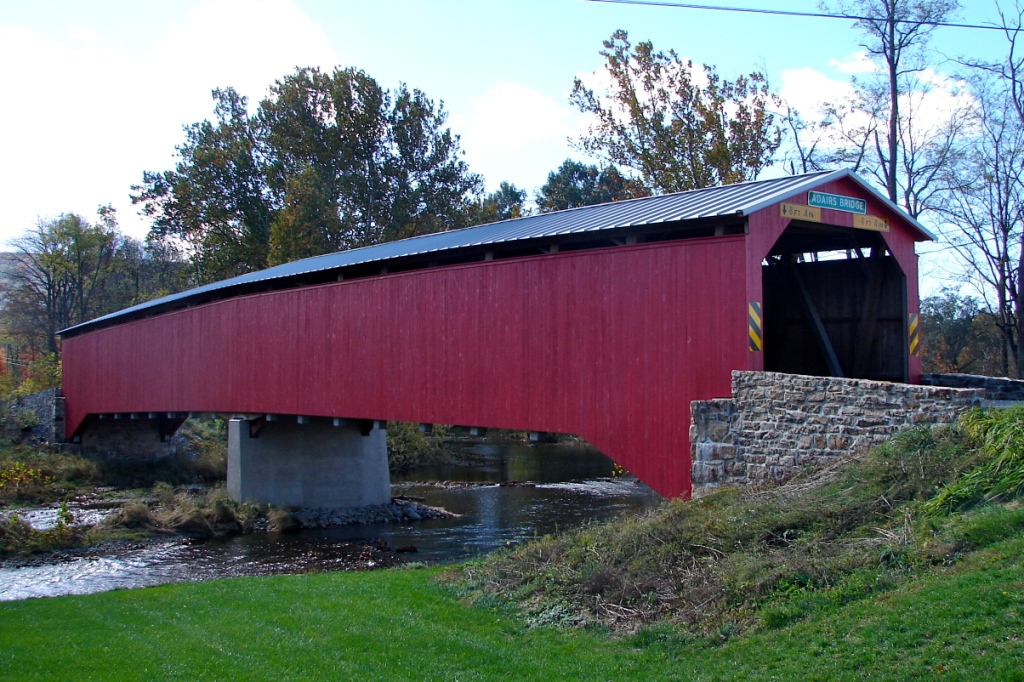
Adairs Covered Bridge
History
Bridges
Fire & Police
Floobydust
USGS Maps
RAILROAD SIGNALS HOME
Location / Name:
Blain PA, Perry County
What's Here:
Newport & Sherman's Valley Railroad Depot with caboose
Data:
GPS Coordinates: as needed
Phone A/C: 717
ZIP: 17006
Access by train/transit:
None
Geography:
Very Hilly / Mountainous
The Scoop:
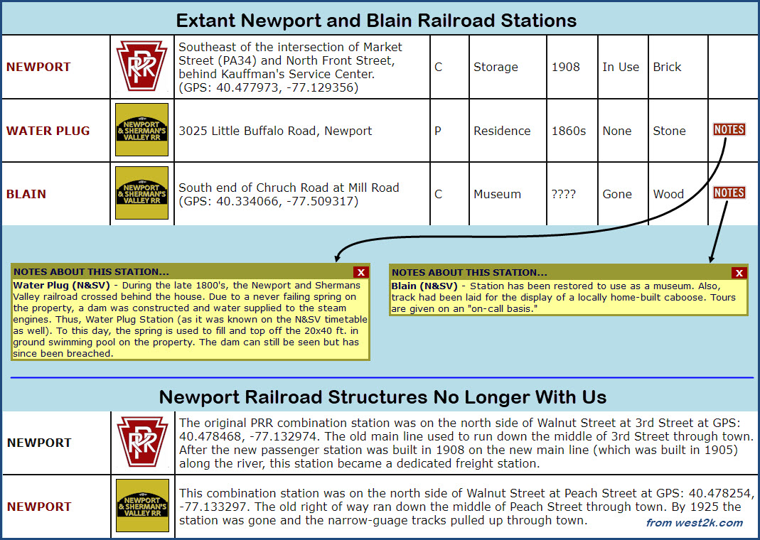
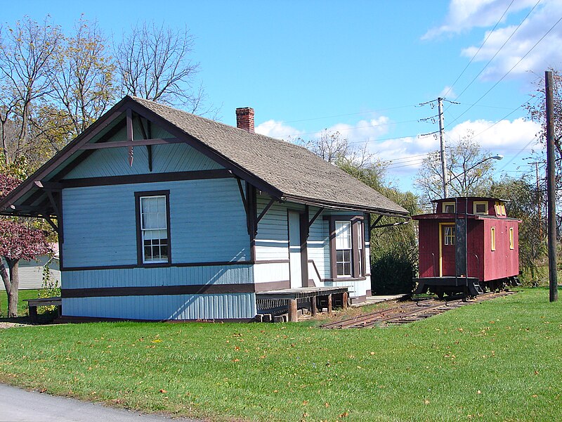
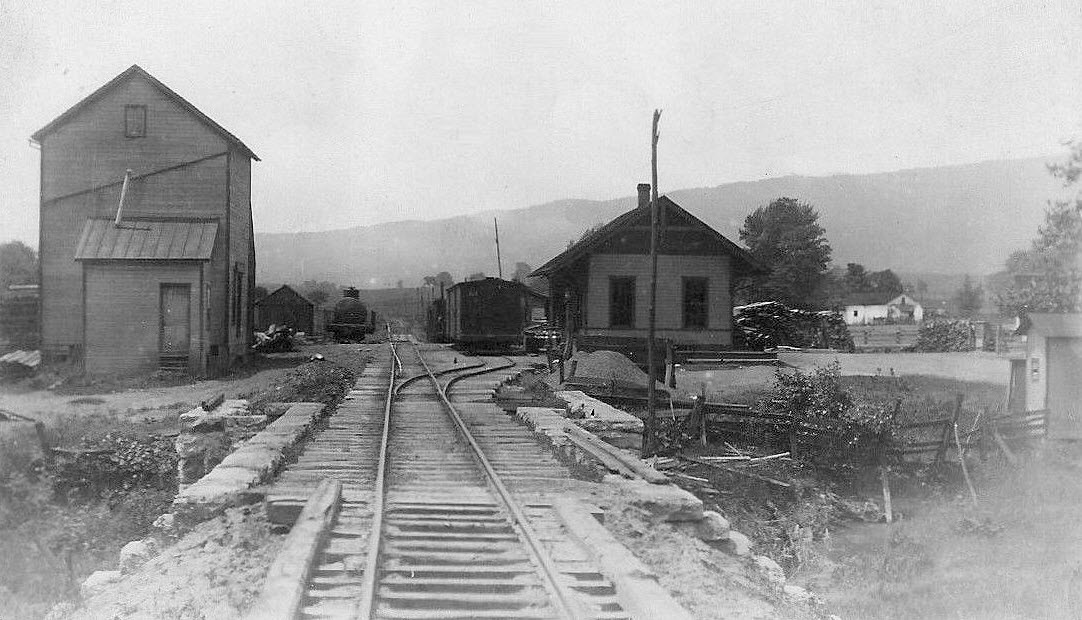
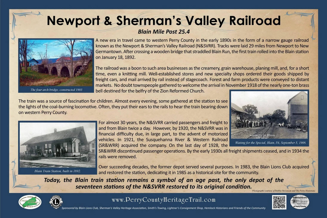
Blain is home to the most significant piece of history from the Newport & Sherman Valley narrow gauge railroad that is still standing - one of 17 stations the railroad used to have.
The Blain Lion's Club restored the depot back in 1983, and tours of it are available.
A caboose sits outside on a short section of rails, but it was custom made just for this display.
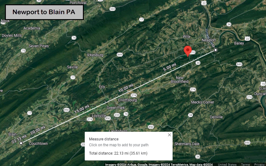
As the crow flies, Blain is about 22 miles SW of Newport.
From the west2K.com webpage for Perry County PA:
I would like to thank Mr. Campbell and Mr. Wertz for the information they provided for this page. This page would not be possible without the help of those two gentlemen. They both put a lot of time into researching and providing answers for all of my dumb questions.
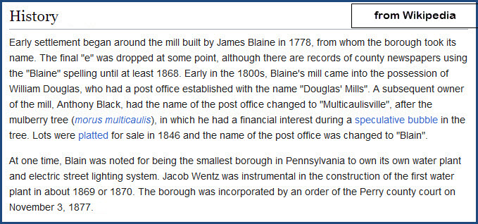
In case you are wondering, Blain used to be spelled with an "E" at the end after the founder of the township, but at some point, a long long time ago, the "E" was dropped, and is now just "BLAIN".
Acknowledgements:
Frank Campbell, Perry County Commissioner
Fred Wertz
west2k.com
USGS
Google Maps
Open Railway Map
Wikipedia
Picryl
Websites and other additional information sources of interest for the area:
https://en.wikipedia.org/wiki/Newport_and_Shermans_Valley_Railroad
https://www.facebook.com/littlebuffalostatepark/
https://www.srbc.gov/our-work/fact-sheets/docs/river-basin-facts.pdf
https://perrycountyheritagetrail.com/trail-locations/regions/newport/
https://www.phmc.state.pa.us/portal/communities/architecture/types/railroad.html
https://pahistoricpreservation.com/from-creek-came-village-blain/#more-4242
https://www.west2k.com/pastations/perrypa.shtml
https://perrycountyheritagetrail.com/trail-locations/regions/blain-western-pc/newport-and-shermans-valley-railroad/
https://millerstown.org/perry%20county%20facts.htm
http://www.perryheritage.com/Rails%20of%20Perry%20County.html
https://www.hmdb.org/m.asp?m=175062
https://journals.psu.edu/phj/article/view/63258
https://dbpedia.org/page/Newport_and_Shermans_Valley_Railroad
https://www.traillink.com/trail/newport-and-shermans-valley-railroad-trace-(formerely-little-buffalo)/
https://www.dcnr.pa.gov/StateParks/FindAPark/LittleBuffaloStatePark/Pages/History.aspx
https://www.waymarking.com/waymarks/WM7QC0_Newport_Shermans_Valley_Railroad_Car12_Newport_PA
https://www.pennlive.com/perry-county-times/2018/12/all_aboard_historic_railway_re.html
Blain IS NOT an easy place to get to. It is situated in a valley between some pretty high mountains, and for the most part, there are no cross mountains roads. So, I would come "down" from Newport. If you decide to come down from Newport, take PA 34 south west out of town. This is Sherman's Valley Road. In about 5-1/4 miles, you will hit New Bloomfield and Main St. Here, PA 34 ends, and joins up with PA 274, which will take you the rest of the way to Blain - about 18-1/2 miles. It is still Sherman's Valley Road. Along the way, you will pass the Adairs Covered Bridge in Cisna Run PA.
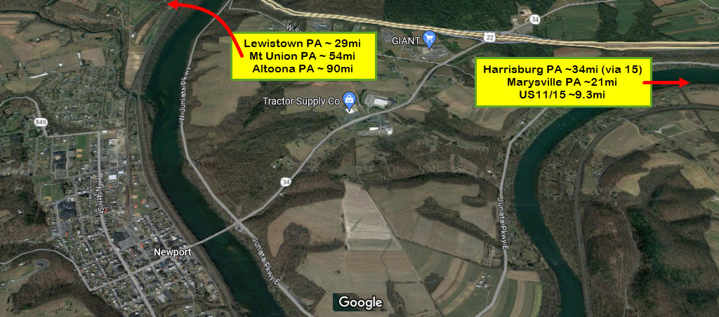
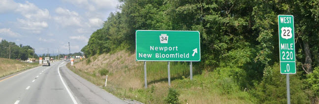
For most of us, find your way to US 22, and hop off at the Newport exit, PA 34. Then head south on 34 into Newport, 1.6mi. You will go down a good sized hill to the Juniata River, and then cross it on the Paul Reider Bridge. JUST after getting off that bridge, you will go under the NS main. The station is IMMEDIATELY on your left!
As you can see from the WB exit sign, you are at the 220 mile marker on US 22.
The mileages below are using US11/15 to get to Marysville and Harrisburg. If you're in a rush, don't get off on 11/15, and stay on US22.
Mileages to the west are via US22 to Lewistown, then by taking US22/US522 to Mt. Union, and 22 to Altoona. US522 heads south out of Mt. Union and will take you to the East Broad Top RR and the Shade Gap Trolley Museum, and eventually east/west running US30 and I-76, the Pennsy Turnpike.
 Coming from US11/15 & Harrisburg
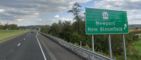 Coming from Altoona / Lewistown
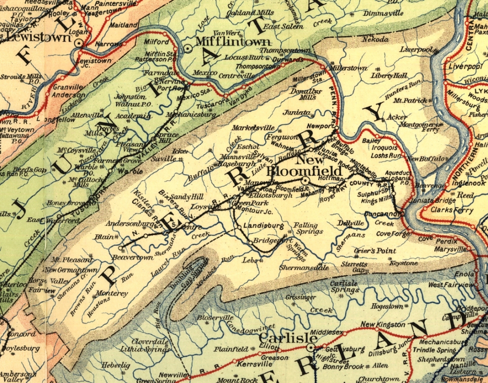
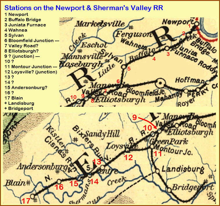
I have not come across a station list for the N&SVRR, but this is what I can determine from the map.....
can anyone help?
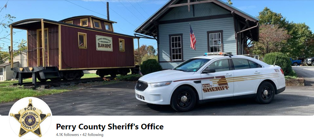
https://www.facebook.com/PCSOPA/?locale=nn_NO&paipv=0&eav=AfZ5_7Kalh3Tm5NOnVtEcigqN0xHu5hTiBLzs6gpckxr32BZdI35cmFetkENMaoGX3I&_rdr
GPS Coordinates: 40.33408, -77.50931
144 Church Road, Blain PA 17006
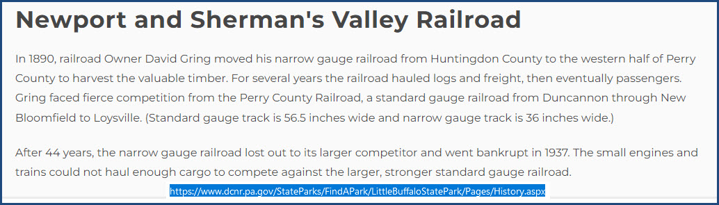
Blain was at the "far end" of a narrow gauge railroad beginning in Newport, called the Newport & Sherman Valley Railroad.
The following picture is "all over the place", even in the heading for the Perry County Sheriff's Department page on Facebook.
Info on the depot is scarce, but one page did have this to say: The Blain train station ended passenger service in 1928 but was given new life when it was restored by Blain Lion’s Club in 1983. It remains open as a historic site.
 via the west2k.com website
Additional N&SVRR Items of Interest
GPS Coordinates: approx 40.45394, -77.1718
Located in the Little Buffalo State Park
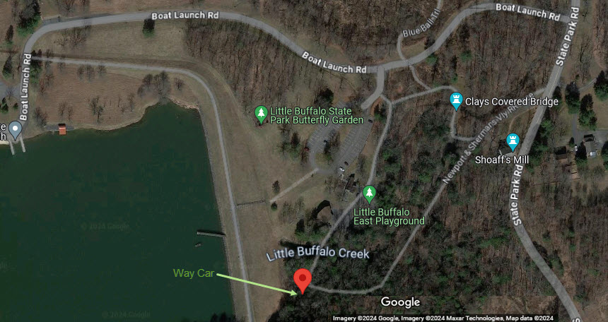
From Mr. Wertz: The two pictures below were taken by park staff. The platform shown on the close-up was not part of the original arrangement. It was added by the park to provide better pedestrian access. Also, the trucks are not original. When the park acquired the car, they bought the trucks from the EBT (East Broad Top RR - A 3ft narrow gauge railroad to the west), but at least they were narrow gauge! Hope this is useful. The car can be found by following the loop trail around the East Area. It is at the opposite end of the Area from the covered bridge and mill, at the base of the dam, south end.
For reference only, the depot no longer exists.
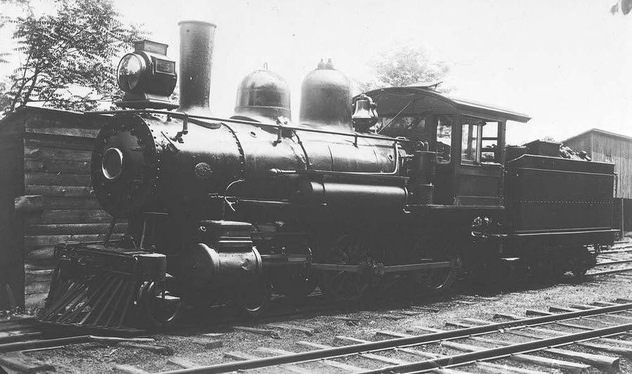 N&SVRR #5
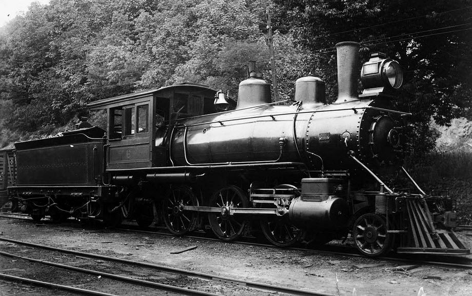 N&SVRR #6
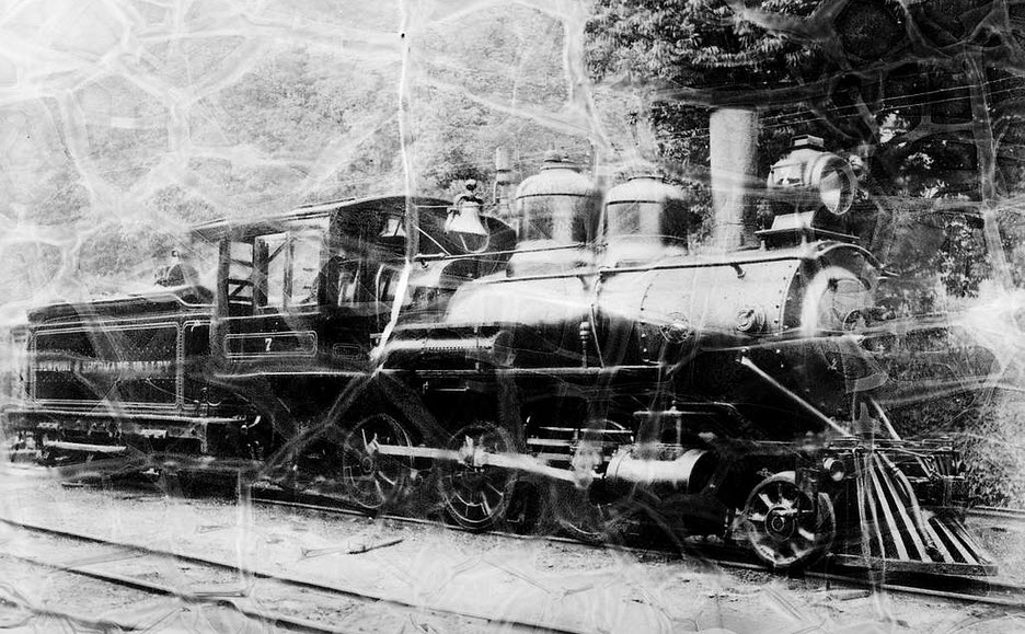 N&SVRR #7
GPS Coordinates: 40.35055, -77.42419
https://en.wikipedia.org/wiki/Adairs_Covered_Bridge
Perry County is something like #3 or #4 in Pennsylvania with the number of covered bridges. This one is still a driveable-over bridge on PA 3008. It is very similar in construction to Clay's Covered Bridge. It is a 150ft long (46 m), Burr Truss bridge, constructed in 1864 and rebuilt in 1919. It crosses Shermans Creek.
I'm sure there is a lot more history to be found on the N&SVRR, this is just stuff I have casually come across in looking for the other items presented here....
GPS Coordinates: ?
https://perrycountyheritagetrail.com/trail-locations/regions/blain-western-pc/newport-and-shermans-valley-railroad/
https://historicbridges.org/b_a_list.php?ct=&c=&ptype=county&pname=Perry+County,+Pennsylvania
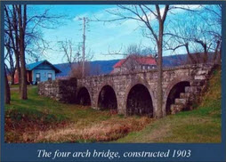
This photo of a four arch Stone Arch Bridge was found on the first referenced page. I don't know where it is, yet. It is NOT listed on the second page, which is a rundown of the bridges in Perry County PA - which strangely, does not include Clay's Covered Bridge in the Little Buffalo state park????
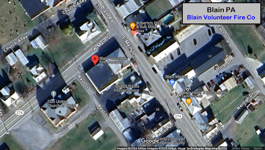
GPS Coordinates: 40.33830, -77.51260
4 W Main St, Blain PA 17006
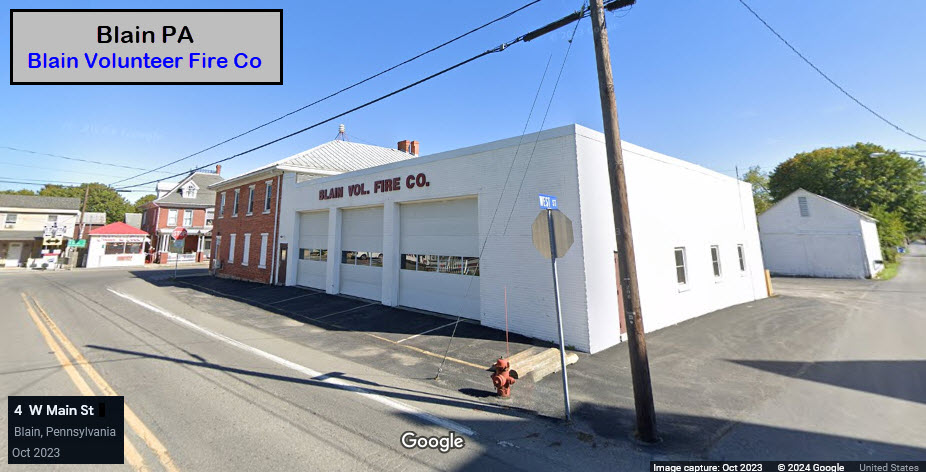
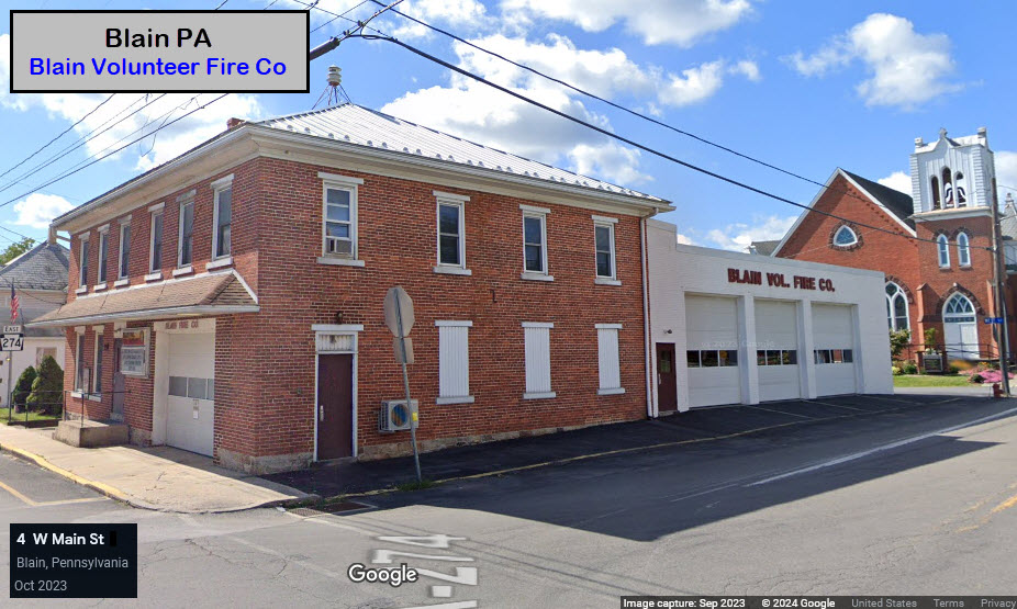
Police
There are no police precincts in Newport or Blain. The Sheriff's department is located over in New Bloomfield. And there is a State Police Barracks to the north of the US22 exit on 34. Please check out my Newport page if you want more info on where they are located.
Errata
Please note, the pictures of the N&SVRR steam locomotives were found on the Picryl website, but were a huge PIA to download, so we did a screenshot of the pictures, while this may not be the best resolution available (and it isn't), they charge you a fee for downloading the hi-res versions. Even the middle resolution pictures are a challenge to wade thru all of the "mierda" in order to download. The pictures are available on the National Park System website, available for free download, but I didn't spend anytime searching for them. As you may have heard me say before, I don't charge for you to use anything from my website, I have no ads, I don't ask for money, and have a problem with those who DO want money from you for stuff that is available for free.
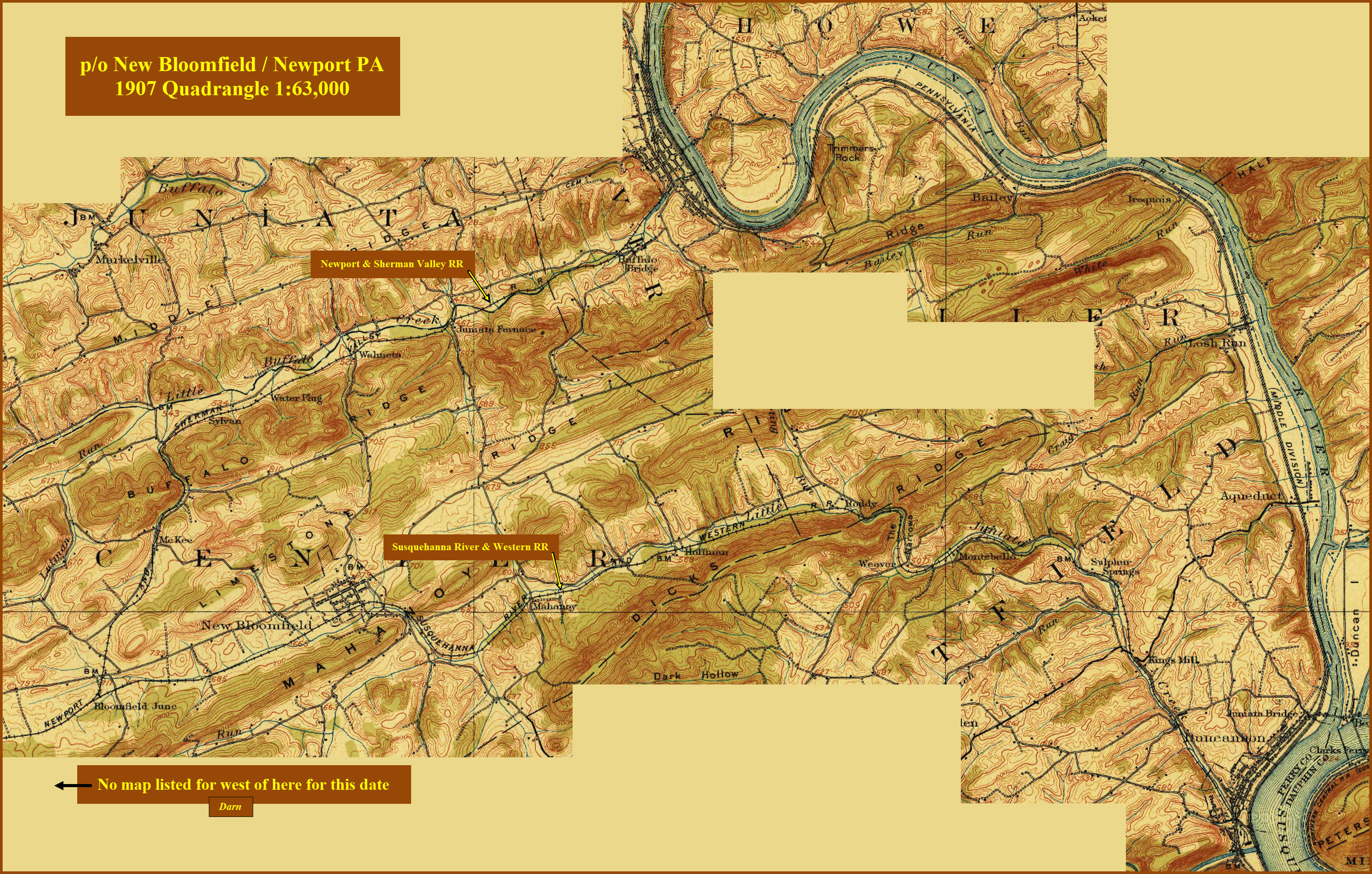
Courtesy USGS, click here for their index page.
Unfortunately, it does not look like the USGS has a map of the area old enough to show the R-O-W of the N&SV in Blain while it was running. The earliest map I could find that shows the railroad is of the New Bloomfield PA from 1907, but it does not go far enough west to show Blain, even at 1:63,000 (which shows much more territory than a standard 1:24,000 map).
Disclaimers:
New format 10/26/23: Please check out my disclaimer page for my standard dribble and contact info here
RAILFAN GUIDES HOME
RAILROAD SIGNALS HOME
NEW 04/20/2024, APR21/23/24/2024
Last Modified 24-Apr-2024