In General
Getting Here
Map
Station by Station
Pictures
Signals
Floobydust
RAILROAD SIGNALS HOME
Location / Name:
Toronto ON
What's Here:
Union Pearson Express (DMU service to the airport)
Extensive Streetcar System
Extensive Subway/Heavy Rail System
Toronto Union Station
VIA (Canada's equivalent to Amtrak)
GO (Regional Commuter System)
Data:
GPS Coordinates: as needed
Phone A/C: 647
ZIP: M5V 3M9 (at the CN Tower)
Access by train/transit:
Union Pearson Express
Via
GO
Amtrak
TTC Streetcar
TTC Subway
The Scoop:
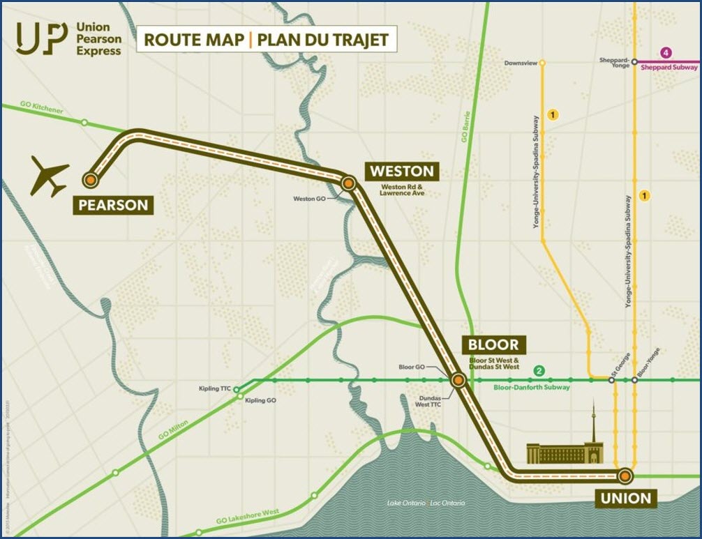
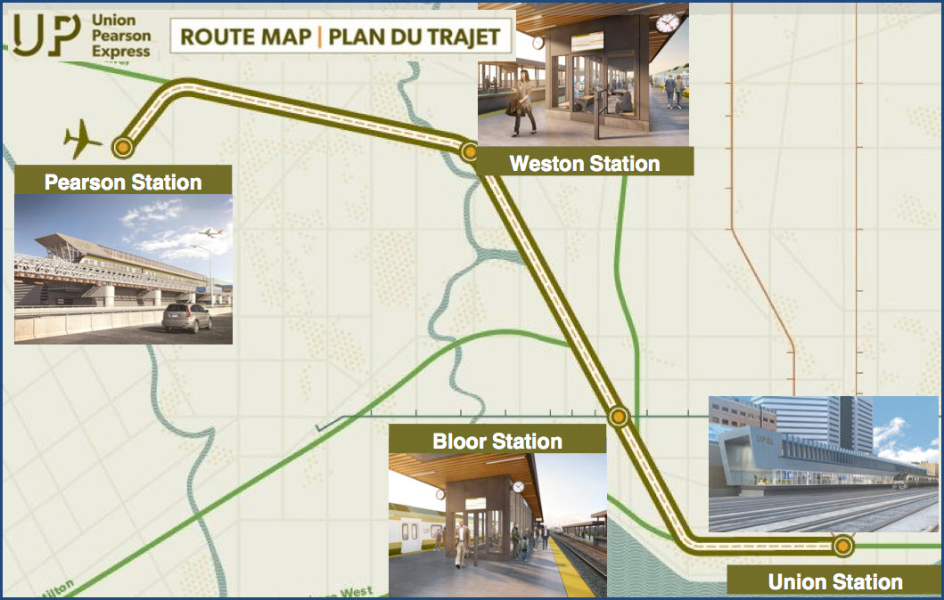
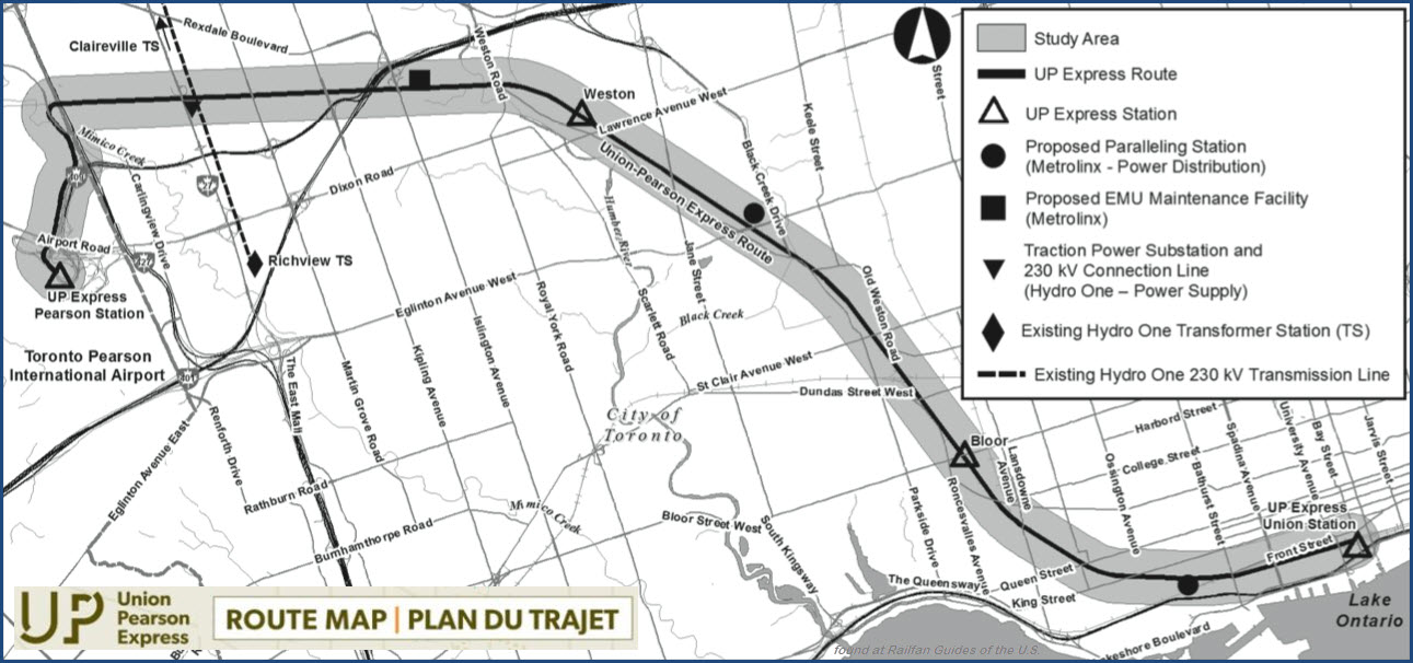
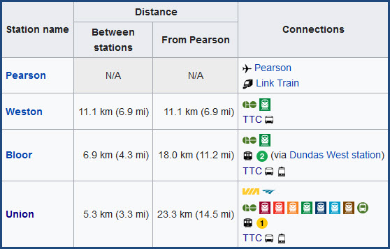
The Union Pearson Express began operation on 6JUN2015, construction started in 2012. The standard gauge line is 14-1/2 miles long (23.3km), however, only 2 miles (3.3km) of it is new from the existing GO Weston sub and must have cost a fortune to build, because it is all elevated!
The train travels between Union Station and Pearson Airport - the trip takes about 25 minutes. UPX operates daily between 04:55 and 01:00, every 15 minutes, making approximately 140 trips per day, seven days a week. UP Express is operated as an independent division of Metrolinx, similarly to GO Transit.
UP Express uses diesel multiple unit (DMU) trains that meet United States Environmental Protection Agency Tier 4 emission standards. The UP Express (and Kitchener) lines will be electrified, although no date has been set. The UP Express has been criticized for not using electric trains from the outset, but they can be converted at some future point to electric operation.
The Union Pearson Express uses Nippon Sharyo DMU trains. The fleet consists of 18 diesel multiple unit (DMU) cars, as four three-car and three two-car sets. On 1MAR2011, Metrolinx announced that it had chosen to buy 12 DMU cars (six two-car trains) from Nippon Sharyo at a cost of C$53 million, for the service. This was later expanded to 18 DMU cars (adding one car to each train) via an option order. This brought the cost to $75 million. The DMUs were manufactured in Japan, assembled in Nippon Sharyo's facility in Rochelle IL, and towed by rail to Toronto, with the first trainset arriving on 15 August 2014. The trains are powered by a diesel/hydraulic drive with a six-speed automatic transmission and features regenerative braking,
The trainsets seat between 115 and 173 people. On-board features include power outlets, Wi-Fi, luggage facilities, and washrooms.
Now for airport background and history....
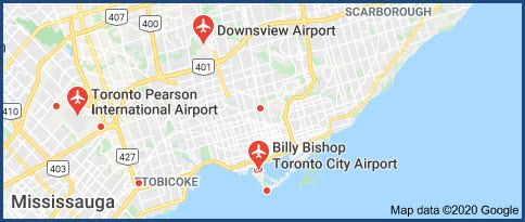
Pearson is Toronto's main airport, it is correctly called the Toronto Pearson International Airport. The other airport of Toronto is the Billy Bishop Airport.
The Greater Toronto Area contains ten airports, eight heliports, and one water aerodrome. These aviation facilities are situated within and around Toronto and its neighboring cities, serving airline passengers, regional air travel and commercial cargo transportation.
Trivia/history: YZ was the code for the station in Malton, Ontario, where Pearson Airport is located and hence the IATA code for Pearson Airport is YYZ. The telegraph station in Toronto itself was coded TZ, which is why Toronto's smaller City Centre Airport is coded YTZ. Rather than each Canadian airport completely renaming their codes to match the name of the airport or city they served, they simply added a 'Y' to the front of each 2 letter code, with the Y indicating that each airport was Canadian.
Acknowledgements:
Craig James White
Reverend Edward Brain, D.D.
Wikipedia
Google Maps
Bing Maps - not this time, as Bing has terrible coverage of Toronto
Websites and other additional information sources of interest for the area:
https://www.upexpress.com/
https://en.wikipedia.org/wiki/Union_Pearson_Express
https://www.facebook.com/UnionPearsonExpressEN/
https://www.railfans.ca/rail-systems/union-pearson-express
https://en.wikipedia.org/wiki/Mount_Dennis_station
Getting to G
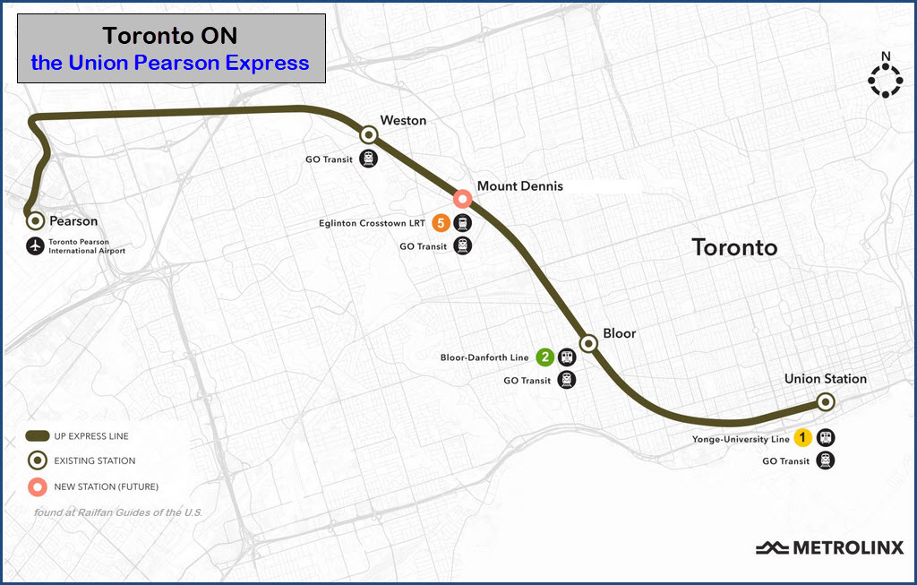
A Mount Dennis station is under construction which will be used to connect to the Line 5 Eglinton light rail line (also known as the Eglinton Crosstown, or simply, Crosstown), which is also under construction. It was supposed to be opened in 2021, but that has been pushed back to 2024.
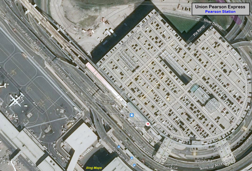
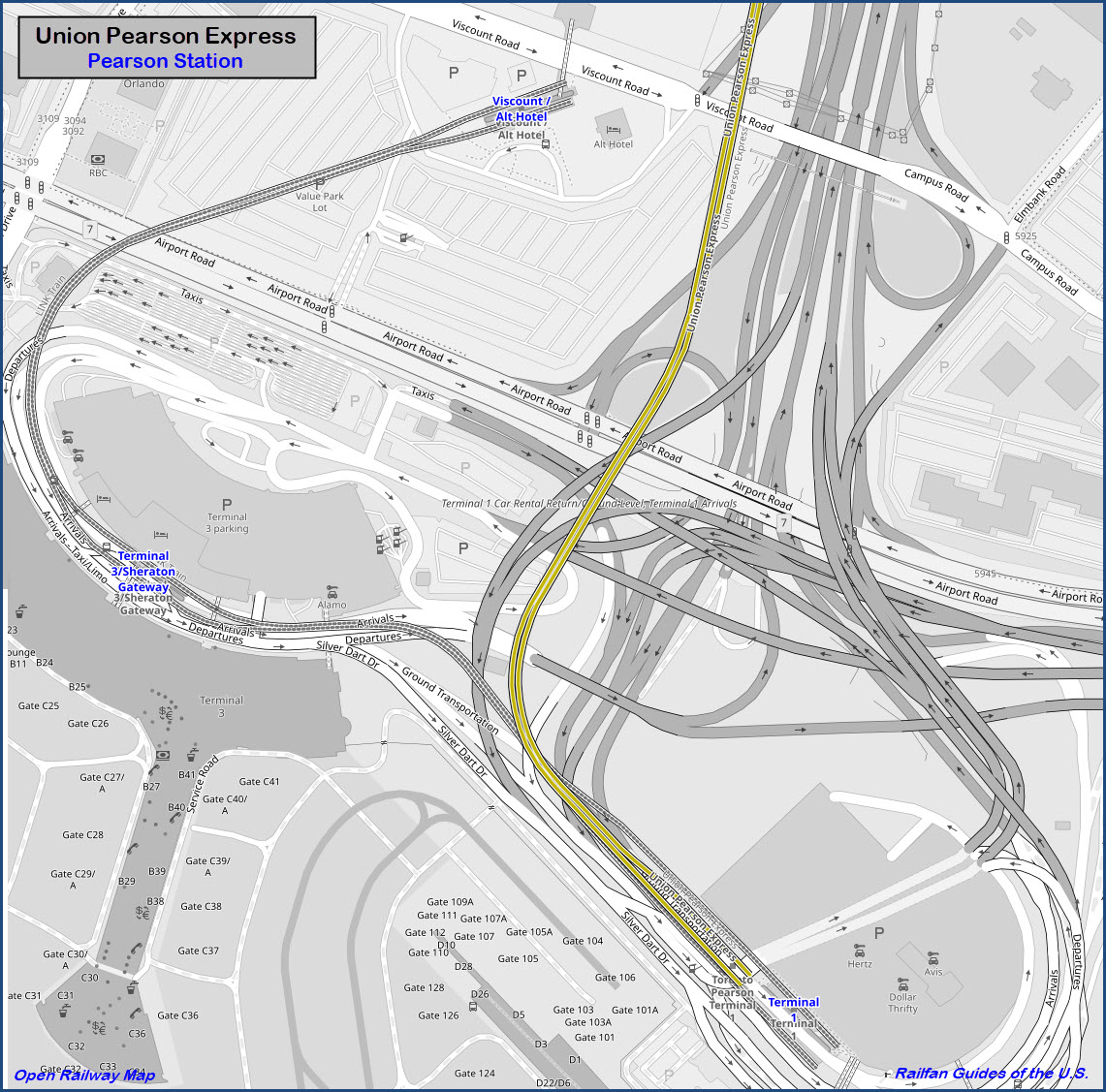
Pearson
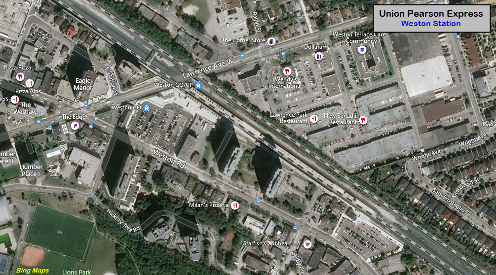
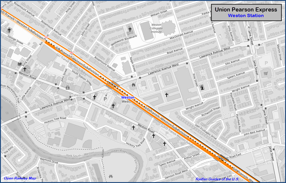
Weston
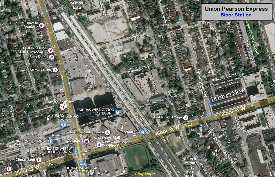
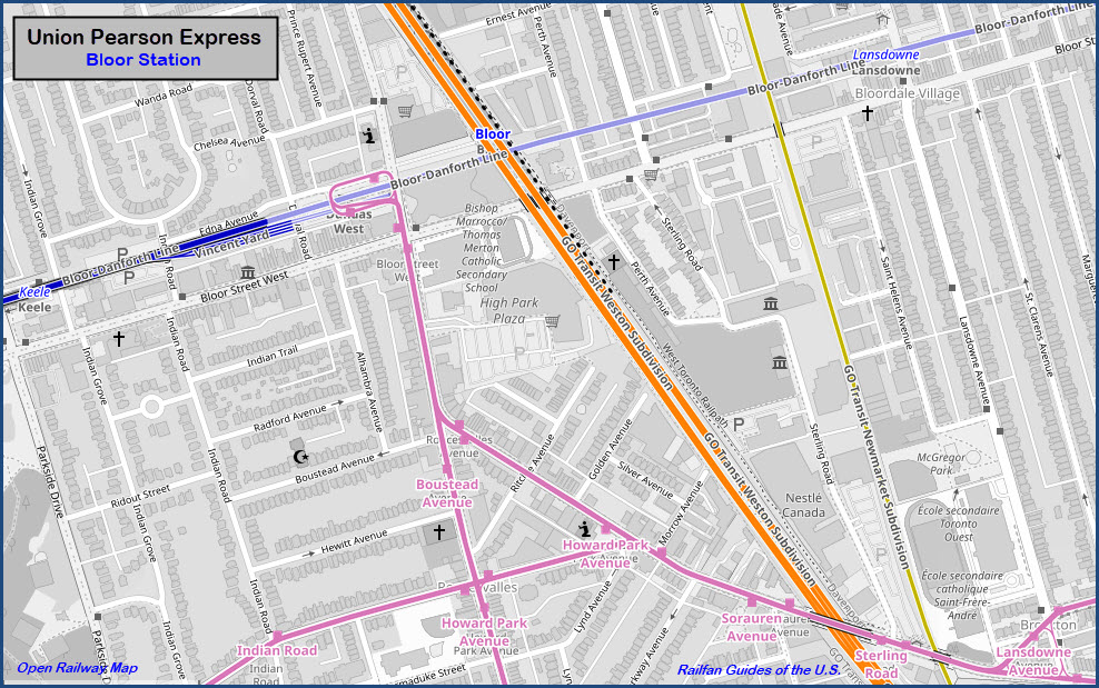
Bloor Station
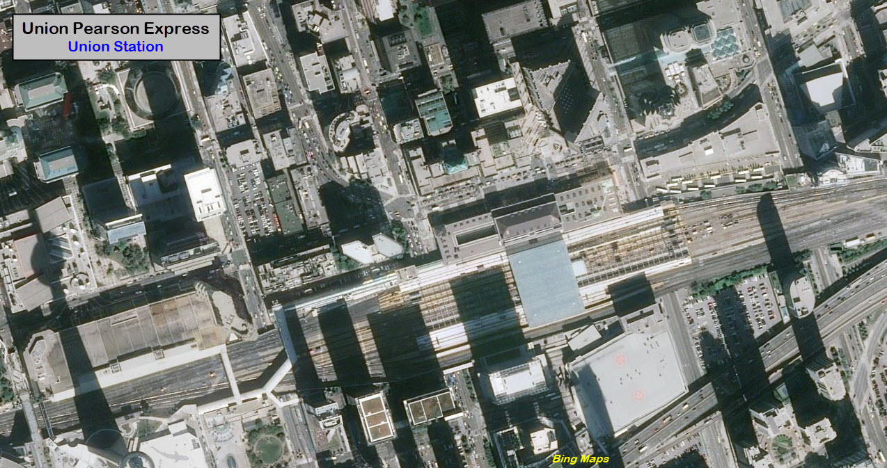
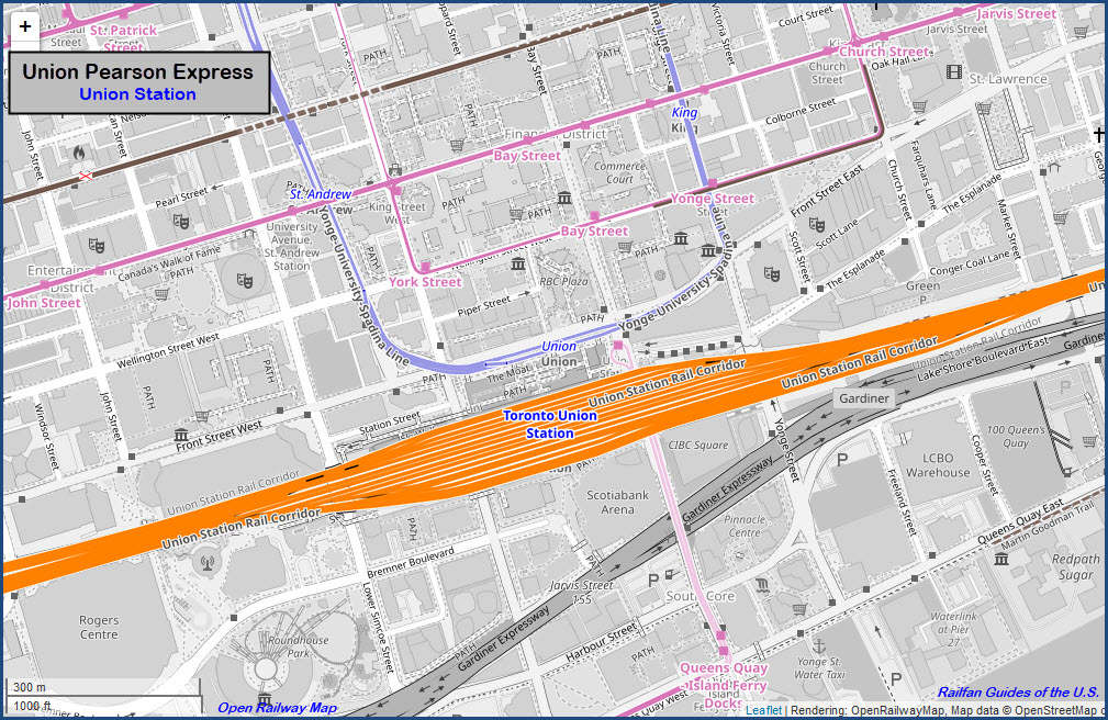
Union Station
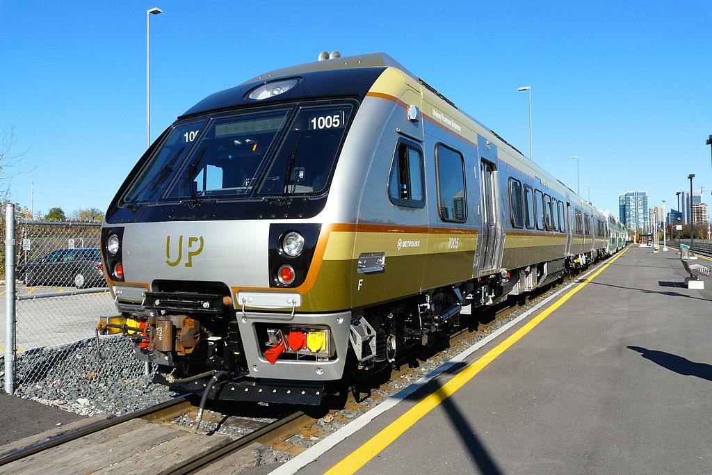
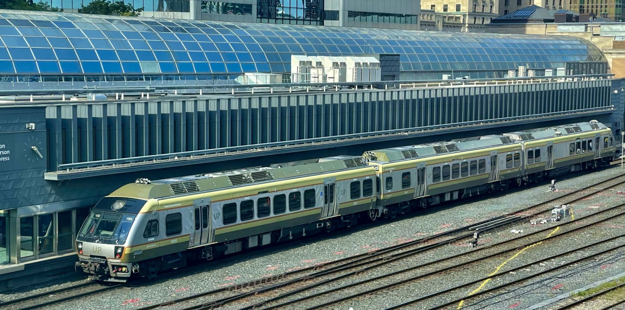
A new train set being delivered at Mimco, pulled by a GO consist. photo by Craig James White, Nov 2, 2014
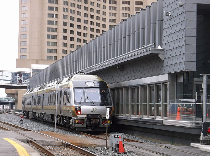
At Union Station, photo by Reverend Edward Brain, D.D.
At Union Station, photo by , via railfans.ca
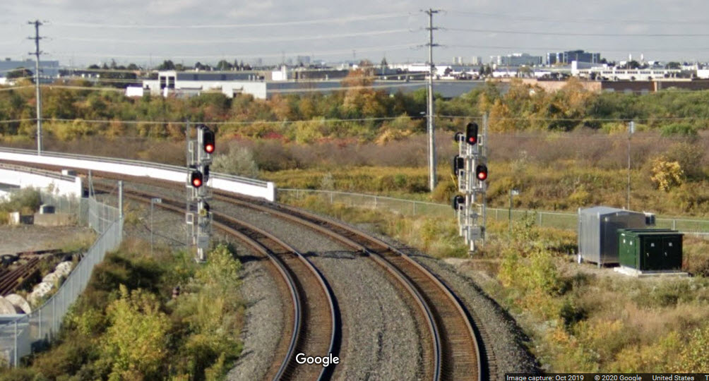
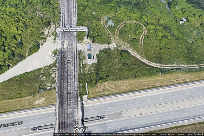
The first three signal locations are part of the extensive interlocking at the Pearson/GO Junction in Etobicoke, just north of the Airport.
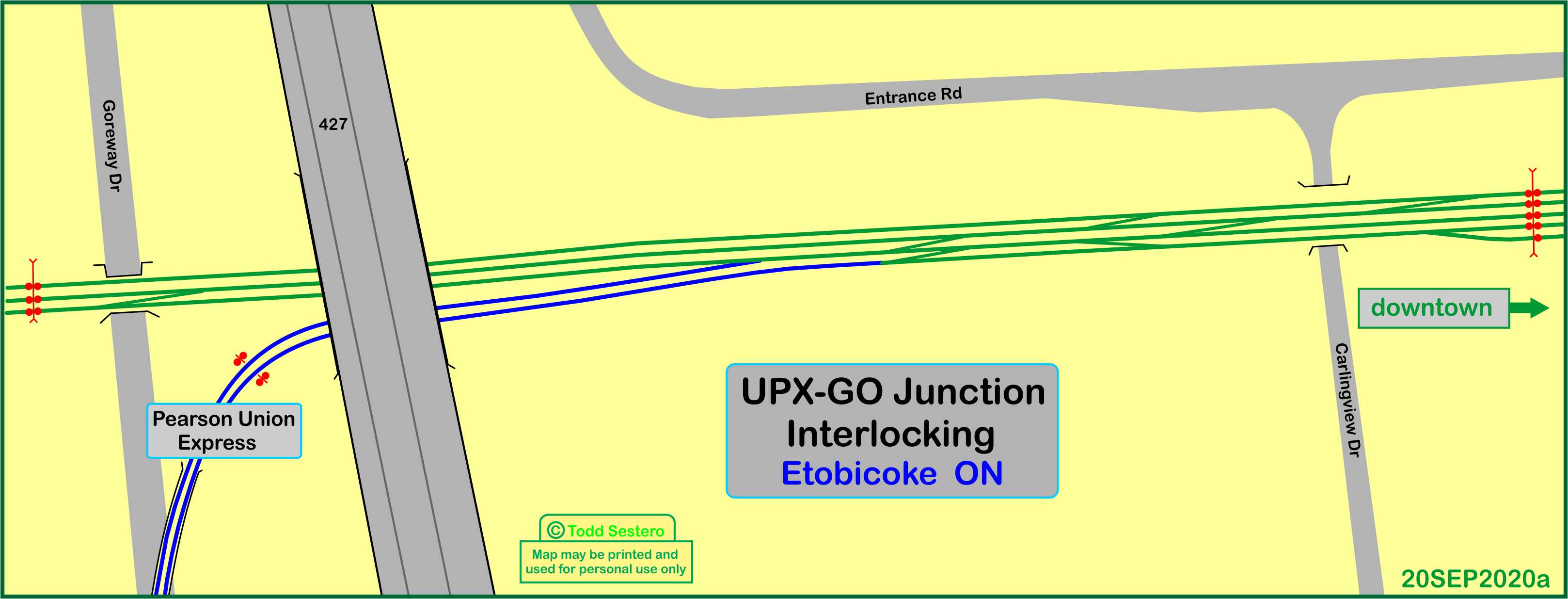
A bidirectional set of signals just after the UPX tracks split off from the GO mainline.
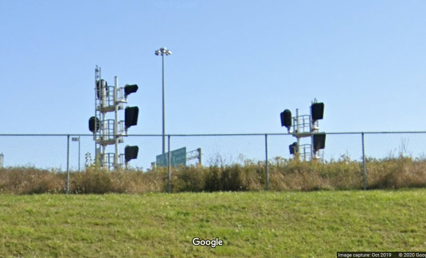
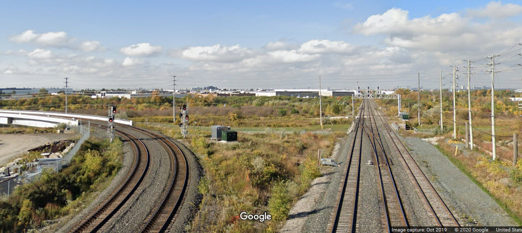
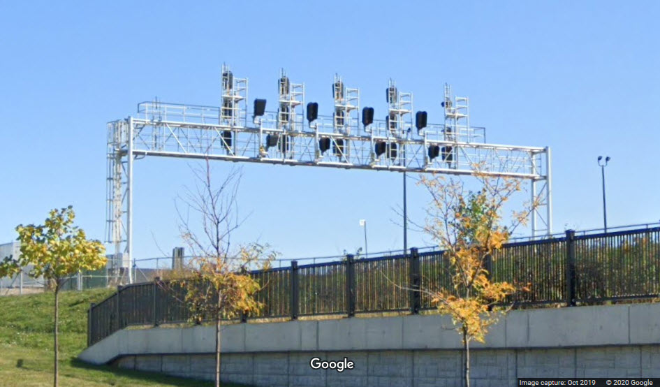
From the 427 overpass, come these two shots looking west, the second includes the next signal bridge for WB GO trains.
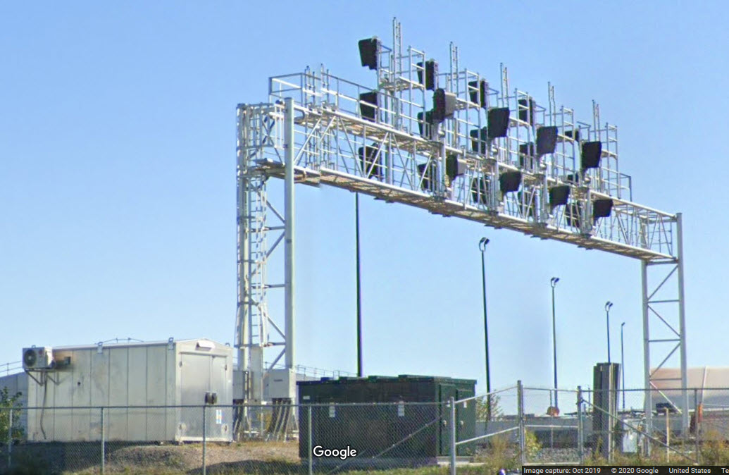
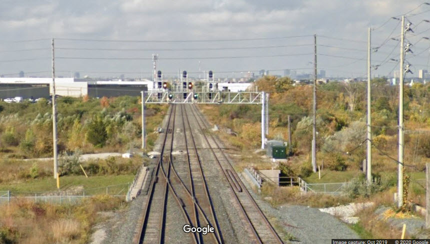 the next set of GO signals
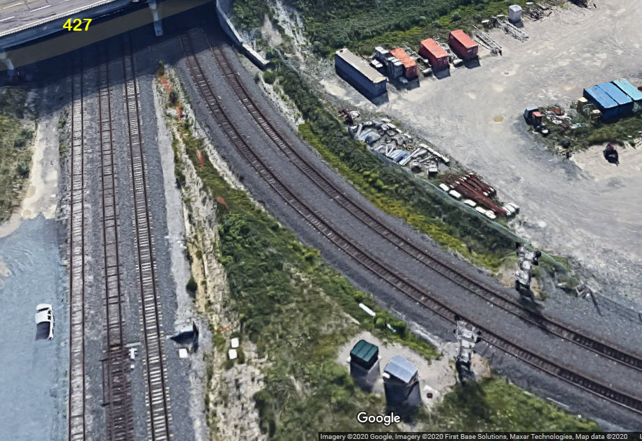
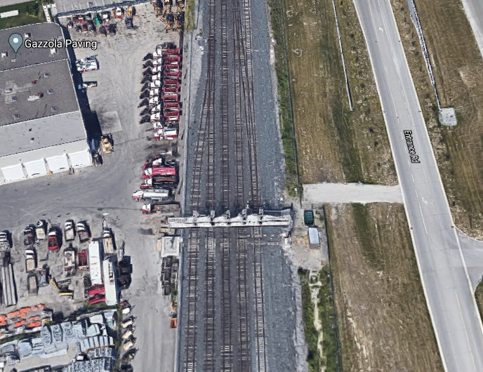
This is the first signal location the UPX trains come to once back on the GO mainline.
Did U Know?
None for now......
Disclaimers:
I love trains, and I love signals. I am not an expert. My webpages reflect what I find on the topic of the page. This is something I have fun with while trying to help others.
Please Note: Since the main focus of my two websites is railroad signals, the railfan guides are oriented towards the signal fan being able to locate them. For those of you into the modeling aspect of our hobby, my indexa page has a list of almost everything railroad oriented I can think of to provide you with at least a few pictures to help you detail your pike.
If this is a railfan page, every effort has been made to make sure that the information contained on this map and in this railfan guide is correct. Once in a while, an error may creep in :-)
My philosophy: Pictures and maps are worth a thousand words, especially for railfanning. Text descriptions only get you so far, especially if you get lost or disoriented. Take along good maps.... a GPS is OK to get somewhere, but maps are still better if you get lost! I belong to AAA, which allows you to get local maps for free when you visit the local branches. ADC puts out a nice series of county maps for the Washington DC area, but their state maps do not have the railroads on them. If you can find em, I like the National Geographic map book of the U.S..... good, clear, and concise graphics, and they do a really good job of showing you where tourist type attractions are, although they too lack the railroads. Other notes about specific areas will show up on that page if known.
Aerial shots were taken from either Google or Bing Maps as noted. Screen captures are made with Snagit, a Techsmith product... a great tool if you have never used it!
By the way, floobydust is a term I picked up 30-40 years ago from a National Semiconductor data book, and means miscellaneous and/or other stuff.
Pictures and additional information is always needed if anyone feels inclined to take 'em, send 'em, and share 'em, or if you have something to add or correct.... credit is always given! Please be NICE!!! Contact info is here
Beware: If used as a source, ANYTHING from Wikipedia must be treated as being possibly inaccurate, wrong, or not true.
RAILFAN GUIDES HOME
RAILROAD SIGNALS HOME
NEW 09/19/2020, JUN09/2022, SEP19/2023
Last Modified 28-Sep-2023