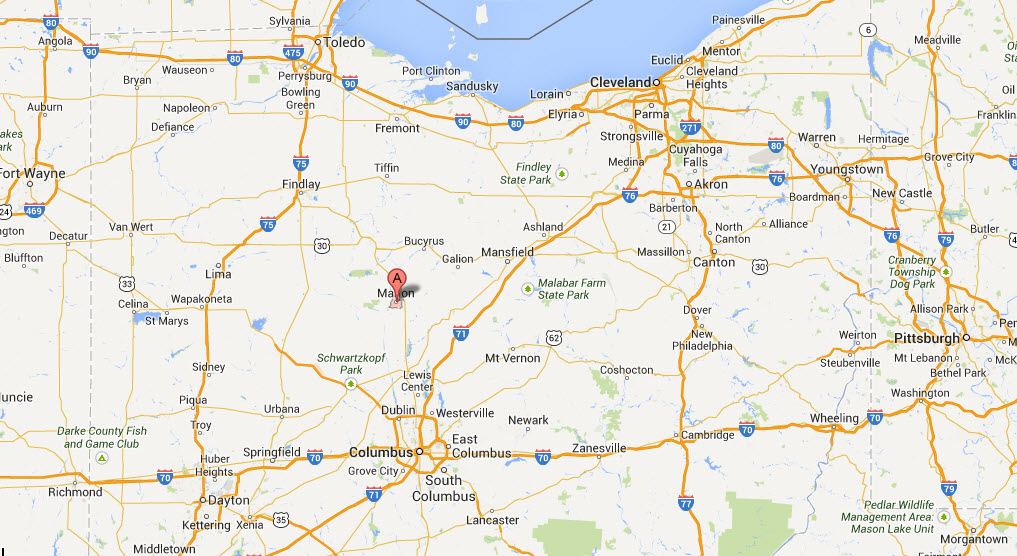
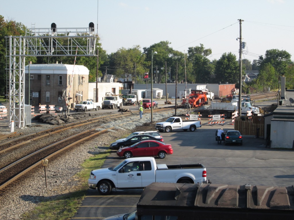
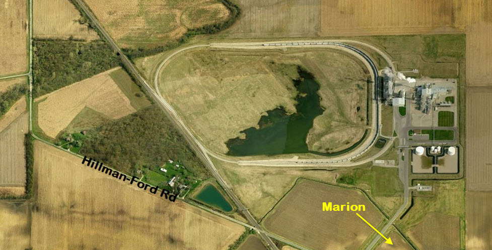
Marion OH offers a lot of action considering its small size, and the fact that a lot of the 60's tracks are torn up.
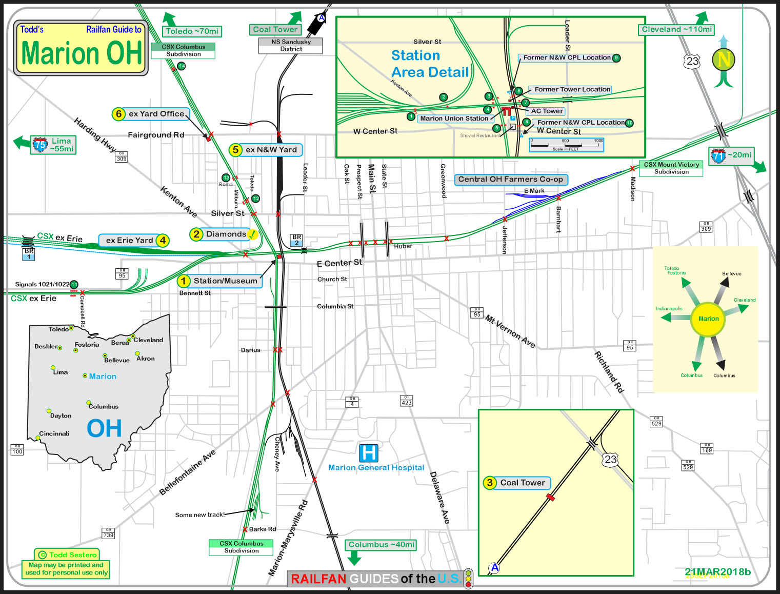
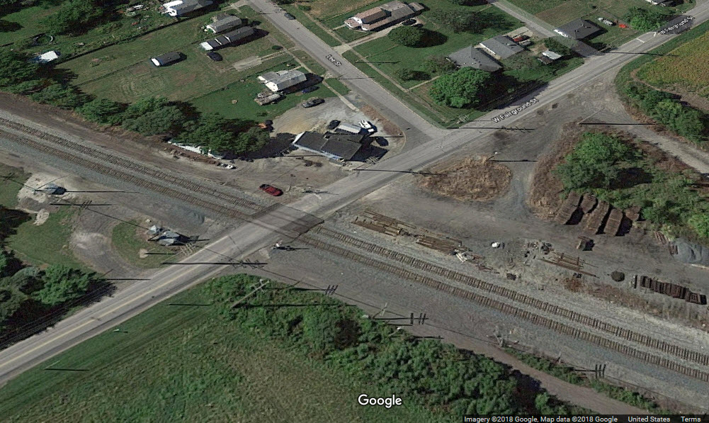
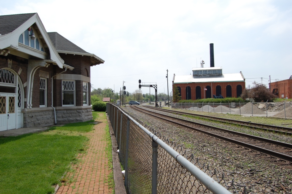
Marion and the depot draws hundreds of railfans a year, mostly for train watching. The depot is situated in the center of three mainlines, and the property is
squared off by two double sets of diamonds..... eight actual diamonds! Fostoria offers three sets of four diamonds, but you can not get as close to them
as here. So come to Marion and experience the pounding of steel from only a few feet away! The parking is free.
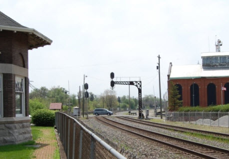
Although the station is surrounded by a fence, it doesn't seem to get in the way of most photographs, as it is a low fence. They have even placed plastic tubing
over the fence rails so you have a place to rest your arms when taking pictures. Do not trespass onto railroad property, as there is a Norfolk Southern office
across the tracks, and they have been known to come out and chase railfans off RR property. There is little lighting for watching trains at night, and one or
two picnic tables.
There is a 7-11 type store nearby with a Subway inside, and for sit down meals, there is the Shovel Restaurant & Lounge next to the station. Fred's Ice
Cream is between the NS and CSX tracks to the north of the station.
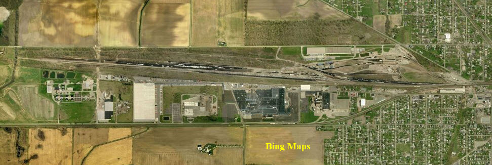
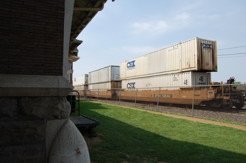
About 60 CSX and NS freight trains pass through Marion every day. You may also be lucky to catch some foreign power too: it is reported there is hardly a day
that passes that you don't see some. Some locals may even sport a caboose!
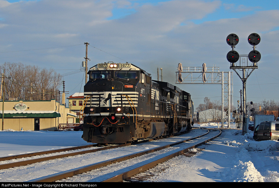
● Norfolk Southern has the most trains coming thru on the ex N&W line, around 40.
● CSX, on the former Conrail/Erie/NYC St Louis line sees around 20 trains a day.
● The former C&O Toledo Line (CSX) line sees the fewest with around 10 trains a day.
● These numbers are all approximate, and will vary.
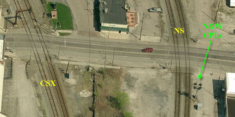
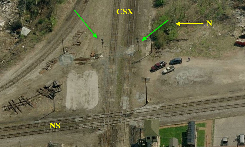
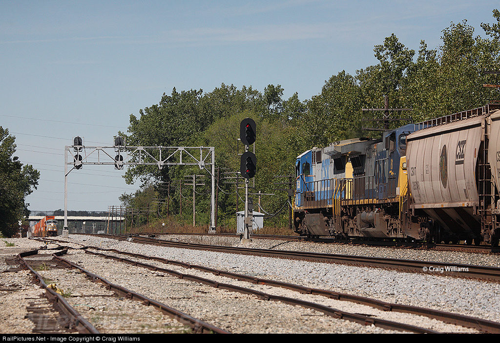
From some of the pictures that follow, it is easy to see who used to own the tracks, as there are N&W style color position lights, and the very noticeable C&O
style signal structures. But I noticed in the newer pictures, that both CSX and NS have replaced the old C&O and N&W with the darth vaders :-(
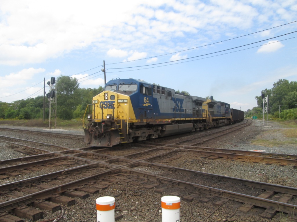
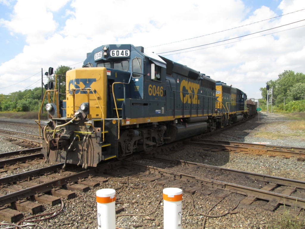
All traffic past the diamonds is controlled by CSX on the Dispatch frequency. Each train needing to pass the depot will call CSX for clearance. "Track
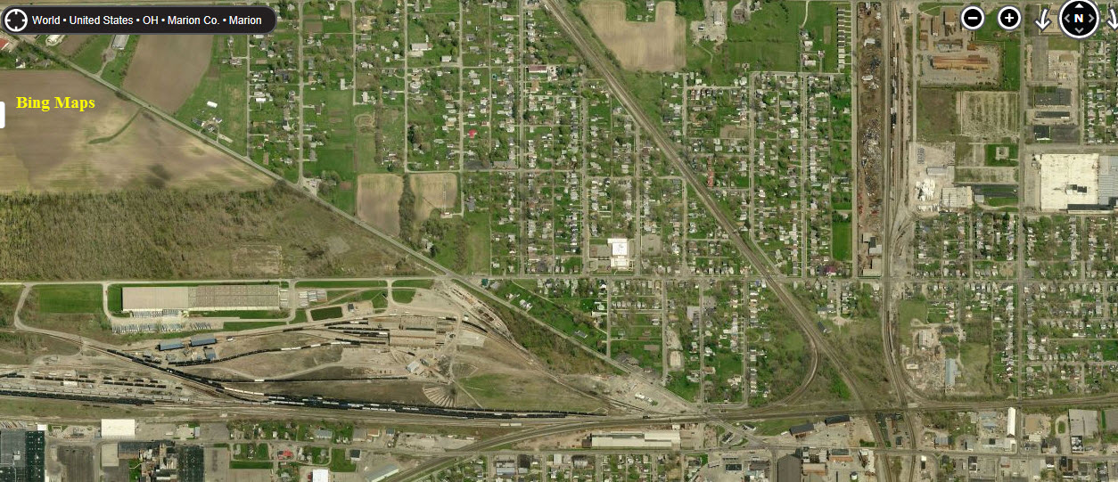
1" for each railroad is the track nearest the depot. There are also railfanning opportunities elsewhere in Marion. West of the station on 95 is a
small CSX (former Conrail) yard. East of the station and just north of OH95 Conrail serves several industries. Just north of Marion, visible from US23, the NS
tracks pass beneath the remains of a concrete coaling bunker. Thanks to William Eric McFadden, WD8RIF for this
info, from the third link below.
The following information is provided by KD8CJL via the second link below:
CSX Indy Sub: 160.800 Road/Dispatcher, Runs East/West between Cleveland and Indianapolis
A small yard is just west of the diamonds is visible. Old Conrail detector at New Bloomington to the west is audible if scanning.
CSX Columbus Sub: 160.230 Road, 160.320 Dispatcher
Tracks run North/South on the west side of station between Columbus and Toledo. Signals are visible to the north from the station. Also Old C&O Cantilever
signal bridge and signals stands next to station grounds.
NS Sandusky District: 161.190 Road/Dispatcher
The Busiest line through Marion runs on the East side of the station between Columbus and Bellevue. Used to have old Norfolk and Western Color Position
Signals protecting the diamonds. NS also has a small yard to the north of the diamonds.
Other nearby railfan hotspots in the area include: Fostoria, about 50 miles north up the CSX Attica Junction, 40 miles north on the NS Willard Yard, 10 miles east of Attica junction Lima OH, about 50 miles west on 309
Acknowledgements:
This guide is prepared in collaboration with Denver Todd. Pictures and info are supplied by him unless noted.
William Eric McFadden, WD8RIF
KD8CJL
Kevin Orcutt
Rob Schreiner
Richard Thompson
Ryan Lewis
Google Maps
Bing Maps
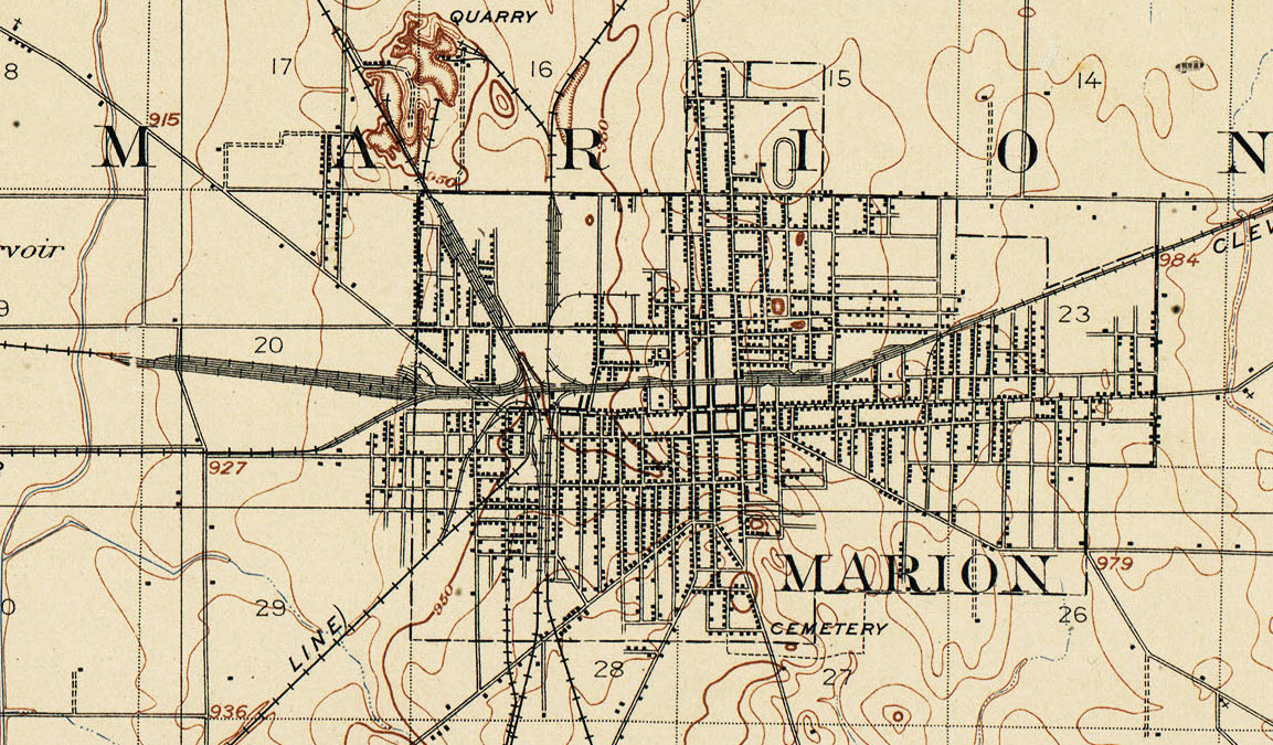
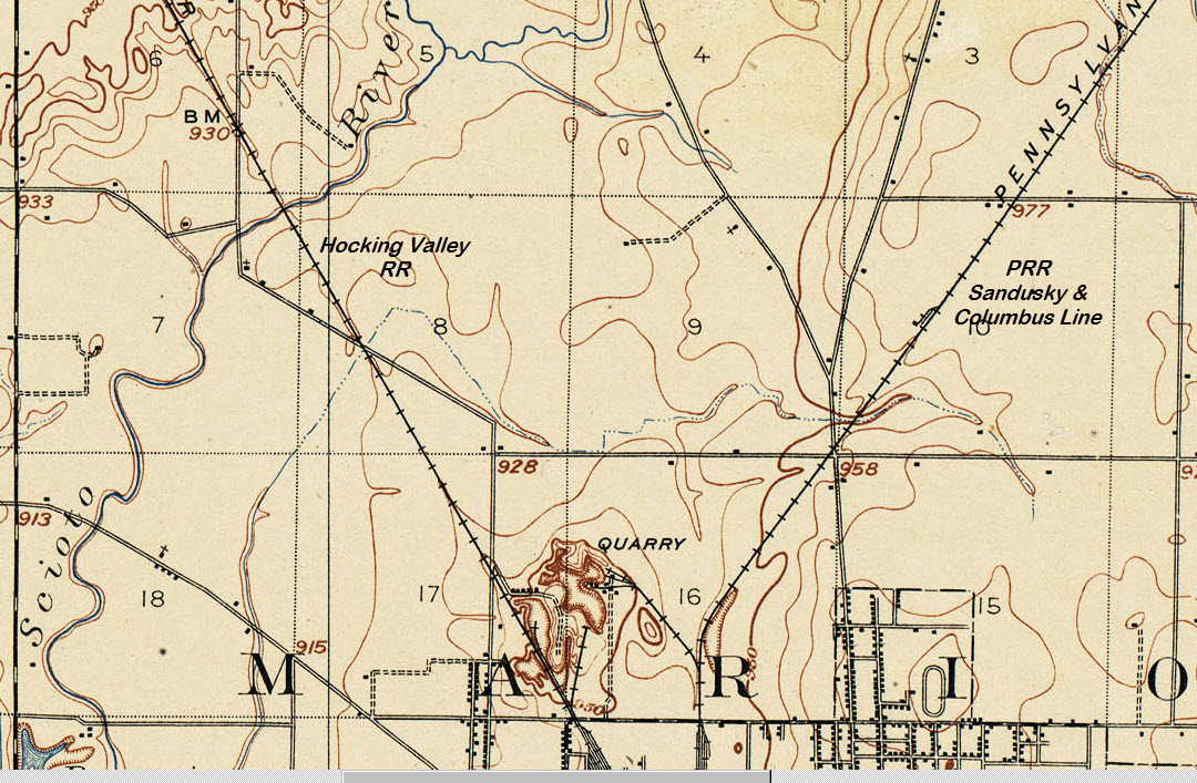
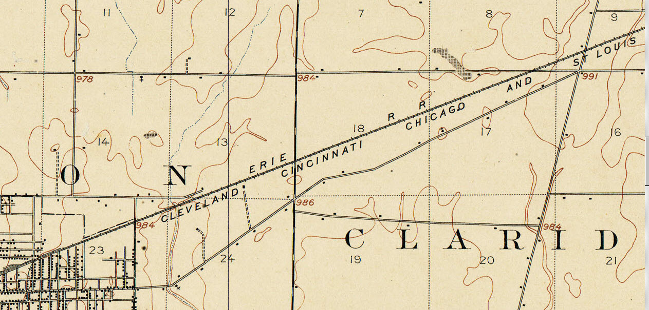
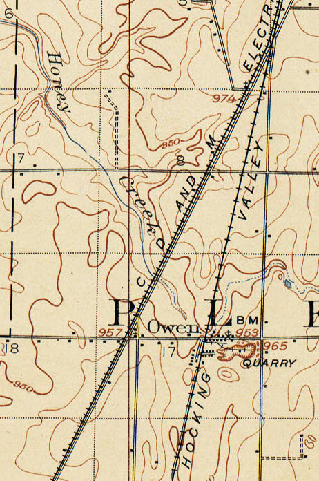
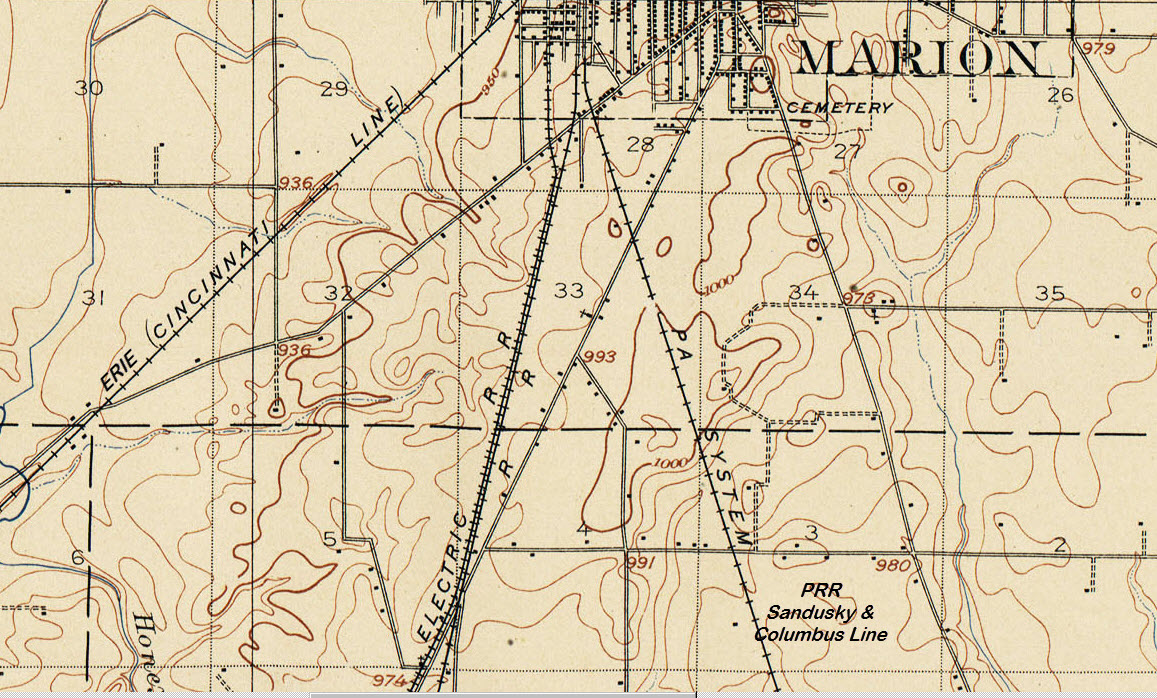
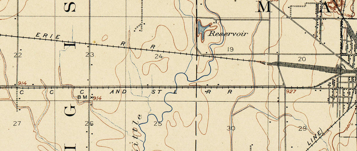
Looking at the USGS maps below, it is noted that
(some of the) railroads that used to come into town are the
Pennsylvania RR, the Erie RR,
the CCC&L - Cleveland, Cincinnati, Chicago & St
Louis RR, and the Hocking Valley RR.
Later on, the Norfolk & Western Rwy and
the Chesapeake & Ohio Rwy came thru,
taking over lines from the earlier railroads.
Hugh Jewett became president of the Erie in 1874. His first task was to lead the road through reorganization; it became the New York, Lake Erie & Western
Railroad. On June 22, 1880, the entire system was converted to standard gauge. That same year the Chicago & Atlantic was completed between Hammond IN
and Marion OH, where it connected with the Atlantic & Great Western. Access to Chicago was over the rails of the Chicago & Western Indiana, a
terminal road. Jewett also double-tracked the Erie from Jersey City to Buffalo. The road was bankrupt again by 1893 and reorganized in 1895 as the Erie Railroad.
The business recession of the 1950s prompted Erie to explore the idea of cooperation with Delaware, Lackawanna & Western. The first results were the elimination
of duplicate freight facilities at Binghamton and Elmira, and in 1956 and 1957 Erie moved its passenger trains from its old Jersey City terminal to Lackawanna's newer one
at Hoboken. The discussions of cooperation turned into merger talks, at first including the Delaware & Hudson. An agreement was worked out with the
Lackawanna, and the two roads merged as the Erie-Lackawanna on October 17, 1960
Disclaimer: The following info comes from Wikipedia.... Marion was also served by an interurban line, the CD&M Electric
Co (originally the Columbus, Delaware, and Marion Railway Co). They operated from 1903 to 1933, and provided both
passenger and freight service. The Columbus, Delaware and Marion Railway, or CD&M, provided interurban service connecting
Columbus, Delaware, Marion, Worthington, and Bucyrus, Ohio. It also provided local street car service in Marion and Delaware. The CD&M provided local
and interurban service on 60 miles (97 km) of track as The Columbus, Delaware and Marion Electric Railway Company. It operated service to Bucyrus through the
Delaware, Marion and Bucyrus Railroad on an additional 20 miles (32 km) of track. At Bucyrus the railway met the Cleveland, Southwestern and Columbus Railway
for connecting service to Cleveland. The CD&M also generated electricity for Marion and sold power to the Middle West Utilities System. As a means of
increasing off hours riders, the company developed Glenmary Park north of Worthington to attract interurban passengers with playing fields and picnic areas, and
provided partial funding for Crystal Lake Amusement Park north of Marion, OH.
The beginnings: The Columbus, Delaware, and Marion Railway was formed in 1901 to establish interurban service north of Columbus, Ohio. The CD&M
Railway purchased the Columbus, Clinton and Worthington Street Railway. At the same time, a rival company, the Columbus, Delaware and Northern Railroad,
acquired a right-of-way between Columbus and Marion. The CD&M Railway bought its rival and the railroad began interurban service in 1903. In October
1904, the CD&M incorporated as a holding company operating through its subsidiary the Columbus, Delaware, and Marion Electric Railroad. In 1908, the company
built the Columbus, Marion, and Bucyrus Railway to connect Columbus to the Cleveland, Southwestern and Columbus Railway at Bucyrus with plans for service to Cleveland,
Sandusky, and Toledo. The Columbus Marion and Bucyrus operated passenger service from Columbus to Bucyrus and nightly through freight service between Columbus
and Cleveland. In 1909, both the CD&M Railway Company and its Bucyrus subsidiary went bankrupt. The Columbus, Marion and Bucyrus emerged from bankruptcy
in 1914, and in 1917, the CD&M was reorganized as the Columbus, Delaware and Marion Electric Company.
Decline and abandonment: The Columbus, Marion and Bucyrus Railway lost money during the late 1920s. The railway went bankrupt in 1930 and was absorbed
into Columbus, Delaware, and Marion in 1931. In 1931, the Cleveland, Southwestern and Columbus Railway abandoned its rail lines, causing the CD&M to lose revenue
from its Cleveland freight service in 1933. The company filed for bankruptcy in March 1933 and abandoned rail passenger service in August 1933. Passenger rail
was replaced by bus service. The CD&M Electric Company was merged with the Reserve Power Company to form Marion-Reserve Power Company in 1937.
The Ohio Railway Museum in Worthington operates on about one mile of former CD&M right-of-way. The museum's collection includes a preserved CD&M parlor car
numbered 501. Until 1969, another 5.2-mile (8.4 km) segment of CD&M track, leading to a power plant, was used in Marion.
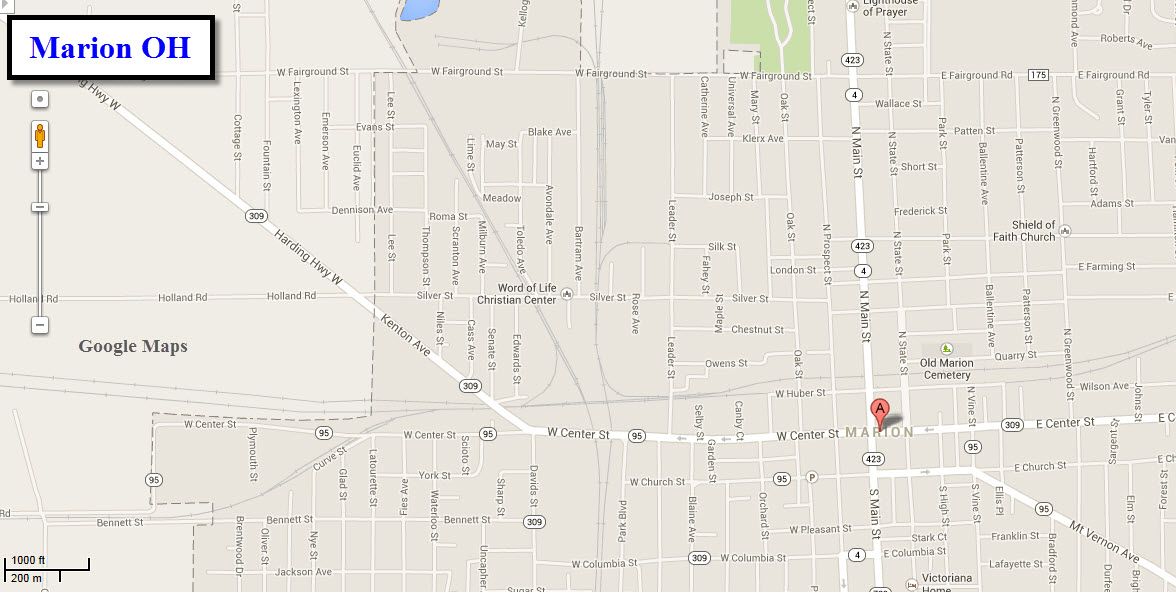
GPS Coordinates: 40.589511,-83.140615
532 W Center St, Marion, OH 43302
(740) 383-3768
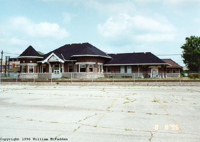
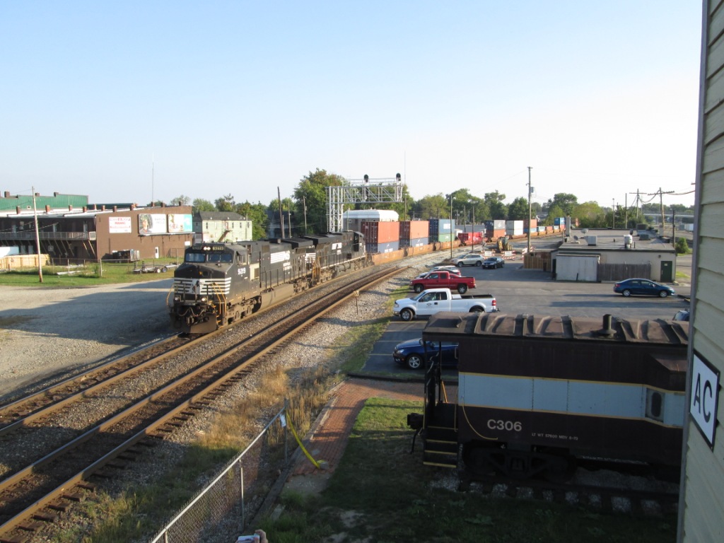
From the city's website: More than 100 trains pass by Union Station every day. It showcases an impressive collection of memorabilia and the AC
Tower, which was once the main switching facility for the Erie Railroad, Marion Division. The unusual nature of the station is that it is located
between two diamond crossovers. Open 10 a.m. – 2 p.m. Tuesday and Thursdays.
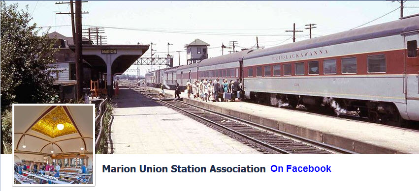
The Marion Union Station was once a busy train station serving the New York Central RR, the Erie RR,
the C&O Rwy, and the Norfolk & Western Rwy. The picture above comes from the Marion
Union Station Association's webpage on Facebook.
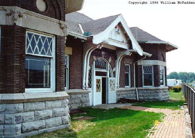
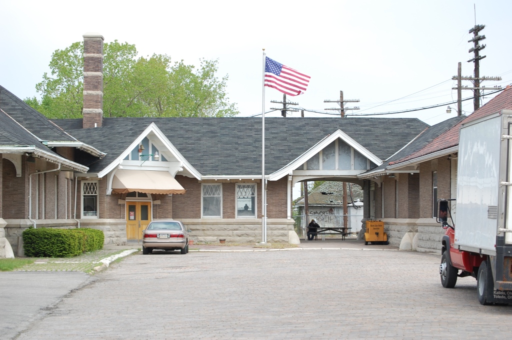
The station is now owned by the Marion Union Station Association, who operates a museum inside the train station. The station
museum has a limited schedule, but the property is available for train watching 24-hours a day, every day of the year. Also on the site is former Erie-Lackawanna
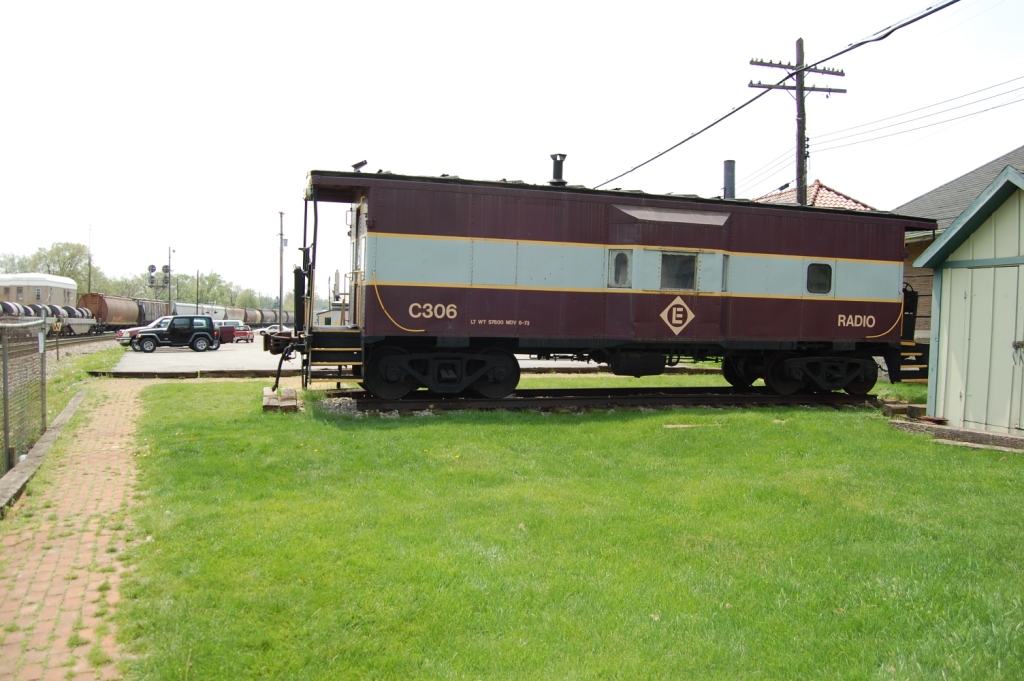
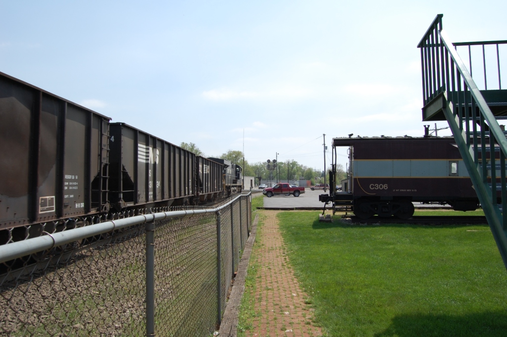
caboose #C306 and AC Tower. The tower has been restored by the museum, and they also relocated the tower from across the tracks,
and now sits next to the train station.. There is also a model railroad layout is open for members.
The website for the model railroad layout is here.
The museum also hosts a train show, held in the August time frame (if the info from a 2010 post is still good).
The address for the museum is: 532 W. Center St, Marion OH 43302. Their phone number is 740-383-3768. Hours are Tuesday and Thursday from 10am till
2pm. Admission is one dollar.
Denver Todd photo
This is a picture of the NW corner of the station. Denver Todd photo
Denver Todd photo
Denver Todd photo More info and pictures on the Marion Tower can be found at Zach's page
here
at the Diamonds
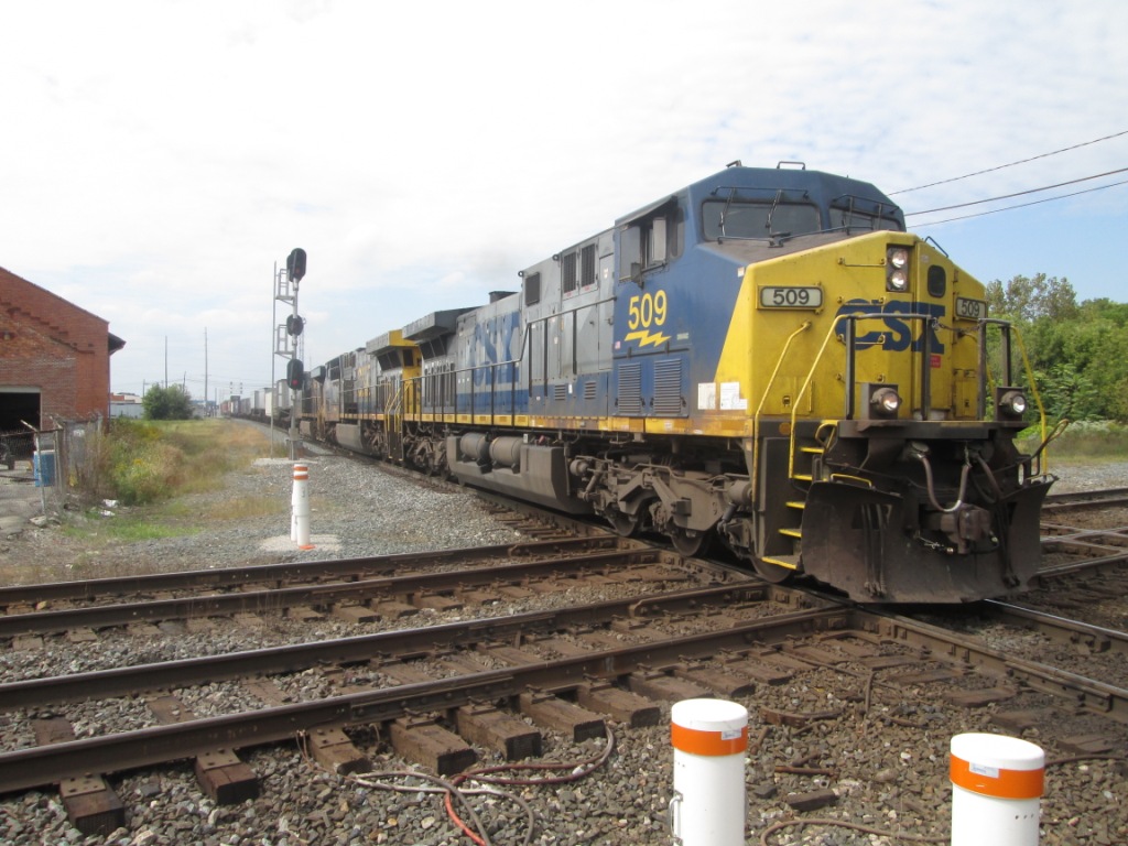
Denver Todd photo.
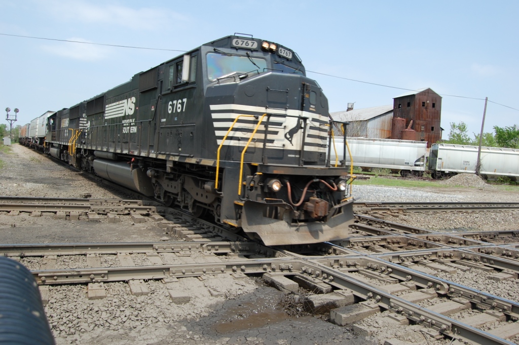
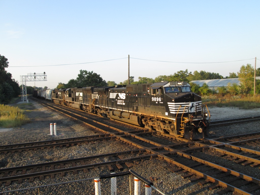
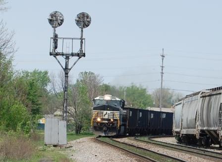
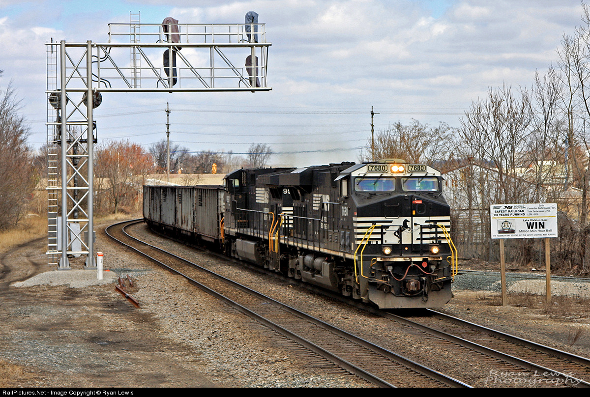
NS 6767 heading up a freight crossing the east diamond between the Norfolk Southern and CSX.
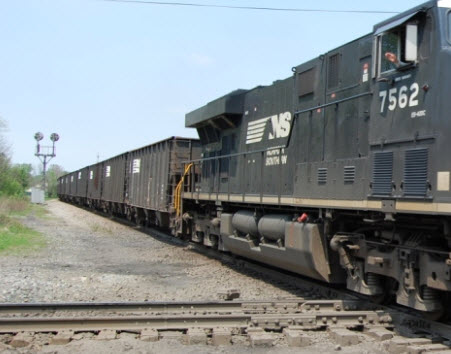
The following 8 pictures are courtesy Kevin Orcutt.
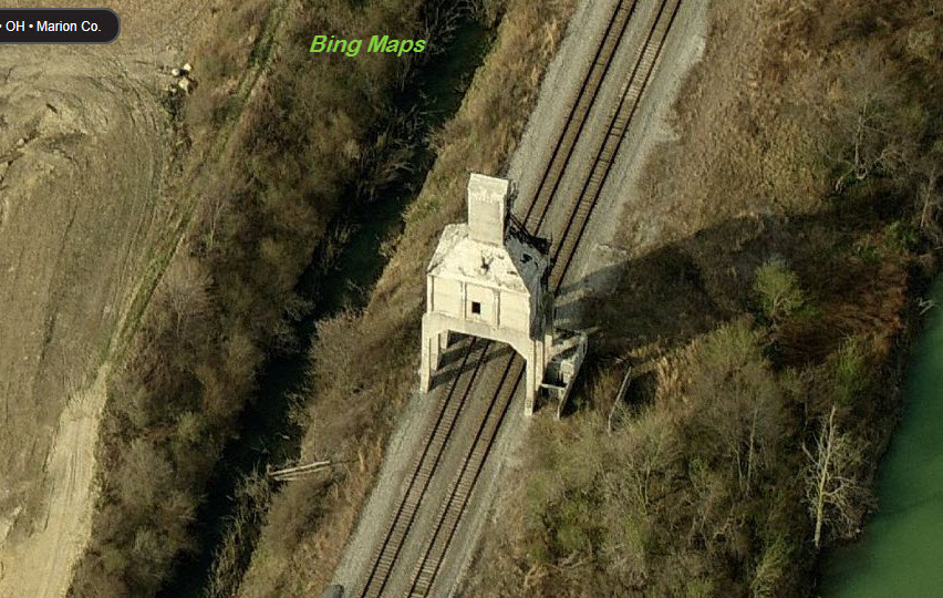
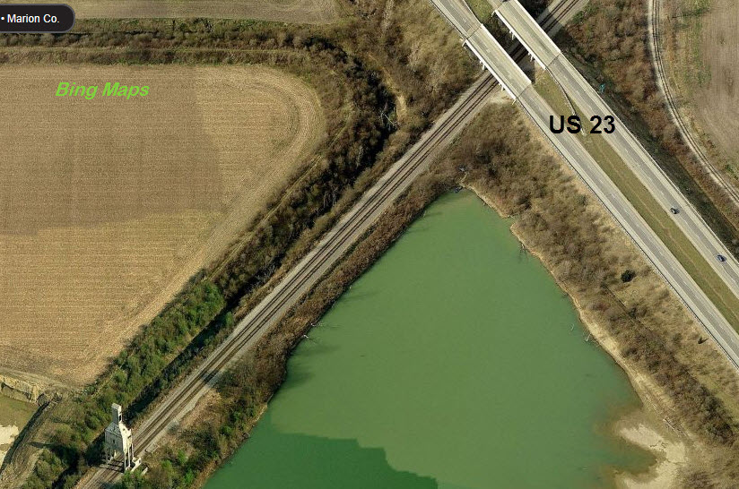
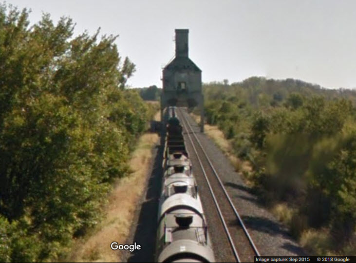
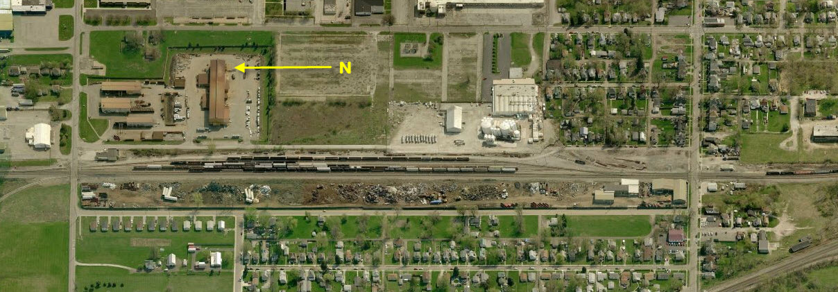
Coal Tower
GPS Coordinates: 40.645489, -83.104450
It's not too often in today's day and age, that a structure such as this is left "along" the right-of-way for mainline trains to pass
through. Good pictures of NB freights can be had from US 23.
From the US 23 overpass
Looking the other way towards the head end of the freight
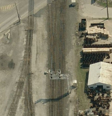
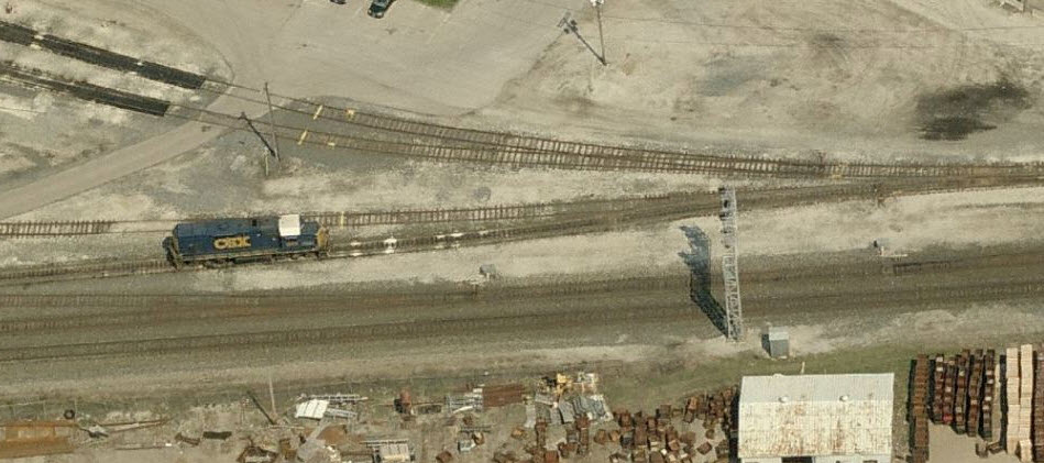
ex Erie RR Yard
ex N&W Rwy Yard
former Yard Office
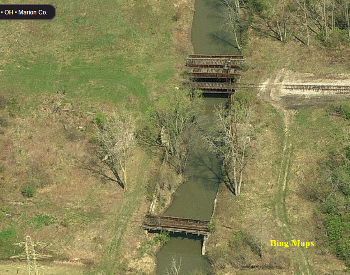
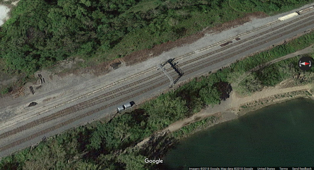
Abandoned Bridges at the west end of the ex Erie Yard
The upper set of three bridges would have gone into the west end of the Erie Yard. Not sure who owned the single bridge.
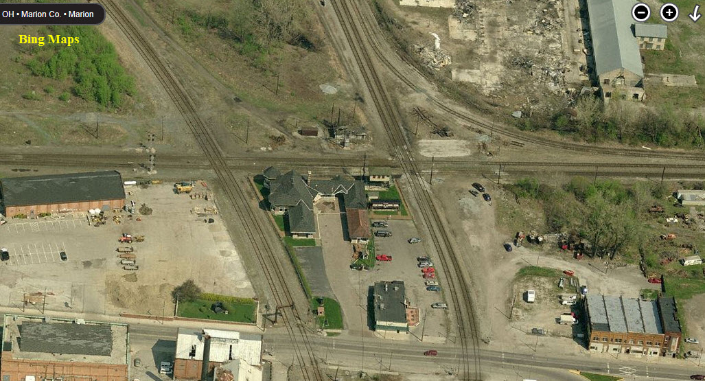
WHen I used Bing's aerial view in 2012, they were there, in Google's 2018 satellite view, they are gone.
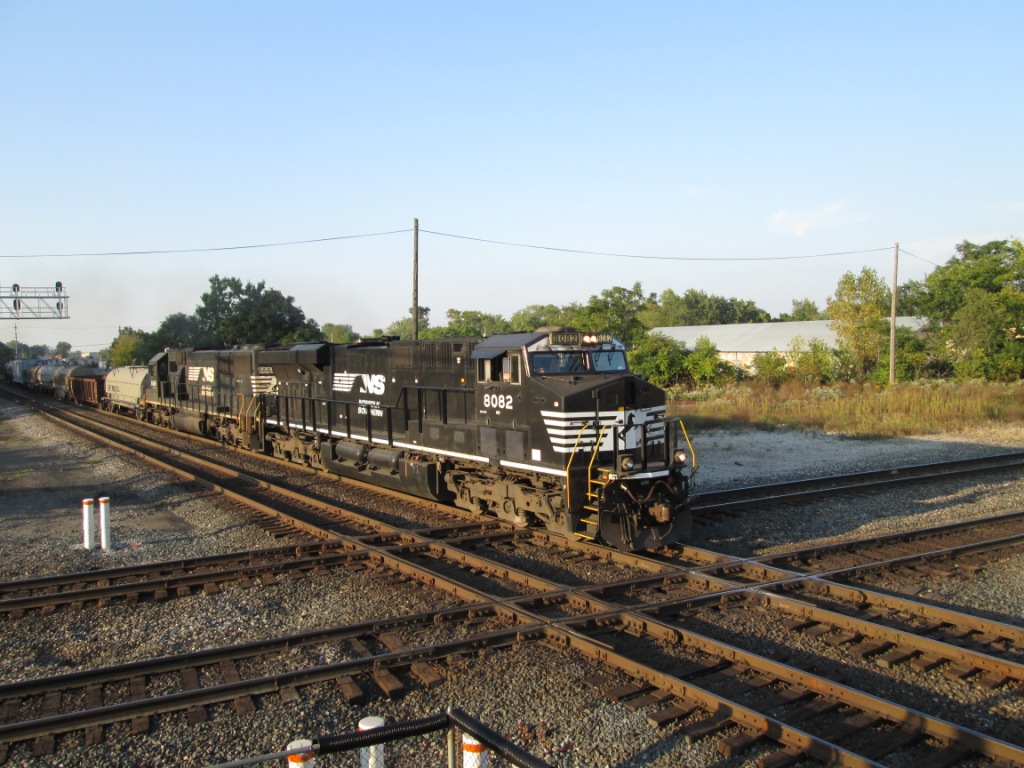
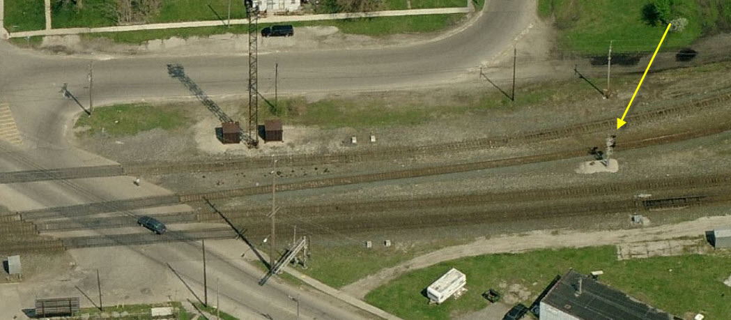
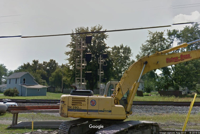
Marion seems to be well signaled, and all of the crossovers & diamonds appear to be signaled.
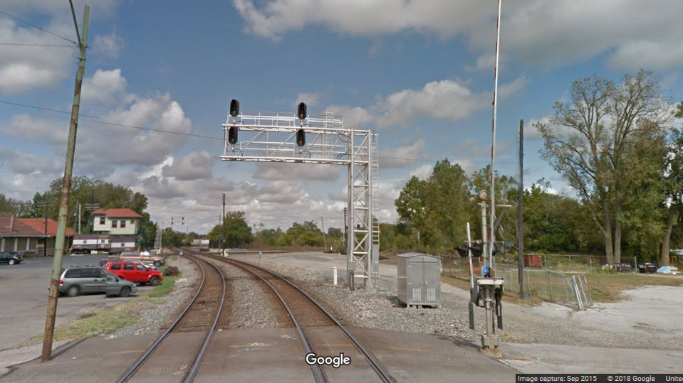
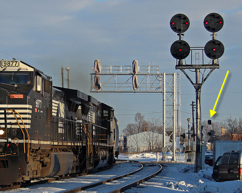
Unfortunately, the signal scene in Marion today is almost all standard color light signals, where as, a few years ago, you could have gotten N&W style CPL's
(color position light), C&O style color lights along with their unique style cantilever structures, and "trilight" style color light signals.
Darn.
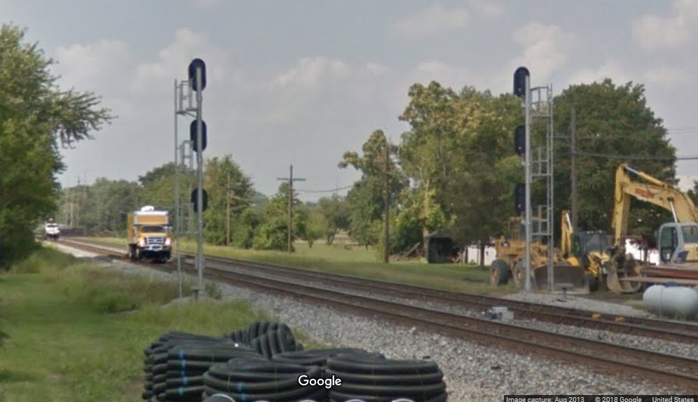
CSX, EB Crossover Interlocking
CSX, EB Interchange Interlocking Signal
This signal controls movements coming from the SB side of the N-S CSX line onto the E-W CSX line.
CSX, SB Diamond Interlocking
CSX, EB Diamond Interlocking
Looking across the diamonds at the CSX signals protecting the diamond. This map also supports the WB interlocking signals for the crossovers. In the
background, you can see the EB signals for the crossovers.
Denver Todd photo
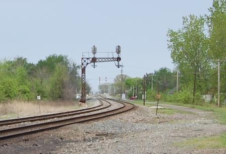
CSX, (ex C&O) NB Diamond Interlocking
NS, NB Diamond Interlocking
CSX, WB Diamond Interlocking
Near as I can tell, these are "trilight" style color light signals. Judging from the second picture below, it seems these have been replaced by
standard "Darth Vader" type color lights.
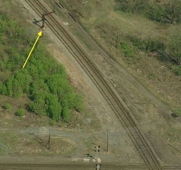
NS, SB Diamond Interlocking
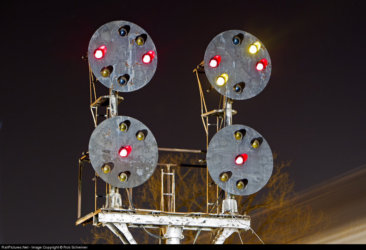
With the new Color Light signals in place, time is short for the N&W CPL signals.
Former N&W CPL Signals - SB Diamond Interlocking
Denver Todd photo
Rob Schreiner photo
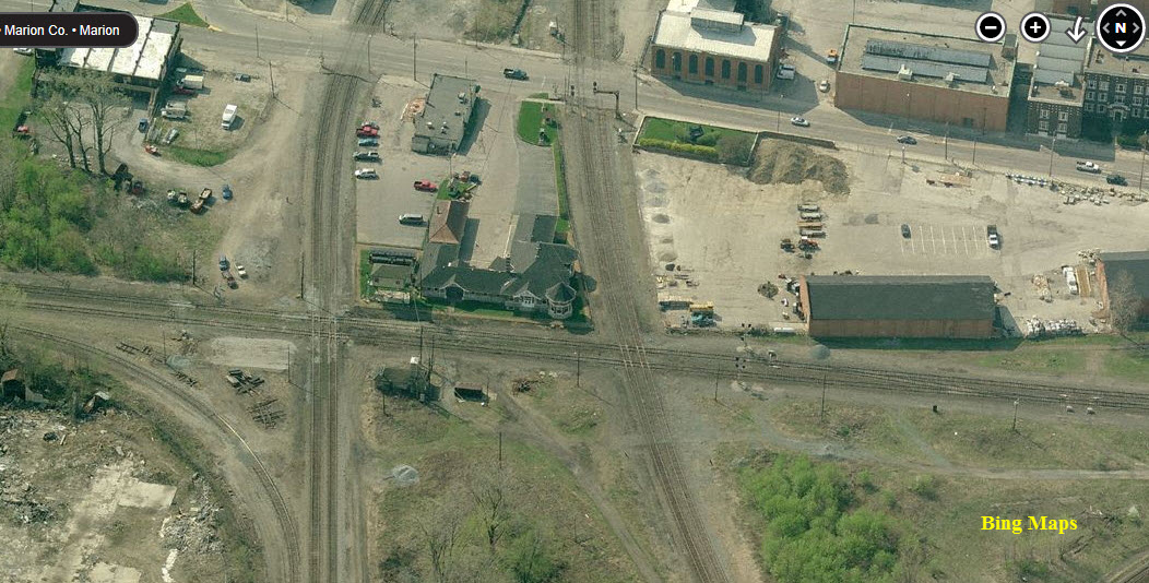
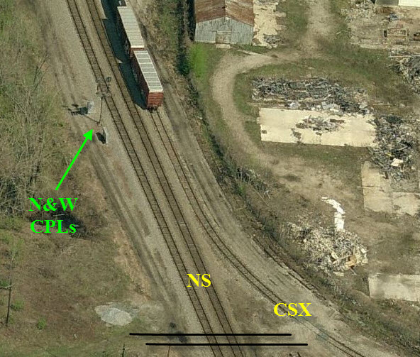
Former N&W CPL Signals - NB Diamond Interlocking
Aerial shot is above.
Denver Todd photo
Richard Thompson photo
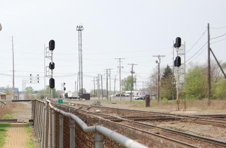
CSX, Interlocking & Intermediate Colorlights
Along Marion-Agosta Rd and the intersection with Campbell Rd.
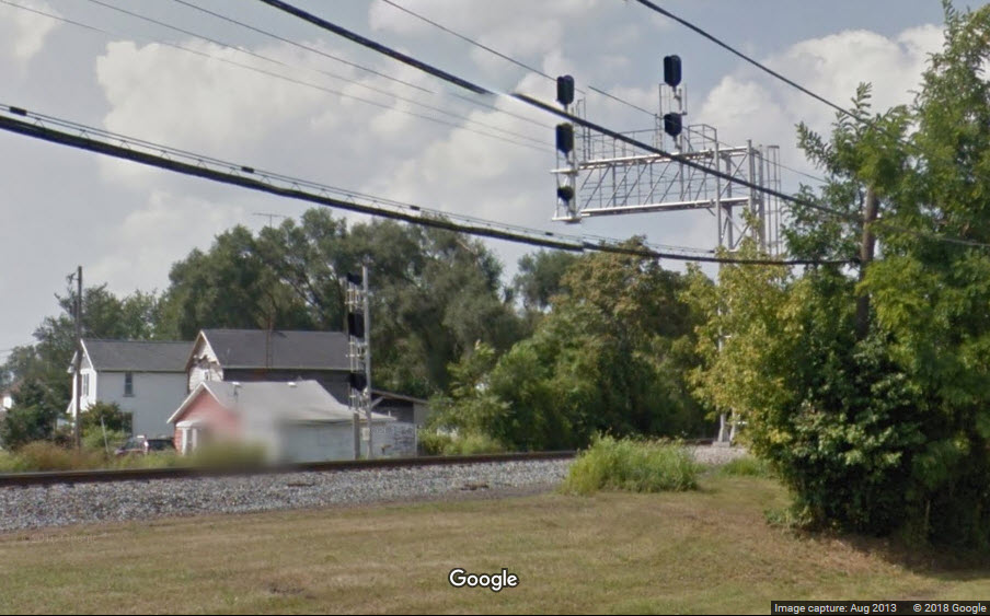
CSX, NB Interlocking Colorlights, just north of Silver St
CSX, SB Interlocking Colorlights, north of Silver St
CSX, SB Interlocking Colorlights, north of Fairground St
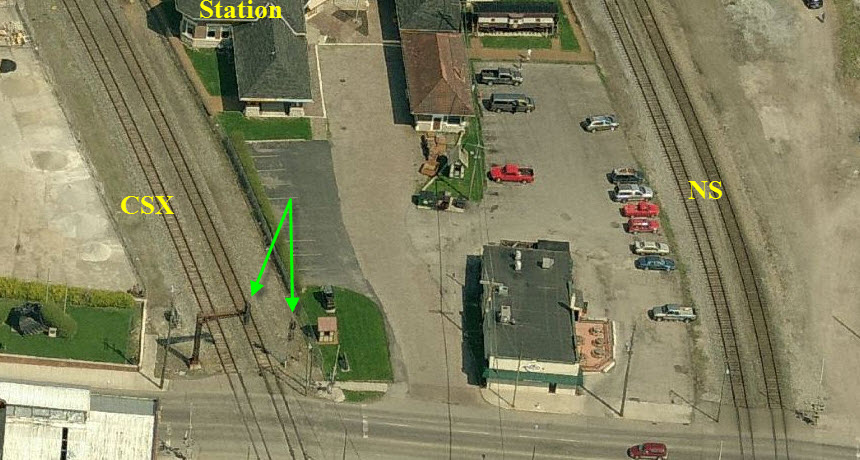
Looking NE from the station, we catch a SB NS freight. Denver Todd photo
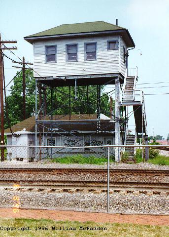
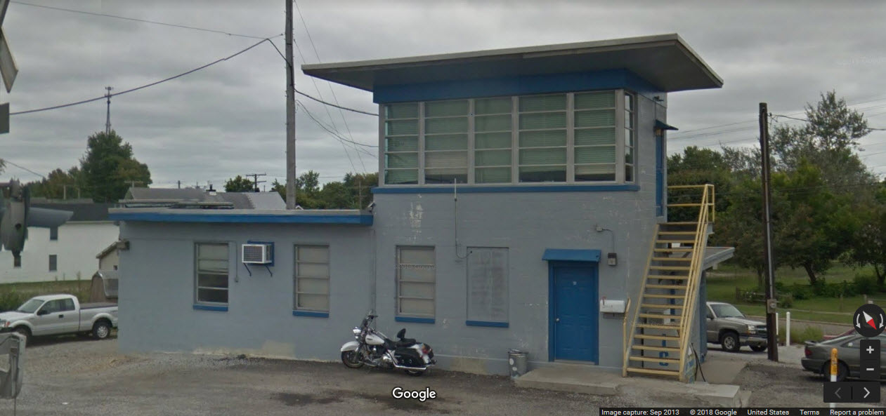
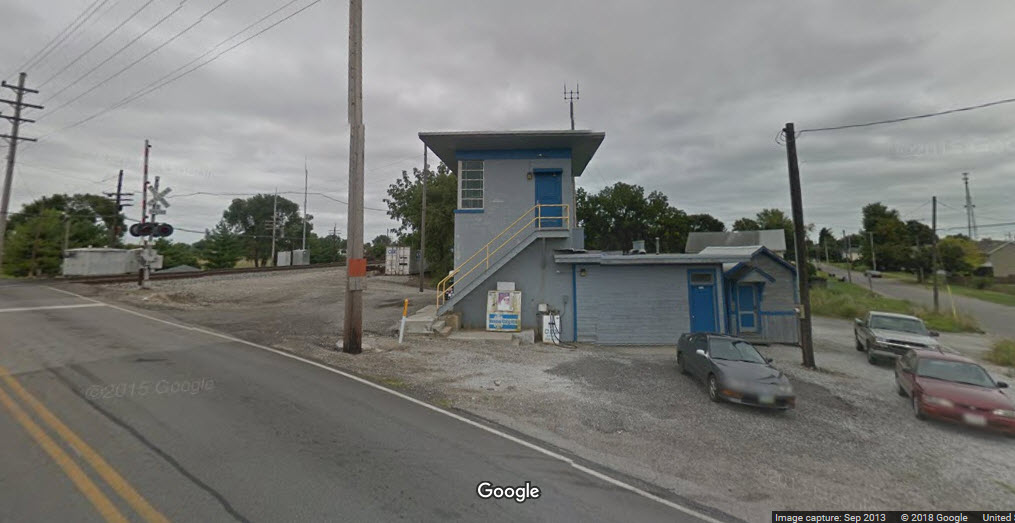
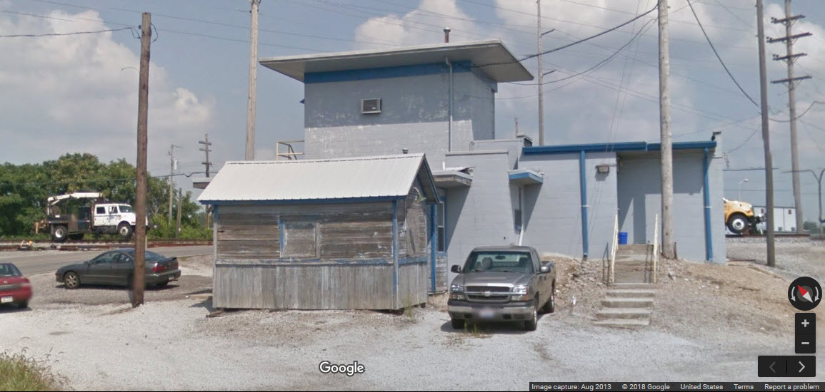
This shot is looking South from the same NE corner of the property. The stairs belong to an interlocking tower that was moved to the location from across the
tracks a number of years ago. The tower and the caboose that you see here show very well in the Bing Bird's eye view. Denver Todd photo
Looking South down the CSX tracks from the NW corner of the property. Denver Todd photo
Looking NW at CSX tracks that run E/W just north of the station.
Taken from the space between the Station and the Freight House. Denver Todd photo
The following pictures were hijacked from RailPictures.net, the photographers names are on each photo.
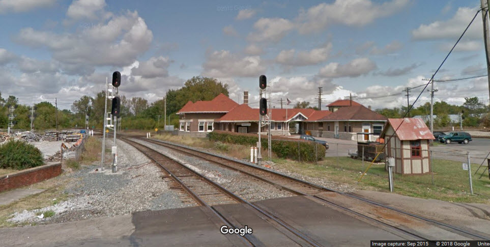
In the above photo, you can see the tower and the Shovel Restaurant to the left. We're looking north.
Nice time exposure of one of the N&W CPL signal sets.
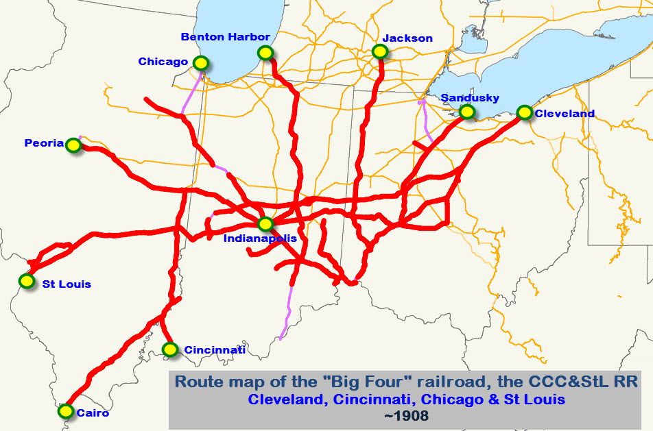
History of the
Cleveland, Cincinnati, Chicago and St. Louis Rwy
(From here)
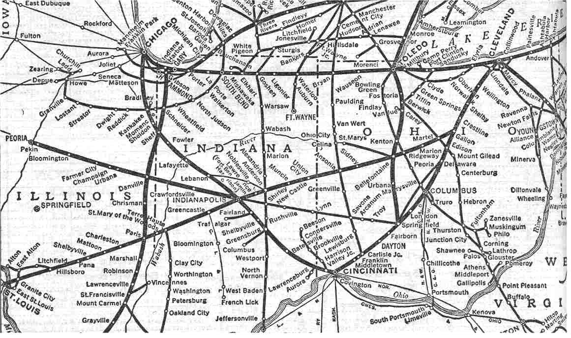
The
Cleveland, Cincinnati, Chicago and St. Louis
Railway, (Big Four Route / the CCC&StL),
was formed by a consolidation of four Midwest regional railroads serving the
principal cities of Cleveland, Columbus, Cincinnati, Chicago, Indianapolis,
Detroit and St. Louis. It's major through lines were from Cleveland
through Columbus to Cincinnati, Cleveland & Indianapolis to St. Louis,
Chicago & Indianapolis to Cincinnati, and Cincinnati to Detroit. It
also
served as a starting railroad for Florida trains, The "Royal Palm", The
Ponce de Leon" and the "Florida Sunbeam" from Chicago, which completed their
runs on the Southern, Seaboard and/or the Florida East Coast Railroads.
In 1941 a fast streamliner train the "James Whitcomb Riley" ran from Chicago
to Cincinnati behind both streamlined steam and new diesel-electric motive
power. The Big Four became part of the New York Central System, and
served as the NYC's portal to reach Columbus, Cincinnati, Indianapolis and
St. Louis from New York and Buffalo.
(From Wikipedia)The Cleveland, Cincinnati, Chicago and St. Louis Railway,
also known as the Big Four
Railroad and commonly abbreviated CCC&StL, was a
railroad company in the Midwestern United States.
Its primary routes were in Illinois, Indiana,
Michigan, and Ohio. At the end of 1925 it reported 2391
route-miles and 4608 track-miles; that year it carried 8180
million net ton-miles of revenue freight and 488 million
passenger-miles.
The oldest predecessor of the Big Four (and a comparatively late
addition to it) was the Mad River &
Lake Erie. Ground was broken in 1835, and the line
was opened from Sandusky to Dayton OH, in 1851. It went
through several renamings and became part of what later was the
Peoria & Eastern before it
was merged into the Big Four in 1890.
The Cleveland, Columbus
& Cincinnati (CC&C) was chartered in 1836, broke
ground in 1847, and opened in 1851 between Cleveland and
Columbus. In 1852, it teamed up with the
Little Miami and Columbus
& Xenia railroads to form a Cleveland–Cincinnati
route.
In 1848, the
Indianapolis & Bellefontaine (I&B) and the
Bellefontaine & Indiana (B&I)
railroads were incorporated to build a line between Galion,
Ohio, on the CC&C, and Indianapolis. The I&B and the B&I
amalgamated and became known as "The B. Line". They were
absorbed by the CC&C when it reorganized as the
Cleveland, Columbus, Cincinnati &
Indianapolis in 1868. The nickname of the new
railroad was "The Bee Line." The Cleveland, Columbus, Cincinnati
& Indianapolis reached Cincinnati with its own rails in 1872;
that same year it opened a line from Springfield to Columbus.
By then the Vanderbilts owned a good portion of the railroad's
stock.
The
Terre Haute & Alton Railroad
was organized in 1852, its backers were certain that with a
railroad to Indiana the Mississippi River town of Alton,
Illinois could easily outstrip St. Louis a few miles south.
It soon combined with the Belleville &
Illinoistown Railroad as the
Terre Haute, Alton & St. Louis.
The Indianapolis & St. Louis
was organized to build between Indianapolis and Terre Haute,
Indiana. It leased the St. Louis, Alton & Terre Haute,
successor to the Terre Haute, Alton & St. Louis, and came under
control of the CCC&I in 1882.
In the late 1840s and early 1850s, several
railroads were completed, forming a route from Cincinnati
through Indianapolis and Lafayette IN to Kankakee IL, connecting
there with the Illinois Central
Railroad north to Chicago. In 1880, these
railroads were united as the
Cincinnati, Indianapolis, St. Louis & Chicago –
considered to be the first "Big Four". Heading the company
was Melville Ingalls, and on its board was C. P. Huntington,
whose Chesapeake & Ohio Railway formed a friendly connection at
Cincinnati. The Vanderbilts had invested in the first Big
Four, and they were firmly in control of the new Big Four, the
Cleveland, Cincinnati, Chicago and St.
Louis, which was formed in 1889 by the consolidation
of the old Big Four (Cincinnati, Indianapolis, St. Louis &
Chicago) and the Bee Line (Cleveland, Columbus, Cincinnati &
Indianapolis).
In the late 1880s, Ingalls and the
Vanderbilts gathered a group of railroads between Cairo and
Danville IL, added to them the St. Louis, Alton & Terre Haute,
and then added them all to the Big Four. The line from Danville
north to Indiana Harbor was a comparatively late addition to the
system. It was built in 1906 and became part of the NYC
rather than the Big Four.
The Peoria & Eastern was formed in 1890
from several small railroads. At one time, its predecessor
briefly included the former Mad River & Lake Erie and a line
from Indianapolis east to Springfield, Ohio, before settling
down to be simply a Peoria-Bloomington-Danville-Indianapolis
route. In 1902 the Big Four bought the
Cincinnati Northern, a line
that had been proposed in 1852 and finally constructed in the
1880s from Franklin OH (between Dayton and Cincinnati), to
Jackson MI. In 1920 the Big Four acquired the
Evansville, Indianapolis & Terre Haute,
a castoff from the Chicago & Eastern
Illinois in southwestern Indiana. The
New York Central Railroad
leased the Big Four starting in 1930.
Notable Facilities:
The railroad was headquartered in
Indianapolis IN, in the Chesapeake Building at 105 S. Meridian Street.
The building was constructed for the railroad in 1929 and was also known as
the Big Four Building. In 2007 this multi-story structure became a
Hampton Inn hotel.
On the southwest corner of Pennsylvania and Georgia streets in the Wholesale District of downtown Indianapolis, a large building was built by the railroad as one of
its maintenance shops. Until the neighboring Conseco Fieldhouse was constructed in the late 1990s, an elevated track crossed Pennsylvania Street into a partially
open locomotive service bay, which remains visible along the south side of the second story of this still standing structure. During the Conrail era most of
the building was used as office space. Its successor, CSX, still uses a portion of this Georgia Street facility.
The railroad once operated a terminal at Bellefontaine OH which included the largest roundhouse
in use at that time between New York City NY and St. Louis MO. Conrail closed the Bellefontaine terminal in 1983, and its roundhouse was dismantled.
A large yard facility known as Big Four Yards is located in Avon IN (just west of Indianapolis) along the line's tracks, now owned and operated by CSX.
In 1895 the railroad acquired what became known as the Big Four Bridge across the Ohio River at Louisville KY,
thereby giving it access to that city. Use of the bridge
for railroad purposes ceased by 1968, and it sat abandoned until
work began by 2006 to convert it to use by pedestrians and
bicyclists.
Additional History of the
lines that made up the Big Four
Early history of the Cleveland Cincinnati Chicago and St. Louis Railroad (Big Four Route)
1889 - Merger of (1) Cleveland, Columbus, Cincinnati and Indianapolis Railway, (2) Cincinnati Indianapolis, St. Louis and Chicago Railway, and (3) Indianapolis and St.
Louis Railway, formed the Cleveland, Cincinnati, Chicago and St. Louis Railroad, the Big Four.
1890 - Control of Indiana Bloomington and Western Railway is obtained
1906 - The Big Four was acquired by the New York Central Railroad.
1968 - NYC and Pennsy merge into Penn-Central
1976 - Penn-Central merged into Conrail
1998 - Most old NYC lines (Conrail) merged into CSX
History of the Cleveland Columbus Cincinnati and Indianapolis Railway (CCC&I)
1851 - Cleveland Columbus and Cincinnati Railroad builds line from Cleveland to Columbus
1853 - Columbus and Springfield Railroad builds from London and Columbus
1862 - Springfield Mt. Vernon & Pittsburgh acquired (line from Springfield through Marysville to Delaware, Ohio)
1868 - Bellefontaine Railroad acquired. (Line to Indianapolis) Name changed to Cleveland, Columbus, Cincinnati and Indianapolis Railroad
1872 - CCC&I gains control of Cincinnati & Springfield and Cincinnati Sandusky and Cleveland Railroads, completing Cleveland to Cincinnati line
1872 - Columbus and Springfield becomes part of CCC&I closing gap to Columbus, and making Marysville line a secondary.
1889 - CCC&I merged into CCC&SL (Big Four)
History of Cincinnati, Indianapolis, St. Louis and Chicago Railway
1846 - Indianapolis and Cincinnati Railroad founded, initially, 1850-1853, as the Lawrenceburg and Upper Mississippi Railroad
1850 - Lafayette & Indianapolis Railroad founded
1861 - Cincinnati and Indiana Railroad founded
1867 - Above three roads merged as Indianapolis Cincinnati and Lafayette Railroad. Line operated from Cincinnati through Indianapolis to Lafayette, Indiana
1880 - After foreclosure reorganization name changed to Cincinnati, Indianapolis, St. Louis and Chicago Railway
1880's CISL&C controls several other smaller railroads in Ohio, Indiana and Illinois
1889 - CISL&C merged into CCC&SL (Big Four)
History of the Indiana Bloomington and Western Railway
1866 - Indianapolis Crawfordsville and Danville Railroad incorporated
1866 - Danville Urbana Bloomington and Pekin Railway Incorporated
1869 - Above roads merged as Indiana Bloomington and Western Railway
1869 - IB&W opens Pekin, llinois to Indianapolis
1879 - IB&W foreclosed and reorganized
1881 - IB&W merged with Ohio Indiana and Pacific Railway, but retained it's IB&W name.
1883 - Line extended from Indianapolis to Springfield
1887 - Foreclosure and reorganization as Ohio Indiana and Western Railway.
1889 - Foreclosure again. Line west from Indianapolis goes to Peoria and Eastern Railway, while newer eastern track, from Indianapolis, goes to CCC&SL (Big Four).
History of the Hocking Valley Railway
(From Wikipedia)
The Hocking Valley Railway (reporting mark HV) was a railroad in the U.S. state of Ohio, with a main line from Toledo to Athens and Pomeroy via Columbus. It also had
several branches to the coal mines of the Hocking Valley near Athens. The company became part of the Chesapeake and Ohio Railway system in 1910, and the line between
Toledo and Columbus continues to see trains as CSX Transportation's Columbus Subdivision. Portions of the main line south of Columbus are now operated by the Indiana
and Ohio Railway and Hocking Valley Scenic Railway.
At the end of 1925 HV operated 349 miles of road on 881 miles of track; that year it reported 2614 million ton-miles of revenue freight and 25 million passenger-miles.
The earliest predecessor of the Hocking Valley was the Mineral Railroad, incorporated in April 1864 to build from Athens in the rich Hocking Valley
to Columbus. The company changed its name to the Columbus and Hocking Valley Railroad in June 1867, shortly after construction began at Columbus, and the line
opened for business from Columbus to Lancaster on January 20, 1869, Logan on August 28, 1869, Nelsonville on September 17, 1869, and Athens on July 25, 1870. The
first branch, from Logan east to New Straitsville, was completed in January 1871, and the railroad completed a cutoff from Nelsonville north alongside Monday Creek to the
Straitsville Branch in 1880. Several more branches reached additional mines in the Logan-Nelsonville area, including along Snow Fork (initially incorporated in
July 1875 as the Snow Fork Valley Railroad) to Orbiston (1877), Murray City (1882), and Coalgate (1893), and along Brush Fork to New Pittsburg (1877-78).
The Columbus and Toledo Railroad was incorporated in May 1872 to connect its namesake cities on an eastern route through Delaware, Marion, Upper Sandusky, and
Fostoria. Construction, delayed by the Panic of 1873, began in August 1875, and the line was opened from Columbus to Marion on November 1, 1876, and the rest
of the way to Walbridge, outside Toledo, on January 11, 1877. Trackage rights were acquired over the Toledo and Woodville Railroad (a Pennsylvania Railroad subsidiary)
to reach Toledo, including a dock on the Maumee River to handle Hocking Valley coal and iron ore.
The final piece of the system was incorporated in March 1870 as the Gallipolis, McArthur and Columbus Railroad, which would build from Gallipolis on the Ohio River to
Logan. It acquired part of an incomplete roadbed graded in the 1850s by the Scioto and Hocking Valley Railroad between Hamden and Logan, but was unable to survive
the Panic of 1873. The Columbus and Gallipolis Railway, incorporated in July 1876, tried to complete the line on an extended route to Columbus, but ran out of funds,
and yet another company, the Ohio and West Virginia Railway, was incorporated in May 1878 to continue construction. The north end was moved back to Logan a year later,
and construction began in July 1879, now allied with the Columbus and Hocking Valley. Operation over the full route commenced on October 15, 1880, and a branch
alongside the river to Pomeroy was completed in January 1881.
The three companies merged in August 1881 to form the Columbus, Hocking Valley and Toledo Railway, which stretched across the state from Toledo to Pomeroy. A short
extension near Toledo was built in 1890, connecting to the Lake Shore and Michigan Southern Railway (a New York Central Railroad subsidiary) at Rockwell
Junction. The new company entered receivership in February 1897 and was reorganized in February 1899 as the Hocking Valley Railway, which came
under the control of a syndicate in December 1902. The stock was distributed among several railroad companies in June 1903, with one-third going to the
Pittsburgh, Cincinnati, Chicago and St. Louis Railway (Pennsylvania Railroad) and one-sixth each to the B&O RR, the C&O Rwy, Lake Shore and Michigan
Southern Railway (New York Central Railroad), and Erie Railroad. The C&O gained control in March 1910, and initially used the Kanawha and Michigan Railway
to make the connection from Charleston, but in 1917 it opened the first piece of the Northern Subdivision, which joined the main line at Limeville
with Norfolk and Western Railway trackage rights to Columbus, and in 1927 a separate line to Columbus was completed. When the C&O acquired control of
the Pere Marquette Railway in 1929, the Hocking Valley served as its connection to the rest of the system. Finally, the Hocking Valley was merged into the C&O
in April 1930.
A small branch railroad was organized in 1903 as the Athens, Amesville and Chauncey Railway. Its trackage was 3.65 miles in 1907, and 5.99 miles in 1908. It
was built expressly to service coal mines in the Sugar Creek valley north of Athens, Ohio, and connected to the Hocking Valley Railway mainline just northwest of
Athens. It was built by coal interests, but operated by the Hocking Valley Railway, and was merged into it in 1911. This line never ventured anywhere near
Amesville or Chauncey, and did not even technically connect to Athens. After the merger, it was known as the Sugar Creek Branch.
Disclaimers:
I love trains, and I love signals. I am not an expert. My webpages reflect what I find on the topic of the page. This is something I have fun with while
trying to help others.
Please Note: Since the main focus of my two websites is railroad signals, the railfan guides are oriented towards the signal fan being able to locate them.
For those of you into the modeling aspect of our hobby, my indexa page has a list of almost everything railroad oriented
I can think of to provide you with at least a few pictures to help you detail your pike.
If this is a railfan page, every effort has been made to make sure that the information contained on this map and in this railfan guide is correct. Once in a while,
an error may creep in :-)
My philosophy: Pictures and maps are worth a thousand words, especially for railfanning. Text descriptions only get you so far, especially if you get lost or
disoriented. Take along good maps.... a GPS is OK to get somewhere, but maps are still better if you get lost! I belong to AAA, which allows you to get
local maps for free when you visit the local branches. ADC puts out a nice series of county maps for the Washington DC area, but their state maps do not have the
railroads on them. If you can find em, I like the National Geographic map book of the U.S..... good, clear, and concise graphics, and they do a really good job
of showing you where tourist type attractions are, although they too lack the railroads. Other notes about specific areas will show up on that page if known.
Aerial shots were taken from either Google Maps or www.bing.com/maps as noted. Screen captures are made
with Snagit, a Techsmith product... a great tool if you have never used it!
By the way, floobydust is a term I picked up 30-40 years ago from a National Semiconductor data book, and means miscellaneous
and/or other stuff.
Pictures and additional information is always needed if anyone feels inclined to take 'em, send 'em, and share 'em, or if you have something to add or correct.... credit
is always given! Please be NICE!!! Contact info is here
Beware: If used as a source, ANYTHING from Wikipedia must be treated as being possibly being inaccurate, wrong, or not true.
 Denver Todd photo
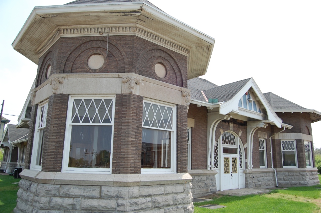
 Denver Todd photo
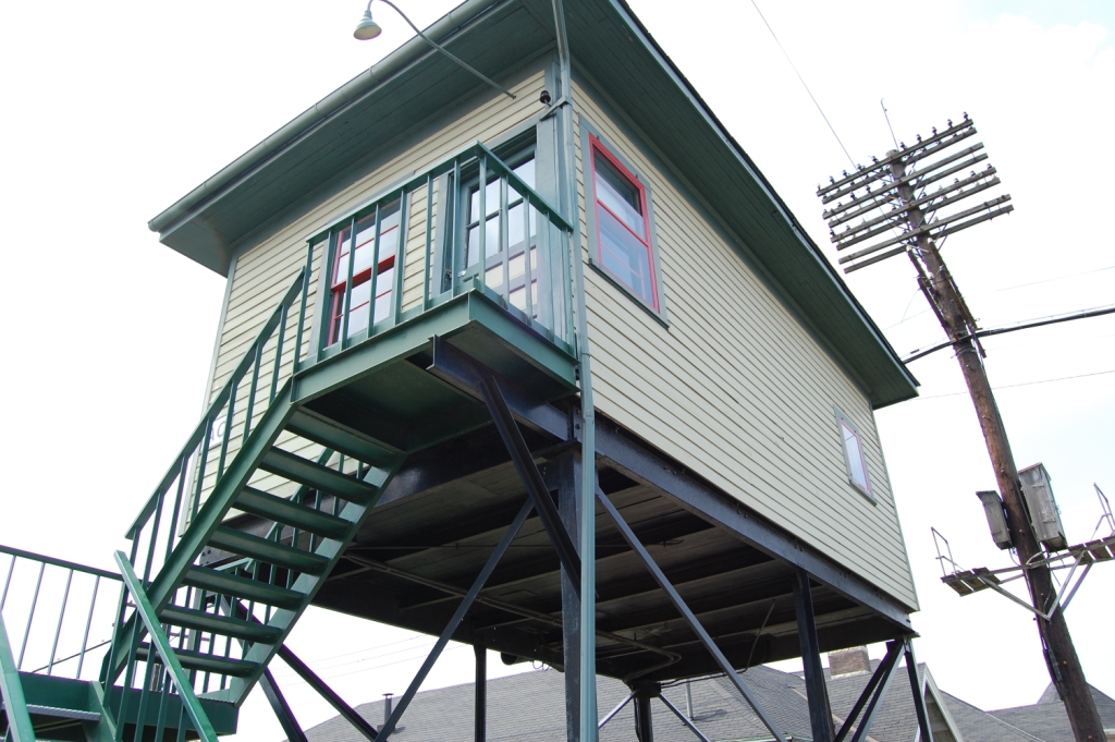 Denver Todd photo
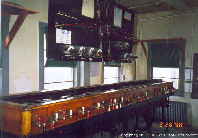
 Denver Todd photo.
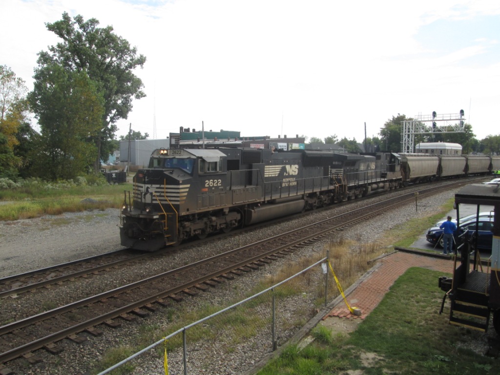
 From the US 23 overpass
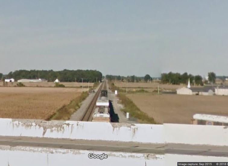 Looking the other way towards the head end of the freight
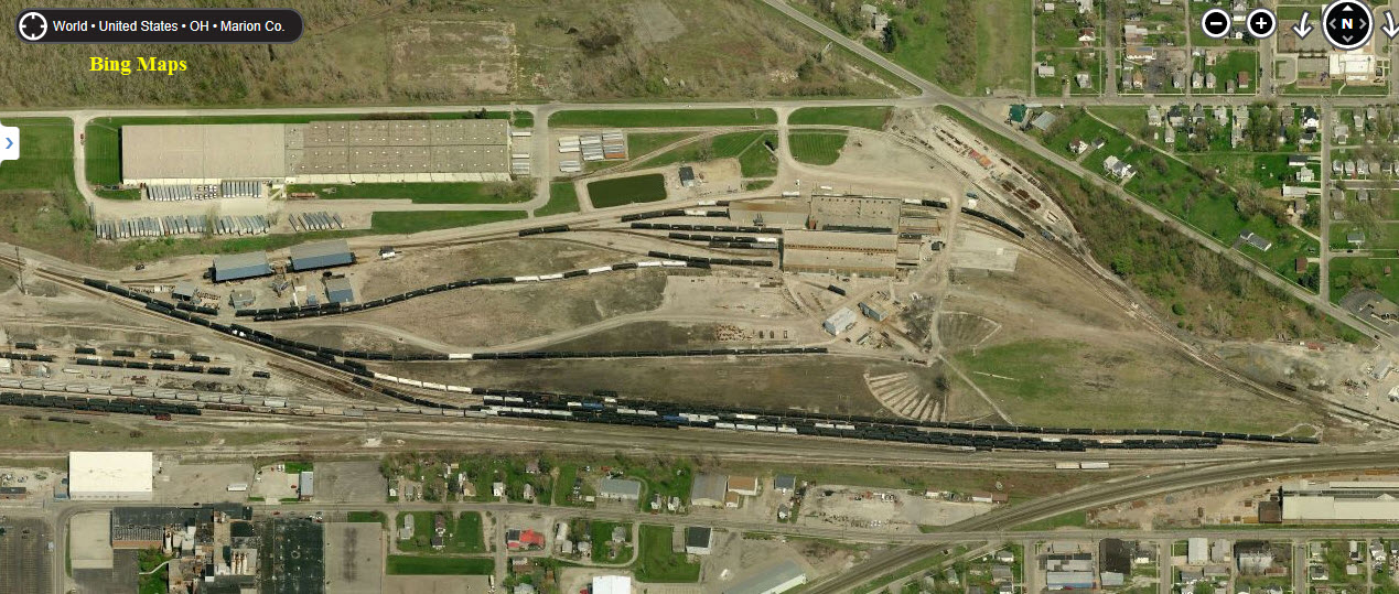
 In 2012
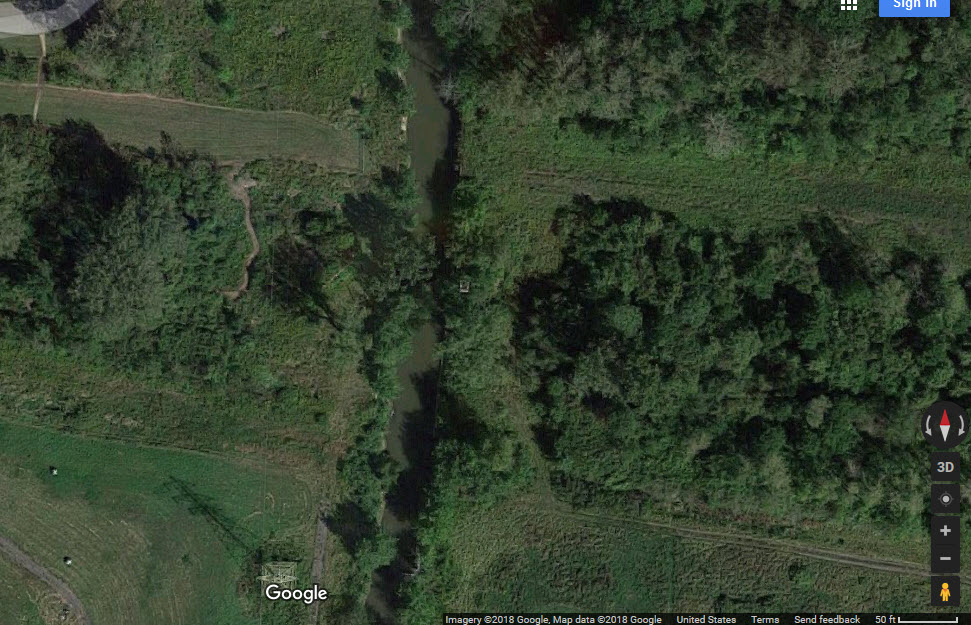 In 2018
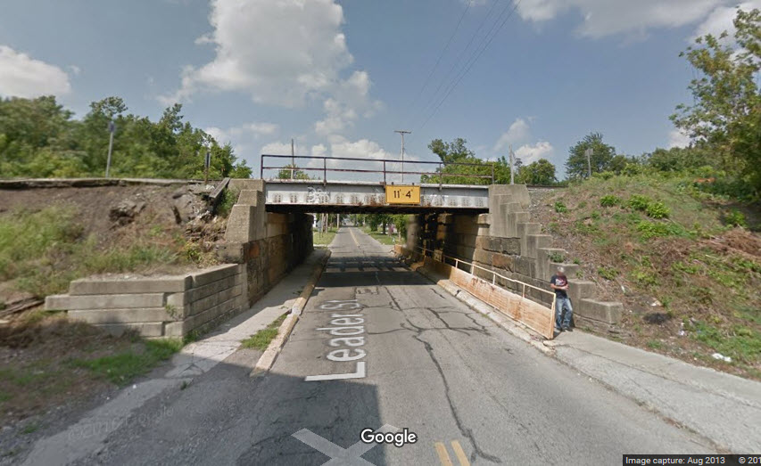
 Denver Todd photo
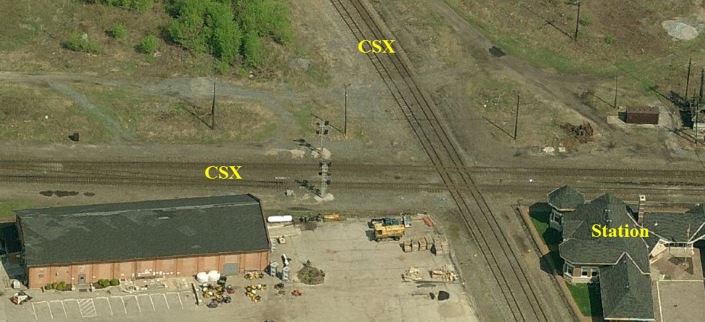

 Denver Todd photo
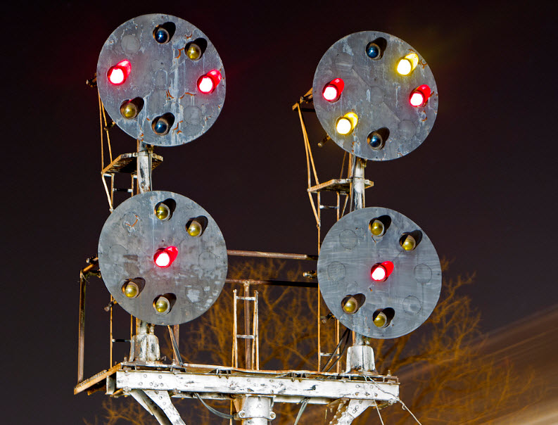 Rob Schreiner photo
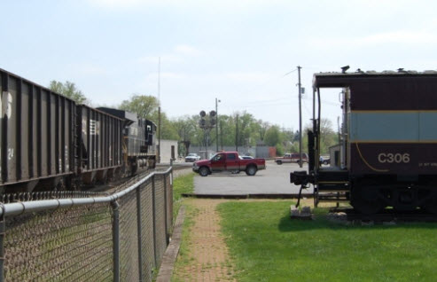 Denver Todd photo
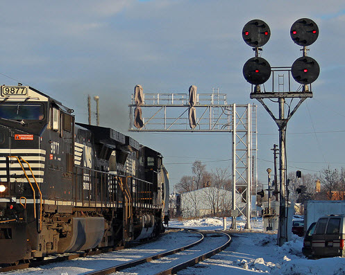 Richard Thompson photo
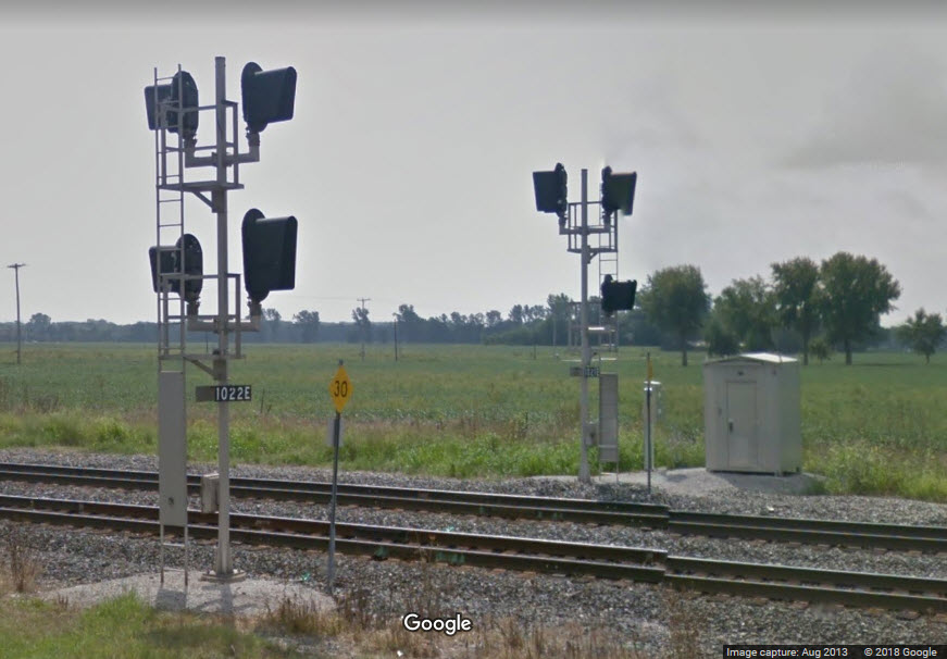

 also
served as a starting railroad for Florida trains, The "Royal Palm", The
Ponce de Leon" and the "Florida Sunbeam" from Chicago, which completed their
runs on the Southern, Seaboard and/or the Florida East Coast Railroads.
In 1941 a fast streamliner train the "James Whitcomb Riley" ran from Chicago
to Cincinnati behind both streamlined steam and new diesel-electric motive
power. The Big Four became part of the New York Central System, and
served as the NYC's portal to reach Columbus, Cincinnati, Indianapolis and
St. Louis from New York and Buffalo.
also
served as a starting railroad for Florida trains, The "Royal Palm", The
Ponce de Leon" and the "Florida Sunbeam" from Chicago, which completed their
runs on the Southern, Seaboard and/or the Florida East Coast Railroads.
In 1941 a fast streamliner train the "James Whitcomb Riley" ran from Chicago
to Cincinnati behind both streamlined steam and new diesel-electric motive
power. The Big Four became part of the New York Central System, and
served as the NYC's portal to reach Columbus, Cincinnati, Indianapolis and
St. Louis from New York and Buffalo. 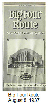 The
Terre Haute & Alton Railroad
was organized in 1852, its backers were certain that with a
railroad to Indiana the Mississippi River town of Alton,
Illinois could easily outstrip St. Louis a few miles south.
It soon combined with the Belleville &
Illinoistown Railroad as the
Terre Haute, Alton & St. Louis.
The Indianapolis & St. Louis
was organized to build between Indianapolis and Terre Haute,
Indiana. It leased the St. Louis, Alton & Terre Haute,
successor to the Terre Haute, Alton & St. Louis, and came under
control of the CCC&I in 1882.
The
Terre Haute & Alton Railroad
was organized in 1852, its backers were certain that with a
railroad to Indiana the Mississippi River town of Alton,
Illinois could easily outstrip St. Louis a few miles south.
It soon combined with the Belleville &
Illinoistown Railroad as the
Terre Haute, Alton & St. Louis.
The Indianapolis & St. Louis
was organized to build between Indianapolis and Terre Haute,
Indiana. It leased the St. Louis, Alton & Terre Haute,
successor to the Terre Haute, Alton & St. Louis, and came under
control of the CCC&I in 1882.