
In General
Getting Here
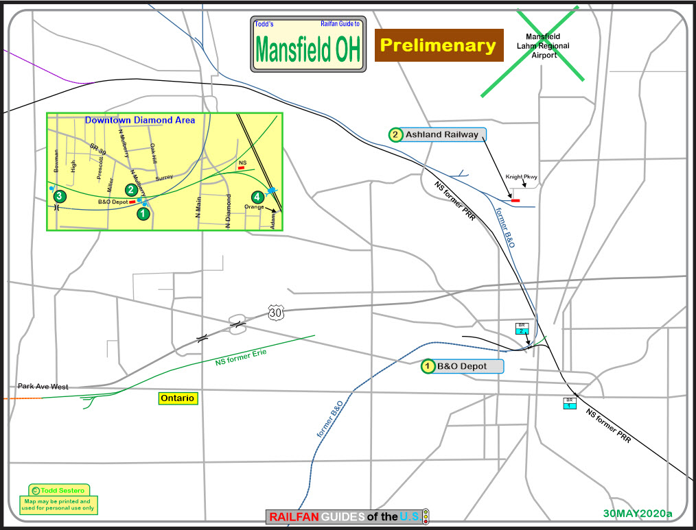
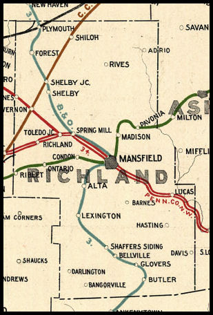
Map
Sights
Pictures
Bridges
Signals
Fire & Police
Floobydust
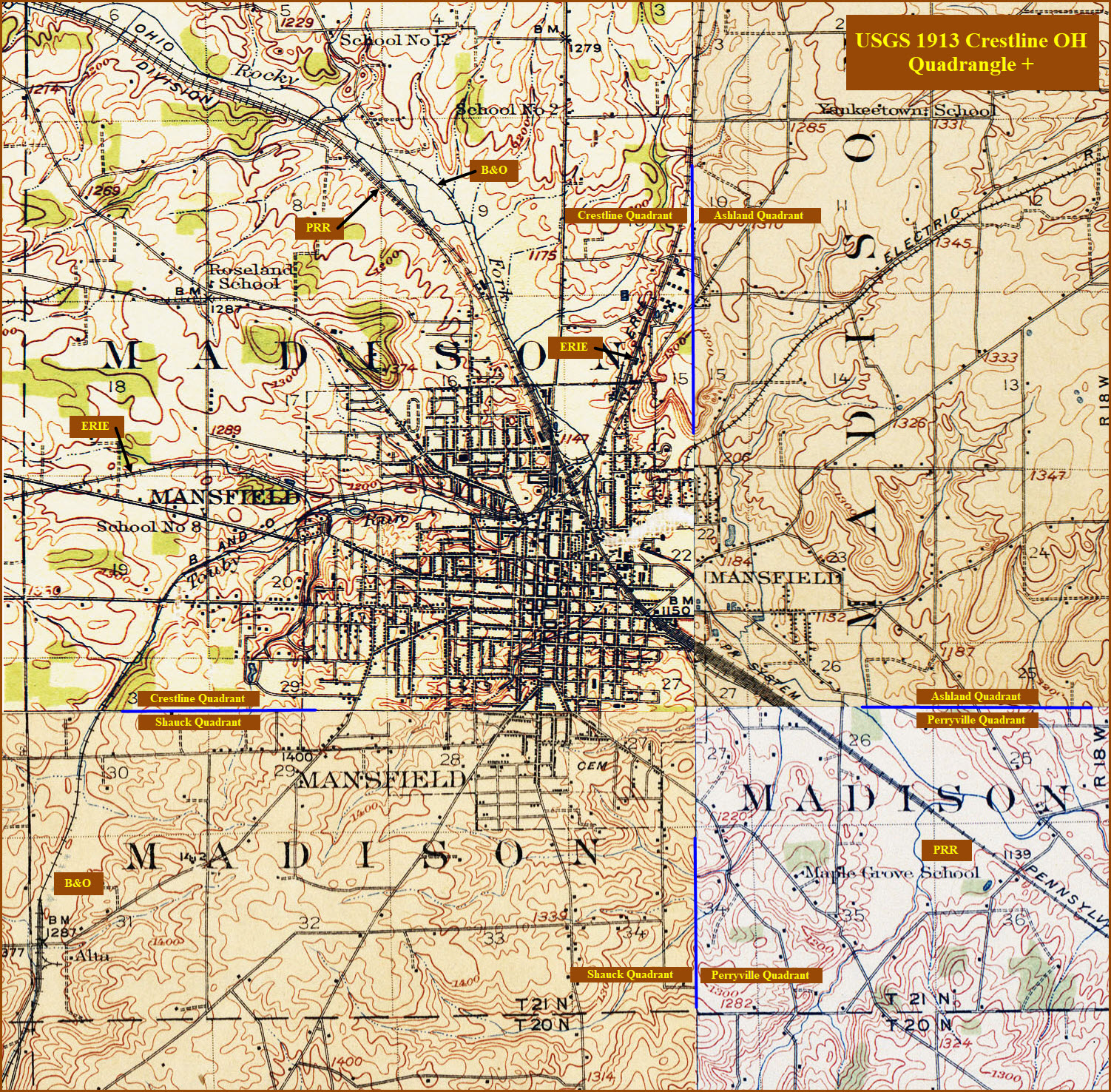
USGS Maps
RAILROAD SIGNALS HOME
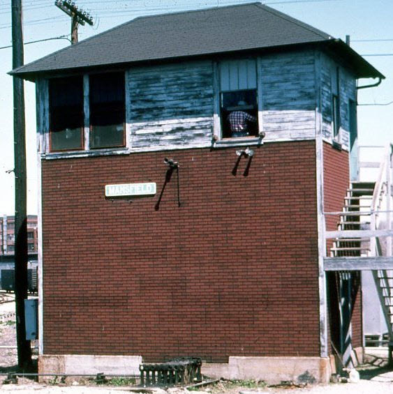
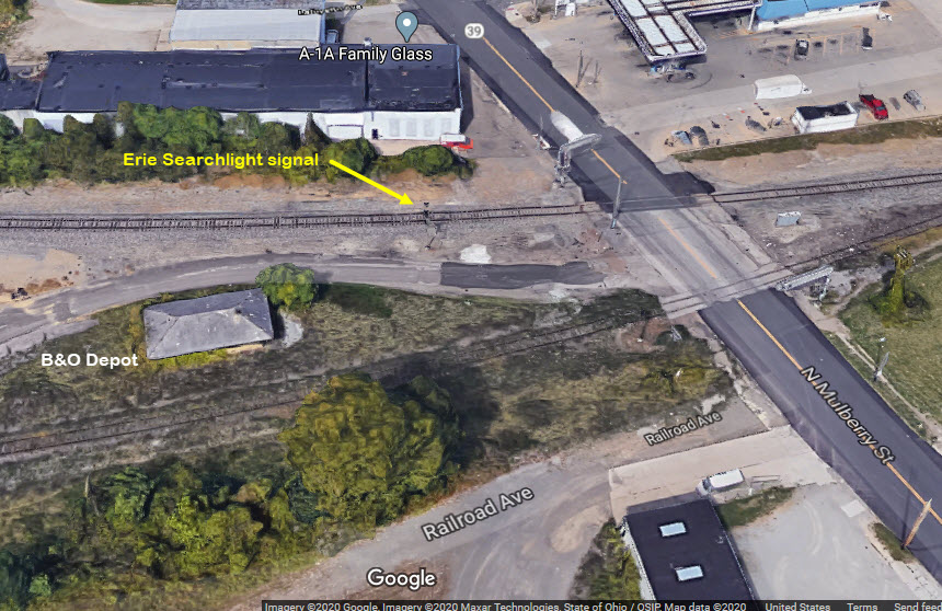
Location / Name:
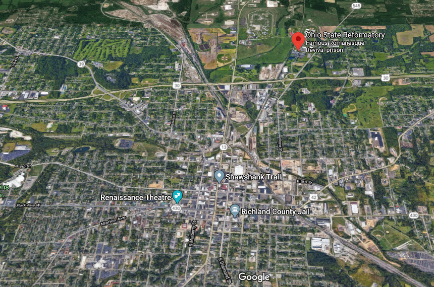
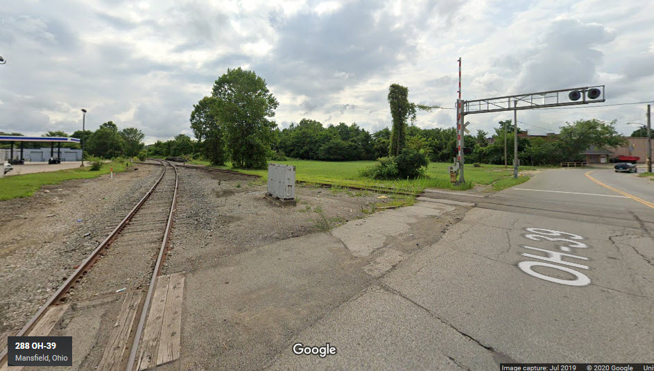
Mansfield OH, Richland County
What's Here:
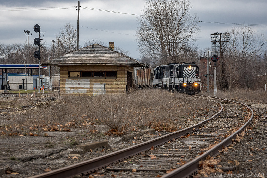
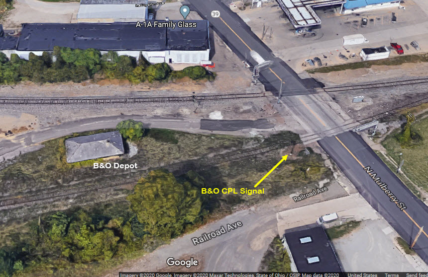
One remaining station, a former B&O depot
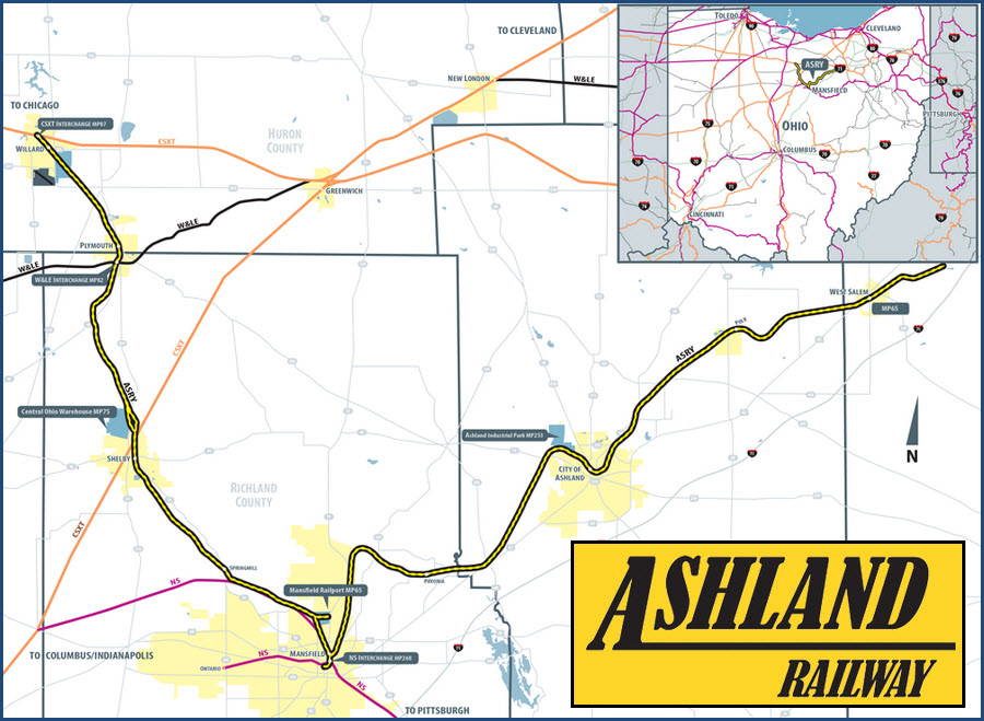
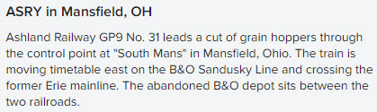
The Ashland Rwy
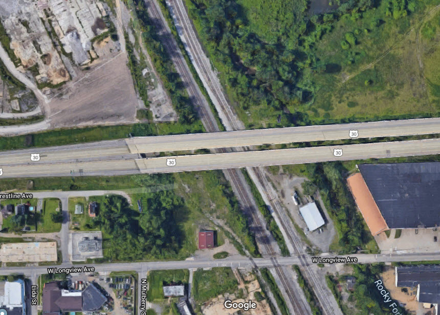
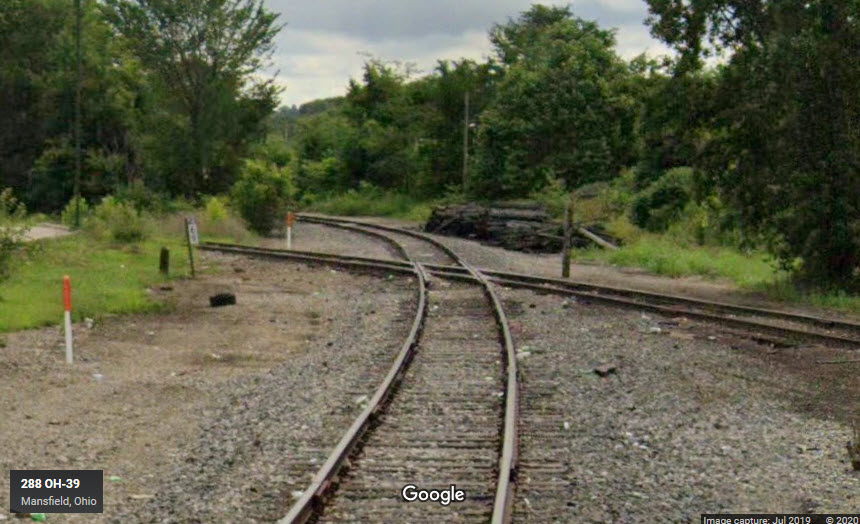
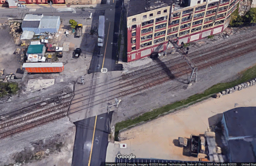
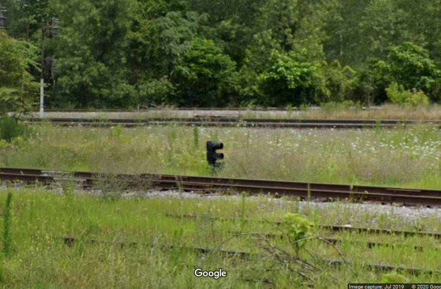
Two diamonds, used to be three
Pennsy, B&O, and Erie signals
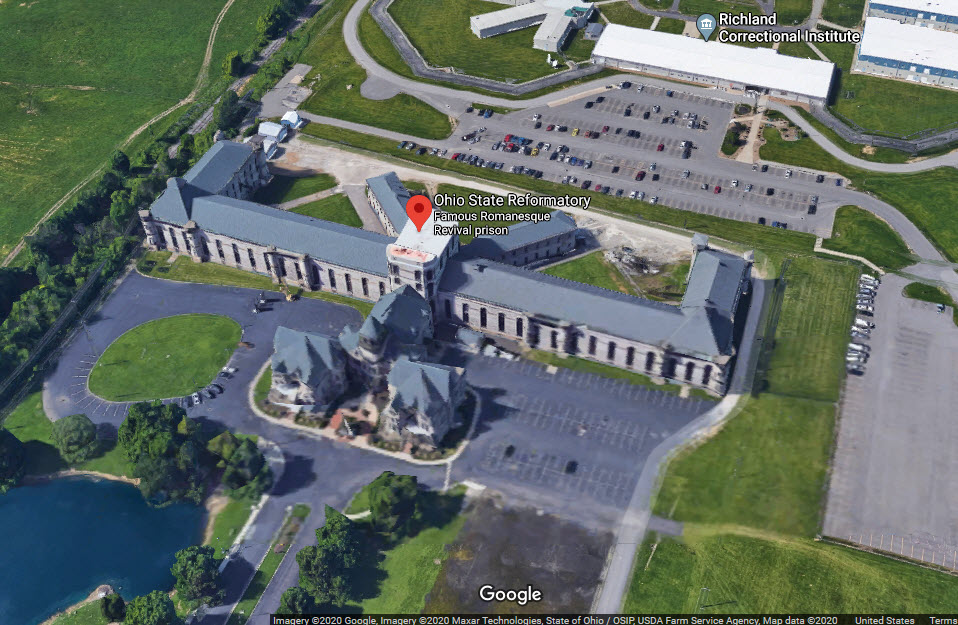
The Ohio State Reformatory, where they filmed "The Shawshank Redemption"
Data:
GPS Coordinates: as needed
Phone A/C: 419
ZIP: 44902
Access by train/transit:
None
The Scoop:
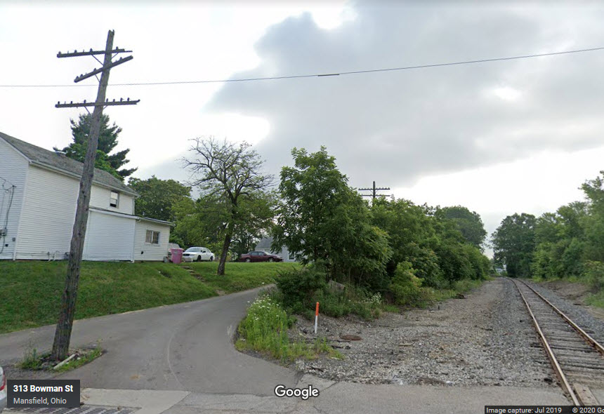
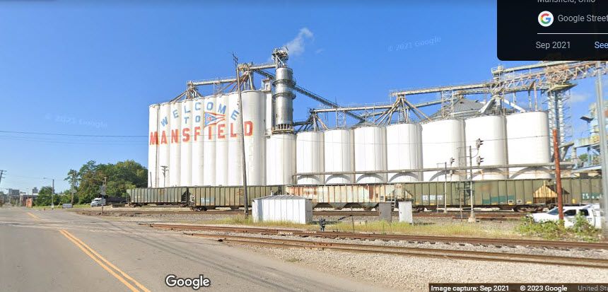
A great town, hidden in northern central Ohio, that time has seemed to forgotten (except for tearing down all of the old railroad structures :-).
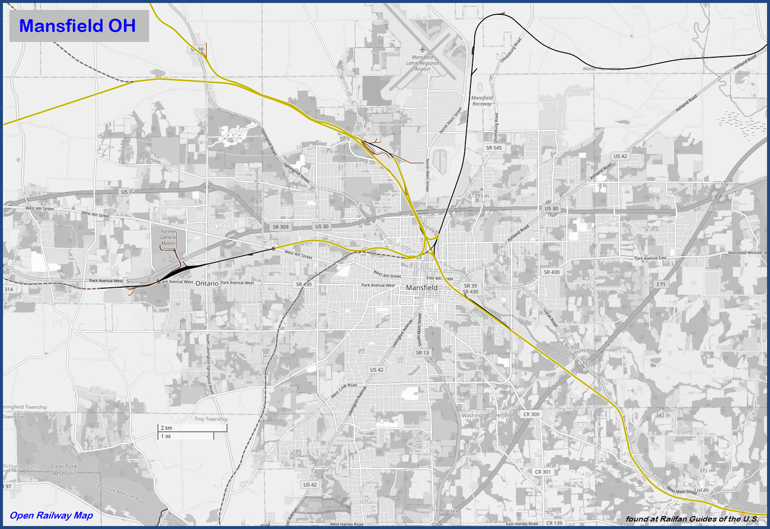
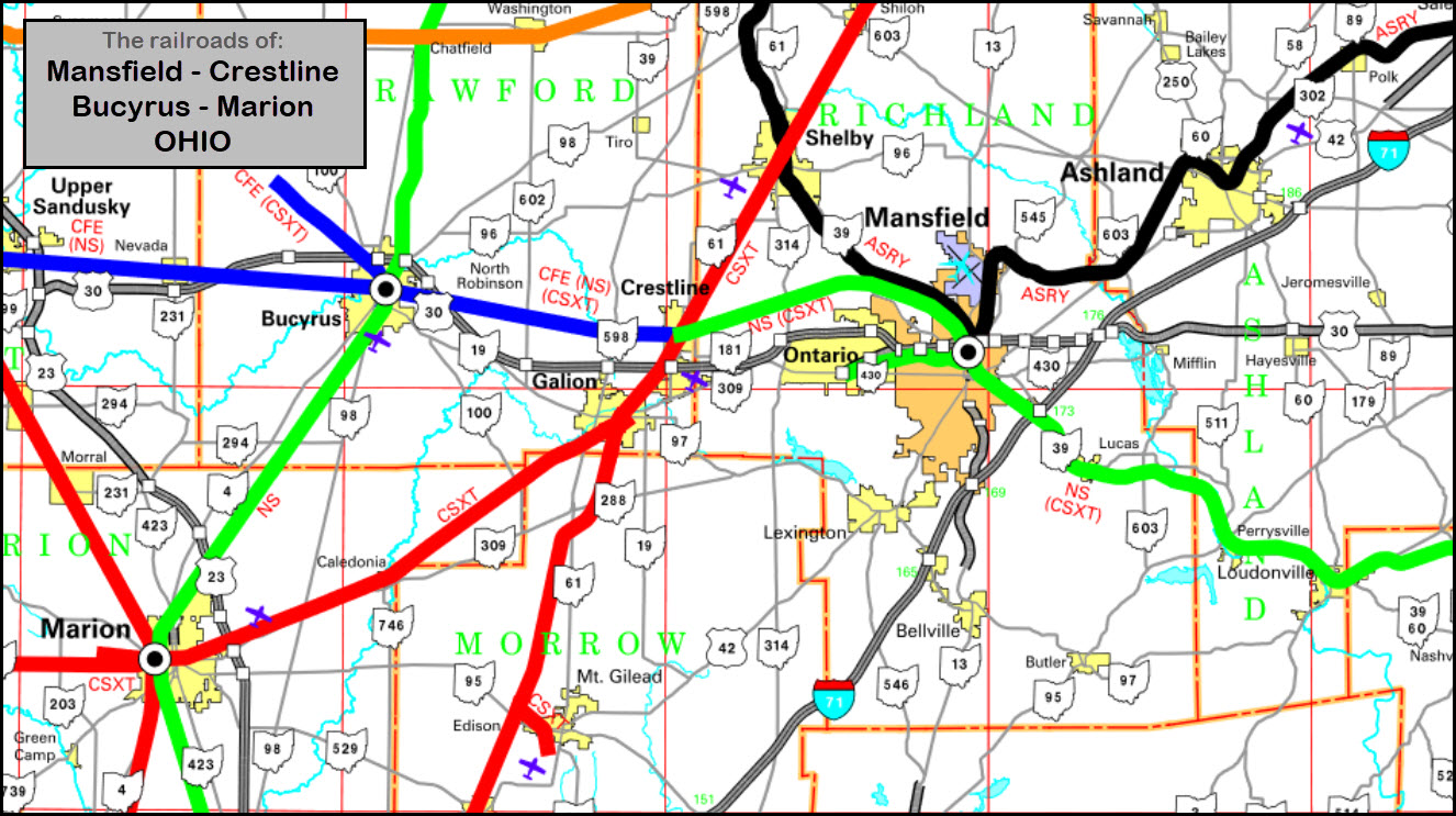
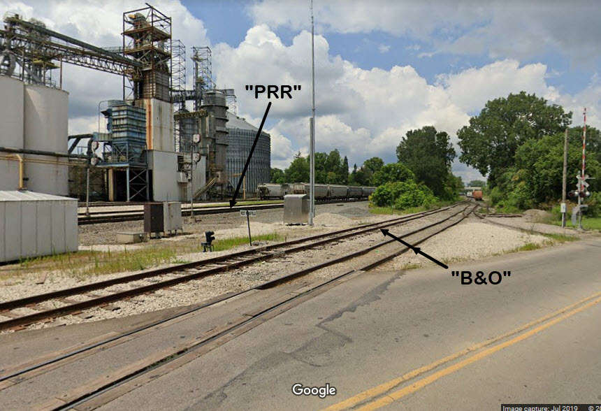
Norfolk Southern is the big name player coming thru here, and they run on parts of the Erie RR and the Pennsy.
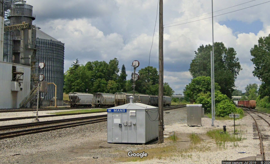
Also coming thru, is the Ashland Railway, and they have a small facility on the northern side of town, off the old B&O tracks. Mansfield is approximately the midpoint of the railroad.
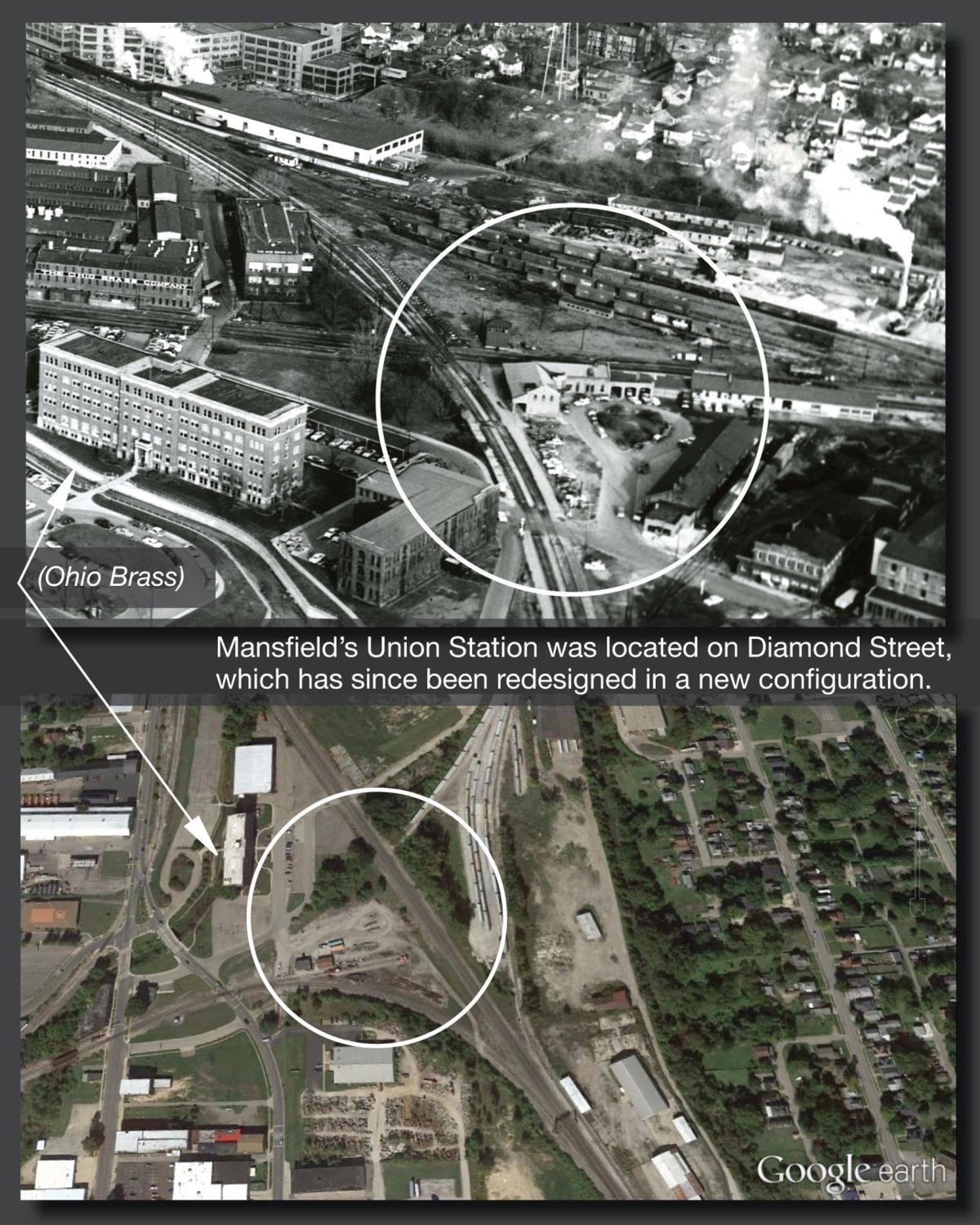
The are a few remaining railroad buildings left: a former B&O depot off Mulberry St, and a Norfolk Southern office off North Diamond Street.
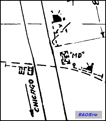
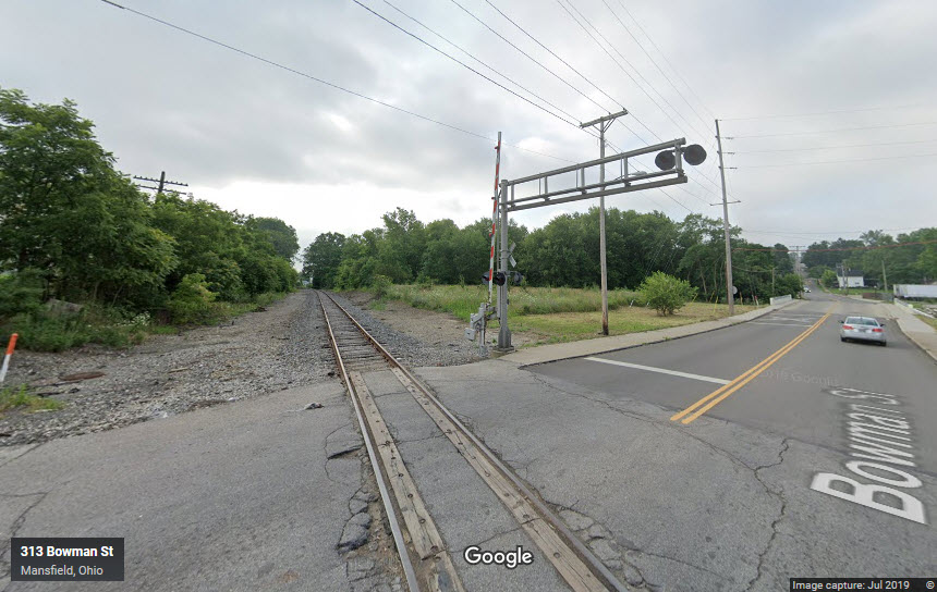
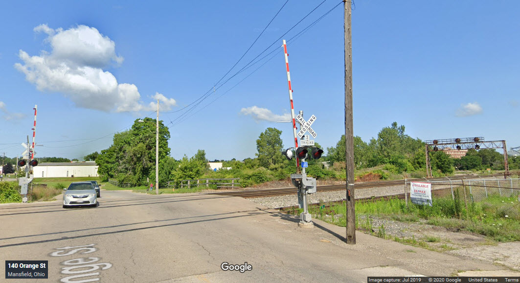
Altho not quite as impressive as the triple double diamonds of Fostoria, Mansfield did have three of them: PRR/Erie, PRR/B&O, and B&O/Erie. The B&O only had a single track running thru town, so their crossings were "simple" affairs. But at one time, the PRR/Erie diamond had three Pennsy and two Erie tracks, quite a noise maker!
The Erie line is now abandoned between Galion and Mansfield. The line extends to a yard west of Lexington-Springmill Road which serviced the former GM Body Plant to the north of the yard. The line appears well maintained. Judging from Google, it appears Norfolk Southern (NS) has the only access to that line.
The B&O is abandoned (mostly) from Newark up to Mansfield, maybe two blocks away from Depot/ CPL. From the B&O depot north thru MD there is a small yard to service a grain elevator next to Main St/OH-13. The line continues north and crosses the PRR (NS) to the Ashland Railway yard.
As you can see on the Ashland Railway map on internet, they use old B&O north to Willard and northeast thru Ashland to West Salem, after that, the track is abandoned on both ends. I think they still service what is left of the steel mill.
Steve has pieced together that there was a B&O freight depot at what is now Robertsons Heating, west of Walnut, between 5th and 6th Street. The rail line came south to the freight depot, turned east to follow 5th Street on the south side. There are still tracks on south side of 5th St. The line from the B&O to the freight depot is long gone. The west2k site shows the freight depot maybe in 1910-1920? He speculates that the freight depot line came off the B&O somewhere north of the existing diamond to cross the Erie heading south. end Steve...
From Wikipedia: Three railroads previously served Mansfield, but currently only two, the Norfolk Southern and the Ashland Railway, provide service in the area.
The Sandusky, Mansfield and Newark Railroad opened in 1846 and became part of the Washington-Chicago main line of the Baltimore and Ohio Railroad (B&O) and then later part of a B&O branch line from Newark to Sandusky. In 1849 the Pittsburgh, Fort Wayne and Chicago Railway (later Pennsylvania Railroad mainline) reached Mansfield, and in 1863 the Atlantic and Great Western Railroad (later Erie Railroad mainline) reached Mansfield.
Passenger services operating into the opening of the 1970s were the Erie Lackawanna's Chicago-Hoboken, New Jersey Lake Cities (discontinued 1970); and the Penn Central's Manhattan Limited and Pennsylvania Limited (both discontinued in 1971, at the transfer over to Amtrak).
After the B&O branch line was abandoned, the 18.3-mile (29.5 km) section from Butler to North Lake Park in Mansfield was opened in 1995 as the recreational Richland B&O Trail. The former B&O track from Mansfield to Willard combined with a piece of the abandoned Erie Railroad east of Mansfield to West Salem to form the L-shaped 56.5 mile (90.9 km) Ashland Railway (1986). A spur of the abandoned Erie Railroad leads west 5 miles (8.0 km) to Ontario to serve the General Motors metal stamping plant there. end Wiki
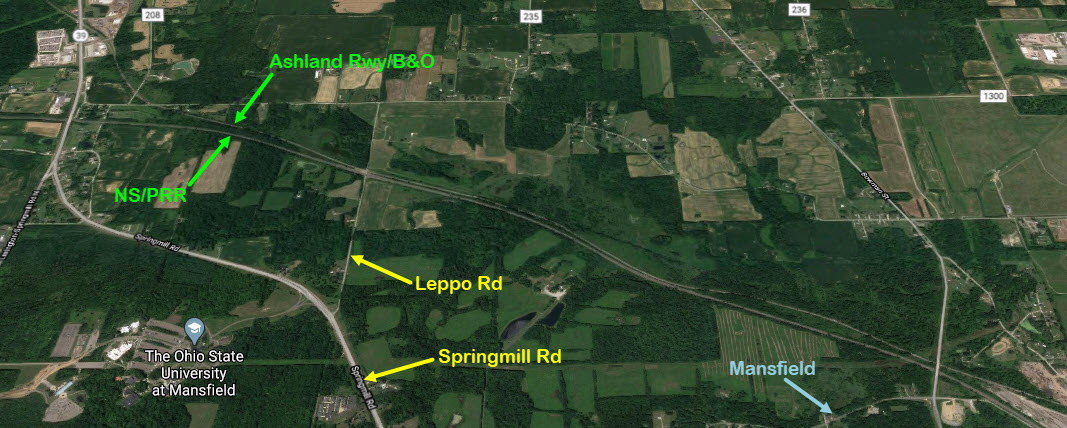
To the northwest of town, at Leppo Road, is a nice grade crossing, with both NS and the Ashland Rwy running next to each other before the Ashland splits off to go north. Good sight lines in both directions. It's off of Springmill Rd/39.
Restaurants are not as plentiful as you would think, McDs and Bob Evans are on Thimble by Rt 30, as is a Quality Inn. Pizza places abound. An Arby's is on W Park Ave off of Thimble. More hotels up by the 30/I-71 interchange. There's a BK, Mcd's, and Wendy's on Ashland Rd near Rt 30.
Acknowledgements:
Steve Robey, signal pictures and history
Jim Mihalek, signal pictures
John F. Bjorklund
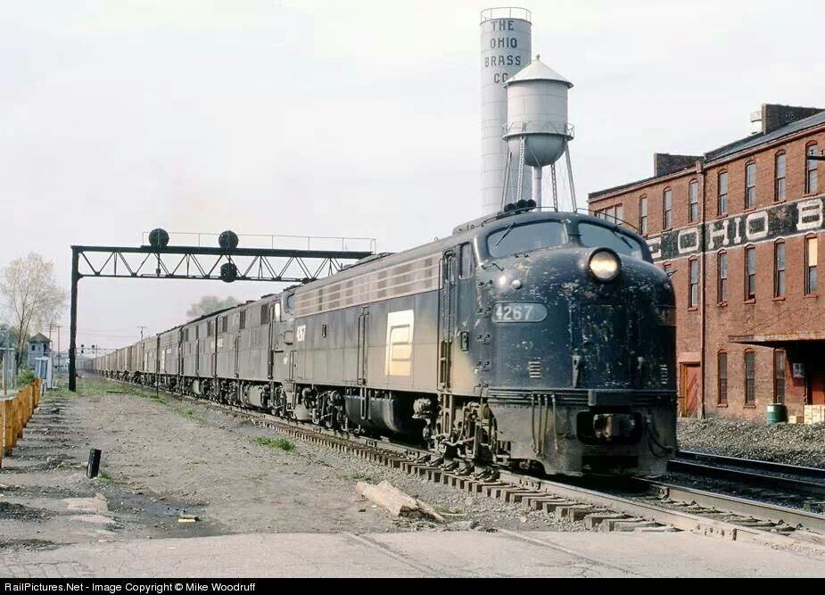
Mike Woodruff
Todd Dillon
Scott Taipale
Brandon Fownley
North American Interlockings
Red Over Yellow dot com
Wikipedia
Denver Todd
Google Maps
Open Railway Map
Bing Maps
Websites and other additional information sources of interest for the area:
https://www.ashlandrailway.com/
http://www.railphoto-art.org/collections/bjorklund/early-conrail/#
https://northamericaninterlockings.com/ohio_11.html
https://elevation.maplogs.com/poi/alta_west_rd_mansfield_oh_usa.454685.html
https://www.west2k.com/ohpix/mansfieldold.jpg
https://www.richlandsource.com/area_history/union-station-in-mansfield-a-lament/article_05d20988-d5a7-11e5-a201-3789b68f65b5.html
https://www.richlandsource.com/area_history/mansfields-history-includes-railway-cars-streetcars/collection_d75ebdd4-5c3d-11e7-9c3d-9b9d69580938.html
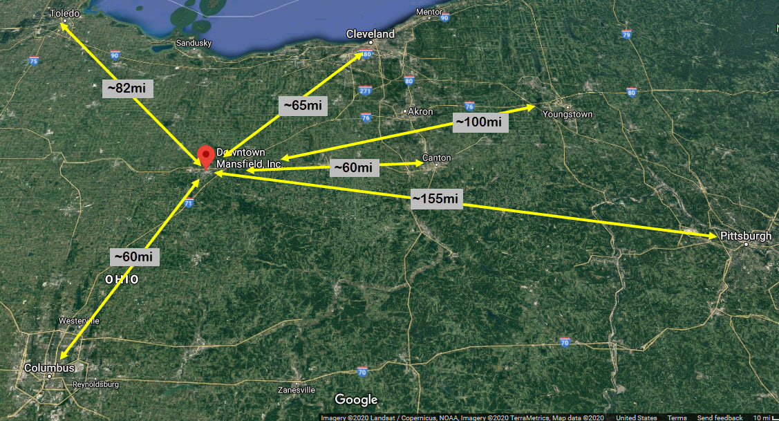
US Route 30 skirts the northern side of town, I-71 is about 3 1/2 miles to the southeast.
Use I-71 exit 173 to get off on Lucas Road / state road 39. Head north ~1.8mi to Park Ave East/430, and take a left into town. Go 1.0 mile to 5th St, and take a right, this will curve around to the southern end of the Pennsy interlocking, continue to Main St and take a right.
Use I-71 exit #176 for Route 30, and head west. There is an exit for Main St in both directions here on Rt 30.
There are rest stops on Route 30, just west of the I-71 interchange, altho if you are coming to Mansfield from somewhere else, as your destination, not sure why you would bother stopping there? :-)
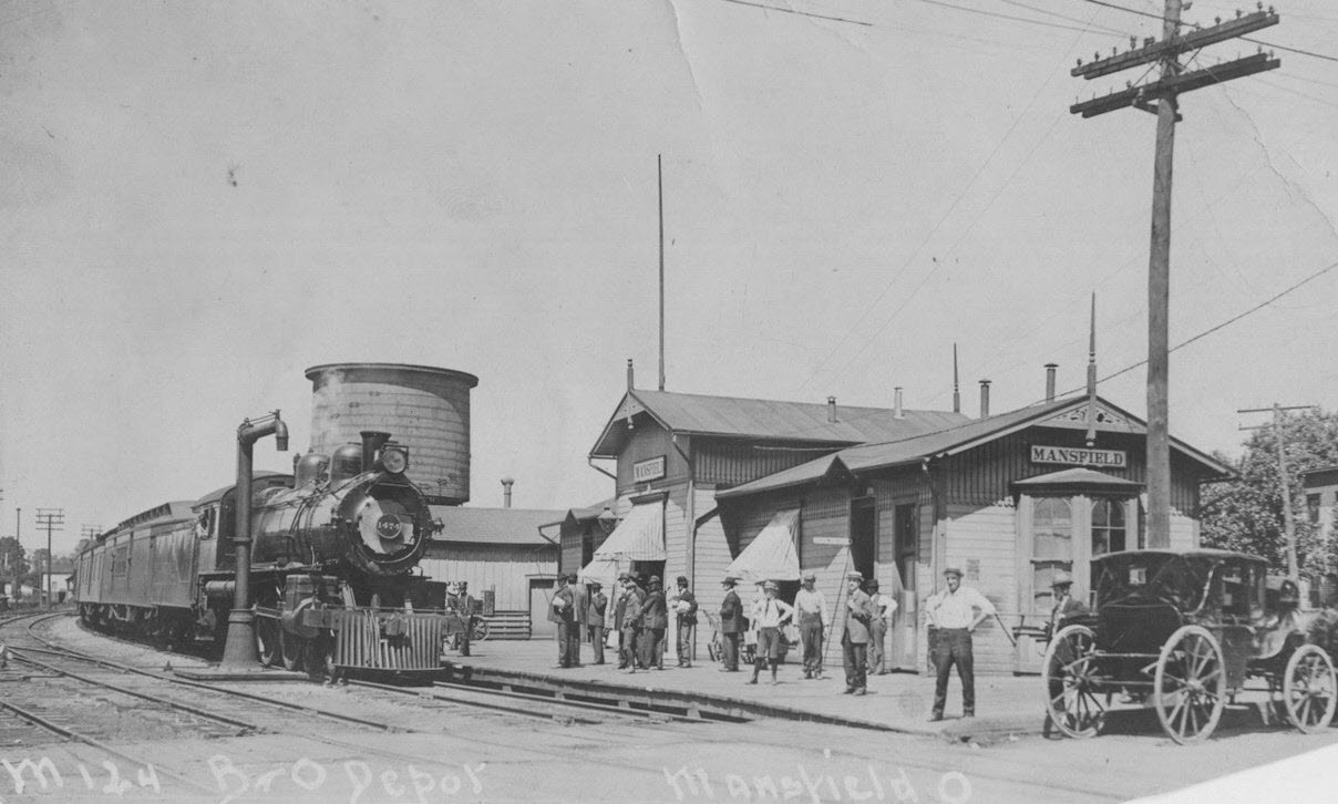
Here is a list of the stations and freight sheds in Mansfield:
This list comes from: https://www.west2k.com/ohstations/richland.shtml
GPS Coordinates: 40.766288, -82.518502
283 N. Mulberry St

There was an older B&O Union Station on the east side of Main Street just south of Orchard Street, GPS: 40.769622, -82.514738.
https://www.ashlandrailway.com/
Mansfield is at the approximate midpoint of the Ashland Rwy system, going from Salem OH on the east side, to Willard OH on the west.
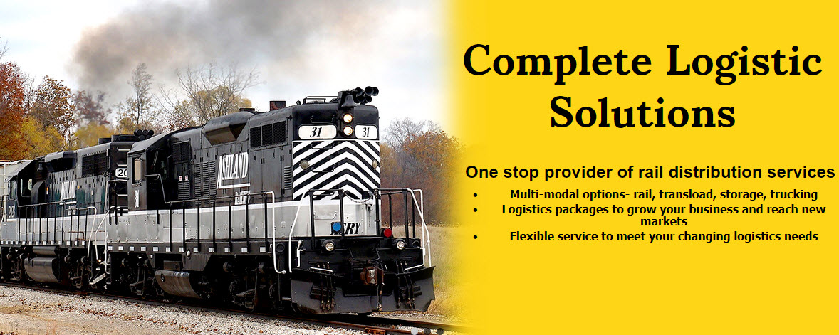
From their website: Ashland Railway began operations in 1986 and operates in Richland, Ashland, Huron, and Wayne counties. We are a 56-mile short line railroad serving North Central Ohio in a region known as “Mid-Ohio.” Located between Cleveland, Columbus, and Akron/Canton along the I-71 corridor, we provide essential rail service to the communities of Ashland, Mansfield, Willard, Shelby, Plymouth, and West Salem. Ashland Railway interchanges with Class 1 railroads Norfolk Southern and CSX Transportation as well as regional short line Wheeling & Lake Erie Railway. Coupled with our affiliated companies, Skye Trucking and Mansfield Railport, we offer customers a complete logistics package.
https://www.flickr.com/photos/47491339@N04/51752215984 photo by Brandon Fownley
https://akronrrclub.wordpress.com/tag/ashland-railway/ photo by Todd Dillon
https://www.flickr.com/photos/alittlevanwerty/8177248874/ photo by Scott Taipale/2012
Former GPS Coordinates: 40.768259, -82.512462
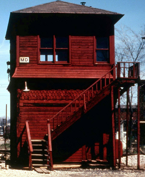
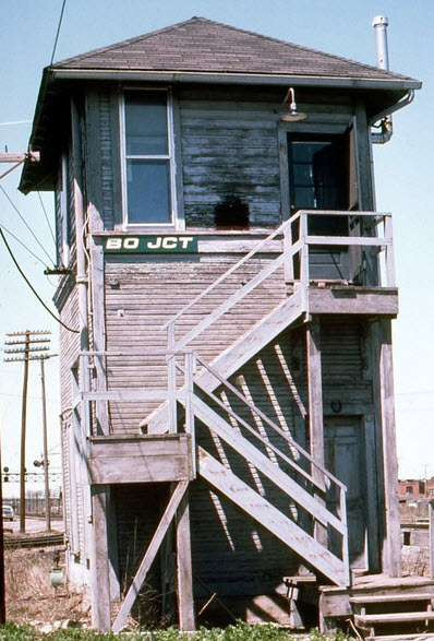
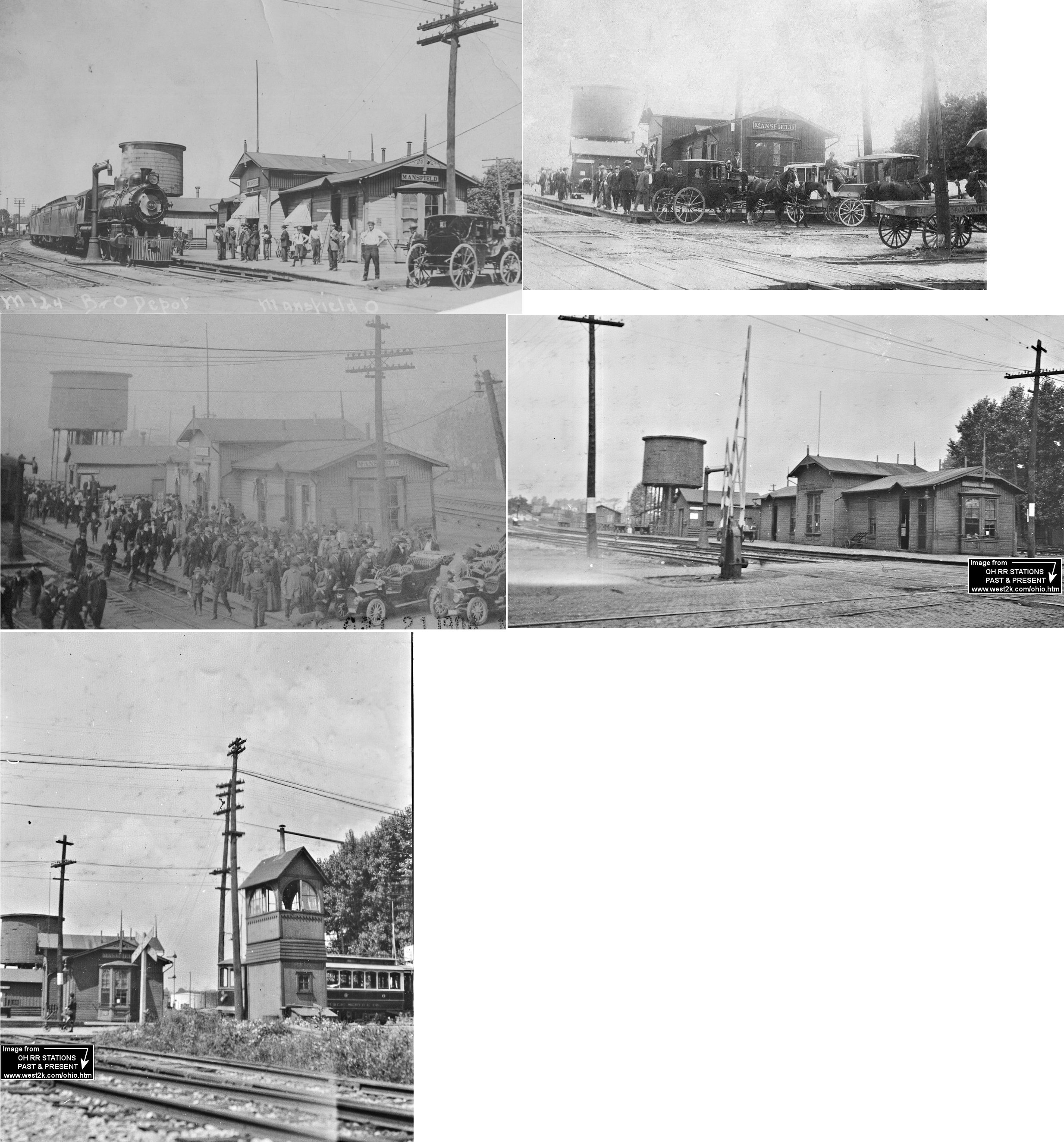
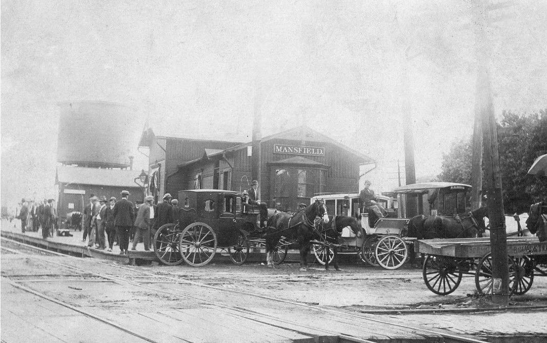
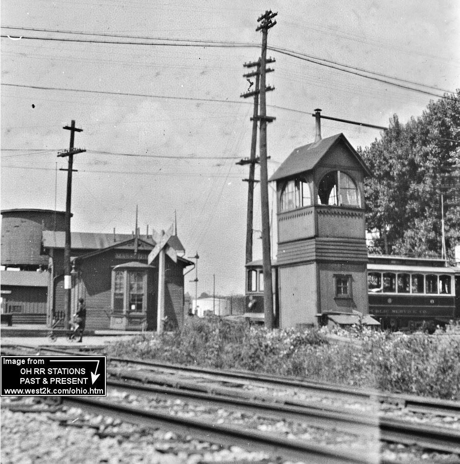
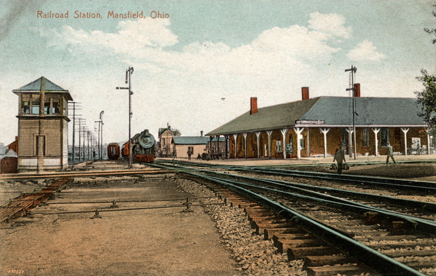
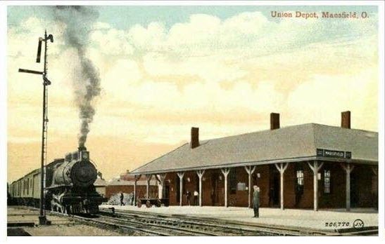
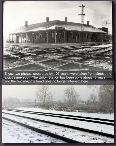
The tower and PRR/Erie depot at the diamond - neither of which are still with us :-(
This union station, built in 1872, was off north Diamond Street, ...It was in the south quadrant of the PRR/Erie diamond. It a major enlargement and modernization project in 1940. PRR valuation records say the station was owned by the PRR with part being leased to the Erie. The records give a build date of 1866.
From the Richland Source page: It was called Union Station because it united two different railroads that crossed in Mansfield. These tracks went by different names in different eras, but were primarily known in the 20th century as the Pennsylvania and the Erie.
Passengers on these two lines headed off in different compass directions, but they were able to board from two sides of the depot because it was built right into the angle of the crossroad. Although freight traffic on the rails into Mansfield is what energized the city to greatness during the industrial boom of the late 1800s, it was definitely the passenger service on these tracks that gave the city true vitality.
In 1900 there were 33 different passenger trains stopping in Mansfield every day. By 1916 there were 42 a day. By the time passenger train service stopped in Mansfield, not too many people even noticed. The last Erie passenger train pulled out in 1970, and Penn Central stopped in 1971. The Union Station lasted only a few more years after that, dark and locked and sadly without heart.
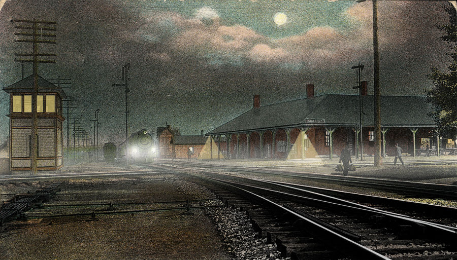
The nightime postcard below, is the same as the daytime one above... early Photoshopping! :-)
GPS Coordinates: 40.772522, 82.514977
489 N Main St, Mansfield OH 44902
 Todd Dillon, December 2010
Built in 1886, this Romanesque Revival prison was featured in the film "The Shawshank Redemption."
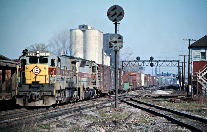
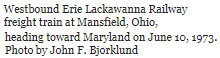
Eastbound Conrail freight train with Erie-Lackawanna Railway power in Mansfield OH, on April 3, 1976. Photograph by John F. Bjorklund.
Gotta love those PL signals! :-)
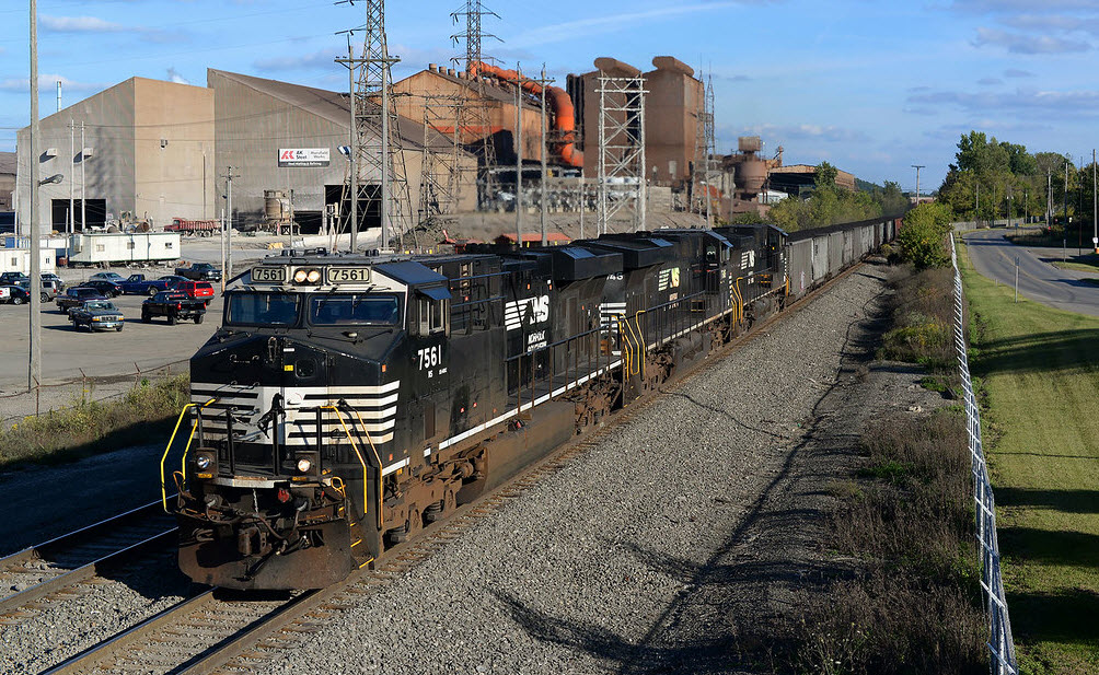
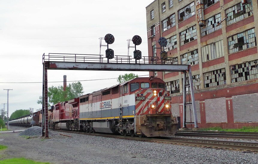 Todd Dillon
 at the entrance to AK Steel
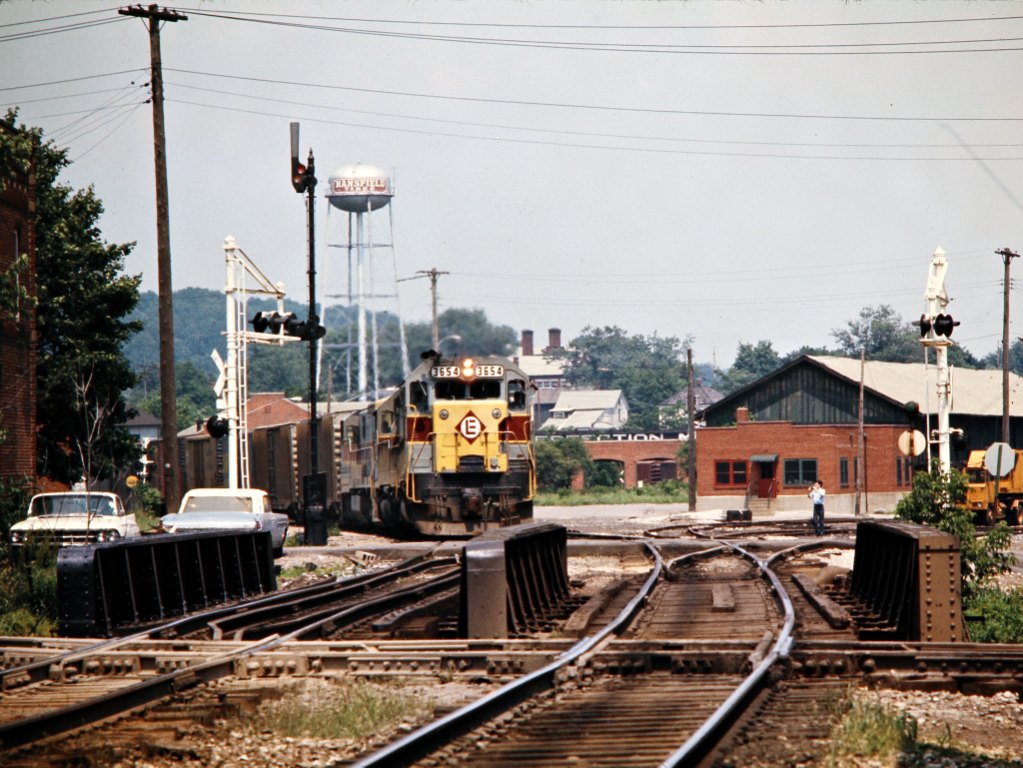
from: https://railphoto-art.org/collections/bjorklund/erie-lackawanna-railway/
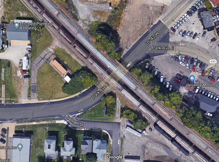
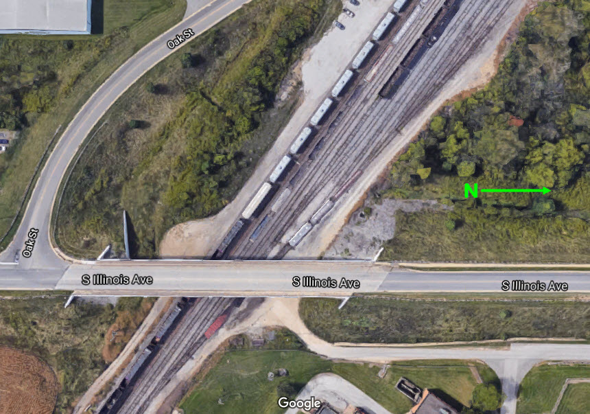
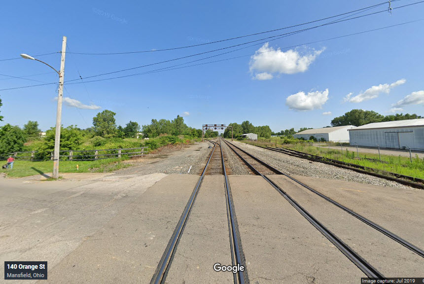
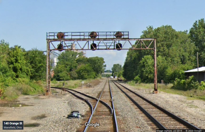
At one time this concrete railroad overpass had five active tracks going over it, now there are (the center) three.

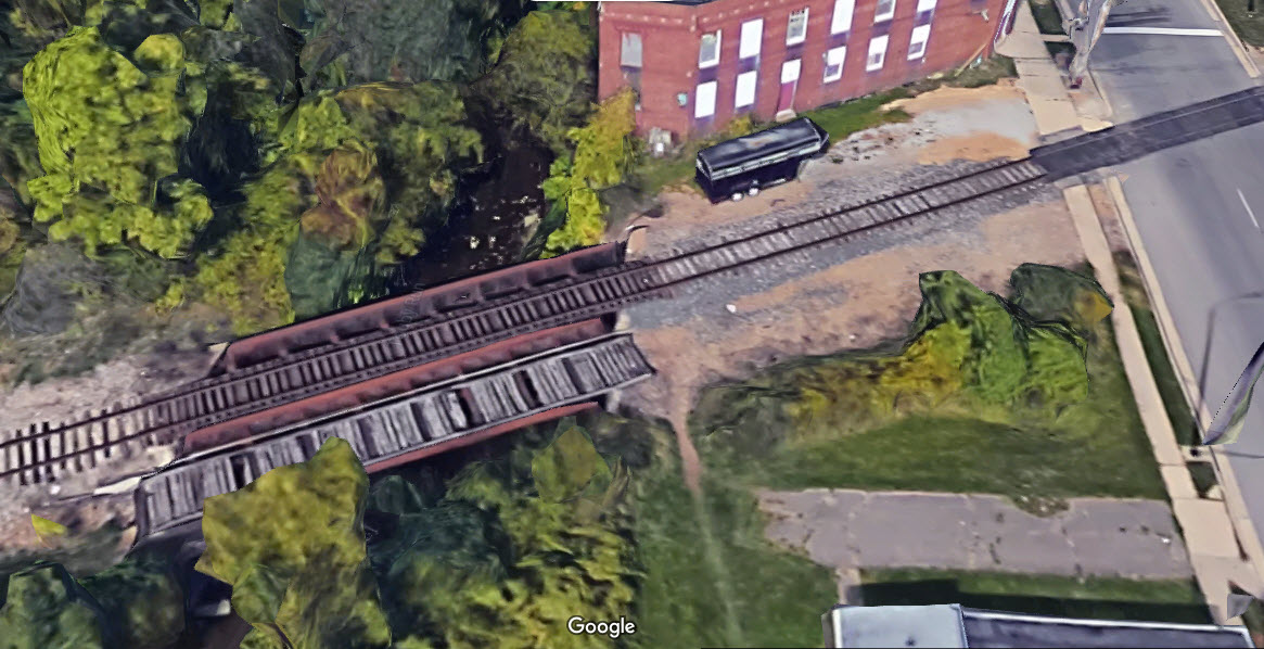
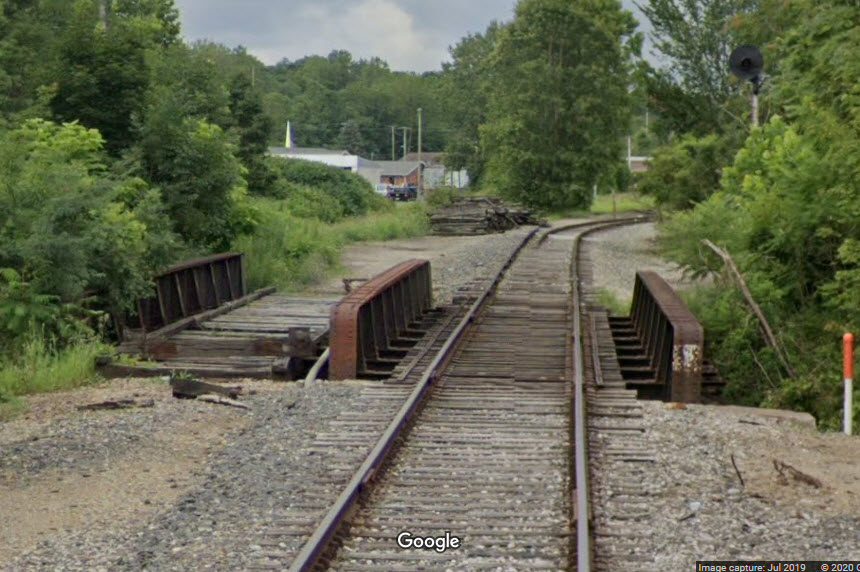
A small girder bridge that used to carry two Erie tracks, just off Main St to the west.
The next few overpasses are noted, because they might be an OK spot to take pictures from, as long as you don't park near the bridges on the shoulder, I ran into trouble in Bellevue OH once where a sheriff stopped me for doing so.... so I don't know if it is a statewide law or not?
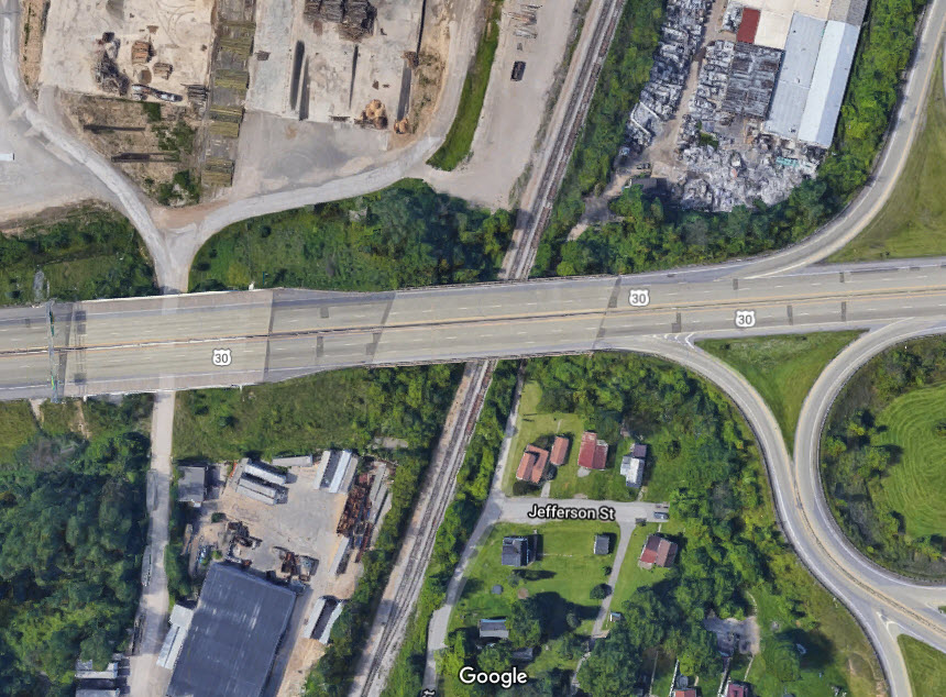
This is a vehicular overpass, going over the old Pennsy at the southern end of the yard. Because of the debri on the sidewalks, it doesn't appear that they get traversed a whole lot.
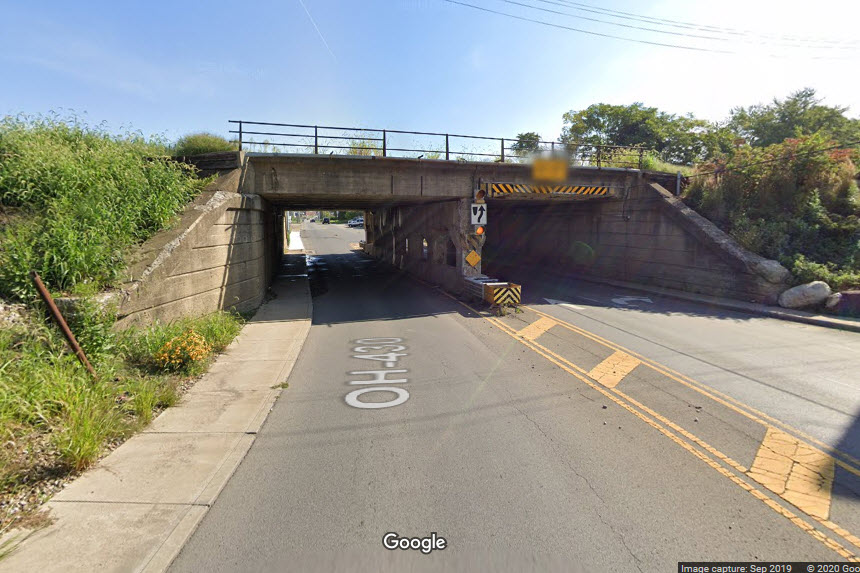
This is a vehicular overpass, going over the old B&O tracks on the north side of town.
This is a vehicular overpass, going over the old Pennsy tracks on the north side of town.
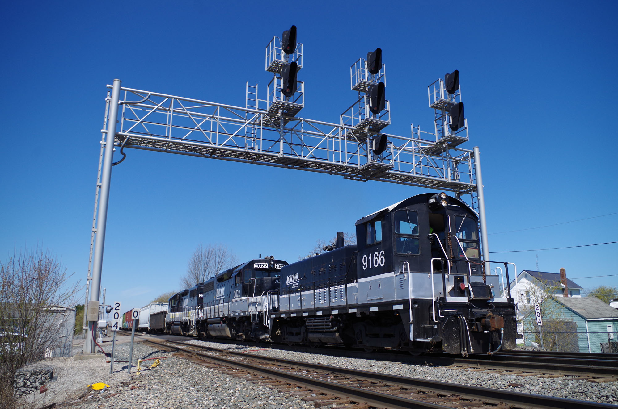
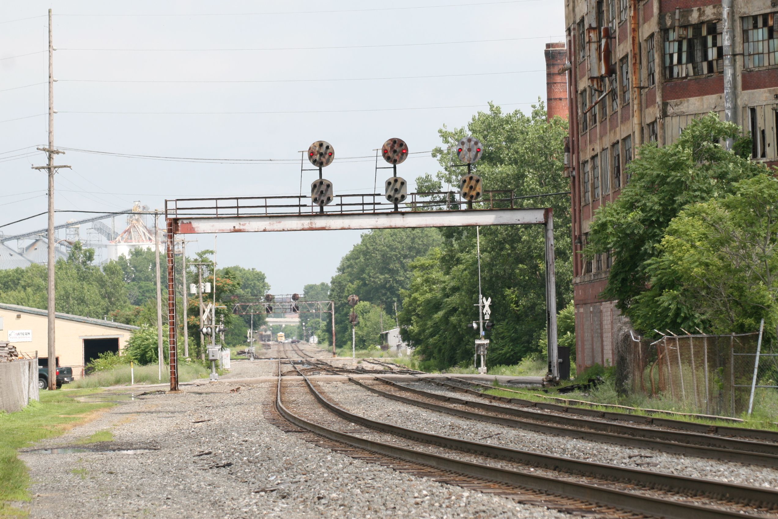
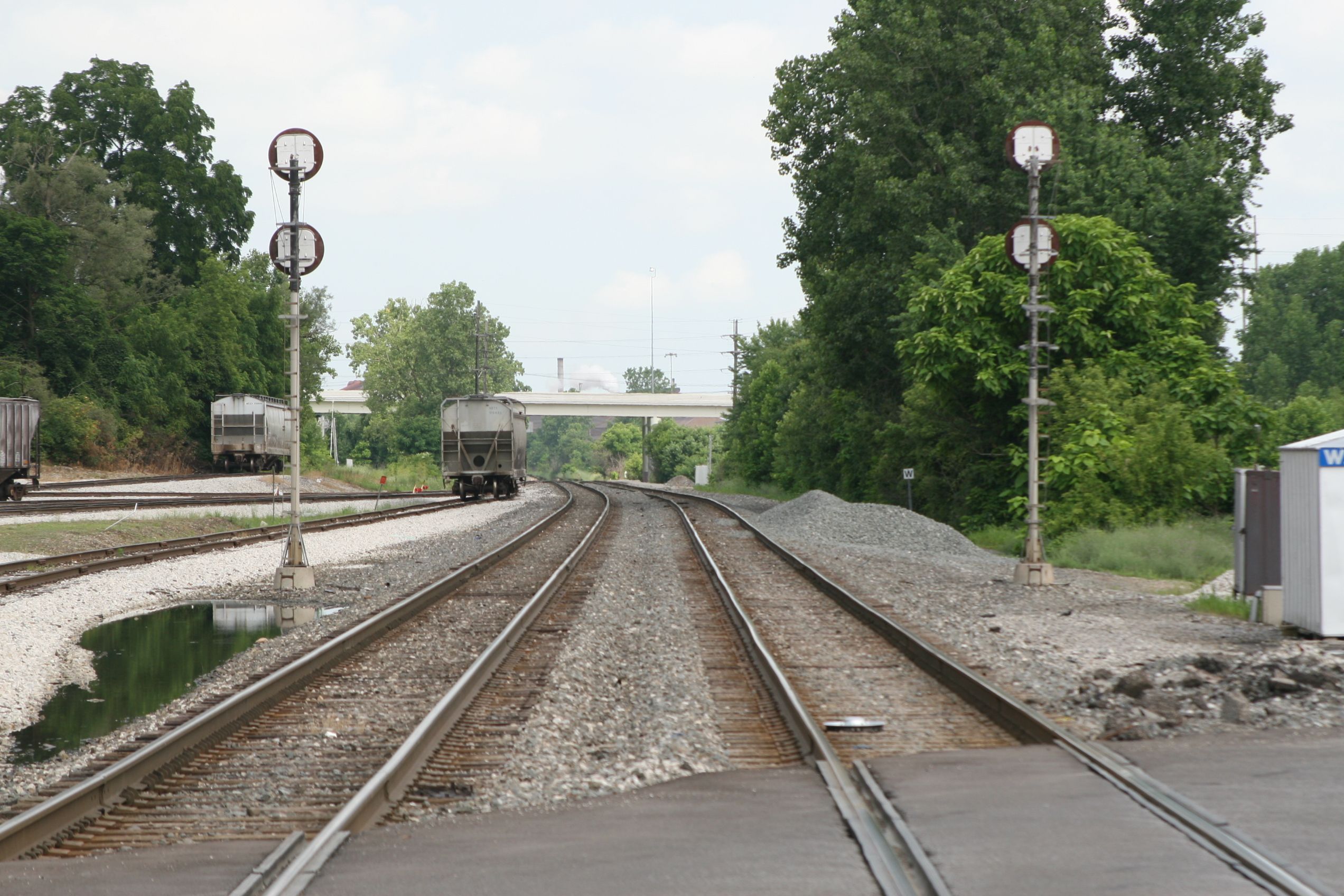
Gee, no standard colorlight signals anywhere to be found, very unusual in this day and age! Signals in Mansfield are kind of like signals in a town "that time forgot!".... A mixture Pennsy PL, B&O CPL, and Erie searchlight signals, and I guess some (maybe) Conrail era "tri-light" style colorlight signals (...at least on the Pittsburgh/Altoona line thru central PA, a few of the Pennsy PL signals were replaced with tri-light signals when Conrail owned the line). Given the traffic in, around, and thru Mansfield, none of them will probably be replaced unless they are absolutely falling over, or in danger of, like the NYC searchlight signals at Berea! :-) Locations below are in no particular order, they were numbered as I came across the locations.
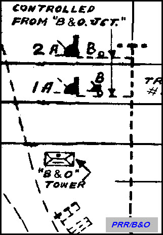
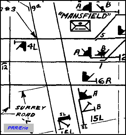
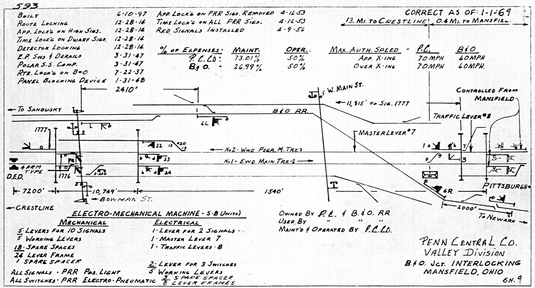
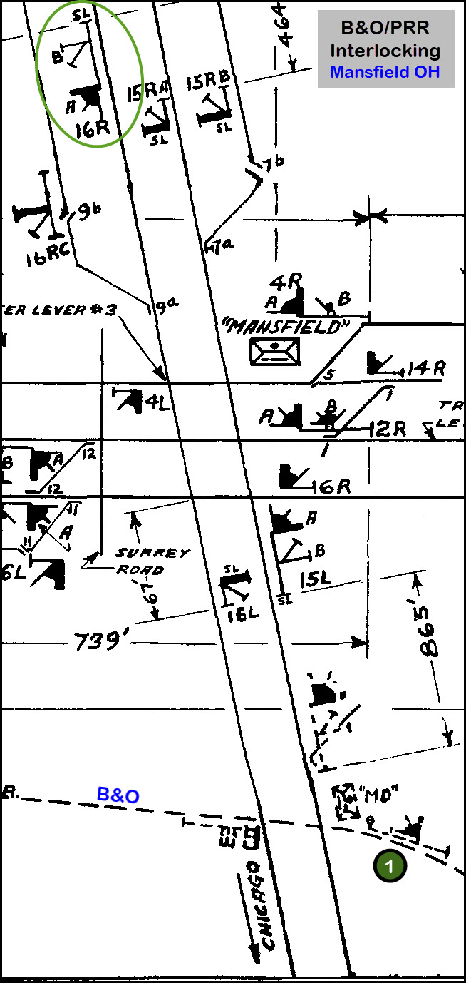
Below is the PRR Interlocking diagram for the "Mansfield" tower, too bad it didn't go over a little further west to cover the entire PRR/B&O crossing. However, the second diagram below from the Penn Central era, does covers the PRR/B&O diamond. The Pennsy line runs left to right in both drawings, while the first one shows the three towers Mansfield used to have. Notice that ALL of the signals on both the PRR and the Erie were Pennsy PL signals. Now all we need is a good drawing for the Erie/B&O diamond.
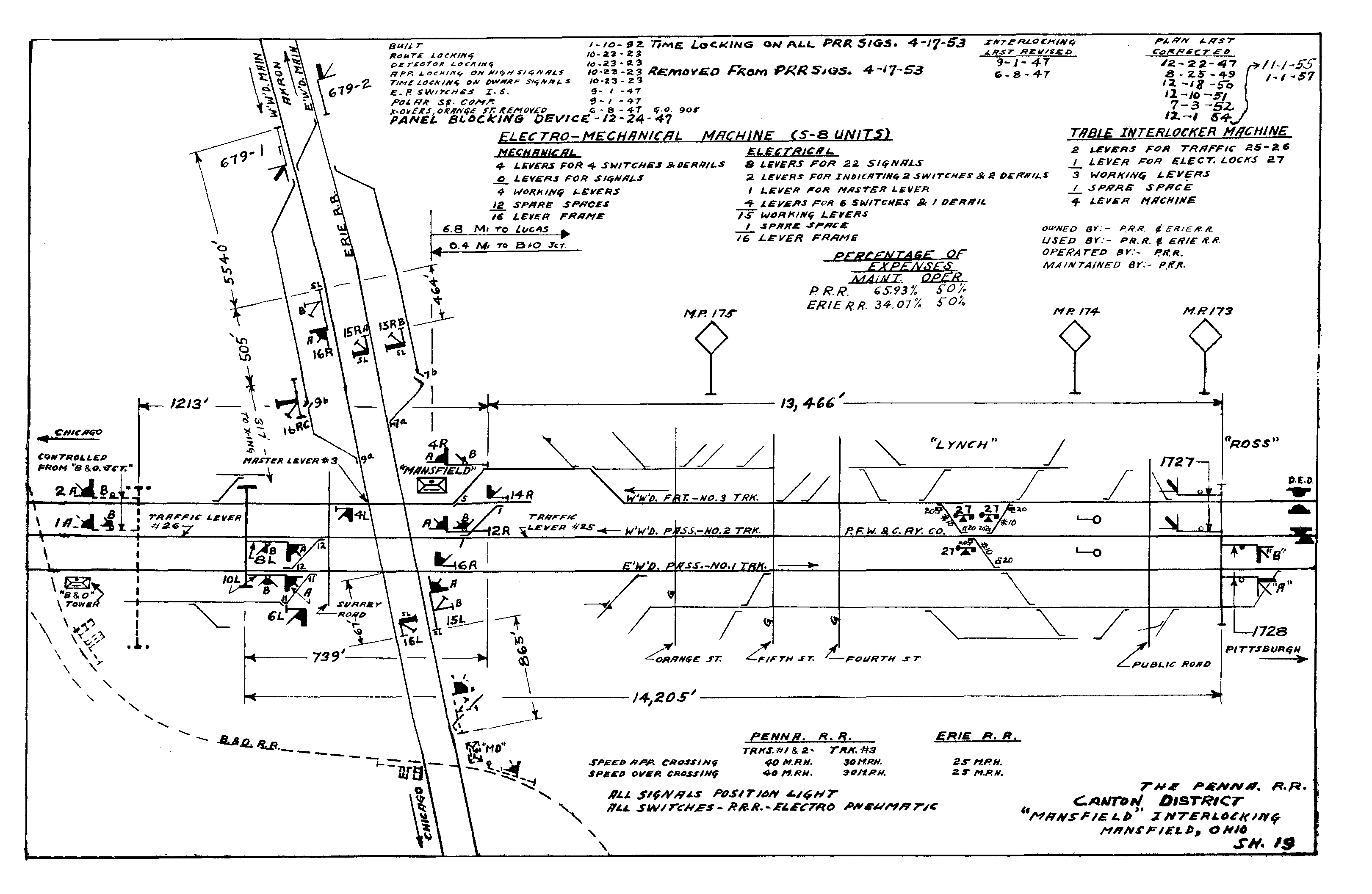
The above interlocking diagram, and many more for the Pennsylvania RR can be found here
"New" signal on an old mast, you can tell from the finial. The signal is not a GRS unit, but a newer version made by Safetran.
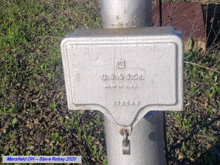
Below is this signal shown on the Pennsy Interlocking diagram.
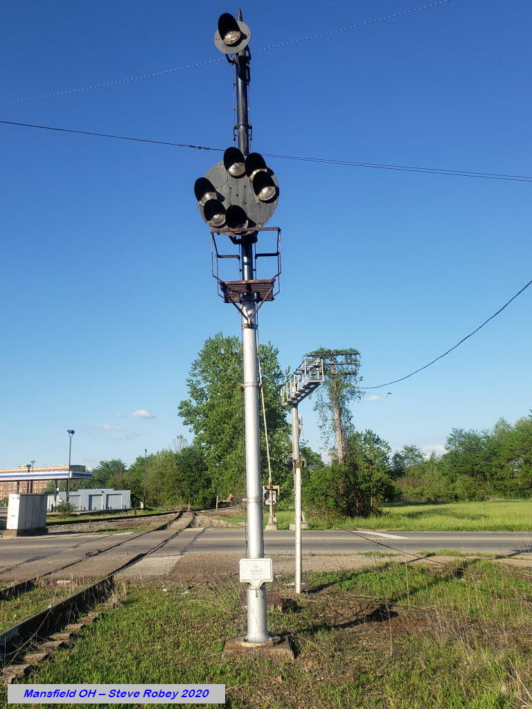
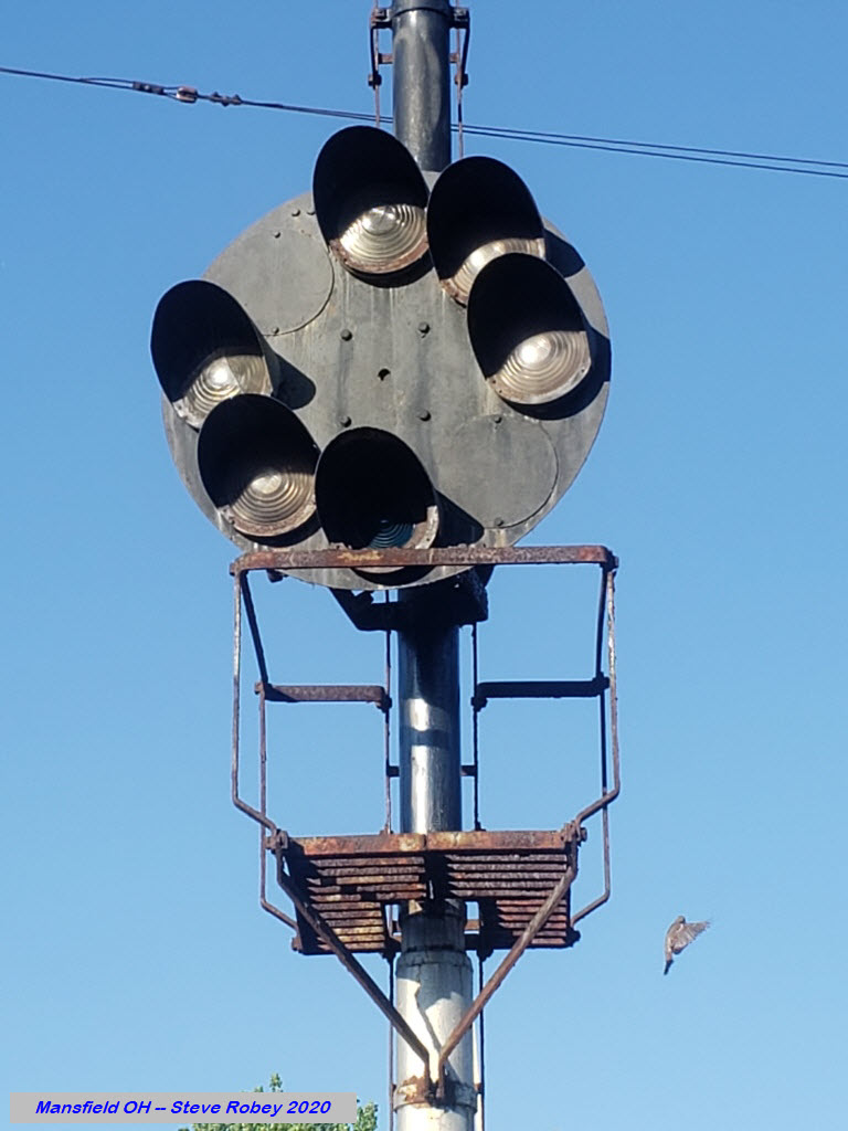
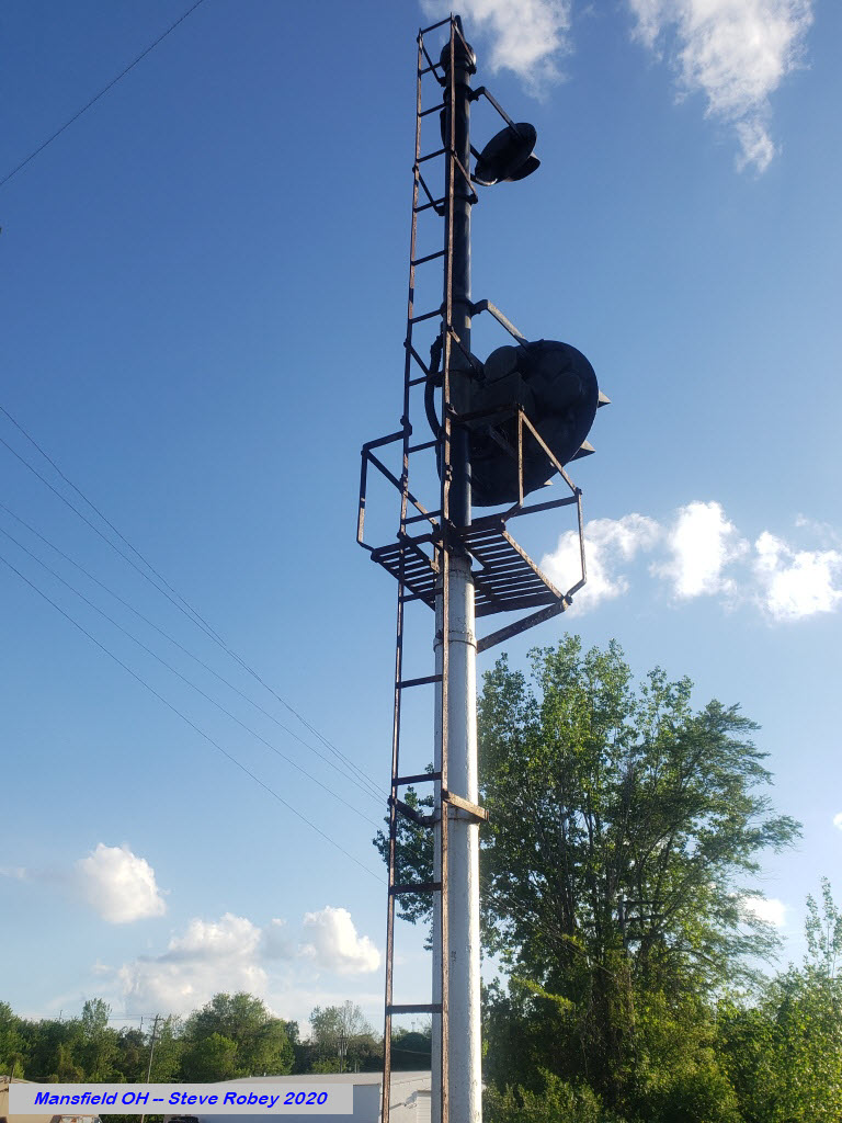
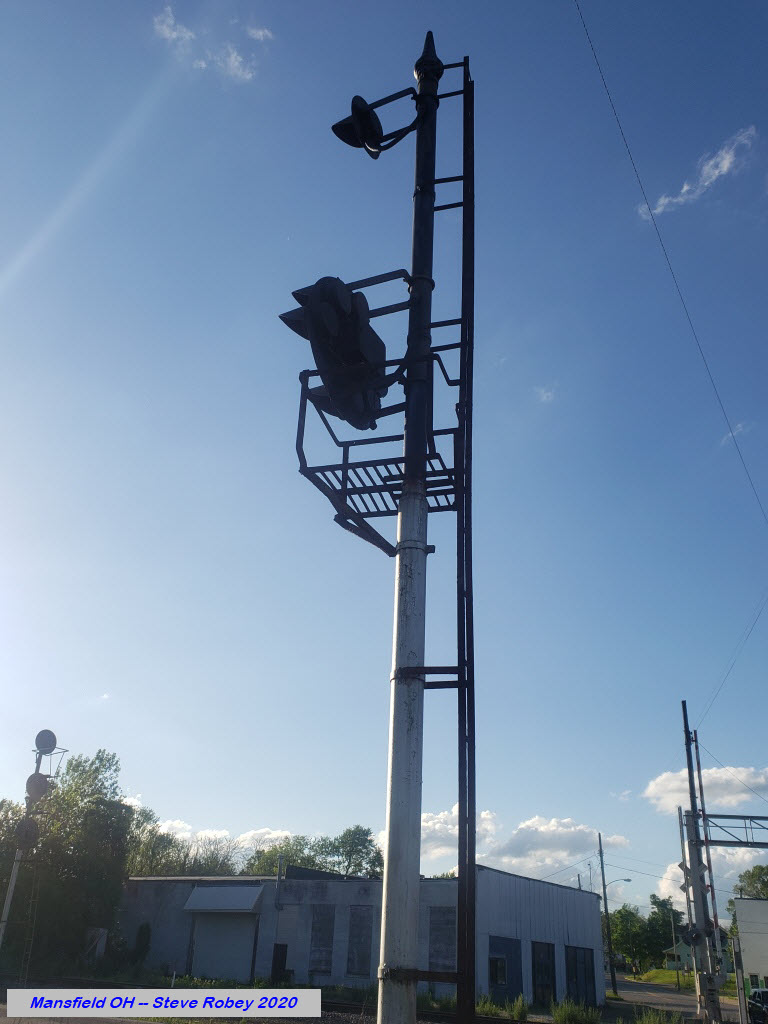
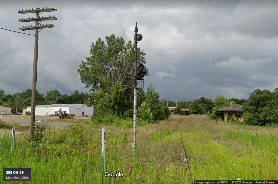
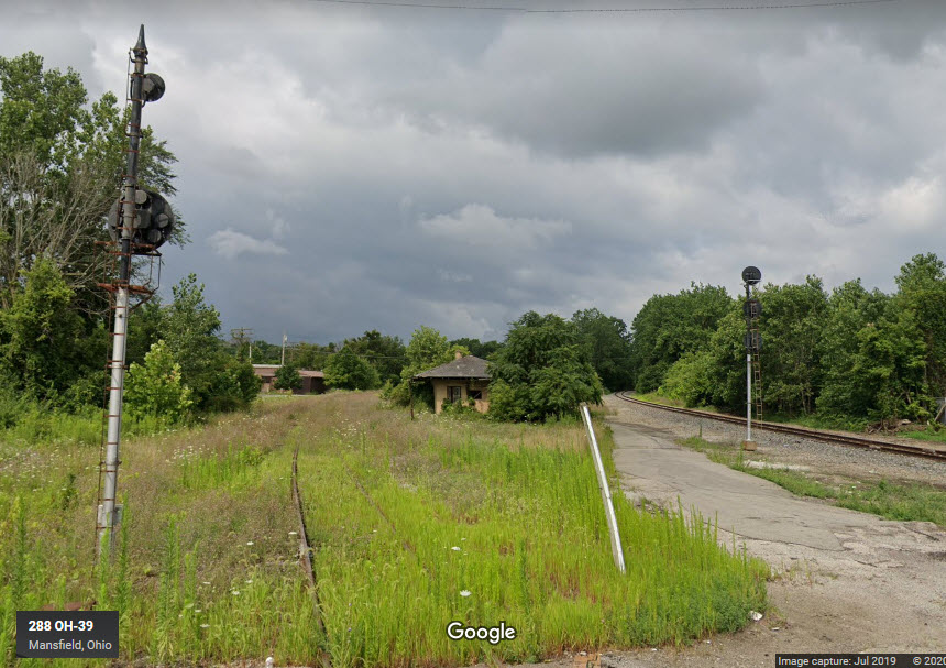
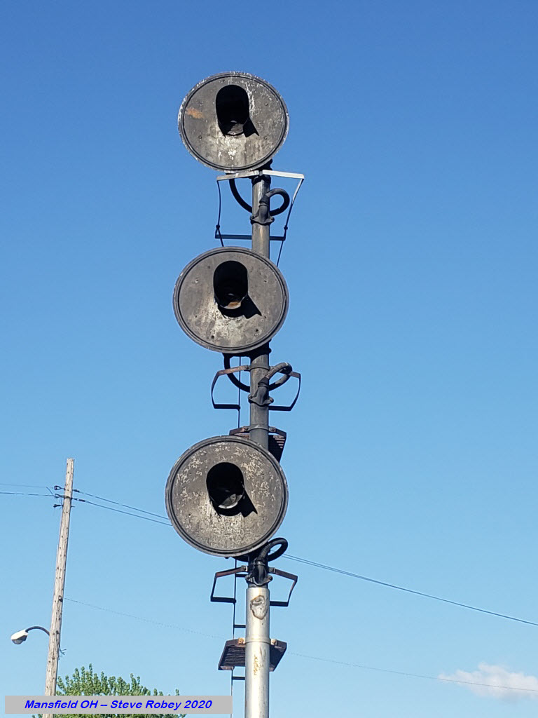
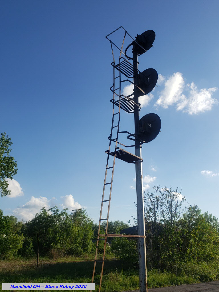
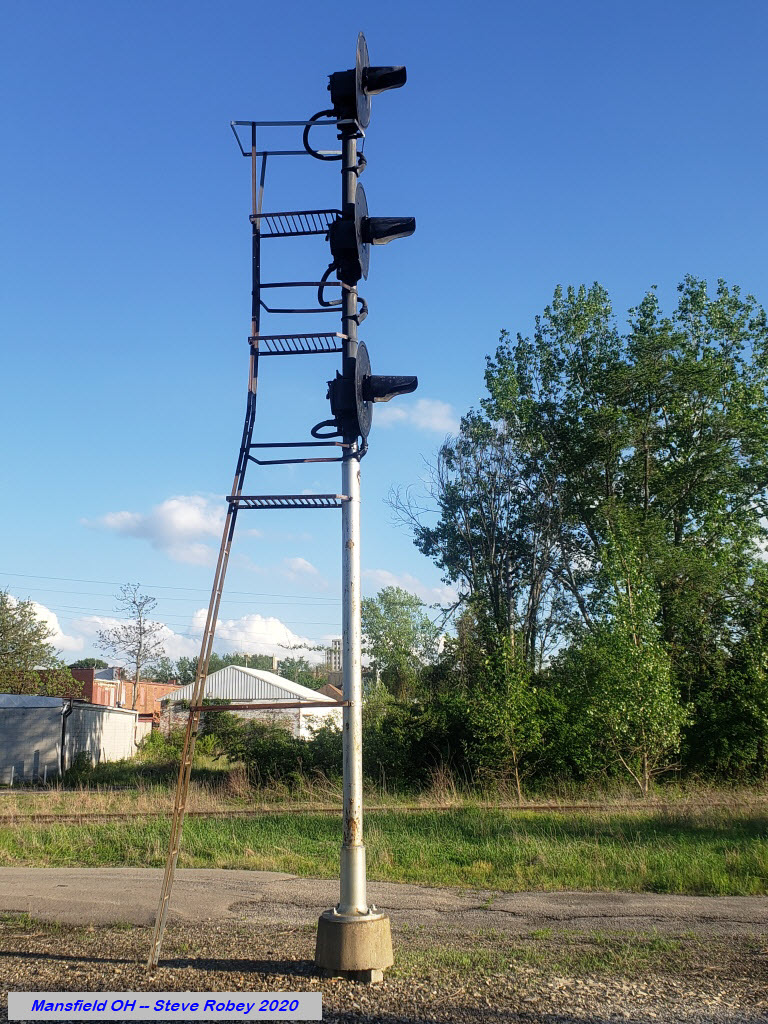
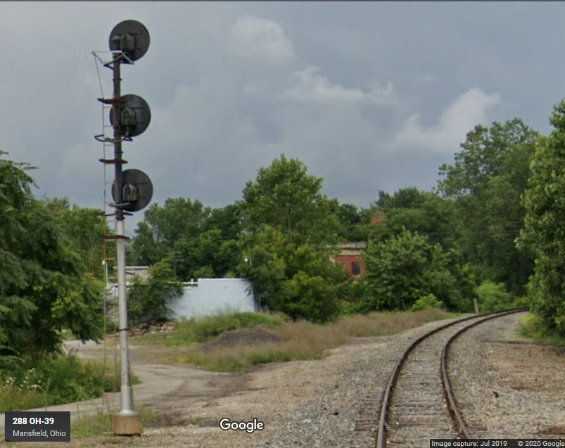
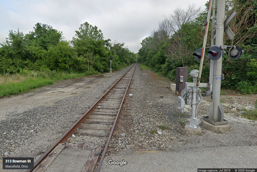
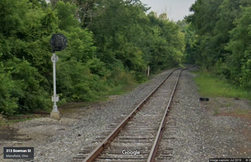
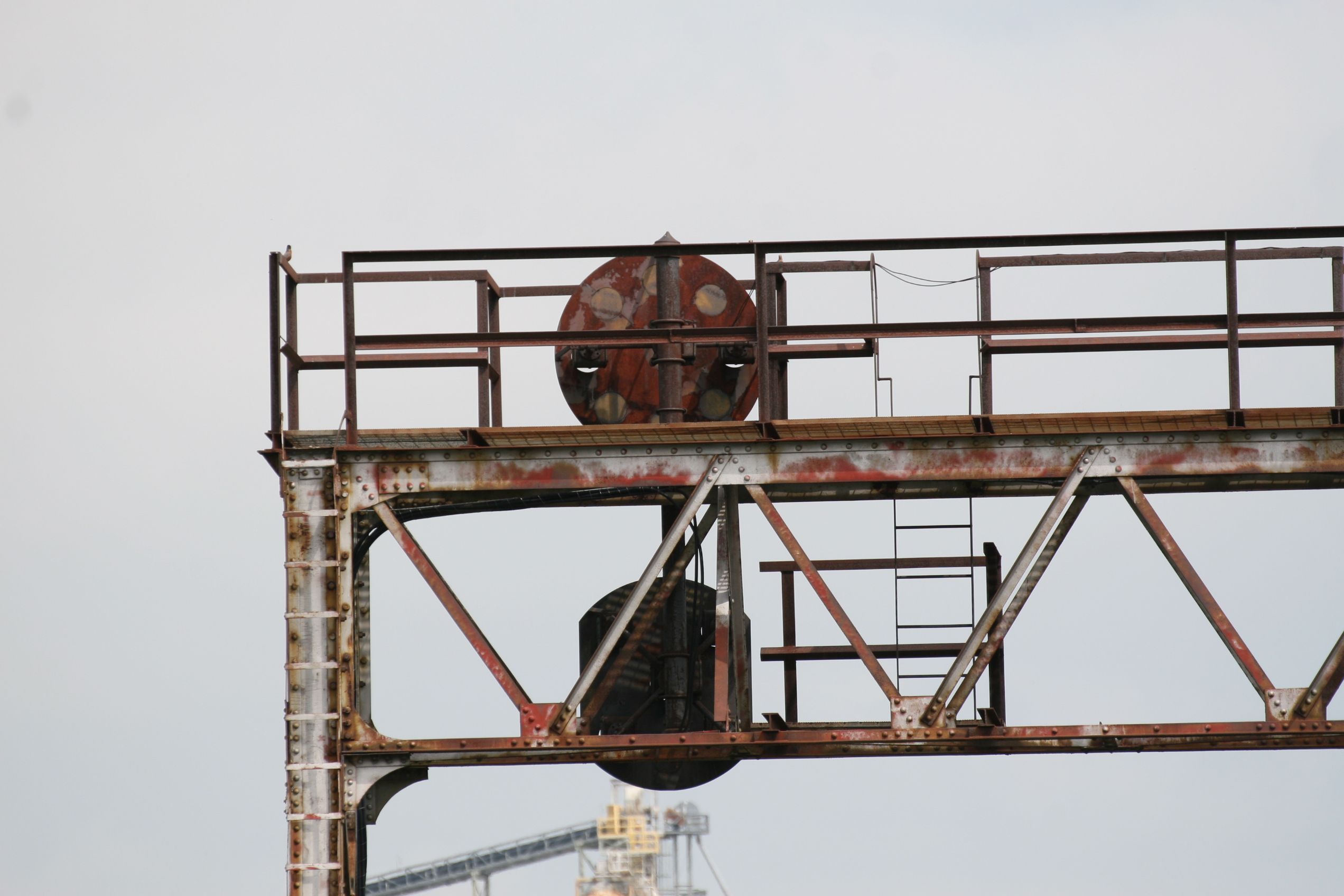
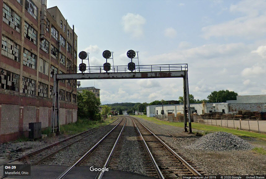
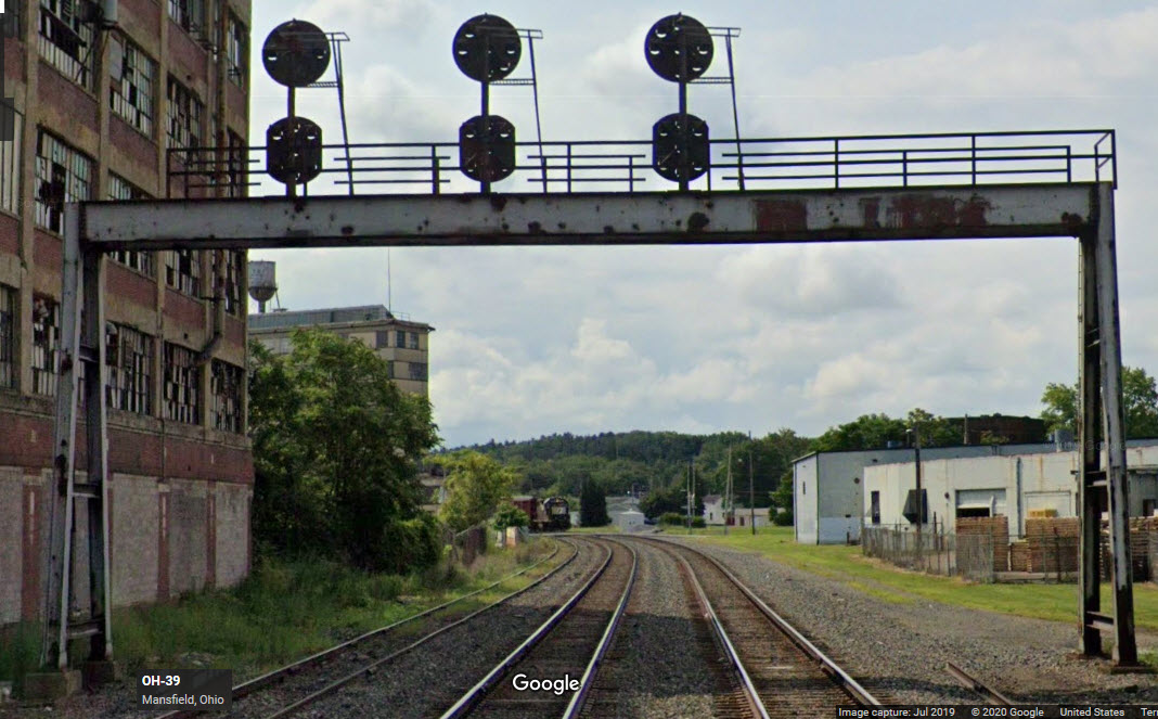
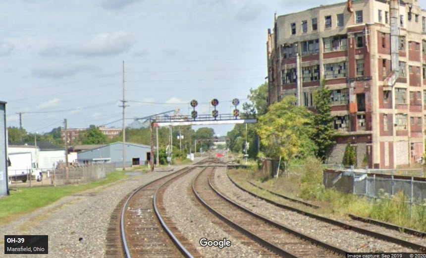
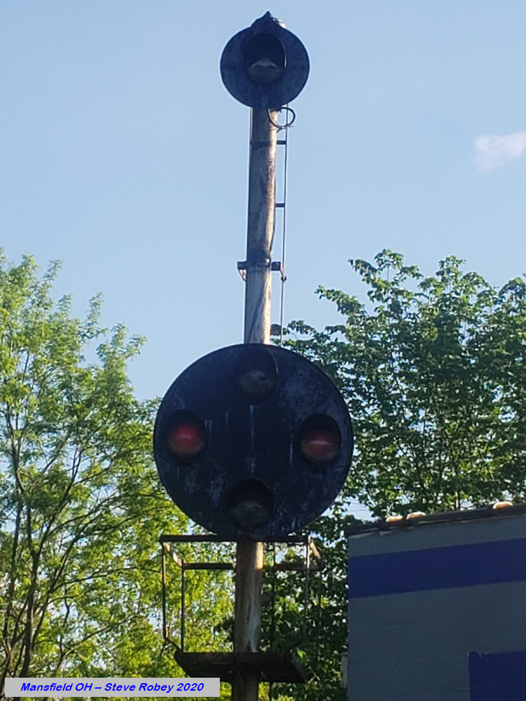
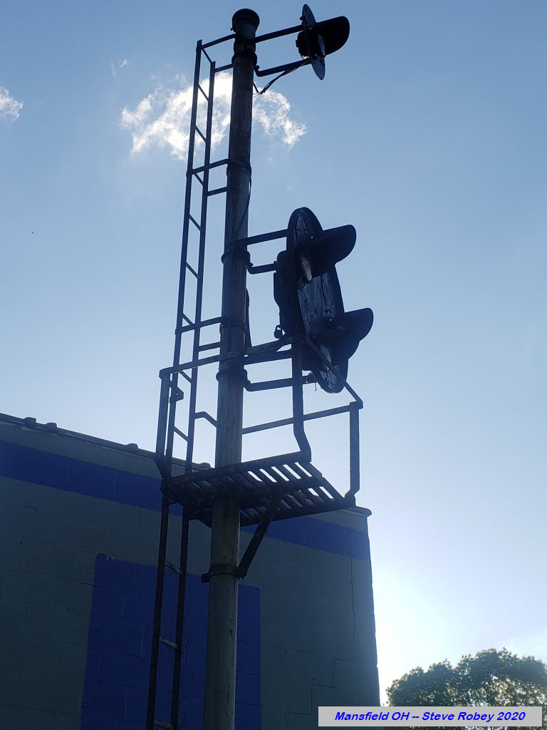
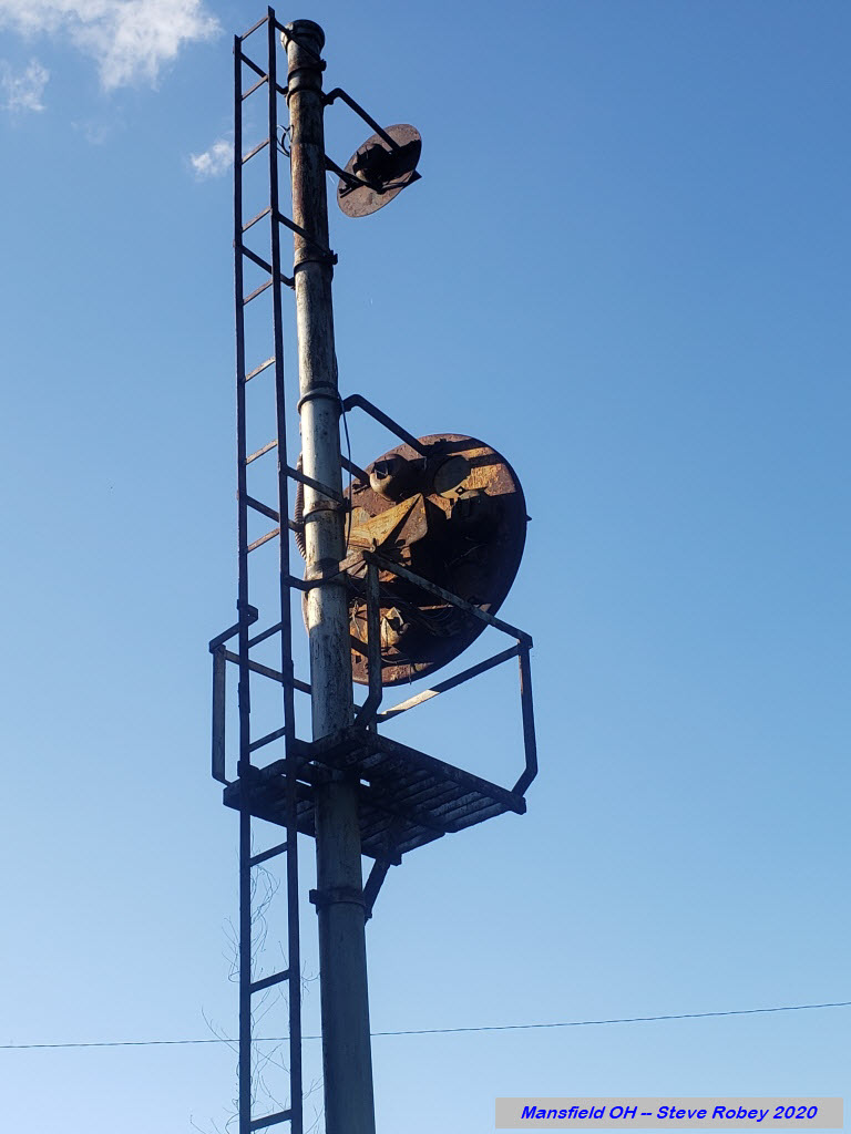
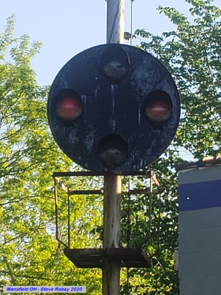
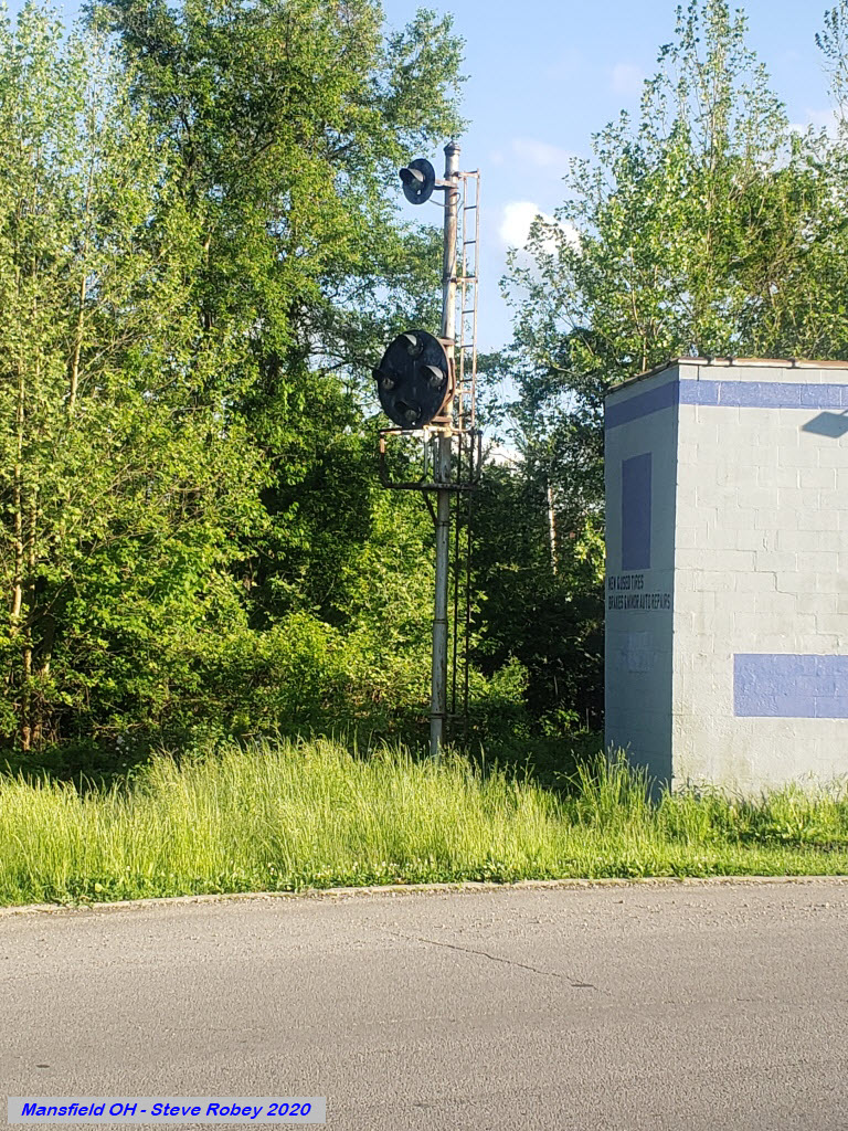
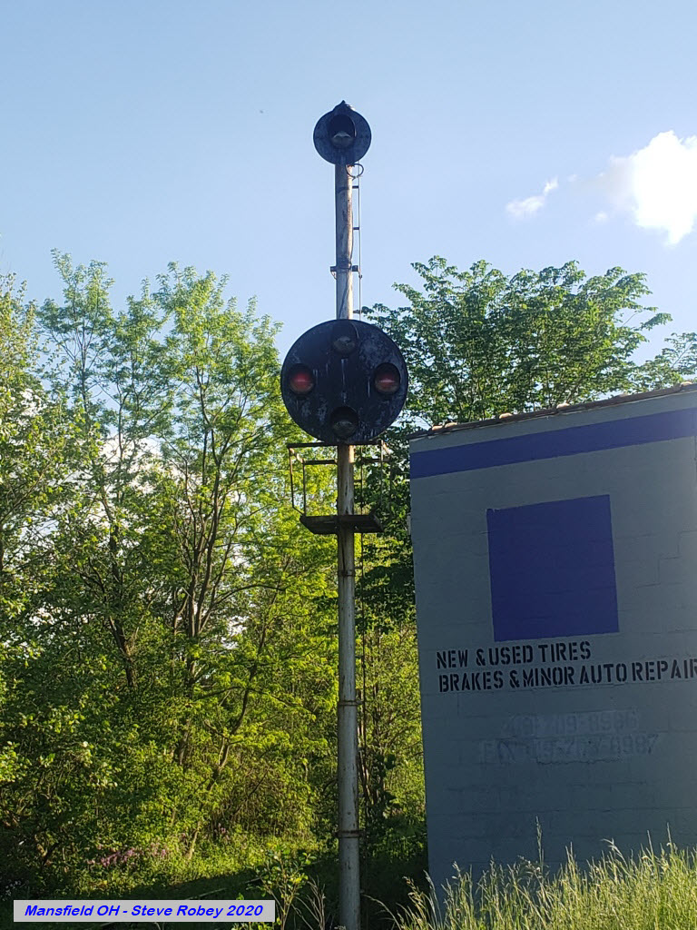
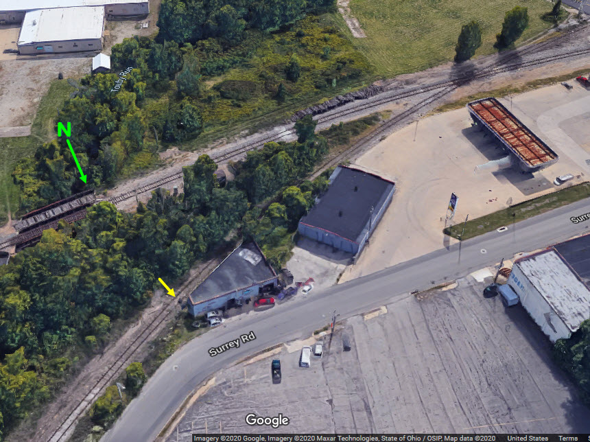
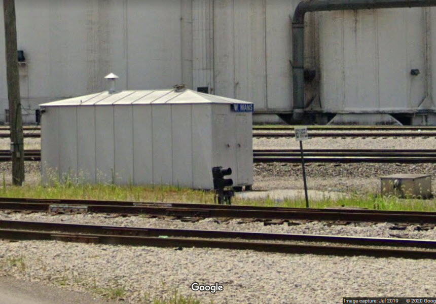
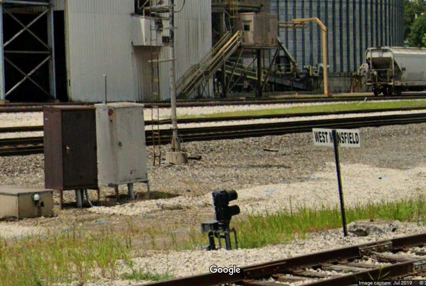
A triple stack of searchlight signals on the old Erie line, the grade crossing at N Mulberry St, and the nearby B&O/Erie diamond.
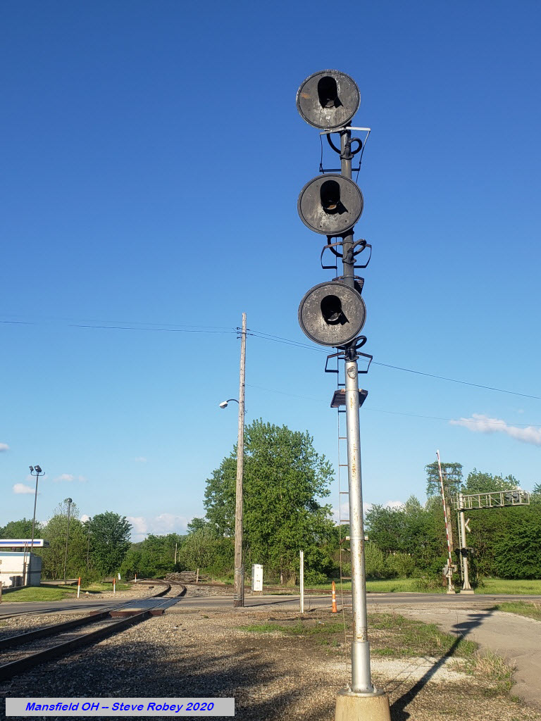
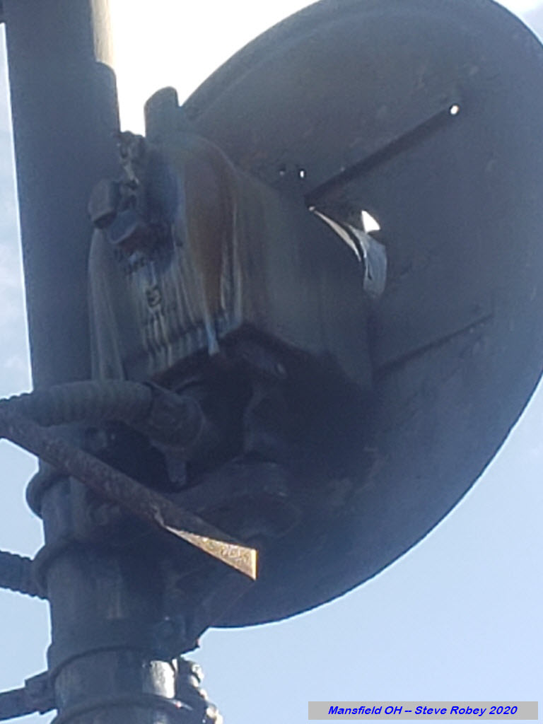
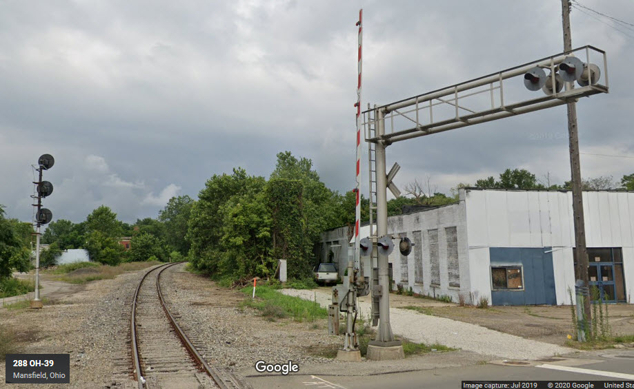
A single head signal, for the approach to the diamond signal with the Erie and B&O. I need a front view to confirm that this is a yellow aspect all the time.
A trio of classic Pennsy PL signals for SB traffic going thru the crossovers, one of which is for the interchange track coming off the Erie.
 Jim Mihalek, 2018
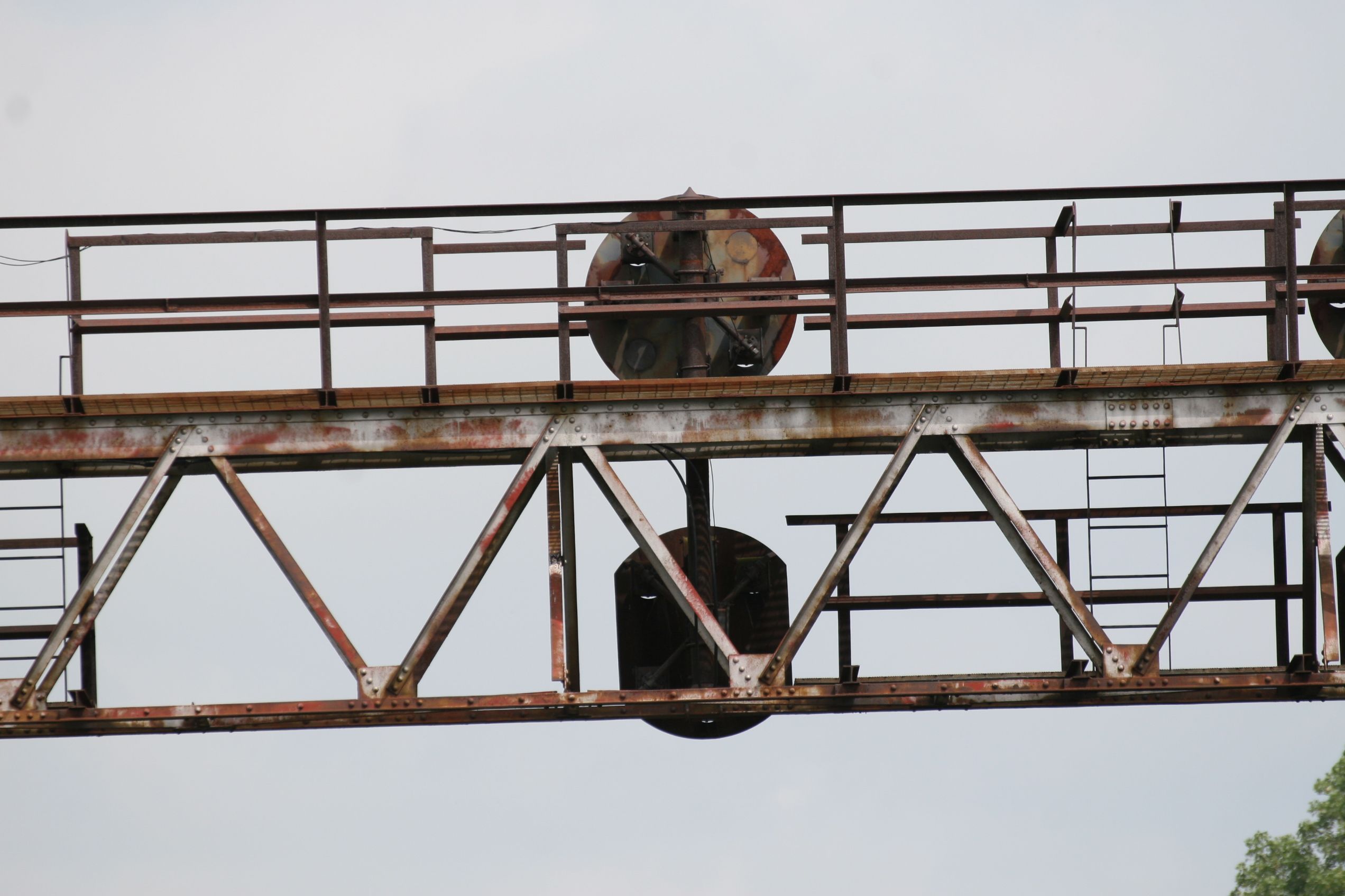 Jim Mihalek, 2018
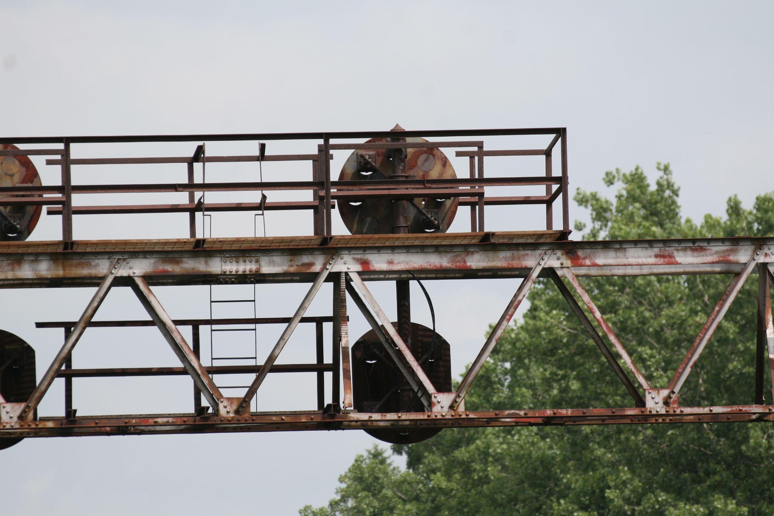 Jim Mihalek, 2018
A trio of classic Pennsy PL signals for NB traffic going thru the crossovers.
 Jim Mihalek, 2018
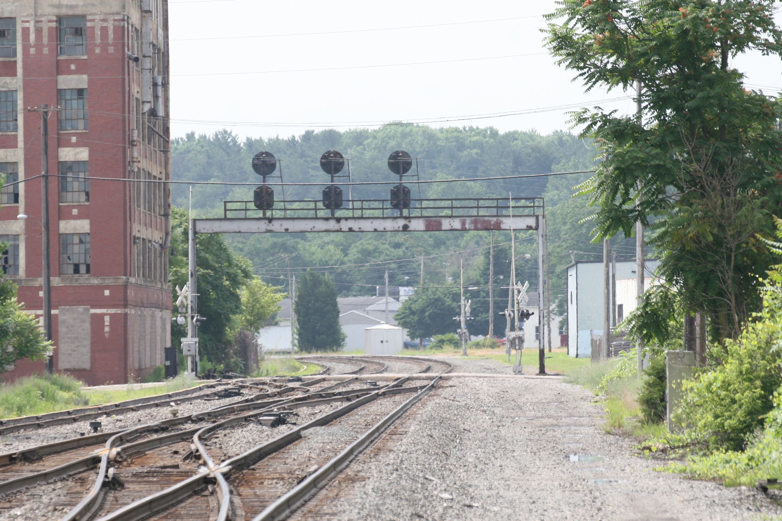 Jim Mihalek, 2018
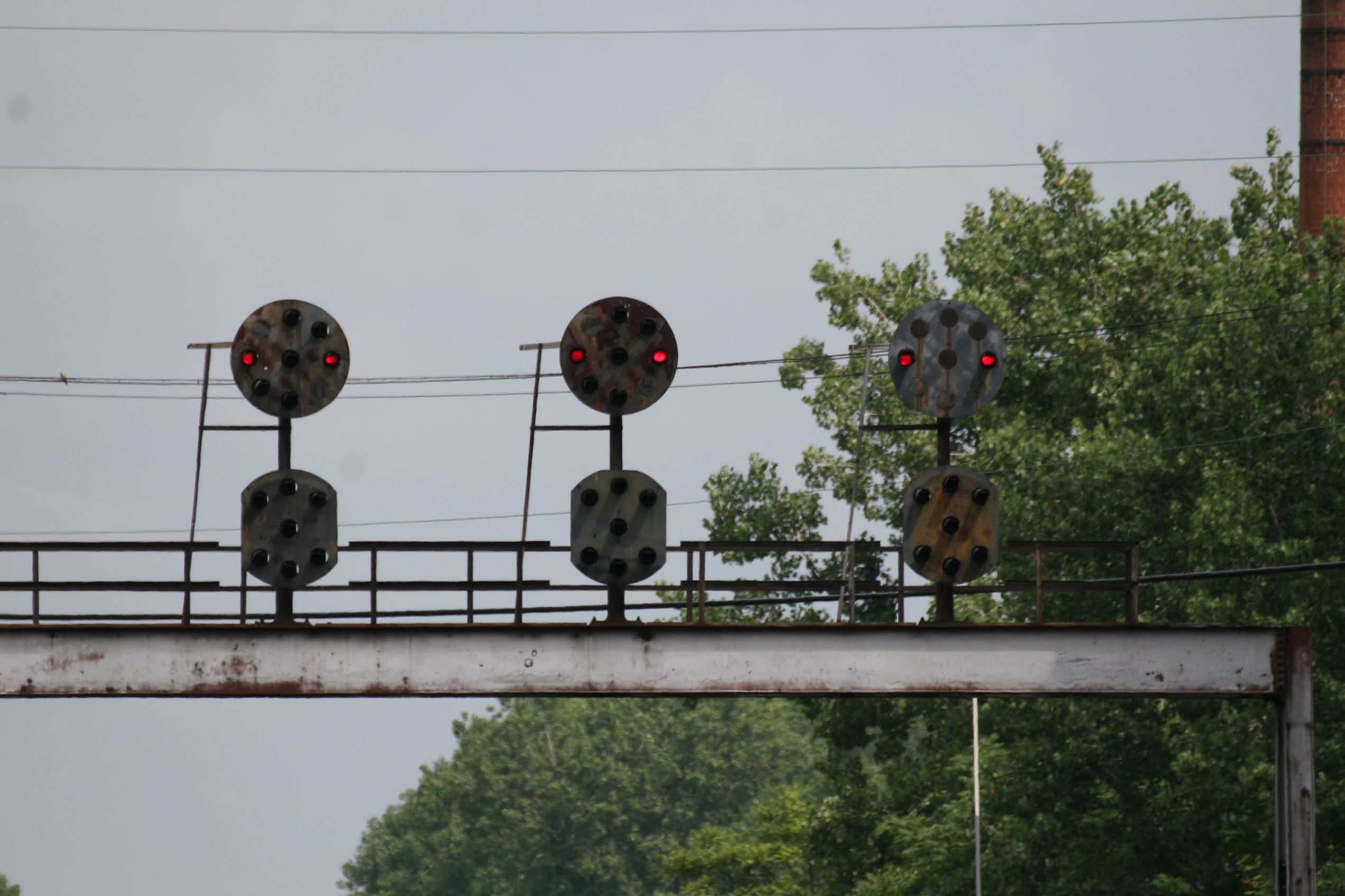 Jim Mihalek, 2018
 Jim Mihalek, 2018
Most "Tri-Light" signals on the former Pennsy appeared during the Conrail era, when I guess they felt it was easier and cheaper to replace the "antiquated" PL signals with something a tad more recent. Here we have a pair of them for SB traffic heading towards where the diamond with the Erie used to be. This is the only colorlight signal in town that I can see!

 Jim Mihalek, 2018
A three aspect CPL signal, for the approach to the diamond with the Erie. This signal can display STOP, CLEAR, and SLOW CLEAR, but probably only shows Clear using the top white marker.
This signal, and it's counterpart on the other side of Main Street and the "PRR", used to be full size CPL signals. Don't know when they were replaced with these two color dwarfs, but it was -probably- after the Ashland took over operations on this segment of track. This signal would have been 6L when it was a CPL. The excerpt is from the PC interlocking diagram above.
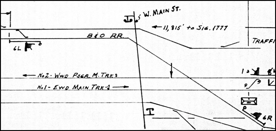
This would have been signal 6R on the Penn Central interlocking diagram.
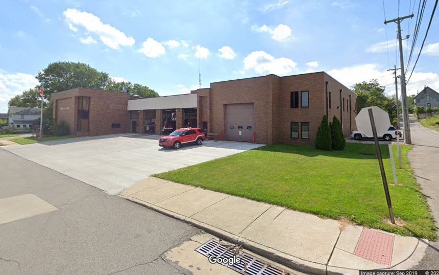
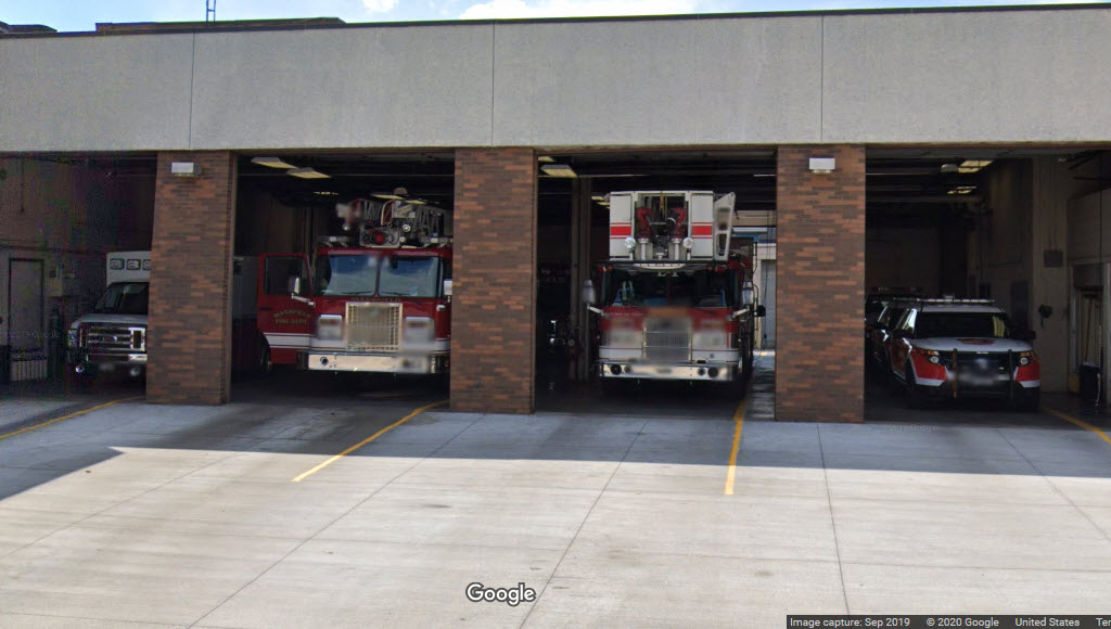
Mansfield Fire Dept Main Station
GPS Coordinates: 40.759289, -82.510531
140 E 3rd St, Mansfield, OH 44902
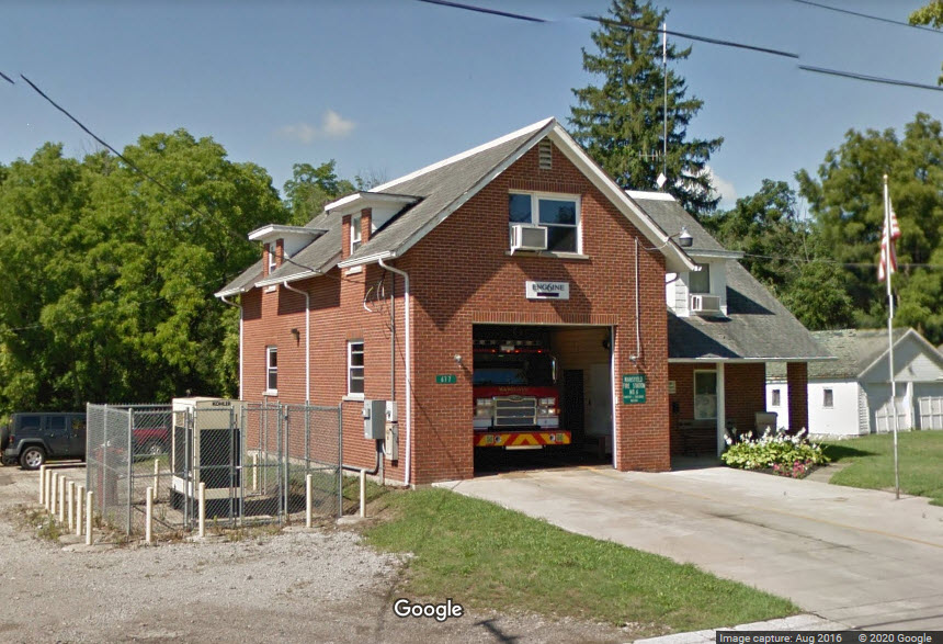
Mansfield Fire Dept Station 6
GPS Coordinates: 40.772096, -82.528880
677 Springmill St, Mansfield, OH 44903
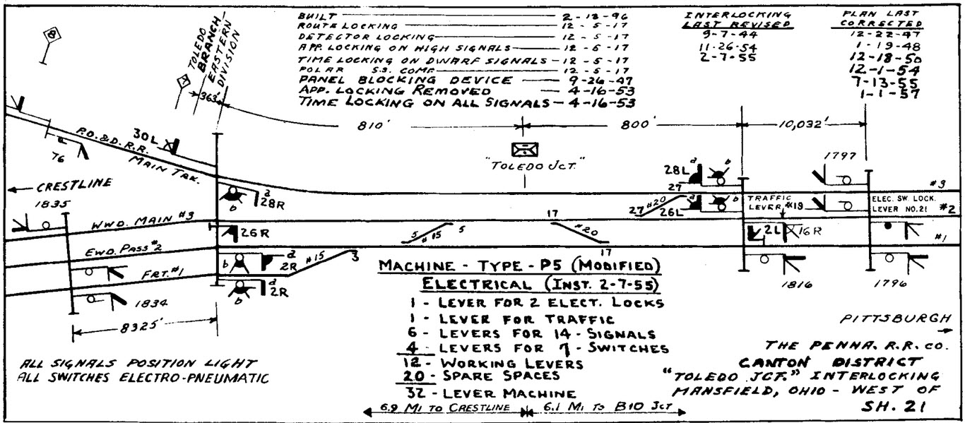
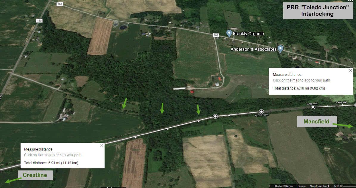
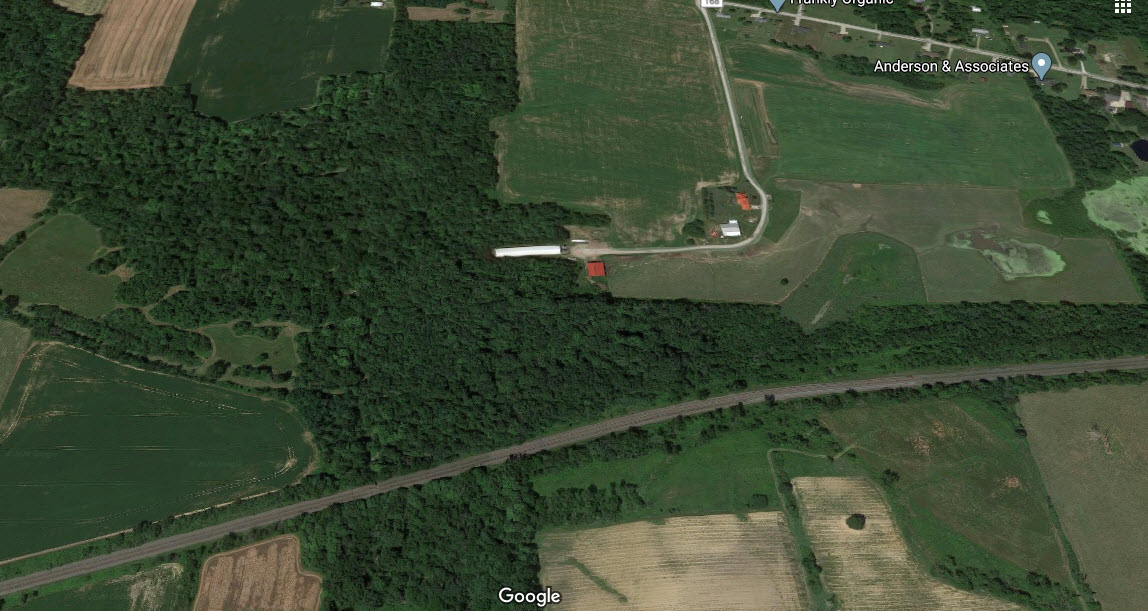
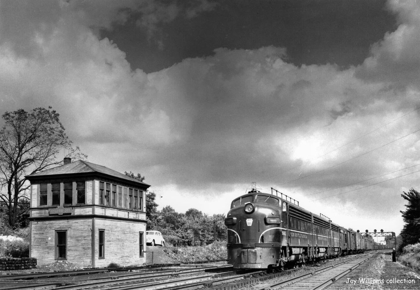
PRR "Toledo Junction"
About halfway between Mansfield and Crestline was another interlocking on the Pennsy: "Toledo Junction".
Today, nothing is left along the right-of-way that may have suggested there was ever anything there. However, if we look from above, we can still see in the tree line, where (at least) some of the branch went. Using Google maps, the 6.1 and 6.9 mile marks don't line up perfectly as noted on the drawing, but they are close enough to get an idea where the tower used to be. This must have been a great spot for pictures with trains whizzing by at speed, with plenty of signals to spice up the pictures, like the one below! Picture and diagram came from North American Interlockings, but the diagram can be found from several sources. While it may look like there are four tracks because you can see four signal heads in the distance, you will find that two are facing in each direction if you look at the diagram.
Other things Steve suggests to investigate in the "area"....
In Crestline OH, about 12 miles west via US Route 30 and the Lincoln Highway:
There is a railroad museum in Crestline OH. It is in the south eastern corner of North Washington and Scott Street.
Also in Crestline is the YMCA that was used for PRR crews at the north western corner of South Thoman St (OH-61) and West Bucyrus St. It is now used by CSX. They have offices there, and you will see vehicles and construction material there. There used to be roundhouse there, but it and all of the other buildings have been flattened. If you continued west on Bucyrus Street you can see the junky area where the roundhouse was.
At some point on Bucyrus you catch a glimpse of the wye-track that extended north from the yard area. This was to turn some of the larger rigid frame PRR loco's too big for the turntable. On the www.crestlineprr.com website, there is a funny story of a hogger and the language used when one jumped the track on the wye.
Mansfield and Crestline are on the historic Lincoln Highway.
In Bucyrus OH, about 25 miles west of Mansfield:
Continuing west from Crestline, you come to Bucyrus OH. Bucyrus has a preserved depot, the T&OC Railroad Station. It is a beautiful brick building on East Renssalear Street. It sits at the crossing of PRR's New York-Chicago mainline with PRR line from Columbus to Sandusky. Both of those lines are still in service. The Toledo and Ohio Central RR also crossed there. Interlocking was run by COLSAN tower (North American Interlocking) which is now gone.
Bucyrus was the home of Bucyrus Locomotive Crane, another rust belt company gone. Check the T&OC website, I think tours are during certain hours.
If you have made it this far, you can go north from Bucyrus on OH-4 to Bellvue OH, and visit the Mad River & NKP Museum.
In Marion OH, about 18 miles south of Bucyrus:
For preserved depot and interlocking fans, south of Bucyrus on OH-4 is restored and preserved 'AC' interlocking tower. The location is still at a very busy railroad hub. It is on the grounds of the Marion Union Station Association.
Courtesy of the University of Texas Library, click here for their index page.
Disclaimers:
New format 10/26/23: Please check out my disclaimer page for my standard dribble and contact info here
RAILFAN GUIDES HOME
RAILROAD SIGNALS HOME
NEW MAY29/2020, OCT28/29/2023, SEP23/2024
Last Modified 23-Sep-2024