RAILFAN GUIDES of the U.S.
Todd's Very Mini-Railfan Guide to
HAMLER OH
In General
Getting Here
Map
Signals
The Changing
of the Signals
Pictures
Floobydust
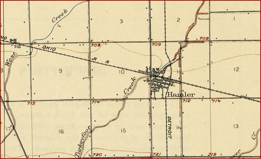
USGS Maps
RAILFAN GUIDES HOME
RAILROAD SIGNALS HOME
Location / Name:
Hamler OH
What's Here:
Diamond Crossing between
the CSX and the DT&I
Former location of the B&O Hamler Tower
Data:
GPS Coordinates: 41.229766, -84.030014
ZIP: 43524
Scanner Frequencies:
CSX: 160.230
Access by train/transit:
None
The Scoop:
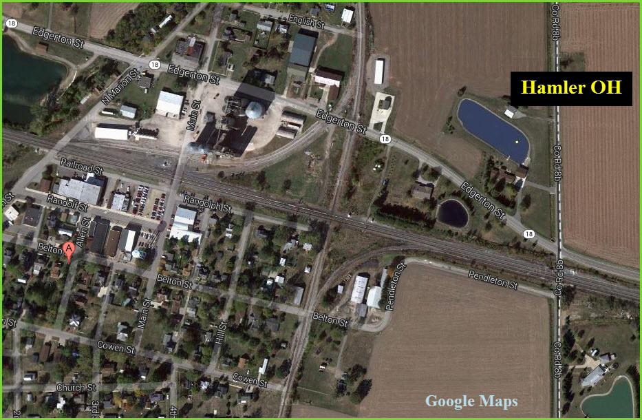
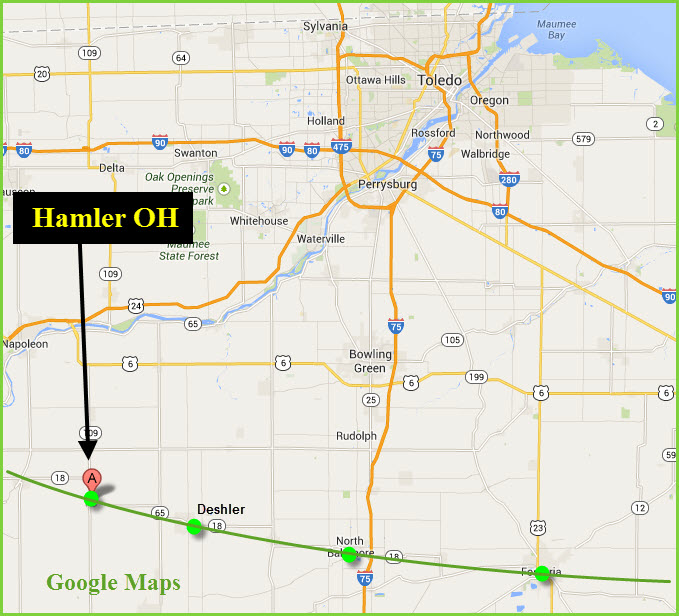
Hamler is located on a
major CSX mainline
heading from Chicago to
the east. To the
west is Holgate.
To the east you have
Deshler,
North Baltimore, and
Fostoria.
Looks like you have excellent sight lines in both directions. CSX train frequency is high, you shouldn't have to wait too long before seeing something come thru.
According to one source, the tower, semaphores, and CPL's disappeared around the 1998 timeframe, when the trackage was given to CSX as part of the Conrail break-up, and CSX upgraded the crossover to two tracks to increase capacity.
The former DT&I trackage is now owned by the IORY, the Indiana & Ohio Rwy, owned by the Genesee & Wyoming guys. Not sure of the train frequency or time(s), but one chat I came across mentioned one train a day.....
From Wikipedia:
Google has better pictures of Hamler than does Bing, Bing's imagery is very coarse.
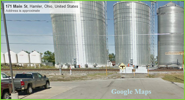
Notice: Main Street DOES NOT cross the tracks!
Acknowledgements:
Thanks to E. Garrett for being in the right spot at the
right time, sure would like to see if he has any more pictures for Hamler!
Thanks to Denver Todd for his help with my railfan
guides and suggesting welcome changes to help all ya'll.
Well, if you're already in Deshler, just head west on 18, it's about an 8 mile ride.
From elsewhere, it looks like 18 may be your best best from the east (off of I-75, exit 167) or the west (via US 24). If you're approaching from the north or south, it may take a while, as travelling the smaller back roads is time consuming.
1 EB CSX Colorlights
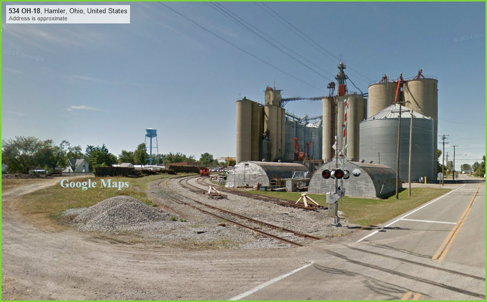
The tower would have been on the far side of the diamond. This picture is taken at the end of Randolph Street, and is the only decent picture of signals from the street view of Google Maps.
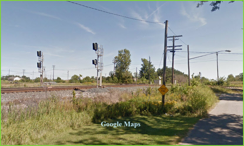
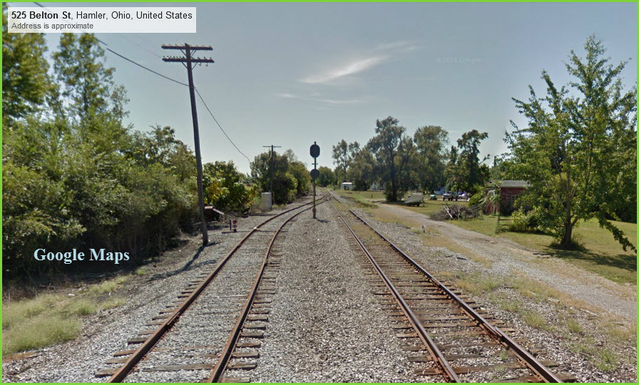
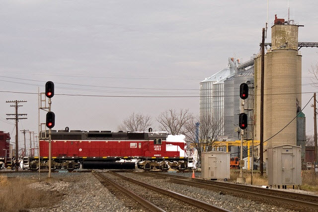
2 NB IORY Colorlights
Here we are at the Belton St crossing with the DT&I, looking south, and we can see the back of the northbound signals for the crossing. In looking at the aerial views on Google, I did not see a SB DT&I signal, but that doesn't mean there's not one hiding around....
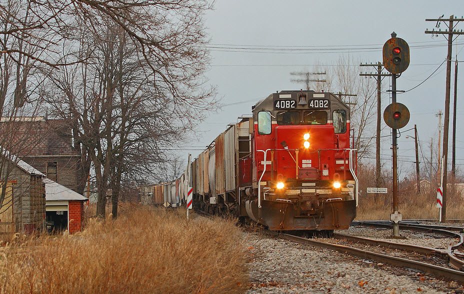
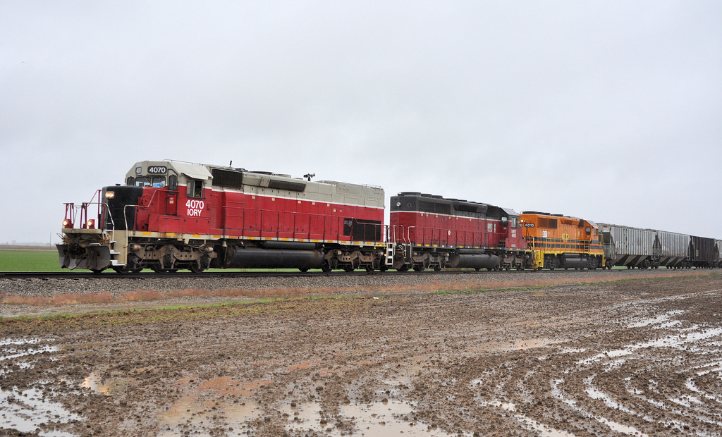
Picture by Aaron J Border, 31DEC2010. On New Year's Eve 2010, IORY SD40-2 4082 bring grain loads south across the CSX diamonds at Hamler for interchange here.
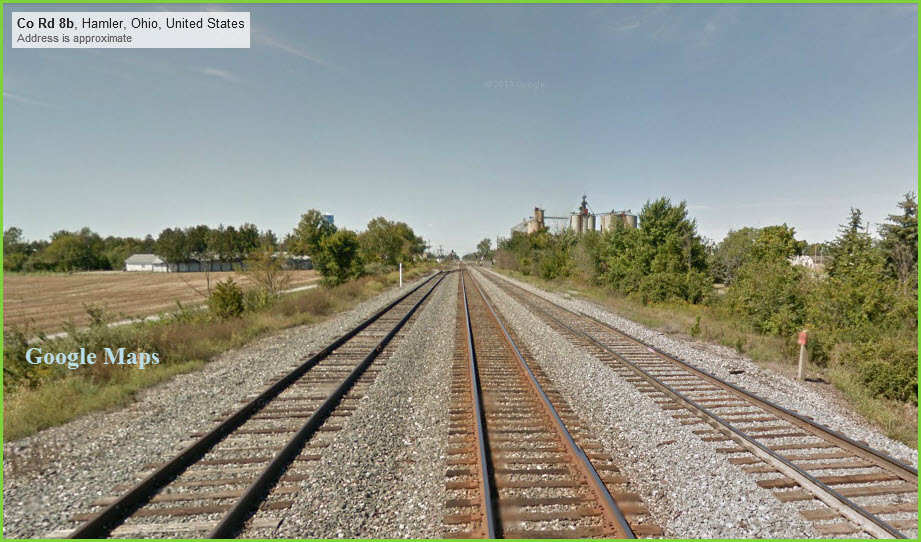
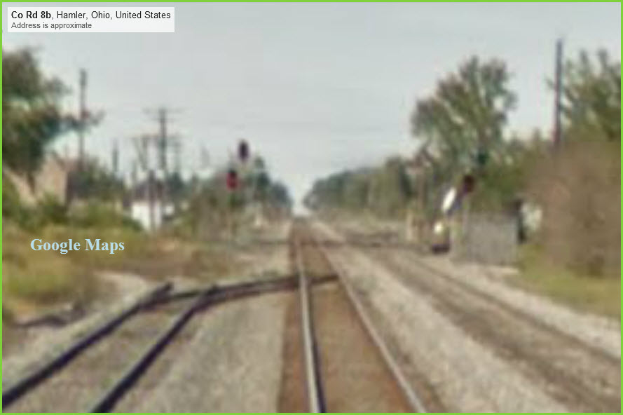
3 WB CSX Colorlights
Viewed from County Road 8b, to the east of the diamond. I'm amazed we can see anything at all of the signals at the crossing when you go to magnify the picture.
4 EB CSX CPL's and Colorlights
In this picture from 1997, we can see the changeover from CPL's to colorlight signals is in progress. Photo by Cass Tellis. Good signal shot!
5 NB IORY Colorlight
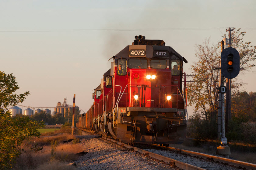
An extra daylight Indiana and Ohio freight passes the Northbound approach signal for the CSX diamond. LNLX-13, Hamler, OH. Either the signal isn't working, or it has been downgraded to a full time approach signal without blanking out the red and green positions. Photo by Jim Guest, 13OCT2013.
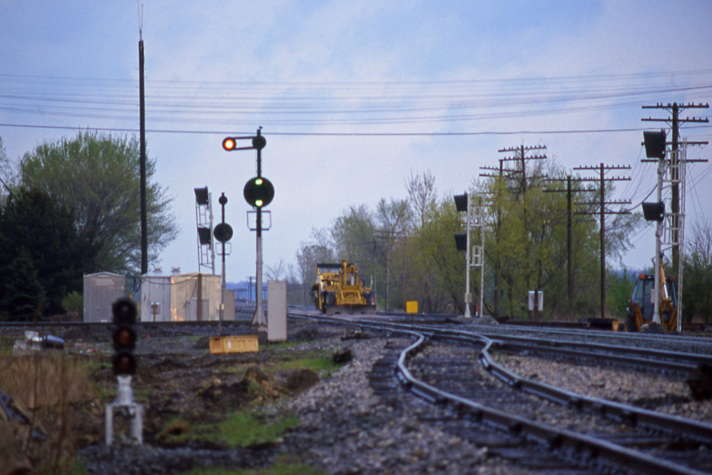
Under the B&O, the track through here was double-tracked. At some point in time (Maybe mid to late 70's? Under the Chessie system?), the immediate crossover area was reduced to a single track as can be seen from the 1992 picture. Then, around 1997/98, CSX decided to re-install the second track through the diamond to increase capacity. The pictures below illustrate this. Notice during the construction period in 1997, they relocated the main signal to the left side of the track. I wonder when the 3 aspect dwarf colorlight made its appearance (Maybe part of the upgrade?)?
 David Wilson - 12/1972
 David Wilson - 12/1972
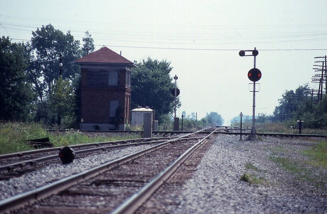 David Wilson - 1992
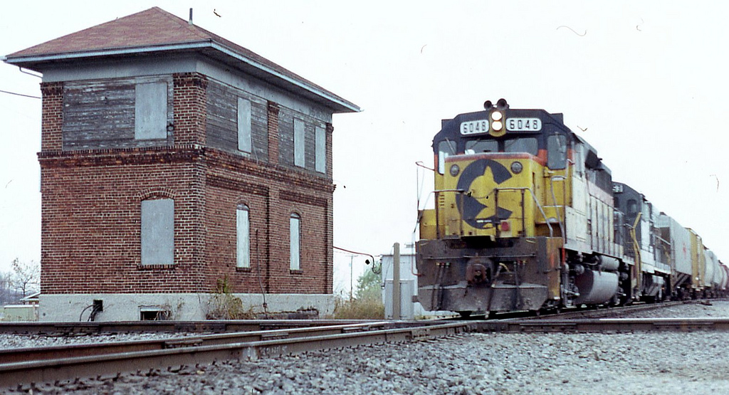 By Fan-T
 Upgrading - Cass Tellis - 1997
 As seen today - photographer unknown
I found a bunch of photos taken in Hamler here: http://flickriver.com/places/United+States/Ohio/Hamler/
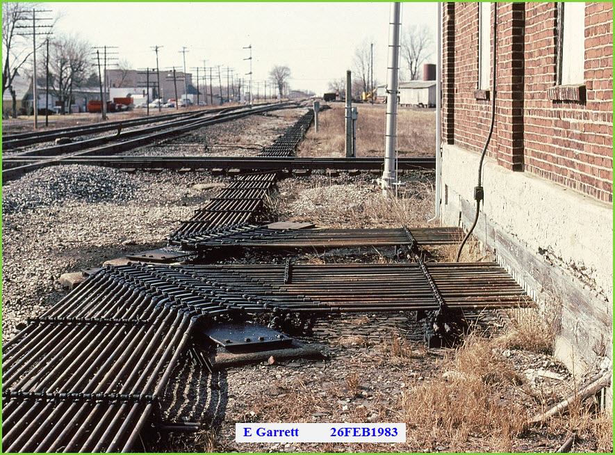
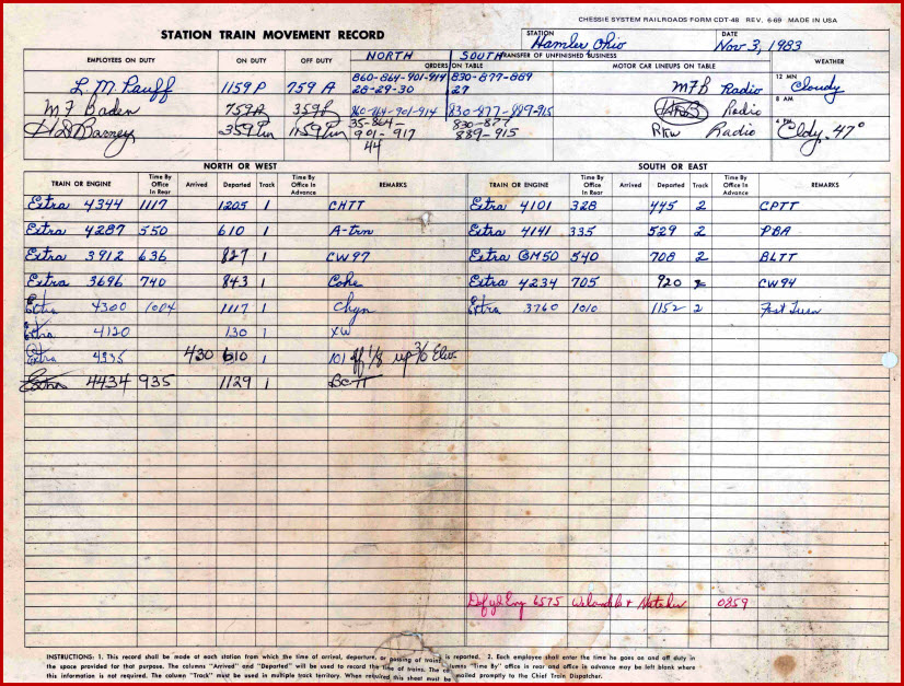
The picture below is the sole reason for this page. I came across it back in 2008, and it was hiding on an old 128M thumb drive I had laying around (and yes, I did say 128 megs...) It shows the "armstrong" rods used to activate the signals and switches at this interchange back in 1983.... notice the semaphores in the picture (more below) The circle in the aerial shot indicates where the tower used to be located.
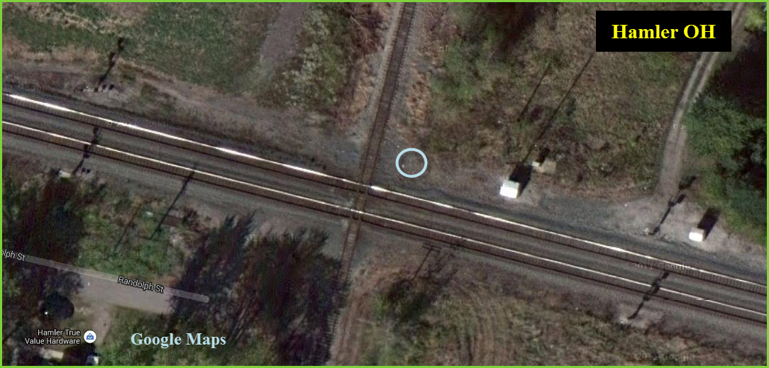
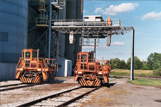
The only other thing I can see in town that might be of interest are these little guys used to shuttle the grain cars around during the loading season. There are two shown in the aerial view above in the maps section.
 By Fan-T, unknown date
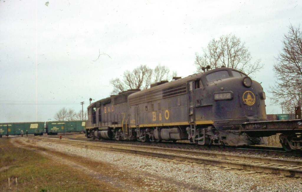
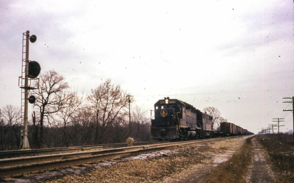
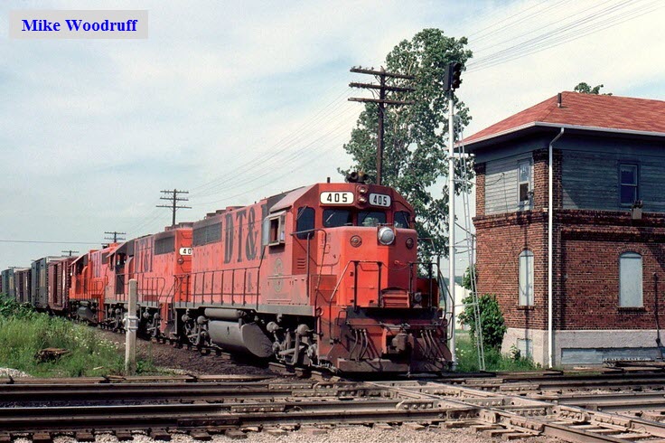
The following two pictures are by David Wilson, taken December 1972, found here: https://www.flickr.com/photos/davidwilson1949/4091688328/
 By Penn Central 74, 6OCT20131
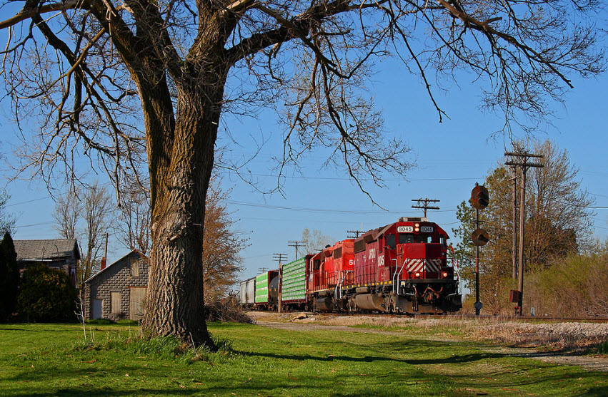
JFDX 8045 brings I&O's LNL-X south across the Hamler diamond on the former DT&I. The trees say it's still late March, but the half nose light at not quite 6pm says early May. Photo by Aaron J Border.
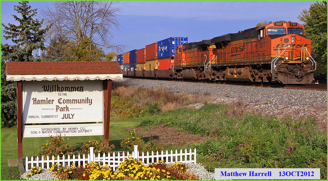
EB CSX stack train Q172 passes the very Germanic "Willkommen" sign at the entrance to Hamler's community park. Taken from route 109.
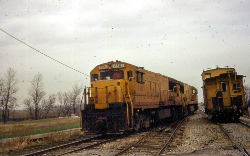
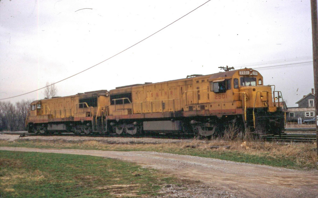
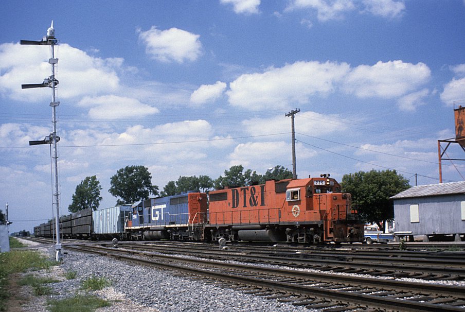
Engines DT&I 225 and GT 5918 are making a setout at Hamler, Ohio on August 14, 1982. The semaphore signal is on the former B&O mainline from Pittsburgh to Chicago. Unknown photographer. Found here
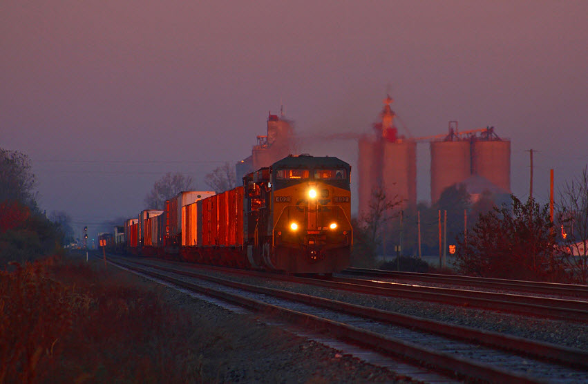
The sun has just began to poke over the horizon on this frosty late October morning as eastbound Q136 roars away from Hamler on the ex-B&O. Photo by Aaron J Border, 30OCT2008. Great shot!
1983 Train Movement Records
These were found here, many more available....
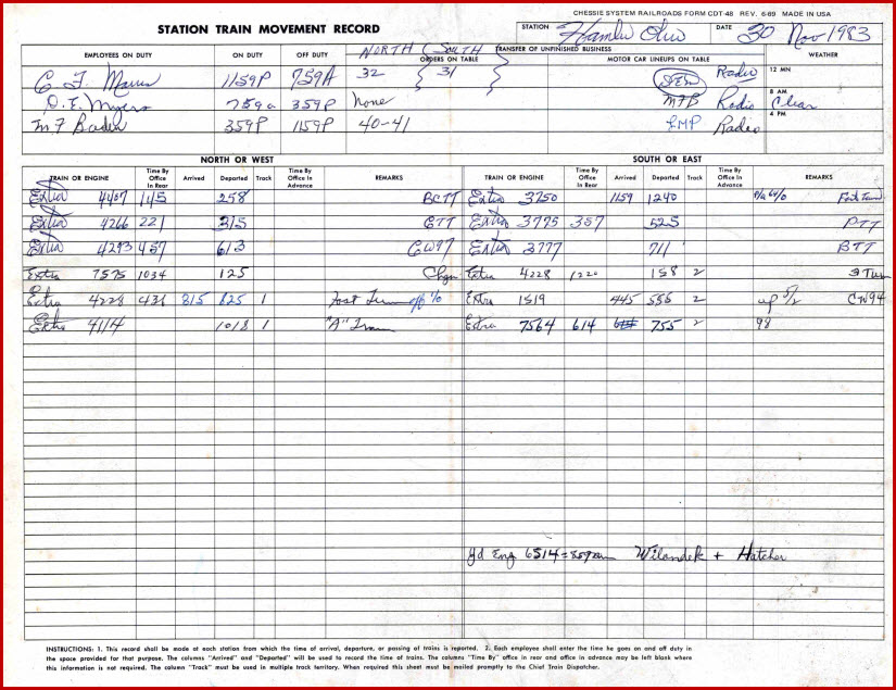
Courtesy of the University of Texas Library, click here for their index page.
Disclaimers:
I love trains, and I love signals. I am not an expert. My webpages reflect what I find on the topic of the page. This is something I have fun with while trying to help others. My webpages are an attempt at putting everything I can find of the subject in one convenient place. There are plenty of other good websites to help me in this effort, and they are listed in the links section on my indexa page, or as needed on individual pages. Please do not write to me about something that may be incorrect, and then hound the heck out of me if I do not respond to you in the manner you would like. I operate on the "Golden Rule Principle", and if you are not familiar with it, please acquaint yourself with how to treat people by reading Mathew 7:12 (among others, the principle exists in almost every religion). If you contact me (like some do, hi Paul) and try to make it a "non-fun" thing and start with the name calling, your name will go into my spambox list! :-)
Please Note: Since the main focus of my two websites is railroad signals, the railfan guides are oriented towards the signal fan being able to locate them. For those of you into the modeling aspect of our hobby, my indexa page has a list of almost everything railroad oriented I can think of to provide you with at least a few pictures to help you detail your pike.
If this is a railfan page, every effort has been made to make sure that the information contained on this map and in this railfan guide is correct. Once in a while, an error may creep in, especially if restaurants or gas stations open, close, or change names. Most of my maps are a result of personal observation after visiting these locations. I have always felt that a picture is worth a thousand words", and I feel annotated maps such as the ones I work up do the same justice for the railfan over a simple text description of the area. Since the main focus of my website is railroad signals, the railfan guides are oriented towards the signal fan being able to locate them. Since most of us railheads don't have just trains as a hobby, I have also tried to point out where other interesting sites of the area are.... things like fire stations, neat bridges, or other significant historical or geographical feature. While some may feel they shouldn't be included, these other things tend to make MY trips a lot more interesting.... stuff like where the C&O Canal has a bridge going over a river (the Monocacy Aqueduct) between Point of Rocks and Gaithersburg MD, it's way cool to realize this bridge to support a water "road" over a river was built in the 1830's!!!
My philosophy: Pictures and maps are worth a
thousand words, especially for railfanning. Text descriptions only
get you so far, especially if you get lost or disoriented. Take
along good maps.... a GPS is OK to get somewhere, but maps are still
better if you get lost! I belong to AAA, which allows you to get
local maps for free when you visit the local branches. ADC puts
out a nice series of county maps for the Washington DC area, but their
state maps do not have the railroads on them. If you can find em,
I like the National Geographic map book of the U.S..... good, clear, and
concise graphics, and they do a really good job of showing you where
tourist type attractions are, although they too lack the railroads.
Other notes about specific areas will show up on that page if known.
Pictures and additional information is always needed if anyone feels
inclined to take 'em, send 'em, and share 'em, or if you have
something to add or correct.... credit is always given! BE NICE!!! Contact info
is here
Beware: If used as a source, ANYTHING from Wikipedia must be treated as being possibly being inaccurate, wrong, or not true.
RAILFAN GUIDES HOME
RAILROAD SIGNALS HOME
NEW 06/15/2014
Last Modified
16-Jun-2014