
In General
Getting Here
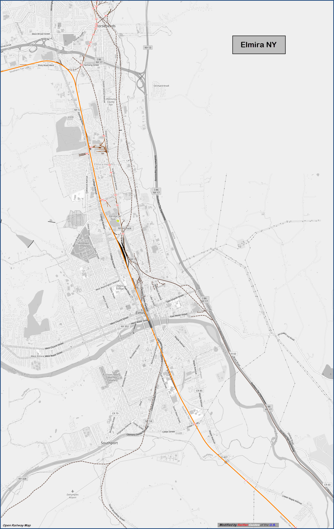
Map
Sights
Signals
Bridges
Pictures
History
Floobydust
Historical & USGS Maps
RAILROAD SIGNALS HOME
Location / Name:
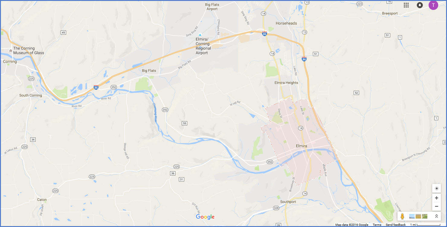
Elmira NY, Chemung County, mid state
What's Here:
Former Erie Depot
Small NS Yard
Lackawanna Trail
A few Signals
Data:
GPS Coordinates: as needed
ZIP: 14901
Phone A/C: 607
Access by train/transit:
None
The Scoop:
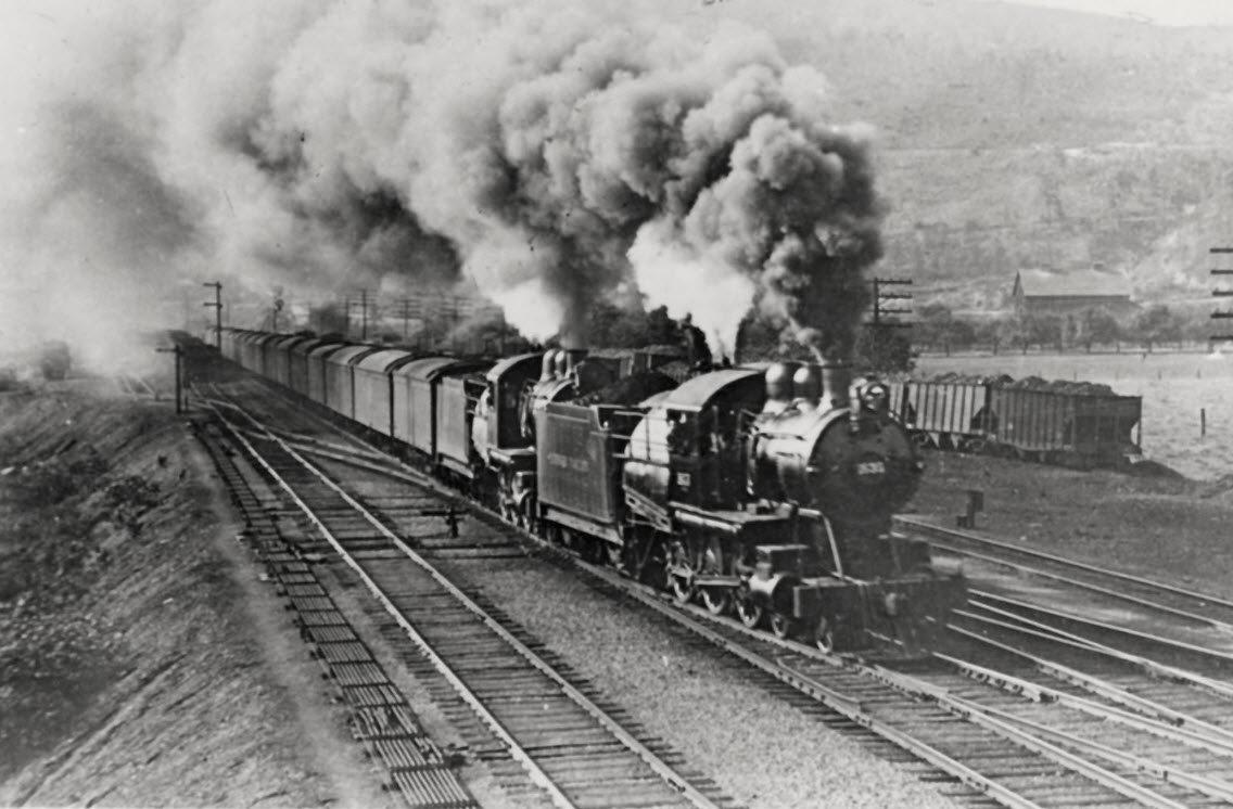
At one time, like most towns, there were four railroads that used to come thru Elmira:
1) The Northern Central, later the Pennsylvania RR,
2) The Delaware, Lackawanna & Western RR,
3) The Lehigh Valley RR, and
4) The Erie RR.
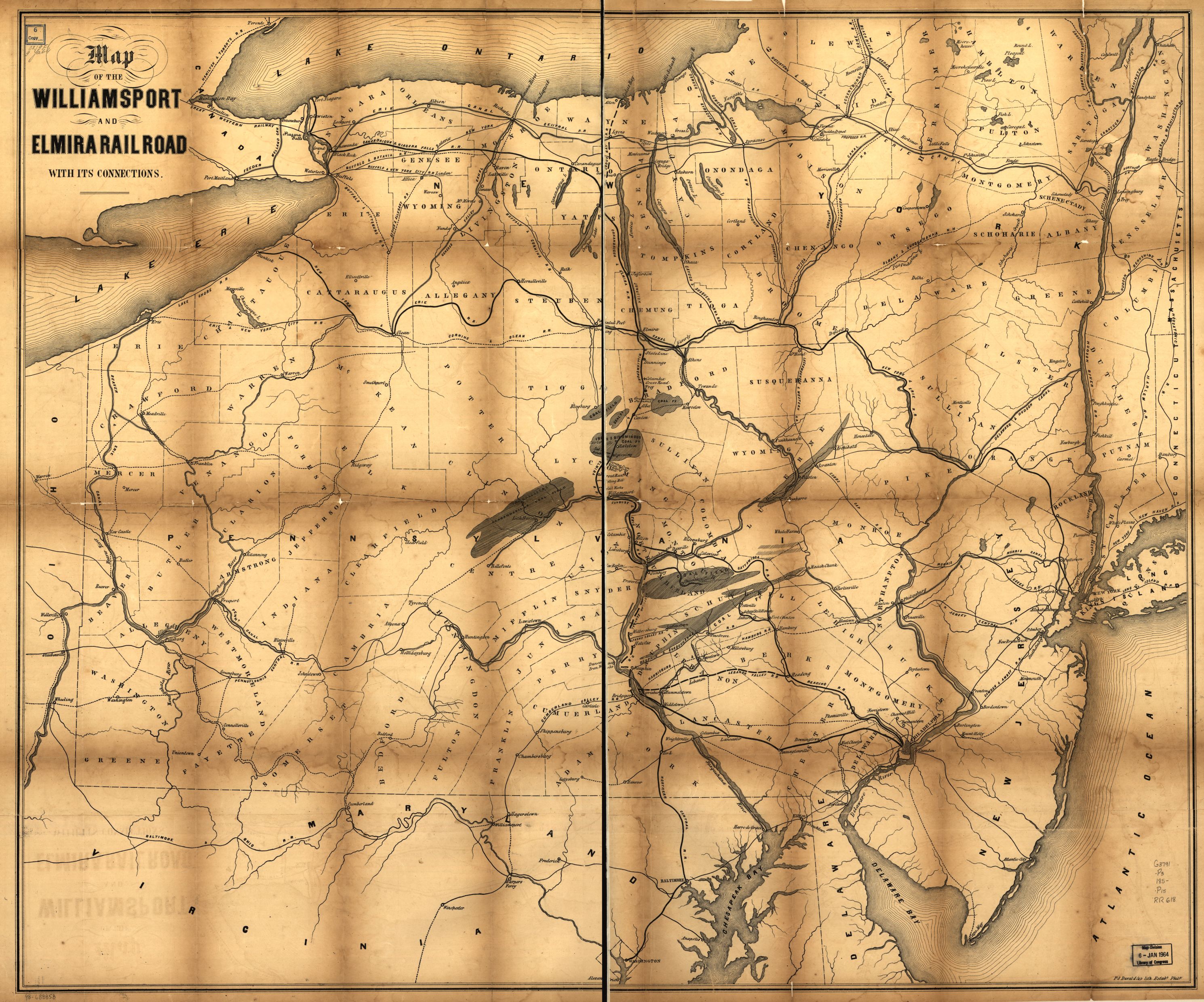
The first railroad to actually make it to Elmira was the New York and Erie RR, which later became the Erie RR. The Elmira and Williamsport Railroad (earlier the Williamsport and Elmira Railroad) is a historic railroad that operated in Pennsylvania. The W&E was organized in 1832 and ran between Williamsport PA and Elmira. It was reorganized as the E&W in 1860, and operated its own property until 1863.
Today, the only thing running through Elmira is the Norfolk Southern, which used to be the Erie. They have a small yard in town.
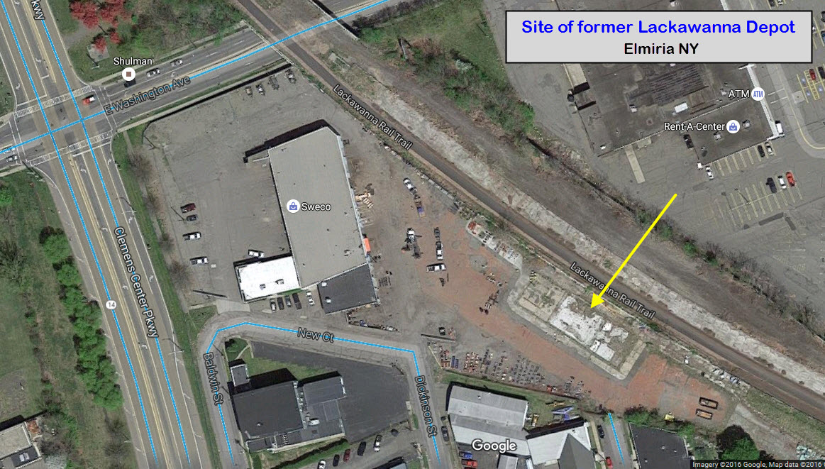
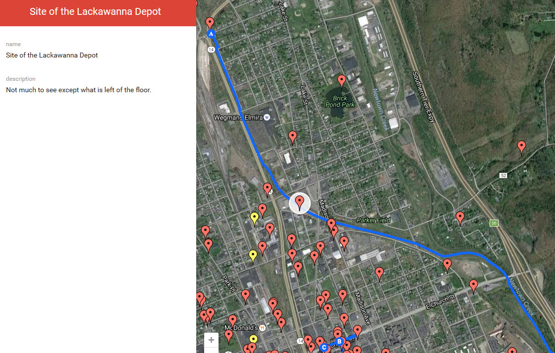
There is one depot still standing, which is the former Erie depot. The foundation remains for the Lackawanna depot along the Lackawanna Trail.
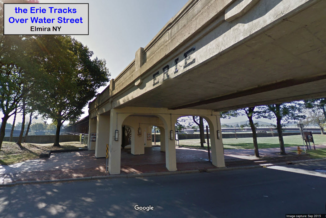
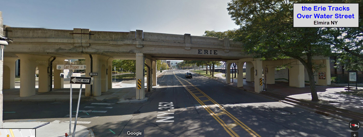
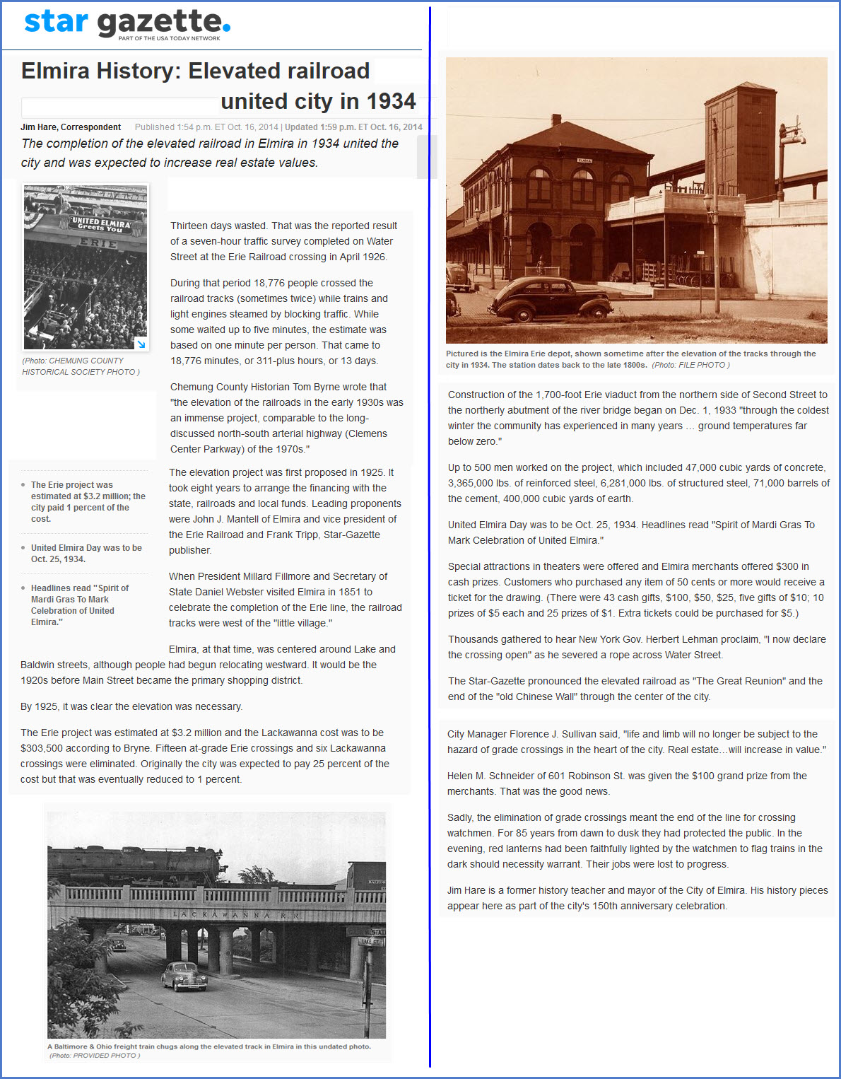
If you look at the pictures below, you will notice that some of them show the tracks at station (ground) level, and others show the tracks elevated above the streets. This was the result of a project embarked upon by the Erie Railroad, and contributed to by the Lackawanaand a little bit by the city. It opened in 1934.
The link for Chemung railroad history page URL has changed, please note the new one below.....
Acknowledgements:
Jon Cassel
Missy Gray
WestConn chapter NRHS
Chemung County Historical Society
Websites and other additional information sources of interest for the area:
https://www.chemunghistory.com/railroads-in-chemung-county
http://www.abandonedrails.com/Cortland_Branch
http://www.rrpicturearchives.net/rspicture.aspx?id=809012
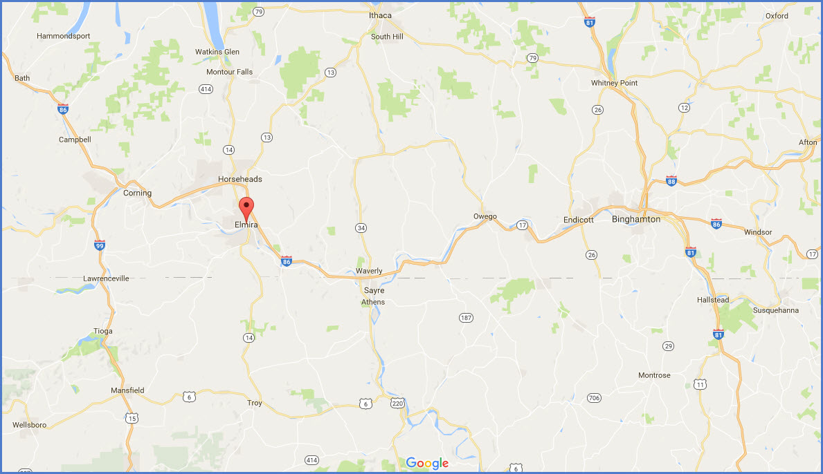
Coming from Rochester? It's about 113 miles. Take I-390 south to I-86 (at Avoca, about 43mi to go) east, go past Corning NY (about 16mi to go), till it gets you to Elmira at exit 56, Church St. Go west into town.
Coming from Buffalo (or Batavia)? It's about a 150 mile drive from downtown. I would probably take I-90 east till you hit Batavia at exit 48, then take NY 63 thru Batavia to just south of Genesco where you will finally hop on I-390 at exit 7. Finish up by following the directions above.
Coming from Syracuse? It's about a 122 mile drive. Head down I-81 to Binghamton (about 69 miles) and then head west on I-86 another 53 miles or so to Elmira at exit 56.
How bout Albany and Schenectady? About a 181 mile drive from Albany. Take I-88 from Schenectady to Bingo (about 125 miles), and then take I-86 west like above.
From Scranton PA, it's about 107 miles via I-81 north to Bingo, and then west on I-86.
If you're coming from NYC, try I-80 to I-390 (just south of Mt Pocono), and then on up to Scranton. It's about a 216mi drive.
If you're coming up from Baltimore MD (~290mi), York PA (~242mi) or Harrisburg (~216mi), it's via I-83 and I-81 thru Scranton.
From anywhere else, you have to go pretty much thru the above towns, except for Philly, where you would want to come up via I-476 to Scranton. It's about a 220 mile trip.
GPS Coordinates: 42.093514, -76.808328
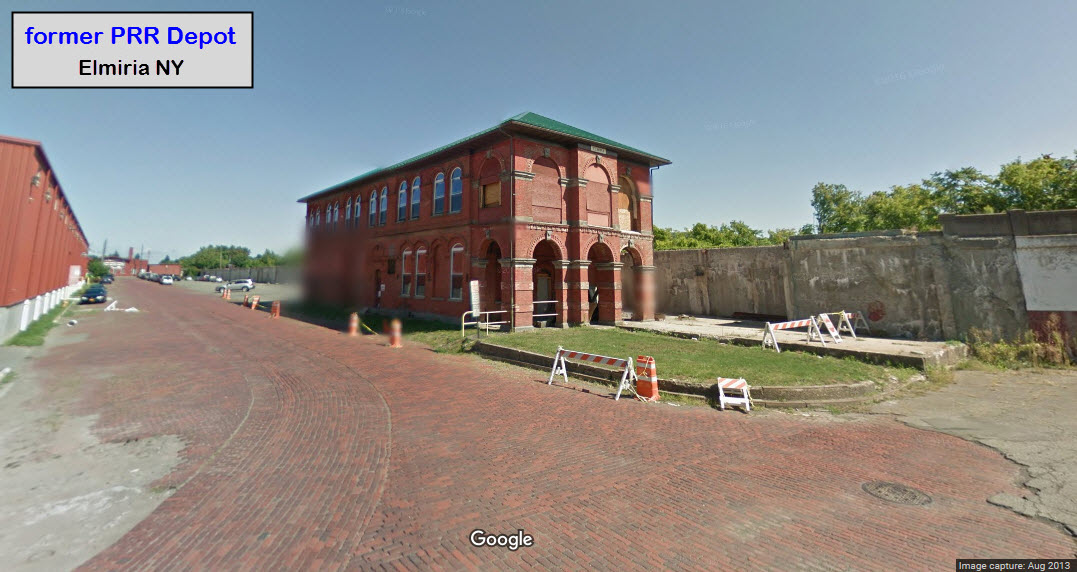
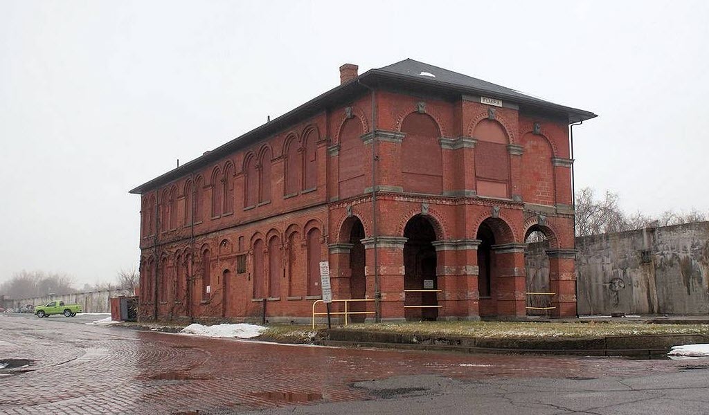
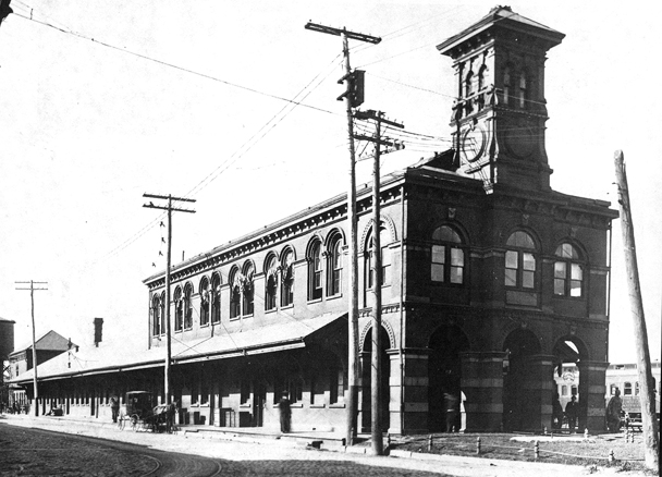
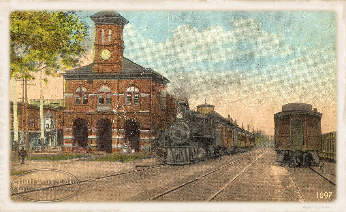
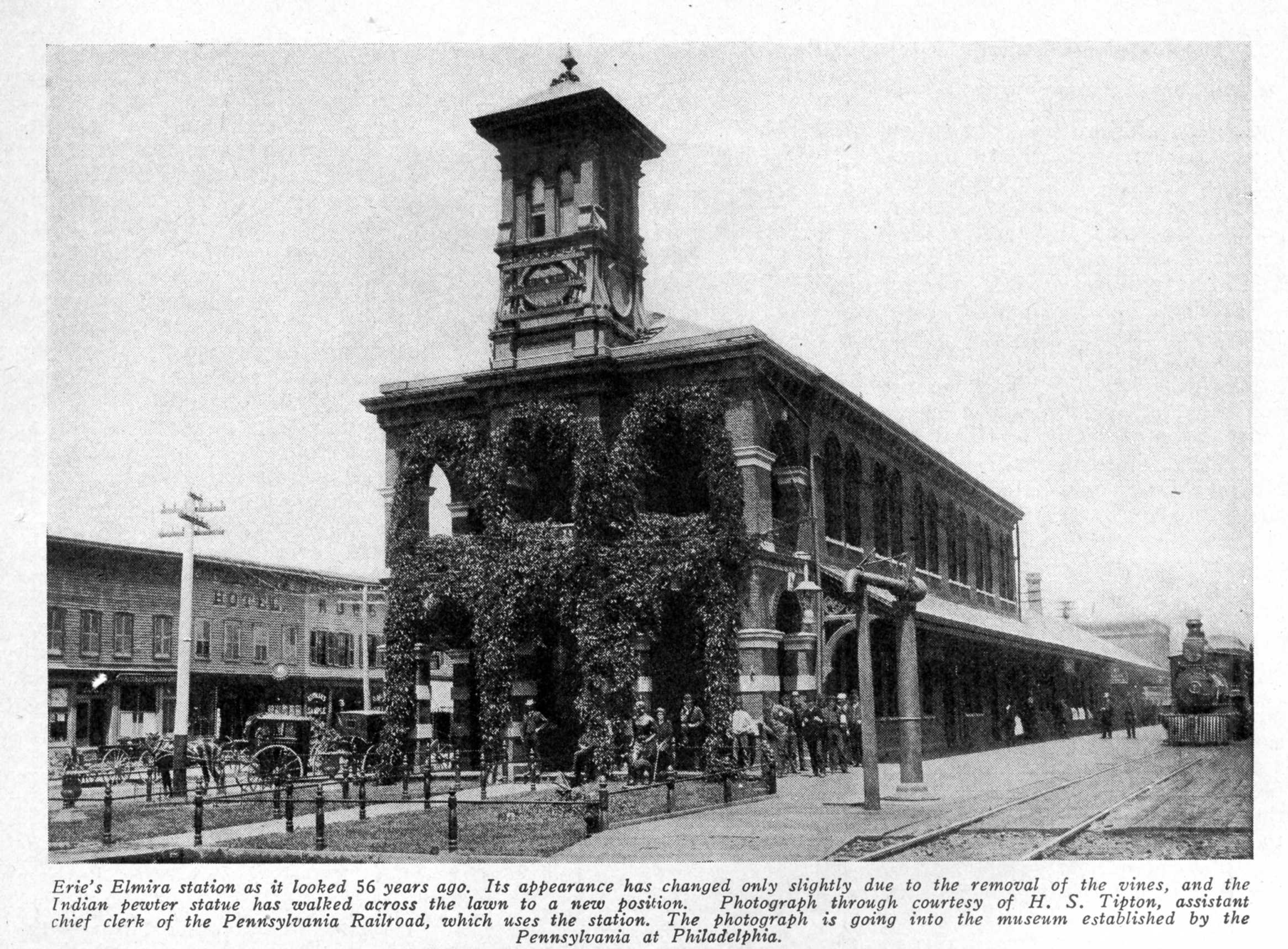
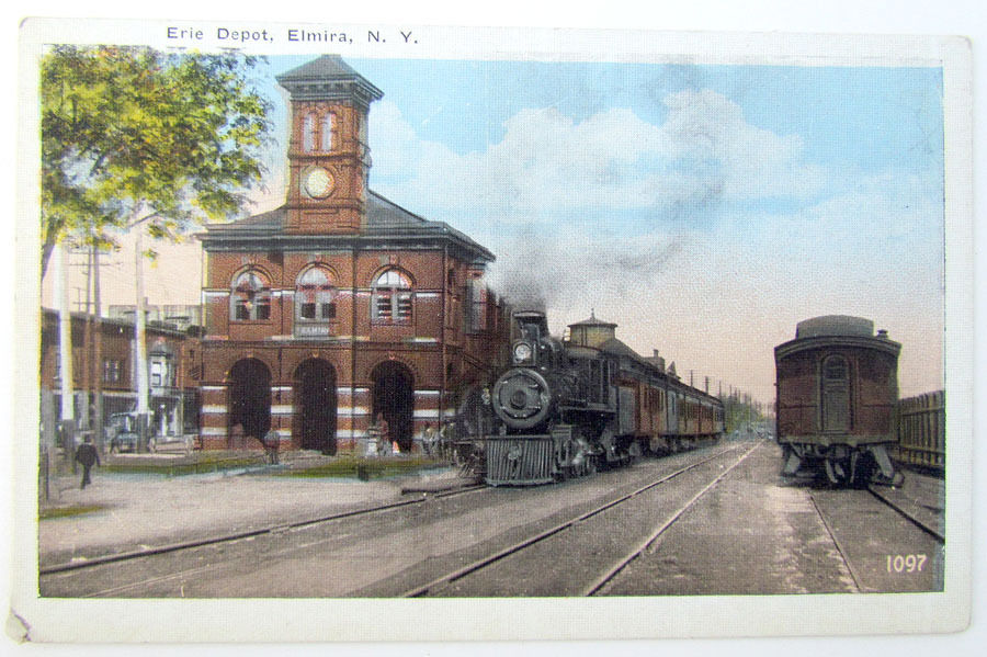
This station, although constructed by the New York & Erie RR, was also used by the Pennsylvania RR.
The tower has disappeared, but the station remains.
There was a track where the curved portion of the brickwork is as can be seen in the lower picture - streetcar, railroad?.
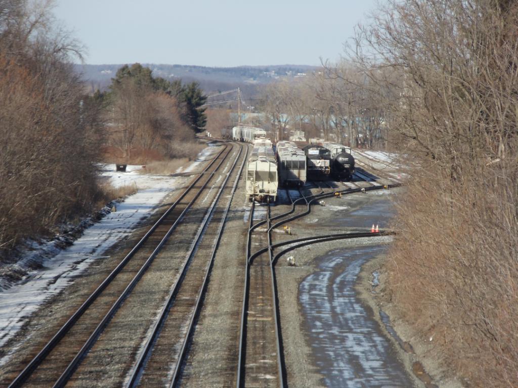
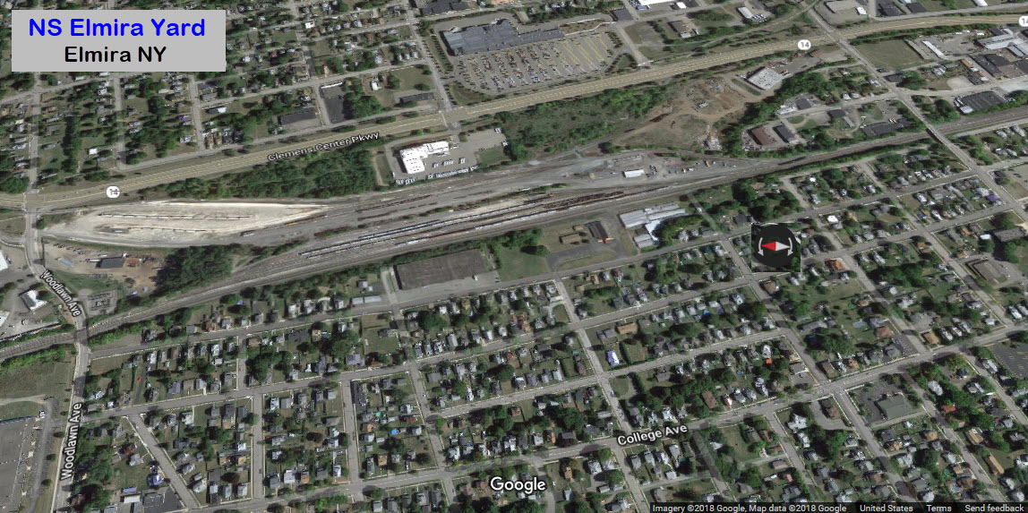
![]() NS Elmira Yard
NS Elmira Yard
The picture below was taken with a good telephoto lens from the Washington Street overpass.
Woodlawn Ave goes under the north end of the yard, Washington St goes over the south end of the yard.
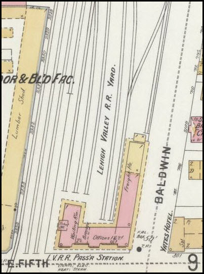
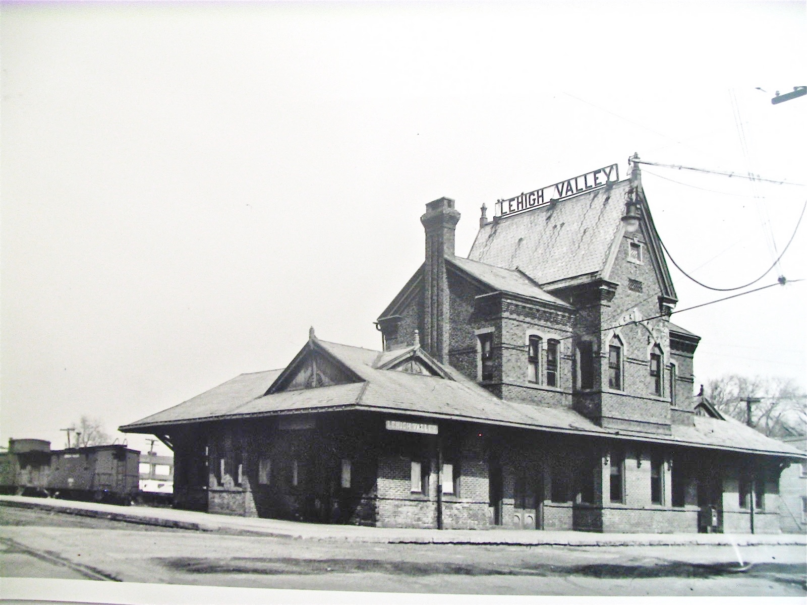
![]() Former Lehigh Valley Depot
Former Lehigh Valley Depot
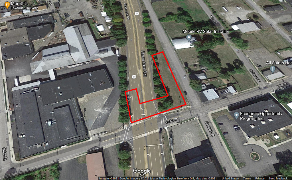
9/1/18 - I have an update from Jon Cassel who has done some investigation on the
location of this station. He has spoken with a couple of retired NS employees
that started with the Lehigh Valley in Elmira during the days when trains freely
roamed around town, and found out the station was located in the area of the Washington
St. Bridge and the Clemens Expressway.
One of the guys also added this: When I worked at Elmira, the Track Supervisor told
me the property was still owned by the Railroad and they had to maintain it. I
can't tell you the exact spot because so much was has changed in that area over the
years. From the station, trains would travel through what is Shuman's Scrap Yard,
cross over the Erie behind their yard offices on the hill, at Franklin St. Tower (now
is Woodlawn and Clemens Expressway), they then crossed over the DL&W main and
headed to Horseheads. It was originally the EC&N RR before the LV took them over.
Update 4/19/21: I found a map of Elmira from 1898, and below is an excerpt
from it, showing it on the corner of 5th and Baldwin. The orientation
of the depot in the picture does not agree with that shown in the drawing,
comparing each to the orientation of tracks.
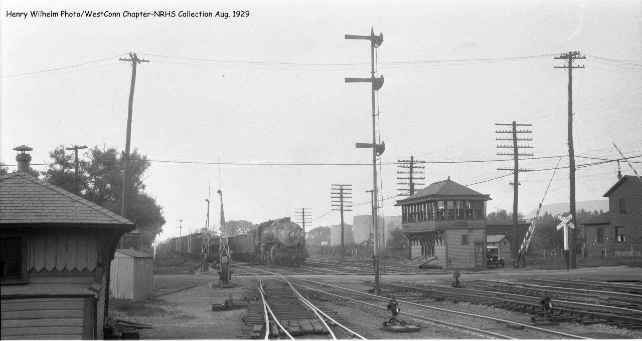
In this picture below passed on to Jon: The DL&W Tower was at Thurston St. In this photo the LV would be coming from the left side. I don’t remember what
the call sign was for the Tower. The train in the photo is coming Eastbound.
Wouldn't you love to have one of those switch stands now?!!!
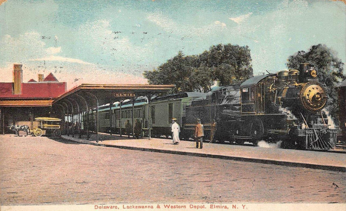
![]() former Lackawanna Depot
former Lackawanna Depot
GPS Coordinates: 42.100026, -76.806047
Looks like the second depot was built in 1913, according to the history below. The station was abandoned in 1959 according to one source.
Looking for info on when it was razed. The foundation is still around.
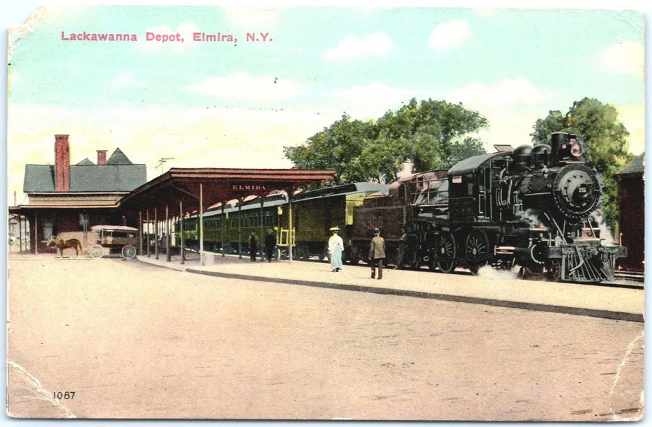
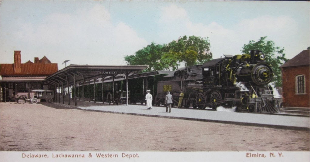 Postcard, earlier station
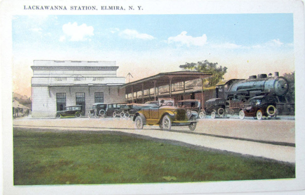
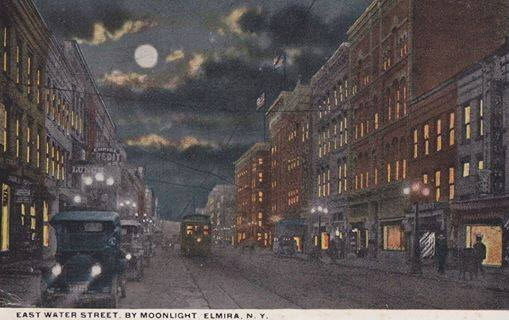
 Same postcard, different colorization
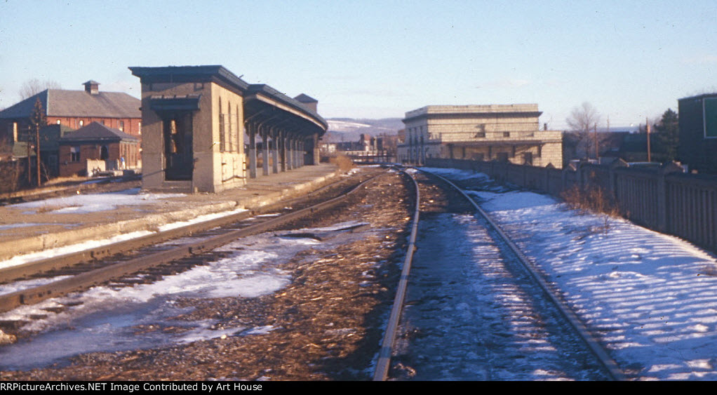 The Lackawanna Depot in 1967.
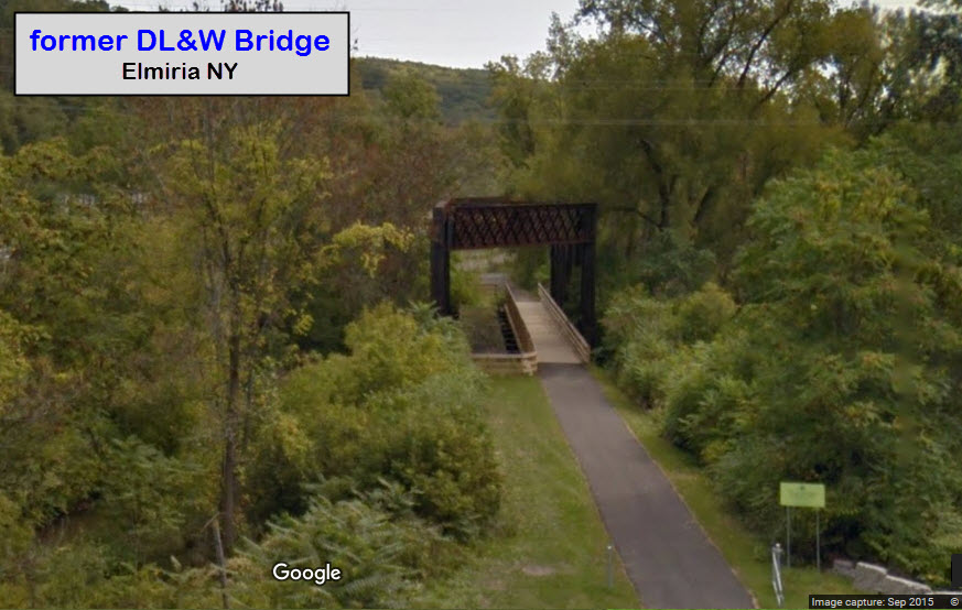
Pretty much follows the former DL&W right-of-way between E. Thurston St on the north end to below E. Water St on the south end. The old DL&W bridge pictured above is part of the trail.
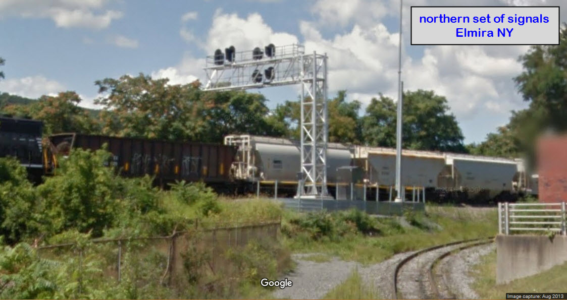
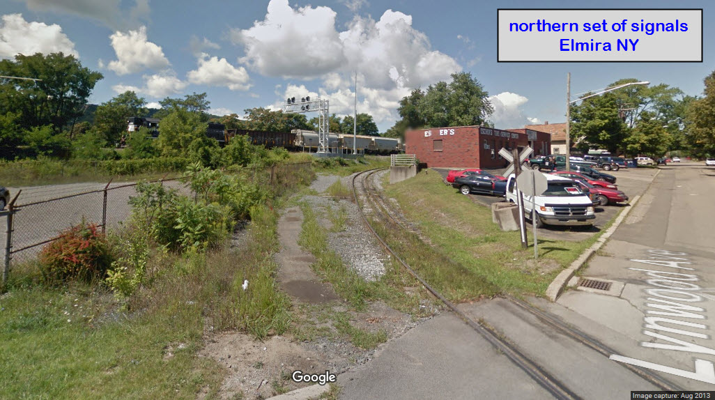
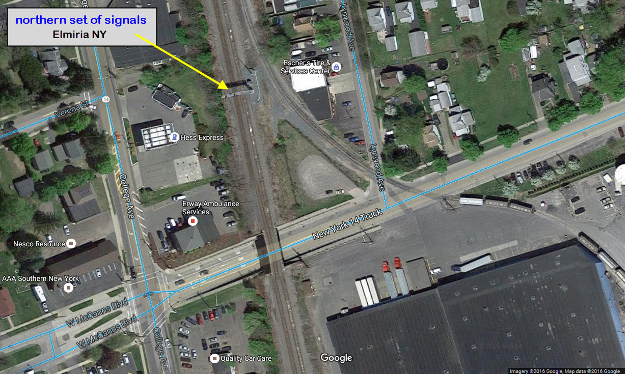
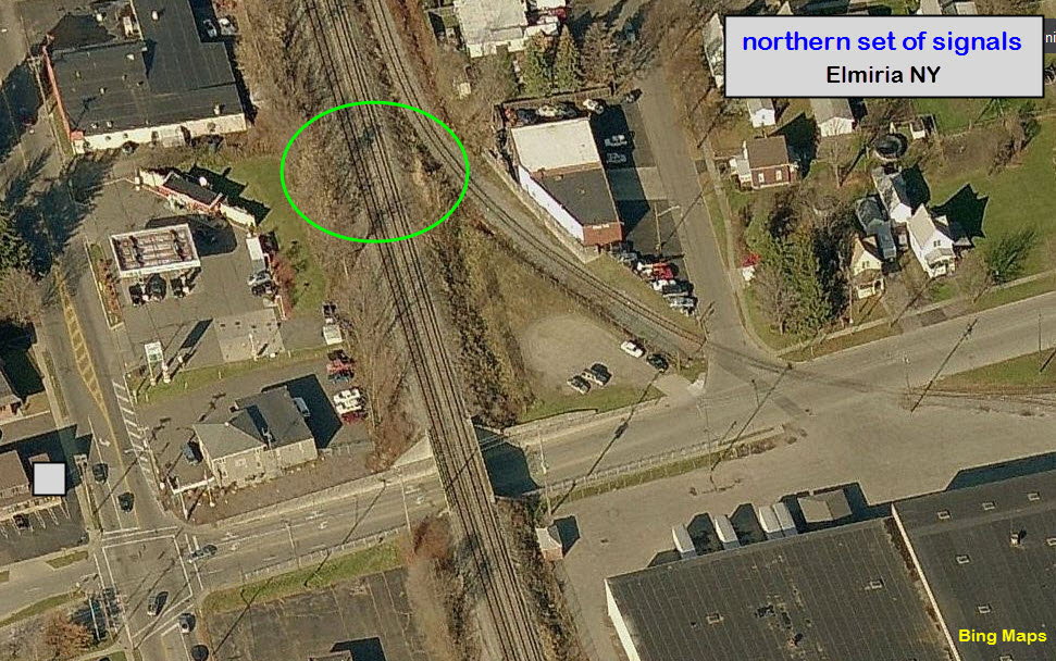
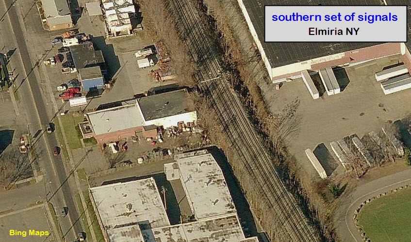
Appears to be a newer set of signals on a cantilever bridge, because the signals are not in the Bing aerial view. The Google streetview was taken 8/2013, so the signals are at least that old.
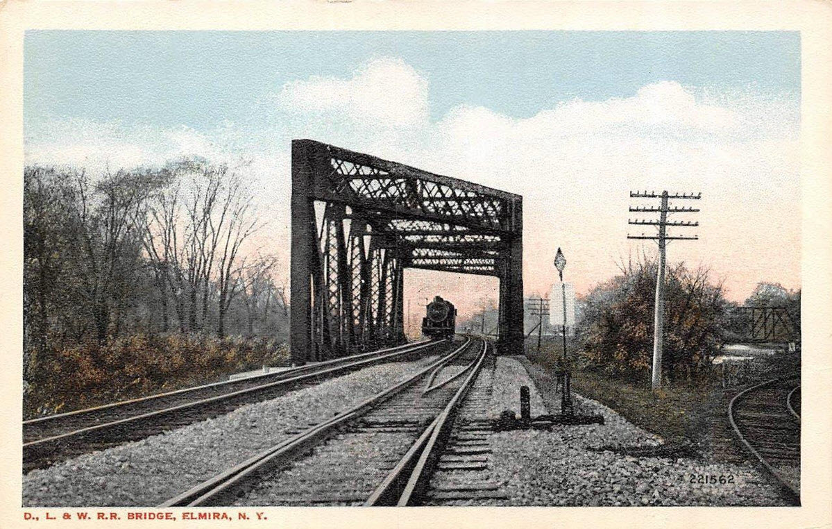
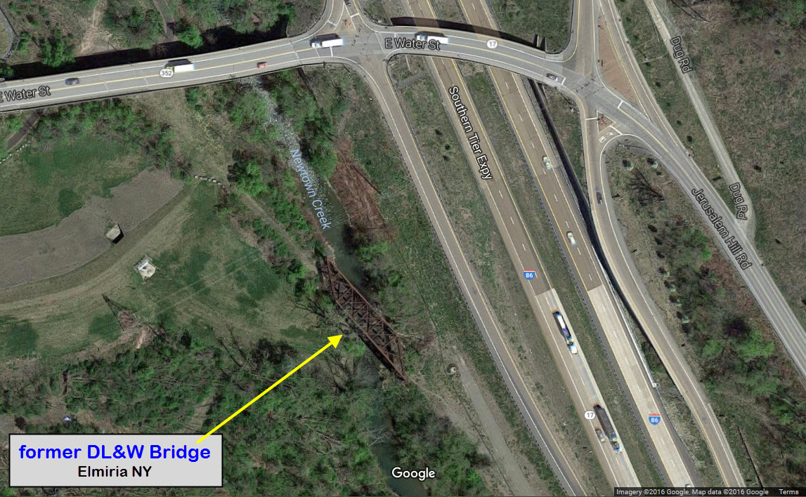
 DL&W Bridge
GPS Coordinates: 42.089461, -76.783158
This bridge is now part of the Lackawanna Trail, as can be seen from the photo below.
 Water Street - former Erie bridge
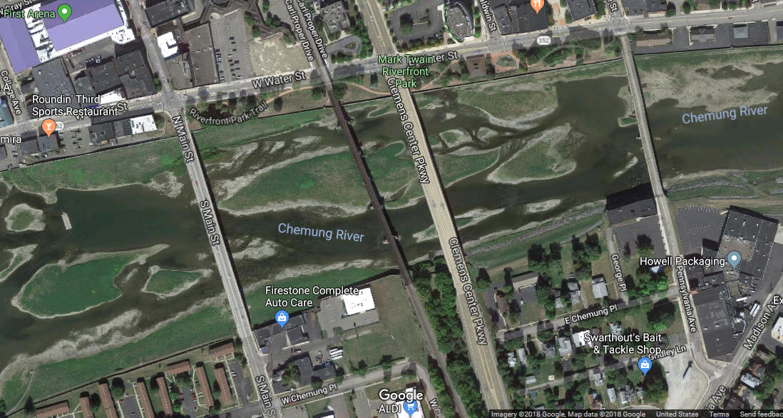
GPS Coordinates: 42.087866, -76.805007
Sort of a continuation of the bridge across the Chemung, but a separate structure altogether.
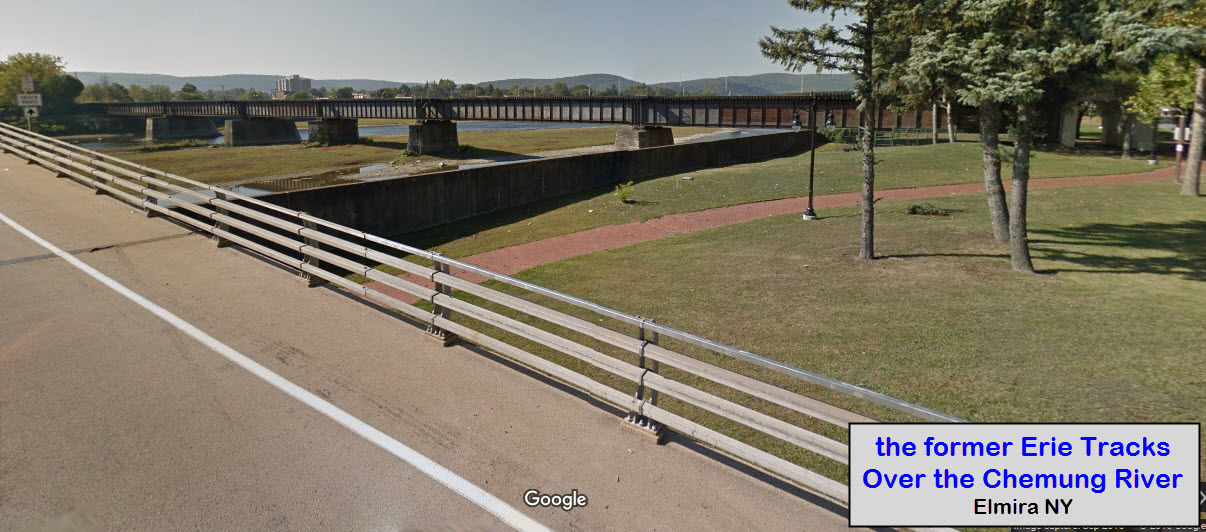
 Norfolk Southern over the Chemung River (former Erie bridge)
GPS Coordinates: 42.086793, -76.804381 (center of the bridge)
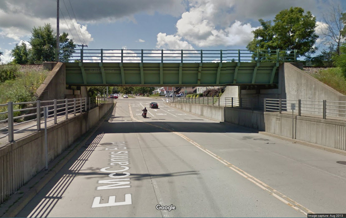
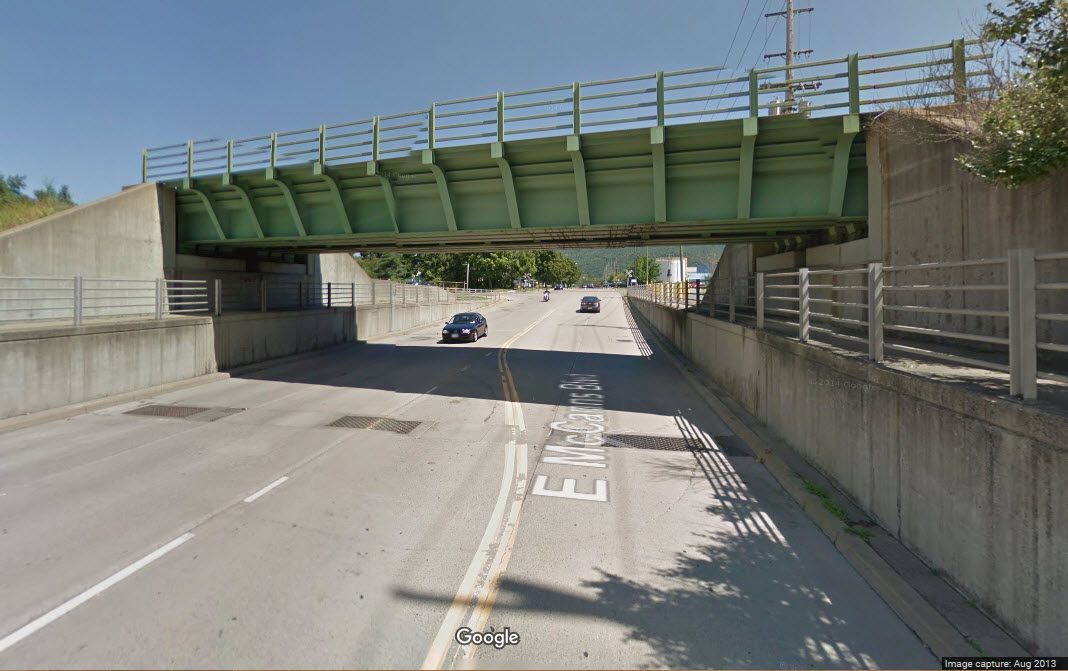
 E McCanns Blvd
GPS Coordinates: 42.119906, -76.822444
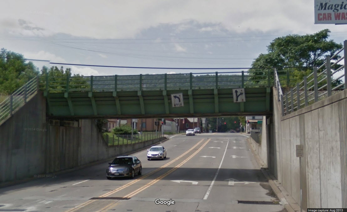
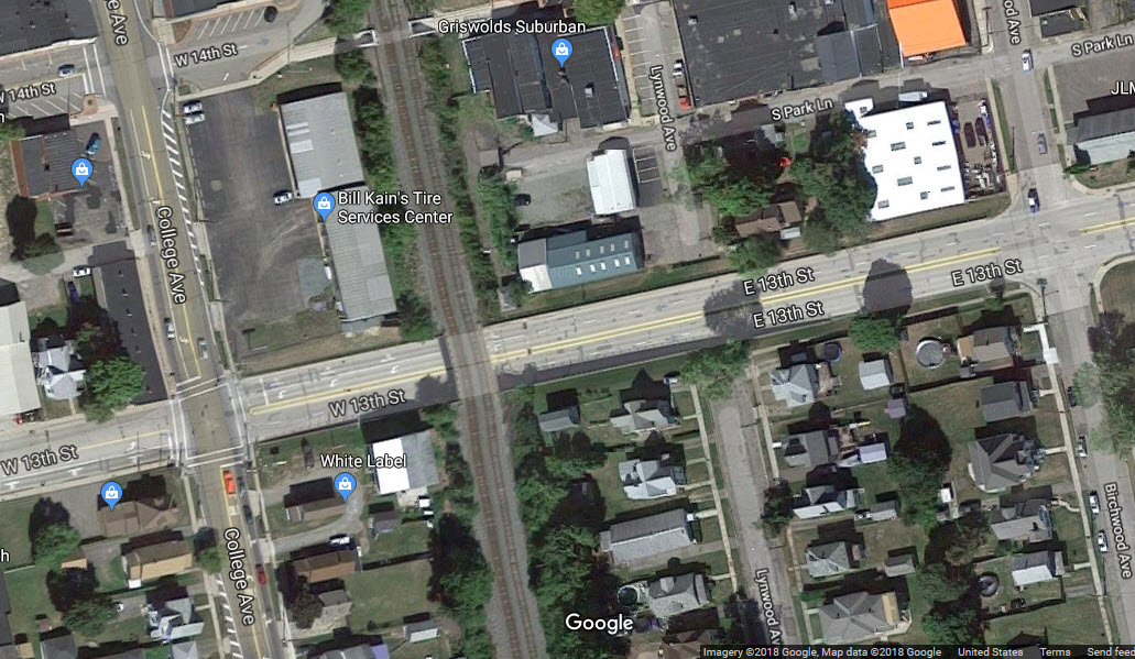
 E 13th St
GPS Coordinates: 42.127958, -76.824703
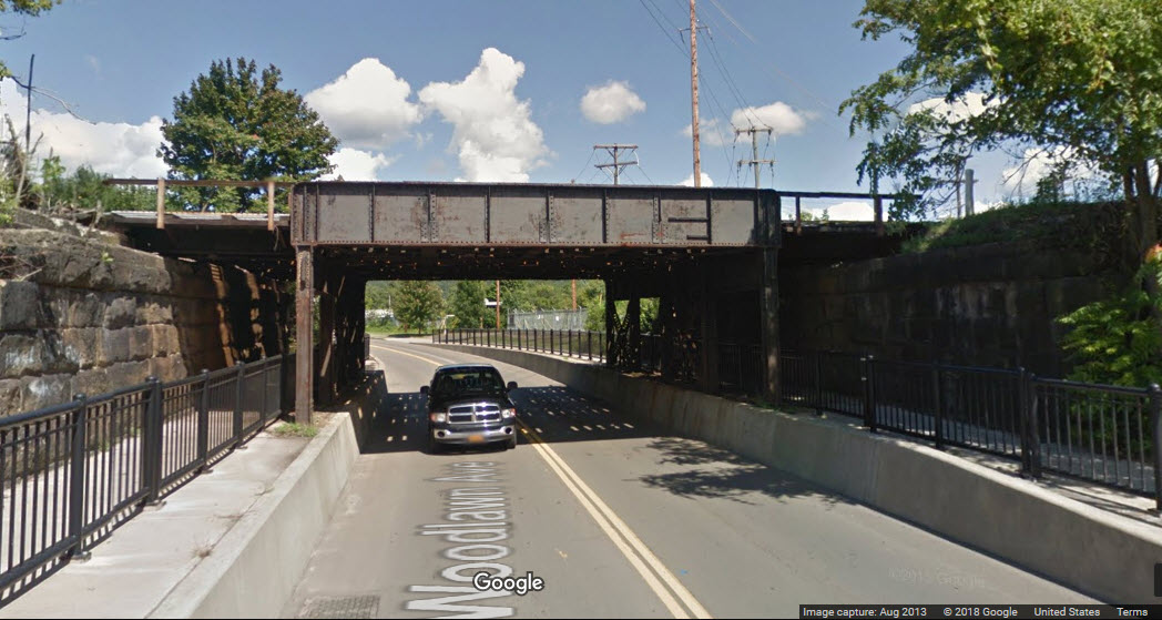
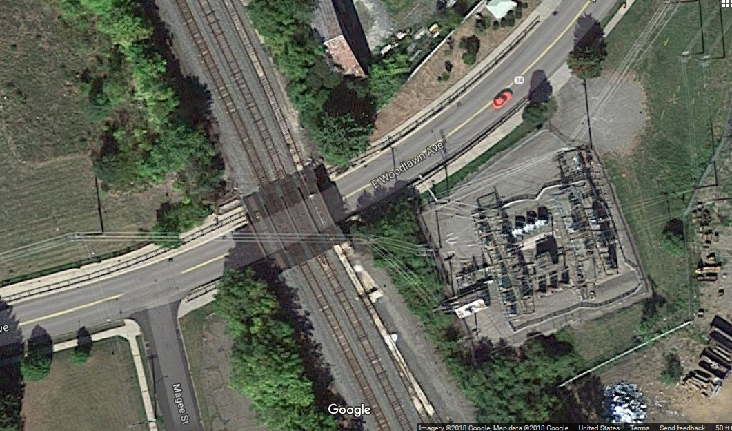
 Woodlawn Ave
GPS Coordinates: 42.109823, -76.816678
Courtesy of the University of Texas Library, click
here for their index page.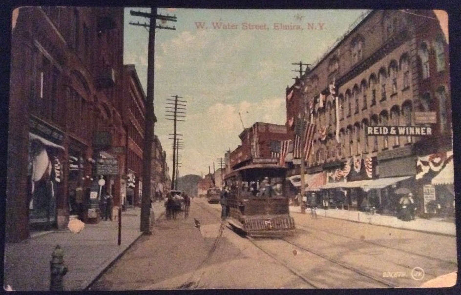

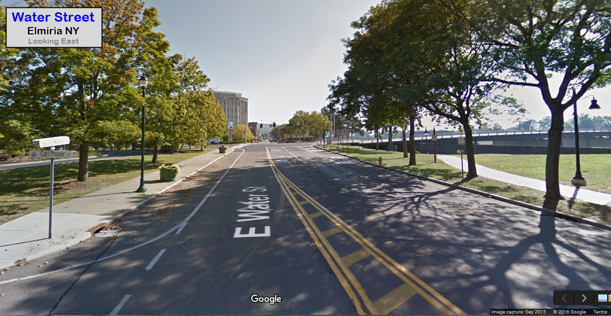
For comparison purposes, here are views of Water Street from Google Streetview. The railroad is above us, and all of the commerce on the river side of Water Street is gone.

A brief history of rail service in Elmira NY (from one of the sources above, modified):
1835 - Construction for the New York and Erie Railroad began in Deposit, NY.
It would be 16 more years until the line was completed (all the way to Dunkirk, NY.
October 2, 1849 - the first NY&E train arrived in Elmira. Regular passenger service began 6 days later with two trains each way per day.
1849 - The Elmira Depot was built.
1850 - The Canandaigua & Corning Railroad changed its name to the
Elmira, Canandaigua & Niagara Falls Railroad.
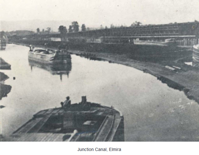
1854 - The Elmira & Williamsport Railroad opened - moving lumber,
coal, and iron between Pennsylvania and the Feeder Canal, the Junction Canal, and the railroad in Elmira.
1861 - The NY&E RR changed its name to New York & Erie Railway.
1863 - The Northern Central took over the Elmira & Williamsport line -
the Pennsylvania RR had become the principal shareholder in the NC in 1861.
1867 - Fire damaged the original Elmira Depot and a new one was built (opened 1868). No reference to which railroad's depot tho.....
1870 - The Lehigh Valley Railroad opens an office in Elmira. Needed, earlier history of the LV in Elmira!
1872 - Utica, Horseheads & Elmira (later the Utica, Ithaca, & Elmira). Construction between Erin and Van Ettenville necessitated building two
curved trestles - the Deep Gorge trestle and the Blockhouse Ravine trestle.
1875 - The New York and Erie Rwy became the New York, Lake Erie, and Western.
1882 - The New York, Lackawanna & Western was completed to Elmira, soon became the Delaware, Lackawanna & Western.
1884 - Elmira, Cortland & Northern service to Syracuse.
1895 - The New York, Lake Erie, and Western becomes the Erie Railroad.
1913 - New Lackawanna station just west of the original.
1932 - Raising of the Lackawanna tracks through Elmira completed.
1934 - Raising of the Erie tracks through Elmira completed.
1956 - Pennsylvania Railroad ended passenger service in Elmira.
1957 - The last PRR steam locomotive rolls through Elmira.
1960 - The Erie and the DL&W merge into the Erie-Lackawanna RR.
1961 - Last passenger train for the Lehigh Valley.
1970 - The Erie-Lackawanna discontinues passenger service.
1976 - The Erie-Lackawanna gets absorbed into Conrail, along with the Penn Central, the CNJ, the Raritan River, and the Lehigh Valley.
1998 - Norfolk Southern takes over Conrail.


The following map was found
here on the University of Minnesota's website while looking for something from the Northern Pacific....... good stuff!
Disclaimers:
I love trains, and I love signals. I am not an expert. My webpages reflect what I find on the topic of the page. This is something I have fun with while
trying to help others.
Please Note: Since the main focus of my two websites is railroad signals, the railfan guides are oriented towards the signal fan being able to locate them.
For those of you into the modeling aspect of our hobby, my
indexa page has a list of almost everything railroad oriented
I can think of to provide you with at least a few pictures to help you detail your pike.
If this is a railfan page, every effort has been made to make sure that the information contained on this map and in this railfan guide is correct. Once in a while,
an error may creep in :-)
My philosophy: Pictures and maps are worth a thousand words, especially for railfanning. Text descriptions only get you so far, especially if you get lost or
disoriented. Take along good maps.... a GPS is OK to get somewhere, but maps are still better if you get lost! I belong to AAA, which allows you to get
local maps for free when you visit the local branches. ADC puts out a nice series of county maps for the Washington DC area, but their state maps do not have the
railroads on them. If you can find em, I like the National Geographic map book of the U.S..... good, clear, and concise graphics, and they do a really good job
of showing you where tourist type attractions are, although they too lack the railroads. Other notes about specific areas will show up on that page if known.
Aerial shots were taken from either Google or Bing Maps as noted. Screen captures are made
with Snagit, a Techsmith product... a great tool if you have never used it!
By the way, floobydust is a term I picked up 30-40 years ago from a National Semiconductor data book, and means miscellaneous
and/or other stuff.
Pictures and additional information is always needed if anyone feels inclined to take 'em, send 'em, and share 'em, or if you have something to add or correct.... credit
is always given! Please be NICE!!! Contact info is here
Beware: If used as a source, ANYTHING from Wikipedia must be treated as being possibly inaccurate, wrong, or not true.
RAILFAN GUIDES HOME
RAILROAD SIGNALS HOME
NEW 10/10/2016, NOV02/2016, AUG15/2018, APR06/2021
Last Modified
21-Apr-2021