In General
Getting Here
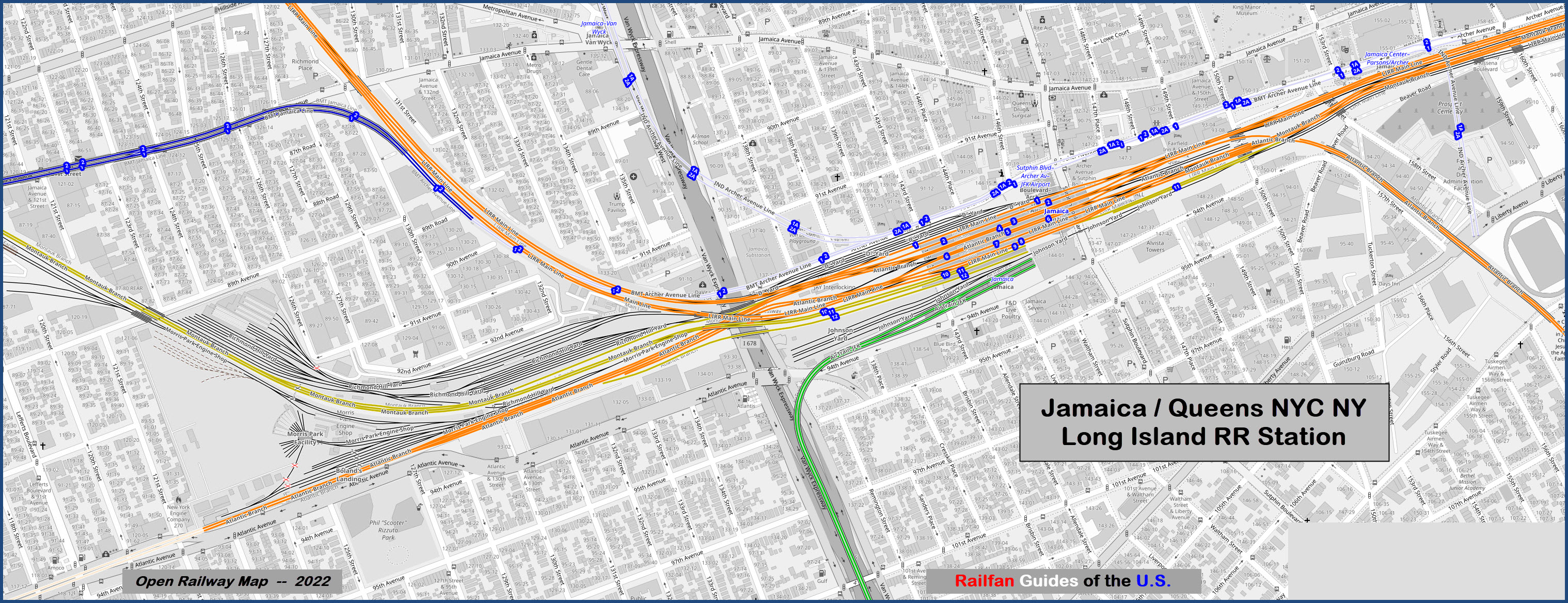
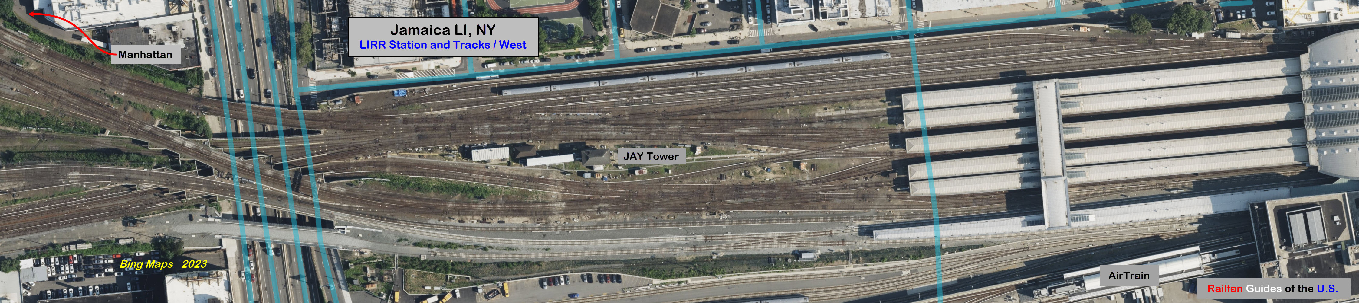
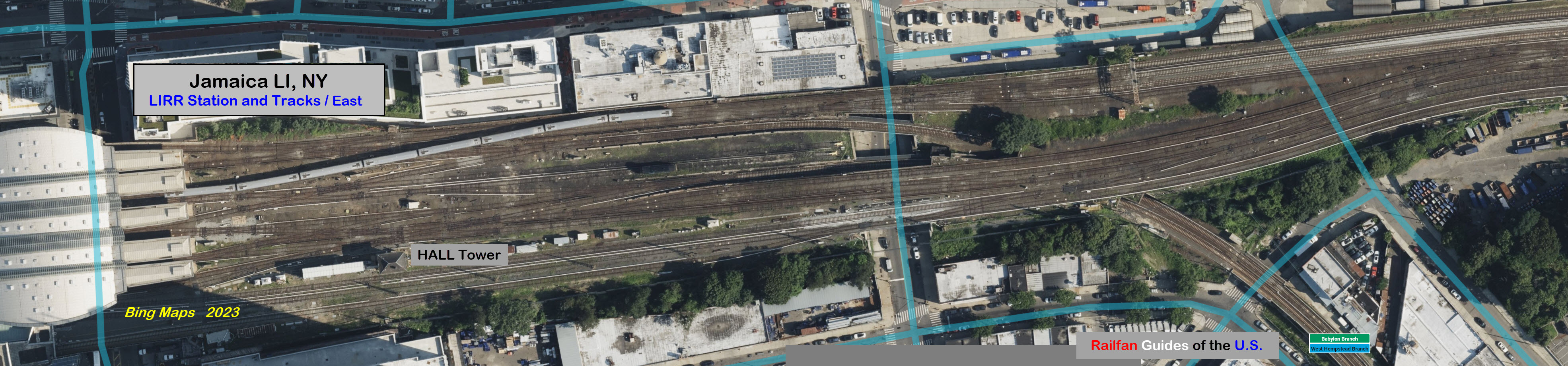
Map
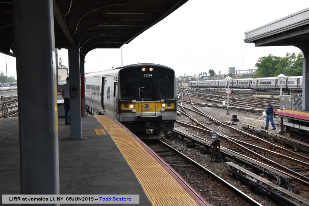
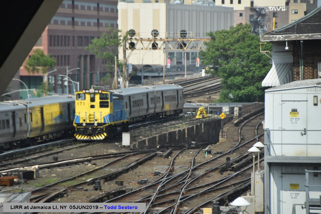
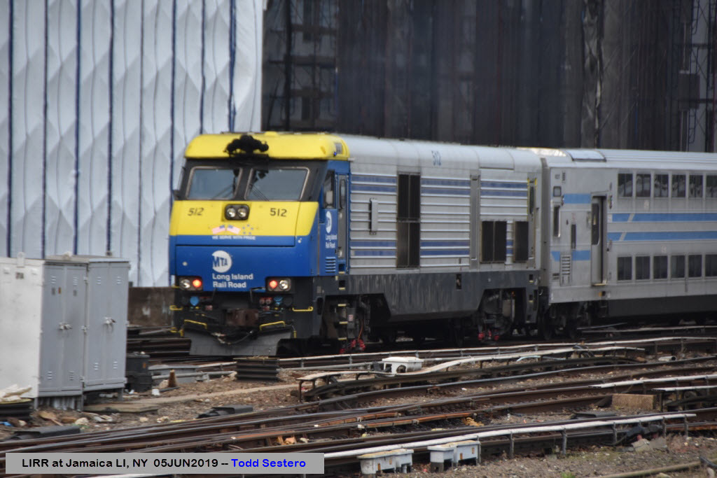
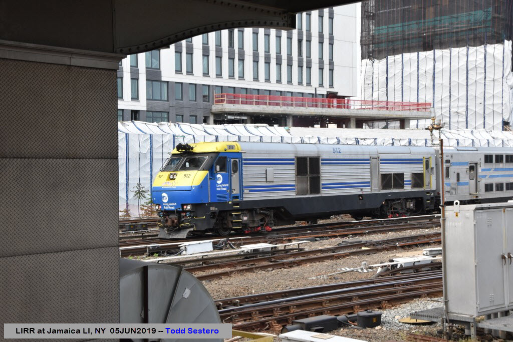
Pictures
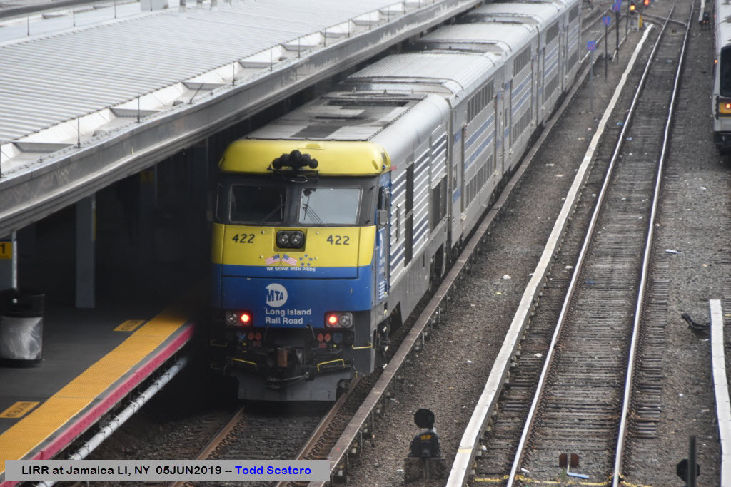
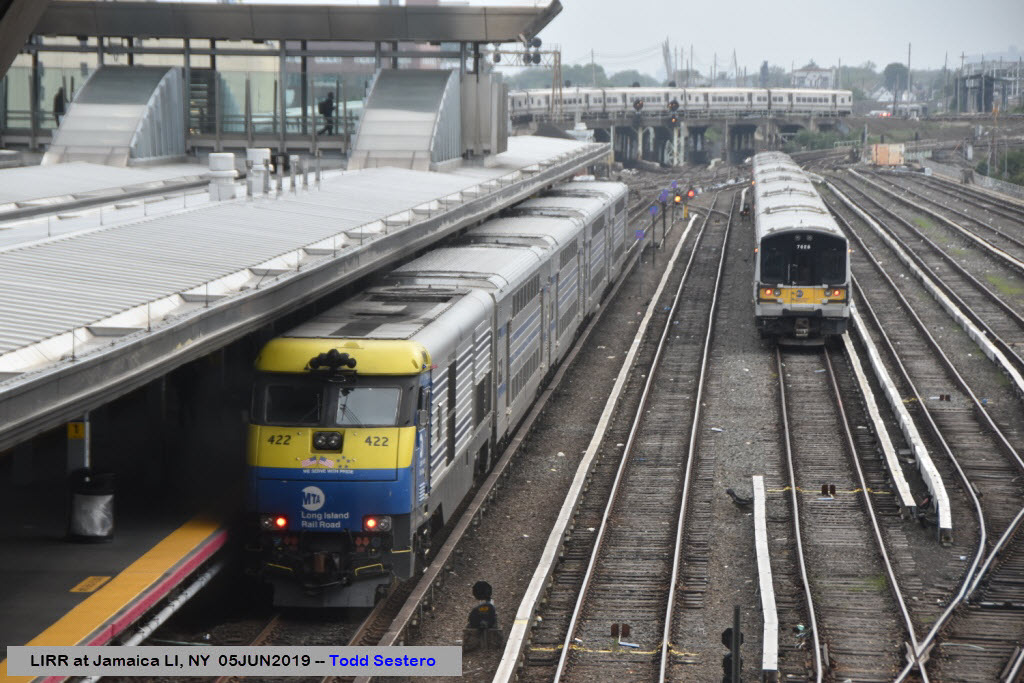
Trains
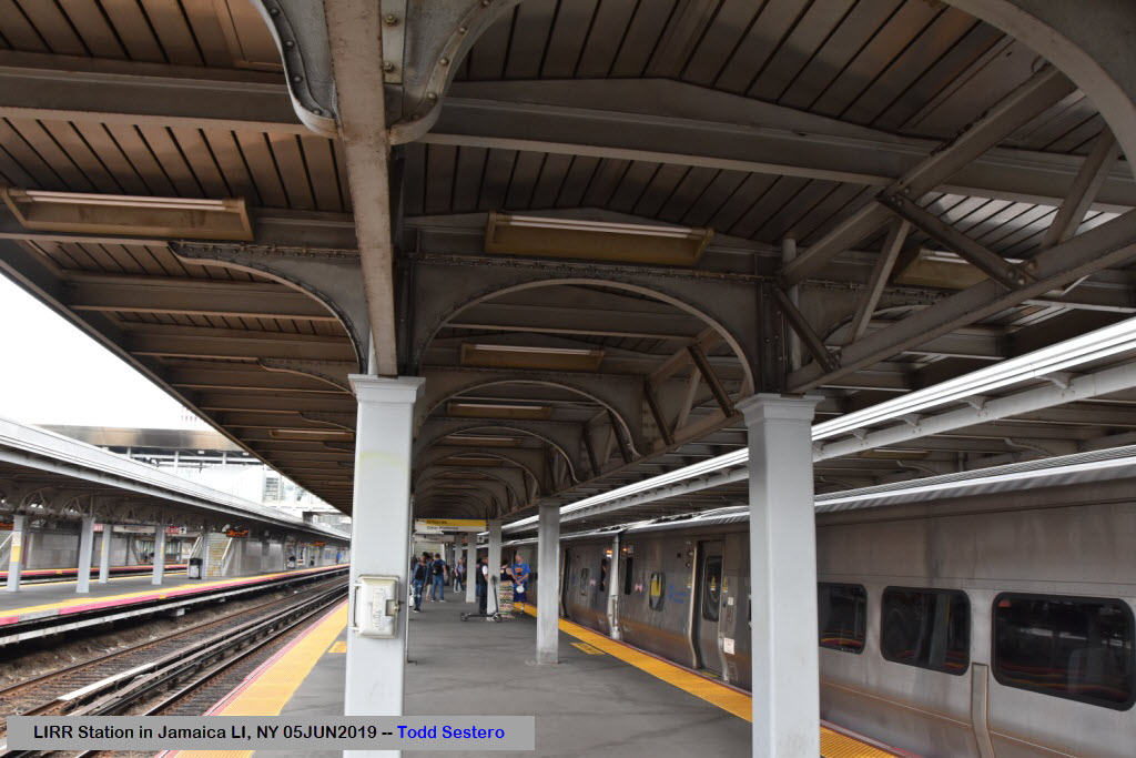
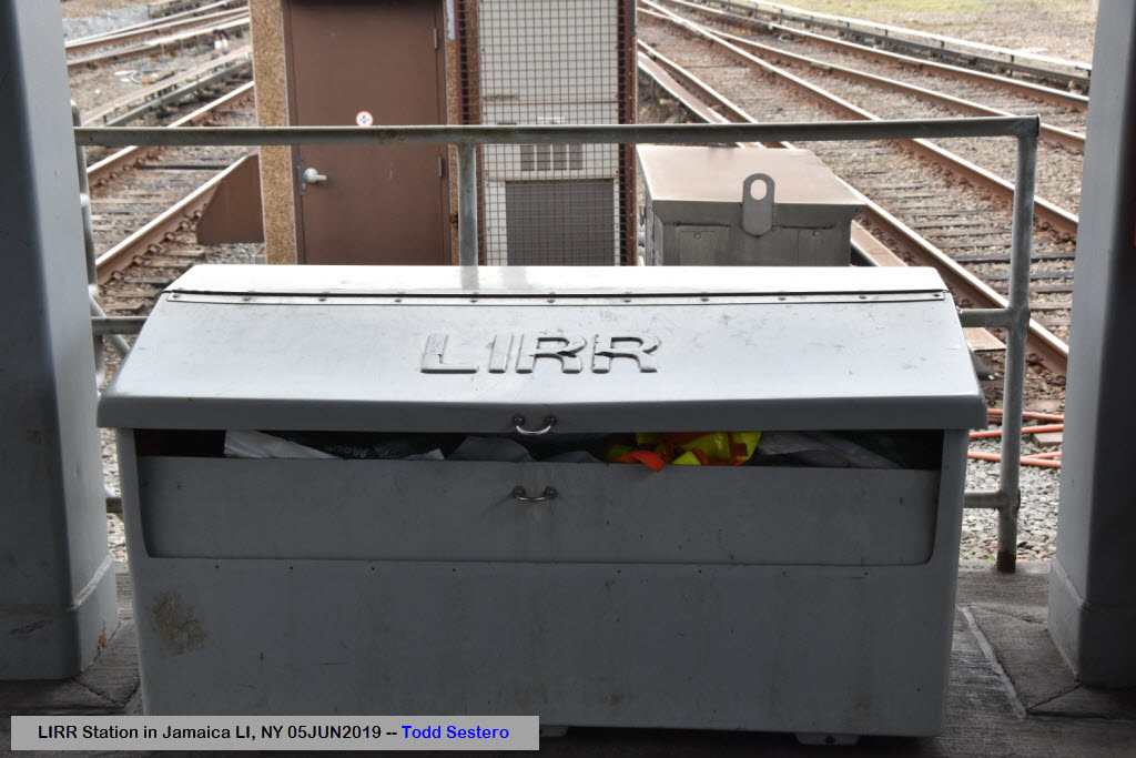
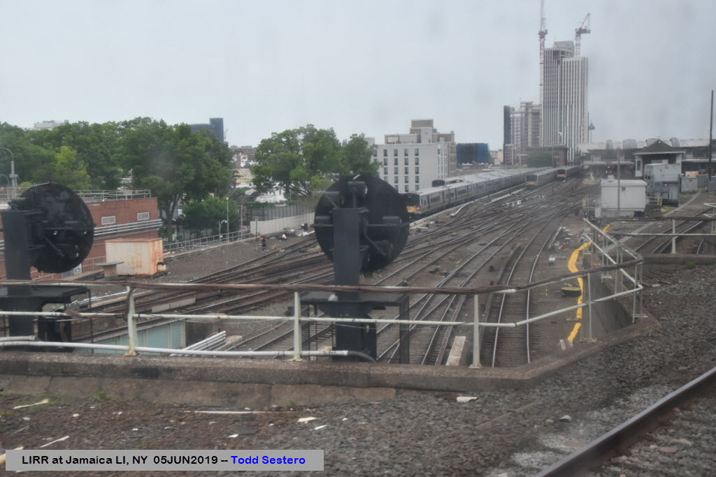
The Station
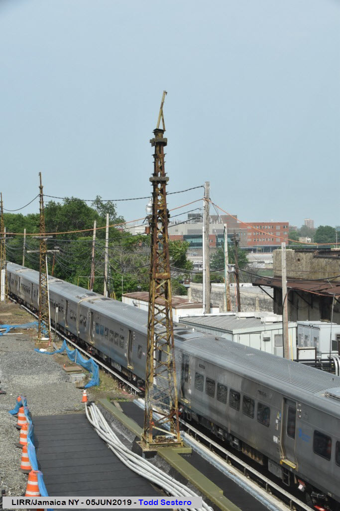
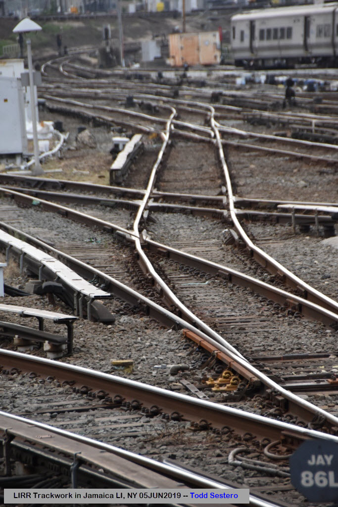
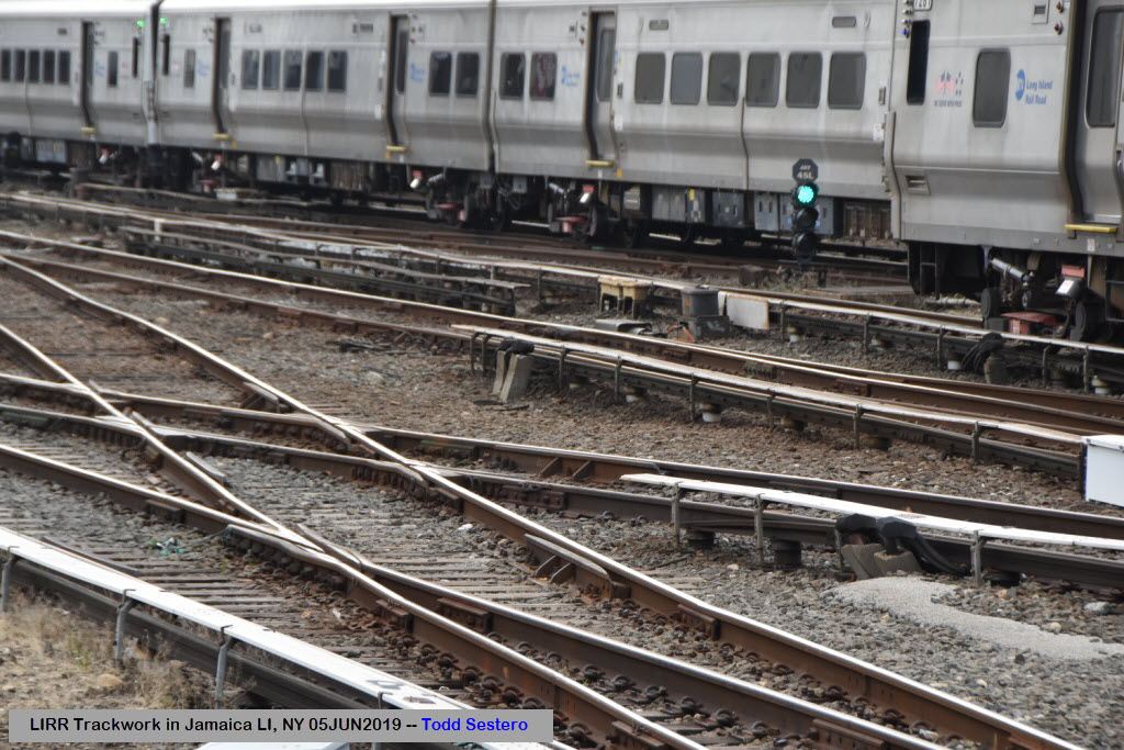
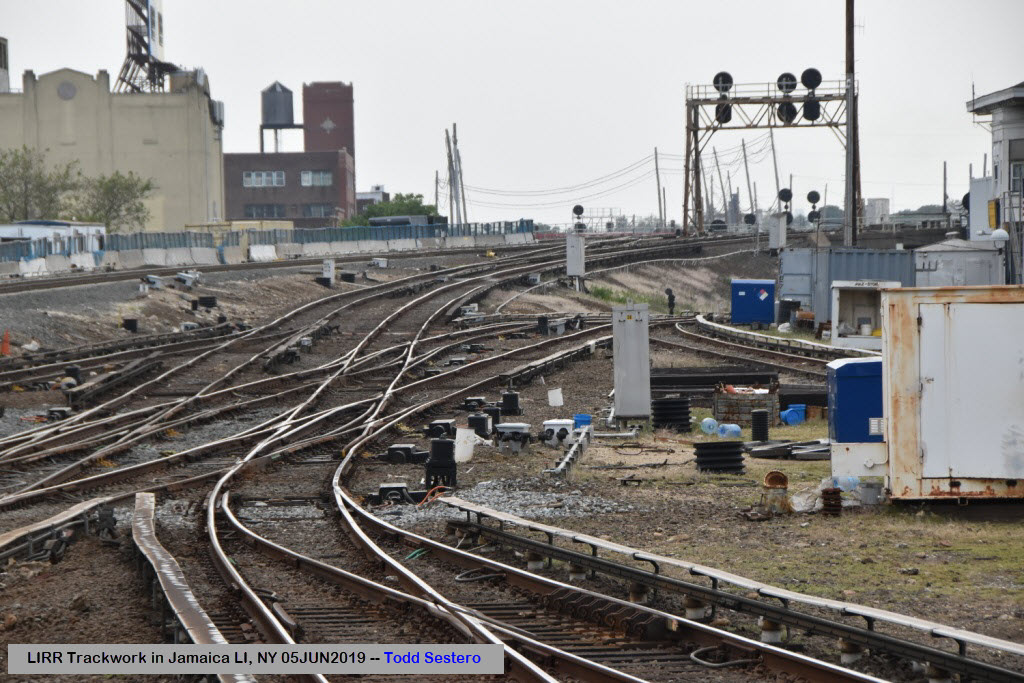
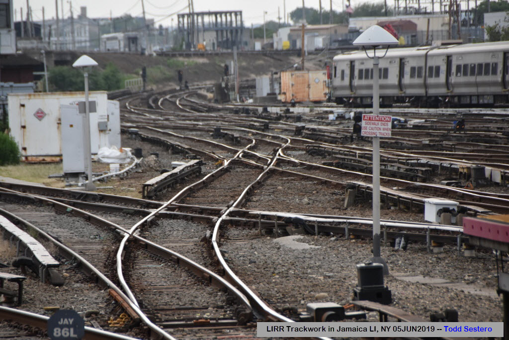
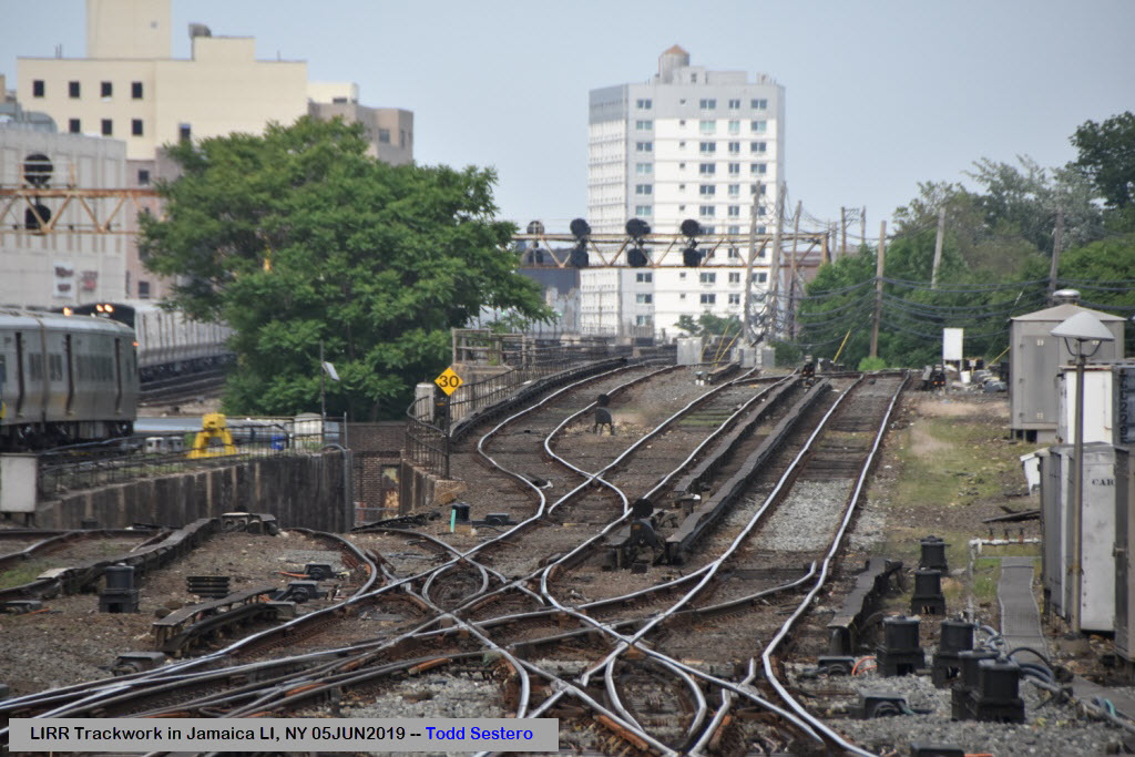
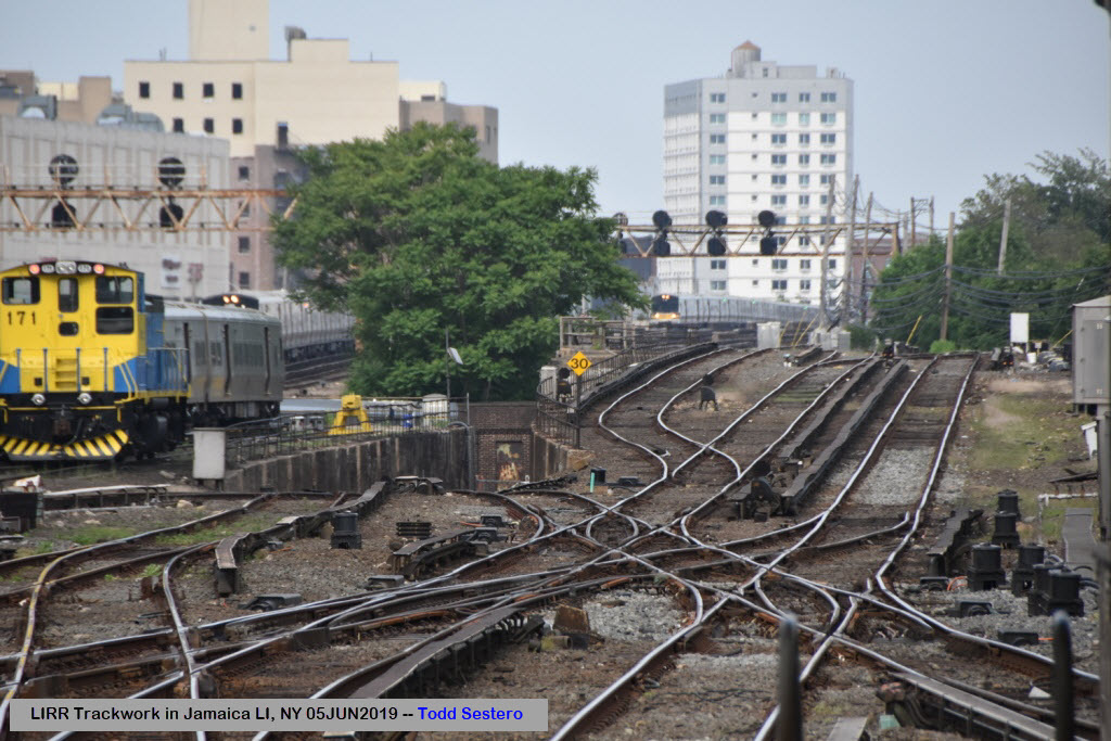
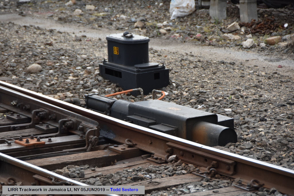
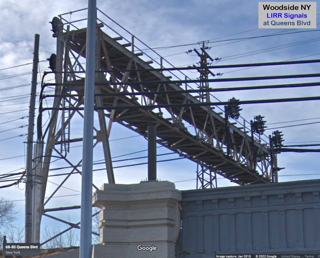
Trackwork and Structures
The Air Train
Signals
Floobydust
USGS Maps
RAILFAN GUIDES HOME
RAILROAD SIGNALS HOME
Location / Name:
Queens Borough of New York City, AKA, Queens County
What's Here:
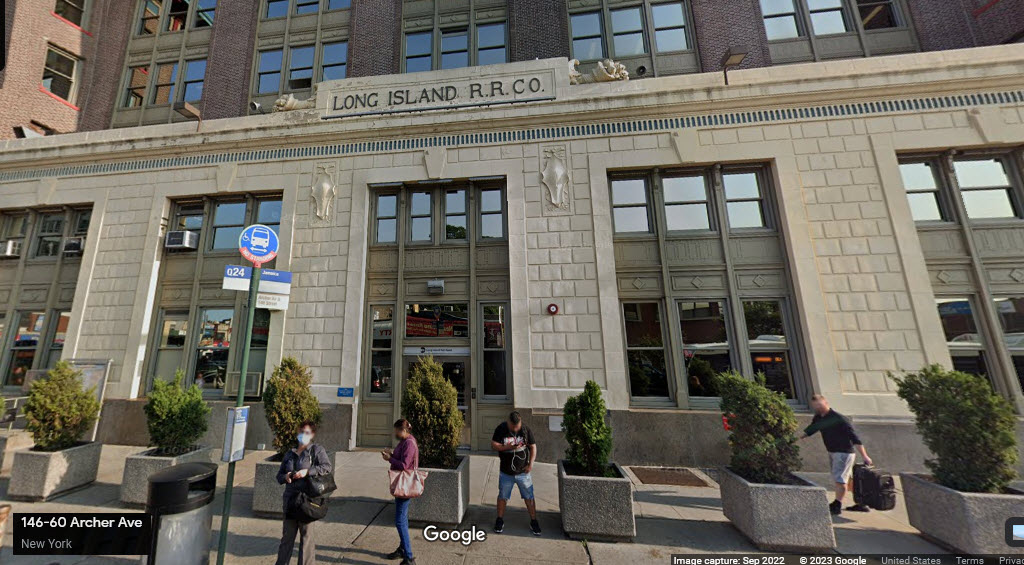
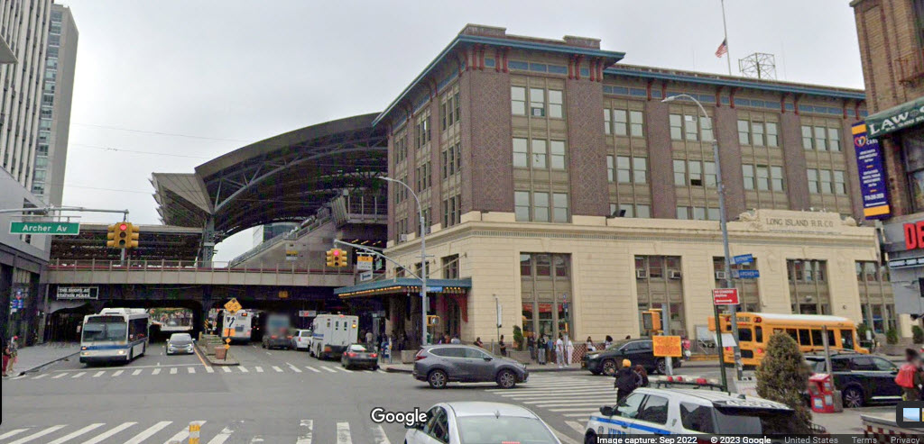
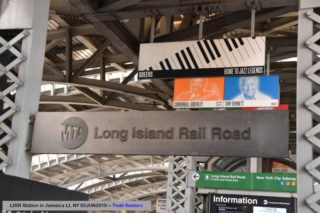
Long Island RR's Jamaica Station
Data:
GPS Coordinates: 40.69956, -73.80871 (center of station)
Access by train/transit:
Take your pick:
-- LIRR trains from/to Manhattan and out to Long Island
-- the IND E, and BMT J and Z Subway Lines
-- the AirTrain system to/from JFK Airport
The Scoop:
If your interests lean towards the rapid transit and commuter rail aspect of railfanning, you have to come to Jamaica if you are in New York City. It is about a 30 minute ride via the Long Island RR out of downtown Manhattan, longer if you come by subway.
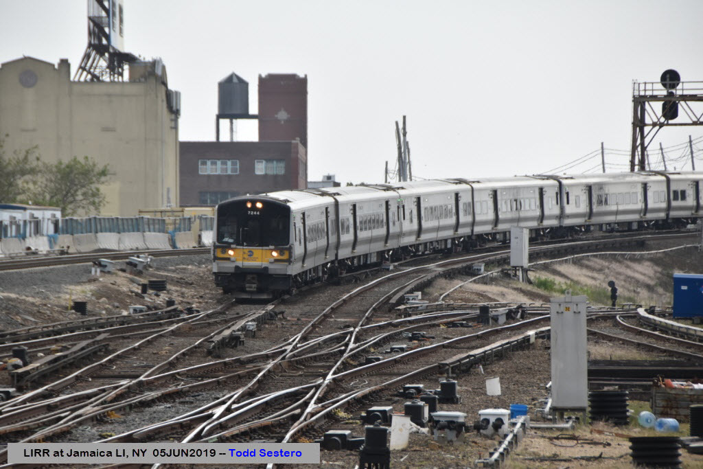
The LIRR commuter trains are almost endless, as almost everything in and out of Manhattan passes through here - the Port Washington Branch splits off a few stations before getting here.
Jamaica is 9.3 miles from Penn Station in Manhattan.
From Wikipedia: Jamaica station is a major train station of the Long Island Rail Road located in Jamaica, Queens, New York City. With weekday ridership exceeding 200,000 passengers, it is the largest transit hub on Long Island, the fourth-busiest rail station in North America, and the second-busiest station that exclusively serves commuter traffic. It is the third-busiest rail hub in New York City, behind Penn Station and Grand Central Terminal. Over 1,000 trains pass through each day, the fourth-most in the New York area behind Penn Station, Grand Central Terminal, and Secaucus Junction.
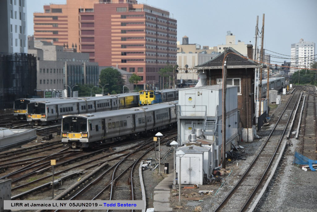
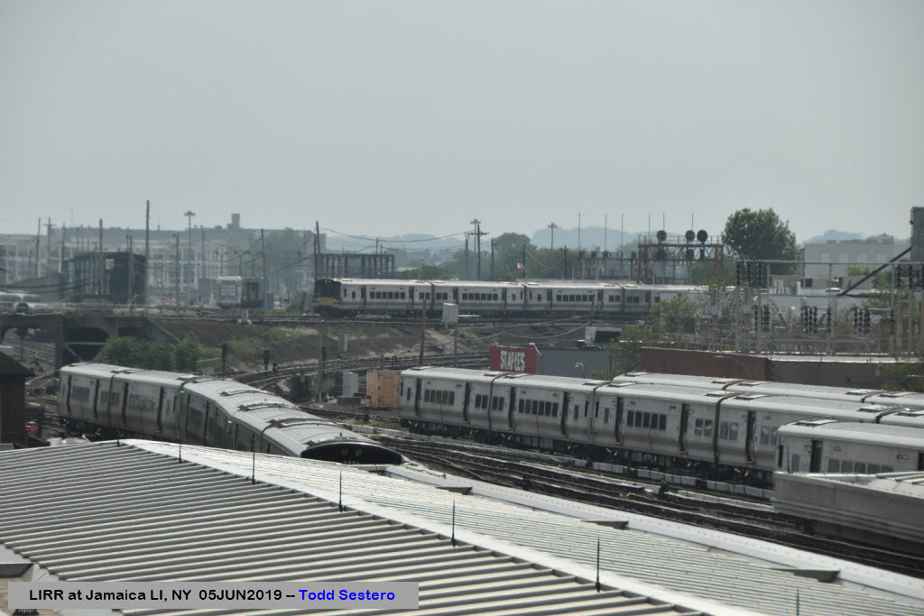
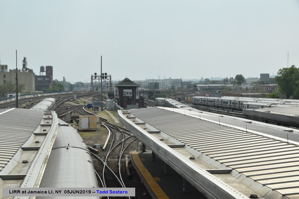
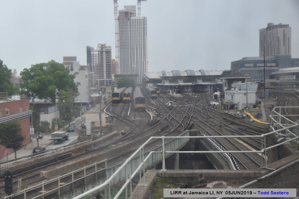
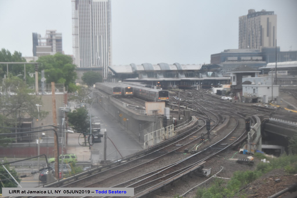
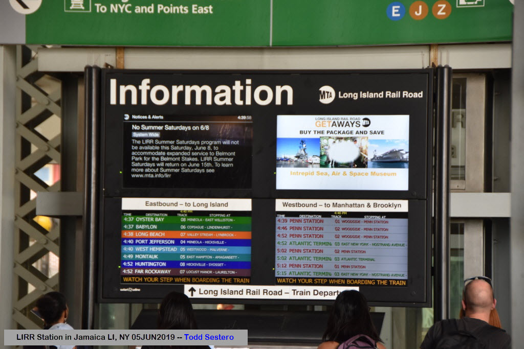
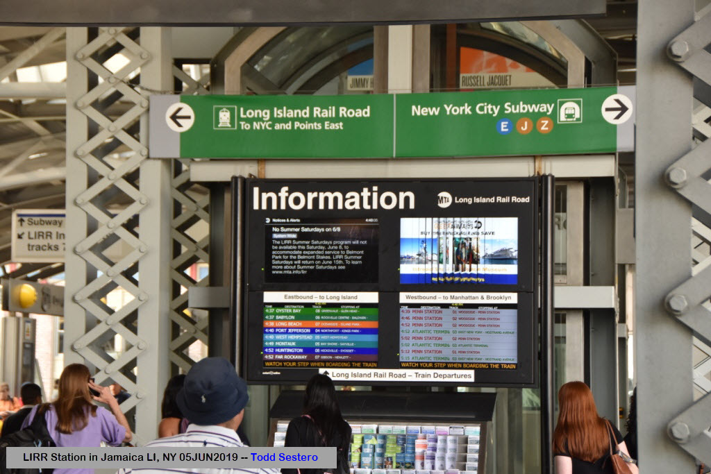
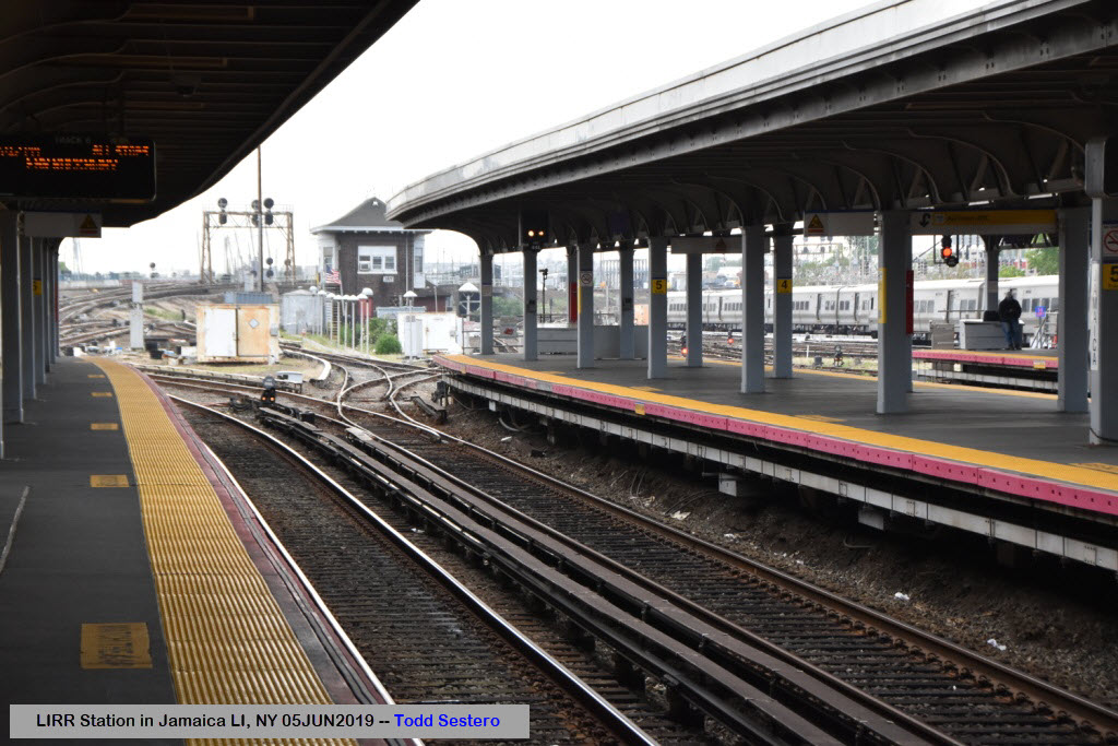
All LIRR services except the Port Washington Branch pass through Jamaica station. The Main Line westward leads to Long Island City station in Queens and Penn Station in Manhattan via Woodside, while the Atlantic Branch diverges along Atlantic Avenue to Atlantic Terminal in Brooklyn. Prior to December 2012, the Montauk Branch served one daily trip to Long Island City station via Richmond Hill, Queens. East of Jamaica, these three lines diverge, with some branch services using the Main Line, some using the Atlantic Branch, and some using the Montauk Branch. Station Layout: Jamaica is the Long Island Rail Road's hub station.
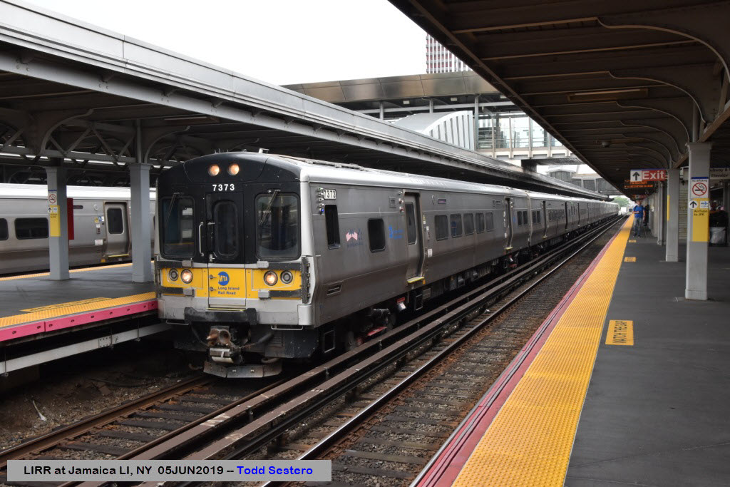
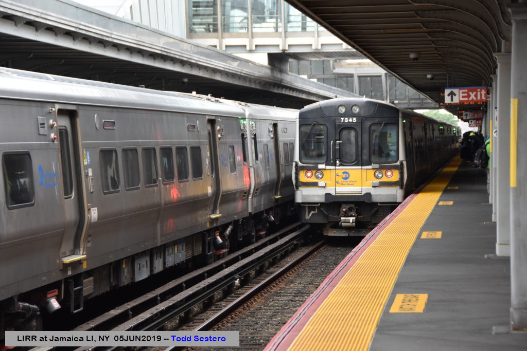
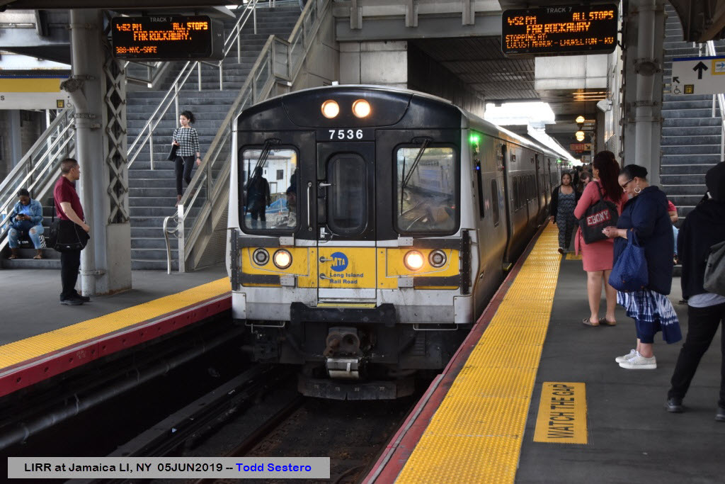
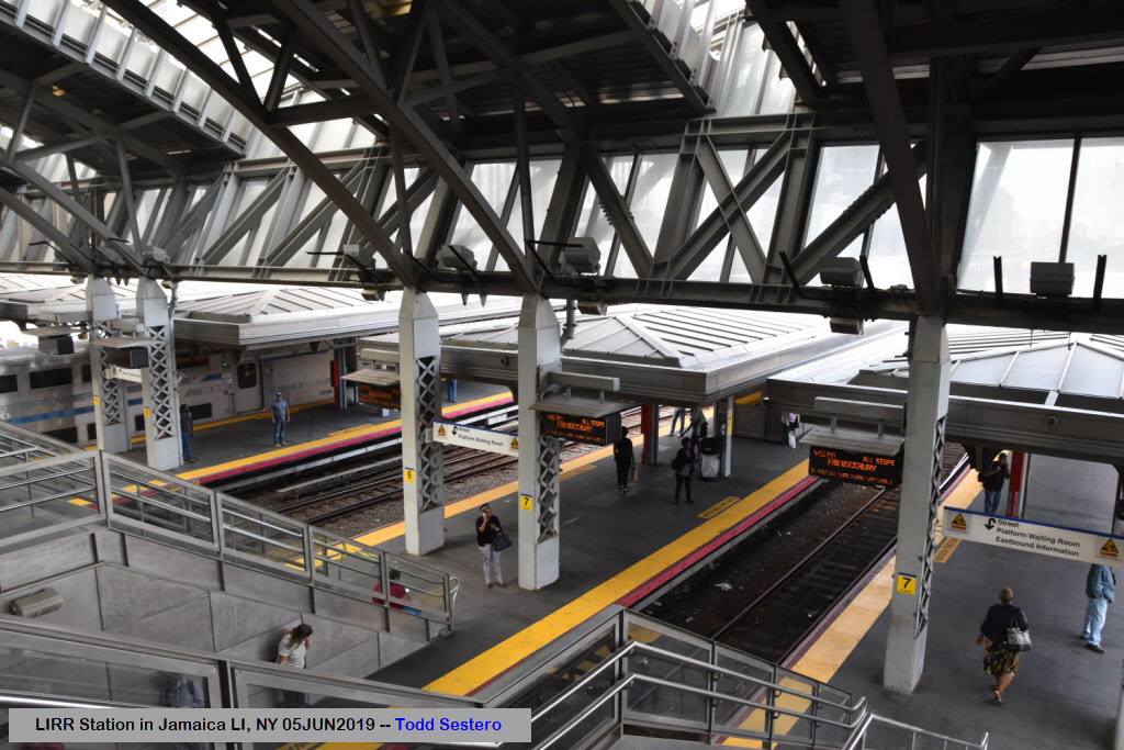
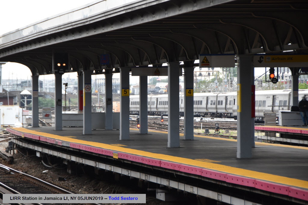
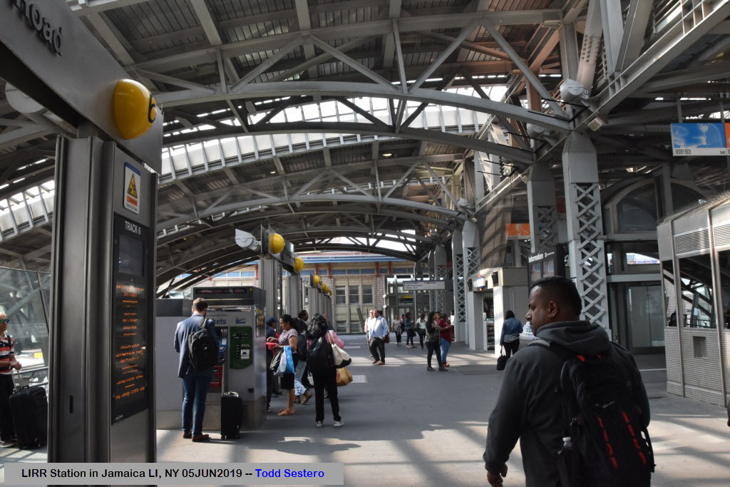
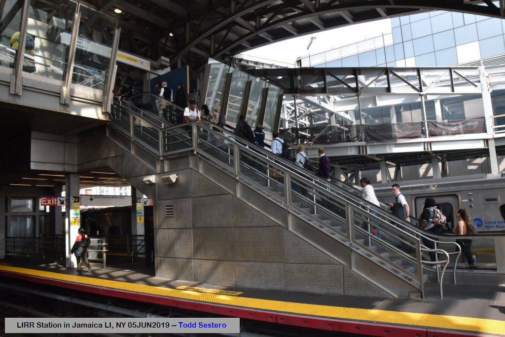
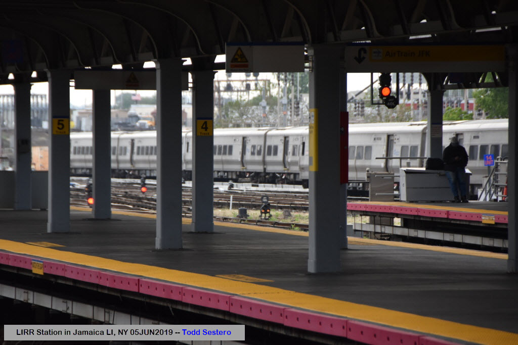
There are six high-level island platforms. Five of them, Platforms A–E, serve tracks 1–8 and are each 1,000 feet (300 m) long, fitting almost 12 cars. Trains on tracks 2 and 7 utilize a Spanish solution boarding layout, as these trains can be entered from platforms on either side, allowing passengers to quickly transfer between three trains at once. During the morning rush westbound trains from three different lines bound for three different terminals are scheduled to arrive at Jamaica simultaneously on tracks 1, 2, and 3. Passengers can cross to the train for their destination by passing through the train on track 2 (or by the stairs). In the evening the process is reversed: trains from three New York terminals destined for three branches arrive on tracks 6, 7, and 8 and allow commuters to cross to the desired outbound train. The middle tracks – 4 and 5 – share a platform which is used during rush hours to allow passengers to transfer to their destination train on the other side of the platform.
The sixth platform, Platform F, serves tracks 11–12 and is shorter than the other platforms. It is located to the south of platforms A–E and is used by Atlantic Terminal-bound trains. Tracks 9–10 are not adjacent to any platforms and can be used by non-revenue passenger trains or by freight trains. (end Wiki, slightly edited)
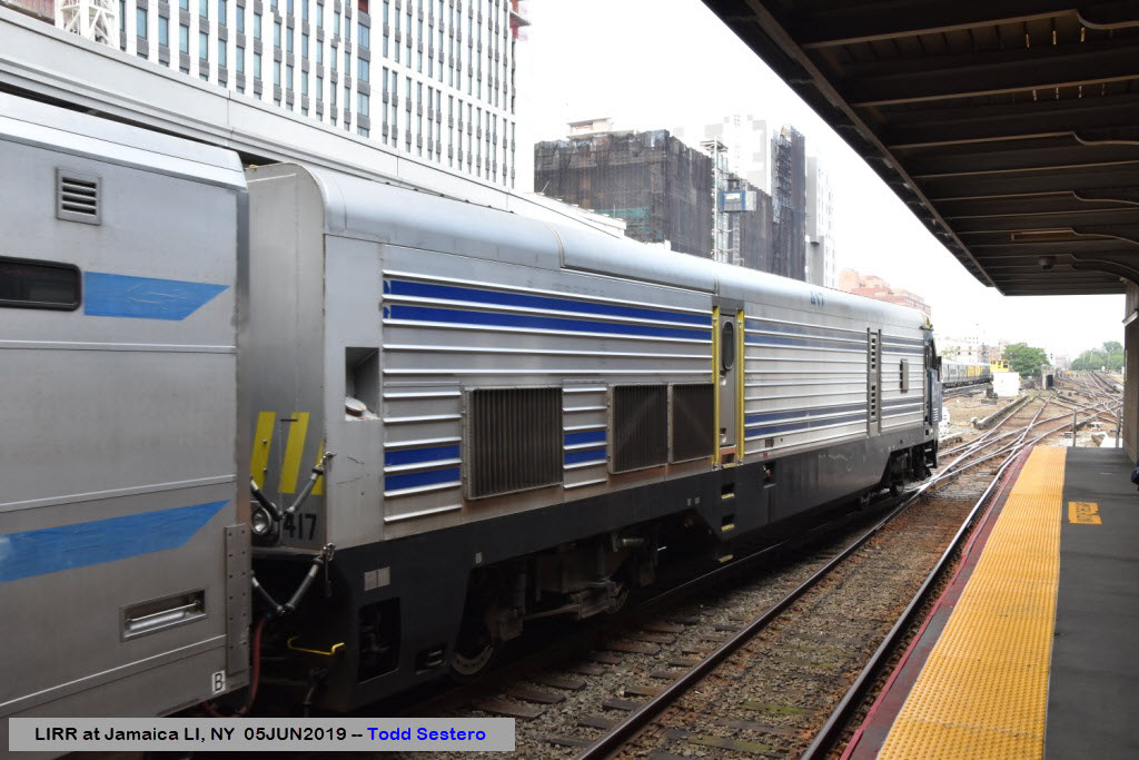
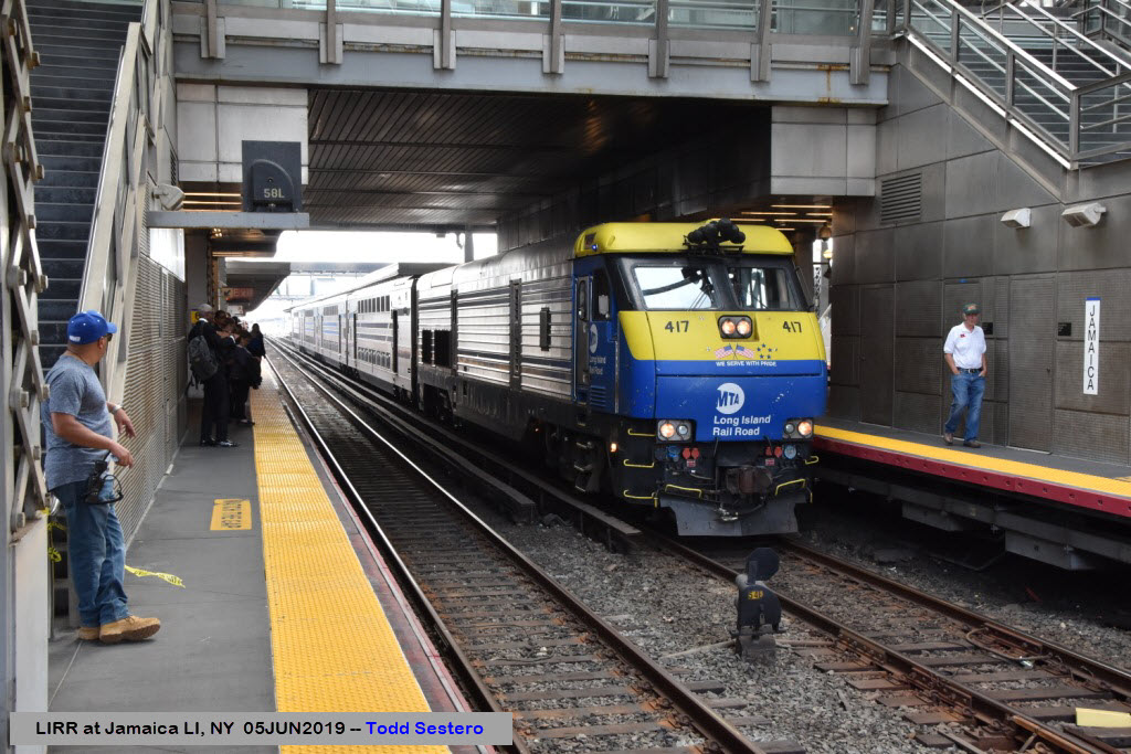
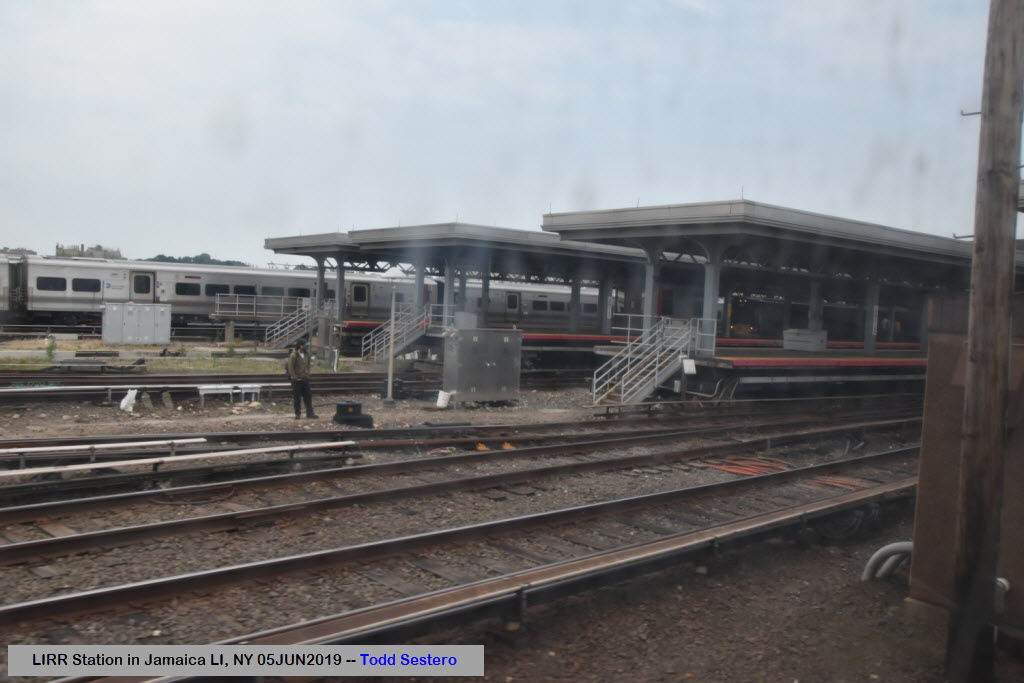
Some of the destinations are not 3rd rail powered, and require a diesel. These trains do not go any further "in" (towards NYC) than Jamaica.
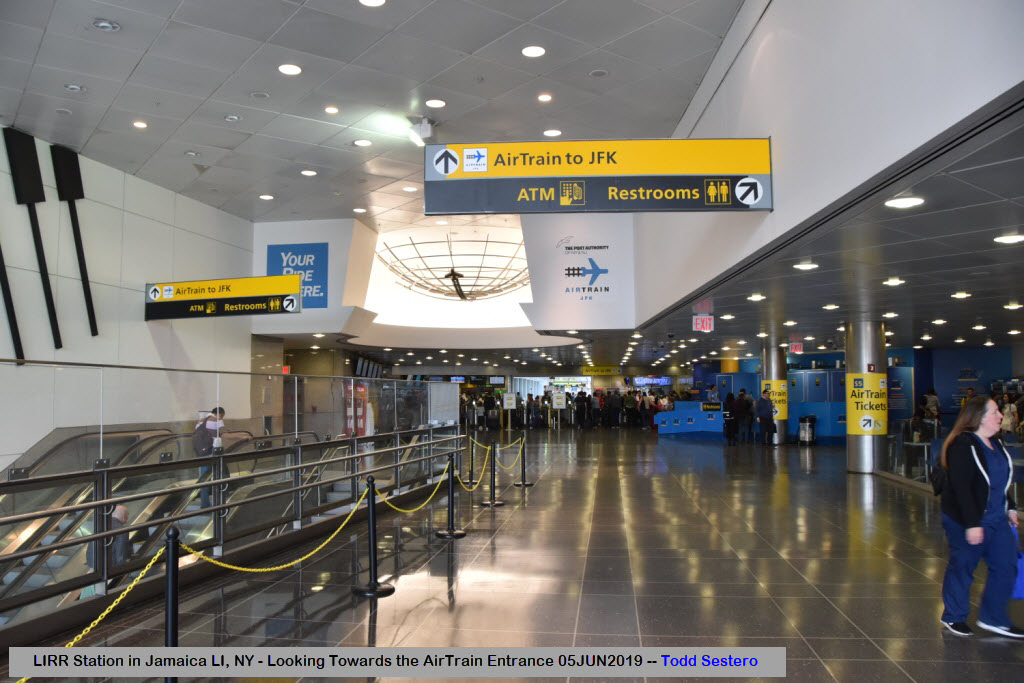
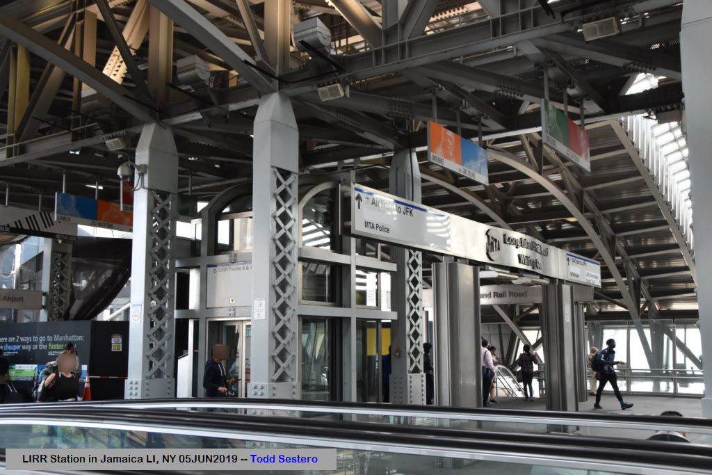
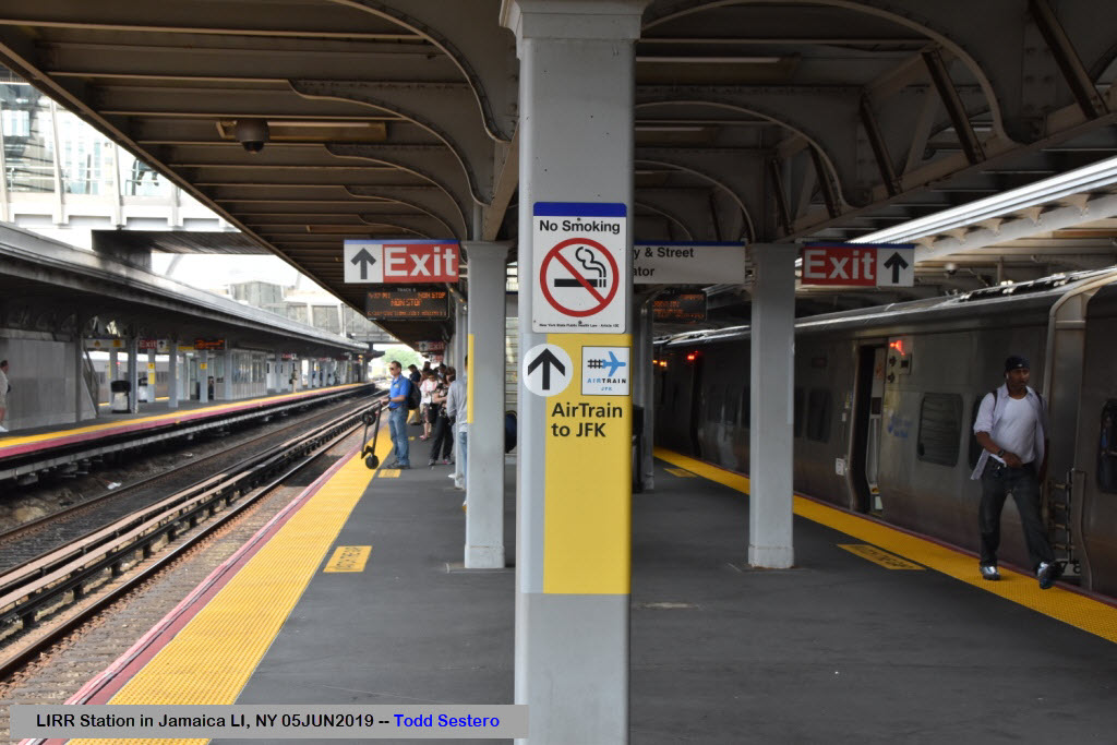
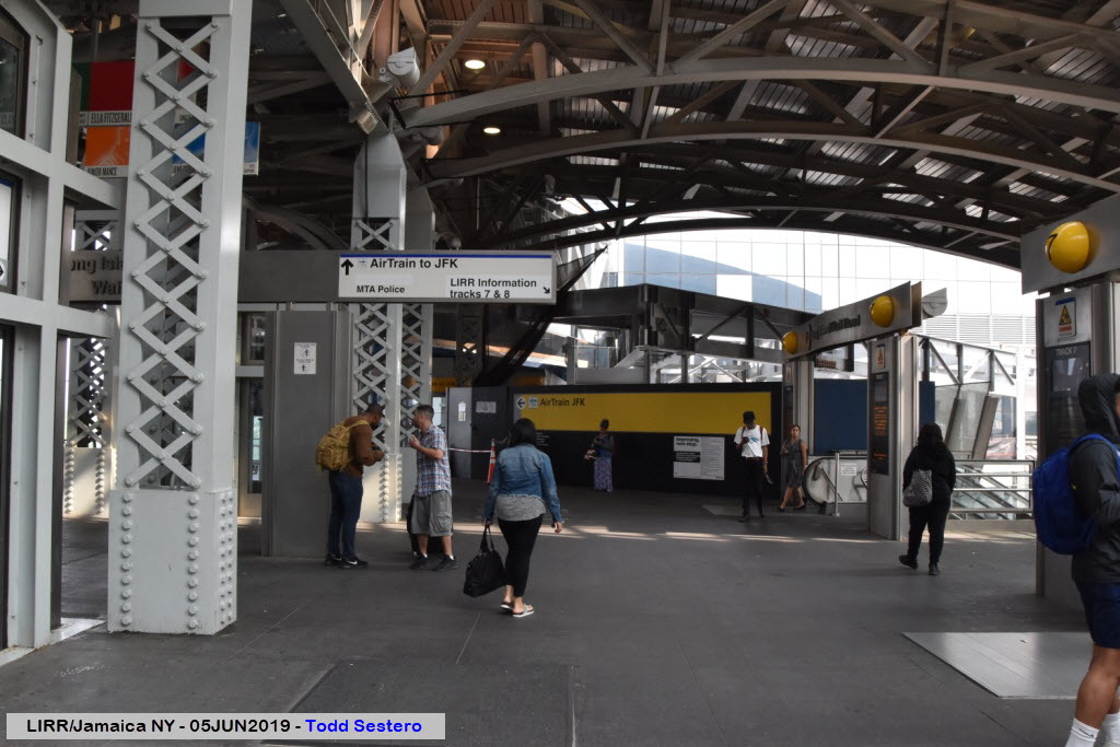
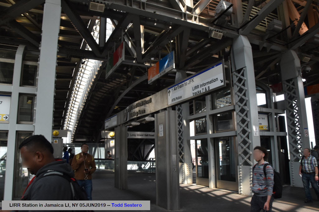
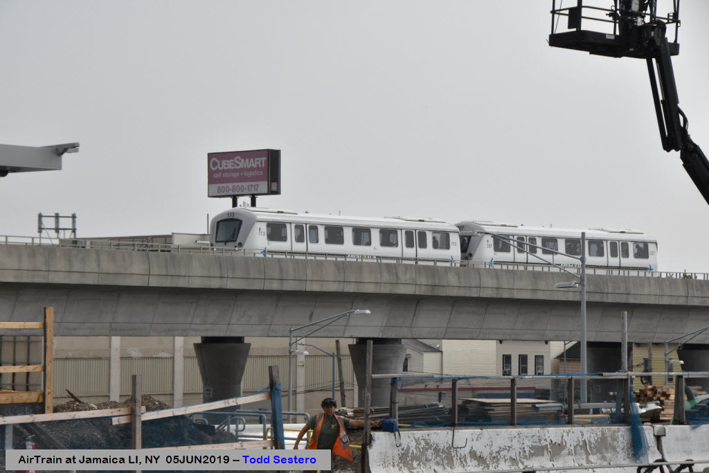
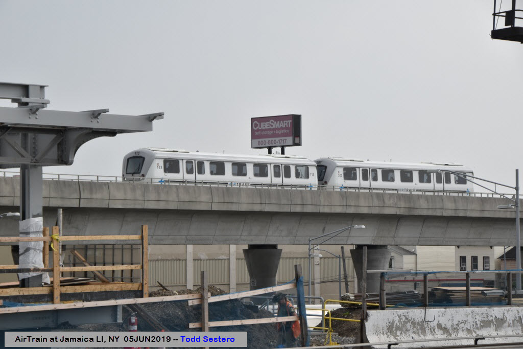
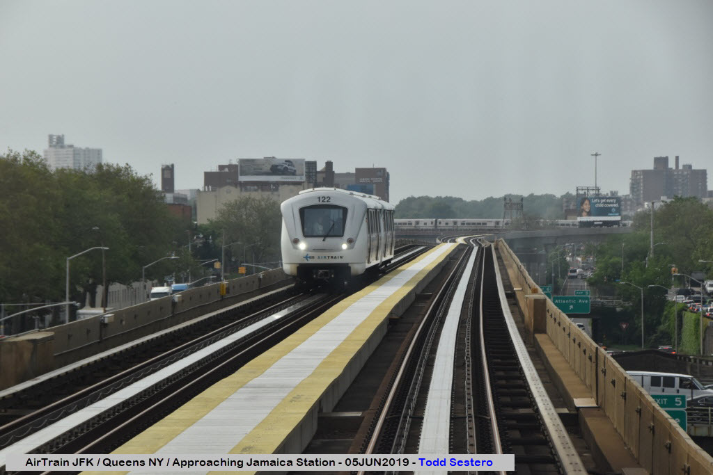
Add to that, the JFK Air Train is off to one side. So between the two of these plus the subway, it is busy enough to keep you occupied taking pictures for hours.
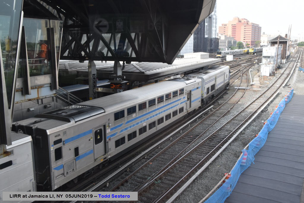
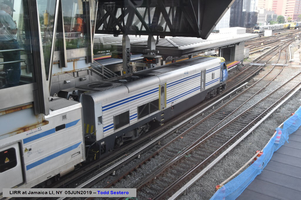
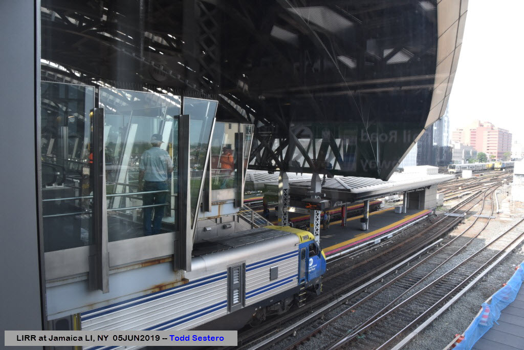
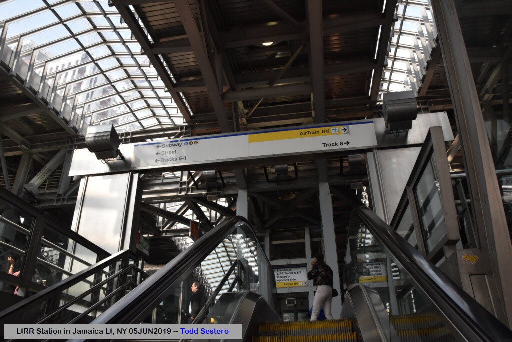
From Wikipedia: AirTrain's Jamaica station, located in an enclosed glass structure to the south of the LIRR platforms, has 2 tracks and 1 island platform. It is accessed by escalator or elevator from street level as well as via an enclosed bridge connecting it to the LIRR station. Unlike the LIRR platforms, the AirTrain JFK platforms are entirely enclosed and feature platform screen doors, which help the station maintain a constant temperature and prevent passengers from falling onto the tracks. An array of sensors detect a train's position on the track, and only when it is properly aligned will the train's doors open. This enables the AirTrain to use automatic train operation without drivers.
The platform measures approximately 240 feet (73 m). The next stop to the south is Federal Circle, followed by the six JFK airline terminal stops. West of the station the track curves to the left and runs south, above the Van Wyck Expressway. Since it is owned by the Port Authority, it uses a separate fare control from the LIRR. Passengers must pay their fare when BOTH entering AND leaving the station/system, as this station and Howard Beach are the only stations where fares are collected. MetroCard vending machines are located on both sides of fare control. (end Wiki)
For you subway fans, Jamaica Station is accessible via three lines: the IND "E" line, and the BMT "J" and "Z" lines. More information on the subway system can be found below in the Floobydust section.....
Please note, that because the large number of pictures on this page, I have gone the thumbnail route... this is the closest I get to being cellphone friendly :-)
Acknowledgements:
Denver Todd
Google Maps
Bing Maps
Open Railway Map
Wikipedia
Websites and other additional information sources of interest for the area:
https://en.wikipedia.org/wiki/Jamaica_station
https://sealevelrise.org/states/new-york/ not train related, but interesting....
https://www.nycsubway.org/wiki/Subway_FAQ:_Which_Lines_Were_Former_IRT,_IND,_BMT
http://lirr42.mta.info/stationInfo.php?id=15
Getting here is pretty easy, thanks to the highway system of New York City and Long Island.
The Van Wyck Expressway (I-678) drops you off right next to the station, exit 5A for the NB side. Go past Atlantic Ave and go under the tracks, and take a right onto Archer Ave, this takes you to the front door of the station.
If you come in via SB Van Wyck, get off at exit 6, then go just under a half mile, and take a left onto Jamaica Ave, and then a right onto Sutphin Ave - this takes you right to the station.
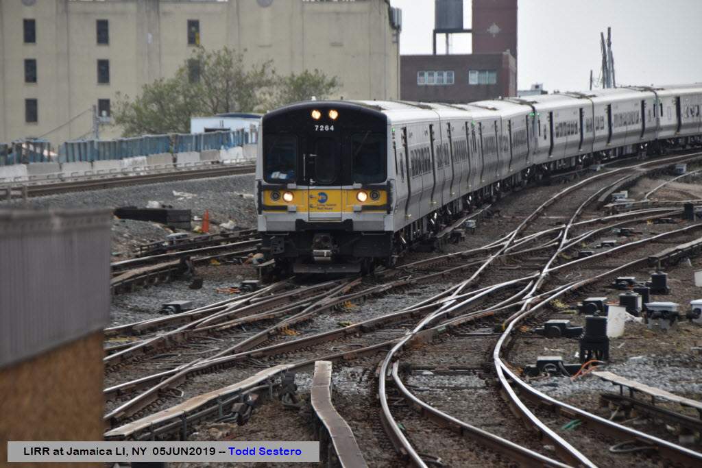
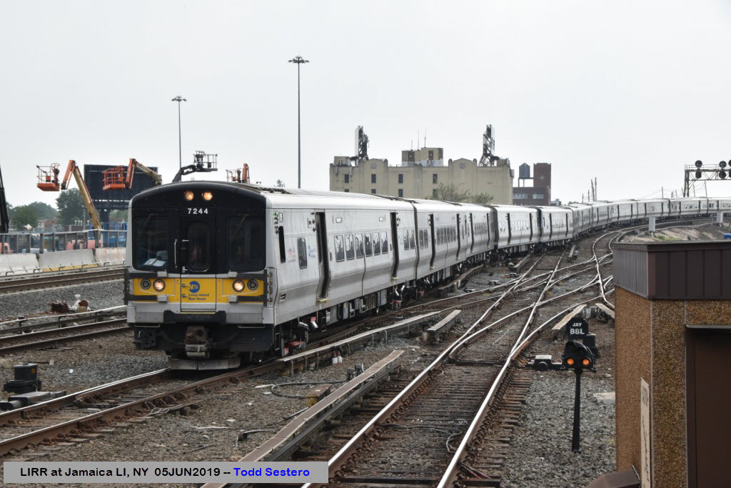
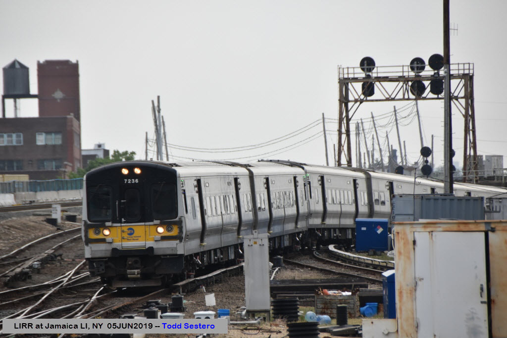
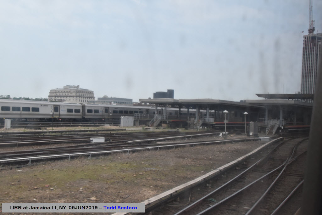
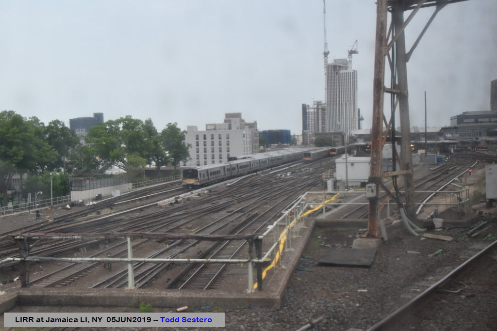
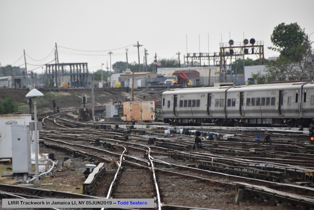
Looking West Towards Manhattan
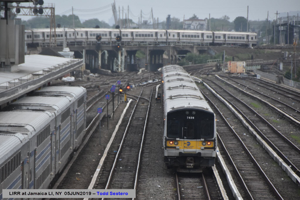
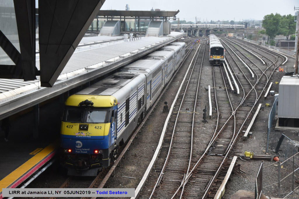
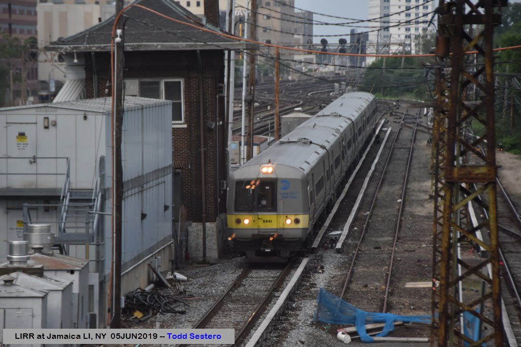
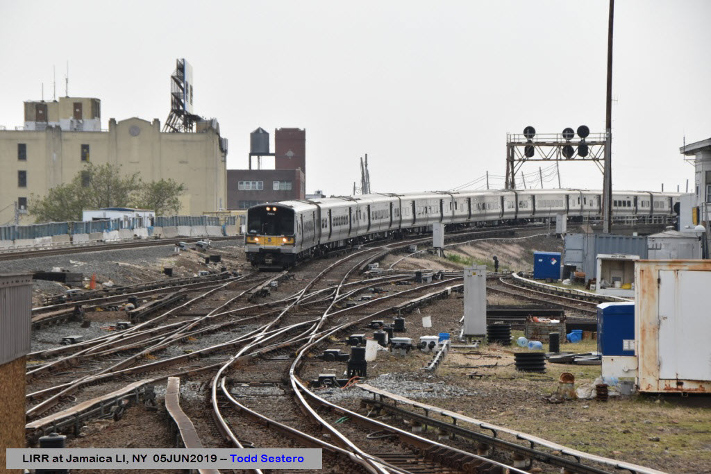
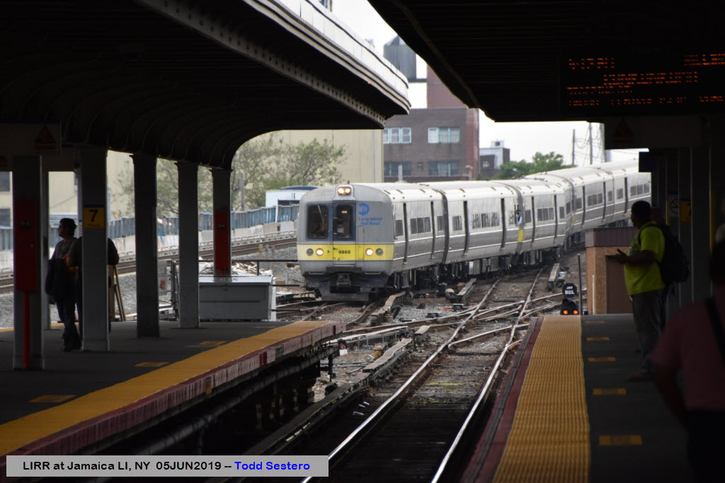
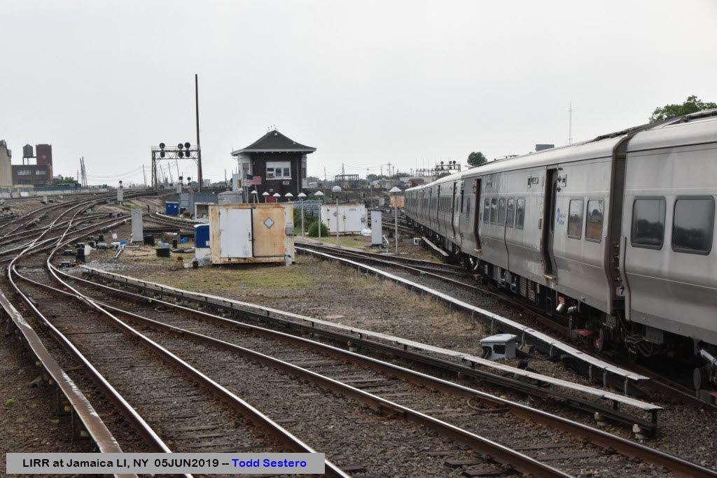
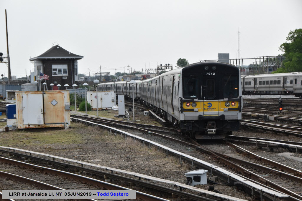
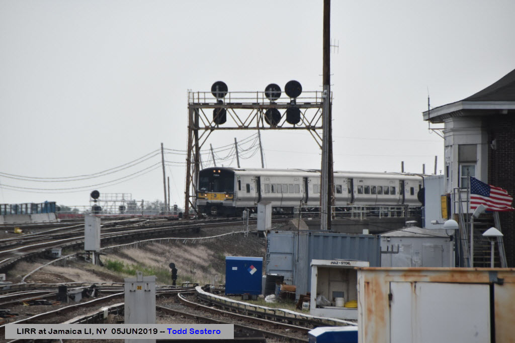
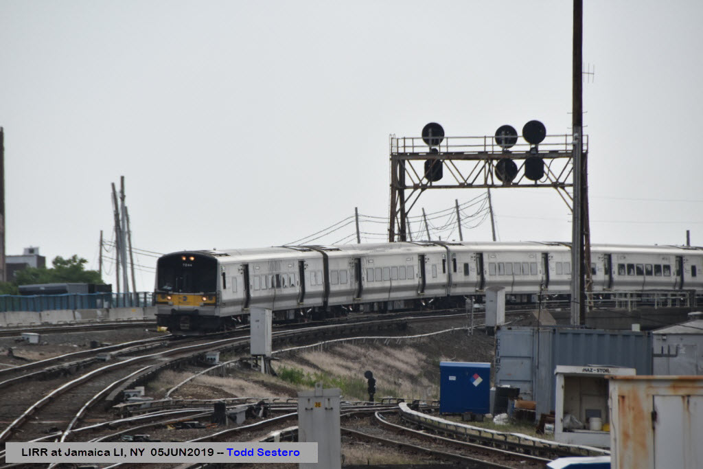
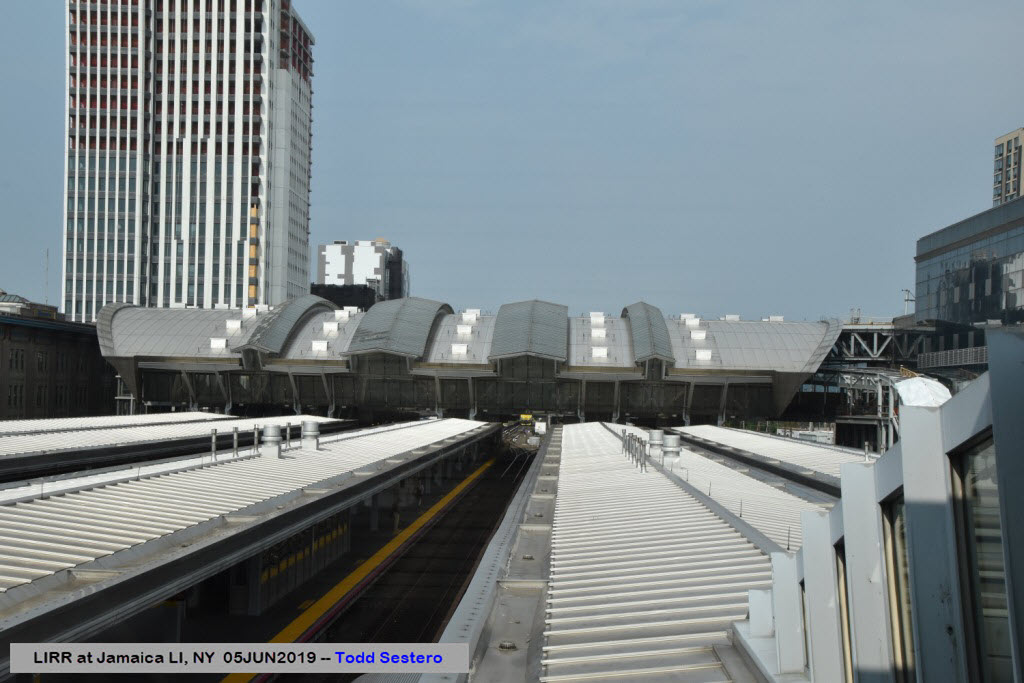
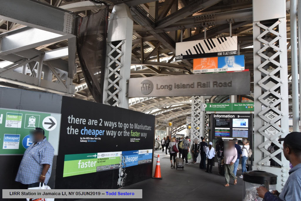
In the Station
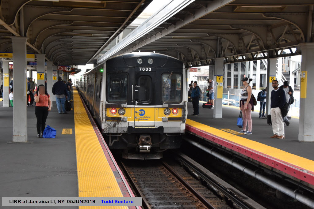
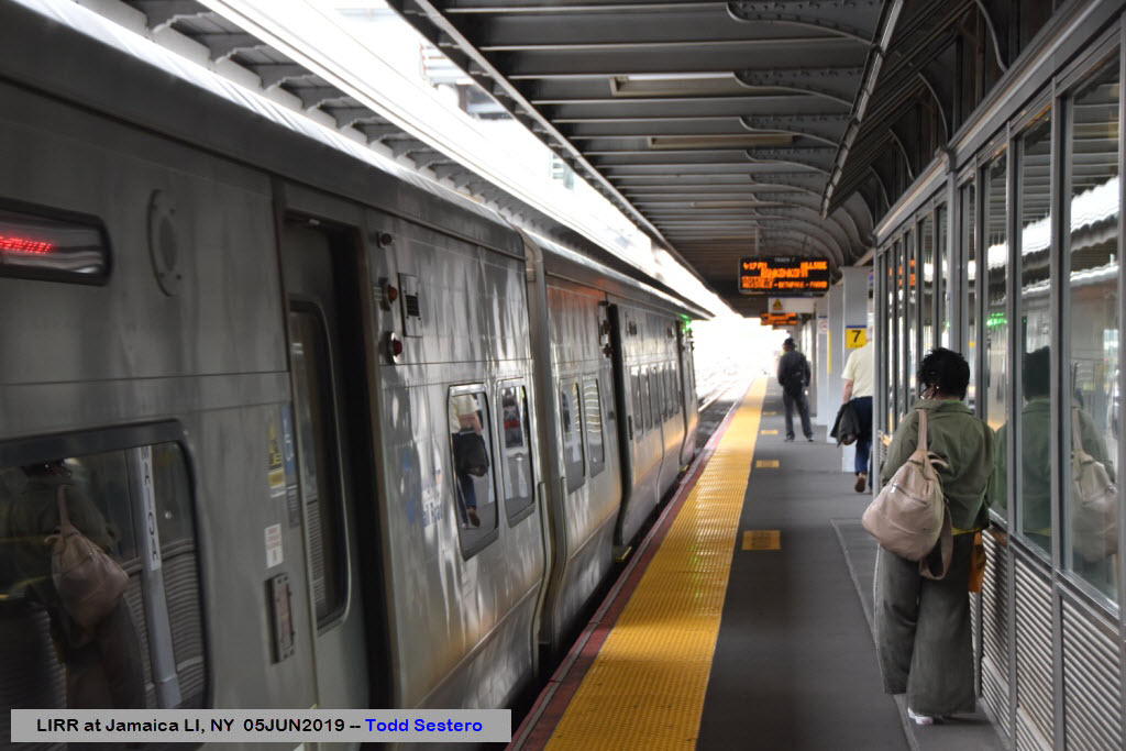
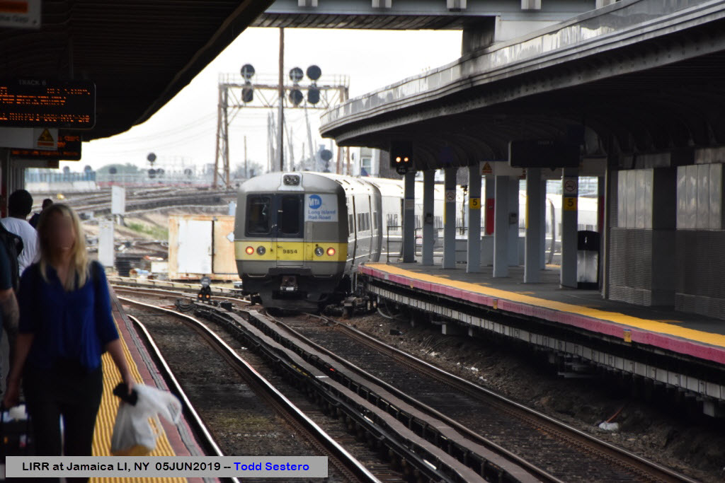
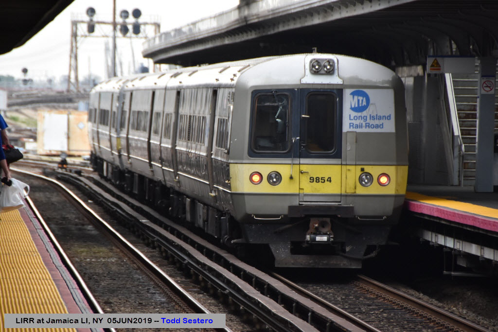
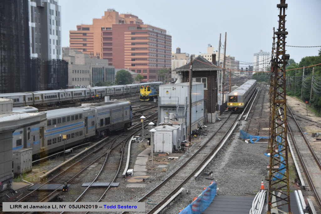
Looking East Towards "The Island"
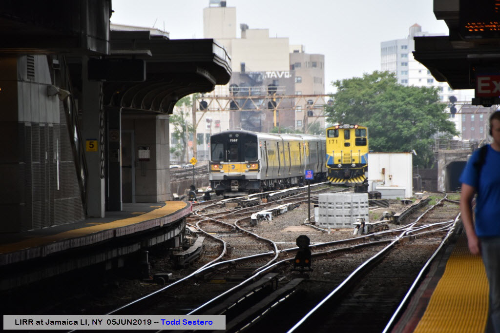
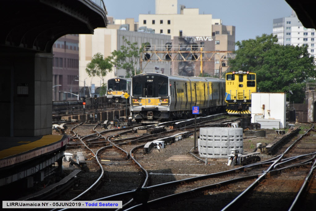

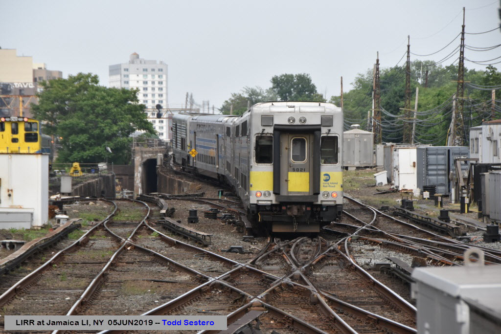

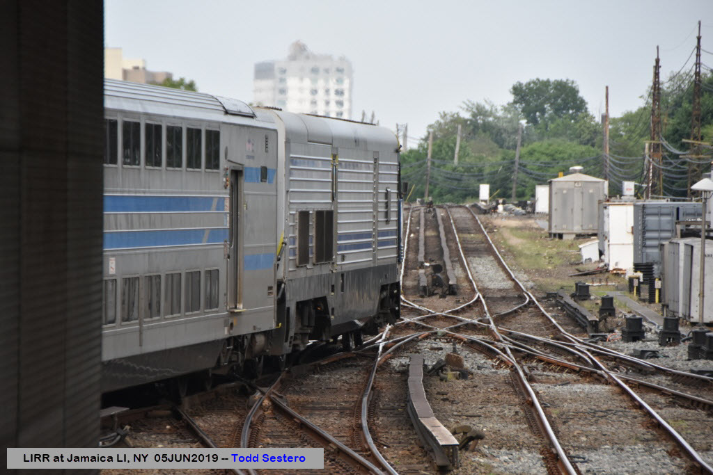
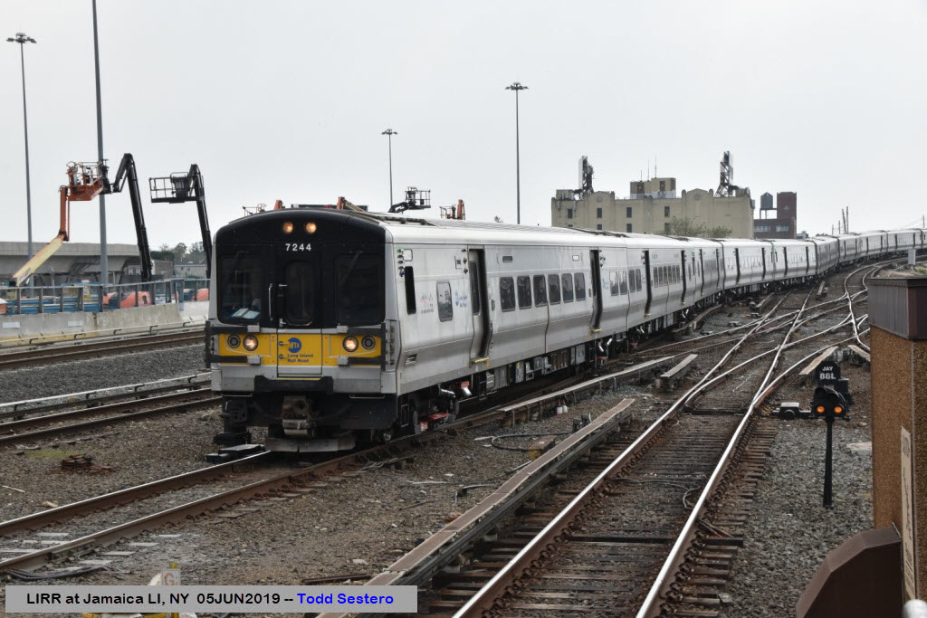
Coming In From Manhattan
From Wikipedia: Jamaica is a major train station of the Long Island Rail Road located in Jamaica, Queens, New York City. With weekday ridership exceeding 200,000 passengers,[4] it is the largest transit hub on Long Island, the fourth-busiest rail station in North America, and the second-busiest station that exclusively serves commuter traffic. It is the third-busiest rail hub in the New York area, behind Penn Station and Grand Central Terminal. Over 1,000 trains pass through each day, the fourth-most in the New York area behind Penn Station, Grand Central Terminal, and Secaucus Junction.
The Jamaica station is located on an embankment above street level and contains six platforms and ten tracks for LIRR trains. A concourse above the LIRR platforms connects to a station on the AirTrain JFK elevated people mover to JFK Airport, which contains two tracks and one platform. There are also connections to the Archer Avenue lines of the New York City Subway at a separate station directly below. The area just outside is served by several local bus routes, and others terminate within a few blocks of the station.
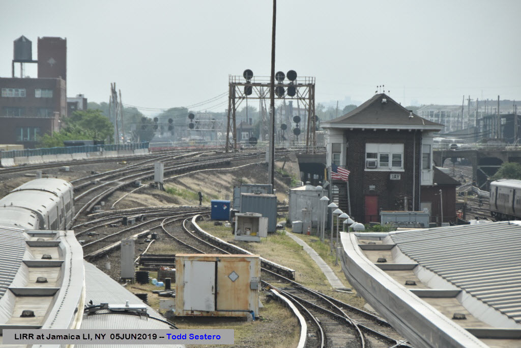
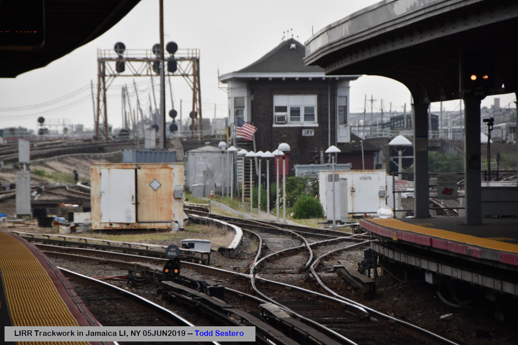
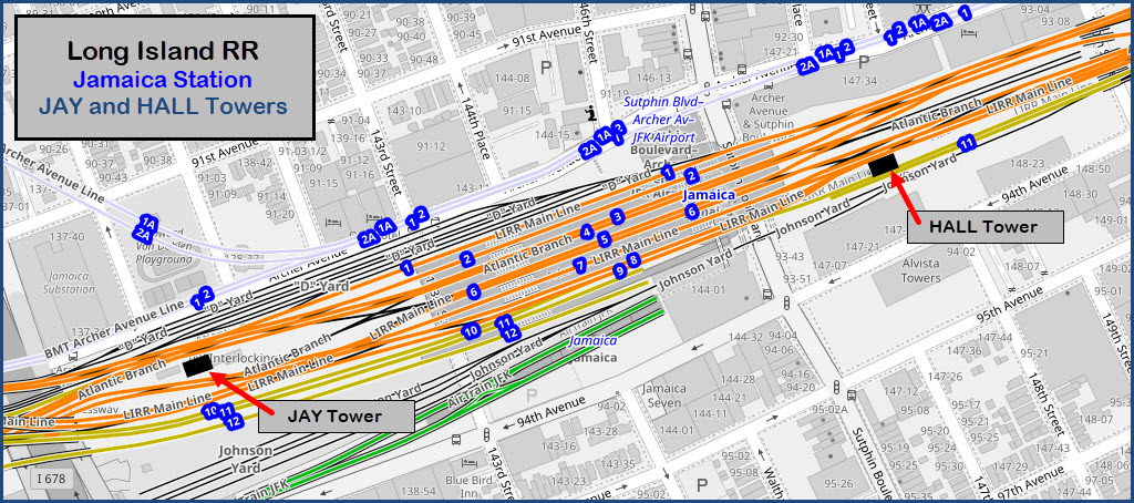
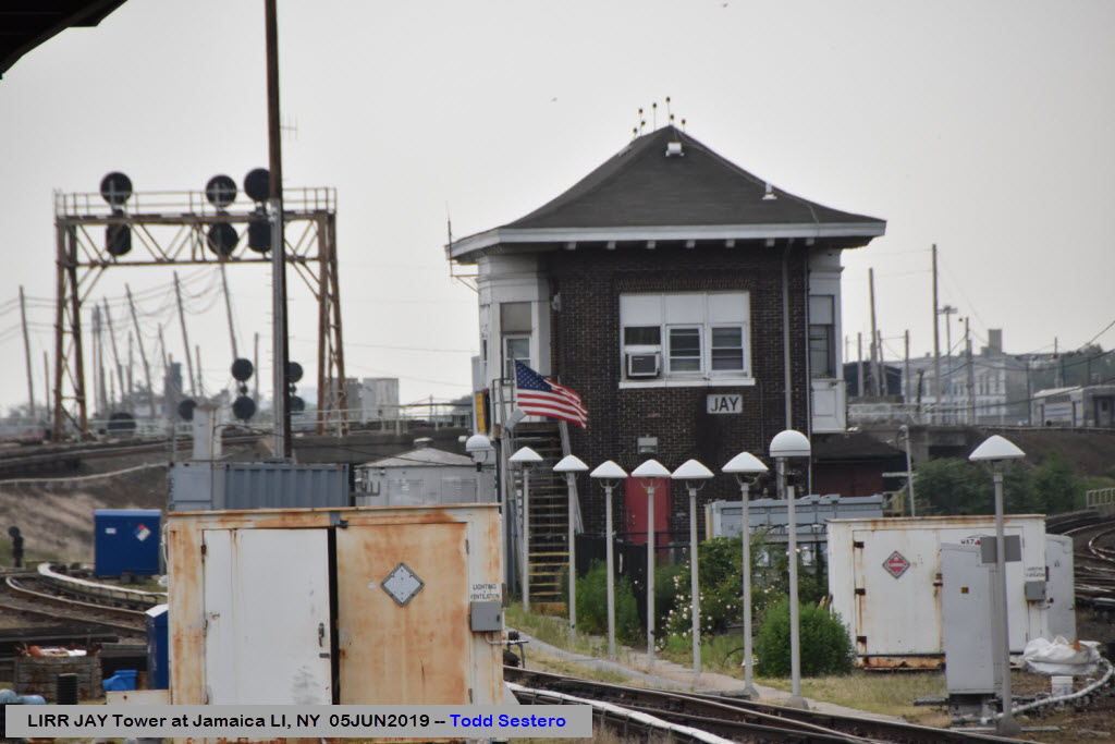
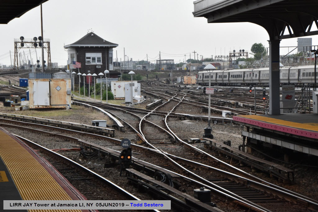
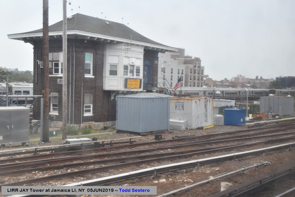
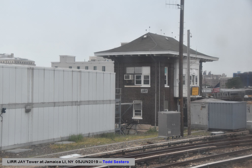
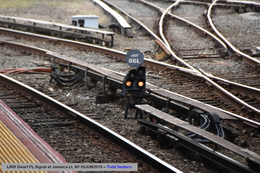
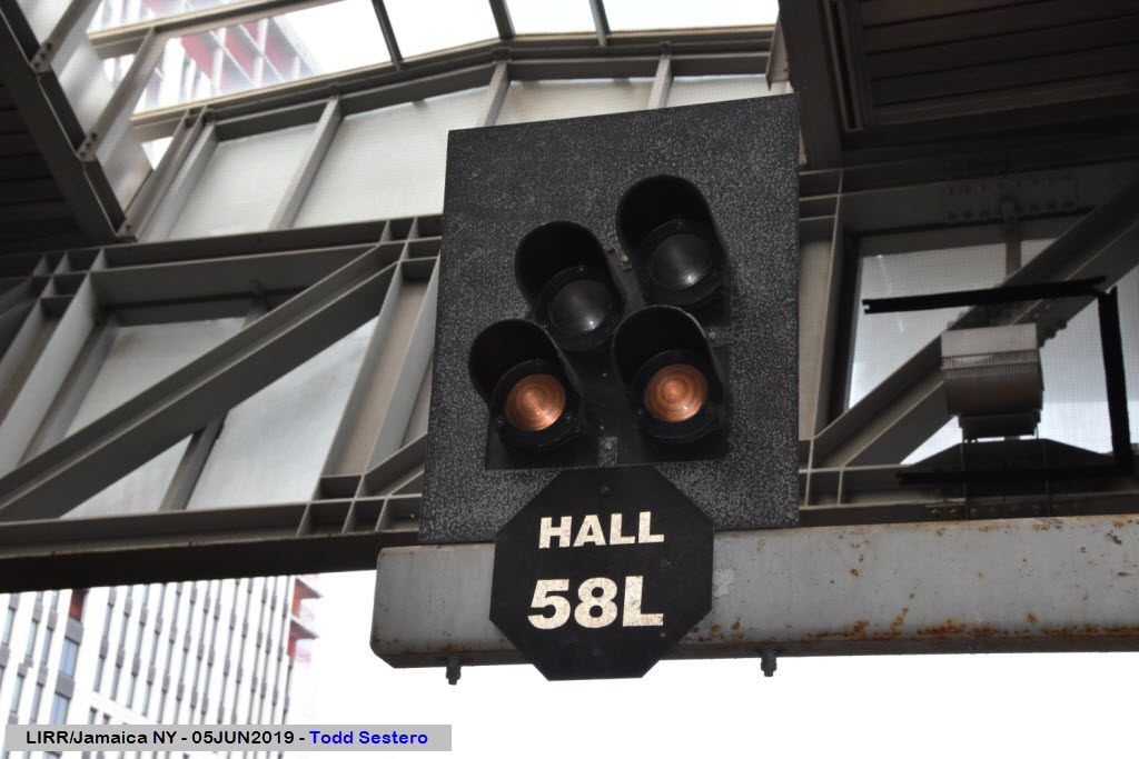
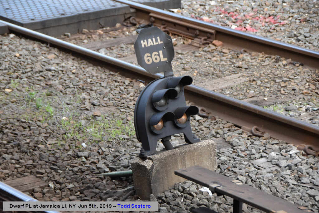
The present Jamaica station was designed by Kenneth M. Murchison[6] and built between 1912 and 1913 as a replacement for the two former stations in Jamaica. Both former stations were discontinued as station stops. The 1912–13 "Jamaica Improvement" was the final step in consolidating the branch lines of the LIRR. To the west of the station, Jay Interlocking was built, and to the east, Hall Interlocking was constructed. These interlockings allowed any line to reach any other line, allowing easy transfer between lines at Jamaica station, which is the hallmark of current day LIRR service.
When the new Jamaica station opened, residents of Jamaica were dissatisfied with its location; downtown Jamaica was centered around Union Hall Street, 0.6 miles (0.97 km) east of the new station at Sutphin Boulevard and Archer Avenue. The LIRR thus decided to add a new Union Hall Street station in 1913 (The Union Hall Street station closed on May 20, 1977). end Wiki
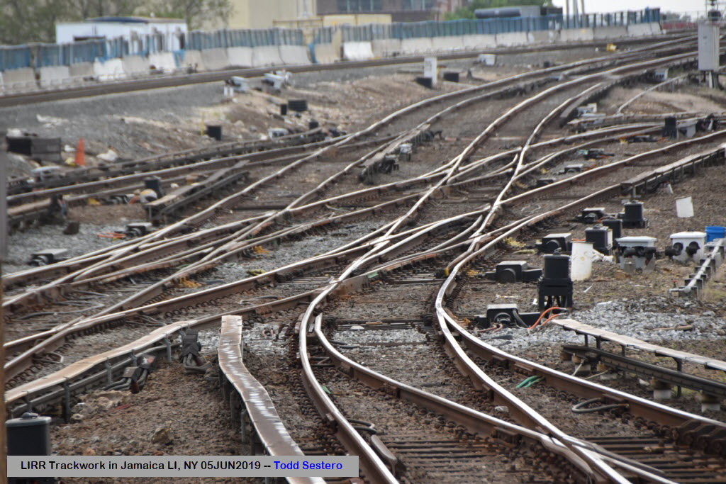
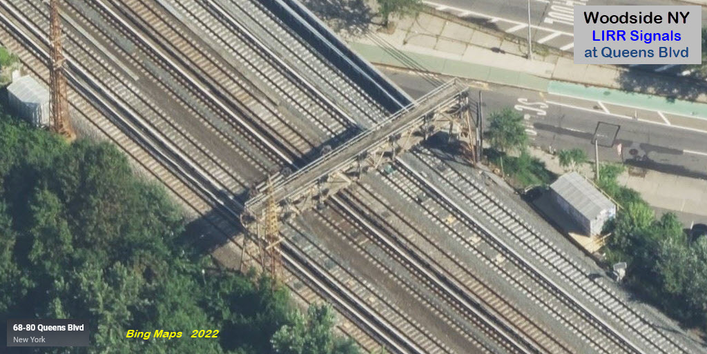
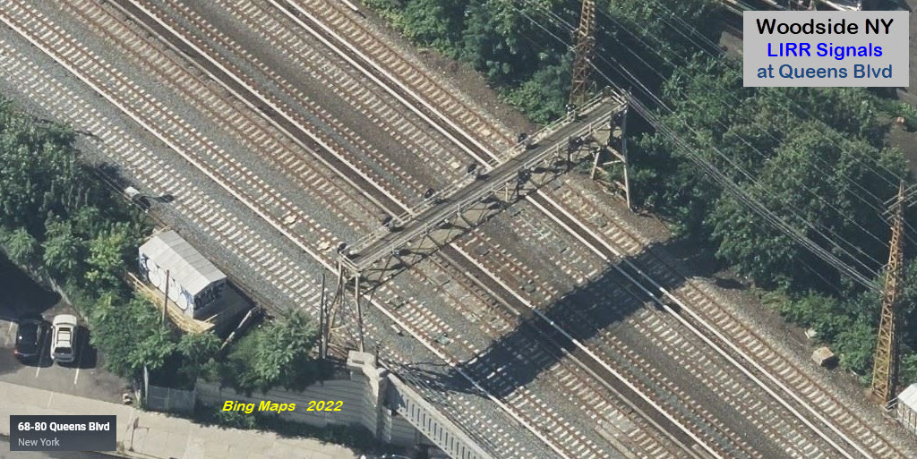
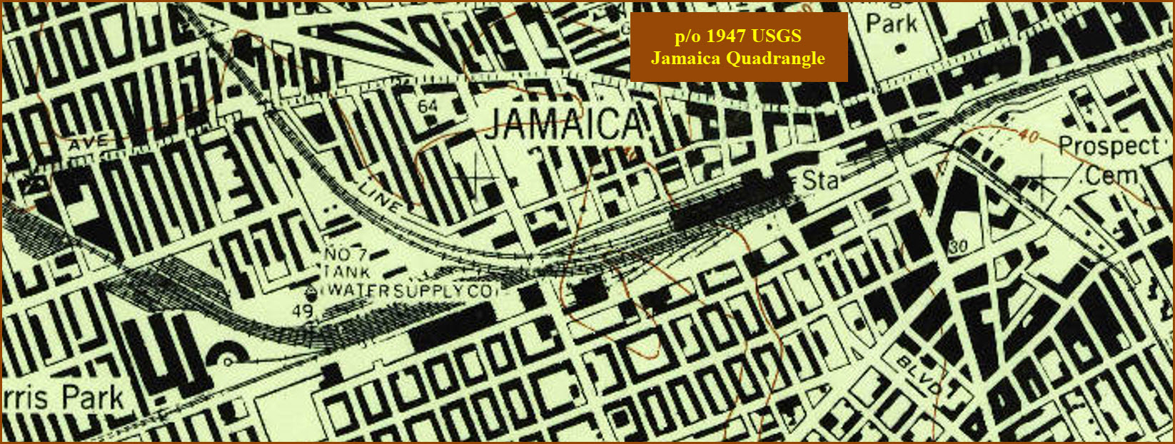
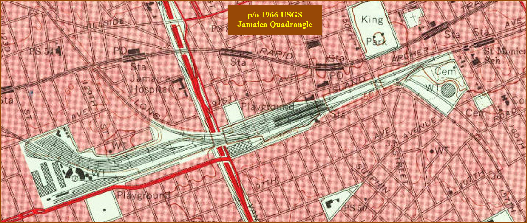
For the two following aerial views, download them if you want to look at the detail, they are made up of about 12 screenshots each.
AirTrain runs between Long Island's Jamaica Station and Leffert's Blvd, and Kennedy Airport, serving all of the terminals.
I have a page for the AirTrain system here.
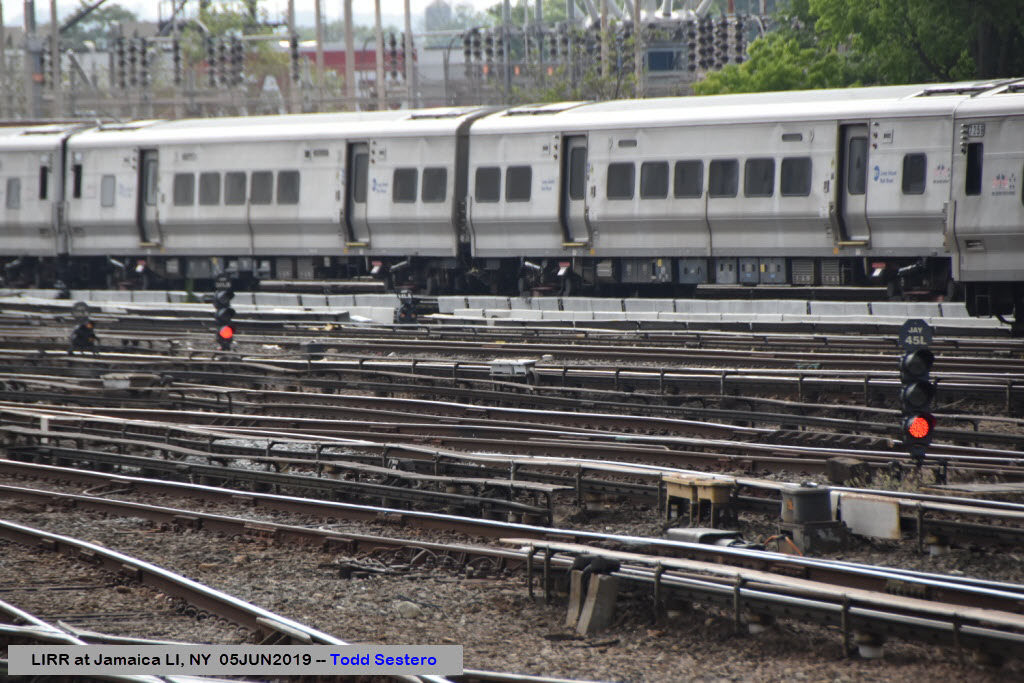
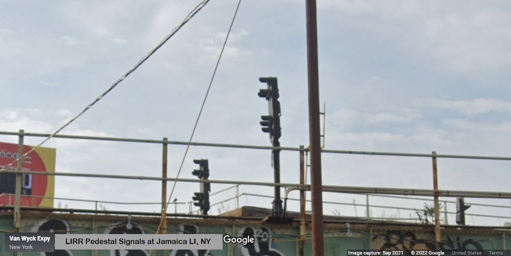
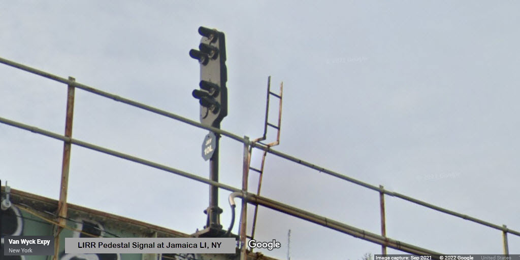
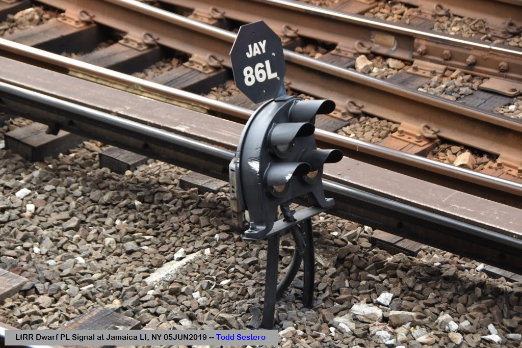
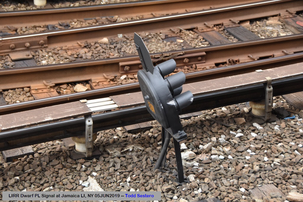
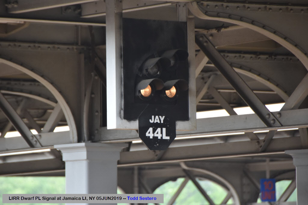
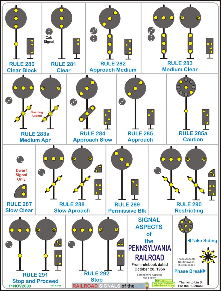
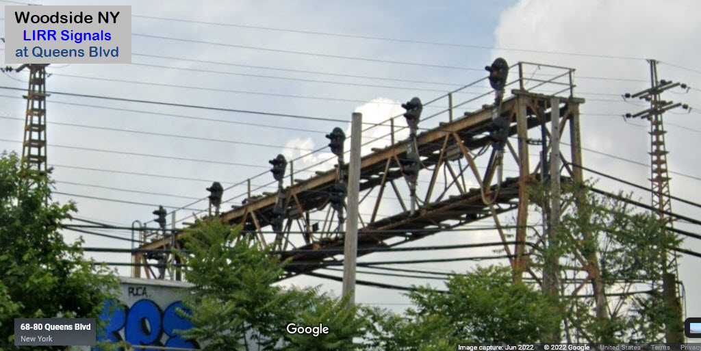
At one time, the Long Island RR was a subsidiary of the Pennsy, so, the signals erected after semaphores were of the Pennsy PL style. The LIRR started replacing them with "tri-light" style colorlight signals, maybe in the early 2000's? However, when I stopped by in 2019, everything at Jamaica was still PL's, including dwarf PL's and Pedestal's in the immediate station area.
GPS Coordinates: 40.74005, -73.89661
Three outbound tracks are signaled, all six inbound tracks are signaled with the newer trilights.
These Google Streetviews are from 2018, so the outbound lights may be replaced by now.
Other Subway Railfanning Info
If you're not from NYC, or if you are younger, here is some history/trivia you may not be aware of, because the MTA has gotten away from the use of IRT, IND, and BMT. They are the three companies that went into forming the NYCTA/MTA system, back in 1940:
-- The IRT was the Interborough Rapid Transit, and was the first to open in 1904
-- The BMT was the Brooklyn-Manhattan Transit
-- The IND was the INDependent Subway, formed in the 1920's to compete with the city run IRT/BMT
Another interesting note, is that the IRT trains are shorter and narrower than the IND/BMT trains, so theIND/BMT cars can not run on IRT lines.
The line number assignments are as follows:
-- Numbers are all former IRT lines
-- Low letter assignments up to "G", plus "Q" are IND lines
-- High letter lines, "J" thru "Z" are BMT lines (with the exception of "Q")
While were talking history, the oldest station in the system is the City Hall station, which opened in 1904 when the IRT opened.
If you're railfanning the Sunnyside area, a couple of subway things to remember:
-- Queensboro Plaza is ABOVE ground for the #7 to Flushing, and the N and W to Astoria
-- Queens Plaza is BELOW ground for the E, M, and R trains
-- The Q train coming up from Brooklyn ends at the Court Square station, you can transfer to the 7, E, and M
Courtesy of the USGS, click here for their index page.
Disclaimers:
I love trains, and I love signals. I am not an expert. My webpages reflect what I find on the topic of the page. This is something I have fun with while trying to help others.
Please Note: Since the main focus of my two websites is railroad signals, the railfan guides are oriented towards the signal fan being able to locate them. For those of you into the modeling aspect of our hobby, my indexa page has a list of almost everything railroad oriented I can think of to provide you with at least a few pictures to help you detail your pike.
If this is a railfan page, every effort has been made to make sure that the information contained on this map and in this railfan guide is correct. Once in a while, an error may creep in :-)
My philosophy: Pictures and maps are worth a thousand words, especially for railfanning. Text descriptions only get you so far, especially if you get lost or disoriented. Take along good maps.... a GPS is OK to get somewhere, but maps are still better if you get lost! I belong to AAA, which allows you to get local maps for free when you visit the local branches. ADC puts out a nice series of county maps for the Washington DC area, but their state maps do not have the railroads on them. If you can find em, I like the National Geographic map book of the U.S..... good, clear, and concise graphics, and they do a really good job of showing you where tourist type attractions are, although they too lack the railroads. Other notes about specific areas will show up on that page if known.
Aerial shots were taken from either Google or Bing Maps as noted. Screen captures are made with Snagit, a Techsmith product... a great tool if you have never used it!
By the way, floobydust is a term I picked up 30-40 years ago from a National Semiconductor data book, and means miscellaneous and/or other stuff.
Pictures and additional information is always needed if anyone feels inclined to take 'em, send 'em, and share 'em, or if you have something to add or correct.... credit is always given! Please be NICE!!! Contact info is here
Beware: If used as a source, ANYTHING from Wikipedia must be treated as being possibly inaccurate, wrong, or not true.
RAILFAN GUIDES HOME
RAILROAD SIGNALS HOME
NEW 07/13/2016, AUG13/2022, JUN28/2023
Last Modified 02-Jul-2023