RAILFAN GUIDES of the U.S.
Todd's Railfan Guide to
WINNEMUCCA NV
In General
Getting Here
Map
Sights
Pictures
Bridges
Signals
Fire & Police
Postcards
Floobydust
USGS Maps
RAILROAD SIGNALS HOME
Location / Name:
Winnemucca NV, Humboldt County (County seat)
What's Here:
Amtrak Station (WNN)
2
3
Data:
GPS Coordinates: as needed , X, -Y
Phone A/C: 775
ZIP: 89445
Population: 7,396 (2010)
Access by train/transit:
California Zephyr
The Scoop:
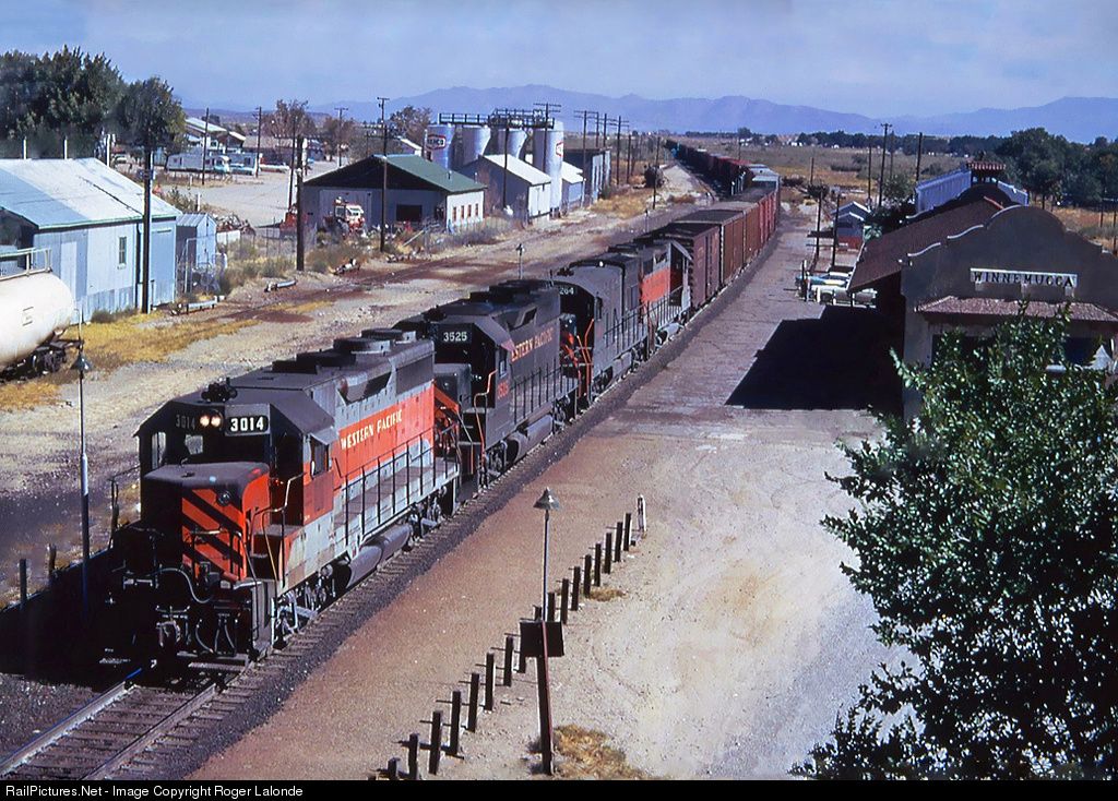
From Wikipedia: On September 16, 1868, the Central Pacific Railroad reached Winnemucca, and was officially opened on October 1 of that year. It was on the First Transcontinental Railroad. It was part of the transcontinental line.
Amtrak, the national passenger rail system, provides service to Winnemucca. The California Zephyr provides a daily service in both directions between San Francisco and Chicago. The Winnemucca passenger rail station is now unstaffed. Historically, since 1867, Winnemucca has been a station on the Transcontinental Railroad.
Winnemucca is near the half-way point between Salt Lake City and San Francisco along Interstate 80, which passes through town. US Route 95 also goes through Winnemucca.
Local aviation needs are served by the Winnemucca Municipal Airport, located about 5 miles southwest of downtown. There are no scheduled passenger services locally. The closest commercial airports are Reno–Tahoe International Airport in Reno and Elko Regional Airport in Elko.
Additionally: The Central Pacific Railroad reached Winnemucca on September 16, 1868, and the first train arrived to the town on October 1. The line was later acquired by the Southern Pacific Railroad. The first transcontinental train rolled through on May 11, 1869. Amtrak took over intercity passenger rail service in the United States in May 1971 and service to Winnemucca continued on the City of San Francisco (later renamed San Francisco Zephyr, and later California Zephyr).
A small shelter was installed in 1993. In early 2012, a 550-foot-long (170 m) accessible platform and a brick station building were constructed for the station as part of a $1.26 million project (equivalent to $1.49 million today). end Wiki
There is one train a day in each direction.
The town is named after Indian Chief Winnemucca. He was a Northern Paiute war chief. He was born a Shoshone around 1820 in what would later become the Oregon Territory. (from Wikipedia)
Looks like the majority of downtown hotels and motels are on W Winnemucca Blvd.
Acknowledgements:
Denver Todd
Errant Knight
Google Maps
Bing Maps
Open Railway Map
Wikipedia
Websites and other additional information sources of interest for the area:
https://en.wikipedia.org/wiki/Winnemucca,_Nevada
https://en.wikipedia.org/wiki/Winnemucca_station
http://www.trainweb.org/usarail/winnemucca.htm
https://railscapes.blog/trip-reports/united-states/wendover-winnemucca/
https://en.wikipedia.org/wiki/Winnemucca_(Paiute_leader)
Interstate 80 make it very easy and convenient to get here.
GPS Coordinates: 40.97, -117.73
209 Railroad Street, Winnemucca, NV 89445
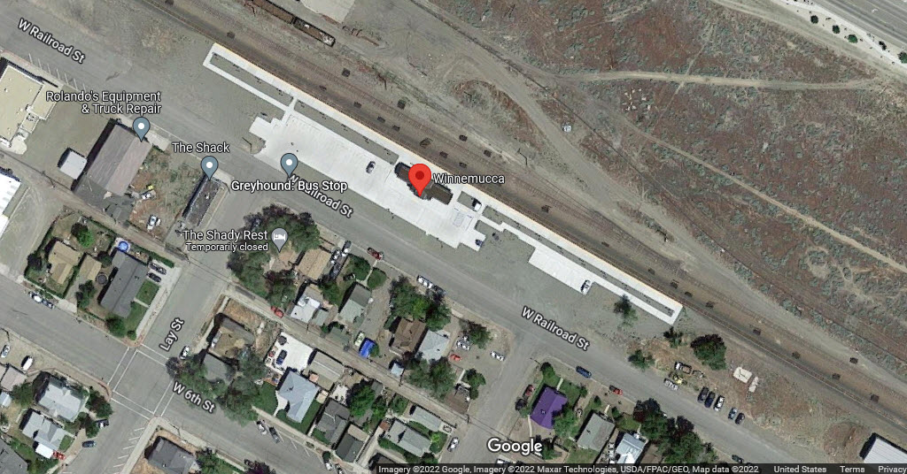
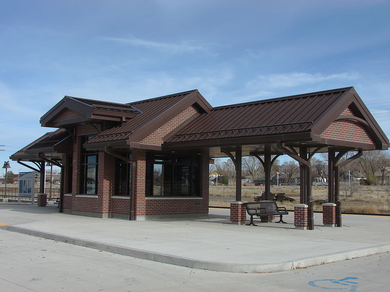 photo by Errant Knight, via Wikipedia
The
The
The
The
The
![]() Xxx
Xxx
![]() Xxx
Xxx
![]() Xxx
Xxx
Did U Know?
None for now......
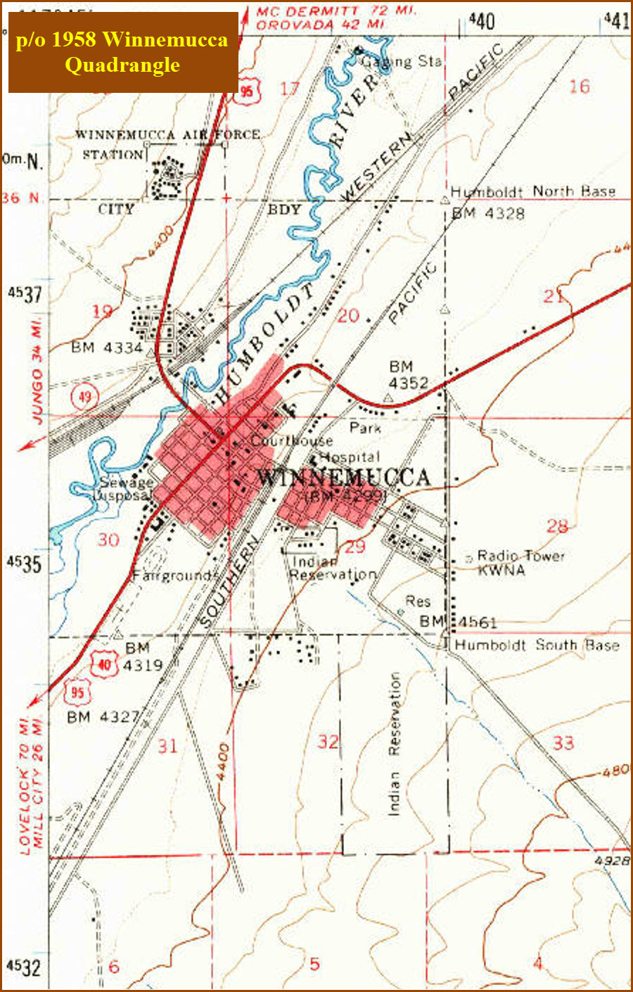
Courtesy of the USGS, click here for their index page.
Disclaimers:
I love trains, and I love signals. I am not an expert. My webpages reflect what I find on the topic of the page. This is something I have fun with while trying to help others.
Please Note: Since the main focus of my two websites is railroad signals, the railfan guides are oriented towards the signal fan being able to locate them. For those of you into the modeling aspect of our hobby, my indexa page has a list of almost everything railroad oriented I can think of to provide you with at least a few pictures to help you detail your pike.
If this is a railfan page, every effort has been made to make sure that the information contained on this map and in this railfan guide is correct. Once in a while, an error may creep in :-)
My philosophy: Pictures and maps are worth a thousand words, especially for railfanning. Text descriptions only get you so far, especially if you get lost or disoriented. Take along good maps.... a GPS is OK to get somewhere, but maps are still better if you get lost! I belong to AAA, which allows you to get local maps for free when you visit the local branches. ADC puts out a nice series of county maps for the Washington DC area, but their state maps do not have the railroads on them. If you can find em, I like the National Geographic map book of the U.S..... good, clear, and concise graphics, and they do a really good job of showing you where tourist type attractions are, although they too lack the railroads. Other notes about specific areas will show up on that page if known.
Aerial shots were taken from either Google or Bing Maps as noted. Screen captures are made with Snagit, a Techsmith product... a great tool if you have never used it!
By the way, floobydust is a term I picked up 30-40 years ago from a National Semiconductor data book, and means miscellaneous and/or other stuff.
Pictures and additional information is always needed if anyone feels inclined to take 'em, send 'em, and share 'em, or if you have something to add or correct.... credit is always given! Please be NICE!!! Contact info is here
Beware: If used as a source, ANYTHING from Wikipedia must be treated as being possibly inaccurate, wrong, or not true.
SEPTA HOMEPAGE
RAILFAN GUIDES HOME
RAILROAD SIGNALS HOME
NEW 07/18/2022
Last Modified 20-Jul-2022