In General
Map
Pictures
Floobydust
USGS Maps
RAILROAD SIGNALS HOME
Location / Name:
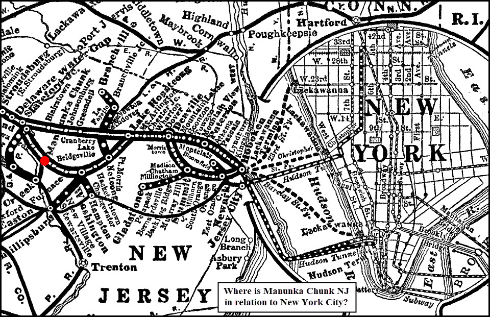
Manunka Chunk NJ
What's Here:
Former tower, station, and tunnel location
Data:
GPS Coordinates: 40.860353, -75.049324
Scanner Frequencies:
None - N/A
Access by train/transit:
None
The Scoop:
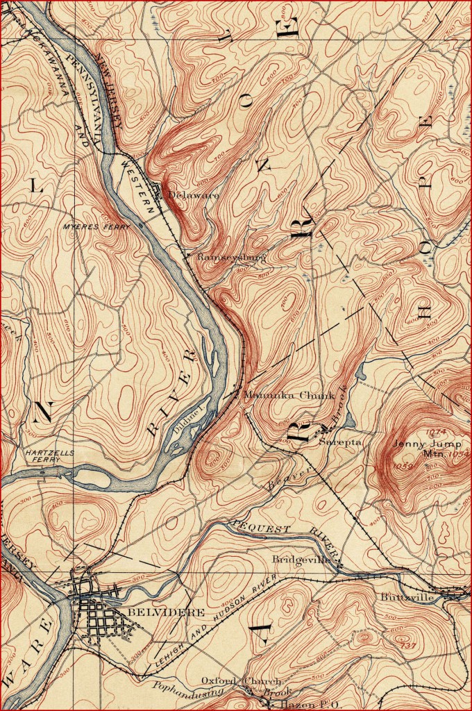
Manunka Chunk is the point where the PRR's Belvidere-Delaware Division joined the Delaware, Lackawanna and Western Railroad's Old Main Line that went through Washington NJ.
The view in the picture below that had me "do a page" around it, and it is looking eastward. A heavy rain in 1913 washed out the bank that the tower, station, and Pennsy tracks sat on. The tower was replaced the following year.
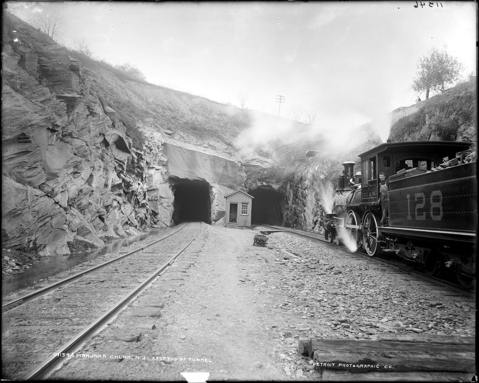
The DL&W tracks heading through the tunnels lead to Washington, Dover, Jersey City and Hoboken, all in NJ. Trackage diverging to the right, along the river bank, is the PRR's Bel-Del Division heading toward Trenton, NJ.
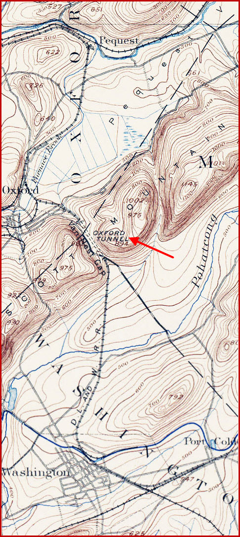
The following is from Wikipedia: The first railroad crossings through the village of Manunka Chunk, New Jersey date back to 1856, when John Blair opened the Warren Railroad throughout Warren County NJ, stretching from Washington NJ to Portland PA. The railroad had to make use of two tunnels to navigate its way through deep mountains and hills in the northwestern portions. The Van Nest Gap Tunnel (also known as Oxford Tunnel) opened in 1862 near Oxford Furnace NJ and the Manunka Chunk Tunnel, a then one-bore tunnel through soft shale. During the construction of the Van Nest Gap Tunnel, Blair had a temporary road over the mountains installed. The railway was complete when the tunnel was finished in 1862. The delay in construction was due to difficulty boring through gneiss in Van Nest Gap and due to the fact that the Morris and Essex Railroad got a temporary injunction to stop construction of the Warren RR. In 1869, a second bore was added to the Manunka Chunk Tunnel and the railroad was double tracked.
In 1876, the Pennsy brought its Belvidere and Delaware Branch up north along the Delaware River and created a junction at Manunka Chunk. The Warren Railroad, now owned by the Delaware, Lackawanna and Western Railroad, and the Pennsy created a joint venture, constructing a new train station, freight station and junction tower (U Tower) for both railroads to share. This was done so neither railroad would have to build extra mileage or construct new bridges to serve its passengers. The station depot at Manunka Chunk was attached to the center of the western bores of Manunka Chunk Tunnel. The station became a junction point for travelers from Newark NJ and Philadelphia PA to reach the beauty of the Delaware Water Gap. As a result of the newfound service, the area around the village of Manunka Chunk grew, opening as a resort town along the Delaware River. The area had the Manunka Chunk House built in the early 1900s, but only lasted into the Great Depression, when the place was abandoned and burned down on June 13, 1938 during a suspicious fire. The area was in a gradual depression since a 1913 washout of the railroad lines, both of which caused the station to be closed down and abandoned along with the collapse of the original Manunka Chunk Tower, which rested on its side after the disaster.
1913 flooding -- On August 1, 1913, a cloudburst formed just west in the community of Pen Argyl PA around 4 pm. The cloudburst crossed the Delaware River and caused extensive damage in its path, and after it passed, six railroads including the Delaware, Lackawanna and Western had washouts. The newly created New Jersey Cut-Off withstood with no damage, however, the DLW's Old Main and the Pennsy's Belvidere and Delaware Branch both received extensive destruction. About 200 feet (61 m) of the Pennsy's track was washed away and crumbled down to the public highway below, causing the Tower and the Freight Station to both topple with the mountainside. The tower operator, however escaped without harm. As a result of the flooding, both railroads were blocked and experienced numerous track washouts, along with a 50 feet (15 m) gully through the roadbed. The Pocono special, a train run by the Pennsy from Philadelphia was blocked at the site and had to turn back for Easton PA. The mountainside supported Lackawanna also lost a freight train when the public roadway collapsed on top of the freight cars passing 30 feet (9.1 m) underneath. Nearby hotels and resorts were badly damaged, resulting in power outages and broken water mains. No lives were lost in the calamity, which was estimated to cause more than $100,000 in damages (in 1913 currency). Local news reports said the worst damage was centralized to Manunka Chunk, where wire communication became near impossible. The Bangor and Portland Branch also lost seven bridges during the storm, causing all trains to be stranded in Portland.
The Manunka Chunk Tunnel was first constructed part of the Warren Railroad through White Township NJ. The tunnel itself first began construction in 1854, after John Blair got the go-ahead from release of a court-appointed injunction placed by the Morris & Essex Railroad. The tunnel itself was bore through soft shale, taking less than considerable time to complete the entire then one-track, one-bore structure. The tunnel at Manunka Chunk opened in 1856, taking a quarter of the time it took to construct Van Nest Gap Tunnel on the same line. It received a 2nd track and bore in 1869. The tunnel was one of the problems with the main line for the now Delaware, Lackawanna and Western Railroad. Its facing on the eastbound portal had a significant design flaw as the natural structures around the two portals sagged. However, the western portal was constructed of fine masonry design of stones and bricks.
The tunnel remained active for many years, although service dwindled once the New Jersey Cut-Off Line was completed to the north in nearby Columbia NJ in 1911. By 1948, there was only one freight train crossing through the tunnel and no passenger service. That year, the eastbound tracks were ripped up from the old main line, leaving Manunka Chunk as a single track line. In April 1970, the now Erie Lackawanna Railway severed any train service past Washington, and closing down Manunka Chunk Tunnel for good. It had not seen a train for a while due to another flood a few years prior.
The Lackawanna Cut-Off opened in 1911, spelling a sharp decline in freight and passenger service on the DL&W's "Old Main." The line was returned to single-track in the 1940s and officially abandoned between Delaware and Washington NJ, on April 21, 1970. Track was removed from the tunnel except for one small section trapped between the two cave-ins of the westbound bore.
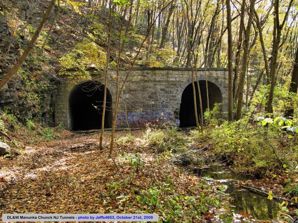
Nothing much exists of either right-of-way today, although the tunnels are still with us.
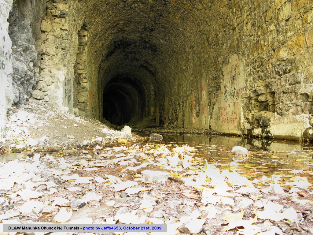
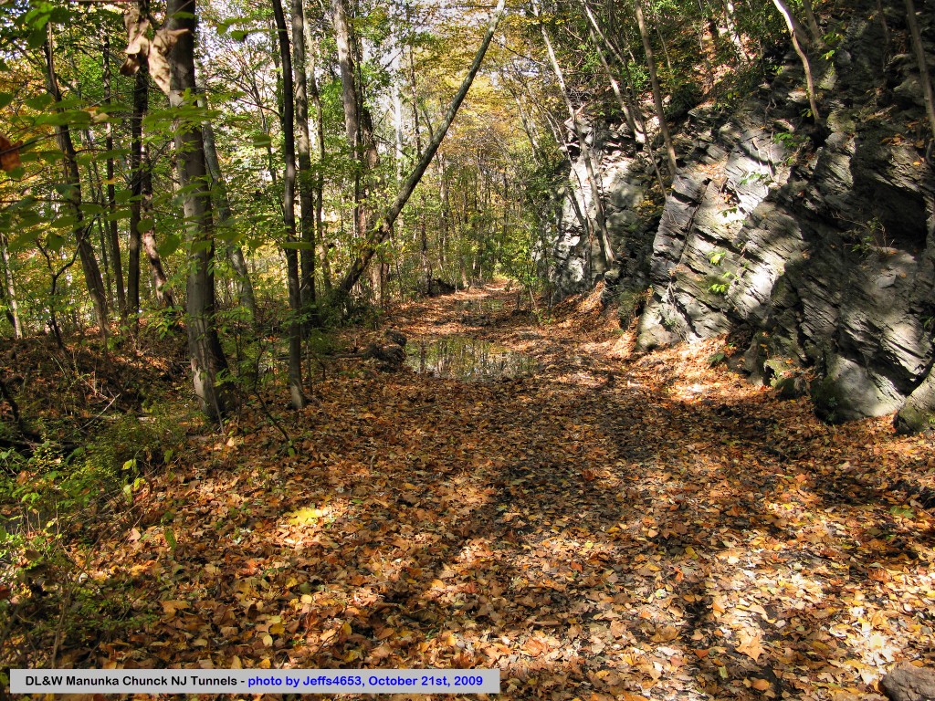
OK, update 2020: at least in 2009, the tunnels were still there, and you can get to them off US 46. Although, again, in 2009, you could go into them, IT IS NOT RECOMMENDED! I would like to thank Mark for bringing the pictures of Jeff4653 to my attention, I hardly ever go out and search for these things! :-)
A review of the timetables below tells us much: Joint operation there was really quite complex, and it is still not clear just how the two RR's coordinated. The 1895 Official Guide shows an almost extreme amount of activity at the Manunka Chunk Union Station (so officially designated in the PRR listings.) It appears that the PRR trains from Philly/Trenton continued on thru Manunka Chunk on the Lackawanna track to at least Stroudsburg and maybe Scranton. The attached two files are extracted from the 1895 Official Guide to the Railways. Without counting precisely, it looks like the junction handled more than 30 passenger trains a day!
The listings don't make clear what kind of switching or combining might have been done at the various points in common on the DL&W. There is no reference to sleeping cars or diners on the PRR Belvidere Division; it appears those were then, and remained, coach trains only. Anyone wanting better service could transfer to the DL&W trains at Manunka Chunk or points west.
Another interesting note: by the 1910 Guide, the Lackawanna no longer even lists Manunka Chunk, although the Lackawanna Cutoff was not yet in service. The PRR service still looks much the same, with one train a day even terminating and originating at Manunka Chunk (where there was a turntable.)
Note: Although this isn't really a railfan guide, I had to create this page for the sake of the picture.... as some things just warrant a page for the sake of preserving history!
Acknowledgements:
Thanks to Abram Burnett for passing along the picture!
Mark Rothschild
Jeffs4653
Bob McCown
Websites and other additional information sources of interest for the area:
http://en.wikipedia.org/wiki/User:Mitchazenia/Manunka_Chunk_Union_Junction
https://www.flickr.com/photos/jeffs4653/ Jeff's pictures - he gets around a lot, and I especially like his pictures of the Poughkeepsie RR bridge
https://www.steamphotos.com/Railroad-Photos/Abandoned-Railroad-Tunnels/Manunka-Chunk-Tunnel/
http://tfpnj.blogspot.com/2021/01/manunka-chunk-tunnels.html
https://bridgehunter.com/nj/warren/bh65658/
https://www.geocaching.com/blog/2013/10/its-the-spookiest-time-of-year-manunka-chunk-tunnels-gc82b5-geocache-of-the-week/
https://www.loc.gov/resource/det.4a07247/ general view of the west end of the tunnel
https://www.loc.gov/resource/det.4a07615/ better view of the west end of the tunnel, yards, turntable, banjo signal, freight warehouse
https://www.loc.gov/resource/cph.3b44483/ stereo view of the junction and station, probably predates the one above... 07615
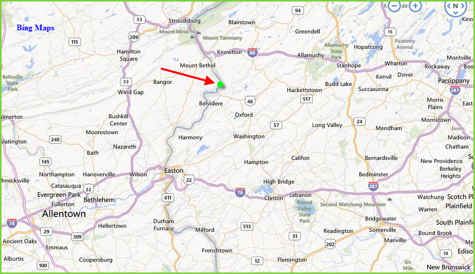
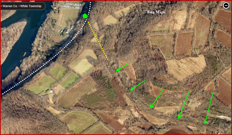
Below is an aerial view of the area from Bing Maps.
The white dashed line is the PRR line, the dashed yellow line is the
tunnel, and the green arrows point to the Lackawanna's Old Main Line.
The tower would have been where the green dot is.
The two timetables are courtesy Bob McCown.
They show us that at the end of the 1800's and the early 1900's, the
junction was "hoppin!".
"U" Tower
This sepia colored photograph is what started this page.....
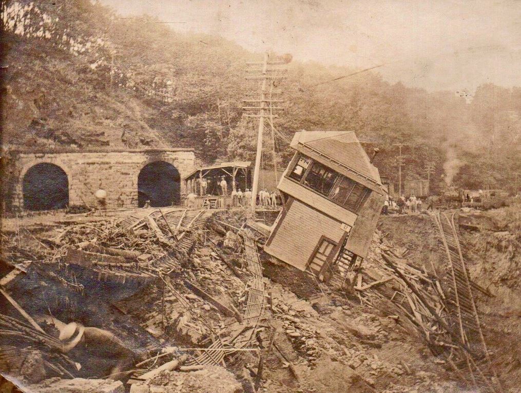
In looking at the picture above, there are 10 control rods coming out of the tower and coming towards us, two of them break off for the switch that is washed out. That leaves eight control rods continuing north for additional switches and/or signals. If you notice in this picture, we do not see the Banjo signal before we head into the tunnel, so it may have been replaced by the time this mudslide occurred in 1916 - it would have been between the end of the platform and the tunnel portal.
Above: the eastern portals.
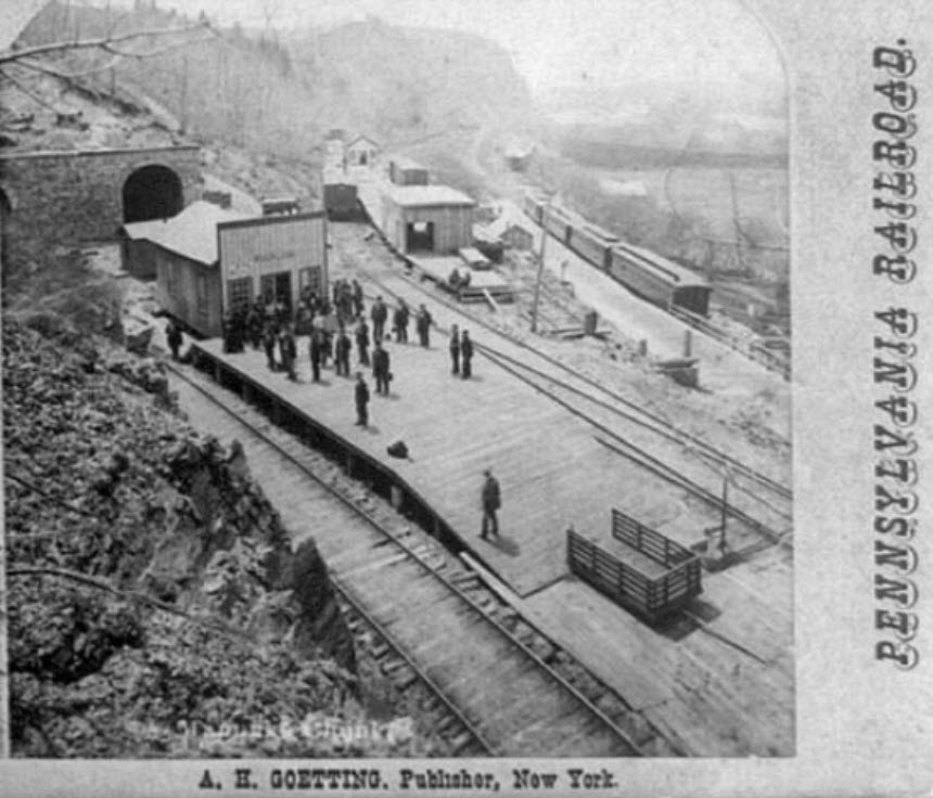
https://www.loc.gov/resource/cph.3b44483/
The picture above is half of a stereo-opticon view of Manunka Chunk. The LOC page gives us a date of 1870 to 1910, but that would conflict with the date they give us for the picture below. The picture above does not have the developed yard as the one below depicts, so my guess is the one above is an earlier view. And maybe it is just my eyes, but does the gauge of the DL&W track look like it is wider when comparing it to the man standing on the platform? Anyone know when, if the DL&W was built wide gauge, when they went to standard gauge???
https://www.loc.gov/resource/det.4a07615/
Above: the western portals, yard, freight warehouse, station, turntable (in the distance), and a BANJO SIGNAL!
The tracks going off into the distance are the Pennsy tracks.
From the Library of Congress and the Detroit Publishing Co, sometime between 1890 and 1901.
Wonder if the banjo signal is still somewhere in the woods? :-) :-)
Thanks to Bob McCown for finding these pictures from the LOC!
And here we have a series of pictures from Jeffs4653 from 2009.....
Maybe we could get him to do a 2020 re-visit and get some pictures of the western portals?


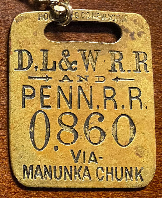
Manunka Chunk Luggage Tag
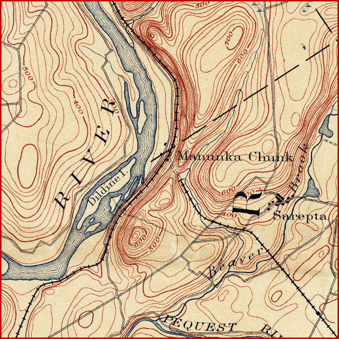
Courtesy of the University of Texas Library, click here for their index page. From an 1885 Delaware PA/NJ quadrangle map.
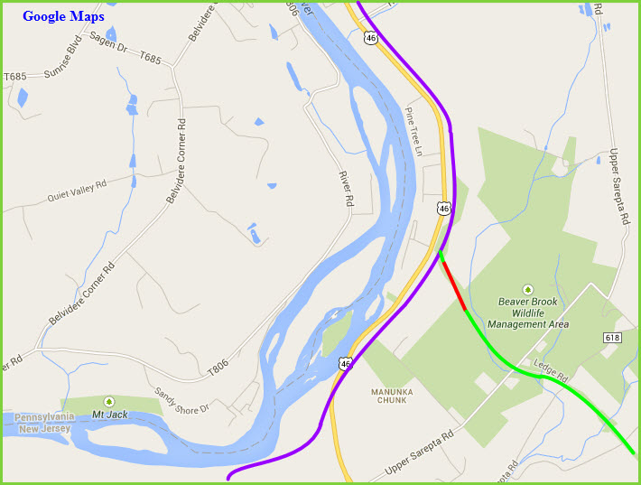
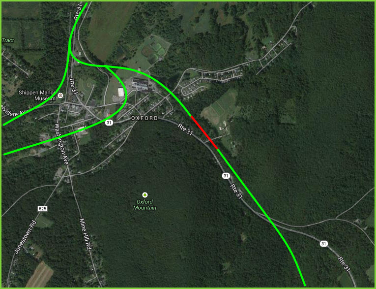
And just for continuity on the Oxford Tunnel, the following screen capture is from the 1883 Hackettstown quadrangle. The Google satellite view shows the approximate locations of the tunnel (in red) and the tracks. I used the 1883 map to guide my efforts, but the old roads don't quite match up with the current ones....
Disclaimers:
I love trains, and I love signals. I am not an expert. My webpages reflect what I find on the topic of the page. This is something I have fun with while trying to help others.
Please Note: Since the main focus of my two websites is railroad signals, the railfan guides are oriented towards the signal fan being able to locate them. For those of you into the modeling aspect of our hobby, my indexa page has a list of almost everything railroad oriented I can think of to provide you with at least a few pictures to help you detail your pike.
If this is a railfan page, every effort has been made to make sure that the information contained on this map and in this railfan guide is correct. Once in a while, an error may creep in :-)
My philosophy: Pictures and maps are worth a thousand words, especially for railfanning. Text descriptions only get you so far, especially if you get lost or disoriented. Take along good maps.... a GPS is OK to get somewhere, but maps are still better if you get lost! I belong to AAA, which allows you to get local maps for free when you visit the local branches. ADC puts out a nice series of county maps for the Washington DC area, but their state maps do not have the railroads on them. If you can find em, I like the National Geographic map book of the U.S..... good, clear, and concise graphics, and they do a really good job of showing you where tourist type attractions are, although they too lack the railroads. Other notes about specific areas will show up on that page if known.
Aerial shots were taken from either Google or Bing Maps as noted. Screen captures are made with Snagit, a Techsmith product... a great tool if you have never used it!
By the way, floobydust is a term I picked up 30-40 years ago from a National Semiconductor data book, and means miscellaneous and/or other stuff.
Pictures and additional information is always needed if anyone feels inclined to take 'em, send 'em, and share 'em, or if you have something to add or correct.... credit is always given! Please be NICE!!! Contact info is here
Beware: If used as a source, ANYTHING from Wikipedia must be treated as being possibly being inaccurate, wrong, or not true.
RAILFAN GUIDES HOME
RAILROAD SIGNALS HOME
NEW MAR30/2014, MAR31/2014, MAR09/2020, JUN12/2021
Last Modified 14-Jun-2021