
In General
Getting Here
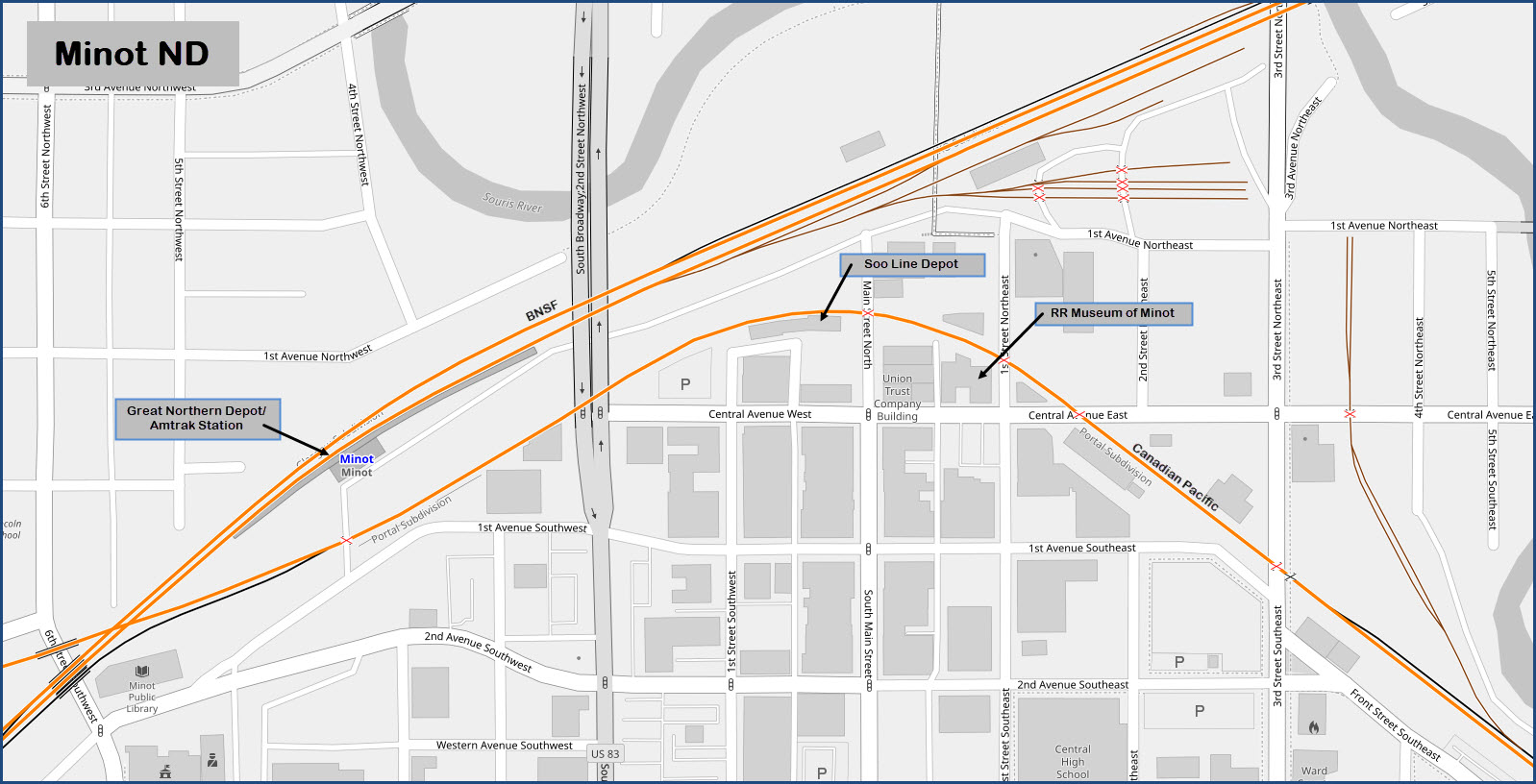
Map
Sights
Pictures
Bridges
Signals
Fire & Police
Floobydust
USGS Maps
RAILROAD SIGNALS HOME
Location / Name:
Minot ND, Ward County (county seat)
What's Here:
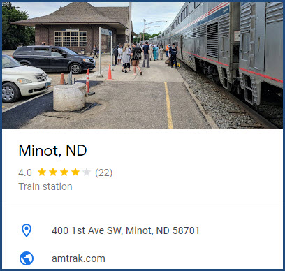
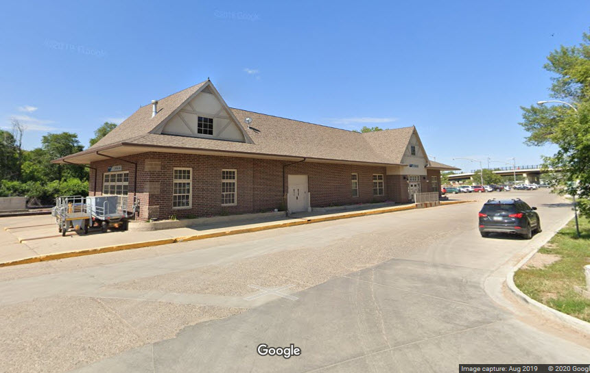
Amtrak/former Great Northern Rwy Station
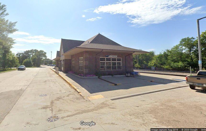
SOO Line Depot
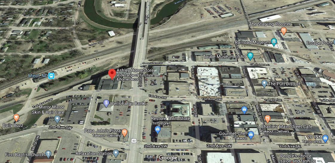
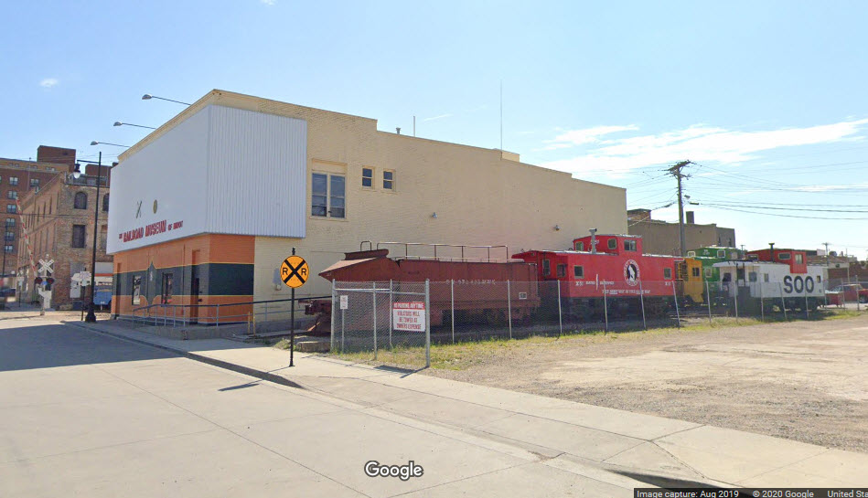
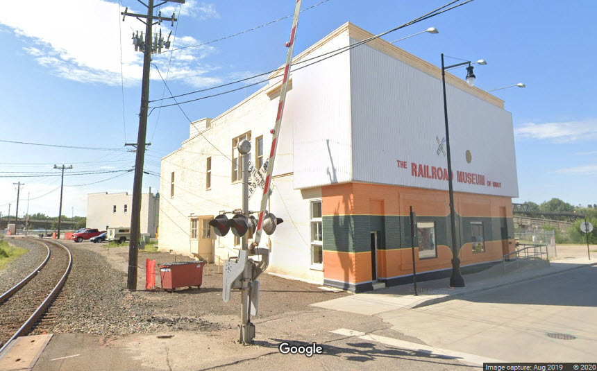
Railroad Museum of Minot
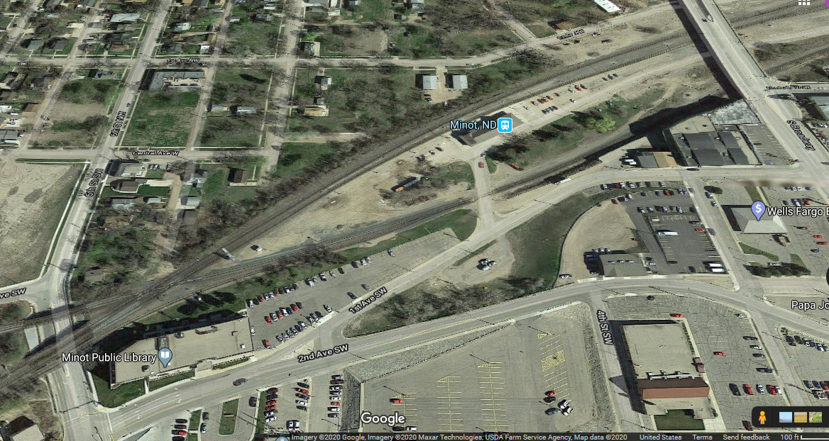
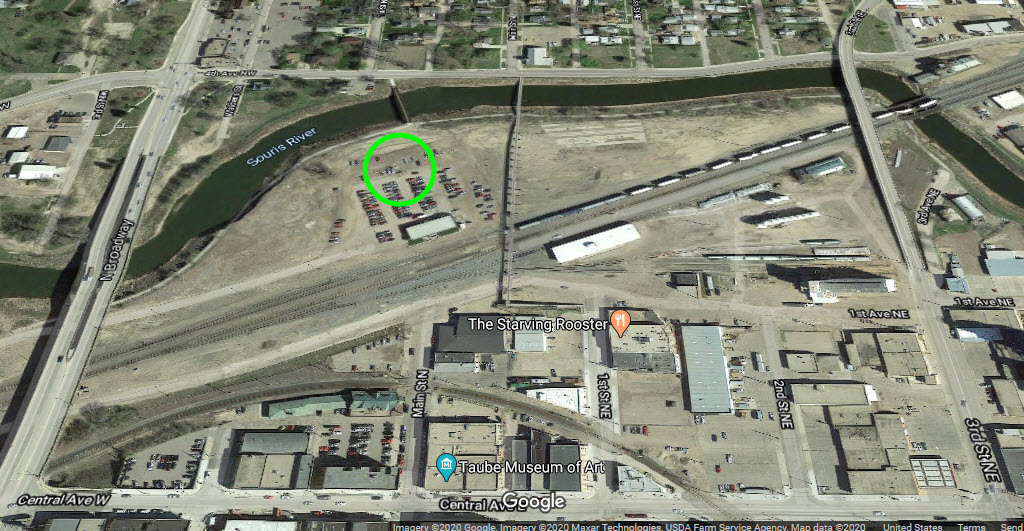
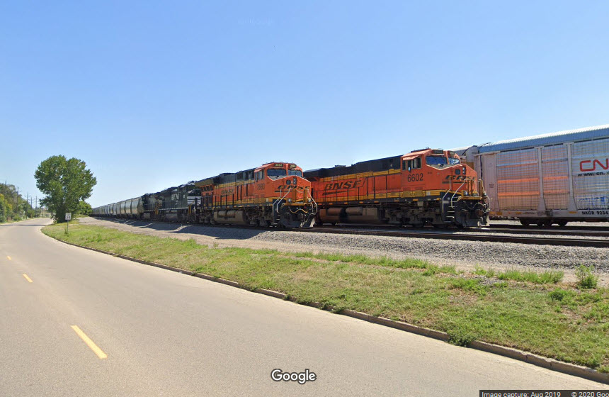
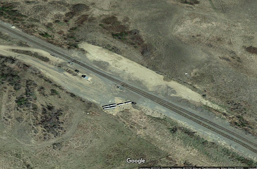
BNSF Gavin Yard
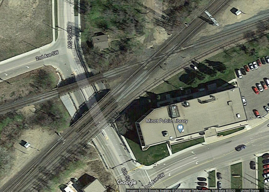
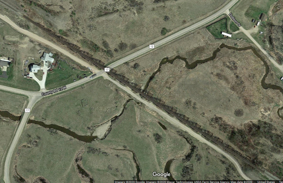
Diamond
Gassman Coulee Trestle on the BNSF west of town
Data:
GPS Coordinates: as needed
Phone A/C: 701
ZIP: 58701
Access by train/transit:
Amtrak Empire Builder, 2 trains a day
The Scoop:
Minot is fortunate to have both of their "vintage" depot's still around, in this day and age when everyone wants to tear the old stuff up and build new!
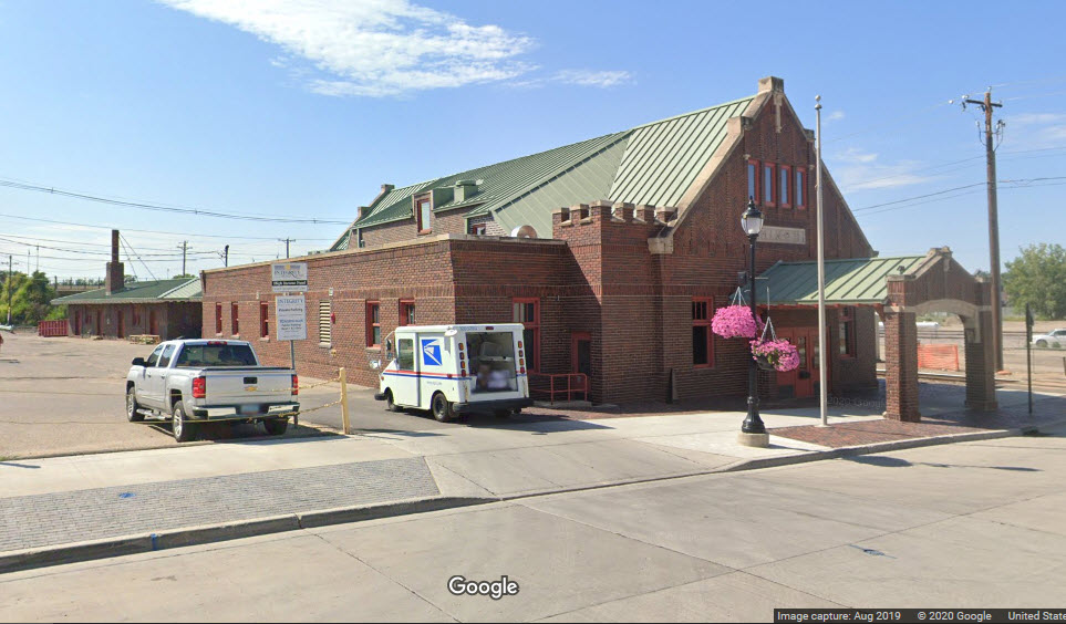
The former Soo Line depot stands next to the railroad tracks on Main Street.
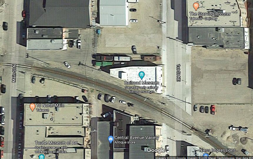
The former Great Northern Rwy depot sits just to the east of a diamond between the BNSF and the Canadian Pacific.
In the days of yesteryear, the railroads coming through here were the Great Northern and the Soo. The Great Northern arrived in Minot in 1886, as work ended for the winter. The Soo came up from Valley City into Minot in 1893.
A little further east of the GN station and diamond is the Railroad Museum of Minot. There are a few items of interest outside, such as a Soo caboose and snowplow. The museum is only open for a while on Saturdays, May thru September.
The diamond is fully signaled, and the CP upgraded their signals sometime between 2012 and 2019.
BNSF has a yard to the east of the diamond.
And, finally, to the west of town is the beautiful Gassman Coulee Trestle!
Non railroad items of interest: Minot AFB is about 12 miles north of town.
Acknowledgements:
Denver Todd
Steven M. Welch
Nelson Lawry
Ron Reiring
Friends of the Burlington Northern RR
Ghosts of North Dakota website
Wikipedia
Google Maps
Open Railway Map
Websites and other additional information sources of interest for the area:
https://www.greatamericanstations.com/stations/minot-nd-mot/
https://en.wikipedia.org/wiki/Minot_station
http://www.greatnorthernempire.net/index2.htm?GNE2003TripReport_1.htm
http://fobnr.org/old-site/yardmaps/gavin1.htm
http://fobnr.org/bn/bn-1970-yard-maps/
Minot is 105 miles north of I-94, exit 159, at Bismarck ND via US 83.
Otherwise, US 2 runs east-west thru town.
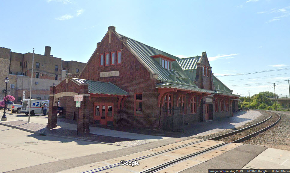
GPS Coordinates: 48.236090, -101.298772
400 1st Avenue S.W., Minot, ND 58701
Station Code: MOT
Trains: Empire Builder (one a day in each direction)
The depot was built in 1905 by the Great Northern Rwy. Amtrak has remodeled the station on several occasions: 1975, 2011, and 2013.
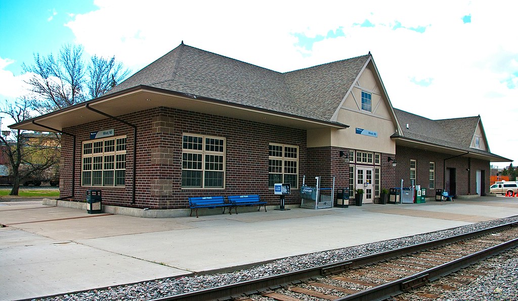 Ron Reiring, 2014
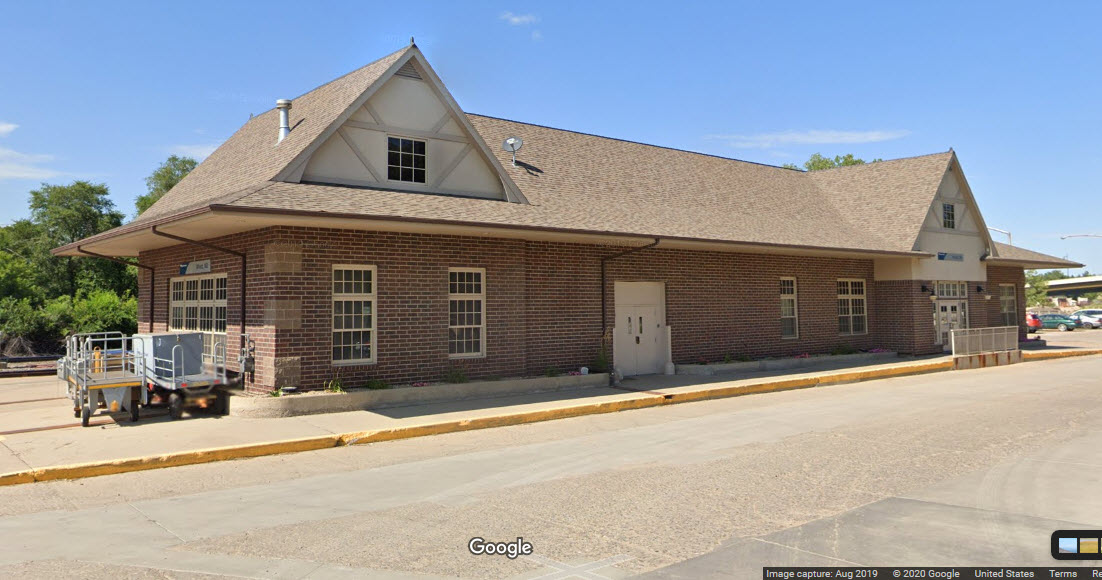
GPS Coordinates: 48.237099, -101.291857
19 First St. NE, Minot, ND 58701
701-852-7091
Hours: 10am-2pm on Saturdays only, MAY thru SEP
https://visitminot.org/play/railroad-museum-of-minot/ (Not much on the page except for what is above)
GPS Coordinates: 48.237083, -101.293412
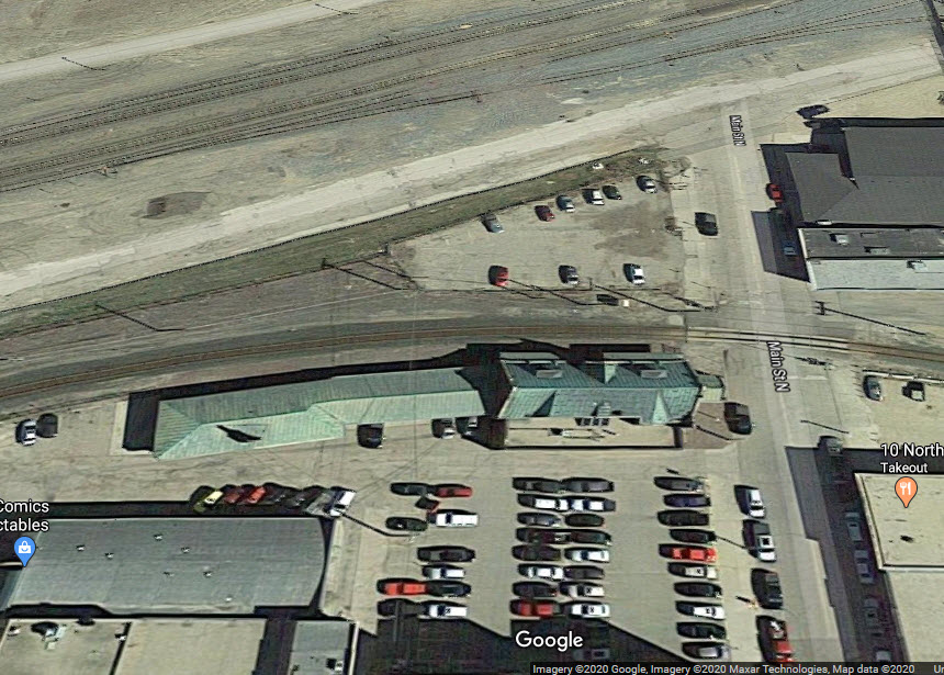
11 North Main Street, Minot, ND 58701
GPS Coordinates: 48.234852, -101.301391
The 1x2 diamond has a 23 degree angle. Two tracks for the BNSF, and one for the Canadian Pacific.
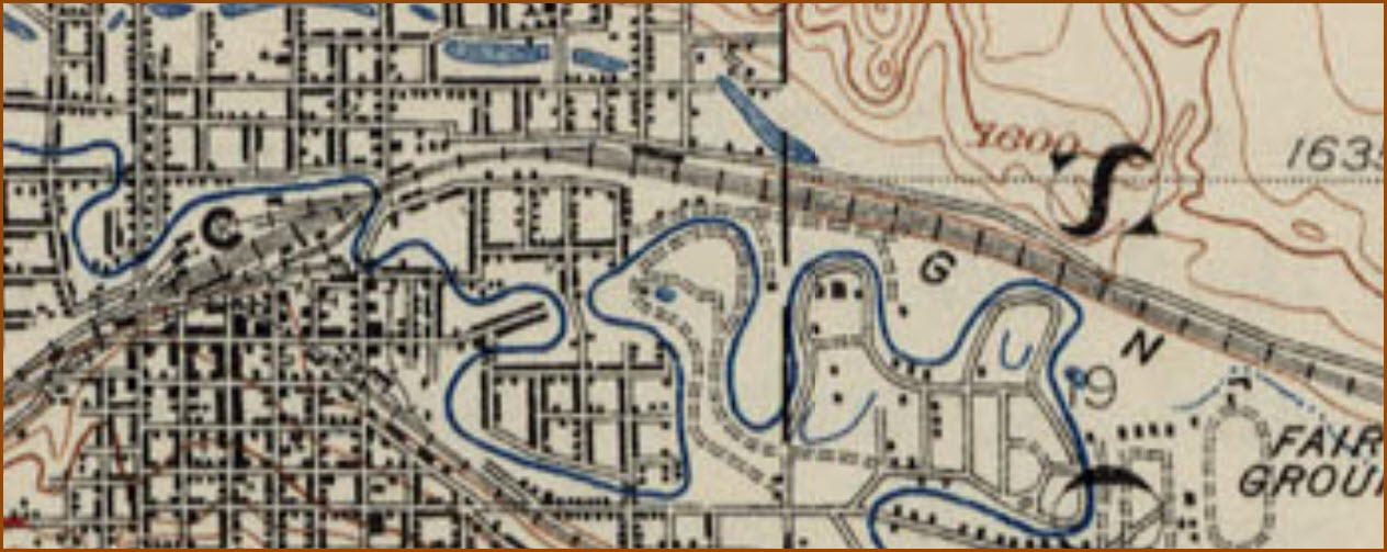
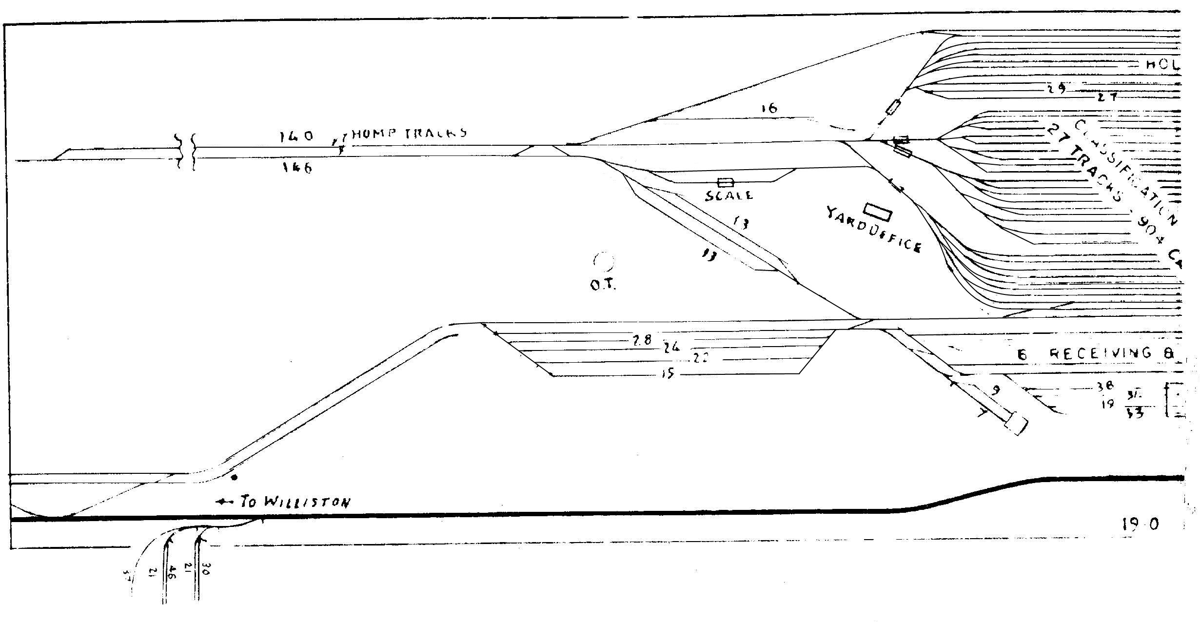
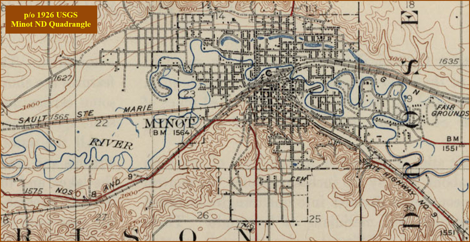
Gavin Yard used to have a whole lot more tracks in it than it does now - 41 according to the yard maps I came across - 27 classification tracks, 8 holding tracks, 6 receiving tracks (and 3 departure tracks). The yard also had a tower, don't know when it went. In looking at the aerials of the yard now, it has 6 tracks in it, plus two through mainline tracks. The yard is about 1.7 miles long from the river at 3rd St NE to 27th St NE.
The turntable and roundhouse used to be where the green circle is, compare the aerial shot with the USGS map below.
 FOBNR
FOBNR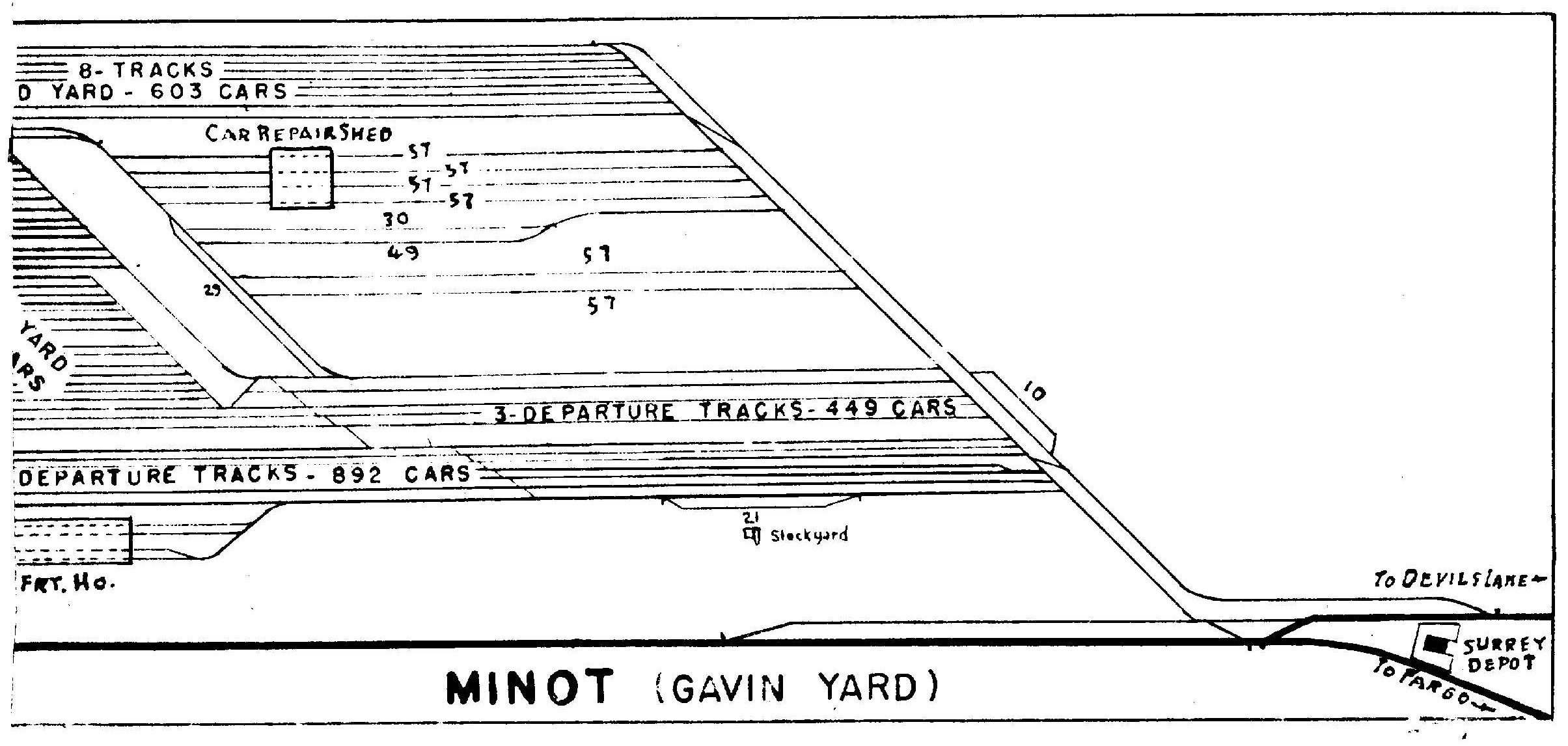 FOBNR
FOBNR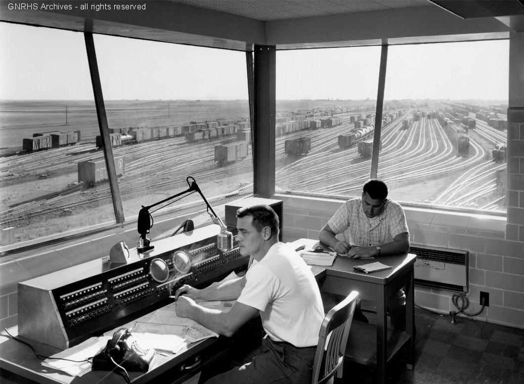
 from 5th Ave NW
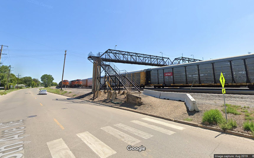
You should be able to get some good shots from the pedestrian overpass adjacent to 8th St NE.
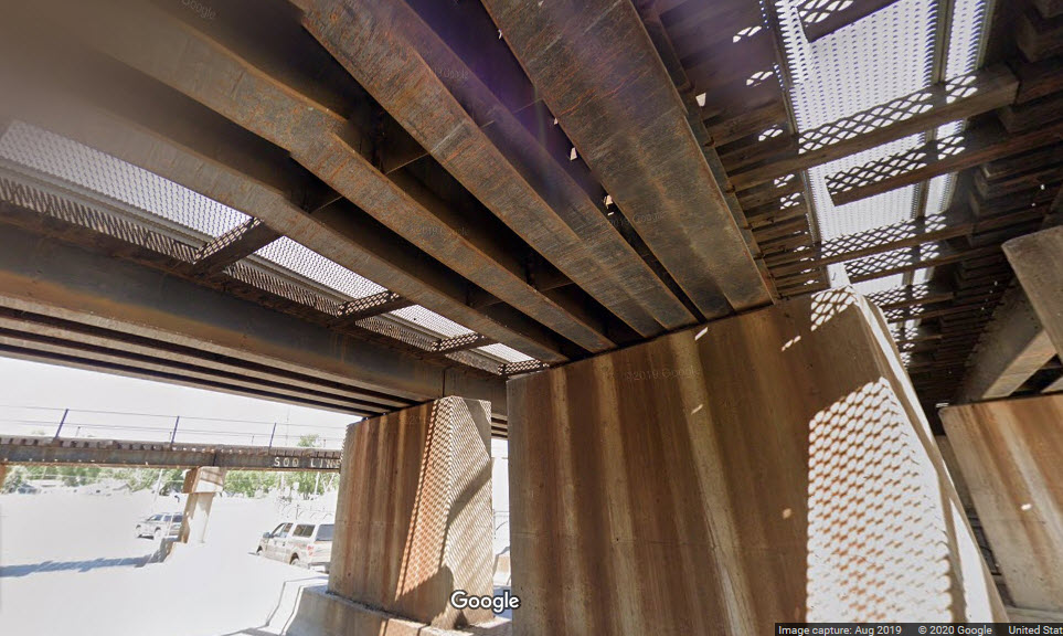
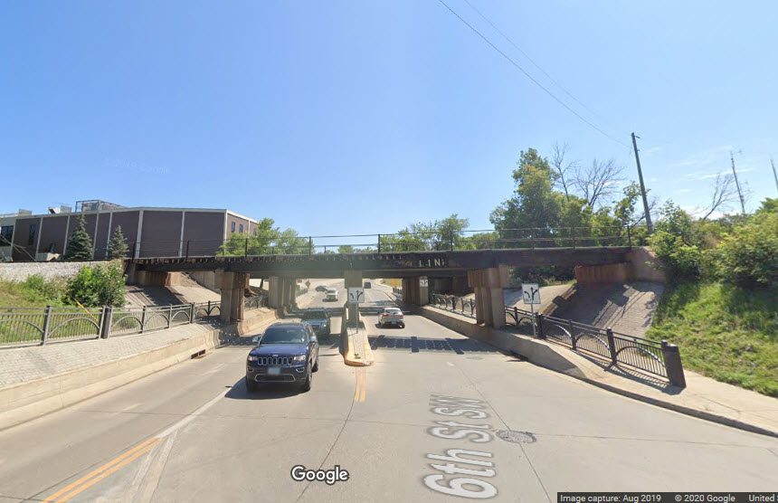
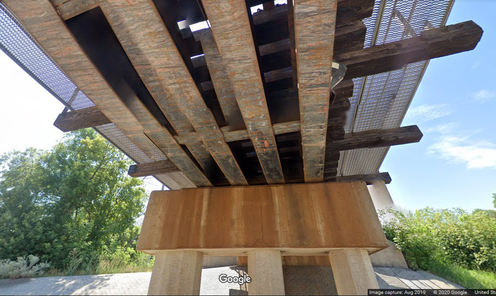
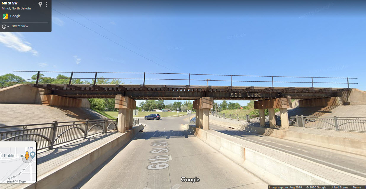
The three NP bridges over 6th Avenue are similar in construction to the Soo bridge. They are of deck-girder design. There are three spans, two of which are for the BNSF mainline, the other one is for the BNSF-CP interchange track.
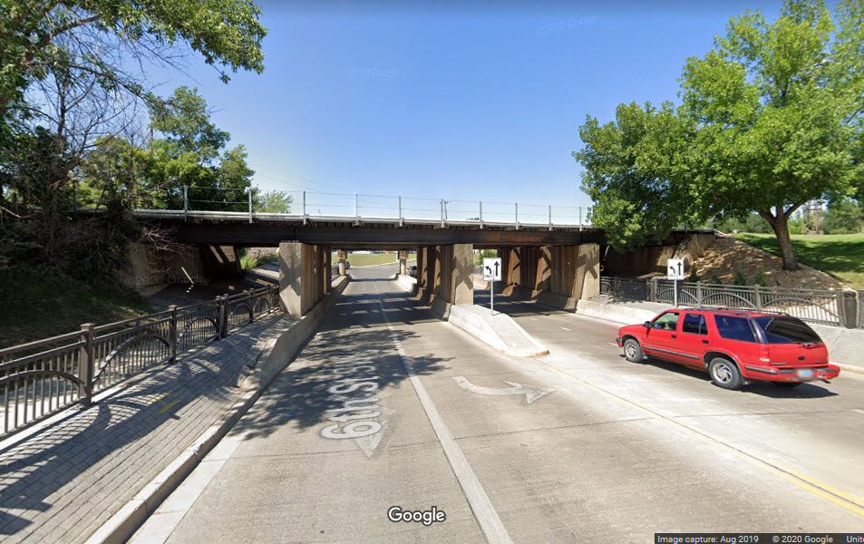
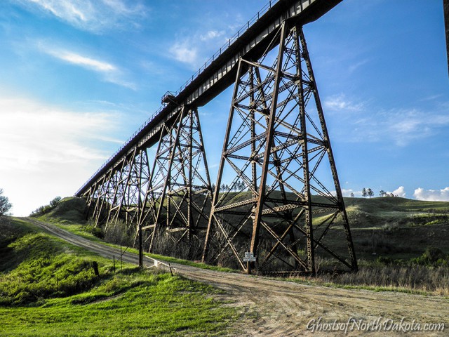
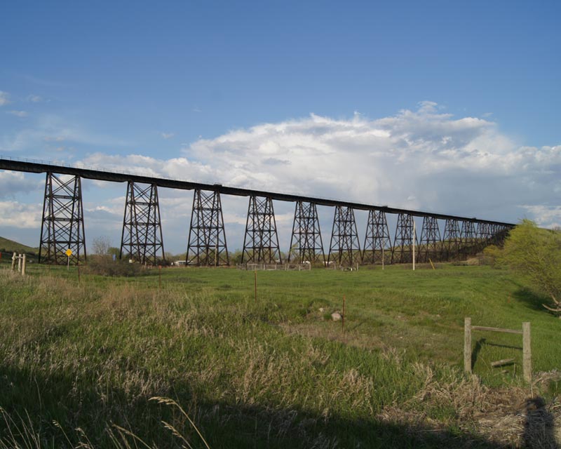
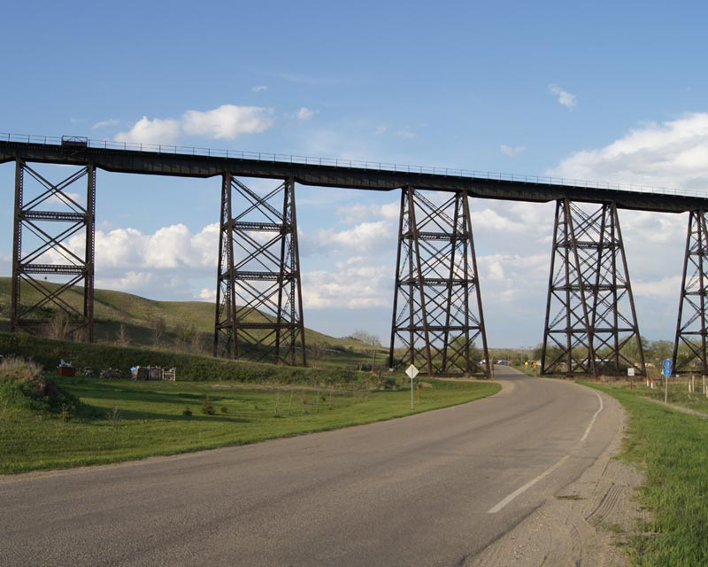
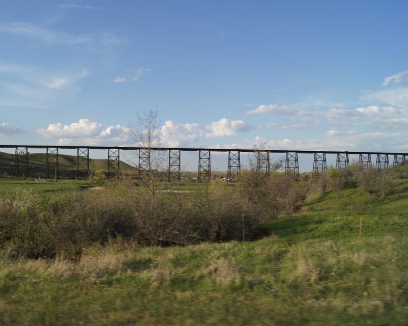
GPS Coordinates: 48.229756, -101.386239
http://www.ghostsofnorthdakota.com/2010/05/19/gassman-coulee-trestle/
https://bridgehunter.com/nd/ward/bnsf-viaduct/
Beautiful trestle in an easy to access location!
Located 4 miles west of Minot, this trestle is 1792 feet long and 117 feet tall at its highest point. According to the comment on the Ghosts website, when a train crosses, you can hear the rumble miles away.
Even tho the BNSF tracks are mostly double tracked thru these here parts, the trestle is a single track bridge.
Non Google photos by Troy Larson, 2010.
 east approach to the trestle
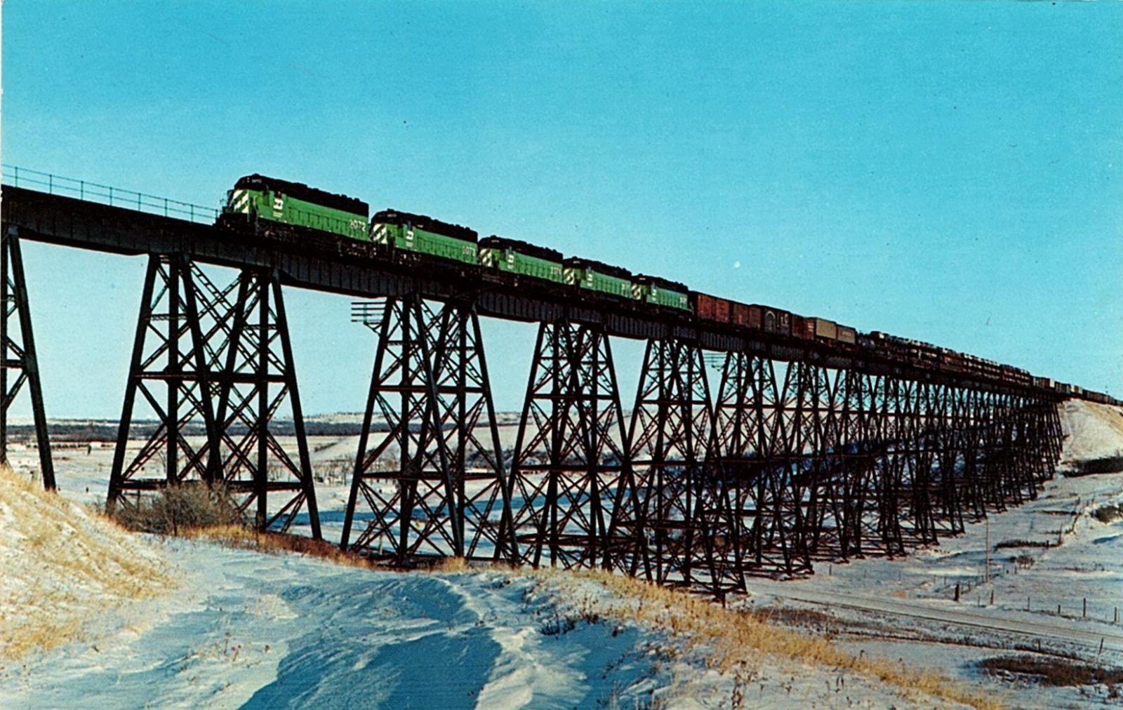
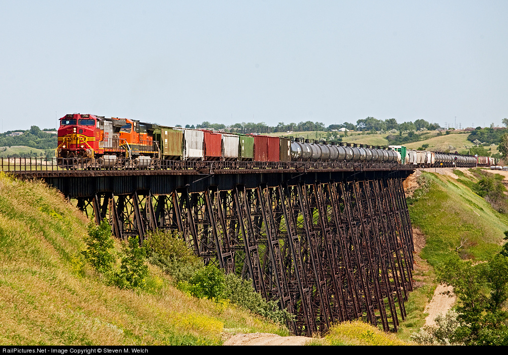
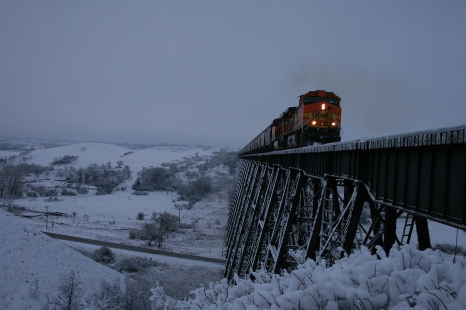 Photo by Tina, 2008, City-Data dot com
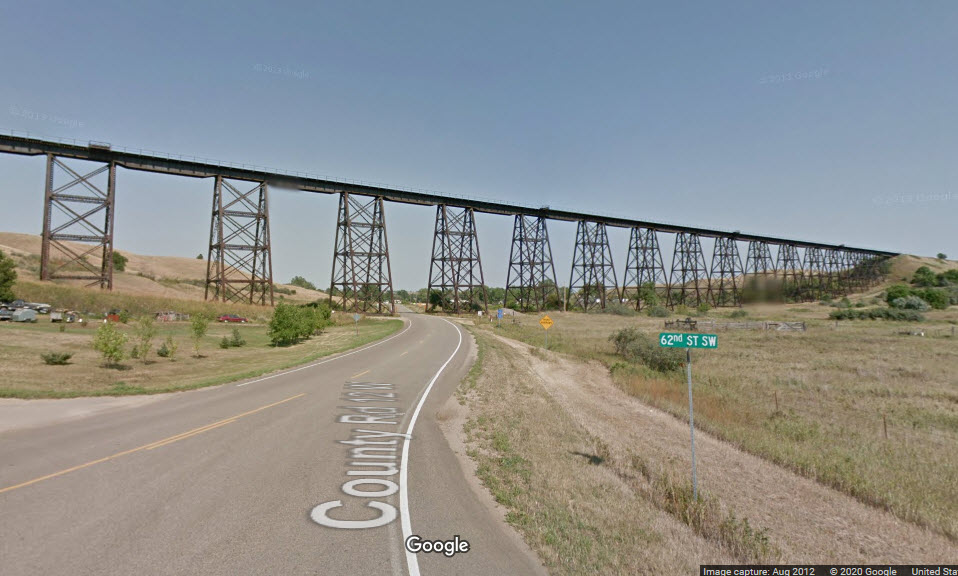

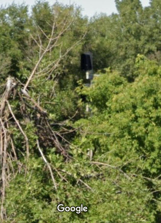
I'm going to take a different approach here, because the signals are not easy to see from the streets, hence, Google Streetview or otherwise, so I will just title them as I can.
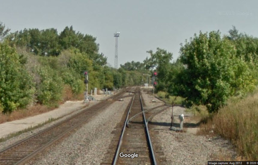
Looking from the direction of the station, we can see the WB interlocking signals for the diamond.
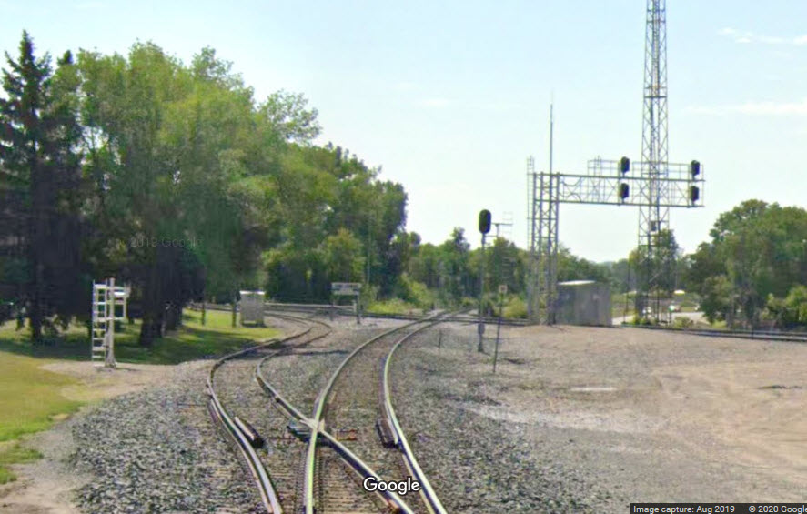
On the "other side" of the diamond, we catch a glimpse of the EB interlocking signal from 2nd Ave NW.
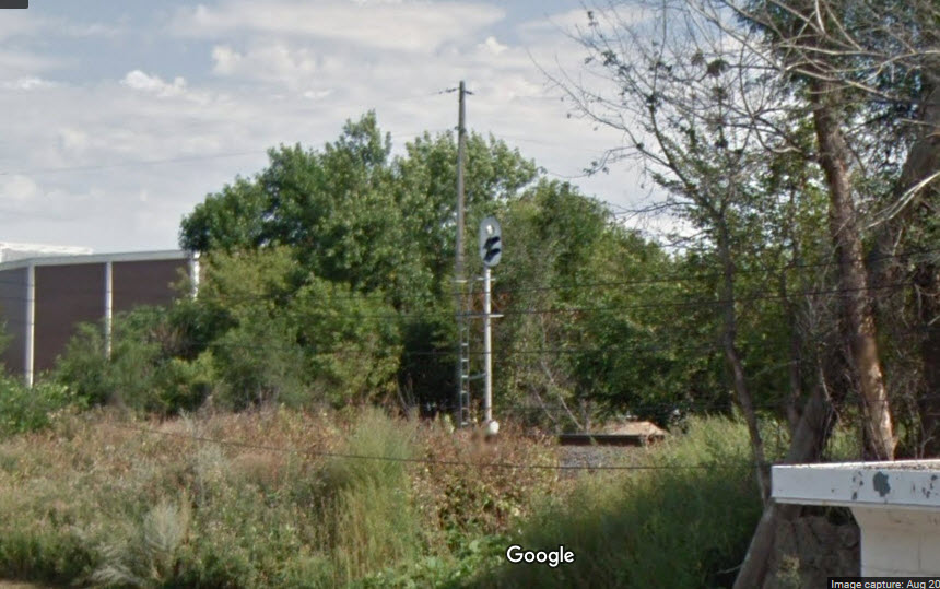
From 4th Ave SW in 2012, we can see there WAS a pair of EB searchlight signals guarding the diamond. In the 2019 snipet from along Western Ave SW, we can just barely make out that the searchlights have been replaced with a standard "Darth Vader" style colorlight signal.
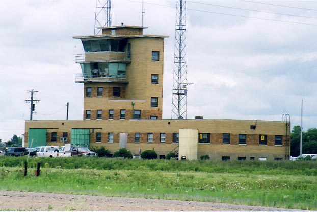
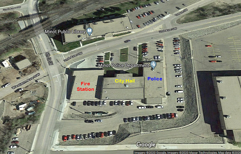
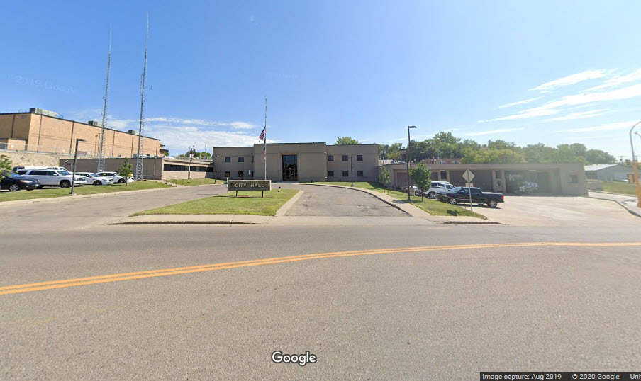
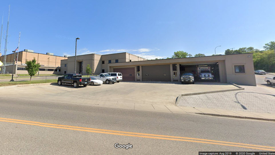
Minot City Hall, Police, and Fire HQ
They are all housed "in one big building", across from the Amtrak station.
Did U Know?
Got "nuthin" for now......
Courtesy of the University of Texas Library, click here for their index page.
Disclaimers:
I love trains, and I love signals. I am not an expert. My webpages reflect what I find on the topic of the page. This is something I have fun with while trying to help others.
Please Note: Since the main focus of my two websites is railroad signals, the railfan guides are oriented towards the signal fan being able to locate them. For those of you into the modeling aspect of our hobby, my indexa page has a list of almost everything railroad oriented I can think of to provide you with at least a few pictures to help you detail your pike.
If this is a railfan page, every effort has been made to make sure that the information contained on this map and in this railfan guide is correct. Once in a while, an error may creep in :-)
My philosophy: Pictures and maps are worth a thousand words, especially for railfanning. Text descriptions only get you so far, especially if you get lost or disoriented. Take along good maps.... a GPS is OK to get somewhere, but maps are still better if you get lost! I belong to AAA, which allows you to get local maps for free when you visit the local branches. ADC puts out a nice series of county maps for the Washington DC area, but their state maps do not have the railroads on them. If you can find em, I like the National Geographic map book of the U.S..... good, clear, and concise graphics, and they do a really good job of showing you where tourist type attractions are, although they too lack the railroads. Other notes about specific areas will show up on that page if known.
Aerial shots were taken from either Google or Bing Maps as noted. Screen captures are made with Snagit, a Techsmith product... a great tool if you have never used it!
By the way, floobydust is a term I picked up 30-40 years ago from a National Semiconductor data book, and means miscellaneous and/or other stuff.
Pictures and additional information is always needed if anyone feels inclined to take 'em, send 'em, and share 'em, or if you have something to add or correct.... credit is always given! Please be NICE!!! Contact info is here
Beware: If used as a source, ANYTHING from Wikipedia must be treated as being possibly being inaccurate, wrong, or not true.
RAILFAN GUIDES HOME
RAILROAD SIGNALS HOME
NEW JUL23/2020
Last Modified
25-Jul-2020