Spencer NC is best known for the former Southern Railway's shops that were
located here, which is now the North Carolina Transportation Museum.
The Spencer Shops, as they are known as, was used by the Southern
Railway from 1896 until the late 1970's. It was at one time, the largest
facility on the Southern. It was named after the first president of the
Southern Rwy, Samuel Spencer (1847-1906), and was built slightly east of
Salisbury. The town of Spencer itself wasn't incorporated until 1905.
The sight was picked because it was approximately halfway between Atlanta
and Washington DC.
Almost all of the old shops are still there, as is a depot on the way in.
The museum is one of the better ones around (anywhere) and shouldn't be missed.
Back in 2012, the Spencer Shops hosted an event for Norfolk Southern, where they
displayed all of their newly painted heritage fleet engines. In Fact, NS
had to hurry a couple of other Conrail engines into a paint booth somewhere in
order to make the one shown off in Spencer THE ONLY Conrail engine left!
It was an impressive event, and featured both day and night activities.
So, in 2026, the Museum is once again going to be hosting a once in a lifetime
event - a display of many of the United States' engines which are painted up in
the 250th Anniversary paint scheme. This is over the weekend of August 28th.
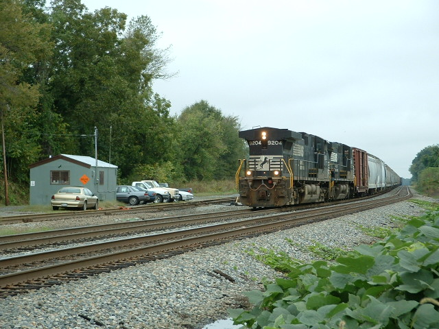
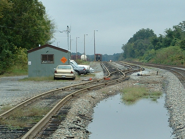
Adjacent to the Spencer Shops is a "small" 12 track yard.
On the east side of Spencer, if you're
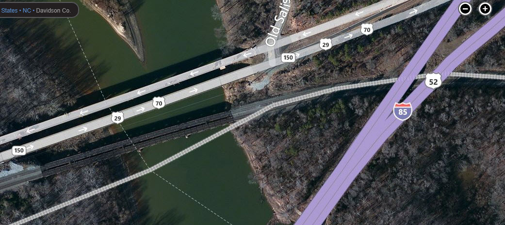
traveling WB (or SB as the case may be) on I-85, and get off at exit 82, you'll
see a bridge off to the left that the Norfolk Southern crosses High Rock Lake
on. If you're lucky, you might be able to catch an EB train as you go over
the tracks on the interstate - I did once, it was an impressive sight for a
location that doesn't have anything special about it like Horseshoe Curve or
Starrucca Viaduct..
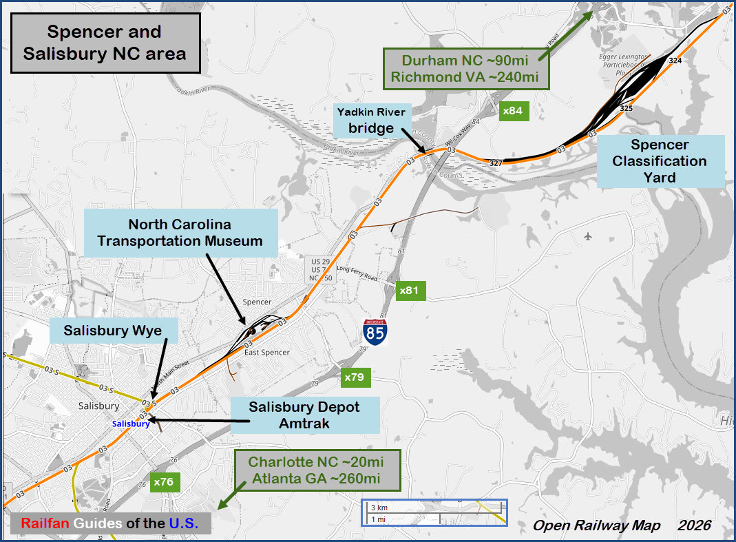
Northeast of Spencer about six miles (~9.6km), in Linwood, is a major classification yard, appropriately named the Spencer
Classification Yard. Access looks extremely limited except for the east end approach
- Being Norfolk Southern, we're not going to take chances by going in.
The Scoop - Salisbury:
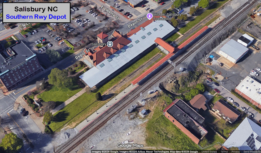
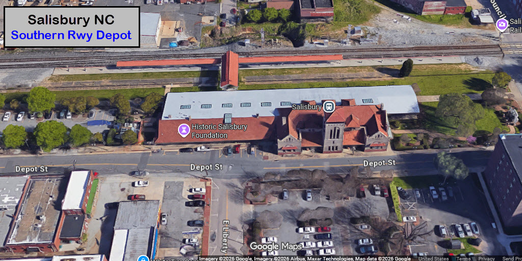
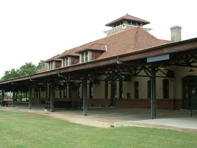
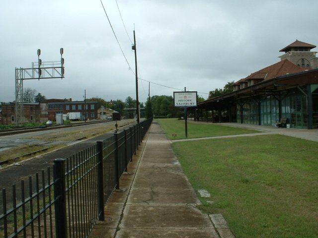
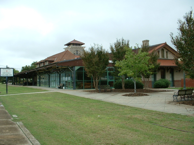
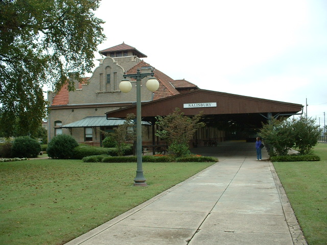
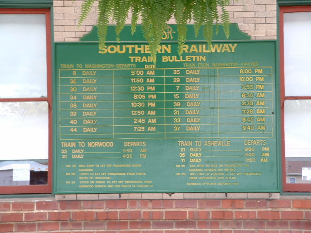
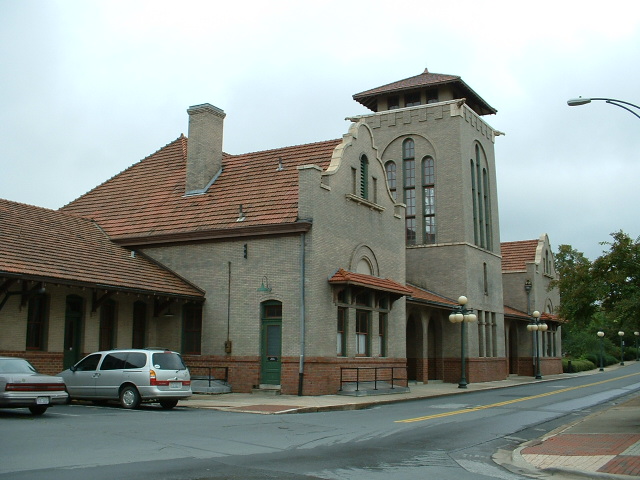
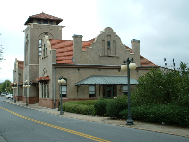
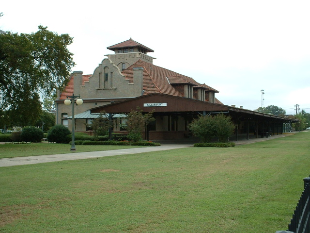
Over in Salisbury, you have a historic
Southern Railway depot, now used by Amtrak. It's very picturesque, and
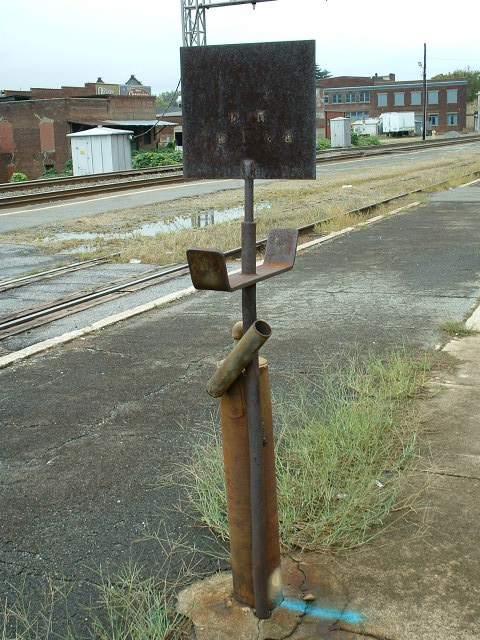
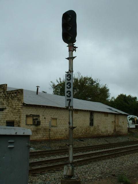
easily photographed. There WAS a classic WB colorlight signal at the
depot - not sure when it got replaced.
Amtrak trains that stop in Salisbury are:
- The Piedmont
- The Crescent
- The Carolinian
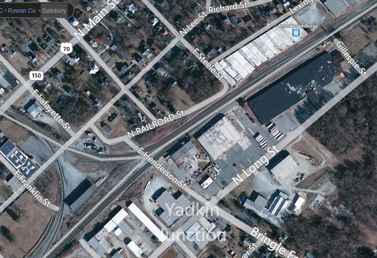
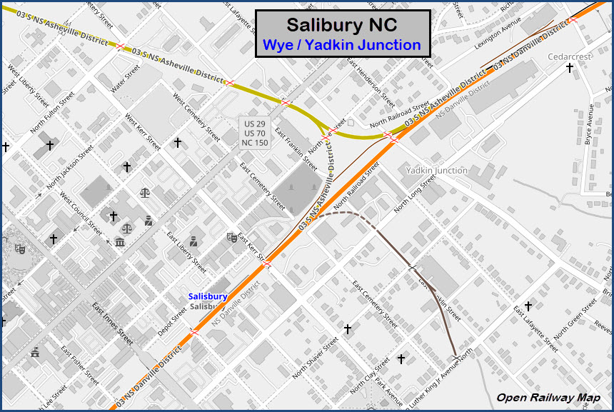
West of the Salisbury depot is a wye. The north
leg of the wye heads up to Statesville, where it splits again. The west
leg heads to Charlotte and then Atlanta.
For signal pictures, and train shots that includes signals, Salisbury is going
to be the place, as there are at least five locations that I am aware of.
All my pictures are from 2005.
Chasing:
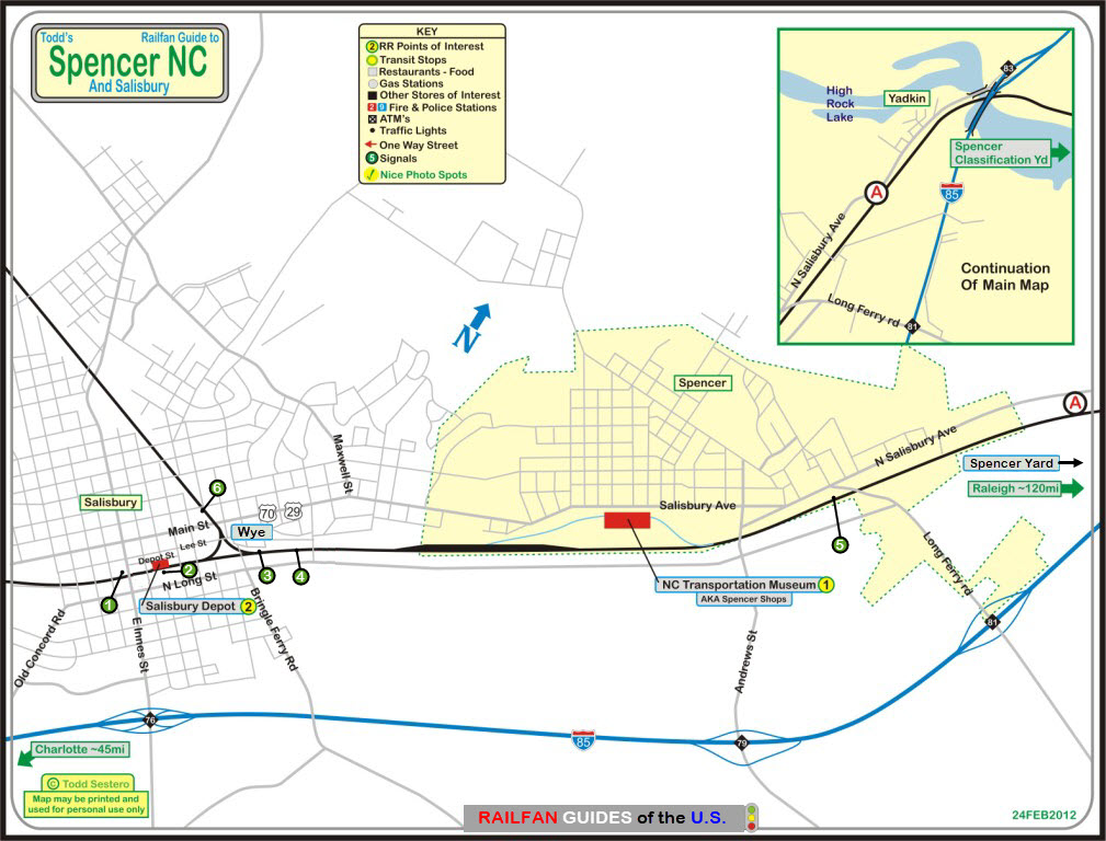
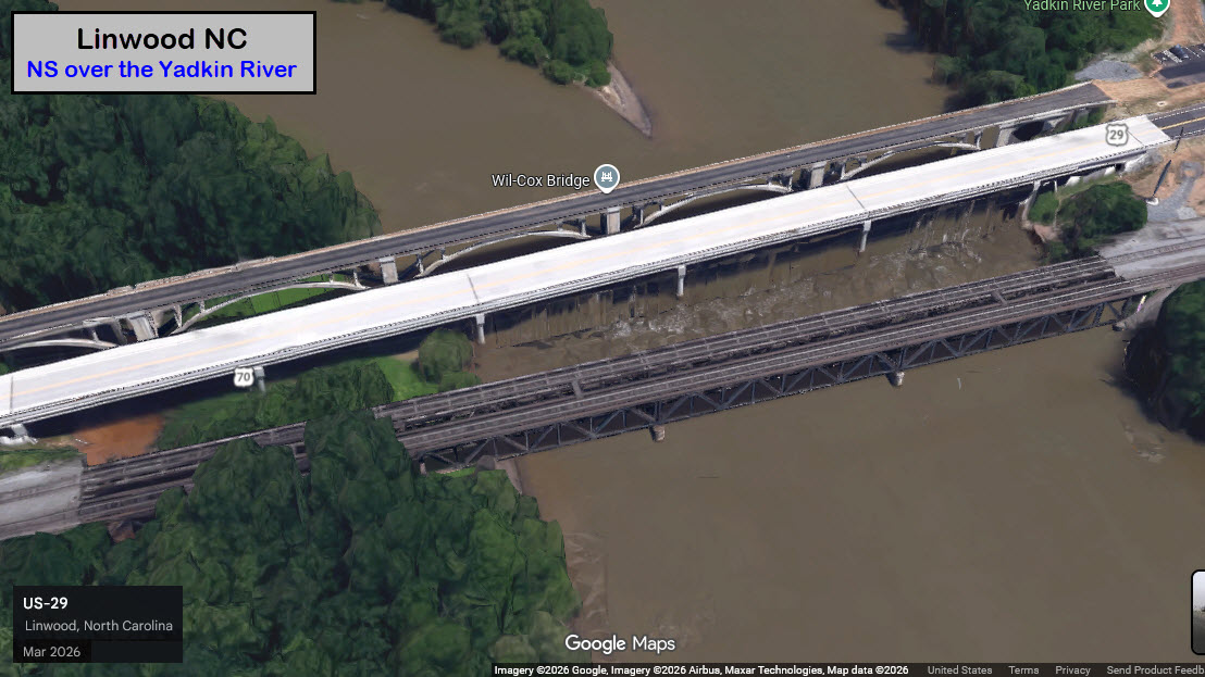
Starting on the west side of Spencer in Linwood,
where the NS crosses Yadkin River,
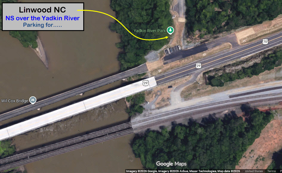
US29/70 follows the tracks OK for about 1.2 miles (1.9km),
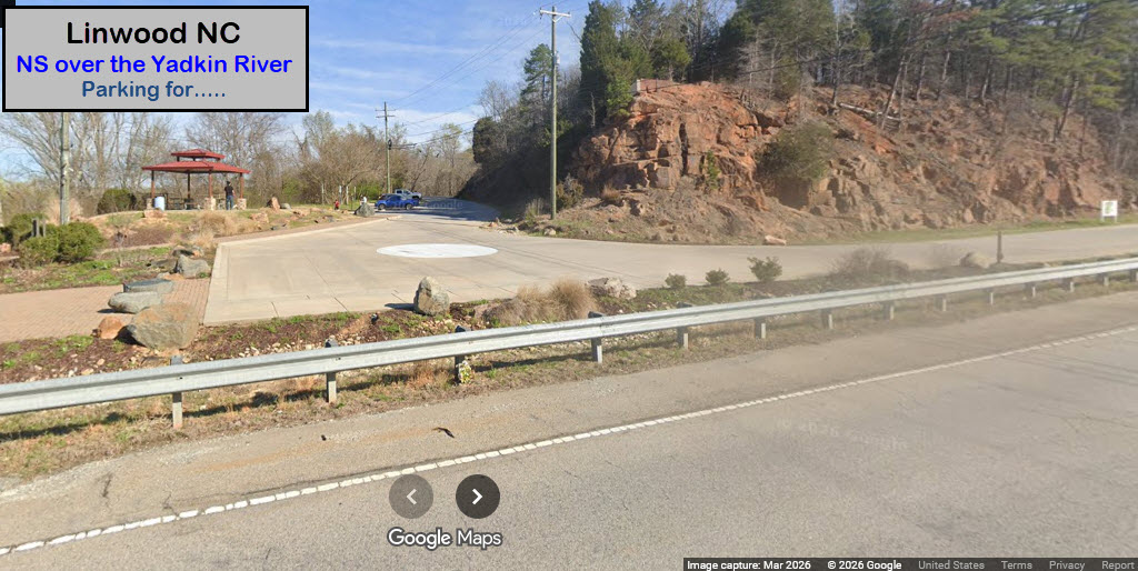
with a convenient place to park at the Yadkin River Park Trailhead, right
off 29/70 on the western shore of the river. After that (traveling
east), 29/70 veers far enough away from the track that photography is impossible.
Next up: a shopping center with a Food Lion at E Jefferson
St, which goes over the line, with a sidewalk on both sides. It's a 750ft
walk from the parking lot.
From there, 29/70 is still far away from the mainline, and, in fact, the Spencer
Shops are between 29/70 and the tracks. So, it's best to use Jefferson to
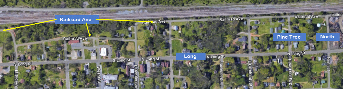
get to the other side of the tracks, take a right onto N Long Ave, go down a few
blocks to either North St or W Pine Tree Es Dr,
take a right, and that will take you to Railroad St. Railroad
St follows the tracks well about half a mile, but you may have to fight under brush.
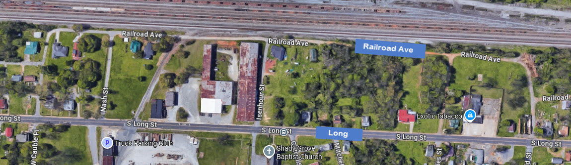
Railroad Ave takes a little detour for a bit, and
then goes back to following the rails, but most of it is now a dirt road, with limited
parking. You do get a break where the siding takes off around Nash
and Isenhour. The fun comes to an end at Cauble
Pl, where you have to turn left and head back down to Long St.
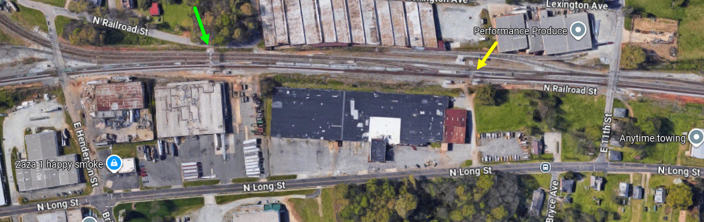
The next place for pictures is the grade crossing at E 11th St
or E Henderson St.
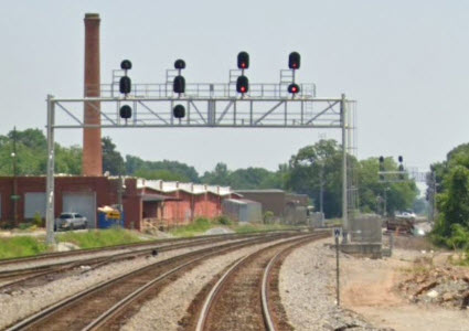
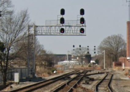
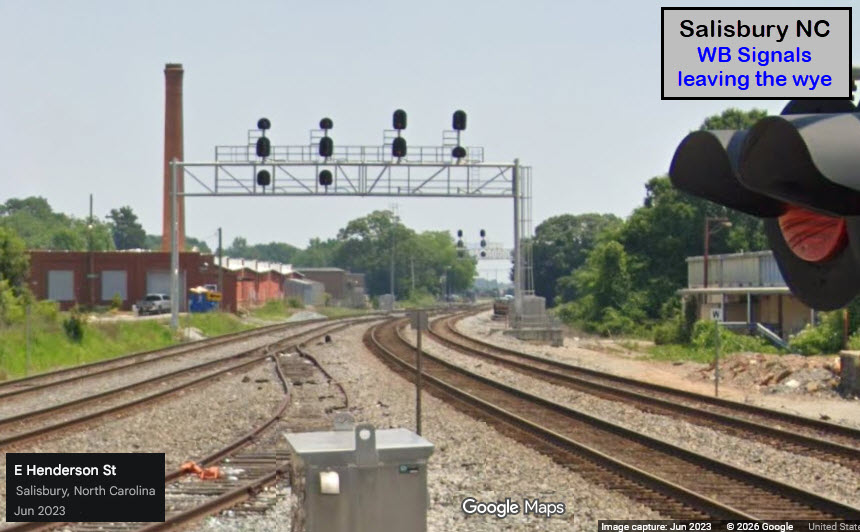
From 11th St, you can get a WB freight with a cantilever signal bridge in the
shot. From Henderson, you can catch an eastbound with a signal bridge over 3 tracks.
Henderson crosses the west side of the wye in Salisbury.
from Henderson
from 11th St
I guess there's a reason the street is called Long Street, because it is still
with us as a way to get to the majority of grade crossings on the NS mainline.
The next opportunity for photos as we travel west, are the two streets on either
side of the Salisbury Depot/Amtrak Station: East Kerr St and East Council St.
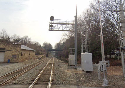
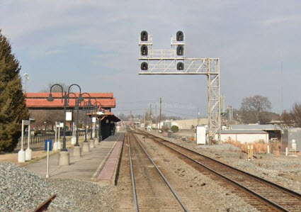
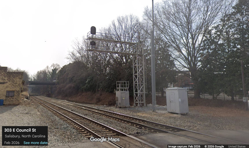
From Council St, you have a signal in both directions. From Kerr, you have
one to the east in front of the depot, with the wye to your west.
Council St looking east
Council St looking west
Continuing east, the next three streets go over the tracks: Innes, Fisher, and Bank. East Innes St
offers a good vantage point for EB freights passing by the depot!
Following E Bank St is E Horah St, which passes UNDER the tracks.
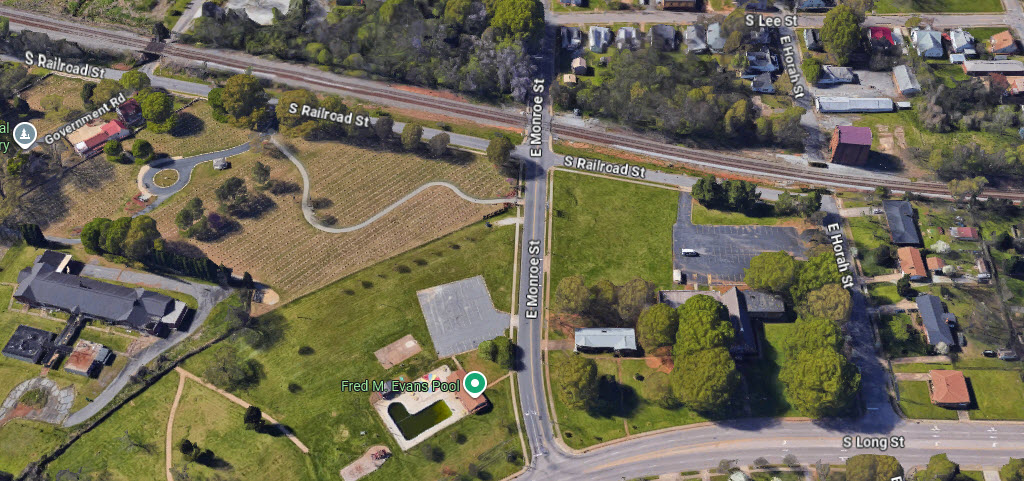
The next grade crossing is East Monroe St.
The next street off Railroad St is Military Ave,
but it goes under the tracks.
We finally have to say goodbye to Long St, as it veers away from the
tracks, but we get Railroad Street back!
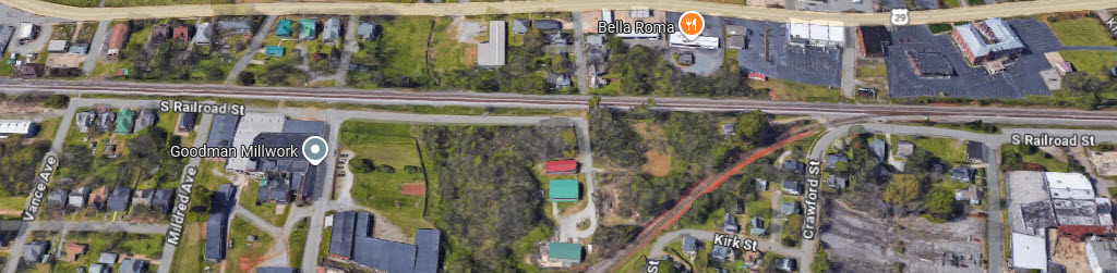
There are no more grade crossings in the vicinity, and Railroad St
comes to an end before another siding at Crawford St.
On the "other side" of the siding, Railroad St
continues for a few blocks along the main, one of the last spots to get mainline pictures
easily on the west side of Spencer and Salisbury.
Acknowledgements:
Denver Todd
Google Maps
Bing Maps
Open Railway Map
Wikipedia
Websites and other additional information sources of interest for the area:
None for now.....
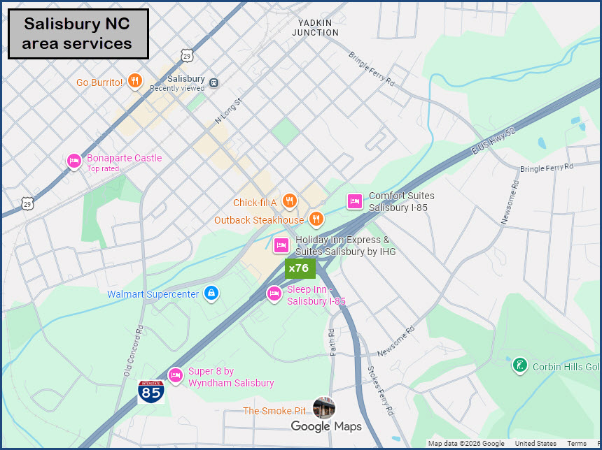
Spencer and Salisbury are conveniently located
right off of I-85, slightly west of central North Carolina. Exit 79 is
best for the Spencer Shops, and exit 76 is good for Salisbury.
They are about 35 miles northest of Charlotte,
which gives you access to points north and south of there via I-77. From
the east coast, I-85 from I-95 in Petersburg VA is your connection, or use the
I-40 connection from southern NC off I-95 - it hooks up to I-85 just west of Durham NC.
Greensboro is about 45 miles east, Durham about 100 miles, and Raleigh another 20 miles.
As for services: gas, food, hotels, etc - looks like exit 76 in Salisbury offers
the most options, followed by perhaps exit 81 in Spencer.
GPS Coordinates: 35.72225, -80.391677 (Center of Bridge)
GPS Coordinates: 35.72333, -80.390301 (Parking)
Bridge Length: ~651ft (198m) measured using Google Maps
According to BRIDGEHUNTER.com, the bridge is a Warren deck truss bridge, built in 1906. https://www.bridgehunter.com/bridges/41795
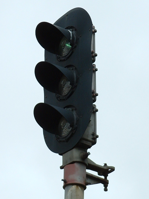
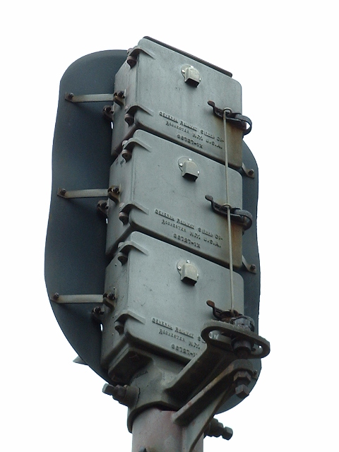
EB Colorlight Signal at Council Street/Salisbury
GPS Coordinates: 35.66636, -80.46685
Formerly a beautiful example of a standard three aspect colorlight signal. Don't know when NS replaced it,
but in going back to 2008 on Google Maps, the old signal was gone...... I'd
LOVE to have this signal in my collection, there are just too many things about
it which makes it representative of an era gone by, which makes me hope that the
NC Museum got it when it was replaced. These
pictures are from 2005.
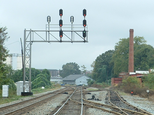
EB Wye Entering Interlocking Colorlights / Westside near 11th St/Salisbury
GPS Coordinates: 35.67339, -80.45656
Same view in 2005.
Notice the freight shed in the distance is gone, and the addition of the new exit signals
which used to be on the cantilever signal bridge.
The dwarf signal on the right has somehow, managed to stay around!
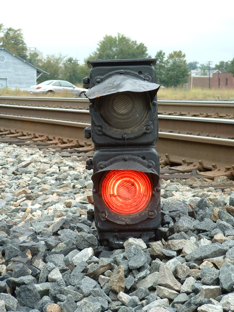
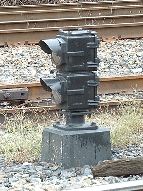
See below for close-ups of the two aspect dwarf signals used around town, which for
the time being, look like they have escaped the NS upgrade programs.
Colorlight Signals Approaching the Wye/Salisbury
GPS Coordinates: 35.67245, -80.46522
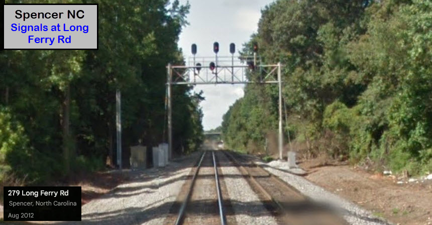
EB Colorlight Signal at Long Ferry Rd/Spencer
GPS Coordinates: 35.69737, -80.41823
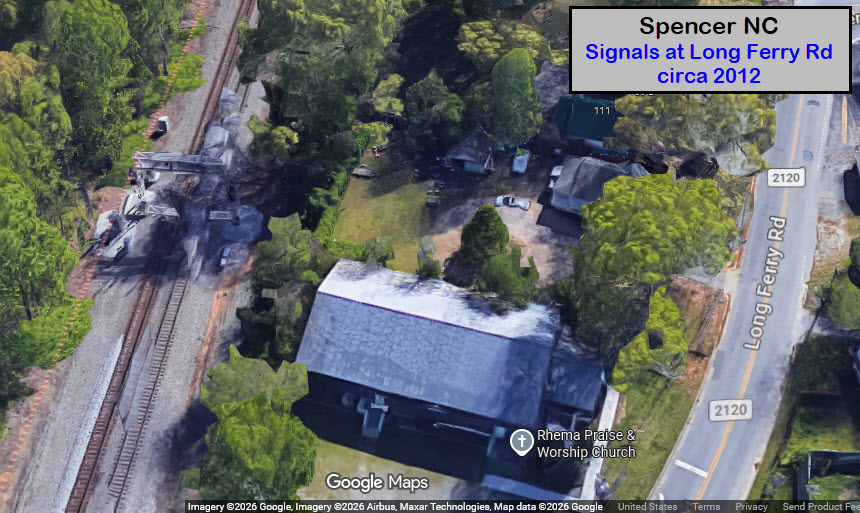
Looks like these signals were replaced sometime after Google came thru here in
2012. Too bad it was hotter than all get-out when I was down here for the
NS engine reveal, I would have gone around and gotten more pictures.
Google's aerial view is still showing the outline of the signal bridge here,
even after 10+ years.
Interlocking/Linwood
GPS Coordinates: 35.67245, -80.46522
You can see these guys if your in the slow lane of Westbound I-85 as you go over the Yadkin River.
2 Aspect Dwarf Signals
A couple of shots I took back in 2005 of dwarf signals in the area, dunno which
ones they are, or where these particular ones were located.
 from Henderson
 from 11th St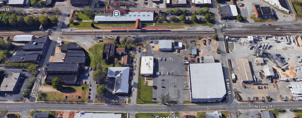
 Council St looking east
 Council St looking west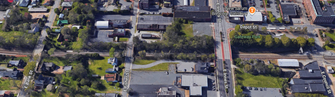
 The North Carolina Transportation Museum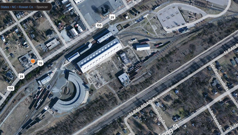
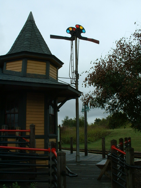
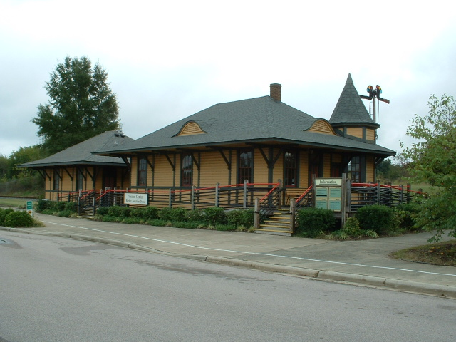
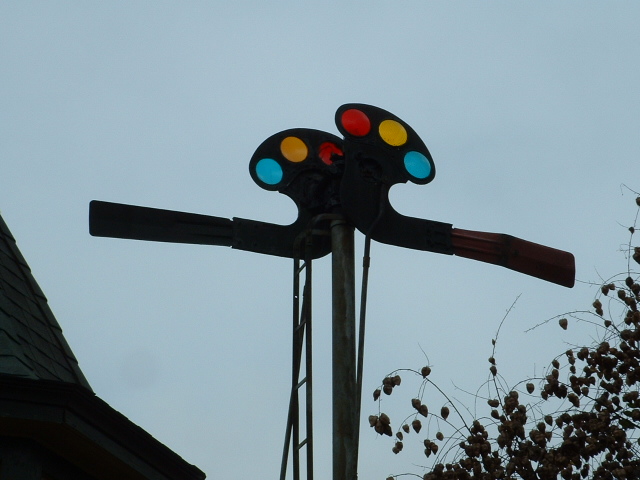
 The Salisbury Depot / Amtrak Station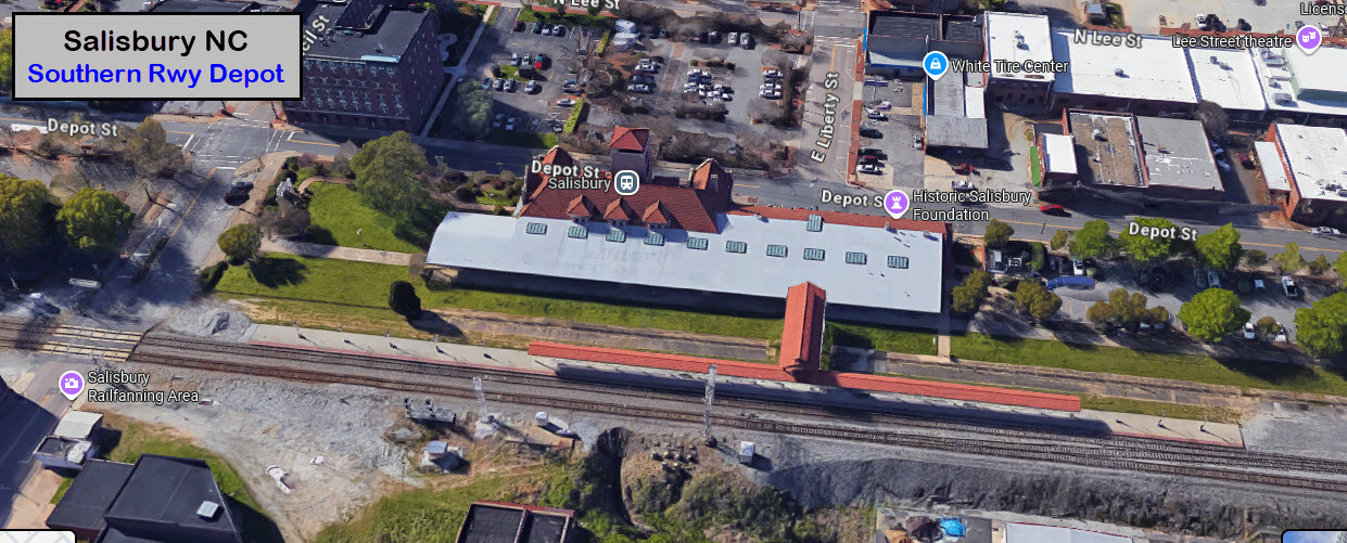
 Spencer Classification Yard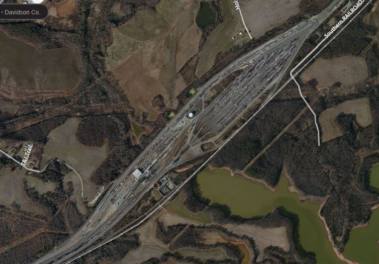
 Yadkin Junction / Salisbury Wye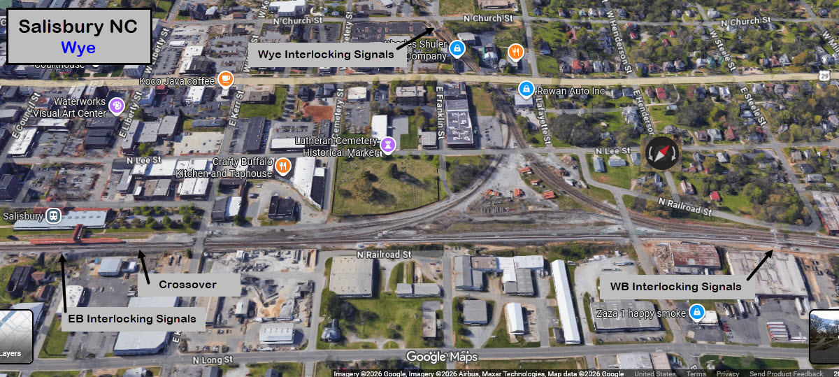
 NS Bridge by I-85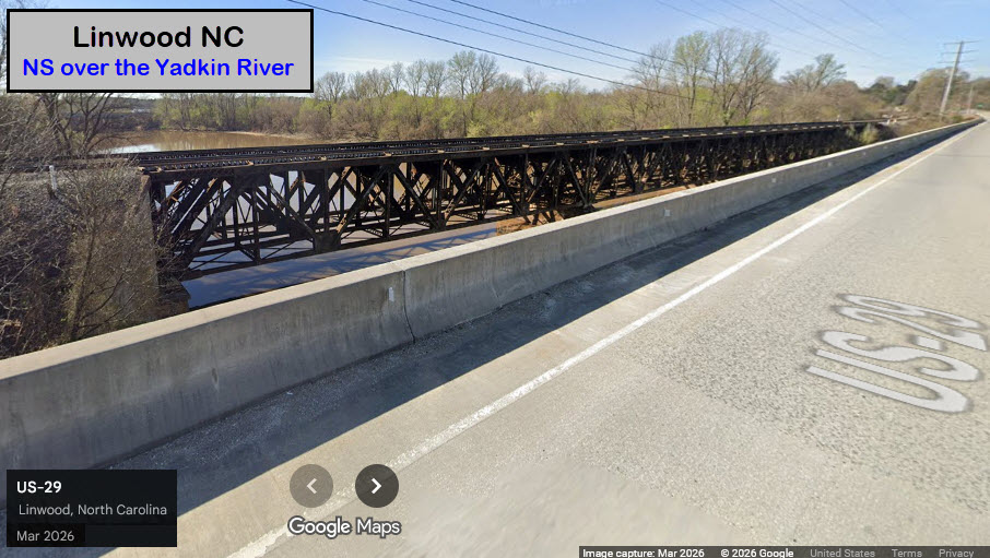
 EB Colorlight Signal at Council Street/Salisbury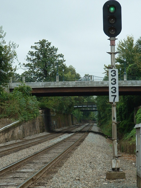
 WB Colorlights Signal at the Salisbury Depot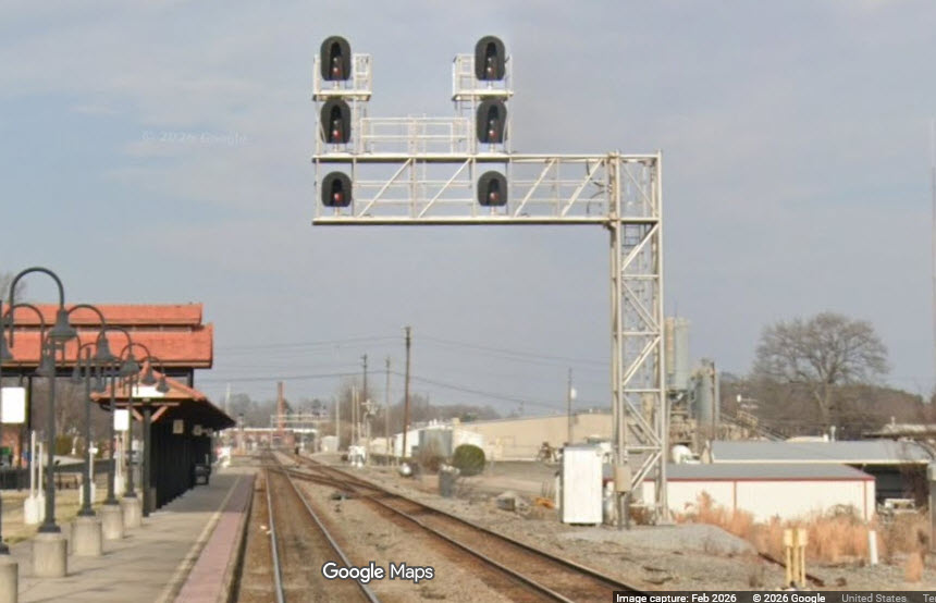
 WB Wye Exit-Interlocking Colorlights / Westside/Salisbury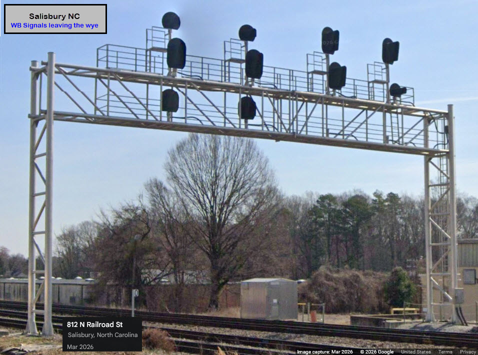
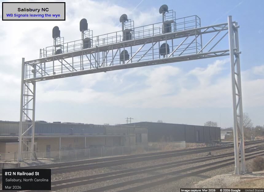
 EB Wye Entering Interlocking Colorlights / Westside near 11th St/Salisbury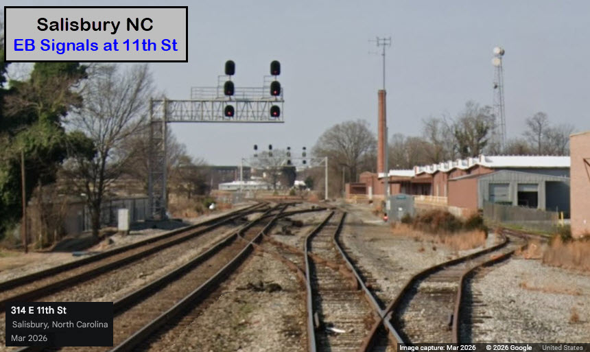
 Colorlight Signals Approaching the Wye/Salisbury
 EB Colorlight Signal at Long Ferry Rd/Spencer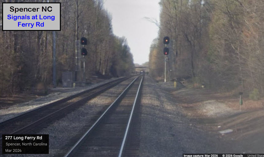
 Interlocking/Linwood

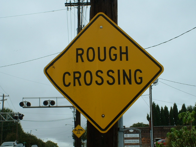

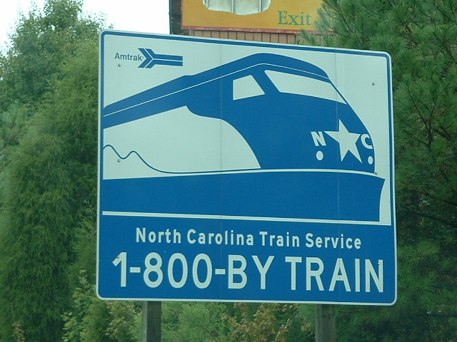
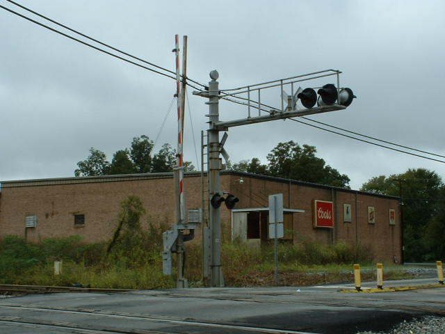


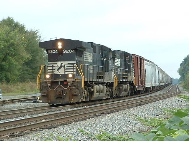
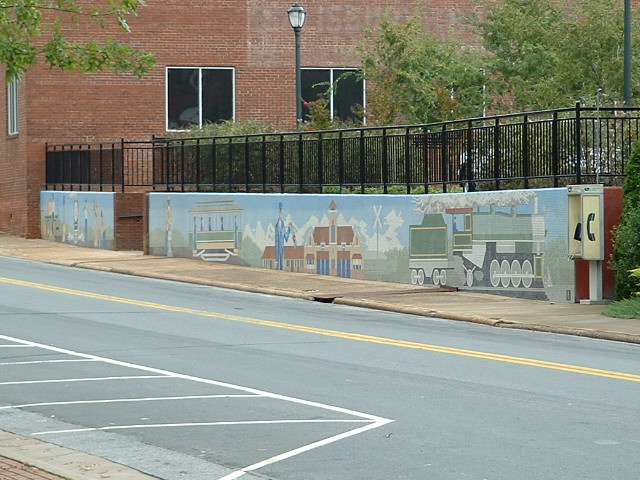 Seen across from the depot