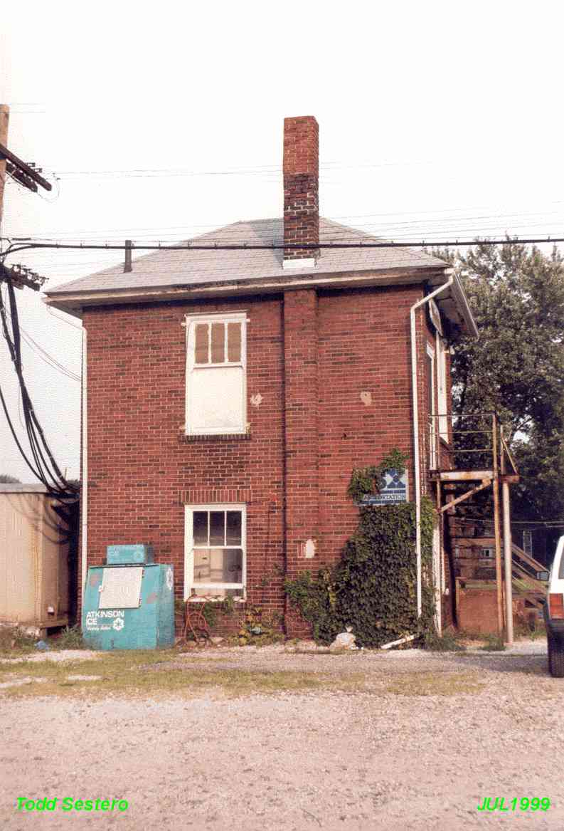
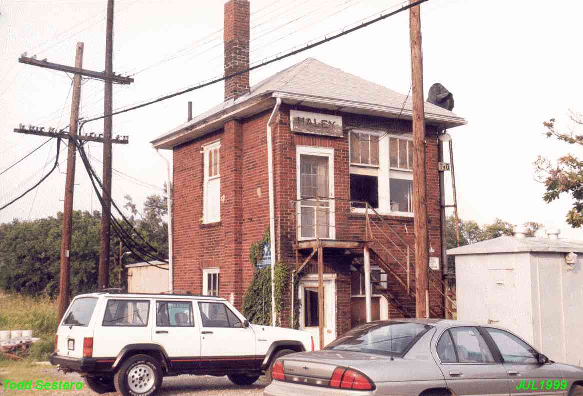
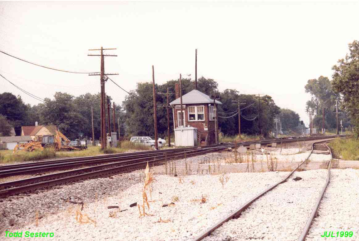
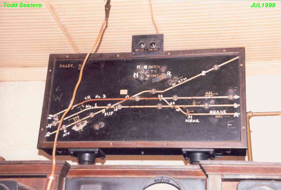
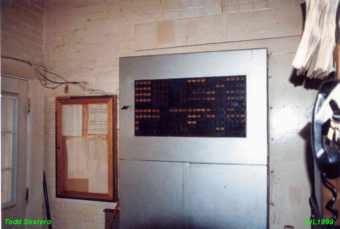
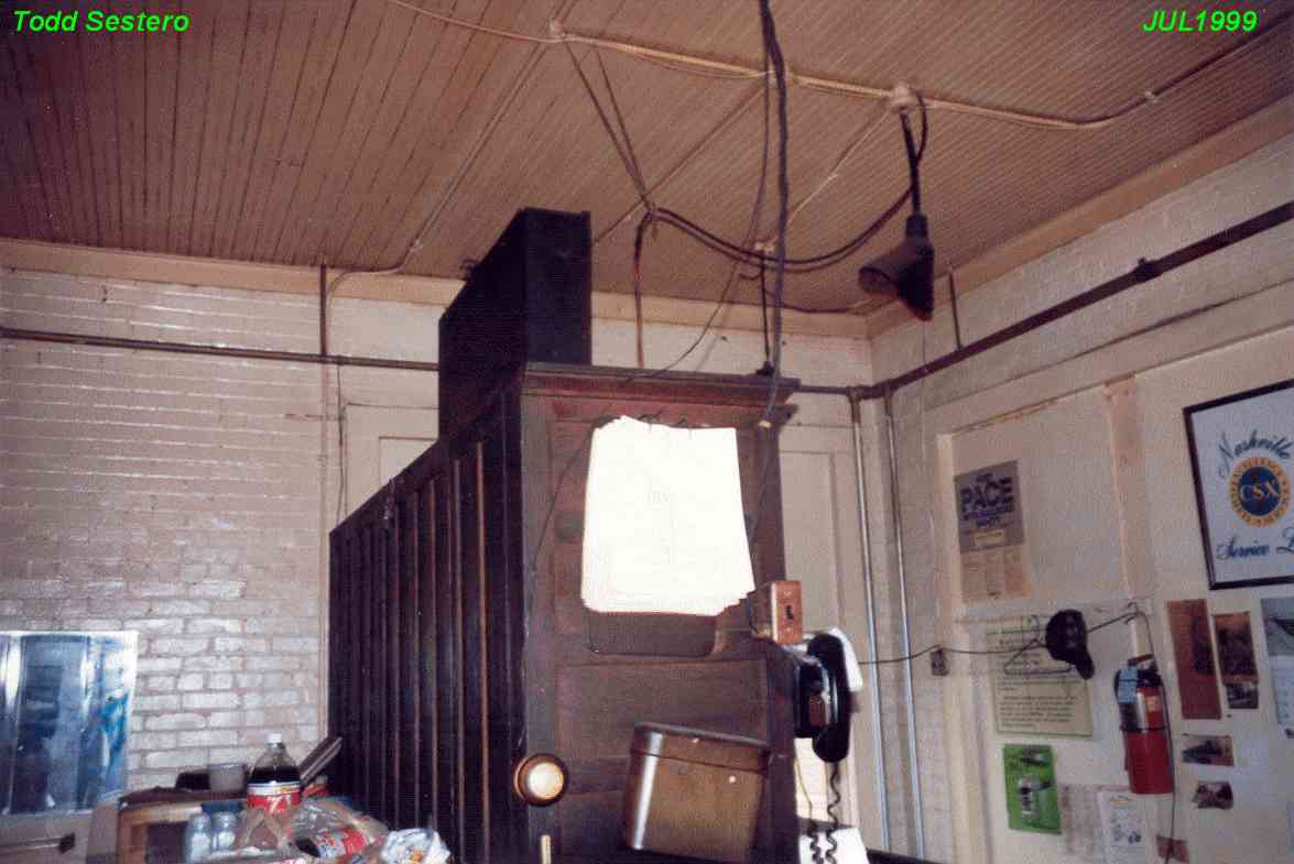
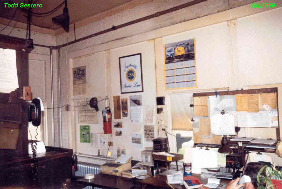
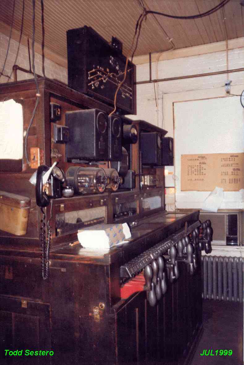
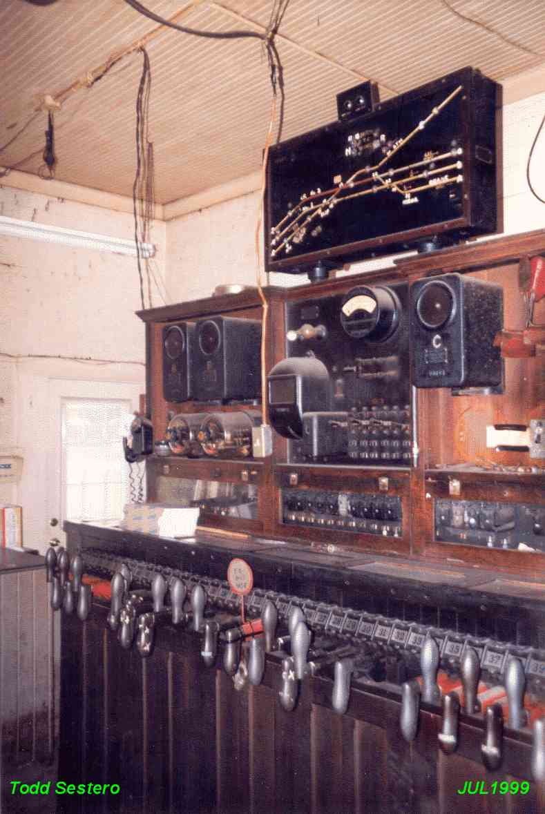
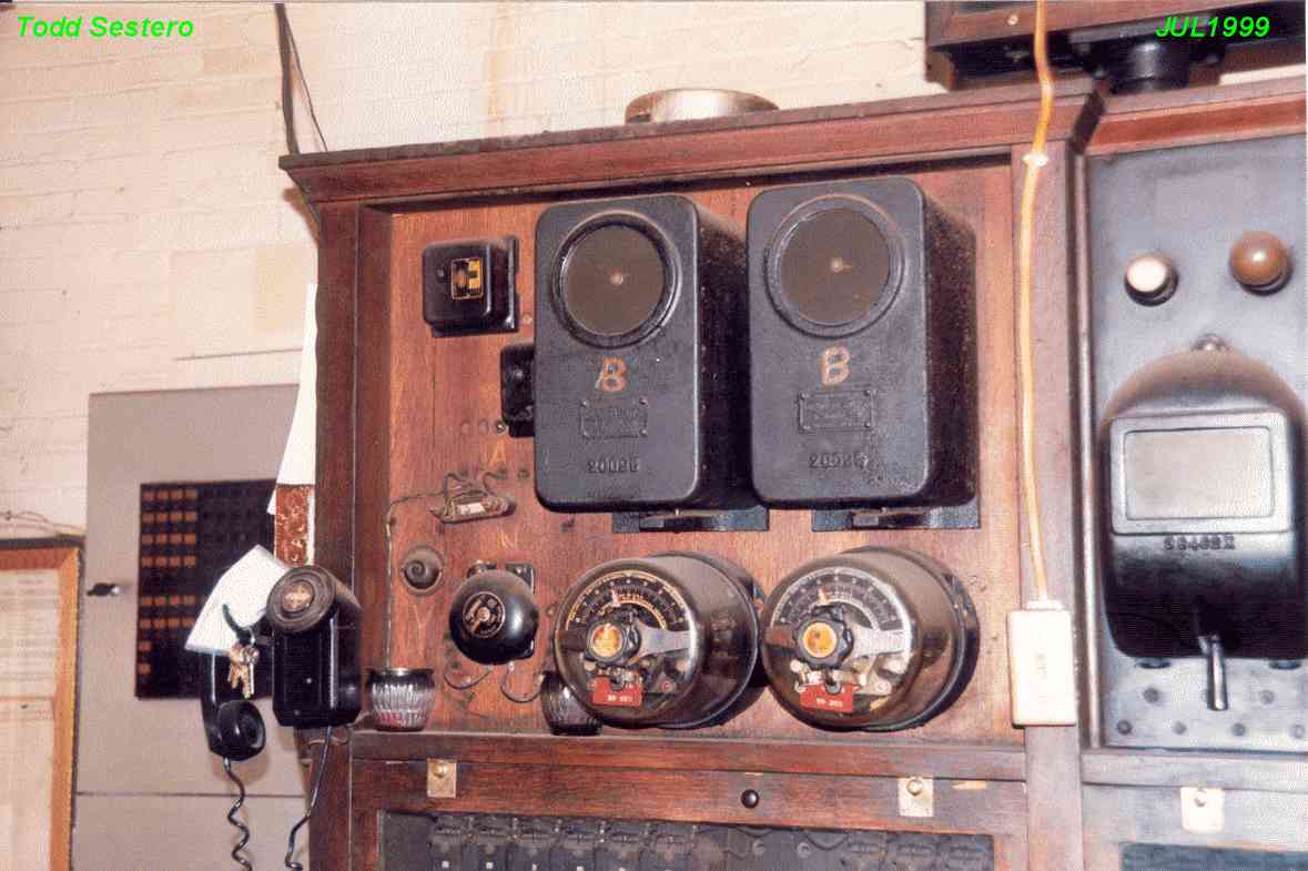
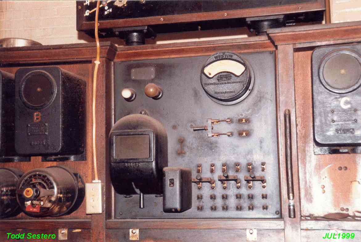
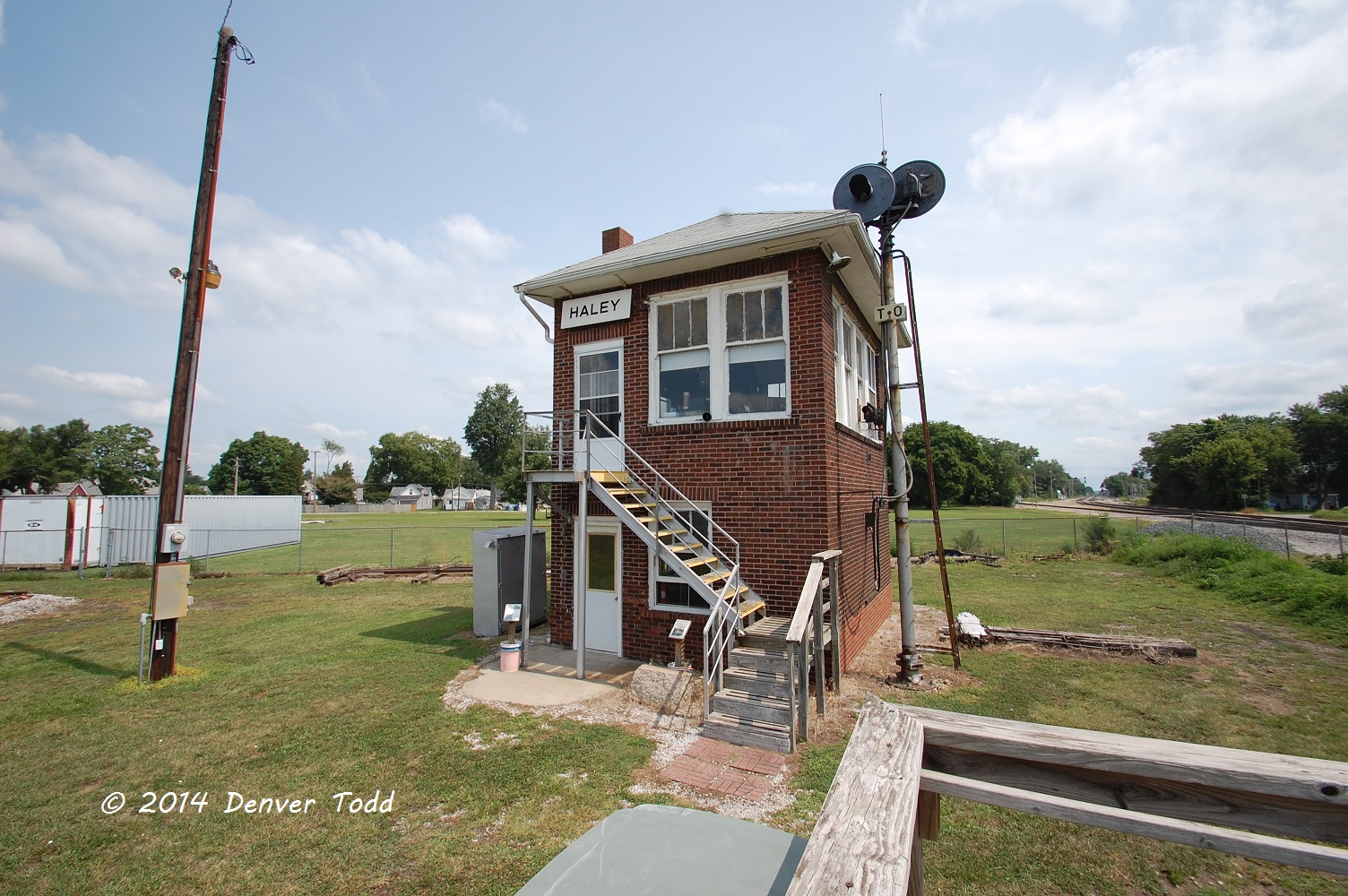
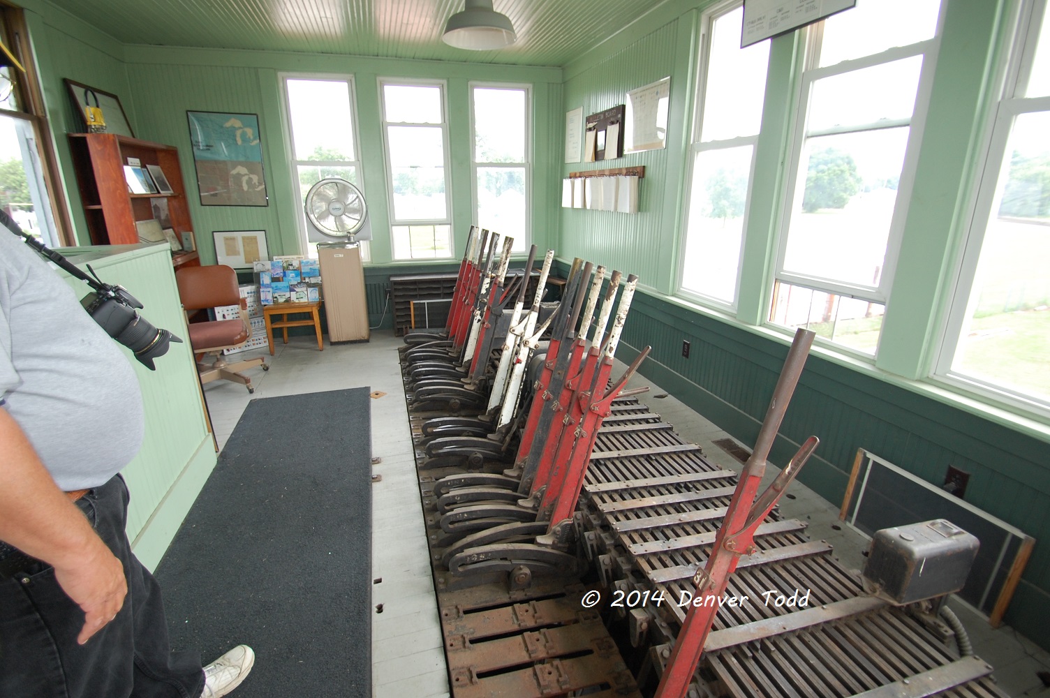
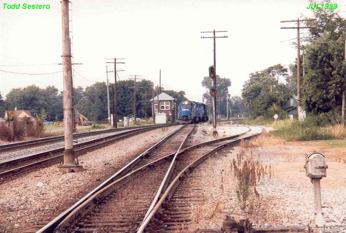
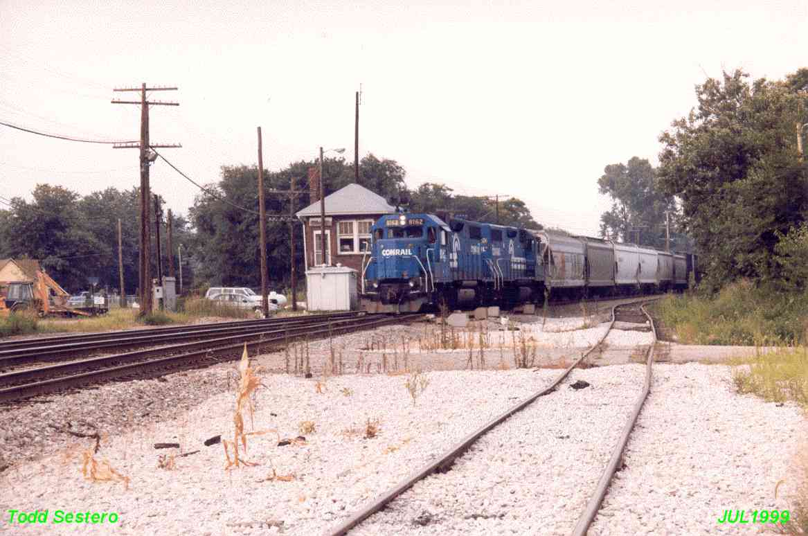
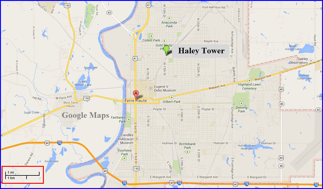
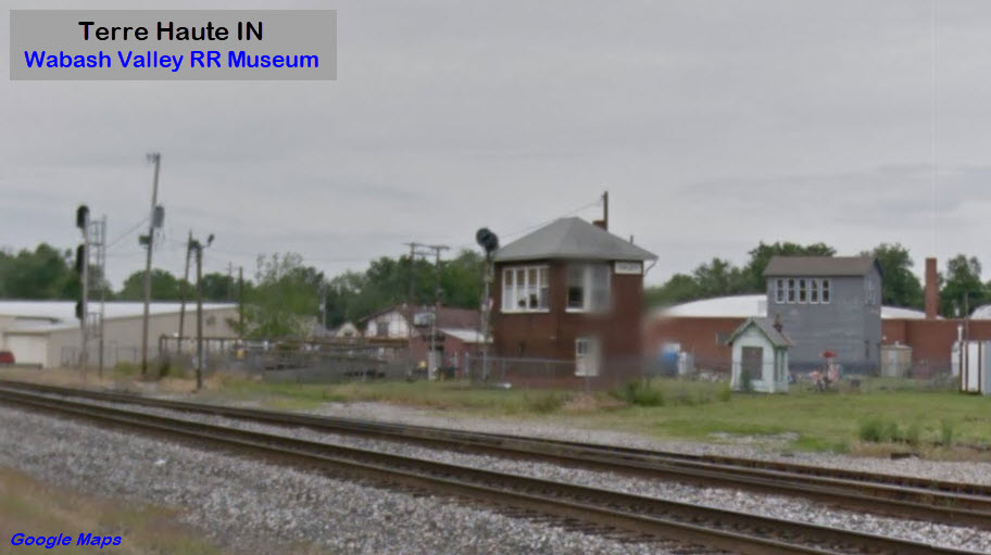
Haley Tower was one of the last operating towers in Indiana. Operating towers
are becoming fewer and fewer, so it is a good thing this one was saved.
Because of my business traveling, I had a chance to stray away from Indianapolis
and head over to Terre Haute, and got these pictures. These pictures are
scans of prints I took in July 1999.
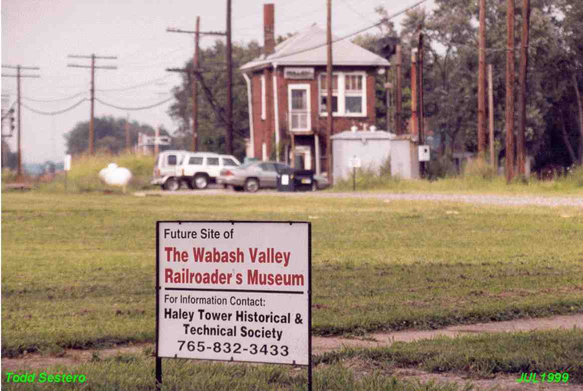
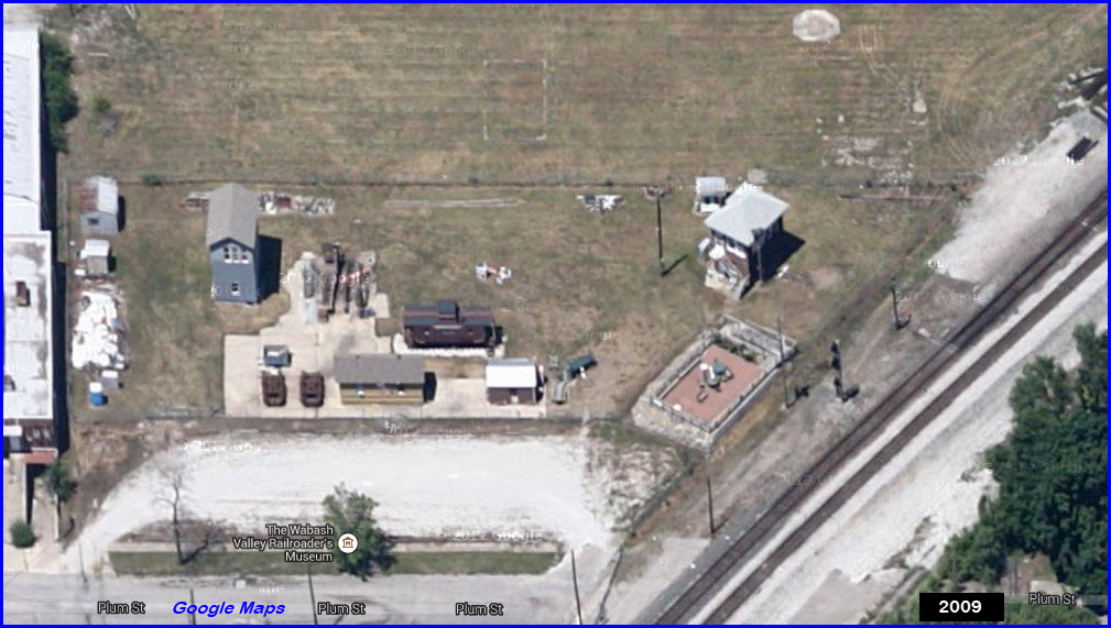
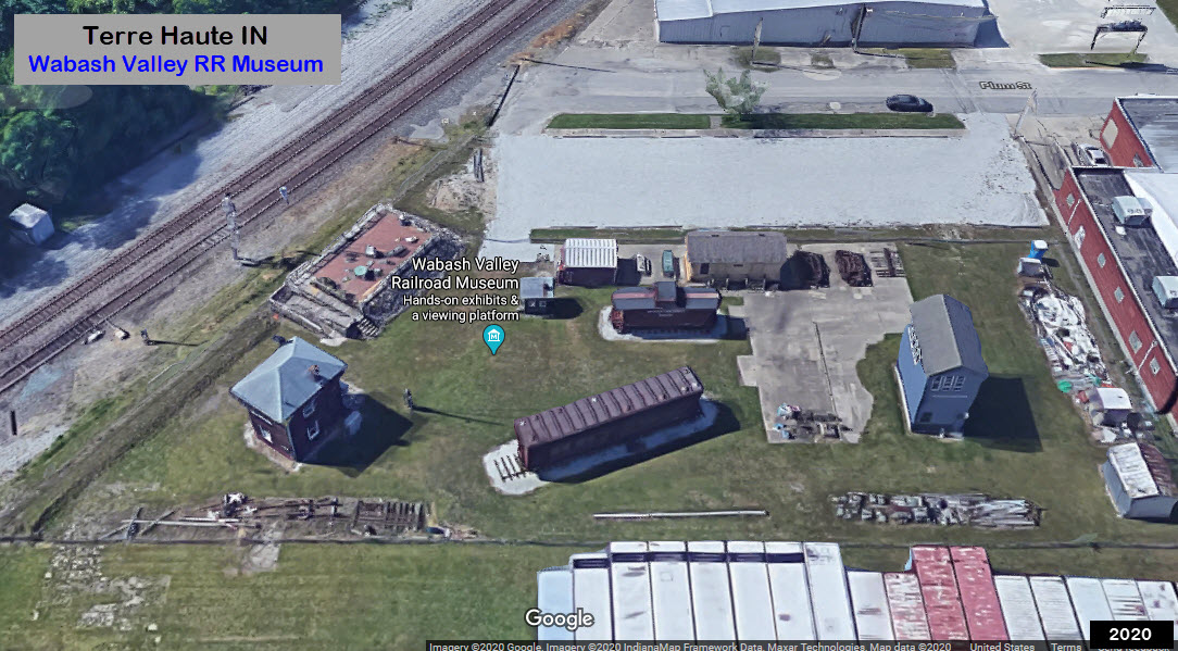
The tower was acquired from CSX by the Haley Tower
Historical and Technical Society, which is associated with the
Wabash Valley Railroaders Museum where
the towers now reside.
The tower was moved about 50 feet to it's present location on Friday,
January 14th, 2000. On Saturday, August 26th, they had a grand
opening celebration.
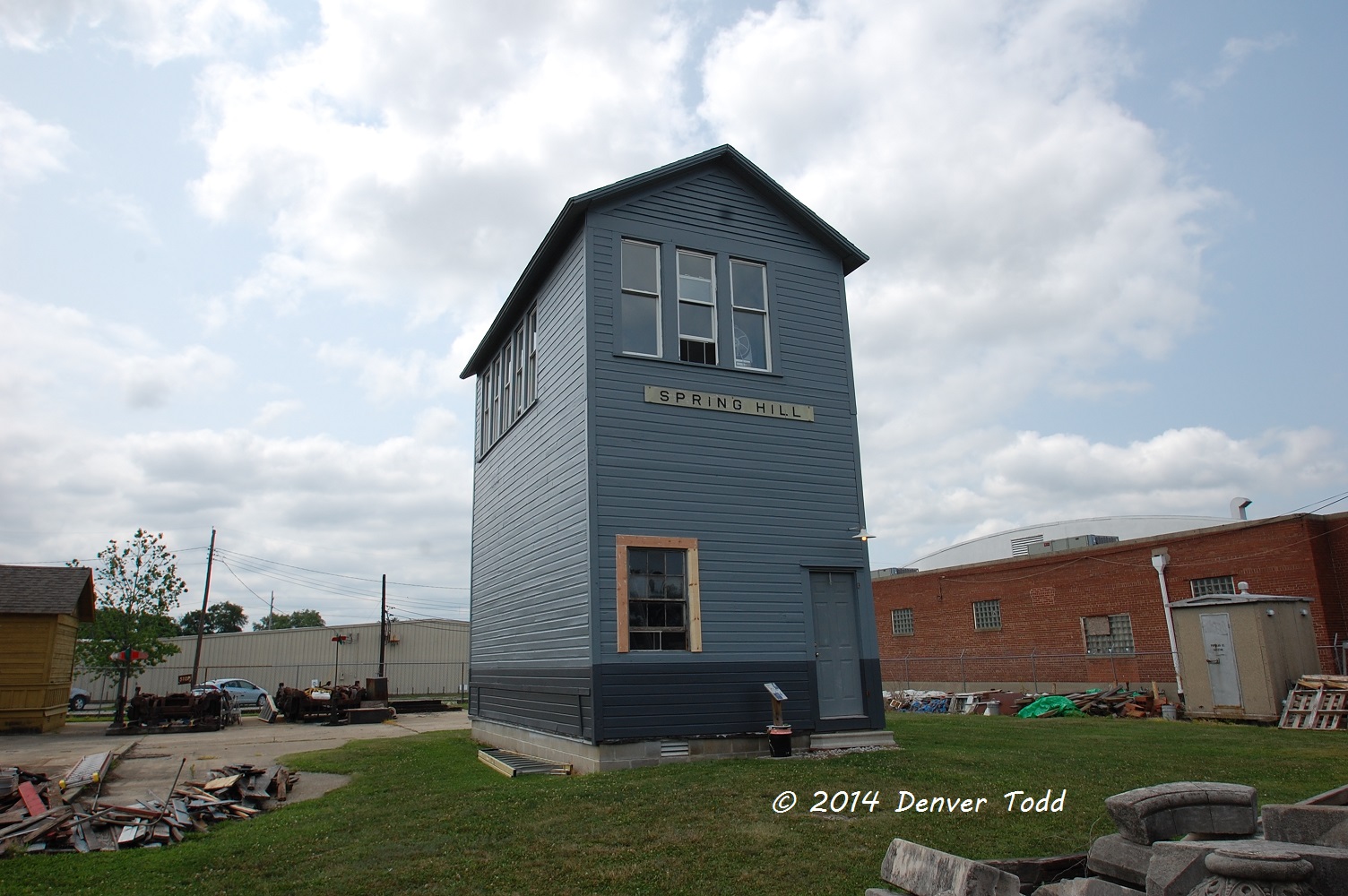
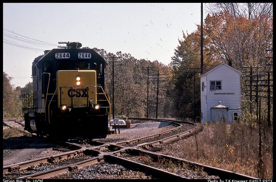
The society also managed to save Spring Hill Tower, which was purchased
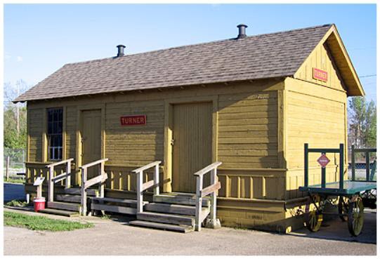
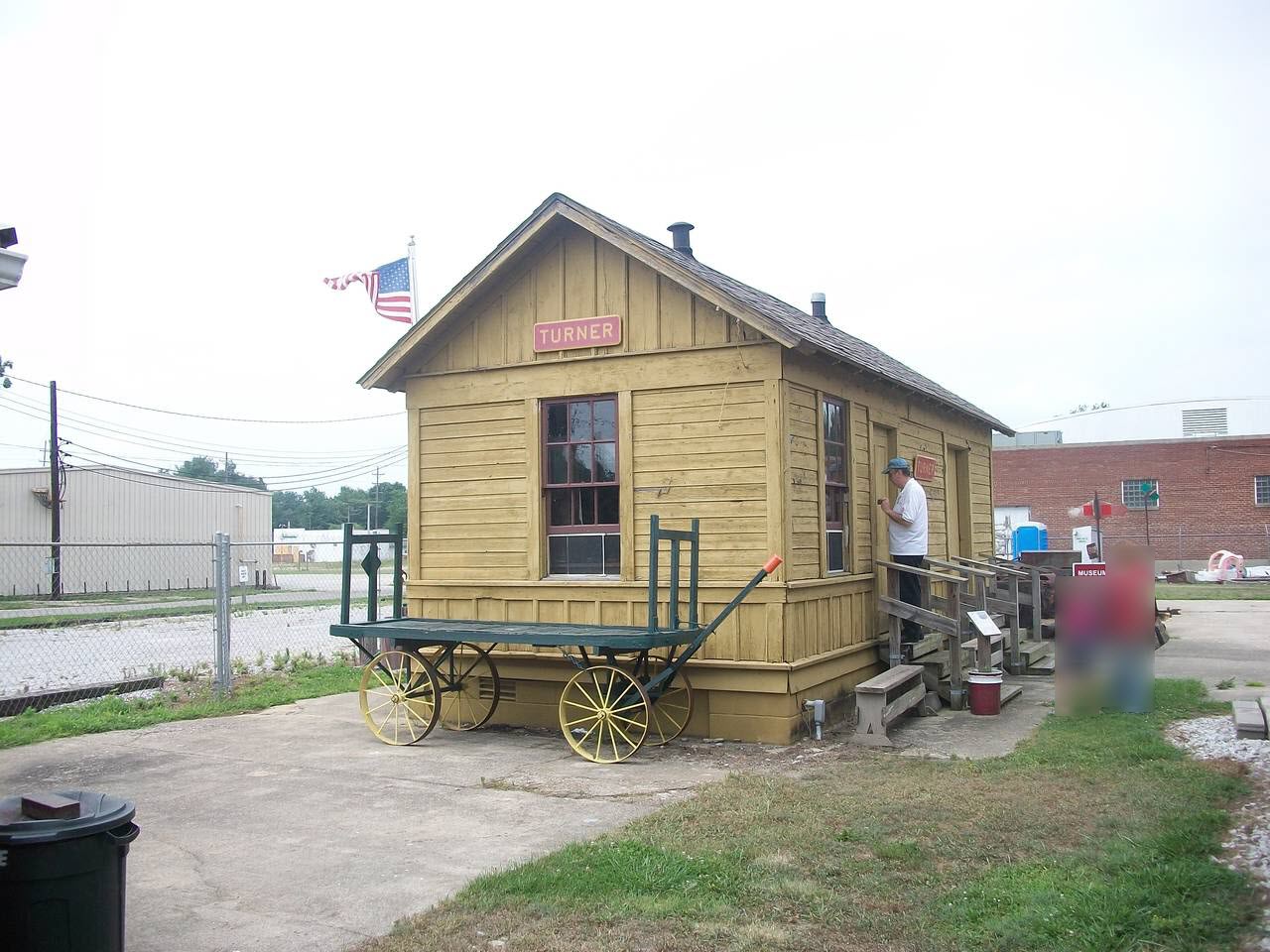
in 2000 and moved to the site in 2001. In 2003, the society also
saved the ex Pennsy depot in Turner IN, and moved it to this site.
The museum is open on Saturdays and Sundays, June thru October. The
hours are 12am to 4pm.
Acknowledgements:
Denver Todd, pictures from Denver as noted
T. K. Kraemer
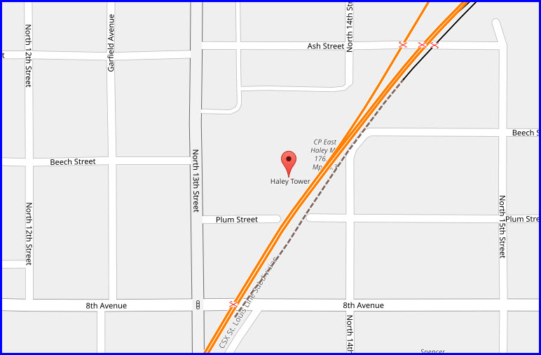
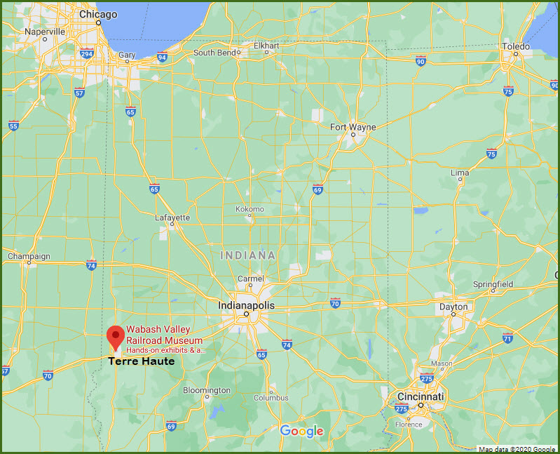
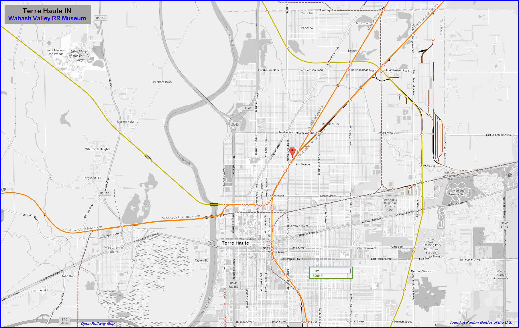
Terre Haute is on the far western side of Indiana, and the museum is 7.2
miles from the IN/IL border. It's also about 70 miles southwest of
downtown Indianapolis IN, and right off Interstate 70 at exit 7.
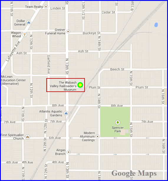
Take exit 7 and go north on US 41, 3.7 miles to 8th Avenue and take a right.
Go slightly less than a mile and then a left onto N. 13th St. One block to
Plum St, take a right, and you're there.
From the Chicago area, I would probably jump off I-65 at Lafayette IN, and
hop onto US 231 and go south to either US 40 or I-70 into Terre Haute.
My pictures were taken in 1999, before the tower was moved to its current location.
Spring Hill Tower
In its native setting before being relocated here.
Turner Depot
Turner Depot was the freight agency and depot in Turner, Indiana, located about
10 miles east of Terre Haute. Surviving in use until the 1940s, Turner was
moved to the museum in 2005. It was built in the late 1800s by the
Terre Haute & Indianapolis Railroad.
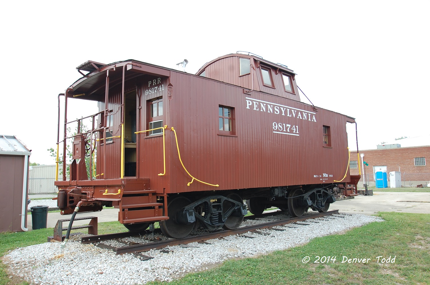
Around the grounds
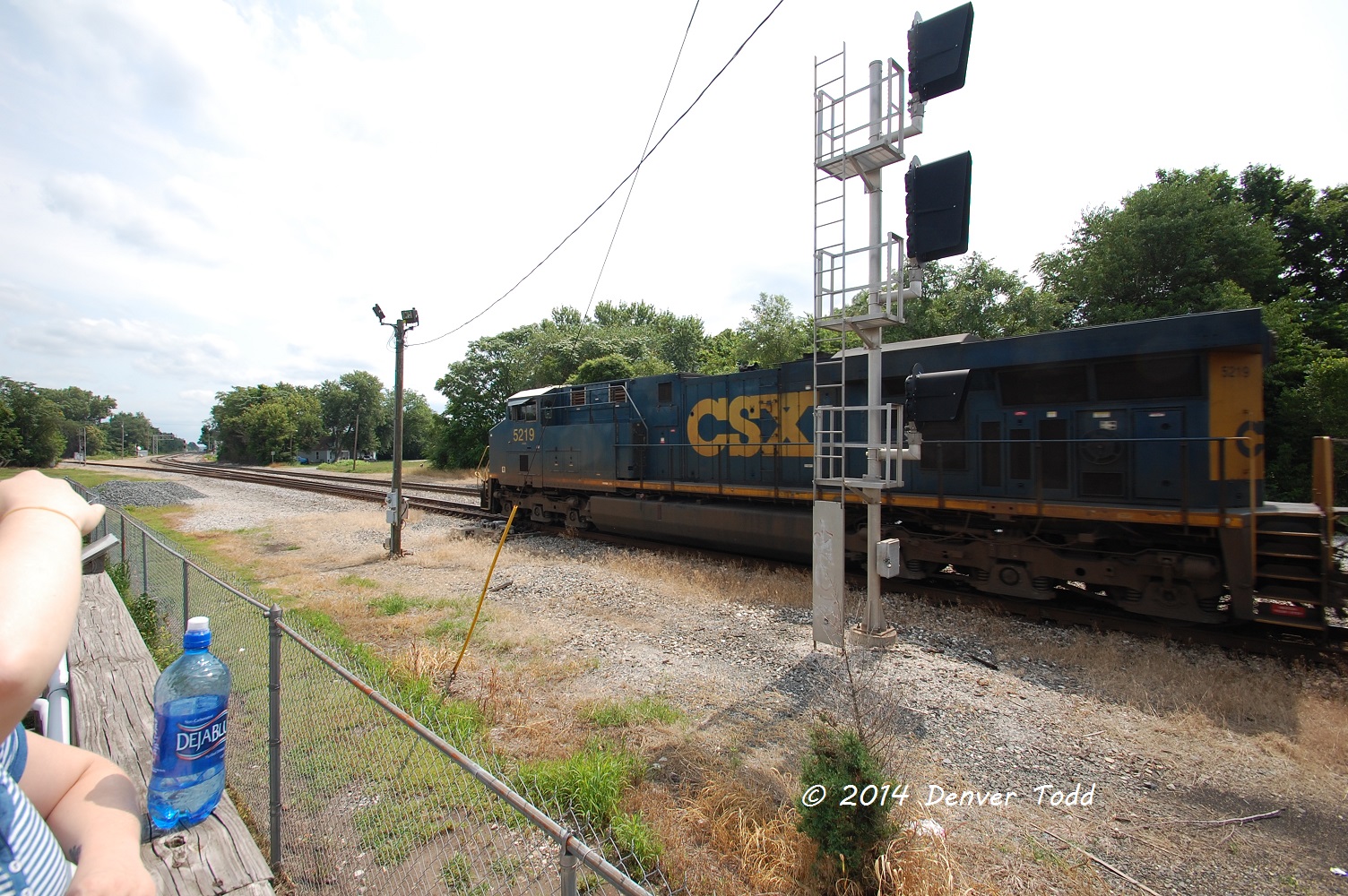
Outside on the Mainline
If you're looking for the double-slip switch, it is gone......
Disclaimers:
I love trains, and I love signals. I am not an expert. My webpages reflect what I find on the topic of the page. This is something I have fun with while
trying to help others.
Please Note: Since the main focus of my two websites is railroad signals, the railfan guides are oriented towards the signal fan being able to locate them.
For those of you into the modeling aspect of our hobby, my
indexa page has a list of almost everything railroad oriented
I can think of to provide you with at least a few pictures to help you detail your pike.
If this is a railfan page, every effort has been made to make sure that the information contained on this map and in this railfan guide is correct. Once in a while,
an error may creep in :-)
My philosophy: Pictures and maps are worth a thousand words, especially for railfanning. Text descriptions only get you so far, especially if you get lost or
disoriented. Take along good maps.... a GPS is OK to get somewhere, but maps are still better if you get lost! I belong to AAA, which allows you to get
local maps for free when you visit the local branches. ADC puts out a nice series of county maps for the Washington DC area, but their state maps do not have the
railroads on them. If you can find em, I like the National Geographic map book of the U.S..... good, clear, and concise graphics, and they do a really good job
of showing you where tourist type attractions are, although they too lack the railroads. Other notes about specific areas will show up on that page if known.
Aerial shots were taken from either Google or Bing Maps as noted. Screen captures are made
with Snagit, a Techsmith product... a great tool if you have never used it!
By the way, floobydust is a term I picked up 30-40 years ago from a National Semiconductor data book, and means miscellaneous
and/or other stuff.
Pictures and additional information is always needed if anyone feels inclined to take 'em, send 'em, and share 'em, or if you have something to add or correct.... credit
is always given! Please be NICE!!! Contact info is here
Beware: If used as a source, ANYTHING from Wikipedia must be treated as being possibly inaccurate, wrong, or not true.