![]()
In General
Getting Here
Map
Sights
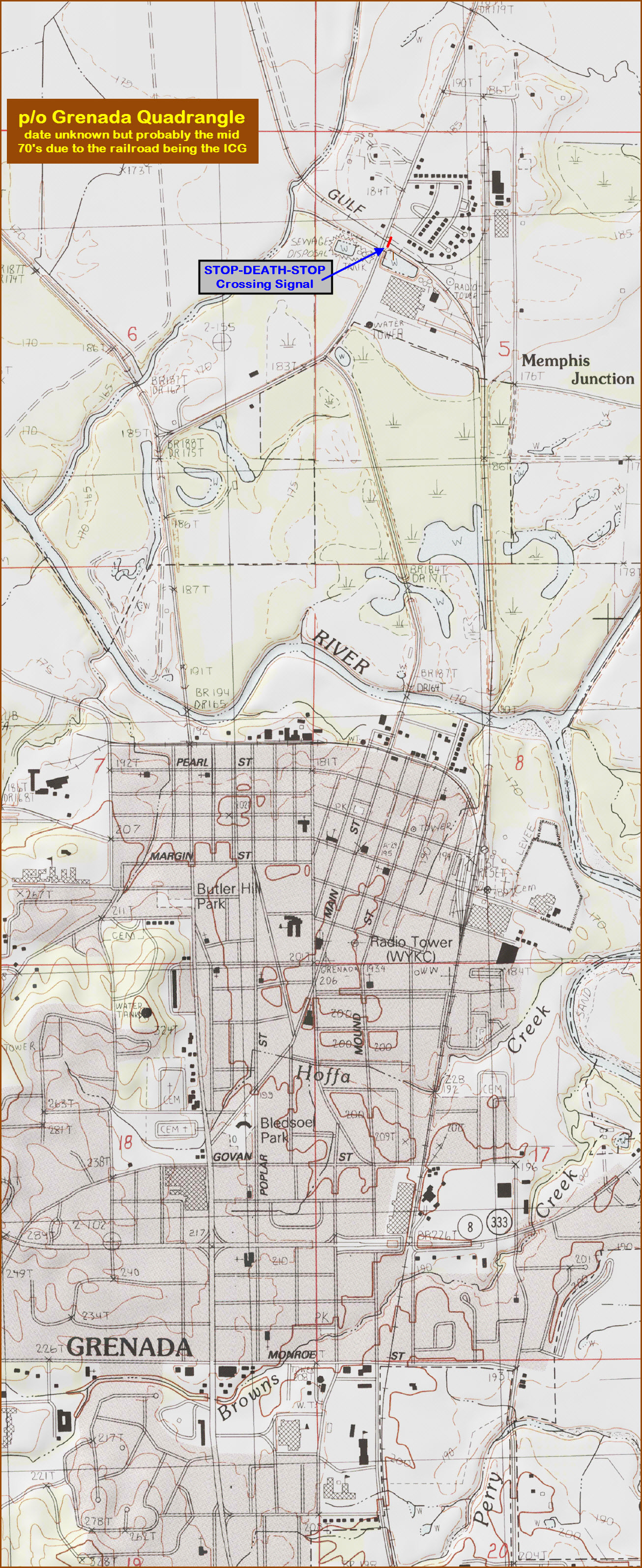
USGS Maps
RAILROAD SIGNALS HOME
Location / Name:
Grenada MS
What's Here:
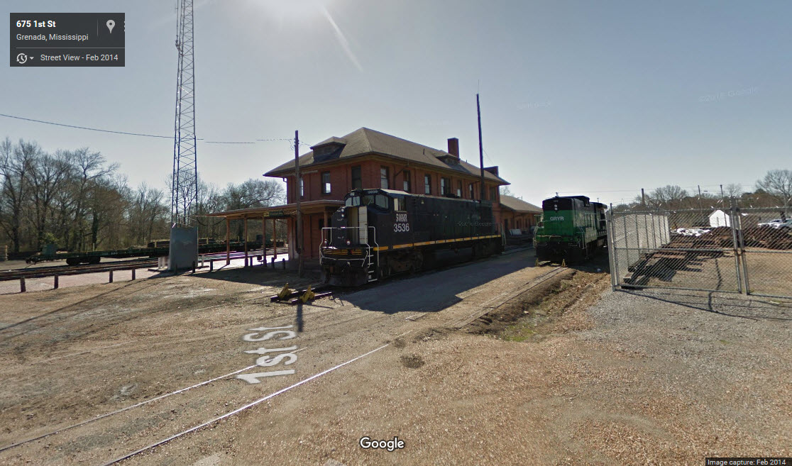
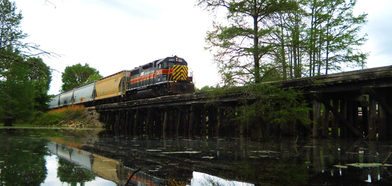
The Grenada Railroad
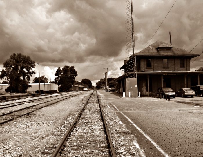
Former Illinois Central RR Depot
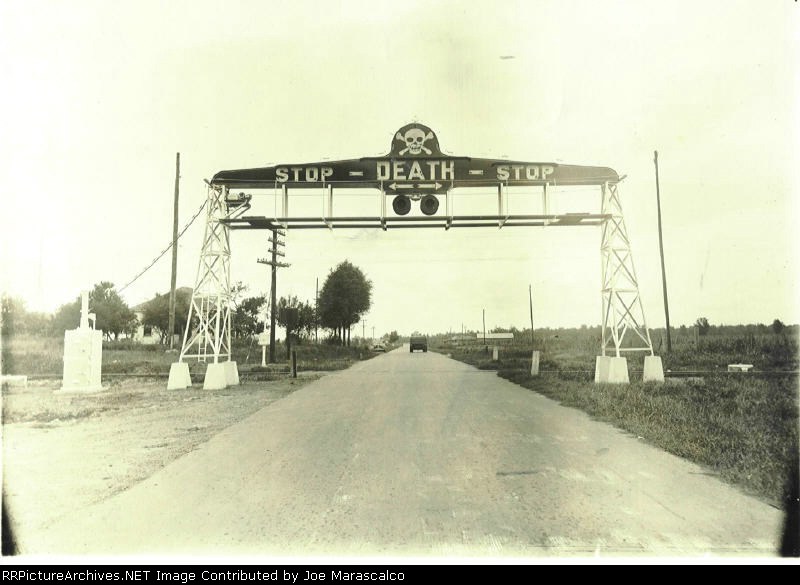
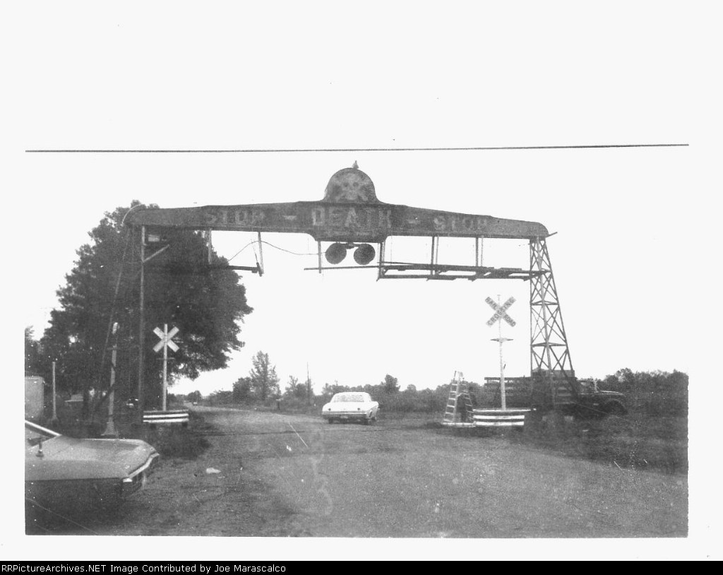
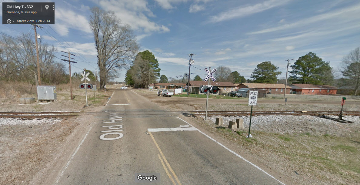
Former location of a unique grade crossing "signal".
Data:
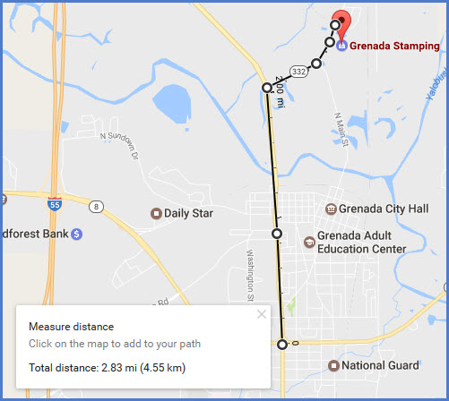
GPS Coordinates: 33.769093, -89.808973 (Downtown at MLK and 7th)
ZIP: 38901
Access by train/transit:
None
The Scoop:
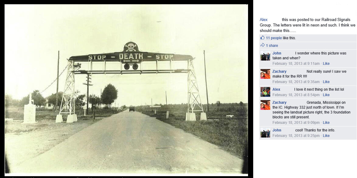
The sole purpose of this page was to show off the photo below of an elaborate and unusual grade crossing signal that used to be here. The page took on it's own life after being created :-)
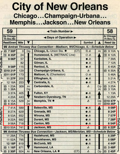
The main attraction in town though, is the Grenada RR. It is headquartered in the former Illinois Central depot, which also served as an Amtrak station until the discontinuance of the City of New Orleans train in 1995.
Railroad vs. Railway..... The Grenada RR is found on the internet as a railroad and a railway. Who is correct? Wikipedia (see my cautionary note below) has it as railway. A reference to a Trains Magazine says railway. They are both wrong, for on the railroads own page, it clearly says RAILROAD. I'vw given up trying to correct people and things (like Wikipedia), so I will just do my own little part in spreading the truth (sorry Cobalt Blue Paul).
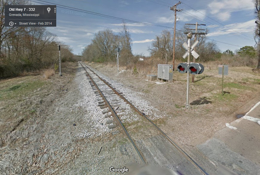
So, back to the grade crossing, according to the info presented below, it was installed in the 1930's because of it being a dangerous grade crossing due to fast trains. It was designed and built by a local feller named Alonzo Billups, and it went by several nicknames. When a train was approaching, the sign would light up in neon "STOP-DEATH-STOP", and what we call an air raid siren, would start blaring. The sign was eventually discontinued in use, mostly because the siren would stay ON, and required railroad maintenance guys to come out and shut the thing off (don't know why they couldn't have substituted bells?). One person stated that WWII prevented any further ones from being built because of the shortage of neon. It was taken down in 1970. The track was formerly an Illinois Central line.
Here is one accounting of the crossing:
The Billups Crossing Sign was placed where Ms. Hwy.7 crossed the IC line just west of the parallel Hwy 51. Traffic on the narrow Hwy 51 ran fairly fast as it was leaving the Grenada City limits and of course the IC's speed was notoriously fast. ( The stories were that the 'City' or the 'Panama' went through those little towns "so fast that the hammer on the bell at the crossing only got to half cocked before the trains were past." or "They went through towns so fast they sucked the trash out of Both ditches when the went by!" Track speed for those trains upper limit was a 'Dollar bill.' ( I can attest they pretty much ran that most of the way). Track was maintained as smooth as glass back then. So Crashes at the area of the Hwy/ Railroad crossing were often deadly to the one running the sign. Speed being the operative element.
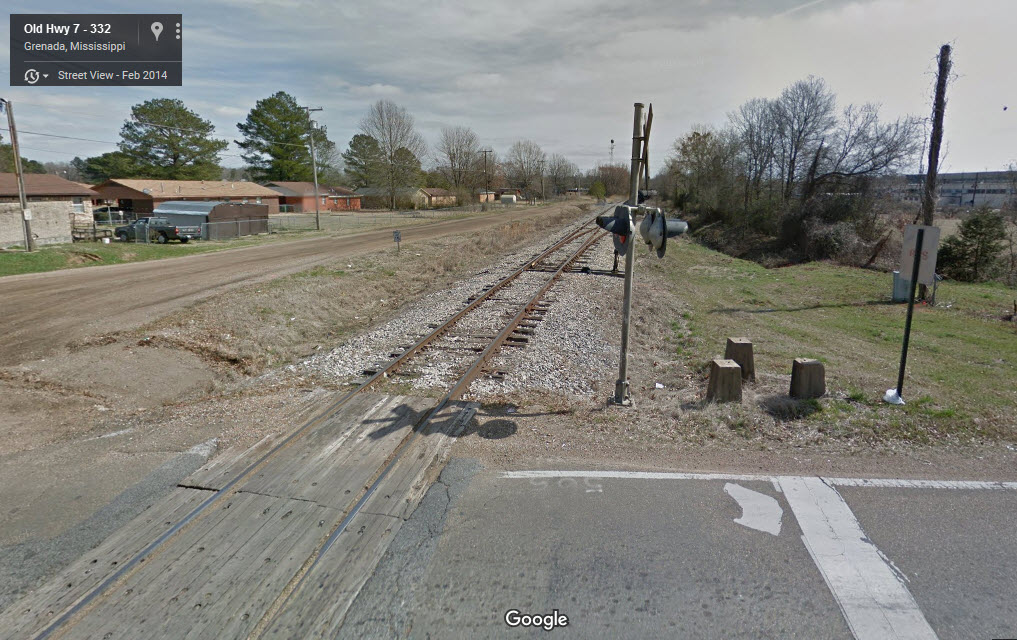
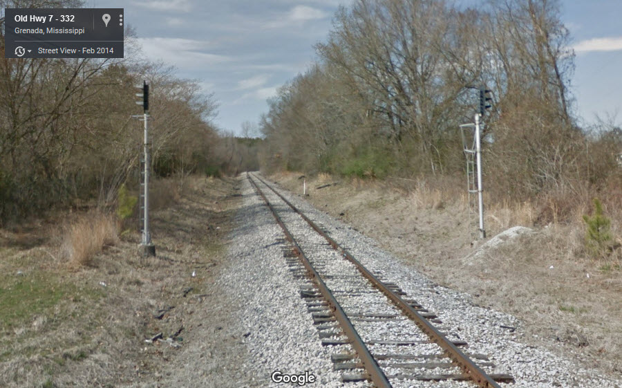
It's kind of amazing that the concrete footings for the right tower are
still with us!
This is one of about three pages I have that were created around one lone
photograph. :-)
This is a great piece of railroad history, and I am glad there are people
like ourselves to go out and document these kinds of things.
I'm sure, if you wanted one, they would be willing to sell you one of the
old color light signals, as I know the Maryland Midland was willing to do so
with one of the former Western Maryland signals for a tidy sum of $1800, and
they were in terrible "shot-up" condition.
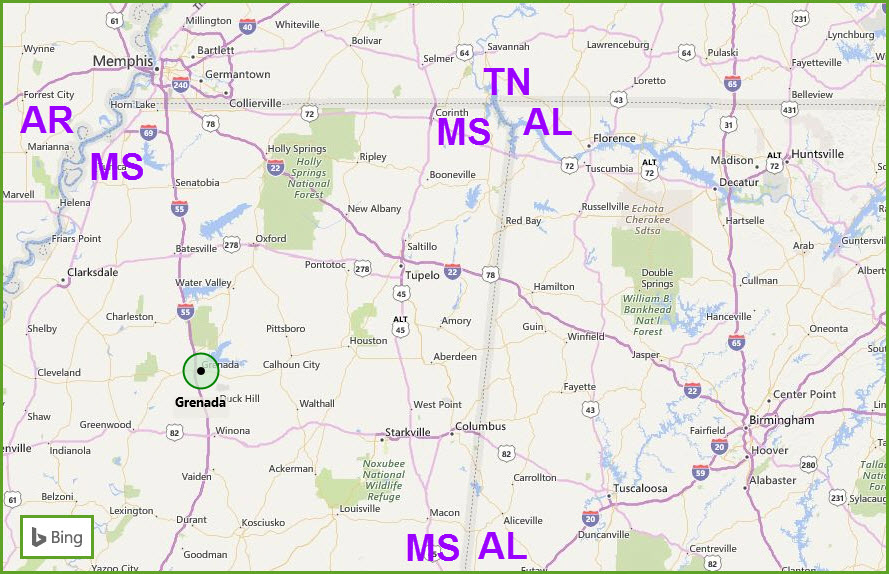
About 73 miles south as the crow flies, and 75 miles via I-55, is Vaughn MS,
where Casey Jones had his accident that prompted the folklore and music.
Jackson MS is about 39 miles to the south of Vaughn (~112mi south of
Grenada), and has another short line. Memphis TN is about 95 miles to
the north.
I used Bing maps instead of Google's, because Google has stopped making the
railroads an important part of the maps, making the lines very difficult to
see.
Acknowledgements:
Joe Marascalco for taking
and/or sharing the picture with everyone
Zachary ZCG for the
picture, and for posting it on the Yahoo Railway Signaling group for the
rest of us to see.
Additional information:
https://en.wikipedia.org/wiki/Billups_Neon_Crossing_Signal
http://cs.trains.com/trn/f/111/p/178383/1957241.aspx
https://www.facebook.com/notes/robert-w-neill-jr/the-neon-railroad-crossing/346326822052592/
http://awalker1829.livejournal.com/66322.html
http://www.railpictures.net/showphotos.php?city=Grenada&country=Mississippi,%20USA
http://www.trainorders.com/discussion/read.php?11,2445368
Aerial shots were taken from either Google Maps or www.bing.com/maps as noted. Screen captures are made with Snagit, a
Techsmith product... a great tool if you have never used it!
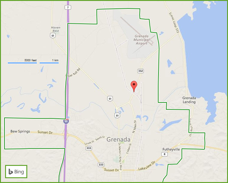
Take exit 208 off of I-55, then go east on Paper Mill Rd. Take a right into US 51, heading SE into town. Go 1.8 miles to 332 on your left, take it. The grade crossing is about 8/10 of a mile from US 51.
From:
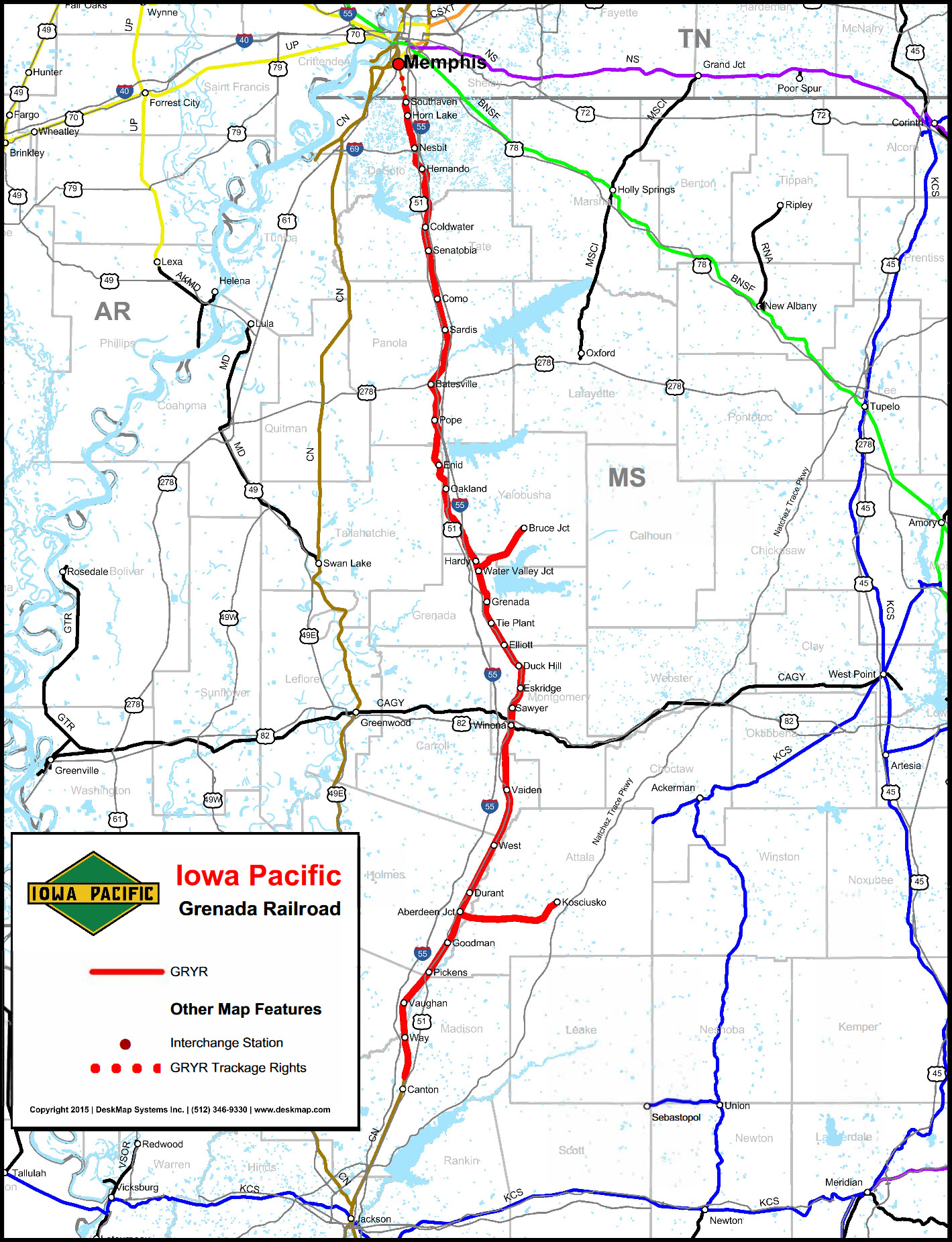
http://www.iowapacific.com/wp-content/uploads/2016/02/Grenada-Railroad-Map.pdf
GPS Coordinates: 33.805645, -89.801492
Location: , Old Highway 7, Road 332, about 2.8 miles from downtown at MLK and Lakeview coordinates above
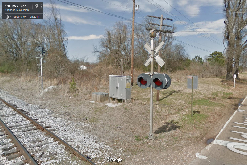
The rest of the pictures are current as of 2014 from Google's Streetview
GPS Coordinates: 33.782818, -89.797764
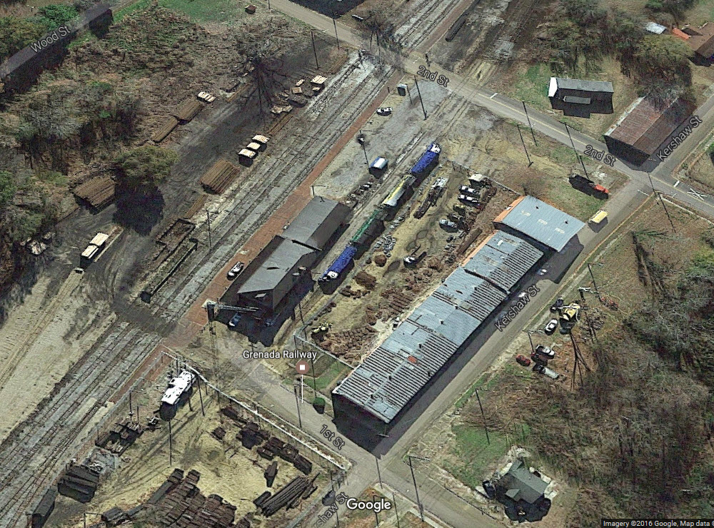
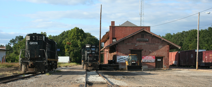
Location: 643 1st St, Grenada MS 38901
Phone: 662-226-8364
http://www.iowapacific.com/railroads/grenada-railroad/
https://www.grenadapolarexpressride.com/
https://www.grenadarail.com/
https://www.up.com/customers/shortline/profiles_d-k/gryr/index.htm
Info from their page:
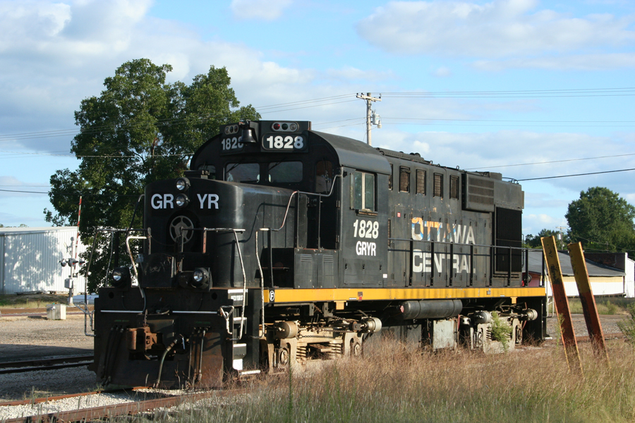
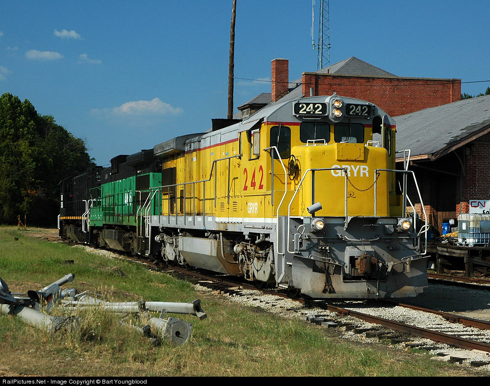
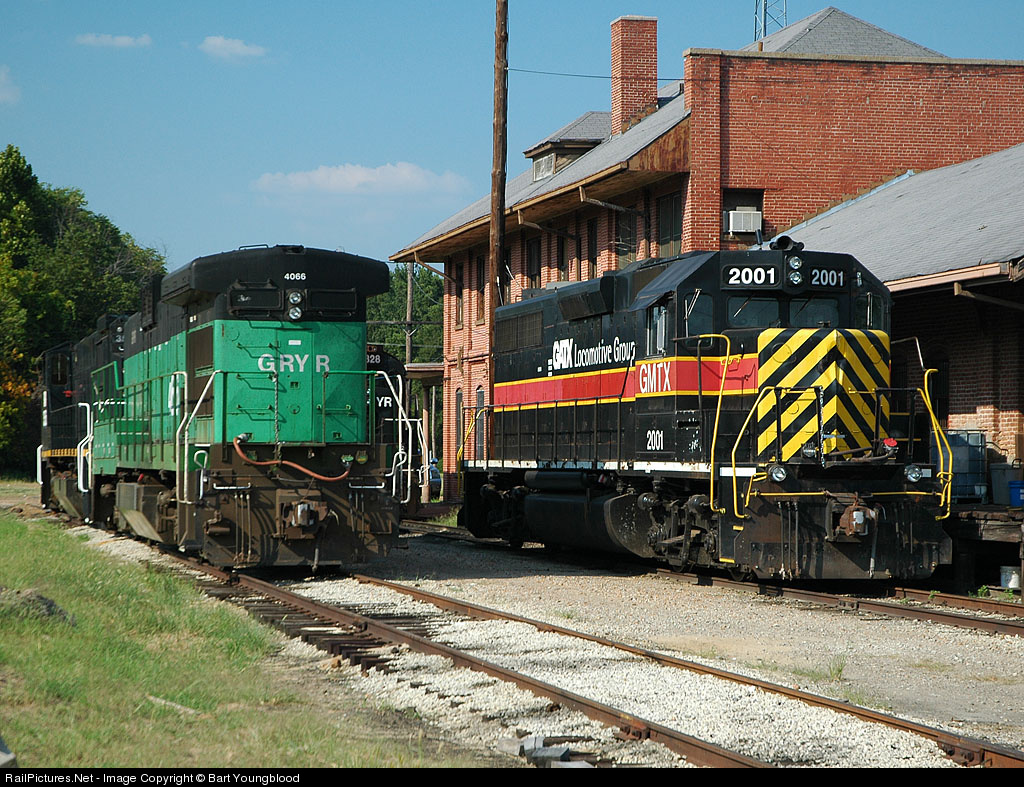
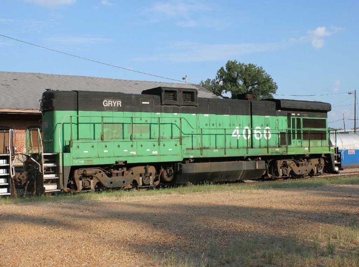
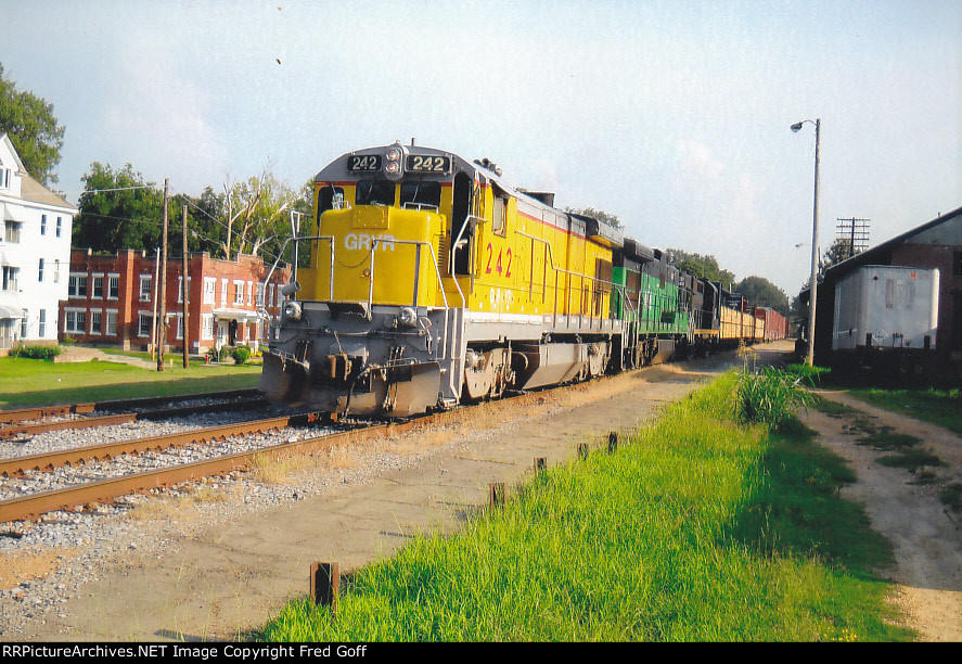
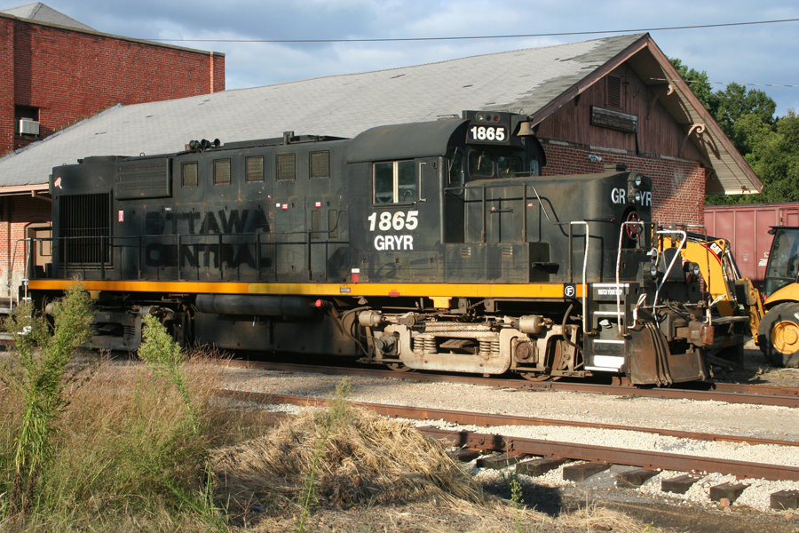
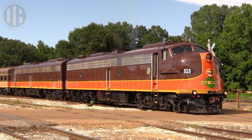
They have five engines, run three times a week, and operate 33 freight cars of their own markings.
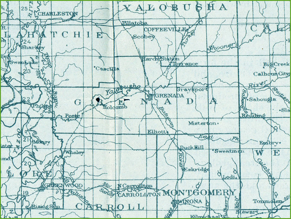
The railroad runs generally southward from Southaven, Mississippi parallel with I-55 to Canton, Mississippi. The GRYR has two branch lines – the Water Valley Branch from just north of Grenada to Coffeeville and the Aberdeen Branch from just south of Durant to Kosciusko.
The GRYR was formerly the Grenada District of the Illinois Central Railroad and is steeped in railroad history. It was on this line that on April 30, 1900 the famed IC Engineer J. L. “Casey” Jones made his last run and met his maker in a collision with a freight train near Vaughan, Mississippi. The Water Valley Branch follows the original route of the “Main Line of Mid-America”. The Grenada District hosted many famous named passenger trains in its long history including the famed “City of New Orleans” and “Panama Limited”. The Grenada line was a major factor in developing industries along the route and facilitated the movement of local goods, in particular, agricultural and wood products, to the marketplace.
The line is now owned by the North Central Mississippi Regional Railroad Authority and operated by the Iowa Pacific. The stakeholders are committed to maximizing the railroad’s contribution to the economic development of North Mississippi.
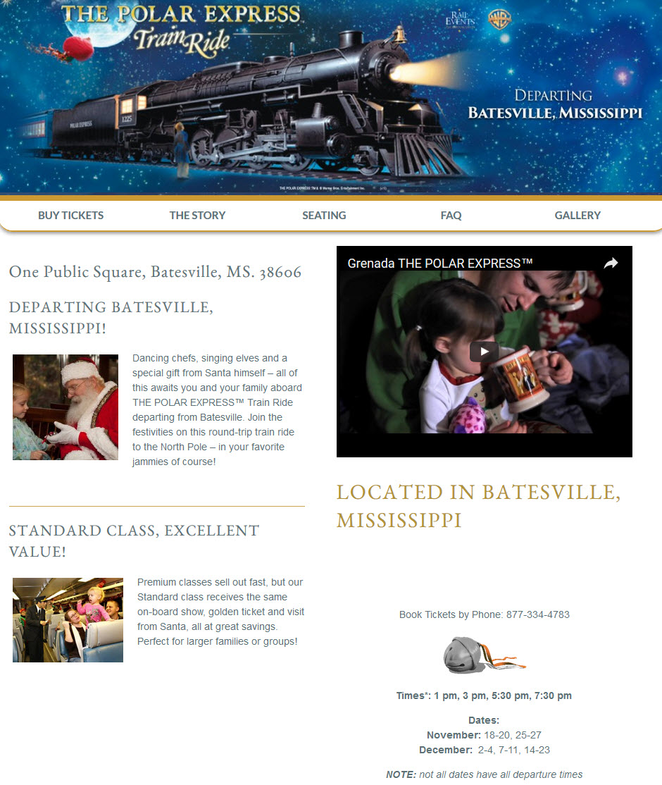
During November and December, they run the Polar Express excursion train (see below).
GPS Coordinates: 33.782818, -89.797764
Location: 643 1st St, Grenada MS 38901
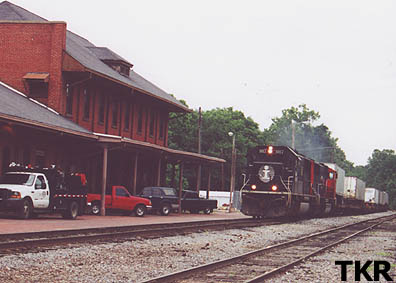
This depot was used until 1995 as a stop for Amtrak's City of New Orleans train. It now serves as the headquarters for the Grenada Rwy.
 During the Amtrak days
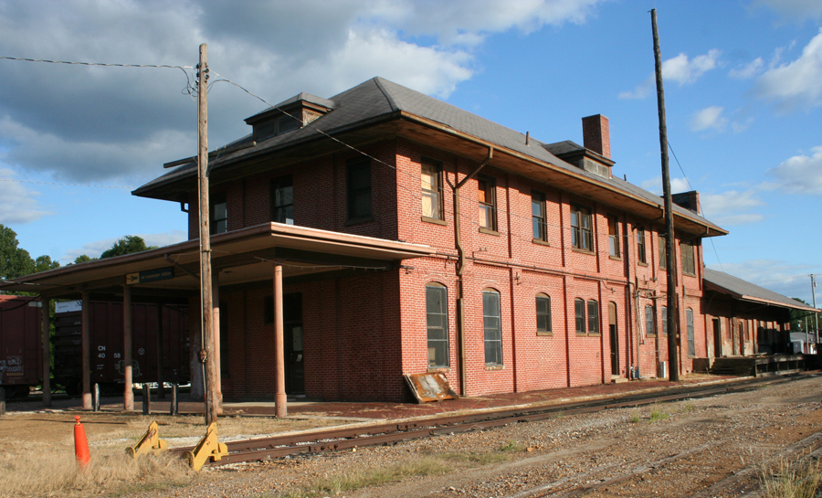
These two pictures are by Mike Condren: http://condrenrails.com/Grenada-Railway/index.html
Courtesy of the University of Texas Library, click
here for
their index page.
Disclaimers:
I love trains, and I love signals. I am not an expert. I do these pages because I love spending my time doing them - although I do a reasonable amount of research to make sure the information presented is accurate! :-) :-)
Please Note: Since the main focus of my two websites is railroad signals, the railfan guides are oriented towards the signal fan being able to locate them. For those of you into the modeling aspect of our hobby, myindexa page has a list of almost everything railroad oriented I can think of to provide you with at least a few pictures to help you detail your pike.
If this is a railfan page, every effort has been made to make sure that the information contained on this map and in this railfan guide is correct. Once in a while, an error may creep in, oooooooops, oh well! :-)
My philosophy: Pictures and maps are worth a thousand words, especially for railfanning. Text descriptions only get you so far, especially if you get lost or disoriented. Take along good maps.... a GPS is OK to get somewhere, but maps are still better if you get lost! I belong to AAA, which allows you to get local maps for free when you visit the local branches. ADC puts out a nice series of county maps for the Washington DC area, but their state maps do not have the railroads on them. If you can find em, I like the National Geographic map book of the U.S..... good, clear, and concise graphics, and they do a really good job of showing you where tourist type attractions are, although they too lack the railroads. Other notes about specific areas will show up on that page if known.
BTW, floobydust is a term I picked up 30-40 years ago from a National Semiconductor data book, and means miscellaneous and/or other stuff.
Pictures and additional information is always needed if anyone feels inclined to take 'em, send 'em, and share 'em, or if you have something to add or correct.... credit is always given! BE NICE!!! Contact info is here. Beware: If used as a source, ANYTHING from Wikipedia must be treated as being possibly being inaccurate, wrong, or not true.
RAILFAN GUIDES HOME
RAILROAD SIGNALS HOME
NEW
12/17/2016
Last Modified
18-Dec-2016