
In General
Getting Here
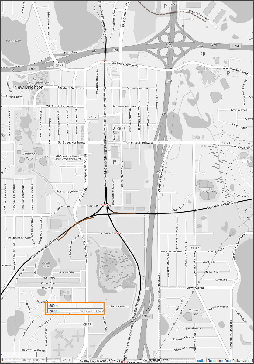
Map
Sights
Pictures
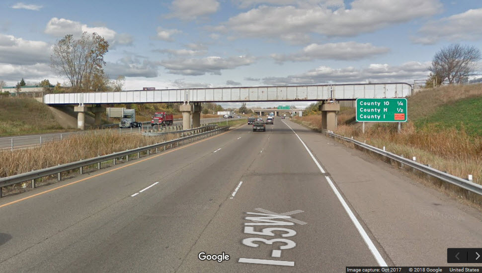
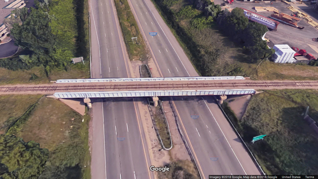
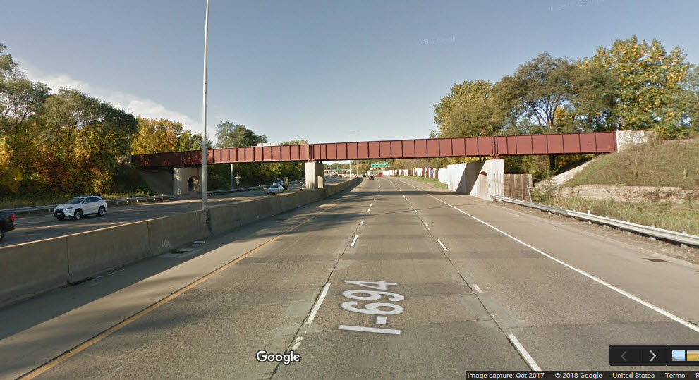
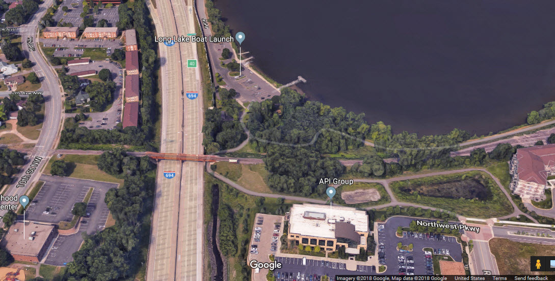
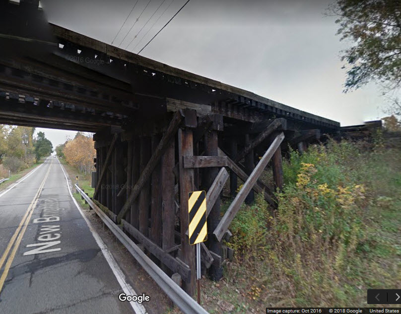
Bridges
Signals
Floobydust
USGS Maps
RAILFAN GUIDES HOME
RAILROAD SIGNALS HOME
Location / Name:
New Brighton MN, Ramsey County
What's Here:
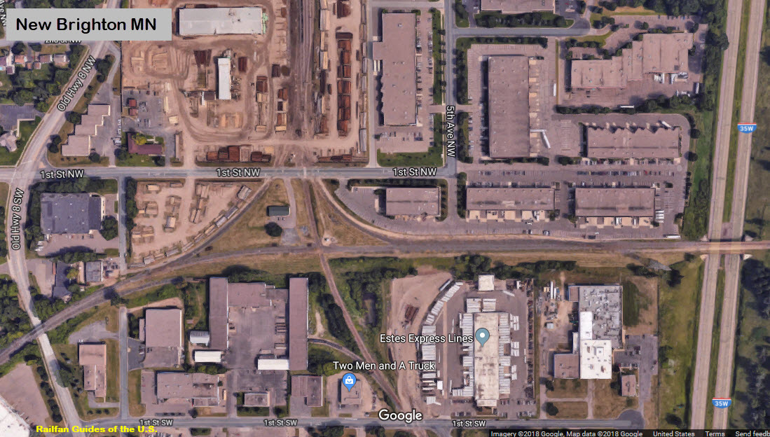
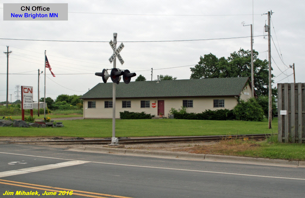
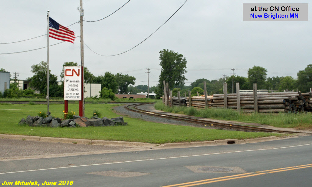
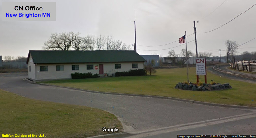
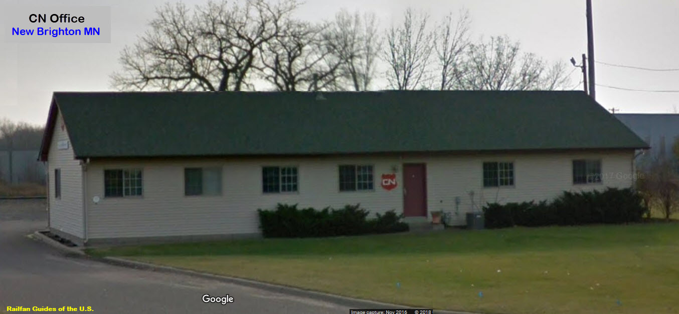
Canadian National Office / former WC
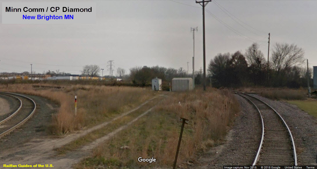
MNRR/CP Diamond
MNNR/CP Interchange
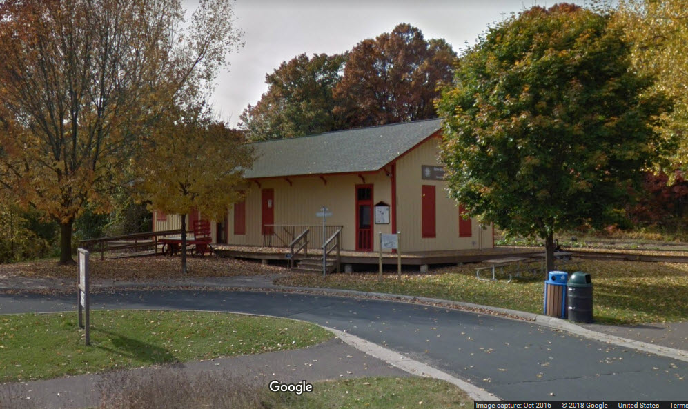
the New Brighton History Center
Data:
GPS Coordinates: 45.050274, -93.194934 (at the diamond)
Phone A/C: 651/763
ZIP: 55112
Access by train/transit:
None
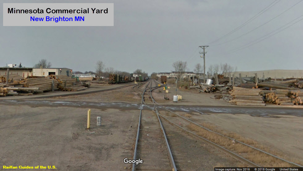
The Scoop:
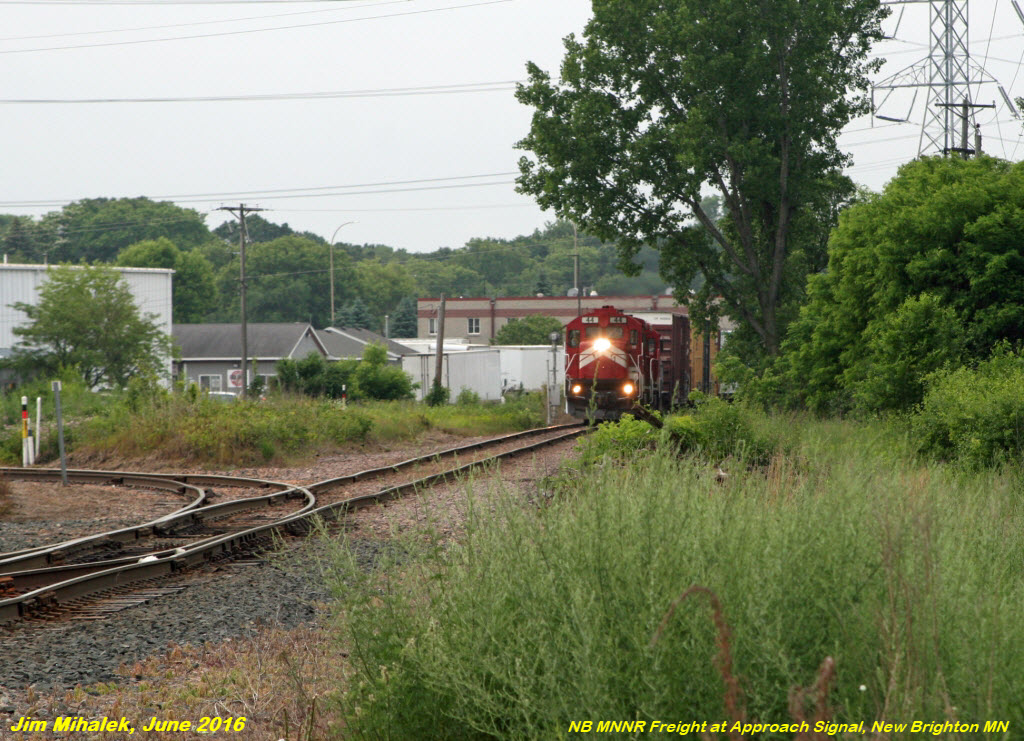
A quiet little diamond in a suburban setting, known as Bulwer Junction. Minnesota Commercial has the north/south track. CP, formerly the SOO and Wisconsin Central, runs east from "University" (4.7 miles to the west) to Withrow MN, where CN ownership of the line begins. This means you can catch both CP and CN freights on the line. Most of them will be heading into or coming out of the former SOO Shoreham yard.
In the past, UP used to run these large coal freights up the MNNR, and then do a complicated reverse move to put the train on the CP, but I understand they no longer do that - darn - it just seemed SOOOO out of place to see these huge UP engines come up the line....
The CN office at the diamond was a former WC office when they were coming into town.
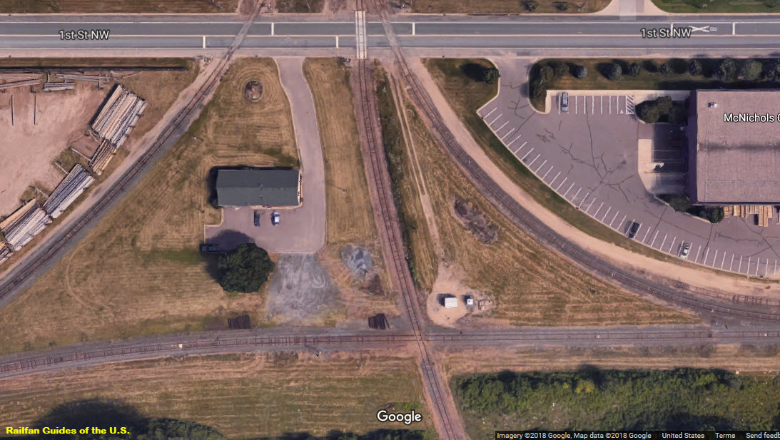
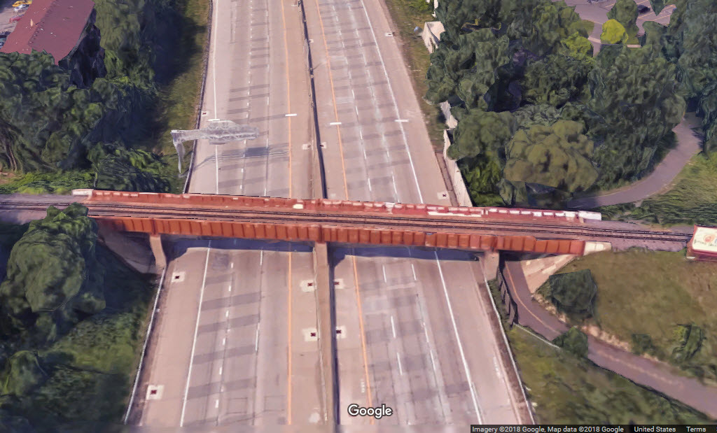
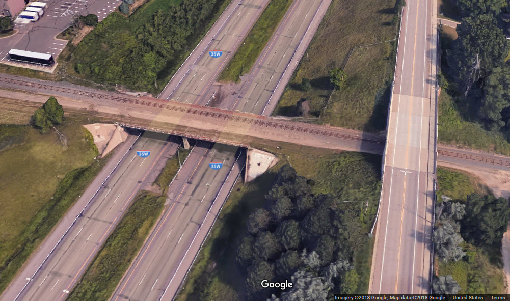
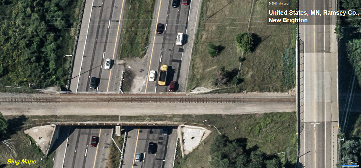
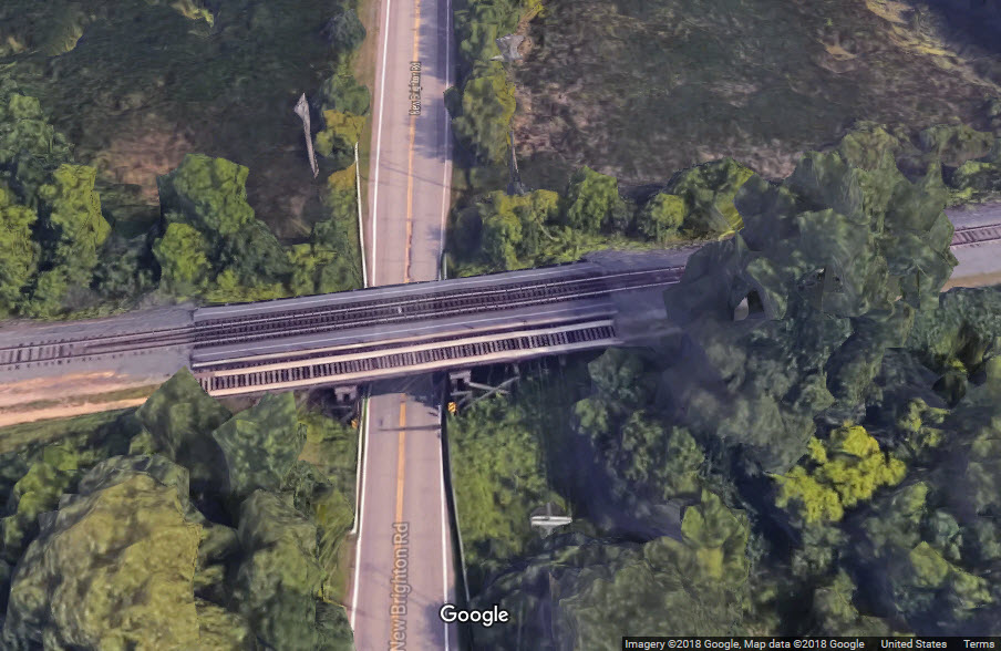
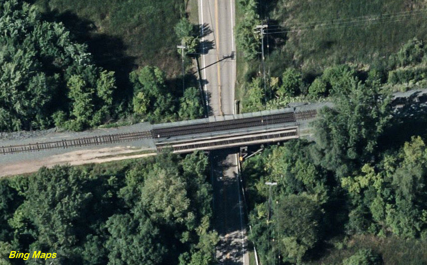
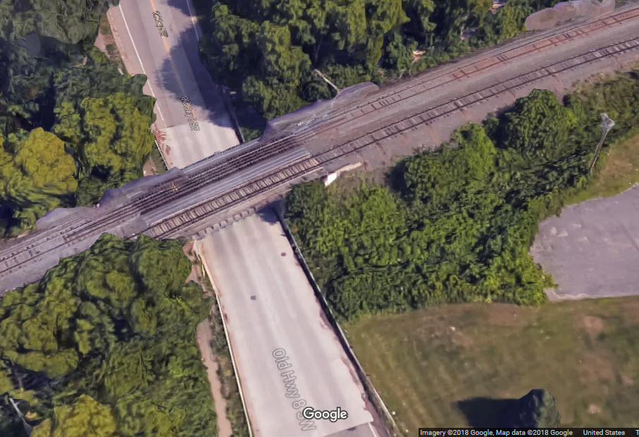
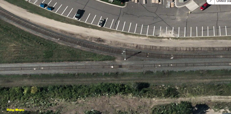
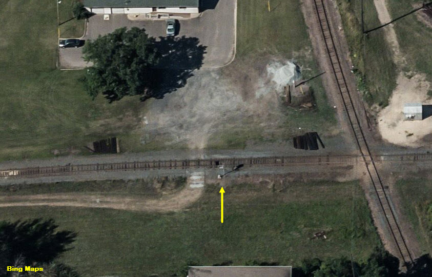
As you can see from the aerial photos from Google and Bing, the SOO, now CP, used to be a double tracked coming thru these here parts.
Any additional info on current operations is appreciated.
Acknowledgements:
Jim Mihalek
Denver Todd
Ed Kanak
Jordan Wiest
Alec Holmes
Open Railway Map
Google Maps
Bing Maps
Websites and other additional information sources of interest for the area:
https://www.youtube.com/watch?v=SCJb6cqWDf0 Video of MNNR working the New Brighton Yard
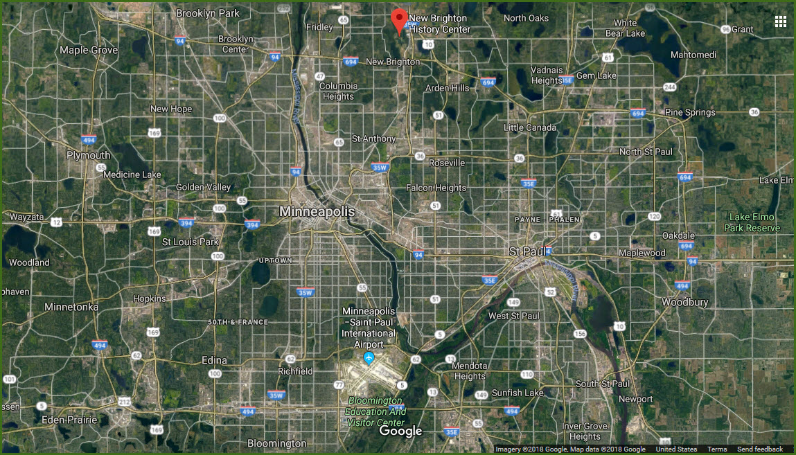
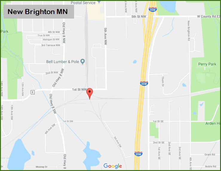
Find your way to interstate 35W, and take exit 26 - go west about a quarter of a mile on 5th Street NW.
Exit 26 is about 2/3mi south of I-694, which is on the north side of St Paul (and Minneapolis).
If you don't pass a gas station (an Exxon in 2018), you're going the wrong way
Take a left at 5th Ave NW, and head south about half a mile.
Take a right onto 1st St NW.
The tracks and office will be on your left almost immediately.
Map
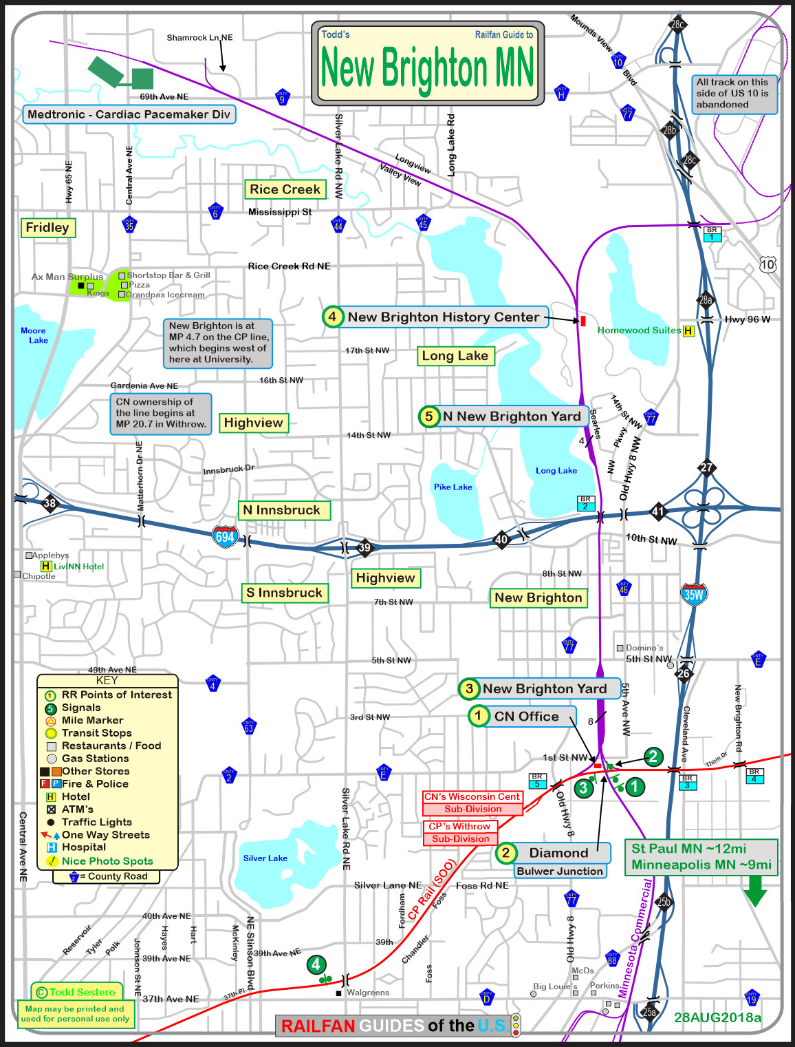
The above map is available here as a PDF
Back at the turn of the Millennium, when I was traveling to Minneapolis for business 4 or 5 times a year, this was a Wisconsin Central office, and sometimes you could catch their engines sitting nearby. I'll have to see if I can dig up some of my old slides.....

A quiet little diamond. A couple of CP freights a day, one MNNR local a day, and (used to be) a UP coal train would come up thru here. Maybe someone can write in and update the info???
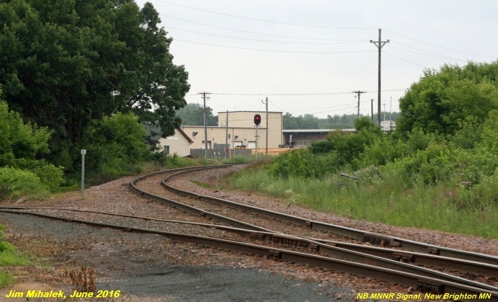
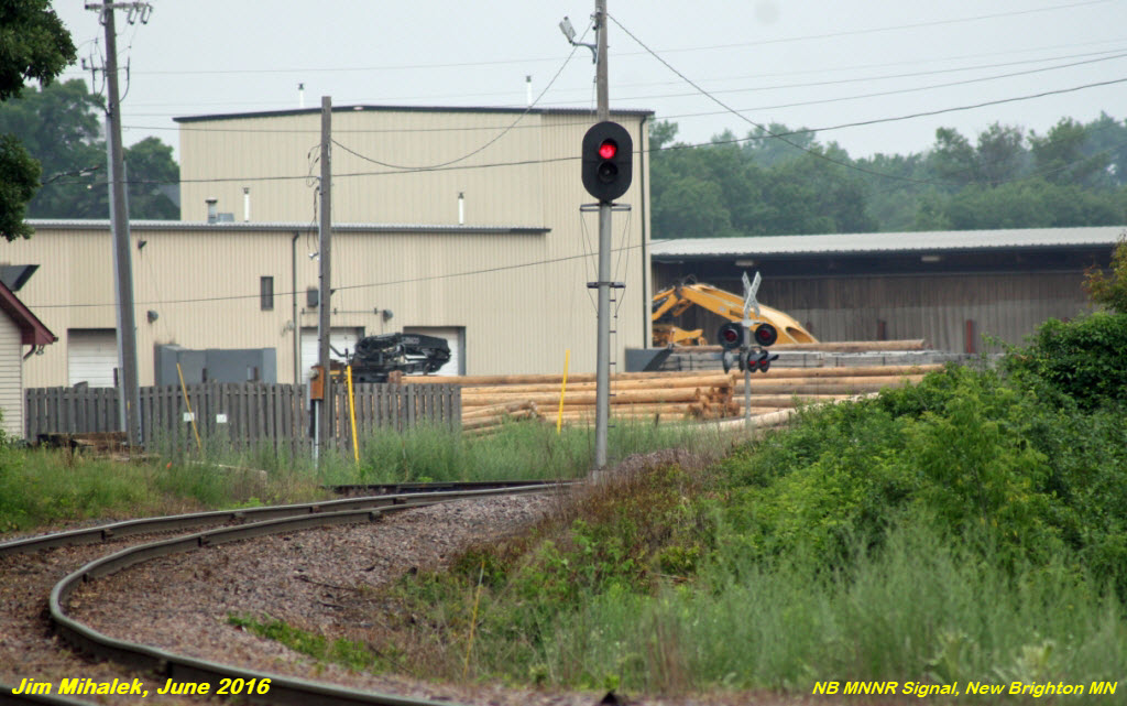
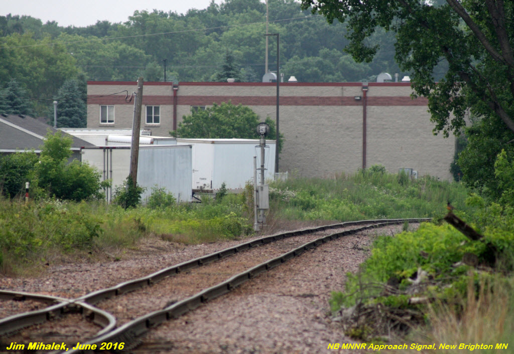
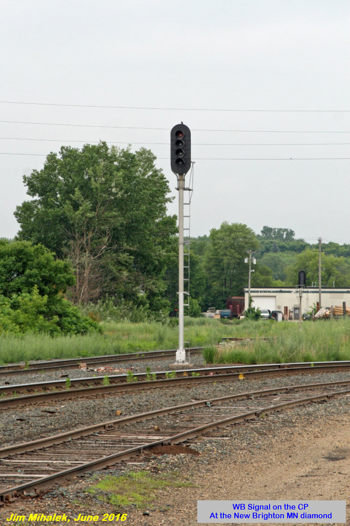
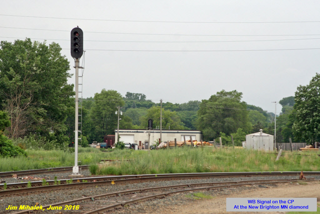
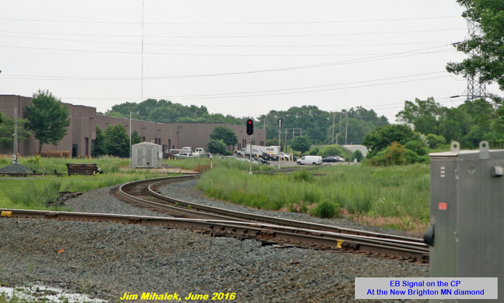
Signals are simple single head colorlight signals, with the NB MNNR signal only displaying red or green. There is no SB signal for trains coming out of the yard. Both CP signals are four aspect.

 found on EBay
The New Brighton Yard serves as a distribution point for Minnesota Commercial's operation on the north side of the Twin-Cities area.
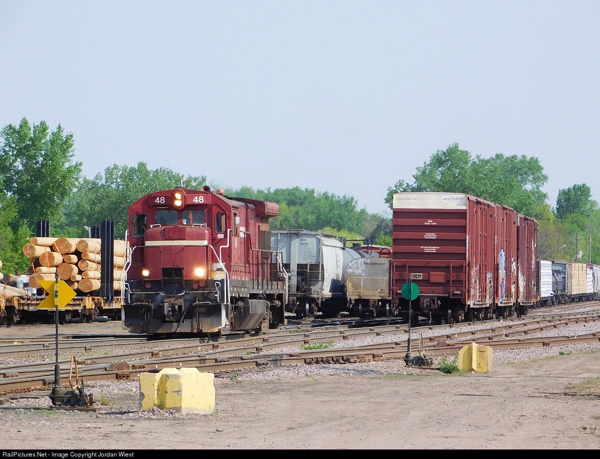 MNNR GE B30-7 #48, 5/8/2016
GPS Coordinates: 45.079239, -93.196991
700 Park Drive, New Brighton, MN 55112 (north of I-694)
2018 dates: June 4 - September 24
Hours: 1:00 - 4:00 PM, Saturdays & Sundays
http://www.newbrightonhistory.com/
The History Center is located a little over a mile north of I-694 in a park located off of Old Hwy 8 NW. Use exit 28 from I-35W, and go west on Hwy 96 a short distance and then take a left onto Old Hwy 8 NW, where the Homewood Suites hotel is.
From their website: The New Brighton Area Historical Society (NBAHS) was founded in 1980 when four residents of the city met to organize the society. Julie Beisswenger, Gene Skiba, Leone Aronson, and Joyce Kloncz met initially in late 1979 to discuss how to set up the organization. Subsequent planning meetings brought in Jan Newham, who was then earning a degree from Metropolitan State University in Practical History. The society was fortunate to use her class papers for the foundations of the society. Later that winter, a meeting was held at Julie Beisswenger’s home where area residents were invited to hear David Nysteun from the Minnesota Historical Society, who gave tips, ideas, and yet, pitfalls which the group might encounter. In January, 1980, the first annual meeting was held. Soon the organization became a robust, growing group that first met at the old New Brighton Elementary School, which was then designated as a community center. Julie Beisswenger became the Society’s first president. Julie Beisswenger’s goals were to have a book written about the New Brighton area and to have a museum for the organization. Gene Skiba began the long process of writing his book, A Centennial History of New Brighton, Minnesota, which was published in 1987, New Brighton’s centennial year. The Society celebrated its 38th Anniversary on April 27, 2018.

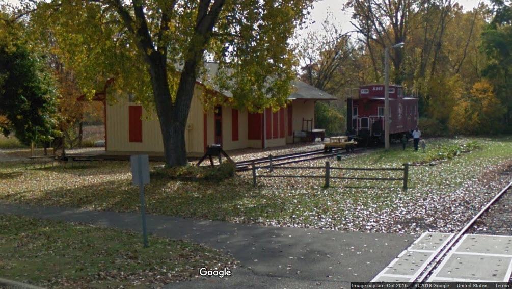
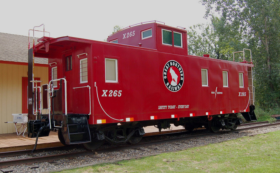
Pictured below is the Great Northern caboose at the museum, which sits on a siding adjacent to the Minnesota Commercial's line going over to Fridley. After retirement from the GN, it wound up at the Valspar Corporation, who used it as a break room for their employees. In 1992, they gave the caboose to the Society. The caboose could be viewed from the Metrodome in Minneapolis. In 1994, the caboose was moved from a site in the arsenal, where it had been stored for two years, to the History Center. The caboose was painted in 2005. Historically accurate decals were affixed in the summer of 2006. The caboose was built by the GN in St. Cloud in 1951.
An auxiliary 4 track yard for additional switching and storage for the MNNR, north of 694.
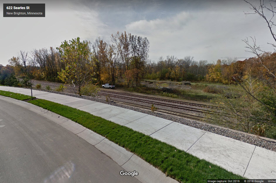
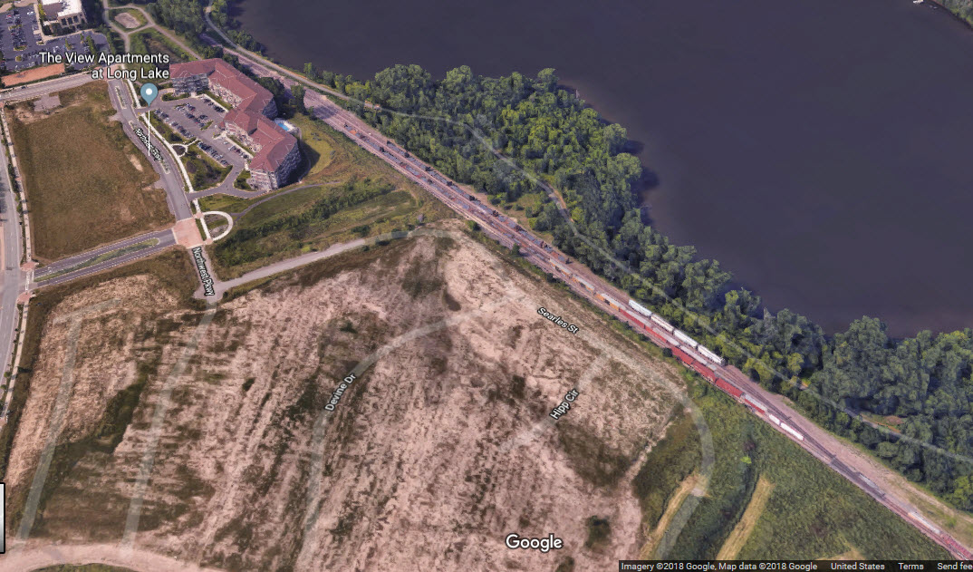
Bordered by a brand new development, decent shots can be had from Searles St.
Bing DOES NOT have any birds eye views of this area.......
Bing DOES NOT have any birds eye views of this area.......
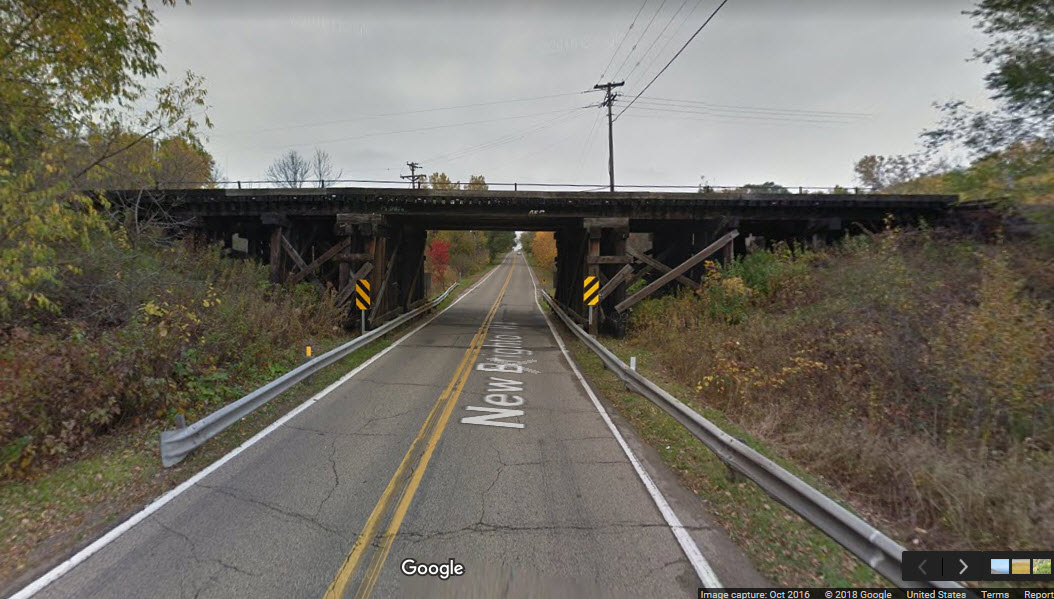
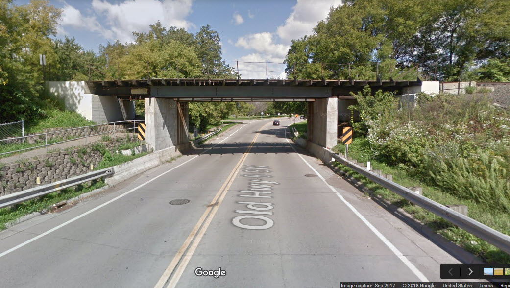
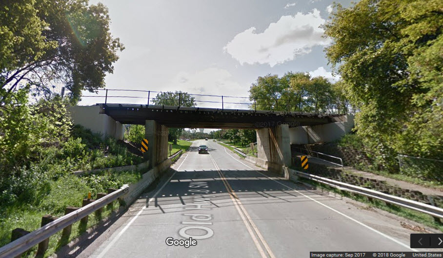
You can catch CP trains crossing this bridge from a pretty good vantage point of the Cleveland Ave bridge going over the tracks.

 Looking north
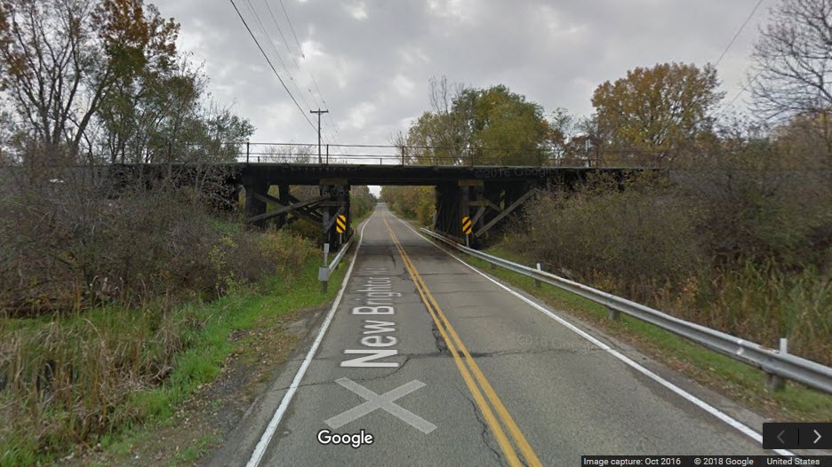 Looking south

Signals are kinda sparse in New Brighton. There is a colorlight signal on the south side of the diamond for NB traffic, along with an approach signal maybe, and signals on either side of the diamond for the SOO/CN. They are all single head signals.
The NB signal is a simple signal showing only green or red, altho several thousand feet south there is an approach signal.


These signals are not in New Brighton, but a few miles west in St Anthony, just west of Silver Lake Rd NE.

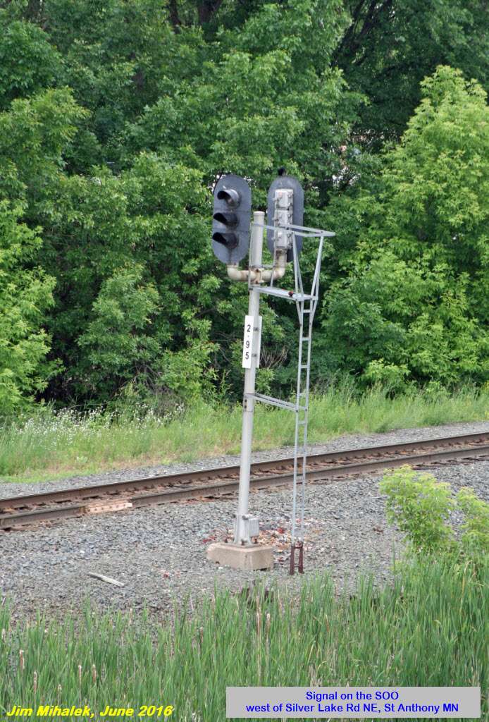
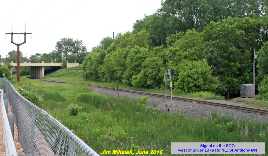
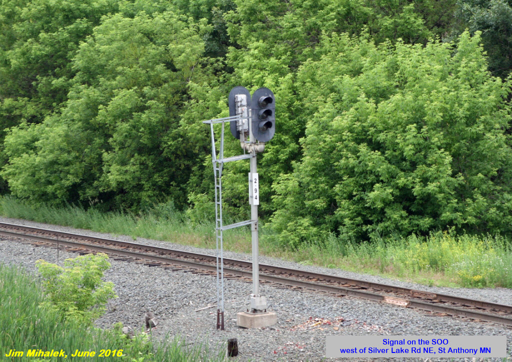
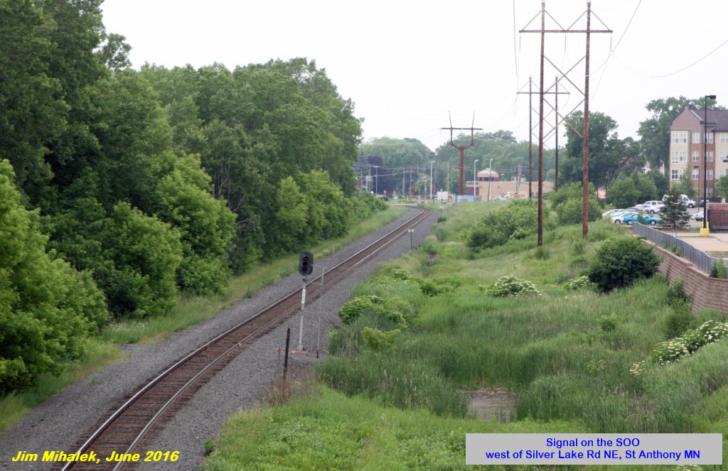
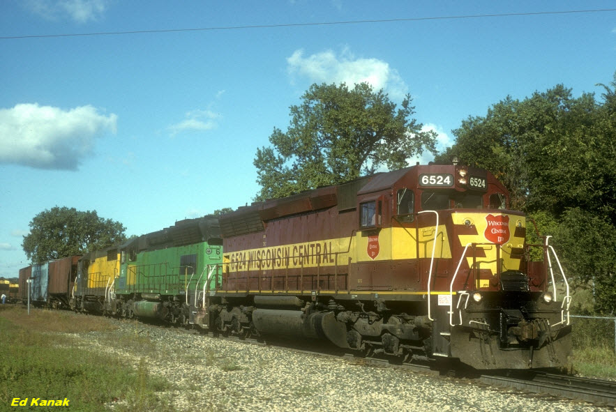 photo by Ed Kanak
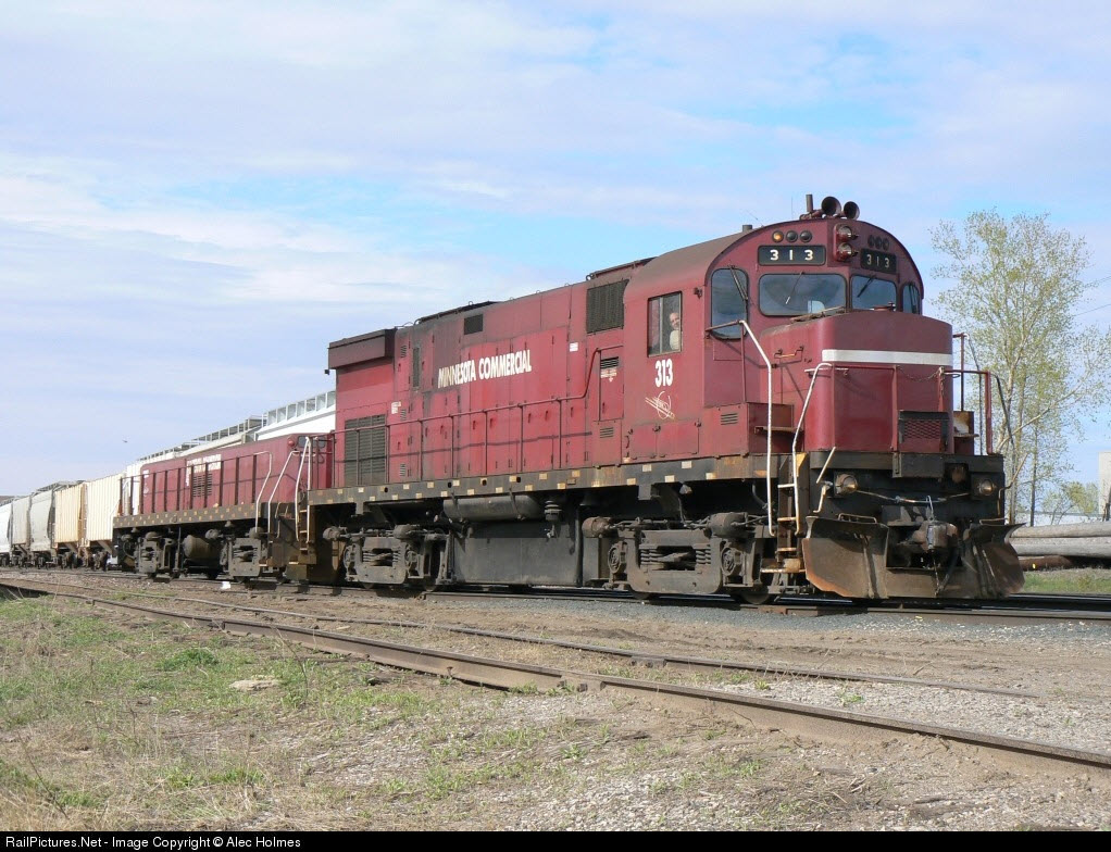 photo by Alec Holmes
 Central Ave near Shoreham Yard
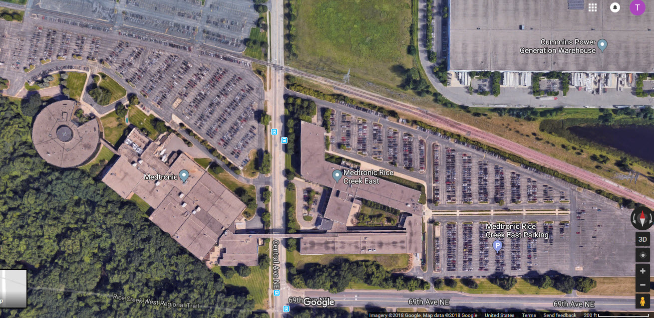
Medtronic
Tucked away in a corner of Fridley, just west of New Brighton, is a Medtronic facility. Some of you may know the name, as they are one of the leading manufacturers of medical equipment in the United States. This particular facility is where they design and produce their pacemakers. I had the pleasure of coming here to calibrate my company's equipment that Medtronic owned, which, between them, Cardiac Pacemaker, and a small start-up semiconductor manufacturer over in Plymouth, was responsible for bringing me into the area 5 or 6 times a year, and thru all kinds of weather. It's a shame the company got bought out and 99% of us lost our jobs. As a bonus, the equipment I worked on, was along the rear of the building, facing the Minnesota Commercial's track, and I could watch them go by if I wasn't too busy to NOT notice them. One time, I even got my boss to agree to let me come into town over a weekend that 261 was running, as (fortunately), I had a NON-ESCORT required badge, witch allowed me to come in over the weekend at weird hours to do my work, and chase trains during the day - can't get much better than that!! Luckily, my boss never caught on (altho if he reads this, he will find out, 18 years later :-)
Ax Man Surplus
This is one store I'm glad is still around, for you'll never know what you will find in here!...... cool store..... great stuff!!!
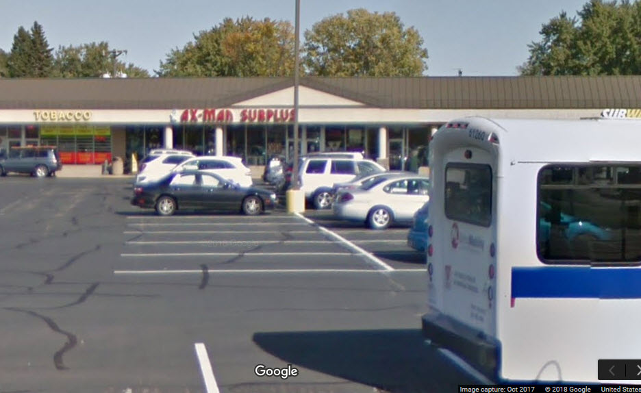

Metro Transit Paratransit Bus
Caught in the Google streetview of the Ax Man shopping center.

End of Serviceable Track
In the upper right corner of my map, the tracks come to an end before crossing US10 - the only reason to continue service this far is for the Scherer Brothers Lumber Co.

Metro T in Fridley

Courtesy of the University of Texas Library, click here for their index page.

Disclaimers:
I love trains, and I love signals. I am not an expert. My webpages reflect what I find on the topic of the page. This is something I have fun with while trying to help others.
Please Note: Since the main focus of my two websites is railroad signals, the railfan guides are oriented towards the signal fan being able to locate them. For those of you into the modeling aspect of our hobby, my indexa page has a list of almost everything railroad oriented I can think of to provide you with at least a few pictures to help you detail your pike.
If this is a railfan page, every effort has been made to make sure that the information contained on this map and in this railfan guide is correct. Once in a while, an error may creep in :-)
My philosophy: Pictures and maps are worth a thousand words, especially for railfanning. Text descriptions only get you so far, especially if you get lost or disoriented. Take along good maps.... a GPS is OK to get somewhere, but maps are still better if you get lost! I belong to AAA, which allows you to get local maps for free when you visit the local branches. ADC puts out a nice series of county maps for the Washington DC area, but their state maps do not have the railroads on them. If you can find em, I like the National Geographic map book of the U.S..... good, clear, and concise graphics, and they do a really good job of showing you where tourist type attractions are, although they too lack the railroads. Other notes about specific areas will show up on that page if known.
Aerial shots were taken from either Google or Bing Maps as noted. Screen captures are made with Snagit, a Techsmith product... a great tool if you have never used it!
By the way, floobydust is a term I picked up 30-40 years ago from a National Semiconductor data book, and means miscellaneous and/or other stuff.
Pictures and additional information is always needed if anyone feels inclined to take 'em, send 'em, and share 'em, or if you have something to add or correct.... credit is always given! Please be NICE!!! Contact info is here
Beware: If used as a source, ANYTHING from Wikipedia must be treated as being possibly being inaccurate, wrong, or not true.
RAILFAN GUIDES HOME
RAILROAD SIGNALS HOME
Last Modified 31-Aug-2018