In General
Getting Here
Map
Sights
Pictures
Signals
Fire & Police
Floobydust
RAILROAD SIGNALS HOME
Location / Name:
Northern Minneapolis, Hennepin Co / Fridley MN, Anoka Co
What's Here:
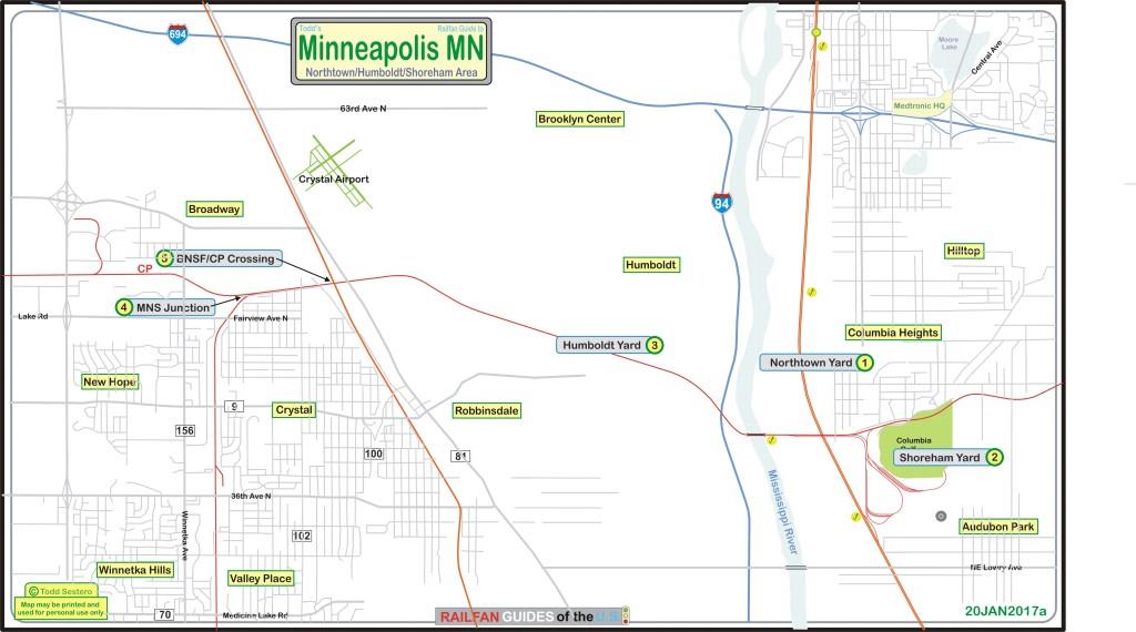
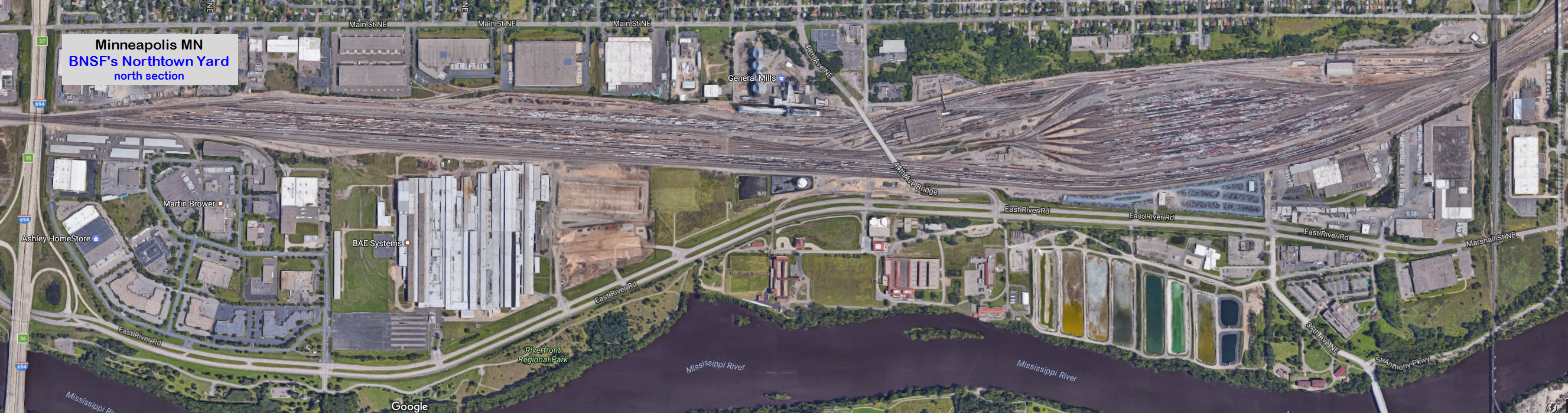
BNSF's Northtown Yard
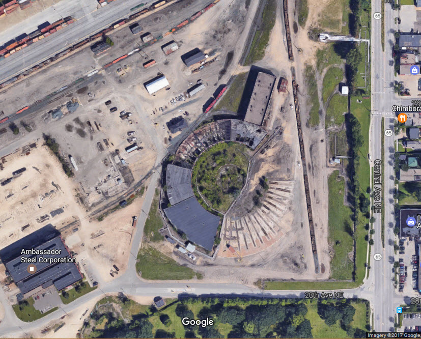
CP's former SOO Line's Shoreham Yard
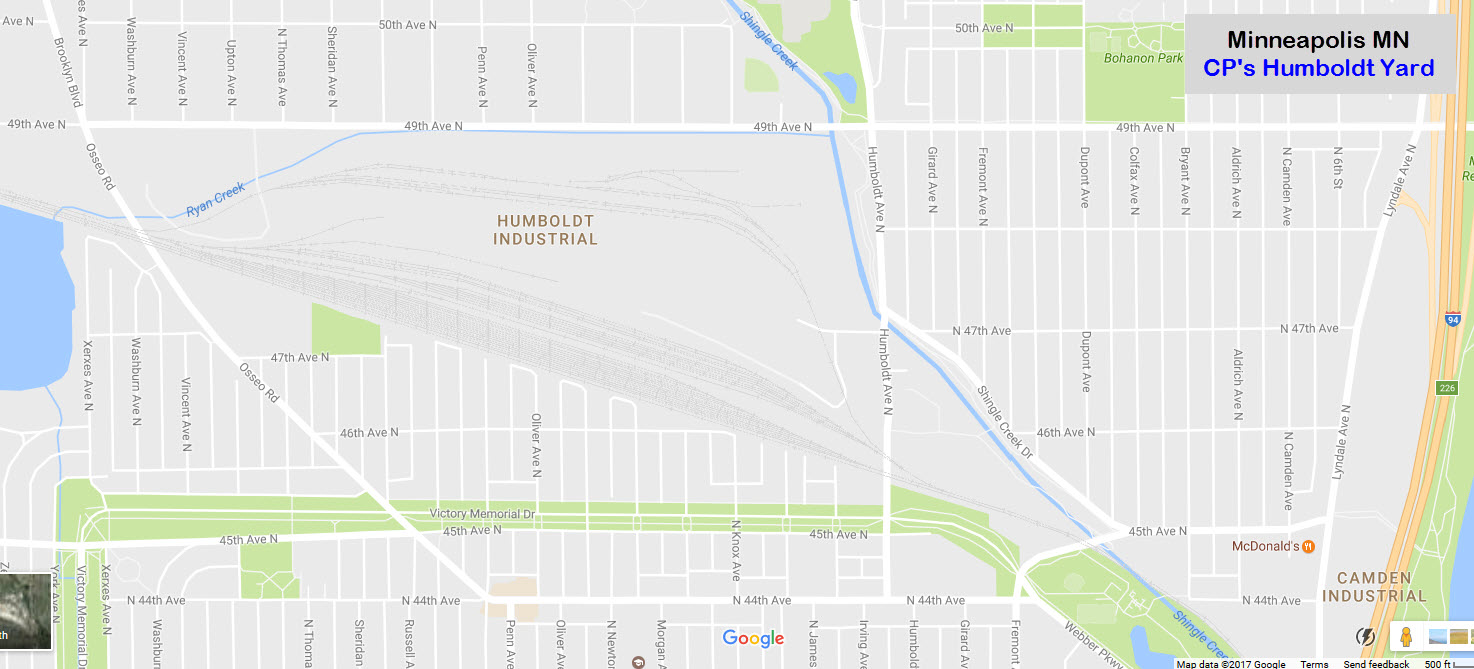
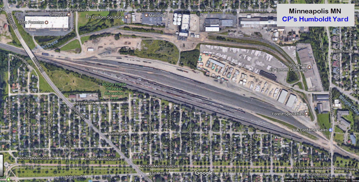
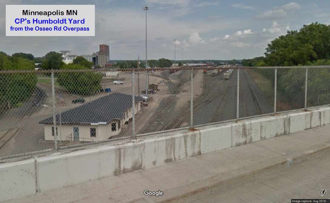
CP's Humboldt Yard
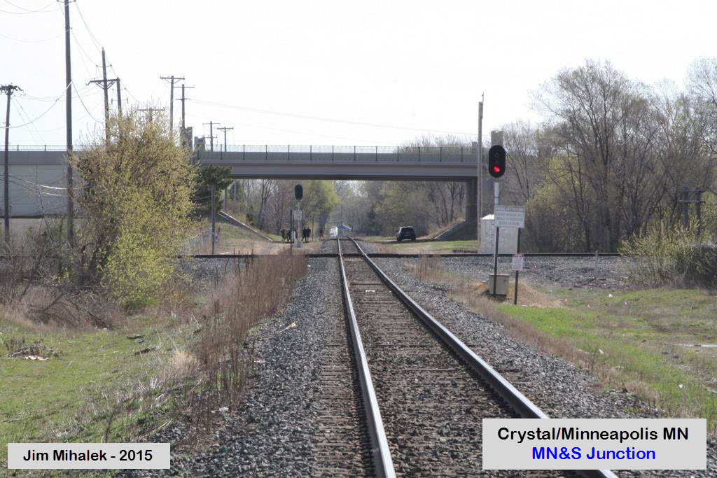
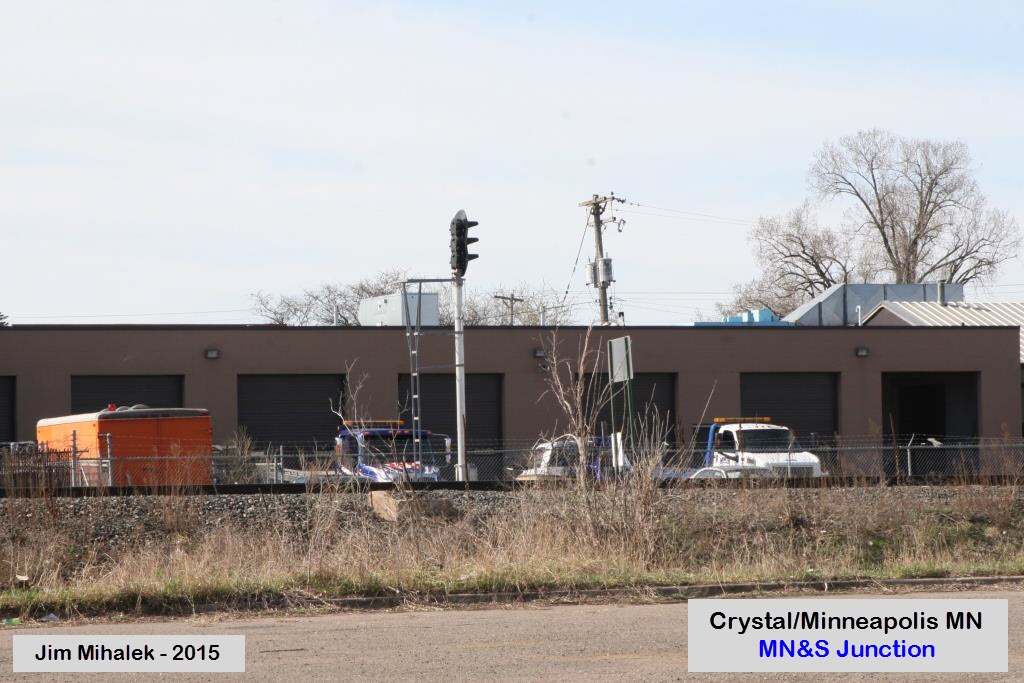
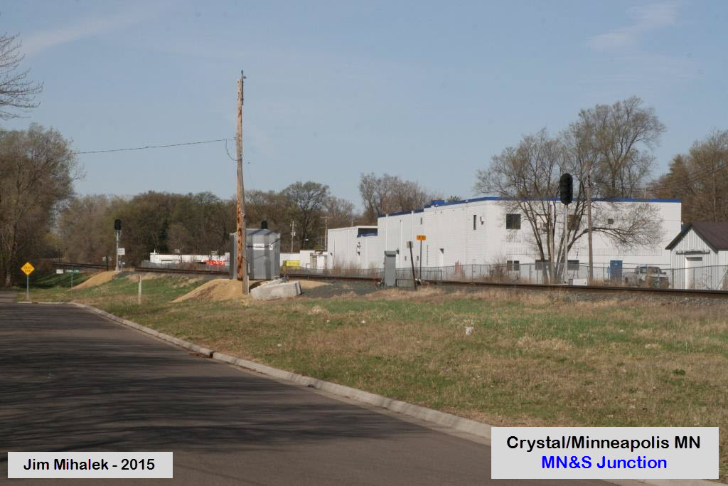
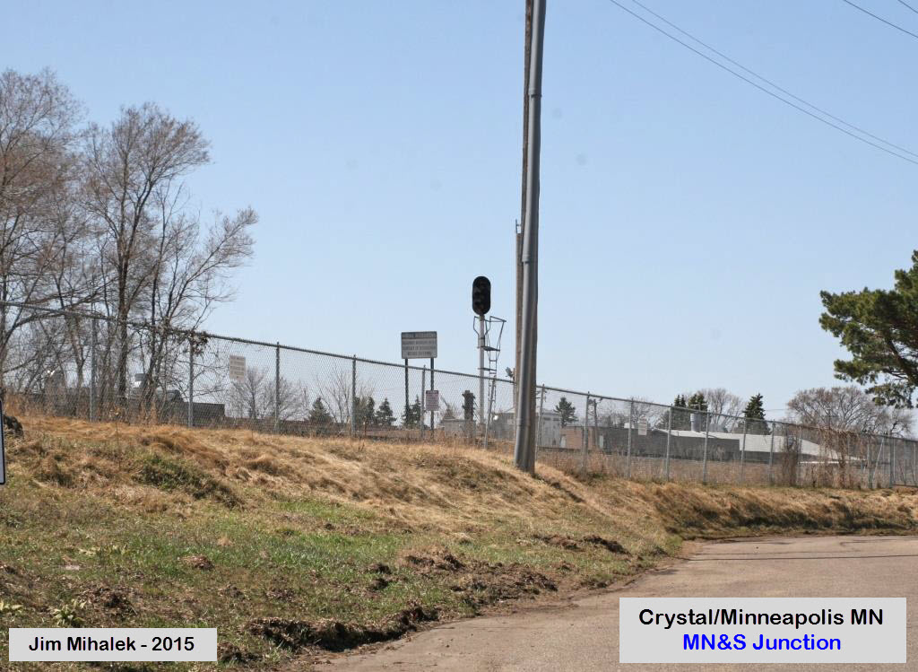
MNS Junction
BNSF/CP Crossing
Data:
GPS Coordinates: as needed
ZIP: 55421/55432
Area Code: 763
Access by train/transit:
Northstar Commuter Service Fridley Station
No light rail service, it does not come "up" this far
The Scoop:
1
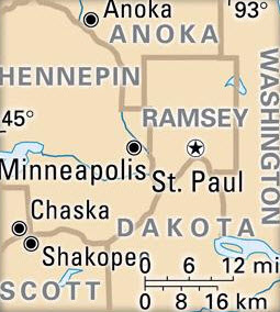 Area
Counties
Area
CountiesAcknowledgements:
Jim Mihalek for pictures, pictures, and pictures :-)
Websites and other additional information sources of interest for the area:
https://railfanguides.us/mn/northstar/index.htm My Northstar page
https://railfanguides.us/mn/hiawatha/index.htm My Minneapolis Light Rail page
Aerial shots were taken from either Google Maps or www.bing.com/maps as noted. Screen captures are made with Snagit, a Techsmith product... a great tool if you have never used it!
Getting here is easy via I-94, I-35, and I-694.
Preliminary, of course.....
GPS Coordinates (from the 44th Ave bridge): 45.045793, -93.272802
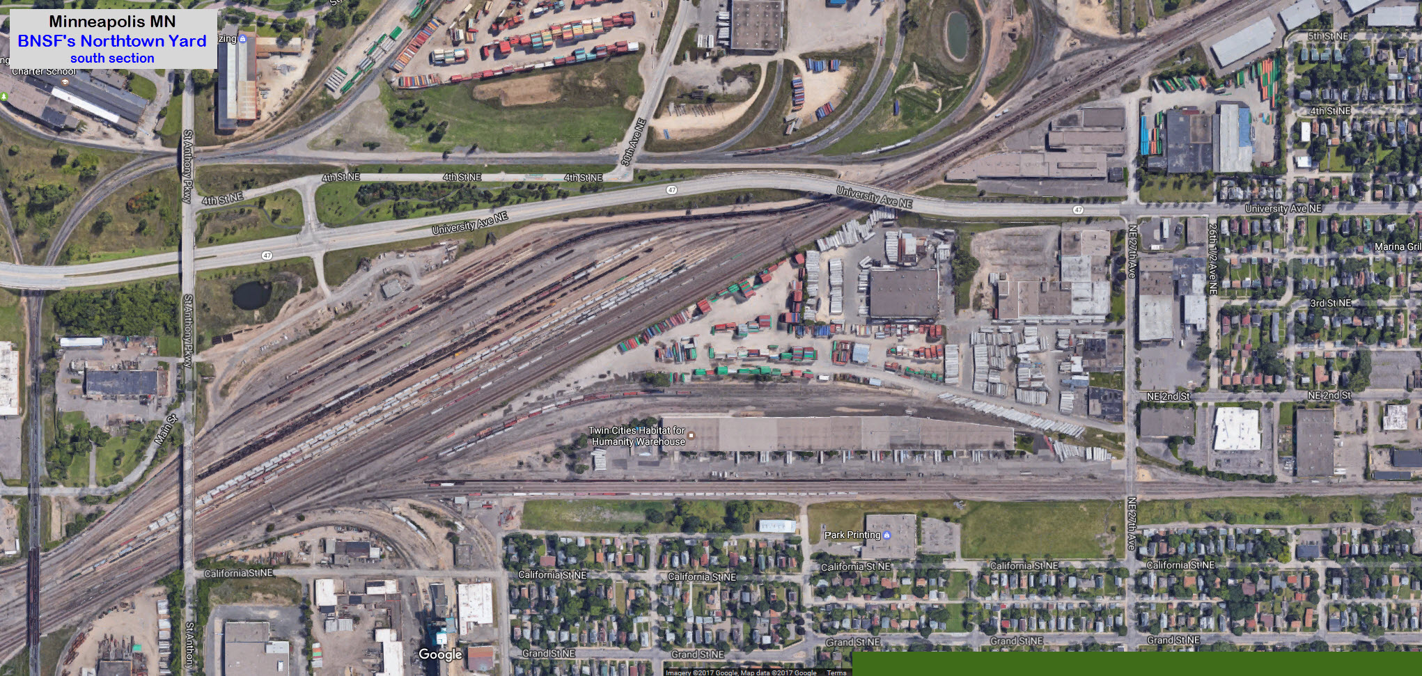
GPS Coordinates (middle of the yard): 45.020834, -93.254918
Shoreham Yard is a former SOO Line yard. Over by Central Ave, there is the remains of a once huge, almost completely circular roundhouse. Some if it still stands.
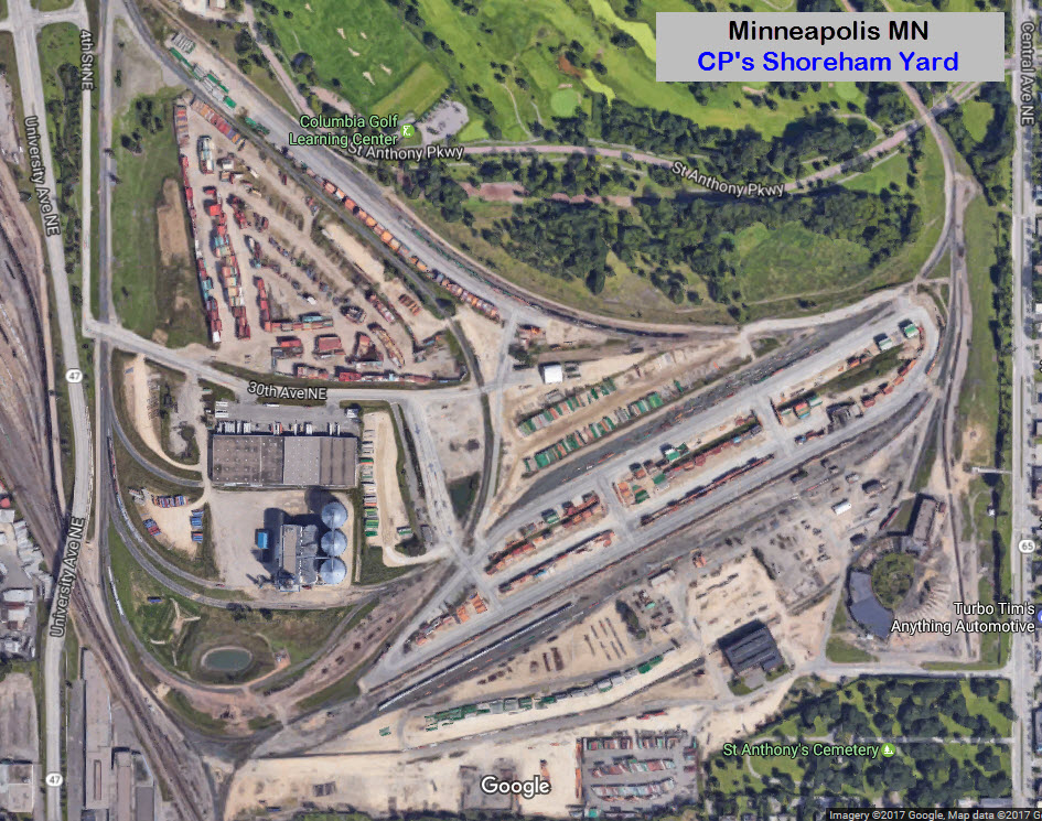

GPS Coordinates (middle of the yard): 45.041149, -93.308251


GPS Coordinates: 45.046532, -93.368562
This is on CP's Paynesville Sub-Division. The interlocking is JUST within the border of Crystal, as you can see from the map. Signals are located at the "X"'s.
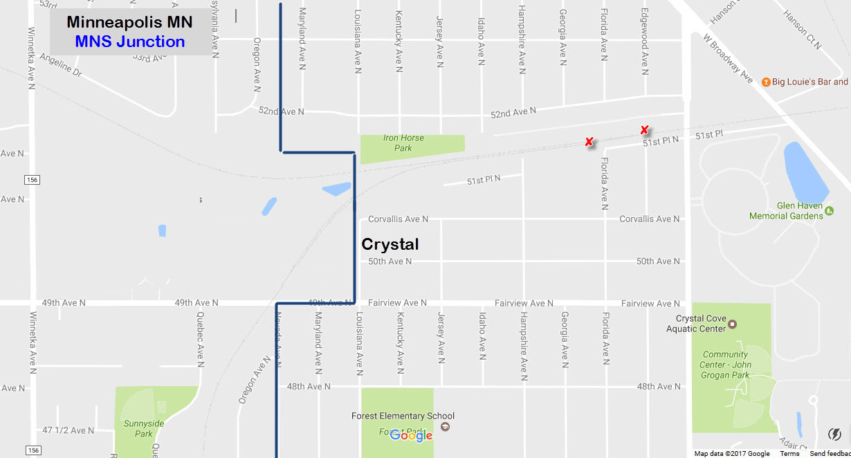


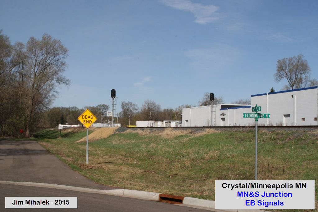
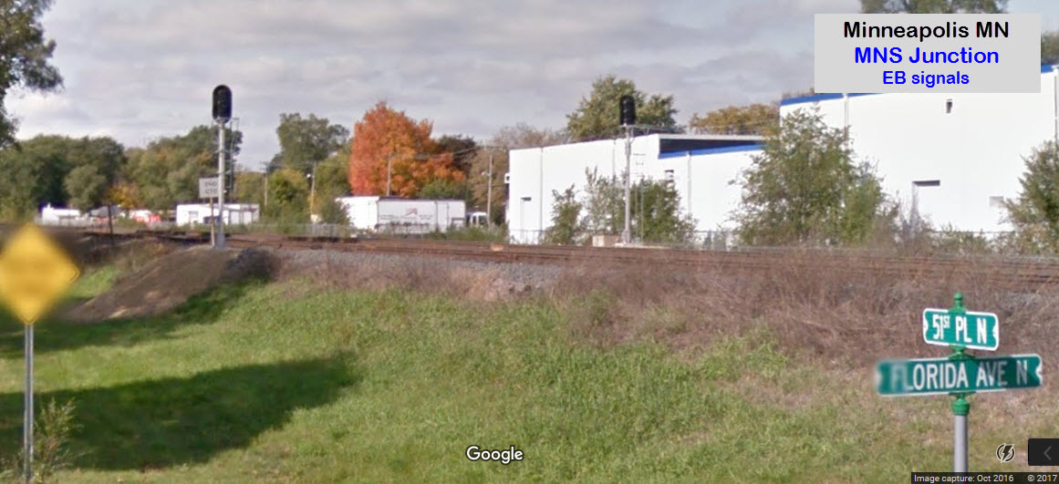
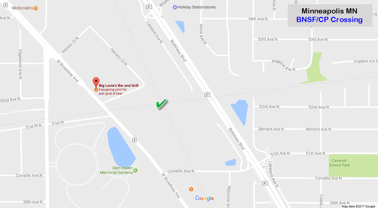
GPS Coordinates: 45.047998, -93.354503
Looks like easy access to the diamond can be had off of Hanson Ct N, and a short walk thru the open field or parking lot.
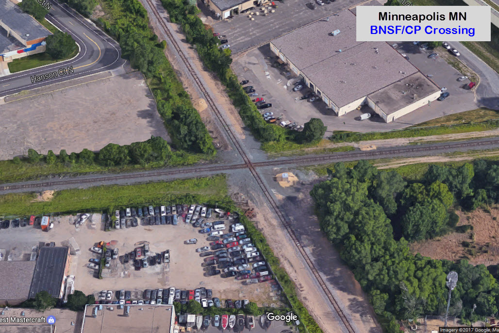
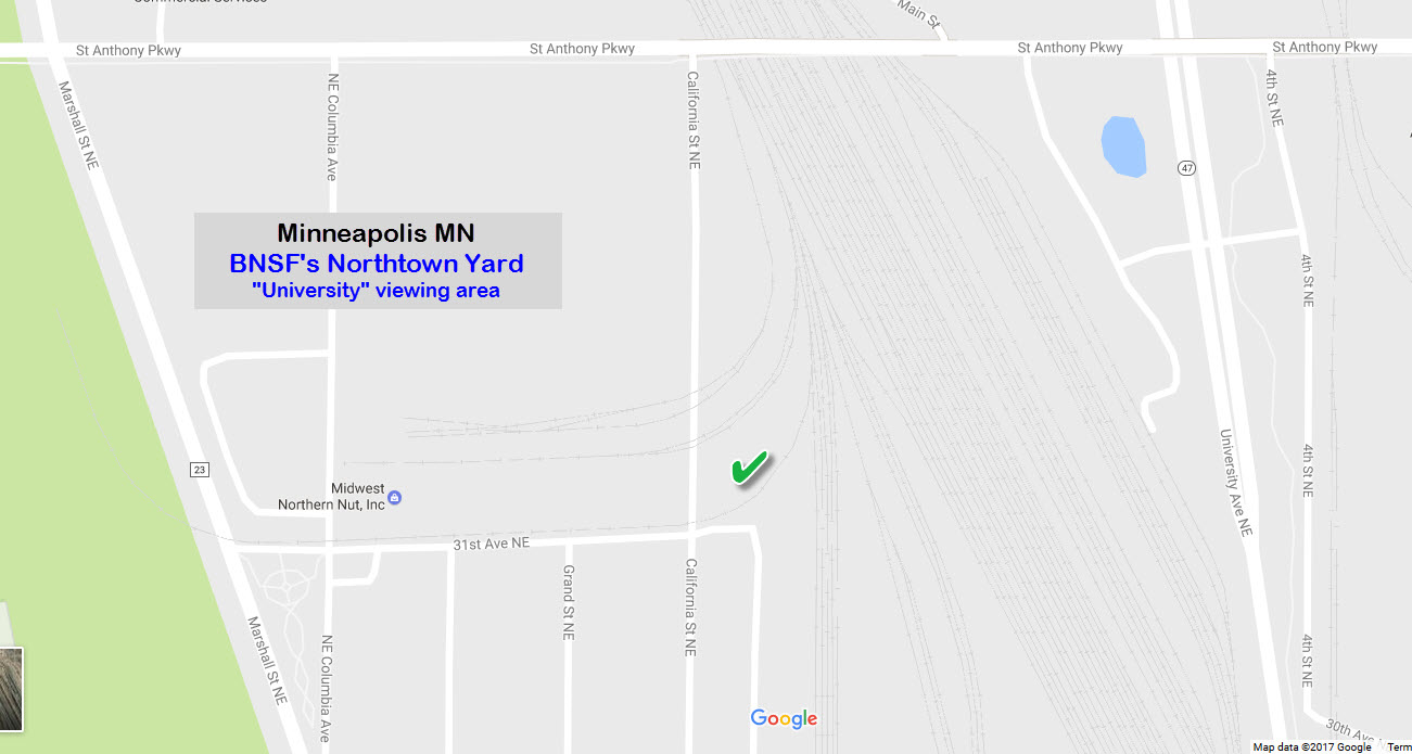
GPS Coordinates: 45.024891, -93.268048
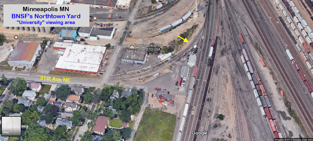
You will probably run into more railfans here than any other place in the area, at least that was my experience. The viewing is good for thru freights going in both directions, altho once in a while, you view may be blocked because of a parked train. It also looks like a couple of buildings have been erected keeping the sight lines to the south obstructed - that's too bad. The yellow arrow is where most of us would sit and watch from.
GPS Coordinates: 45.027610, -93.267952
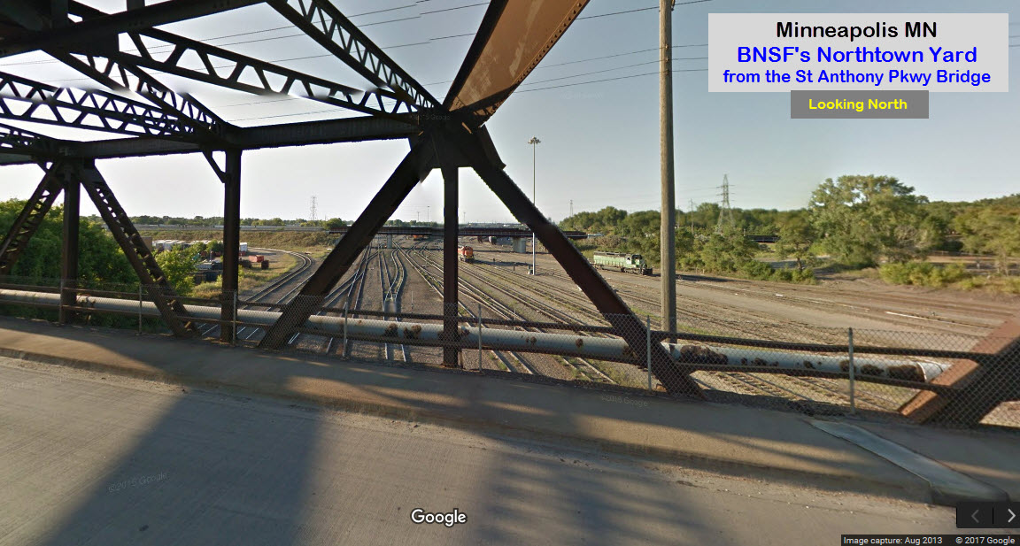
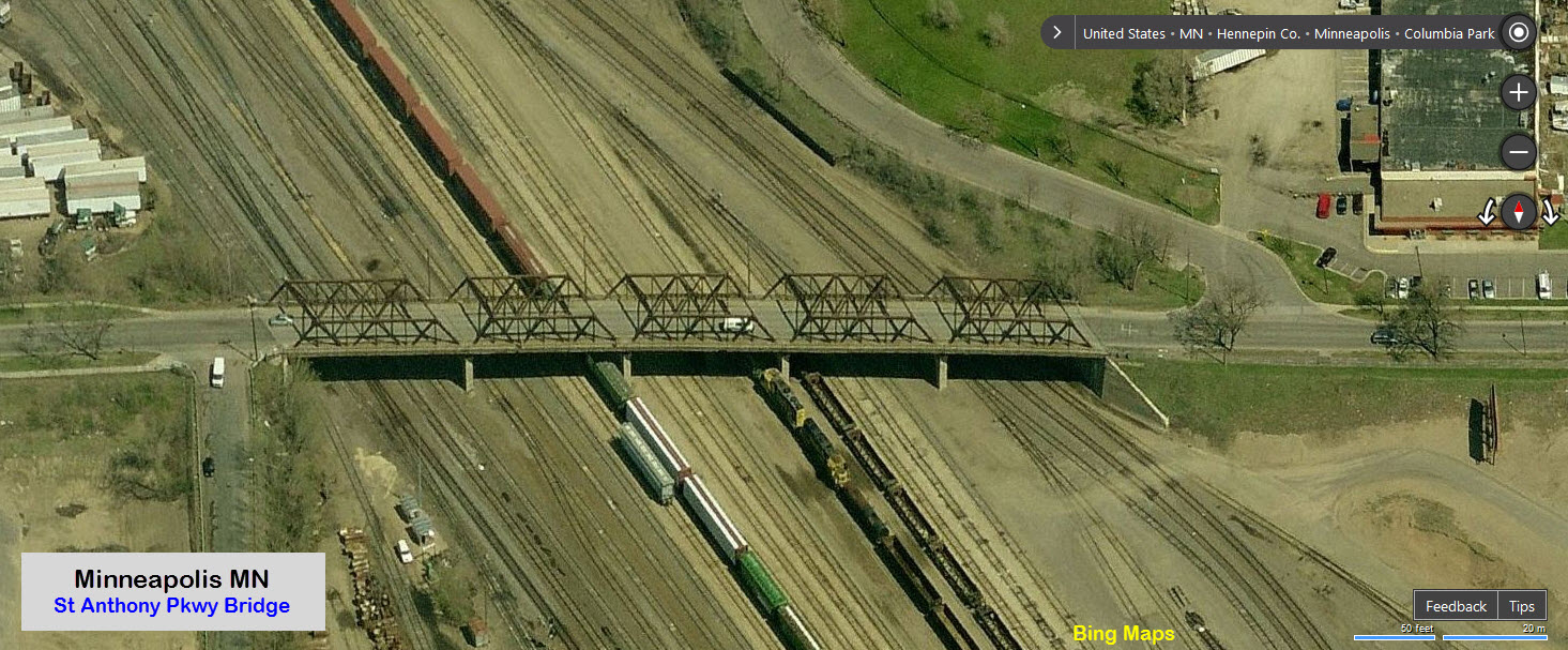
From here, you used to be able to get good shots of "under passing" BNSF stuff, and to the north, you can get nice shots of CP stuff going over Northtown Yard.
I understand from Jim that the bridge has been taken down as of early 2017, and so far, a replacement has not been constructed..... stay tuned....
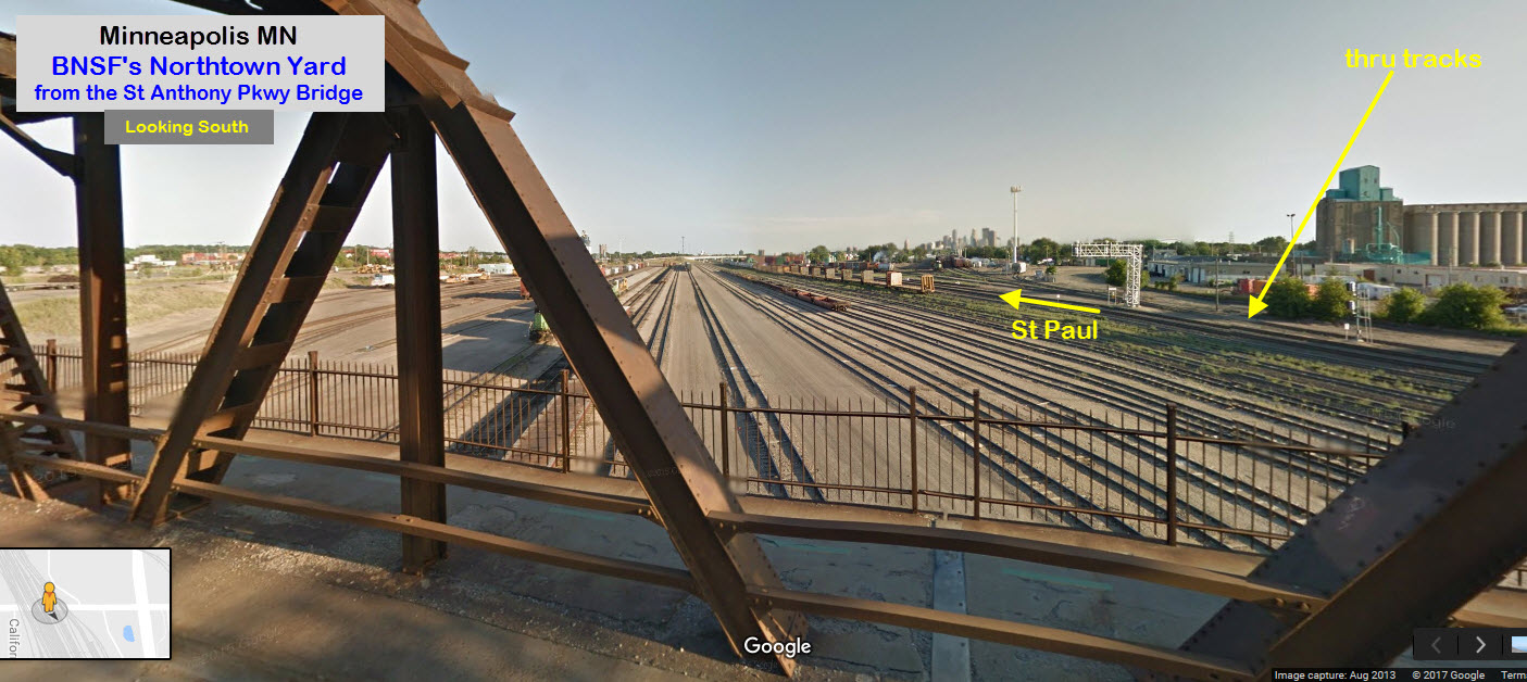
Good photo spots are at the green checkmarks. In years past, BNSF would sit all of their dead engines on the tracks with the red "X" - even got pictures of some old high-nose cabless units around 1999. Thru tracks are to the left.

GPS Coordinates: 45.019871, -93.262874
From here you can get good shots of NB/WB freights, because that is the side of the overpass that the sidewalk is on. There is a concrete barrier to keep you from going to the other side and risk getting hit by an oncoming car, however (not that I advocate putting yourself in danger as I do :-)......


![]() A
A
Adja
![]() A
A
Adja
Fire Station 13
1903 Firehouse
Courtesy of the University of Texas Library, click here for their index page.


Disclaimers:
I love trains, and I love signals. I am not an expert. I do these pages because I love spending my time doing them - although I do a reasonable amount of research to make sure the information presented is accurate! :-) :-)
Please Note: Since the main focus of my two websites is railroad signals, the railfan guides are oriented towards the signal fan being able to locate them. For those of you into the modeling aspect of our hobby, myindexa page has a list of almost everything railroad oriented I can think of to provide you with at least a few pictures to help you detail your pike.
If this is a railfan page, every effort has been made to make sure that the information contained on this map and in this railfan guide is correct. Once in a while, an error may creep in, oooooooops, oh well! :-)
My philosophy: Pictures and maps are worth a thousand words, especially for railfanning. Text descriptions only get you so far, especially if you get lost or disoriented. Take along good maps.... a GPS is OK to get somewhere, but maps are still better if you get lost! I belong to AAA, which allows you to get local maps for free when you visit the local branches. ADC puts out a nice series of county maps for the Washington DC area, but their state maps do not have the railroads on them. If you can find em, I like the National Geographic map book of the U.S..... good, clear, and concise graphics, and they do a really good job of showing you where tourist type attractions are, although they too lack the railroads. Other notes about specific areas will show up on that page if known.
BTW, floobydust is a term I picked up 30-40 years ago from a National Semiconductor data book, and means miscellaneous and/or other stuff.
Pictures and additional information is always needed if anyone feels inclined to take 'em, send 'em, and share 'em, or if you have something to add or correct.... credit is always given! BE NICE!!! Contact info is here. Beware: If used as a source, ANYTHING from Wikipedia must be treated as being possibly being inaccurate, wrong, or not true.
RAILFAN GUIDES HOME
RAILROAD SIGNALS HOME
NEW
10/10/2016
Last Modified
30-Mar-2017