RAILFAN GUIDES of the U.S.
Todd's Railfan Guide to
MINNEAPOLIS MN
Metro Southwest Extension Light Rail
Line
In General
Getting Here
Map
Station by Station
Pictures
Bridges
Signals
Floobydust
RAILROAD SIGNALS HOME
Location / Name:
Minneapolis MN SW to Eden Prairie
What's Here:
Metro T's Southwest Extension / Green Line Light Rail System
Data:
GPS Coordinates: as needed
Phone A/C: 612
ZIP: 55415 (downtown)
Access by train/transit:
Metro Blue Line Light Rail in downtown Minneapolis
Northstar Commuter Rail in downtown Minneapolis
The Scoop:
The
Acknowledgements:
Jim Mihalek
Websites and other additional information sources of interest for the area:
https://urbanmsp.com/viewtopic.php?t=5&start=4700
https://www.mprnews.org/story/2016/05/13/feds-release-final-environmental-review-of-southwest-light-rail
https://www.minnetonkamn.gov/our-city/public-transportation/southwest-light-rail-transit
https://metrocouncil.org/Transportation/Projects/Light-Rail-Projects/METRO-Green-Line-Extension/Route-Stations.aspx
https://metrocouncil.org/Transportation/Projects/Light-Rail-Projects/METRO-Green-Line-Extension/About.aspx
https://www.youtube.com/watch?v=neKcEGXFbZ4 drone view of the entire Green Line
Please use your GPS as a guide, as there is almost an unlimited number of ways to get to your particular destination.
Main roads that kinda follow the line are I-394 heading west out of downtown Minneapolis, MN 100, MN 7, US 169, and finally US 212/MN 5, which will drop you off at the SouthWest station.
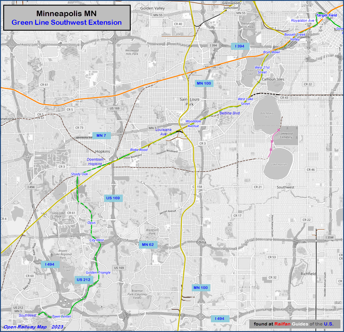
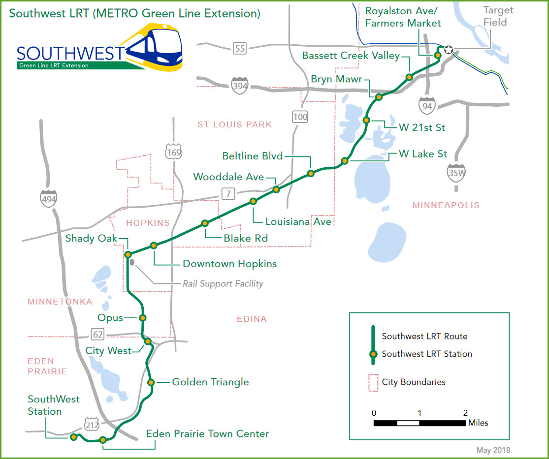
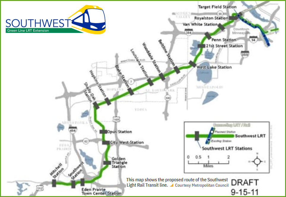
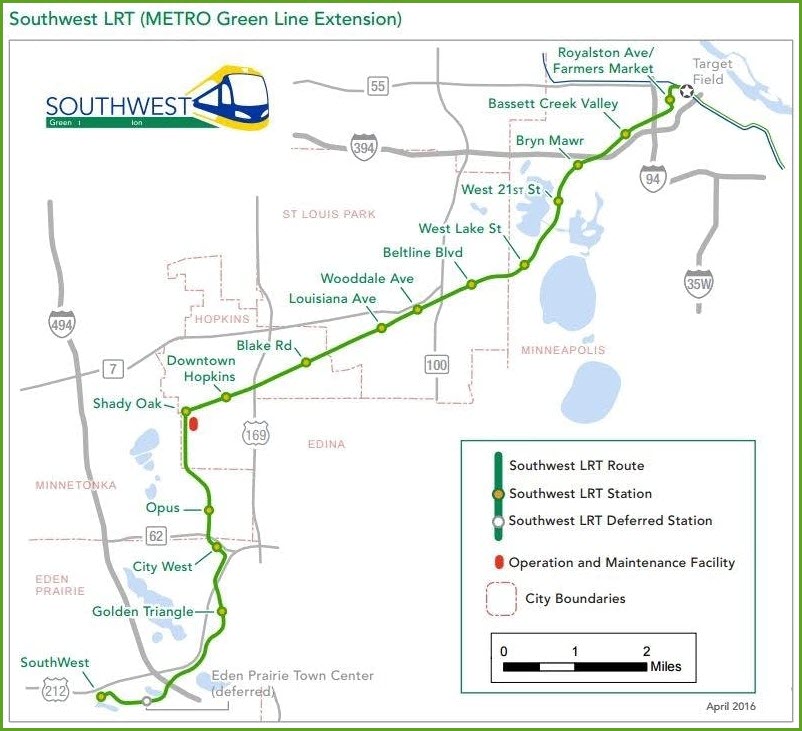
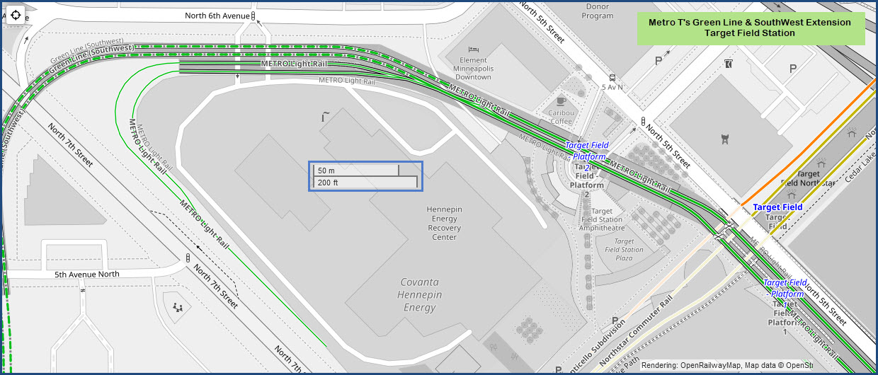
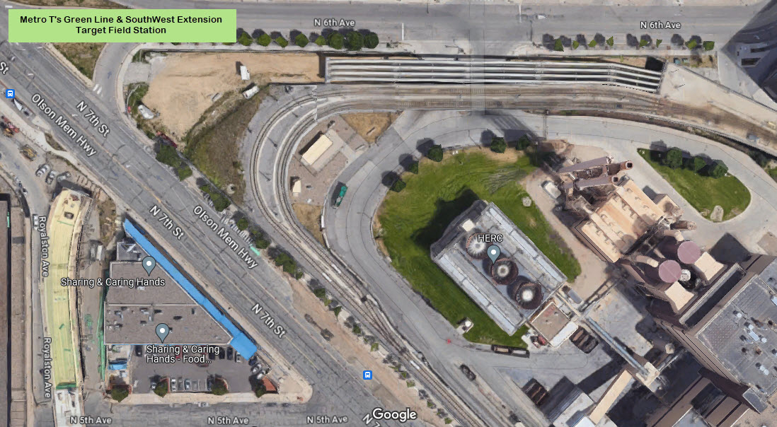
Target Field - Minneapolis
GPS Coordinates: 44.98274, -93.27713
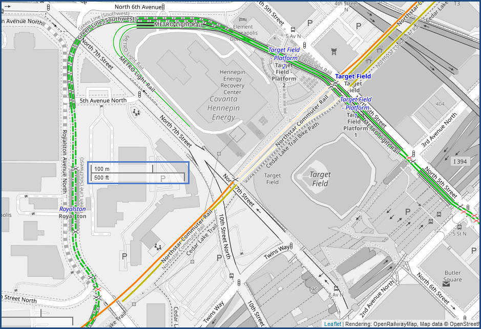
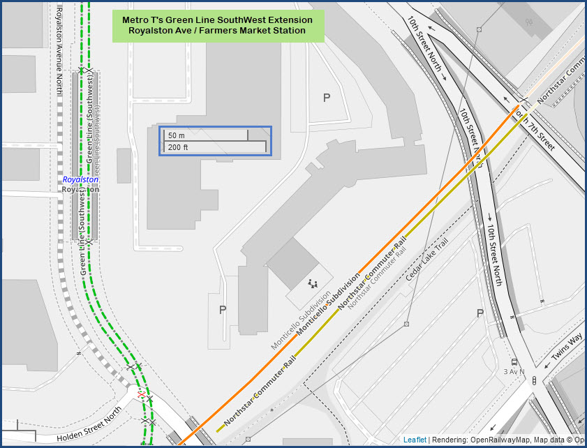
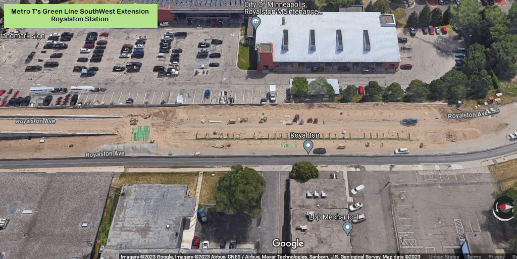
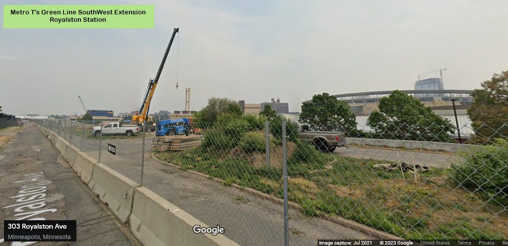
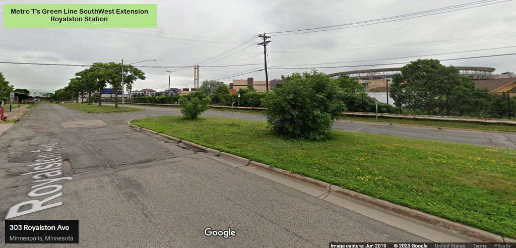
Royalston Ave / Farmers Market - Minneapolis
GPS Coordinates: 44.98167, -93.28297
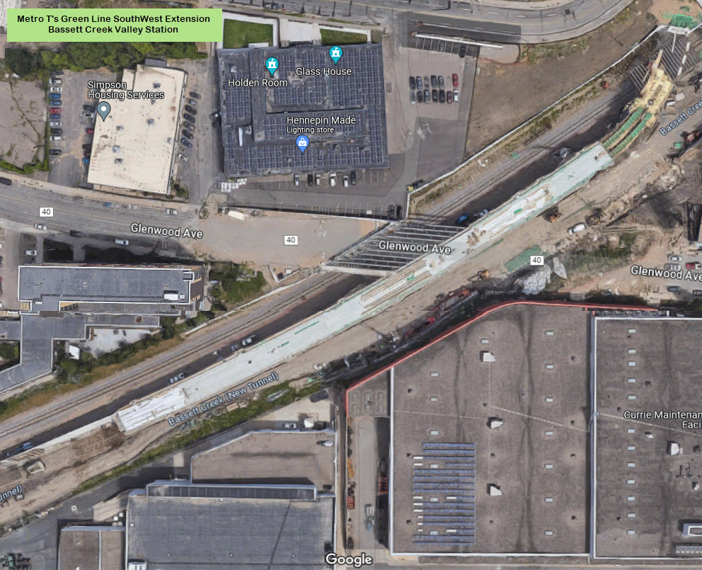
Bassett Creek Valley - Minneapolis
GPS Coordinates: 44.97875, -93.28436
Bryn Mawr - Minneapolis
GPS Coordinates:
W 21st St - Minneapolis
GPS Coordinates:
W Lake St - Minneapolis
GPS Coordinates:
Beltline Blvd - St Louis Park
GPS Coordinates:
Wooddale Ave - St Louis Park
GPS Coordinates:
Louisiana Blvd - St Louis Park
GPS Coordinates:
Blake Rd - Hopkins
GPS Coordinates:
Downtown Hopkins - Hopkins
GPS Coordinates:
Shady Oak - Hopkins
GPS Coordinates:
Opus - Minnetonka
GPS Coordinates:
City West - Eden Prairie
GPS Coordinates:
Golden Triangle - Eden Prairie
GPS Coordinates:
Eden Prairie Town Center - Eden Prairie
GPS Coordinates: 44.85910, -93.43130
8030 Eden Rd, Eden Prairie, MN 55344
SouthWest Station - Eden Prairie
GPS Coordinates: 44.86001, -93.44412
The
The
The
The
The
Did U Know?
None for now......
Disclaimers:
I love trains, and I love signals. I am not an expert. My webpages reflect what I find on the topic of the page. This is something I have fun with while trying to help others.
Please Note: Since the main focus of my two websites is railroad signals, the railfan guides are oriented towards the signal fan being able to locate them. For those of you into the modeling aspect of our hobby, my indexa page has a list of almost everything railroad oriented I can think of to provide you with at least a few pictures to help you detail your pike.
If this is a railfan page, every effort has been made to make sure that the information contained on this map and in this railfan guide is correct. Once in a while, an error may creep in :-)
My philosophy: Pictures and maps are worth a thousand words, especially for railfanning. Text descriptions only get you so far, especially if you get lost or disoriented. Take along good maps.... a GPS is OK to get somewhere, but maps are still better if you get lost! I belong to AAA, which allows you to get local maps for free when you visit the local branches. ADC puts out a nice series of county maps for the Washington DC area, but their state maps do not have the railroads on them. If you can find em, I like the National Geographic map book of the U.S..... good, clear, and concise graphics, and they do a really good job of showing you where tourist type attractions are, although they too lack the railroads. Other notes about specific areas will show up on that page if known.
Aerial shots were taken from either Google or Bing Maps as noted. Screen captures are made with Snagit, a Techsmith product... a great tool if you have never used it!
By the way, floobydust is a term I picked up 30-40 years ago from a National Semiconductor data book, and means miscellaneous and/or other stuff.
Pictures and additional information is always needed if anyone feels inclined to take 'em, send 'em, and share 'em, or if you have something to add or correct.... credit is always given! Please be NICE!!! Contact info is here
Beware: If used as a source, ANYTHING from Wikipedia must be treated as being possibly inaccurate, wrong, or not true.
RAILFAN GUIDES HOME
RAILROAD SIGNALS HOME
NEW 10/07/2021, SEP29/30/2023
Last Modified 01-Oct-2023