RAILFAN GUIDES of the U.S.
Todd's Railfan Guide to
WYANDOTTE MI
In General
Getting Here
Map
Sights
Signals
Floobydust
USGS Maps
RAILFAN GUIDES HOME
RAILROAD SIGNALS HOME
Location / Name:
Wyandotte MI, Wayne County
What's Here:
Former Michigan Central Depot
Data:
GPS Coordinates: as needed
Phone A/C: 734
ZIP: 48192
Access by train/transit:
None
The Scoop:
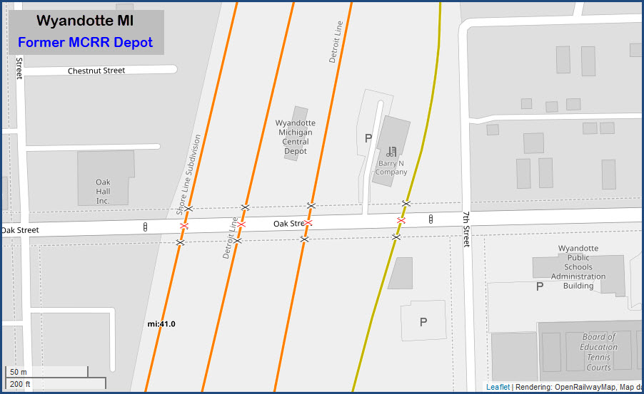
This page is mostly to highlight one of the few vintage depot's left in the Detroit area. There's not much else to bring you here, however, if you are in the area, or traveling between Detroit and Toledo OH, it is worth a stop if you are into more than heavy-duty mainline action, altho, the station sits in the middle of four parallel lines, so your chances of seeing something may be pretty good.
Acknowledgements:
Denver Todd
Websites and other additional information sources of interest for the area:
https://www.thenewsherald.com/news/history-wyandotte-sees-four-train-lines-by-1900/article_3ac3c8ad-7404-5152-8eb4-eb6c96319a43.html
From "the south" via I-75: get off at exit 36, Eureka Rd and head east to Fort St (3 miles) and take a left. Go up to Oak Rd (about a quarter of a mile) and take a right, the depot is 1 mile on your left.
From "the north" via I-75: get off at exit 37, Northline Rd, head east, also to Fort St (2.2 miles) and take a right (by the way, Northline turns into Ford Ave at Fort St). Go down to Oak Rd (~ 2/3 mile) and take a left.
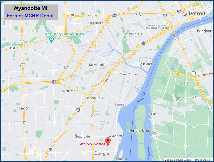
GPS Coordinates: 42.204475, -83.160873
758 Oak St, Wyandotte, MI 48192
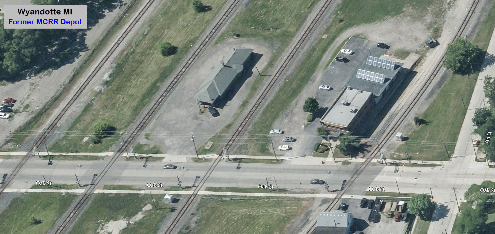
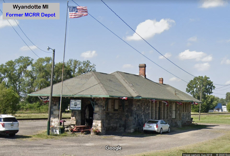
The depot was built in 1891 by Michigan Central Railroad, but it was also used by Lake Shore & Michigan Southern. It was a union depot, which meant that the facility served more than one rail company. The Lake Shore used the west side track and the Michigan Central used the east side. The depot ended its life as a station July 12, 1959. Since 1961, the depot has been the home of American Legion Post 447. Amtrak trains used to pass by here until 1995, when they were rerouted.
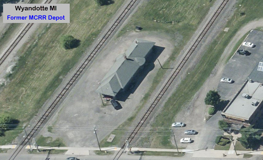
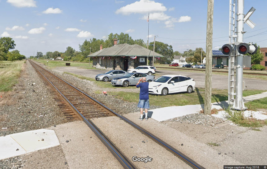
Google caught a railfan in action taking a picture of the depot :-)
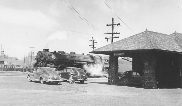 NYC train passing the depot in 1948
One of the more interesting facets of railroading in the Detroit area is in the Wyandotte area - where there are four sets of tracks coming into town, all parallel to each other, and within 200 feet of each other. During the vintage years of the 40's, 50's and 60's, this must have been an exciting time - Think of how many trains each railroad used to have, and the variety of colors you would see - wow! I imagine there were times when you couldn't get across the grade crossings for 10's of minutes, at least. I would love to find some pictures from this area, if anyone knows of any, maybe you could email me! :-) Thanks.
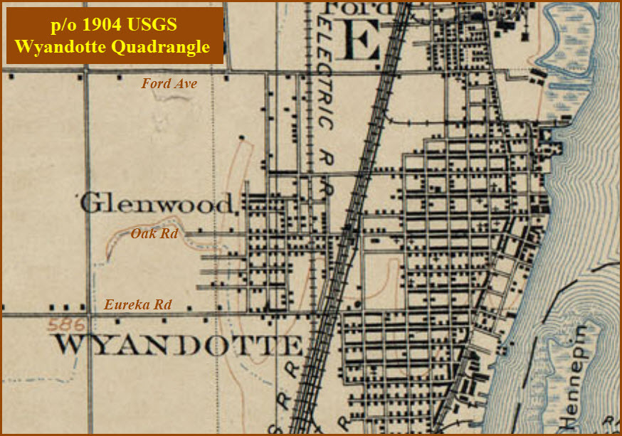
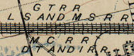
In 1904, the four railroads running thru here were the:
Detroit, Toledo & Ironton RR
Grand Trunk RR
Lake Shore & Michigan Southern RR
Michigan Central RR
Below West Rd down towards Trenton, the tracks spread out, into 2 sets of two.
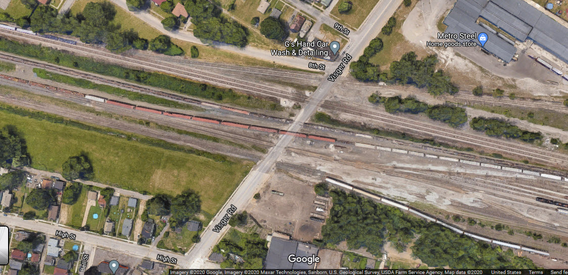
Between West and Visger Roads, it is a straight run of about 8.4 miles, except a small bend at King Rd.
Visger Road is the south end NS's River Rouge Yard.
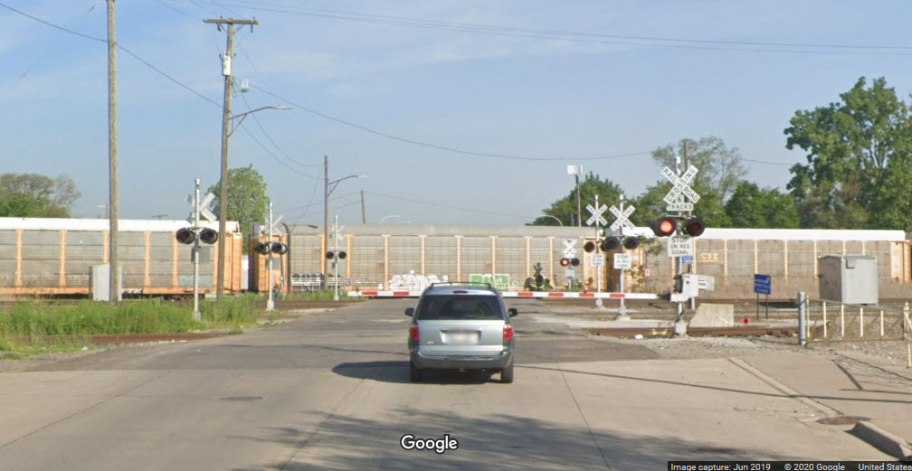
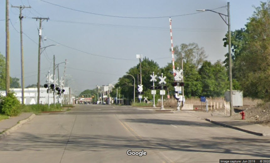
There are plenty of photo ops, as you have grade crossings at (starting on the north end):
Visger Rd
Saliotte Rd
-West Outer Dr- no, they go over
One of the tracks splits off, we now have 3 tracks going north from here
-Southfield St- nope, the tracks go over Southfield
Mill St
Emmons Blvd
St John St
Goddard Rd
Antoine St
Northline Rd/Ford Ave
Vinewood St
Oak St
-Eureka Rd- no, the railroads go over Eureka
Pennsylvania Rd
Sibley Rd
King Rd
Harrison Rd
This is at Visger Rd, where the parallel run "starts", there are seven tracks to cross here:
None to report on.
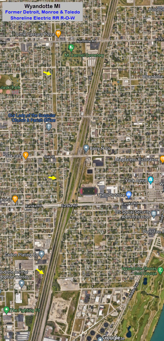
Former Detroit, Monroe & Toledo Shoreline Electric RR right-of-way
Courtesy of the University of Texas Library, click here for their index page.
See above.
Disclaimers:
I love trains, and I love signals. I am not an expert. My webpages reflect what I find on the topic of the page. This is something I have fun with while trying to help others.
Please Note: Since the main focus of my two websites is railroad signals, the railfan guides are oriented towards the signal fan being able to locate them. For those of you into the modeling aspect of our hobby, my indexa page has a list of almost everything railroad oriented I can think of to provide you with at least a few pictures to help you detail your pike.
If this is a railfan page, every effort has been made to make sure that the information contained on this map and in this railfan guide is correct. Once in a while, an error may creep in :-)
My philosophy: Pictures and maps are worth a thousand words, especially for railfanning. Text descriptions only get you so far, especially if you get lost or disoriented. Take along good maps.... a GPS is OK to get somewhere, but maps are still better if you get lost! I belong to AAA, which allows you to get local maps for free when you visit the local branches. ADC puts out a nice series of county maps for the Washington DC area, but their state maps do not have the railroads on them. If you can find em, I like the National Geographic map book of the U.S..... good, clear, and concise graphics, and they do a really good job of showing you where tourist type attractions are, although they too lack the railroads. Other notes about specific areas will show up on that page if known.
Aerial shots were taken from either Google or Bing Maps as noted. Screen captures are made with Snagit, a Techsmith product... a great tool if you have never used it!
By the way, floobydust is a term I picked up 30-40 years ago from a National Semiconductor data book, and means miscellaneous and/or other stuff.
Pictures and additional information is always needed if anyone feels inclined to take 'em, send 'em, and share 'em, or if you have something to add or correct.... credit is always given! Please be NICE!!! Contact info is here
Beware: If used as a source, ANYTHING from Wikipedia must be treated as being possibly inaccurate, wrong, or not true.
DETROIT RAILFAN GUIDE HOME
RAILFAN GUIDES HOME
RAILROAD SIGNALS HOME
NEW AUG31/2018
Last Modified
01-Sep-2020