
In General
Nearby Towns with Interesting Stuff
Getting Here
Maps
Sites
Signals
Bridges
USGS Maps
Floobydust
RAILFAN GUIDES HOME
RAILROAD SIGNALS HOME
Location / Name:
Grand Rapids MI, Kent County (County seat and 2nd largest city in MI)
What's Here:
Amtrak
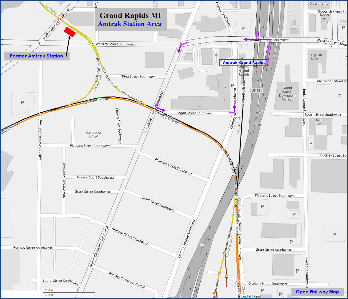
Former Amtrak Depot
Former Kalamazoo, Allegan & Grand Rapids RR Depot
CSX
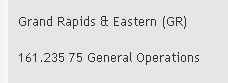
Grand Rapids & Eastern RR
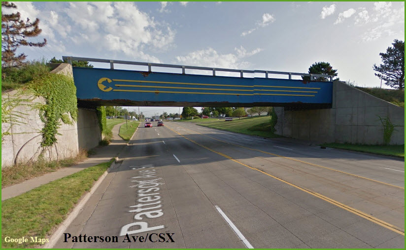
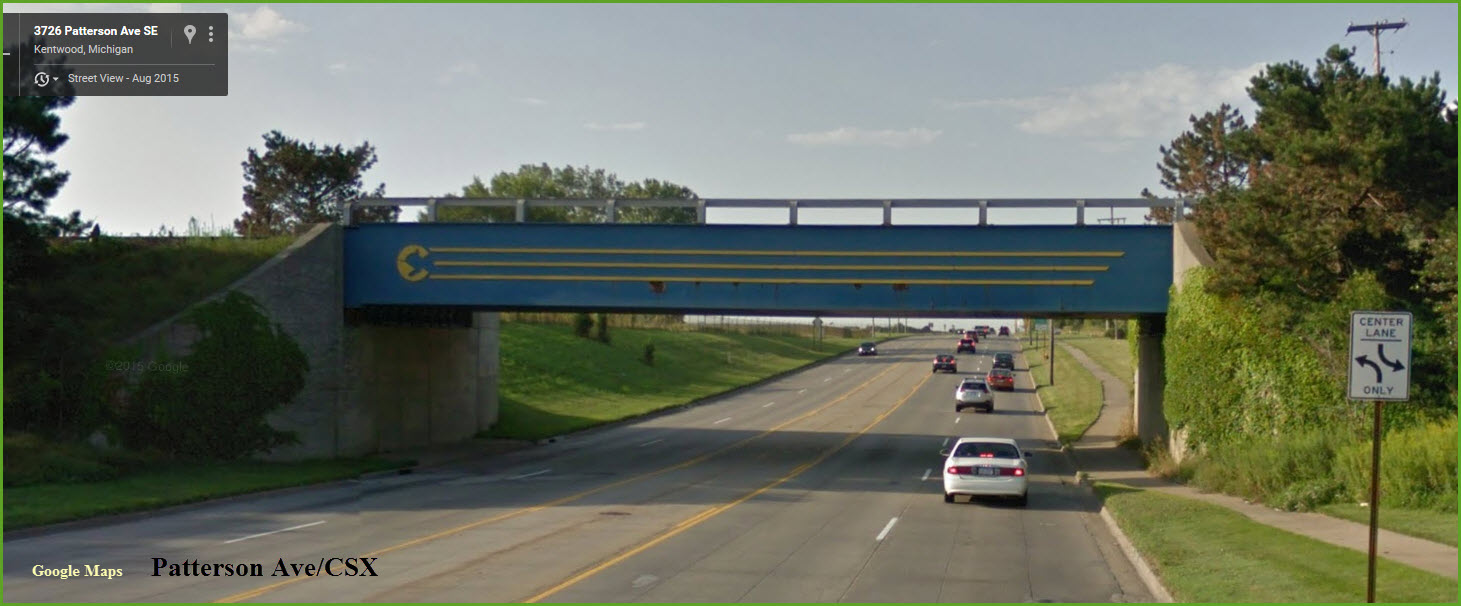
Cool Chessie System bridge over Patterson Ave
CSX's Wyoming Yard
NS/Grand Elk Grand Rapids Yard
Lydi Line RR, a quarter scale railroad over at Vierson Boiler
Russ Eldrid's 1/8 scale White Creek Railroad, ~20 miles north
Data:
GPS Coordinates: as needed
Phone A/C: 616
ZIP: 49503+
Geography:
Flat to Hilly
Access by train/transit:
Daily Amtrak to Chicago commuter
The Scoop:
Grand Rapids is an interesting town to railfan, and I always enjoyed my business trips here. CSX has a large presence in Grand Rapids. Norfolk Southern formally did, but now leases their line from here down to Elkhart Indiana to the Grand Elk RR, giving us a new shortline to photograph. The other shortline in town is the Grand Rapids and Eastern. To round out the action in town, you have an Amtrak commuter train that heads into Chicago every morning and returns in the evening.
The Amtrak commuter train which leaves for Chicago in the AM can be shot at many locations in and around the station, as well as along Chicago Dr SW, and further south. If they are keeping the train overnight at the GR&E, then you can also get Amtrak pictures in parts of Grand Rapids that probably haven't seen passenger trains since the 50's (that's my guess).
As always, I don't normally venture into the yards unless I have an escort or someone else that knows the territory and is friendly with the RR folks.
Apparently, the end of Freeman Ave is popular with local railfans, and gives you a fairly good vantage point for shooting stuff at Wyoming. I saw some of my first "2 digit" CSX engines along that that road, way back in 98.
One of the most interesting sites (IMHO) is the Chessie System overpass on Paterson Ave SW, although catching a train going over it can be a time consuming process. Morning sun is best from the south side of the bridge, altho there aren't really any places "right there".... you'll have to walk a ways. Trains coming into Grand Rapids often stop here for signal just off to the left of the picture, making it a little easier to snap one off. I don't know if they still visit, but I often saw CPR engines on stuff coming into town this way.
Jim adds this: Where the GR&E meets the CSX (It is known as Fuller Junction), running north from that junction is Marquette Rail (a G&W company) which runs on the old C&O up to Ludington, and Manistee via Baldwin.
The Coopersville and Marne, in addition to being an excursion railway, runs west from the CSX/GRE/MQT junction and has one freight customer that gets a few cars a month.
The GRE runs most weekdays to the Amway complex in Ada, and King which is a grain mill in Lowell.
And a note about Kalamazoo..... The BO tower is no longer staffed.
If you are driving between Kalamazoo and Grand Rapids, stop in Plainwell at The Old Mill Brewpub and Grill. It is on the east side of town right next (and I mean right next) to the Grand Elk KAL to GRR line. Back in the day when there was still PRR (ex GR&I) and NYC (ex LS&MS) there was a diamond there. When Penn Central took over they abandoned most of the line from Parchment to Plainwell, and from Otsego to Allegan. Because the paper mill in Otsego still got service, they turned the diamond into a pair of switches. The Old Mill is open daily except Sunday. Chances of catching a train are hit or miss. If there is one, the northbound almost always works Otsego and leaves the cars it picks up on the spur to Otsego. The switch to the Otsego spur is right by the restaurant as well. The GDLK does use HOT/EOT equipment, so if you're listening, you'll know if they're around. Their road frequency is 160.335. It is usually the engineer and conductor talking to each other. On occasion they use the radio to call Watco dispatch on the PBX. The radio tower is just south of M-89 across from The Old Mill.
As for places to stay and eat, 28th St off i96 exit 43 has just about anything you want, including your choice of at least 11 hotels. I'm sure there are other places too off other exits, but I never had the time to search them out. The big chain stores are Target and Walmart.
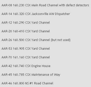
Here are the local radio freqs I found in a blog, so I can't attest to their accuracy, altho the .230 and .320 freqs are used system wide on CSX. The 160.800 freq was a channel used by the Pennsy before the Penn Central days, as the Northern Central going by my house in Towson MD used it.
Acknowledgements:
Jack Prange
Jim Cance
Denver Todd
Nate Danenberg
Jason Mancuso
PPWIII
Wikipedia
Google Maps
Bing Maps
Thanks to the many railfans for going out and taking the up close and personal pictures for the Grand Rapids railfan guide.
Their invaluable help makes this a better and more complete guide for everyone!
Nearby Towns with Interesting Stuff
About 15 miles northwest of Grand Rapids is an excursion railroad known as the Coopersville & Marne Railway. This year they are celebrating their 25th anniversary. More info below.
Kalamazoo to the south still has an operating tower, an Amtrak station and track that is exclusively Amtrak, and a couple of diamonds. For those of you into busses, the main yard and depot is right next to the Amtrak station.
Along the east-west corridor from Kalamazoo on I-94 is Battle Creek, Albion, and Jackson. The track that parallels I-94 is an Amtrak line, so don't go looking for anything but. Jackson hosted the Amtrak 40th Birthday train in October of 2011.
Lansing, Michigan's state capitol, is about 60 miles east of Grand Rapids, and has quite a few yards, an Amtrak station, with CSX, NS, and CPR action.
North of Grand Rapids, bout 80 miles or so, you have Cadillac..... now, by rail standards, a sleepy little town, but nevertheless, a worthy stopping point if you're in the area.
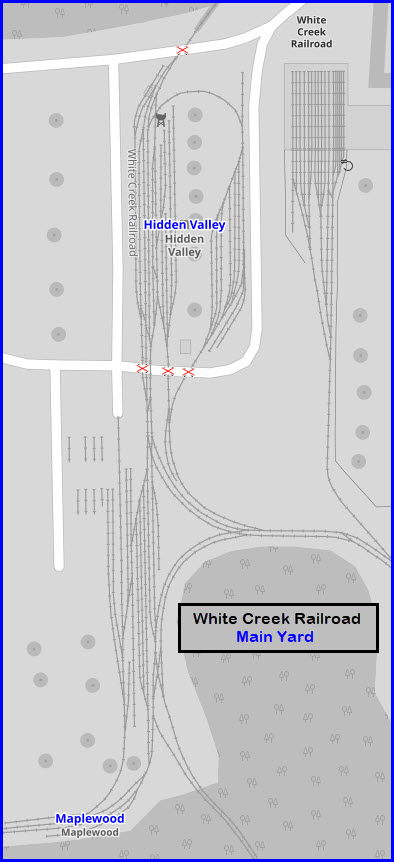
If you are into things like Live Steam and/or Live Diesel, 7 1/2 inch gauge style, the second largest railroad in the U.S.A. (and the largest private one!) is ~15 miles north of Grand Rapids off US131 in Cedar Springs: The White Creek RR. Russ Eldrich has over six (actual) miles of rail on the ground. To take it all in takes about a 45 minute train ride thru some of the prettiest scenery and lakes!
To the south in Indiana, within fairly easy driving range, you have Michigan City, Elkhart, and South Bend.
Getting to Grand Rapids is easy from almost anywhere.
From the Chicago and western Indiana areas, take I-94 east and when you get to the Benton Harbor MI, take I-196 up into Grand Rapids. BTW, if anyone remembers Heathkit, Benton Harbor used to be their home.
From the mid section of Indiana, US131 takes you right into Grand Rapids, passing thru Kalamazoo, which is also a very good town spot to stop in, with a working tower.
From western Indiana and Ft Wayne, take I-69 north to Lansing, then head west on I-96. This will take you close to Battle Creek, which I also recommend, and of course, Lansing.
From northern Ohio, it's I-75 north to Toledo, of which I would swing around the west side of to catch US23 heading north to hit I-96. Of course, by going this way, you have to stop in Toledo and Ann arbor (not only to get pictures of the depot there, but to also grab some grub too)
Coming in from the east as in Detroit, or a little north of there, it's I-96 all the way into Grand Rapids. If you're coming from Flint or further north, take I-69 to Lansing, then head west on I-96.
From even further east, such as Pennsylvania or any other east coast state from PA on up, come across the Ohio Turnpike, I-80/90 to Toledo, then take US23 north following the directions for northern Ohio.
From the northern section of Michigan, west side of central, I would work your way over to US131 and come down it.

The above map is available here as a PDF
Sites
the Former Amtrak Station
the Grand Rapids and Eastern RR
the Kalamazoo, Allegan & Grand Rapids RR
CSX's Wyoming Yard
Grand Elk RR Yard
Large Scale Model Railroad
Chessie System Bridge
Wye
Current (New) Amtrak Station
GPS Coordinates: 42.956404, -85.678606
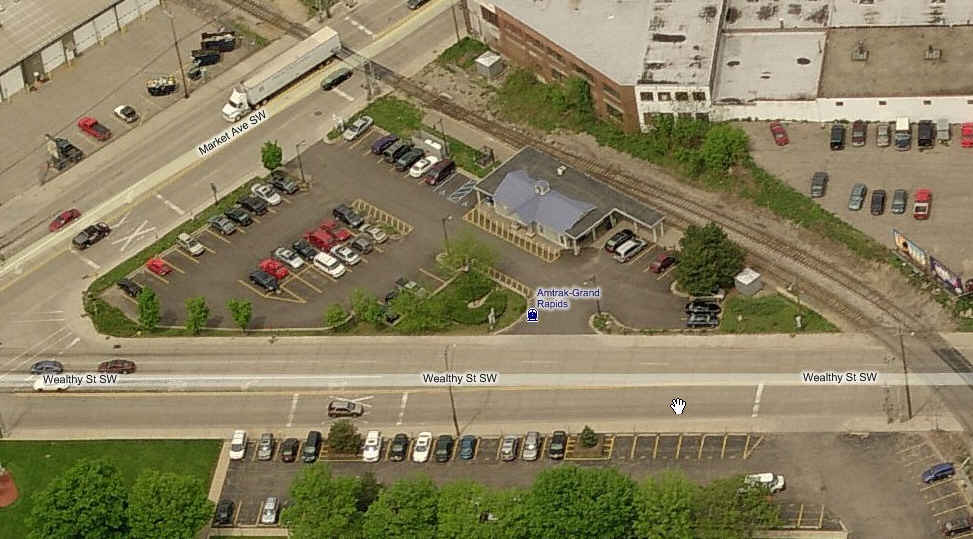
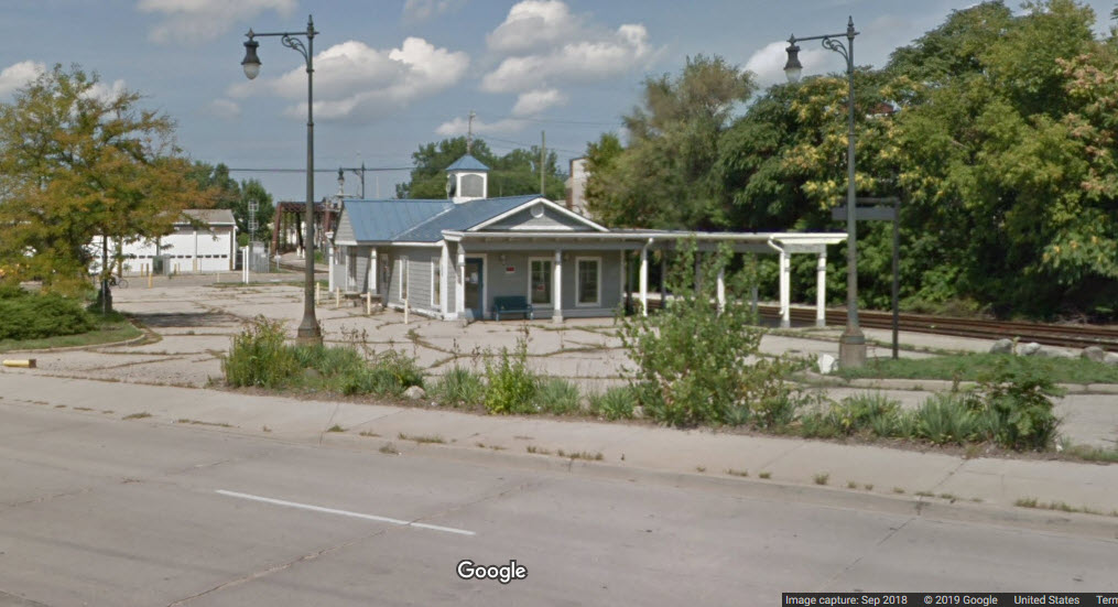
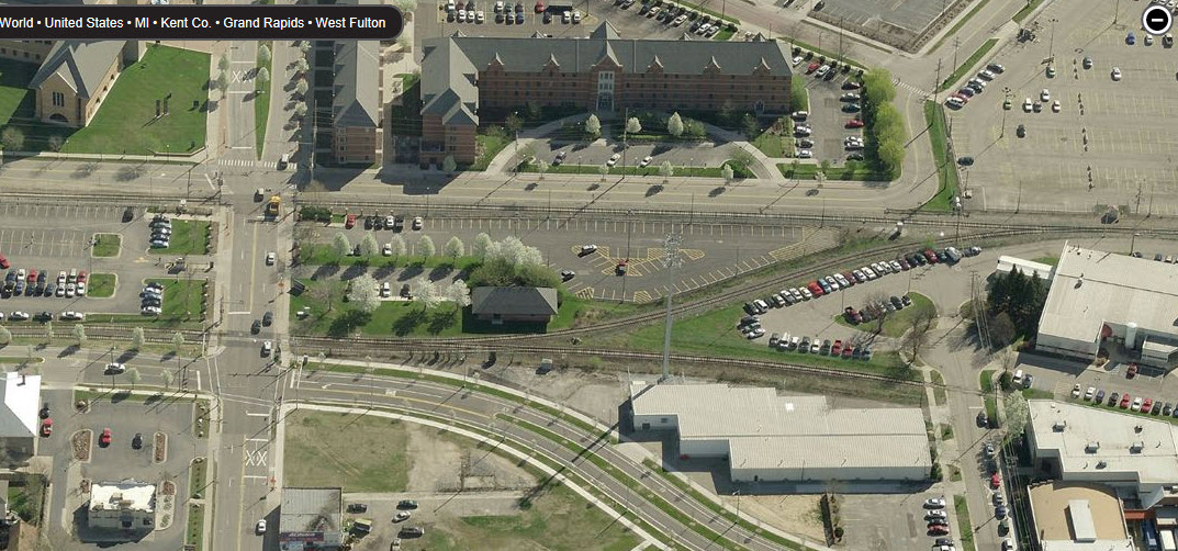
This is the former Amtrak station, which is just north of the CSX wye. Amtrak, according to one source of info found on the web, now ties their Chicago commuter train up overnight at the Grand Rapids and Eastern facility because it is safer than leaving it here. Access is easy from most anywhere because of the interchange off 131 at Wealthy St.
GPS Coordinates: 42.997378, -85.685245
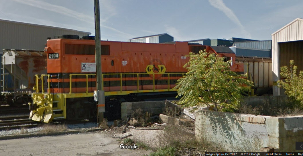
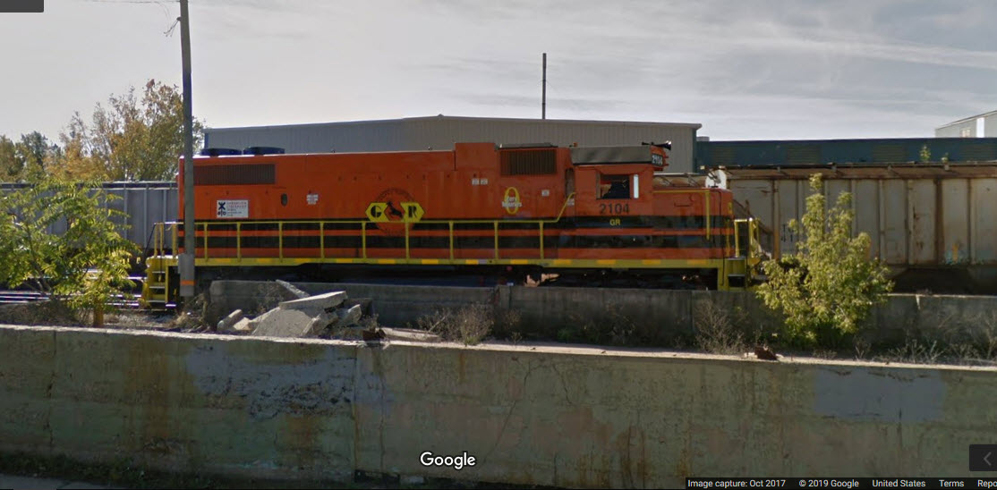
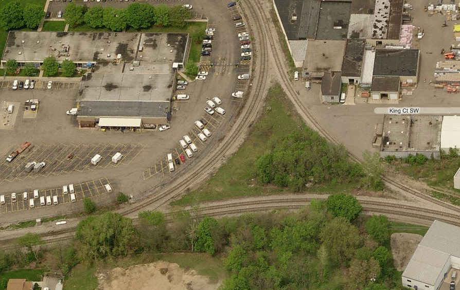
This is the HQ for the Grand Rapids and Eastern, along with the interchange with CSX, and a diamond with them. In all of my visits to Grand Rapids, pictures of them operating always eluded me... Anyone have any pictures they want to share with the rest of the world?
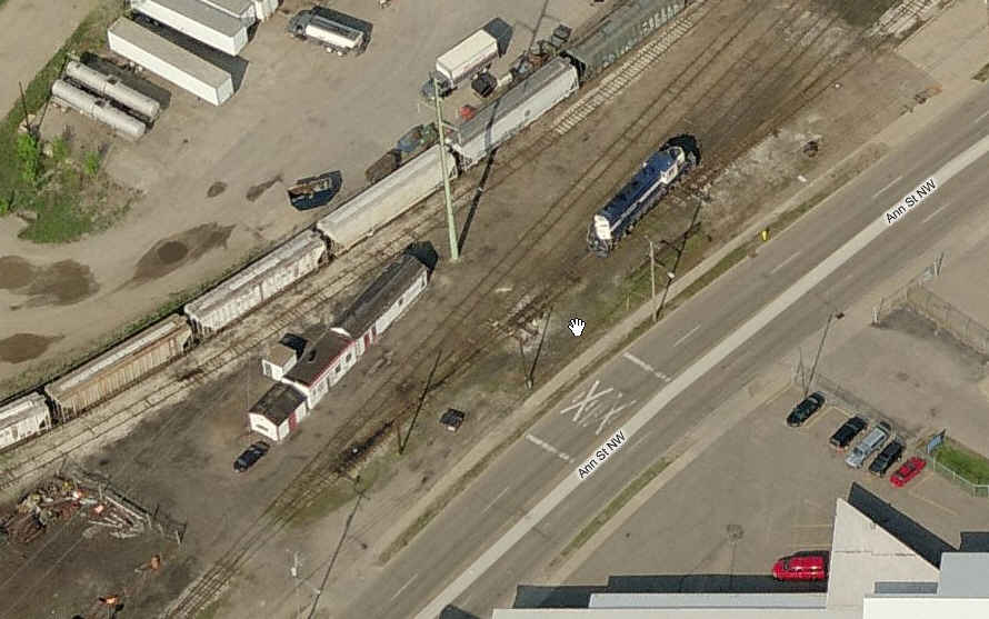
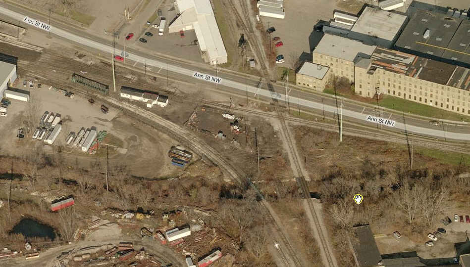
A couple of screen shots from Google Maps, seems like they had better luck in catching their engine than I ever did :-) Gone is the blue GRE engine....
And just think, I didn't live too far from where this empire started in New York as a kid in Batavia NY!
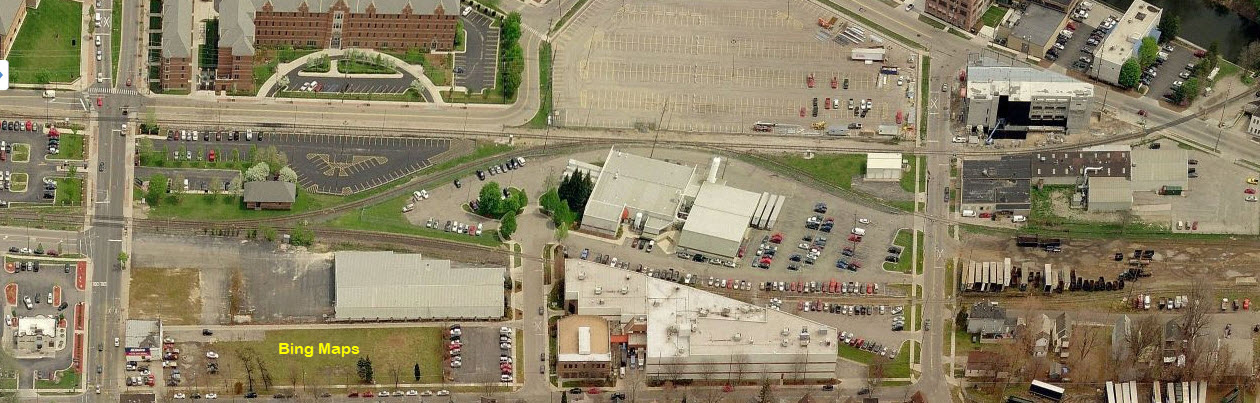
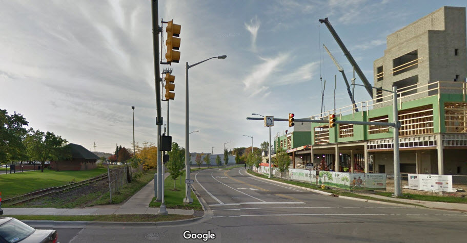
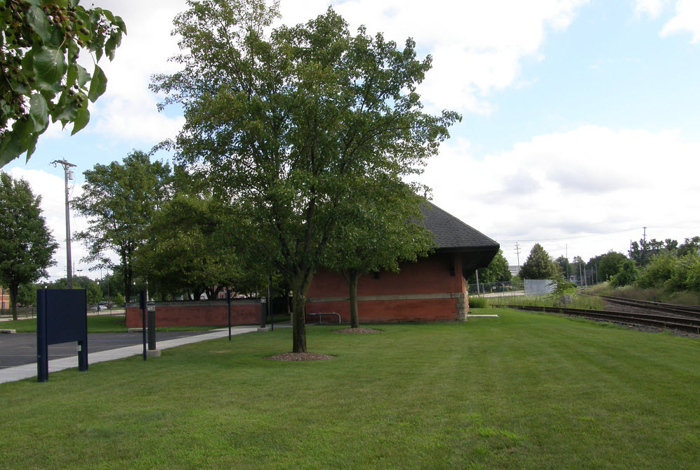
GPS Coordinates: 42.962772, -85.682257
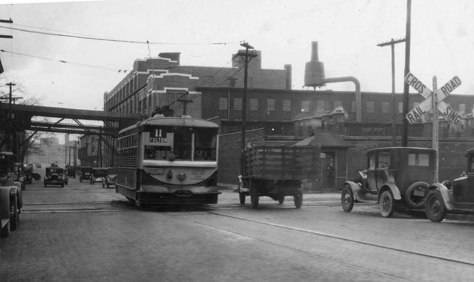
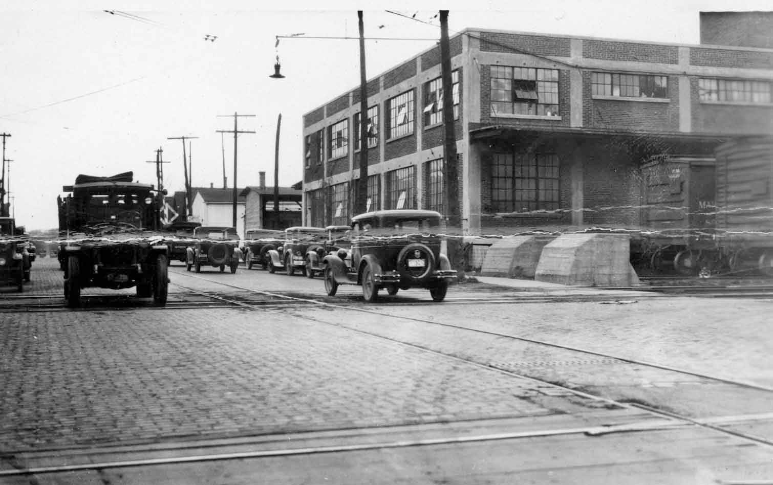
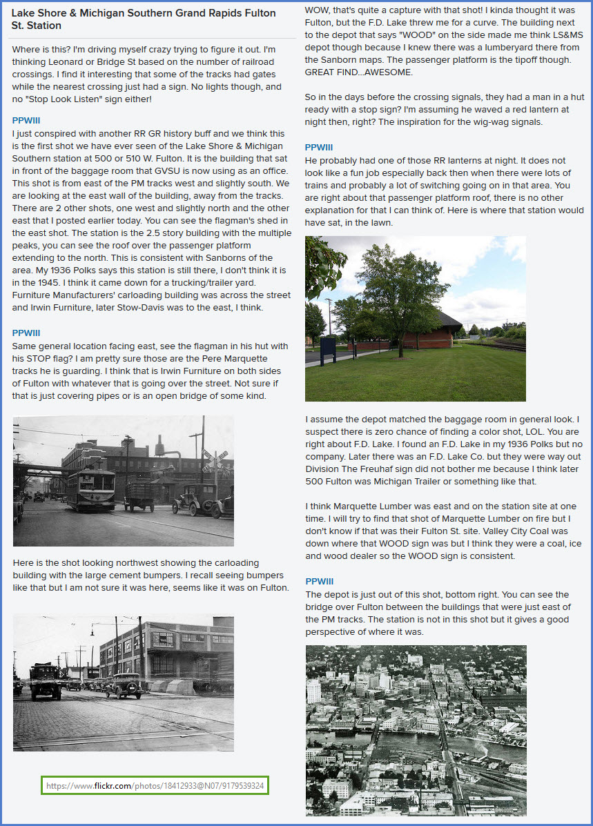
This is a depot of the former Kalamazoo, Allegan & Grand Rapids RR (which was part of the Lakeshore & Michigan Southern RR). The depot faces Fulton St.
Thanks to Jason Mancuso for providing me with the correct information about the history on this building.
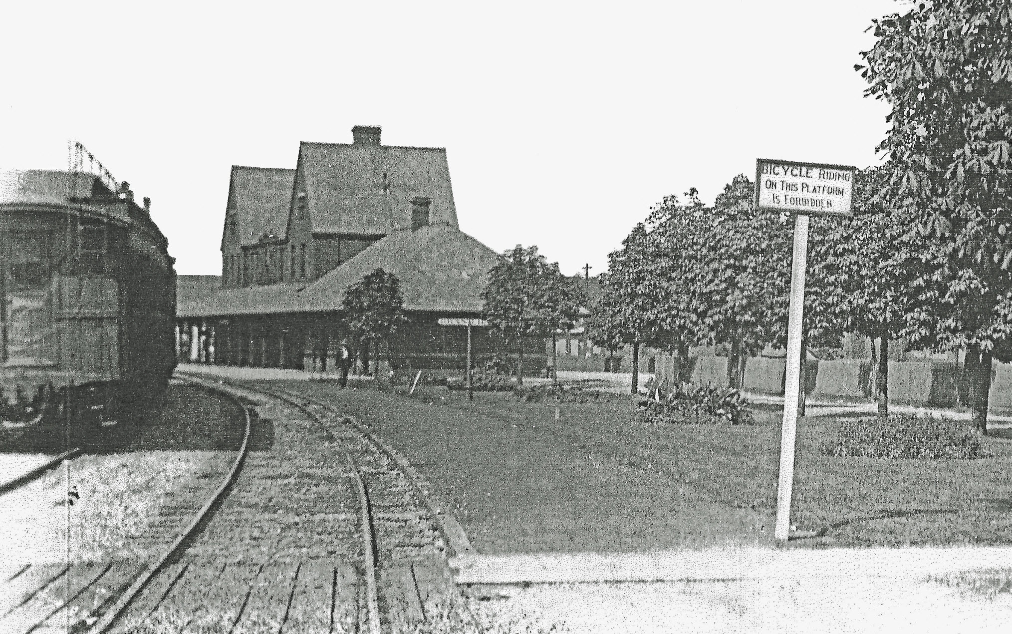
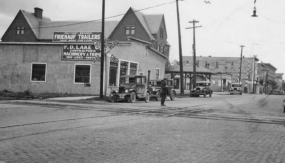
The blog below comes from https://www.flickr.com/photos/18412933@N07/9179539324
Thanks to PPWIII for providing the historical pictures,
They came from https://www.flickr.com/photos/18412933@N07/9179539324 and https://www.flickr.com/photos/18412933@N07/9633496435 , but are shown here too in case they disappear.
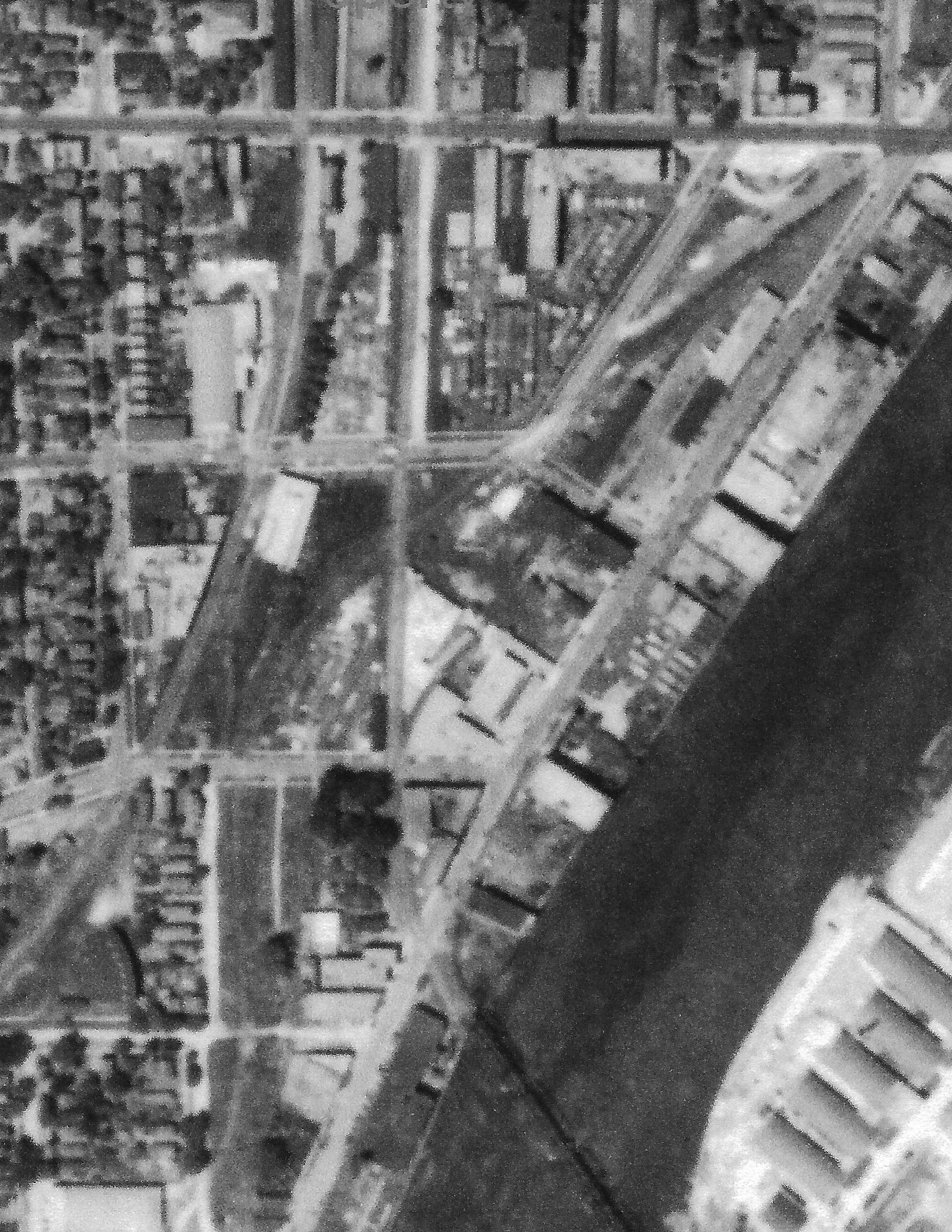
 Bing Maps
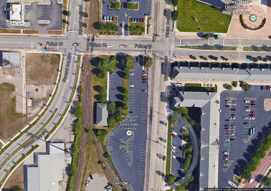
 Bing Maps
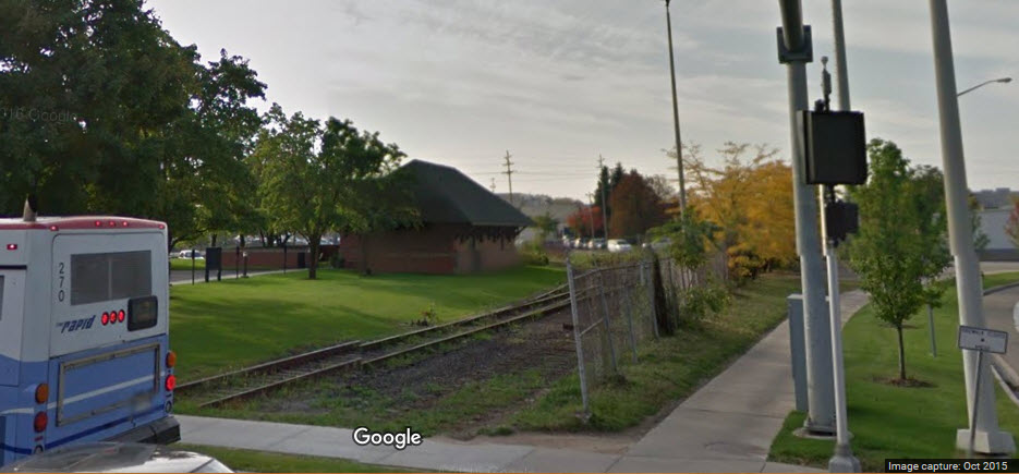
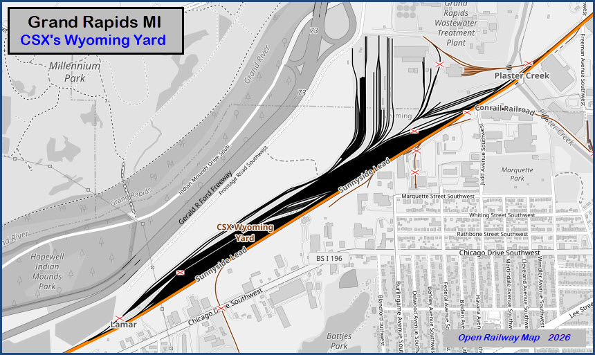
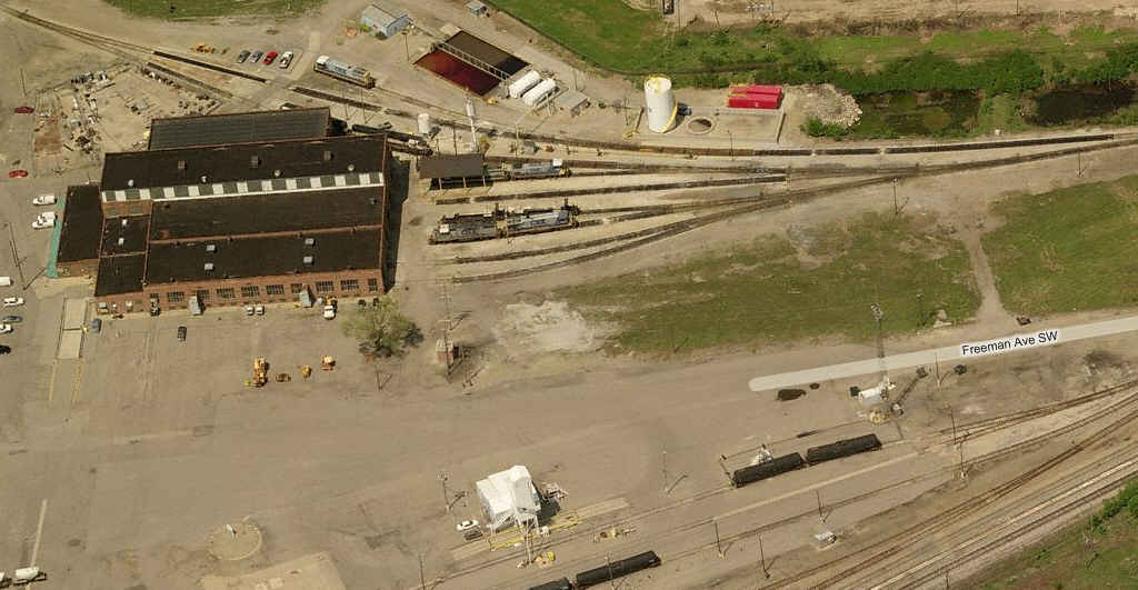
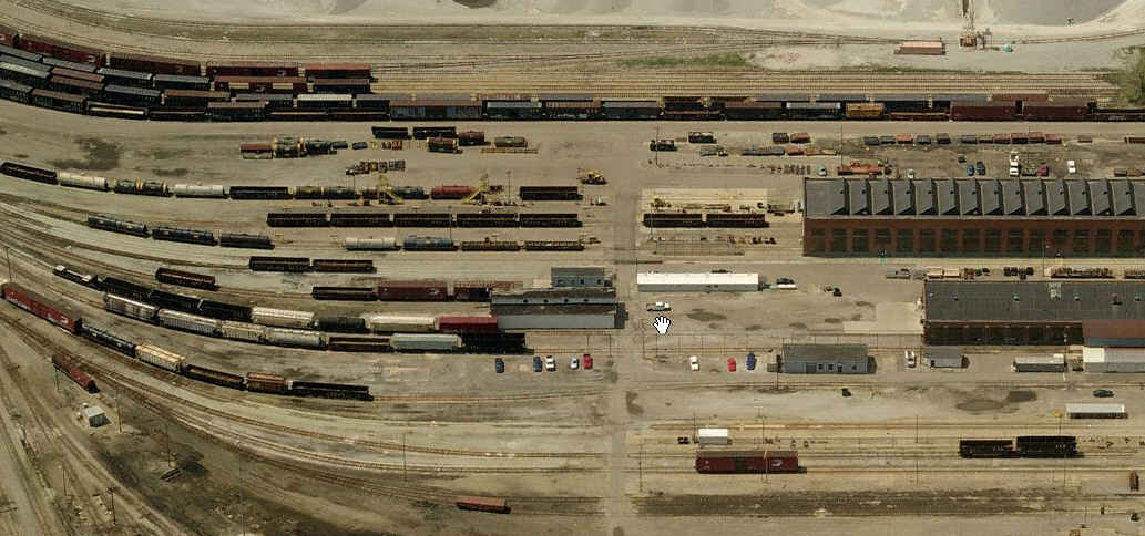
GPS Coordinates: 42.943103, -85.704989 (center of the maintenance part)
A couple of shots of CSX's Wyoming Yard and the car repair facility.
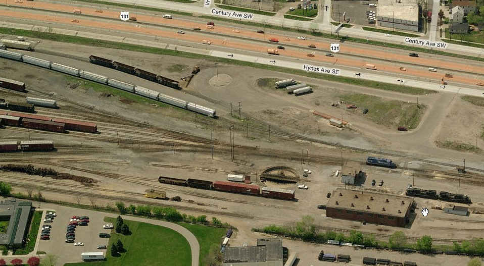
GPS Coordinates: 42.933082, -85.679519 (center of the yard)
A couple of pictures of the Grand Elk yard. Most recently an ex Norfolk Southern yard, and before that, Conrail.
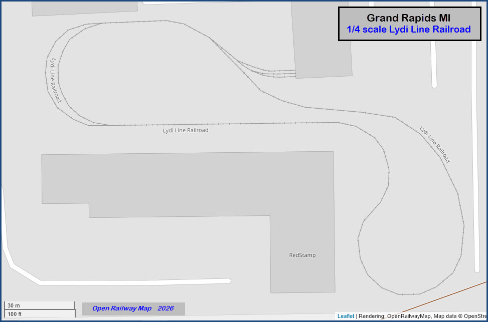
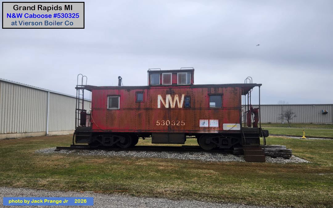
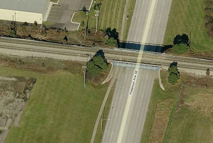
GPS Coordinate: 42.895448, -85.546376
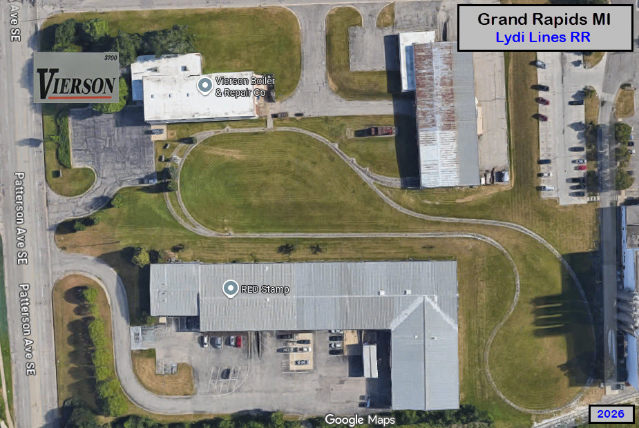
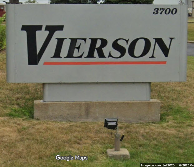
Adjacent to the Chessie System overpass is this private small scale railroad. Don't know much about it other than during the years I visited Grand Rapids (1998-2002), the loop was in the process of being completed, but on the few visits I made to the site, I never caught anyone around to ask questions of. This is also why my maps contain the notice that the info hasn't been field checked (by me) for 15+ years.
In checking with Open Railway Maps, they have the railroad noted as the Lydi Line Railroad. Given that tidbit of information, I did a Google search, and their AI engine came up with the results shown below. That's something..... know more than I did 30 minutes ago! :-) :-)
It appears to be a quarter scale railroad, with 15" tracks. There are/were several other quarter scale railroads in the state, notably the Traverse Steam engine at the park/former zoo (but has since been moved to another quarter sized railroad south of Traverse City). Since Vierson is a boiler maker, it would kinda make sense for the owner to have an interest in steam engines, and have one on the property.
The Steam Engine that was on display, is now gone, and the supporting tracks removed. Anyone know what happened to it?
In a like note, in Hunt Valley MD, there is an office supply company, of which the owner loved computers - so - he started a small museum in the office of his business, which you could visit. This interest, or obsession, has become so "big", that the office supply part of the building is now located somewhere else, and the computer museum took over the whole building. PLUS, on top of that, the Electronics Museum which was started by Westinghouse 40+ years ago near BWI airport, closed, and the contents and displays moved up to the computer museum. They even have a 33ft long AWACS radar antenna waiting to be put on display (which was probably the one hanging in the main (BWI) building)!
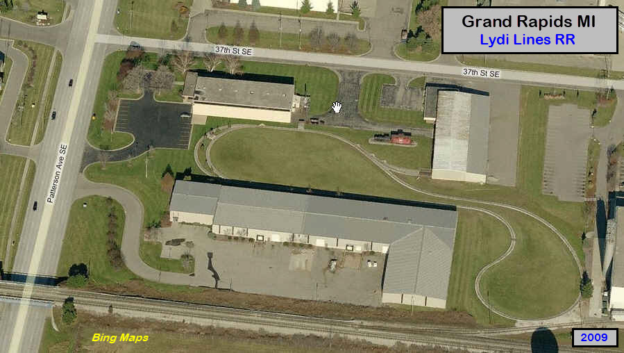
 Bing's birds-eye view from 2009
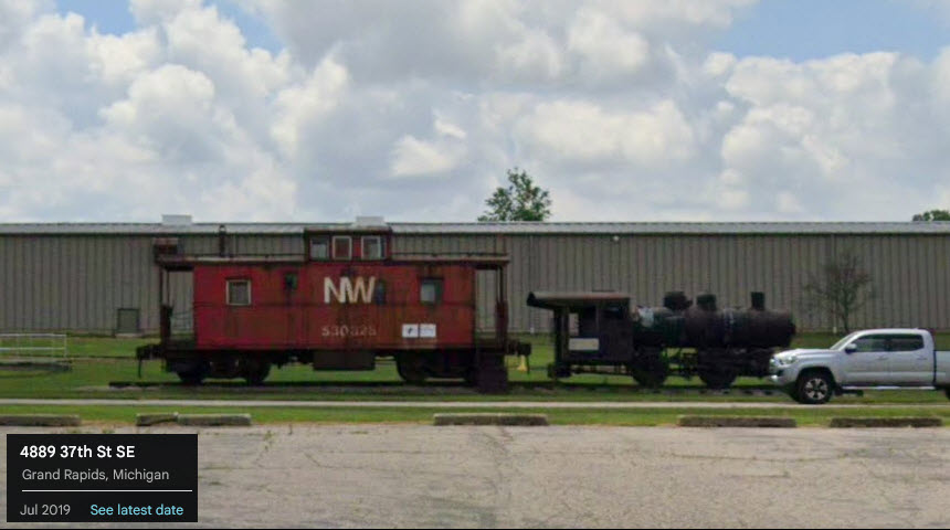 in 2019
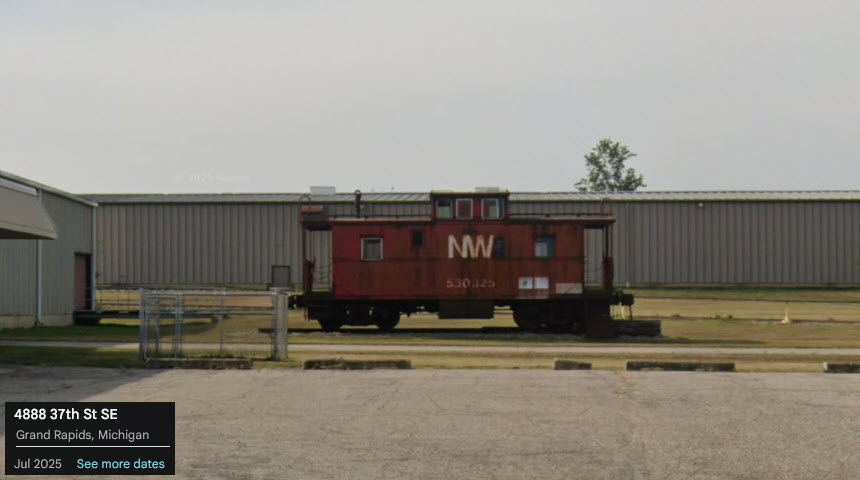 in 2025, steam engine gone :-(
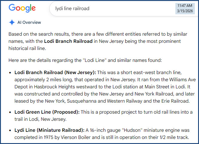
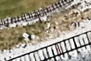 the tracks are close enough for a pretty good comparison
GPS Coordinates: 42.895448, -85.546376
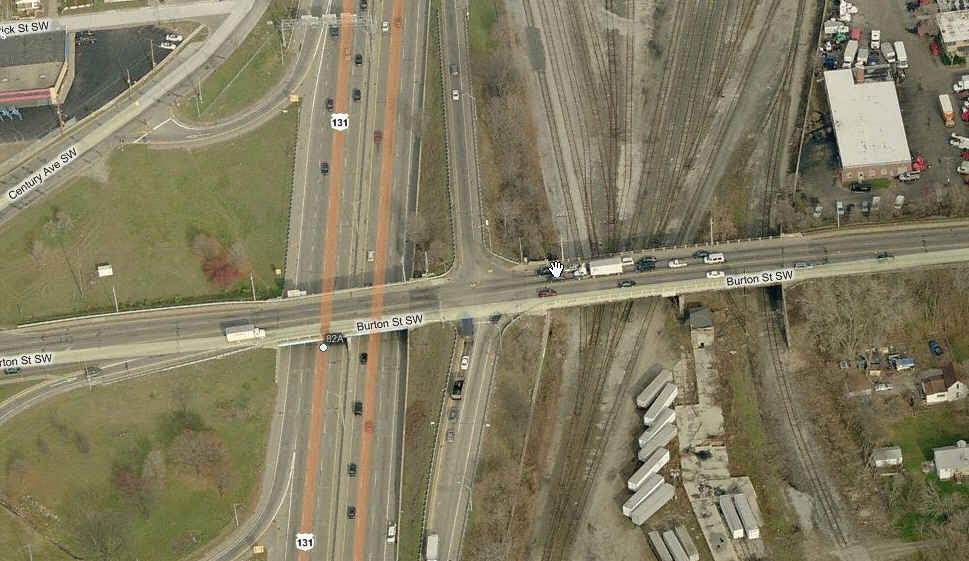
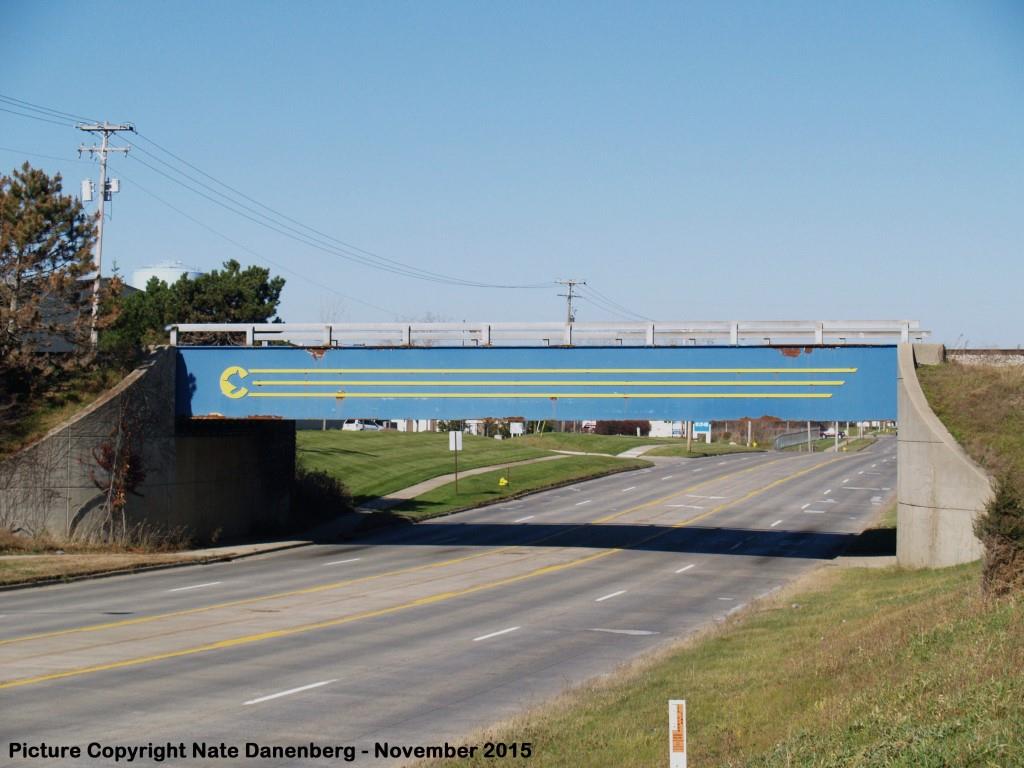
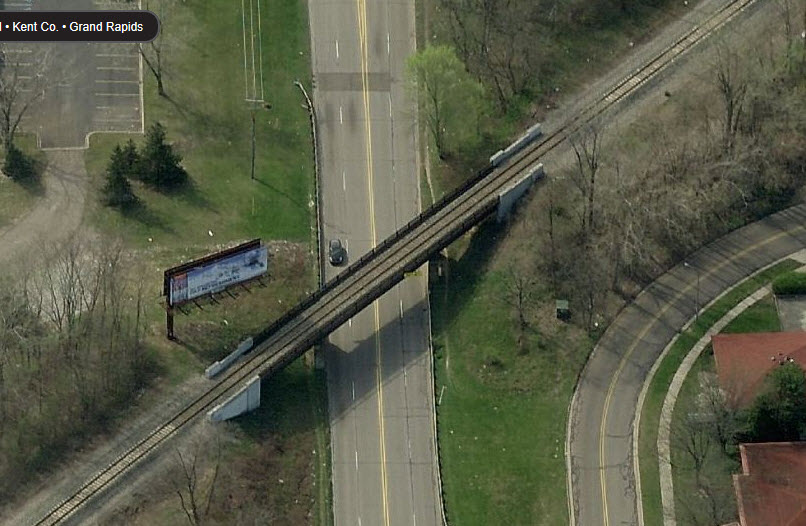
CSX overpass just north of the airport on Patterson... they went to a lot of trouble to "make" the Chessie System logo, so I guess they decided to keep it around! That's good for us. Inbound freights will often stop here waiting for a clear signal. The really good picture of the bridge is by Nate Danenberg, I could never seem to catch it on a good clear day like this. The other two are from Google Maps.
GPS Coordinates: 42.954881, -85.677372
The CSX wye, just south of the OLD Amtrak station.
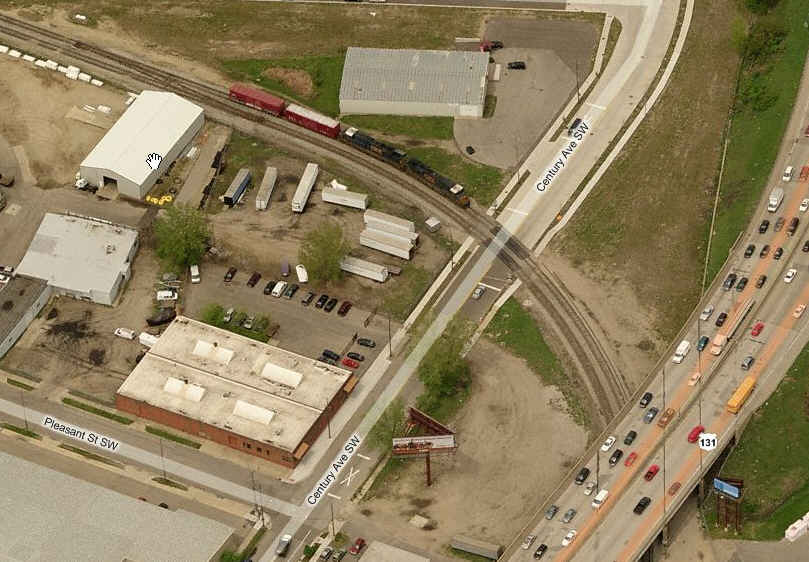
A CSX freight heading south off the right leg of the wye.
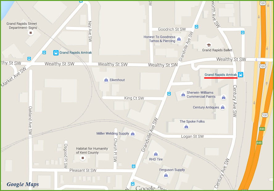
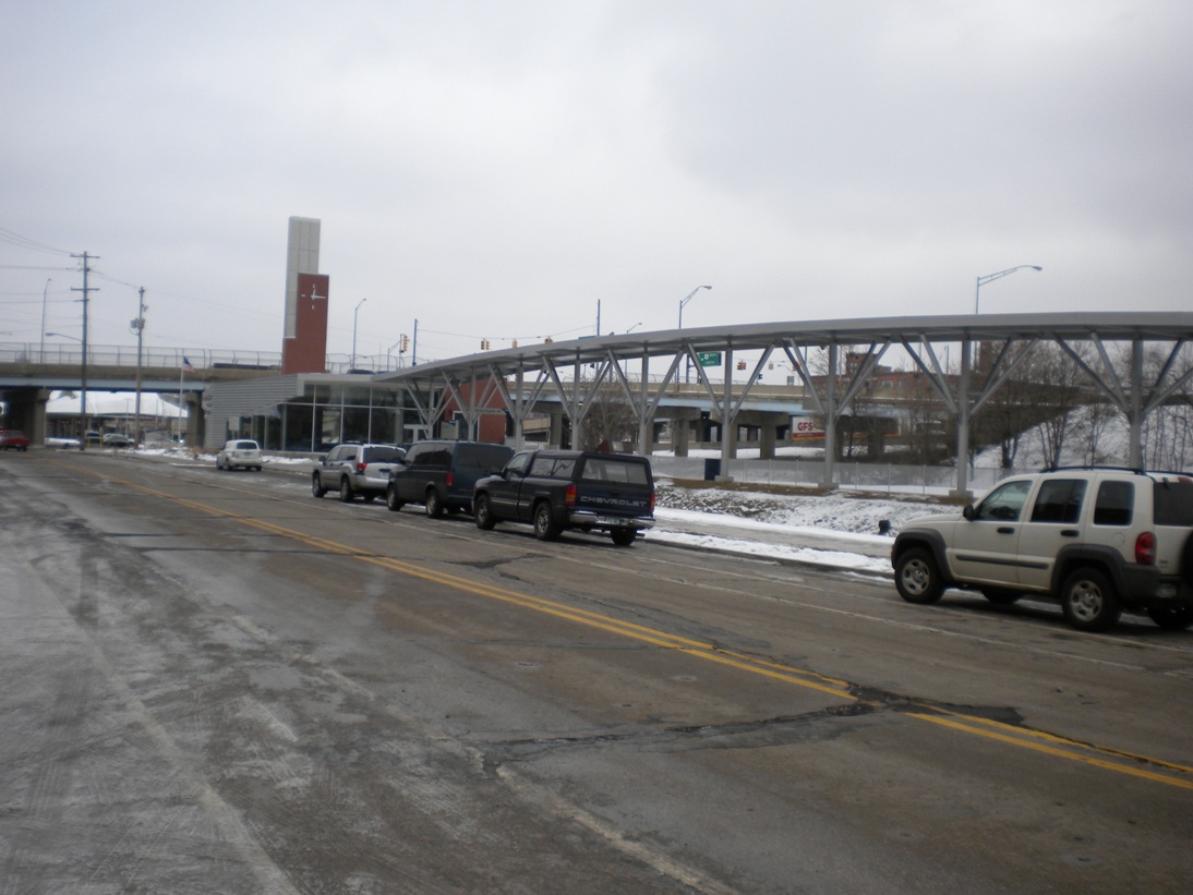
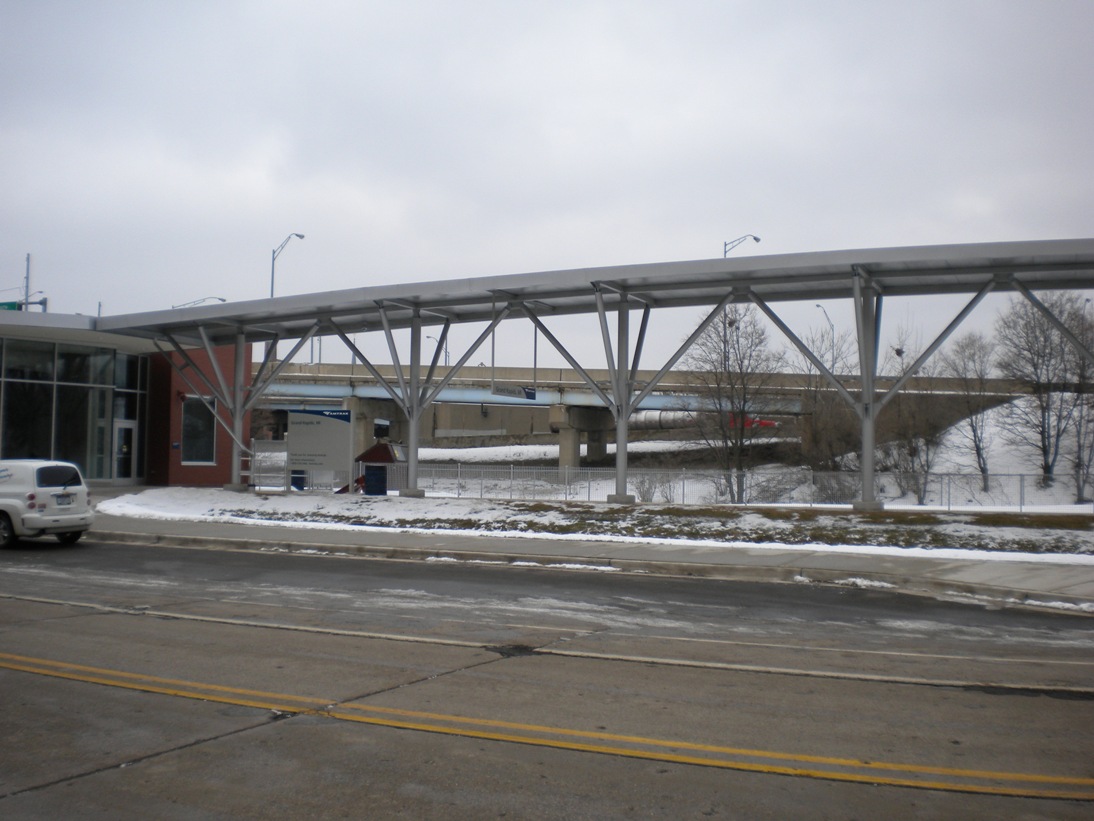
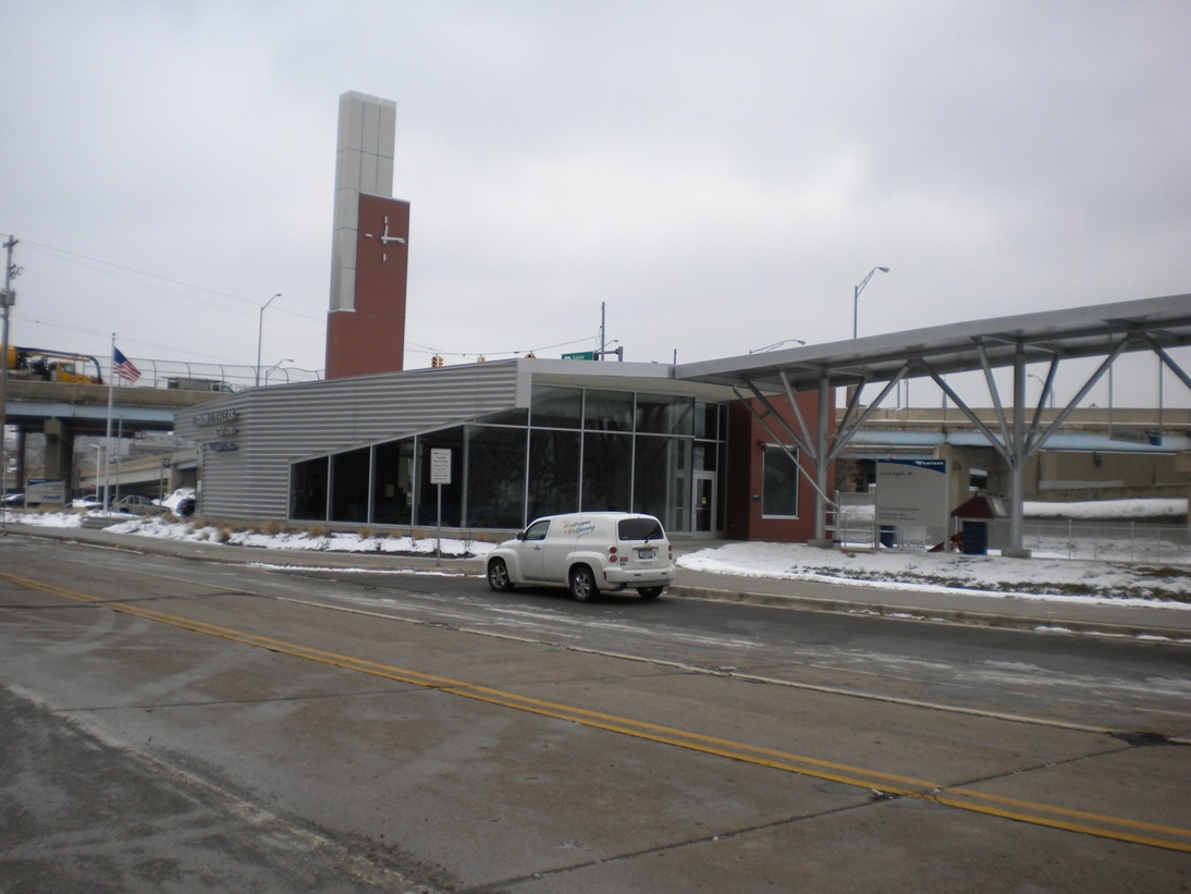
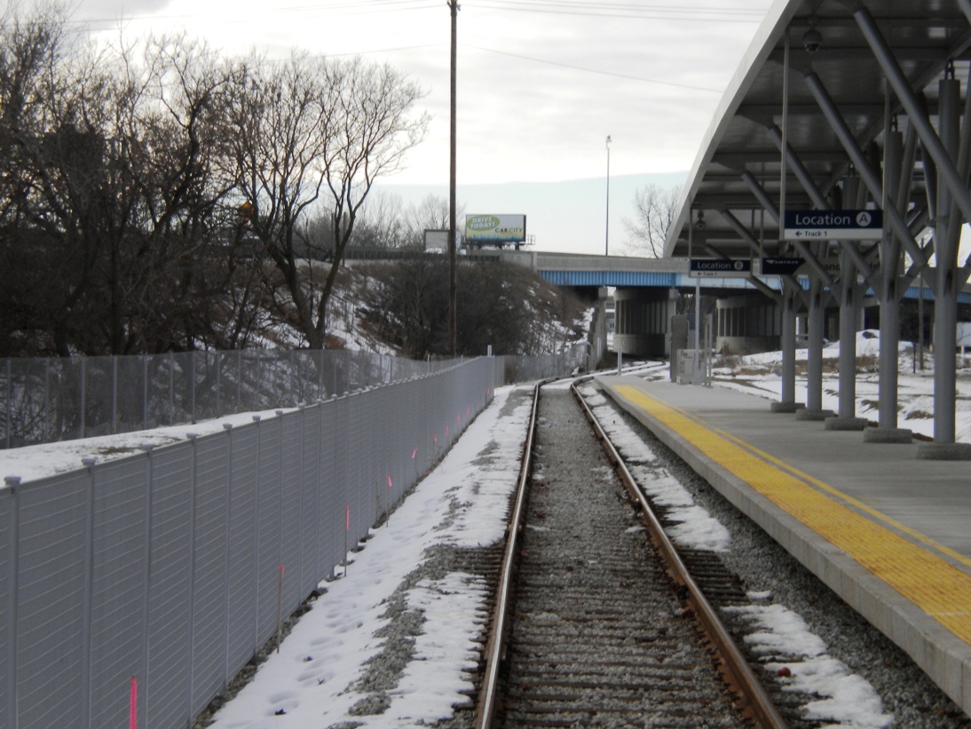
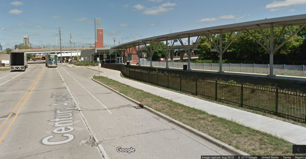
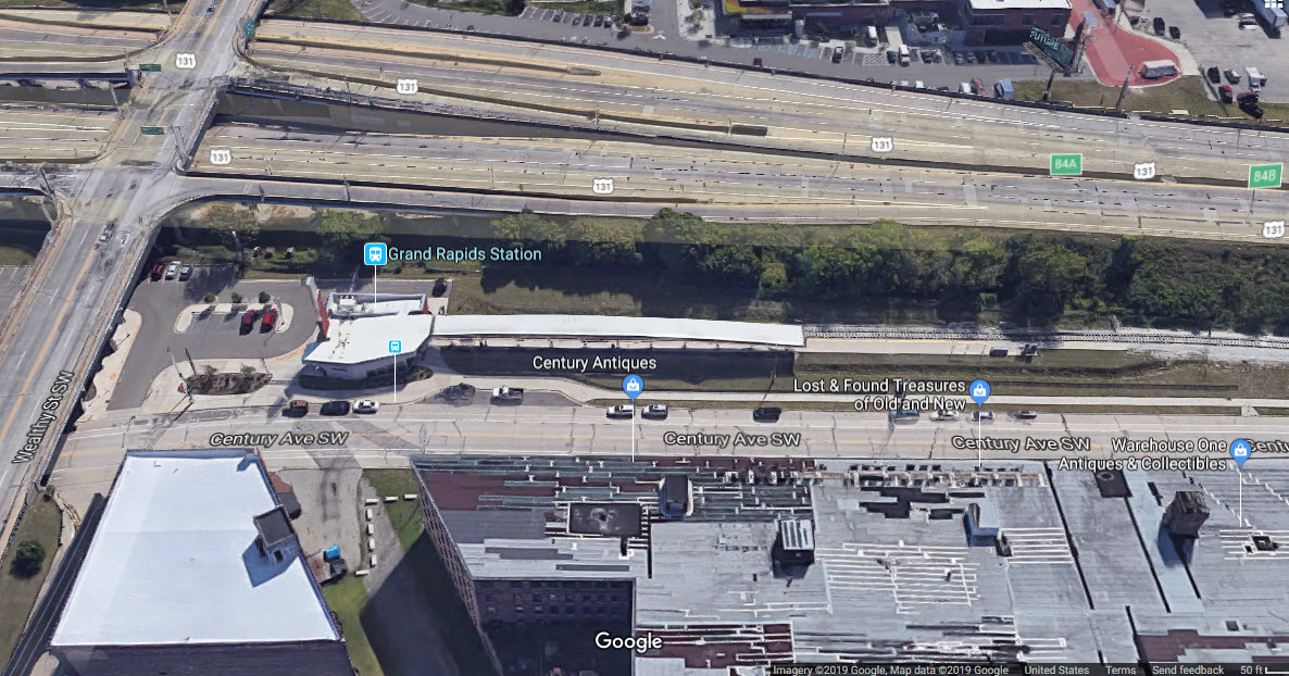
GPS Coordinates: 42.955552, -85.672586
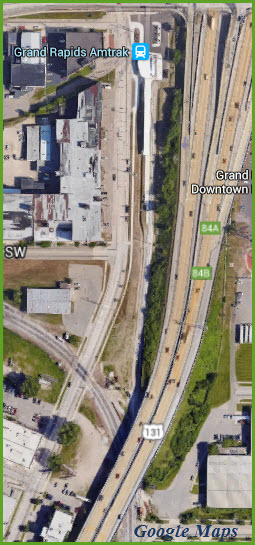
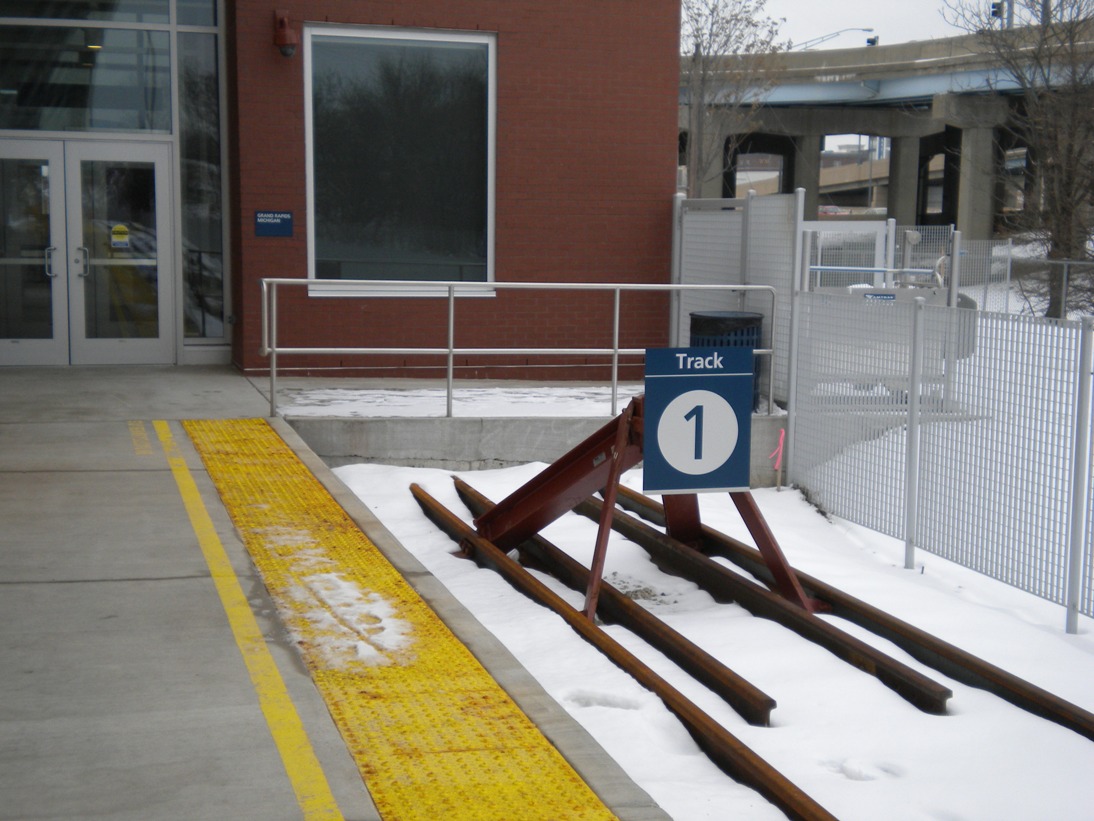
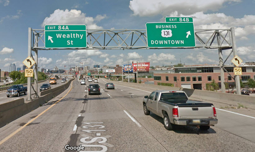
This is Amtrak's new station for Grand Rapids. It opened in October of 2014, and is named the Vernon J. Ehlers Station. It is located at the terminus of the Pere Marquette line that connects Chicago's Union Station with Grand Rapids. It is located on Century Avenue under the US131/ Wealthy St overpass, immediately south of the Rapid's Central Bus Station.
Photos of the new station are by Denver Todd.


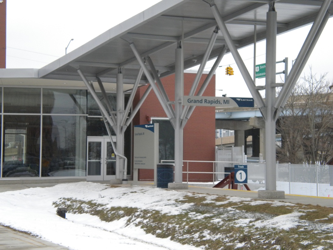
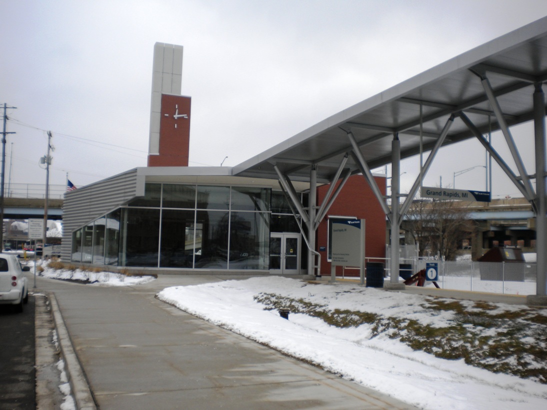
Getting here:
Take the Wealthy Ave exit from US131, make sure you stay to the left if you are heading north on 131.
Take a left onto Grandville Ave, then a left onto Logan St, and finally a left onto Century Ave SW.
Signals
If anyone lives in or around Grand Rapids, I could really use a few pictures of
the signals on my map, and any others you come across.... many thanks
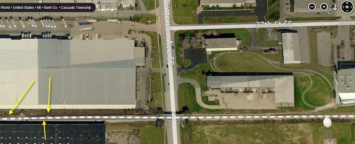
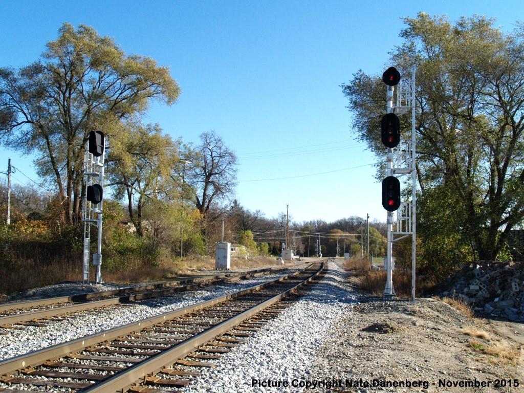
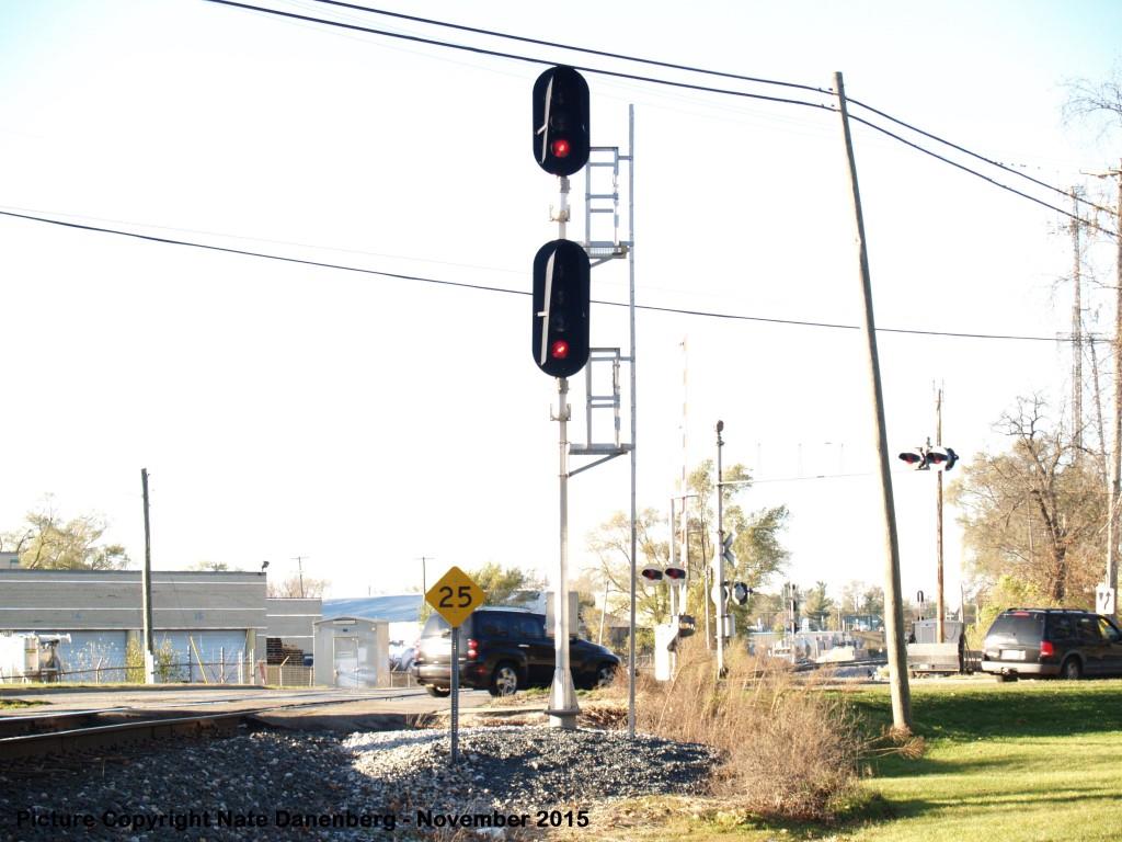
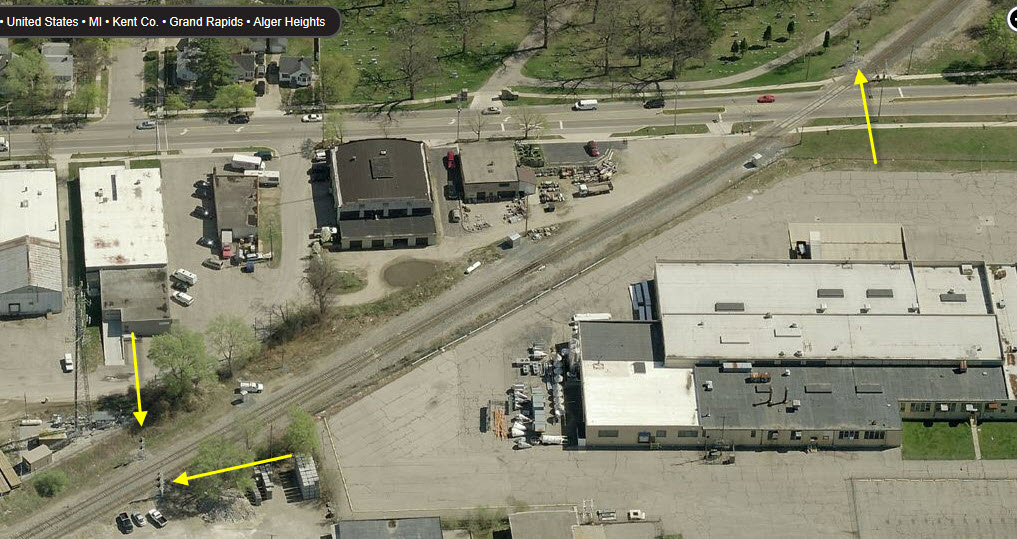
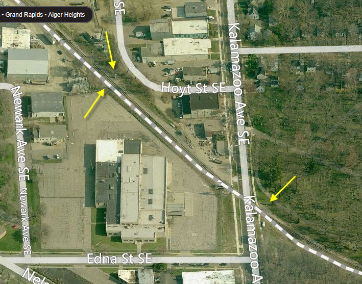
The tracks coming into Grand Rapids from the east are double-tracked. This is where they go down to one for it's ride west to Kalamazoo Ave SE.
All of the aerial views are from Bing Maps.
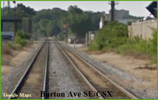
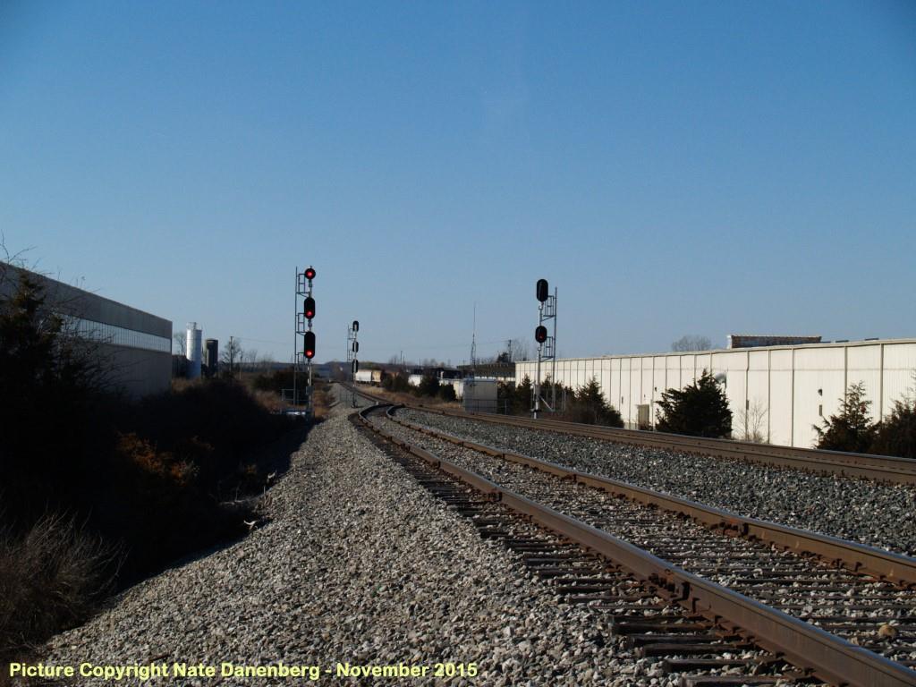 Picture courtesy Nate Danenberg
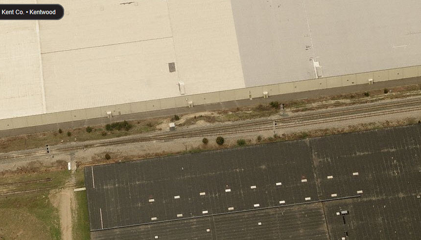
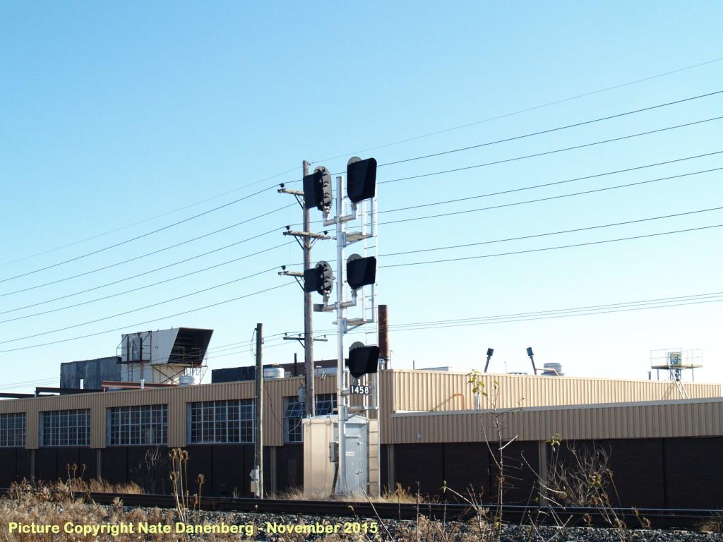 Picture courtesy Nate Danenberg.
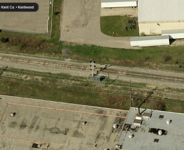
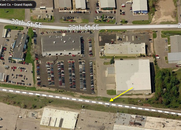
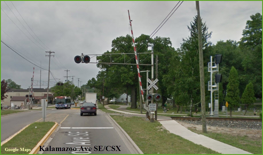
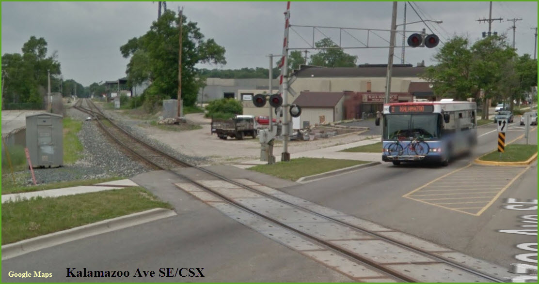
These signals are at the western end of the single track stretch starting at Patterson Ave SE, and for the interlocking of going from a single track to double track. The picture at the bottom of this set comes from zooming in on Google Streetview - good thing they have used higher resolution cameras! The two newest and clear pictures are courtesy Nate Danenberg. Thanks!
 CSX Bridge Over Patterson Ave SE
Already Seen Above, But What the Heck? :-)
 CSX Bridge Over 28th St SE
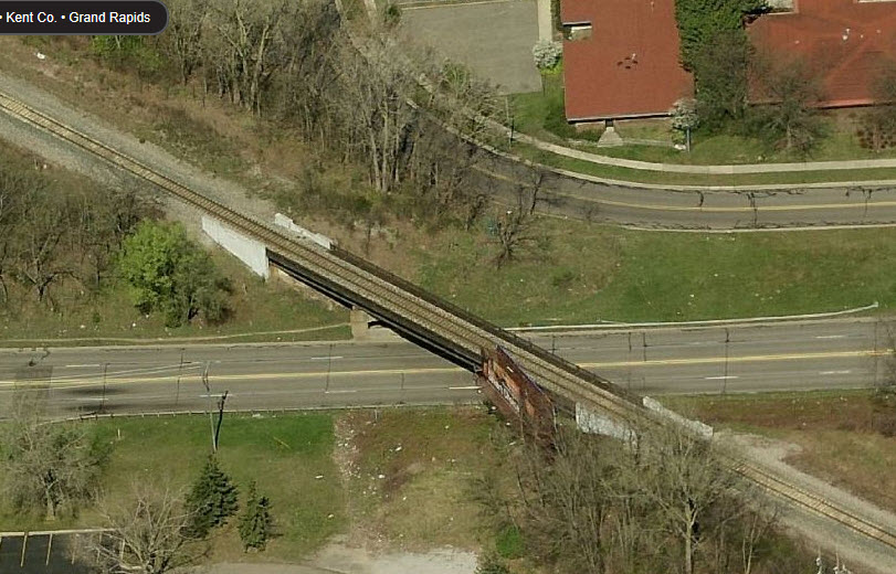
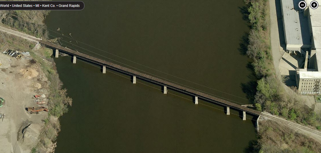
 CSX Bridge Over the Grand River
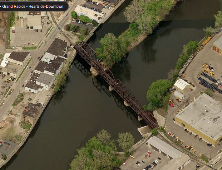
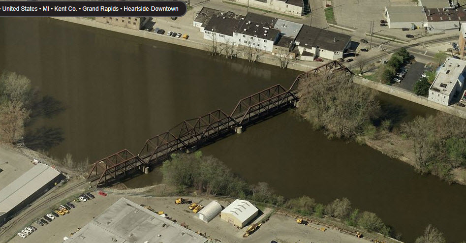
 GR&E Bridge Over the Grand River
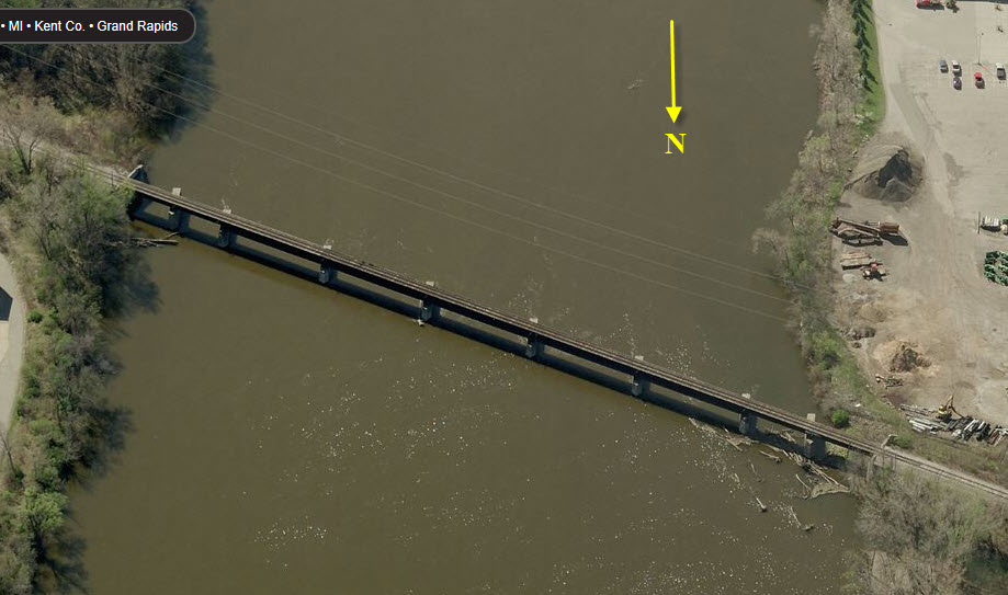
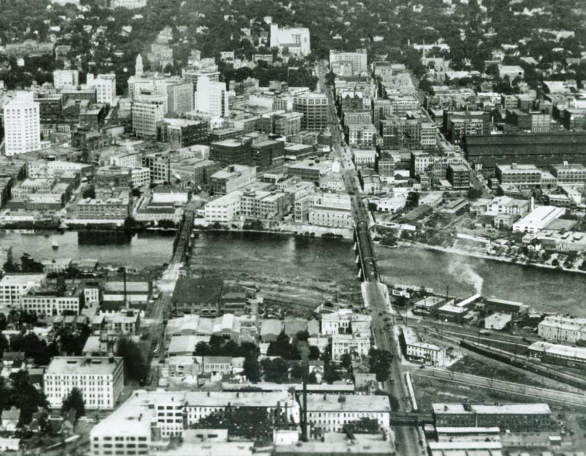
Courtesy of the University of Texas Library, click here for their index page. This is a screen capture using Snagit of their 1912 Grand Rapids quadrangle.
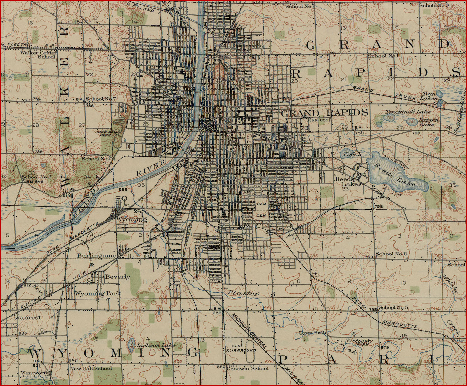
Download so you can see the detail better!


Disclaimers:
New format 10/26/23: Please check out my disclaimer page for my standard dribble and contact info here
RAILFAN GUIDES HOME
RAILROAD SIGNALS HOME
Last Modified 15-Mar-2026