
In General
Getting Here
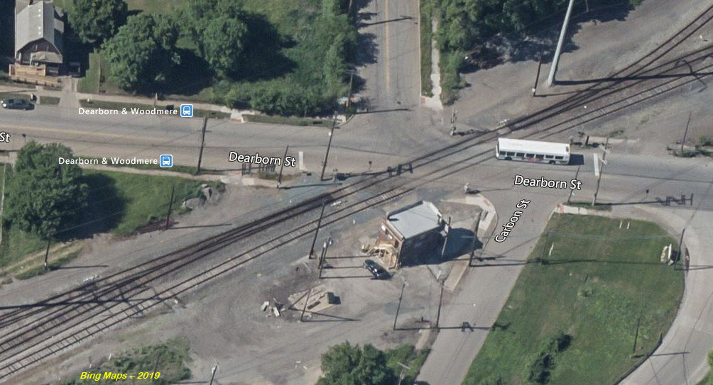
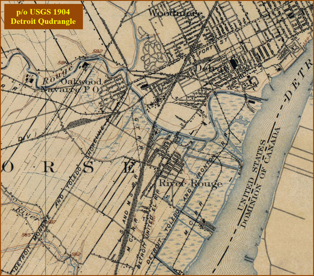
Map
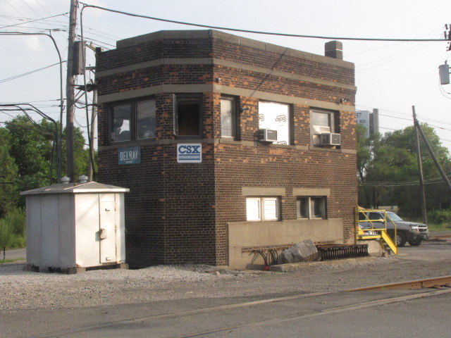
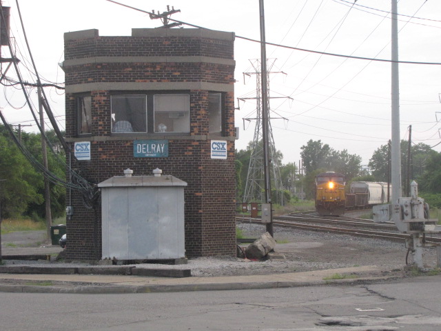
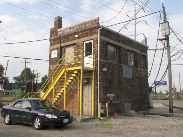
The Tower
Train Pictures
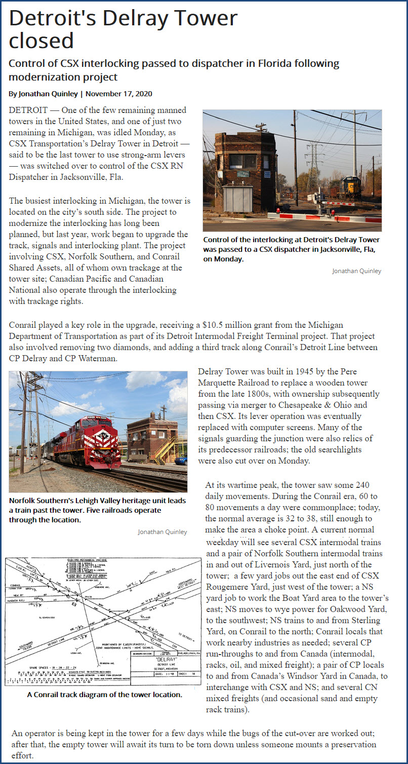
The Closing of Delray
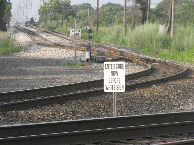
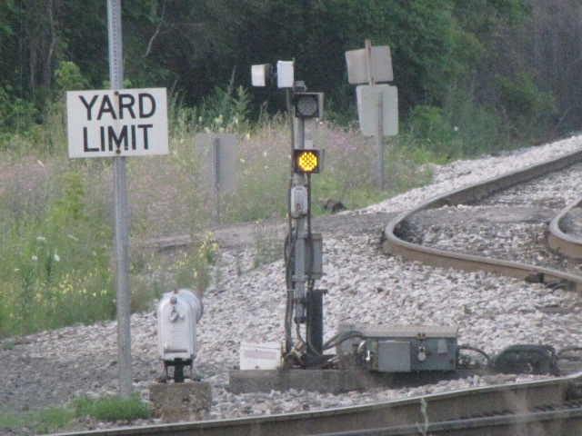
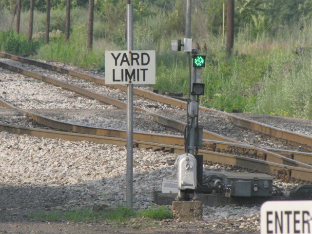
Signals
Floobydust
USGS Maps
RAILFAN GUIDES HOME
RAILROAD SIGNALS HOME
Location / Name:
Detroit MI, Wayne County
What's Here:
Delray Tower
Data:
GPS Coordinates: 42.29296, -83.12976
Phone A/C: 313
ZIP: 48209
Access by train/transit:
None except for bus
The Scoop:
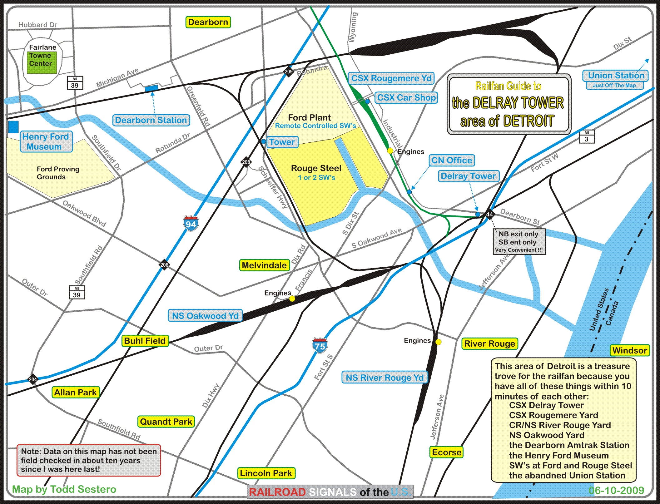
Detroit has so much cool stuff for the railfan to see. In this area alone, all within 10 minutes or so of each other, are a multitude of yards, two stations, two towers, the Ford Museum, the Ford plant, Rouge Steel... phew, I get tired just thinking about it all!
Delray Tower is a fun place to go, even tho the tower is now closed :-( The tower ops were usually nice, with the exception for a woman I ran into on one occasion (to young and not enough male hormones to understand "us"). Contrast this to going to Plymouth Diamond on the other side of town - and they're both CSX!
Delray Tower was built in 1945 by the Pere Marquette, and was the last staffed tower in Detroit. The current tower replaced a wooden structure built around 1891. You can find more info on the pages below.
Unfortunately for "us", as of Monday, November 16th, 2020, operation of Delray was handed over to the CSX Operations Center in Jacksonville FL. An operator will be at the tower for a while to make sure things are working properly. More info below.
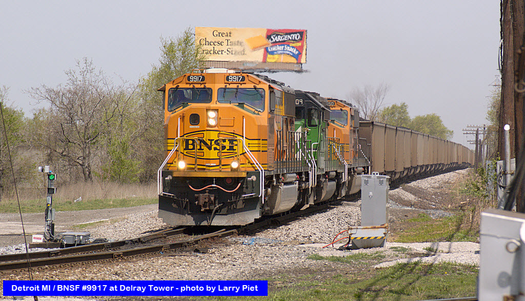
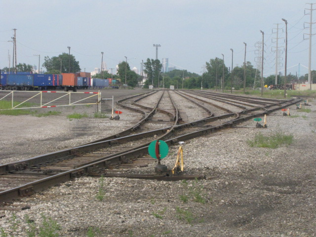
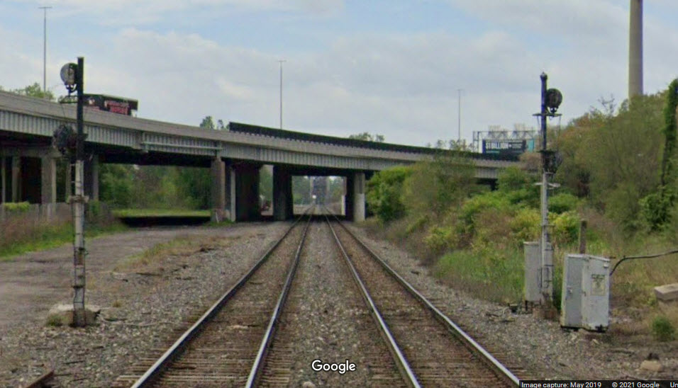
Here you can see almost anything. In two hours on Friday, 7/24/2009, my buddy and I saw a CN freight, 2 CSX freights, an NS freight, and a CSX freight headed up with two UP engines, in addition to a CSX cop for the first time in all of my visits......
Acknowledgements:
Mark Hinsdale
Alex Bogert
Larry Piet / http://lapiet.info/images/photos02/photos02.html
Denver Todd
Google Maps
Bing Maps
Websites and other additional information sources of interest for the area:
http://www.michiganrailroads.com/RRHX/Stations/CountyStations/WayneStations/DetroitTerminal/DelrayMI.htm
http://www.knorek.com/RR/SAA/TwrJct/Delray.htm
http://www.rrsignalpix.com/delraytower.html
http://towns-and-nature.blogspot.com/2017/07/detroit-mi-delray-tower-pmwabash-vs-nyc.html
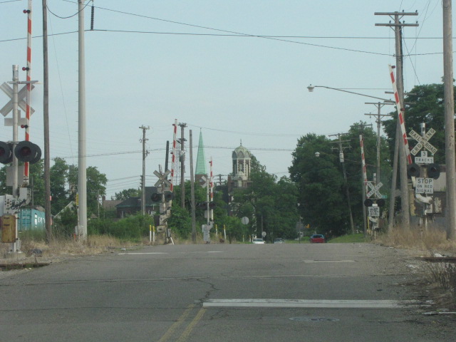
The tower is very conveniently located at I-75 exit 44, Dearborn Ave. The only problem is that the exit is only for northbounders. The entrance back onto I-75, conversely, only let's you go SB.
If you're coming up from "the south" on I-75, exit 44 is makes it SOOOO simple - because at the bottom of the exit ramp, Delray Tower is a few feet from you to the left!!!
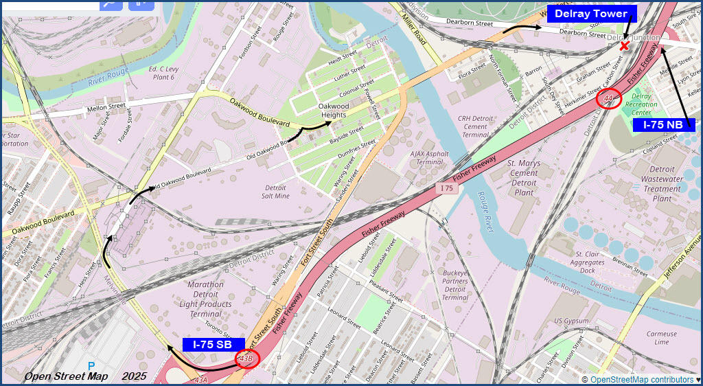
Southbounders can get off I-75 at exit 43 onto Schaefer Road, and then take a right onto South Dix Street After going only about 800ft, take another right onto Oakwood Blvd. This will take you to Dearborn Ave after crossing the River Rouge, where you take yet another right. This will place you at Delray tower in about 1500ft, a good place to start your railfanning of Detroit!
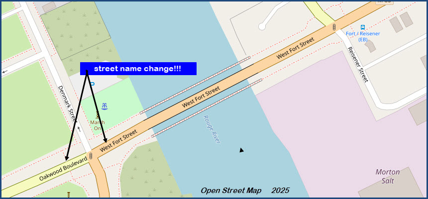
Oakwood Blvd turns into Fort St just before crossing the Rouge River, and going in the other direction, Fort St will bear off to your left after crossing the river.
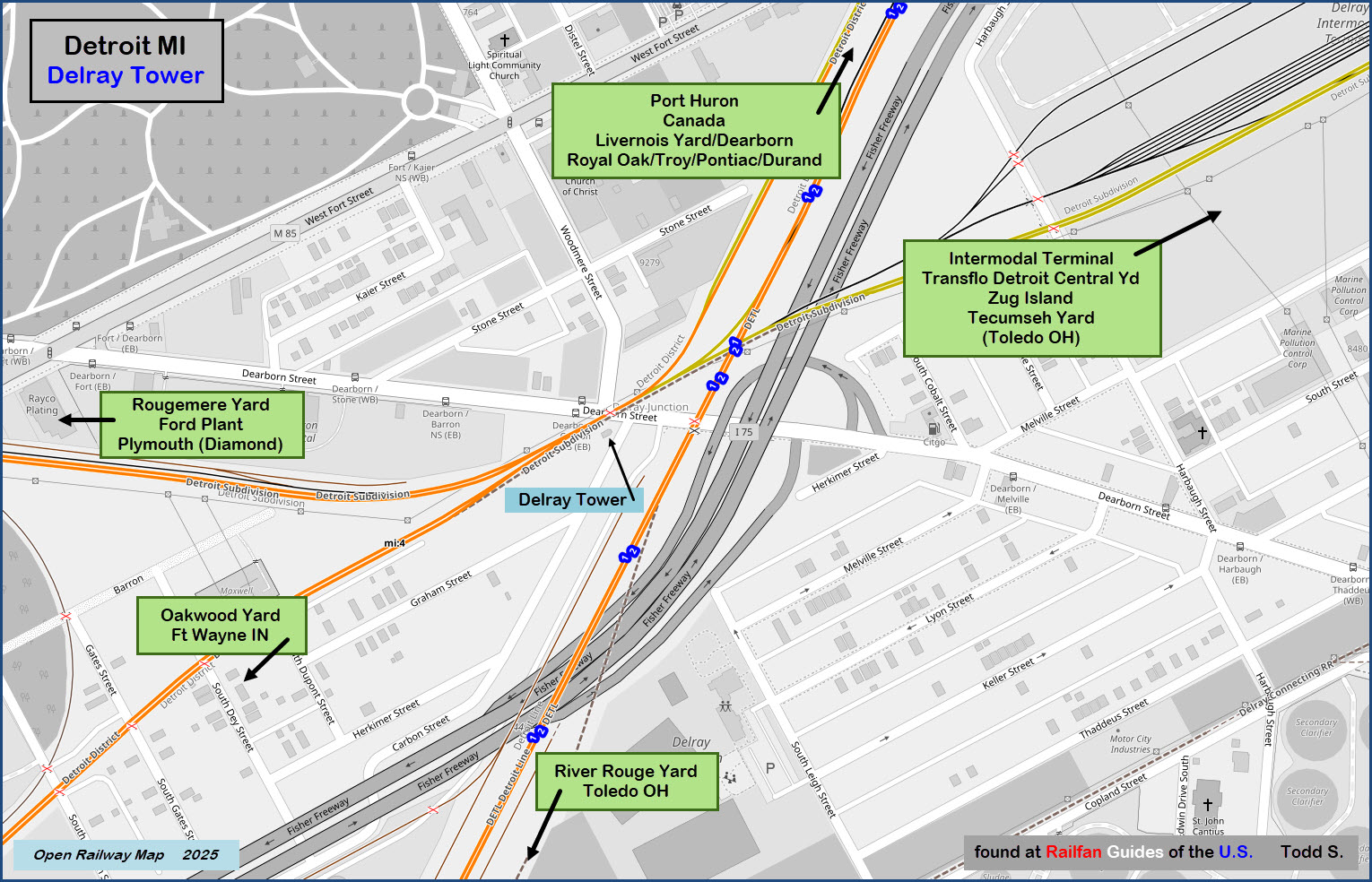
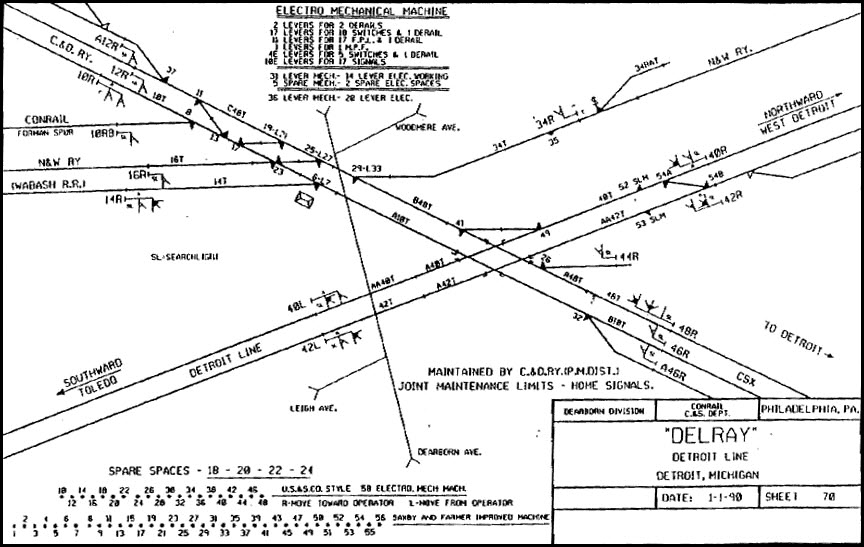
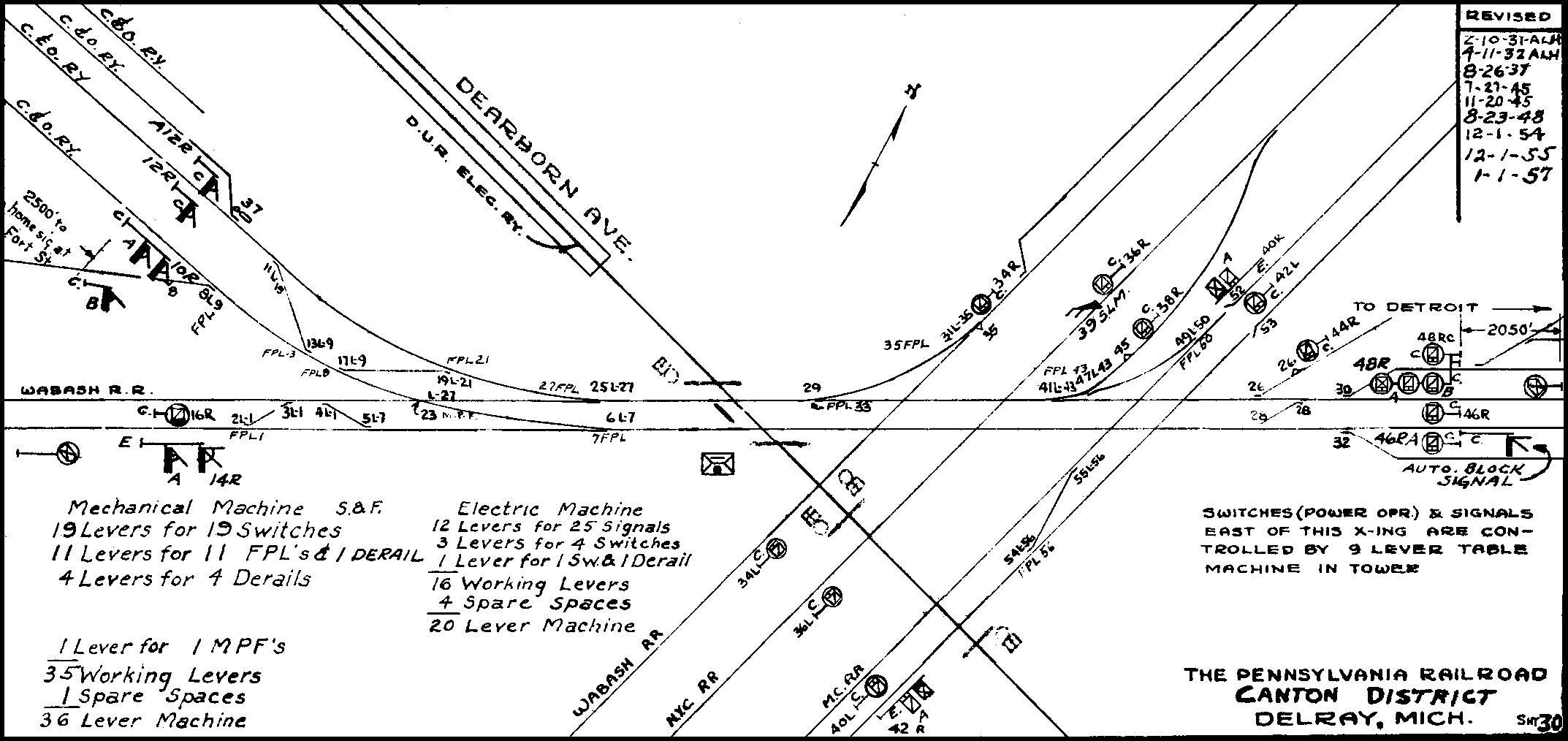
Maps for Delray seem to be in abundance on the internet, a few of what I have come across are shown below in addition to my own map of the area.
the above map in PDF format is available
here
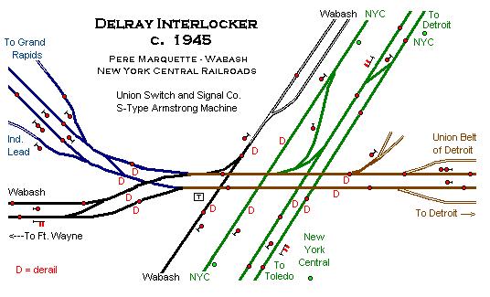
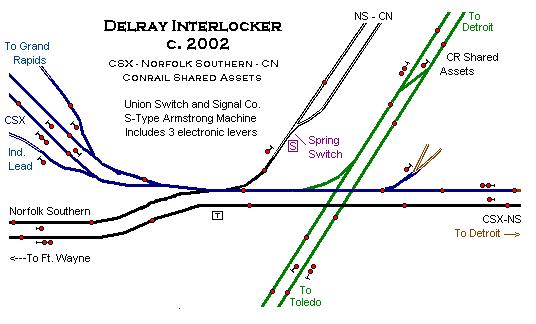
The above two drawings are by drawn by Dale Berry with info provided by Nathan Neitering
Delray Tower
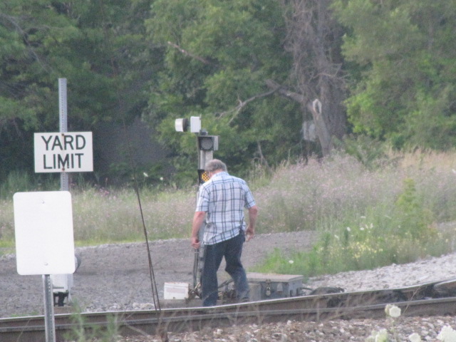
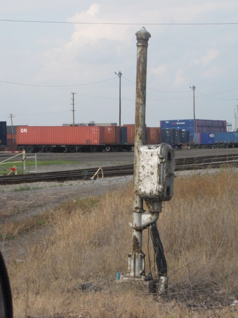
Here are some shots of the tower itself, including where all of the wires come in and out of the tower, and where the armstrong actuating rods used to come out of the building.

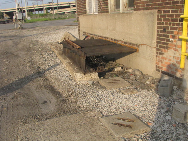
Love to see a picture of the throw rods when they were being used! :-)
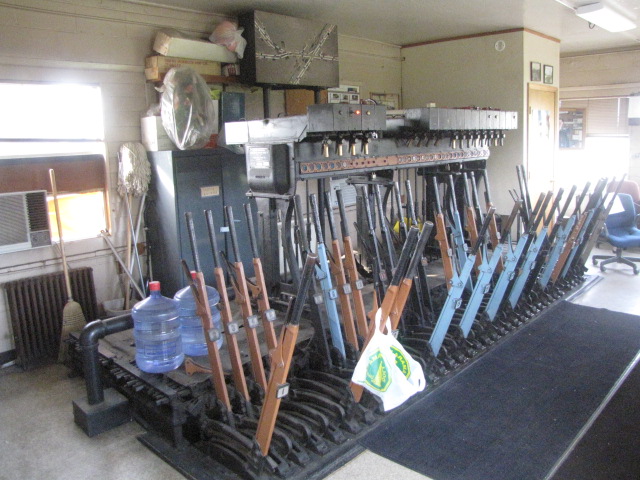 A US&S machine handles the interlocking
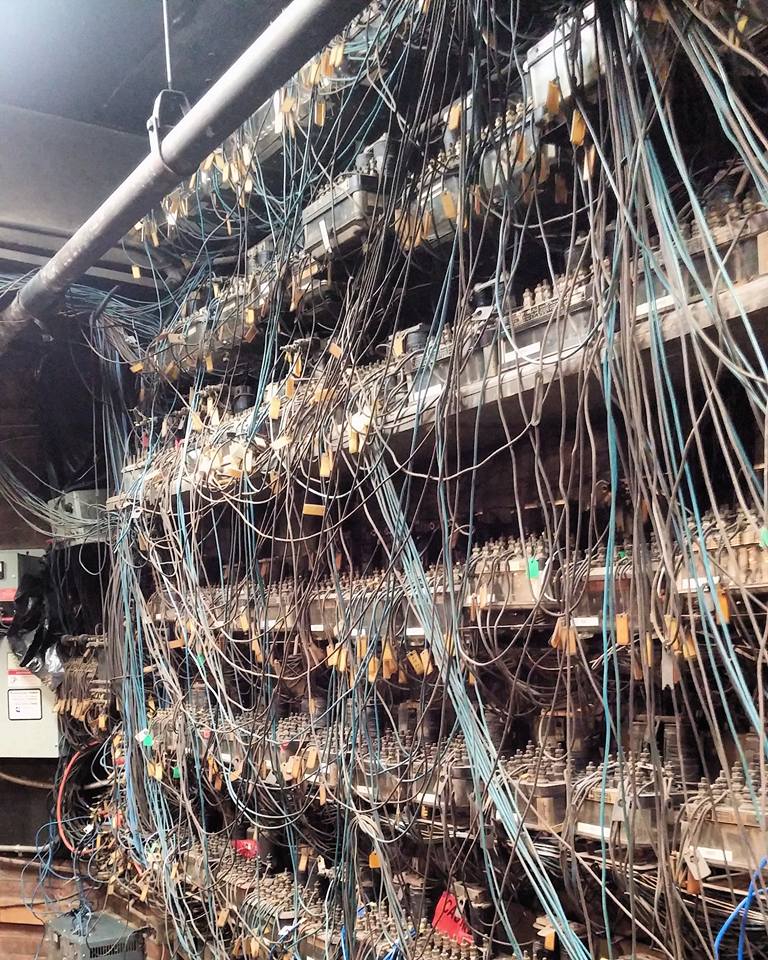 Vital relays on the bottom floor, photo: Alex Bogert
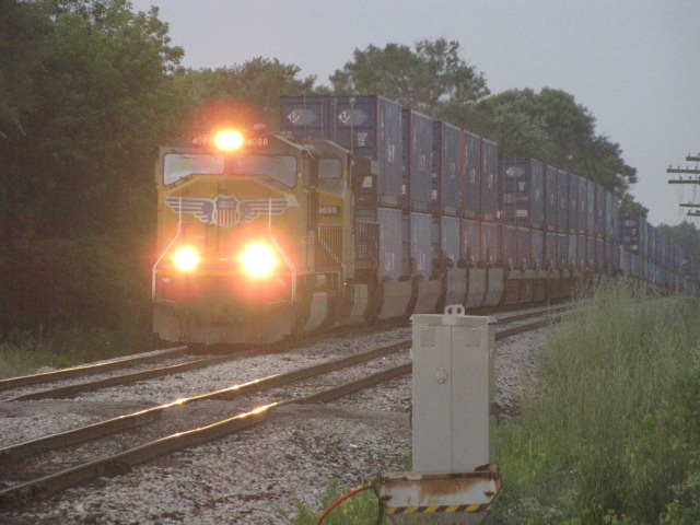 A pair of UP engines head up a CSX freight
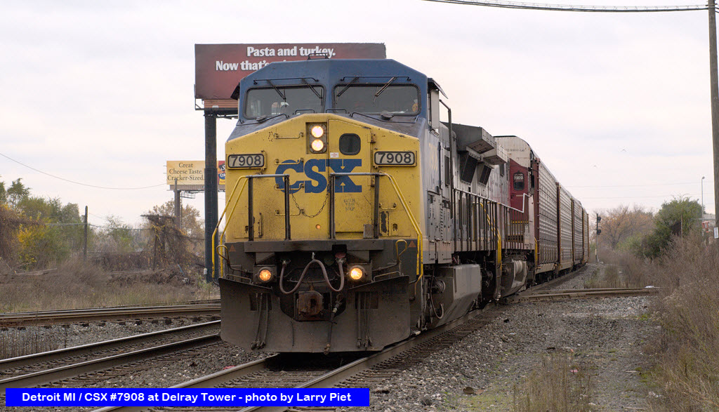
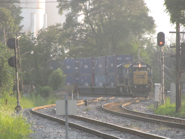 A CSX freight coming from Rougemere yard
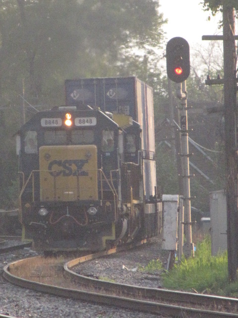
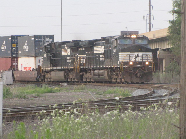 A SB NS freight
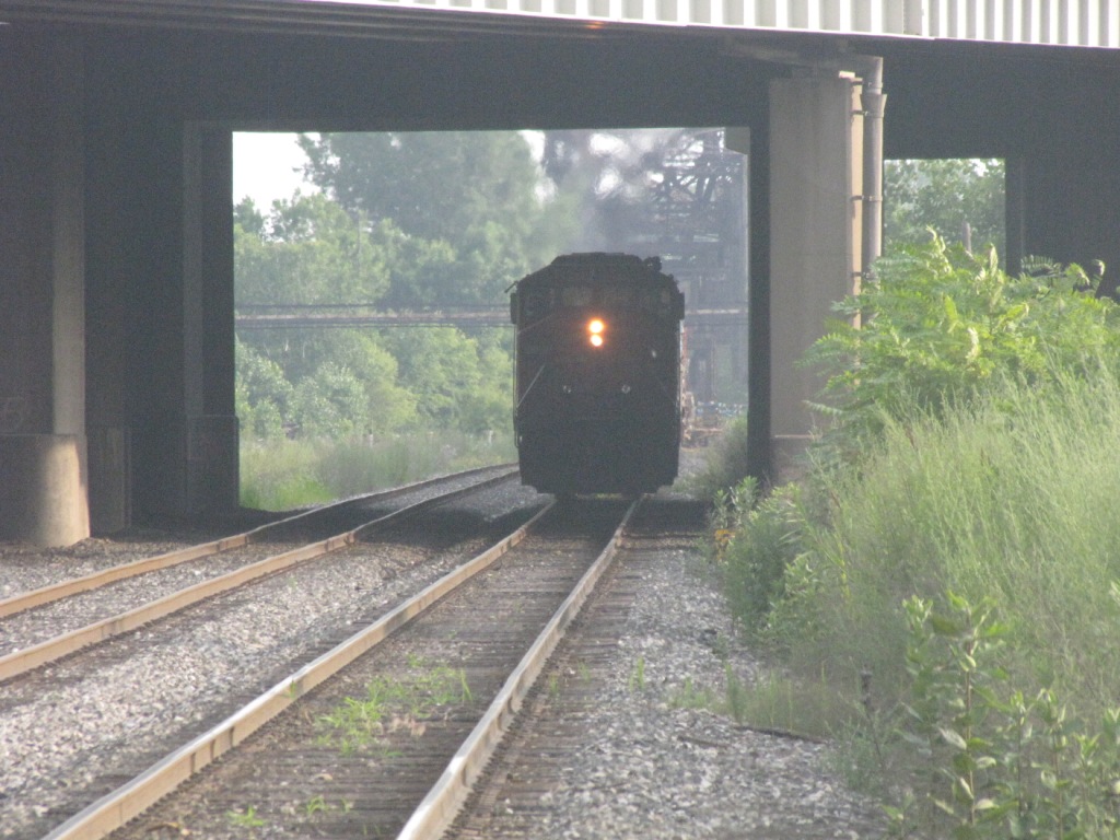 A NB CN freight
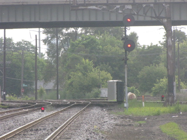
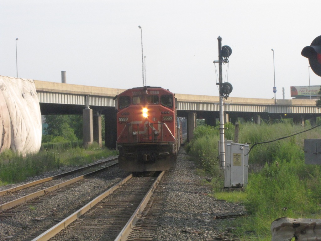 The searchlight signals were replaced in late 2020
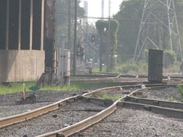
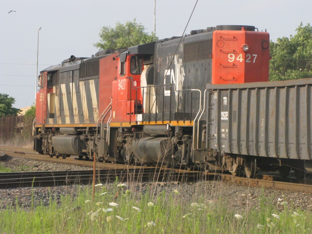 The CN freight crossing the diamonds
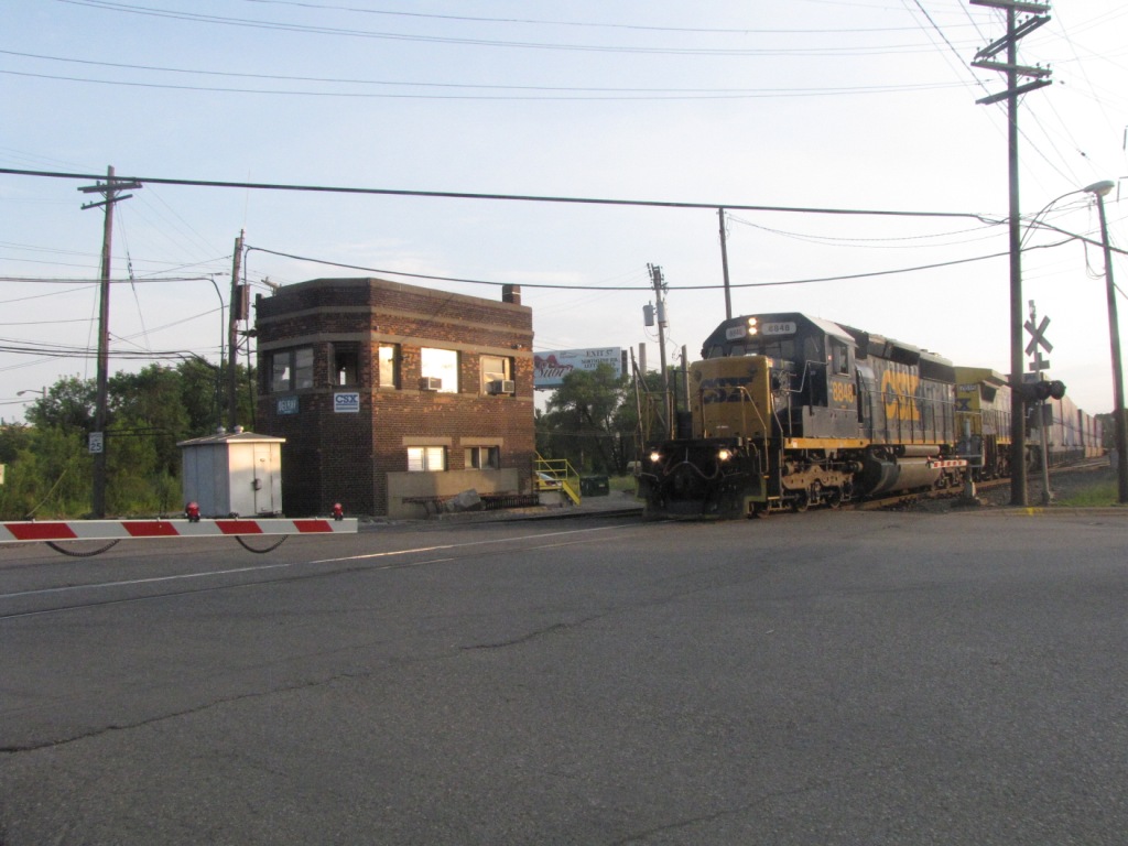 And another CSX freight out of Rougemere
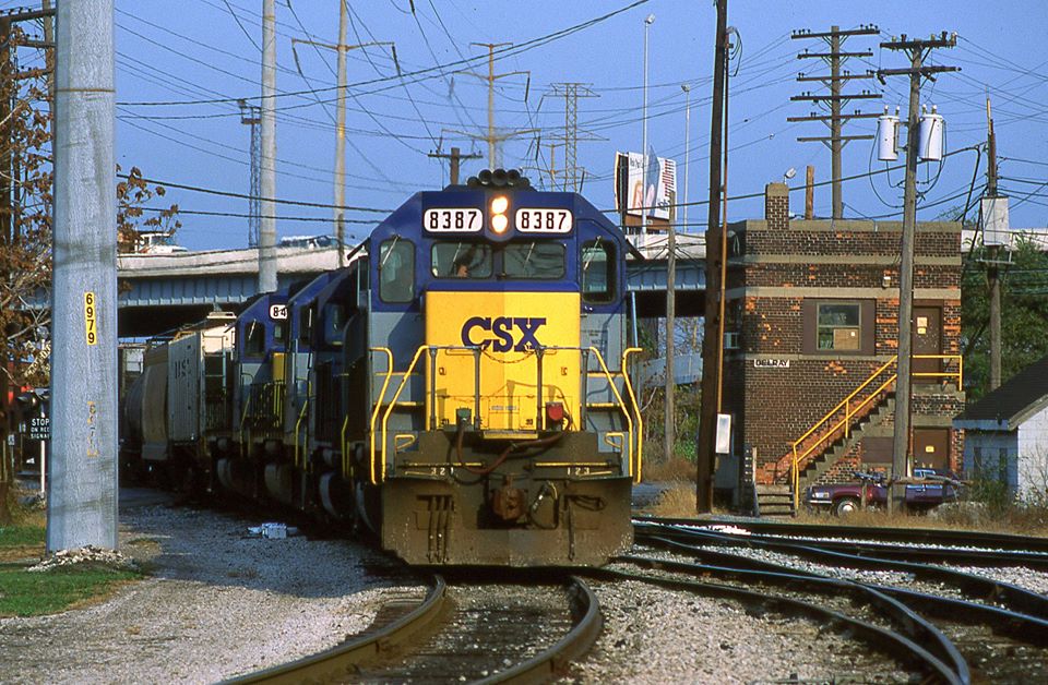 11/1991, photo by Mark Hinsdale
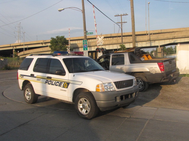
Busted for parking on the shoulder which is owned by CSX! At least he was nice and let us off. IT PAYS TO BE NICE... HELLOOOO!
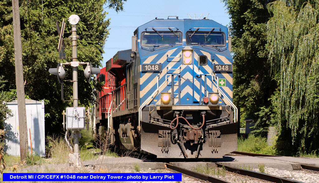
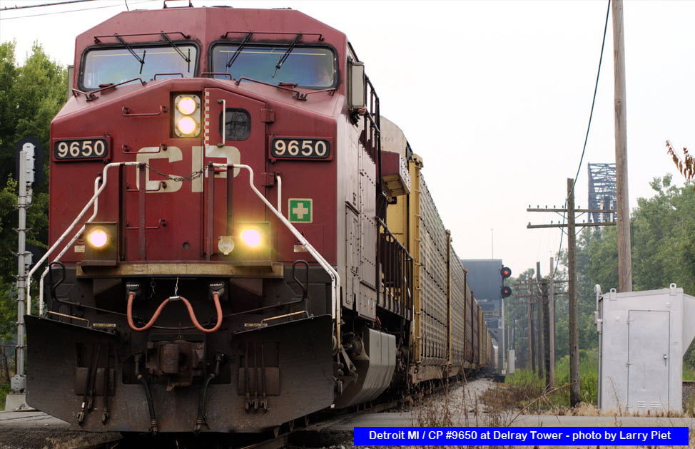
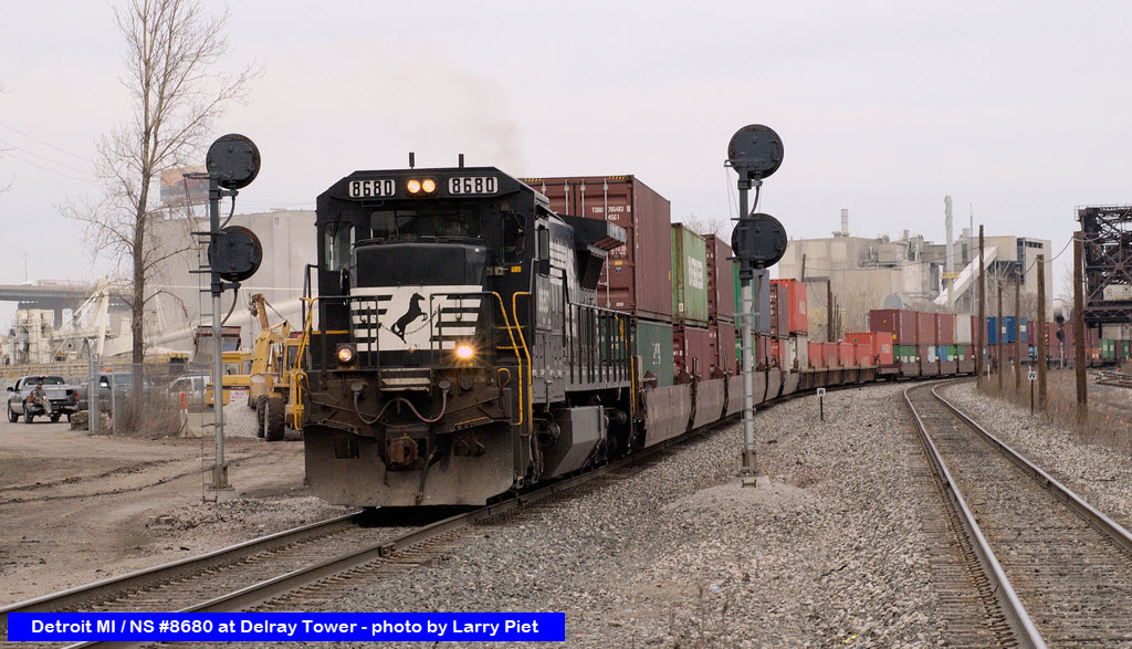
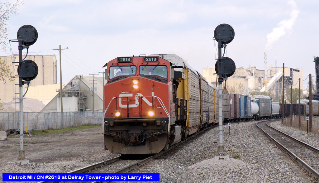
Pictures from Larry Piet.....
A different little simple green/yellow LED signal for the NB CSX tracks, and the turnout is manually switched by the tower op. The picture of the green aspect just goes to show you that the reliability of LED signal elements has a long way to go to justify their extra expense, as there is one string of LED's out within the "bulb".
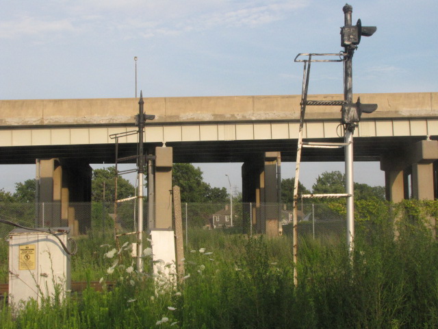
These shots are from "on the other side" of i75 (except for the far right photo), a more seedy part of town than where the tower is, if that's possible - the two on the bottom are looking back under the interstate towards the tower. The cantilever bridge doesn't have a signal on it, probably got replaced by the searchlight signal underneath it.
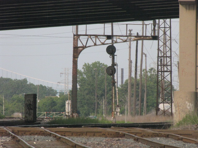
A pair of GRS searchlight installations guarding the NB NS tracks going to the diamond, and are directly across from the tower.
 2009
2009
None for now.
Courtesy of the University of Texas Library, click here for their index page.
Disclaimers:
I love trains, and I love signals. I am not an expert. My webpages reflect what I find on the topic of the page. This is something I have fun with while trying to help others.
Please Note: Since the main focus of my two websites is railroad signals, the railfan guides are oriented towards the signal fan being able to locate them. For those of you into the modeling aspect of our hobby, my indexa page has a list of almost everything railroad oriented I can think of to provide you with at least a few pictures to help you detail your pike.
If this is a railfan page, every effort has been made to make sure that the information contained on this map and in this railfan guide is correct. Once in a while, an error may creep in :-)
My philosophy: Pictures and maps are worth a thousand words, especially for railfanning. Text descriptions only get you so far, especially if you get lost or disoriented. Take along good maps.... a GPS is OK to get somewhere, but maps are still better if you get lost! I belong to AAA, which allows you to get local maps for free when you visit the local branches. ADC puts out a nice series of county maps for the Washington DC area, but their state maps do not have the railroads on them. If you can find em, I like the National Geographic map book of the U.S..... good, clear, and concise graphics, and they do a really good job of showing you where tourist type attractions are, although they too lack the railroads. Other notes about specific areas will show up on that page if known.
Aerial shots were taken from either Google or Bing Maps as noted. Screen captures are made with Snagit, a Techsmith product... a great tool if you have never used it!
By the way, floobydust is a term I picked up 30-40 years ago from a National Semiconductor data book, and means miscellaneous and/or other stuff.
Pictures and additional information is always needed if anyone feels inclined to take 'em, send 'em, and share 'em, or if you have something to add or correct.... credit is always given! Please be NICE!!! Contact info is here
Beware: If used as a source, ANYTHING from Wikipedia must be treated as being possibly being inaccurate, wrong, or not true.
DETROIT RAILFAN GUIDE HOME
RAILFAN GUIDES HOME
RAILROAD SIGNALS HOME
NEW 06/10/2009, AUG24/2020, FEB25/2021, DEC02/2025
Last Modified 02-Dec-2025