
In General
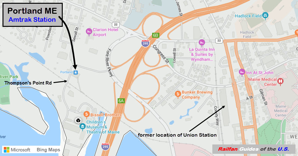
Getting Here
Map
Sights
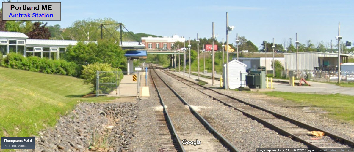
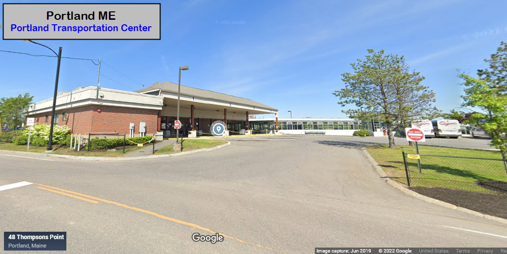
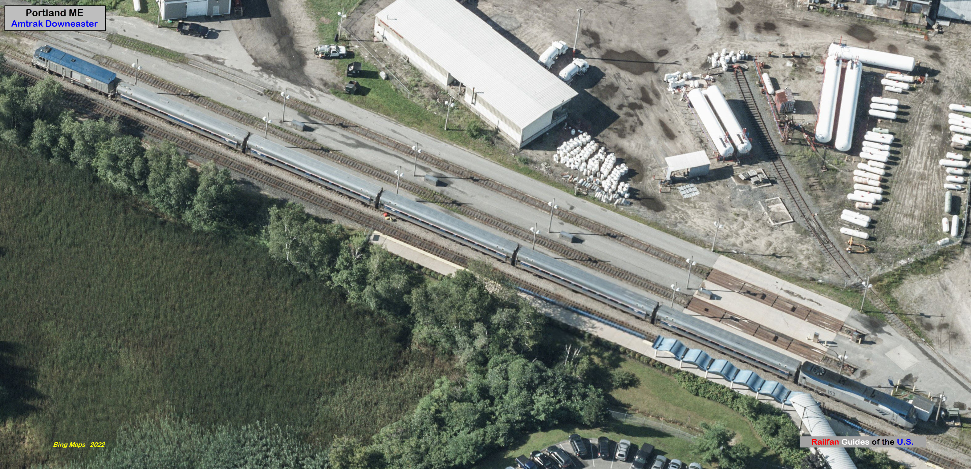
Amtrak Station
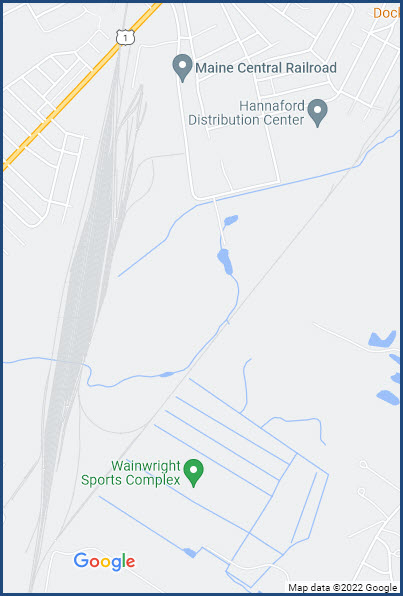
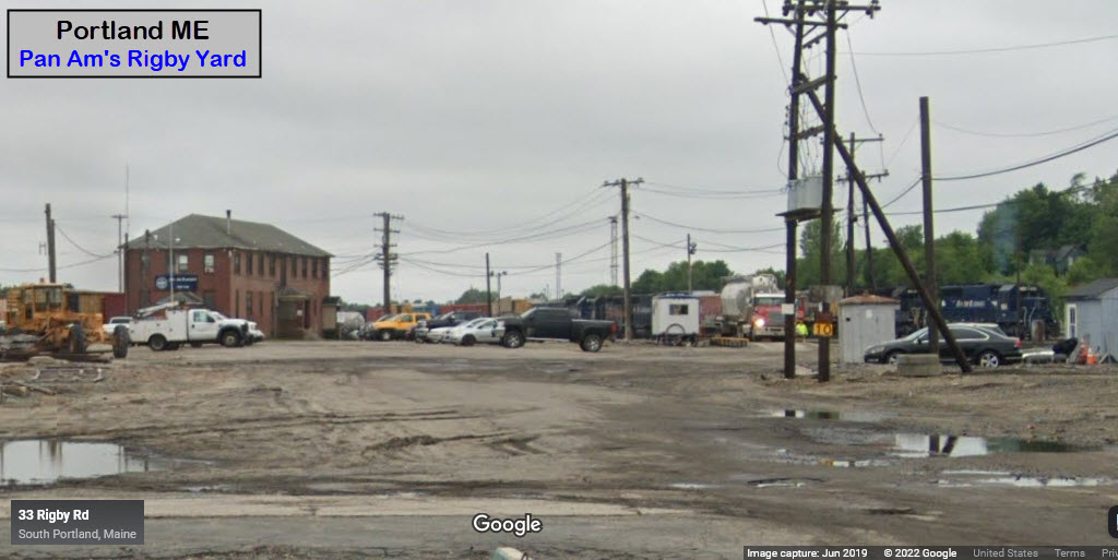
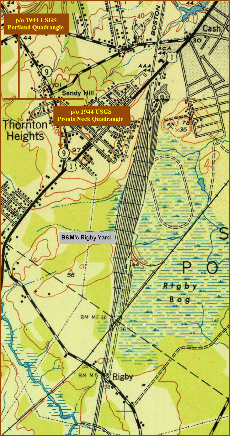
Pan Am's Rigby Yard
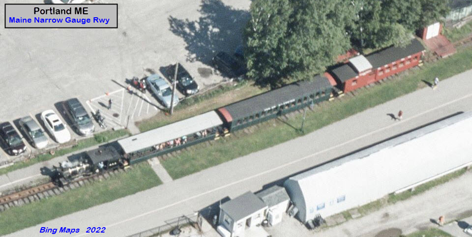
Maine Narrow Gauge RR
Union Station
Pictures
Bridges
Signals
Fire & Police
Postcards
Floobydust
USGS Maps
RAILROAD SIGNALS HOME
Location / Name:
Portland ME, Cumberland County
What's Here:
Amtrak Station
Maine Narrow Gauge RR
Pan Am Rwy's Rigby Yard
Data:
GPS Coordinates: as needed
Phone A/C: 207
ZIP: 04101
Access by train/transit:
Amtrak Downeaster
The Scoop:
The
It appears that "they" are looking at relocating the train station, according to the article below.
Other Related Railfanning:
If you're interesting in coming this far north, and are looking for some Canadian action, the closest place - I - can find something is about three hours north of Portland via I-95. "Up there", the Canadian Pacific has a line which runs from Montreal to St John, New Brunswick, and cuts across the northern part of Maine. I95 passes OVER the tracks, 1.4 miles north of I95 exit 227. Portland is around the 50 mile marker on I95, so you have a ~175 mile ride from Portland to exit 227. From exit 227, it looks like the best bet would be to head over to Mattawamkeag ME, where the CP has an interchange with the Eastern Maine RR. I don't have any clue when the CP trains run, or how many there are. My guess is probably once a day in both directions... a rough guess. Most of the line is single track, so that is indicative of the traffic density. In Mattawamkeag ME, you have the northern end of the Eastern Maine RR, where it interchanges with the CP. You might find something from them worth taking pictures of.....
Acknowledgements:
Denver Todd
Michael Rosenstein
David Lee
Google Maps
Bing Maps
Open Railway Map
Wikipedia
Websites and other additional information sources of interest for the area:
https://amtrakdowneaster.com/stations/portland
https://www.nnepra.com/project/portland-station-relocation/
https://en.wikipedia.org/wiki/Downeaster_(train)
https://en.wikipedia.org/wiki/Union_Station_(Portland,_Maine)
Getting to G
Map

The above map IS NOT what I expect out of a state agency when compared to most
other states, it looks like a day project for someone who was bad :-) :-)
GPS Coordinates:
Station Code: POR
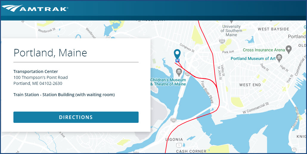
100 Thompson's Point Road, Portland ME 04102
The Downeaster platform is located at the Portland Transportation Center open to passengers from 4:15am to 10:30pm daily with access to the Amtrak self-service ticketing kiosk, visitor information, restrooms, and other passenger services. Amtrak ticket agents are on duty weekdays from 7:30am to 5:00pm daily.
From Wikipedia: The Downeaster follows the route historically used by the Pine Tree and Flying Yankee trains that traveled from Bangor to Boston and were operated jointly by the Boston & Maine Railroad and Maine Central Railroad. Passenger operations between Portland and Boston ceased in 1965. end wiki
Parking: is $5.00 per day and available on a first-come, first-served basis. Parking for Downeaster passengers is available in the lot across the street from the Portland Transportation Center (on the right of Thompson's Point Road).
Bus Service: The Portland Transportation Center is served by two METRO Bus Routes. METRO Bus Route 1 provides service to destinations throughout the city including the waterfront, Arts District, Hadlock Field and the Old Port. The METRO Breez provides daily express bus service between the Portland Transportation Center, Yarmouth, Freeport, and the Brunswick Visitor Center.
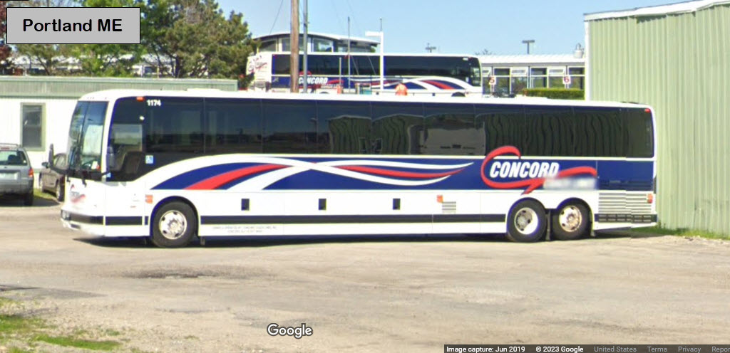
Concord Coach Lines provides service to Auburn, Coastal Maine, Augusta, Bangor, and Orono.
GPS Coordinates: 43.62454, -70.29599 (center)
Former Guilford and Boston & Maine Yard.
Access off Route 1, then Rumery St (across from a Jiffy Lube), to Rigby street (take a right).
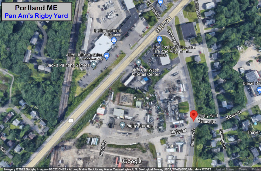
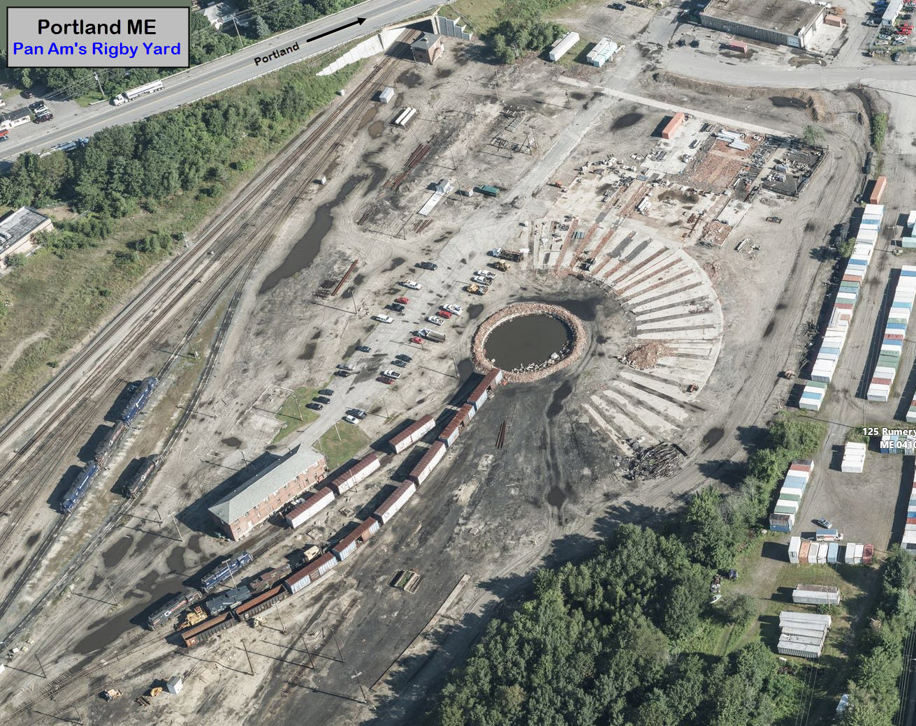
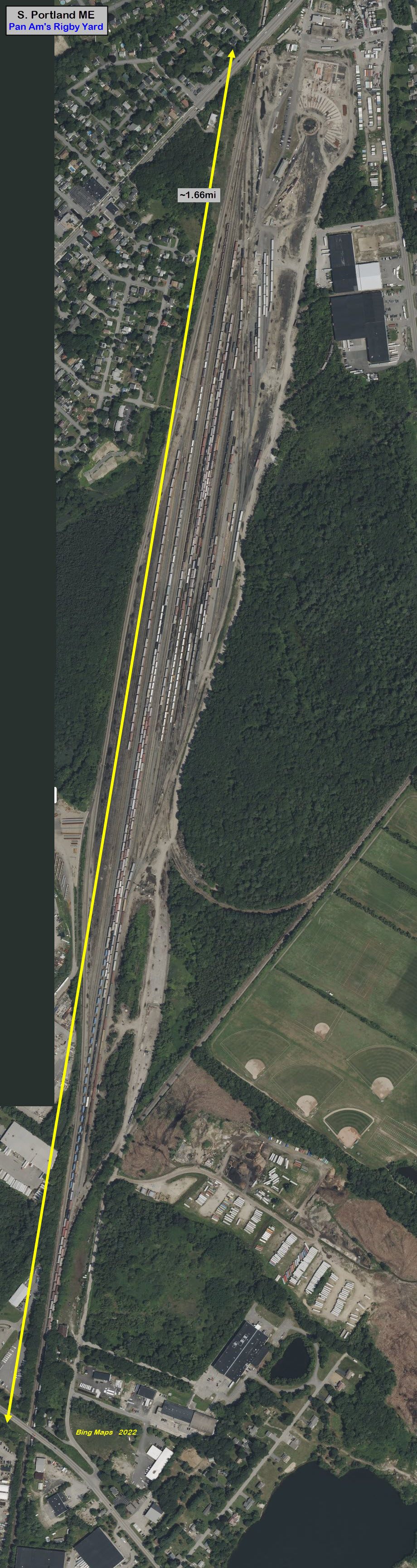
GPS Coordinates: 43.66078, -70.24578
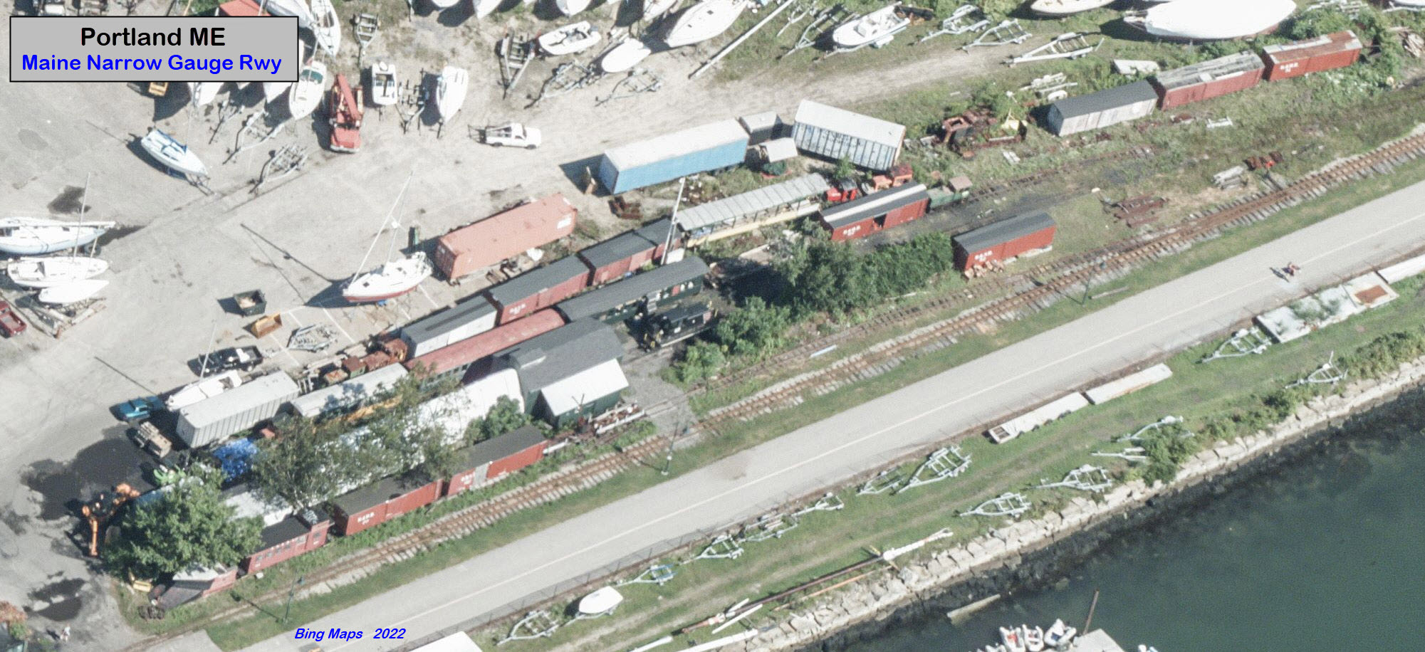
49 Thames St, Portland ME 04101
207-828-0814
https://mainenarrowgauge.org/
https://en.wikipedia.org/wiki/Maine_Narrow_Gauge_Railroad_Museum
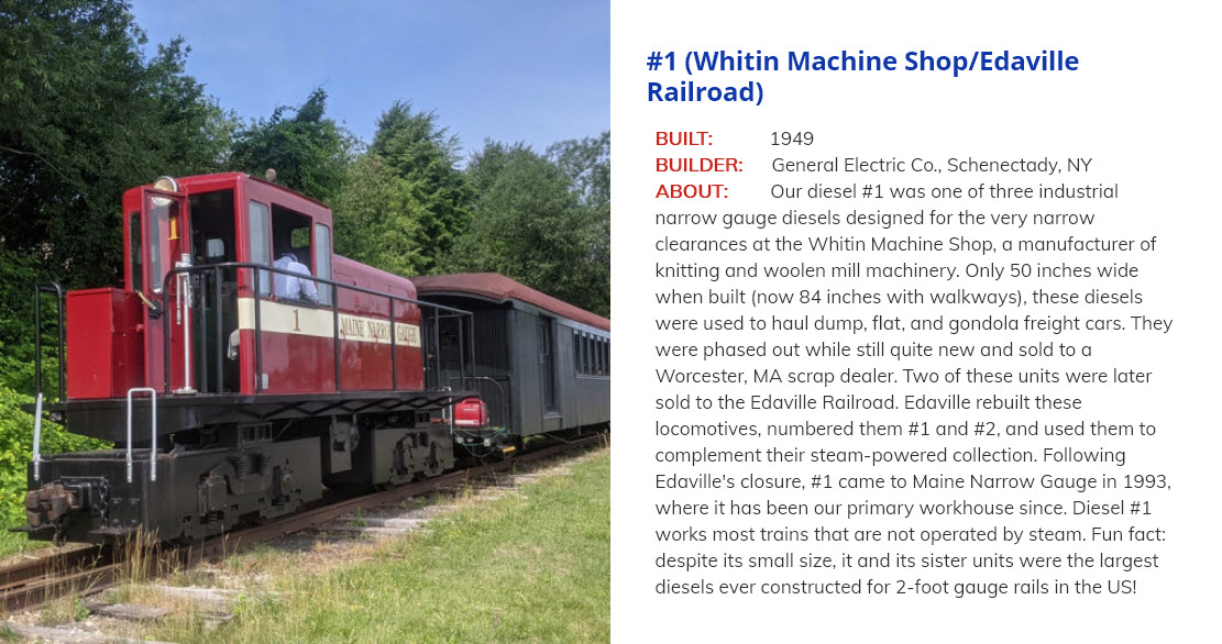
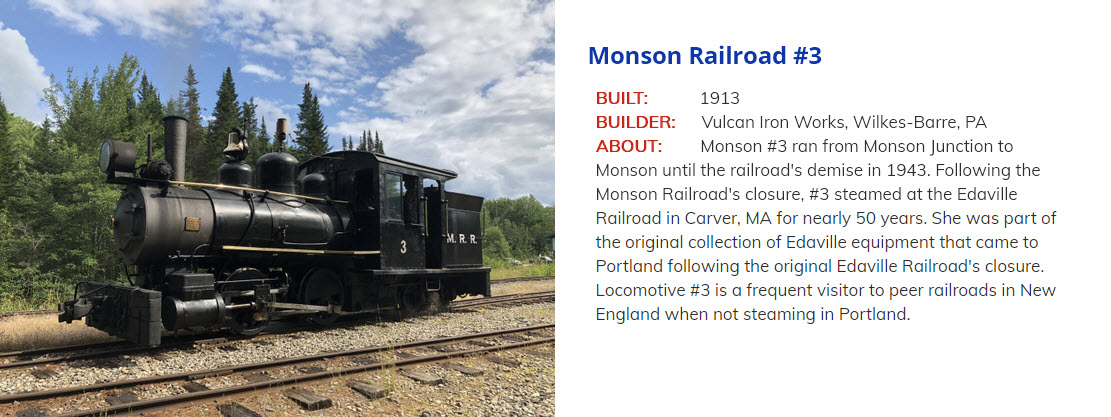
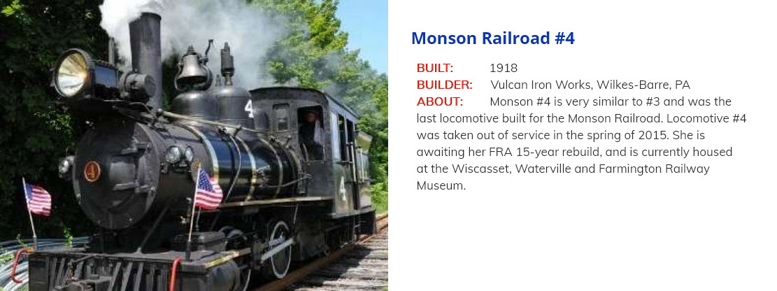
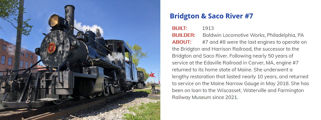
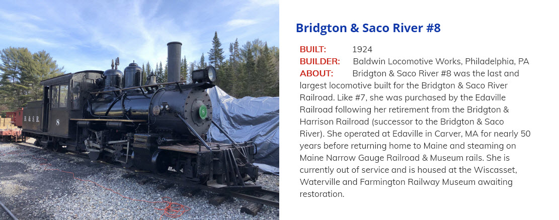
The Maine Narrow Gauge Railroad Co. & Museum is a 2 foot narrow gauge railway located in Portland. It opened in 1993, and is approximately 1.5 miles long (2.4km). The following pictures of their engines come from their website.
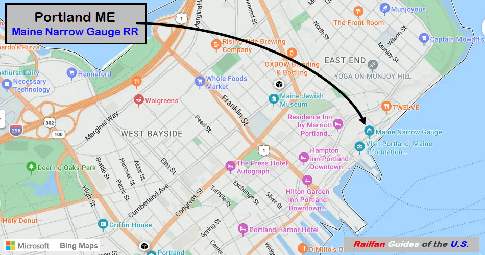
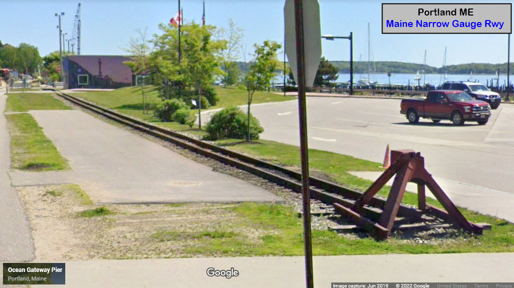
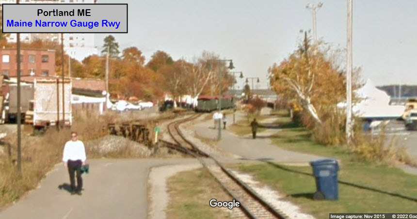

GPS Coordinates: 43.6522, 70.2804
https://en.wikipedia.org/wiki/Union_Station_(Portland,_Maine)
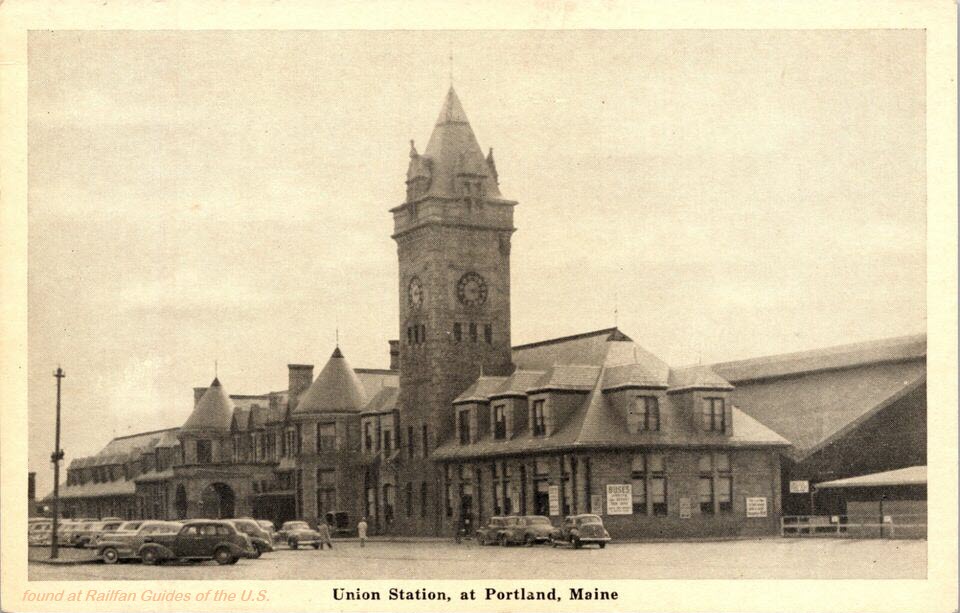
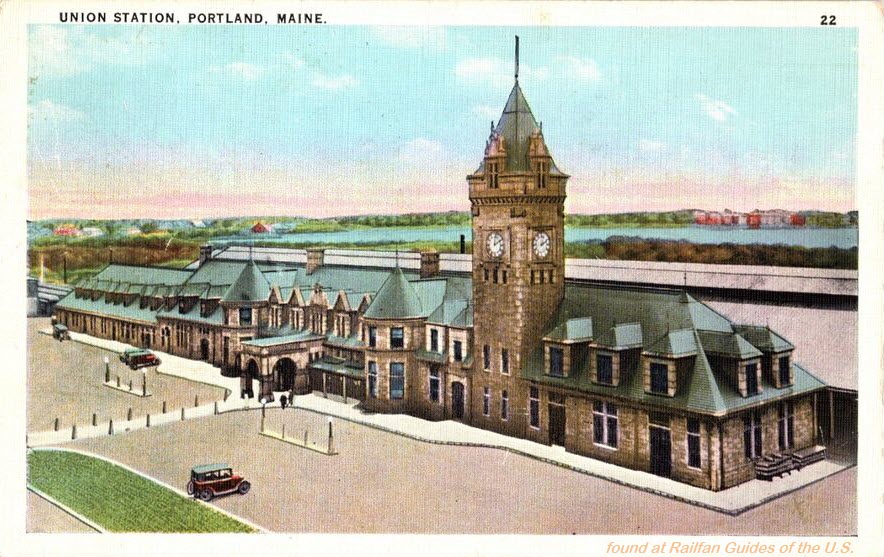
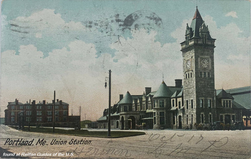
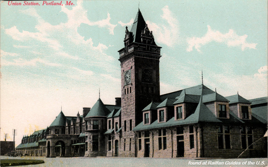
Judging from the postcards below, it looks like the station had an addition built onto it at both ends. Nothing is mentioned on the Wikipedia page about the additions.
From Wikipedia: The building was opened on June 25, 1888, serving trains of the Boston and Maine, Maine Central and Portland and Ogdensburg railroads. Designed by Boston architects Bradlee, Winslow & Wetherell, it was inspired by the designs of medieval French châteaux. It was a primarily granite building, with a 188 foot (57 m) clock tower. Despite its 'union station' name, the Grand Trunk Railway used a different station two miles away. The Maine Central ended passenger rail service to the station in September 1960, and it closed on October 30, when the Boston and Maine moved its remaining trains out of the facility. On August 31, 1961, the train station was demolished, and a strip mall built on the property. Nevertheless, the Boston and Maine continued multiple daily trains from Portland to Boston until 1965.
The
This 2 track bridge looks to be about 1200ft (365m) long using Google Maps as a measuring tool, with the girder bridge section being about 120 (37m) feet long. Can't tell what the rest of the bridge is made of.
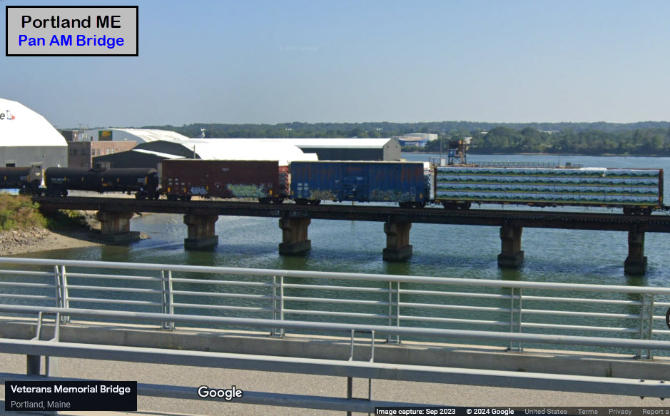
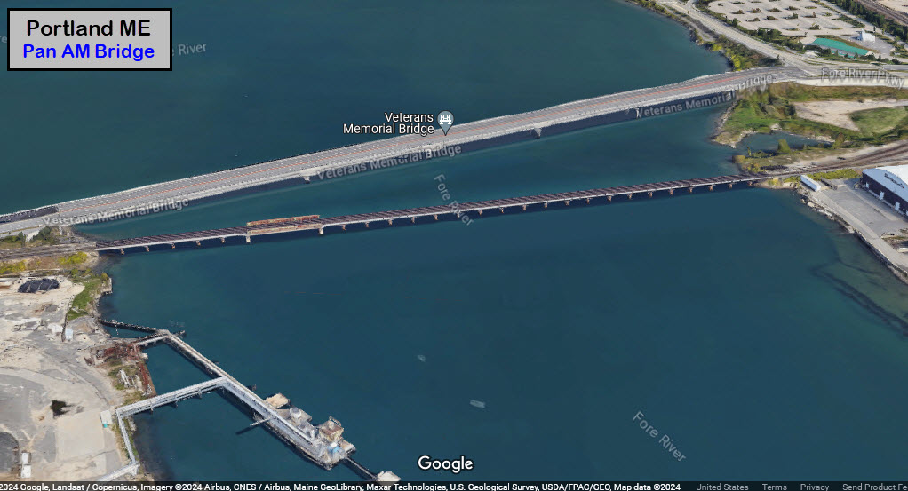
GPS Coordinates: 43.62969, -70.29589
This 2 track girder bridge over Broadway is just north of Rigby Yard.
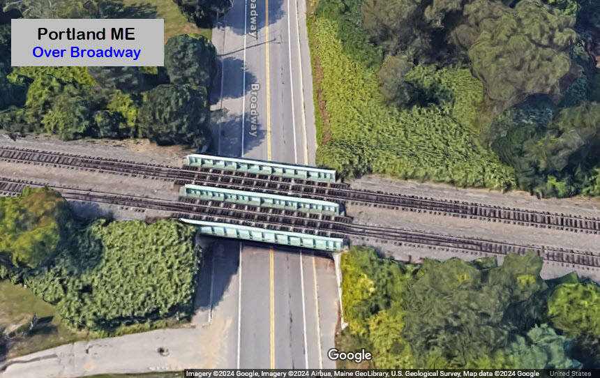
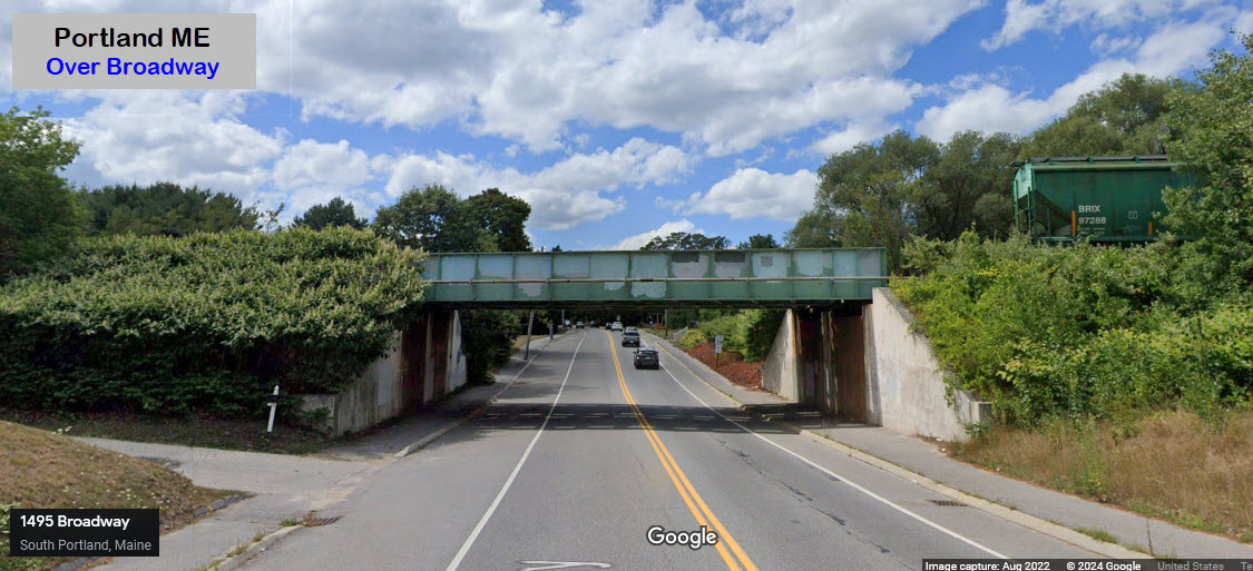
GPS Coordinates: 43.67506, -70.25068
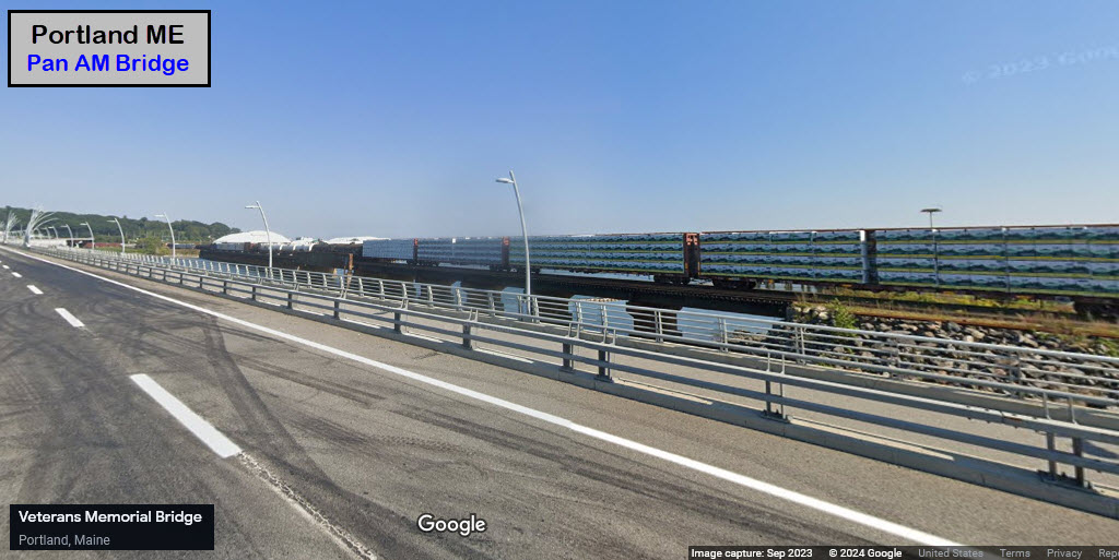
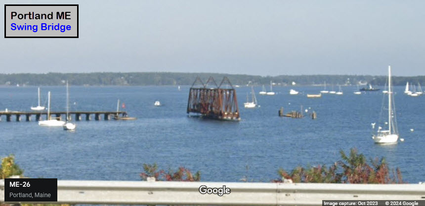
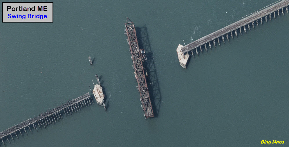
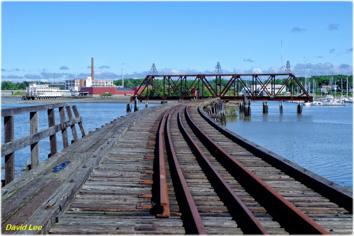
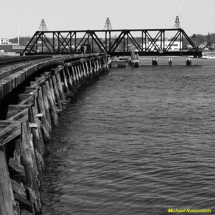
Except for the swing bridge, this is a wooden structure. The Google pictures are more recent than the Bing pictures, as Bing shows the two "sides" almost complete. Again, using Google maps to measure, the whole thing is about 1550 feet (480m) long. The swing bridge itself looks to be around 225ft (68m) long. The article below tells you about the history, but is light with details such as dates and lengths.
https://www.onlyinyourstate.com/maine/abandoned-bridge-back-cove-me/
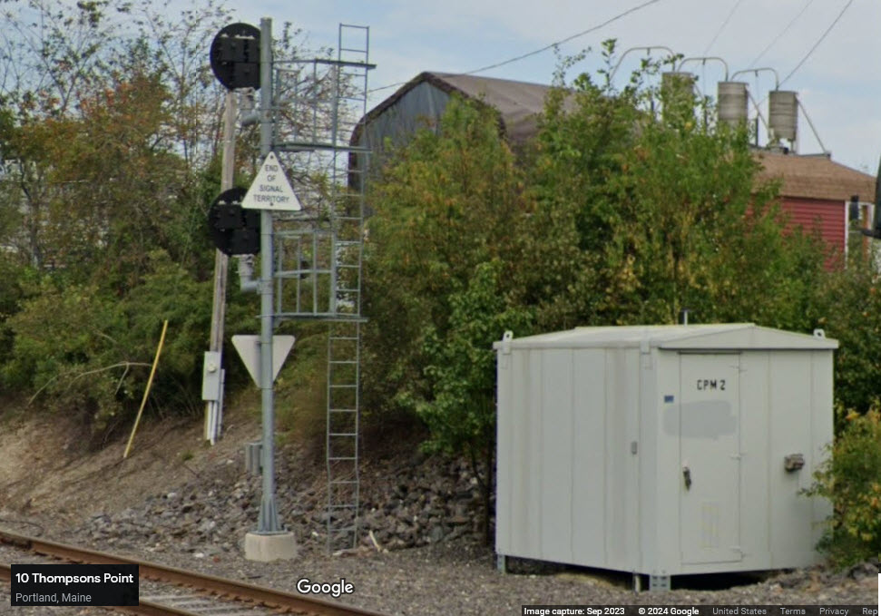
This signal marks the end of signaled track, just on the "other" side of Thompson's Point Rd from the Amtrak station.
The
![]() Xxx
Xxx
![]() Xxx
Xxx
![]() Xxx
Xxx
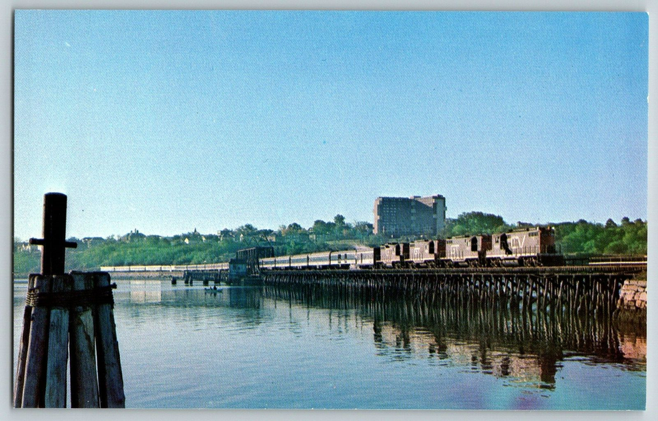
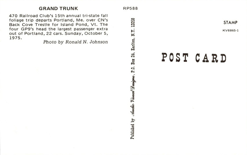
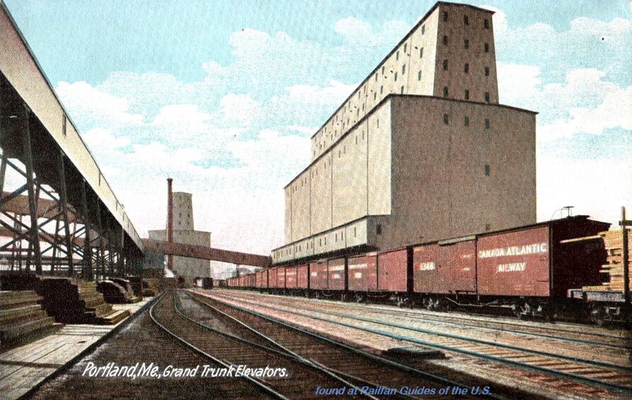
I look for mostly postcards that feature trains or streetcars, but there are bunches of other cool things from the past, here is a sampling for Portland.....
These were all found on EBay.


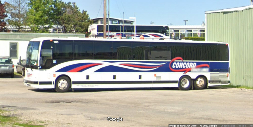

A Breeze Bus sits outside the Transportation Center.
Courtesy of the USGS, click here for their index page.
Disclaimers:
New format 10/26/23: Please check out my disclaimer page for my standard dribble and contact info here
RAILFAN GUIDES HOME
RAILROAD SIGNALS HOME
NEW 08/04/2022, JUL13/2023, FEB09/10/11SBS/2024
Last Modified 11-Feb-2024