
Please note: This is an opinion page in
addition to being informative,
and may not reflect prevailing or common opinions and/or ideology.
In General
Maps
Station by Station
Pictures
The LRV's
Signals
How NOT to Build The Line
Articles & Stories
Lawsuits
RAILFAN GUIDES HOME
RAILROAD SIGNALS HOME
Location / Name:
Suburban Washington DC (north to east side)
Montgomery and Prince Georges Counties MD
Bethesda to New Carrolton MD
What's Here:
Purple Line light rail system (under construction as of JUL2024)
Data:
GPS Coordinates:
-- Bethesda: 38.982034, -77.094274
-- Silver Spring: 38.993886, -77.030690
-- College Park: 38.977109, -76.928459
-- New Carrolton: 38.948545, -76.872412
Scanner Frequencies:
We'll have to wait and see.
Access by train/transit:
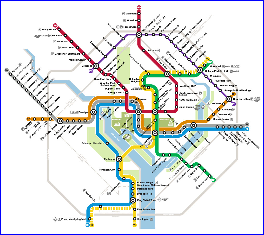
New Carrolton: MARC Commuter Rail/Penn Line, Amtrak, Orange Line DC Metro (east end of)
Silver Spring: Two light rail stops along the DC Metro Red Line and MARC stations
College Park: 1 block from a Green Line DC Metro station and MARC stations
Bethesda: 3 blocks from the DC Metro Red Line
The Scoop:
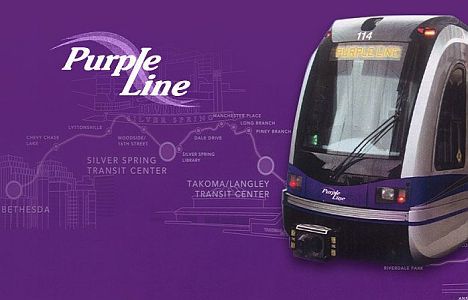
The Purple Line light rail system will be Maryland's newest light rail system when completed (until the Red line gets built).
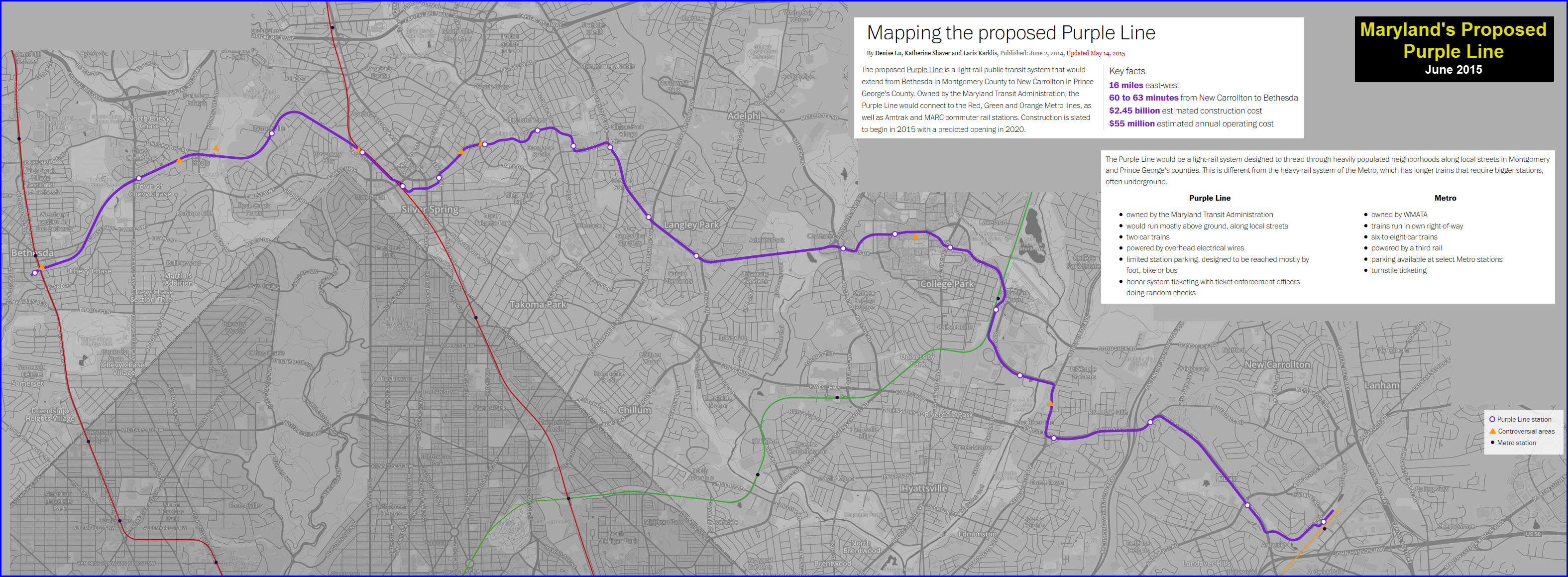
From Wikipedia: The Purple Line is a 16.2-mile (26.1 km) light rail line being built to link several Maryland suburbs of Washington, D.C.: Bethesda, Silver Spring, College Park, and New Carrollton. Currently slated to open in late 2027, the line will also enable riders to move between the Maryland branches of the Red, Green, and Orange lines of the Washington Metro without riding into central Washington, and between all three lines of the MARC commuter rail system. The project is administered by the Maryland Transit Administration (MTA), an agency of the Maryland Department of Transportation (MDOT), and not the Washington Metropolitan Area Transit Authority (WMATA), which operates the DC Metro.
In 2016, a consortium headed by Fluor Enterprises won the $5.6 billion contract to design and build the Purple Line, then to operate and maintain it for 36 years. Construction began in August 2017. Work halted in September 2020, when the consortium withdrew from the contract, citing mounting delays and disputes with the state government. The project had already consumed $1.1 billion of the anticipated $2 billion construction cost.
A new general contractor was selected in November 2021, and a new contract was signed in April 2022. This new agreement added $3.7 billion to the total cost of building, running, and maintaining the Purple Line for 30 years, bringing it to $9.3 billion. Construction costs alone rose $1.46 billion, bringing the total to $3.4 billion. Full-scale construction activity resumed in summer 2022.
Costs rose and the opening date receded again in 2023 and 2024. As of March 2024, the estimated cost to build the line and operate it through 2057 was $9.53 billion, some $4 billion over the initial 2016 budget of $5.6 billion. Train service is expected to begin in December 2027. end wiki
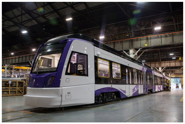
Early stats on the system put the number of LRV's expected to be 28, the first of which was delivered in July of 2024. The overhead line is 1500VDC instead of the more common 750V of today, and the older 600VDC standard from the early 1900's. The R-O-W is a mixture of at grade, elevated, and tunnel running. Top speed is supposed to be 55MPH (89km/h). The cars are manufactured by Construcciones y Auxiliar de Ferrocarriles of Spain (Grupo CAF, literally "Construction and Other Railway Services"). The system is standard gauge (4ft 8-1/2", 1,435mm).
From the purplelinemd website: The Purple Line has 21 stations, 11 in Prince George’s County and 10 in Montgomery County. The stations have a platform, shelters, benches, and ticket vending machines unless otherwise noted. The platforms will be more substantial than a bus stop, but not the size of a Metrorail station and will be between 140 and 200 feet long.
Additional Information can be found on these pages:
https://purplelinemd.com/
https://en.wikipedia.org/wiki/Construcciones_y_Auxiliar_de_Ferrocarriles
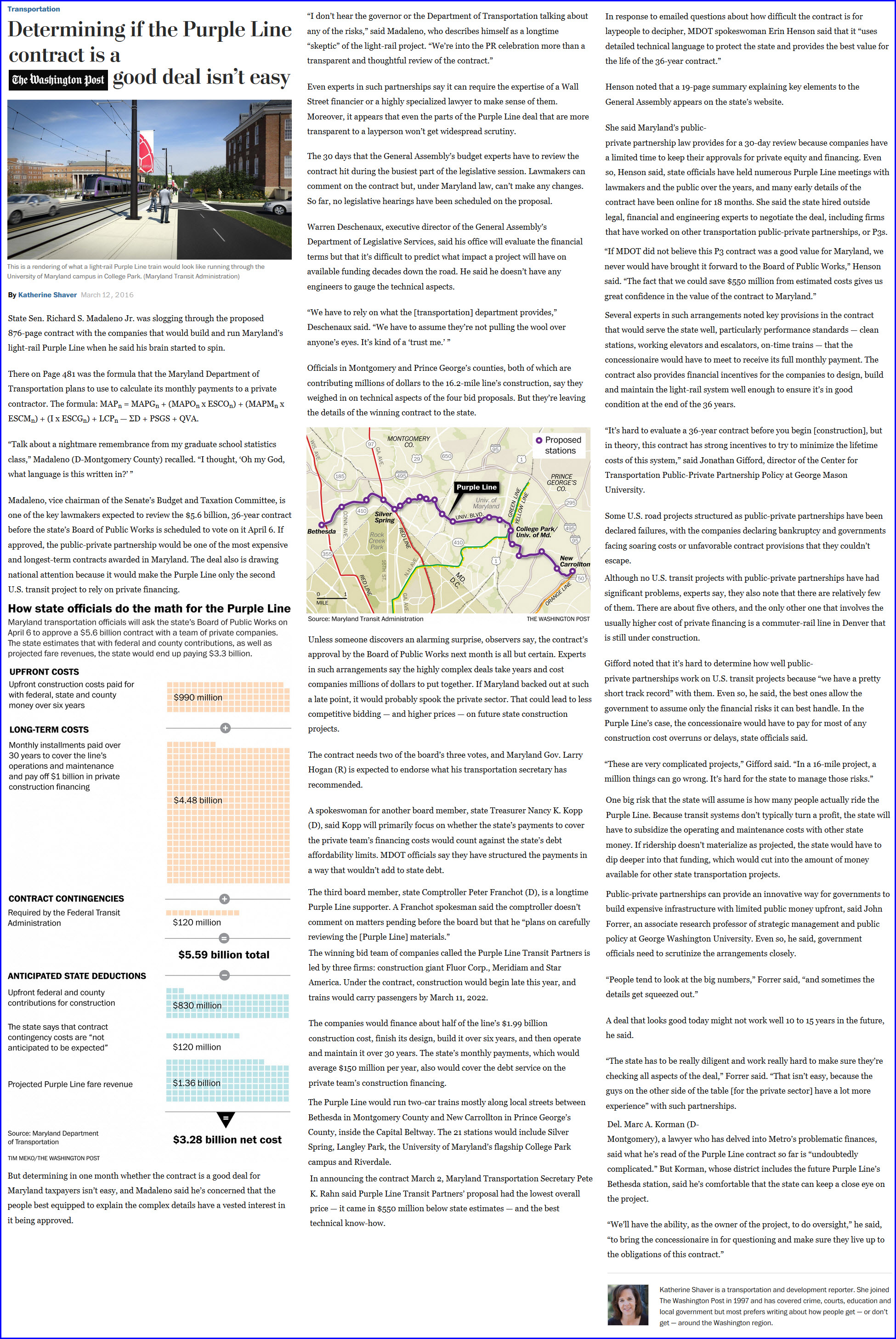
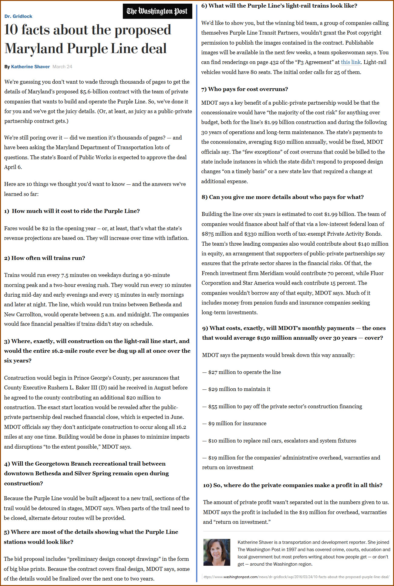
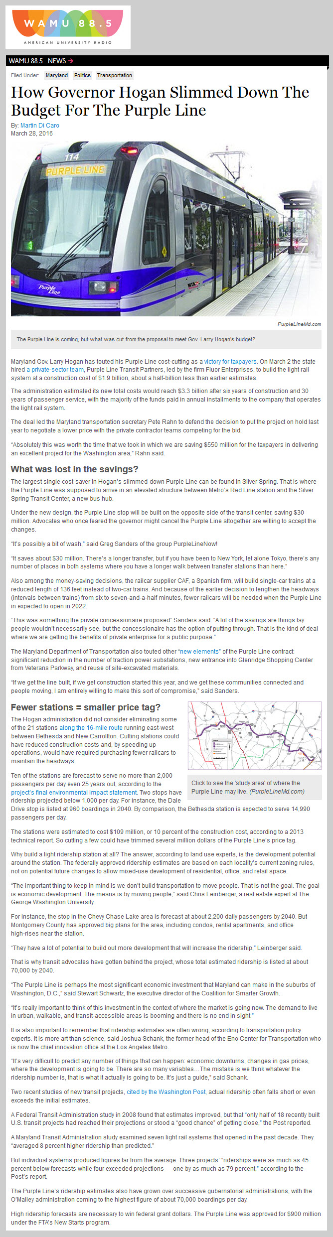
https://www.washingtonpost.com/local/trafficandcommuting/determining-if-the-purple-line-contract-is-a-good-deal-isnt-easy/2016/03/12/a31aa580-e586-11e5-a6f3-21ccdbc5f74e_story.html?tid=a_inl
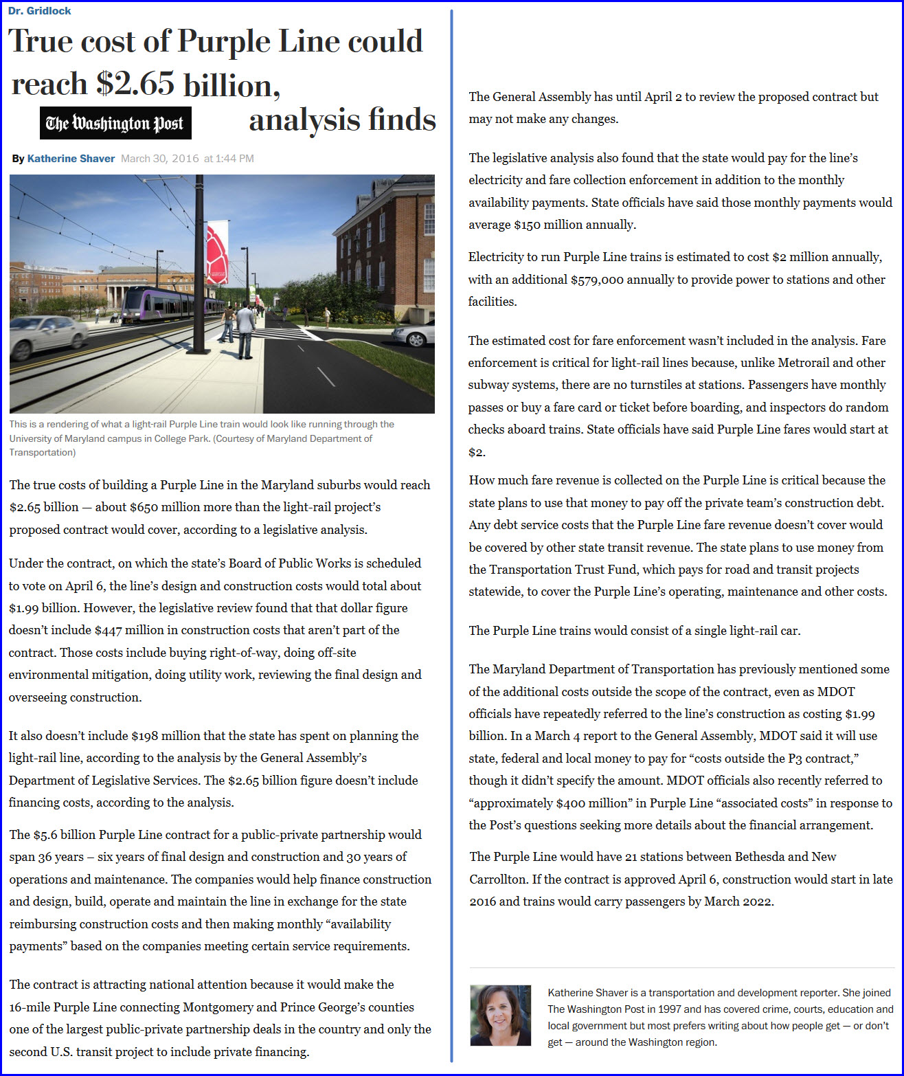
https://www.washingtonpost.com/news/dr-gridlock/wp/2016/03/30/true-cost-of-purple-line-could-reach-2-65-billion-analysis-finds/
https://www.washingtonpost.com/local/trafficandcommuting/maryland-chooses-private-team-to-build-operate-light-rail-purple-line/2016/03/02/d4dadd9e-d107-11e5-88cd-753e80cd29ad_story.html?tid=a_inl


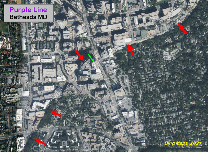
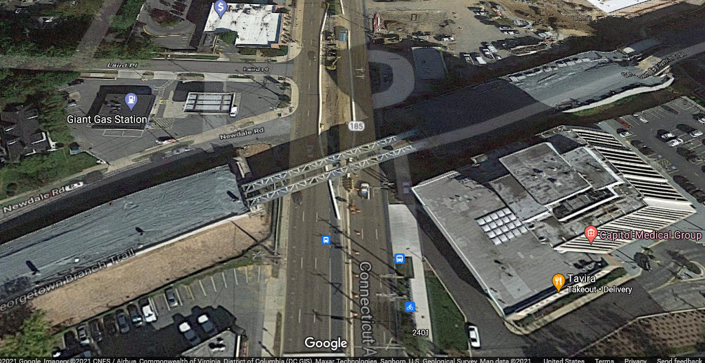
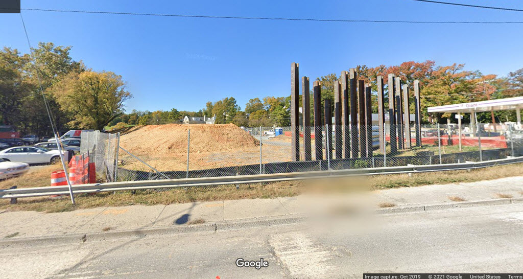
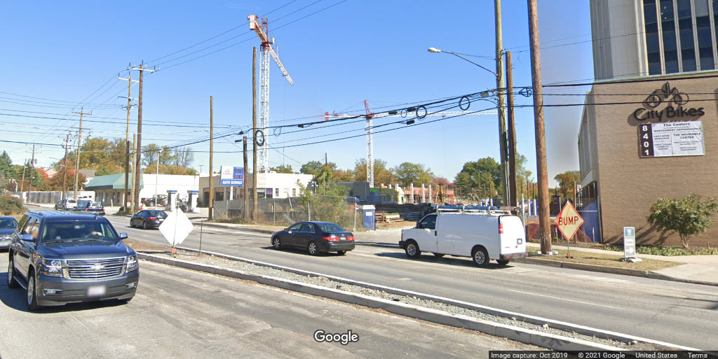
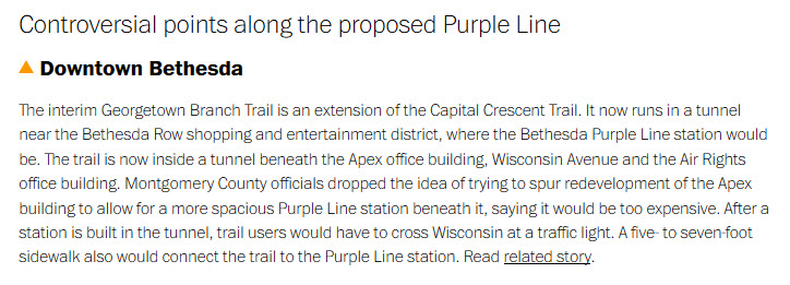
Bethesda
The red arrows point to the former right-of-way, the green line is supposed to be where the Purple Line ends.
Not sure what the plans are since the "7315" building is in the path of the trail/R-O-W.
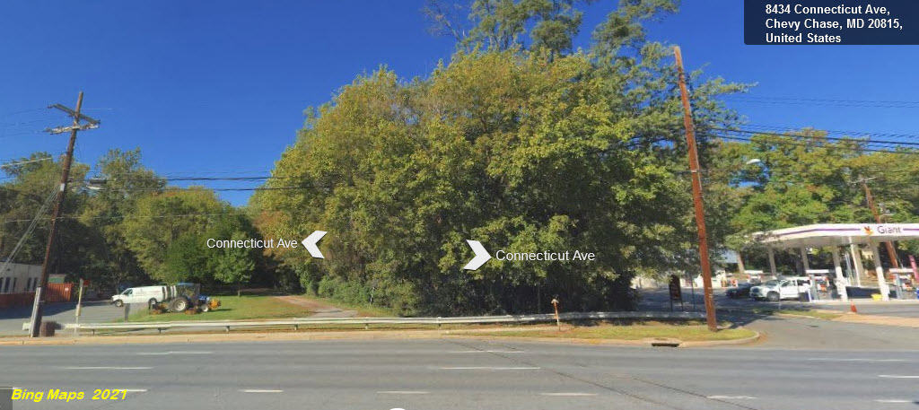
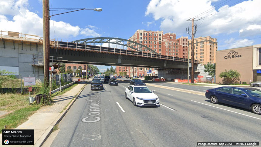
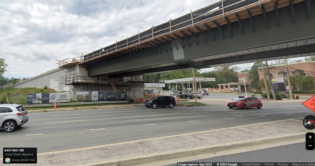
Chevy Chase / Connecticut Ave

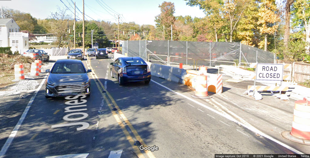
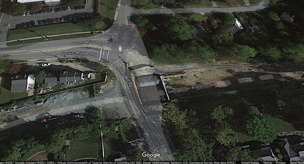
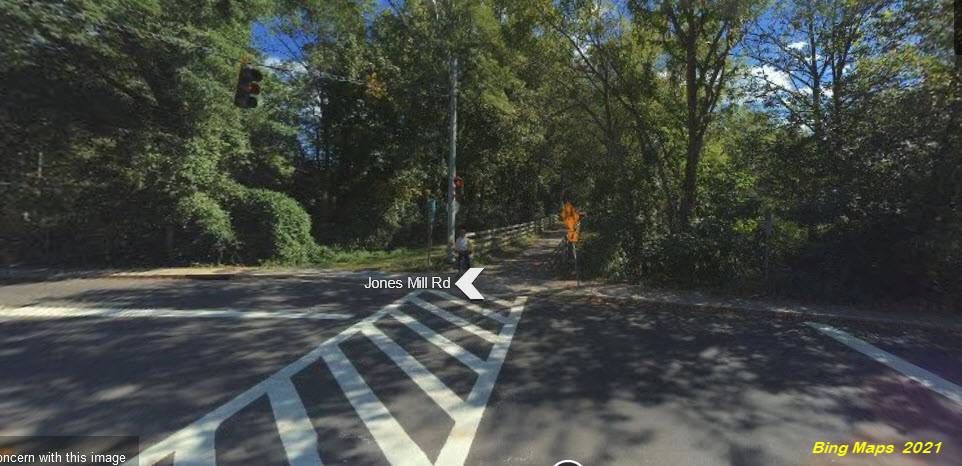
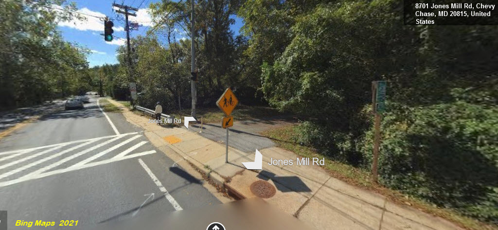
Jones Mill Rd
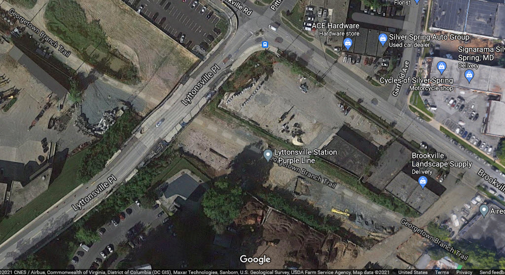
Lyttonsville
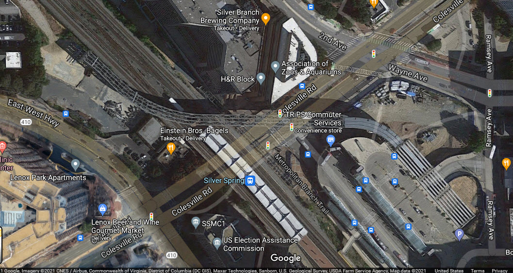
Silver Spring
Shops
GPS Coordinates: 38.95463, -76.89023
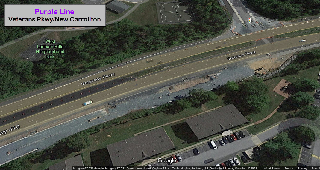
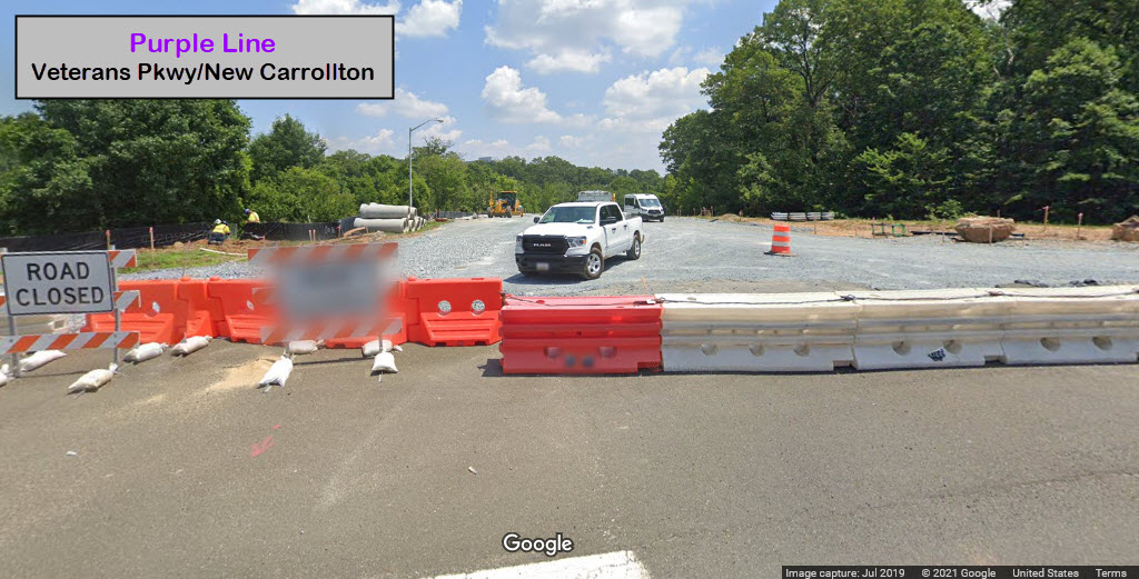
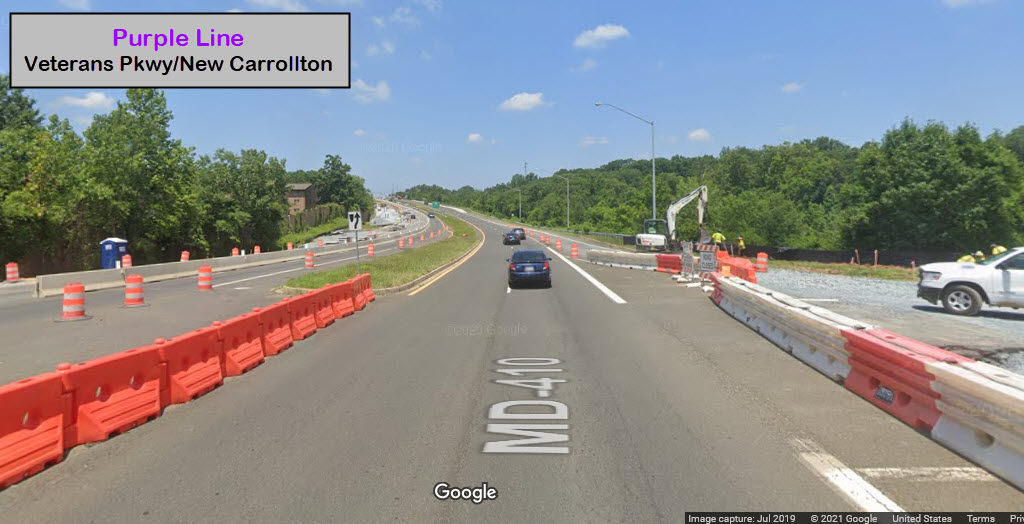
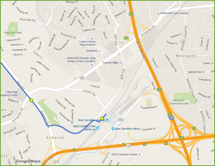
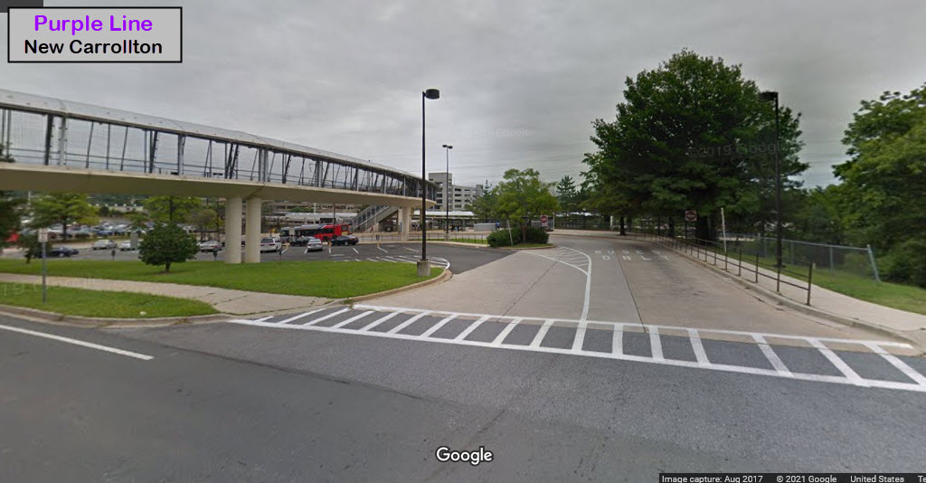
4800 Veterans Pkwy, New Carrollton MD 20784


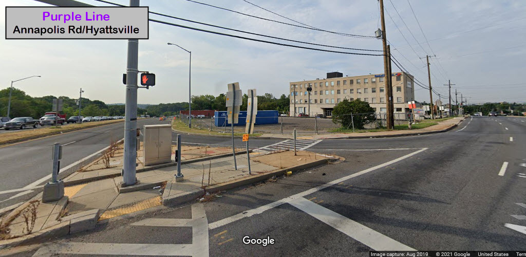
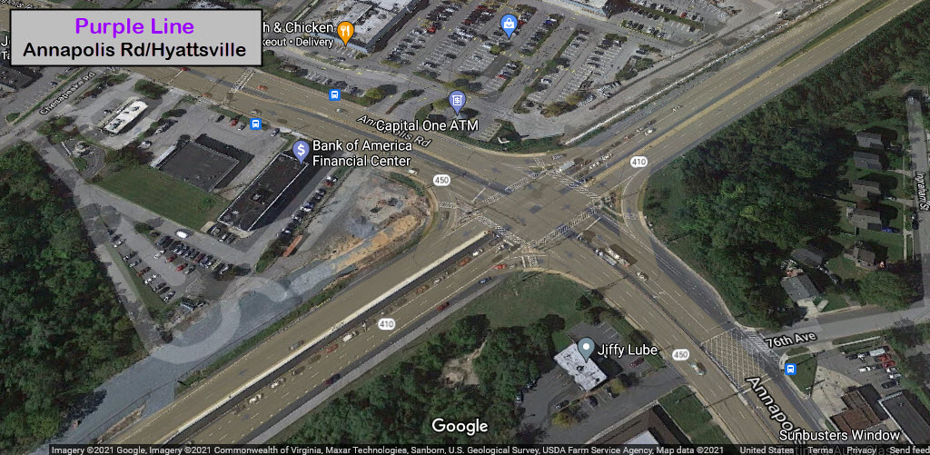
Annapolis Rd / Grade Crossing
GPS Coordinates: 38.95141, -76.88562
As of May 2025, I have not been down to DC to take pictures of the Purple Line. But someone wrote to me and made me aware that the MTA decided to have the line go up and down about a 6-8% grade to get to the Annapolis Rd station, AND, cross Annapolis Road. Here's my two cents on this, and why I feel the MTA messed up big-time.
The climb goes from where the shops are (beyond the overpass over the tracks), located along Veteran's Hwy/410, up to MD 450/Annapolis Rd. The Maryland MTA had the opportunity to put a tunnel under 450, eliminating a whole host of potential problems, including:
- Clogging up the road and pissing people off when a train comes thru,
- Slipping and sliding on the grades, even with sanders,
- Continuous maintenance headaches such as stuck gates and track/gate maintenance and replacement.
For some reason, the Maryland MTA only seems to be worried about how much it costs to put this stuff in, and less with long term costs and consequences. 40+ years ago, when Huntsville upgraded Memorial Pkwy, they built it OVER the cross streets, eliminating intersections, which made traffic flow ever much so more efficiently. When Dallas built their light rail system, they did the same thing, and built the ROW over cross streets. Sure, it's more expensive. But in the long run, that added expense pays off! Why can't we have a competent design team that is willing to go up to bat against Annapolis and ask for a little more money to design things with an eye on the future? Maryland will spend MORE over the life of the light rail system maintaining this crossing, than it would have cost to put that tunnel in..... Not to mention eliminating a grade crossing and the subsequent chances of accidents between auto traffic and the LRV's.
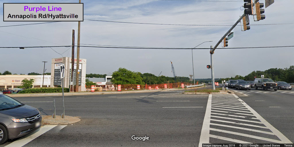

Annapolis Rd / Glenridge
Formerly called Veteran's Pkwy
GPS Coordinates: 38.95099, -76.88516


New Carrolton
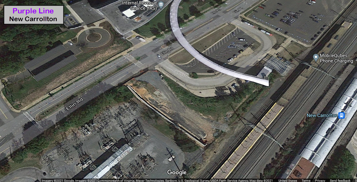
Nothing yet.
No pictures yet.
I know a page in any respected website shouldn't contain personal opinion, but I hope to have someone read this that can make a difference and not make the same mistakes that have been made before, with systems like the DC Streetcar and the Baltimore Light Rail System. There are a whole slew of commonly made mistakes made, stupid decisions made, that waste time and money to a rail project. Over the years, I have gotten the impression that very few of the people employed by transit companies OR rail design consultants, really have no clue what they are doing. My latest confirmation of this came in 2019 at a hearing for Amtrak's B&P Tunnel that runs thru Baltimore. Although there were quite a few well informed representatives there, several had ideas that in no uncertain terms were a waste of time, and you couldn't convince them otherwise.
Bad ideas for design come in several forms. One is just a plain ole lack of common sense. The other prevalent form is stupidity and getting their training from other people who have very little REAL WORLD experience. Transit companies, generally, in the old days when they were a private venture, employed educated people that were responsible for their designs. "They knew their stuff" and generally made good decisions, BECAUSE, they had to make a profit! Now that almost everything is public and run by the government, no-one cares because the public thinks "they" (the government) will pay for everything, including their mistakes. But in the end, WHO winds up paying for these mistakes? You and I do, of course!
Another website that promotes common sense engineering: http://citytransport.info/Lawn.htm.
Let's go over a few examples to illustrate what I'm talking about. Most come from the Baltimore light and heavy rail systems, because they are so plentiful with illustrations.
Common sense: If you put the catenary poles in the middle of the two tracks, providing you are making the system a two track right-of-way, you accomplish several things. One, it costs a whole lot less money than it would if you put poles on the outside of the two tracks, necessitating two footings, two poles, AND additional room for the R-O-W (more land, much more money, etc, etc, etc). Below are a few pictures from the Pittsburgh, Seattle, and Portland Light Rail systems, showing how they used a single pole line in the middle of the double track right-of-way. It wasn't done this way over the entire line, but where they could, they did. Below them are a couple of pictures from the Baltimore system showing the use of two catenary poles over (about) 95% of the system. Such a waste. :-(


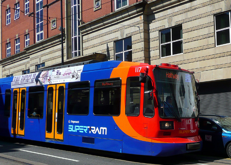
Common sense: Use existing buildings in a downtown environment to support the catenary wires. Europe does this all over the place. Why they don't do it here is anyone's guess.
Below: Sheffield, England - Some street sections of the Supertram feature overhead wiring supported invisibly from rosettes attached to building walls.
Common sense: When they whipped up the original plans for the Baltimore Light Rail system, the consultants insisted on making the curves easier to traverse by lessening their curvature. While this may have improved the wear on the wheels and track, it did no service to the tax payers in 2005 when they decided to double-track the north end of the system - EVRYTHING had to be torn out - track, catenary supports - the whole enchilada. Then, it all had to be put back in. This is because no-one had the common sense to sit down and say, "what if". What if they decide to double track the system at some point?
Common sense: Or is it? The Baltimore light rail system "winds" its way down Howard Street, making it confusing for (especially) visitors to the city to figure out where to drive and what not to do. Pick a side to the street and stay on it.
Specifications and equipment: Check everything. Back when I worked for the Light Rail system in Baltimore (1995-1998), they decided to update the North Avenue yard. One of the "things" they decided to do to this end was to give the yard its own sub-station, instead of using power from the main line. Why did they want to do this? In the winter, when all of the cars were in the yard overnight, a one megawatt sub-station could not keep all of the cars operating when they had the heat on. They had specified a two-megawatt sub-station. Instead, a one-megawatt sub-station was delivered and installed. It was eventually fixed by replacing it with one of the correct size, but I never did hear who paid for that mistake.
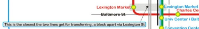
Common sense: The Baltimore rail transit system is often criticized for having one of the worst, if not the worst, transfer systems between modes. What do I mean by this? OK, how does one transfer between the light rail and metro system? Answer: you can't without walking a block in the open weather between the two Lexington Market stations. Another brilliant idea conceived by the people at the MTA who designed the light rail system. Since the Metro system came first, I pin this gross oversight on the MTA's light rail people. To make matters worse, they were going to "do it" a second time by not providing riders with a easy transfer between the proposed RED LINE and either the existing light rail or metro systems. Really? It's just as well, because the MTA already used red for the Metro Subway system.
Common sense. What is the reasoning behind the MTA's choice for the naming of the metro system: the Metro Subway. Did they not think that the citizens of Baltimore would know what it was if they called it just the METRO or the SUBWAY?
Specifications and equipment: Double-check everything. Another thing happened while I worked for Light Rail. The MTA (without asking Baltimore City - I might add) decided to use traffic light pre-emption. This is where the LRV's have priority over the vehicular traffic in an effort to save a few minutes in traversing the downtown area by setting the lights for the LRV's to green. In order to accomplish this, their plan was to use GPS to report train location. So the GPS units they ordered were supposed to have two RS-232 ports on them so they could connect to a trunking radio and a data processor. Guess what, the GPS units came in, and they only had ONE port on them. NO-ONE had the kahuna's to return them and get the proper units, so, the MTA ordered a second GPS receiver. After I left in 1998, they ordered yet another (that's now THREE GPS units) for use onboard the trains, this time to use as part of the automatic train control. The last time I looked, you could see the three receivers above the articulated section in the middle of each car. Aha, but the story does not end there. In yet another tribute to incompetence with this story, the MTA ordered new UHF trunking radios to use with the GPS receivers. The idea was to replace the VHF radios with the new units, but the VHF radios had to stay in use during the changeover. So the MTA removed one of the clearance lights in order to mount the UHF antenna. None of this stuff was ever used, because signal pre-emption was nixed by Baltimore City, How many hundred's of thousands of dollars were wasted in this effort?
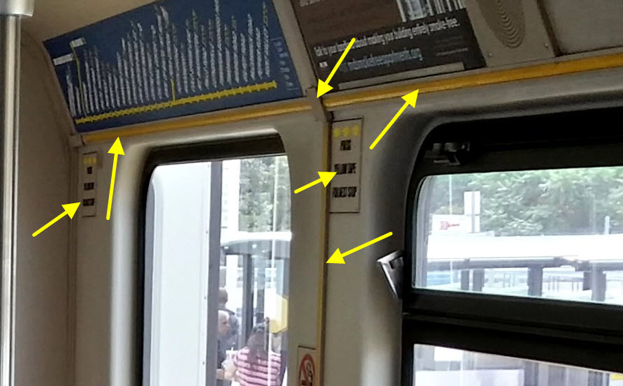
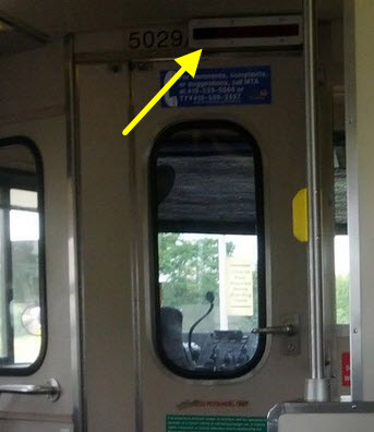
Common sense. Even though the Baltimore cars stop at every station, they (the MTA) STILL had ABB install a stop request system, which adds to the cost of the car, not only initially, but as a regular maintenance item, when the tape, switches, indicators, or intercom system malfunction. Brilliant idea. Then, the MTA decided to make it painfully obvious that the yellow tape switches needed to be pushed in order for the operators to stop at the next station. WHAT WERE THEY THINKING? Everything pointed at in the two pictures below are needed to support this brainiac idea.
Specifications and equipment: Double-check everything. Back in the 80's, the Maryland MTA wanted to extend the heavy rail system from Reisterstown Plaza north to Owings Mills. Someone, in all their infinite wisdom, designed the track on the north section a half inch wider to a gauge of 4ft-9in. Just north of the Reisterstown Plaza station, there is a 20-30ft section of track, on wooden ties, to go from the standard gauge to the wide gauge tracks. Another boner designed by ill-informed and poorly-educated consultants.
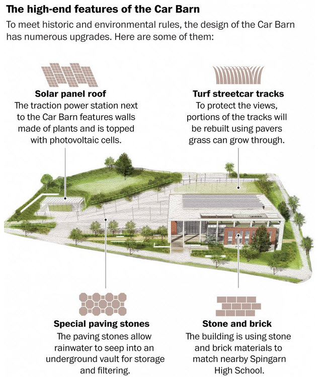
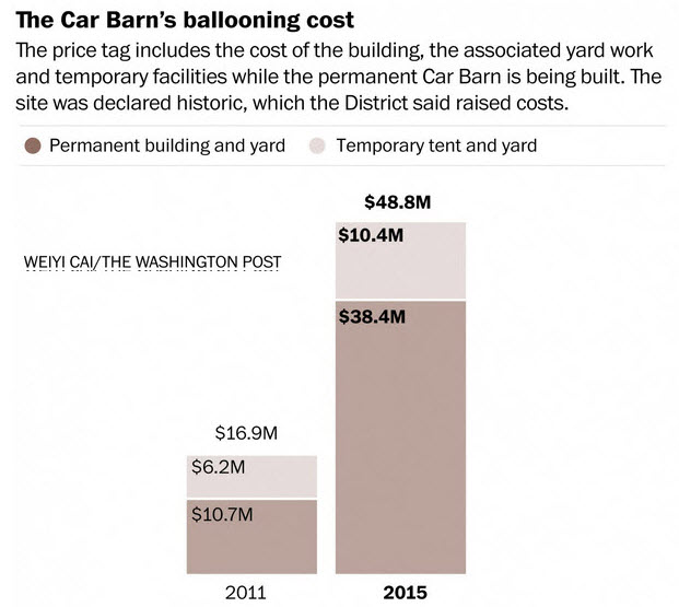
The KISS principle (keep it simple stupid). Down in DC, someone decided the shops (maintenance facility) for the new 2.2mi streetcar system should be a "show palace". And it cost them dearly for the title. It cost roughly TRIPLE to construct the car barn building of what it cost for a similar facility on other properties. They wanted the curb appeal of the building to match that of the neighboring school.... ca-ching!..... they wanted solar.... ca-ching..... they want greenery to make it feel like we're not in the city.... ca-ching..... and so on, and so on.
I don't know what the solution to poor design is. The newest example of a system so badly miss-managed from the beginning is the new DC Streetcar system in Washington DC. It is like, the Holy Grail of examples of what can go wrong when you have the wrong people in charge giving out the wrong orders. It also doesn't help that Washington DC is sort of like a free for all zone, where there are too many organizations and governing agencies for anything to get done efficiently.
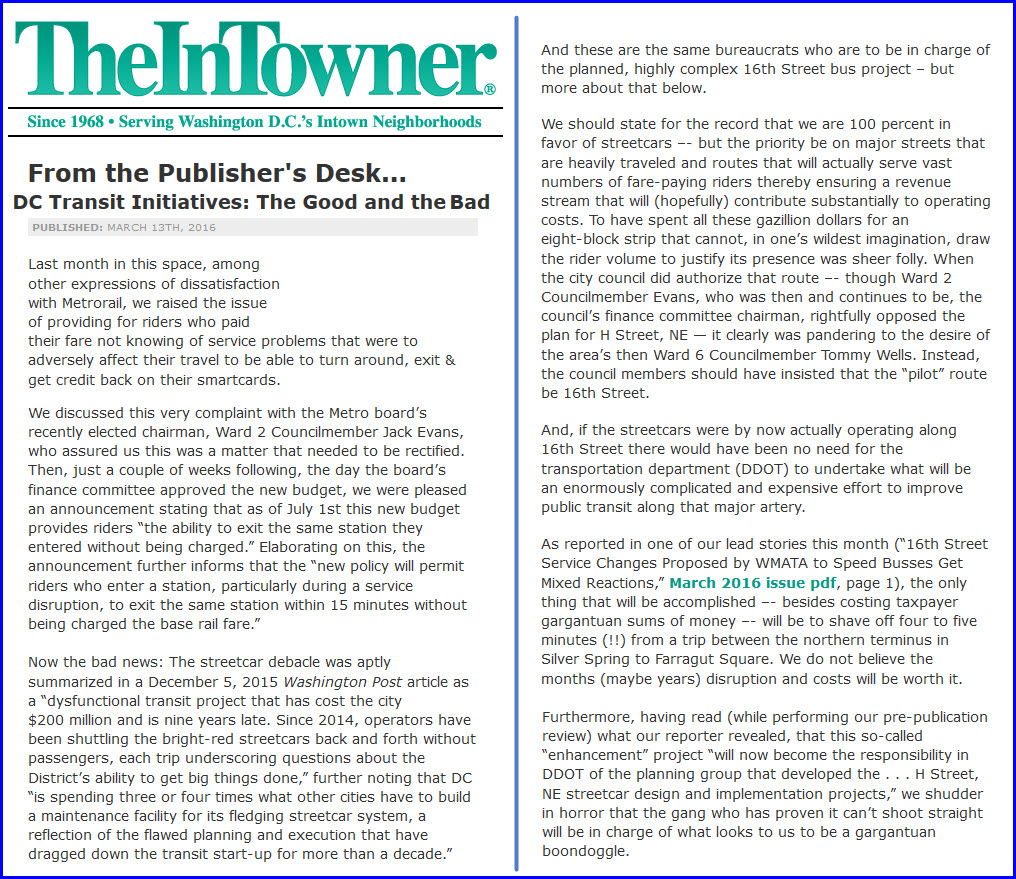
To support some of what I say, here is an article that appeared recently about the DC Streetcar. The author criticizes the maintenance facility, and the route the the city choose to put the streetcar on, saying it will not serve a sufficient number of people to even come close to supporting the system.
Problem Spots.....
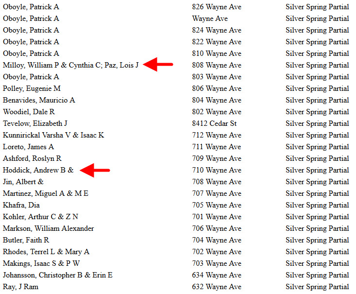
So here we go. This is one of the first lawsuits to hit the books standing in the way of the Purple line.
Two families have sued the state because they feel they are not getting enough for the land the state wants from them to build the line.
They are suing the state for more than what their house is worth. So I have a solution. Let the state buy the houses for what the City Data value of the house is, and then the state can put a substation in the house and no-one will ever know a sub-station is there! :-)
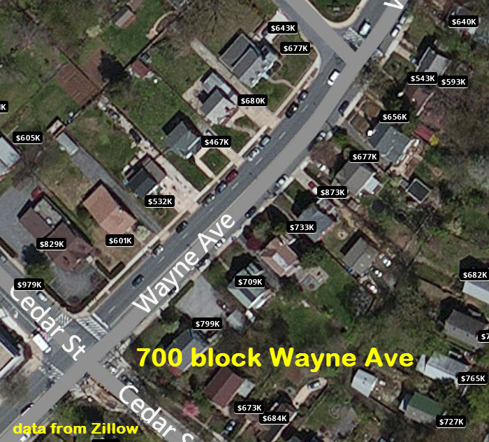
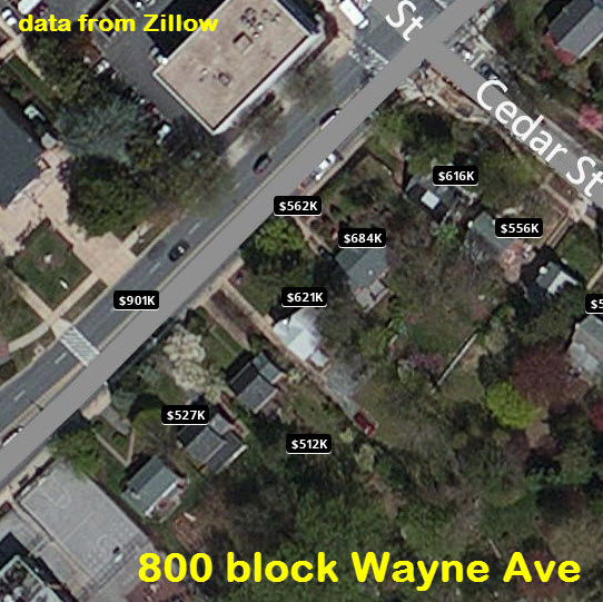
The only reason these houses are as expensive as they are, is because of their close proximity to the center of Silver Spring, and they are inside the Beltway, where ALL house prices are inflated. If these houses were in my suburban neighborhood of Towson, they would be in the $400K range.
But because they ARE that close to Silver Spring, let's go over another couple of facts....
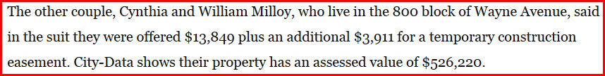
Here are some of the arguments they are using:
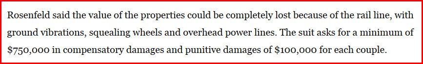
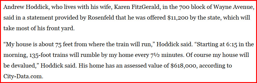
Wow, 850 grand for a house that's not even worth that much! Phew! Are these people crazy? Really? Just move....
Well, first of all, they are not going to lose ALL of their value. I live 75 feet from a light rail line, and the value didn't waver a bit because of it. So that is a BOGUS claim rooted in fear and ignorance! The people in Portland Oregon had the same fears prior to the Tri-Met light rail coming through, and none of them came to fruition! Now, the majority of residents like the fact that light rail is running in their back yards.
I have a way around this for now. Let's agree to wait for a period of say, 5 years, and if, and only if, then, it has been determined that the property values have gone down because of the light rail coming through, then the state can make some sort of compensation. If the prices go up, then the homeowners have to pay the state! I think that is fair.
Another solution, let a commercial developer come in and buy the houses on the south side of Wayne Ave, and put in a nice shopping mall that would be glad to have a light rail stop in front of their businesses.
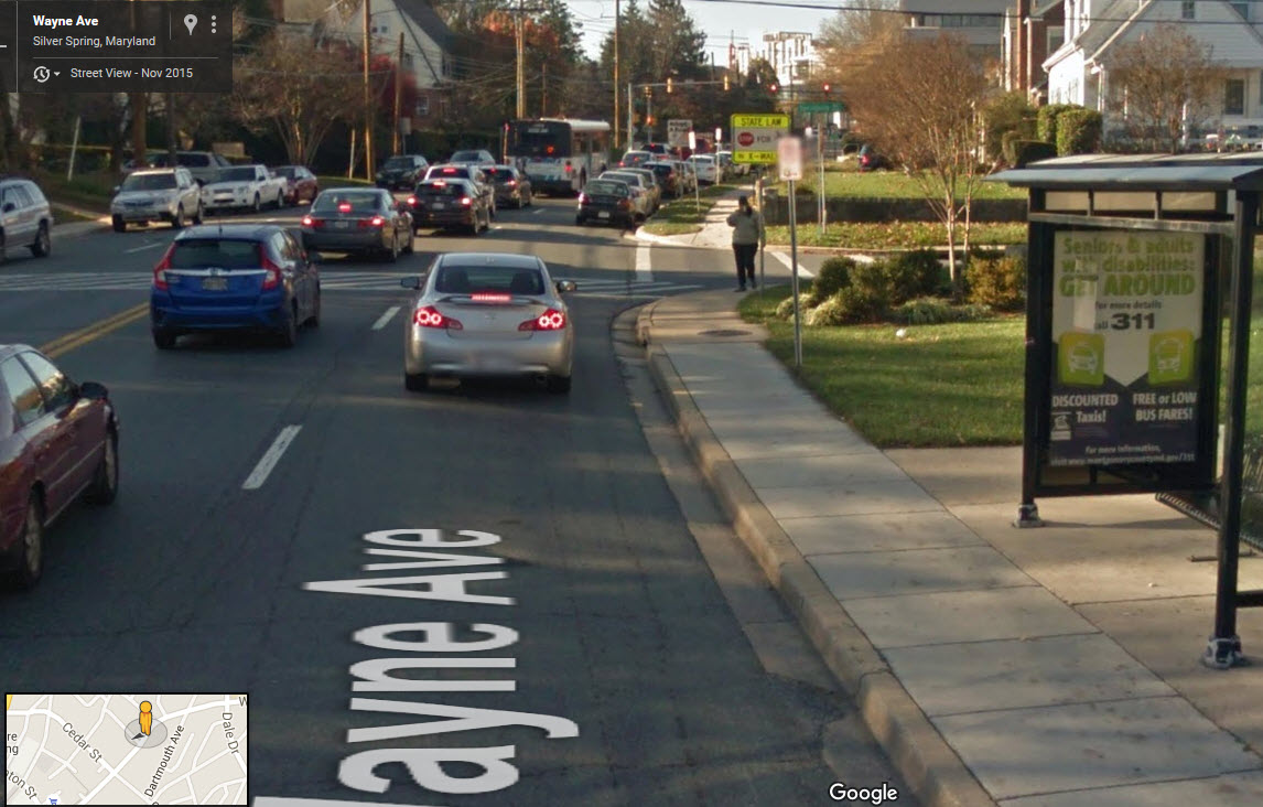
Next, the vibration. Nope, no vibration. The trains are going to be doing what, 20-30MPH through here, not the 45MPH they do when they go behind my house. And I never feel any vibration from them. Maybe if you put some earthquake measuring equipment in the ground at their house might you measure something, but I have had cups sitting on a display shelf for the 20 years we have lived here, and they haven't budged a millimeter.
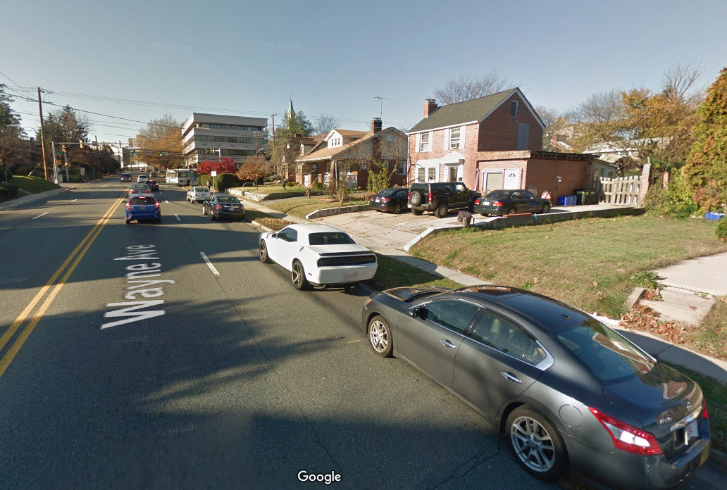
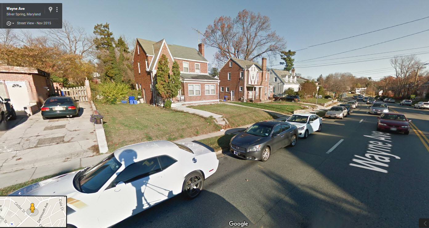
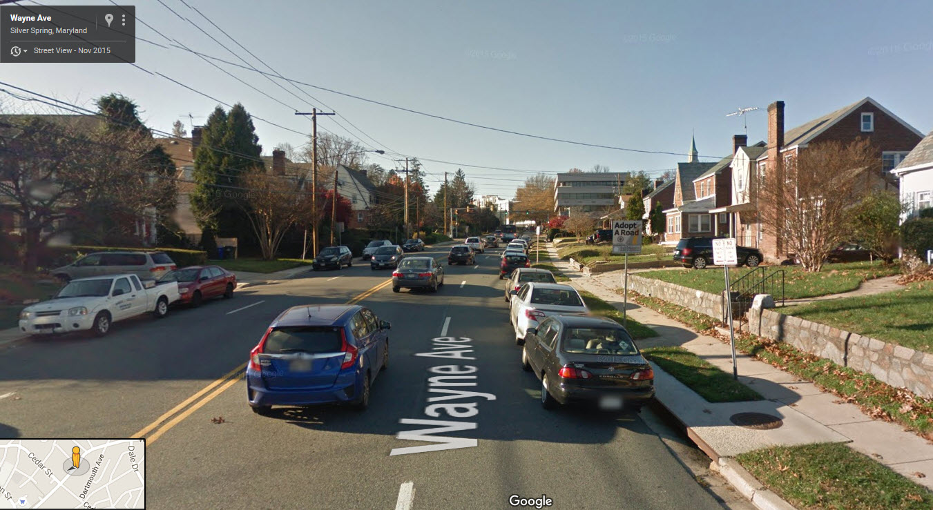
Squealing wheels. Again: NO. Especially in the 800 block, it is a straight tangent, so there is nothing to make the wheels squeal. Only in the 700 block do we start to get a slight curvature , but probably not enough to make the wheels slip. The wheel profile should allow for that. Maybe at the curve at Cloverfield, but not in the 700 or 800 block! This can be clearly seen from the aerial shot below.
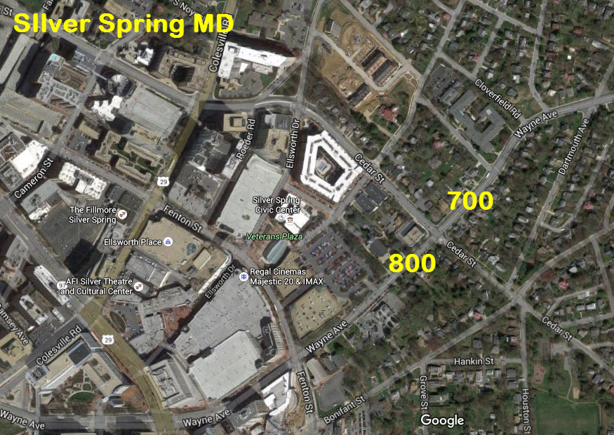
Overhead power lines. PLEASE. Have you looked at the power lines already in place???? This would be a good opportunity for the MTA to pay to have the utilities buried through here to help with the aesthetics. And how can it get much uglier than having a separate pole for phone and electric???
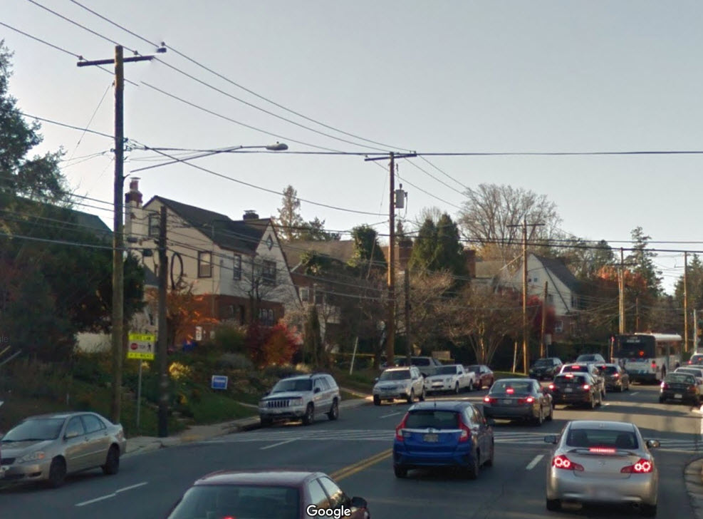
Now, let's go over a few things the residents haven't mentioned in their lawsuit. It looks like Wayne Ave is a major thoroughfare in and out of Silver Spring. This means traffic, and wait, is that a bus I see on Wayne Ave? Yep, sure is? So the guy is complaining about the noise from the light rail starting at 6:15? Oy.
So can someone please tell me how things could really get worse when the light rail come through??? If they lived in a nice quiet, suburban setting on a quiet side street with no traffic and immaculate lawns, I could understand the residents concern. But they don't. They live on a bustling, noisy thoroughfare. If they want quiet, move away from downtown Silver Spring! If they win, I want to jump on the bandwagon and get some money from the state for having to put up with the years worth of noise and vibration from the double-tracking in 2005.
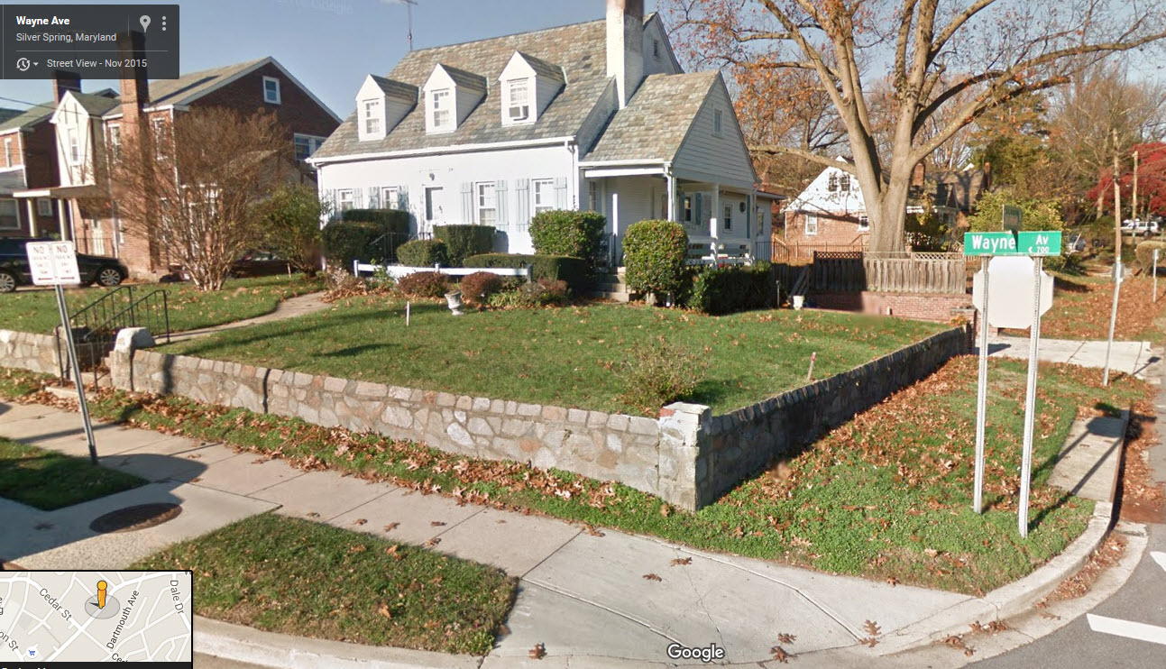
Here are some additional street views from Google Maps:
http://www.washingtonpost.com/wp-srv/metro/data/purple-line-land.html
And finally the story....
https://www.washingtonpost.com/local/trafficandcommuting/silver-spring-homeowners-along-purple-line-sue-to-get-more-for-their-land/2016/05/09/91b0ad24-1611-11e6-aa55-670cabef46e0_story.html
Disclaimers:
New format 10/26/23: Please check out my disclaimer page for my standard dribble and contact info here
RAILFAN GUIDES HOME
RAILROAD SIGNALS HOME
NEW 07/14/2015, MAY11/2016, JUL24/2021, JUL13/14/2024, MAY13/2025
Last Modified 14-May-2025