In General
Getting Here
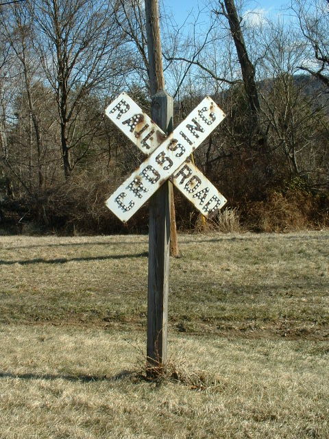
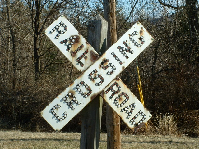
Sites
Signals
Floobydust
USGS Maps
RAILFAN GUIDES HOME
RAILROAD SIGNALS HOME
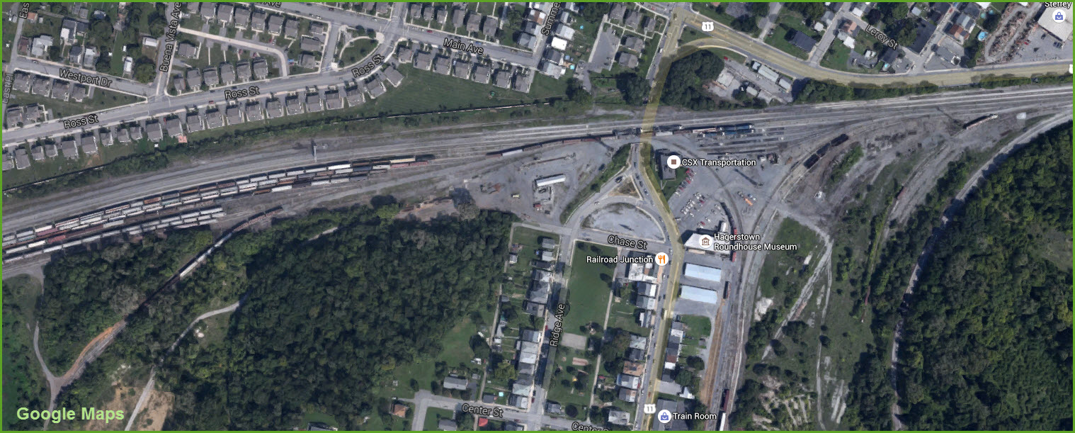
Hagerstown is at the crossroads of what used to be the Western Maryland, the Pennsy, the Baltimore and Ohio, and the Norfolk and Western. It's now served by CSX (B&O and WM) and the NS (N&W and PRR). Thru freights on both roads share the ROW going past the Police Station in the downtown area.
The WM had the biggest presence in old Hagerstown, and reached there in 1872. Because of the decline in passenger traffic, after WWII, the WM ended passenger service completely in 1959.
Back in the 60's and 70's, the
Western Maryland was host to many, many railfan events, including excursions
to the west and to Baltimore; hosting steamers like 759 and 2102, and the D&H PA's.
When 759 was painted in American Railroad
colors for the 100th anniversary of transcontinental train service, the train
came back east through Hagerstown and stopped here overnight..... The WM back
then was a railfan's dream railroad! Anyways, back to reality, there are no Amtrak or MARC trains
coming into or going through Hagerstown. The B&O had a branch from Weverton
MD (slightly west of Brunswick) into Hagerstown, passing thru Rohrersville and
Keedysville. It was built in the late 1800's. There was also a
bypass on the east side of town connecting to the WM main, going from Security
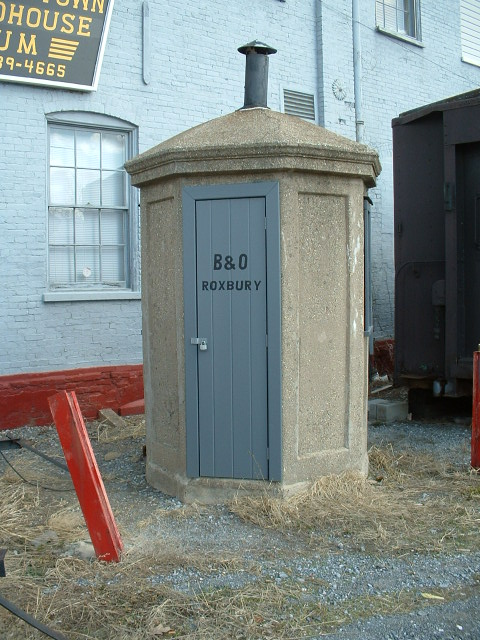
Jct on the B&O to Security on the WM. There's supposedly an old B&O depot
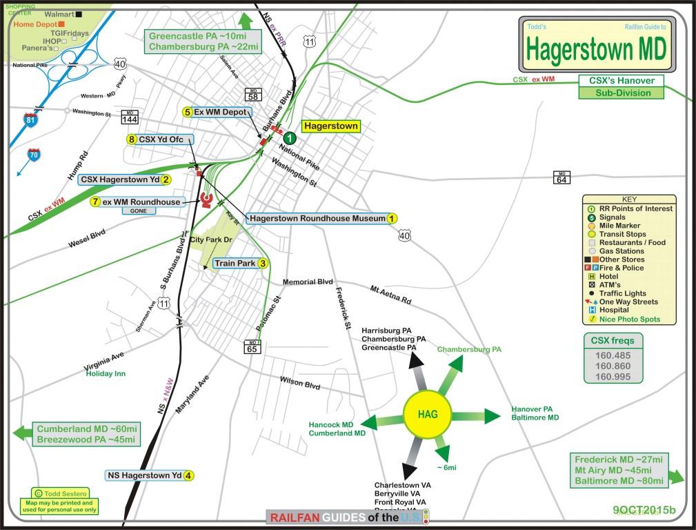
still in town camouflaged as a car wash. For other guides of the area, check
out the Central
Maryland Railfan Guide Homepage
From the north, NY, MA, etc, come
down via I78 (and I95) from the Philly area, or I81 from the NY and Binghamton
area. Stay on I81 south through Harrisburg, and it will bring you directly
into Hagerstown. From the west (OH, western PA, etc)
or east (as in Baltimore), I70 gets you to Hagerstown. Hagerstown is at the crossroads of
I70 and I81. Coming up from the south west, as in
TN, southern WV, AL, or SW Virginia,
I81 going north gets you there From DC, southern/eastern VA, I
would head up I270 to Frederick after going north on I95 and around DC on the
Beltway, and then head west on I70.
Click
here for the
Central MD map in PDF version.
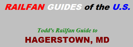
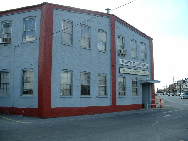
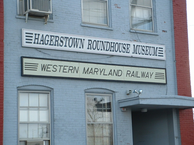
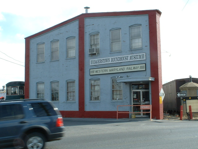
1
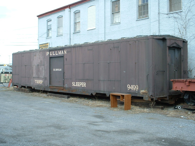
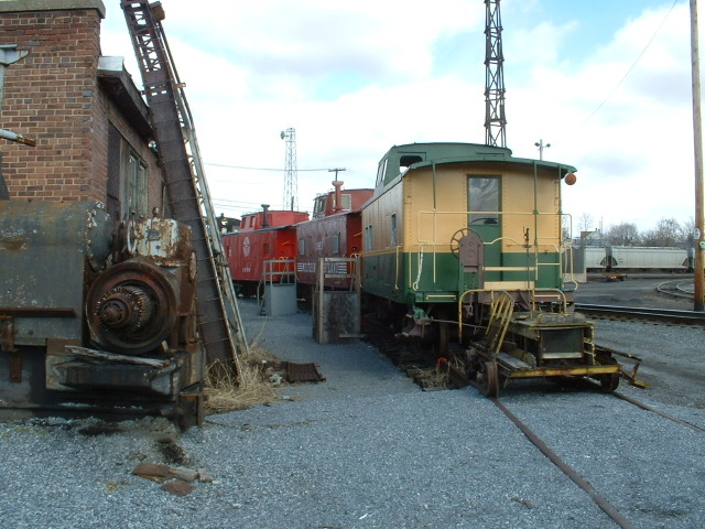
Hagerstown
Roundhouse Museum
2
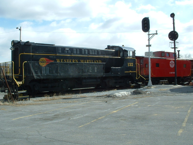
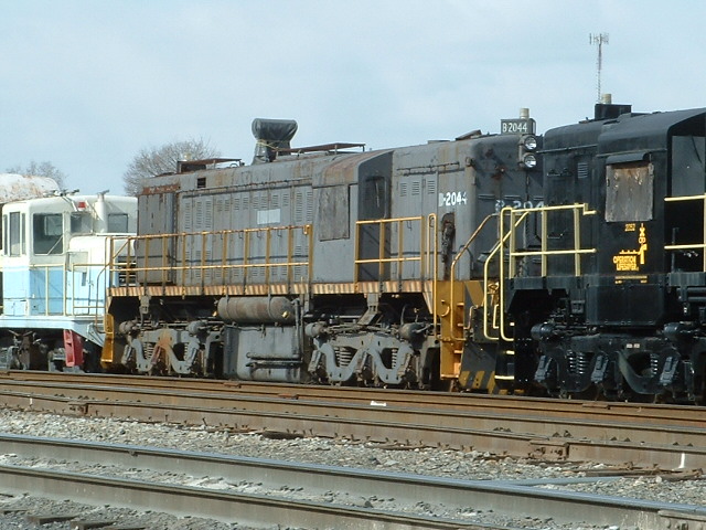
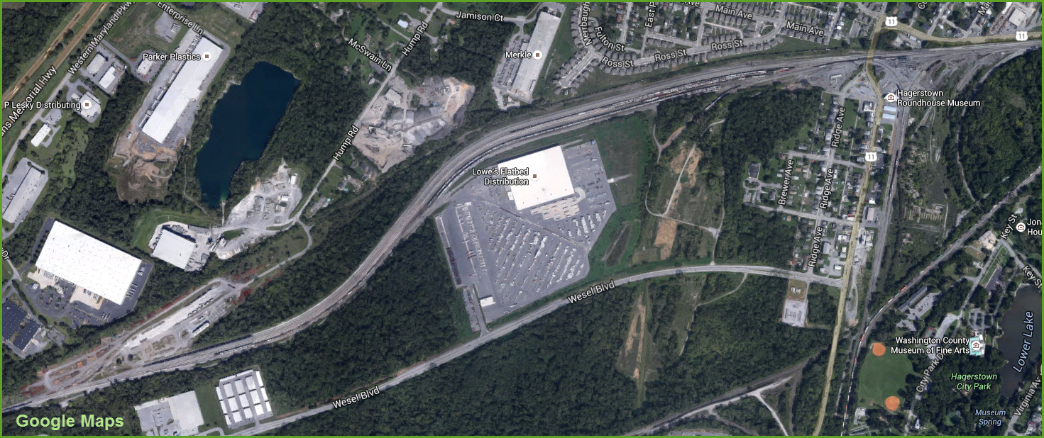
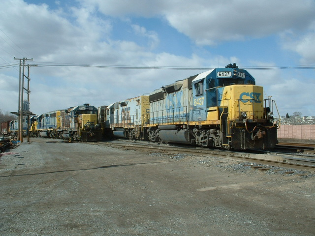
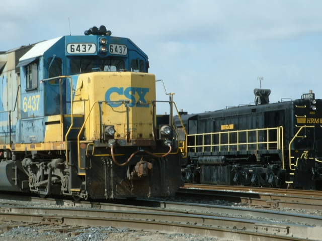
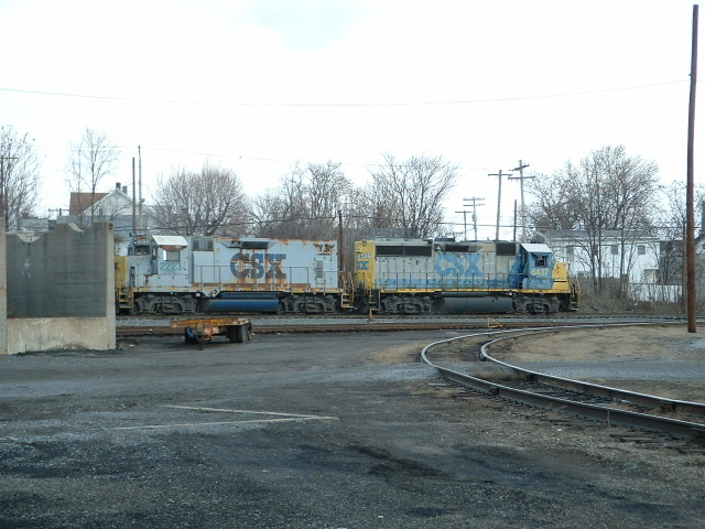
Ex Western
Maryland Hagerstown Yard (CSX) Activity here is very slow compared to what it used to
be.... darn.....
3
Train
Park
4
The
Norfolk Southern Yard (Ex Norfolk and Western)
5
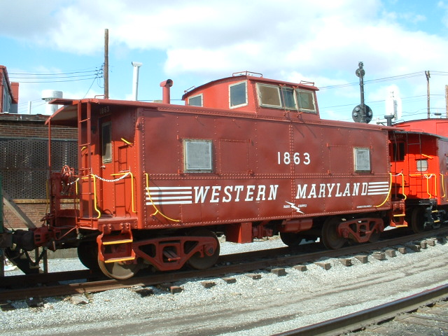
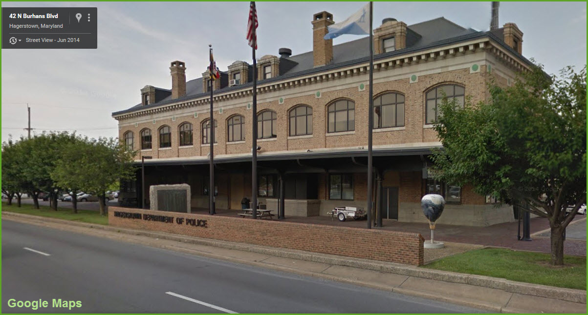
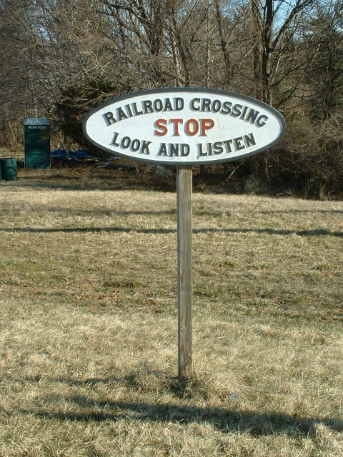
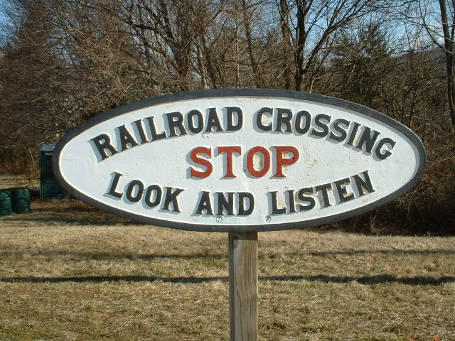
Ex
Western Maryland Depot
6
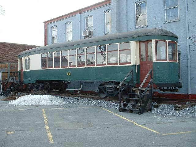
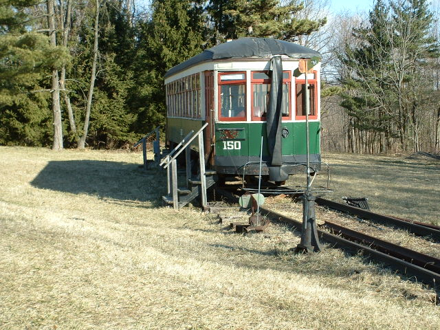
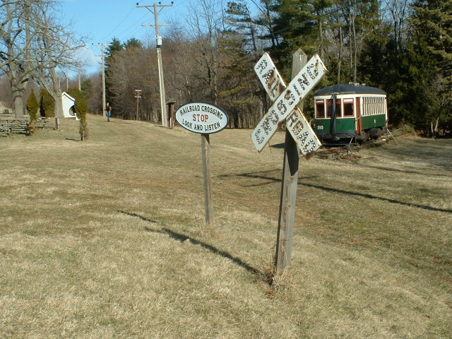
Hagerstown and Frederick Trolley
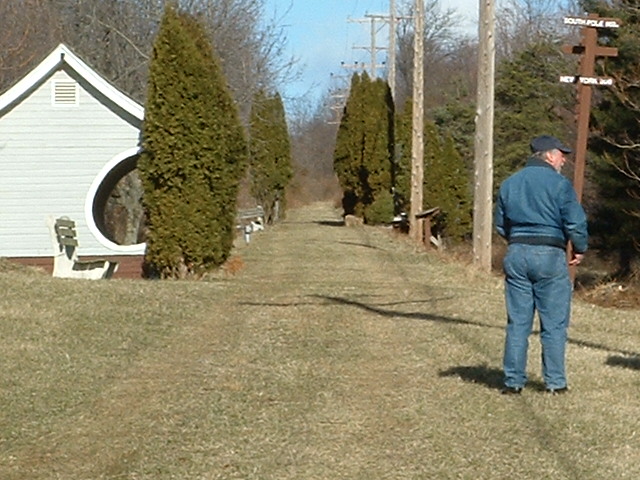
West of Hagerstown, off I70, sits a lone H&F trolley, with a
couple of signs and a trolley stop bungalow. When last there in 2006, the
trolley didn't look like it was being well taken care of, and had a tarp over
the roof. Maybe 15 years ago or so, there was a pretty big event
dedicating the trolley, I'll have to see if I can find pictures from it.....
6
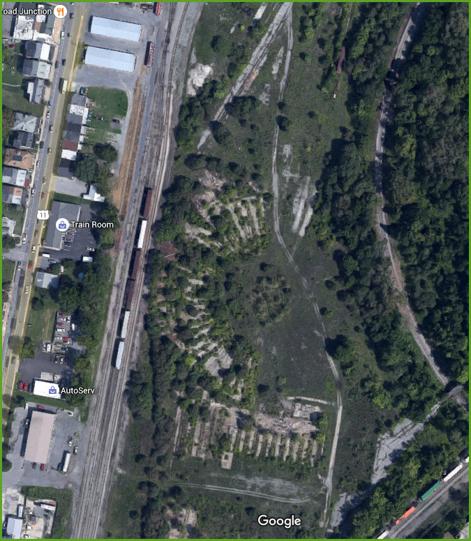
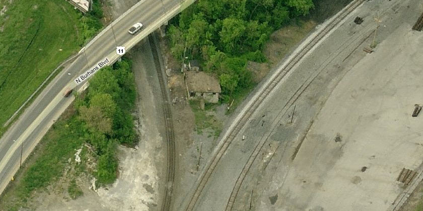
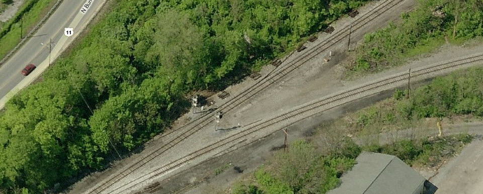
Site of the Former WM Roundhouse
From the ground, you don't see much if anything, but from the
air, you can still see where everything used to be. Good memories used to
be here, especially with 759, 2102, and the D&H PA's coming through here back in
the 70's!
6
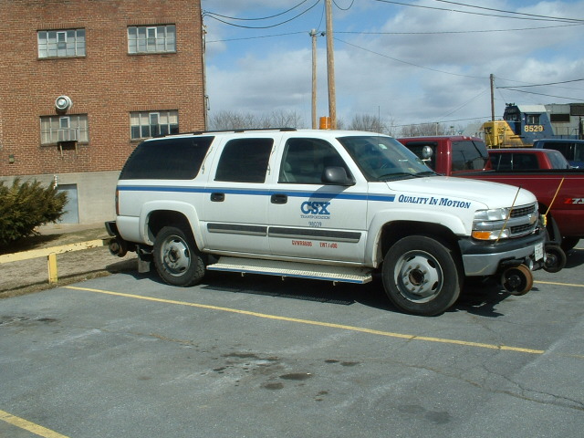
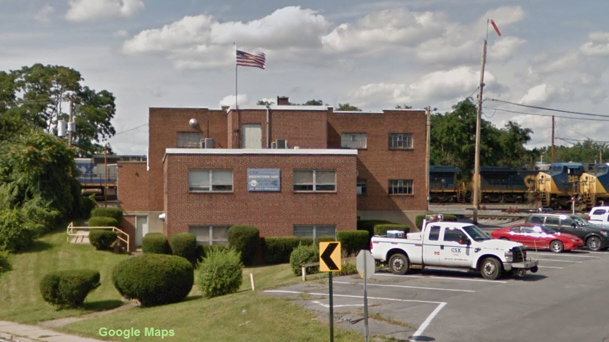
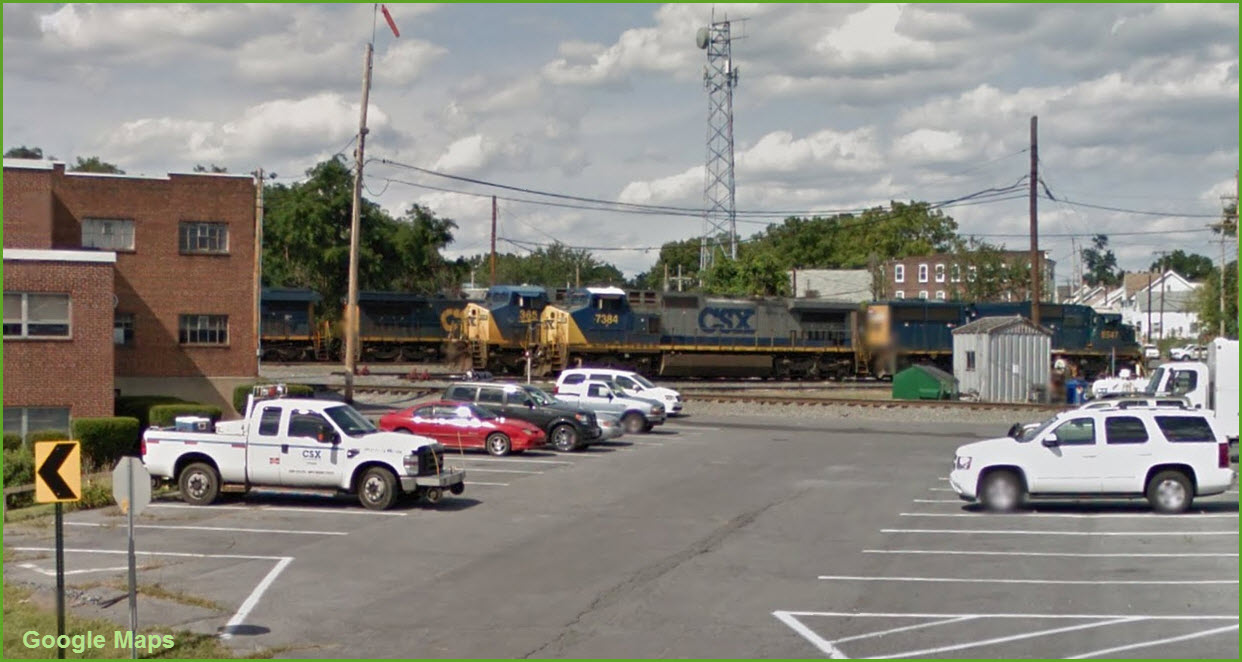
CSX
Yard Office
This building hasn't changed much since I first saw it in
1969!
Locations 1 thru 6 start across from the WM
yard and progress east in order of their locations.
1
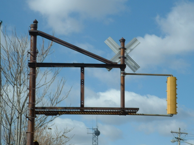
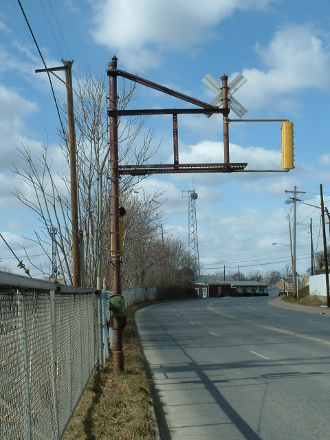
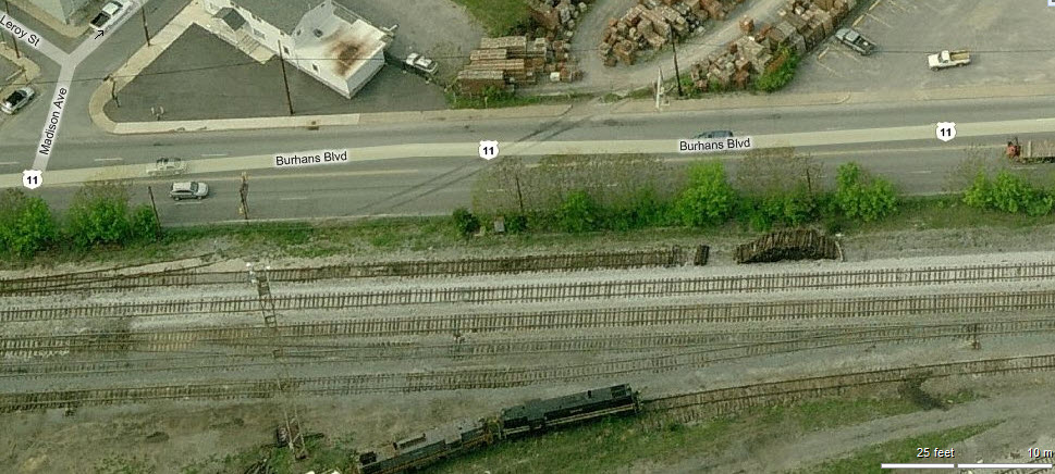
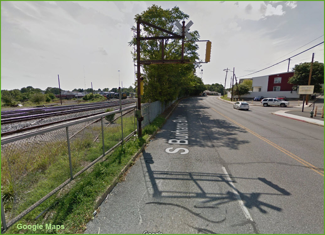
Located on Burhans Blvd (at Madison), along the top of the
"wye" at the yard, are these unique grade crossing signals.
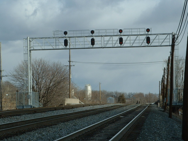
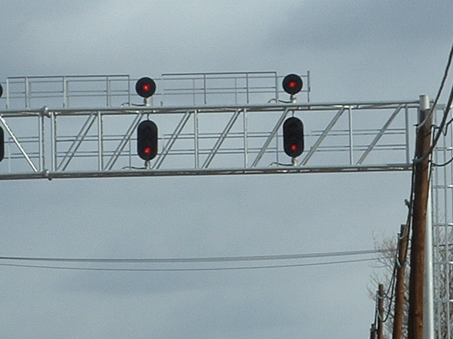
2
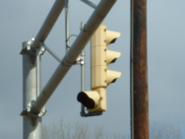
An older signal bridge at W Antietam Street.
3
Here's an interesting note.... if
you're old enough to remember semaphore type lenses on auto type traffic lights,
Hagerstown still had a few around, at least back in 2010 or so when I came across them.
I can't attest to whether or not they are still around, but I have pictures of
them here:
https://railroadsignals.us/signals/hagerstown/
More info at:
http://wikimapia.org/7351343/B-O-Railroad-Weaverton-to-Roxbury-Abandoned
Hagerstown also had an interurban line, the Hagerstown and Frederick
Railway..... construction started in 1896 and saw it's last train around
1958/1961, depending on who you consider the last operating entity. They
ran trolleys and freight service.
For more info:
http://en.wikipedia.org/wiki/Hagerstown_and_Frederick_Railway
Click
here for the
Hagerstown map in PDF version.


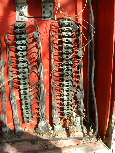
 These used to be very common along the B&O, and some are still
around if you look hard enough. These were for track side phones before
there were radios.
These used to be very common along the B&O, and some are still
around if you look hard enough. These were for track side phones before
there were radios.


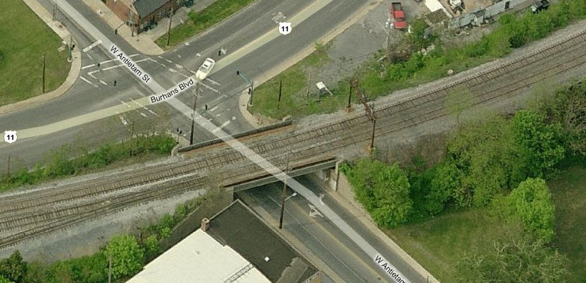
 The yard goes over Burnham Blvd on this very nice looking
overpass.
The yard goes over Burnham Blvd on this very nice looking
overpass.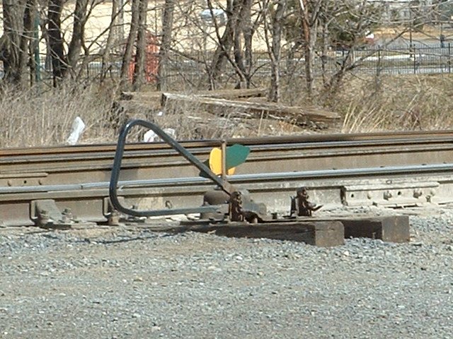 You don't see many throws like this around these parts.
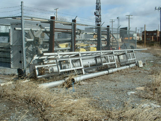
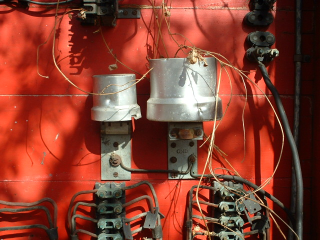
 The signal maintainers maintain a small presence on the far
side of the yard.
The signal maintainers maintain a small presence on the far
side of the yard.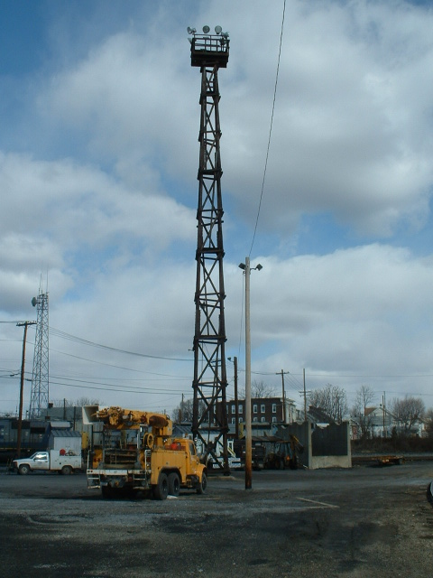
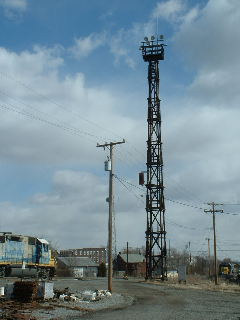
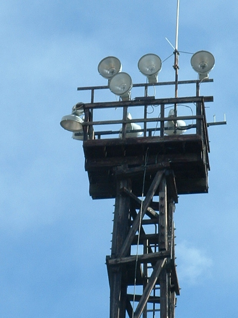
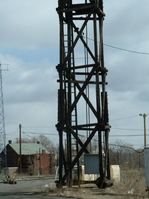
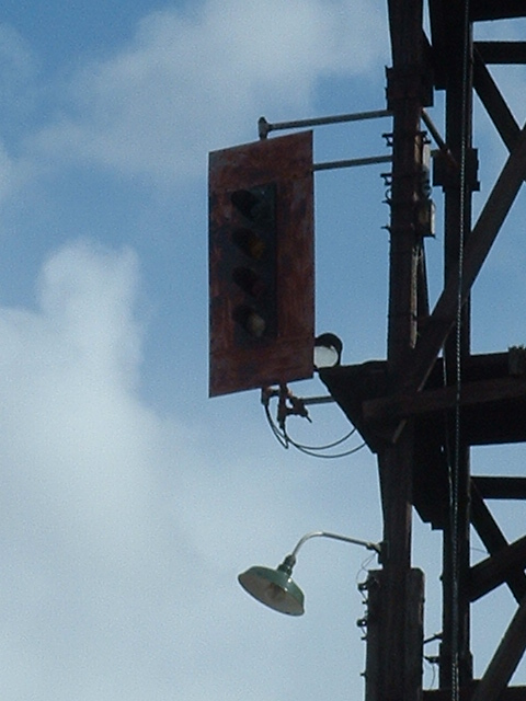
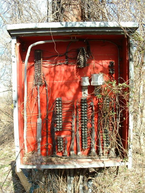
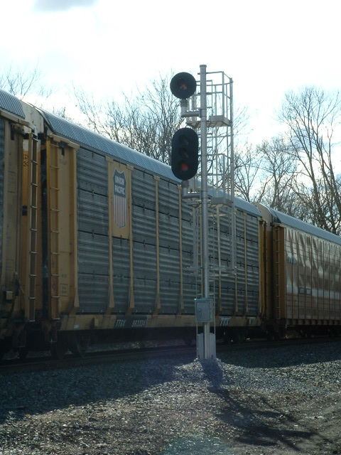
As old as this structure is, I'm surprised it has survived
this long, it uses an auto type signal for controlling the hump movements.


 Michael Watnoski walking the line. The site is actually placed along the
old R-O-W.
Michael Watnoski walking the line. The site is actually placed along the
old R-O-W.


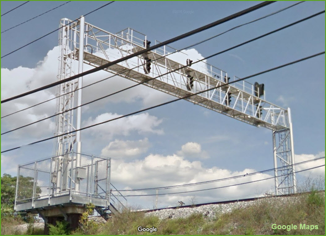
This signal bridge is in downtown Hagerstown, and is easy to get to from either side of the tracks by W Church St and McPherson.
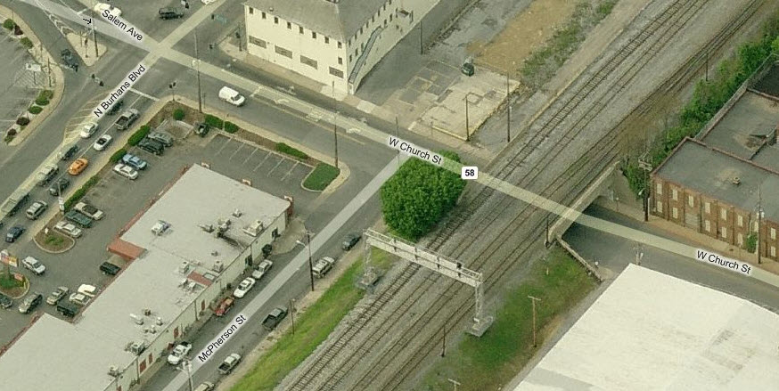
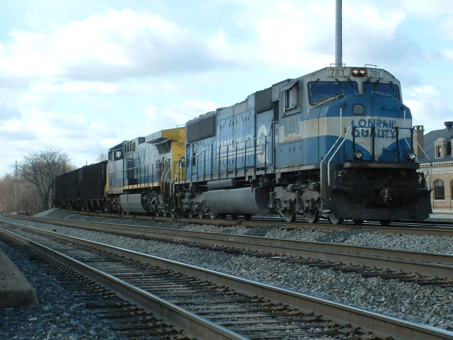
4
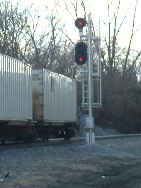
A Norfolk Southern freight is headed north at this signal location, where the signal is controlling a line coming in from the east.
5
This is a little north of location 3 and 4 where the tracks diverge.
6
And once past the diverge, is this pair of signals for trains inbound to Hagerstown from Chambersburg via the long way around.
Railroad History of Hagerstown
From Wikipedia: Hagerstown's nickname of the "Hub City" came from the large number of railroads
(and roads) that served the city. Hagerstown was the center of the
Western
Maryland Railway and an important city on the Pennsylvania,
Norfolk and Western,
Baltimore and Ohio, and
Hagerstown and Frederick Railroads.
Also, Hagerstown was formerly served by the Hagerstown & Frederick Railway, an
interurban trolley system, from 1896 to 1947. The Beginning: The Cumberland Valley Railroad
Company was chartered by the Pennsylvania Legislature on April 2, 1831, to
construct a railroad from Carlisle to a point on the Susquehanna River at or
near Harrisburg. This charter expired, but it was renewed on April 15, 1835,
allowing the road to be built from the Susquehanna River to Chambersburg. On
June 27, 1835, Thomas Grubb McCullough was elected as the first President of the
road, and in August, William Milner Roberts was selected as Chief Engineer. The initial cost of building the road, including a bridge across the
Susquehanna, was estimated before construction at $564,064, and the average
annual receipts of the road at $284,617.50, calculated at 100 passengers each
way per day at 3 cents per mile, and 35,000 tons of through freight and
51,950 tons of local freight, at 4½ cents per ton per mile. $642,000 was raised
by local stock subscription and construction began in the Spring of 1836. The railroad opened for travel from White Hill, near Harrisburg to Carlisle
in August, 1837, and through to Chambersburg in November, 1837. The first
locomotive, built by William Norris in Philadelphia, had two driving wheels,
wooden spokes, and was named "Cumberland Valley," The passenger cars carried 14 passengers each and were bought used from the
Philadelphia and Columbia Railroad, according to the 1887 "History of Franklin
County Pennsylvania." The railroad track was constructed of cross ties laid 4.5
feet (1.4 m)apart without ballast, with 5x9 in (127x229 mm) oak stringers
serving as rails. Iron bar, 0.625 inches (15.9 mm) thick by 2.25 inches (57 mm)
wide, was spiked to the top of the stringers. When service began to
Chambersburg, the iron was not laid for the last 3 miles (4.8 km) and the cars
were run in on the wooden stringers. The first Cumberland Valley Railroad Bridge across the Susquehanna was opened
for travel on January 16, 1839. The first regular passenger service to
Philadelphia, via the Harrisburg, Portsmouth, Mount Joy and Lancaster Railroad,
began on February 1, 1839 with the following schedule:
Leave Chambersburg at 4 o'clock in the morning; Arrive at Harrisburg at 8, at
Lancaster at 12, at Philadelphia before 6 P.M. Returning it will leave
Harrisburg as soon as the cars from Philadelphia arrived, about 5 o'clock in the
evening and arrive at Chambersburg at 10 P.M. The Cumberland Valley Railroad pioneered the use of sleeping cars in the
spring of 1839, a first on any American railroad, with a car named
"Chambersburg." The berths were upholstered boards, in three rows, one above the
other, held by leather straps, and in the daytime were folded back against the
walls. A couple of years later a second car, the "Carlisle," was introduced into
service. Passengers traveling from Pittsburgh to Philadelphia traveled by horse drawn
stage for 36 hours to get to Chambersburg, arriving about midnight, then left by
rail about 1 am, arriving at Harrisburg about 5 am, in time to catch a HPMt.J&L
train to Philadelphia. "The History of Franklin County Pennsylvania" also claims that the first
locomotive cab was constructed in the CVRR shops in Chambersburg in 1841 for a
Franklin Railroad locomotive, named "Washington." Growth: In 1839 the CVRR bought three locomotives
for $21,250, and two passenger cars for $4,175; and ran two passenger trains and
one freight train each day between Chambersburg and Harrisburg. They boasted
that no passenger had been injured in the 2½ years that the road had been
operated. Frederick Watts was elected the third President of the CVRR in 1841 and
served in the post for 32 years. He reported that total annual earnings were
$70,116.82 for 1842. By 1849, annual earnings were $101,084.77, and tonnage
hauled was reported for the first time, totaling 37,439 tons, including
7,818 tons of flour, 5,126 of iron ore, 4,247 of coal, 2,123 of grain, and 2,237
of lumber. In that year plans were made to reconstruct the track with heavy iron
rails. Daniel Tyler was hired in 1850 to supervise the line's rebuilding. He
hired Alba Smith as Superintendent of the machinery shop in 1850. Smith
served as Superintendent of the railway from 1851-1856, and helped introduced
lighter weight "single-wheel" locomotives on the line. These locomotives
included the Pioneer and the
Jenny Lind, bought in 1851,
and the Boston and
Enterprise bought in 1853-54.
In 1999, the Pioneer was moved
from its display at the Smithsonian Institution in Washington DC. to the as yet
unopened National Museum of Industrial History in Bethlehem PA. (The locomotive
was later moved to the Baltimore and Ohio Railroad Museum in Baltimore,
Maryland.) In October, 1862, the Confederate forces destroyed railway buildings in
Chambersburg, and on June 15, 1863, during the Gettysburg Campaign,
they destroyed all company property in the town, and tore up five miles (8 km)
of Franklin Railroad. In July, 1864 Confederate raiders led by Jubal Early
returned and burned the greater part of Chambersburg including most railroad
property. During the 1870s feeder lines such as the
Mont Alto Railroad were added in the Cumberland Valley
to gain access to iron ore deposits. In 1873 the railroad extended south
from Hagerstown to the Potomac River. The Mechanicsburg PA Railroad
Station was built about 1875. In 1889, it reached Martinsburg WV and
Winchester VA, at the head of the Shenandoah Valley. The Cumberland Valley
was to have a junction with the South
Pennsylvania Railroad in Newville, but the ambitious South
Penn ran into financial difficulties during its construction and was never
completed. In June, 1882, the Shenandoah Valley
Railroad was opened from Hagerstown to Roanoke VA. In
conjunction with the Norfolk and Western
Railway the CVRR operated the middle link of the New
York-Harrisburg-Hagerstown-Roanoke, Va. passenger trains. Trains
reportedly traveled at over 90 mph on parts of this route. The End: Regular passenger train service on the
CVRR ended in 1952, the last New York-Roanoke train ran in 1961. The PRR's
successor, the Penn Central, closed all railway facilities in Chambersburg in
1972. Its successor, Conrail, first renamed what had been known as the
Cumberland Valley Branch with three names: Shippensburg Secondary Track
(Harrisburg to PENNROAD, south-east of Shippensburg); Hagerstown Secondary Track
(from the Reading junction north-east of Shippensburg, through PENNROAD, to TOWN
and HAGER towers in Hagerstown); and Winchester Secondary Track. Conrail later
(1979–1980) abandoned the southern half of the Shippensburg Secondary (from the
west side of Carlisle to Shippensburg, including street-running trackage on Earl
St. in the latter town), opting instead to use the Reading connection for
freight trains. Instrumental in this realignment was the placement of a wye
track at CAPITOL interlocking in Harrisburg. Conrail also abandoned the trackage
on the western portion of the CV bridge in Harrisburg, leaving a wye for Amtrak
to turn power. The Winchester Secondary was sold to a short line. The Lurgan
Branch name, originally used by Conrail for the ex-Reading trackage that passed
through Shippensburg to a connection with the Western Maryland, was retained.
Norfolk Southern Railway operates the trackage since the 1999 breakup of
Conrail. The planned CorridorOne commuter rail service between Harrisburg and
Carlisle, plans to use the old Cumberland Valley Railroad Bridge In the beginning. The Western Maryland Railway
(reporting mark WM) was an American Class 1 railroad which operated in Maryland,
West Virginia, and Pennsylvania. It was primarily a coal hauling and
freight railroad, with a small passenger train operation. The WM became
part of the Chessie System
in 1973, although it continued independent operations until May 1975 after which
time many of its lines were abandoned in favor of parallel
Baltimore and Ohio Railroad
lines. In 1983 it was fully merged into the Baltimore & Ohio Railroad,
which later was also merged into the Chessie System with the former Chesapeake
and Ohio Railroad, which is now CSX
Transportation.
Hagerstown is currently
served by: CSX, Norfolk Southern, and the
Winchester and Western Railroads.
The Cumberland Valley RR
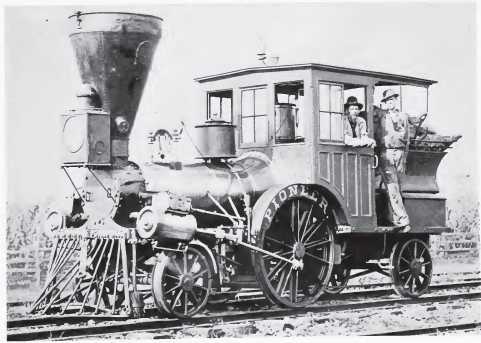 Pioneer Locomotive
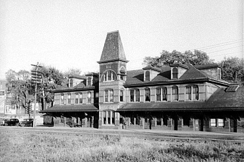 The
Hagerstown station, built 1883
The
Hagerstown station, built 1883
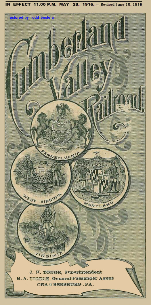 The 1916 CVRR
Timetable
The 1916 CVRR
Timetable
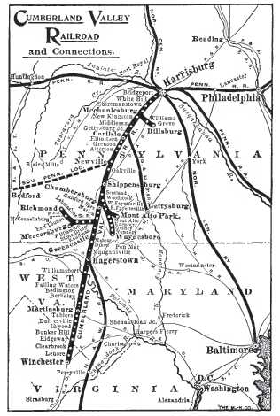 CVRR system map from
1919
CVRR system map from
1919
In March, 1832, the Franklin Railroad was
chartered by the Pennsylvania Legislature, and on January 16, 1837 by the
Legislature of Maryland. The road was built from Chambersburg to
Greencastle PA in 1837, and to Hagerstown MD in 1841. It owned its own
steam locomotives, but these were sold about 1841, when the CVRR began operating
the road. Horse power, rather than steam power, was used during the 1840s
and 1850s. Ownership and operating rights changed hands several times,
until 1860 when the track was rebuilt with heavy rails and the CVRR contracted
to operate the track. In 1865 the two railroads were merged.
The Western Maryland Rwy
In 1873 the WM built its own line from Owings Mills to Fulton Junction in Baltimore, and obtained trackage rights from the Baltimore and Potomac
Railroad (B&P) for the remaining two miles of the route eastward to Union Station (later called Penn Station). It built a branch east of Union Station
to Hillen Station, which opened in 1876 and became the company headquarters. The WM built a connection from Hagerstown to Williamsport, in order to access coal traffic
from the Chesapeake and Ohio Canal.

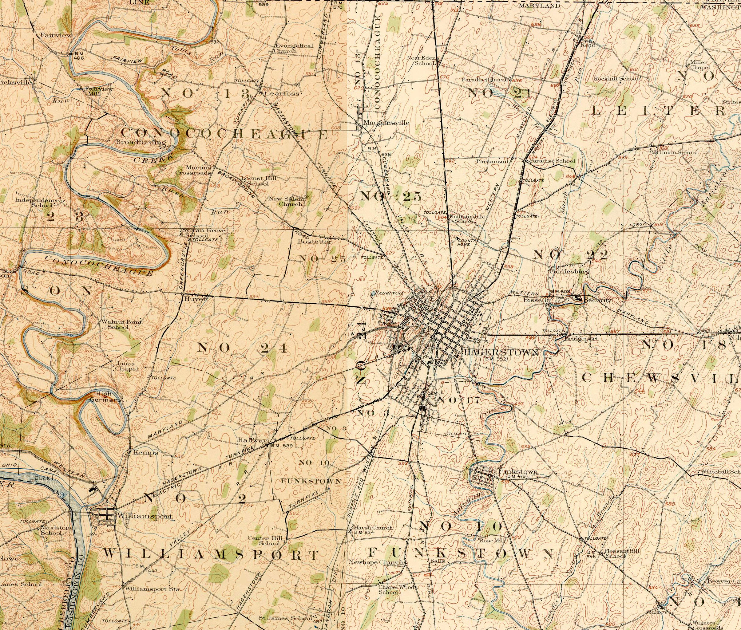
The map below is composite of four maps from 1912, two from the Hagerstown quadrangle, and two from the Wiliamsport quadrangle.
Disclaimers:
I love trains, and I love signals. I am not an expert. My webpages
are a compilation of what I find on the topic and subject of the page. This is something I have fun with while
trying to help others. Please try to NOT be too critical if you feel
compelled in writing to me, remember, I'm trying trying to have fun!!! :-)
:-) Corrections and additions are always welcome.
Please Note: Since the main focus of my two websites is railroad signals, the railfan guides are oriented towards the signal fan being able to locate them. For those of you into the modeling aspect of our hobby, my indexa page has a list of almost everything railroad oriented I can think of to provide you with at least a few pictures to help you detail your pike.
If this is a railfan page, every effort has been made to make sure that the information contained on this map and in this railfan guide is correct, as of the last date it was worked on. Once in a while, an error may creep in :-)
My philosophy: Pictures and maps are worth a
thousand words, especially for railfanning. Text descriptions only
get you so far, especially if you get lost or disoriented. Take
along good maps.... a GPS is OK to get somewhere, but maps are still
better if you get lost! I belong to AAA, which allows you to get
local maps for free when you visit the local branches. ADC puts
out a nice series of county maps for the Washington DC area, but their
state maps do not have the railroads on them. If you can find em,
I like the National Geographic map book of the U.S..... good, clear, and
concise graphics, and they do a really good job of showing you where
tourist type attractions are, although they too lack the railroads.
Other notes about specific areas will show up on that page if known.
By the way, floobydust is
a term I picked up 30-40 years ago from a National Semiconductor data
book, and means miscellaneous and/or other stuff.
Pictures and additional information is always needed if anyone feels
inclined to take 'em, send 'em, and share 'em, or if you have
something to add or correct.... credit is always given! Contact info
is here
Beware: If used as a source, ANYTHING from Wikipedia must be treated as
being possibly being inaccurate, wrong, or not true.
RAILFAN GUIDES HOME
RAILROAD SIGNALS HOME
2006-0226
New: 09-3-2010/10-11-2014
Mod: 31-May-2017