

In General
Getting Here
Map
Sights
Pictures
Bridges
Signals
Fire & Police
Floobydust
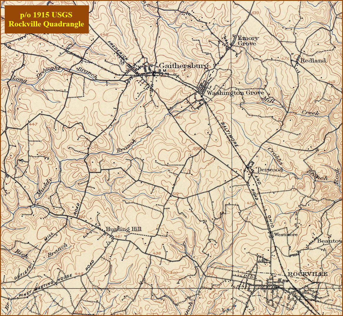
USGS Maps
RAILROAD SIGNALS HOME
Location / Name:
Gaithersburg MD, Montgomery County
What's Here:
CSX
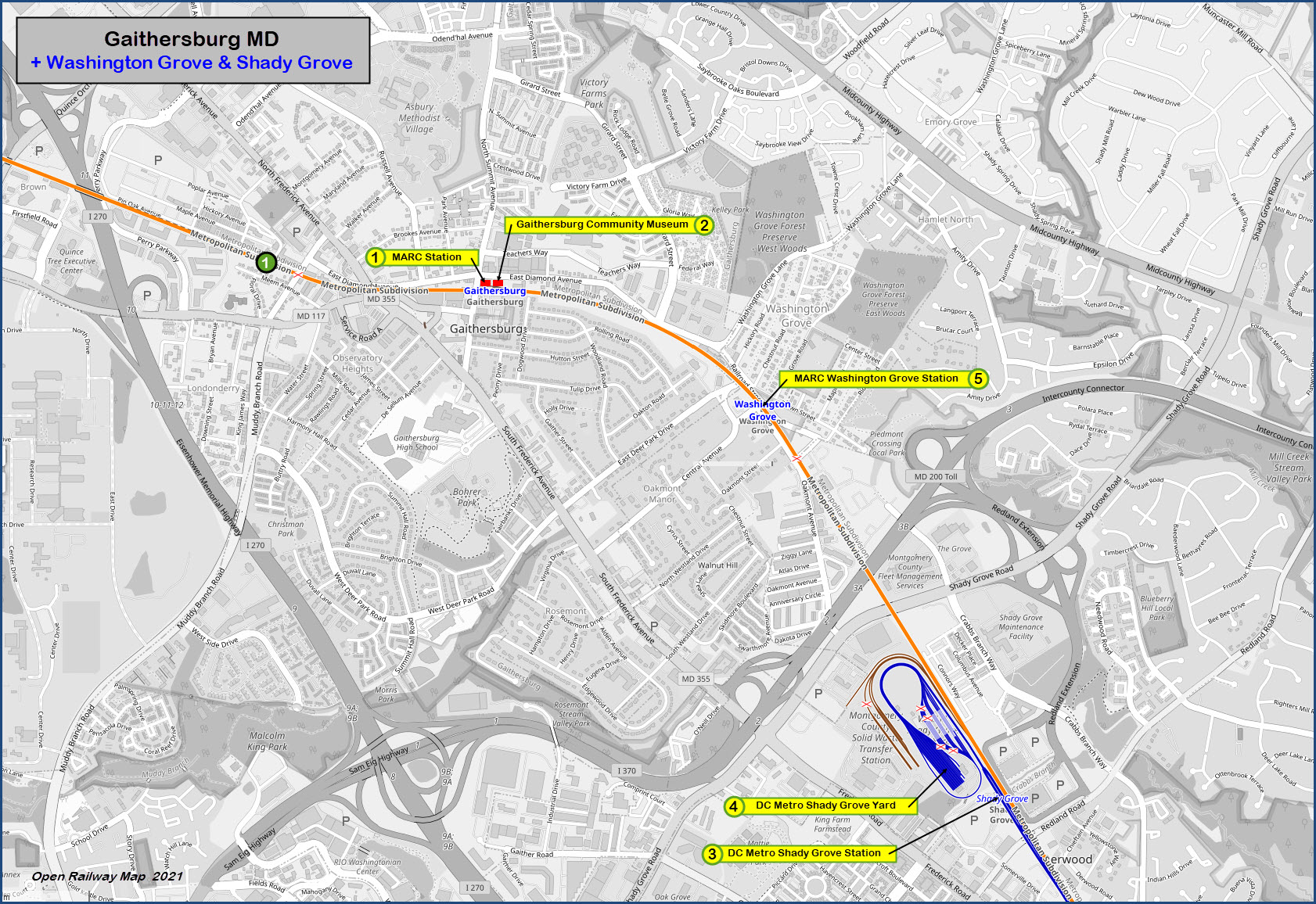
MARC Gaithersburg Station
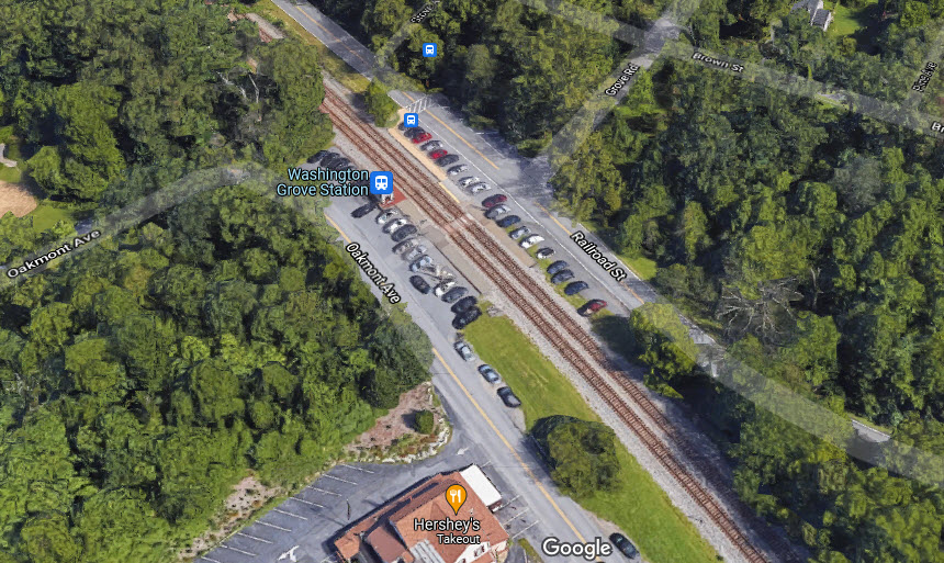
MARC Washingtion Grove Station
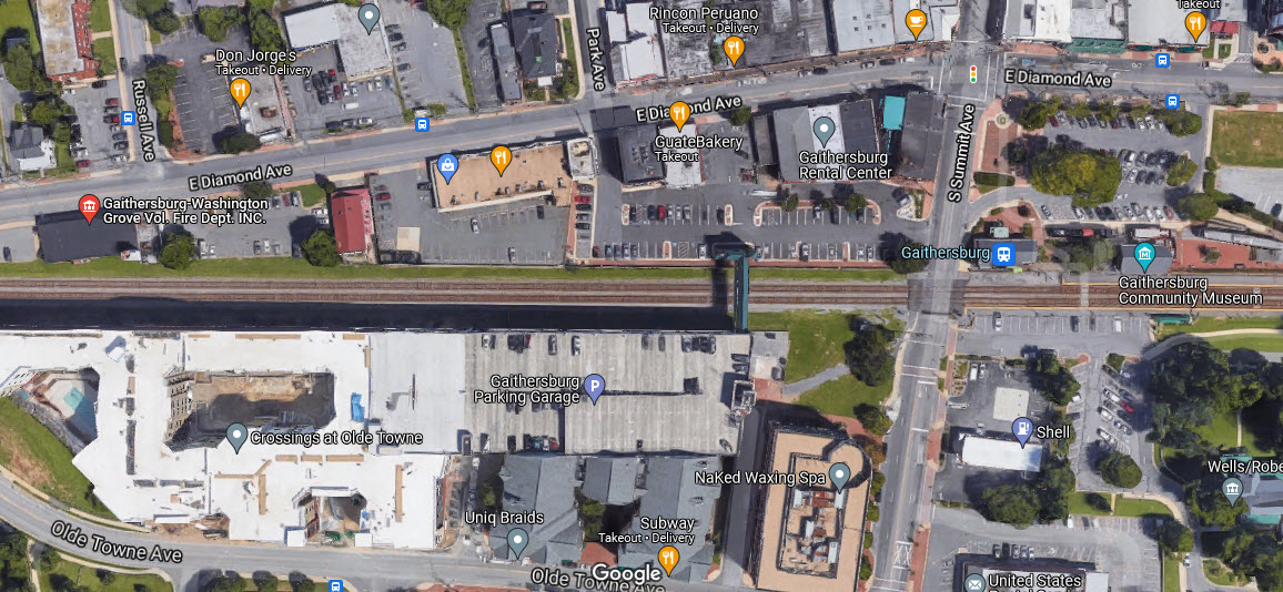
Gaithersburg Community Museum
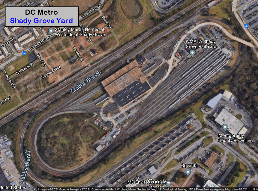
DC Metro Shady Grove Station
DC Metro Red Line Yard and Maintenance Facility
Data:
GPS Coordinates: as needed
Phone A/C: 301/240 (cellphones)
ZIP: 20877
Access by train/transit:
MARC
DC Metro, Red Line (end of the line)
The Scoop:
CSX's two-track mainline that heads west out of the Baltimore/Washington area treks through Gaithersburg. It is the Metropolitan Division. The other way out of Baltimore is the Old Main Line, which splits off from the Baltimore to DC mainline in Elkridge MD, goes thru Frederick MD, and joins up with the Metropolitan Division in Point-of-Rocks MD.
The Gaithersburg train station is a great place to watch activity from, and a number of things, like the parking garage overpass, provide a nice back-drop for EB trains (those headed into DC).
As for MARC service, Gaithersburg sits on the Brunswick line, which goes all the way to Martinsburg WV. Metropolitan Grove is the station to the west of Gaithersburg (~3.6mi), and Washington Grove is about 0.9mi east.
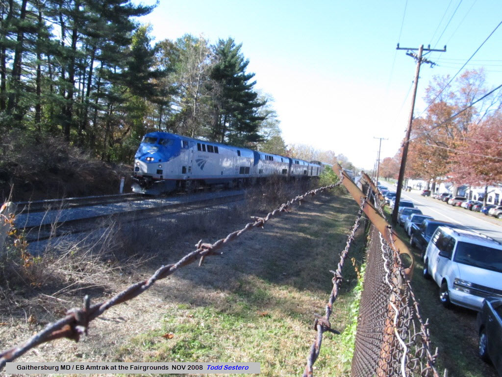
If you happen to be at the Gaithersburg Fairgrounds, you need to be near the tracks to catch them as they come by, for there is no real way to know when something is approaching, so it is not possible to run and catch 'em, trust me, I know... been there, done that (at least tried :-)
Signals on the line are now standard "Darth Vader" style color lights, having replaced the B&O CPL's around 2015? or so. Darn.
Although Washington Grove and Shady Grove are technically outside of the city limits of Gaithersburg, they are being included in the Gaithersburg guide.
In the very first episode of the final season of THE WALKING DEAD, we find one of the search teams (with Neegan and Daryl) entering the Metro system at the Shady Grove station, altho they depict the station as being underground.
The area is especially lucky to be in the middle of a "touristy" area, and as such, there are plenty of places to eat at - catering to almost every taste.
Acknowledgements:
Adam White
John Cowgill
Ben Schumin
Websites and other additional information sources of interest for the area:
https://en.wikipedia.org/wiki/Gaithersburg_station
https://mht.maryland.gov/nr/NRDetail.aspx?NRID=500
https://en.wikipedia.org/wiki/Metropolitan_Grove_station
https://johncowgillstoriesoftherailroad.com/2019/04/17/gaithersburg-community-museum-gaithersburg-maryland/
https://en.wikipedia.org/wiki/Shady_Grove_station
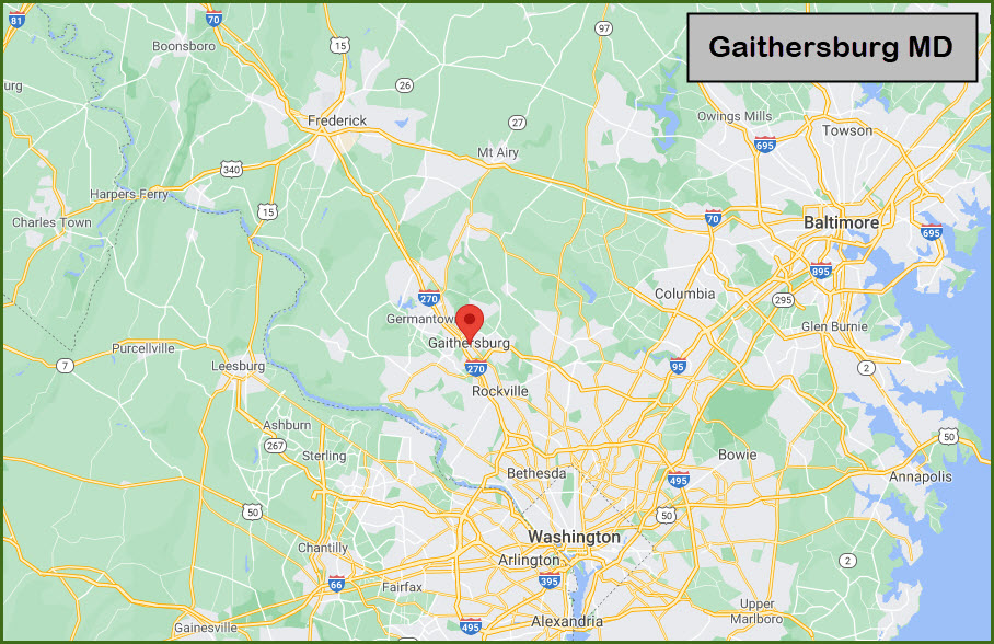
From Baltimore you have two choices:
1) Come down I-95 to the Washington Beltway, I-495, and go west. Get off at I-270 and head to exit 11.
2) The other way, which I use since I am on the north side of Baltimore, is to head west on I-70, and get off at exit 68, MD 27, and head south thru Damascus. Take a left when you get to Frederick Rd (355), and take into Gaithersburg.
If you are coming from the west, ie, PA, WV, etc, find your way to I-70, and when you get to Frederick MD, take I-270 south towards DC (exit 53). Get off at exit 11, MD 124, which is Montgomery Village Ave. Take a left at the end of the ramp to get over to Frederick Rd/MD 355, and take a right.
Coming up from the south via I-95 in Virginia: take the DC Beltway west to I-270 (exit 170), and then get off at exit 9A/B for I-370 over to Frederick Rd at Shady Grove, or exit 11.
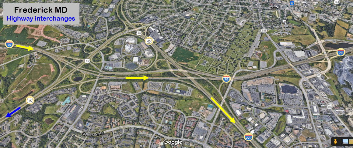
The interchanges at Frederick MD.... it is a mess, and you need to pay attention!!! If you want to go down to Harpers Ferry or Brunswick, take US 15 at the blue arrow.
GPS Coordinates: 39.14168, -77.19325
From Wikipedia: The station was originally built in 1884 for the Metropolitan Branch of the Baltimore and Ohio Railroad (B&O). The station was designed by Ephraim Francis Baldwin, and consists of two historic buildings. The passenger station is a one-story common-bond brick structure with a gable roof. It is nearly identical in plan and dimensions to the Laurel MD station Baldwin designed, also built in 1884, although the rooflines and settings are quite different. About 90 feet to the east of the station is the freight shed or loading dock, a brick structure about 45 ft × 20 ft. Its north and south facades are divided into six panels with a door in the second and fifth bays on both sides. The station was extended to the east in 1905.
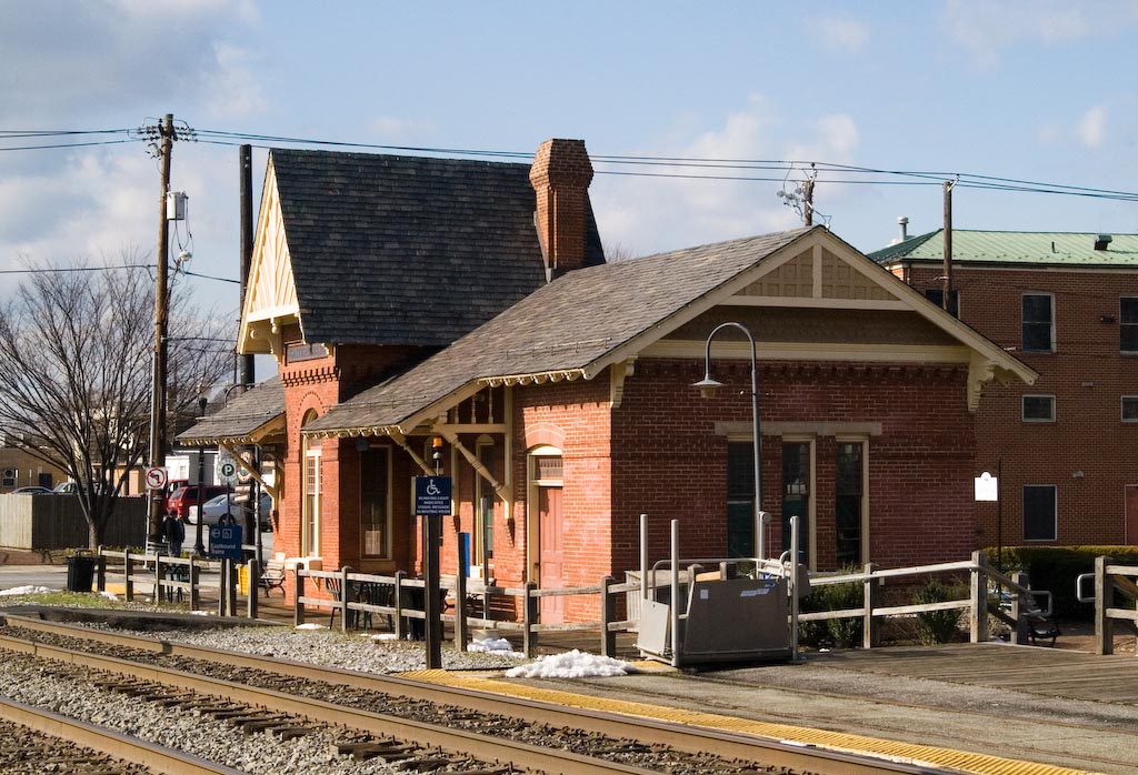 photo by BobDrzyzgula via Wikipedia
GPS Coordinates: 39.14166, -77.19276
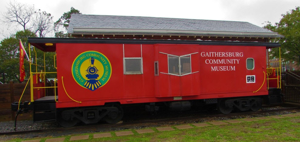
From Wikipedia: The Gaithersburg Community Museum is located in the restored 1884 B&O Railroad Station complex, and includes the freight house, a history park and a caboose. The museum features exhibits about the city's history, as well as historic railroad artifacts and equipment. The Buffalo Creek and Gauley Railroad steam locomotive Consolidation #14, along with a caboose and a Budd RDC are on display in front of the freight shed.
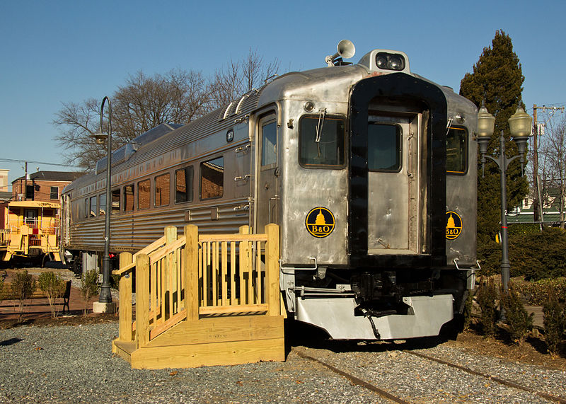 photo by jpmueller99 via Wikipedia
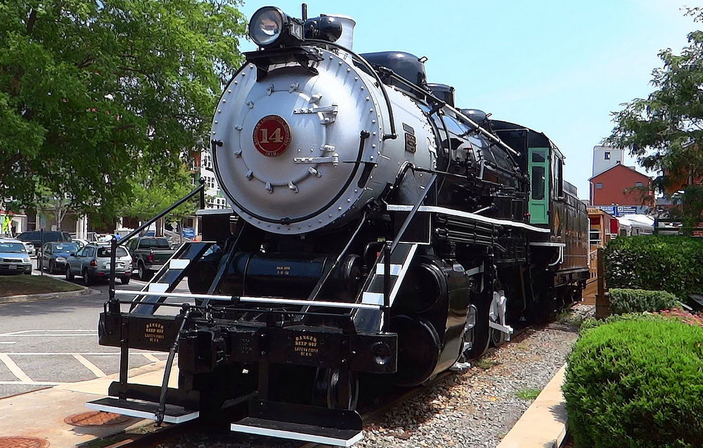
 John Cowgill
GPS Coordinates: 39.11997, -77.16470
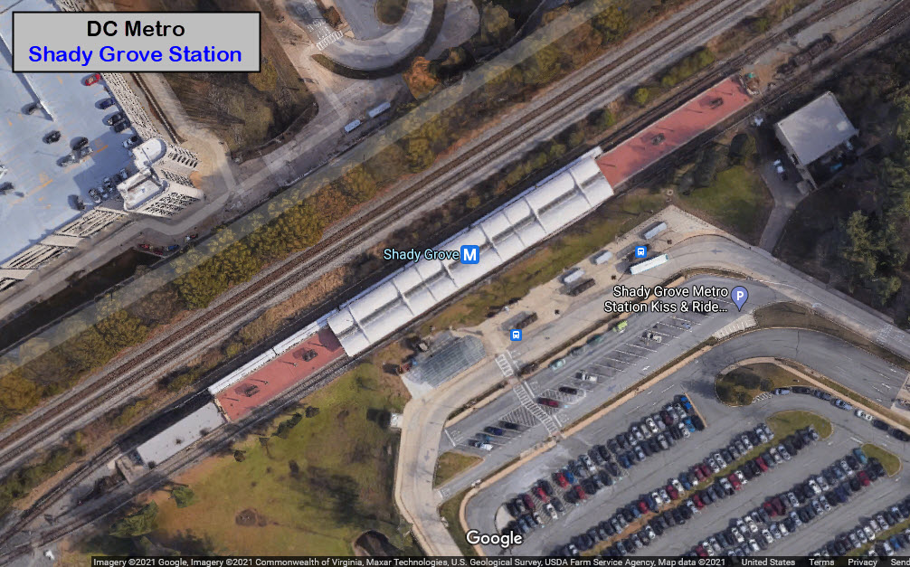
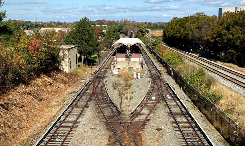
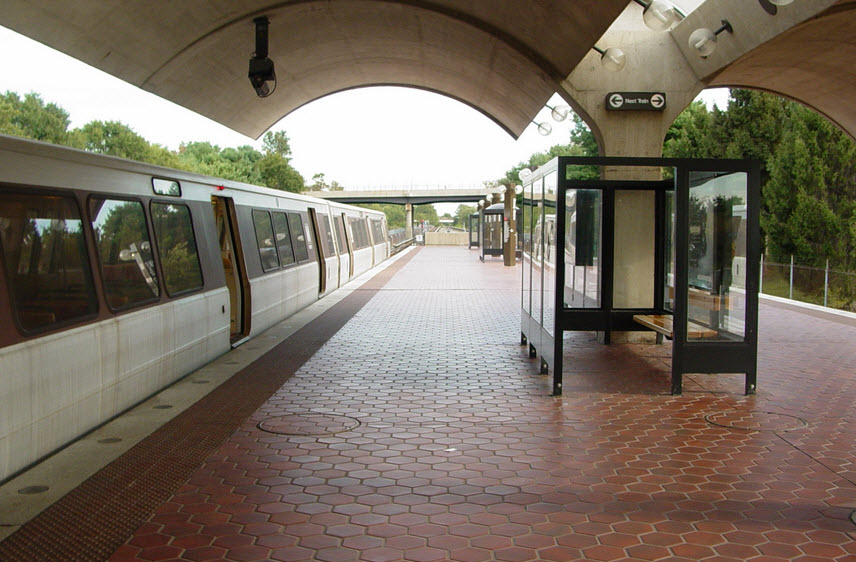 photo by Ben Schumin, via Wikipedia
GPS Coordinates: 39.12297, -77.16822
GPS Coordinates: 39.13643, -77.17769
From Google comes this nice shot of a NB Amtrak train.
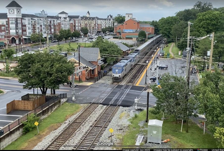 Adam White via Google
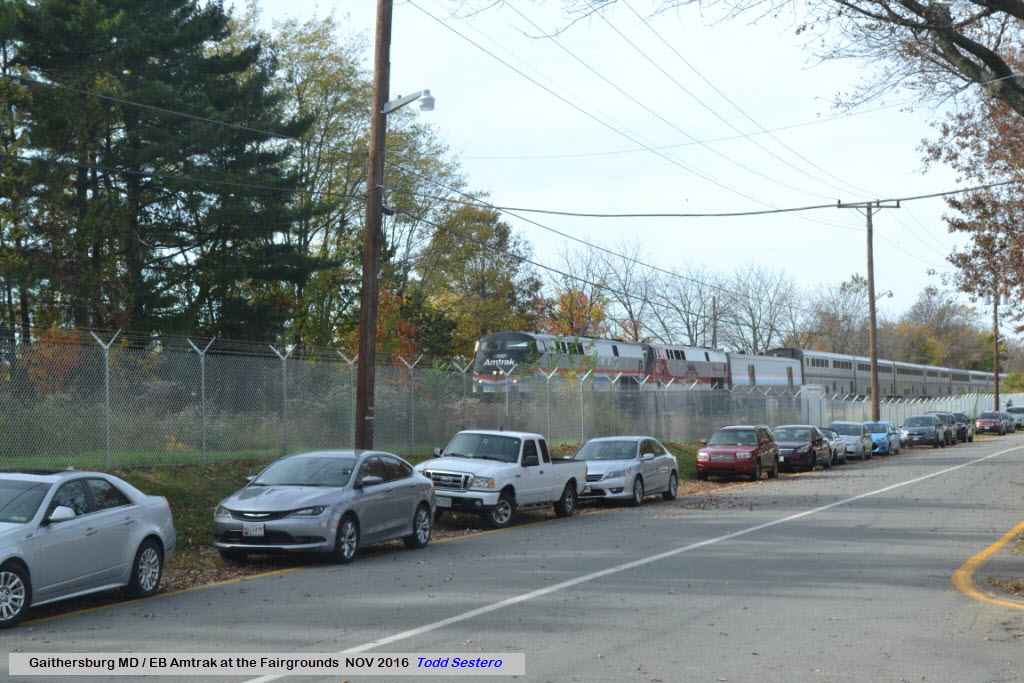
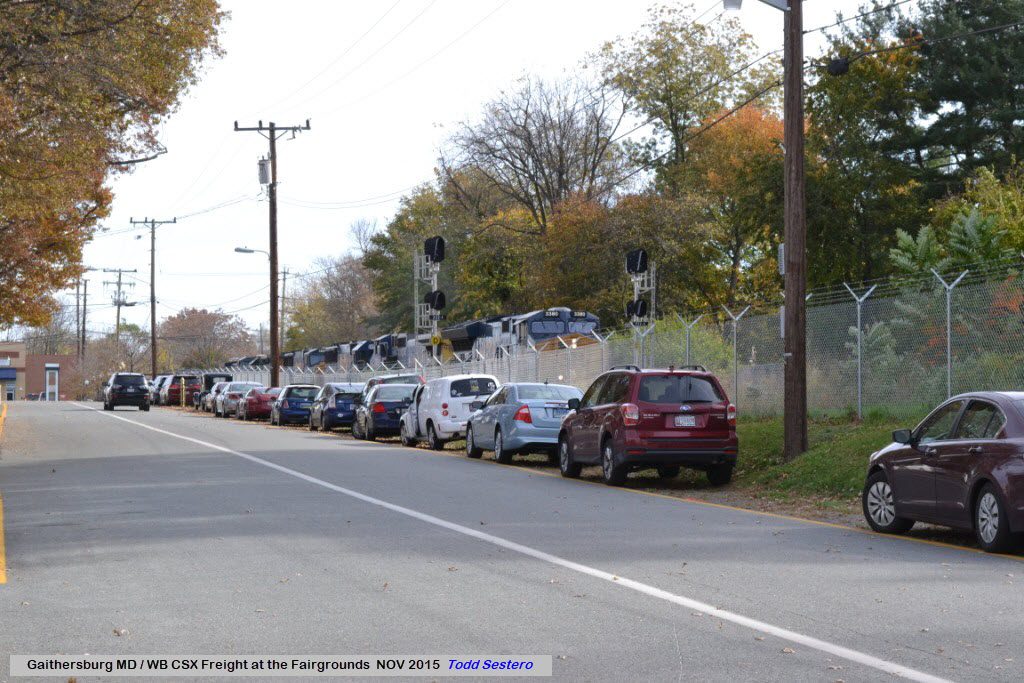
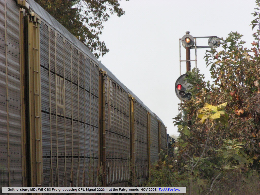
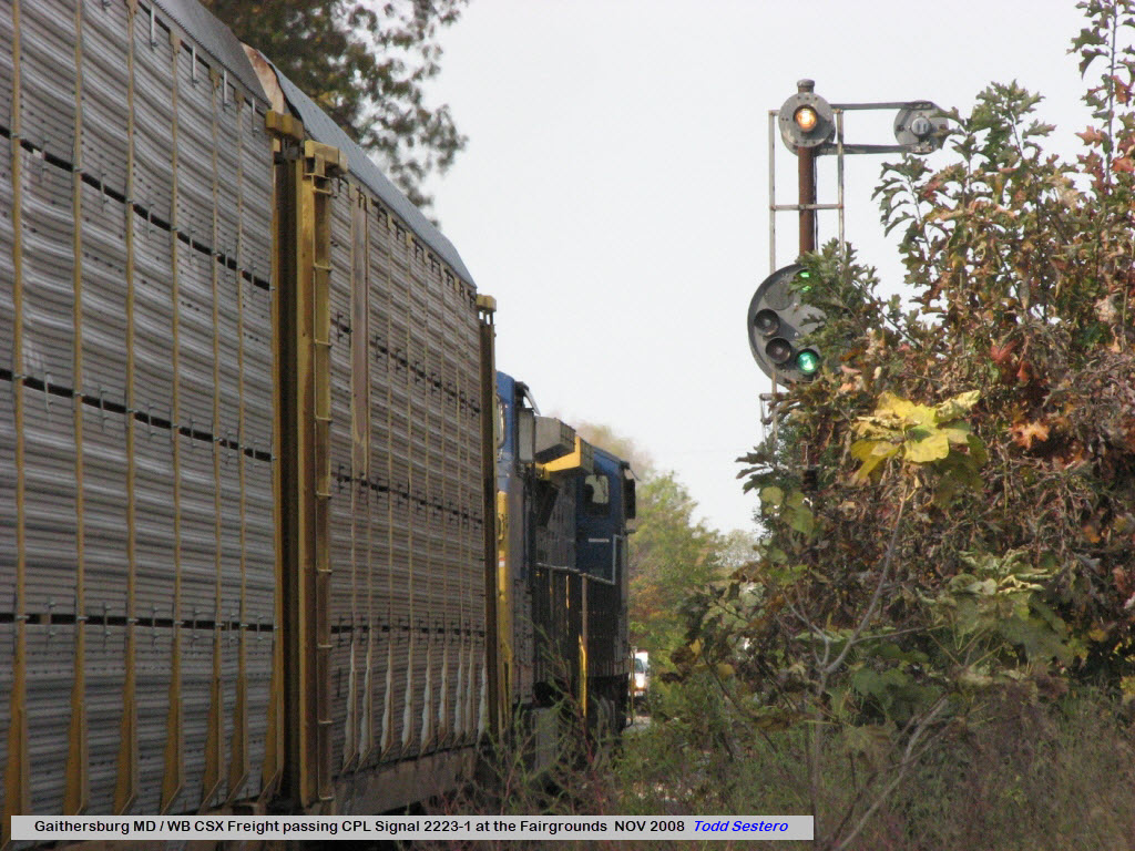
Unfortunately, the signals at the fairgrounds are approach lit, so unless you have an opposing move on the other track, the signals will be dark.
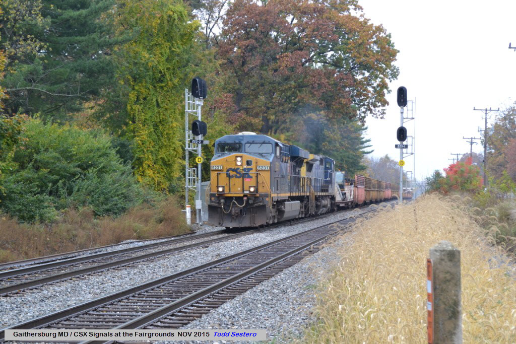
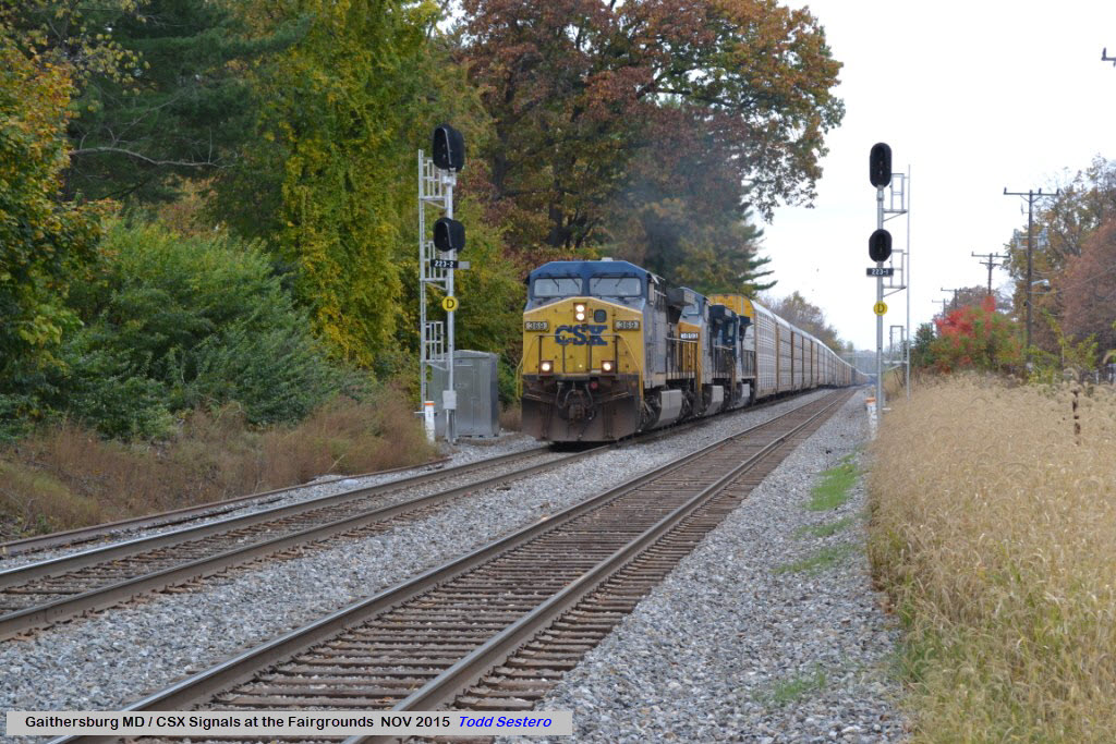
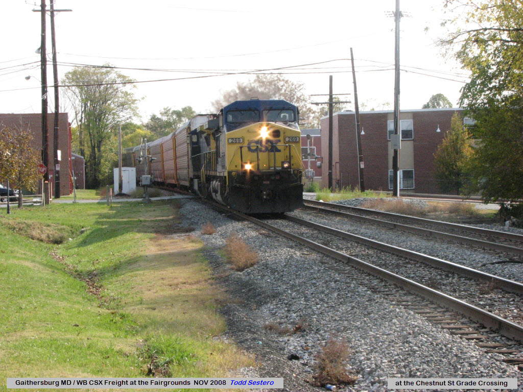
The next three pictures illustrate what you can expect to see if you can't make it to the end of the fence before a train comes....
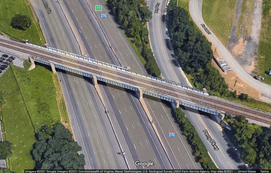
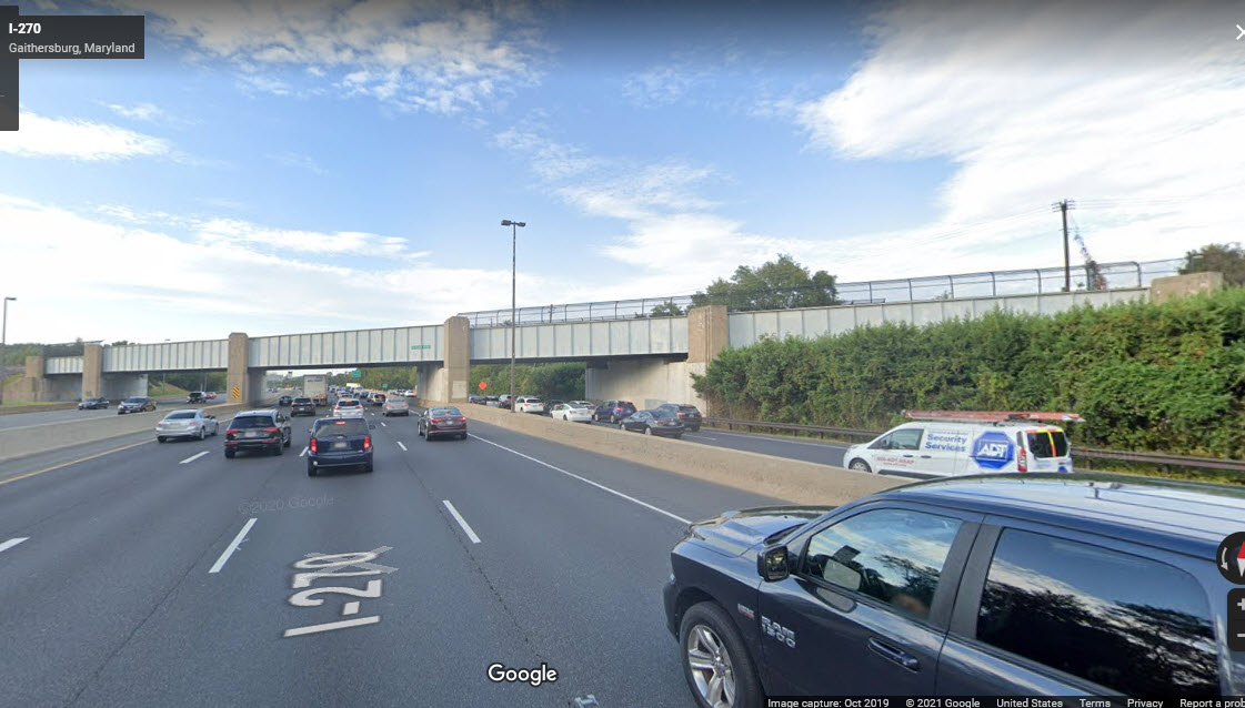
GPS Coordinates: 39.14567, -77.21465
A massive steel girder bridge for two tracks, spanning 4+4+2+2 highway lanes, with concrete abutments and 4 intermediate supports. I'm sure this bridge was rebuilt from what the B&O had built when they widened I-270.
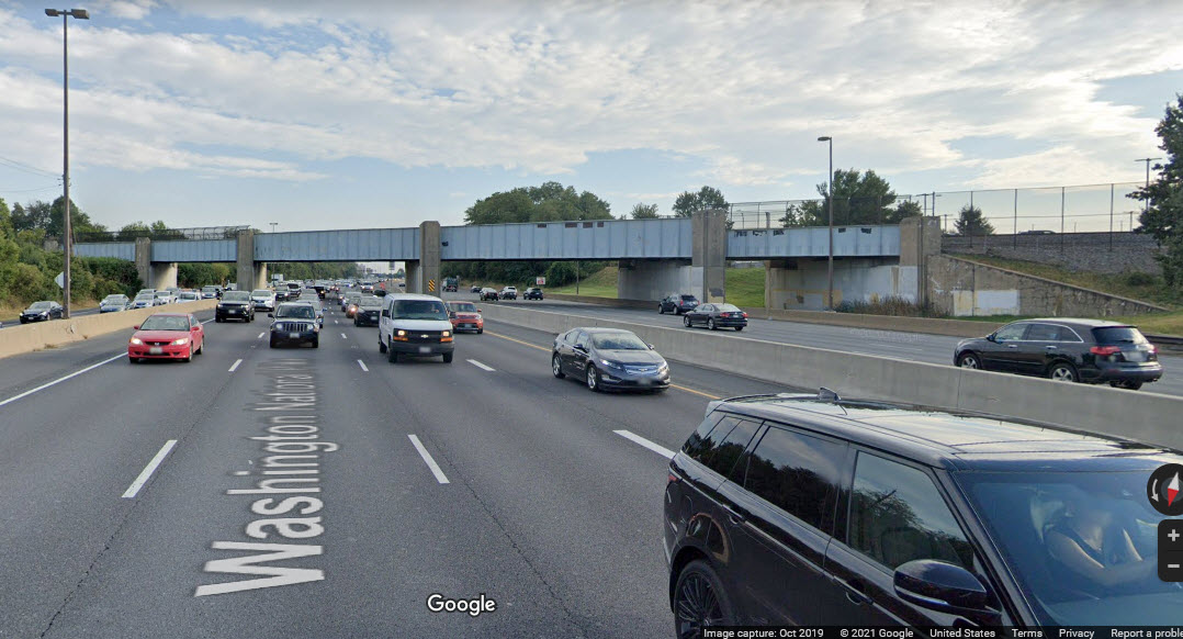
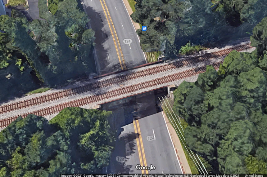
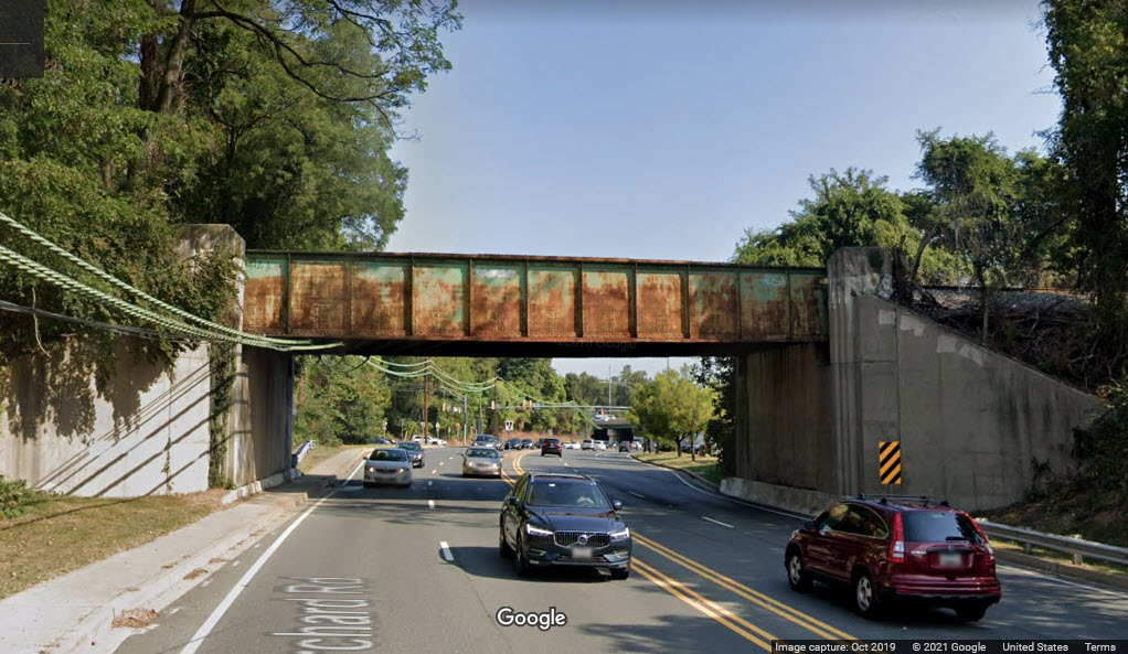
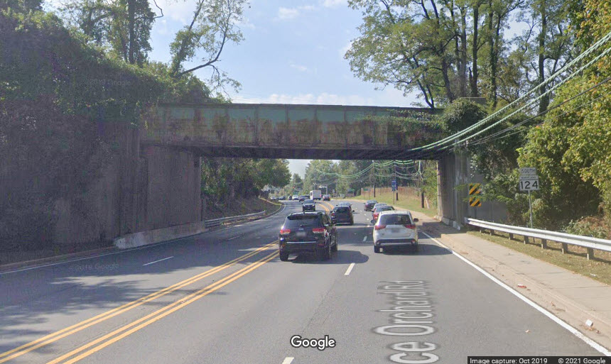
GPS Coordinates: 39.14695, -77.21906
A steel girder bridge for two tracks, over a four lane road, with concrete abutments. Span also goes over one sidewalk, not separated from the road.
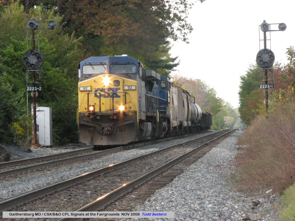
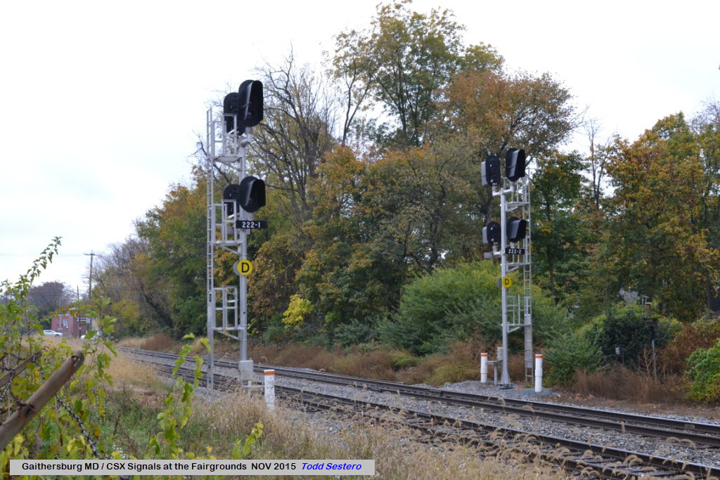
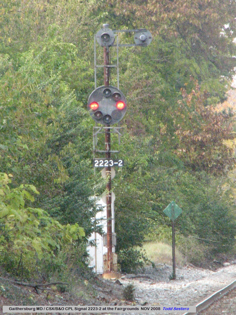
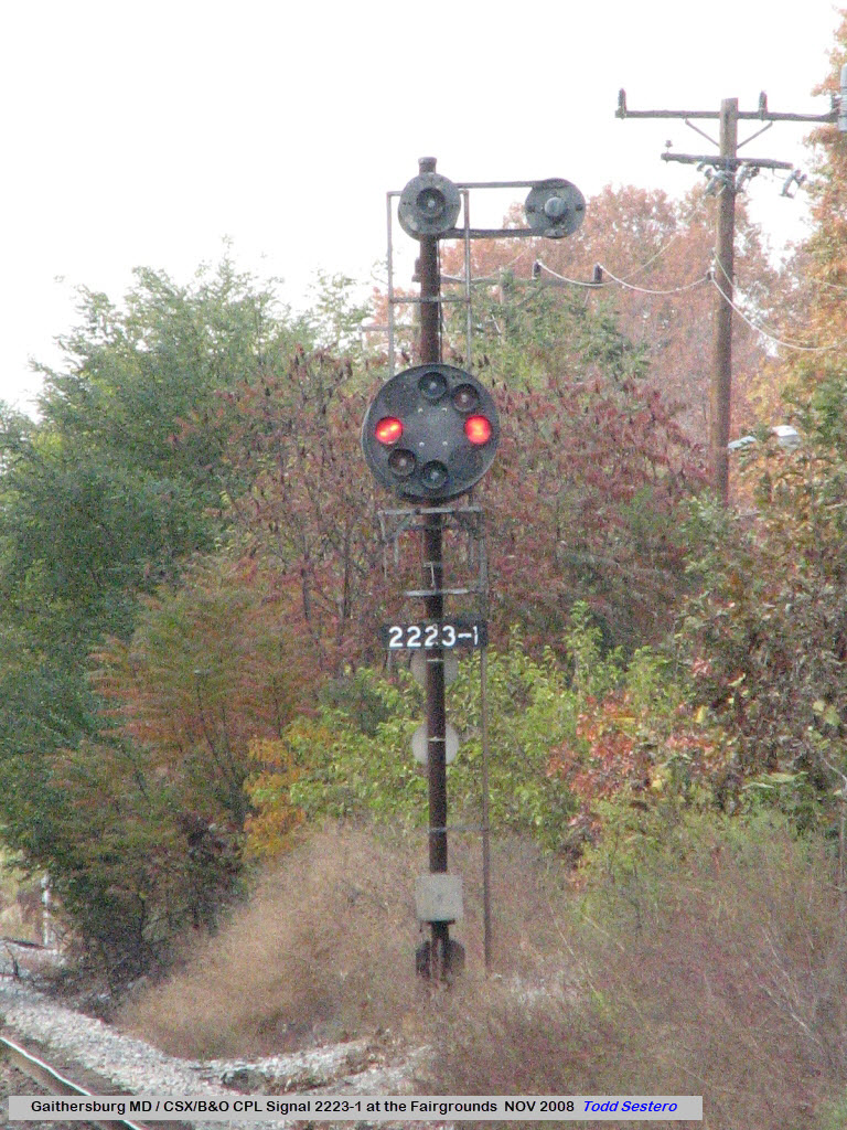
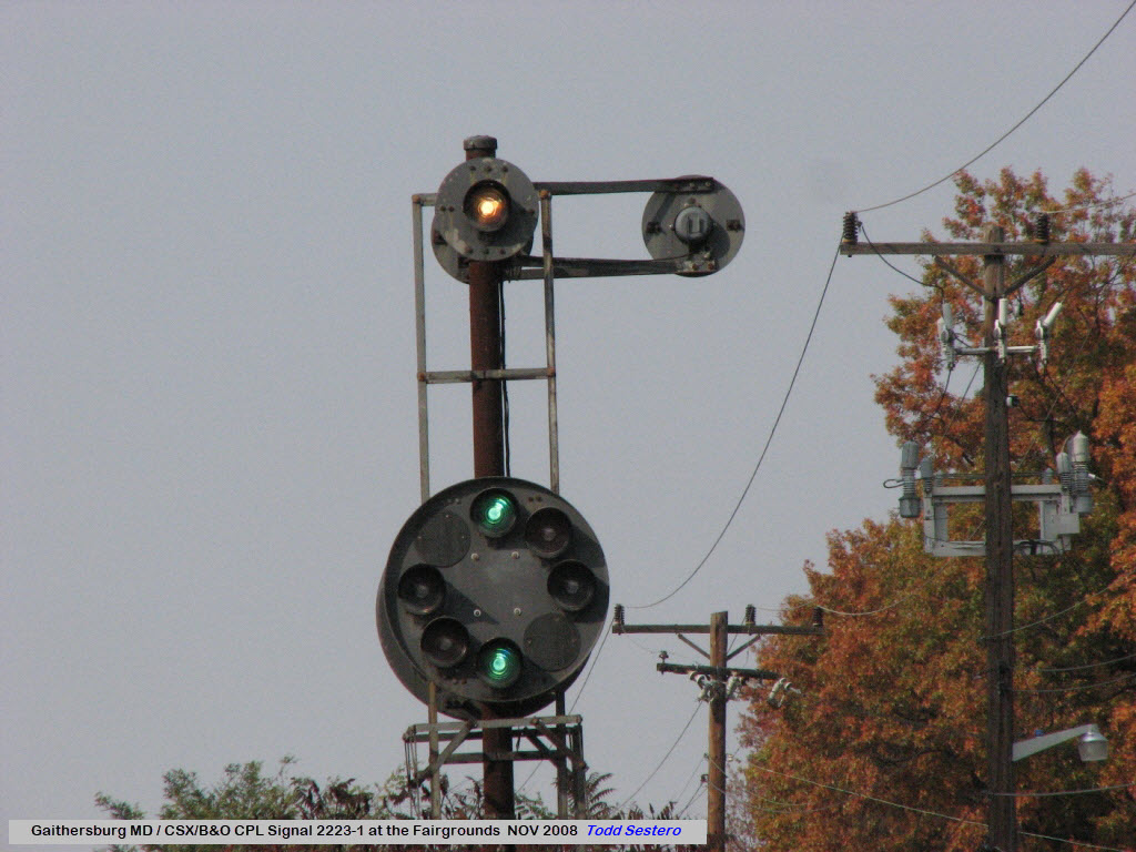
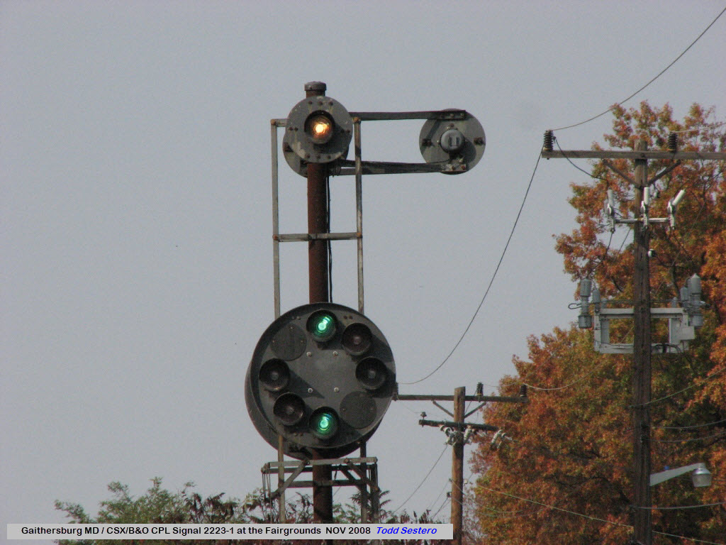
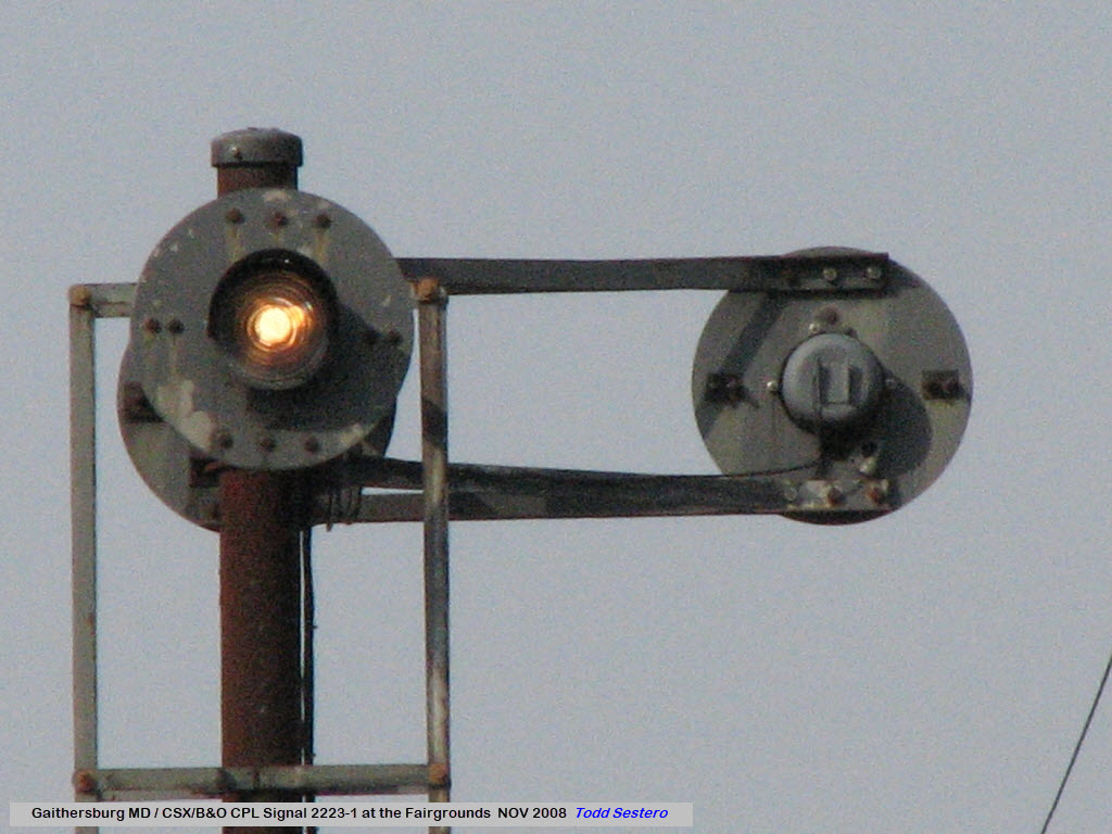
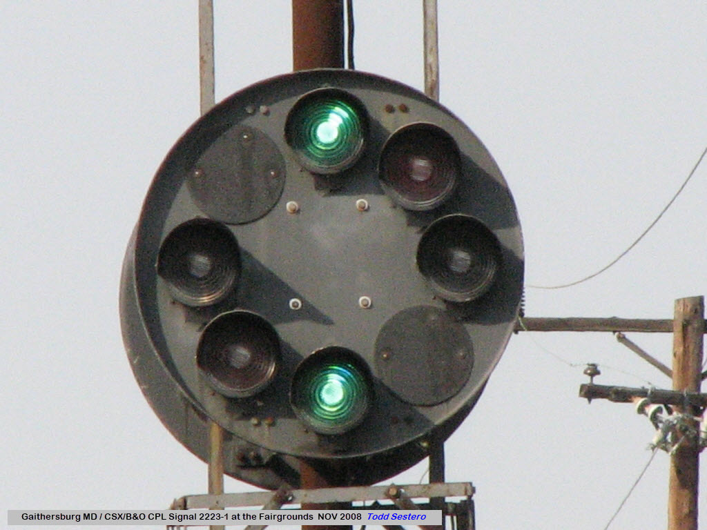
CSX's Metropolitan Branch was a former B&O line, as such, they used to have CPL signals on the line, but they were converted over to standard color light signals around 2012.... sorry.
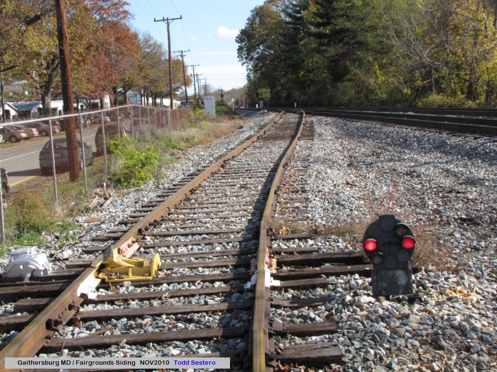
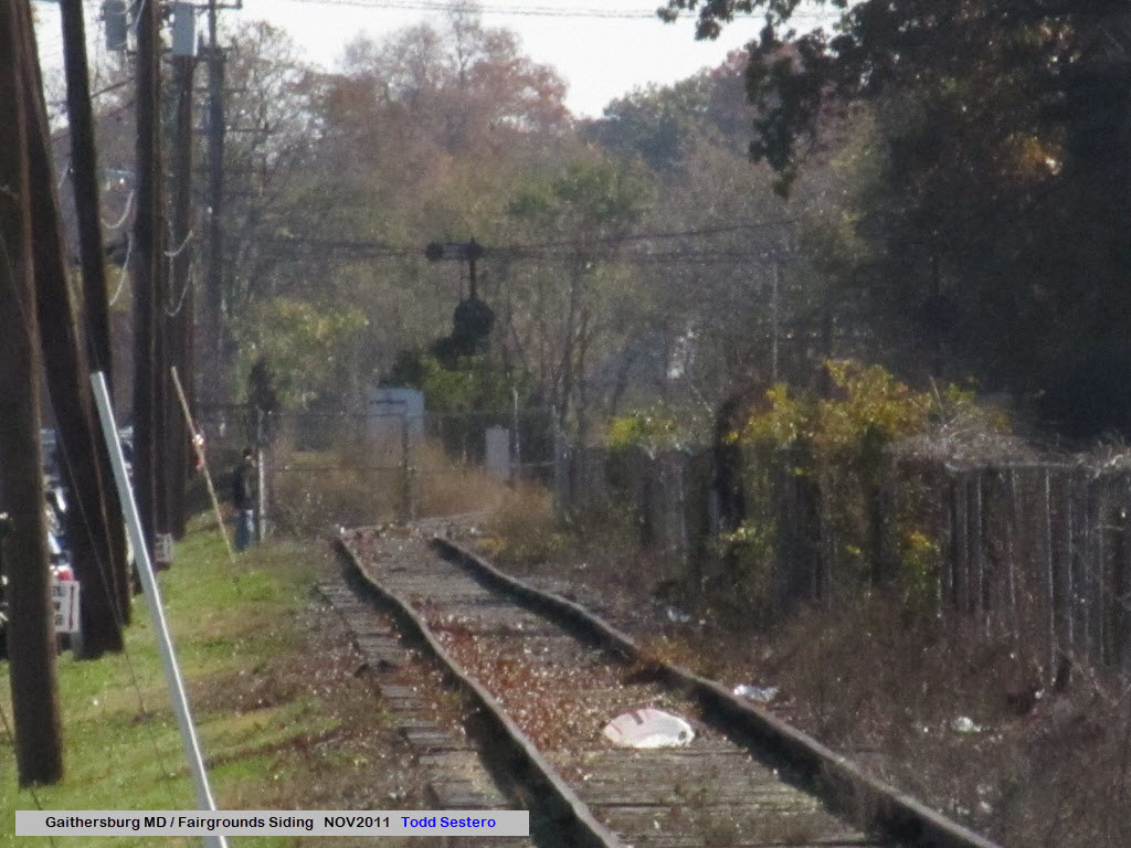
The Metropolitan Branch was signaled for traffic in both directions on both tracks, hence, the signals were back to back on the side of each track. There was also a siding at the fairgrounds, which had a dwarf CPL controlling movements onto the mainline.

What Came Before - The CPL Signals
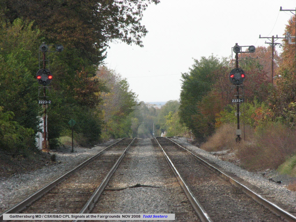
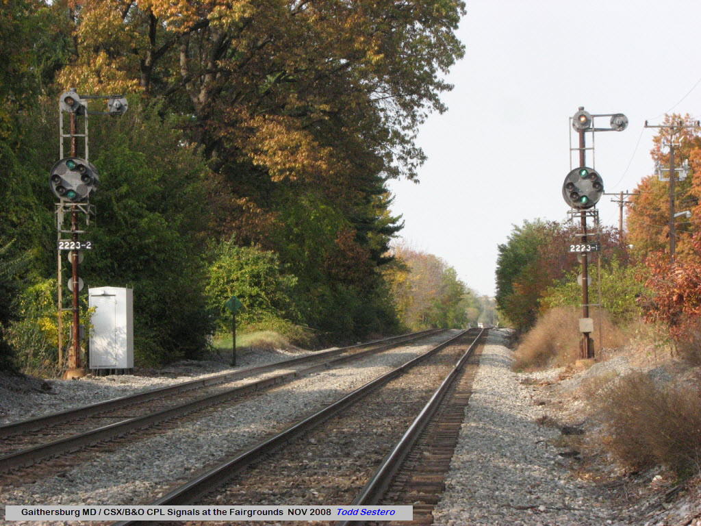
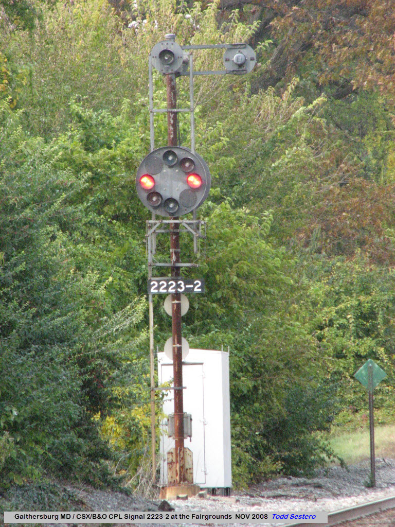
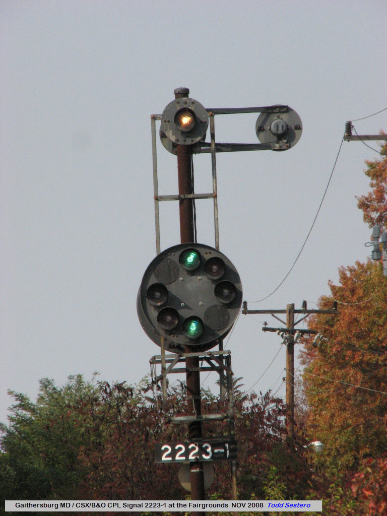

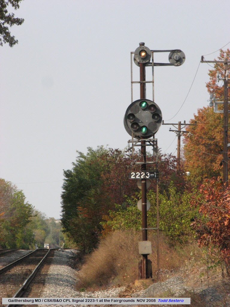
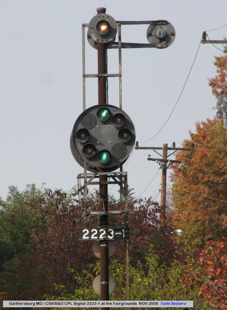
The Fairgrounds Siding
I haven't walked down to the siding lately (read: the past 3 or 4 years), if it is even still there, to see if CSX still has a signal on it.
![]() the
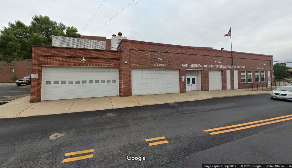
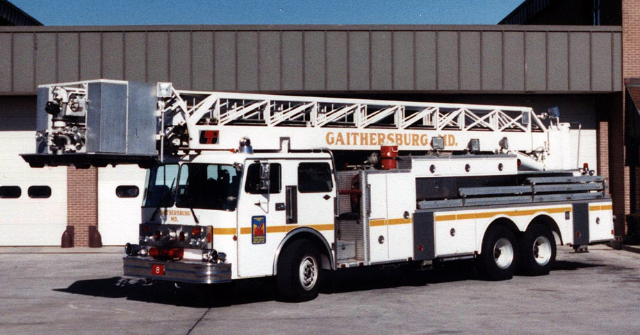
Gaithersburg-Washington Grove Volunteer Fire Dept
the
Gaithersburg-Washington Grove Volunteer Fire Dept
13 E Diamond Ave, Gaithersburg MD 20877
https://www.gwgvfd.org/
This is a former fire station located just down the street from the Gaithersburg MARC station. It now houses a small fire museum and is where they have their meetings.
They have another station, Station #28 in Derwood MD at 7272 Muncaster Mill Rd, 20855.
![]() the
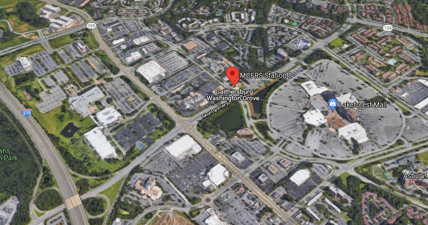
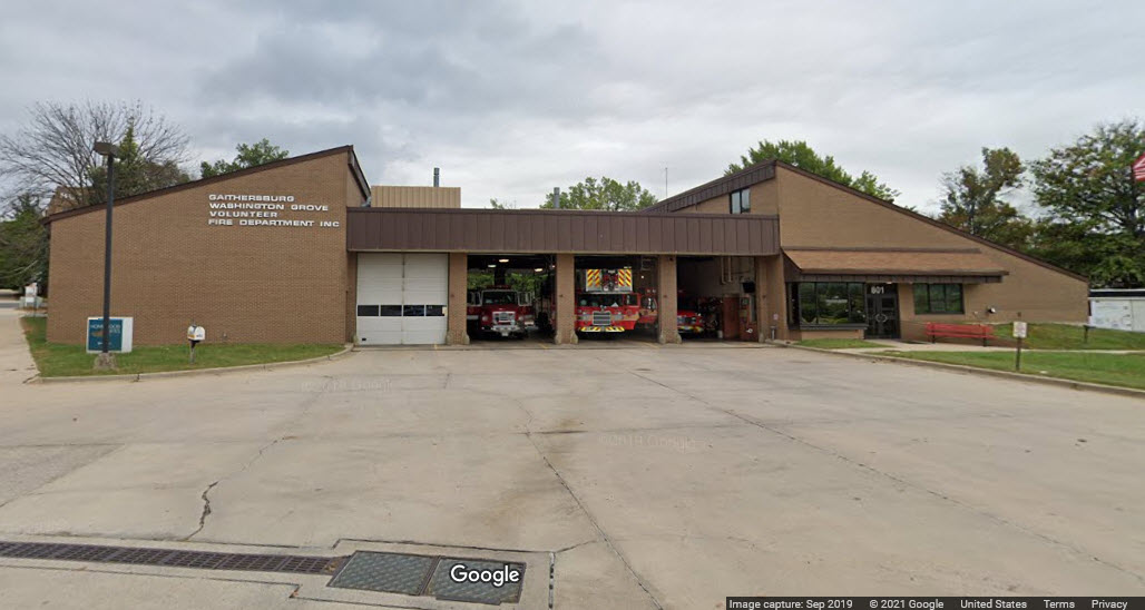
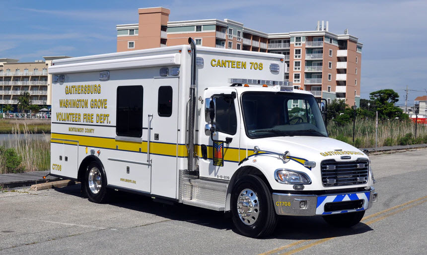
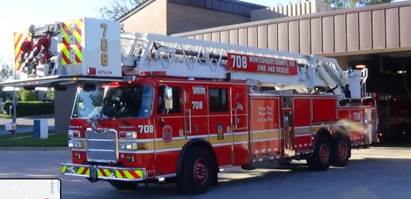
Gaithersburg-Washington Grove Volunteer Fire Dept / MCFRS #8
the
Gaithersburg-Washington Grove Volunteer Fire Dept / MCFRS #8
801 Russell Ave, Gaithersburg MD 20879
https://www.montgomerycountymd.gov/mcfrs/connect/phone.html
The website above has a list of all of the fire stations in Montgomery County. All stations, including volunteers, are numbered as part of the Montgomery County Fire & Rescue Service numbering system. This fire station is on the "backside" of Lakeforest Mall.
Station 8 houses Engine 708, Ariel Tower 708, UTV 708, Brush UTV 708B, Brush 708, Medic 708, Medic 708B, Ambulance 708 and Ambulance 708C. Station 8 is the busiest in Montgomery County.


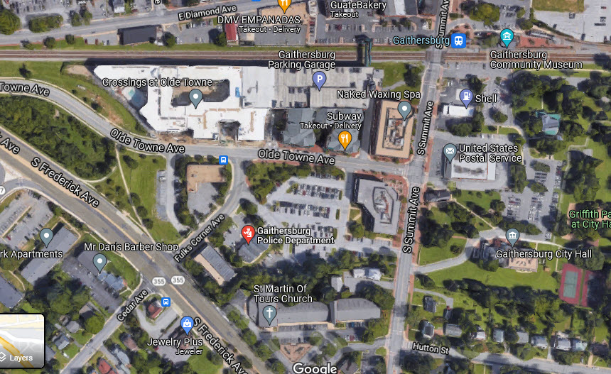
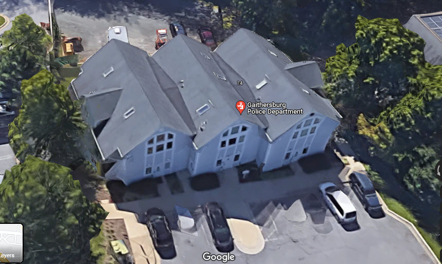
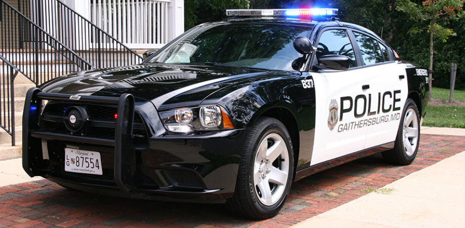
![]() Gaithersburg Police Dept
Gaithersburg Police Dept
14 Fulks Corner Ave, Gaithersburg MD 20877
https://www.gaithersburgmd.gov/government/departments/gaithersburg-police-department
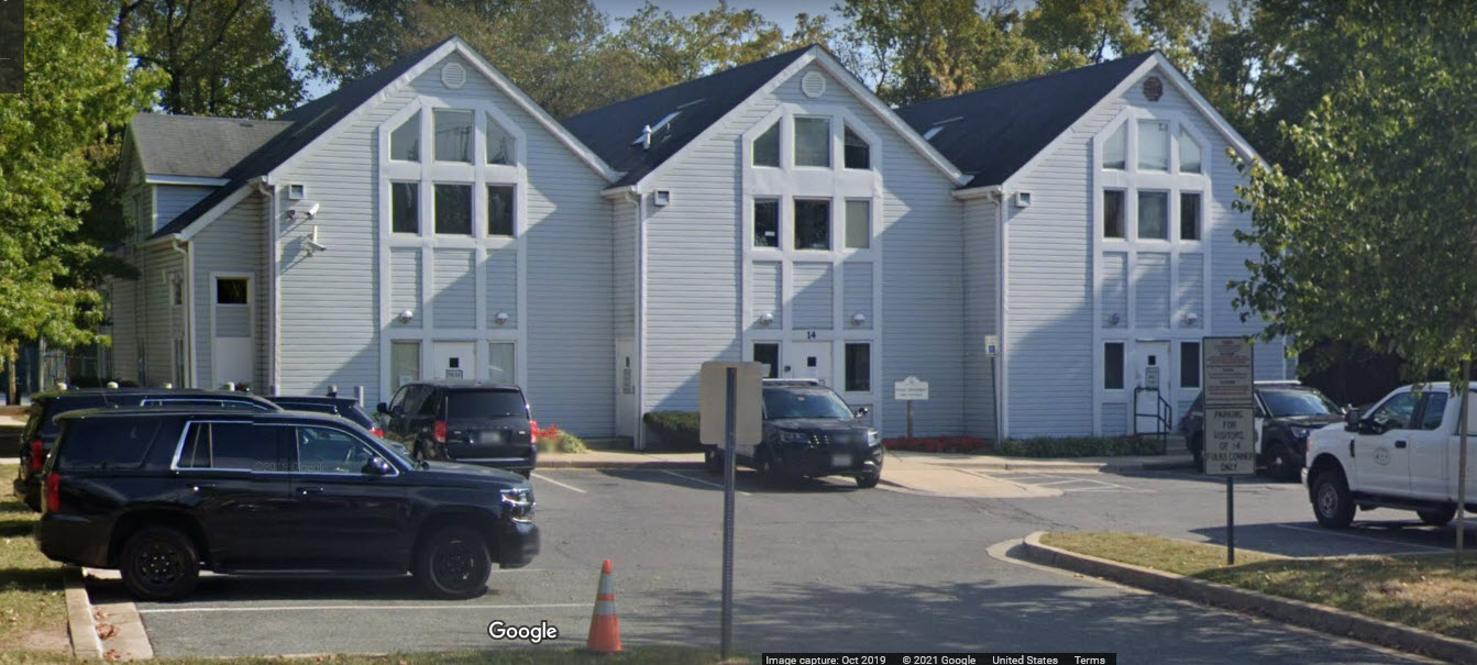
 from their webpage
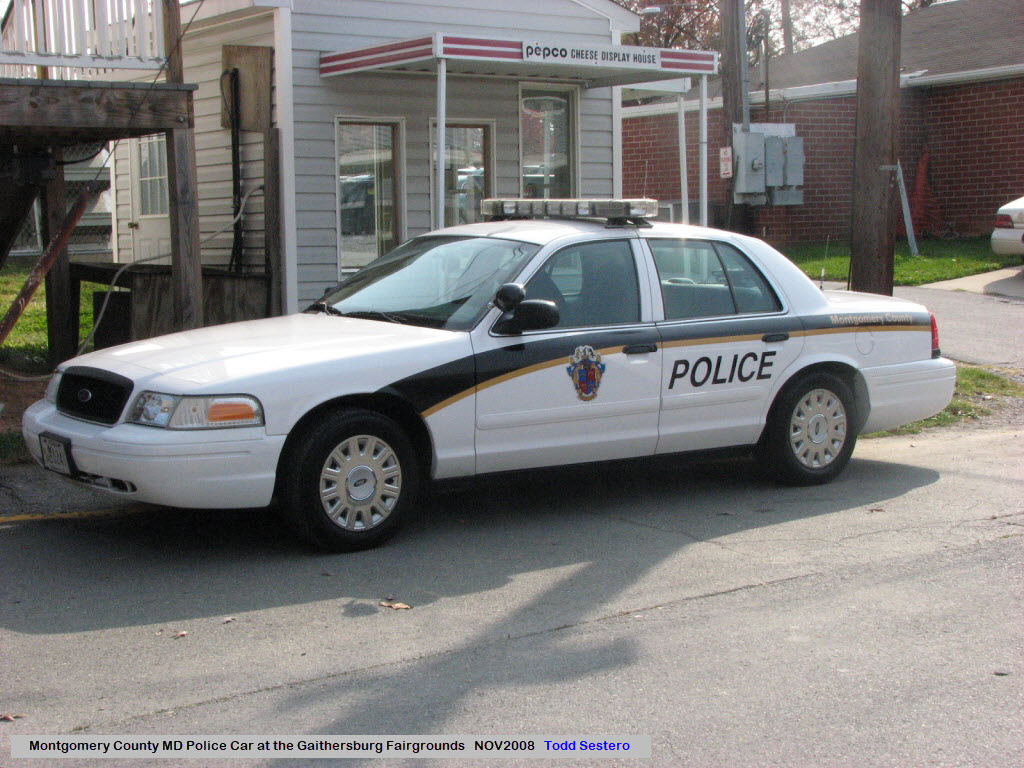
![]() Montgomery County Police Dept
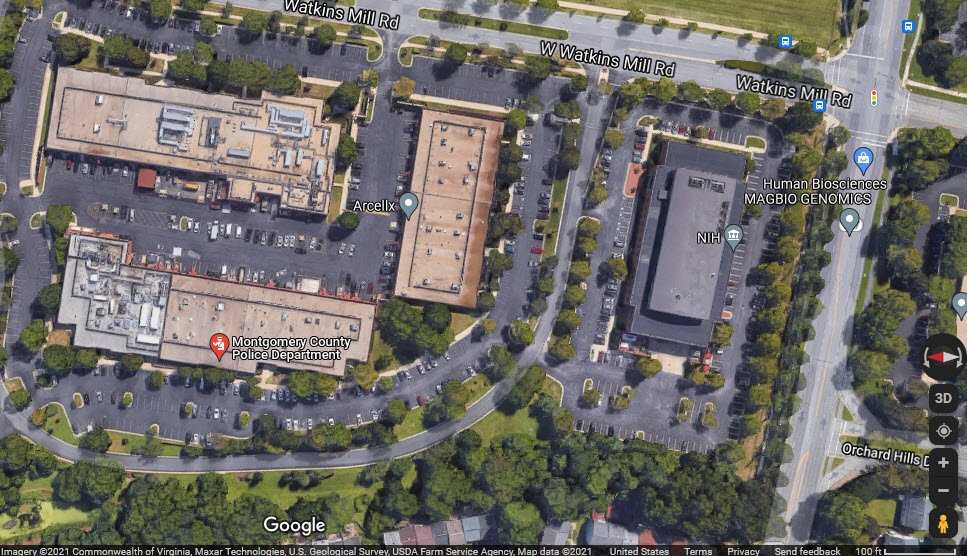
Montgomery County Police Dept
45 W Watkins Mill Rd, Gaithersburg MD 20878
Nothing to get too excited over, as the police station is in a strip mall type industrial building.
Did U Know?
None for now......
Courtesy of the University of Texas Library, click here for their index page.
2010_1108gaith, 2008_1102gaithc, 2016_1112Nall
Disclaimers:
I love trains, and I love signals. I am not an expert. My webpages reflect what I find on the topic of the page. This is something I have fun with while trying to help others.
Please Note: Since the main focus of my two websites is railroad signals, the railfan guides are oriented towards the signal fan being able to locate them. For those of you into the modeling aspect of our hobby, my indexa page has a list of almost everything railroad oriented I can think of to provide you with at least a few pictures to help you detail your pike.
If this is a railfan page, every effort has been made to make sure that the information contained on this map and in this railfan guide is correct. Once in a while, an error may creep in :-)
My philosophy: Pictures and maps are worth a thousand words, especially for railfanning. Text descriptions only get you so far, especially if you get lost or disoriented. Take along good maps.... a GPS is OK to get somewhere, but maps are still better if you get lost! I belong to AAA, which allows you to get local maps for free when you visit the local branches. ADC puts out a nice series of county maps for the Washington DC area, but their state maps do not have the railroads on them. If you can find em, I like the National Geographic map book of the U.S..... good, clear, and concise graphics, and they do a really good job of showing you where tourist type attractions are, although they too lack the railroads. Other notes about specific areas will show up on that page if known.
Aerial shots were taken from either Google or Bing Maps as noted. Screen captures are made with Snagit, a Techsmith product... a great tool if you have never used it!
By the way, floobydust is a term I picked up 30-40 years ago from a National Semiconductor data book, and means miscellaneous and/or other stuff.
Pictures and additional information is always needed if anyone feels inclined to take 'em, send 'em, and share 'em, or if you have something to add or correct.... credit is always given! Please be NICE!!! Contact info is here
Beware: If used as a source, ANYTHING from Wikipedia must be treated as being possibly inaccurate, wrong, or not true.
RAILFAN GUIDES HOME
RAILROAD SIGNALS HOME
NEW AUG24/2021, SEP05/6/2021, SEP11/2021-20 YEARS!
Last Modified 11-Sep-2021