In General
Getting Here
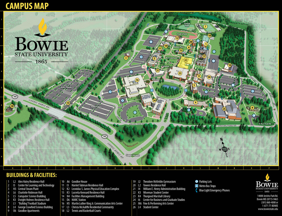
Map
Sites
Pictures
Signals
RAILFAN GUIDES HOME
RAILROAD SIGNALS HOME
Location / Name:
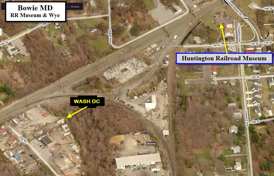
Bowie MD, Prince George's County
What's Here:
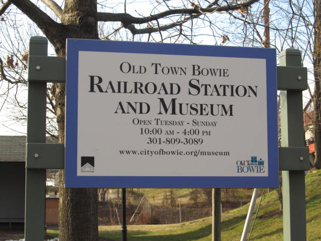
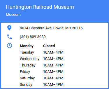
Huntington (Bowie) Railroad Museum
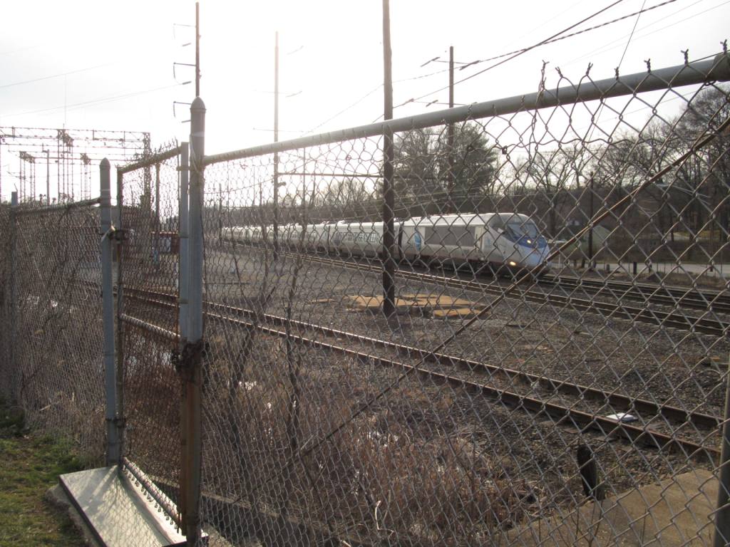
Amtrak Northeast Corridor
Wye
The Pope's Creek Branch
Data:
GPS Coordinates: 39.007123, -76.779156 (museum)
Phone A/C: 301
ZIP: 20715
Access by train/transit:
Bowie State MARC station if 1.1 miles north
The Scoop:
This guide covers Bowie MD, a town on the old Pennsy mainline, now the Northeast Corridor. Bowie is Maryland's third largest incorporated city.
Bowie has a MARC station, kinda, it's a little north at Bowie State University. The next station going south is Seabrook.
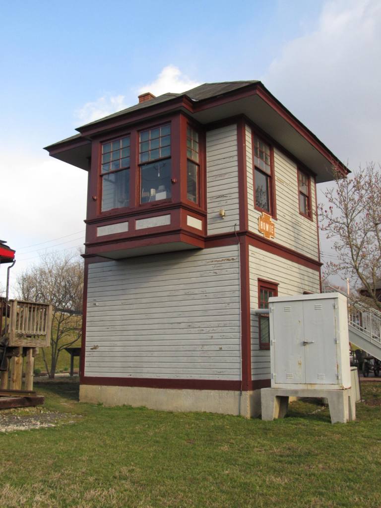
Bowie is home to the Bowie RR Museum, AKA the Huntington RR Museum, and is centered around the old Pennsylvania Railroad Bowie tower and depot.
The Pope's Creek Branch splits off from the NEC in Bowie, and heads south to a couple of power plants. Back in the Pennsy, then PC, then Conrail days, the coal used come to the branch via Harrisburg PA and the Port Road down to Perryville MD, where it would head south to Bowie. Since CSX assumed control of the branch after the Conrail split-up in 1999, the coal has come from the south... Via CSX's Benning Yard on the east side of Washington DC, along MD 295 at US 50.
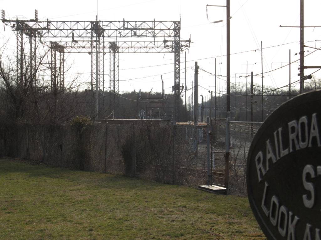
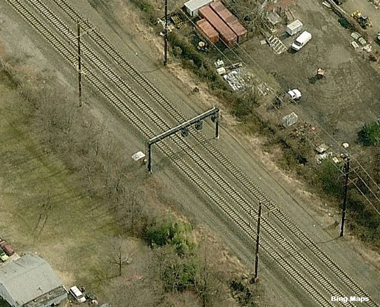
The interlocking was changed in 1984 to accommodate the
southbound freights, that is also probably when the NB signals were moved
south.
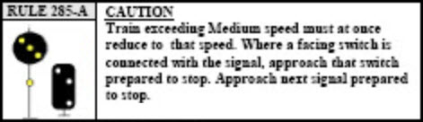
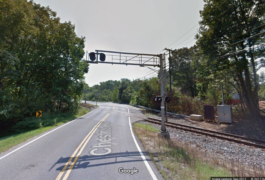
Signals around here are all Pennsylvania Railroad PL (position light) style
signals, altho the ones of the corridor have been converted to colorized
versions of them, and are usually referred to PCL's (Position Color Lights)
to differentiate them from the B&O CPL's (Color Position Lights). One
signal remains in it's original Pennsy form is the caution signal a few
blocks down the Pope's Creek branch at Highbridge Street, and is a permanent
all yellow Caution signal for the approach to the Wye.
For some interesting reading, here is a link to a study by the state on extending passenger service south from Bowie.
Acknowledgements:
Ric
Carter
Denver Todd
Websites and other additional information sources of interest for the area:
http://www.trainweb.org/oldmainline/misc1.htm Additional pictures of
stuff around Bowie
http://www.trainweb.org/oldmainline/pa1.htm Pennsy's route from
Washington to Baltimore
http://www.trainweb.org/oldmainline/ Index page
There are two fairly easy ways to get to Bowie. One is coming from either I-95 or the Baltimore-Washington Parkway from the west of Bowie via MD197. The other way is getting off the Capitol Beltway (I-495/I-95) at exit 20, the MD450 exit, and then look for the signs for MD564.
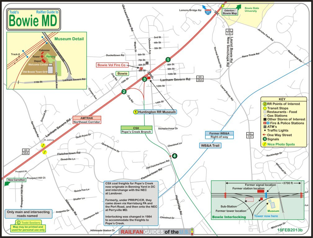
For the above map in PDF format, click here
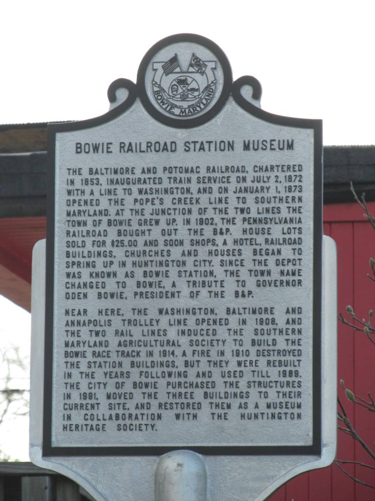
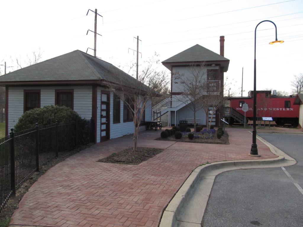
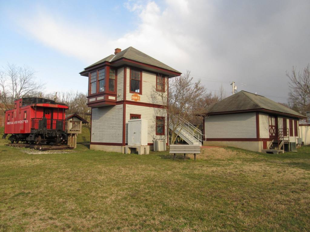
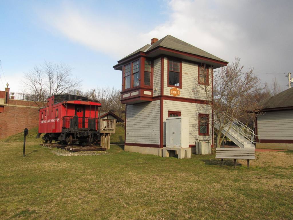
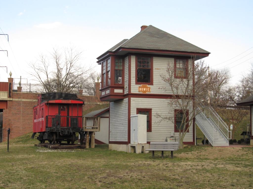
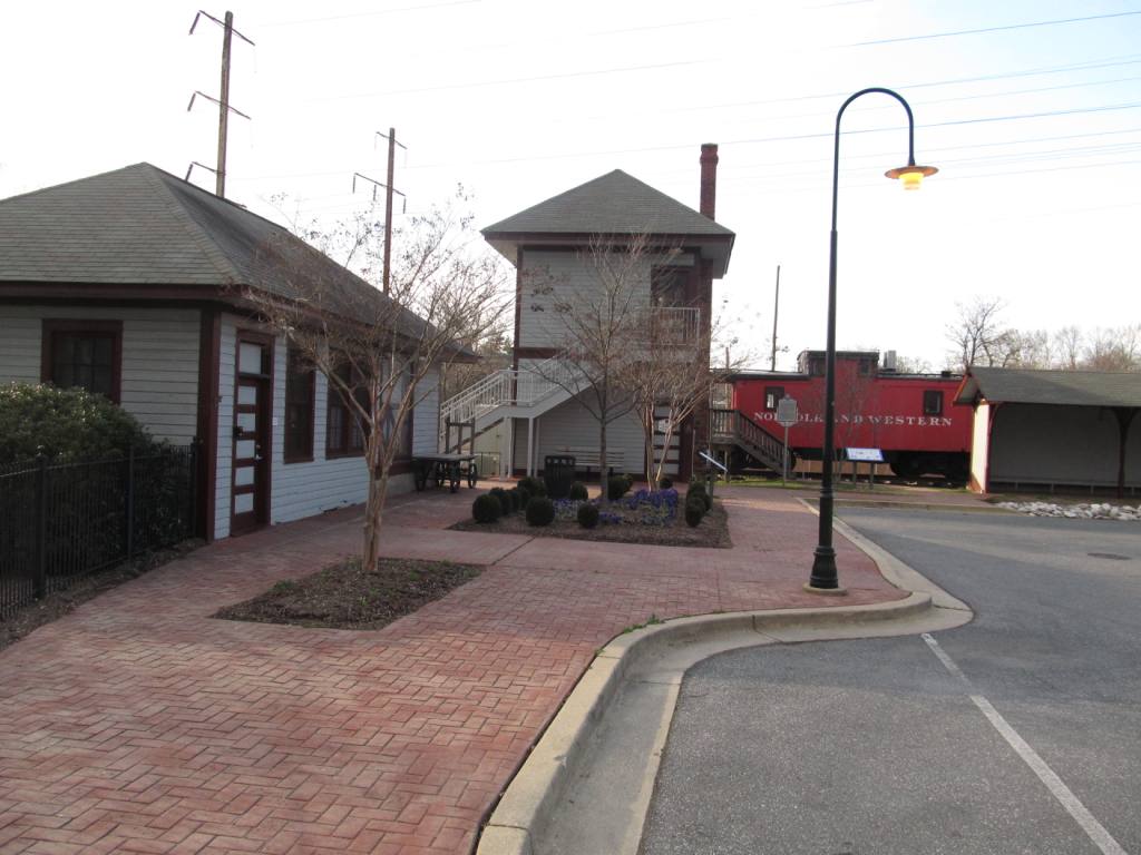
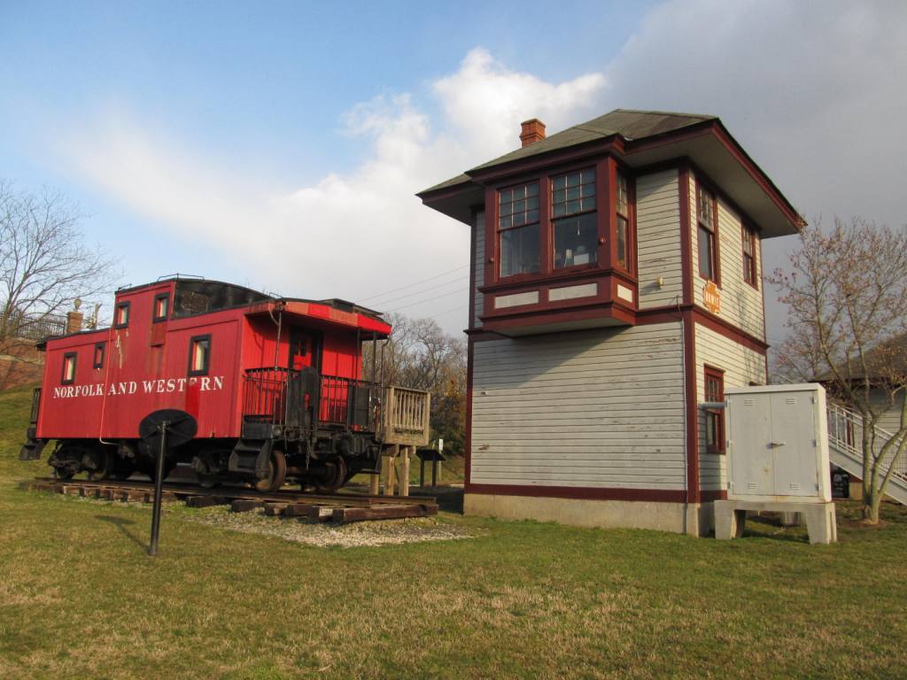
![]() Huntington Railroad Museum
Huntington Railroad Museum
GPS Coordinates: 39.007124, -76779157
For more info:
http://wx2dx.net/rrmuseum/rr.html
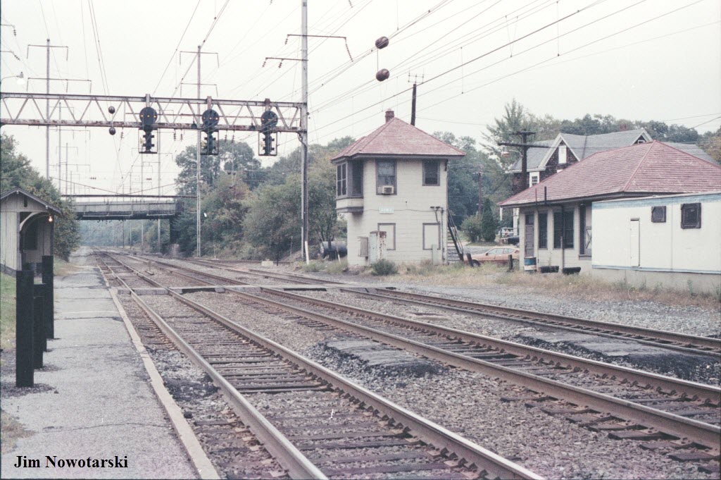
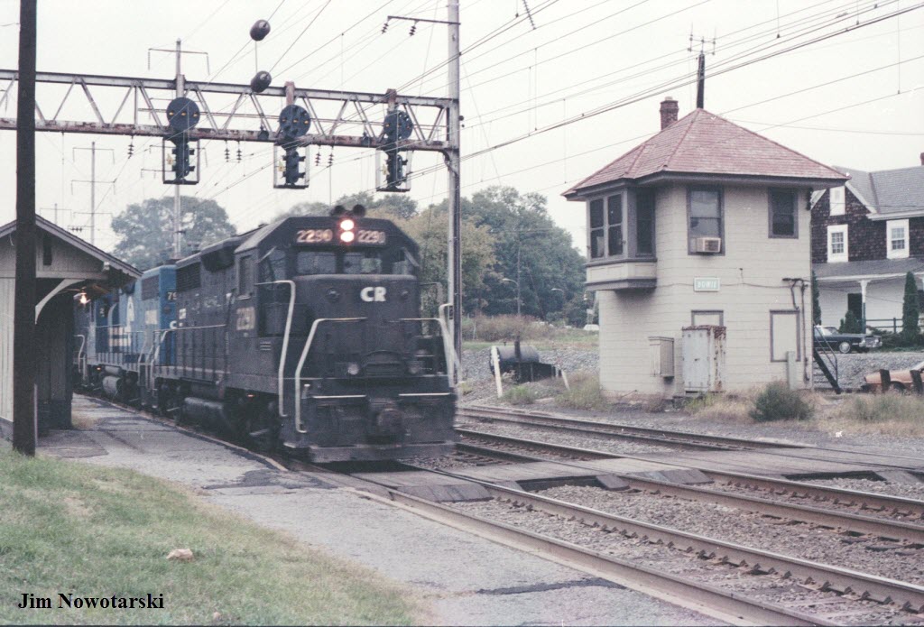
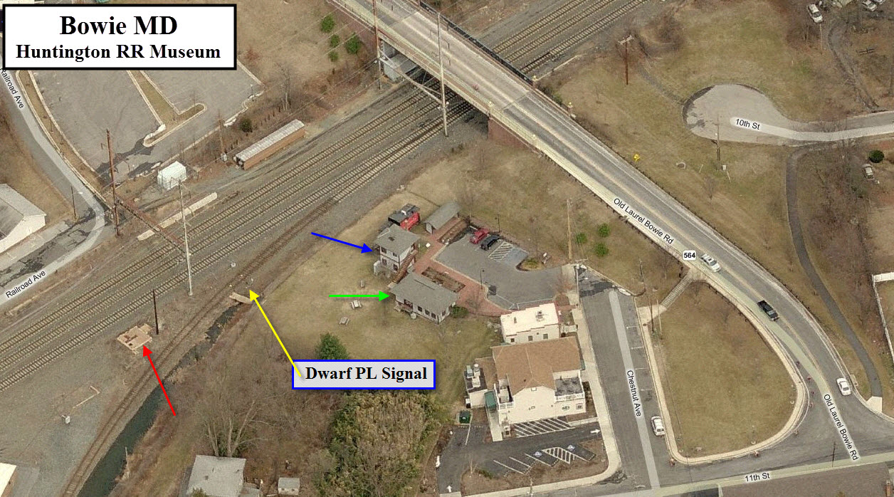
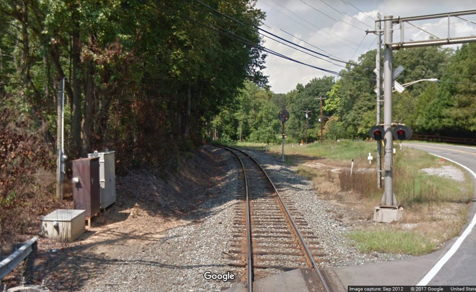
In the aerial view below, the green arrow points to the museum, which used to be
the Bowie station until around 1989 when it was moved here. The museum
is named after the original name for the town before it was renamed to Bowie
in honor of the PB&W president of the same name.
The red arrow points to where the tower used to be. The blue arrow points to where it is today.
Across the tracks from the dwarf PL signal is where the last Bowie "station" used to be, which can be seen in Jim's pictures below.
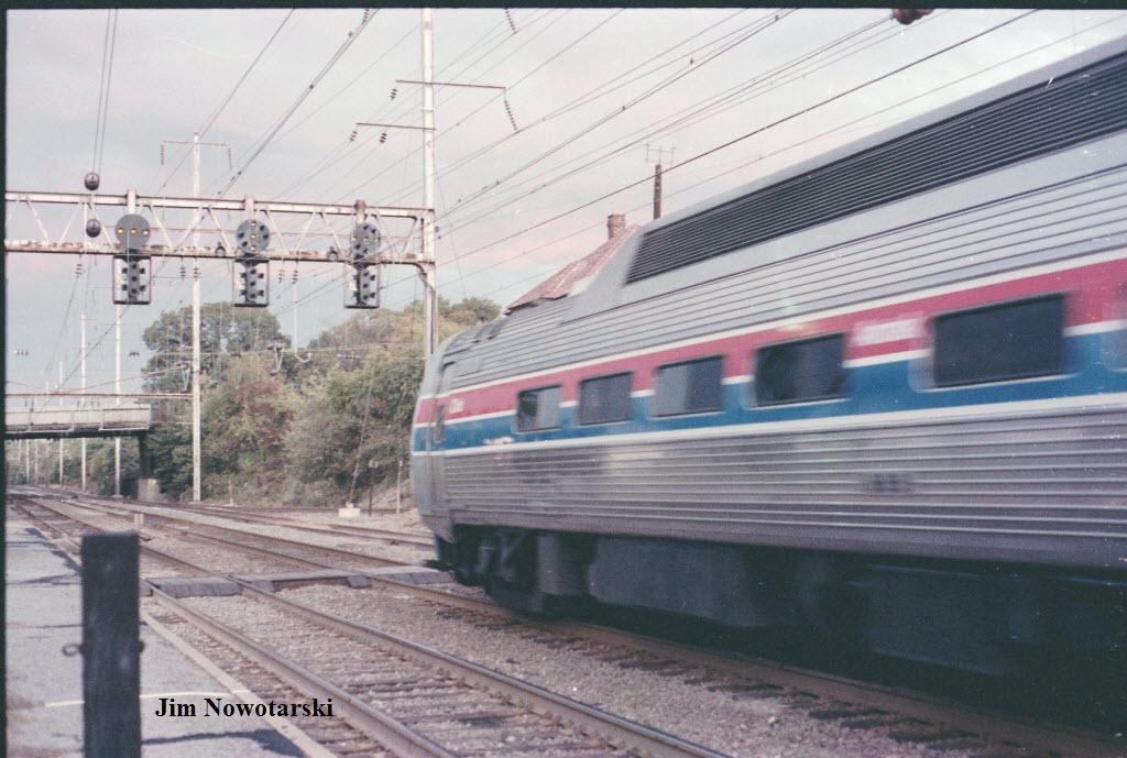
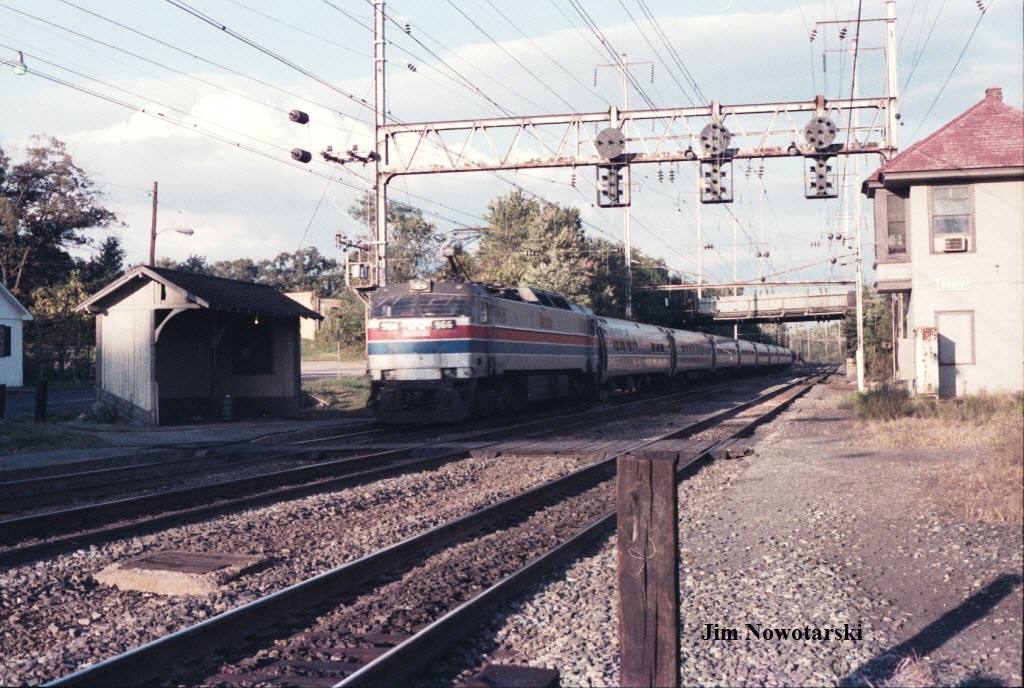
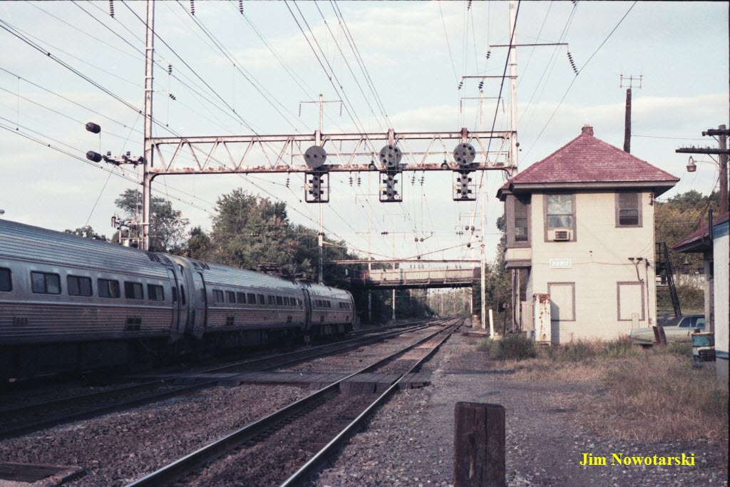
The pictures are courtesy Jim Nowotarski, and are from the mid 1970's.
Many thanks to Jim for sending these to me!
Notice the NB signals in Jim's pictures were moved south about 1500ft or so.
The current pictures
are from March 2012.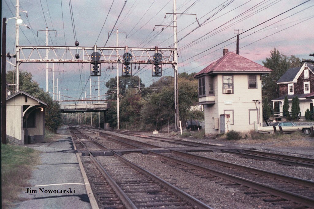


![]() Bowie State MARC Station
Bowie State MARC Station
GPS Coordinates: 39.020754, -76762070
This station replaced the "old" Bowie station in 1989.
Not many colleges can claim a train stop on their campus!
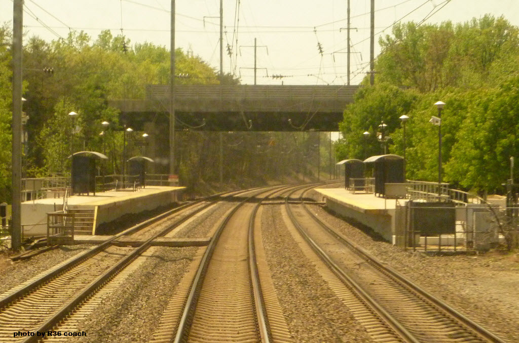
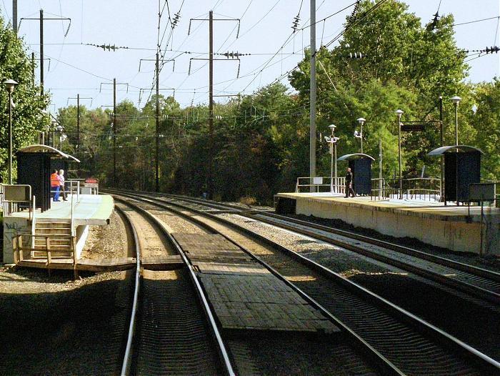
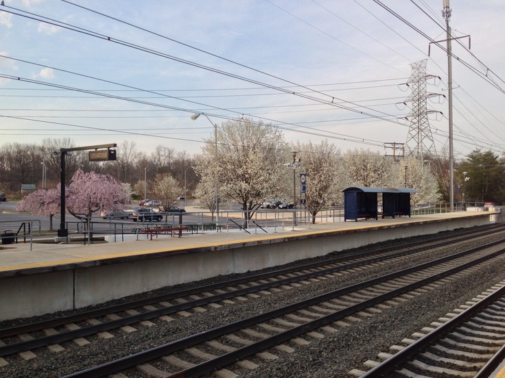
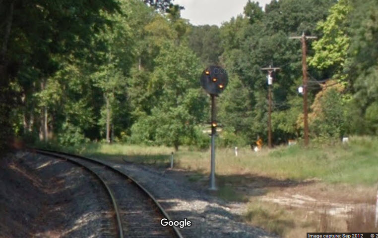
These are taken from the grounds of the museum.

The southbound signals.

The northbound signals.
![]()
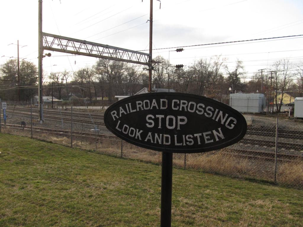
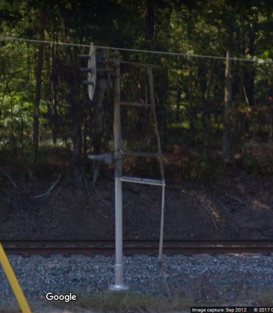
This dwarf PL signal controls the branch line traffic onto the NB mainline.
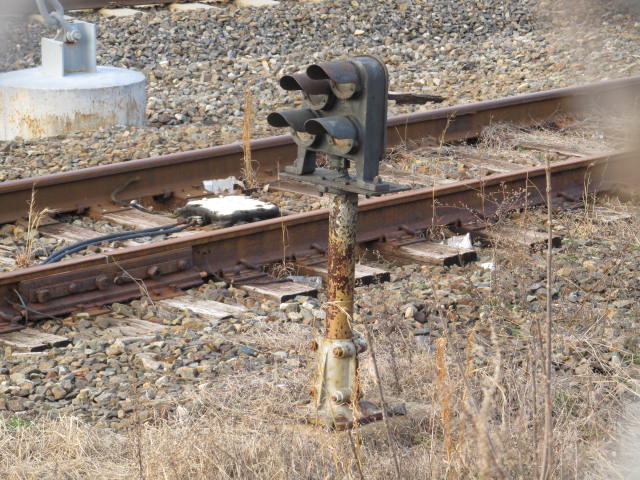
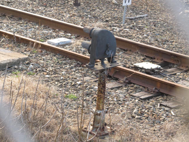
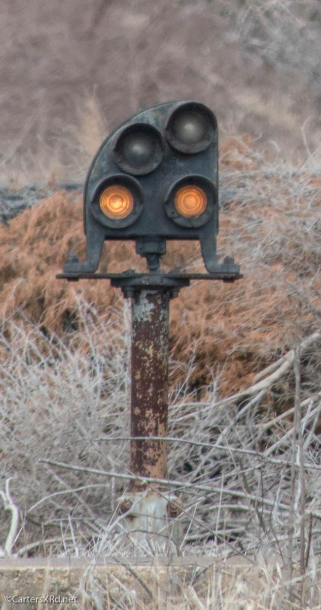 Photo by Ric Carter
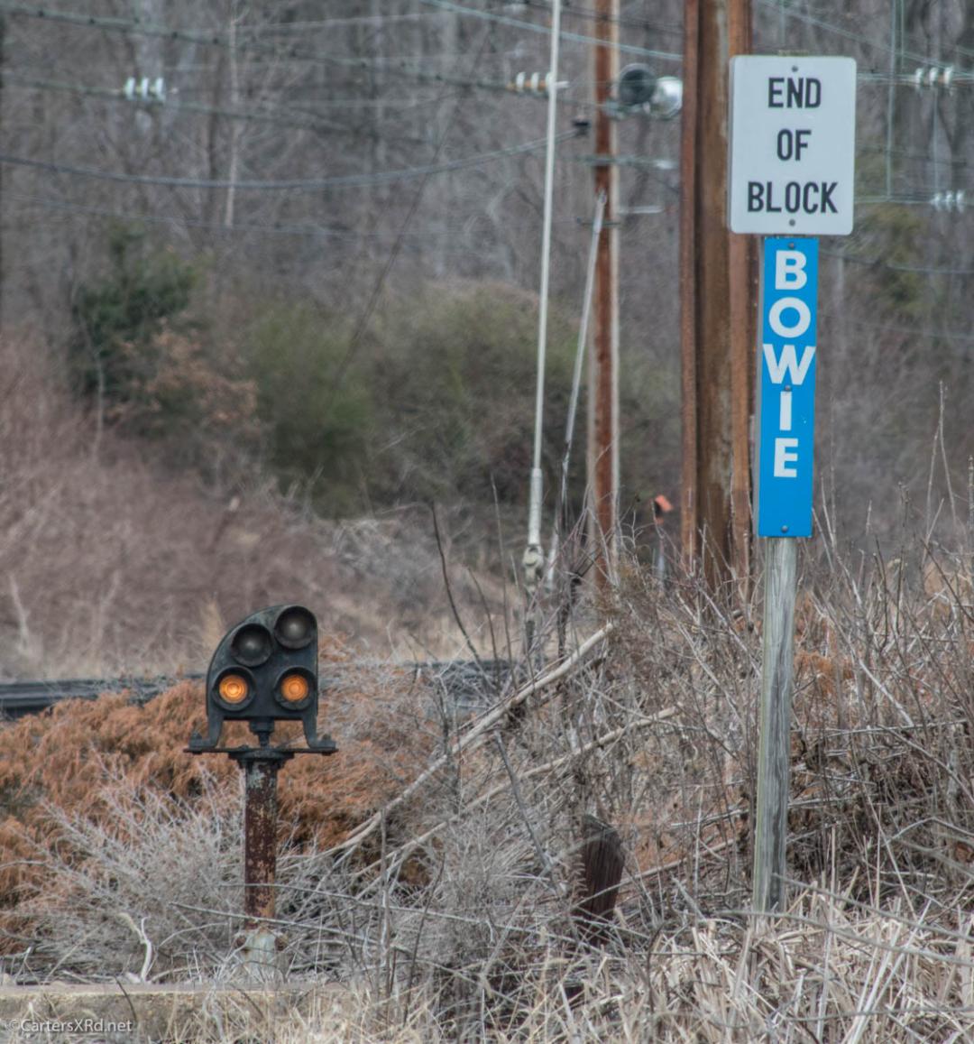 Photo by Ric Carter
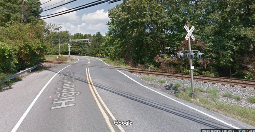
GPS Coordinates: 38.994101, -76.774732
This signal displays a single, lone indication: Caution, in advance of the wye. It is located on the north side of the Highbridge Road grade crossing.
Even though CSX now runs trains on the branch, since this track was once a Pennsy track, it retained this PL type signal.
2012-0305, 2012-1112
Disclaimers:
I love trains, and I love signals. I am not an expert. My webpages reflect what I find on the topic of the page. This is something I have fun with while trying to help others.
Please Note: Since the main focus of my two websites is railroad signals, the railfan guides are oriented towards the signal fan being able to locate them. For those of you into the modeling aspect of our hobby, my indexa page has a list of almost everything railroad oriented I can think of to provide you with at least a few pictures to help you detail your pike.
If this is a railfan page, every effort has been made to make sure that the information contained on this map and in this railfan guide is correct. Once in a while, an error may creep in :-)
My philosophy: Pictures and maps are worth a
thousand words, especially for railfanning. Text descriptions only
get you so far, especially if you get lost or disoriented. Take
along good maps.... a GPS is OK to get somewhere, but maps are still
better if you get lost! I belong to AAA, which allows you to get
local maps for free when you visit the local branches. ADC puts
out a nice series of county maps for the Washington DC area, but their
state maps do not have the railroads on them. If you can find em,
I like the National Geographic map book of the U.S..... good, clear, and
concise graphics, and they do a really good job of showing you where
tourist type attractions are, although they too lack the railroads.
Other notes about specific areas will show up on that page if known.
BTW, floobydust is
a term I picked up 30-40 years ago from a National Semiconductor data
book, and means miscellaneous and/or other stuff.
Aerial shots were taken from either Google Maps or www.bing.com/maps as noted. Screen captures are made with Snagit, a
Techsmith product... a great tool if you have never used it!
Pictures and additional information is always needed if anyone feels
inclined to take 'em, send 'em, and share 'em, or if you have
something to add or correct.... credit is always given! BE NICE!!! Contact info
is here
Beware: If used as a source, ANYTHING from Wikipedia must be treated as being possibly being inaccurate, wrong, or not true.
RAILFAN GUIDES HOME
RAILROAD SIGNALS HOME
NEW 02/18/2013
Last Modified
01-Apr-2019