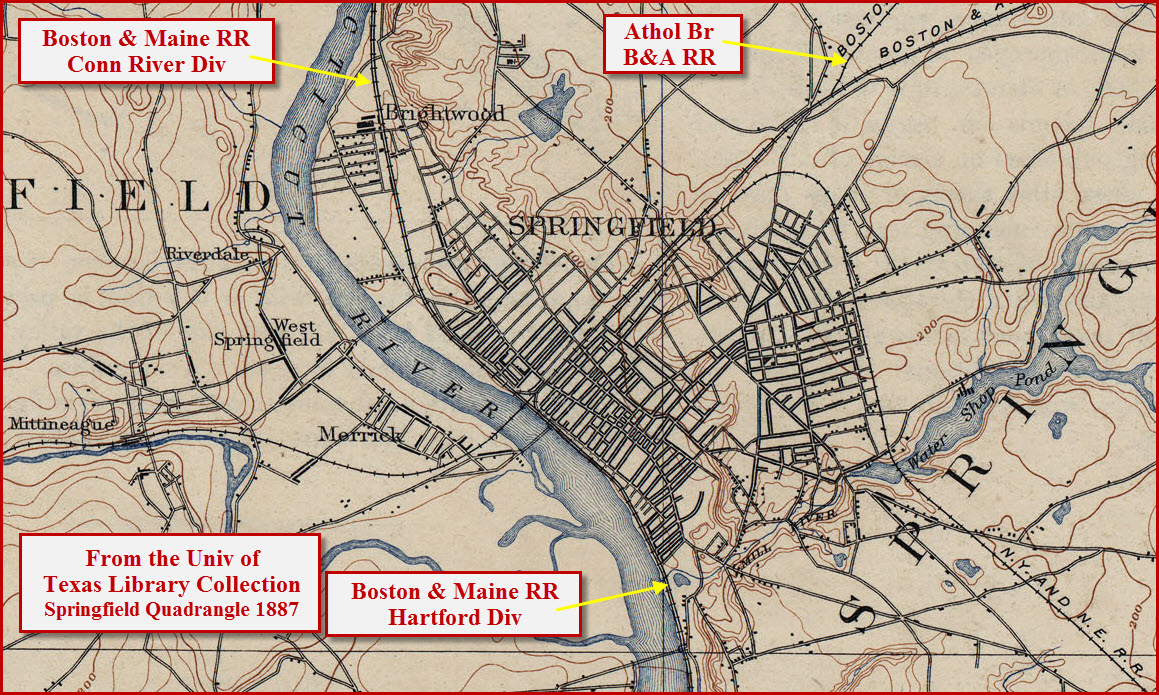
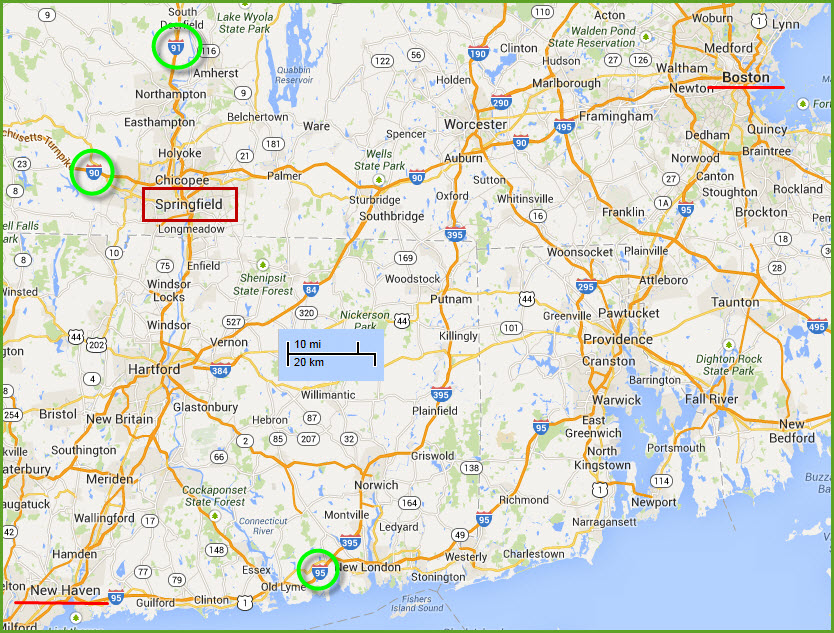
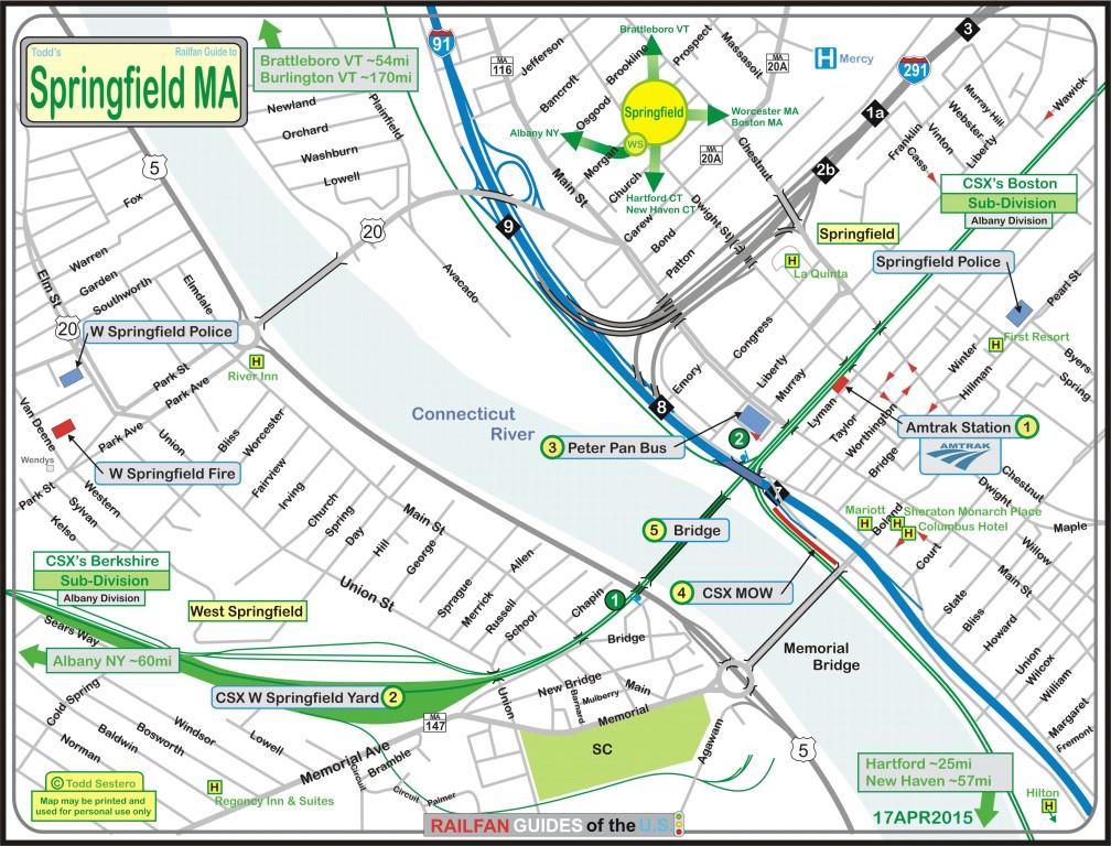
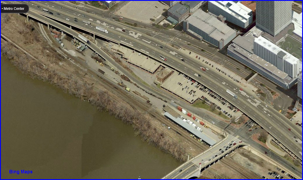
Springfield is conveniently located along I91,
between Boston and Albany, and not too far north of Hartford and New Haven CT.
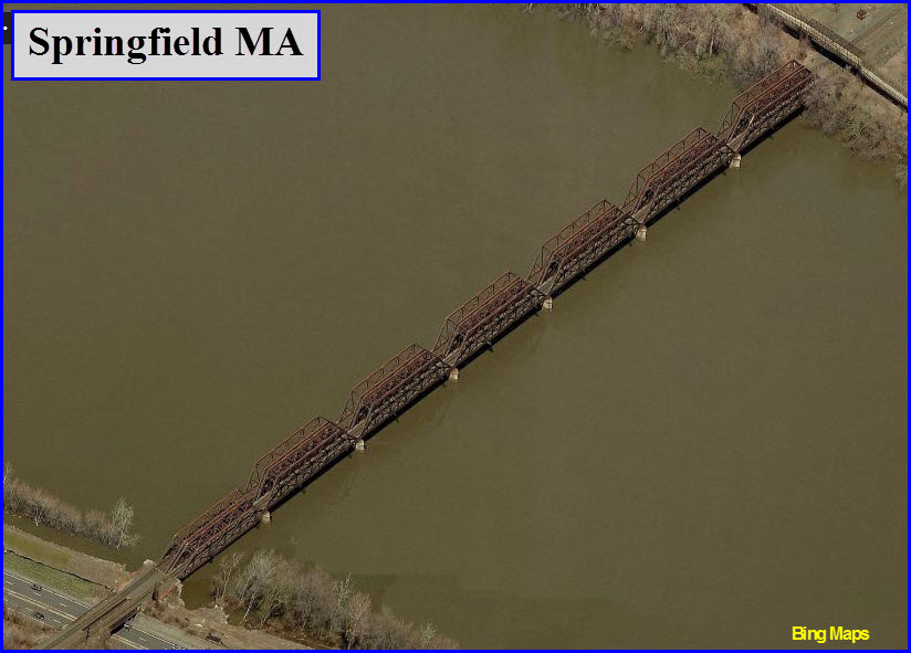
The area has a few things to attract railfans,
the station in Springfield, a few neat bridges, the interlocking under I91,
Pioneer Valley RR to the west in Westfield (the only town I have ever seen a
sign with an arrow pointing to the rail yard!), a few semaphores on the PVRR (if
still there, I saw them last in 2000-2001), and CSX freights coming thru at
speed.
The Amtrak 40th birthday / anniversary train
visited town on July 9th and 10th, 2011. I don't have any pictures from
Springfield (donations gladly accepted), but my page for the train is
here.
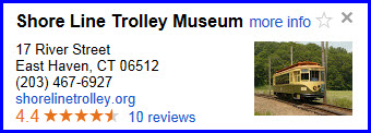
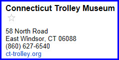
For streetcar fans, you have two museums
fairly close, one just to the north of Hartford in East Windsor - the
Connecticut Trolley Museum. It's at
exit 45 off of I-91 and then east. The other one is down in New Haven,
the Shore Line Trolley Museum, more info
here.
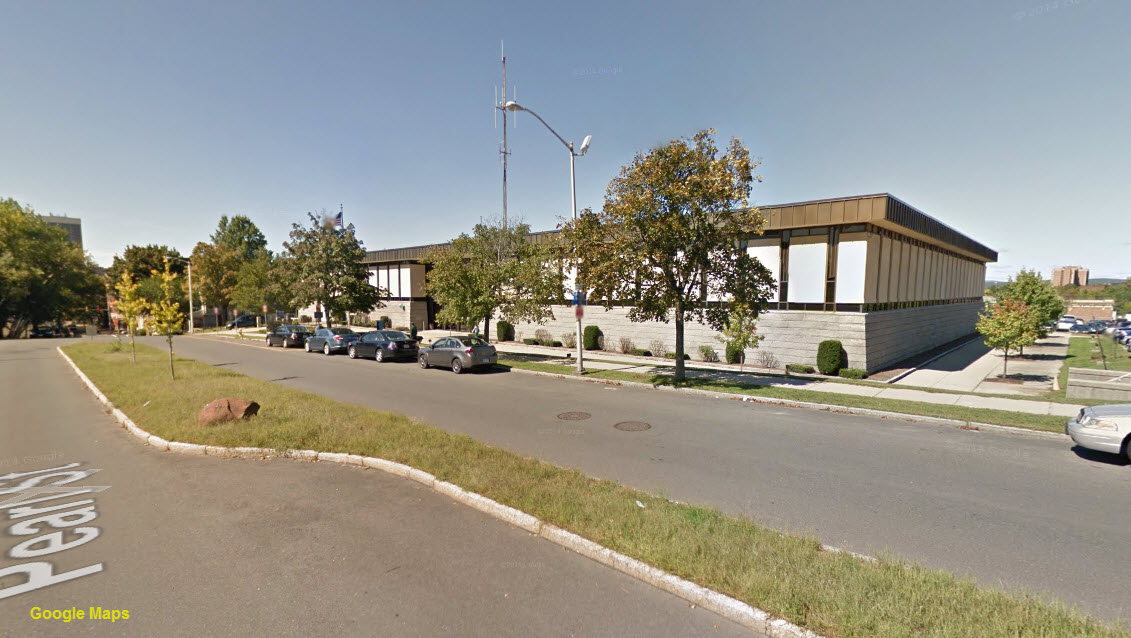
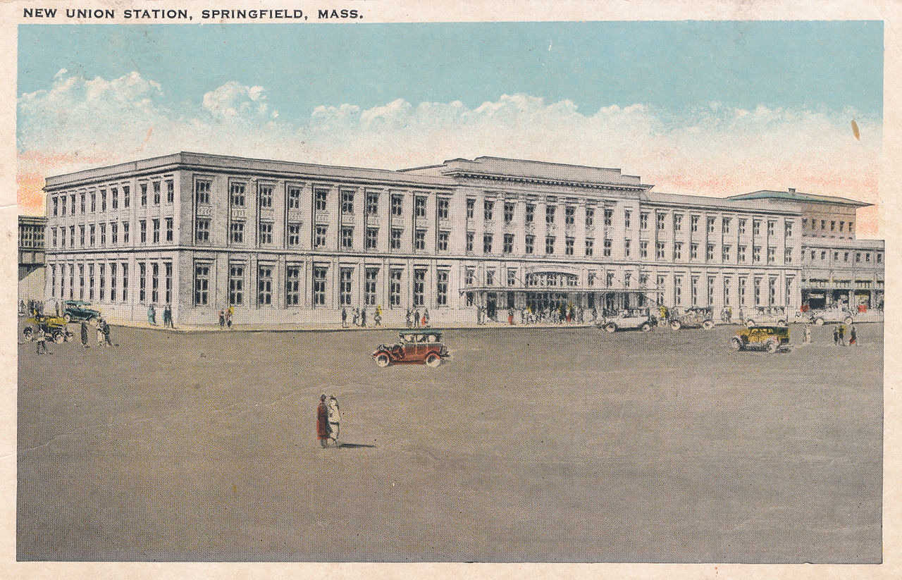
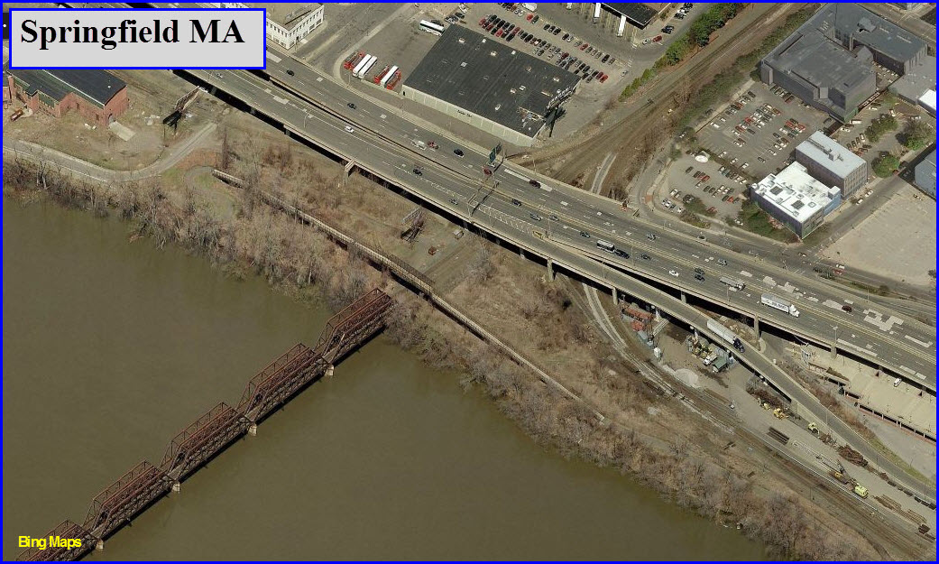
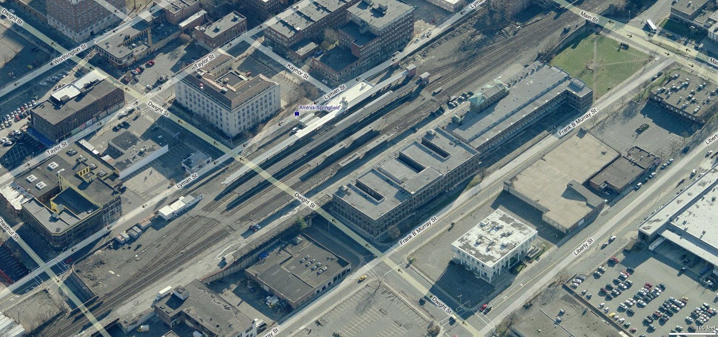
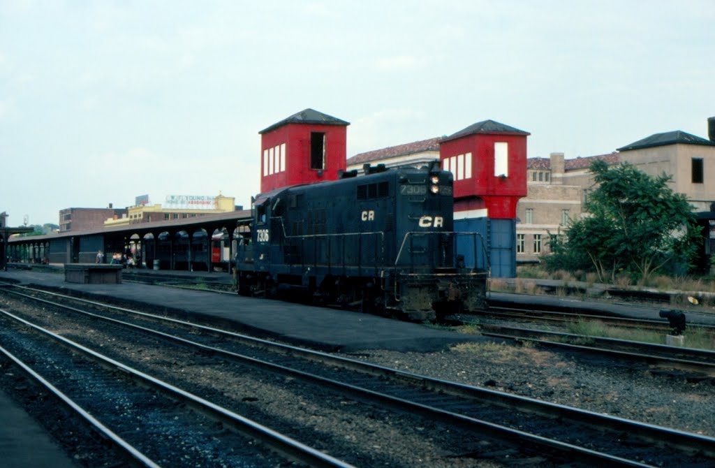
Among railroad stations, the Springfield
station is fairly unique in that it is perched above road level of the town, as
seen in the accompanying photo. Springfield Union Station is the fifth
busiest Amtrak station in Massachusetts. It is currently (APR2015)
undergoing a restoration. When the renovation is complete the property
will be known as the Union Station Regional Intermodal Transportation Center.
Union Station is situated
on a grade elevated plot of land one block wide and approximately four blocks
long. The main passenger entrance was on the north side of the station and
located east to the former express freight facility. The eight former station
tracks were accessed via an underground concourse that utilized stairs and
elevators to connect to the platforms. The former elevator headhouses remain an important visual element to the
station as they have been adorned with large Amtrak logos.
Today the station consists of six tracks;
tracks 1, 2 and 2a serve CSX's Boston Line
and tracks 4, 6 and 8 serve the Amtrak's New Haven–Springfield Line.
Amtrak trackage is independent from CSX.
Amtrak tracks connects with Boston Line
track 2A via dispatcher controlled switches at either end of the track.
Each of the low level platforms retain the stairs and elevators which
connect to the now closed concourse/street level. The current Amtrak
station building is at track level adjacent to Track 8 and trains are
reached by crossing the tracks at designated walkways. West of the
station platforms the Amtrak New Haven-Springfield line immediately curves
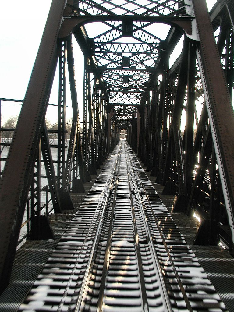
to the south while the CSX Boston Line continues on to cross the Connecticut
River on a twin truss bridge.(from WIkipedia)
"Amt
SPG 9640+Amtrak-Stand" by Sturmovik at en.wikipedia.
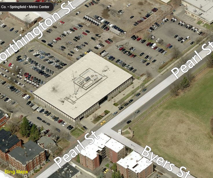
2
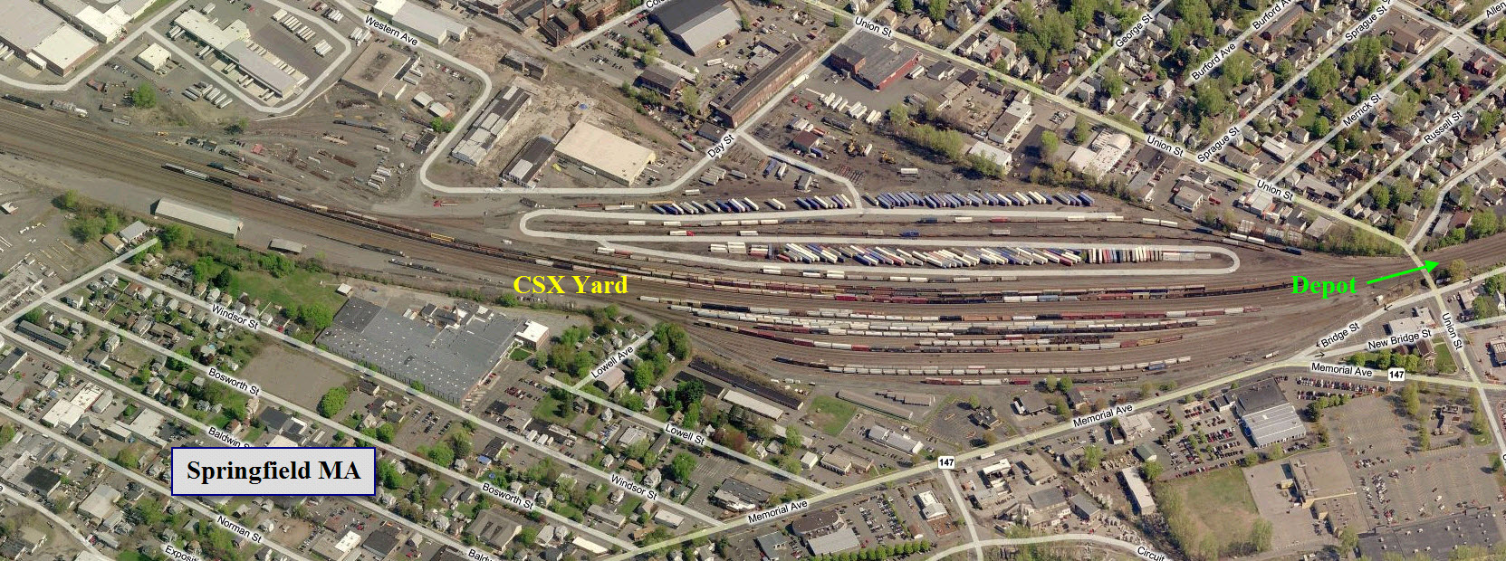
The CSX West Springfield Yard
3
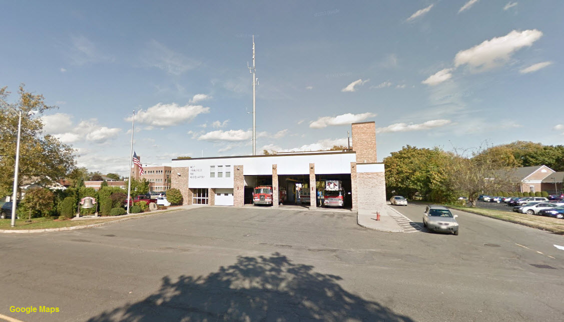
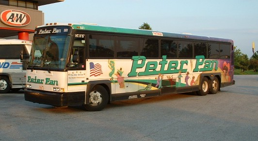
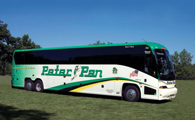
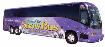
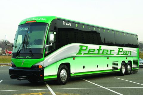
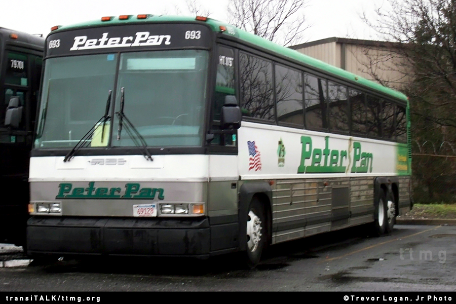
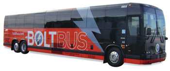
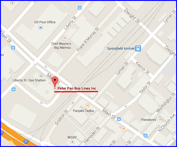
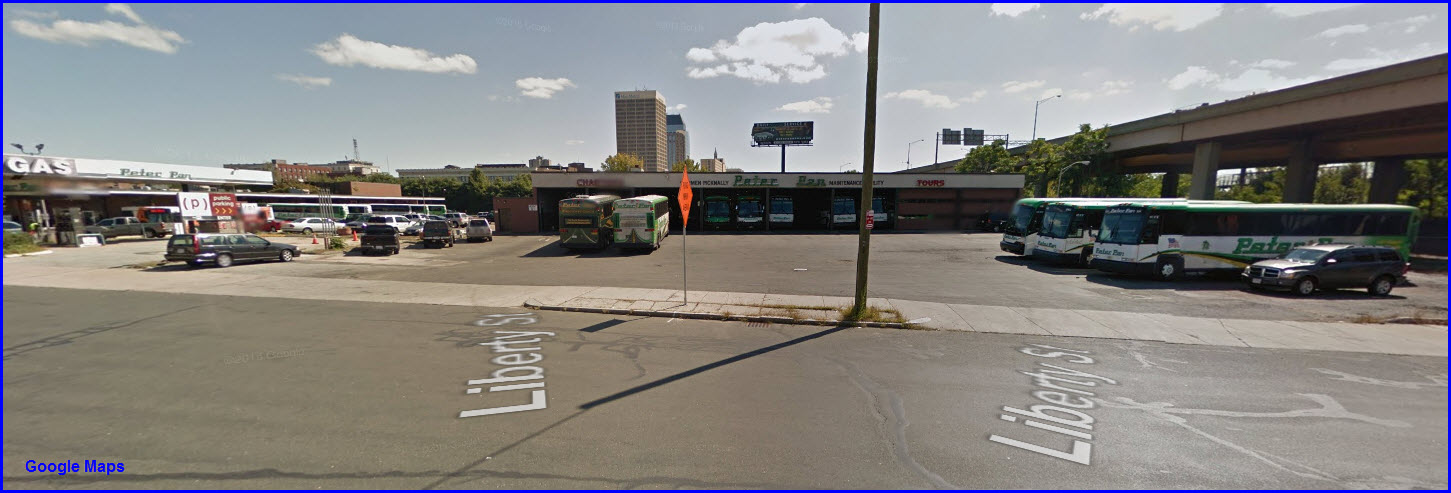
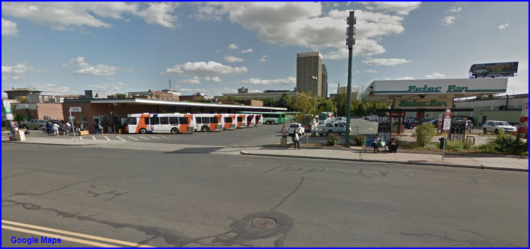
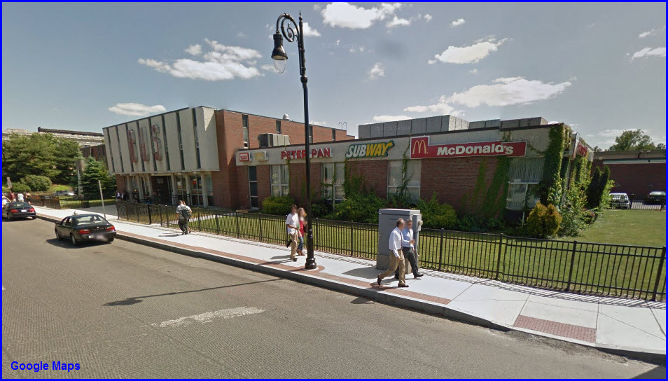
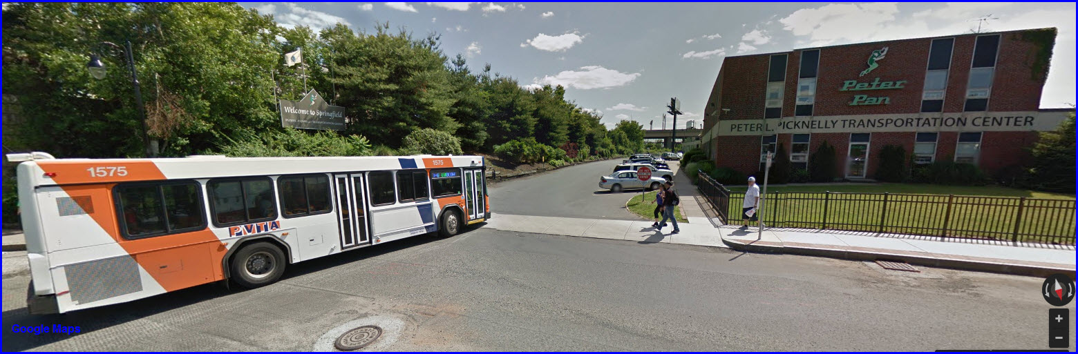
Peter Pan Bus Lines
GPS Coordinates:
42.104852, -72.596070
Peter Pan Bus Lines has a history going back to something
like 1933, and was named for the founder's favorite story as a kid. They
have kept expanding over the years and are one of the largest regional bus lines
in the U.S. On April 4th, 1969, they opened their terminal at 1776
Main St, becoming the first such terminal in the U.S. In 1985, they bought Trailways New England. In 1990, they expanded with a route to Washington
D.C, and now have stops in Boston, Baltimore, Philadelphia, and New York City.
In 2003 they acquired Coach USA, and doubled the size of their fleet to over 300
busses. In 2007, they started a joint venture with Greyhound called Bolt
Bus.
All of the pictures below were found at Google
Images, including the first one which is my own shot at the Travel Plaza in
Baltimore.
The screen captures below are from Google's StreetView....
4
CSX MOW Yard
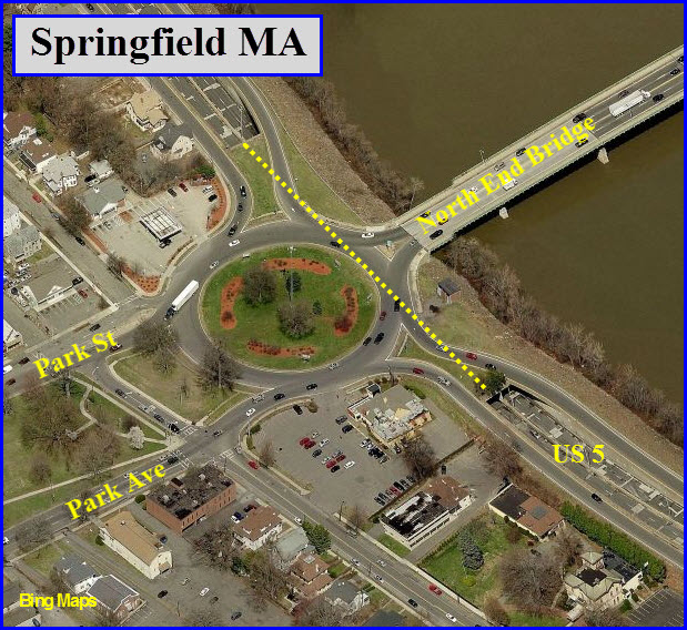
GPS Coordinates: 42.102181, -72.595399
5
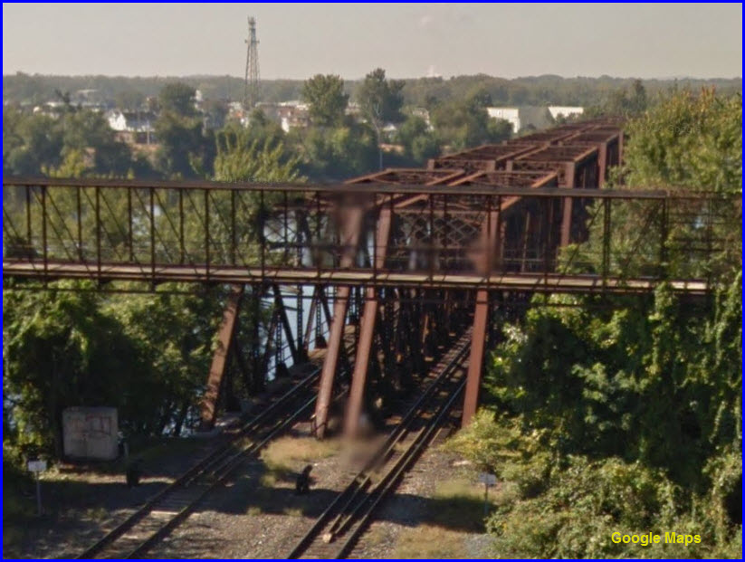
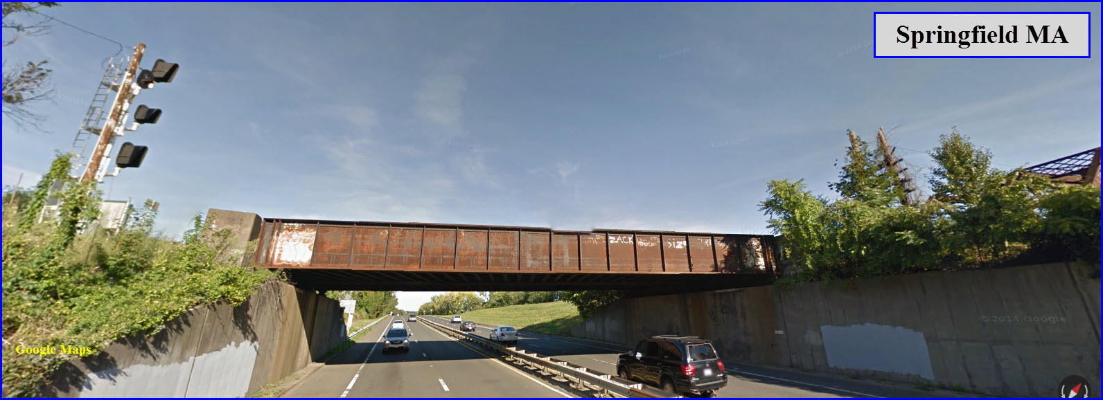
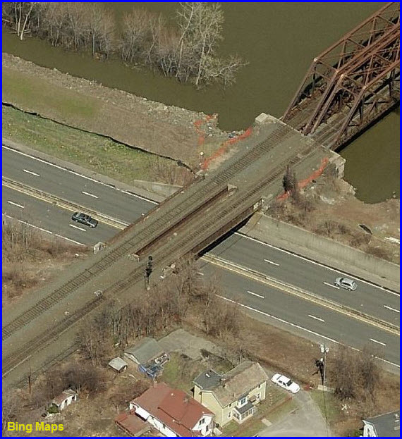
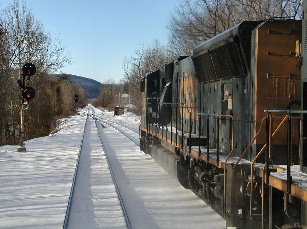
The CSX Bridge
This view is from I-91 and Google Streetview
Picture courtesy Jersey Mike
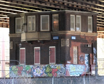
6
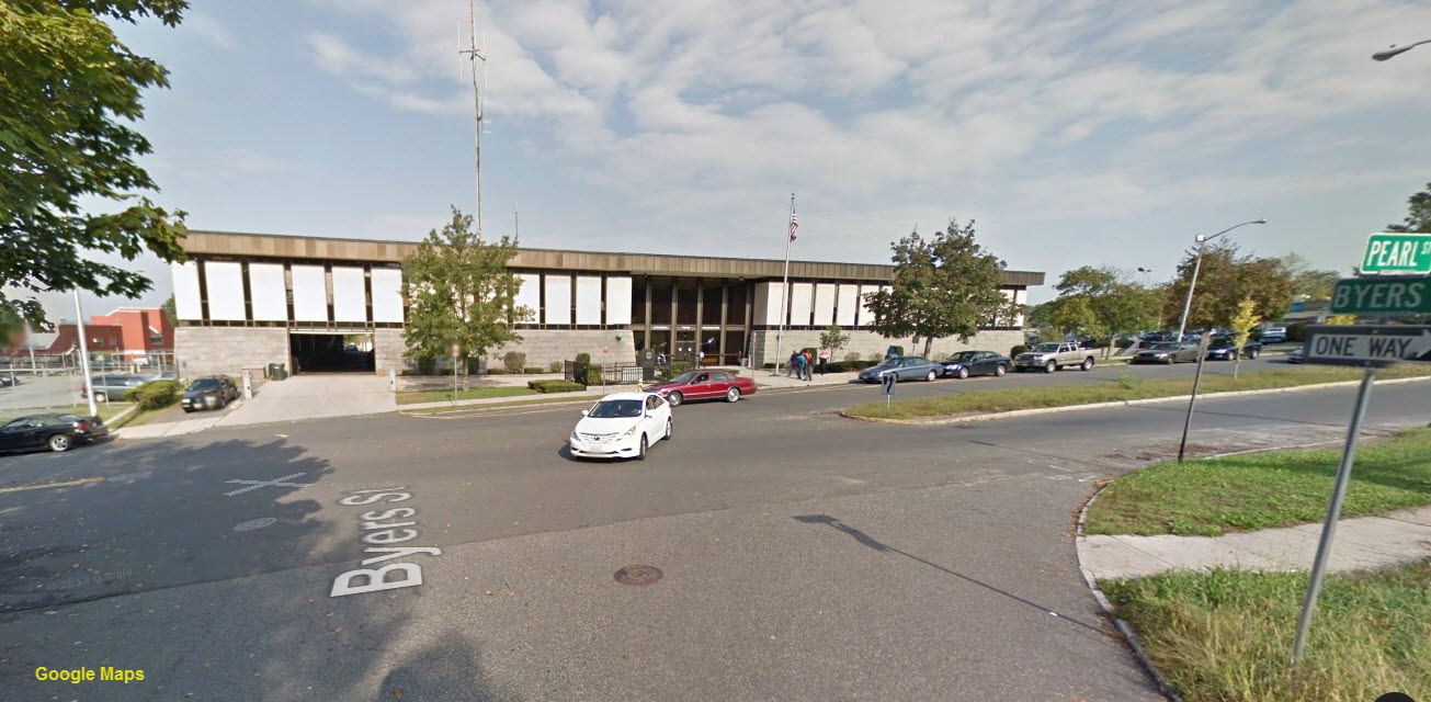
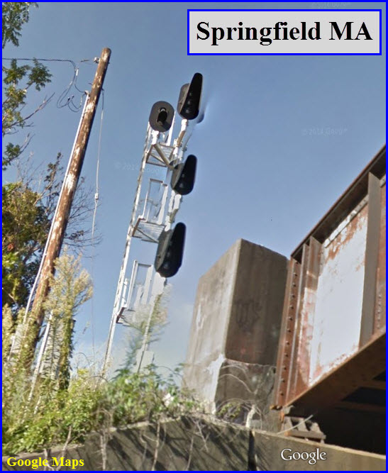
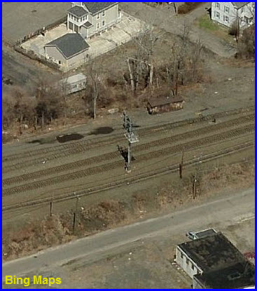
SPRING Tower
GPS Coordinates:
42.103507, -72.596674
Hidden underneath I-91 at
the diamond is the former Spring Tower. The following information comes
from
here:
Question: On the northeast corner of East
Columbus Avenue and Gridiron streets in Springfield, there is a graffiti-laden
building under the Interstate 291 connector. Who built it, maintains it
and what’s it used for?
Answer: This mysterious-looking little
building squats in a kind of no-man’s land, deep in the shadows of Interstate
91.
The building was once used as a railroad control tower to control
east-west and north-south train traffic coming through the city. Robert A.
Lingane of West Haven, Conn., a railroad historian and former Conrail employee,
said the building is no longer in use as a control tower although it was still
performing that function in 1990 when he retired.
“I am surprised it
hasn’t been torn down,” Lingane said, adding that the railroad control functions
that it once performed are now computerized and performed out of Boston.
“It used to be manned,” said City Assessor Stephen P. O’Malley. “A guy
would sit at the top of the tower and pull levers to move the switches to move
the tracks.”
Springfield historian Frances M. Gagnon said she believes
the building was built in the 1870s, about the same time that the city’s first
railroad station was built at Main Street and Gridiron Street, which was known
then as Railroad Row.
O’Malley said the structure is owned by Amtrak,
which as a railroad is exempt from taxation per federal law. An Amtrak
spokesman in the New York office had no knowledge of the building. An Amtrak
employee at Union Station in Springfield, who declined to give his name, said
the building is used for storage.
O’Malley theorized that the building
remains standing because it stands so close to active rail lines and that it
would be difficult to demolish.
Sgt. John M. Delaney, aide to Police
Commissioner William J. Fitchet, said the building, although covered with
graffiti, has not posed any particular problems with law enforcement.
The B&W on the left was found
here,
picture by Tom Hildreth.
7
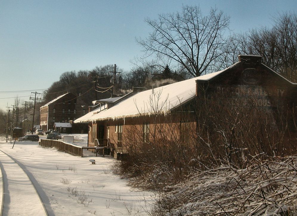
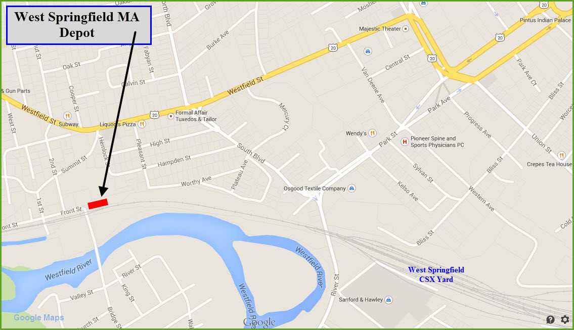
West Springfield Depot
GPS Coordinates: 42.101099, -72.636029 38 Front St, West Springfield
MA 01089
The last time I was in Springfield was in the 2000-2001
timeframe, and I had very little time to take pictures - and the ones I did
get are all slides filed away under piles of electronic paraphernalia in my
basement. But in looking at what can be seen from Google's Streetview,
it looks like a combination of newer colorlight signals, and older
searchlight signals used around the interlocking at the wye. I will
have to wait until someone can send me some good pictures or I get back
there myself. In the picture above of the CSX bridge from I-91, it
looks as if there might be a couple of dwarf searchlights on the approach to
the junction under the interstate, and then, maybe not.
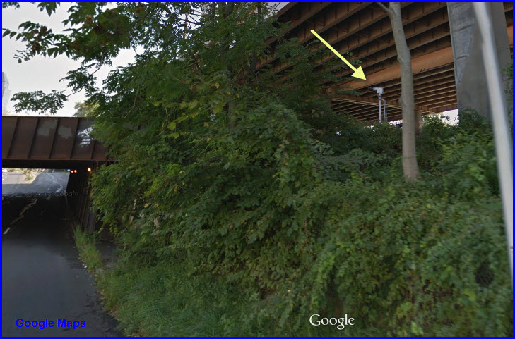
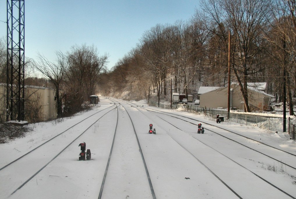
1
WB Colorlights
This view is from US 5 as you go under the railroad bridge
on the west shore of the river. The signal is for traffic coming from
Springfield into the West Springfield yard. The real picture below is
courtesy Jersey Mike, and was taken before they replaced the "tri-light"
signals with "darth vaders".
What does it Mean?
In the above photo, there is an extra signal head
showing. What does it mean, what is it for?
Per CSX rules, the
signal will display:
1) a "C" on top with a white light under it.
Rule CR 1280A Clear to Next Interlocking
Or
2) a "N" on top with a white light under it. Rule CR 1280B
Approach Normal These appear at interlockings
and are used by the dispatcher to keep trains moving when the signal system
(cab signals between interlocking) is not operating, or the lead locomotive
has had an en route cab signal failure. The signal is called "Clear to
Next Interlocking". On some of the Boston Sub, trains are governed by
cab signals only, with wayside signals only at interlockings and controlled
points. NORAC Rule 562 or its CSXT equivalent apply. If a train
has a problem with its cab signals the dispatcher can light up the unit
below the "C" sign, and the train has the railroad to the next signal.
Here is one on the Northeast Corridor in Secaucus NJ:
Thanks to Frank L., William L., Fran G., and Len G.
for helping out with the answer on this one, they are all on the Yahoo
Railway Signaling group.
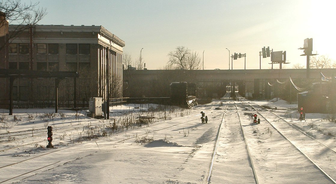
2
Searchlight
This signal is
for traffic coming from the station, and hookin a right turn to go up the
east side of the river (a guess, seeing I can't see the track :-).
3
West Springfield - EB Bridge Approach
Picture courtesy Jersey
Mike
4
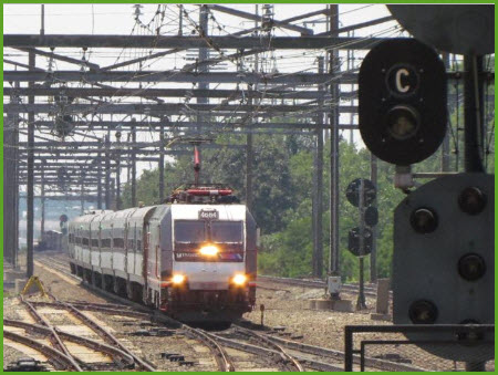
Amtrak Union Station - West Side
Picture courtesy Jersey Mike
Other Signal Pictures from Around
Thanks to Jersey Mike for letting me use his
pictures!
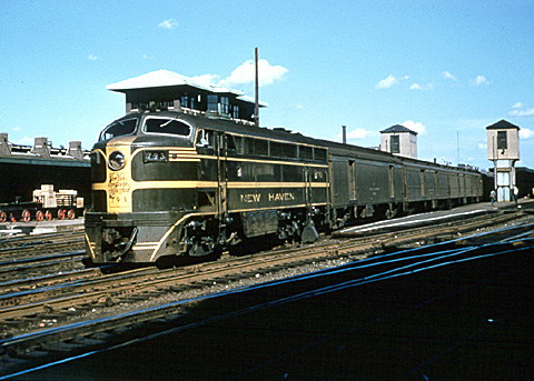
Springfield's grand Union Station was
constructed in 1926 by the Boston & Albany
Railroad to replace a smaller Union Station, which had been
adorned in unique Egyptian-style architecture. Springfield is exactly
equidistant to both Boston and Albany—89 miles (143 km.). The
New York, New Haven & Hartford (aka, the New
Haven) and Boston & Maine railroads also utilized the station.
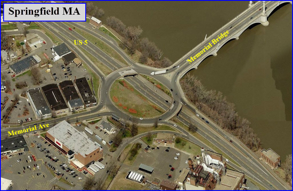
US 5 Interchanges
The two US 5 interchanges in West
Springfield deserve a special note, because if you are not familiar with
them, you could wind up going somewhere you did not intend to. US 5 is
a thru road, while it has exit ramps for the local roads.
Wye and Crossing under I91
There is a nice pedestrian overpass put
in just for us railfans to get shots of trains crossing the Connecticut River.
:-)
Disclaimers:
I love trains, and I love signals. I am not an
expert. My webpages reflect what I find on the topic of the page.
This is something I have fun with while trying to help others. My
webpages are an attempt at putting everything I can find of the subject in
one convenient place. There are plenty of other good websites to help
me in this effort, and they are listed in the links section on my indexa
page, or as needed on individual pages. Please do not write to me
about something that may be incorrect, and then hound the heck out of me if
I do not respond to you in the manner you would like. I operate on the
"Golden Rule Principle", and if you are not familiar with it, please
acquaint yourself with how to treat people by reading Mathew 7:12 (among
others, the principle exists in almost every religion). If you contact
me (like some do, hi Paul) and try to make it a "non-fun" thing and start
with the name calling, your name will go into my spambox list! :-)
Please Note:
Since the main focus of my two websites is railroad signals, the railfan guides
are oriented towards the signal fan being able to locate them. For those
of you into the modeling aspect of our hobby, my
indexa page has a list of
almost everything railroad oriented I can think of to provide you with at least a few pictures to
help you detail your pike.
If this is a railfan page, every effort has
been made to make sure that the information contained on this map and in this
railfan guide is correct. Once in a while, an error may creep in,
especially if restaurants or gas stations open, close, or change names.
Most of my maps are a result of personal observation after visiting these
locations. I have always felt that a picture is worth a thousand words",
and I feel annotated maps such as the ones I work up do the same justice for the
railfan over a simple text description of the area. Since the main focus
of my website is railroad signals, the railfan guides are oriented towards the
signal fan being able to locate them. Since most of us railheads don't have just
trains as a hobby, I have also tried to point out where other interesting sites
of the area are.... things like fire stations, neat bridges, or other
significant historical or geographical feature. While some may feel they
shouldn't be included, these other things tend to make MY trips a lot more
interesting.... stuff like where the C&O Canal has a bridge going over a river (the Monocacy Aqueduct) between Point of Rocks and Gaithersburg MD, it's way cool to
realize this bridge to support a water "road" over a river was built in the
1830's!!!
My philosophy: Pictures and maps are worth a
thousand words, especially for railfanning. Text descriptions only
get you so far, especially if you get lost or disoriented. Take
along good maps.... a GPS is OK to get somewhere, but maps are still
better if you get lost! I belong to AAA, which allows you to get
local maps for free when you visit the local branches. ADC puts
out a nice series of county maps for the Washington DC area, but their
state maps do not have the railroads on them. If you can find em,
I like the National Geographic map book of the U.S..... good, clear, and
concise graphics, and they do a really good job of showing you where
tourist type attractions are, although they too lack the railroads.
Other notes about specific areas will show up on that page if known.
By the way, floobydust is
a term I picked up 30-40 years ago from a National Semiconductor data
book, and means miscellaneous and/or other stuff.
Pictures and additional information is always needed if anyone feels
inclined to take 'em, send 'em, and share 'em, or if you have
something to add or correct.... credit is always given! BE NICE!!! Contact info
is here
Beware: If used as a source, ANYTHING from Wikipedia must be treated as
being possibly being inaccurate, wrong, or not true.
 "Amt
SPG 9640+Amtrak-Stand" by Sturmovik at en.wikipedia.
"Amt
SPG 9640+Amtrak-Stand" by Sturmovik at en.wikipedia. 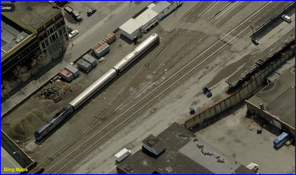
 This view is from I-91 and Google Streetview
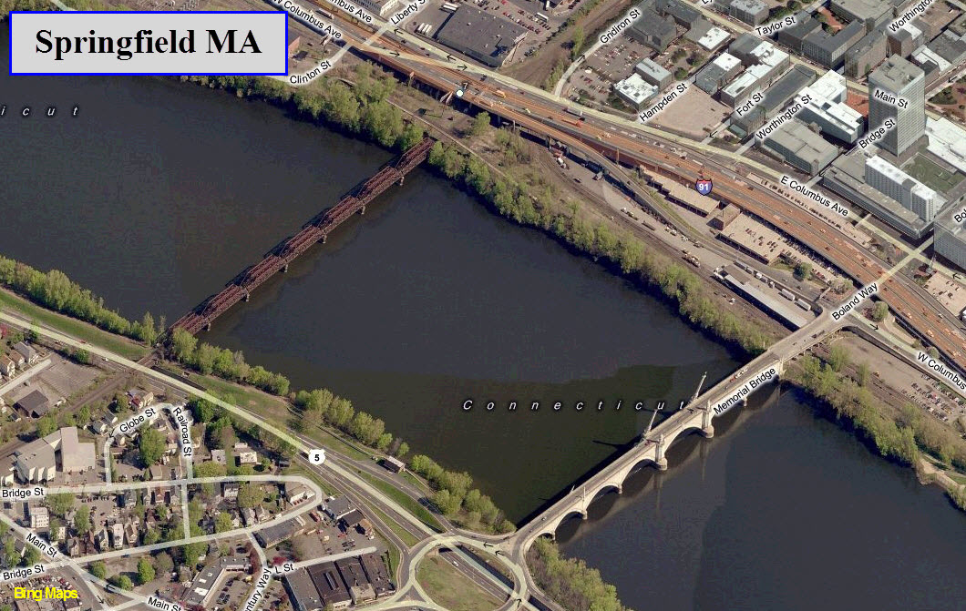
 Picture courtesy Jersey Mike
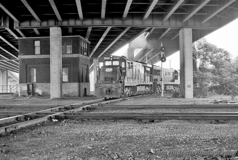
 Picture courtesy Jersey Mike
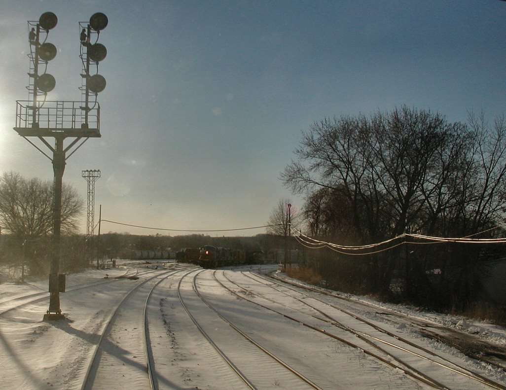
 The west end of the West Springfield Yard
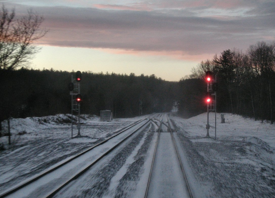 CP60
CP60
 3 from CP160