
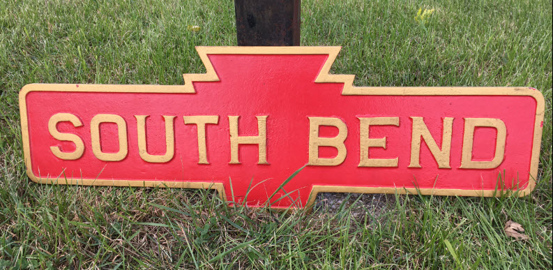
In General
Getting Here
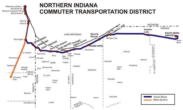
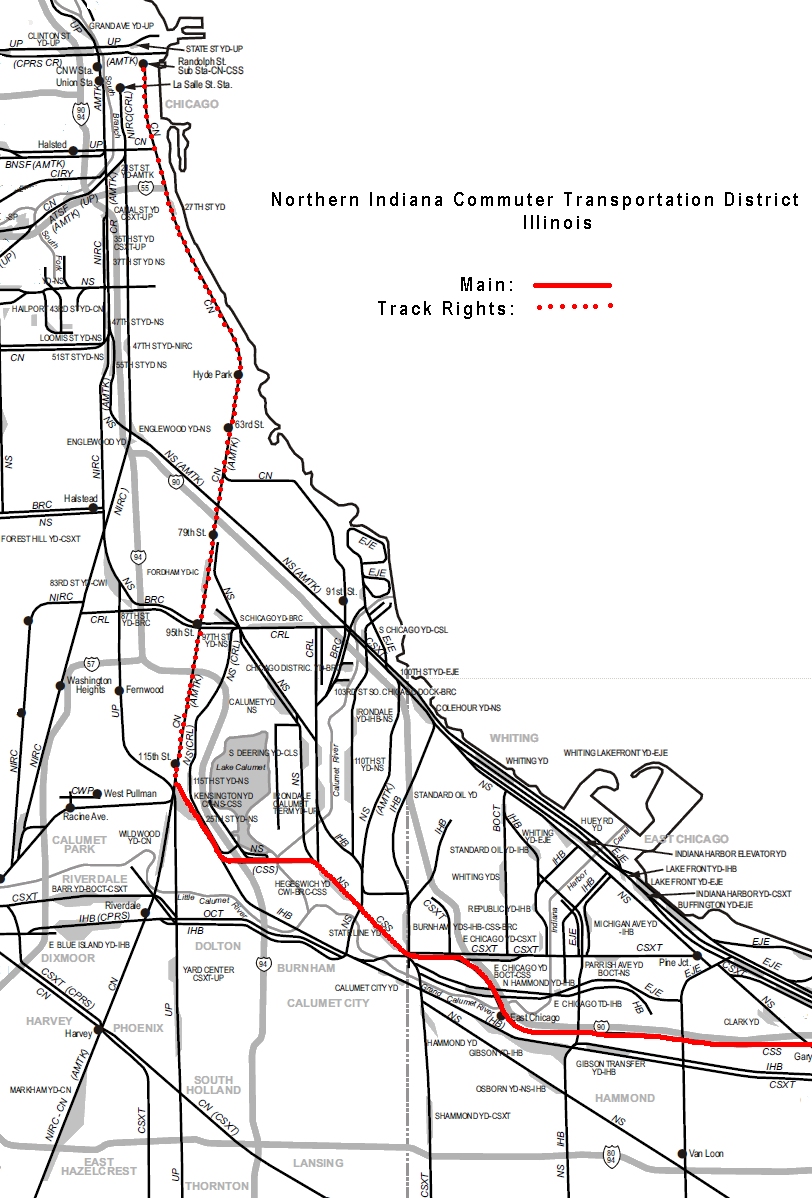
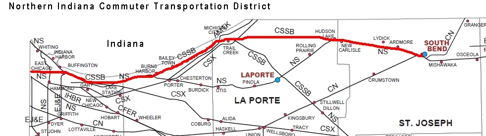
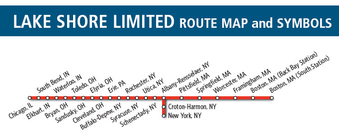
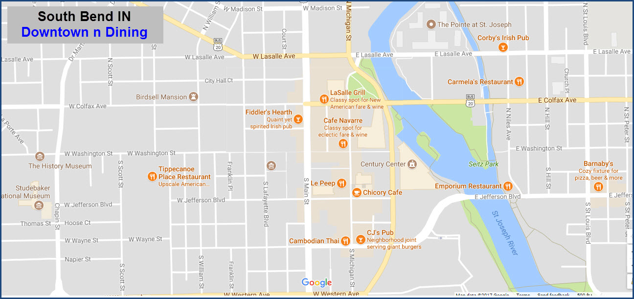
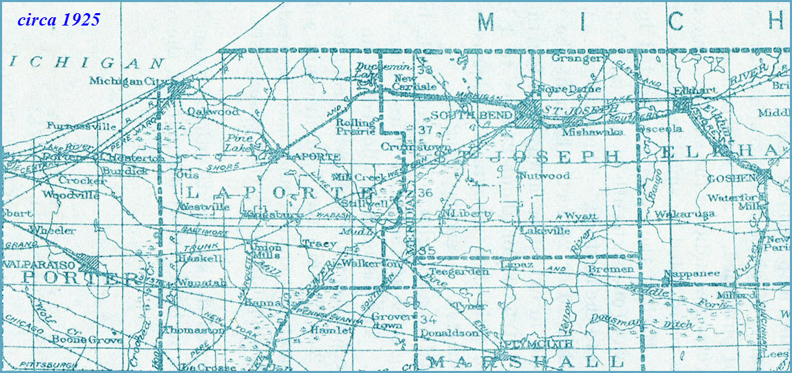
Map
Sights
Pictures
Bridges
Floobydust
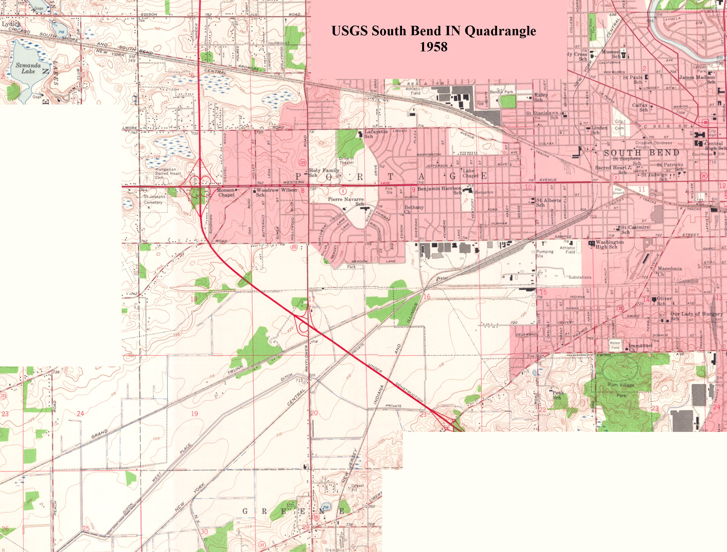
USGS Maps
In General
Getting Here
Map
Sights
Pictures
Bridges
Floobydust
USGS Maps
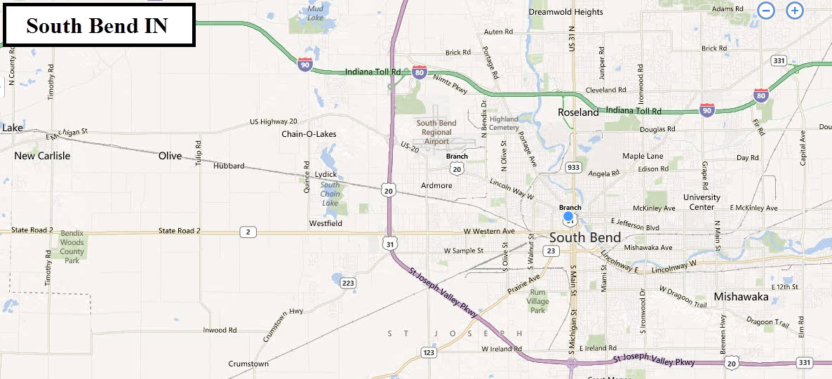
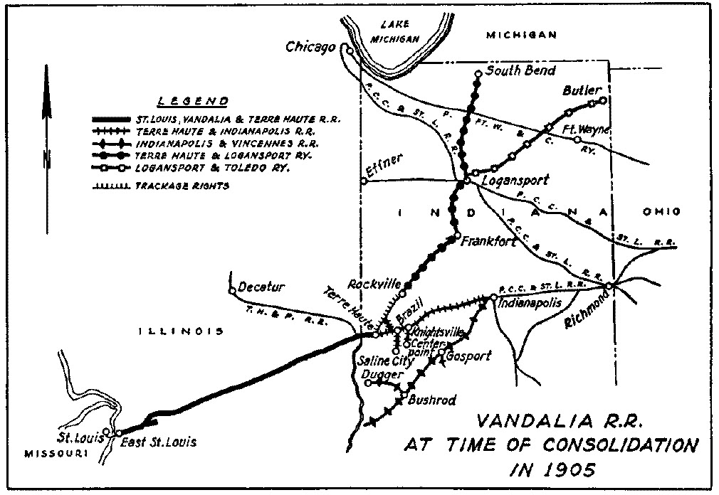
Maps
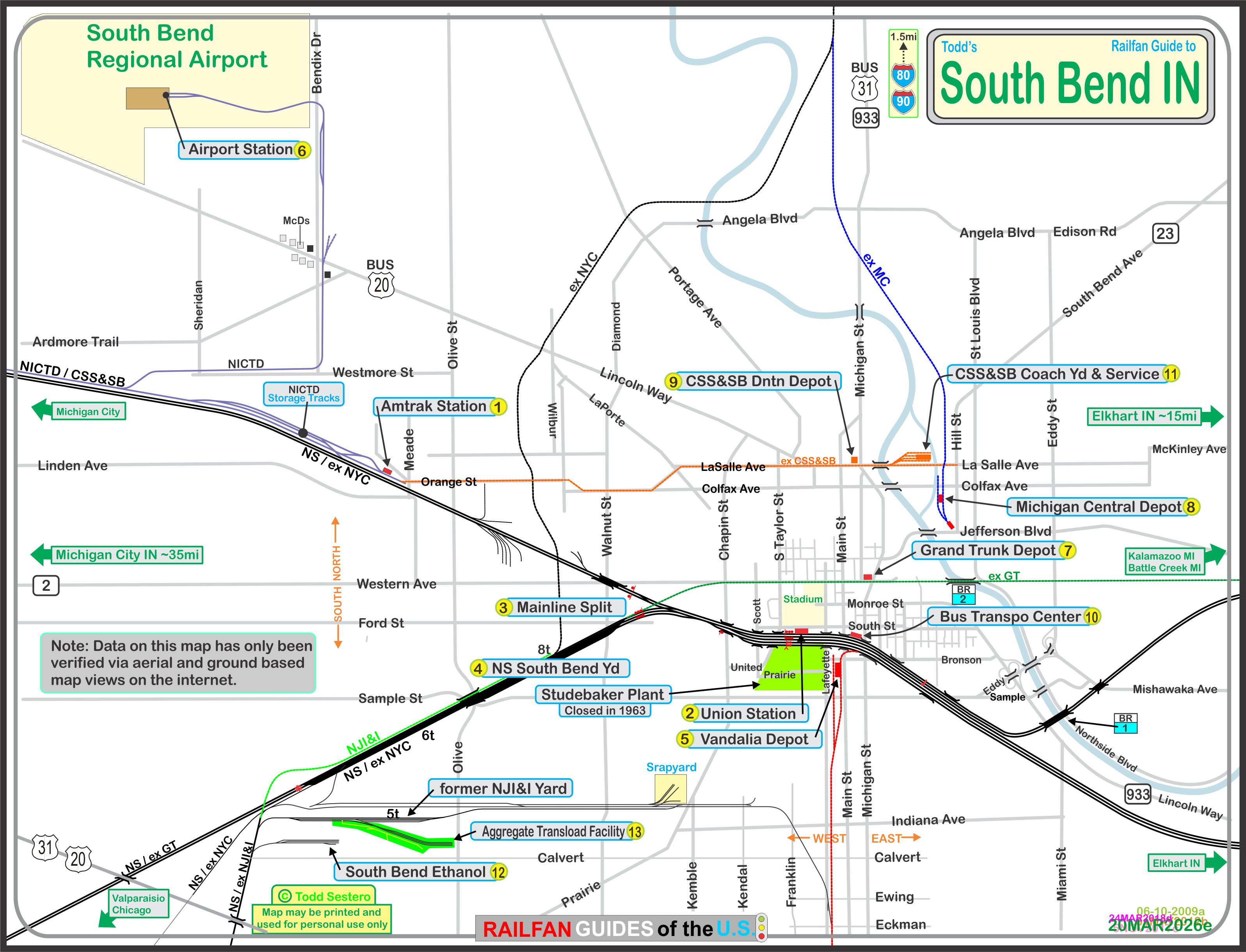
The above PDF is available here
Sights
the Amtrak Station
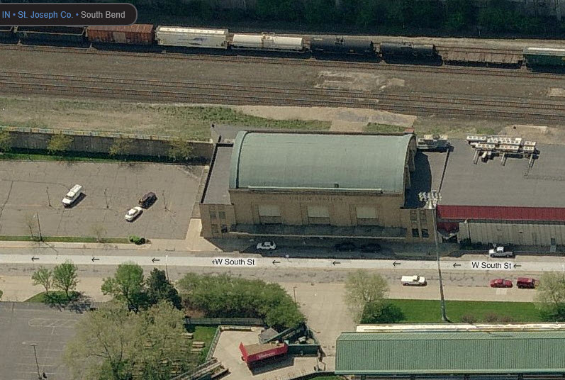
Union Station
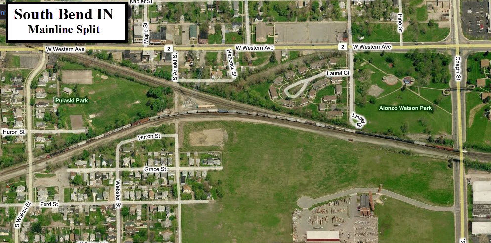
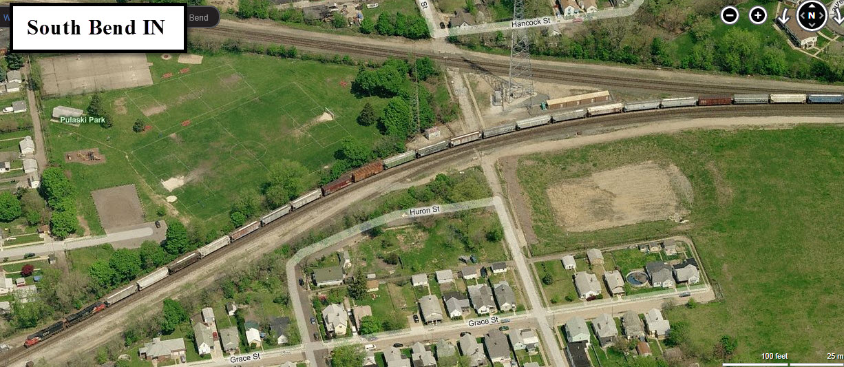
Mainline Split
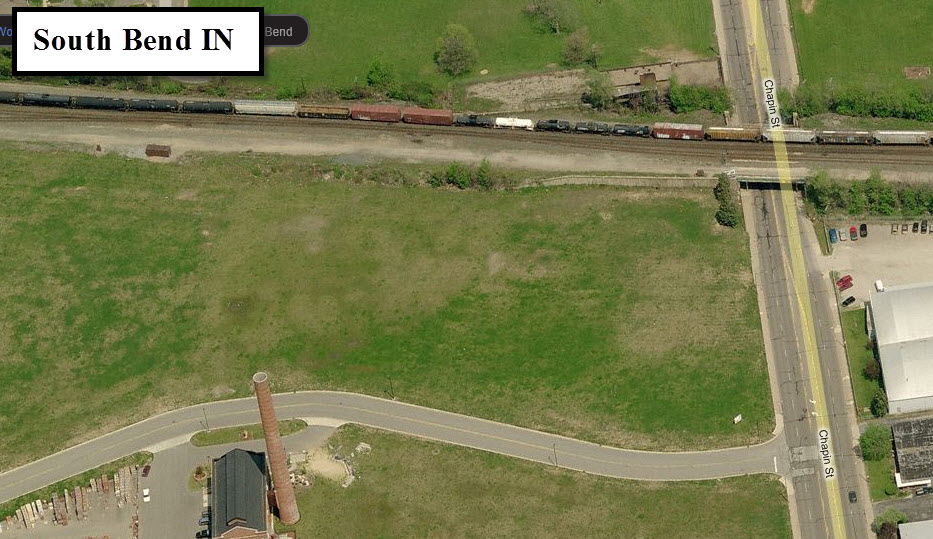
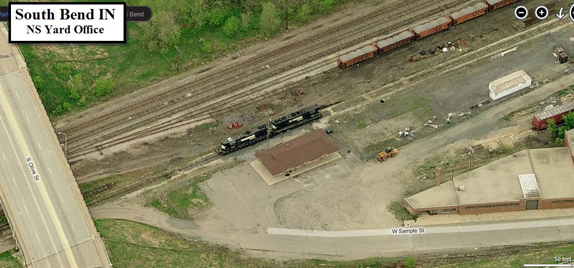
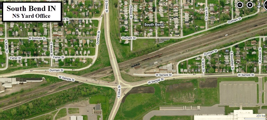
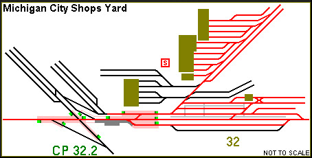
NS South Bend Yard
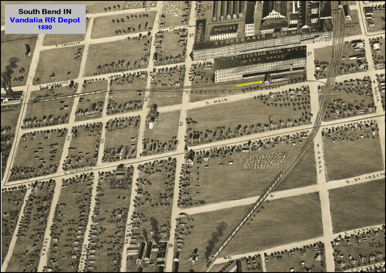
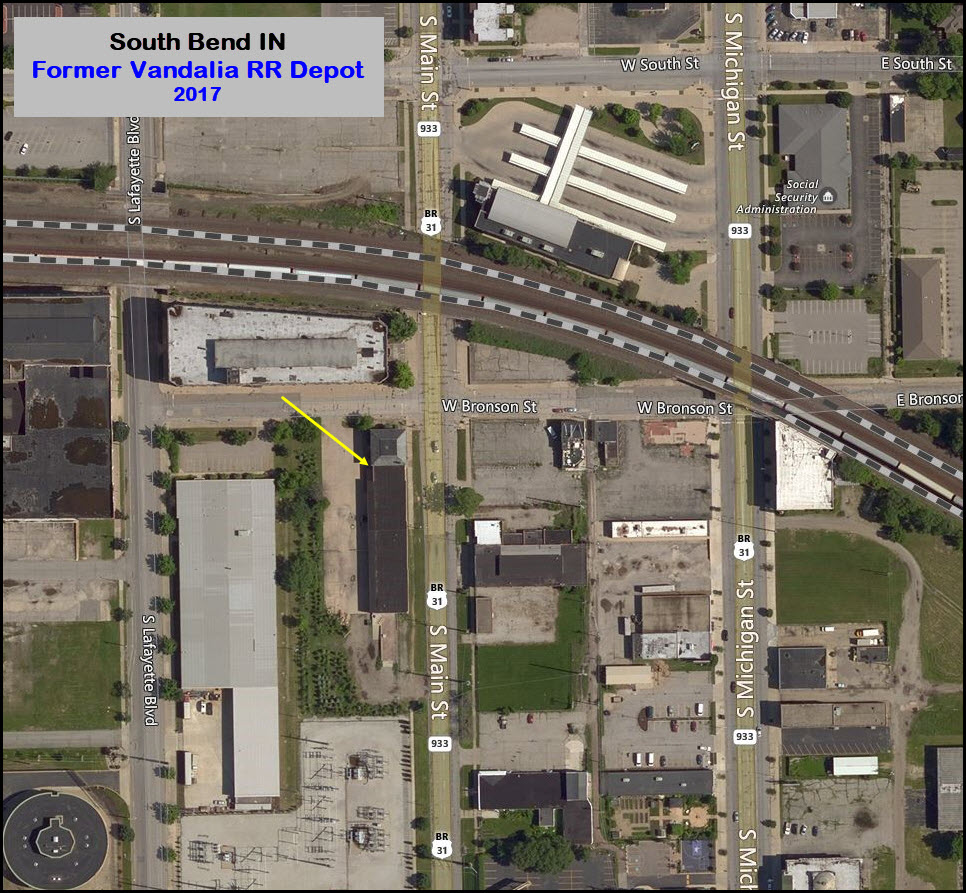
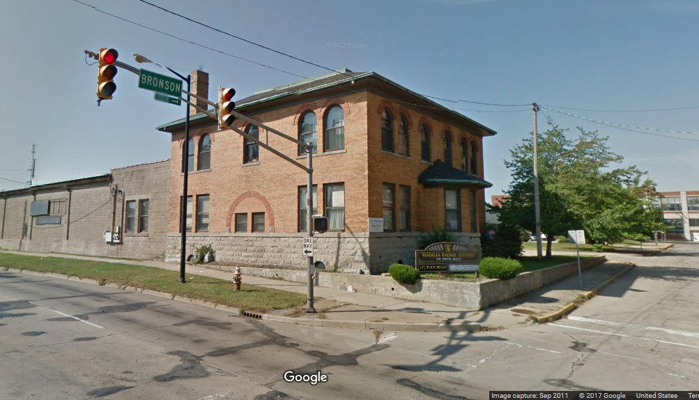
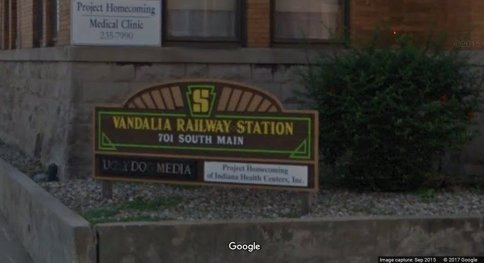
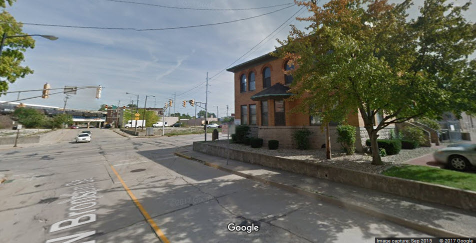
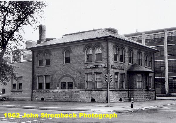
Former Vandalia Rwy Depot
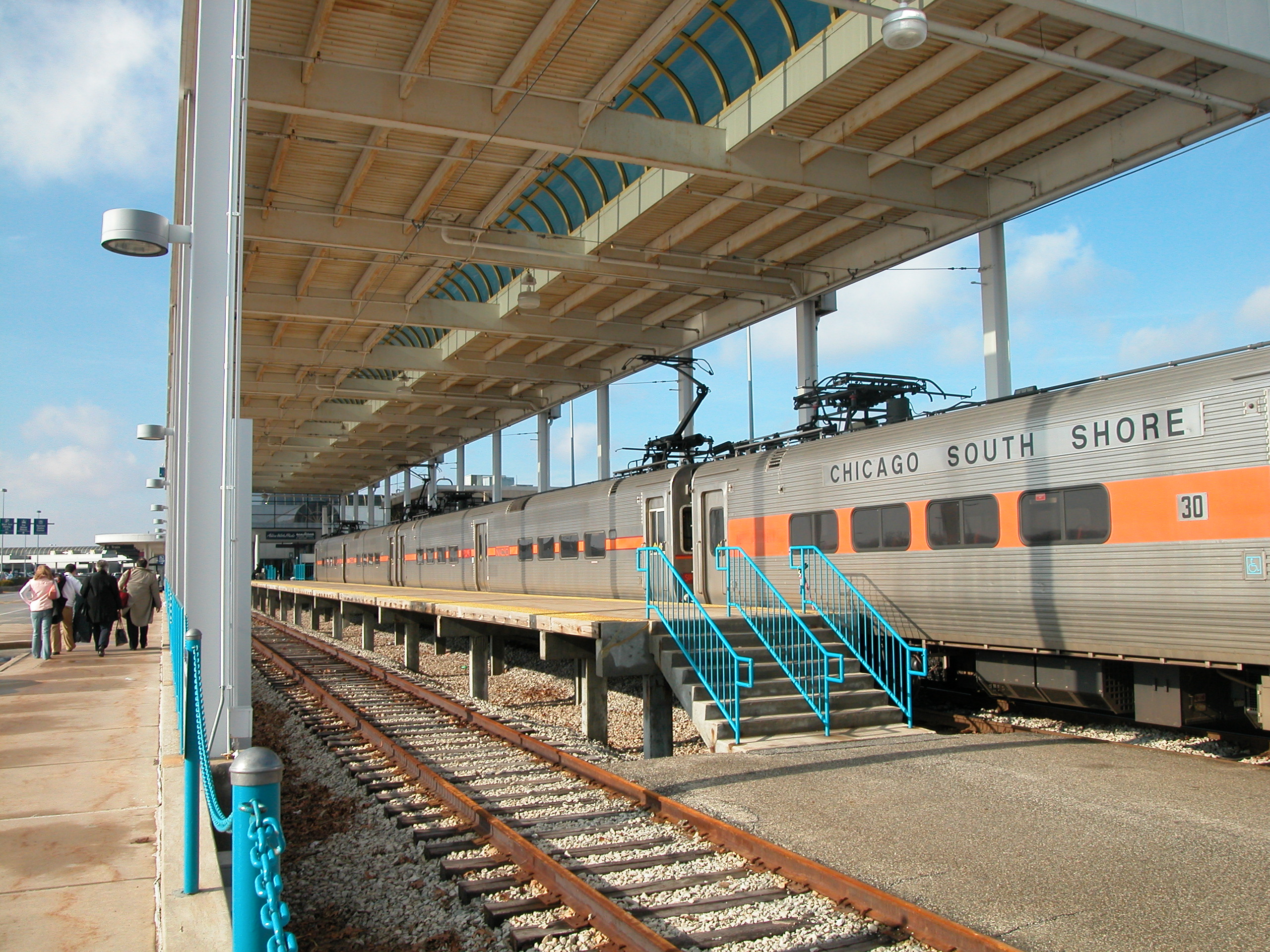
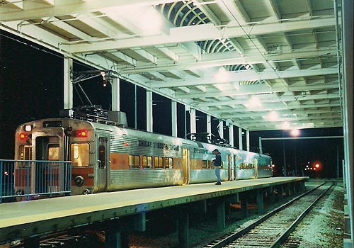
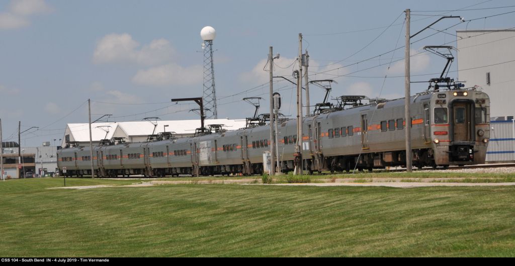
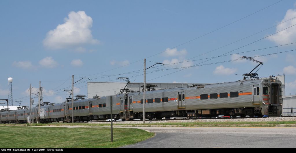
NICTD South Bend Airport Station
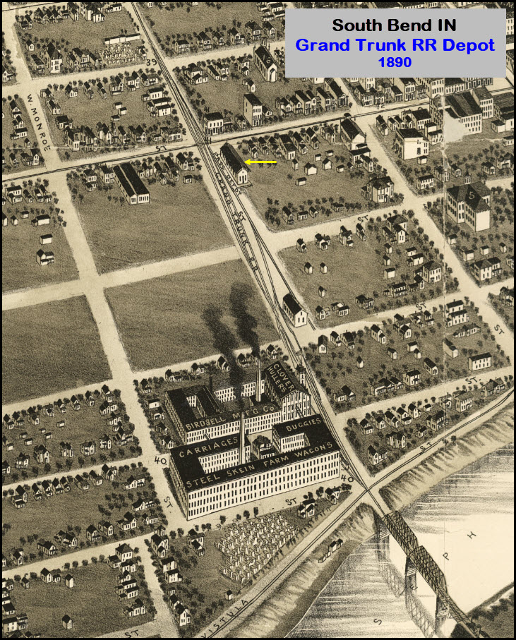
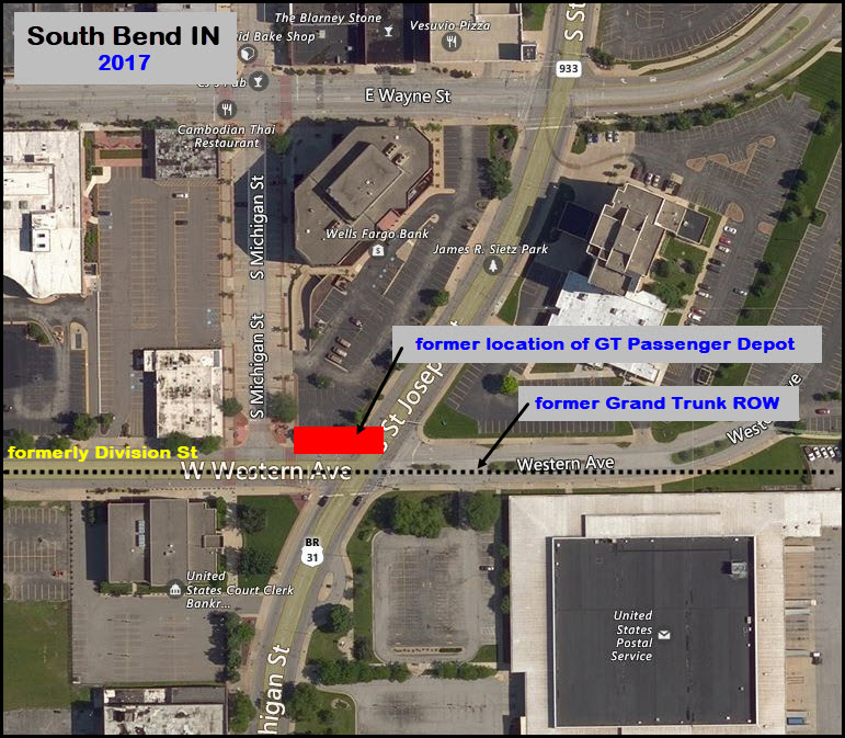
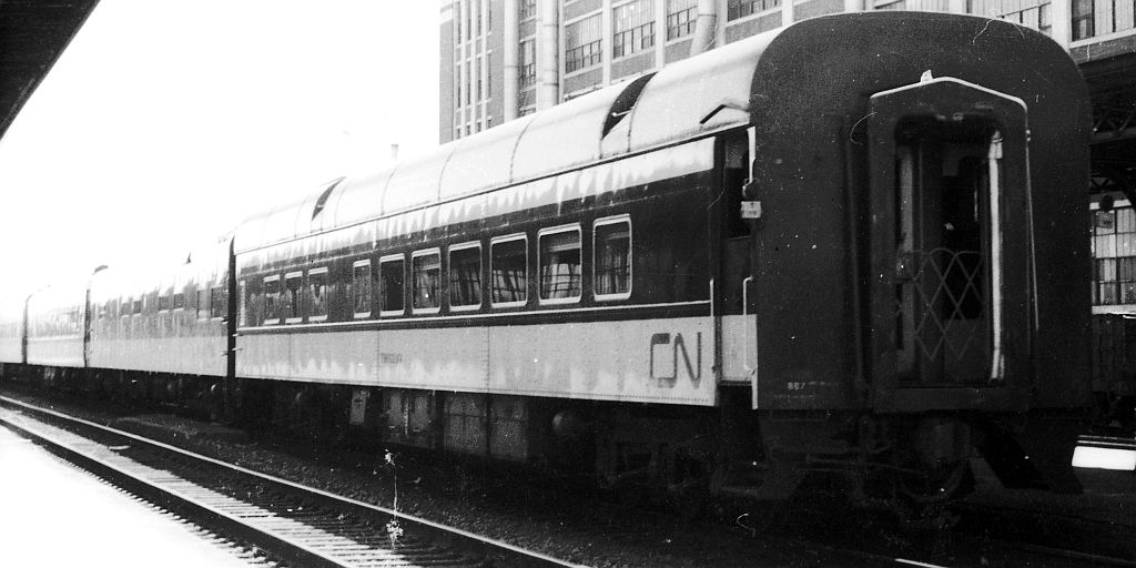
Former Grand Trunk Depot
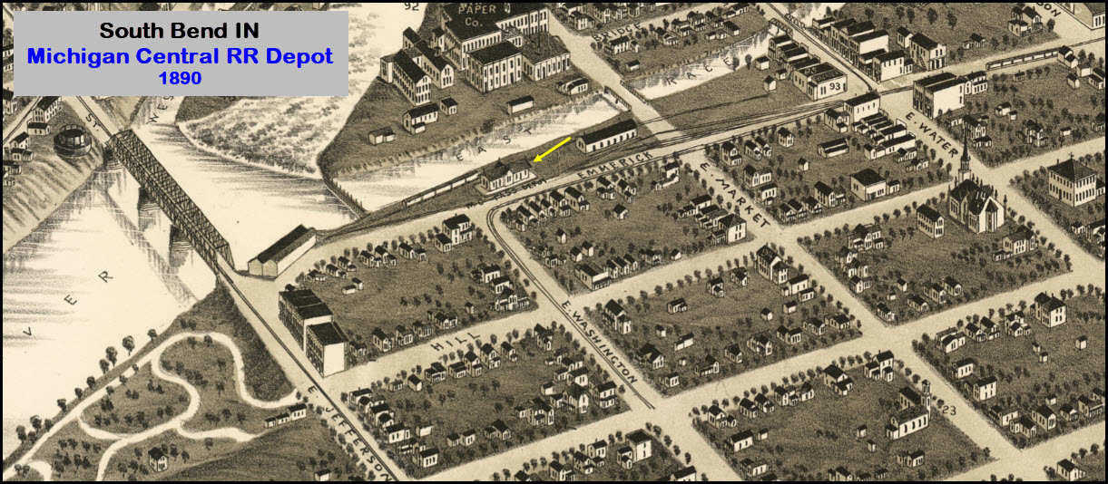
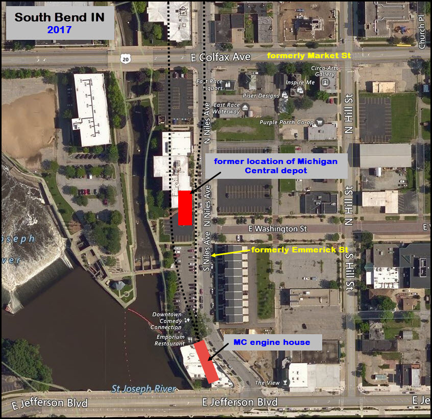
Former Michigan Central Depot
the Downtown South Shore Station
the Bus Transportation Center
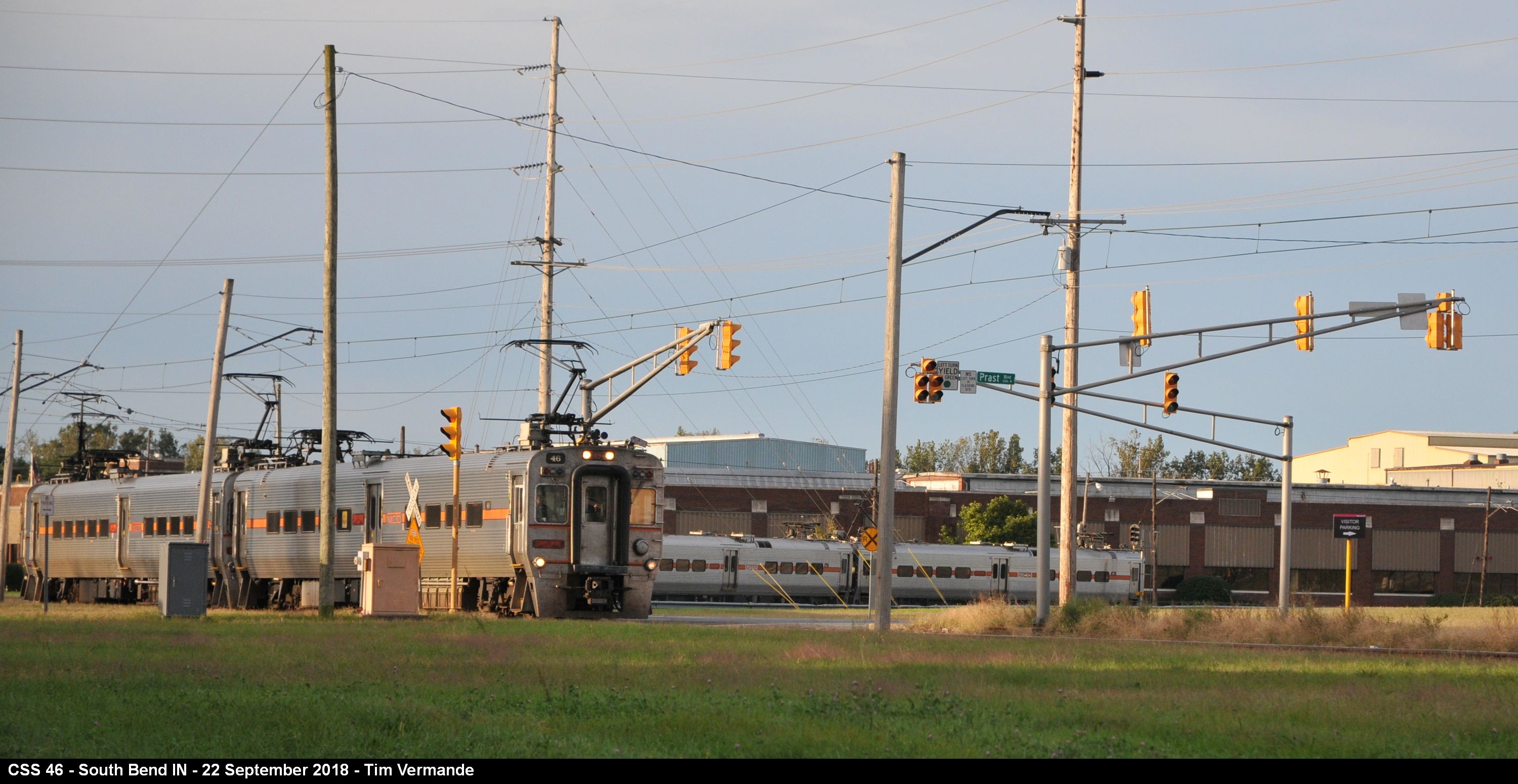
South Shore Yard & Maintenance
South Bend Ethanol
Aggregate Transload Facility
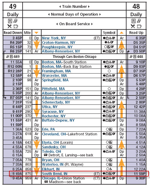
Amtrak Schedules
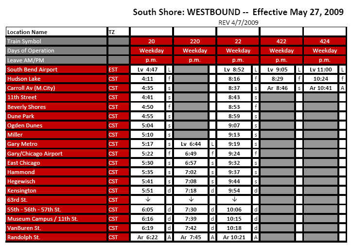
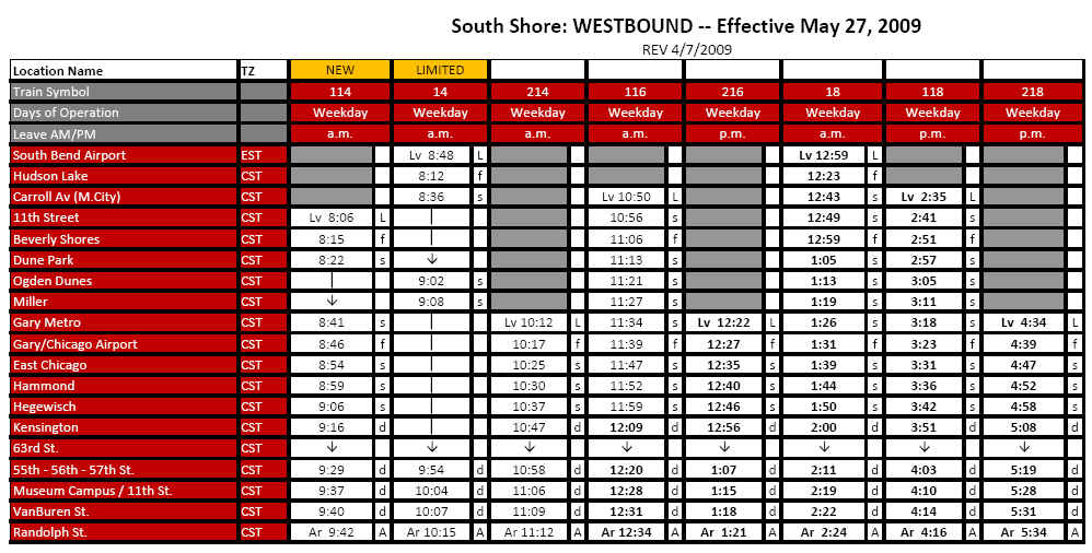
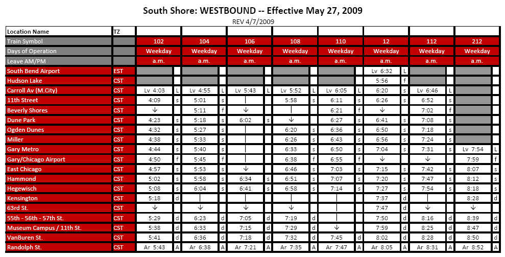
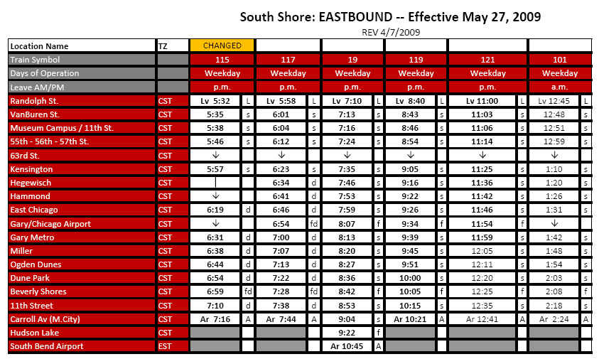
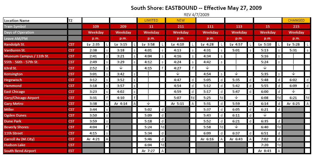
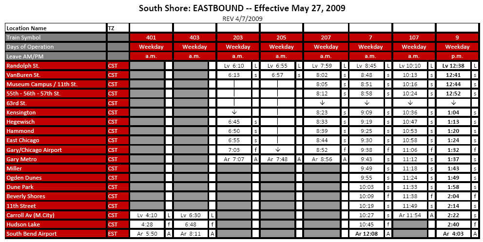
NICTD Schedules
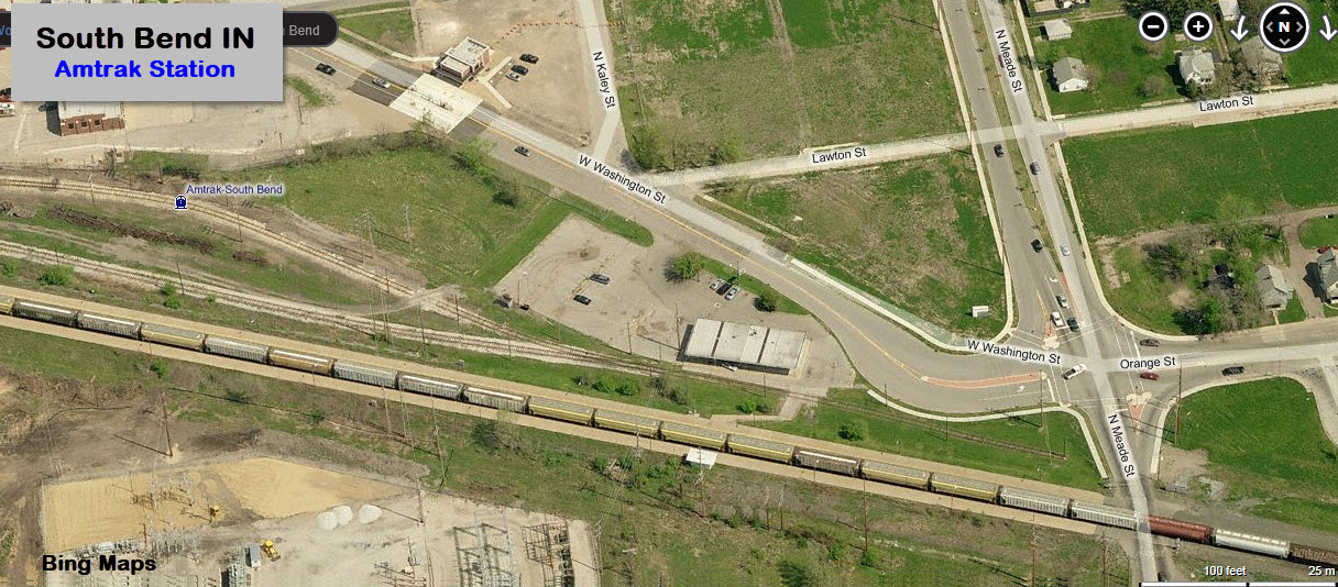
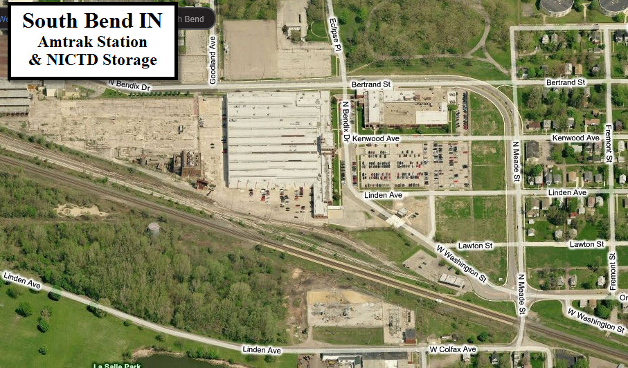
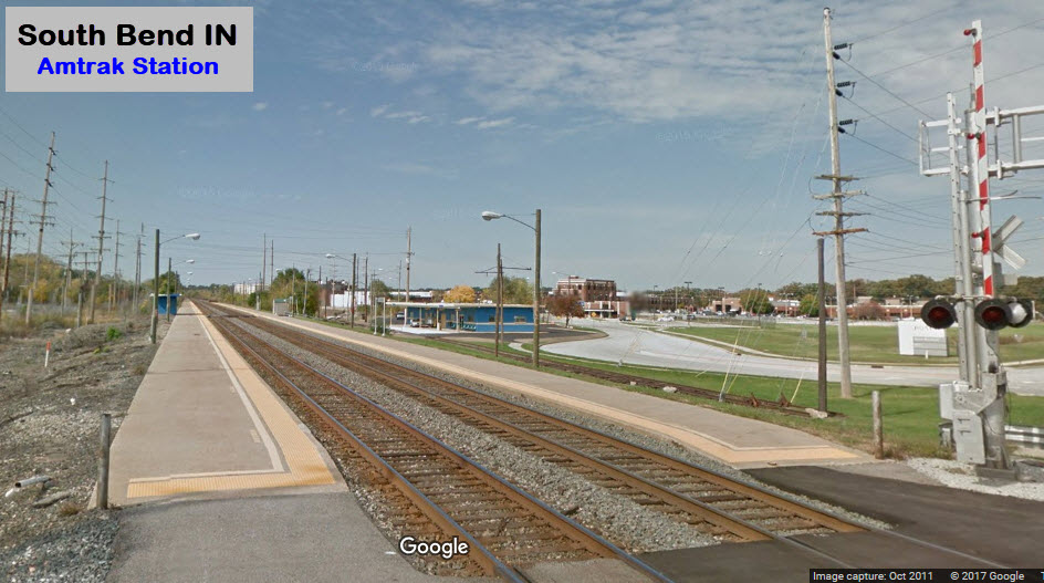
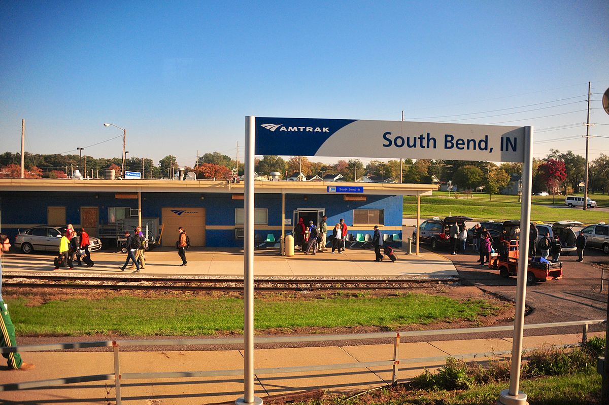
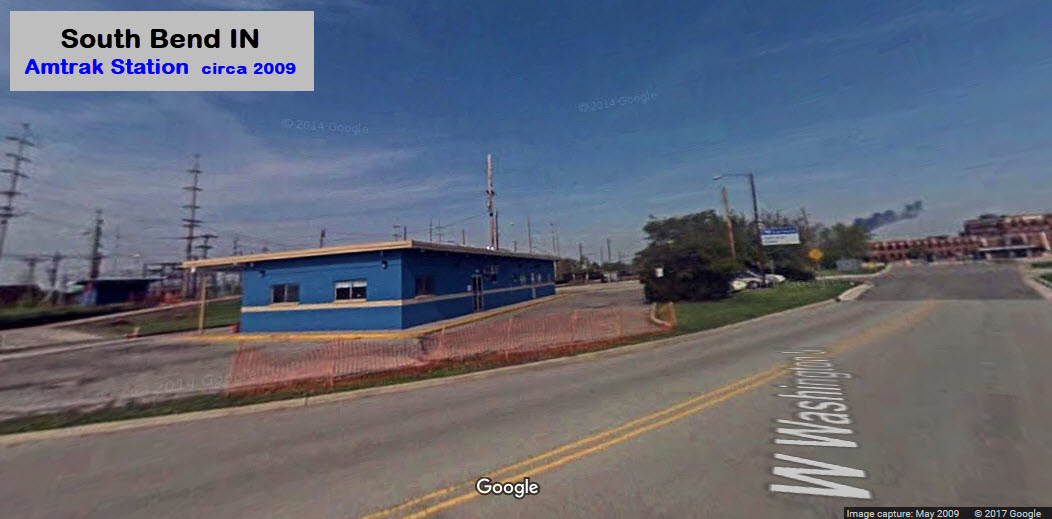
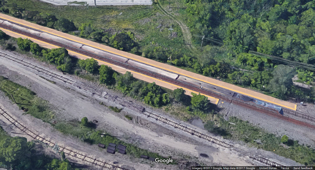
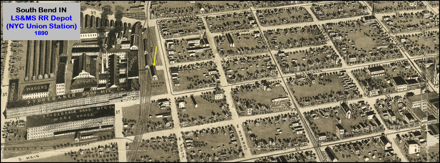
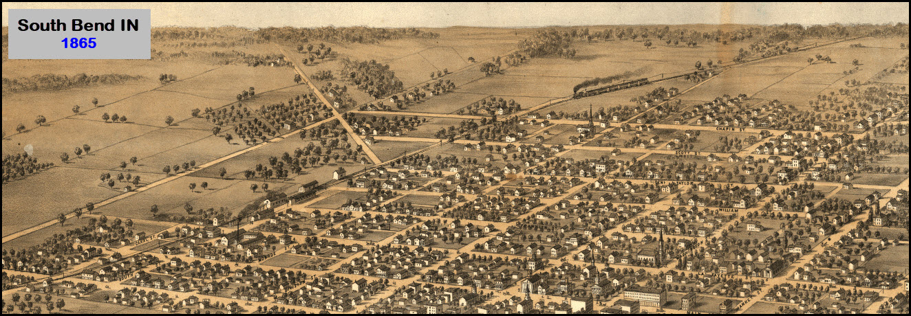
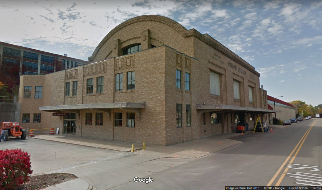
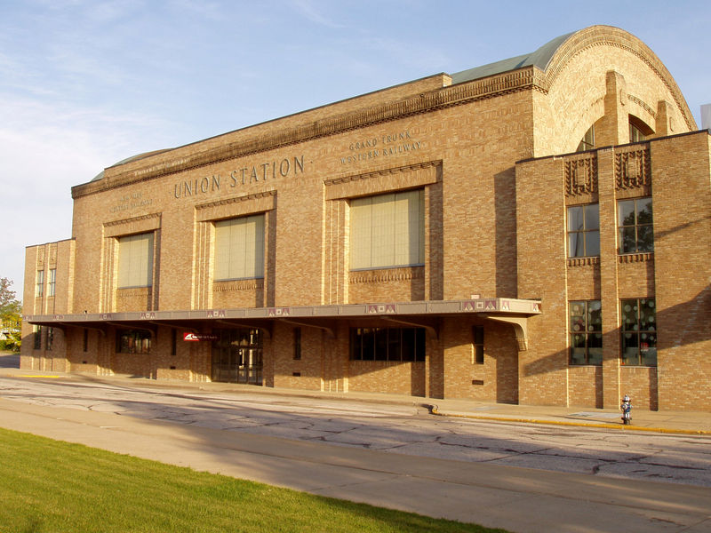 Photo: Derek Jensen, 2005, from Wikipedia
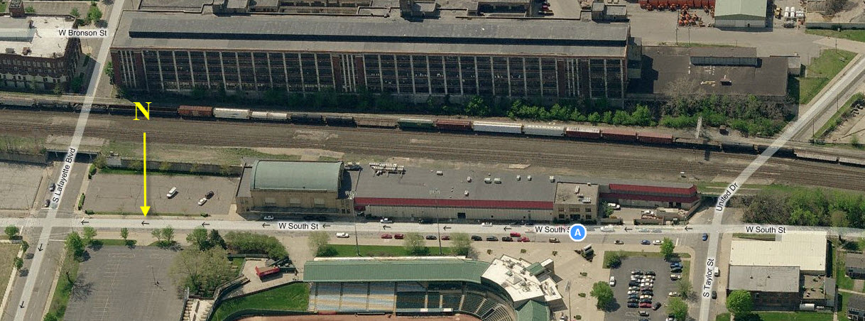
 Collection of and photo courtesy Paul Flaherty
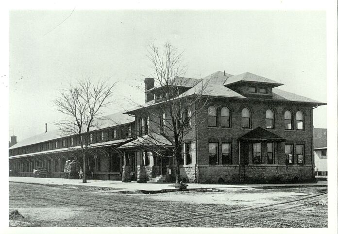
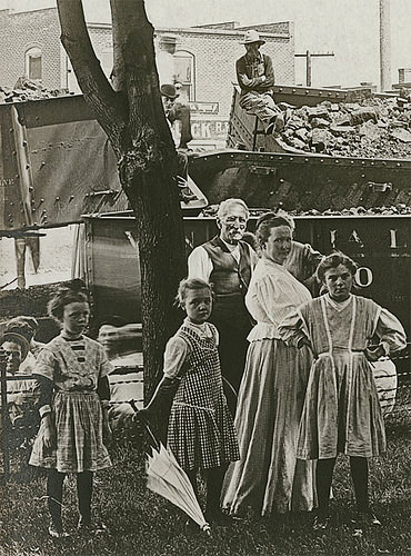
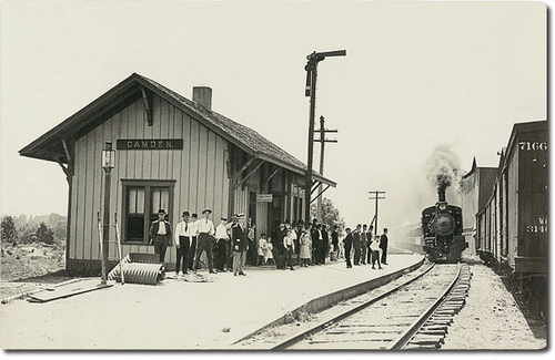 Camden IN
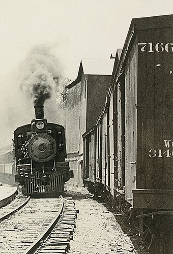
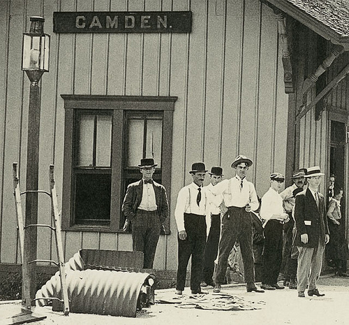 Camden IN
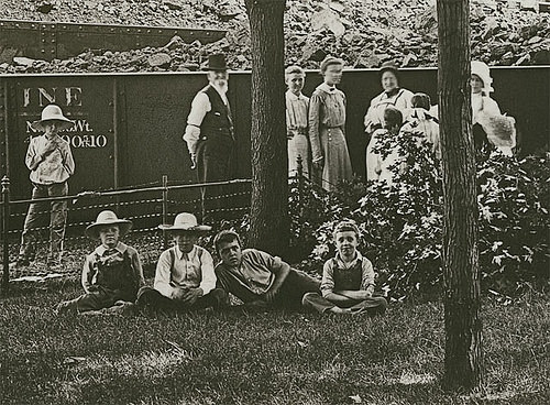
 Wreck in Flora IN
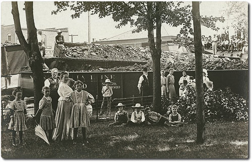

 Culver IN
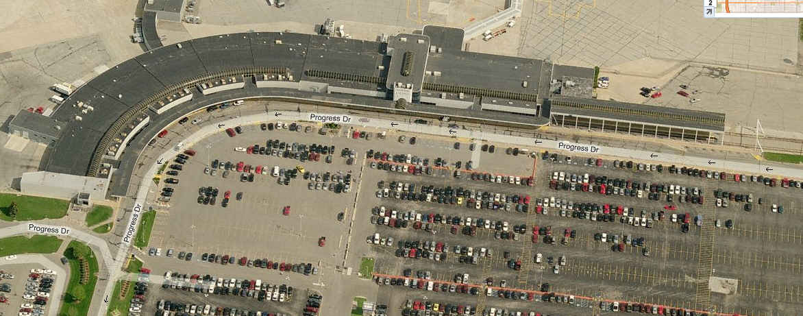
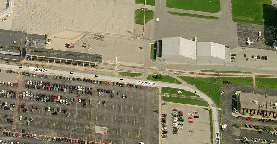
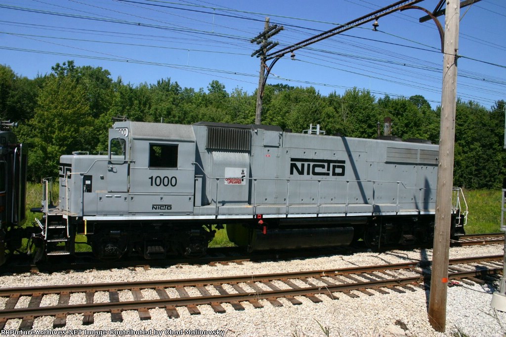
A couple of shots of NICTD's stop at the airport.... Looks like a pleasant ride along the property edge coming into the airport.
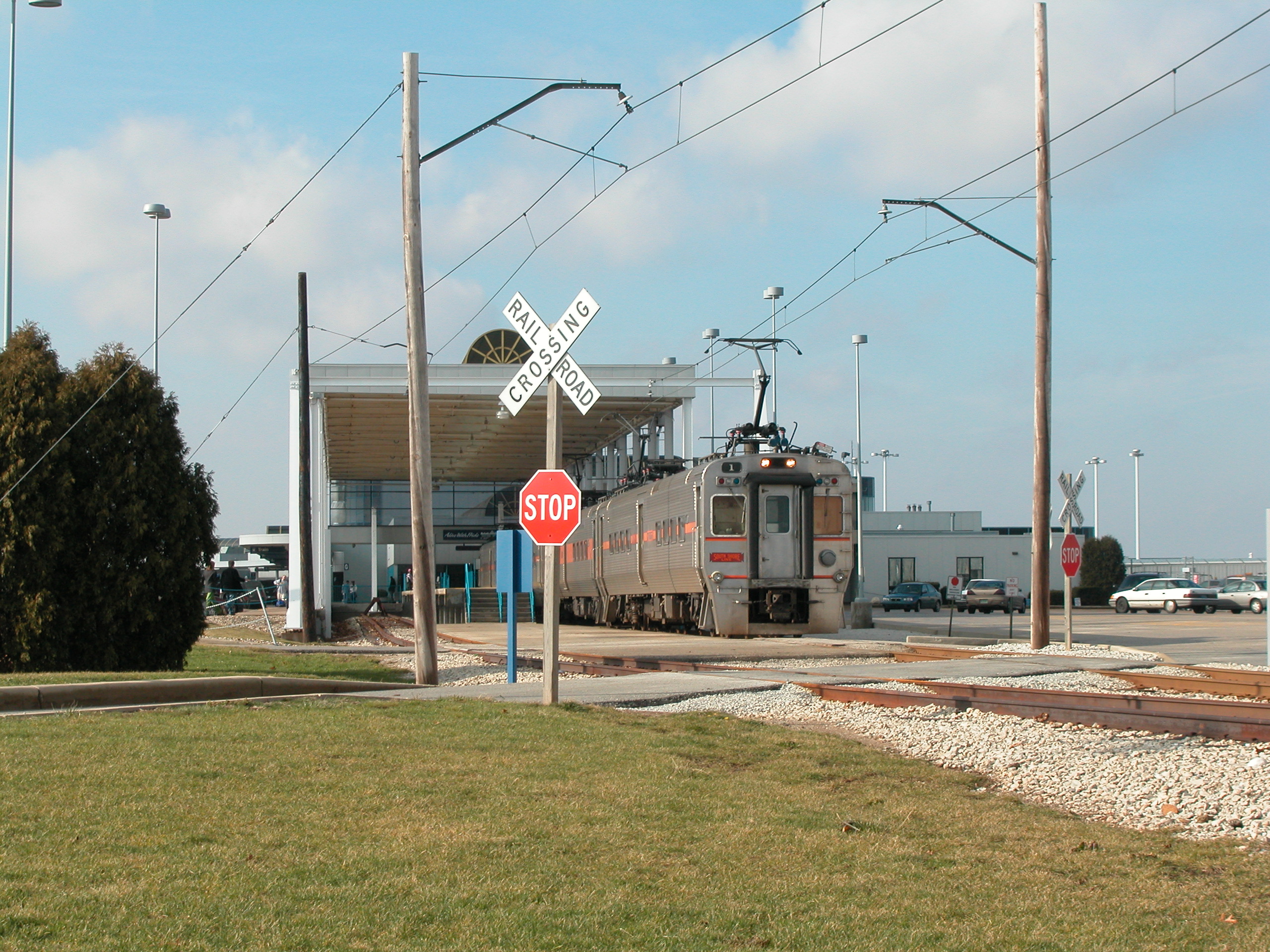 David Wilson photo
 David Wilson photo
NICTD Route maps
![]() Former Grand Trunk Depot
Former Grand Trunk Depot
GPS Coordinates: 41.672481, -86.249992
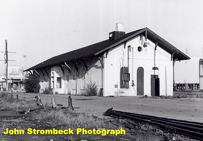 John Strombeck photo via monon.org
![]() Former Michigan Central RR Depot
Former Michigan Central RR Depot
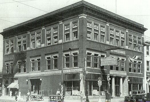
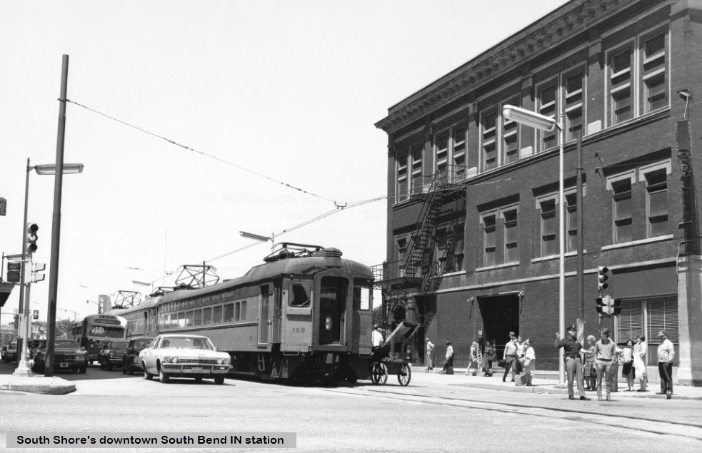
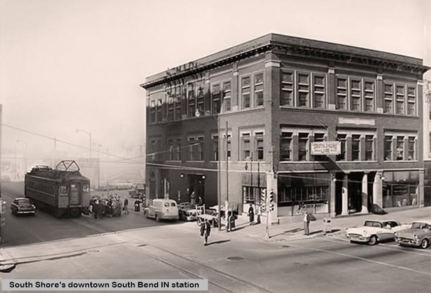
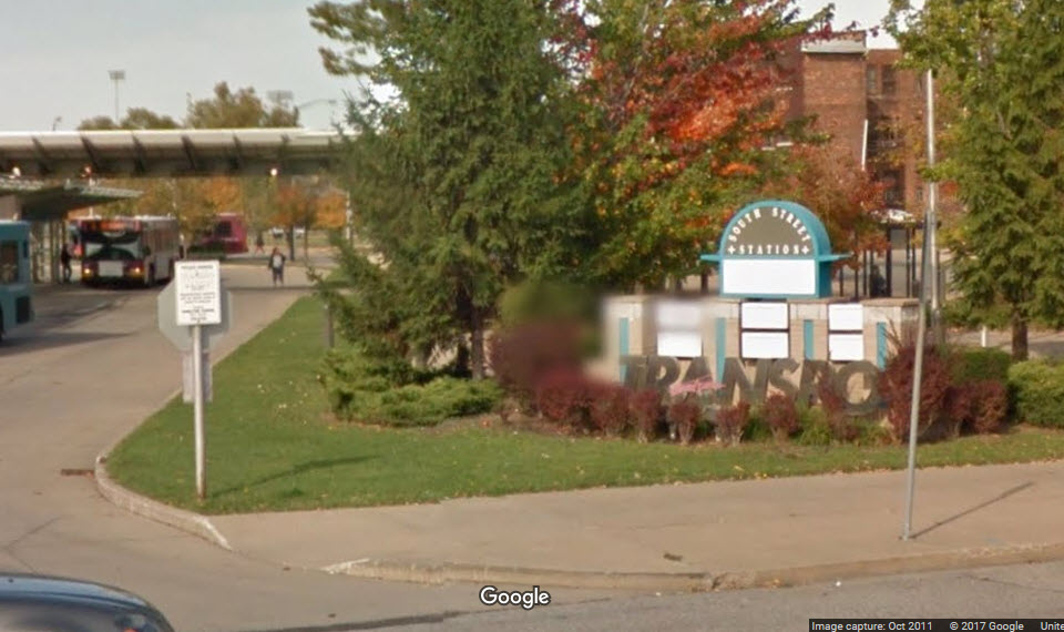
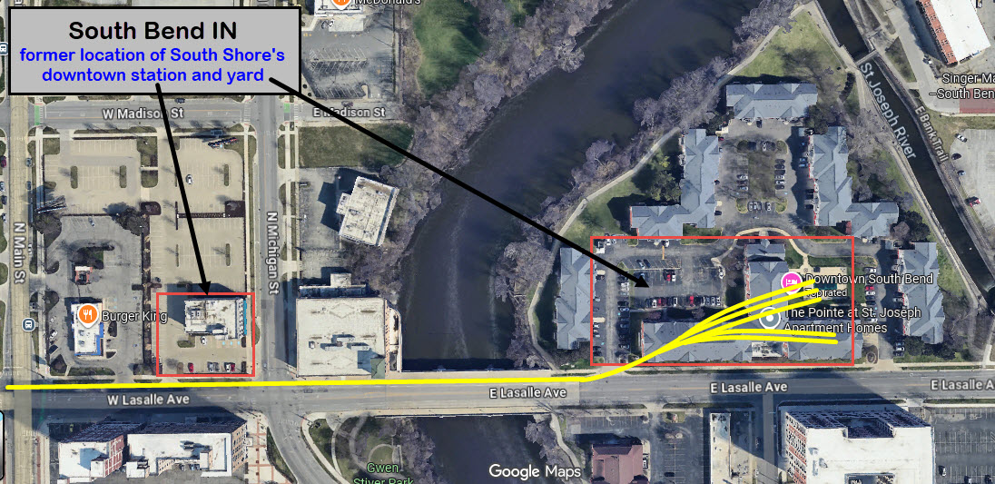
![]() South Shore's Downtown Station
South Shore's Downtown Station
GPS Coordinates: ~41.67946, -86.25108
Located at Michigan and LaSalle Streets, this station began operation in 1903, and came
down in 1974, four years after service to downtown was discontinued.
 picture from the monon.org page
Above photo taken by the Late Lee Hastman, from the Lou Gerard collection, via Facebook.
 found on FB via post by Joe Barron
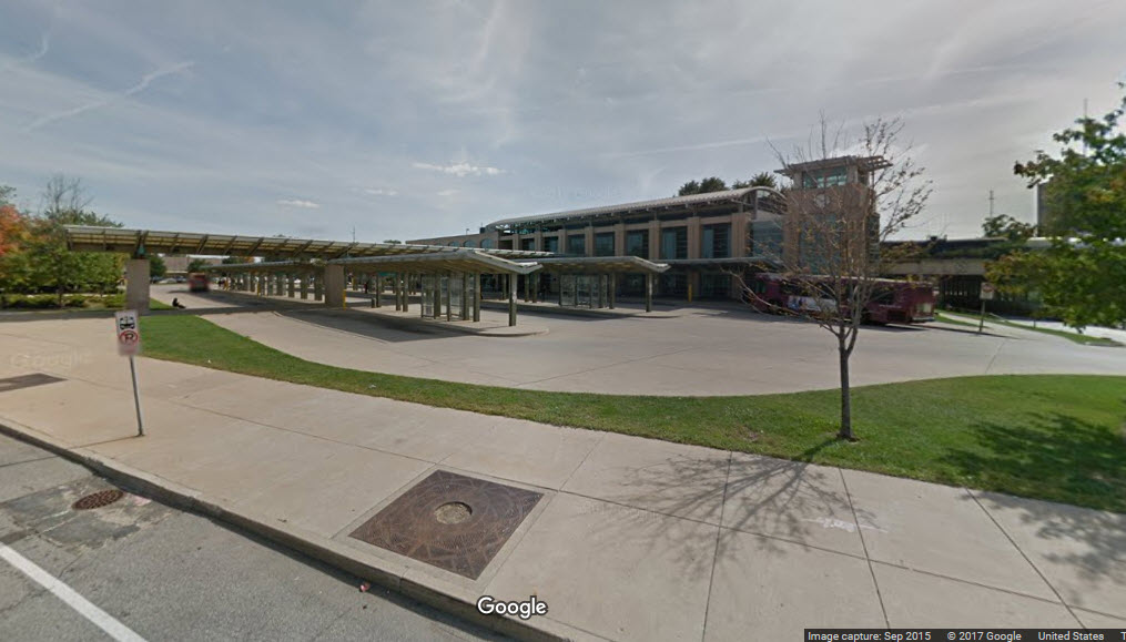
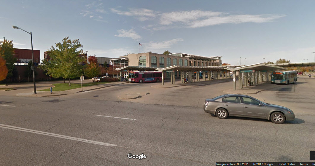
![]() Bus Transportation Center
Bus Transportation Center
GPS Coordinates: 41.668954, -86.251095
Originally designed to accommodate both busses and Amtrak, an agreement for use with Amtrak could not be reached,
so it never saw train service.
![]() South Shore Downtown Yard
South Shore Downtown Yard
GPS Coordinates: ~41.67960, -86.24741
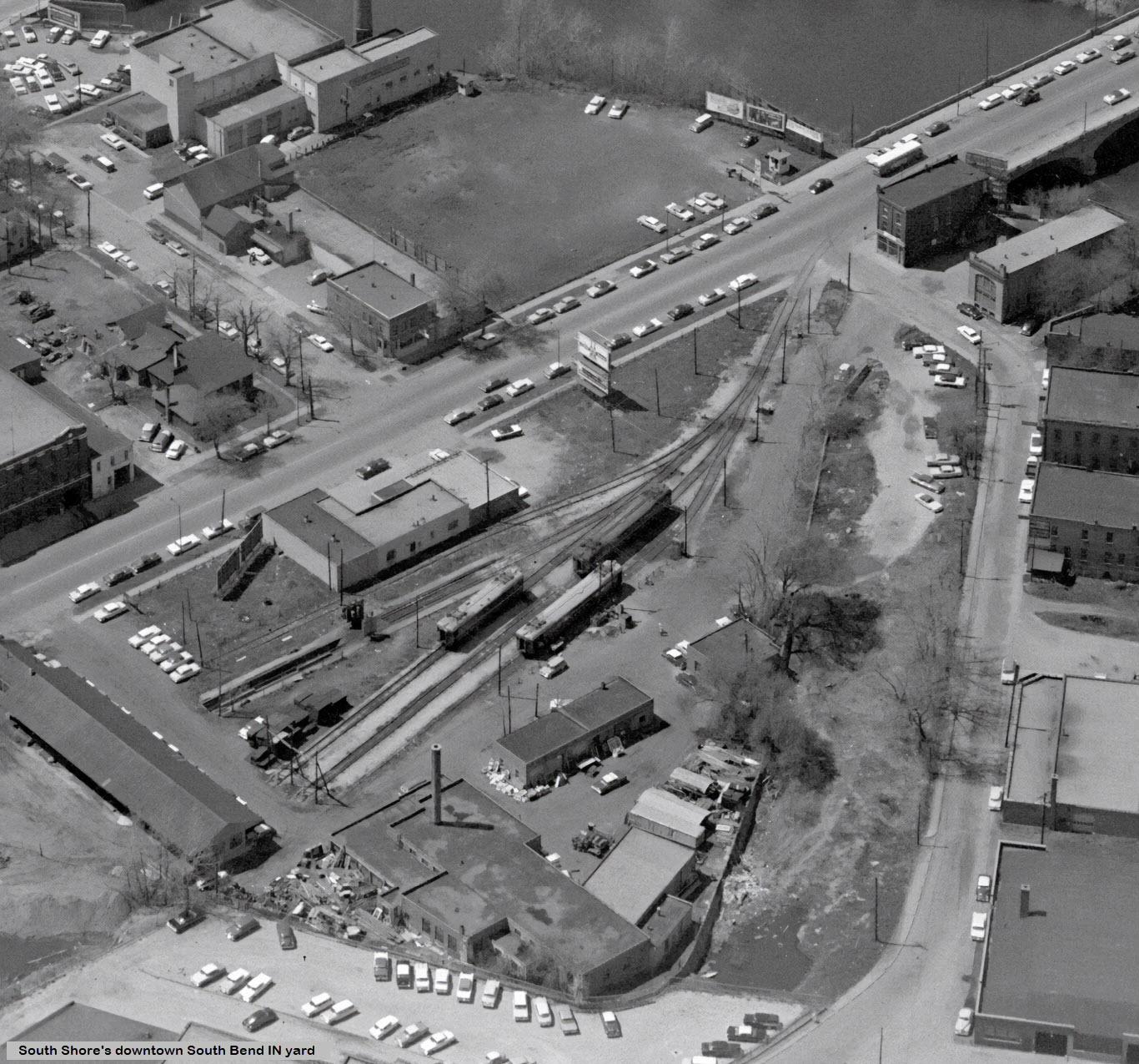 found on FB via post by Joe Barron
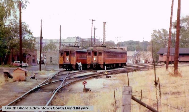 from monon.org
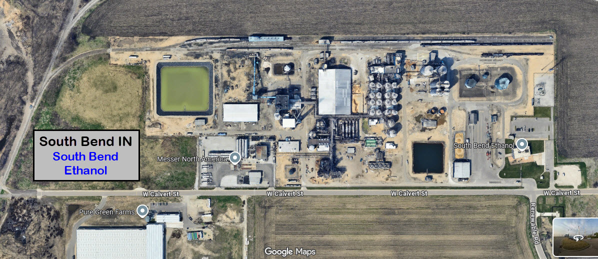
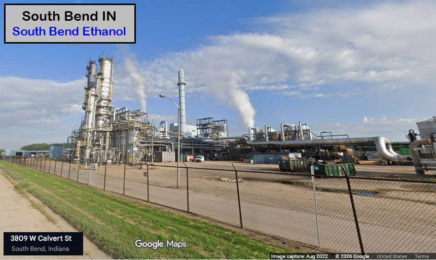
![]() South Bend Ethanol
South Bend Ethanol
GPS Coordinates: 41.65497, -86.29755
Tracks are on the far side of the facility from Calvert St, so picture
taking will be a hassle if you want to catch them servicing the business....
![]() Aggragate Transload Facility
Aggragate Transload Facility
GPS Coordinates: 41.65573, -86.28327
West Plains Distribution - South Bend Yard
If you drive by, maybe you will have better luck than the Google Streetview camera car, and catch something in the yard.
![]()
![]()
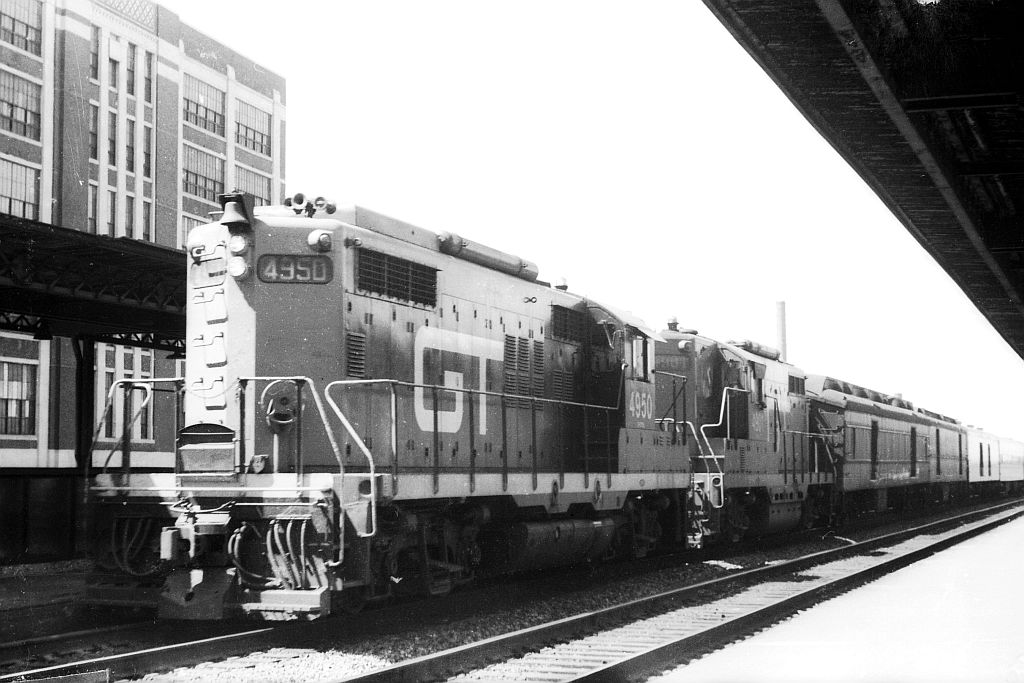
A couple of pictures from Tim Vermande from the mid to late 60's of GTW #4950 coming into South Bend

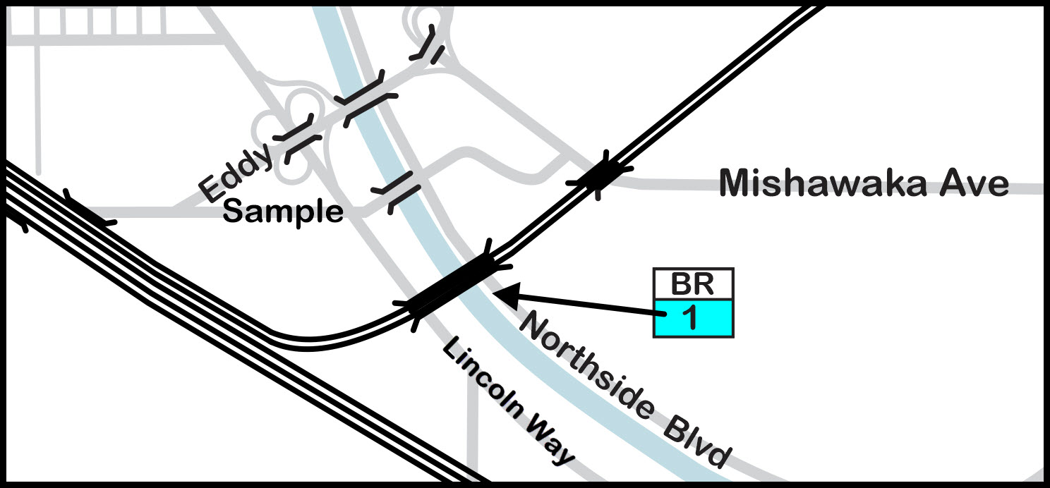
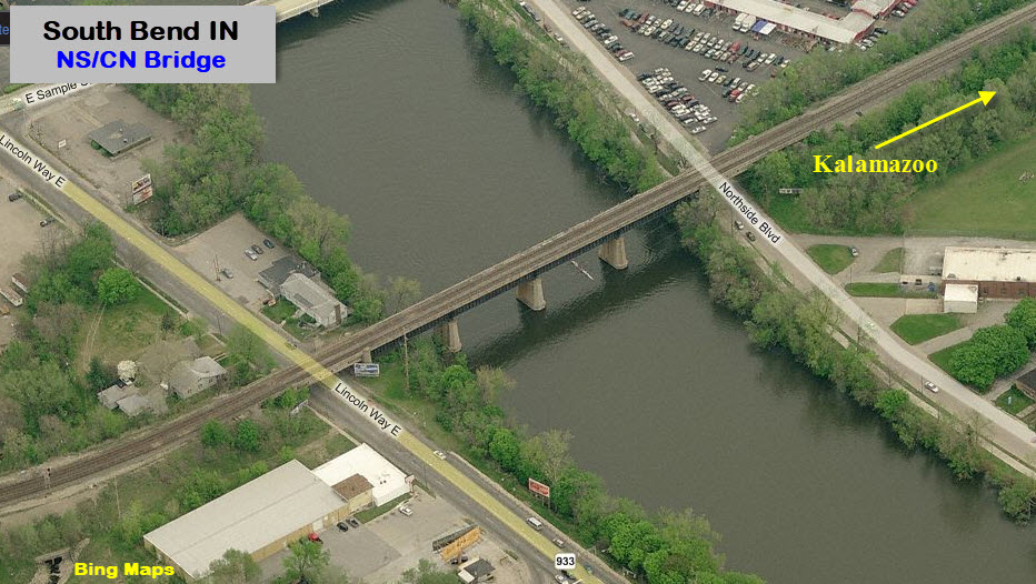
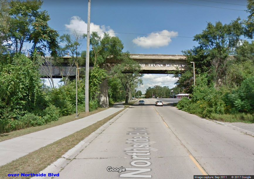
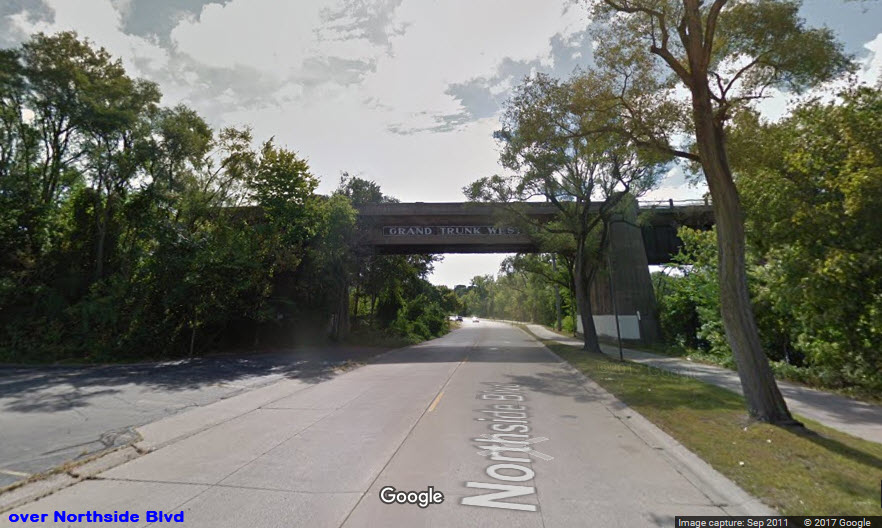
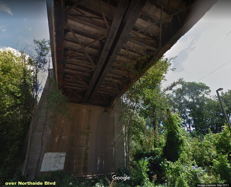
![]() Bridge over Lincoln Way, Northside Blvd, and the River
Bridge over Lincoln Way, Northside Blvd, and the River
GPS Coordinates west side: 44.663926, -86.235867
GPS Coordinates east side: 44.664779, -86.234342
Looks like the better of the two sides is the western shore, where you can climb the embankment to catch WB freights coming through.
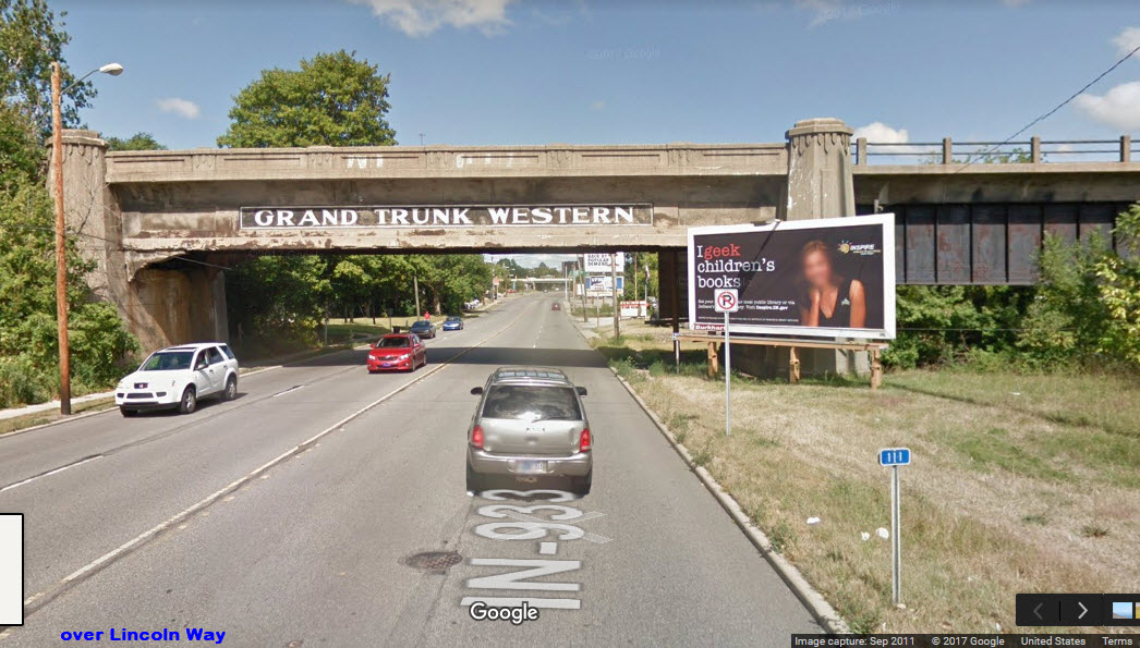
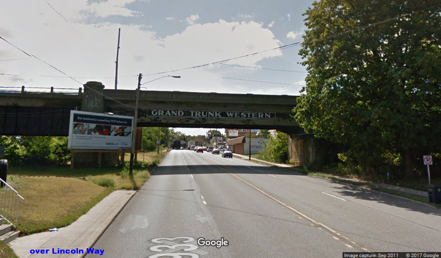
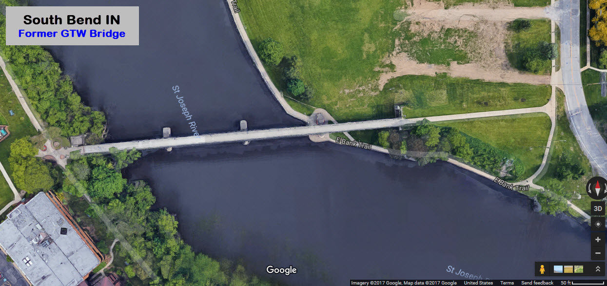
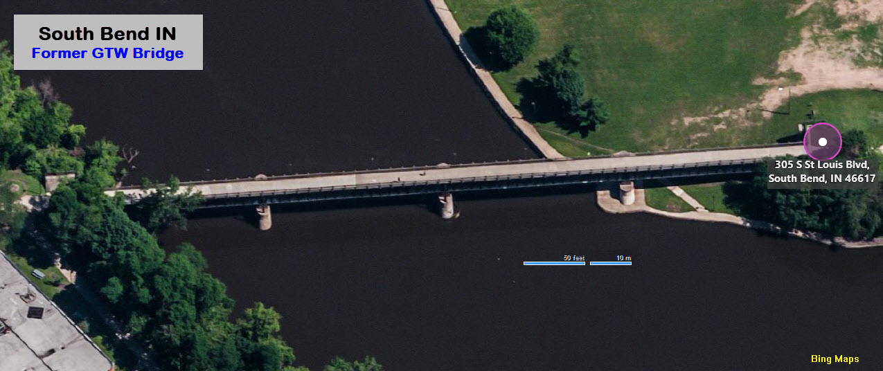
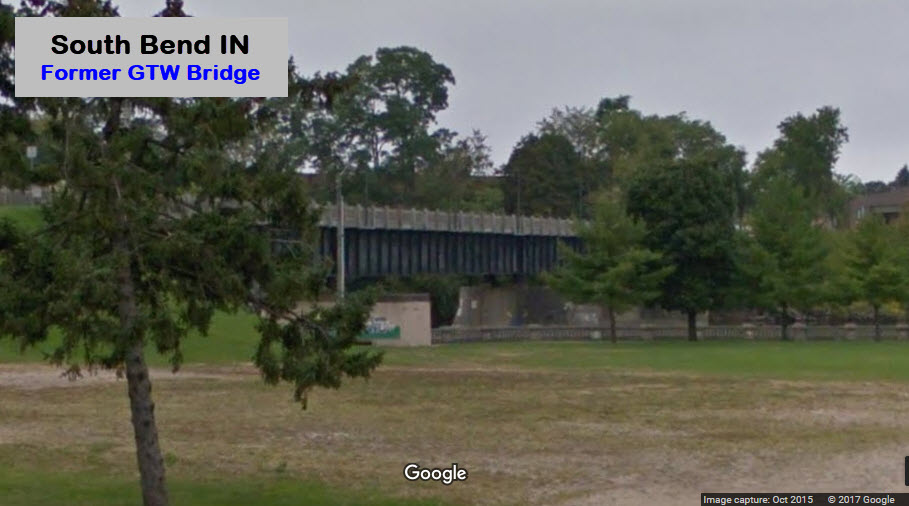
![]() Former GTW Bridge
Former GTW Bridge
GPS Coordinates: 44.672546, -86.243381
A pedestrian walkway now occupies what used
to be the Grand Trunk's main line bridge over the St Joseph River, off the east end of Western Ave.
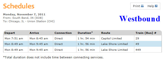
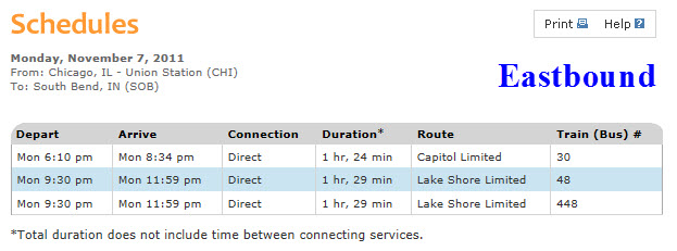
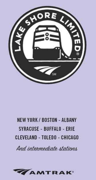
Lakeshore Limited Service.....
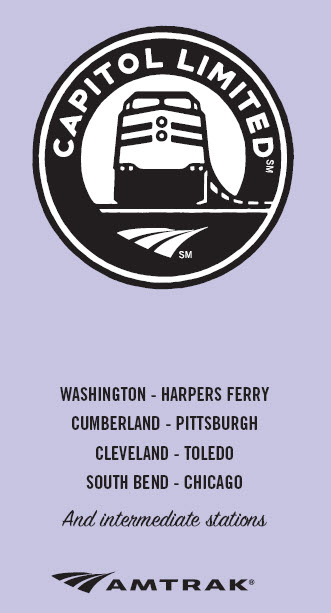
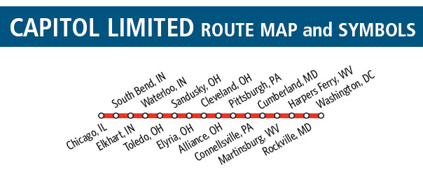
Capitol Limited Service.....
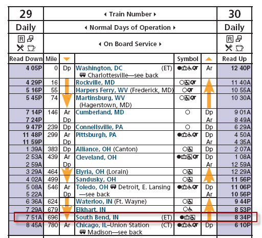
Westbound
Eastbound
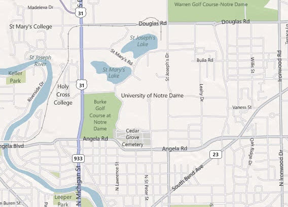
The biggest tourist draw in Town is the 150 year old University of Notre Dame, with their 800,000 seat stadium. There are numerous other things to come by the campus
to see besides a Fighting Irish game.... Numerous works of art, the Basilica of the Sacred Heart,
and the Grotto of Our Lady of Lourdes.

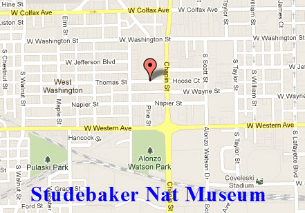
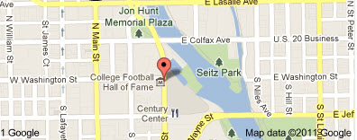
South Bend is also home to the College Football Hall of Fame, and the Studebaker
National Museum, which are pretty close to each other.
There is also the South Bend Regional Museum of Art, the Northern Indiana Center for History, a
complex of four museums, and the South Bend Chocolate Company. South Bend also hosts the Silver
Hawks, a Class A minor league baseball team.
Some of the above info comes from Amtrak's website.
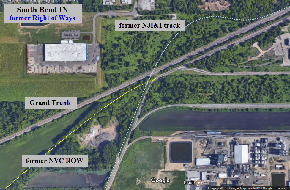
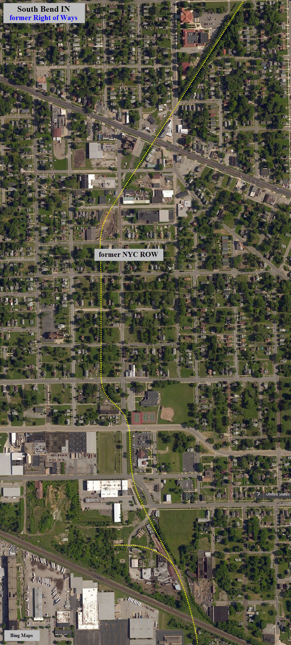
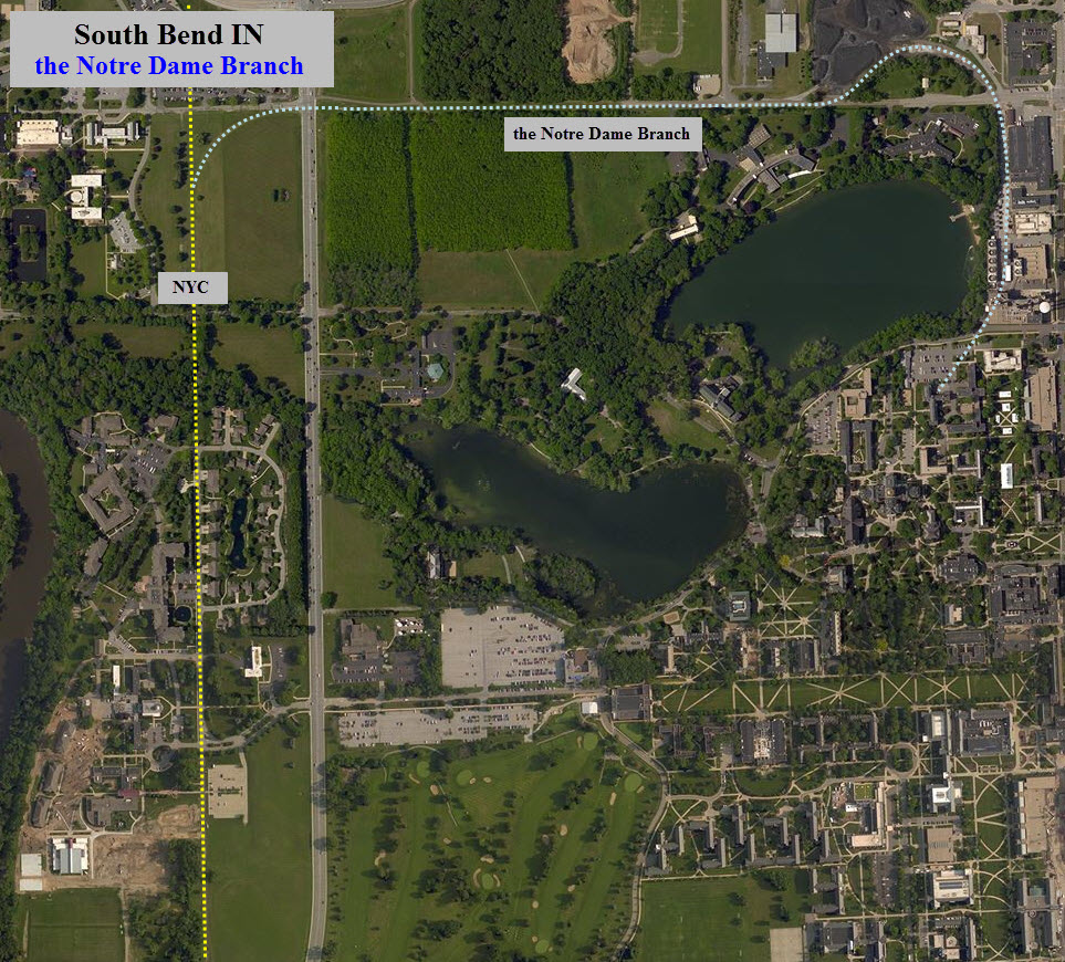
This is a section of the USGS maps of South bend from 1958, east and west.
This should help to dispel any rumor as to whose railroad the Notre Dame branch came off of.
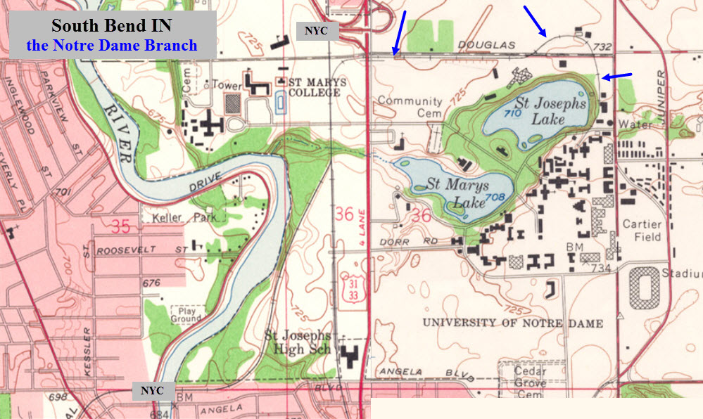
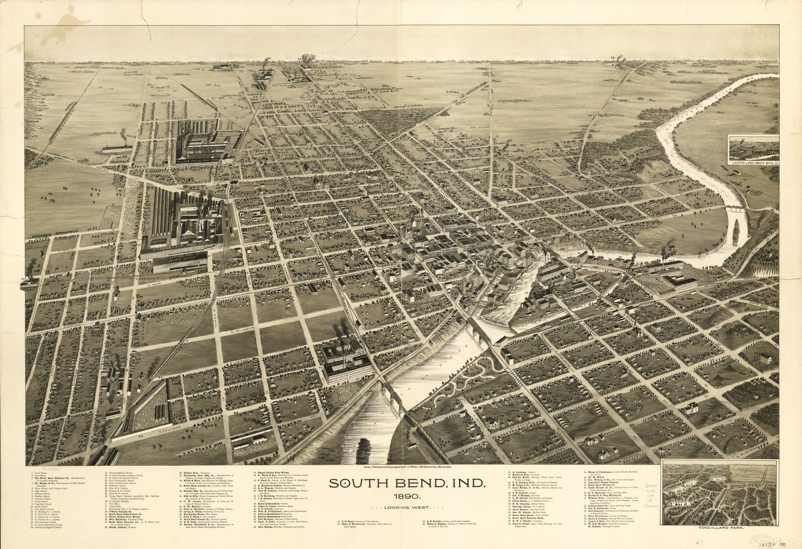
If you want the detail I used for the above screen captures, you will have to download the 312meg TIFF file from the LOC.....
Other snippets of useless info :-)
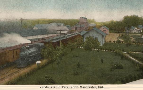
In 1925, the South Shore Interurban company started service between here and Chicago.
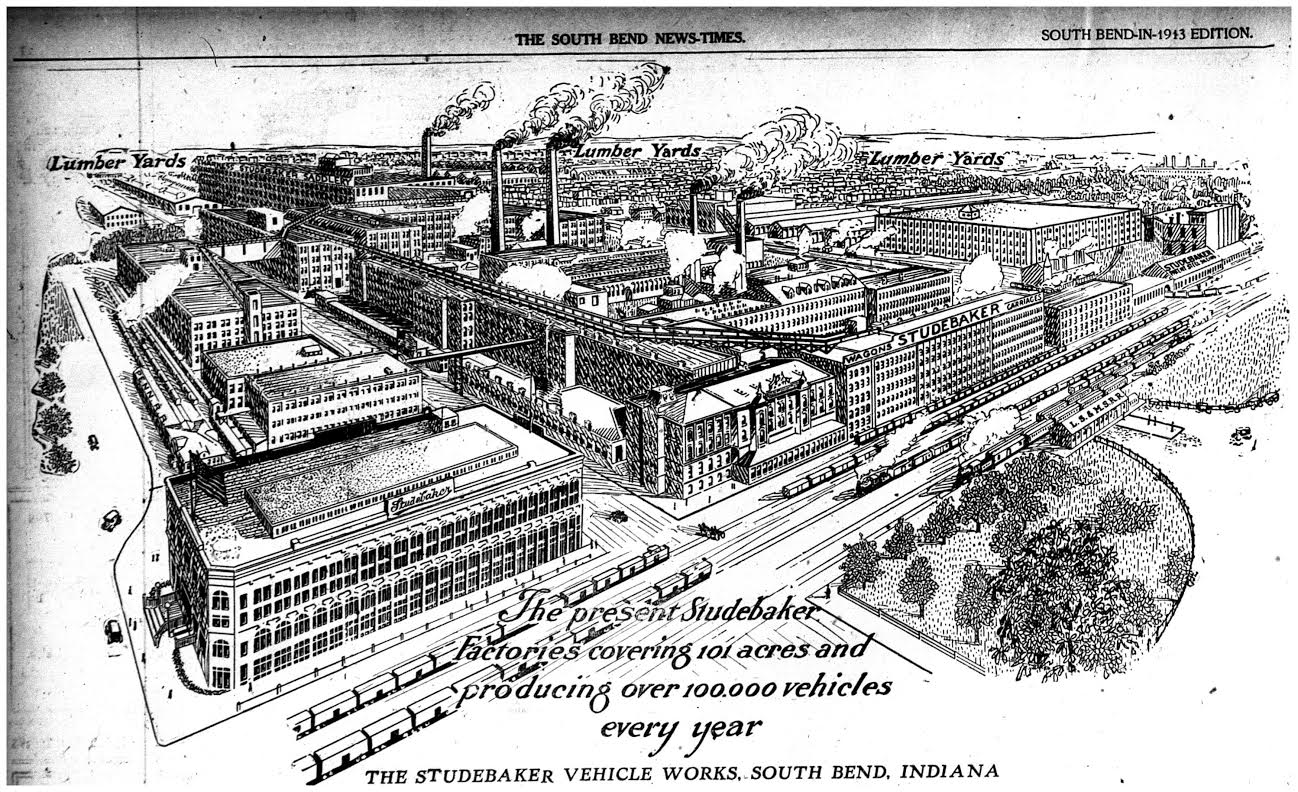
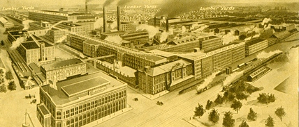
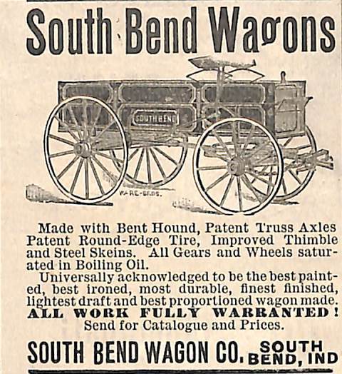
The Studebaker plant was located in town until it closed in 1963... it was the world's largest wagon
manufacturer, and the only one to succeed in the automobile business.
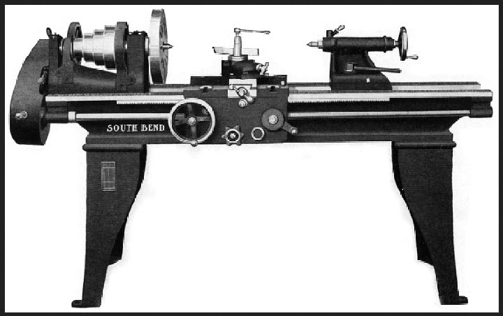
Those of you who are into machining should be familiar with the South Bend
name because they were located here.
On June 30, 1934 The Merchants National Bank in South Bend was the last bank to be robbed by the notorious "Dillinger gang".
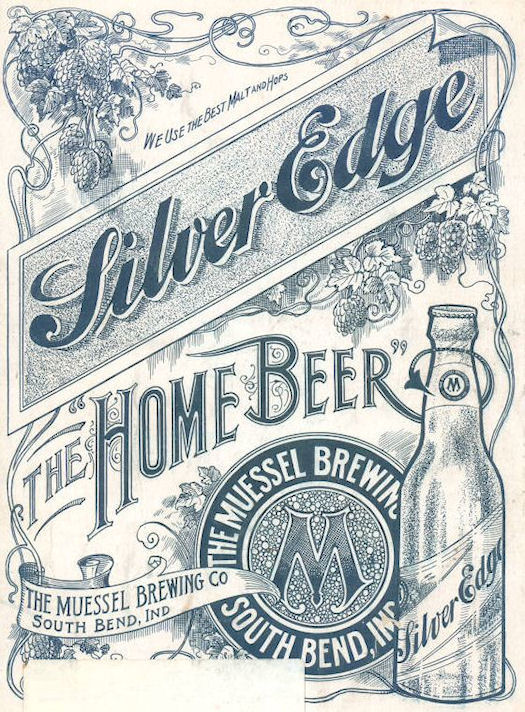
The Singer Sewing Machine Company and the Oliver Chilled
Plow Company were driving forces in the development of South Bend in the early 1900's.
Other businesses that had a presence here were Bendix,
Honeywell, Allied Signal,
and the O'Brien Paint Company.
Disclaimers:
New format 10/26/23: Please check out my disclaimer page for my standard
dribble and contact info here
RAILFAN GUIDES HOME
RAILROAD SIGNALS HOME
NEW 07/09/2009, APR27/2014, NOV13/2017, JUL30/2029, MAR19/20/2026
Last Modified
20-Mar-2026