In General
Getting Here
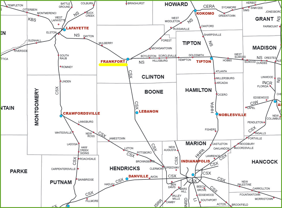
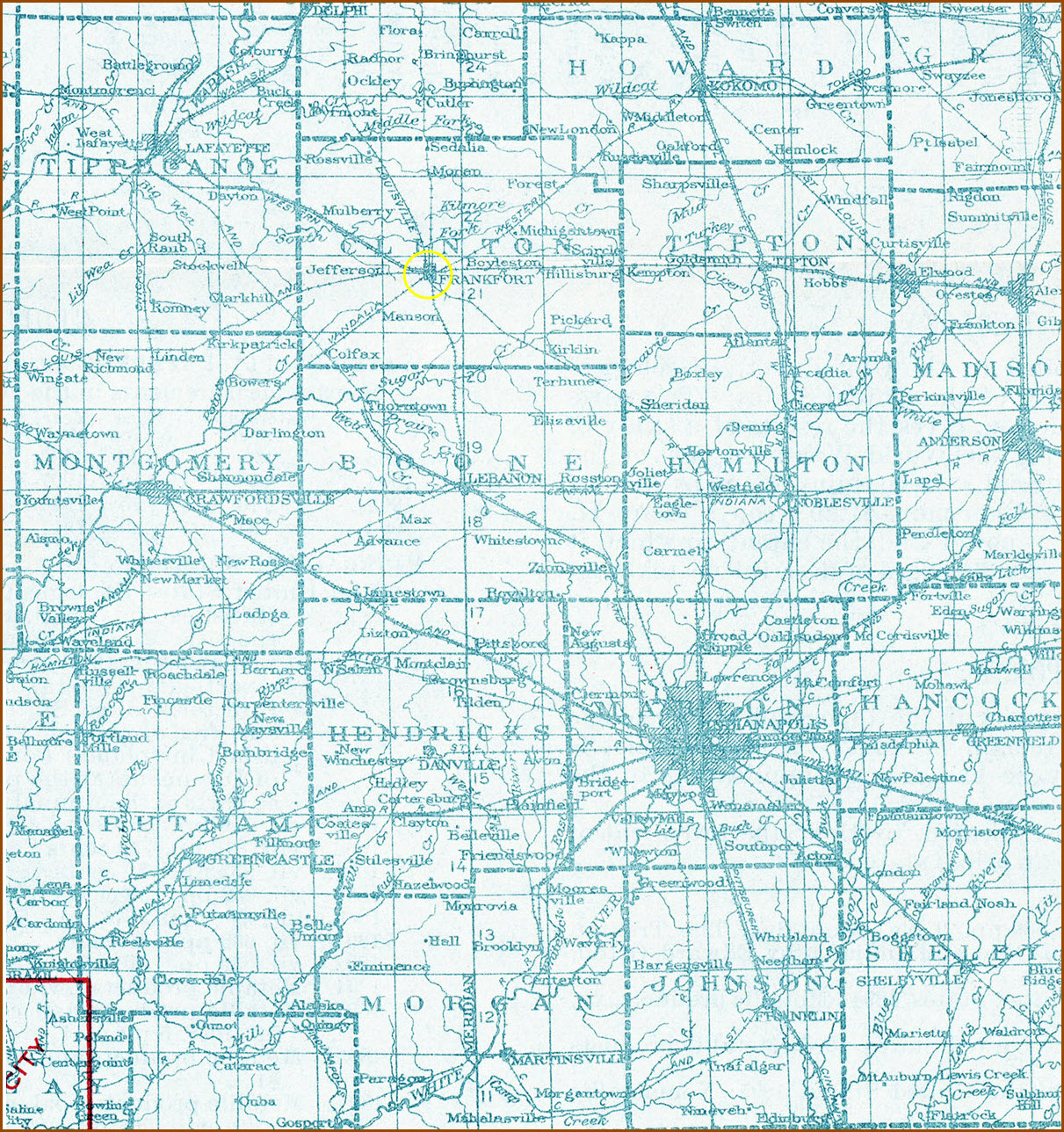
Map
Sights
Pictures
Signals
Fire & Police
Floobydust
USGS Maps
RAILFAN GUIDES HOME
RAILROAD SIGNALS HOME
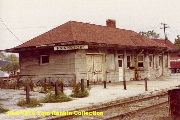
Location / Name:
Frankfort IN, Clinton County
What's Here:
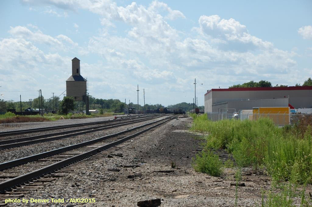
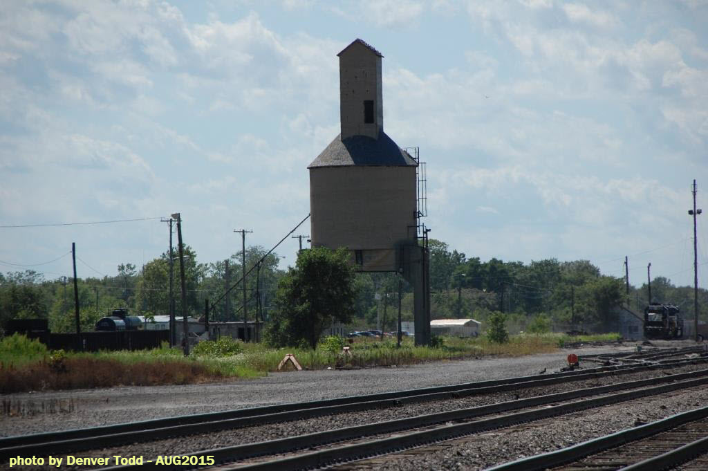
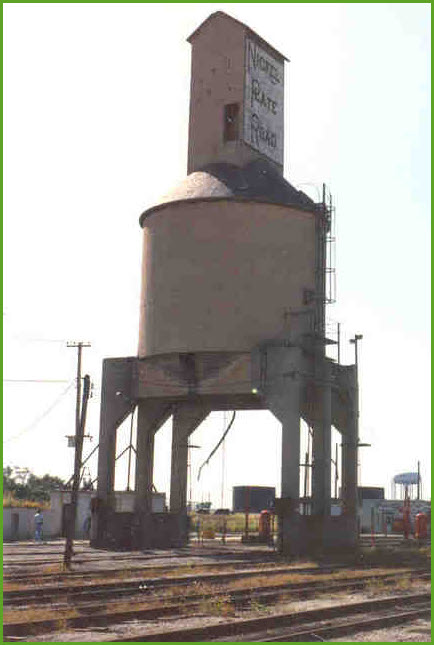
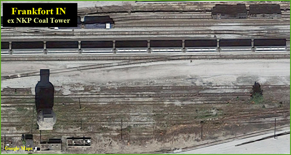
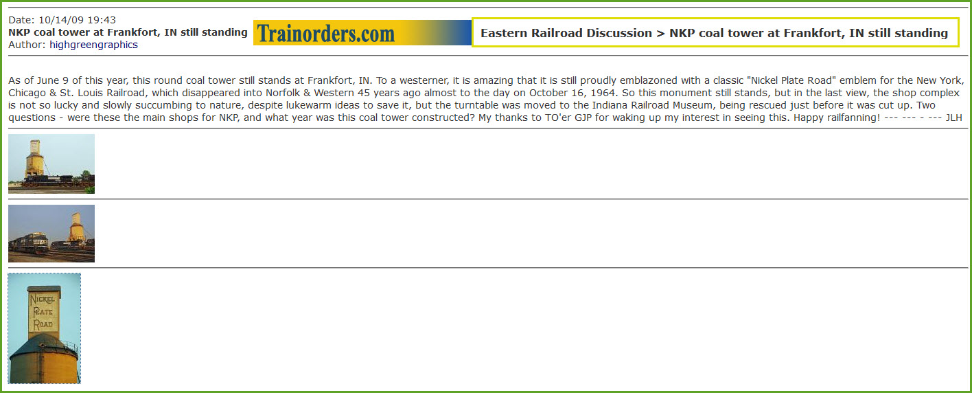
Old NKP Coal Tower - still with NKP markings
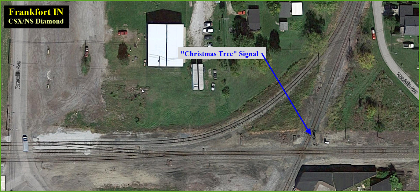
CSX-NS diamond
Unique diamond crossing signal
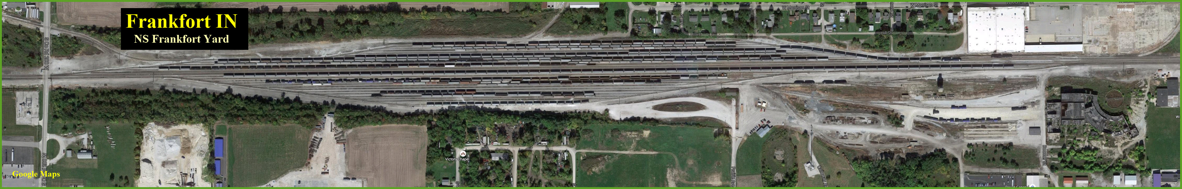
NS yard
Data:
GPS Coordinates: 40.282610, -86.518052 (at the signal)
ZIP: 46041
Phone A/C: 765
Access by train/transit:
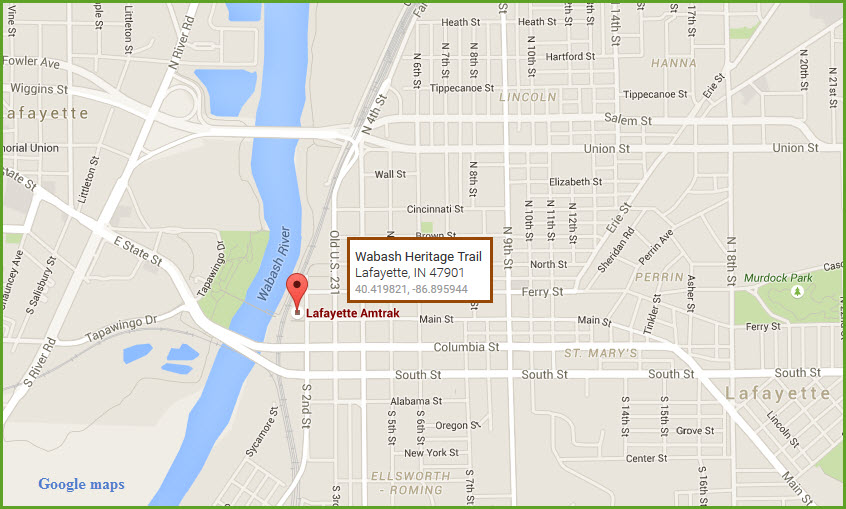
None - Nearest Amtrak is ~23 miles to the NW in Lafayette IN
The Scoop:
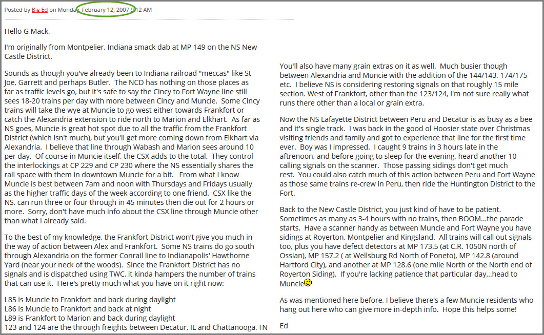
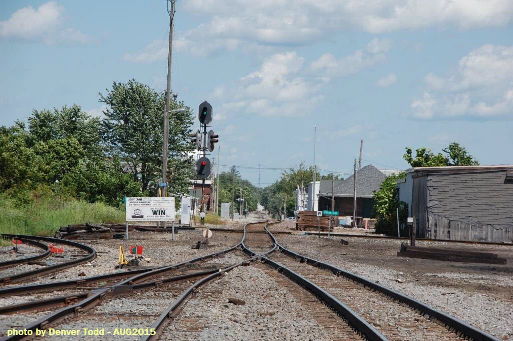
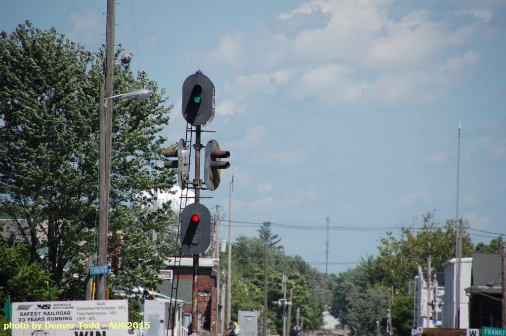
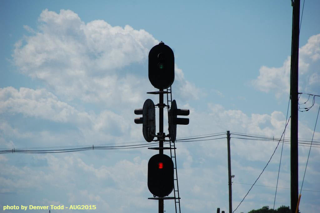
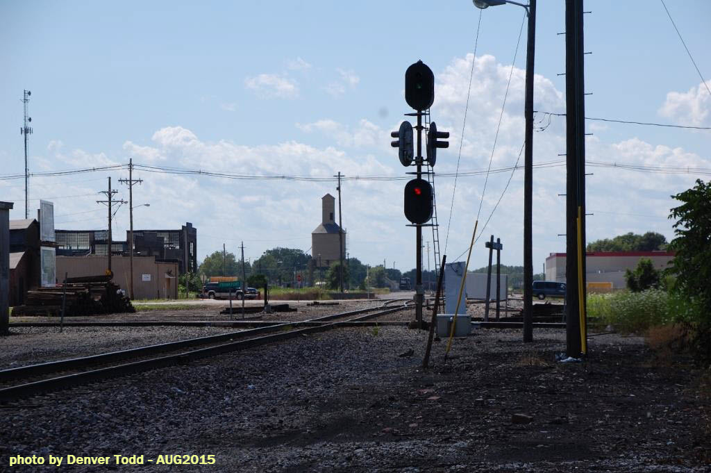
Frankfort made it into a recent issue of Trains Magazine (November 2014) because of the "Christmas Tree" signal, located at the diamond - it is fairly unique. Jeff informs me that there is still a lone Monon semaphore still around to the north in Rossville. As of 10 years ago, the NS line had no signals, don't know if this has changed in order to carry more traffic or not - maybe someone can help me out here? :-)
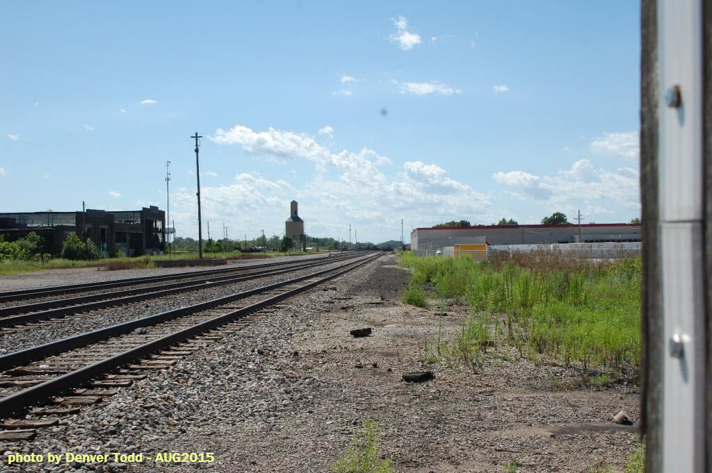
Frankfort also sports an ex NKP coal tower, a Norfolk Southern yard, and the remains of the former NKP facility, including the roundhouse and turntable pit.
On the NS going NW out of town, there is no road to follow the ROW, so you will have to zig-zag back n forth to catch the trains at crossings. Washington Ave turns into Michigantown Rd, which parallels the NS ROW, but I do not know if anything goes up to Michigantown, however, as of early 2017, Jeff is unaware of anything on the NS going NE towards Michigantown and/or Kokomo. Up in Kokomo, the city has removed two of the trestles between Defanbaugh Street and downtown.
Same thing goes for the CSX on the south side (you have to do the zig-zag thing), and the NS on the east side of town.
Although the information is 10 years old, I present the meat of one of the conversations listed below:
Acknowledgements:
Thanks to Denver Todd for his help with coming into town and taking photos.
Jeff Tackett for updating info April 2017.
Big Ed.
Websites and other additional information sources of interest for the area:
http://www.abandonedrails.com/Indiana
https://en.wikipedia.org/wiki/Frankfort_and_Kokomo_Railroad
http://www.monon.monon.org/bygone/frankfort.html
http://www.abandonedrails.com/Cloverleaf_Division_2
http://www.in.gov/indot/files/MAIN-RR-11_V1.pdf
https://en.wikipedia.org/wiki/Monon_Railroad
http://cs.trains.com/trn/f/507/t/87680.aspx
http://www.fwarailfan.net/community/viewtopic.php?f=1&t=79&start=30
Aerial shots were taken from either Google Maps or www.bing.com/maps as noted. Screen captures are made with Snagit, a Techsmith product... a great tool if you have never used it!
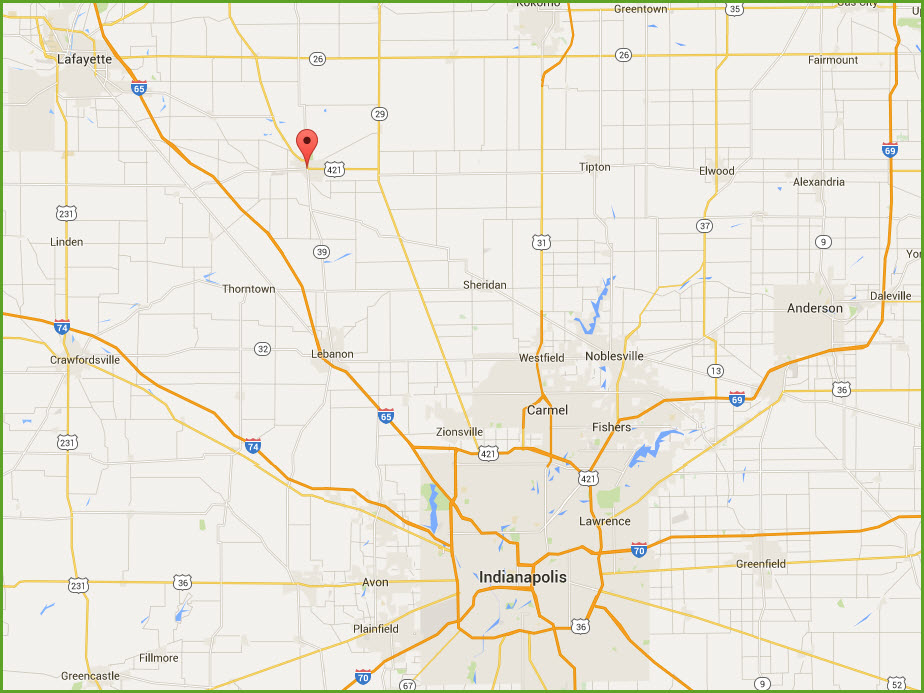
Frankfort is Northwest of Indianapolis, off of
Interstate 65. Exit 158 seems to be your best bet if you can find your
way to that exit. Then take state road 28 NE into Frankfort.
From I-69, which runs Northeast out of Indianapolis, it may be an OK choice
to come across on state road 26, at exit 255 (E 900 S). In Middlefork,
take 29 south to US421, which you will go west on into Frankfort. I've
never tried it, so I can't really say.
From Kokomo, go south on state
road 931, US31, South Dixon Rd, or South Park Rd, depending on where you
are, and then take 26 west, and following the directions above.
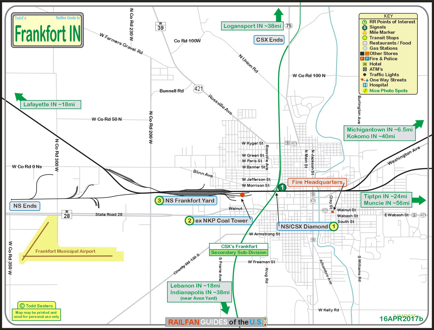
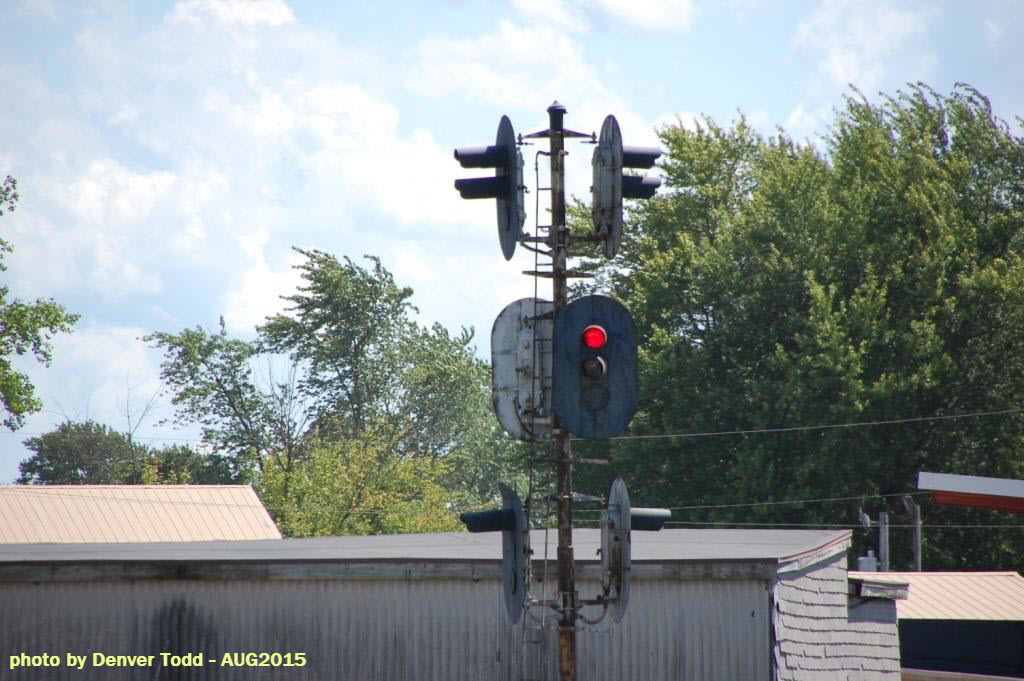
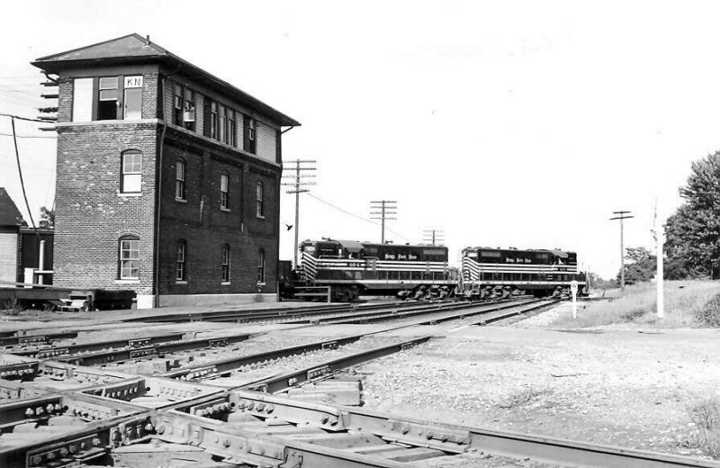
![]() CSX/NS Diamond
CSX/NS Diamond
GPS
Coordinates: 40.282565, -86.518139
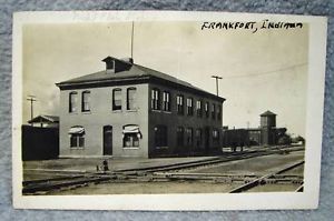
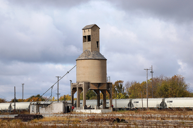
![]() ex NKP Coaling Tower
ex NKP Coaling Tower
GPS Coordinates: 40.282112, -86.525049

 Picture from
here,
photo by River Run
Picture from
here,
photo by River Run
The following was found
at:
http://www.trainorders.com/discussion/read.php?2,2036267
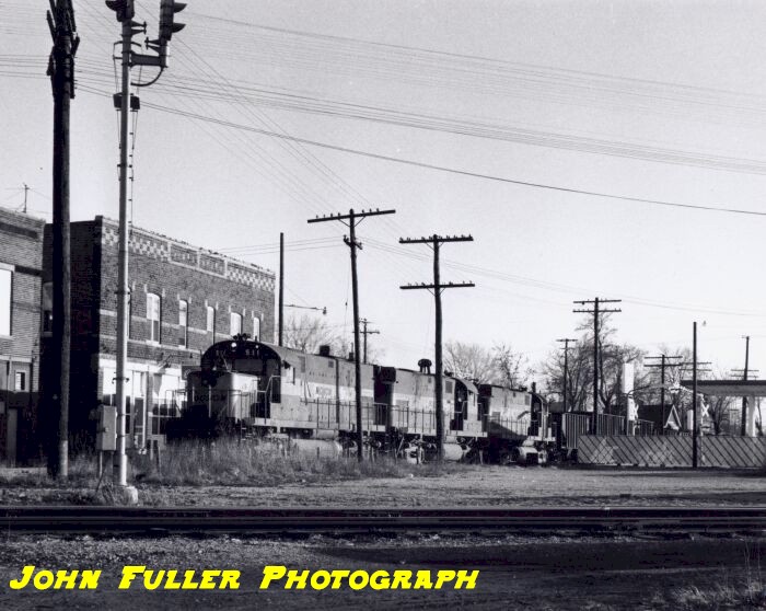
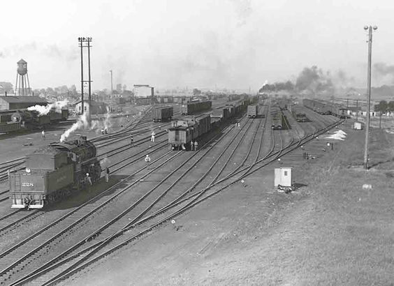
![]() NS Frankfort Yard
NS Frankfort Yard
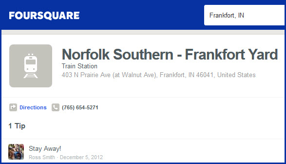 Found Here:
https://foursquare.com/v/norfolk-southern--frankfort-yard/4fb7ea8de4b0189bef3af40b
Found Here:
https://foursquare.com/v/norfolk-southern--frankfort-yard/4fb7ea8de4b0189bef3af40b
![]()
GPS Coordinates: 40.282610, -86.518052
A very interesting signal used for crossing protection
between the NS and CSX.
You can get a relatively close shot without trespassing on RR property just northeast of the junction on Vandalia Ave - Denver. All photos by
Denver Todd.


Found the following pictures on Bing images.
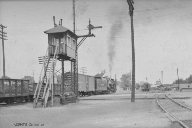
 In the
NKP yard in Frankfort.
In the
NKP yard in Frankfort.
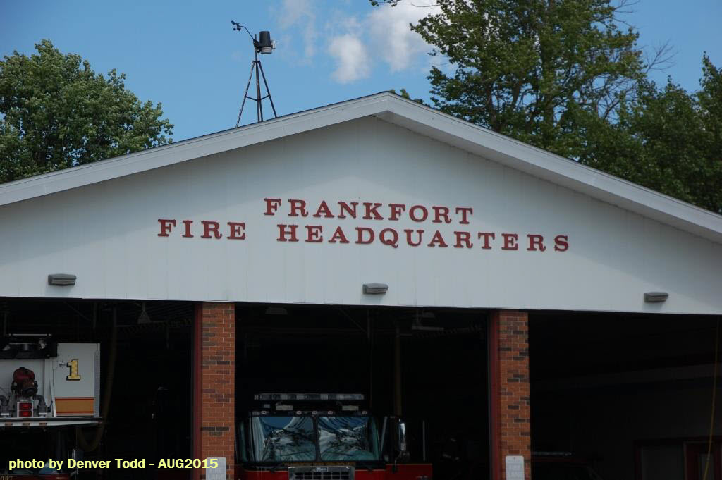
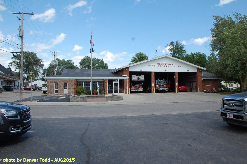
Frankfort Fire Headquarters
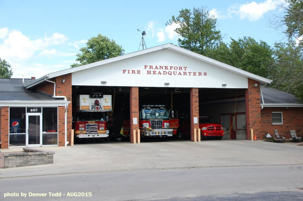
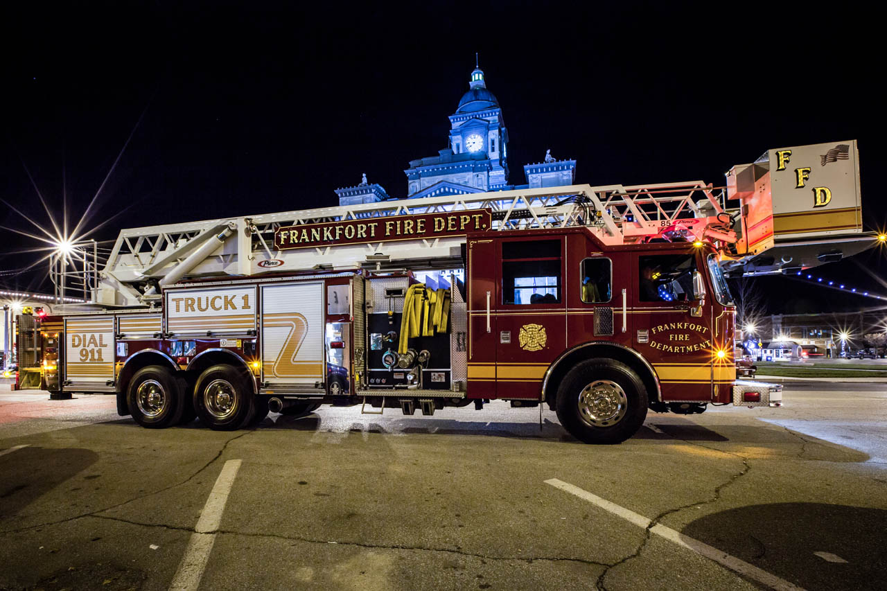 Nice
looking Truck 1 in front of City Hall !
Nice
looking Truck 1 in front of City Hall !
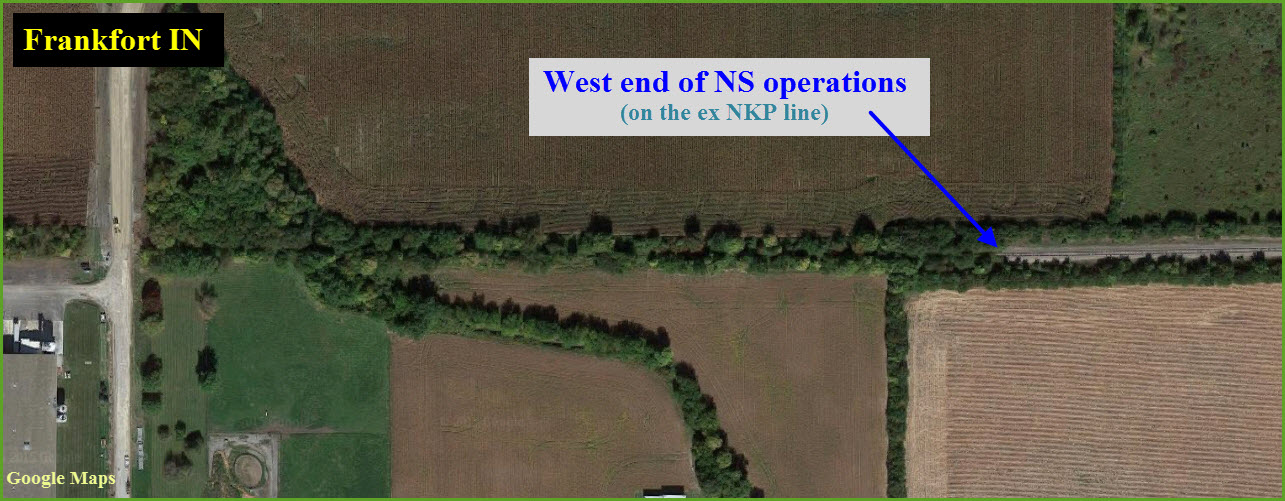
The western end of NS Operations
GPS Coordinates: 40.281388, -86.571076
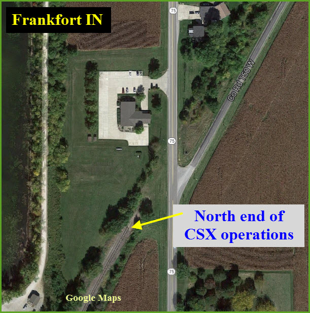
The northern end of CSX Operations
GPS Coordinates: 40.304860, -86.515964
This line used to head on over to Kokomo.
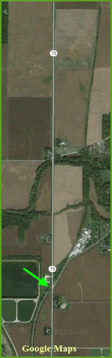
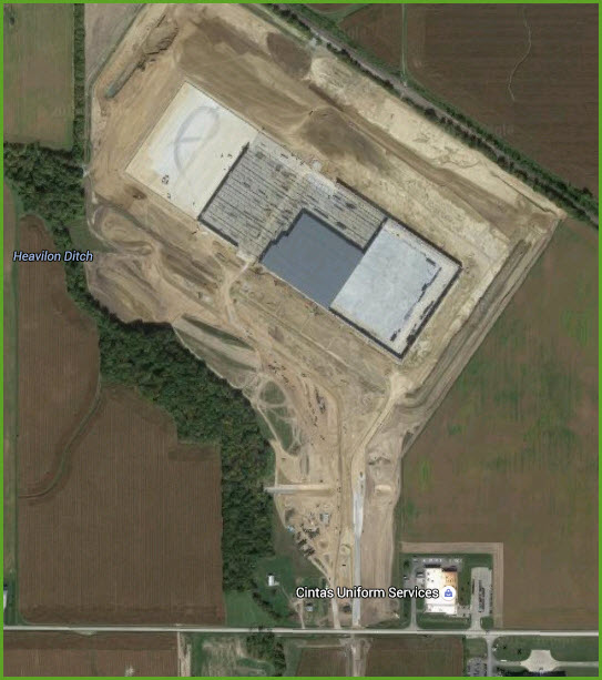
New Industry
This grabbed my attention as I was perusing the map around
Frankfort, only because you don't see many "new" facilities of this size
being built much anymore. It is a Con-Agra Distribution Center. It is just north of the end of NS operations.
I originally had this facility as NOT having any tracks serving it, but Jeff
tells me they now do have a line extending to here, with room on a dock for
about 10 cars.
Nearest Amtrak
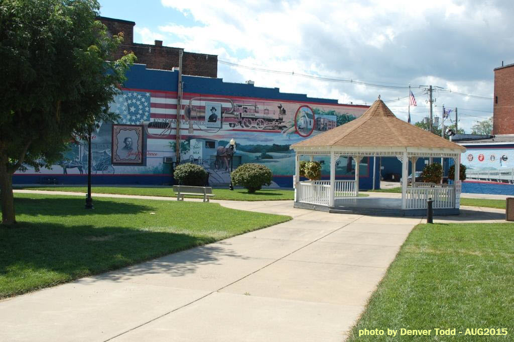
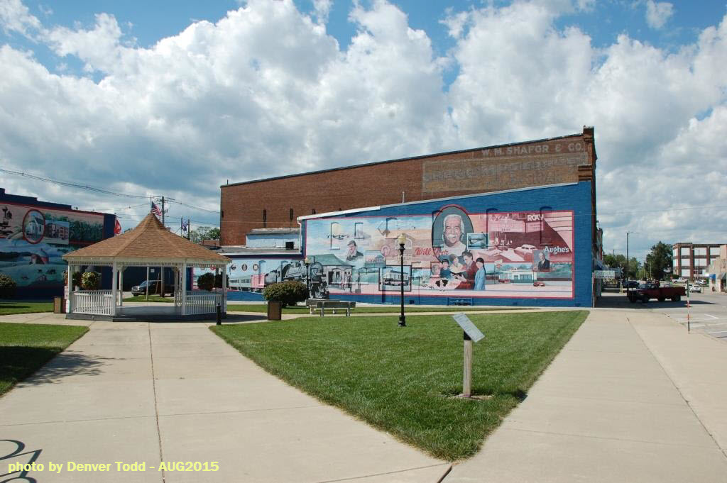 Wall Art
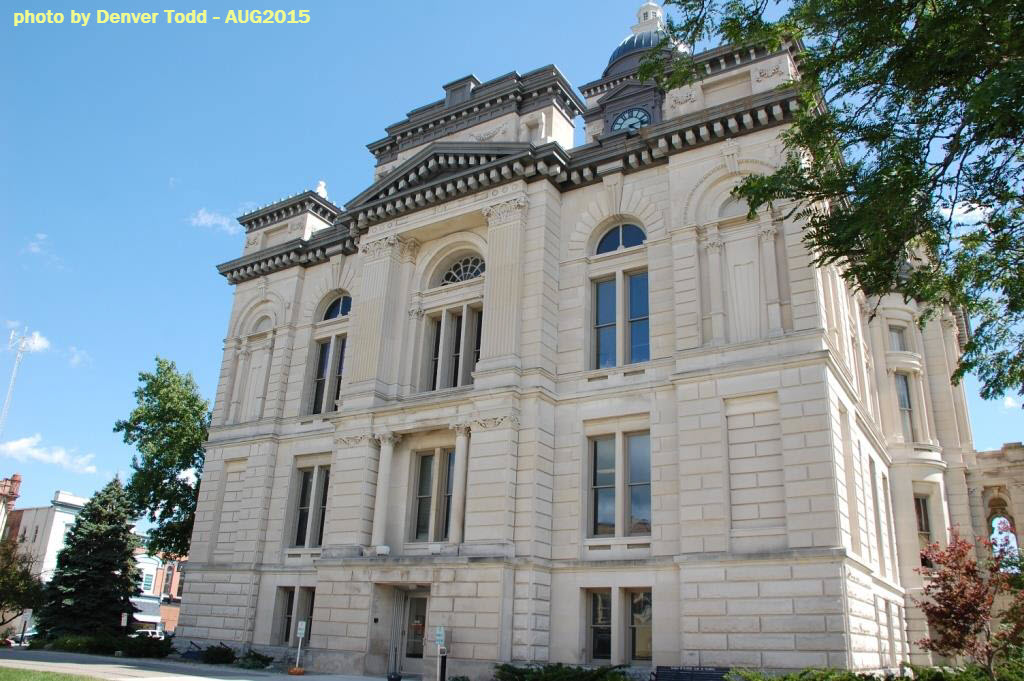 City Hall
 City Banner
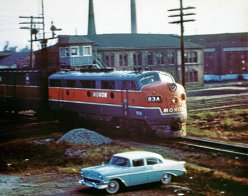
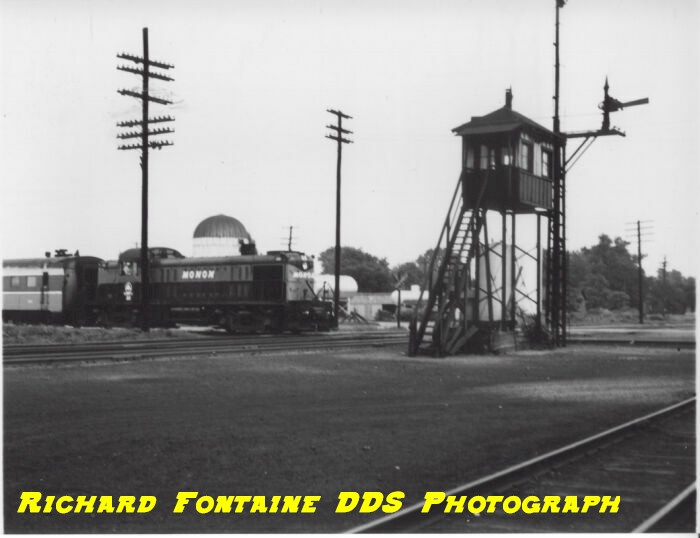
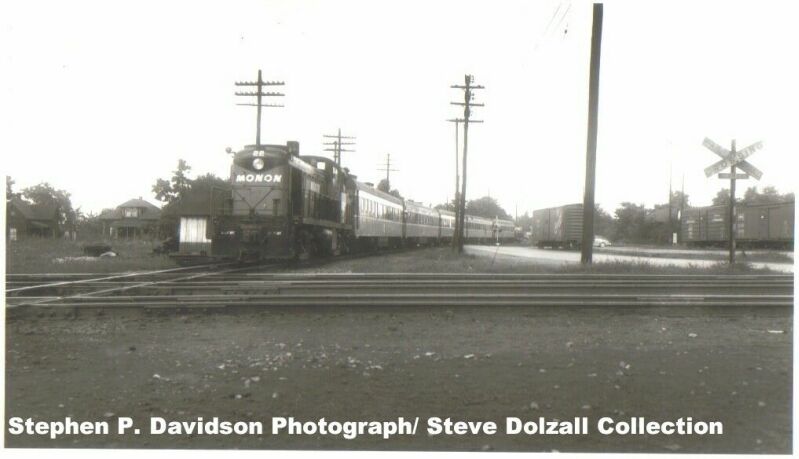
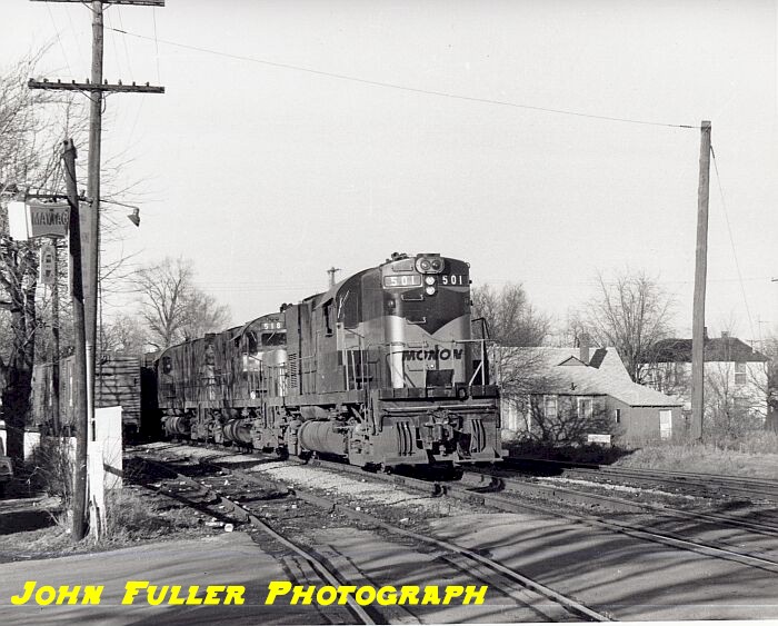
the Monon Railroad
(from Wikipedia) The Monon Railroad (reporting mark MON), also known as the Chicago, Indianapolis, and Louisville Railway (reporting mark CIL) from 1897–1956, was an American railroad that operated almost entirely within the state of Indiana. The Monon was merged into the Louisville and Nashville Railroad in 1971, and much of the former Monon right of way is operated today by CSX Transportation. In 1970 it operated 540 miles (870 km) of road on 792 miles (1,275 km) of track; that year it reported 1320 million ton-miles of revenue freight and zero passenger-miles. (It showed zero miles of double track -- the longest such Class I railroad in the country.)
Monon route
The railroad got the name Monon from the convergence of its main
routes in Monon IN. From Monon, the mainlines reached out to Chicago,
Louisville, Indianapolis and Michigan City IN. In Chicago the Monon's
passenger trains served Dearborn Station. Branches connected the Louisville
mainline to
Victoria IN and
French Lick IN. Courtesy of the University of Texas Library, click
here for
their index page. The library has precious few quadrangle maps for
Indiana from the late 1800's and early 1900's. Disclaimers: I love trains, and I love signals. I am not an
expert. My webpages reflect what I find on the topic of the page.
This is something I have fun with while trying to help others. Please Note:
Since the main focus of my two websites is railroad signals, the railfan guides
are oriented towards the signal fan being able to locate them. For those
of you into the modeling aspect of our hobby, my
indexa page has a list of
almost everything railroad oriented I can think of to provide you with at least a few pictures to
help you detail your pike. If this is a railfan page, every effort has
been made to make sure that the information contained on this map and in this
railfan guide is correct. Once in a while, an error may creep in :-)
My philosophy: Pictures and maps are worth a
thousand words, especially for railfanning. Text descriptions only
get you so far, especially if you get lost or disoriented. Take
along good maps.... a GPS is OK to get somewhere, but maps are still
better if you get lost! I belong to AAA, which allows you to get
local maps for free when you visit the local branches. ADC puts
out a nice series of county maps for the Washington DC area, but their
state maps do not have the railroads on them. If you can find em,
I like the National Geographic map book of the U.S..... good, clear, and
concise graphics, and they do a really good job of showing you where
tourist type attractions are, although they too lack the railroads.
Other notes about specific areas will show up on that page if known. Beware: If used as a source, ANYTHING from Wikipedia must be treated as
being possibly being inaccurate, wrong, or not true.
RAILFAN GUIDES HOME
NEW 08/08/2015
The Monon's main line ran down the middle of streets in several cities,
notably Lafayette, New Albany and Bedford. It also installed an unusual "home
grown" warning signal at many grade crossings; these used a green signal light
(similar to and adapted from a standard highway traffic signal) that stayed lit
at all times, except when a train was approaching. A sign below or to the side
of the signal read, "STOP When Signal Is Out." This design was fail-safe, in
that when the signal bulb was burned out, an approaching vehicle driver would
assume a train was coming — until he eventually realized there was no train and
just a burned-out signal.
The Monon had seven sections. Beginning in the north, Section One was from
the Indiana line to Lafayette, passing through the Monon switch in Monon. As a
primary passenger route, it connected to Section Four running between Lafayette
and Bloomington. This route reached the Ohio River over Section Five from
Bloomington to New Albany. From this southern route, Sections Six and Seven were
spurs to the west. Section Six served the Coal Fields between Midland and Clay
City connecting to the main line at Wallace Jct, just south of Cloverdale. Section Seven provided passenger service to the resort hotels in West Baden and
French Lick, through a connection at Orleans.
The other primary line, mainly a freight line, included Section Two from
Michigan City on Lake Michigan to Monon and then Section three from Monon to
Indianapolis. Although each route had its primary traffic, freight and
passengers were carried over all parts of the line.
Today, the remains of the line are operated
mostly by
CSX. Large segments have been abandoned in recent
years: most of the line from Monon southeast to Indianapolis, the line north
from Monon to Michigan City, and the line segment between Cloverdale and
Bedford (this segment was abandoned largely due to a washout). A portion of
the French Lick branch is now home to a railroad museum, with part of the
line wired for trolley service.
The Monon's original
semaphore signals are still in operation between Salem and Mitchell.
These are some of the last semaphore signals remaining in mainline operation in
the United States. From Crawfordsville to near Lafayette, some semaphore
signals were removed in 2009, however several are still in service, including
two sets in Crawfordville, with their replacement signals adjacent for the day
CSX makes the conversion (as of November 10, 2010).
Monon Timeline
Genealogy
the Frankfort and Kokomo Railroad
(from Wikipedia) The Frankfort and Kokomo Railroad was a small railroad company
that operated approximately 25 miles (40 km) of track between the Indiana
cities of Frankfort and Kokomo. The F&K's rail line, laid down in
1873, was generally of poor condition and made the cars that traveled along
it jog from side to side, leading to its nickname "The Rabbit Track Line".
The first train cars made the trip between the two cities on May 28, 1874.
In 1881 the F&K Railroad was converted from 4ft 8.5in (1,435mm) standard gauge to 3ft (914mm)
narrow gauge and consolidated into the
Toledo, Cincinnati and St. Louis Railroad. In 1886, it was returned to standard gauge under the ownership of the
Toledo, St. Louis and Kansas City Railroad, later renamed the
Toledo, St. Louis and Western Railroad and commonly known as the "Clover
Leaf."
By the way, floobydust is
a term I picked up 30-40 years ago from a National Semiconductor data
book, and means miscellaneous and/or other stuff.
Pictures and additional information is always needed if anyone feels
inclined to take 'em, send 'em, and share 'em, or if you have
something to add or correct.... credit is always given! BE NICE!!! Contact info
is here
RAILROAD SIGNALS HOME
Last Modified
15-Apr-2017