RAILFAN GUIDES of the U.S.
Todd and Denver Todd's Railfan Guide to
METRA COMMUTER SERVICE
BNSF RAILWAY line
Union Station to Aurora IL
In General
Map
Station by Station
Pictures
Floobydust
RAILFAN GUIDES HOME
RAILROAD SIGNALS HOME
This Metra commuter line is on a former Burlington Northern (BN) line, now owned by the BNSF.
The Metra BNSF Railway line runs from Union Station in Downtown Chicago out to Aurora, IL. The mostly triple track main line (known by railfans as the BNSF Racetrack) runs through the downtowns of many of Chicago’s western suburbs.
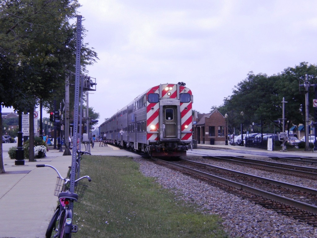
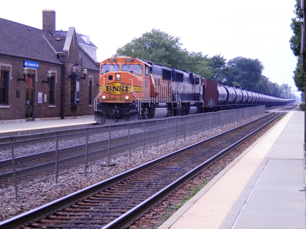
Frequent BNSF intermodal, unit trains for ethanol, and manifest freights as well as Metra and Amtrak mix on this line. Amtrak’s California Zephyr, Southwest Chief, and 2 Illinois Service Trains (The Illinois Zephyr and The Carl Sandburg) use this route. During the weekdays, there are 100 trains + (mostly Metra), with less on the weekends. Between freight and commuter traffic, it is a pretty busy line!
Metra offers reduced fare passes on weekends, and railfans might enjoy a trip into Union Station and back from any of the stations along this line.
Parking fees exist in the vicinity of all Metra stations and are strictly enforced so make sure and pay the fees. Most communities also have free parking nearby.
Most Metra Stations have restrooms open to the public, always important to a railfan.
Six stations in particular offer a better experience for railfan only because of proximity to restaurants or points of interests. They are La Vergne, Brookfield (& Hollywood station), LaGrange, Western Springs, Highlands, and Aurora.
Scanner Frequencies: BNSF 161.100, 161.160
Additional info can be found at:
www.amtrak.com/
http://metrarail.com
http://bnsf.com/
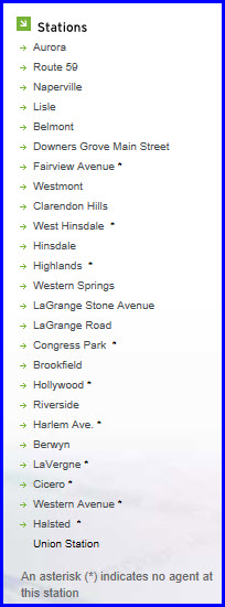
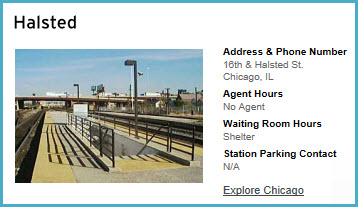
Halsted
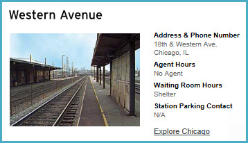
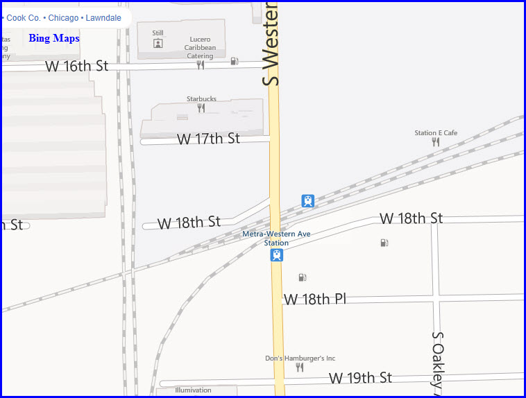
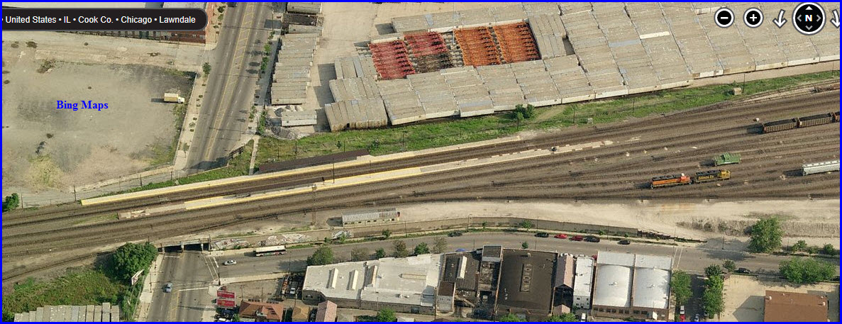
Western Avenue
Cicero
LaVergne
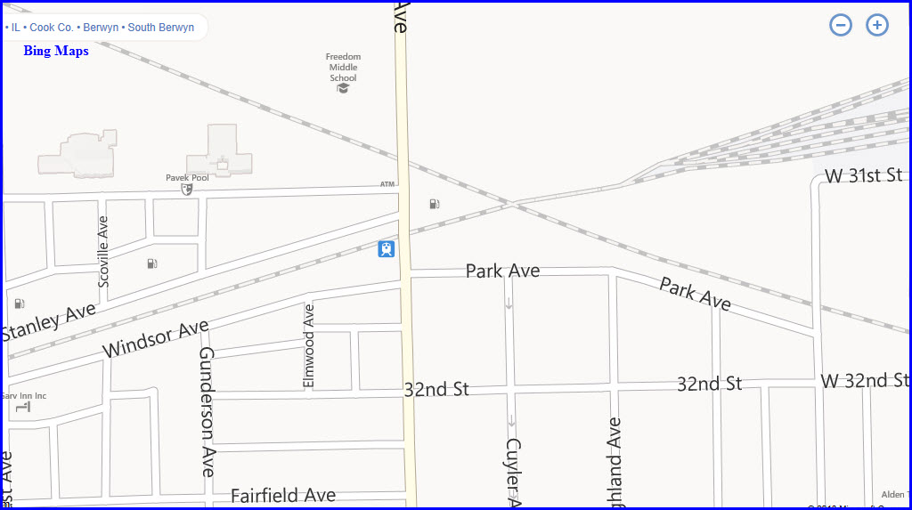
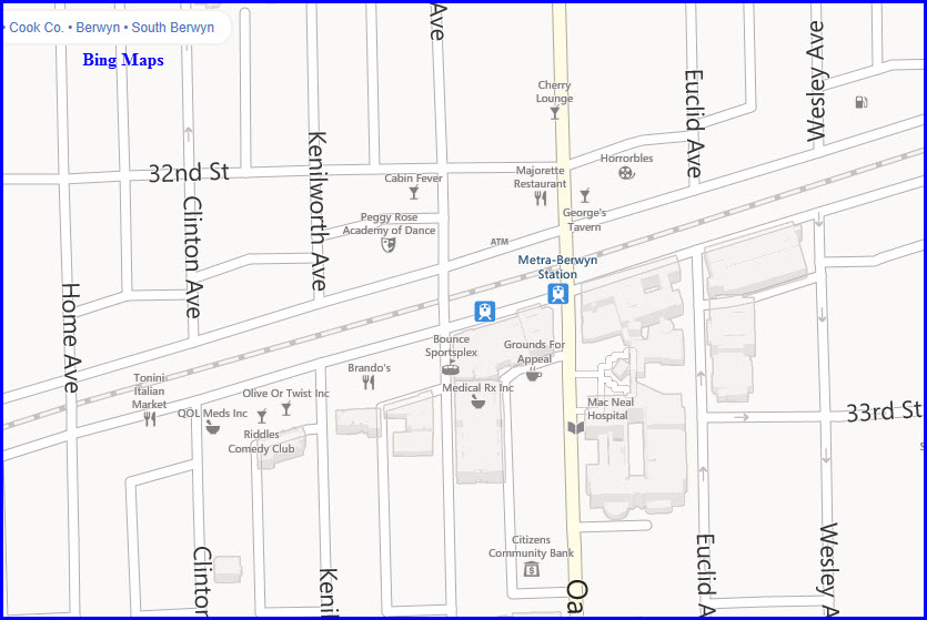
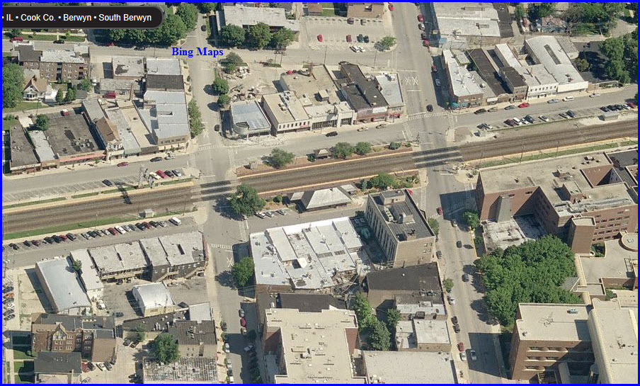
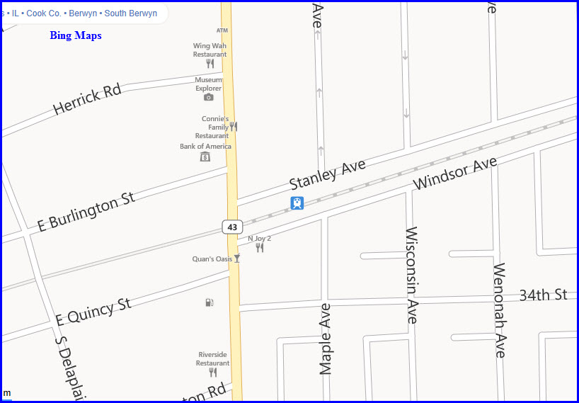
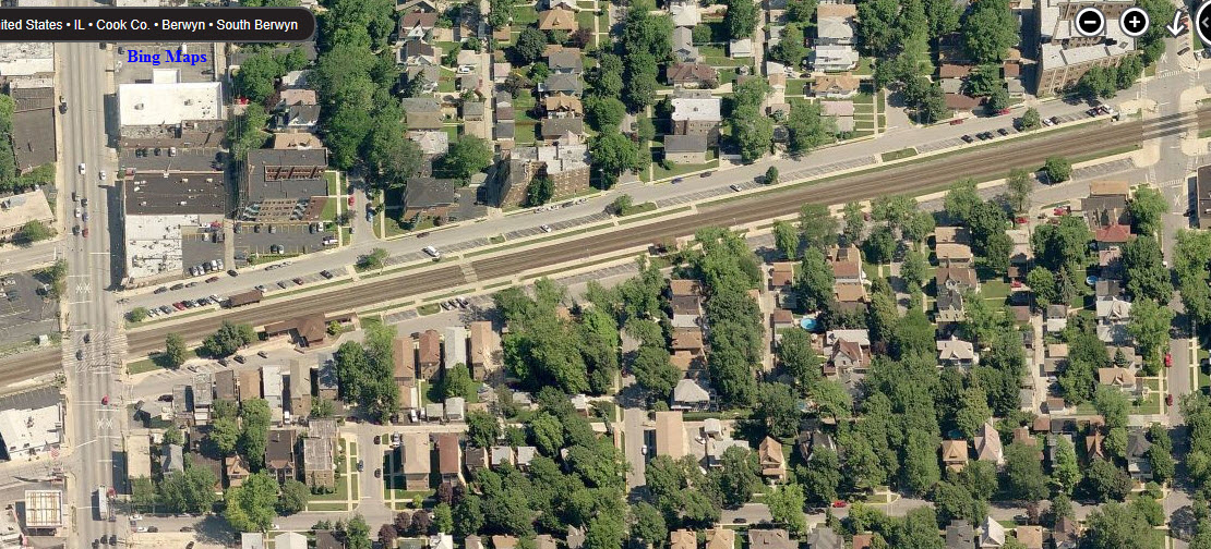
Berwyn
Harlem Ave
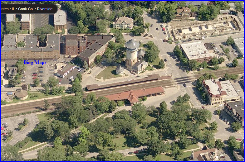
Riverside
Hollywood
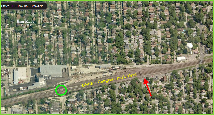
Brookfield
Congress Park
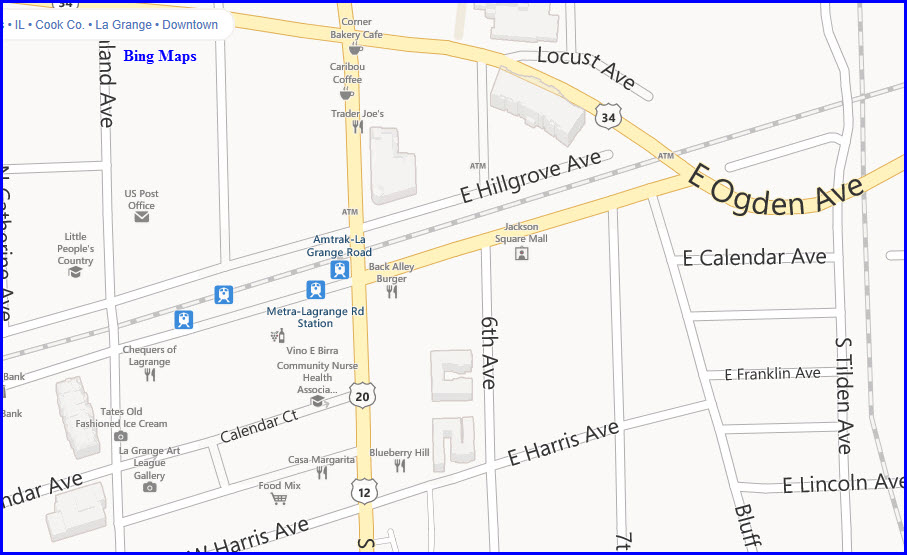
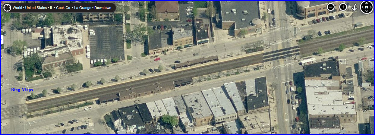
LaGrange Road
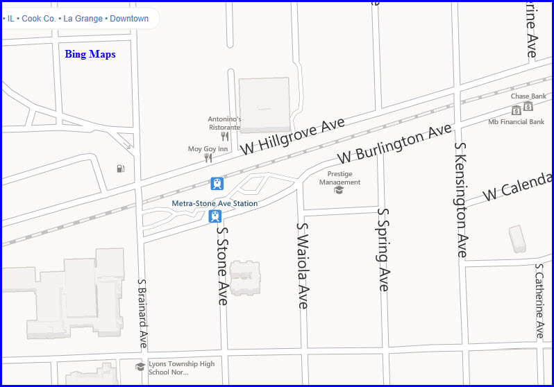
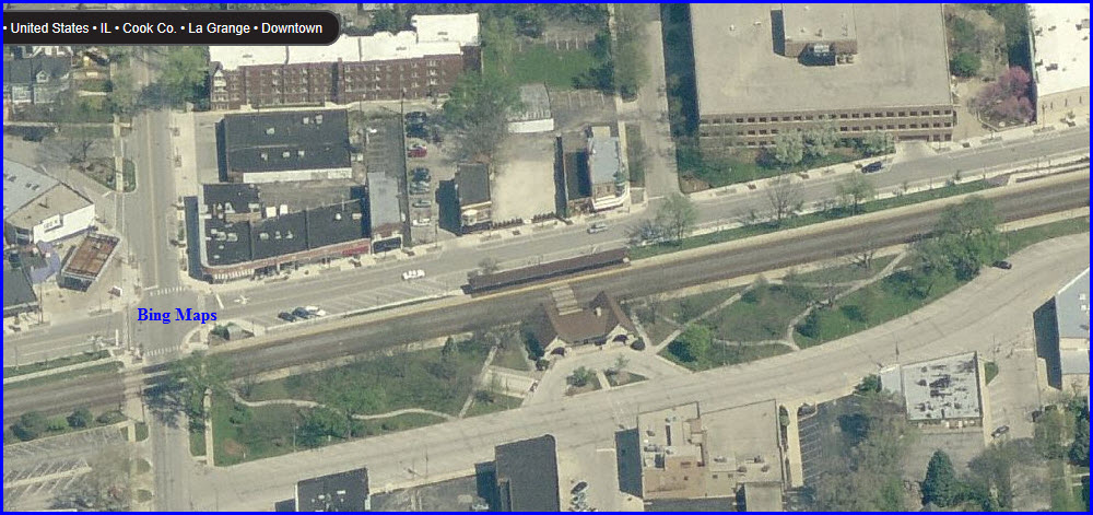
LaGrange Stone Avenue
Western Springs
Highlands
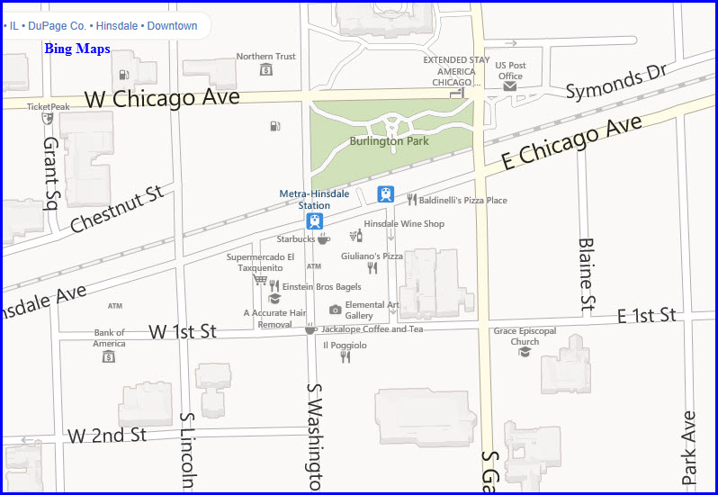
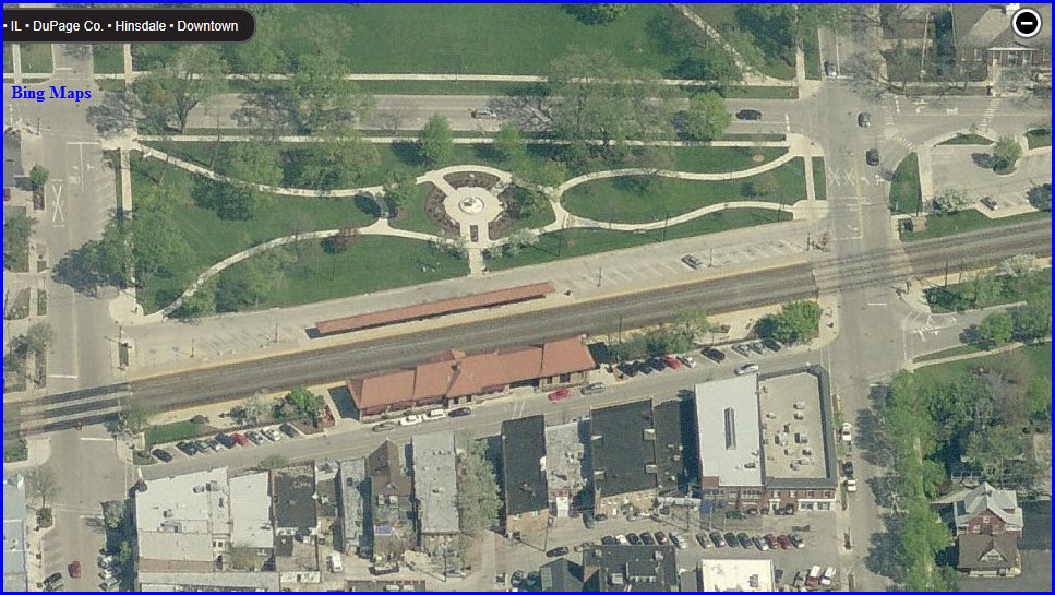
Hinsdale
West Hinsdale
Clarendon Hills
Westmont
Fairview Avenue
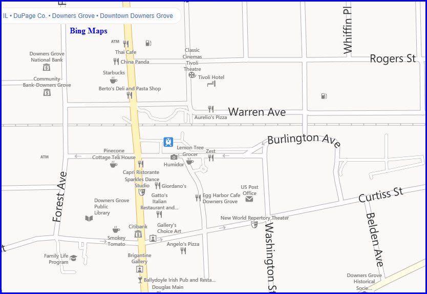
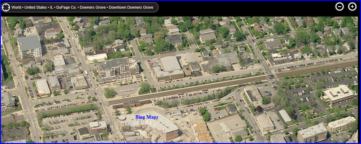
Downers Grove Main Street
Belmont
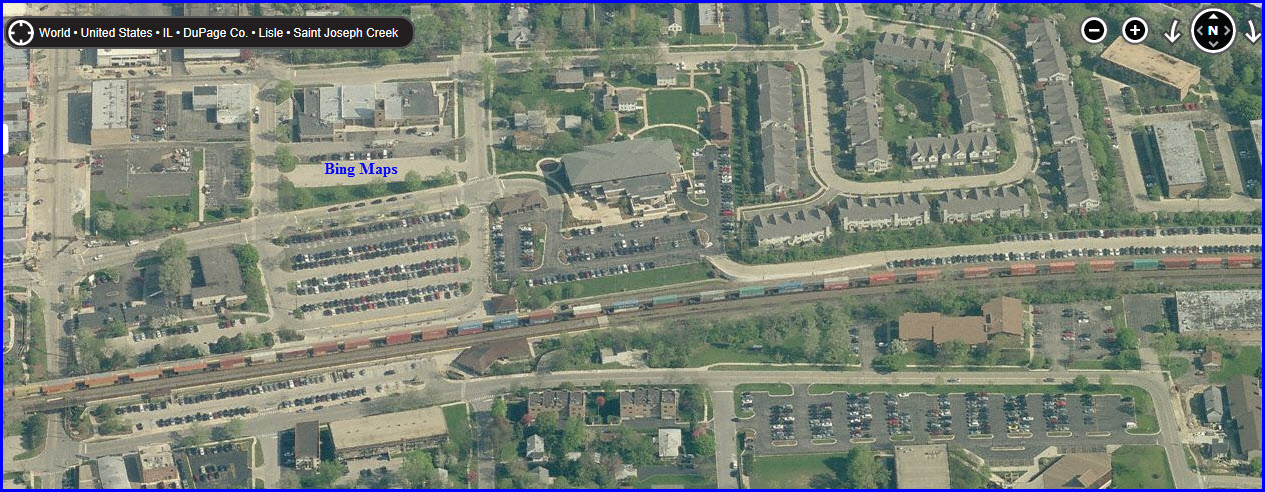
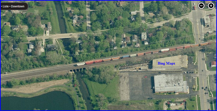
Lisle
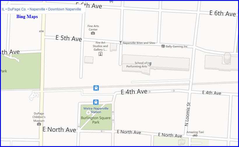
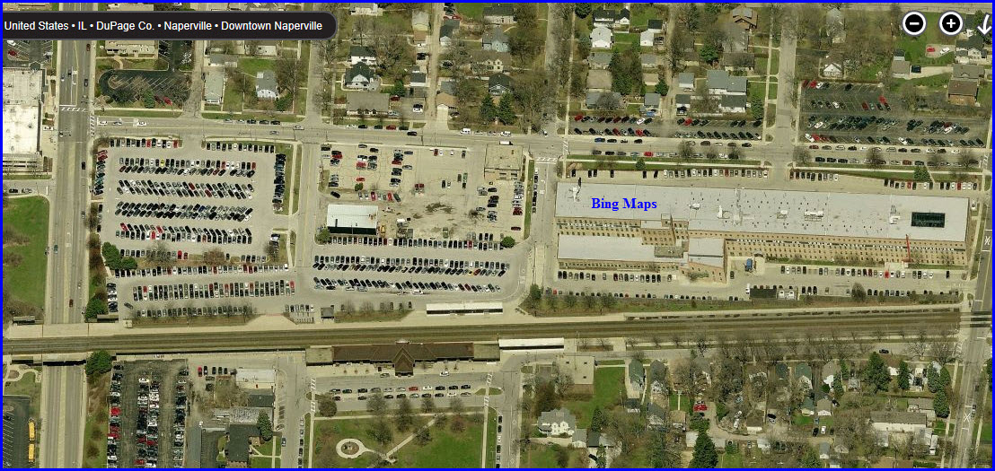
Naperville
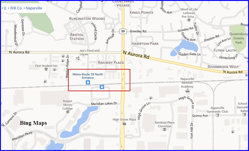
Route 59
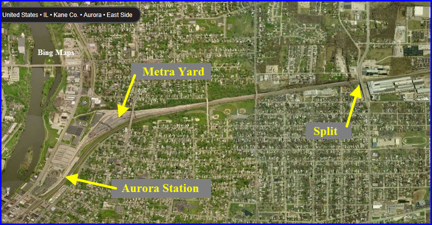
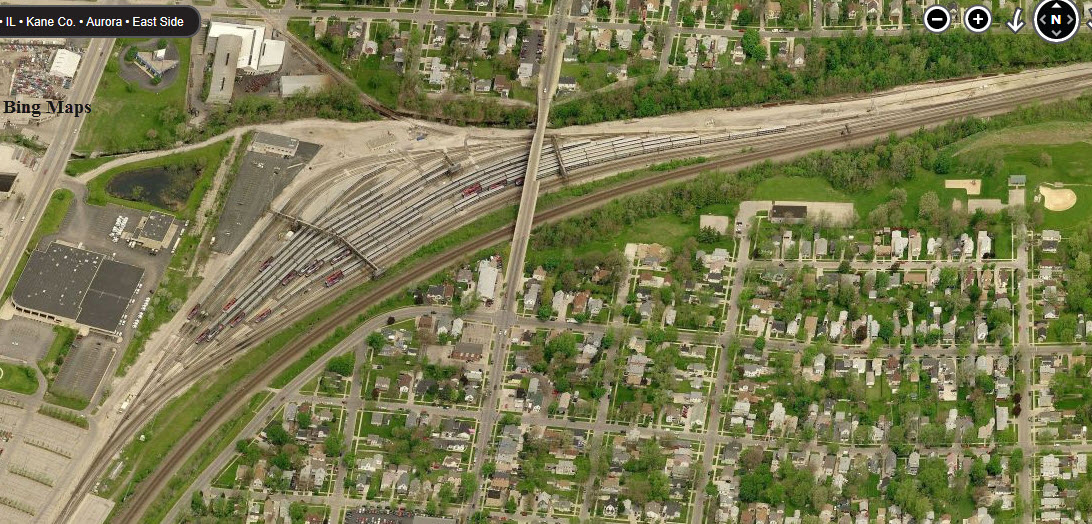
Metra Yard
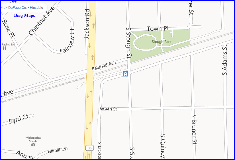
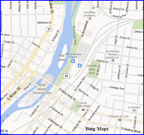
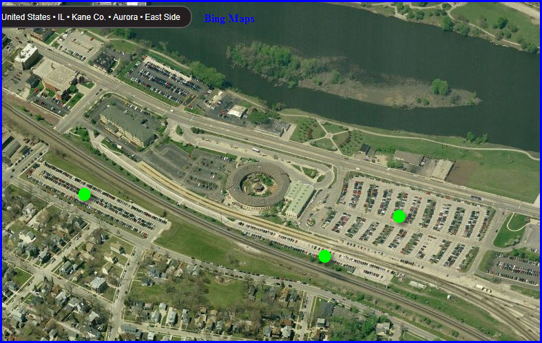
Aurora
Metra Coach Yard
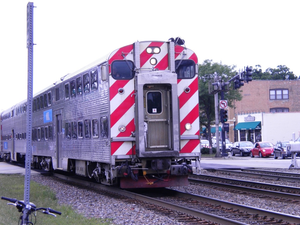
Well, before we head out to Aurora, we first have to
pass thru the Metra coach yard after we exit the underground from Union
Station.
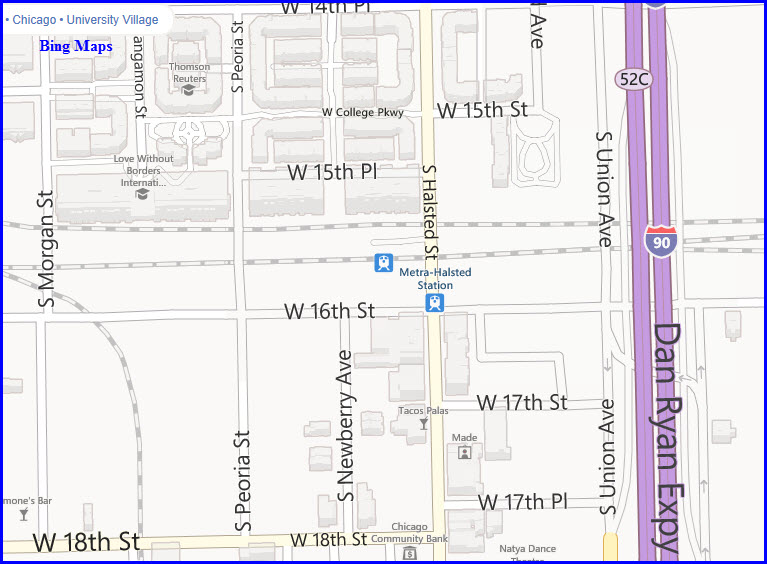
The next point of interest is the Halsted station, which is circled by yellow.
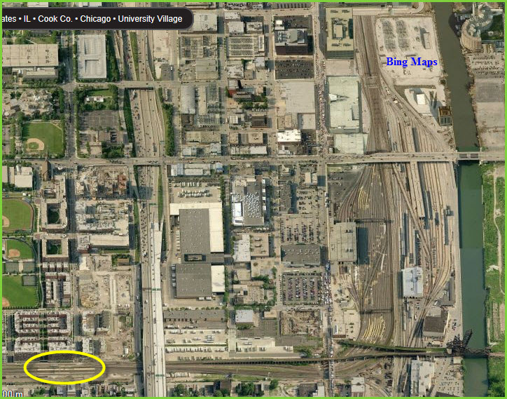
GPS Coordinates: 41.860211, -87.646778
Not much of a station,
but boy does does it look like a fun place to railfan from!
Typical non-descript
station with ground level platforms, no station or shelters.
Good sight lines in both directions.
Minimal parking if any at all, street only.
GPS Coordinates: 41.857311, -87.685842
Typical non-descript
station with ground level platforms, small station on south side with small adjoining
parking lot.
Great sight lines in both directions.
Fair parking on north side with small station building.... two lots plus a
little street parking.
Cool Stuff 1
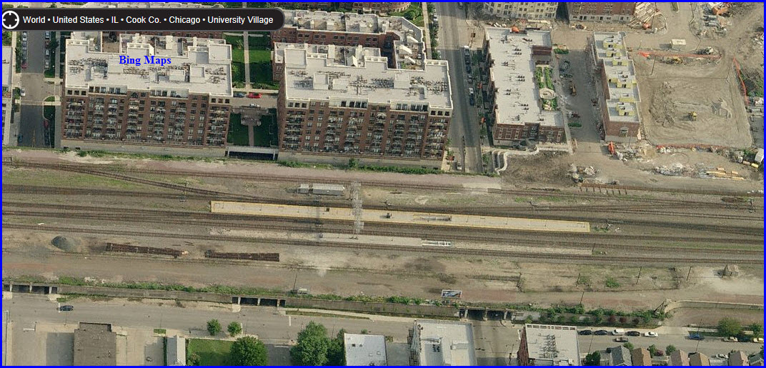
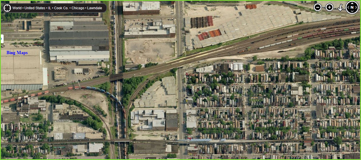
I love aerial views, for you can see a lot of stuff not otherwise seen from the ground. In this snag, you can see not only the Metra Western station, on the edge of yet another yard..... you have CSX (left) and NS (right) running N/S, a wye, and the EL at the bottom of the picture. Ogden Junction is just off the map at the top of the upper map, which can be seen in the bottom Cool Stuff 1 map.
Cool Stuff 2
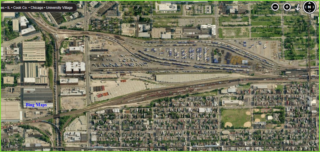
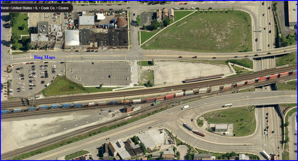
In this Snag, you can see the mix of railroad lines, interchanges, the Cicero yard, the remains of an old roundhouse, and the plethora of roads and overpasses needed to fit everything into what wasn't used up by the railroads. The BRC is the line running N/S.
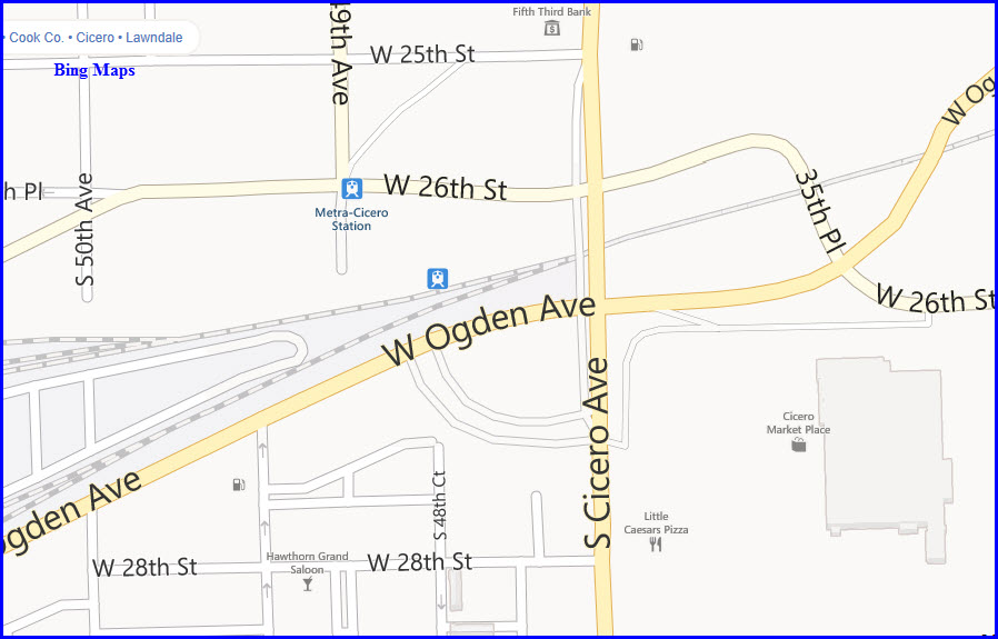
GPS Coordinates: 41.844108, -87.745601
Typical non-descript
station with ground level platform on the north side, no station, 3/4 car
length shelter.
Good sight lines in both directions.
Three fair sized lots for parking.
Signal bridge spanning the three main line tracks to the west.
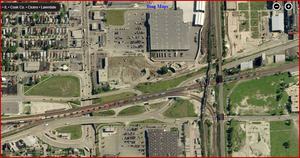
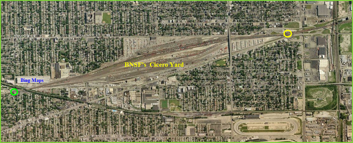
BNSF's Cicero Yard
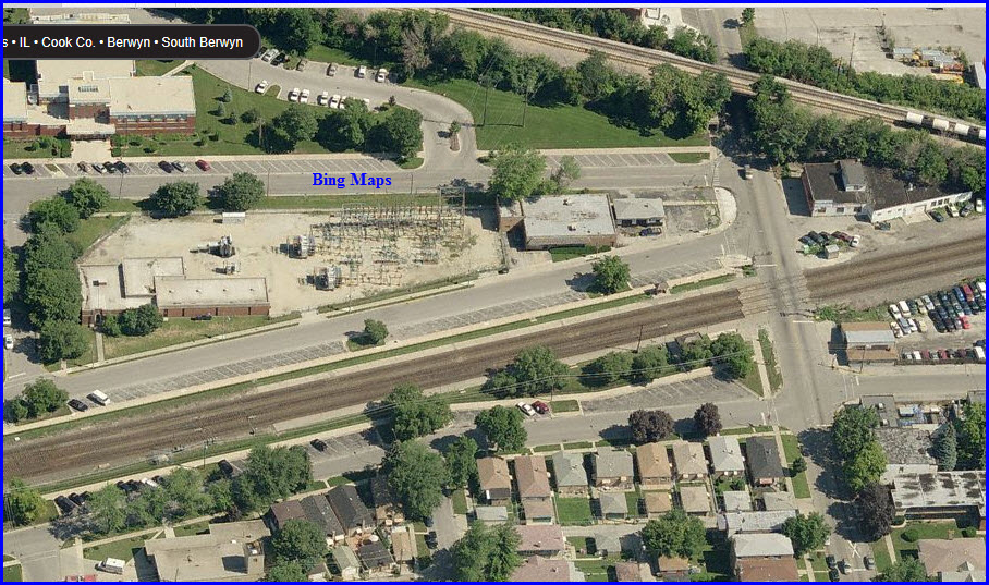
Sandwiched in between Metra's Cicero stop (yellow), and LaVergne station (green), is one of BNSF's bigger yards in these here parts.... and riders are lucky to be able to whiz thru it :-) The CN tracks and CN's Hawthorne yard can also be seen in this shot. The N/S tracks are the BRC, as already seen above in Cool Stuff 2.
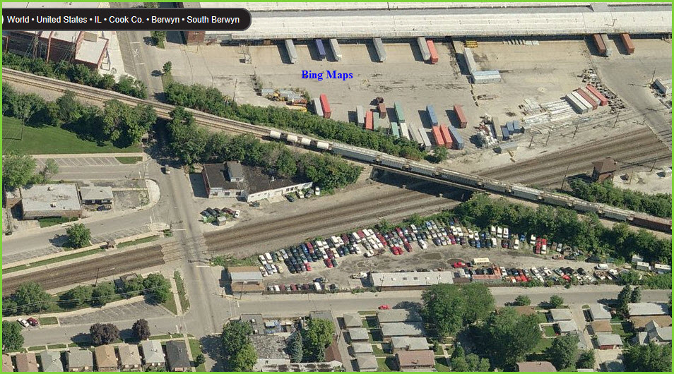
Caught In The Act
In different frames stitched together by Bing, here are two freights, one on the Racetrack, one on the CN tracks running over the Racetrack, just west of BNSF's Cicero yard. The two Snags are very close to each other, the bottom one being about a block away (west) from the upper one - with the upper one adjacent to the LaVergne station.
GPS Coordinates: 41.835732, -87.783254
Typical non-descript
station with ground level platforms, tiny station on the south side-no
shelter on south side, useless bus style shelter on the north.
Good sight lines in both directions, especially
from the crossing at Ridgeland Ave.
Two small angle parking strips, one on both sides of the tracks.
La Vergne station is the first
good station to watch trains west of the Roosevelt Rd. overpass near Union
Station.
Just east of the station is the CN overpass of the BNSF (see above).
GPS Coordinates: 41.833301, -87.792921
Typical non-descript
station, ground level platforms, has small station building on the south
side with some covered platform, small shelter north side.
Great sight lines in
both directions.
Three (maybe) small angle parking areas, both sides of the tracks.
Cantilever signal bridge spanning the three main line tracks to the west, just on the other side of the grade crossing from the platforms.
GPS Coordinates: 41.831159, -87.802909
Typical non-descript
station, ground level platforms, has small station building on the south
side with some covered platform, small shelter north side.
Great sight lines in
both directions.
Two small strip parking areas for angle parking, one on each side of the tracks.
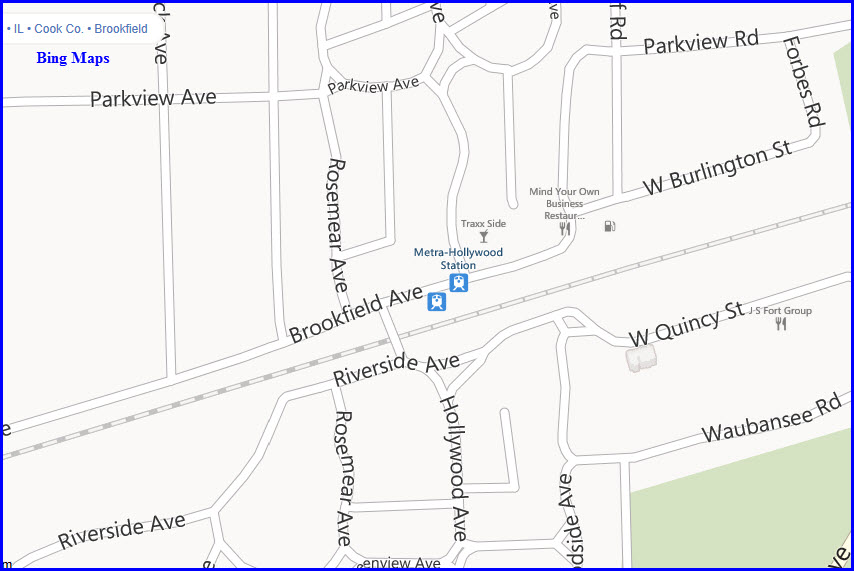
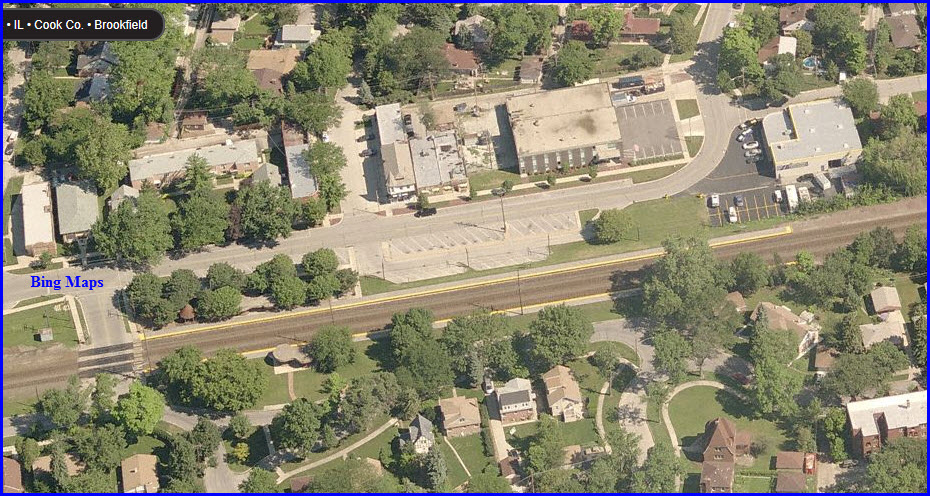
GPS Coordinates: 41.827466, -87.819829
Typical non-descript
station, ground level platforms, has station building on the south side,
with covered platforms on both sides.
Great sight lines in
both directions.
One small parking lot on the south side.
Check out the cool buildings for the Riverside Museum!! Gotta get shots of them!
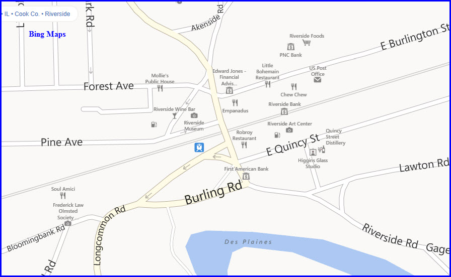
GPS Coordinates: 41.824611, -87.833830
Typical non-descript
station, ground level platforms, no station building.
Great sight lines in both
directions.
Only one very small parking lot on the north side of the tracks for angle
parking.
GPS Coordinates: 41.822229, -87.843614
Typical non-descript
station, ground level platforms, has small station building on the south
side, no shelters.
Great sight lines in
both directions.
Five small angle parking areas on both sides of the tracks.
Signal bridge spanning
the three main line tracks to the west, just on the other side of the grade
crossing.
Bridge to the east of the platforms, with a pedestrian bridge to take
pictures from!
Brookfield is convenient and less crowded than other locations. There is a great Irish Pub with good food and refreshments south across the street from the Brookfield Metra station. The stop just east of Brookfield (Hollywood station) is within walking distance (five blocks) to the world famous Brookfield Zoo.
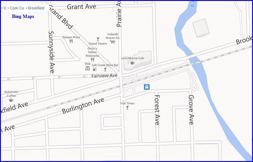
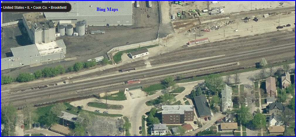
Congress Park Yard
Small BNSF yard, with Metra's Congress Park station (green circle) in the middle of it, of sorts. Burlington Ave on the south side, and Southview Ave on the east-north side provide a good view of almost everything going here since it's a small yard. The two extra tracks heading off west are interchange tracks with the N/S IHB line. A signal bridge (red arrow) on the eastern end of the yard provides an opportunity for framing shots.
GPS Coordinates: 41.818703, -87.857594
Typical non-descript
station, ground level platforms only, no station building.
Great sight lines in both
directions.
This station uses underpasses for platform access, for there are additional
tracks on both sides of the platforms.
No parking, kiss n ride only.
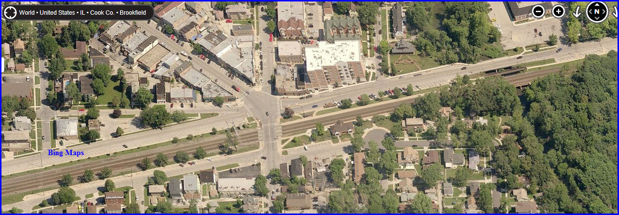
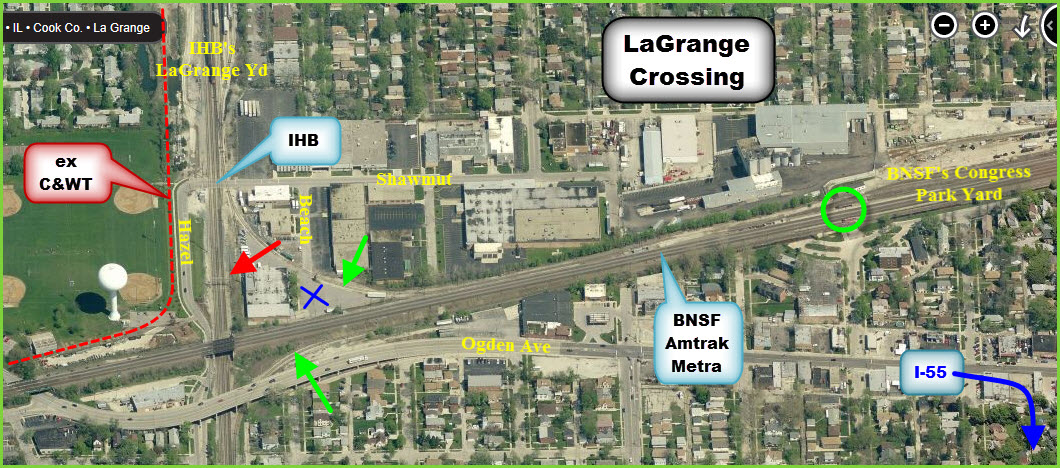
Cool Stuff 3
Interesting spot, with all sorts of photo ops. First is the BNSF mainline; then you have the IHB running N/S, and their LaGrange yard just north of the crossing/junction; BNSF's Congress Park yard sits to the east, with the imbedded Congress Park Metra station (green circle); there is a signal bridge on the IHB just north of the crossing (red arrow); there is also a place to watch from the NE side of the crossing, in the middle of the interchange (blue "X"). Mornings and early afternoons are supposed to be the best time for non-commuter train activity.
To get here by car from downtown, come out I-55, get off at exit 282, which is 171, go north, it turns into 1st Ave, take that to Ogden Ave and hang a left till you're on the map below. Going south on 171 at exit 282 will also take you to the Metra Summit station. By train, get off at the LaGrange station and walk east.
IHB scanner frequencies are: 160.980, 161.070
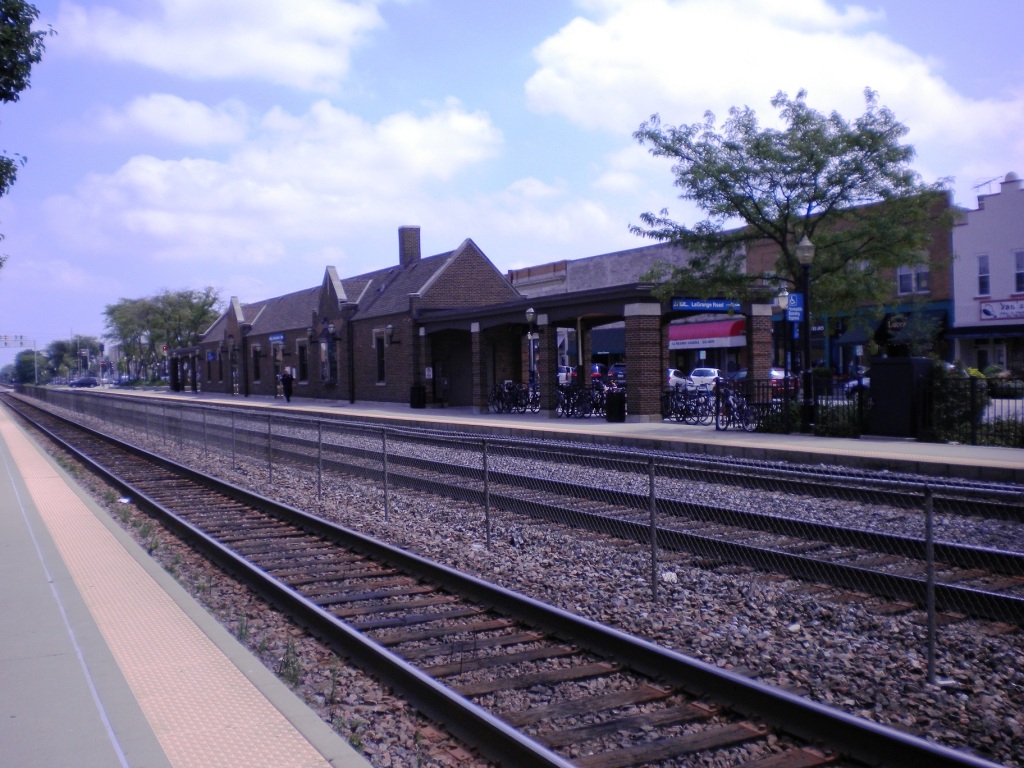
LaGrange Road
GPS Coordinates:
41.816088, -87.870340
Both Amtrak and Metra
service this station.
Typical non-descript station, ground level platforms only, has small station building on
south side of tracks>
Great sight lines in both directions.
Six fair size parking areas on both sides of the tracks.
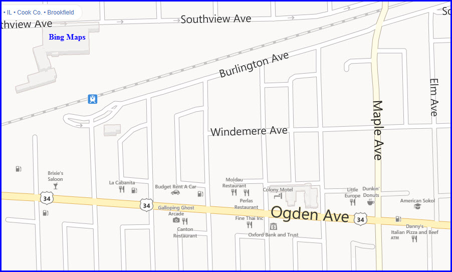
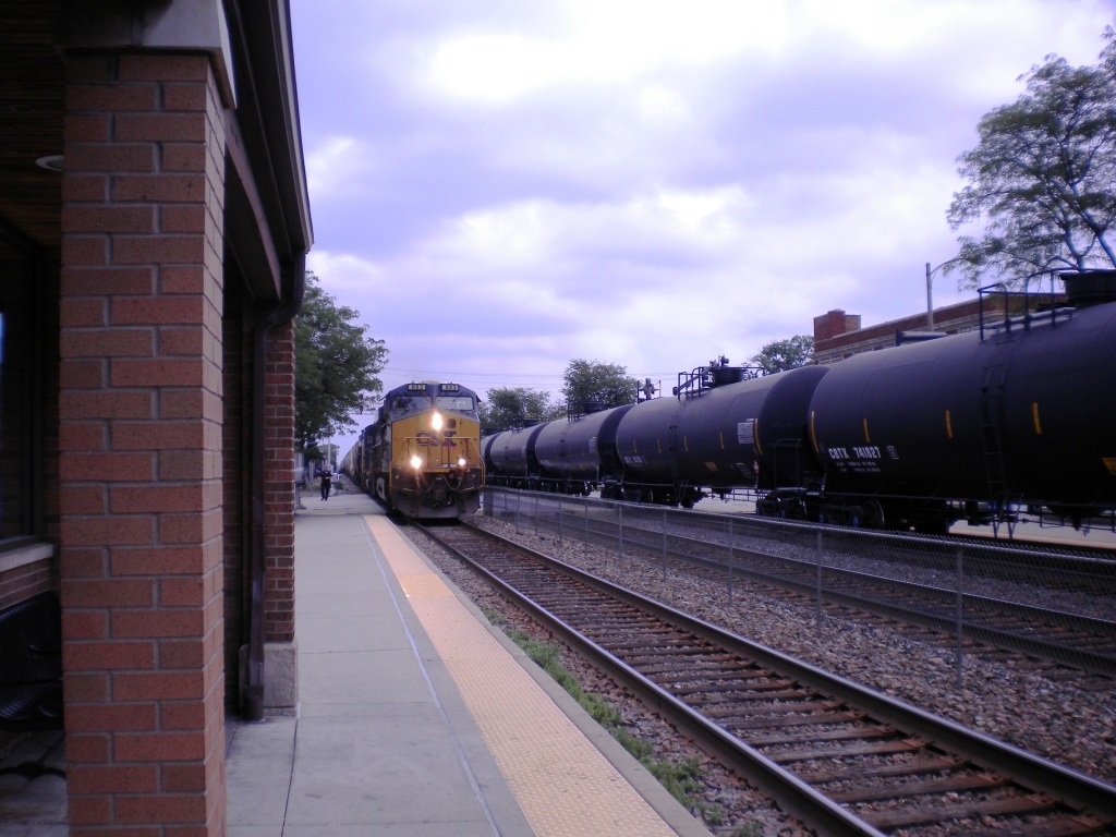
La Grange, Illinois (population, 15,550) has many nearby restaurants. Tate’s Old Fashioned Ice Cream at 25 S. Ashland is nearby; as is the historic and reasonably priced Colony Motel at 9232 Ogden in Brookfield, IL. While you're here, the Stone Ave. Station back in La Grange (west of here) is very photogenic and also a good place to watch trains. Just east of downtown is the Ogden Ave. overpass (N 41.8169, W 87.8643) of the IHB, with a view of the triple track BNSF over the triple track IHB (seen above). Again, make sure to stay off railroad property.
La Grange is just an excellent example of the railfan experience along the Racetrack.
A hobby shop is located about a block south of the Station.
Tate's Old Fashioned Ice Cream Shop
25 S Ashland Ave
La Grange, IL 60525-2349
GPS: 41.81410 -87.87223
La Grange Hobby Center
25 S La Grange Rd Ste 1
La Grange, IL 60525-3484
GPS: 41.814908 -87.86953
 The Signals
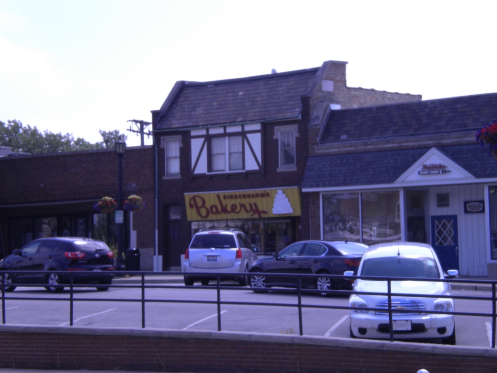 Kirschbaum's Bakery (these 8 pictures courtesy Denver
Todd)
Kirschbaum's Bakery (these 8 pictures courtesy Denver
Todd)
LaGrange Stone Avenue
GPS Coordinates:
41.814225, -87.878558
Typical non-descript
station, ground level platforms with small station on south side of tracks.
Great sight
lines in both directions.
Four fair size parking areas on both sides of the tracks. Very close
to the LaGrange station.
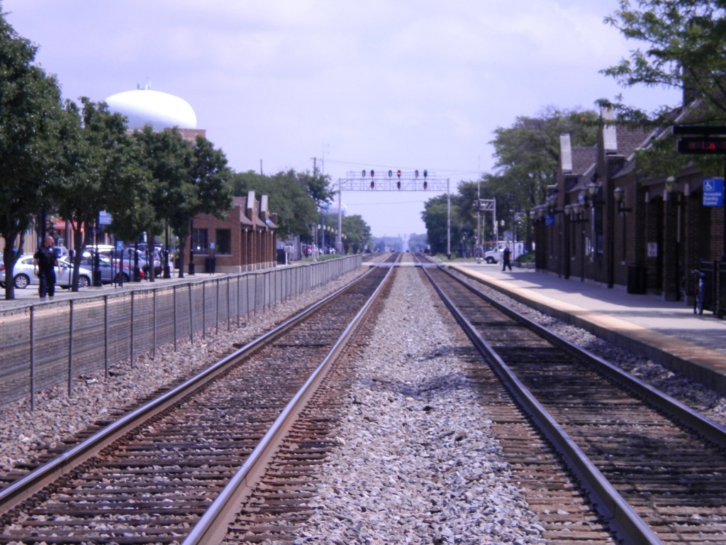
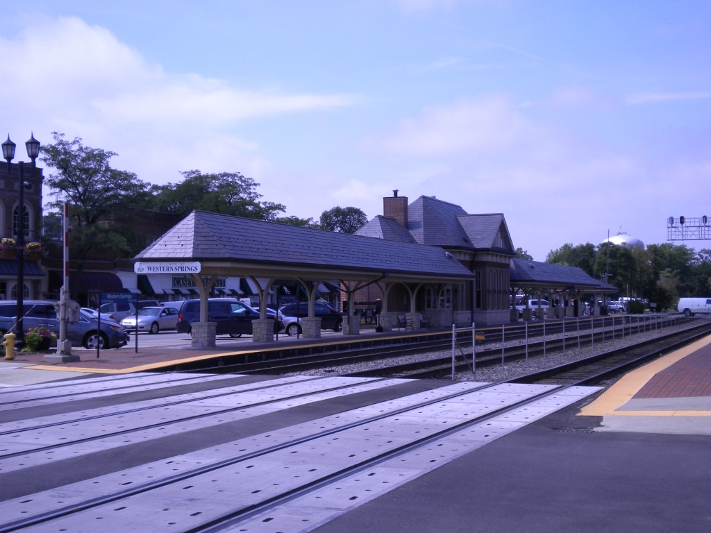
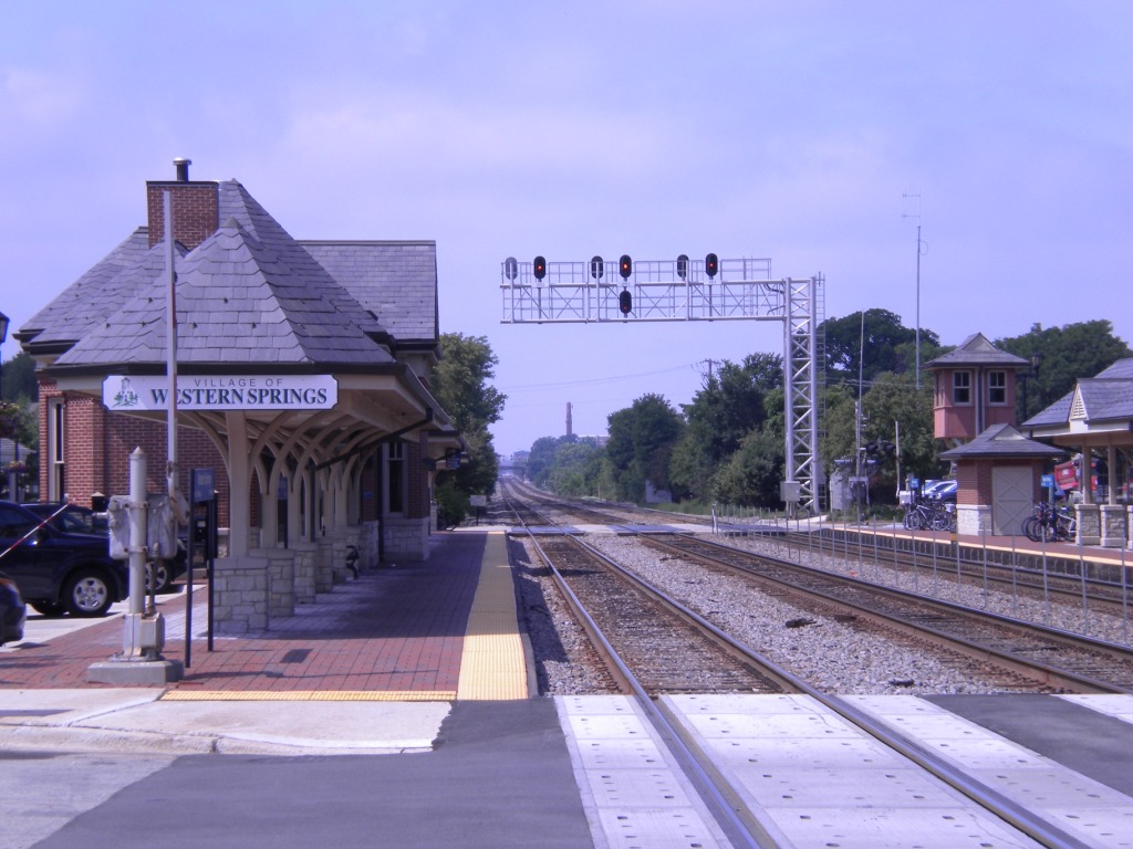
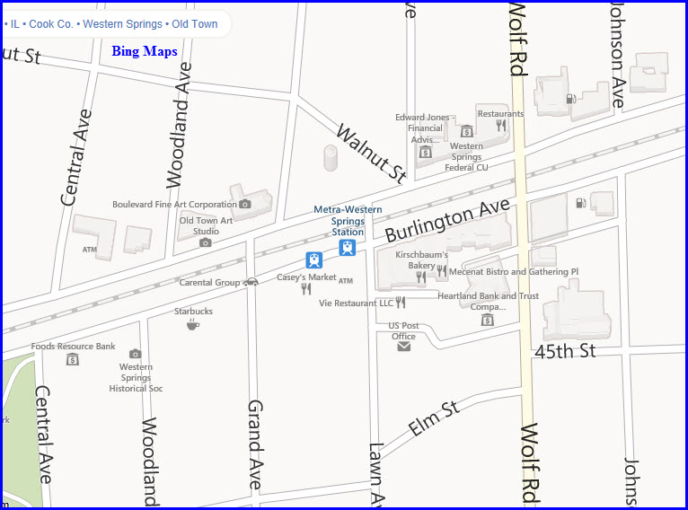
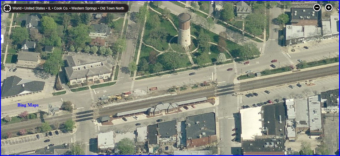
Western Springs
GPS Coordinates:
41.809211, -87.900788
Typical non-descript
station, ground level platforms with small station on south side of tracks.
Great sight
lines in both directions.
6, 7, or 8 fair size angle parking areas on both sides of the
tracks.
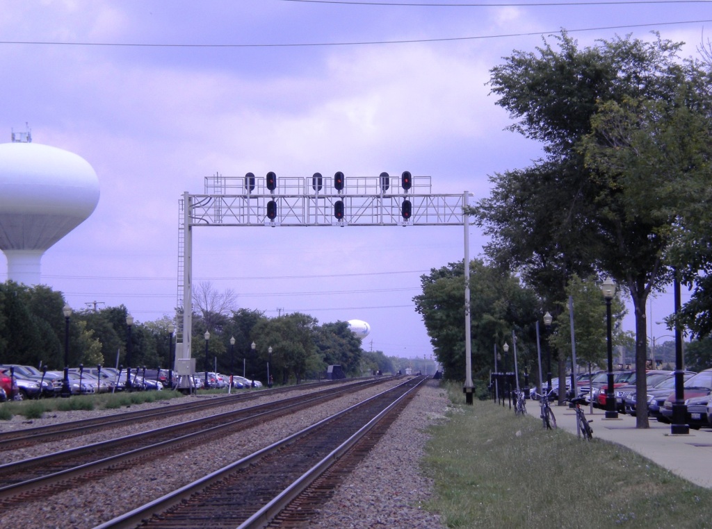
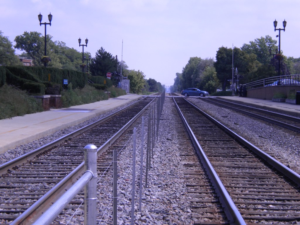
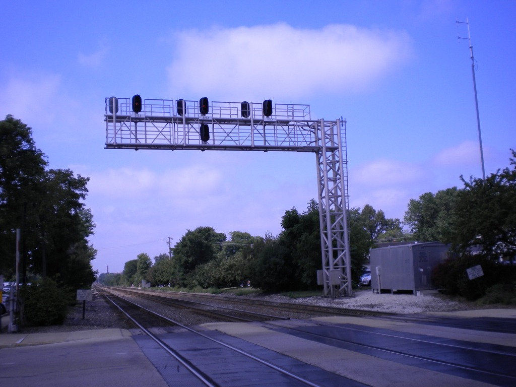
Cantilever signal bridge, spanning all three tracks, is just to the west of the station.
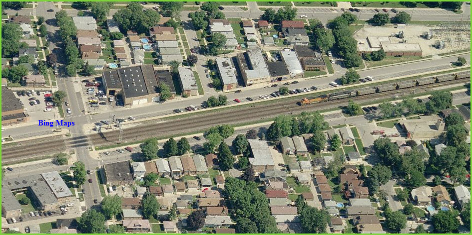
Western Springs has a couple of restaurants and an absolutely fantastic bakery across from the Metra Station and ½ block east, Kirscbaum’s Bakery has all kinds of pastries and dainty’s to satisfy a sweet tooth. (Caution, they are closed Sun. & Mon. and generally sell out by noon on the days they are open). Burlington Ave by the bakery is at train cab level with a railing and provides a good place to watch trains. Oberweis Dairy Bar is one block to the west on Burlington and has great ice cream.
Kirschbaum's Bakery
(Delicious Dainties) Tues. - Sat.
825 Burlington Avenue
Western Springs, IL 60558
GPS: 41.80909 -87.8999
http://kirschbaumsbakery.com/
Oberweis Dairy (Ice Cream)
929 Burlington Avenue
Western Springs, IL 60558
GPS: 41.80869 -87.9017
http://www.oberweis.com/web/retail.asp
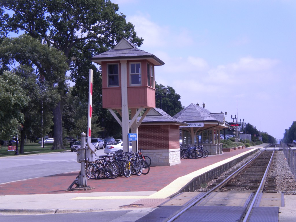
 The station. All 9 pictures taken by Denver Todd.
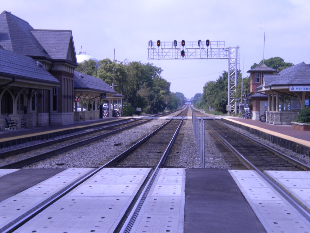
 The signal bridge.
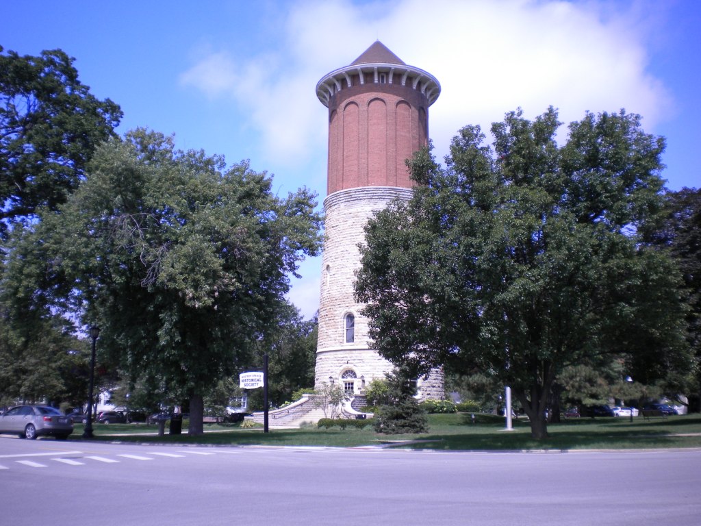
 The water tower and Kirschbaums.
GPS Coordinates: 41.805253, -87.918470
Typical non-descript
station with ground level platforms, no station.
Great sight lines in both directions.
Parking is one lot, south side in the park, fair size.
Nice feature, signal bridge on the west end of the platform making those EB
trains look great!
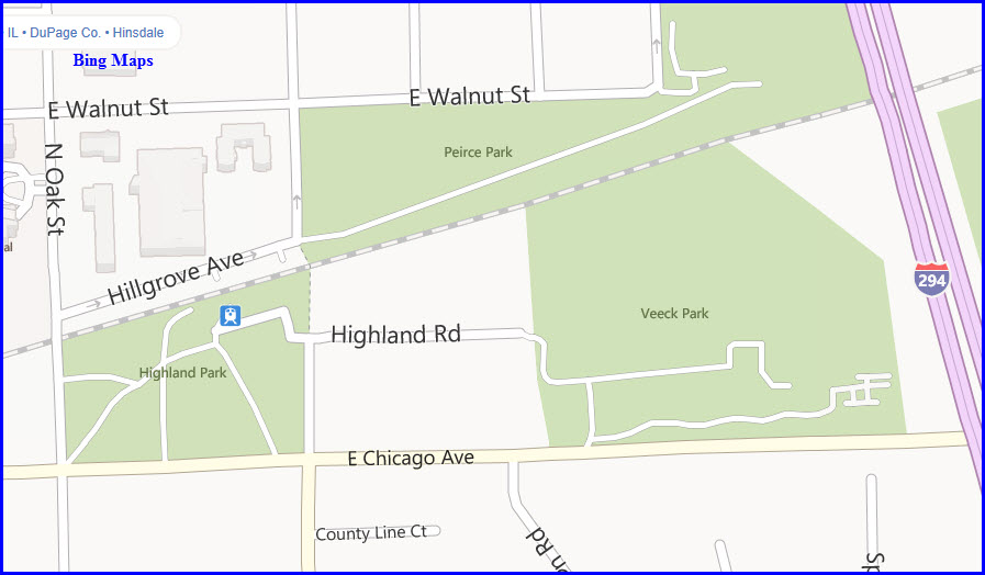
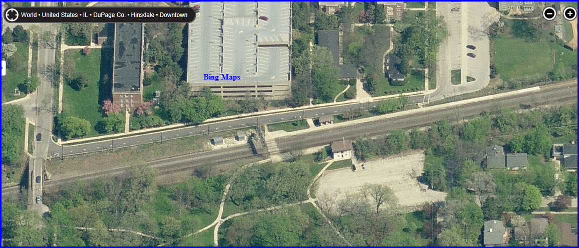
Highlands station is in East
Hinsdale and is another photogenic station.
Just to the west, the walkway of the Oak St Bridge over the BNSF offers a
nice overhead view of the trains.
GPS Coordinates: 41.802789, -87.929123
Typical non-descript
station with station on south side.
Great sight lines in both directions.
Looks to be maybe four parking areas, one several blocks long on the north
side.
GPS Coordinates: 41.799030, -87.945420
Typical non-descript
station with ground level platforms, no station.
Great sight lines in both directions.
Fair parking, three areas, one on the north size is about 8 blocks long,
shared with Clarendon Hills.
Signal bridge to the west end of the station, however, overpass in the way
for good pictures from the platforms.
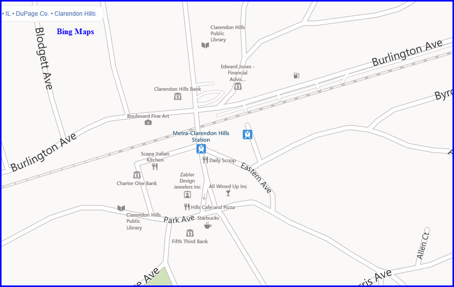
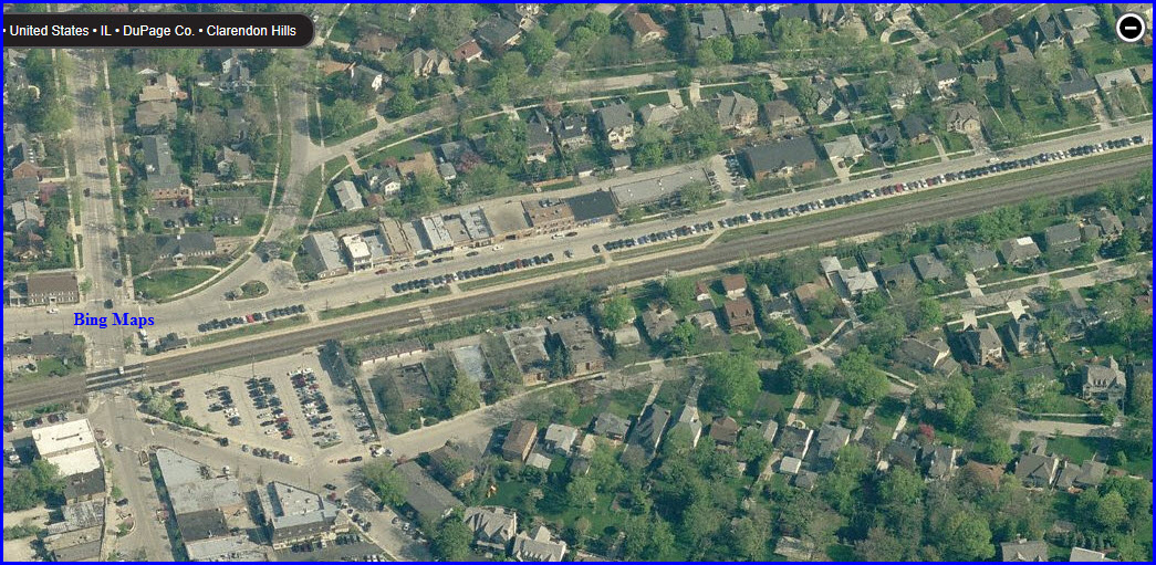
GPS Coordinates: 41.797015, -87.954712
Typical non-descript
station with ground level platforms, really bare bones with no station - not even a
shelter!
Great sight lines in both directions.
Two parking areas - north side, about 8 blocks long, but shared with West
Hinsdale; south side fair size, maybe 80 cars?
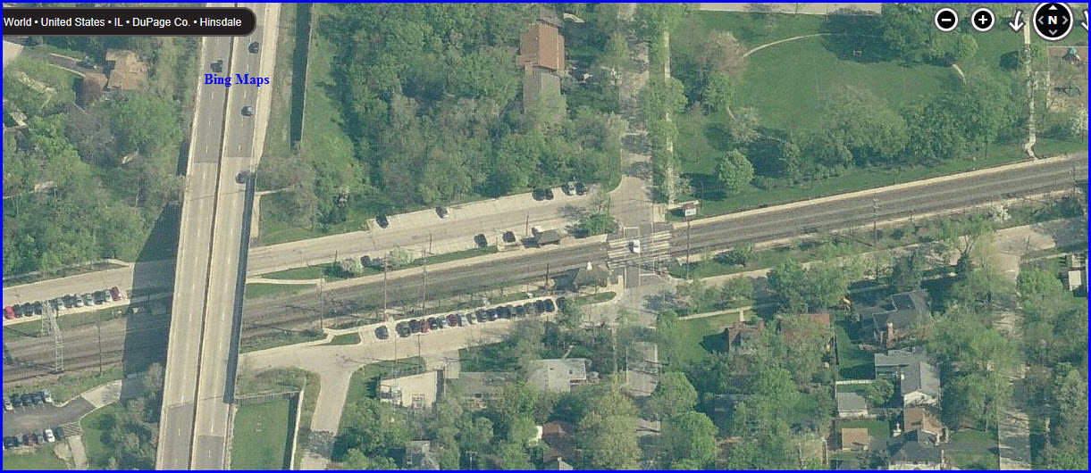
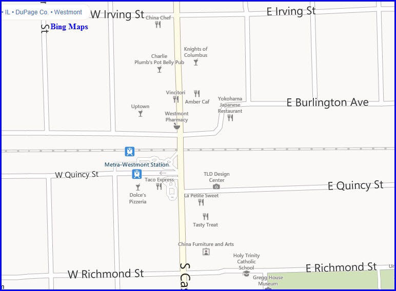
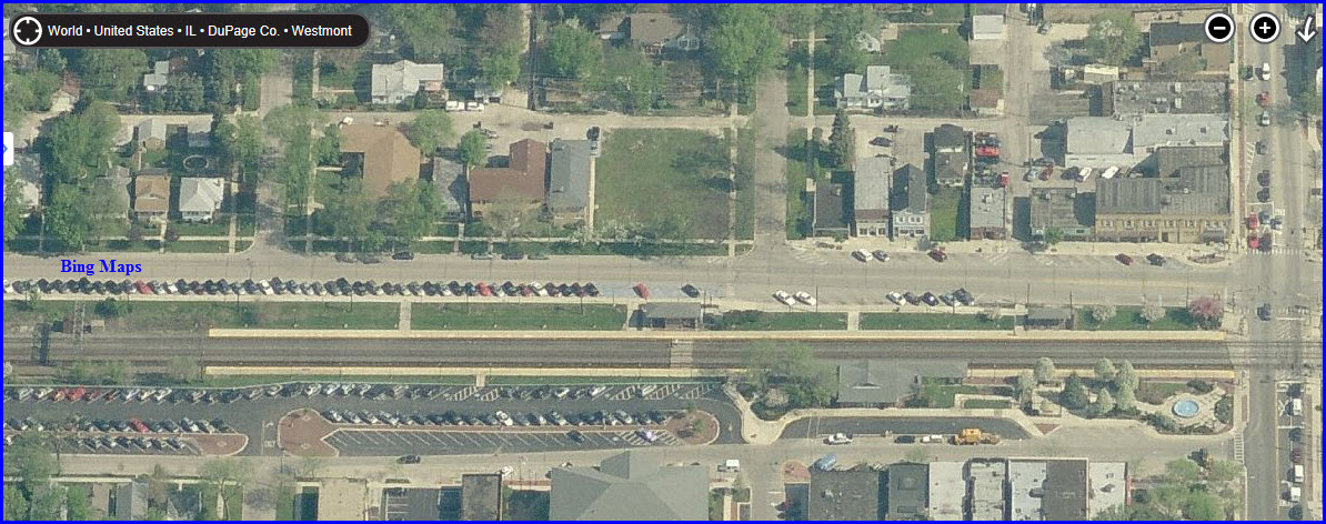
GPS Coordinates: 41.795447, -87.975912
Typical non-descript
station with ground level platforms, station on south side, 2 shelters on north side.
Great sight lines in both directions.
Pretty good parking, two areas, one on the north size is about 6 blocks
long; south side lot plus street.
Signal bridge to the west end of the station.
WB Metra train "caught in the act" approaching the station in second aerial
- if you move your view on Bing, the train disappears :-)
GPS Coordinates: 41.795591, -87.994119
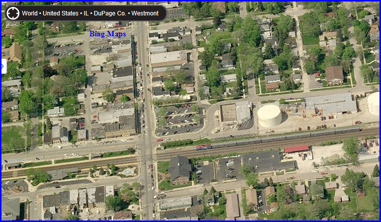
Typical non-descript
station with ground level platforms, small station on south side, no shelters on north
side.
Great sight lines in both directions.
Fair parking, one lot - south side, maybe 130-140 cars? 7-11 adjacent
to parking lot.
Signal bridge to the west end of the
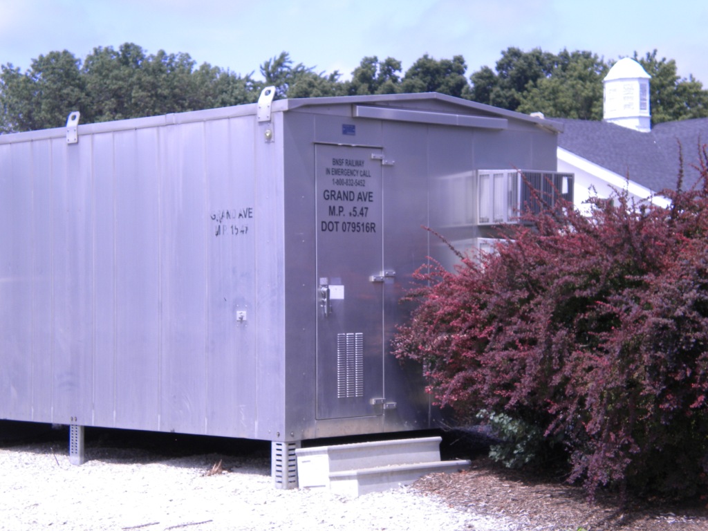
platforms on the "other" side of the grade crossing for crossovers.
Additional signals, and another signal bridge about 1200 feet west, for the
western approach to the crossovers.
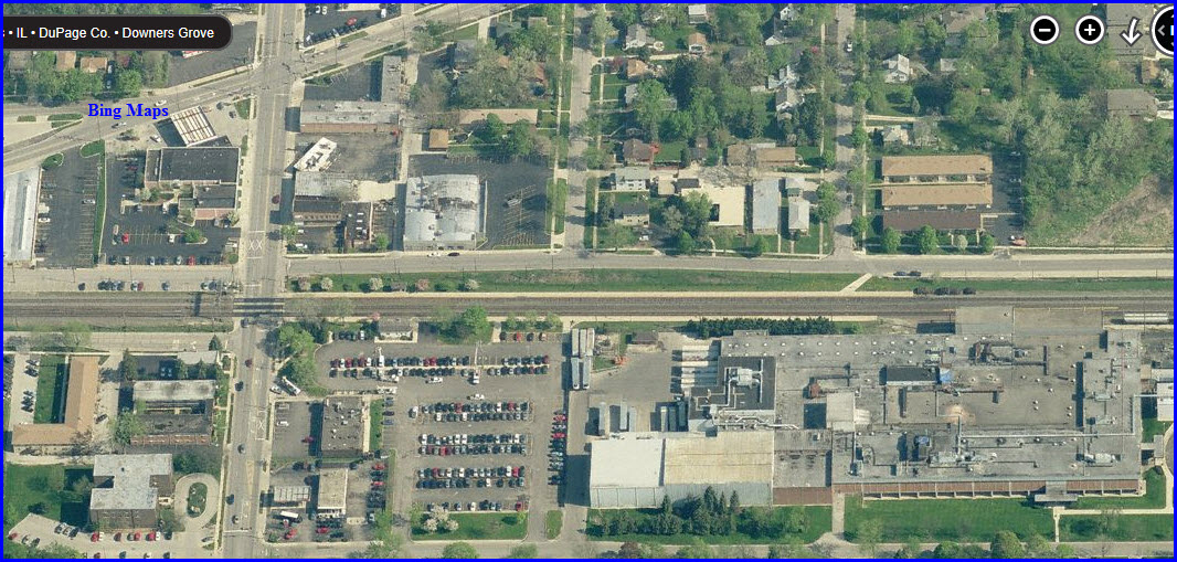
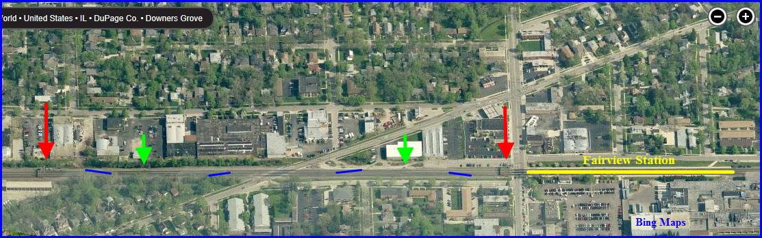
Crossovers
Just west of the Fairview Metra station.
Red arrows are full three track signal locations on signal bridge.
Green arrows are intermediate signals on wayside masts.
GPS Coordinates: 41.795615, -88.009890
Typical non-descript
station with ground level platforms, small station on south side, no shelters on north
side.
Great sight lines in both directions.
Fair parking with about five lots plus street parking.
Signal bridge to the west of Forest Ave.
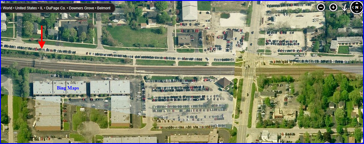
GPS Coordinates: 41.795535, -88.038482
Typical non-descript
station with ground level platforms, small station on south side, two small bus-type
shelters on north side.
Great sight lines in both directions.
Fair parking with about three areas, and a lot on the south side next to the
station.
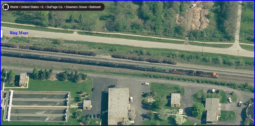
Caught In The Act
Bing provides us not one, but two EB freights west of Belmont, as can be seen below, showing us that daytime can have its plusses with the freight action along this commuter line.
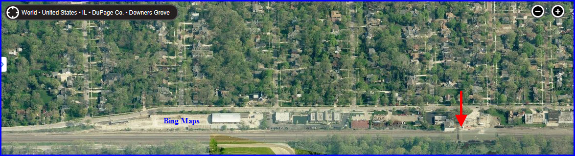
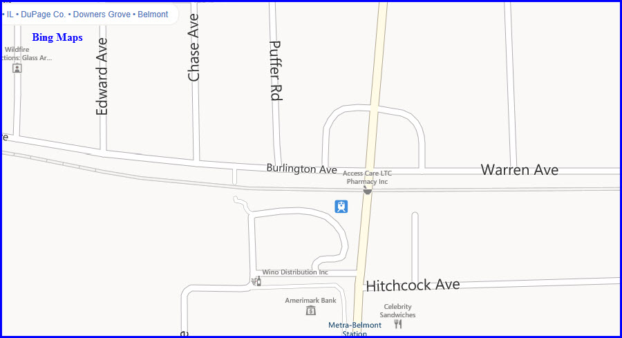
GPS Coordinates: 41.797887, -88.072203
Typical non-descript
station with ground level platforms, small station on south side with small adjoining
parking lot.
Great sight lines in both directions.
Fair parking on north side with small station building.... two lots plus a
little street parking.
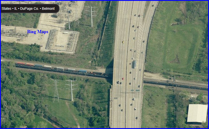
Bridge
Looks more like concrete culverts, maybe easy access thru the parking lot for the commercial building seen below.
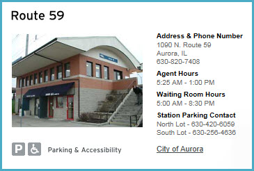
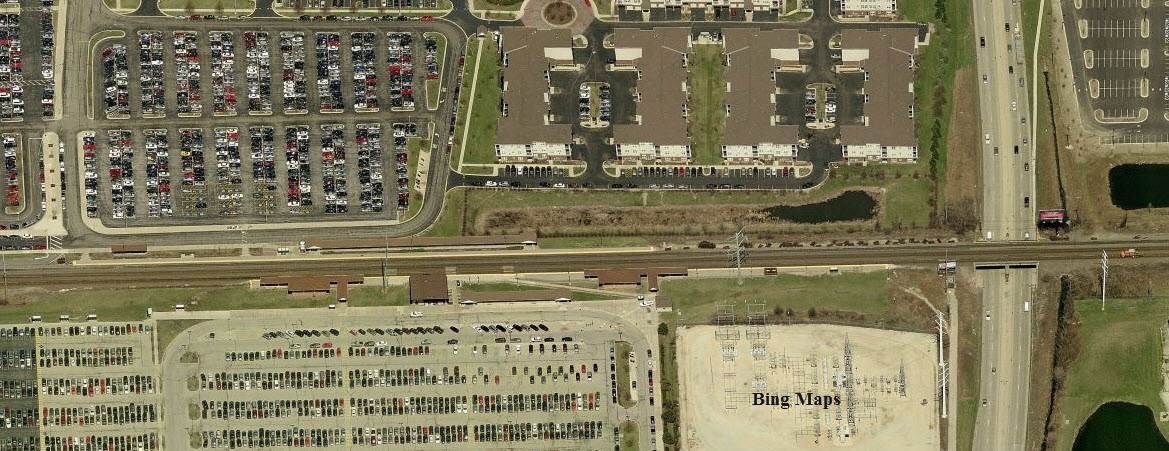
GPS Coordinates: 41.779816, -88.145996
Typical non-descript
station with ground level platforms and station on south side, also shelters on both
sides.
Great sight lines in both directions.
Fair parking on north side with 2/3 lots..... plus some street parking.
GPS Coordinates: 41.777802, -88.208889 South Side
Non-typical non-descript
station (for Metra) with ground level platforms and station on south side, good shelter
coverage on both sides. Covered bus area.
Great sight lines in both directions.
Very good parking on both sides.
Signal bridge to the far west.
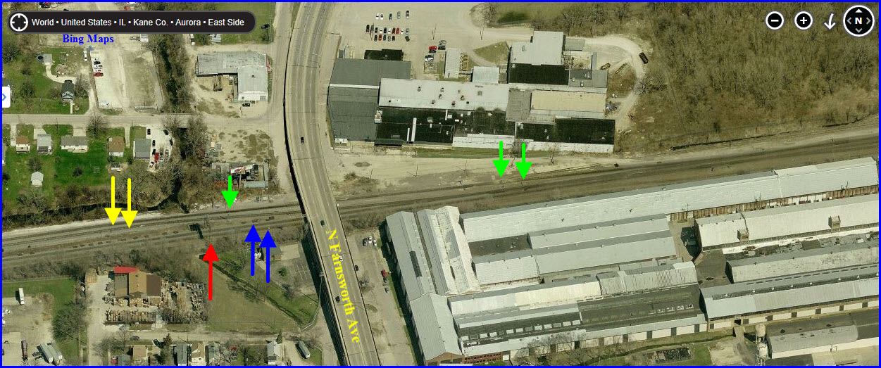
Metra Split
Just under Farnsworth Ave, you have the Metra splitting off from the BNSF mainline. Signal bridges are at the red arrows, mast mounted signals at the green arrows. The yellow arrows point to the Metra tracks, and the blue - BNSF.
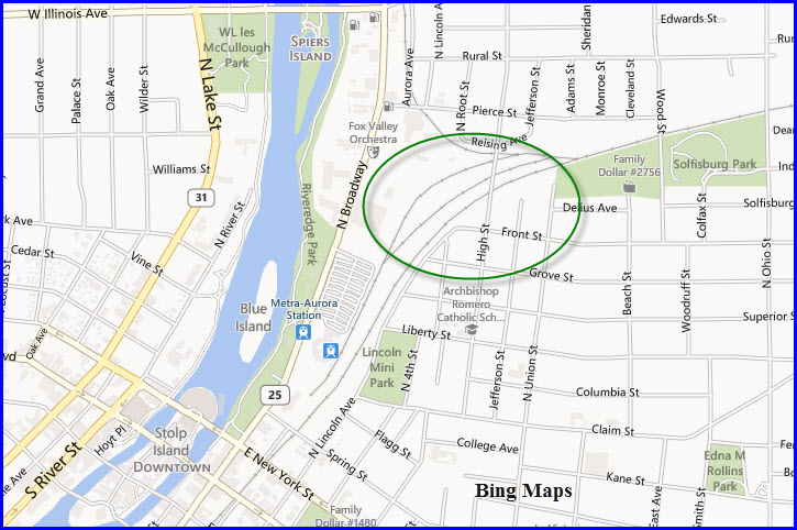
GPS Coordinates: 41.761806, -88.308743
End of the line, dudes.
Typical non-descript station with ground level platforms. Station building
from parts of
the former BN/CB&Q shop complex.
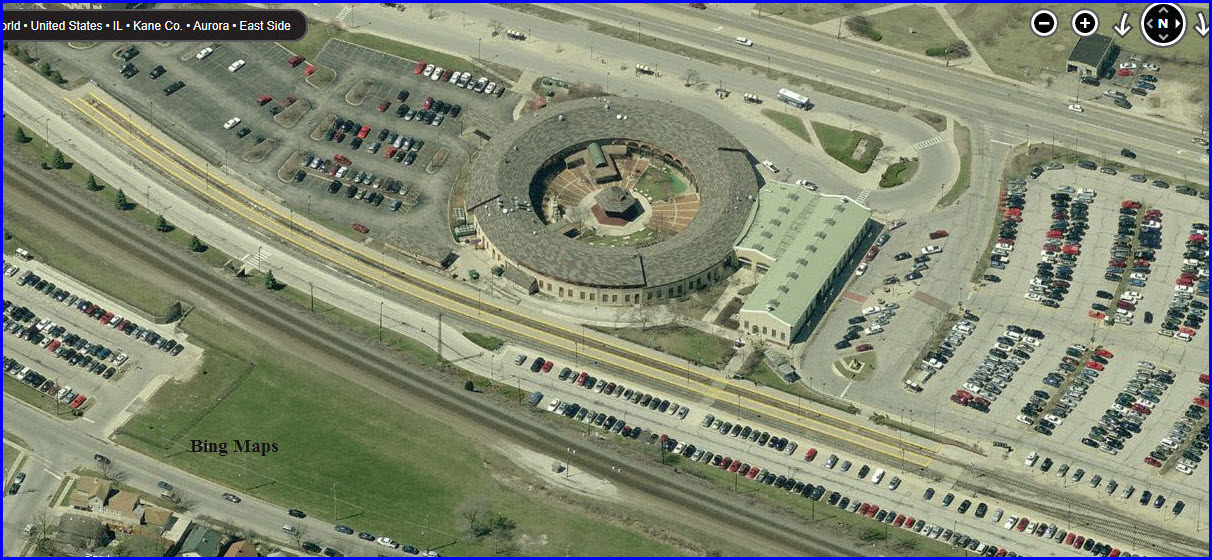
Former CB&Q/BN roundhouse saved and converted into commercial space.
Good parking on both sides.
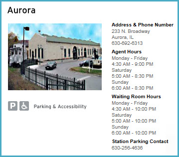
This is the end of the Metra Line. West of here the BNSF splits and continues west to Galesburg IL and beyond on the BNSF Transcon, on the Mendota Sub, and northwest on the Aurora Sub heading to Savanna, IL and on to Minneapolis/St Paul and further west to the far Northwest. There is a Metra coach yard located just east, and right next to the station is Two Brothers Roundhouse Restaurant and Brew Pub, located in the old, former CB&Q Roundhouse. There is a static display of a CB&Q Caboose at the station.
Two Brothers Roundhouse (Brew Pub)
205 North Broadway Street
Aurora, IL 60505
GPS: 41.76047 -88.30906
http://www.twobrothersroundhouse.com/
1903 Firehouse
RAILFAN GUIDES HOME
RAILROAD SIGNALS HOME
NEW
11/27/2013
Last Modified
04-Dec-2013