In General
Getting Here
Map
Sights
Pictures
Signals
Fire & Police
Floobydust
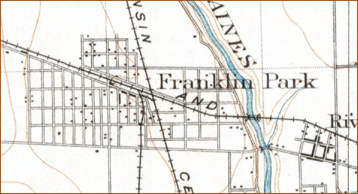
USGS Maps
RAILROAD SIGNALS HOME
Location / Name:
Franklin Park IL, Cook County
What's Here:
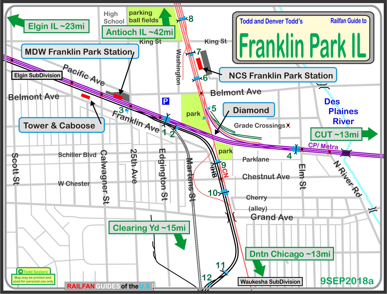
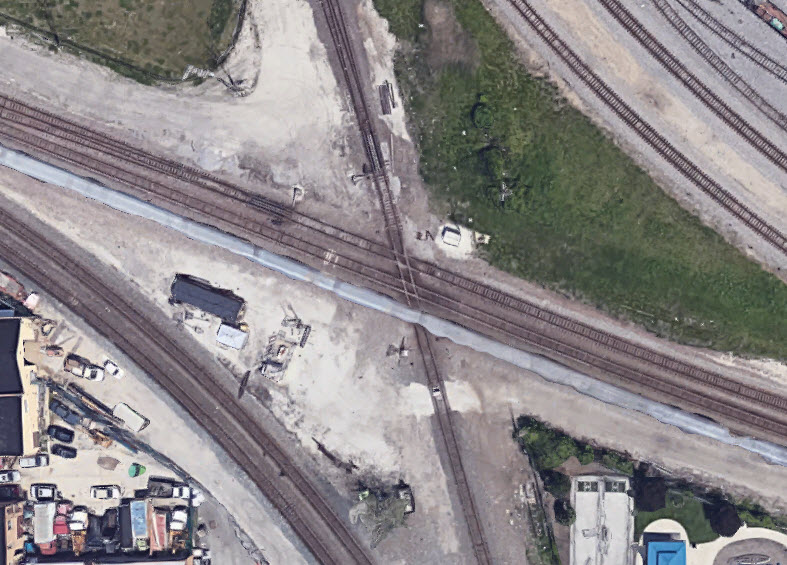
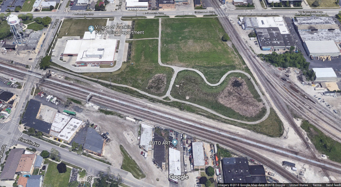
Diamond Junction
2 Metra Stations
IHB, CN, and CP/Metra Tracks
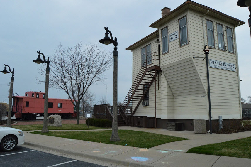
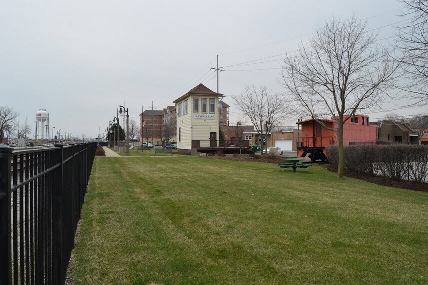
Tower Park, with a caboose and former Milwaukee Tower B-12
Data:
GPS Coordinates: as needed
Phone A/C: 847
ZIP: 60131
Access by train/transit:
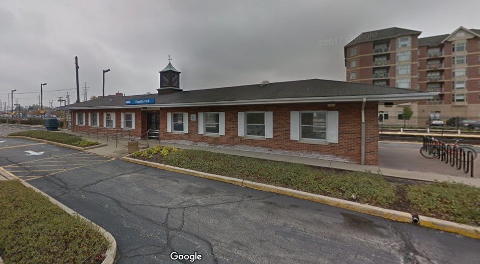
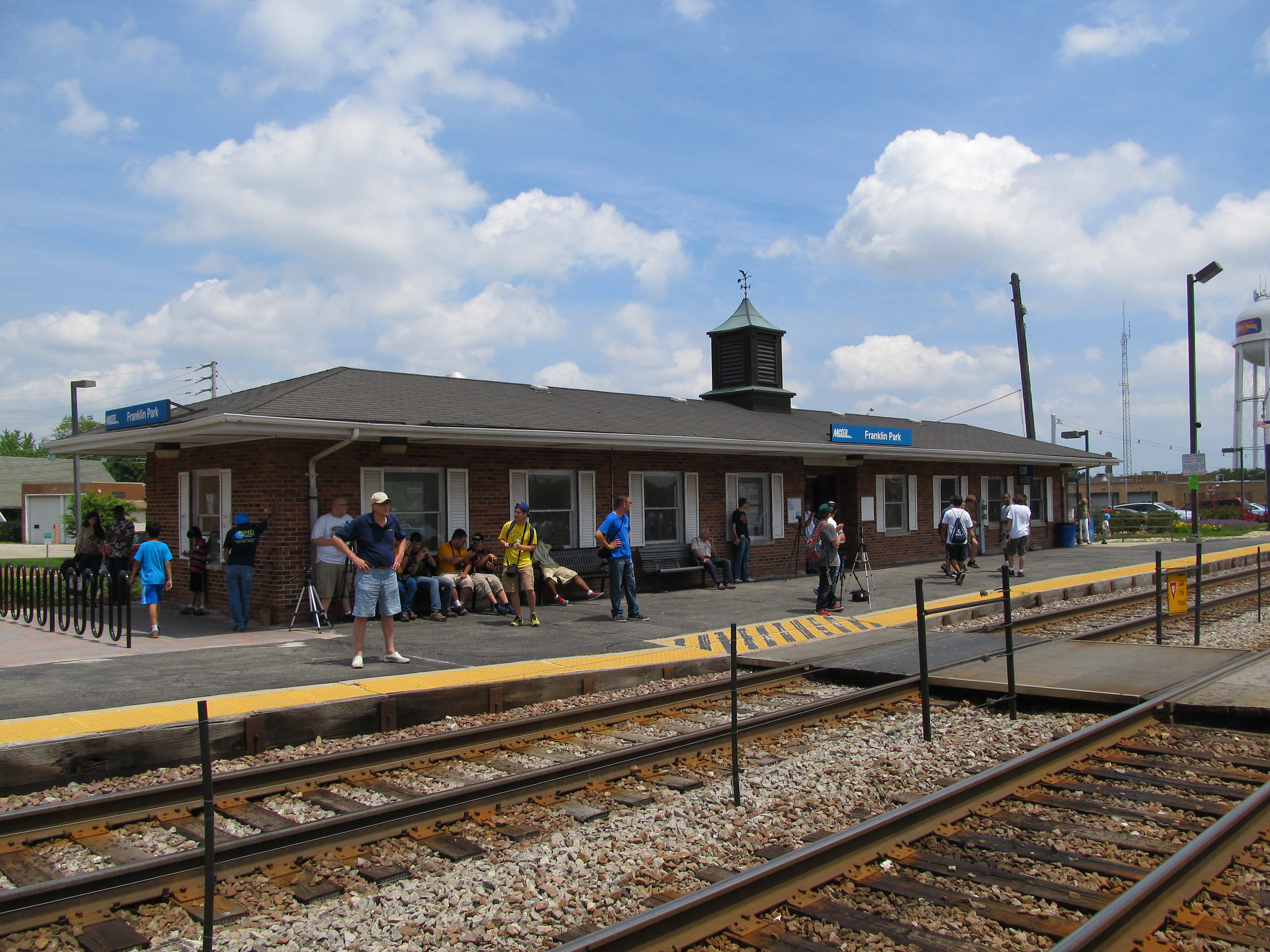
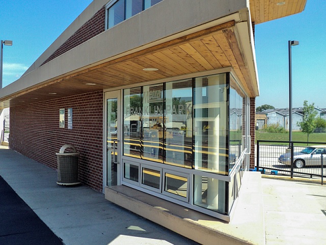
Franklin Park station on Metra NSB Line
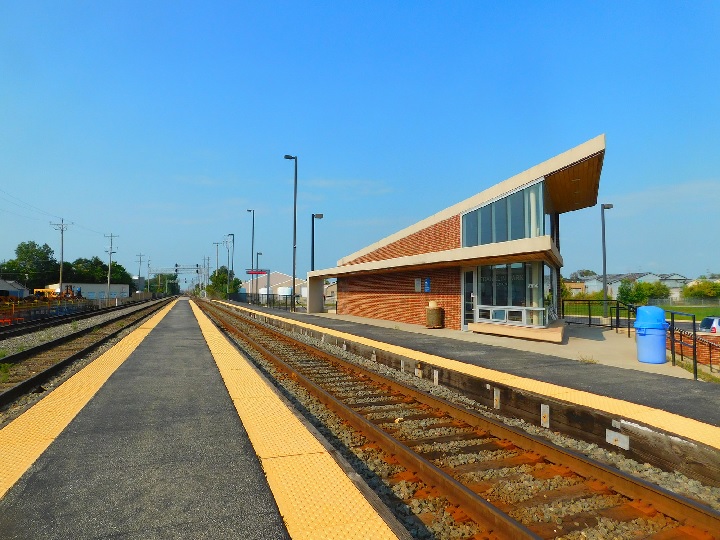
Franklin Park station on Metra M-DW Line
O'Hare Airport is about 7 miles away
Railroad Radio Freqs:
CN 161.295, 160.215
Metra/CP: 160.770, 161.520
IHB: 160.980, 161.070
The Scoop:
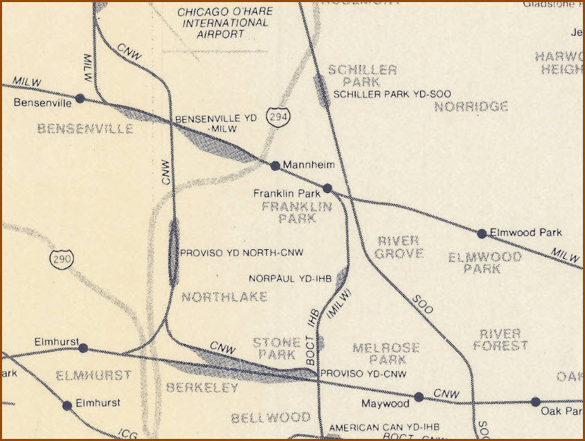
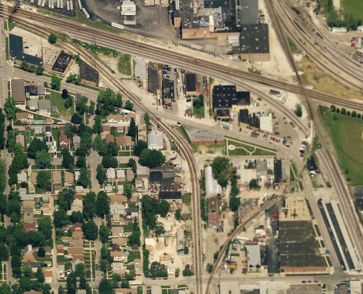
Franklin Park is a busy place.
You have two Metra lines originating at the Chicago Union Terminal (CUT) in downtown Chicago, that come thru and split in Franklin Park: the North Central Service line which is the one that diverges and heads north towards Antioch; and you have the Milwaukee District West line, which is the line that continues west from Franklin Park.
As far as freight action goes, you have the Indiana Harbor Belt, Canadian National, and Canadian Pacific freights competing for times in between the commuter trains (or is it the other way around?).
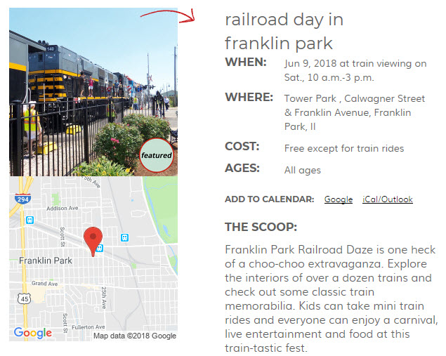
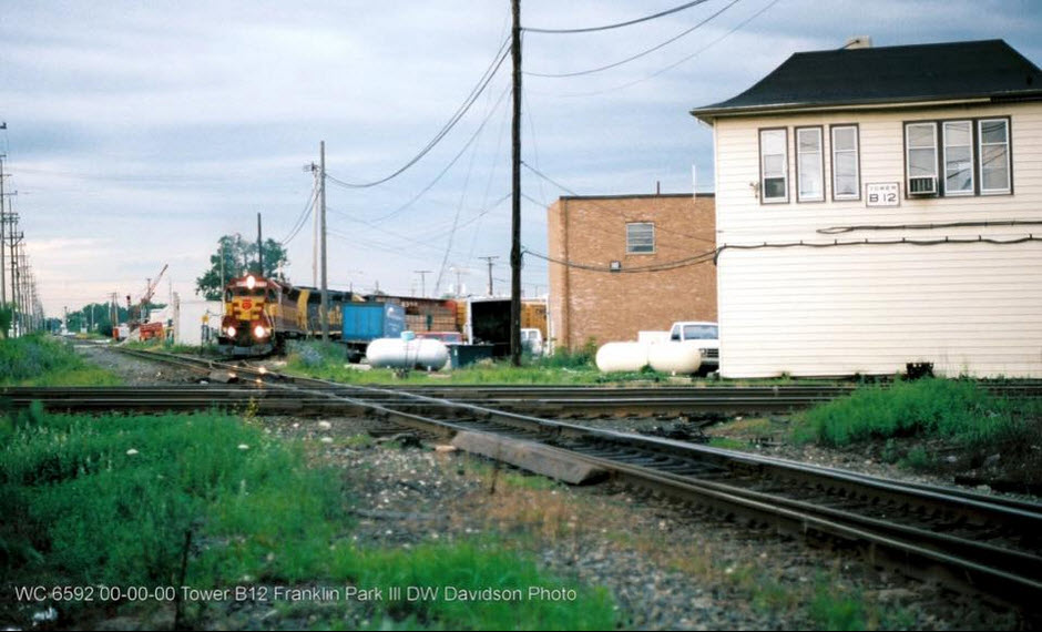
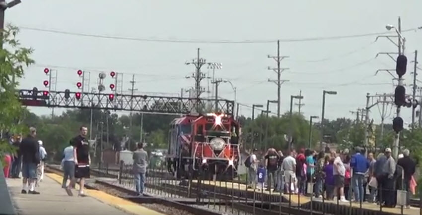
The north/south CN line (former Wisconsin Central) crosses the east/west CP line cross each other here, and the tower that used to stand over the action, tower B-12, has been moved about a half mile west to a railfan park along with a caboose. Every year in June, Franklin Park hosts their RAILROAD DAZE, an event that shouldn't be missed.
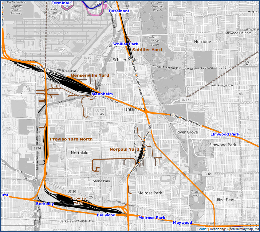
Canadian Pacific's (former Milwaukee (and SOO)) Bensenville Yard is just to the west on the other side of the Metra station, and this is where the IHB tracks are heading to. And speaking of the IHB, they did a track re-alignment, completed around the end of 2006, and moved their two tracks alongside the CN tracks, and turned the old R-O-W into Martens St. The new alignment reduces the number of grade crossings south of here, and consolidates train movements in the area to one location instead of two. The IHB sees about 25 trains a day. You will also see on the IHB, trains of CP, Norfolk Southern, CSX and the Belt Railway.
Franklin Park is in the close vicinity of five yards: CP's Bensenville Yard, IHB's Norpaul Yard, UP's Proviso Yard, UP's Proviso Yard North, and CN's Schiller Yard.
This was a Trains Magazine hotspot in the September 2018 issue, but it should have been a four page spread to do it any justice.
Acknowledgements:
Denver Todd
William F Kane
DW Davidson
Edward Kwiatkowski
Jonathan Lee
SOO6061
Websites and other additional information sources of interest for the area:
http://industrialscenery.blogspot.com/2016/03/milws-tower-b-12-milw-vs-ihb-franklin.html
http://industrialscenery.blogspot.com/2016/03/franklin-parks-railfan-park-tower-b-12.html
https://www.youtube.com/watch?v=_yWyetx3B0E
http://www.dhke.com/CRJ/frankpk.html
Getting to Franklin Park is fairly easy. Take the Eisenhower Expressway (I-290) west to 25th Avenue (Lyman Avenue) in the suburb of Bellwood. Head north on 25th about five miles to Franklin Park and turn right on Franklin Street. Turn left at Edgington Street and go north a block to the tracks. Parking is available on the south side of the tracks. It's even easier to take a Metra Milwaukee West Line train from Union Station to the Franklin Park station and walk east a few blocks. The junction is three blocks east of Edgington. To reach the diamonds, continue east on Franklin Street to the point where it curves south.
GPS Coordinates: 41.934221, -87.858809
3x1 (3 E/W, 1 N/S)
Angle = 54 Degrees
The tower was closed on July 19, 1996, and was moved on November 11, 1997 to help create the railfan park. The tower has been modified slightly from its original appearance by using vinyl siding, but at least it will make the tower last a bit longer.
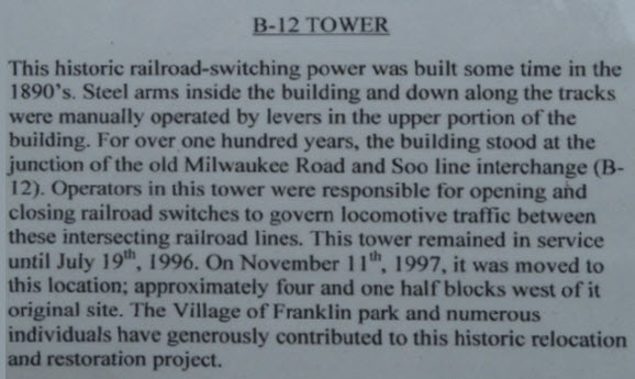 I think they meant to say TOWER instead of POWER.
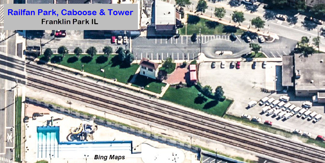
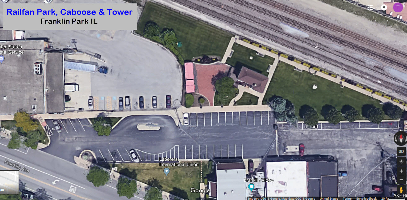
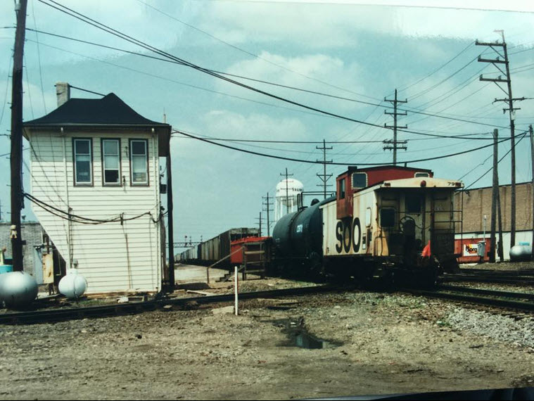 photo by William F Kane
Tower B-12 on what used to be the Milwaukee Road. This is the new Soo (now CP) crossing the old Soo (now CN.)
The NCS Line (North Central Service), which, up to this point in Franklin Park, runs west out of Chicago Union Terminal (CUT), takes an interchange track before hitting the diamond, to head north about 42 miles to the end in Antioch. Franklin Park is the first station on the north/south portion of the line.
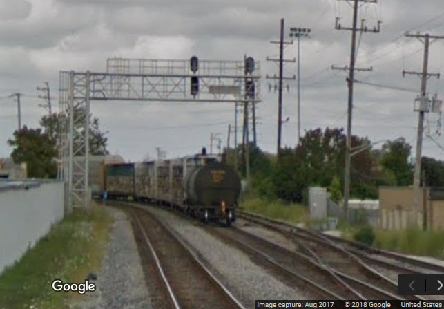
With all of the track around here, and the diamond, you can imagine that there are signals all over the place :-)
I can use some close-up and personal pictures of the signals if anyone visits the area and would like to share and be famous.
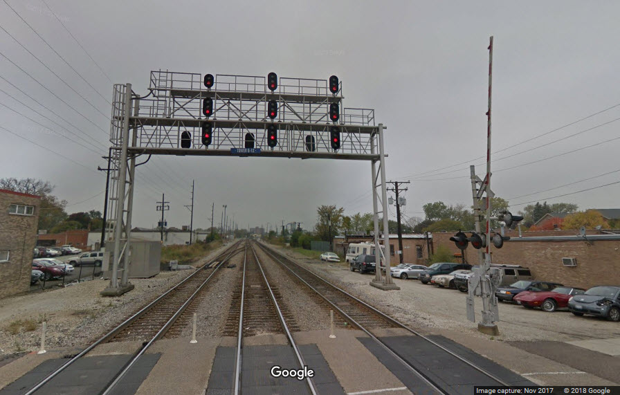
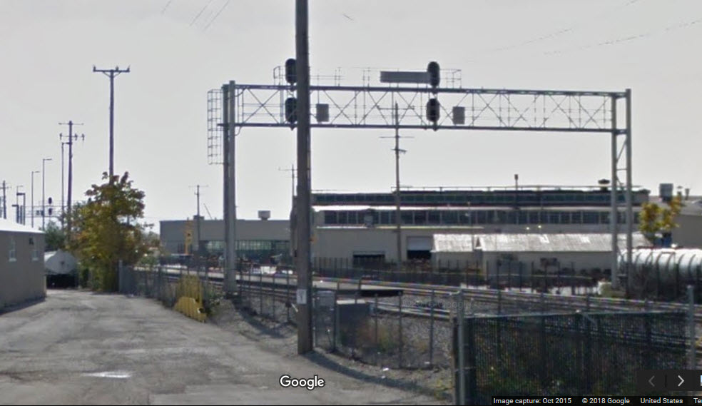
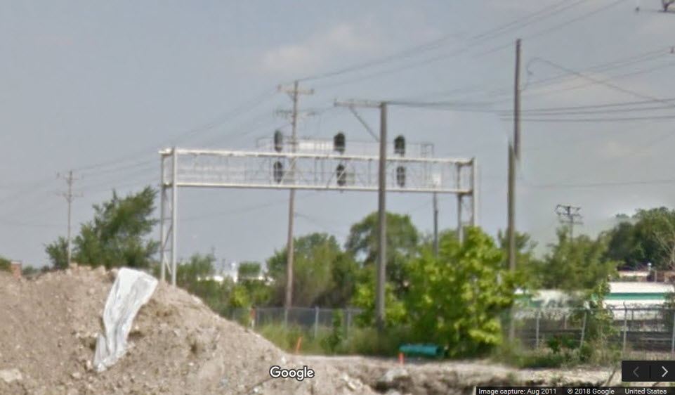
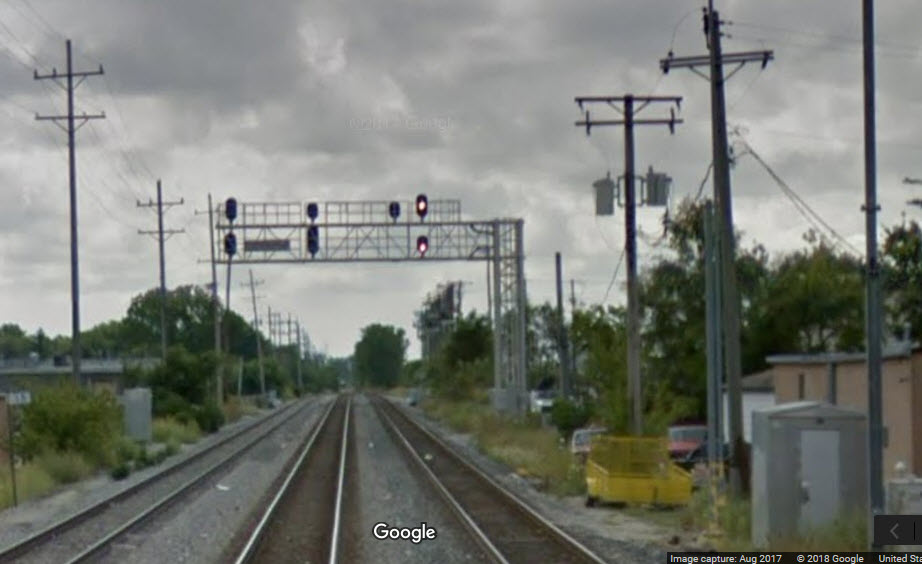
There are two sets of signals just west of the diamond. One is a substantial signal bridge spanning all 5 tracks, which has signals for both directions of the CP/Metra line. The other set of signals (set 2) is on a cantilever bridge, and is for the two IHB tracks heading into Bensenville Yard.
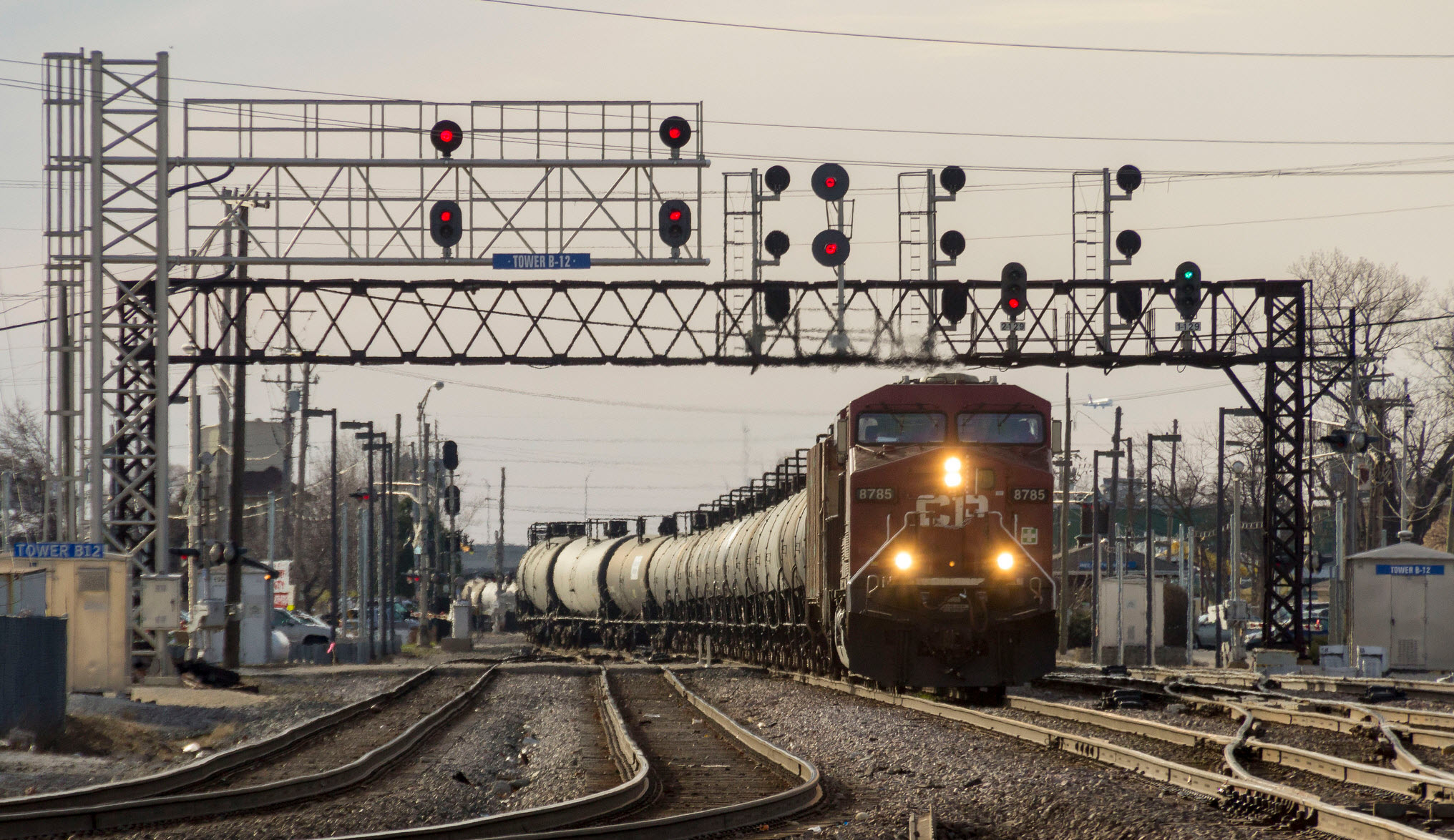 photo by Jonathan Lee, 2017
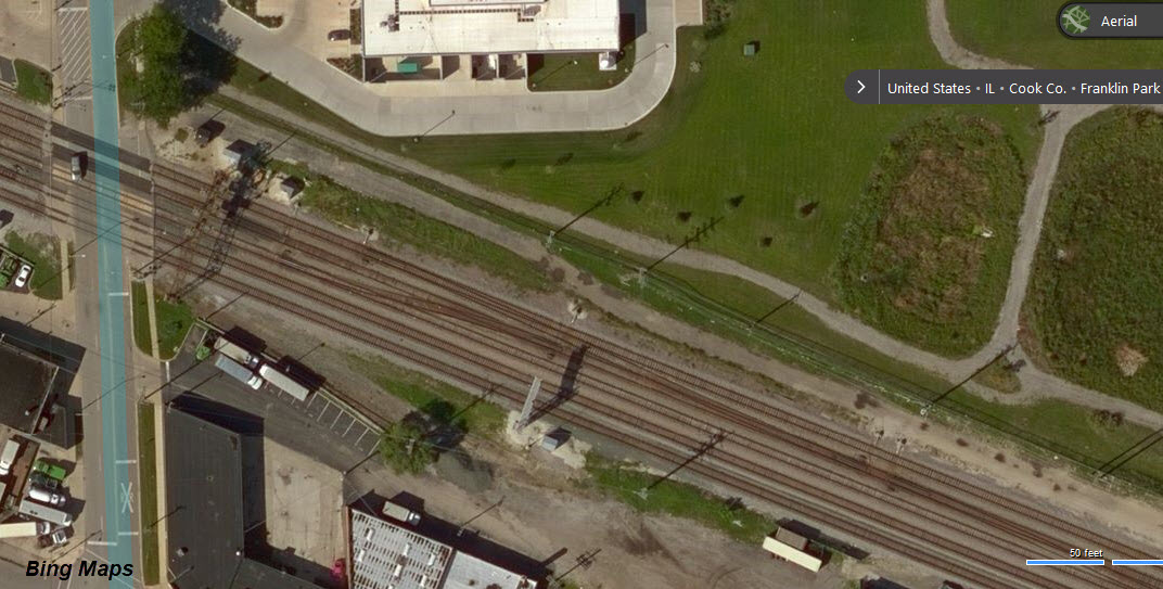
 RR Days, 2013
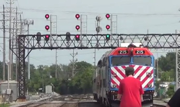
Need good pictures.
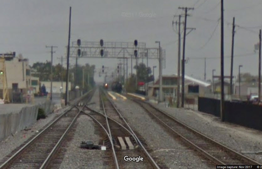
This is the only picture I have come across that shows this lone signal, which is on the far right, unlit.
The signal is to protect the two interchange tracks with the Canadian Pacific.
We are fortunate to have the signals right at the Elm Street grade crossing.
Notice the signals are interlocking for WB traffic, and intermediates for WB trains.
This streetview shot actually shows the signal from the rear (the one on the left), and the signals down at the diamond (5a) and beyond (9, 10).
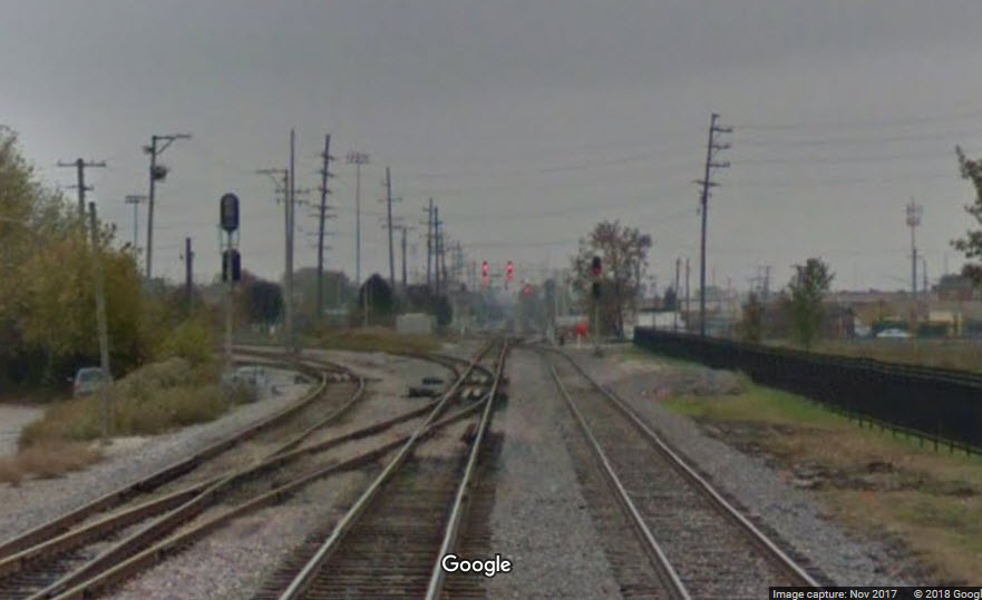
This signal is for SB traffic joining the main and going across the diamond, can't tell if there is one for the other track, there could be a dwarf not evident in the picture.
Need good pictures.
In this picture from Google's Streetview, you can see all three sets of signals at location 6, 7, and 8 (not particularly well, but they're there).
Need good pictures.
Need good pictures.
Need Good Pictures
Need Good Pictures
Need Good Pictures
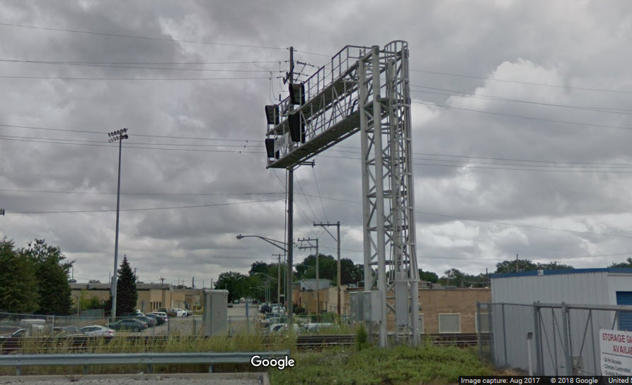
Google streetview has a vantage point for this location, but there is a lightpole right in the middle of the cantilever bridge.
On it's way to Owosso MI for the steam spectacular in 2009, we have 4449 posed in front of the Franklin Park Tower, Saturday, August 1st 2009.
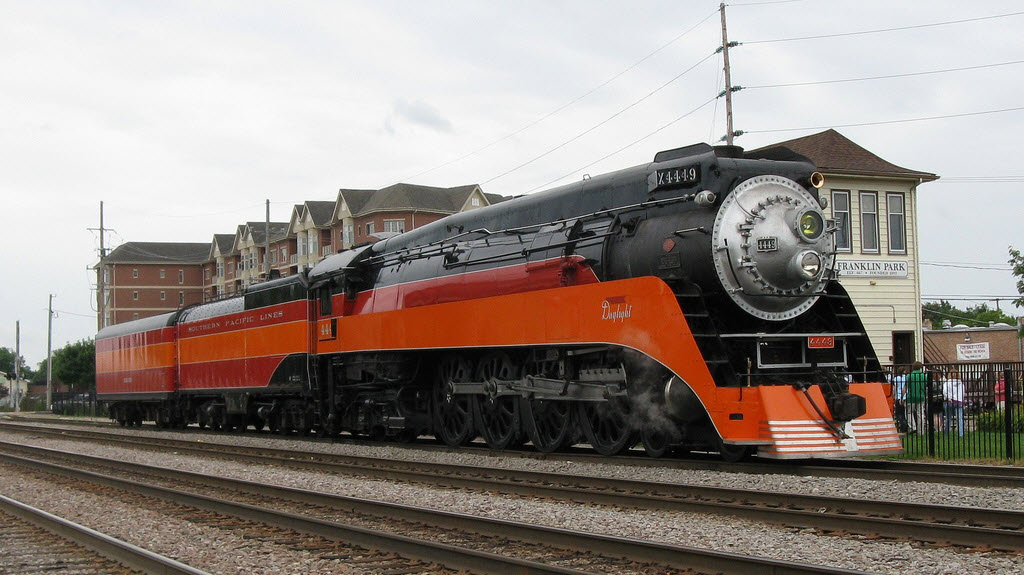 photo by Edward Kwiatkowski
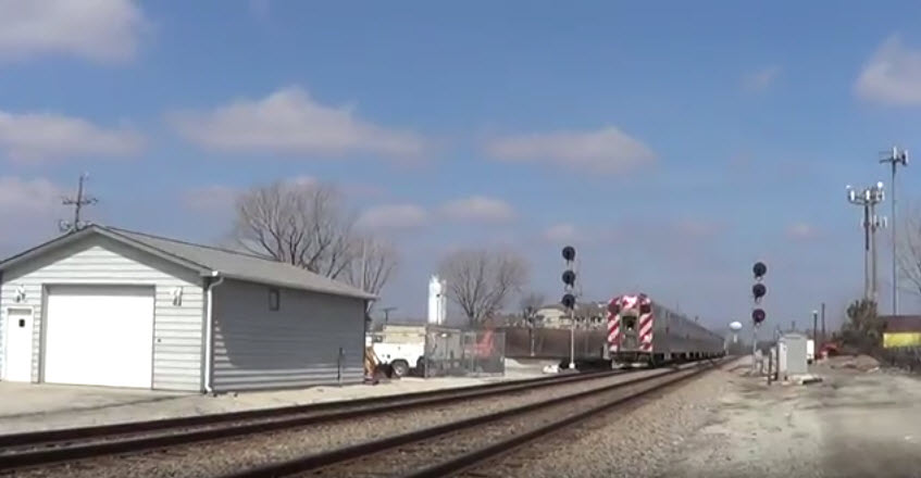 2013
2013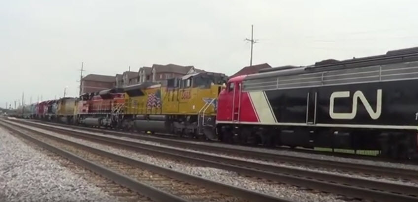 Railroad Days, 2013
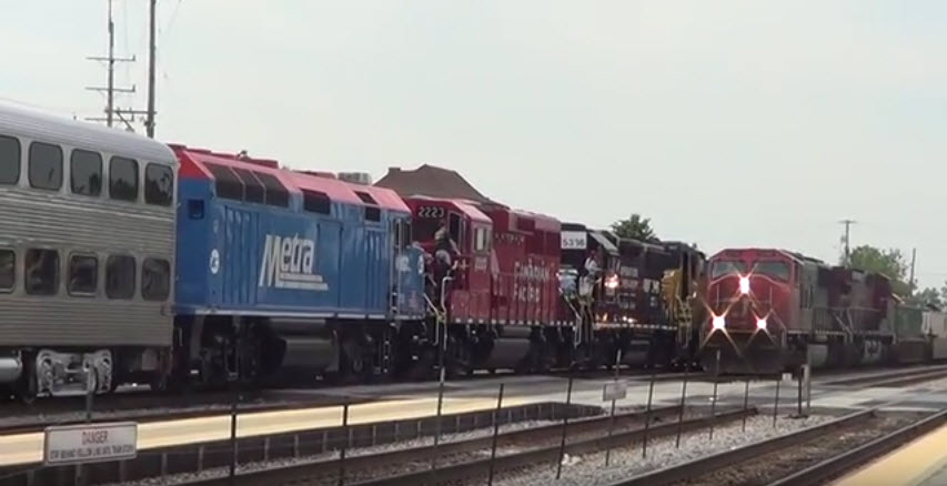 Railroad Days, 2013
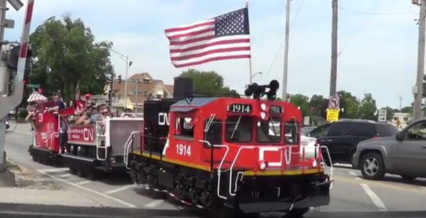 Railroad Days, 2013, now is this cool or what?
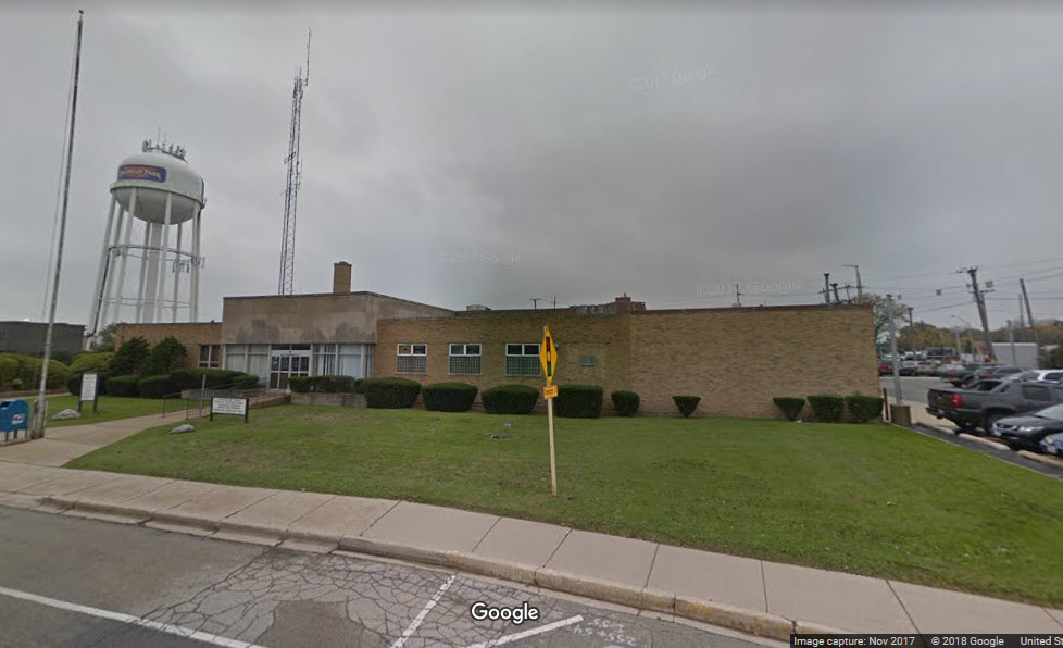
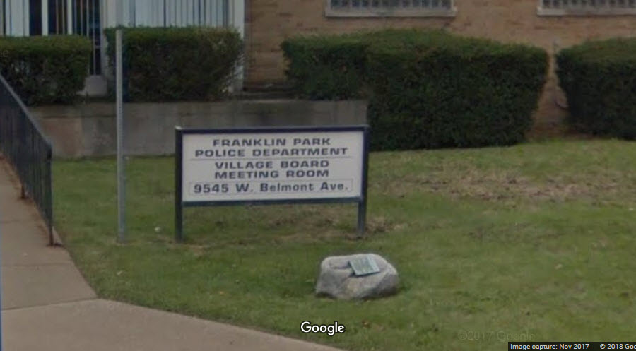
Franklin Park Police Department HQ
GPS Coordinates: 41.936448, -87.864607
9545 W. Belmont Ave.
Notice that you can get good pictures of action at the diamond from the park next to the police station.
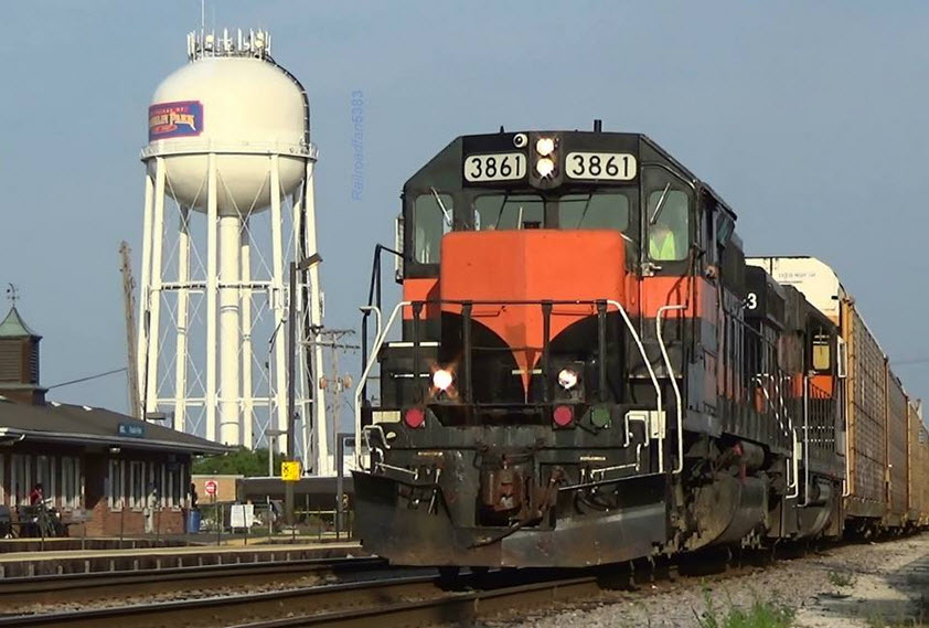
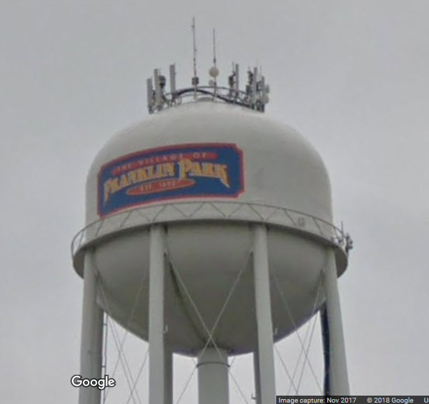
the Franklin Park Water Tower
One of the nicer paint jobs to adorn a water tower.
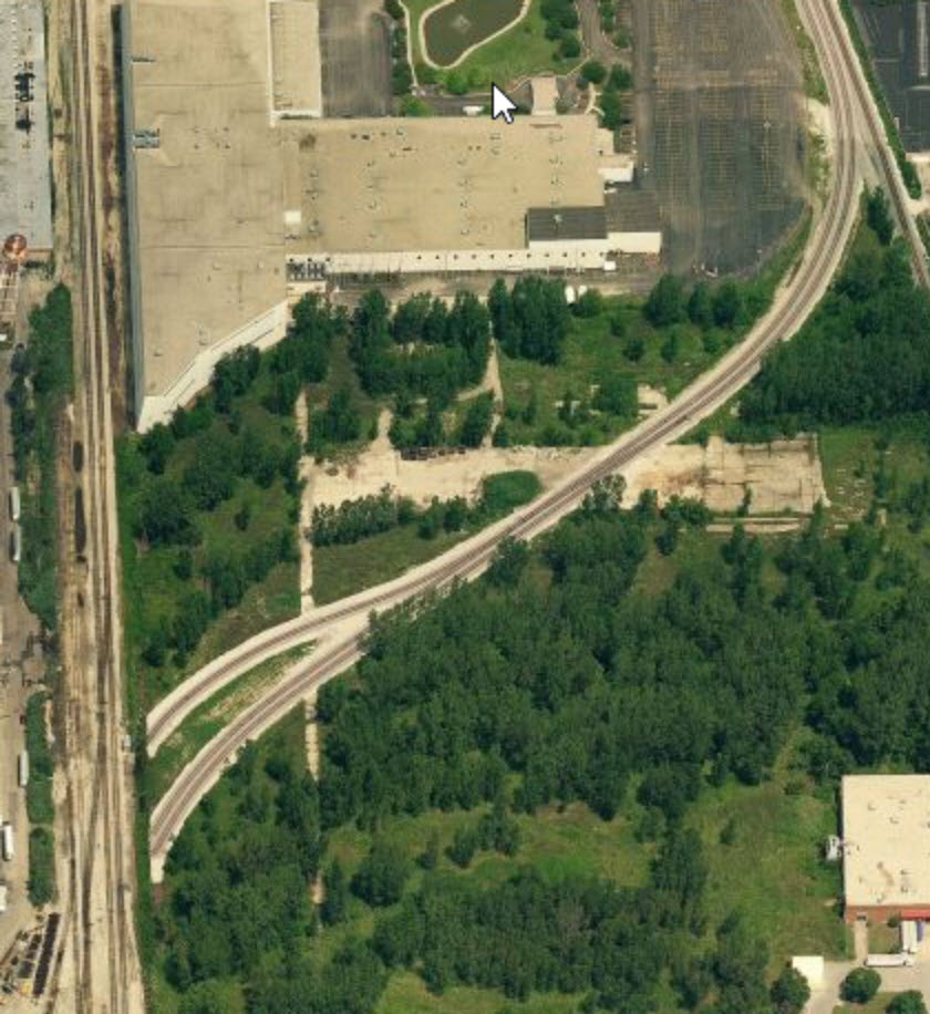
IHB Track Re-Alignment
Not sure when it happened, but one website did the same thing I do, and scoured Bing for "old" aerials of the area.
The dotted yellow line in the aerial photo below shows where the tracks used to run.
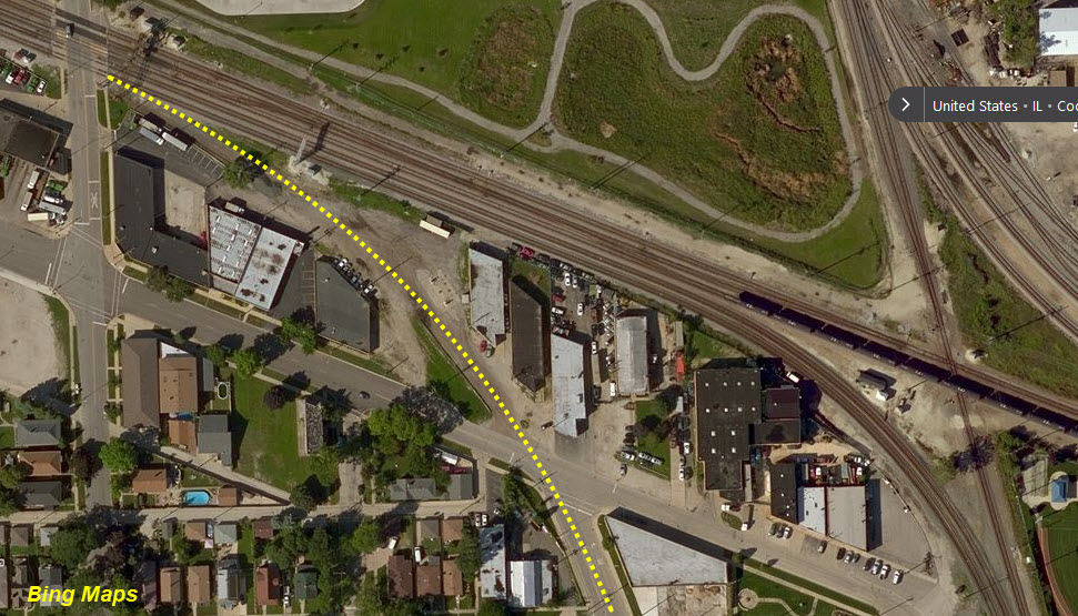
The pictures below are old screen captures from Bing Maps.
Courtesy of the University of Texas Library, click here for their index page.

Disclaimers:
I love trains, and I love signals. I am not an expert. My webpages reflect what I find on the topic of the page. This is something I have fun with while trying to help others.
Please Note: Since the main focus of my two websites is railroad signals, the railfan guides are oriented towards the signal fan being able to locate them. For those of you into the modeling aspect of our hobby, my indexa page has a list of almost everything railroad oriented I can think of to provide you with at least a few pictures to help you detail your pike.
If this is a railfan page, every effort has been made to make sure that the information contained on this map and in this railfan guide is correct. Once in a while, an error may creep in :-)
My philosophy: Pictures and maps are worth a thousand words, especially for railfanning. Text descriptions only get you so far, especially if you get lost or disoriented. Take along good maps.... a GPS is OK to get somewhere, but maps are still better if you get lost! I belong to AAA, which allows you to get local maps for free when you visit the local branches. ADC puts out a nice series of county maps for the Washington DC area, but their state maps do not have the railroads on them. If you can find em, I like the National Geographic map book of the U.S..... good, clear, and concise graphics, and they do a really good job of showing you where tourist type attractions are, although they too lack the railroads. Other notes about specific areas will show up on that page if known.
Aerial shots were taken from either Google Maps or www.bing.com/maps as noted. Screen captures are made with Snagit, a Techsmith product... a great tool if you have never used it!
By the way, floobydust is a term I picked up 30-40 years ago from a National Semiconductor data book, and means miscellaneous and/or other stuff.
Pictures and additional information is always needed if anyone feels inclined to take 'em, send 'em, and share 'em, or if you have something to add or correct.... credit is always given! Please be NICE!!! Contact info is here
Beware: If used as a source, ANYTHING from Wikipedia must be treated as being possibly being inaccurate, wrong, or not true.
SEPTA HOMEPAGE
RAILFAN GUIDES HOME
RAILROAD SIGNALS HOME
NEW 07/01/2017
Last Modified
10-Sep-2018