In General
Getting Here
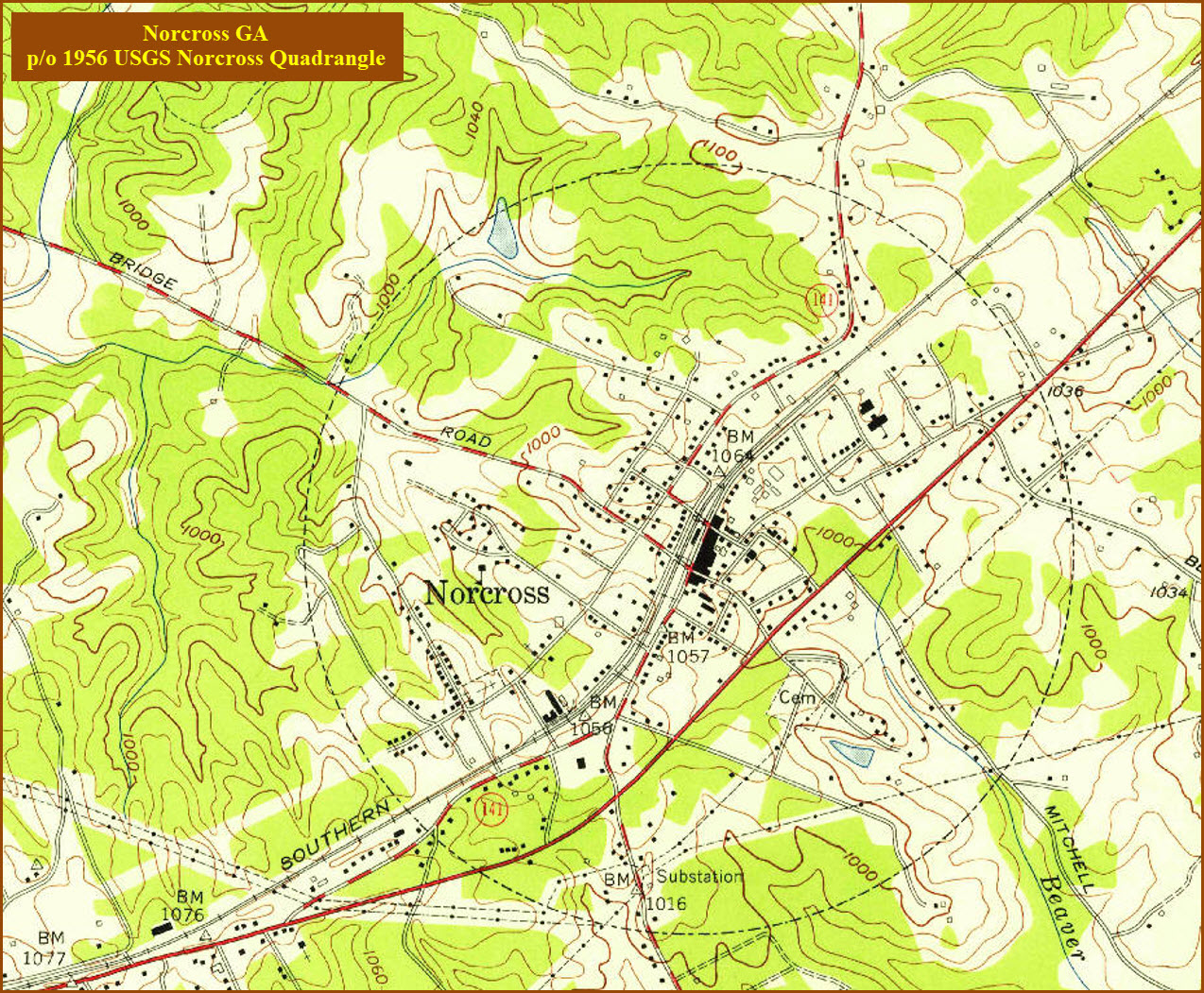
Map
Sights
Bridges
Signals
Fire & Police
Floobydust
USGS Maps
RAILROAD SIGNALS HOME
Location / Name:
Norcross GA, Gwinnett County
What's Here:
Norcross Depot
Norfolk Southern Mainline from Atlanta to SC, NC and Petersburg VA
Data:
GPS Coordinates: as needed
Phone A/C: 770
ZIP: 30071
Access by train/transit:
None
The Scoop:
Duluth and Norcross GA sit on the north east side of Atlanta. The main line going through there is Norfolk Southern, and is the old Southern Railway line. If we keep going north, we will pass through Spartansburg SC, Charlotte and Raleigh NC (and the historic Spencer Shops), Lynchburg VA, and finally wind up in Manassas VA. Another route also takes you over to Petersburg and Richmond VA. Last I heard, there were around 10-15 trains a day, plus Amtrak.
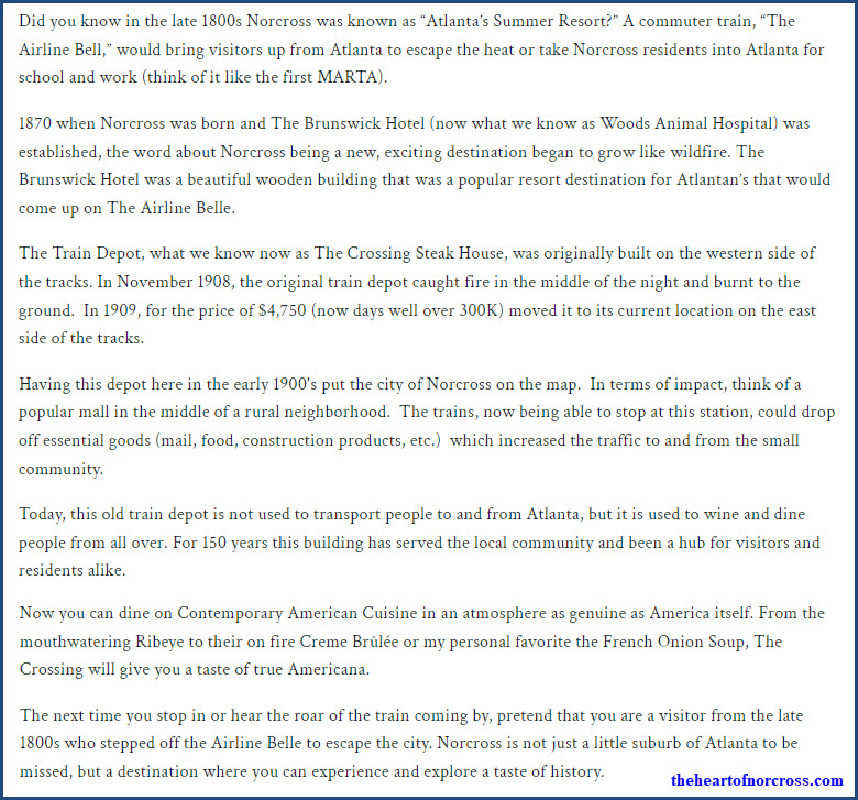
Norcross hosts a former SR depot that is now being used as a restaurant.
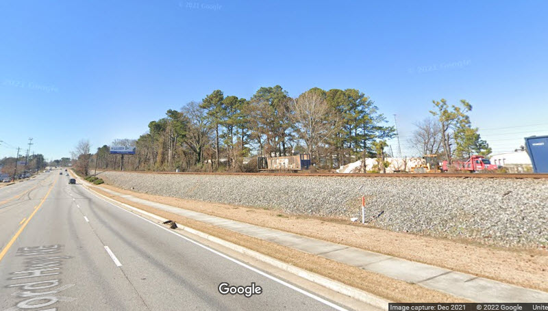
Also in Norcross, the tracks are adjacent to Buford Hwy for about 1.5 miles, giving you a pretty clear shot in both directions, but you will have to park on the opposite side and be careful in crossing the road. The view below is across from Cornerstone Automotive.

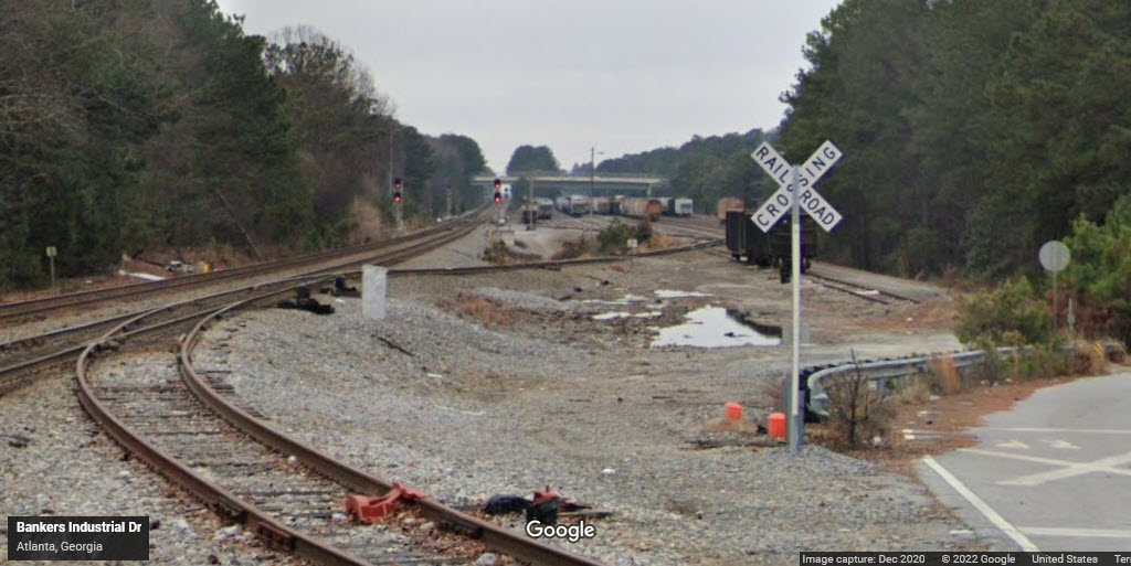
Just south of where the road and right-of-way leave each other is a small 11 track yard (the red "X" in the picture above), the north end of which can be viewed from Bankers Industrial Drive. If you have a good telephoto lens, you can probably get decent pictures of NB freights splitting the signals adjacent to the yard, the signals protect a pair of crossovers.
Just south of Norcross is Doraville, where there is another (bigger) Norfolk Southern yard, and we have the last stop on the MARTA Northeast line.
Just north of Norcross is Duluth, where you have another SR depot, and the Southeast Railroad Museum.
Acknowledgements:
Denver Todd
Google Maps
Bing Maps
Wikipedia
USGS
the clio.com
the heart of norcross.com
Websites and other additional information sources of interest for the area:
https://www.theclio.com/entry/40821
https://www.norcrossga.net/325/History
https://www.theheartofnorcross.com/businessdirectory/the-crossing-steakhouse-history
https://www.duluthhistoricalsociety.org/duluth_train_depot
The main access to Norcross is I-85, which comes out of Atlanta and heads NE to South Carolina.
I-85 exit #99 for the south end of Norcross, go north at the exit on Jimmy Carter Blvd/140, to Buford Hwy (about 1.6mi).
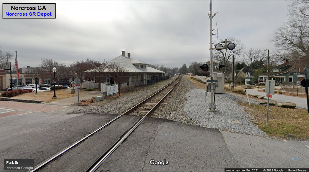
The tracks are about 800 feet north of Buford Hwy.
The Norcross Depot is about halfway between Jimmy Carter Blvd, and Beaver Ruin Rd, so take your pick depending on which way you are coming from.
Exits #101 and #102 to reach the northern side of Norcross. Exit 102 is Beaver Ruin Rd/378. Exit #101 takes you to Beaver Ruin Rd.


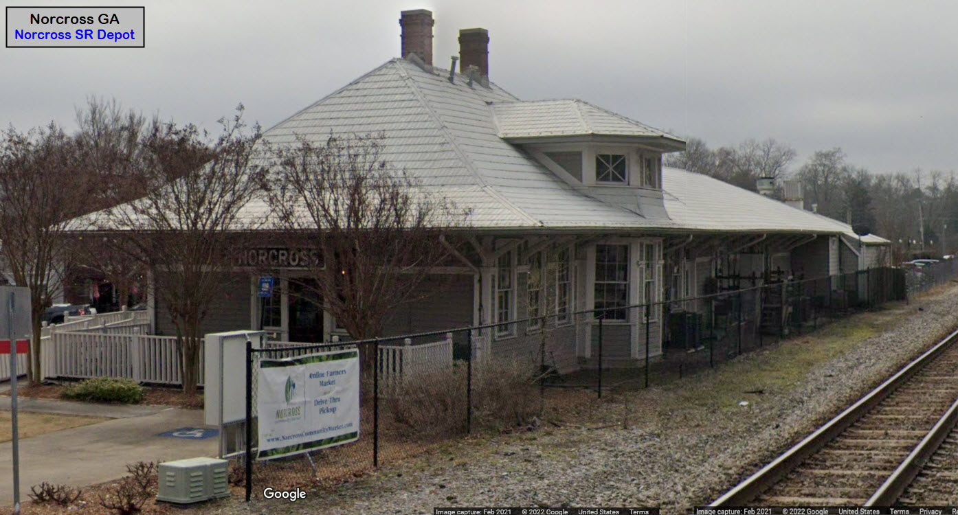
GPS Coordinates: 33.94219, -84.21344
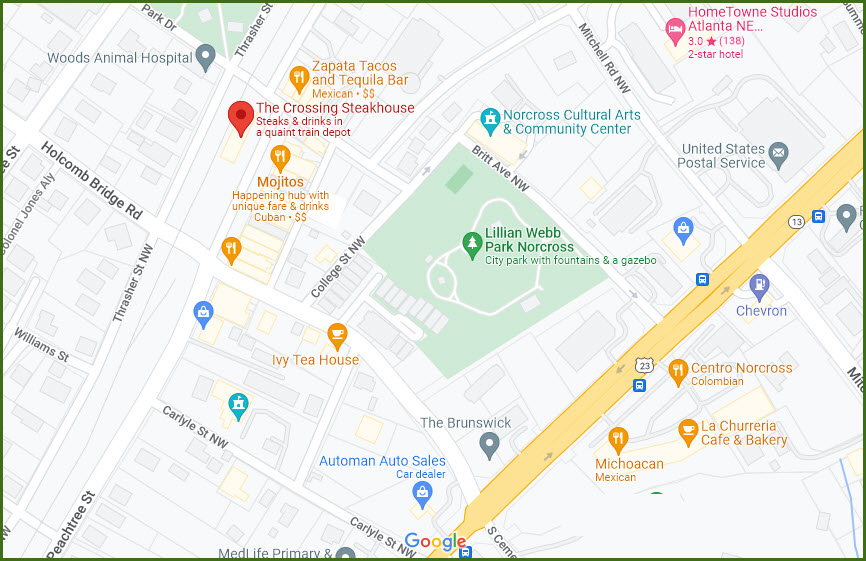
40 South Peachtree St, Norcross GA 30071
678-280-9081
This former Southern depot is now The Crossing Steakhouse. From their menu, it looks like they have an American type faire, at pretty reasonable prices, hope I can get there sometime to try it out :-).

Bridges, Overpasses and Tunnels
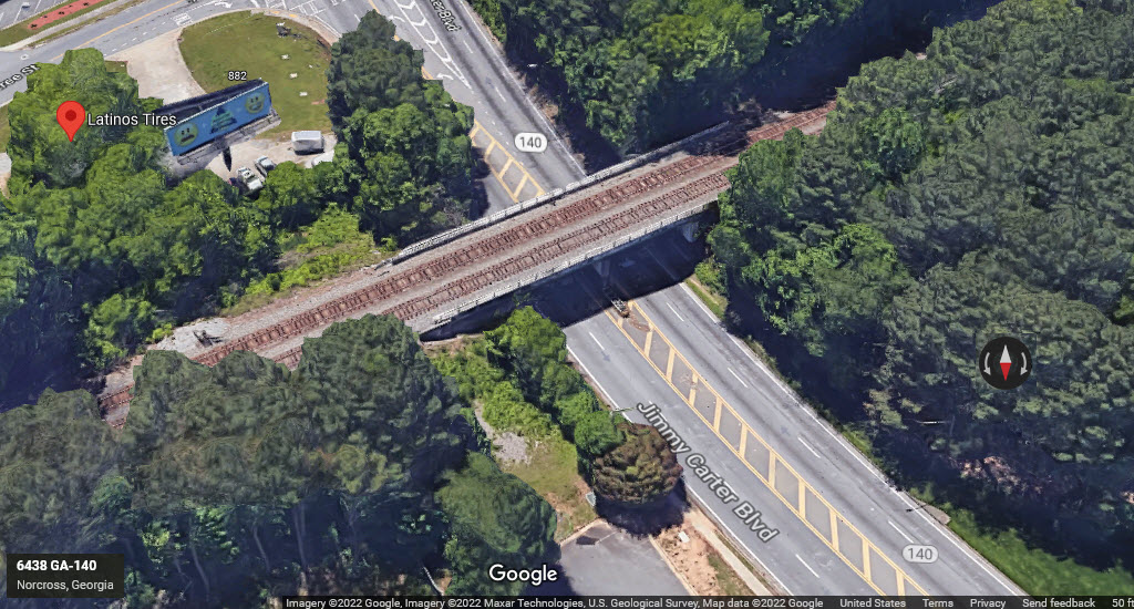
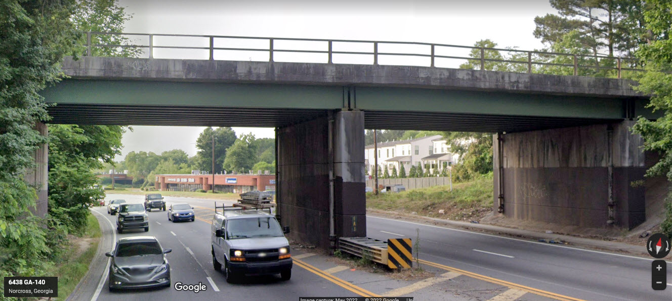
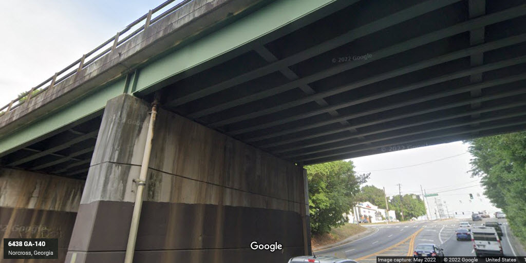
GPS Coordinates: 33.93411, -84.22346
Steel beam bridge spans on concrete abutments, 11 beams for each of the two spans, each span goes over two lanes of traffic, with two tracks.
GPS Coordinates: 33.91737, -84.26058
Difficult to get pictures of without some walking, but if you want to do some walking, you can get fairly good pictures from the Oakcliff Road overpass, which is the overpass in the distance in the screenshot below.

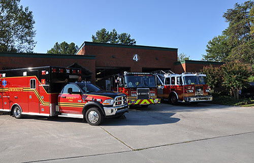
Gwinnett County Fire and Emergency Services has 31 fire stations to serve and protect you. There's more on the Duluth page.


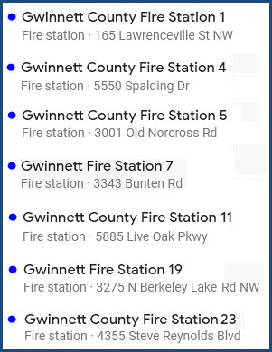
https://www.gwinnettcounty.com/web/gwinnett/departments/fireandemergencyservices/organization/divisions/operations/stations/
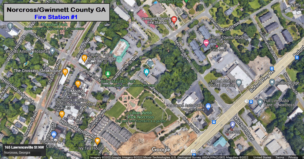
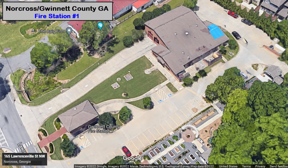
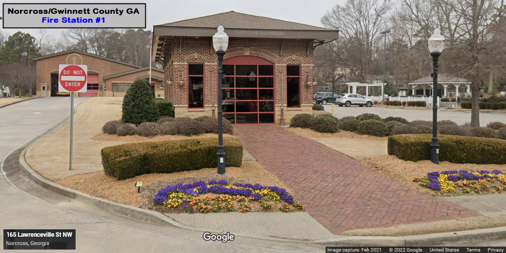
GPS Coordinates: 33.94341, -84.21027
165 Lawrenceville Street, Norcross GA 30071
Engine 1, Medic 1

 From the Gwinnett County Fire Website
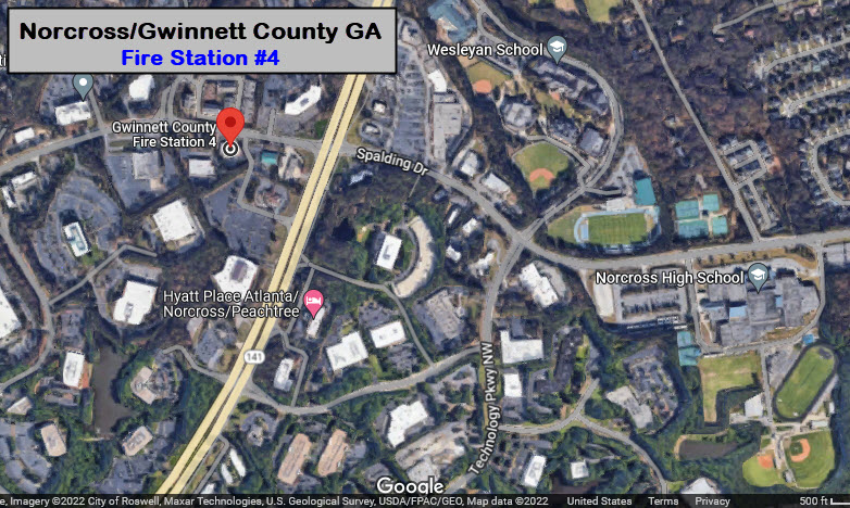
GPS Coordinates: 33.96982, -84.22368
5550 Spalding Drive, Peachtree Corners GA 30092
Engine 4, Truck 4, Medic 4
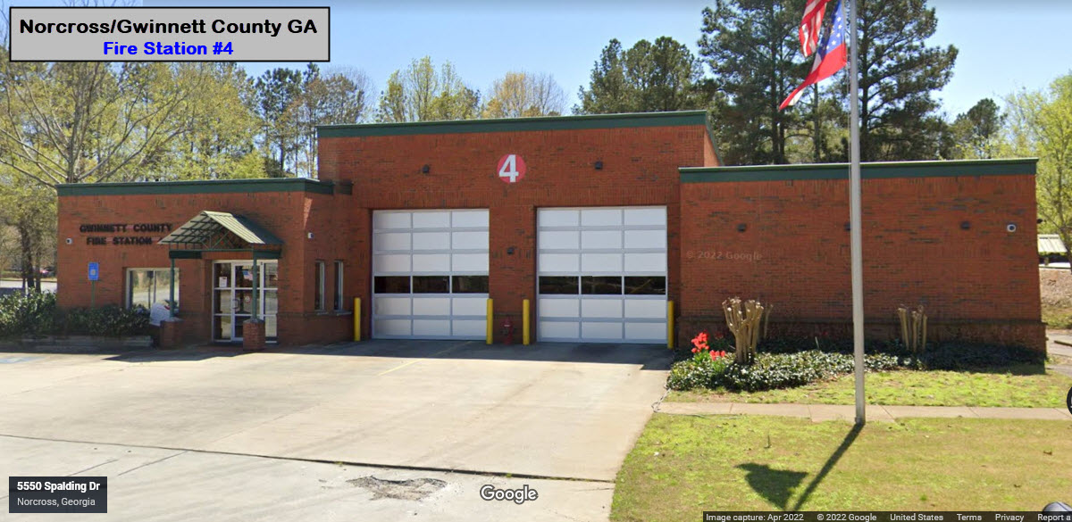
 From the Gwinnett County Fire Website
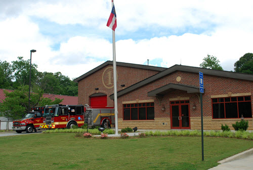
GPS Coordinates: 33.94277, -84.21181
65 Lawrenceville St NW, Norcross GA 30071
770-448-2111
If you're having lunch at the Crossing Steakhouse, it is a short walk!


?
None for now....
Courtesy of the USGS, click here for their index page.
Disclaimers:
I love trains, and I love signals. I am not an expert. My webpages reflect what I find on the topic of the page. This is something I have fun with while trying to help others.
Please Note: Since the main focus of my two websites is railroad signals, the railfan guides are oriented towards the signal fan being able to locate them. For those of you into the modeling aspect of our hobby, my indexa page has a list of almost everything railroad oriented I can think of to provide you with at least a few pictures to help you detail your pike.
If this is a railfan page, every effort has been made to make sure that the information contained on this map and in this railfan guide is correct. Once in a while, an error may creep in :-)
My philosophy: Pictures and maps are worth a thousand words, especially for railfanning. Text descriptions only get you so far, especially if you get lost or disoriented. Take along good maps.... a GPS is OK to get somewhere, but maps are still better if you get lost! I belong to AAA, which allows you to get local maps for free when you visit the local branches. ADC puts out a nice series of county maps for the Washington DC area, but their state maps do not have the railroads on them. If you can find em, I like the National Geographic map book of the U.S..... good, clear, and concise graphics, and they do a really good job of showing you where tourist type attractions are, although they too lack the railroads. Other notes about specific areas will show up on that page if known.
Aerial shots were taken from either Google or Bing Maps as noted. Screen captures are made with Snagit, a Techsmith product... a great tool if you have never used it!
By the way, floobydust is a term I picked up 30-40 years ago from a National Semiconductor data book, and means miscellaneous and/or other stuff.
Pictures and additional information is always needed if anyone feels inclined to take 'em, send 'em, and share 'em, or if you have something to add or correct.... credit is always given! Please be NICE!!! Contact info is here
Beware: If used as a source, ANYTHING from Wikipedia must be treated as being possibly inaccurate, wrong, or not true.
RAILFAN GUIDES HOME
RAILROAD SIGNALS HOME
NEW 13JUN2022
Last Modified 13-Jun-2022