RAILFAN GUIDES of the U.S.
Todd's Railfan Guide to
ATLANTA GA
the Downtown Area
In General
Getting Here
Map
Sights
Pictures
Bridges
Signals
Fire & Police
Floobydust
USGS Maps
RAILROAD SIGNALS HOME
Location / Name:
Atlanta GA, Fulton (mostly) and DeKalb Counties
What's Here:
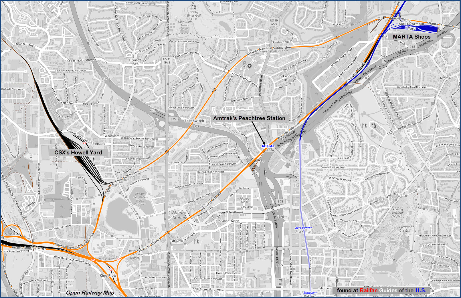
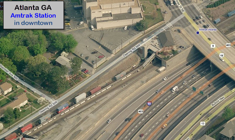
Amtrak's Peachtree Station
MARTA's Armour Yard
CSX's Howell Yard
Data:
GPS Coordinates: as needed
Phone A/C: 404/770
ZIP: 30303
Access by train/transit:
Amtrak
MARTA
The Scoop:
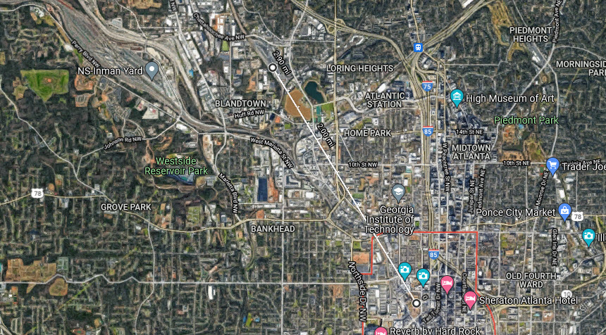
This page is kind of a misnomer, because the area I'm covering here is approximately 3 miles North West of the downtown area. However, in relation ot everything else covered as part of the Atlanta guide, and the surrounding neighborhoods, it is basically "downtown". The aerial shot below measures from downtown to Howell Yard.
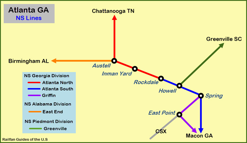
Here is an overview of the Norfolk Southern lines in and out of the Atlanta area:
Acknowledgements:
Denver Todd
Websites and other additional information sources of interest for the area:
https://blog.adaptershack.com/category/atlanta-railfan-locations/ Good railfanning info
https://www.youtube.com/watch?v=RgePMguC6CI
Getting to G
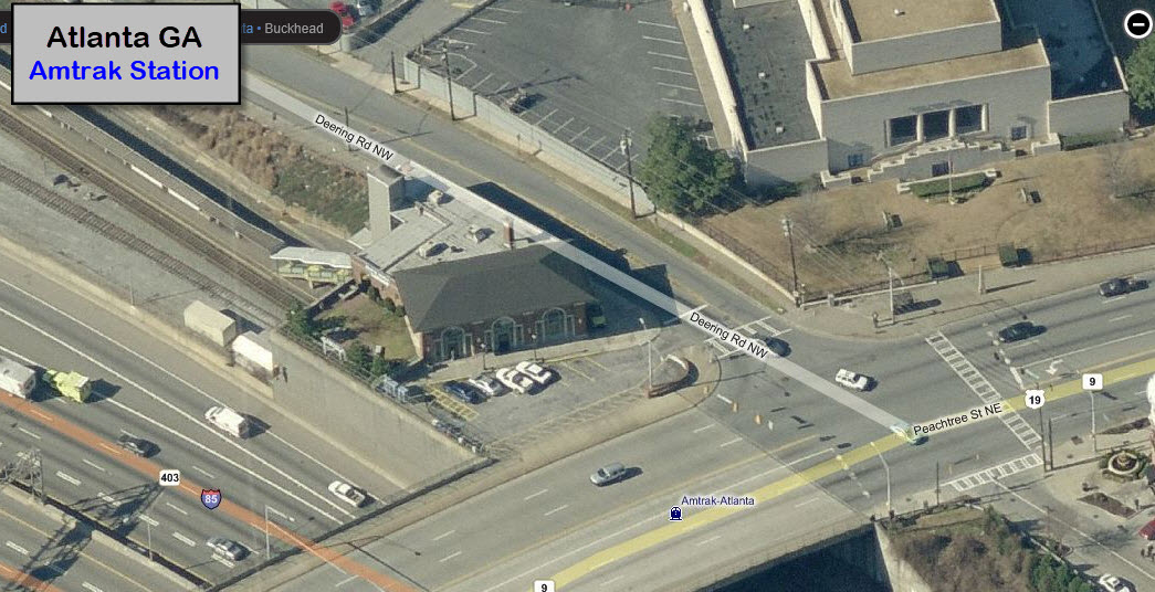
GPS Coordinates: 33.79938, -84.39264
1688 Peachtree Rd NW, Atlanta GA 30309
There is not a whole lot of parking available at the station - 7 spots, and it may be very limited in terms of you being able to park for railfanning purposes... I can't say, I've never been to the station.
Directions:
To get here from I75: take the Northside Dr NW exit (exit 252) and go north to Collier Rd NW, where you want to take a right. This will take you over to Peachtree RD NE, where you will take another right.
From I85: Things are a little more complicated. If you're travelling I85 southbound, after going under Peachtree, the road makes a substantial left curve... stay to the right for the exit ramps off the curve, and once on the exit ramp, stay to the left so you can exit at 17th St NW... then take a left onto 17th St to get over to Peachtree, which is the 2nd major intersection, and take a left there. A few blocks up, the road will split, and Peachtree goes off to the left.
From I85 northbound, take the exit for 10th St NW (it might be exit 250, not sure), and take a right onto it. Again, two blocks over is Peachtree, and you want to make a left onto it.

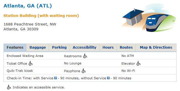 Station Information
GPS Coordinates: 33.79760, -84.41992 (center of)
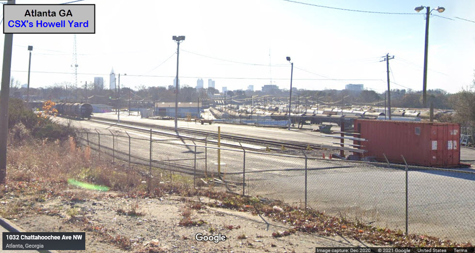
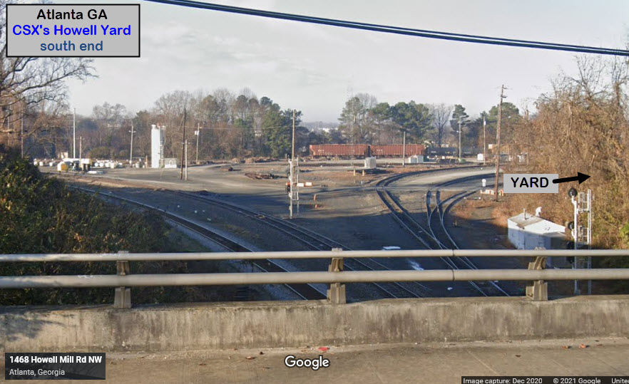
There is limited access for taking pictures at Howell Yard. You can get pictures from the Chattahoochee overpass on the north end, and then a couple of spots from Chattahoochee as you continue "east". You lose sight of it for a while, and can't see it again until you pass over the wye on the south end of the yard on Howell Mill Rd.
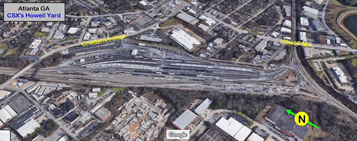
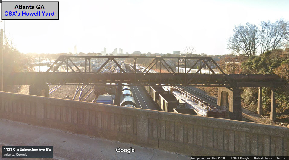
From the Chattahoochee Ave NW overpass
Coming around the curve (EB) from the overpass, this is what you'll see:
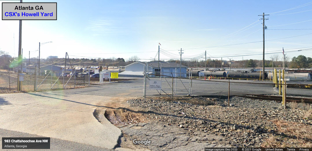
A little further, and we come to the entrance for the TRANSFLO yard:
Staying on Chattahoochee, and then taking a right onto Howell Mill Rd, we will go over the wye at the south end of the yard - the tracks going off to the right in the picture below lead into the yard.
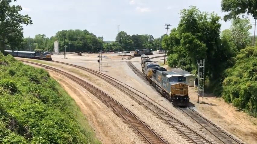 Pix from Hotspots Southeast video
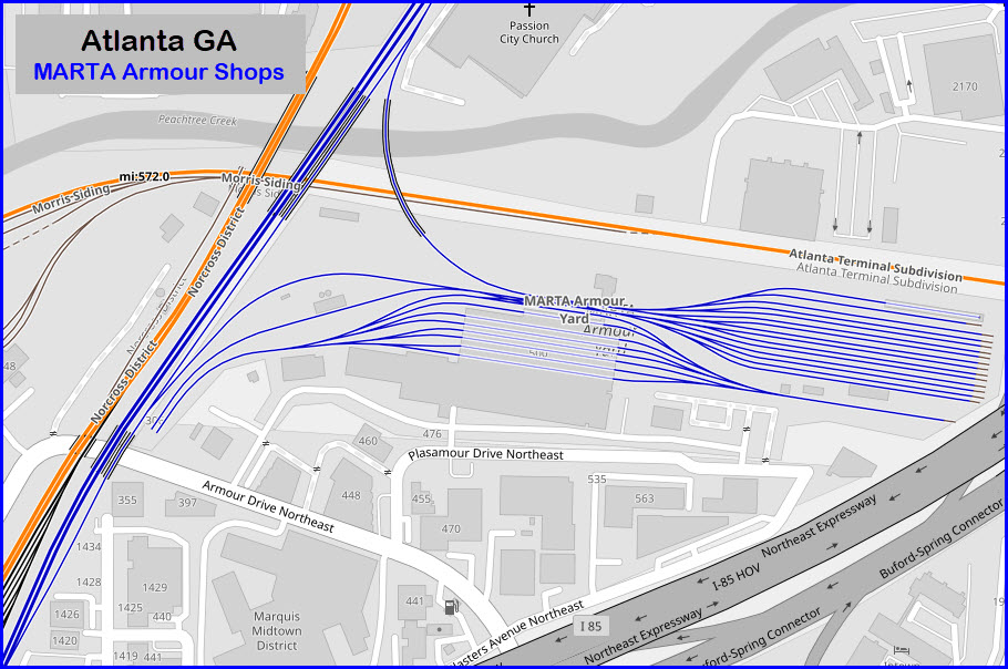
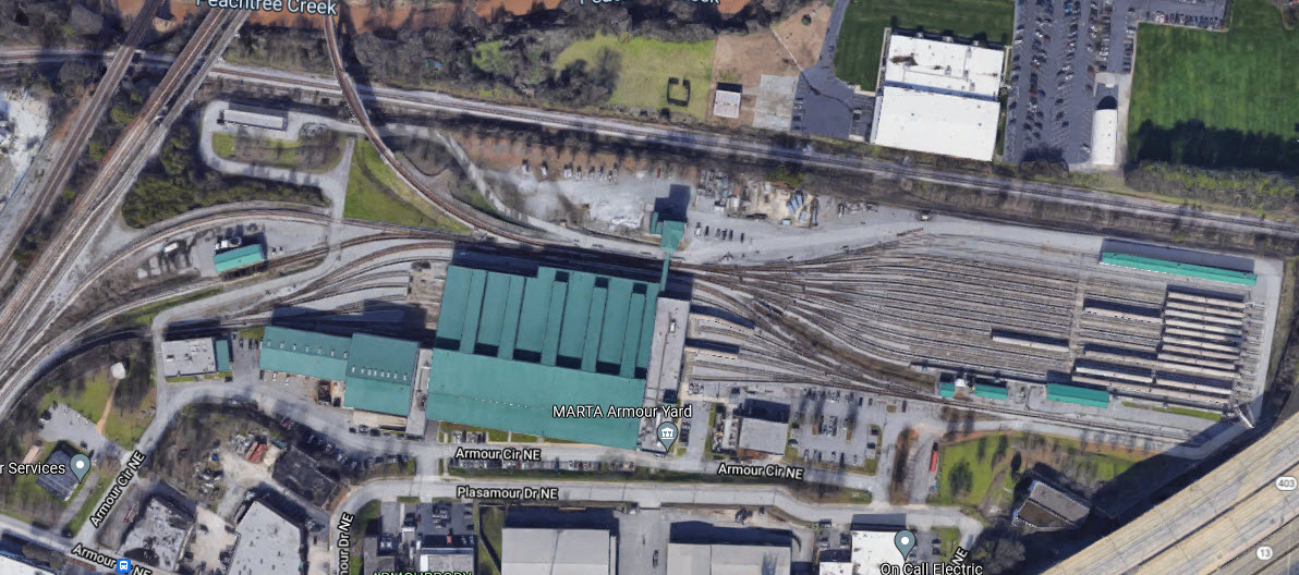
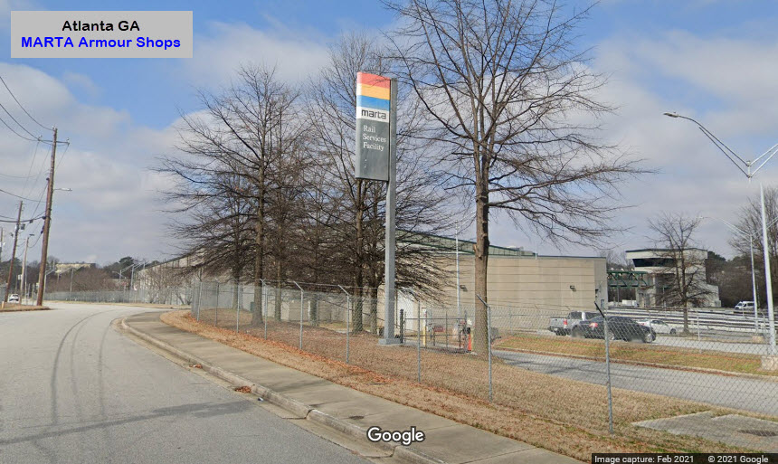
GPS Coordinates: 33.81391, -84.37157 (center of building)
Entrance is off of Plasamour Dr NE, but it is gated.
MARTA calls it a Rail Services Facility. There are 13 tracks in the yard, another two for non revenue equipment, 6 tracks in the shop, and it looks like one more for the car wash. Doesn't look like there is a direct route into the shops from the mainline, trains have to "see-saw" back and forth to get from the yard tracks into the shop.
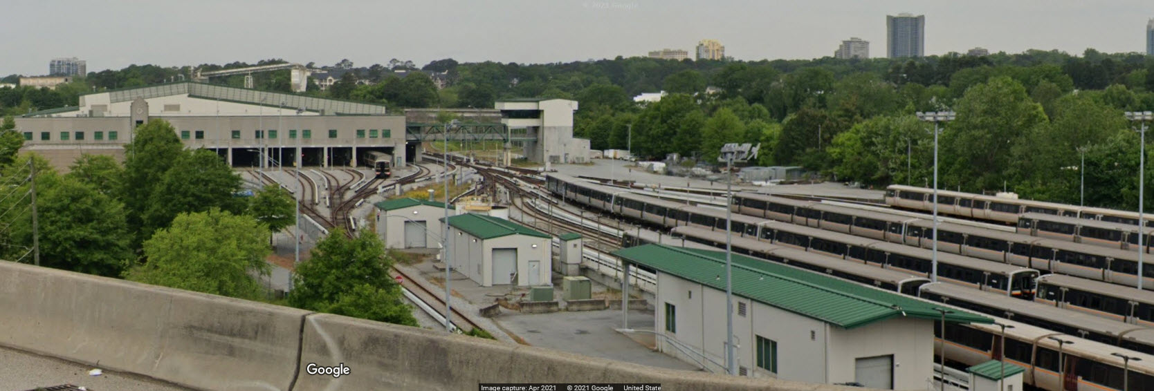
Google Streetview from the Northeast Expressway
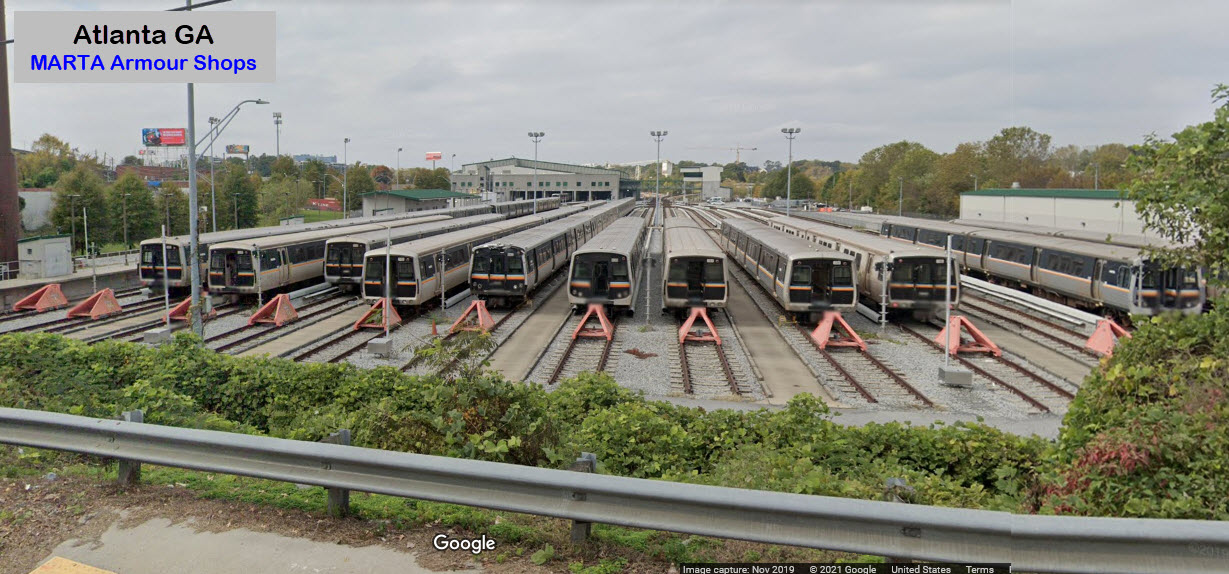
From Piedmont Rd NE
Disclaimers:
New format 10/26/23: Please check out my disclaimer page for my standard dribble and contact info here
RAILFAN GUIDES HOME
RAILROAD SIGNALS HOME
NEW 10/29/2021, JAN3/2026
Last Modified 03-Feb-2026