Location / Name:
Atlanta GA, Fulton (county seat), and DeKalb counties
What's Here:
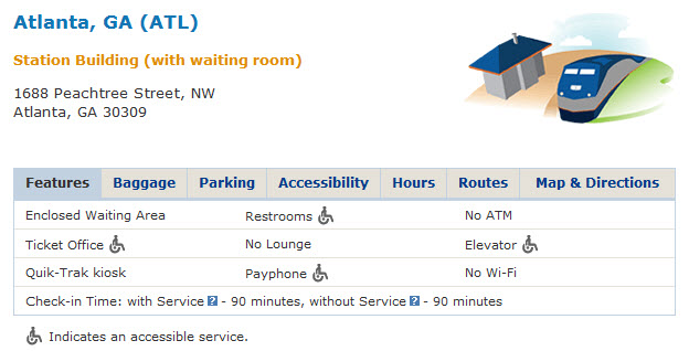
Amtrak's Atlanta Peachtree Station
MARTA Metro System (Heavy Rail, aka Subway)
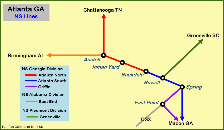
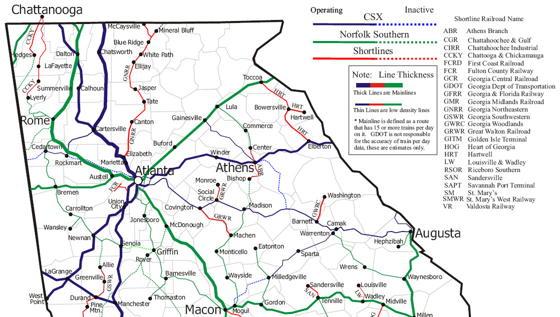
Norfolk Southern:
- Inman Yard
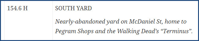
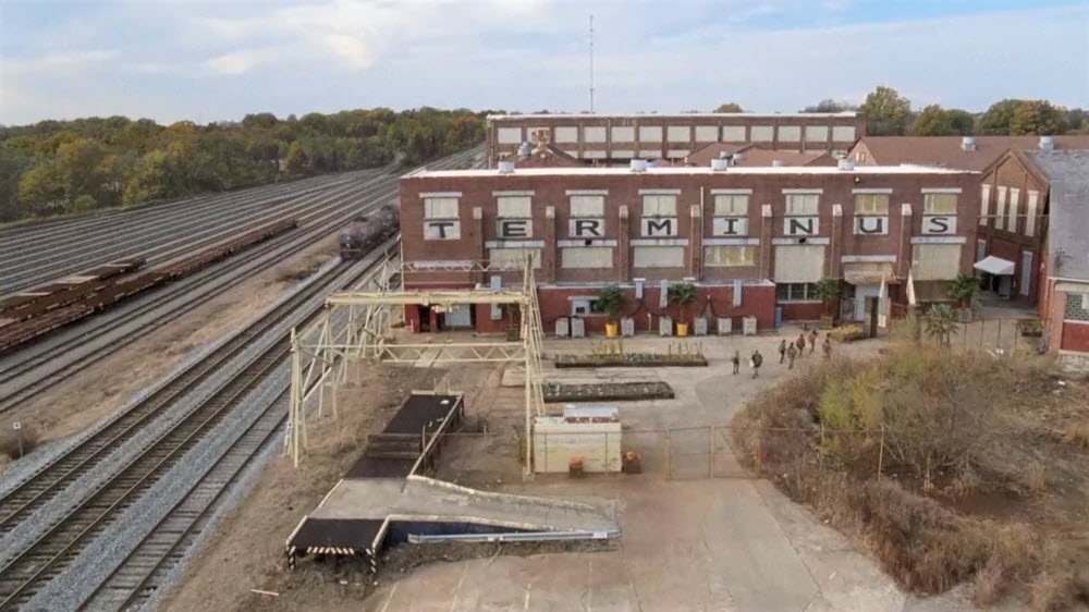
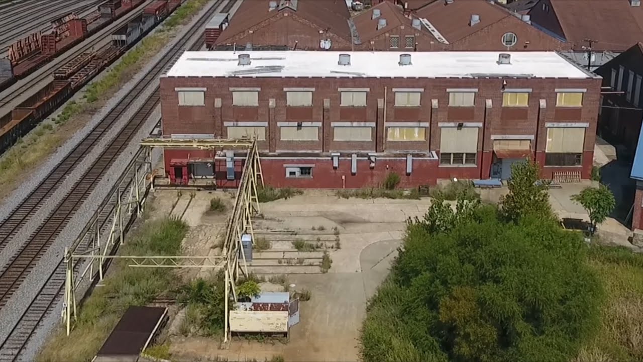
- South Yard
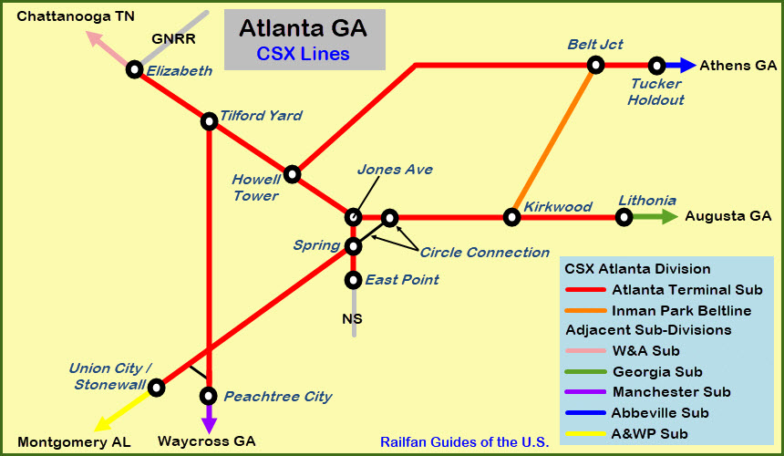
CSX:
- Tilford Yard (closed in 2017, ripped up 2018-2020)
- Howell Yard
- Hulsey Yard
Georgia Northeast RR
Fulton County RR
Marietta Depot (Marietta GA / ~14mi NW of the Amtrak station)
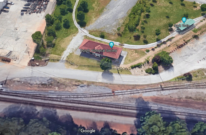
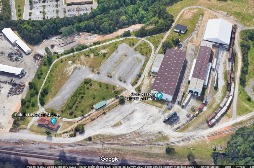
Southeastern Railway Museum (Duluth GA / ~20mi NE of the Amtrak station)
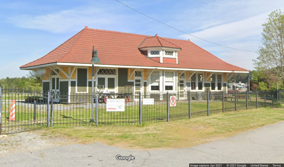
Hapeville Depot Museum (Hapeville GA / ~10mi south of the Amtrak station)
Norcross Depot (Norcross GA / ~14mi NE of the Amtrak station)
Access by train/transit:
MARTA Heavy Rail / Metro System
Amtrak / downtown
The Scoop:
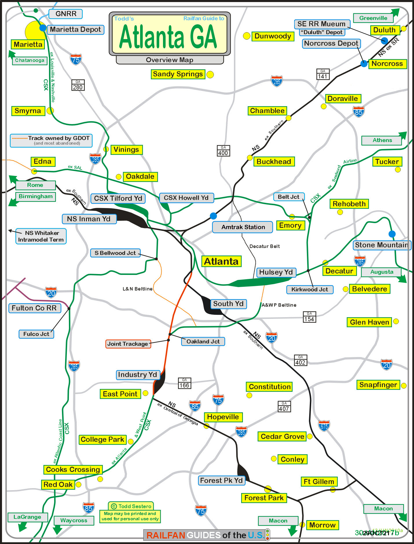
This is the introduction page to the Atlanta area. There is LOTS to
see. To cover them all, it will take you several days to do it thoroughly,
for things are spread out over a wide geographical area - be prepared to spend a
lot of your time in the car getting from one place to another.
I will touch on the Amtrak station here, as well as the four historic depots still with
us. Everything else will be covered on separate pages as listed.
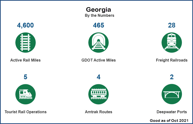
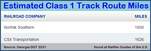
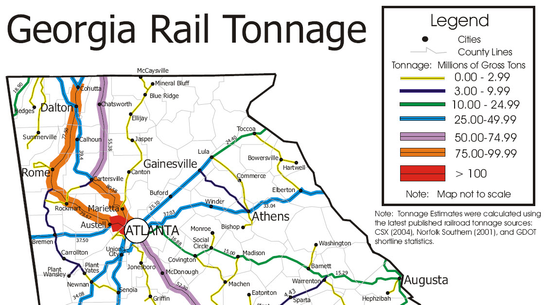
According to the Georgia DOT webpage listed below: With over 4,600 miles of active
rail lines, Georgia has the largest rail network in the Southeast. Georgia’s
location provides direct rail access to the Mid-Atlantic, Northeast and Midwest
regions of the United States.
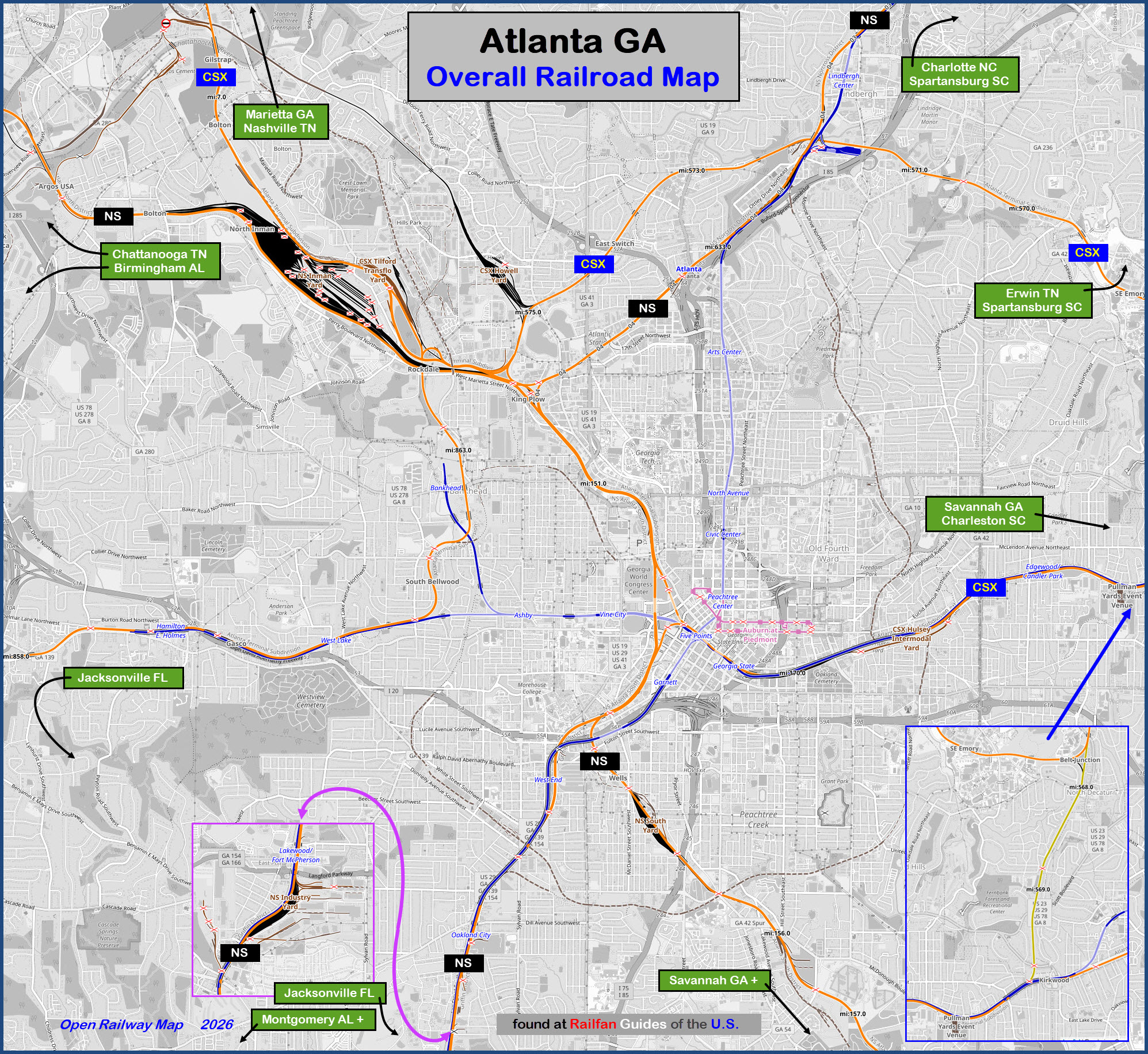
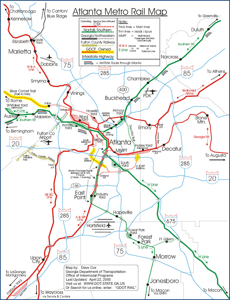
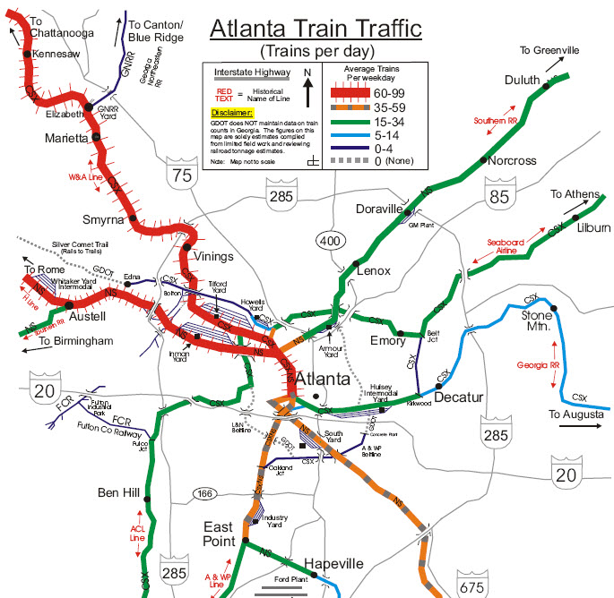
The highest volume tracks are NS's and CSX's lines running between Atlanta and Chattanooga.
Here is a map of the Norfolk Southern's lines in and out of Atlanta:
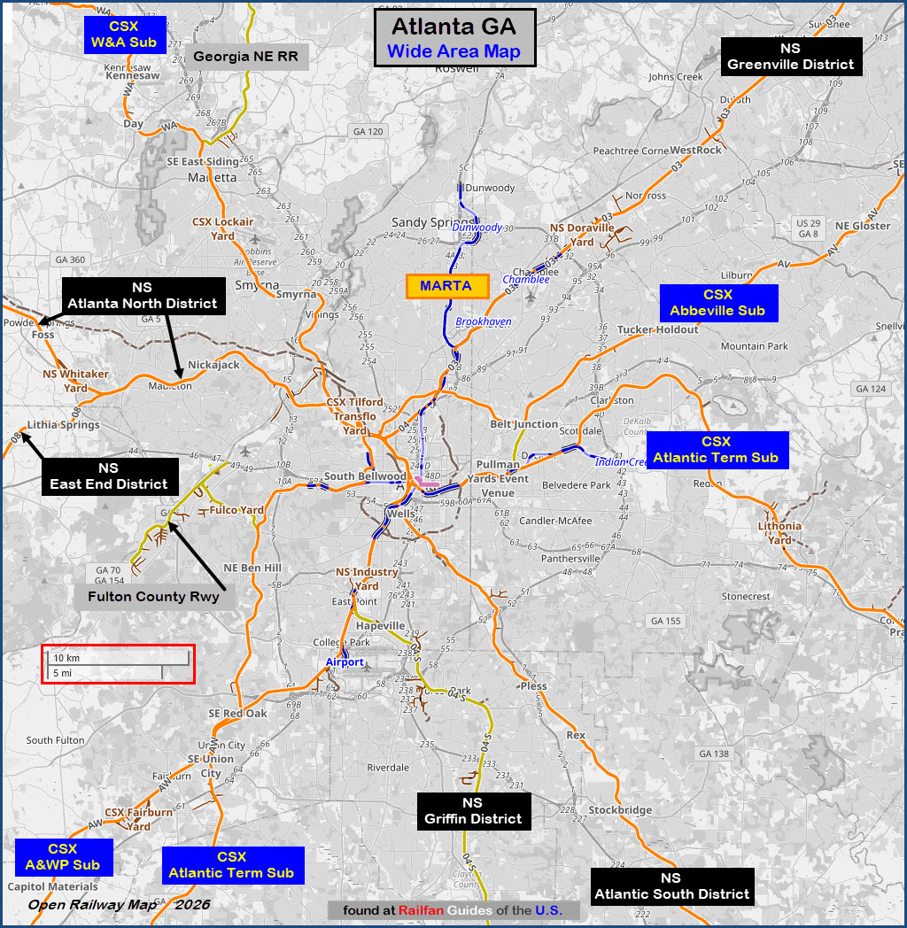
And here is a map of CSX's lines in and out of Atlanta (Open Railway Map
was used as the source of sub-division names, as the Wikipedia list was
incomplete, as well as the base map used to draw this), most lines in Atlanta
are part of the Atlanta Terminal Sub:
In the area, you also have the
Georgia Northeastern RR running out of Marietta
northward in the Tennessee.
Over on the northeast side of Atlanta in Duluth, you have the
Southeast RR Museum.
There are a number of vintage depots in the area. The ones in Marietta,
Hapeville, Duluth, and Norcross come to mind right away, there might be others.
Hapeville is down near the airport south of town, Marietta is NW of town off
I-75, and Duluth and Norcross are NE of town off I-85.
Although there is a lot of freight action to be had in Atlanta, we are not
so lucky in the passenger arena, as there is only one train a day, the Crescent.
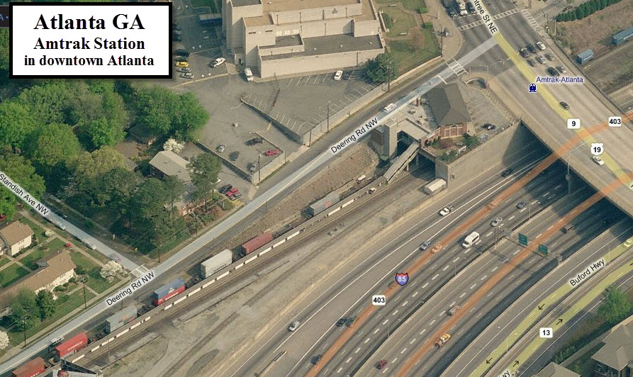
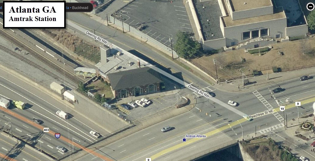
The Amtrak station is downtown on Peachtree St, near the junction of I85 and I75,
north of the downtown area. There is limited parking.
From the Georgia DOT website also comes this graphic:
Let's go over some of these items:
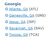
Amtrak: Daily passenger rail service in Georgia is served by four Amtrak routes,
three of which serve coastal Georgia: the Palmetto, Silver Meteor, and Silver Star.
The Palmetto operates between New York and Savannah, while the Silver Star and
Silver Meteor operate between New York and Miami. Each of the three coastal
trains stop in Savannah, and the Silver Star adds a stop in Jesup. North Georgia
is served by Amtrak’s Crescent route, which travels between New Orleans and New
York City with stops in Atlanta, Gainesville, and Toccoa.
Deepwater Ports: Savannah (exit 99 on I-95 via I-16) and Brunswick
(exits 29 and 36 on I-95). In addition,
there are inland terminals in Chatsworth, Bainbridge and Columbus, and they
are all part of Georgia's gateways to the world.
Tourist Rail Operations and Railfan Attractions: 1) the Blue Ridge Scenic
Railway (in Blue Ridge, of course :-), 2) Stone Mountain Park, east Atlanta 3) Southern Museum of Civil War & Locomotive
History in Kennesaw, 4) Locust Grove Train Watching Platform, 5) Southeastern Railway
Museum in Duluth, 6) the SAM Shortline in Plains, 7) St. Marys Express Train Rides in St Marys,
8) the Thronateeska Heritage Center in Albany, 9) and
finally, the Georgia State Railroad Museum in Savannah.
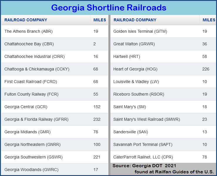
Georgia's Shortline Railroads: The graphic above says there are 28
railroads in Georgia. There are 23 listed below, plus CSX and NS, that
makes 25. I wonder where the other three are?.....
BTW, Nikos Kavoori's Atlanta railfan guide at: http://atlantarails.com/ ... is out
of business, the domain is for sale....dam, I wish I had saved the pages....
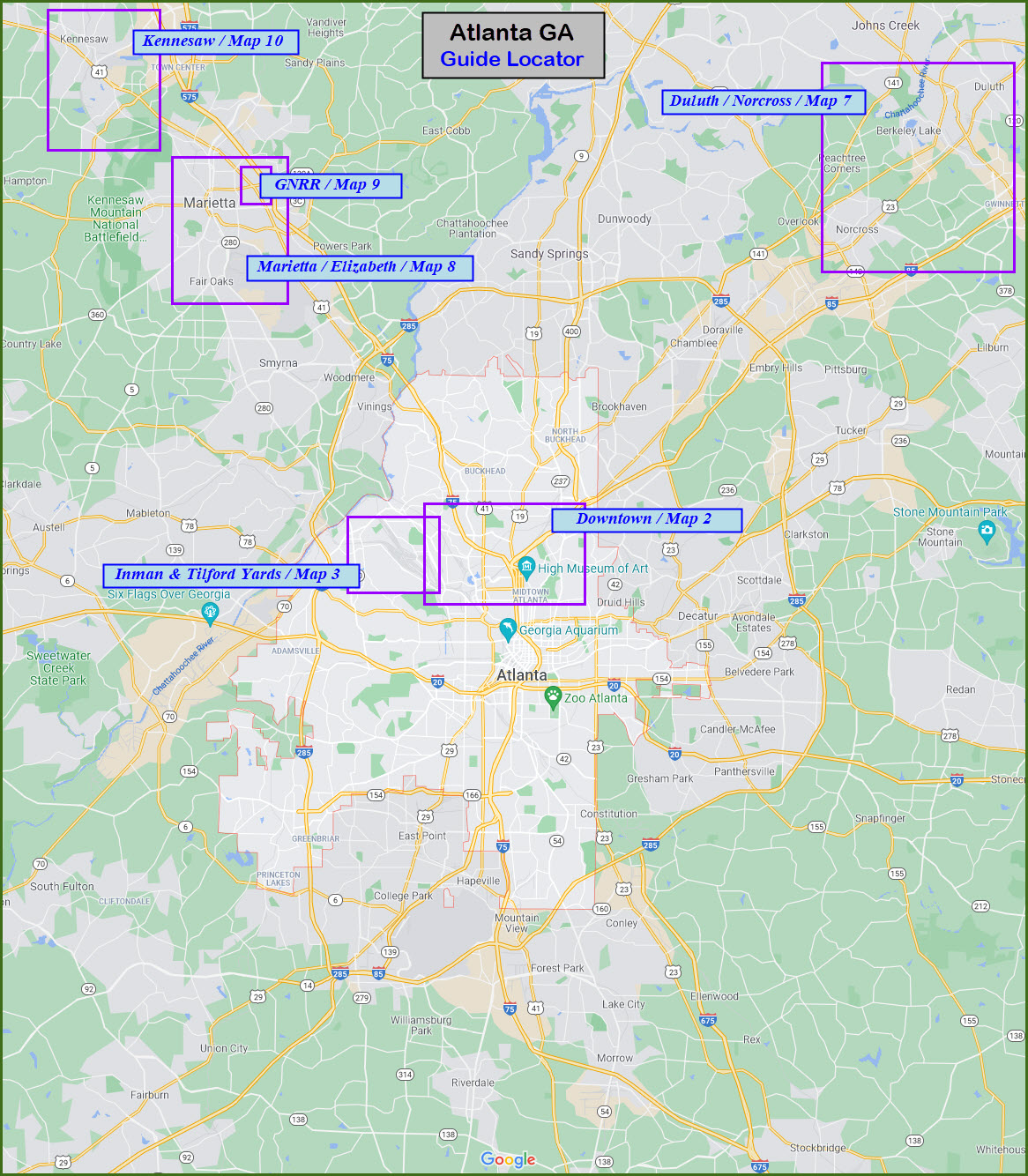
MAP 1 - General Overview MAP 2 - Downtown Atlanta MAP 3 - NS's Inman yard and CSX's Tilford & Howell Yards - NW of downtown Atlanta
MAP 4 - south of Atlanta
MAP 5 - east of Atlanta
MAP 6 - west of Atlanta MAP 7 - the Duluth and Norcross area, with the Southeast Railroad Museum MAP 8 - the Marietta and Elizabeth area - NW outside the Perimeter MAP 9 - Guide to the Georgia Northeastern RR MAP 10 - the Kennesaw area & the Southern Museum of Civil War and Locomotive History
GPS Coordinates: 33.79938, -84.39264
1688 Peachtree Rd NW, Atlanta GA 30309
There is not a whole lot of parking available at the station - 7 spots, and it may
be very limited in terms of you being able to park for railfanning purposes...
I can't say, I've never been to the station.
Directions:
To get here from I75: take the Northside Dr NW exit (exit 252) and go north to
Collier Rd NW, where you want to take a right. This will take you over to
Peachtree RD NE, where you will take another right.
From I85: Things are a little more complicated. If you're travelling
I85 southbound, after going under Peachtree, the road makes a substantial left
curve... stay to the right for the exit ramps off the curve, and once on the
exit ramp, stay to the left so you can exit at 17th St NW... then take a left
onto 17th St to get over to Peachtree, which is the 2nd major intersection,
and take a left there. A few blocks up, the road will split, and
Peachtree goes off to the left.
From I85 northbound, take the exit for 10th St NW (it might be exit 250,
not sure), and take a right onto it. Again, two blocks over is
Peachtree, and you want to make a left onto it.
The historic train station was built in 1871 to serve the city. The depot
was built by a predecessor of the Southern Railway, part of today’s Norfolk
Southern Corp., and was one of several constructed in the area in 1871,
according to information provided by the city. The railroad primarily
served the cotton trade, which was cultivated on a reported 50,000
acres in the area. Since Forsyth and Milton counties had no rail
service at the time, the addition of the passenger station at
Duluth made the city a center for shipping and commercial activity.
Declines in passenger service and changes in rail freight led to the
closing of the Duluth depot by the early 1950s. Eventually, the
Southern Railway, which then owned the property, encouraged the
city to find a use for the building. The city lacked the resources
to do so, and in 1975 the depot building was moved by the late
Scott Hudgens, a local developer, to a site on Pleasant Hill Road
where the Joan Glancy Rehabilitation Center is located today. The
depot was used as an office for a major development project in
progress at the time. In 1986 Hudgens again moved the depot across
Pleasant Hill Road to W. P. Jones Park. At this location, the city
used the building as a police substation and an office for city
parks personnel and related recreation programs.
The depot was moved to the entrance to the Southeastern Railway
Museum on Buford Highway in August 2008. Under a lease agreement
between Duluth and the museum, the city retained ownership of the
depot, and the Southeastern Railway Museum became responsible for
restoring the building and operating it as a historic exhibit. At
the end of 2014, The Duluth Historical Society moved into the Depot
and it is still operating the Society from this location.
The depot, originally constructed in 1890, and expanded in 1947, has been the home of
the Hapeville Historical Society museum since 1982. The museum houses an extensive
collection of items celebrating the development of the city across three centuries.
The collection includes archives, historic household items, clothing, and furniture,
and an extensive transportation exhibit centered on the contribution of interstate,
rail, and airport to the city’s development.
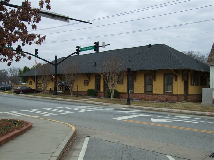
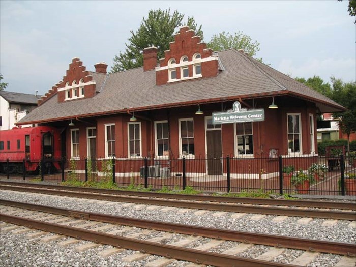
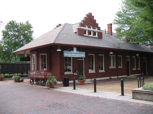
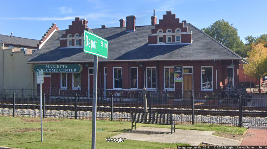
From Wikipedia: The Marietta depot is a former freight
and passenger stop in Marietta, Georgia. It was originally built in
1864 for the Western and Atlantic Railroad, a railroad between
Chattanooga, Tennessee and Atlanta, Georgia.[1] That railroad was
absorbed by the Nashville, Chattanooga and St. Louis Railway. In
turn, the latter railroad was merged into the Louisville and Nashville
Railroad in 1957. The station was burned down by the Union troops
of Gen. William Tecumseh Sherman in the latter years of the US.
Civil War. It was rebuilt in 1898. Presently occupying the
building is the Marietta Welcome Center and Visitors Bureau.
The city of Marietta bought the building from the State of
Georgia toward the end of 2019. In 1968 the Georgian was
eliminated. In its place was an unnamed St. Louis-Evansville
train, and an unnamed Evansville-Atlanta train. These two
trains were among the trains that Amtrak chose not to pick
up when it assumed long distance operations on May 1, 1971.
Thus, passenger service through Marietta ended.
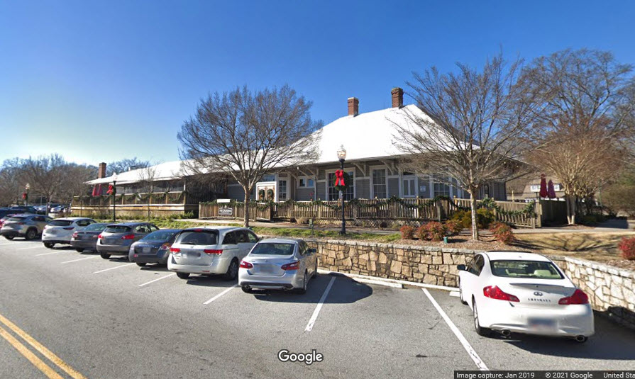
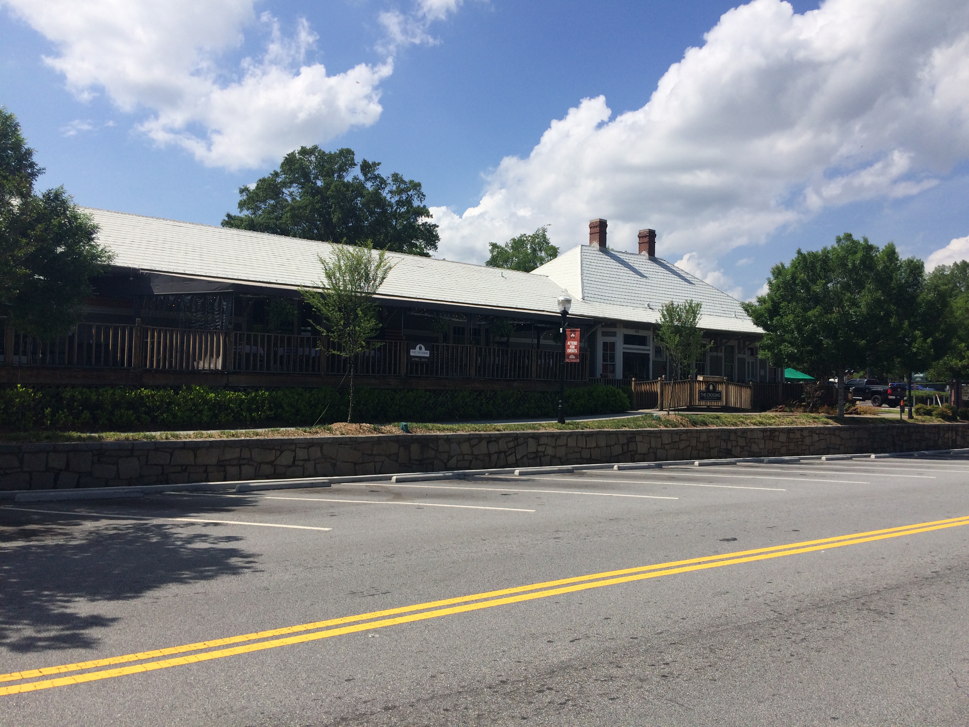
Construction of this historic train depot began in 1909 and the building
served passengers until 1959. The building was donated to the city by
Norfolk Southern in 1983 and has been repurposed as a historically-themed
restaurant. The railroad depot was essential to the community of
Norcross during the age of rail travel and is largely responsible for
the growth of this community which was originally founded in 1870. The
community was the first stop north of Atlanta along the Richmond
Danville Railroad, Norcross is Gwinnett County's second-oldest city.
The former rail depot is a contributing property of the historic
district of Norcross, an area known for its many historic homes
and buildings in the downtown area. The original depot had a warehouse
for cargo, railroad offices, a passenger waiting area, and ticket
counter. The depot hustled and bustled with the activity that a
train known as the "Air-Line Belle" created carrying commuters
into Atlanta and back every day of the week, except for Sunday.
Today patrons can enjoy a wonderful meal at this historic train
depot and watch as train engines pass through Norcross just as
they did in the past - though it is no longer an active passenger rail line.
From Wikipedia: In 1836, the Georgia General Assembly voted to
build the Western and Atlantic Railroad in order to provide a link between
the port of Savannah and the Midwest. The initial route was to run southward
from Chattanooga to a terminus east of the Chattahoochee River, which would
be linked to Savannah. After engineers surveyed various possible locations
for the terminus, the "zero milepost" was driven into the ground in what is
now Five Points. A year later, the area around the milepost had developed
into a settlement, first known as Terminus, and later Thrasherville,
after a local merchant who built homes and a general store in the area.
By 1842, the town had six buildings and 30 residents and was renamed
Marthasville to honor Governor Wilson Lumpkin's daughter Martha. Later, John
Edgar Thomson, Chief Engineer of the Georgia Railroad, suggested the
town be renamed Atlanta. The residents approved, and the town was
incorporated as Atlanta on December 29, 1847.
Interesting note, maybe:
Back in 1971, I had gone to Los Angeles to visit my aunt and
uncle (via a
United 747). Came back to Baltimore by train via the
southern route: The Espee (SP/Southern Pacific) from LA to NOLA (New
Orleans), the Southern from NOLA to Washington
DC, and then to Baltimore via the Penn Central using a GG1! We came thru
Charlottesville probably around 5-6am, because I remember getting into Baltimore
around 8 or 8:30. The train also came/went thru Atlanta and Charlotte
NC. Amtrak was still 5 months away on "A-Day", May 1st,
1971. BTW, on the third night of the trip, I had the best ever dinner
on a train, pork chops - tasted just like mom used to make em! Ahhhhh, the
good ole days :-) Wish I had something other than a Kodak Instamatic
traveling with me! Charlottesville VA Railfan Guide
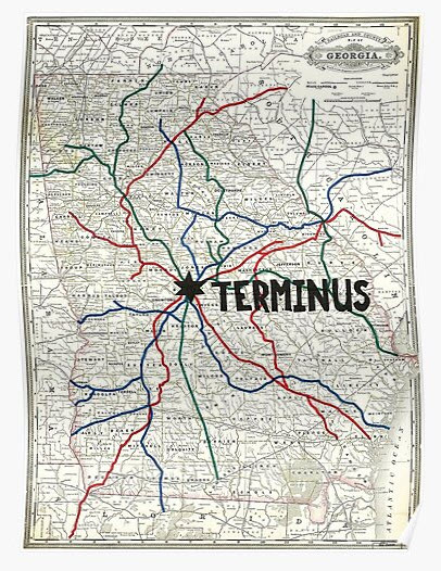
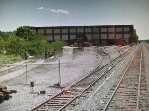
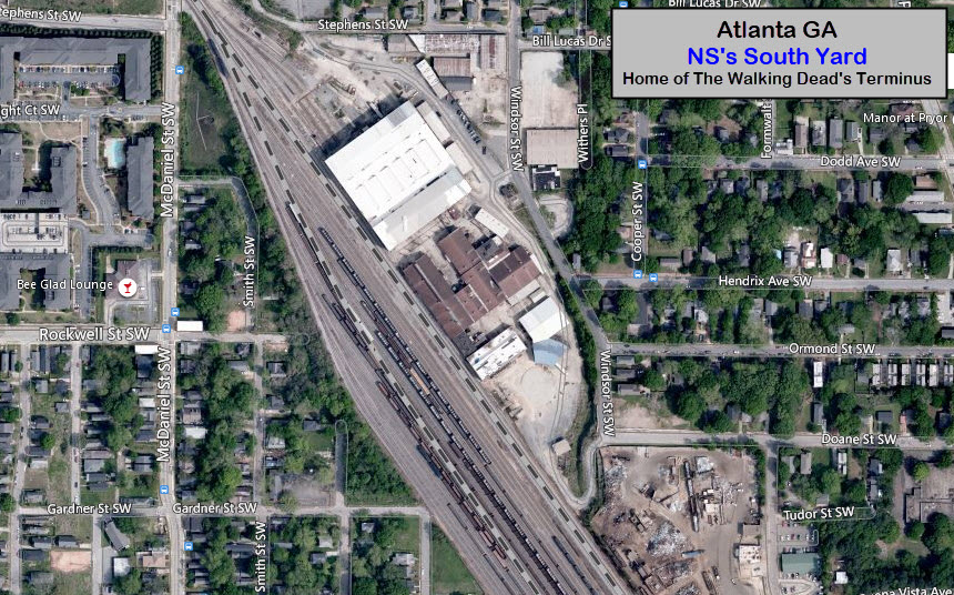
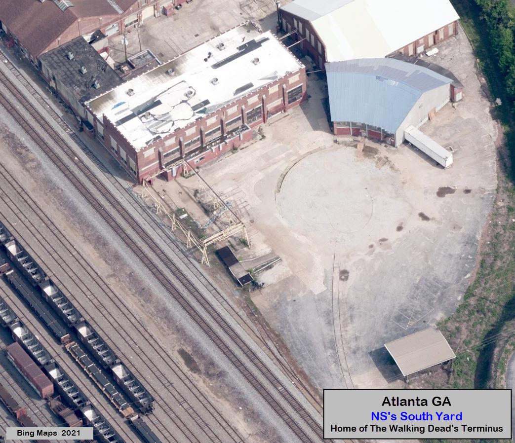
Norfolk Southern's South Yard, which apparently isn't used a whole lot
anymore, was used in AMC's The Walking Dead, at the end of the 4th
season, and the first episode of the fifth season, as a place called
Terminus.

 Station Information
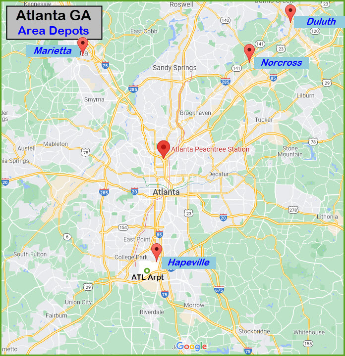

 Stations in Georgia served by Amtrak
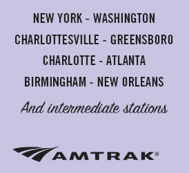 Off the cover of the Crescent schedule
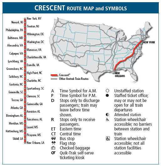 Route map for the Crescent
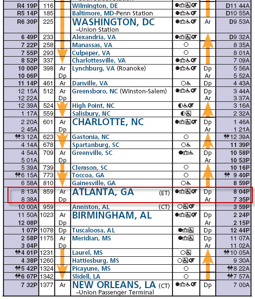 Timetable as of 11/2011