
In General
Getting Here
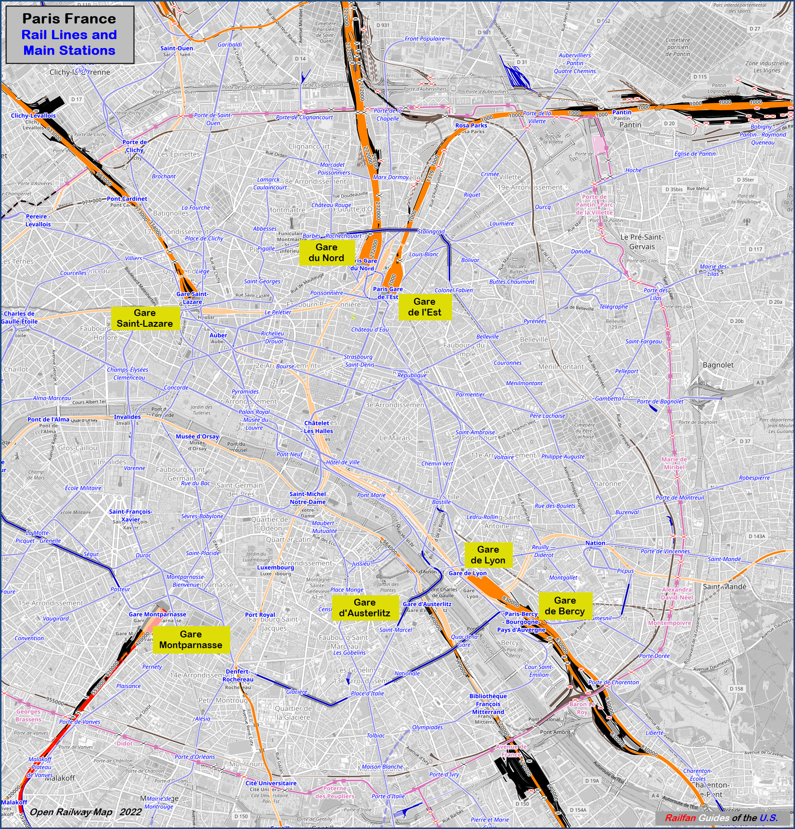
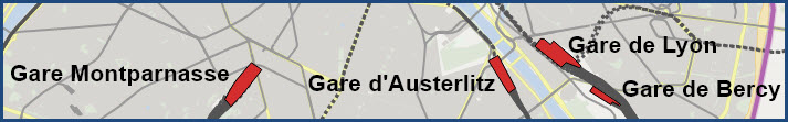
Map
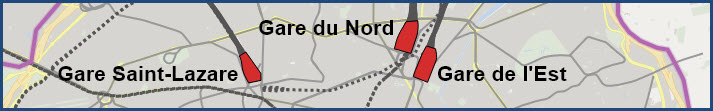
Stations - North Side
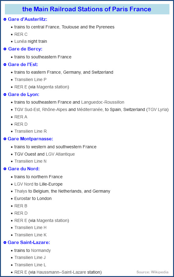
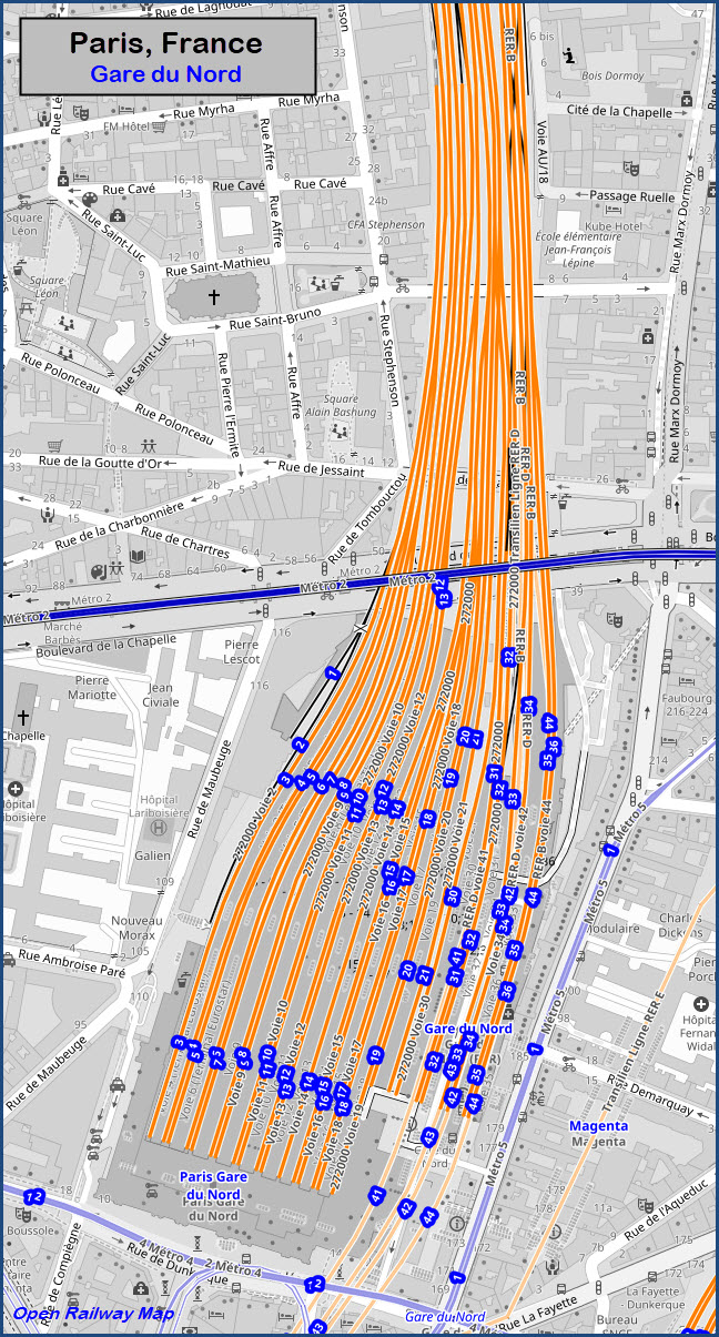
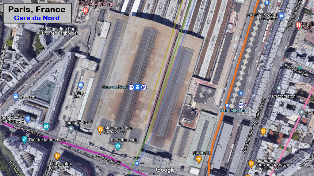
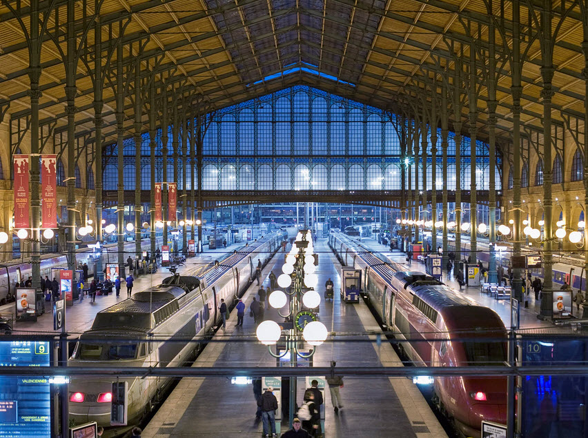
Gare du Nord
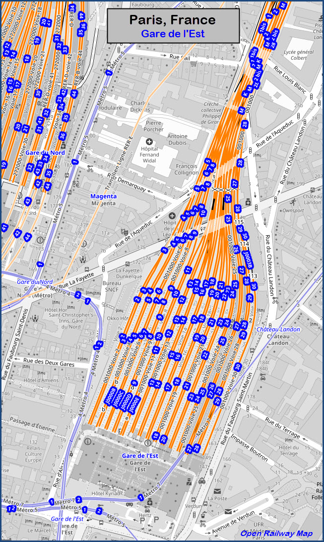
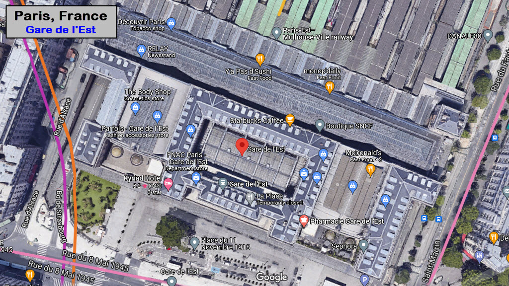
Gare de l'Est
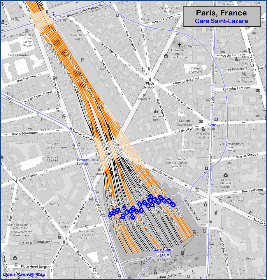
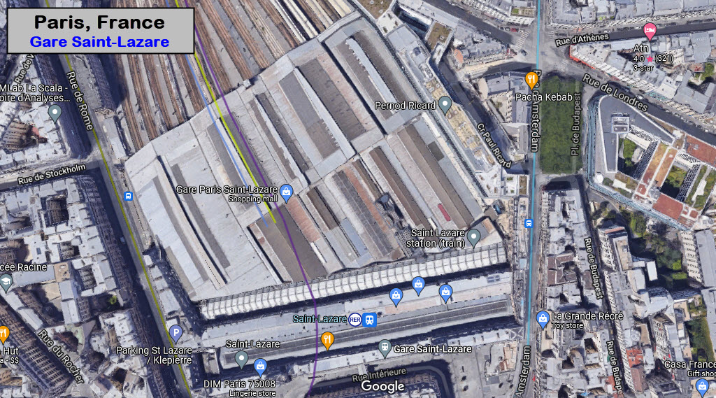
Gare Saint-Lazare
Stations - South Side
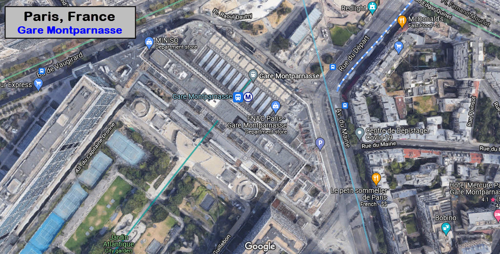
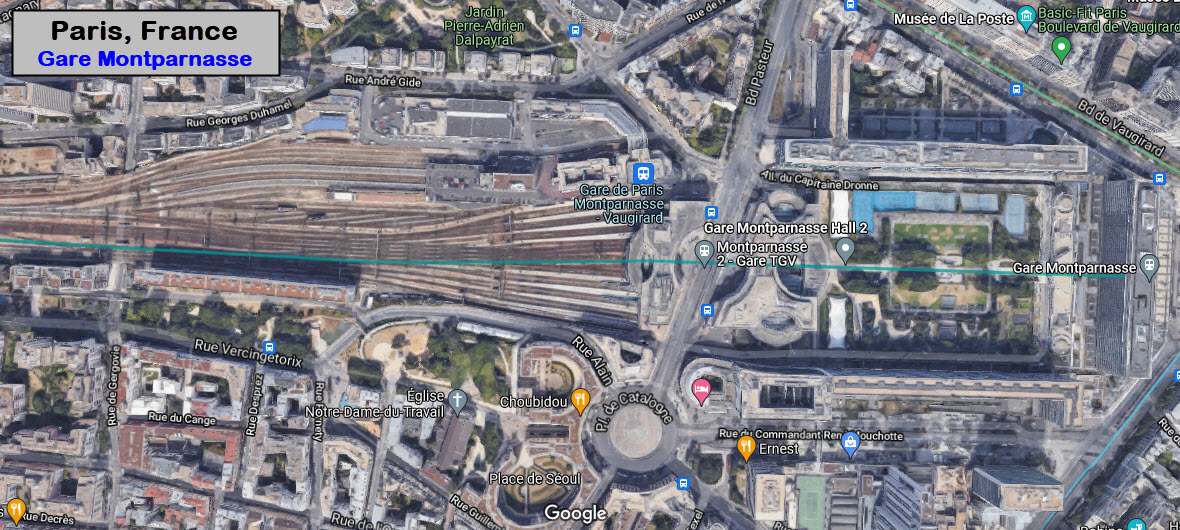
Gare Montparnasse
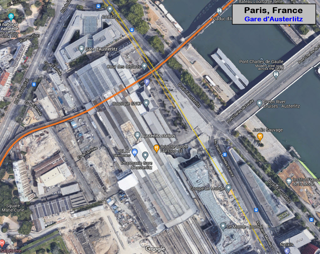
Gare d'Austerlitz
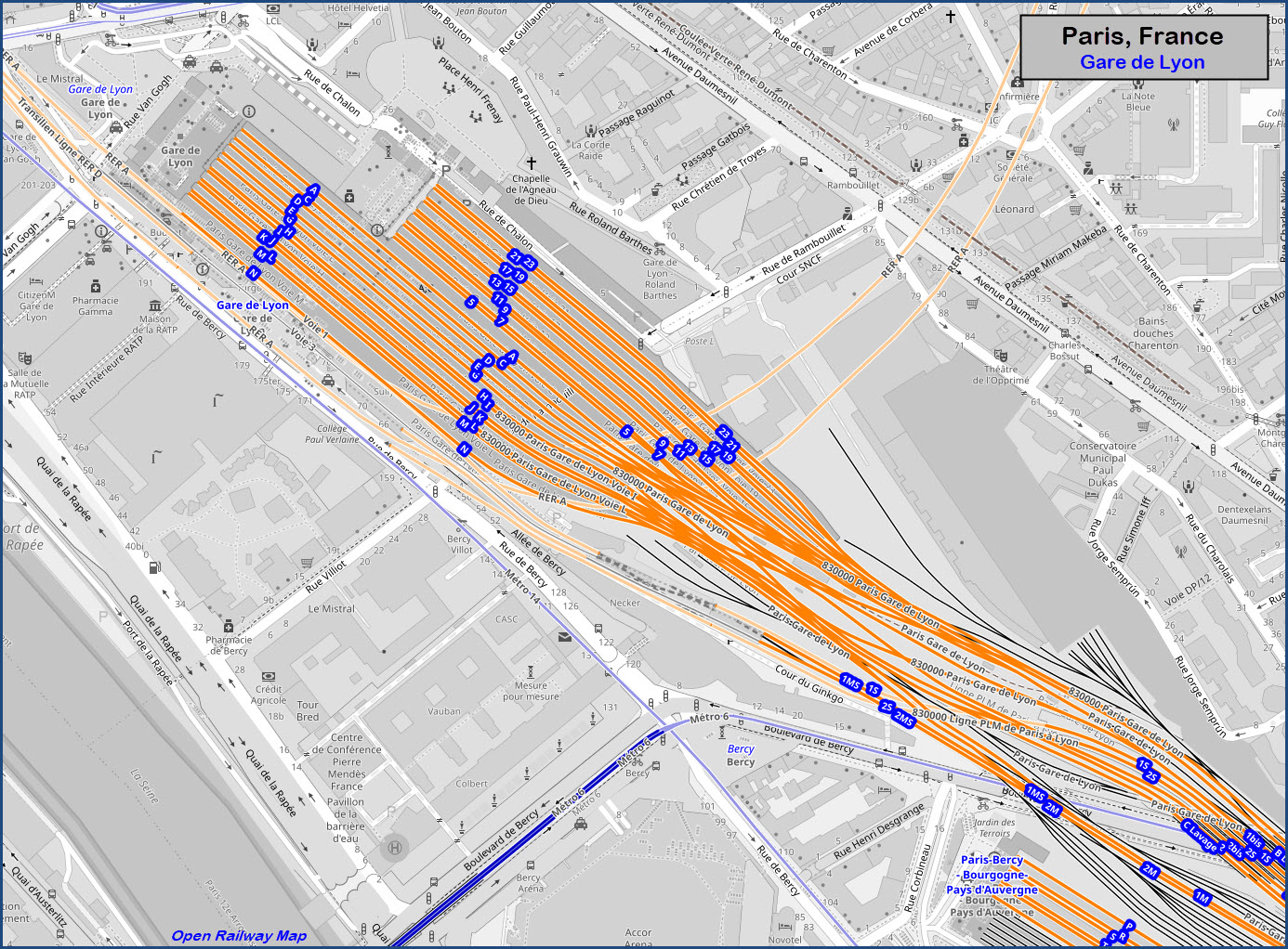
Gare de Lyon
Gare de Bercy
RAILROAD SIGNALS HOME
Location / Name:
Paris, France
What's Here:
Gare d'Austerlitz
Gare de Bercy
Gare de L'Est
Gare de Lyon
Gare Montparnasse
Gare du Nord
Gare Saint-Lazare
Data:
GPS Coordinates: as needed
Phone A/C: n/a
ZIP: n/a
Access by train/transit:
Plenty
The Scoop:
The railroad station "scene" in Paris is what Chicago would look like if it has been around as long as Paris. Fortunately for Paris, they didn't knock down most of the old depots in the name of progress, and what remains today are just superb examples of architecture, equal to that of La Tour d'Eiffel.
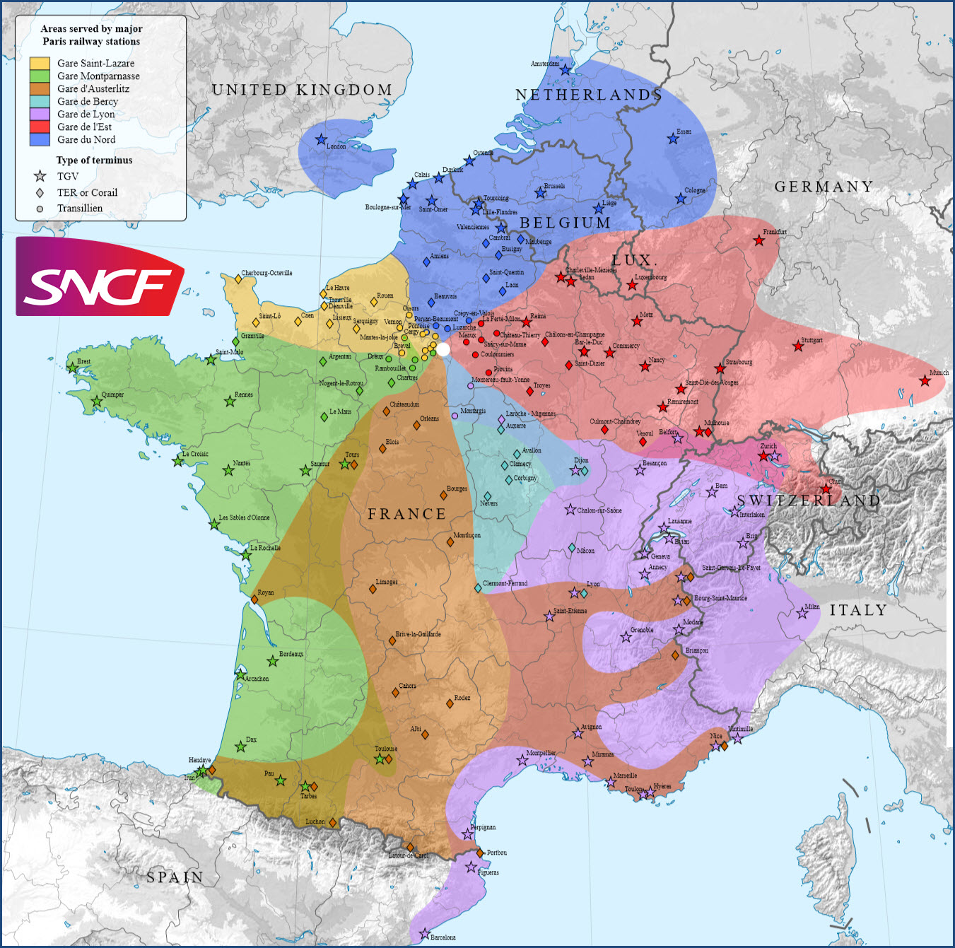
There are seven major rail stations for inter-city trains. Here is a list of them, and the train lines that service the stations:
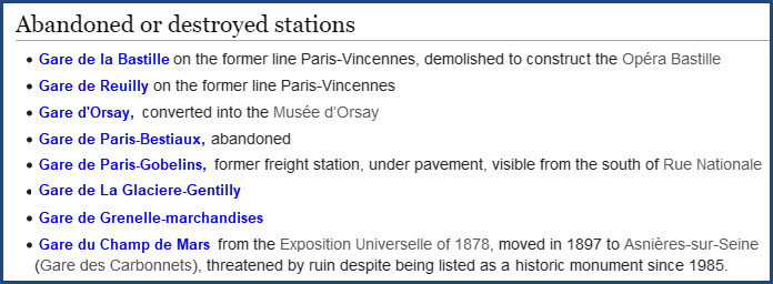
According to Wikipedia, here is a rundown on the stations of Paris that are either not used or gone:
Acknowledgements:
Wikipedia
Websites and other additional information sources of interest for the area:
https://en.wikipedia.org/wiki/Category:Railway_stations_in_Paris
https://en.wikipedia.org/wiki/List_of_Paris_railway_stations
The best way to get to Paris is probably by train, unless you are coming in from another country besides those that border France. Your options are virtually endless.
Map
Rail Connections Between the Stations:
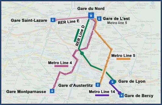
Stations - North
GPS Coordinates: 48.87841, 2.36022
The busiest railway station in Europe and the hub for trains arriving and departing Paris on the Eurostar.
GPS Coordinates: 48.87680, 2.35926
GPS Coordinates: 48.87707, 2.32492
Stations - South
GPS Coordinates: 48.84109, 2.32022
GPS Coordinates: 48.84168, 2.36601
GPS Coordinates:
GPS Coordinates:
Did U Know?
None for now......
Disclaimers:
I love trains, and I love signals. I am not an expert. My webpages reflect what I find on the topic of the page. This is something I have fun with while trying to help others.
Please Note: Since the main focus of my two websites is railroad signals, the railfan guides are oriented towards the signal fan being able to locate them. For those of you into the modeling aspect of our hobby, my indexa page has a list of almost everything railroad oriented I can think of to provide you with at least a few pictures to help you detail your pike.
If this is a railfan page, every effort has been made to make sure that the information contained on this map and in this railfan guide is correct. Once in a while, an error may creep in :-)
My philosophy: Pictures and maps are worth a thousand words, especially for railfanning. Text descriptions only get you so far, especially if you get lost or disoriented. Take along good maps.... a GPS is OK to get somewhere, but maps are still better if you get lost! I belong to AAA, which allows you to get local maps for free when you visit the local branches. ADC puts out a nice series of county maps for the Washington DC area, but their state maps do not have the railroads on them. If you can find em, I like the National Geographic map book of the U.S..... good, clear, and concise graphics, and they do a really good job of showing you where tourist type attractions are, although they too lack the railroads. Other notes about specific areas will show up on that page if known.
Aerial shots were taken from either Google or Bing Maps as noted. Screen captures are made with Snagit, a Techsmith product... a great tool if you have never used it!
By the way, floobydust is a term I picked up 30-40 years ago from a National Semiconductor data book, and means miscellaneous and/or other stuff.
Pictures and additional information is always needed if anyone feels inclined to take 'em, send 'em, and share 'em, or if you have something to add or correct.... credit is always given! Please be NICE!!! Contact info is here
Beware: If used as a source, ANYTHING from Wikipedia must be treated as being possibly being inaccurate, wrong, or not true.
RAILFAN GUIDES HOME
RAILROAD SIGNALS HOME
NEW MAR19/2021, JAN11/2022
Last Modified 13-Jan-2022