
RAILFAN GUIDES HOME
RAILROAD SIGNALS HOME
Location / Name:
Grenoble, France
What's Here:
TAG Light Rail System
SNCF Intercity Trains
Data:
GPS Coordinates: as needed
Phone A/C: 04
ZIP: 38000 (at the SNCF station)
Access by train/transit:
SNCF, TER, and TAG
The Scoop:
I choose the Grenoble system to do as my first venture outside North America because it is the only system I have spent anytime riding and photographing, way back in 2002 as part of a three week business trip which included Toulouse and Aix-en-Provence. Even though I was close, I never made it to Lyon or Marseille, darn-it. I did manage to get chased by a tower operator in Toulouse, and narrowly missed getting hauled in by the police while taking pictures on a viaduct in Aix-en-Provence (scenes from the movie The Transporter come to mind :-)
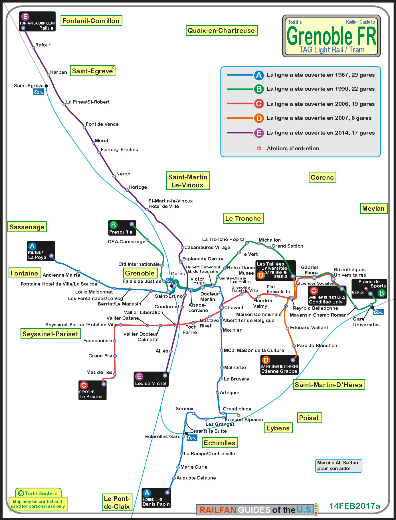
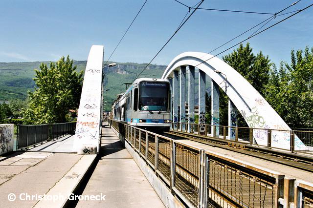
TAG stands for: Transports de l'agglomération grenobloise, which is the transportation authority for Grenoble. The system comprises 5 tram, or light rail lines, 149 bus lines, and a regional rail service, TER - all serving 49 communities around Grenoble. The Wikipedia page says there are 8 stations for TER, but on the TAG map PDF, only four are shown, hence, only four show up on my map.
From Railway-Technology: Grenoble, the capital city of the Isère département in the Rhône-Alpes region in France, had a tram service until 1952. Like many French systems, it went out of existence due to the high cost for required renewals when compared to bus replacements, being perceived as an outmoded form of transport. When asked in 1983 whether they would like a modern tramway, voters were only narrowly in its favour.
Grenoble opened its first tramway in 1987 with an 8.8km (5.5 mile) line between Fontaine La Poya and Grand Place. With the opening of Line D in October 2007, the system had grown to four lines with a combined length of 34.2km (21.4 miles).
The Grenoble network is widely seen as an excellent example of marrying modern technology with sympathetic urban renewal.
It has won particular praise for providing far greater access and independent travel for those with impaired mobility through pioneering use of level access to low floor vehicles.
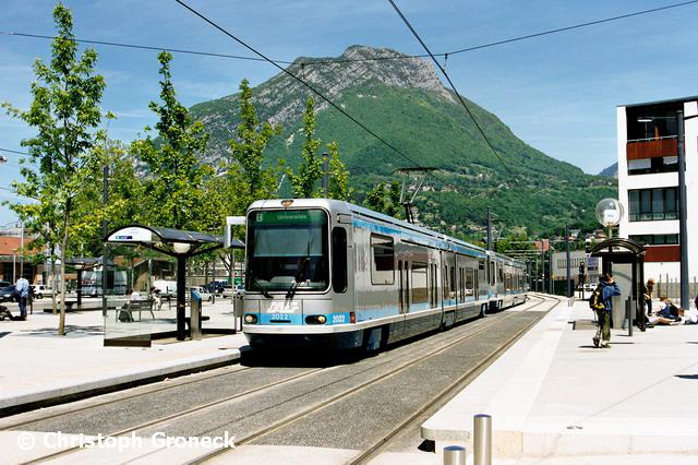
Grenoble celebrated the opening of the initial 4.8km section of light rail Line E on June 28th, 2014, with a music festival and two days of free travel across the network. The first phase of Line E runs from an interchange with Line A at Louise Michel in Grenoble city centre to Saint-Martin-le-Vinoux Town Hall and has eight stations, including a park-and-ride station at Casamaures-Village.
Grenoble inaugurated the second phase of light rail Line E on July 13th, 2015 with the launch of commercial services on the 6.7km extension from Saint-Martin- le-Vinoux Town Hall to Saint Égrève and Fontanil Cornillion. The 10-station extension takes the total length of Line E to 11.5km and is expected to boost ridership on the north-south line to nearly 45,000 passengers per day, with trams operating at six-minute headways at peak times.
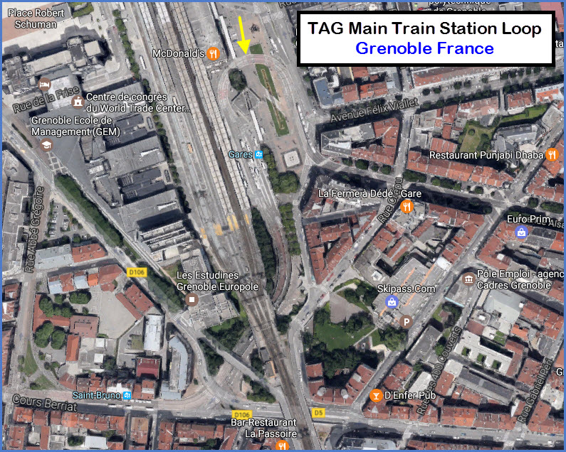
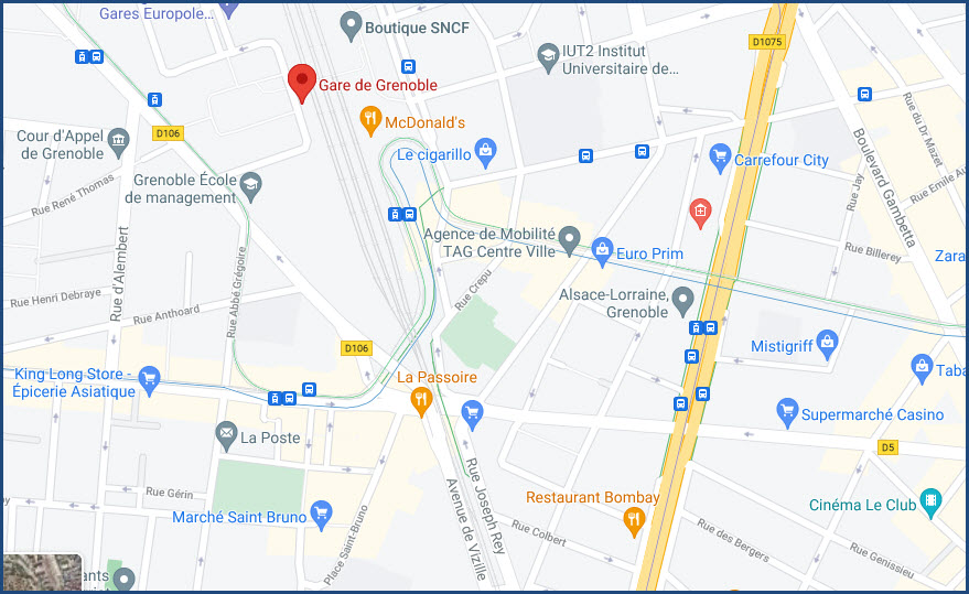
SNCF has a line that comes through, but it does not have the high high speed TGV service running on it. For that, you need to go almost all the way to Lyon by way of A48 and A43, to Grenay. On the south side of the station, the right-of-way leaves/enters town on a built up stone viaduct, making photos darn near impossible. The Grenoble yard is on the north side of the station, but access is extremely limited, and I wouldn't take a chance, especially if you don't speak French.
The light rail has a nice stop right in front of the main station. Parking is (was) so-so, and a little further north of the station, there was ample parking, don't know if it is still around or not. For signal fans, the SNCF used to use white/purple dwarf signals to control shunting moves in the yard - don't know if they still do or not.
Acknowledgements:
Christoph Groneck
Google Maps
Websites and other additional information sources of interest for the area:
http://en.tag.fr/ the website has an English option
https://twitter.com/tag_grenoble?lang=en en francais
http://en.tag.fr/507-download-maps.htm
https://fr.wikipedia.org/wiki/Transports_de_l'agglom%C3%A9ration_grenobloise en francais
https://fr.wikipedia.org/wiki/Lignes_de_bus_Chrono_de_Grenoble en francais
https://fr.wikipedia.org/wiki/Lignes_de_bus_Proximo_de_Grenoble en francais
https://fr.wikipedia.org/wiki/Lignes_de_bus_Flexo_de_Grenoble en francais
http://www.railway-technology.com/projects/grenoble/ current up to 2014
https://en.wikipedia.org/wiki/Grenoble_tramway
http://www.lightrailnow.org/facts/fa_lrt_nation-france.htm
http://www.railjournal.com/index.php/light-rail/grenoble-opens-light-rail-line-e-phase-2.html
http://www.railjournal.com/index.php/light-rail/grenoble-inaugurates-tram-line-e.html
http://wikitravel.org/en/Grenoble
https://wise.com/gb/blog/calling-codes-for-france
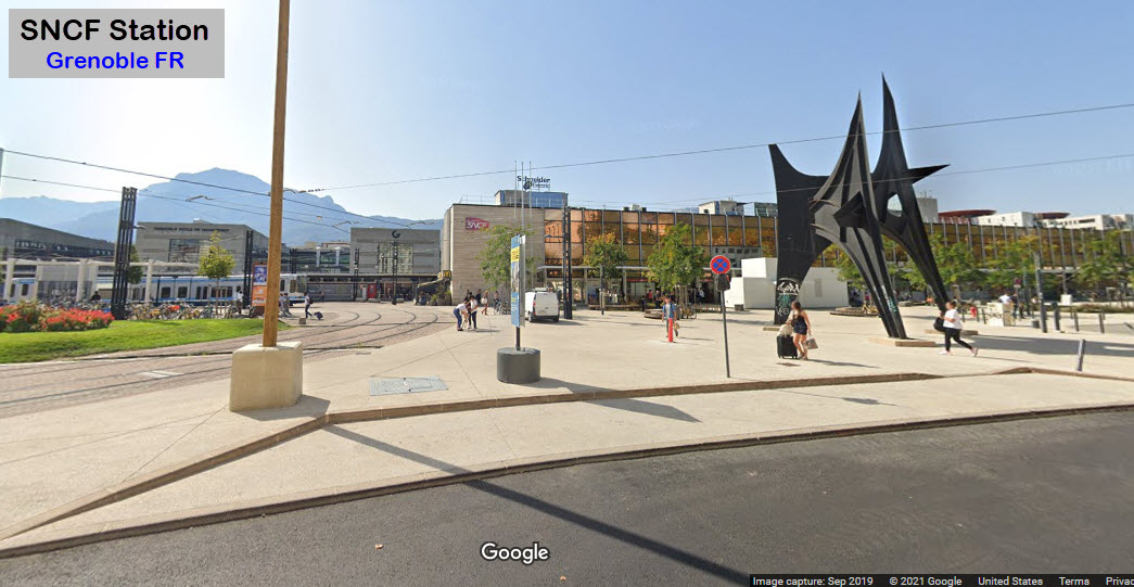
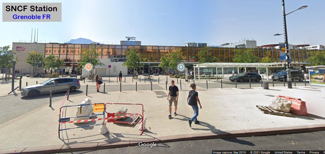
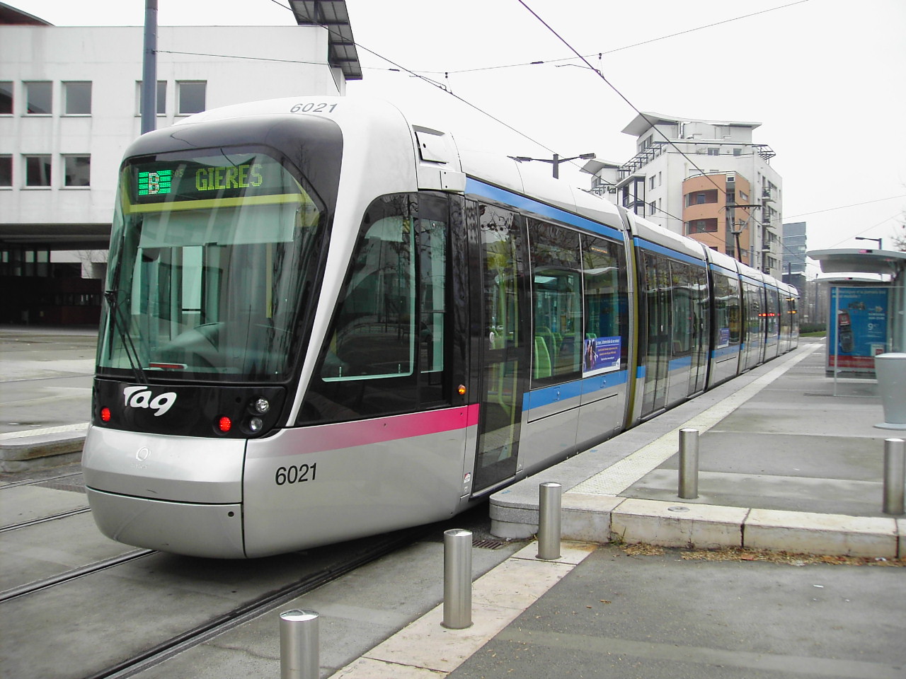
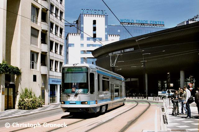
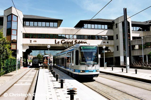
At the SNCF Station
The picture below is at the main train station, where TAG does a 180 degree loop.
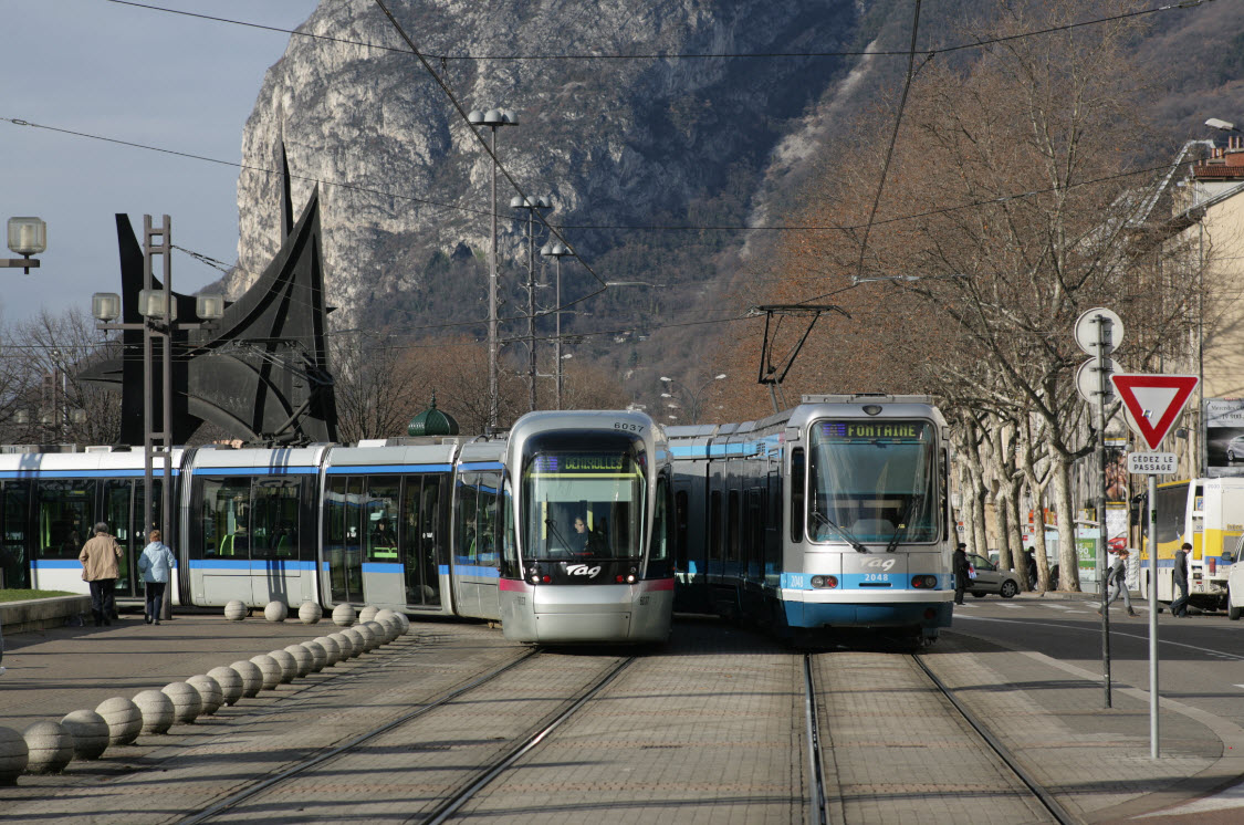
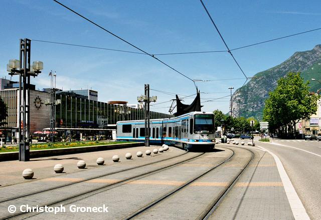
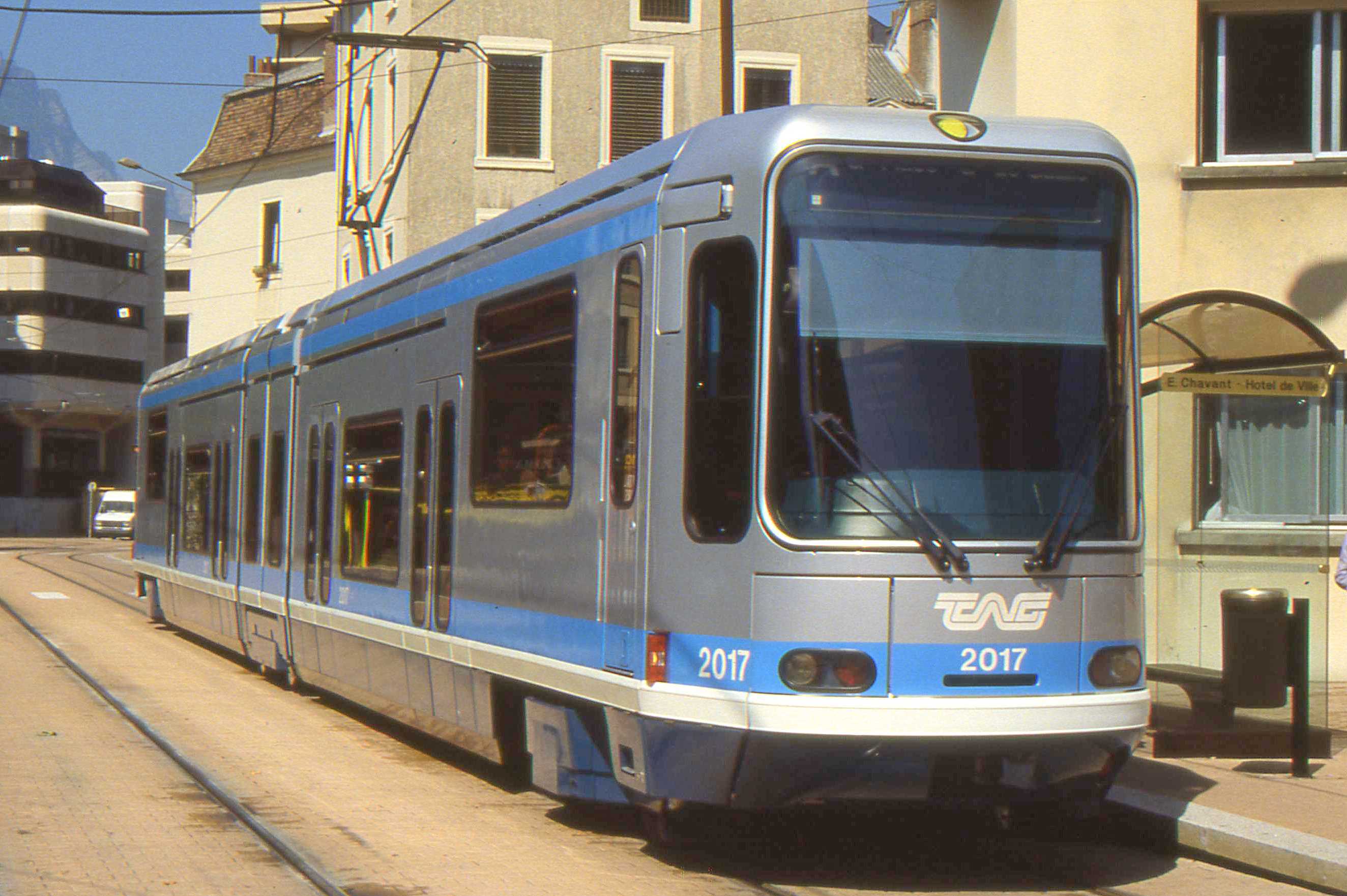
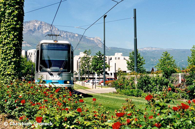
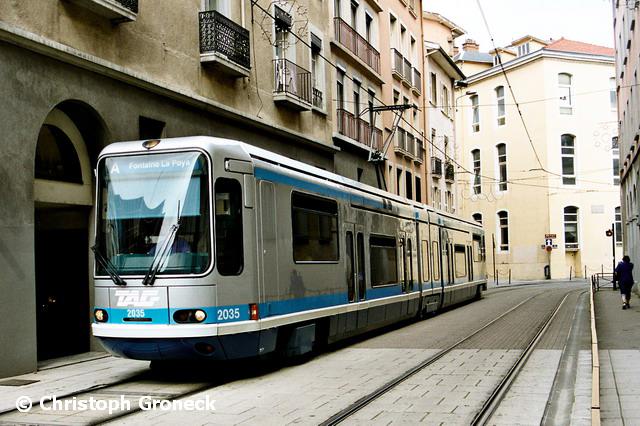
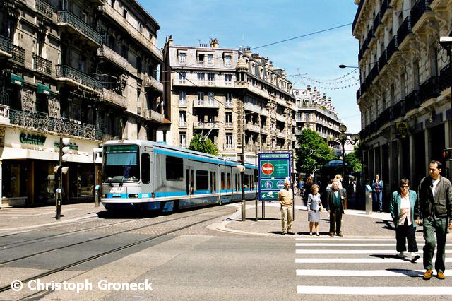
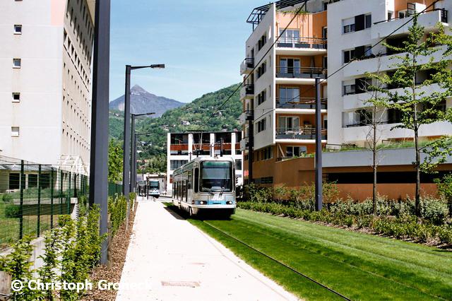
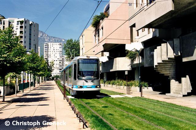
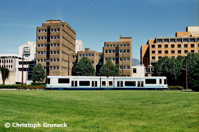
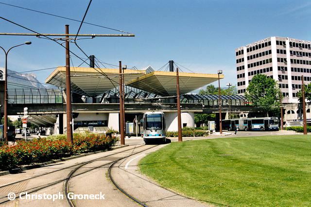
Elsewhere on the system

Phone calls to France
One of the things we ALL take for granted is calling someone. If you live in "the states", we have gotten used to the fact that most phone calls are now 10 digits, regardless of where you live.... gone are the days of 7 digit phone calls, this is due to the explosive growth of cellphones here and abroad. I could go one further, and tell you that when I was young, many towns only needed a 4 or 5 digit number to place local calls, if you were calling within the same exchange! :-)
Here is a guide I found to help you calling someone while in France:

Disclaimers:
I love trains, and I love signals. I am not an expert. My webpages reflect what I find on the topic of the page. This is something I have fun with while trying to help others.
Please Note: Since the main focus of my two websites is railroad signals, the railfan guides are oriented towards the signal fan being able to locate them. For those of you into the modeling aspect of our hobby, my indexa page has a list of almost everything railroad oriented I can think of to provide you with at least a few pictures to help you detail your pike.
If this is a railfan page, every effort has been made to make sure that the information contained on this map and in this railfan guide is correct. Once in a while, an error may creep in :-)
My philosophy: Pictures and maps are worth a thousand words, especially for railfanning. Text descriptions only get you so far, especially if you get lost or disoriented. Take along good maps.... a GPS is OK to get somewhere, but maps are still better if you get lost! I belong to AAA, which allows you to get local maps for free when you visit the local branches. ADC puts out a nice series of county maps for the Washington DC area, but their state maps do not have the railroads on them. If you can find em, I like the National Geographic map book of the U.S..... good, clear, and concise graphics, and they do a really good job of showing you where tourist type attractions are, although they too lack the railroads. Other notes about specific areas will show up on that page if known.
Aerial shots were taken from either Google or Bing Maps as noted. Screen captures are made with Snagit, a Techsmith product... a great tool if you have never used it!
By the way, floobydust is a term I picked up 30-40 years ago from a National Semiconductor data book, and means miscellaneous and/or other stuff.
Pictures and additional information is always needed if anyone feels inclined to take 'em, send 'em, and share 'em, or if you have something to add or correct.... credit is always given! Please be NICE!!! Contact info is here
Beware: If used as a source, ANYTHING from Wikipedia must be treated as being possibly inaccurate, wrong, or not true.
RAILFAN GUIDES HOME
RAILROAD SIGNALS HOME
NEW 10/10/2016, FEB15/2017, JUL19/2021
Last Modified 19-Jul-2021