In General
Getting Here
Map
Sights
Pictures
Station by Station
Bridges
Signals
Floobydust
RAILROAD SIGNALS HOME
Location / Name:
Aubagne FR, Provence-Alpes-Côte d'Azur
What's Here:
The Aubagne Tram (Light Rail)
SNCF Gare D'Aubagne
Data:
GPS Coordinates: as needed
Phone A/C: 0442
ZIP: 13005 / 13400
Access by train/transit:
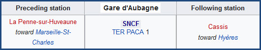
SNCF TER at Gare D'Aubagne
The Scoop:
Aubagne is a relatively small town (~47,000 people) 10 miles (16km) due east from Marseille.
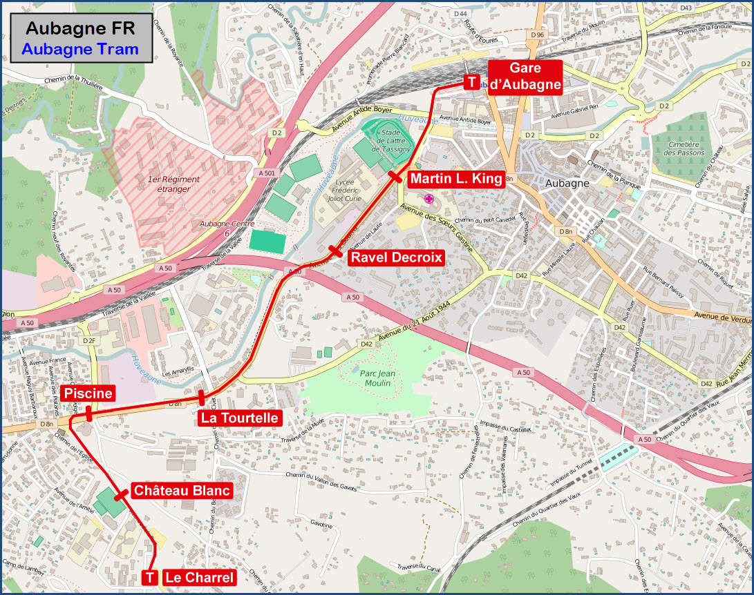
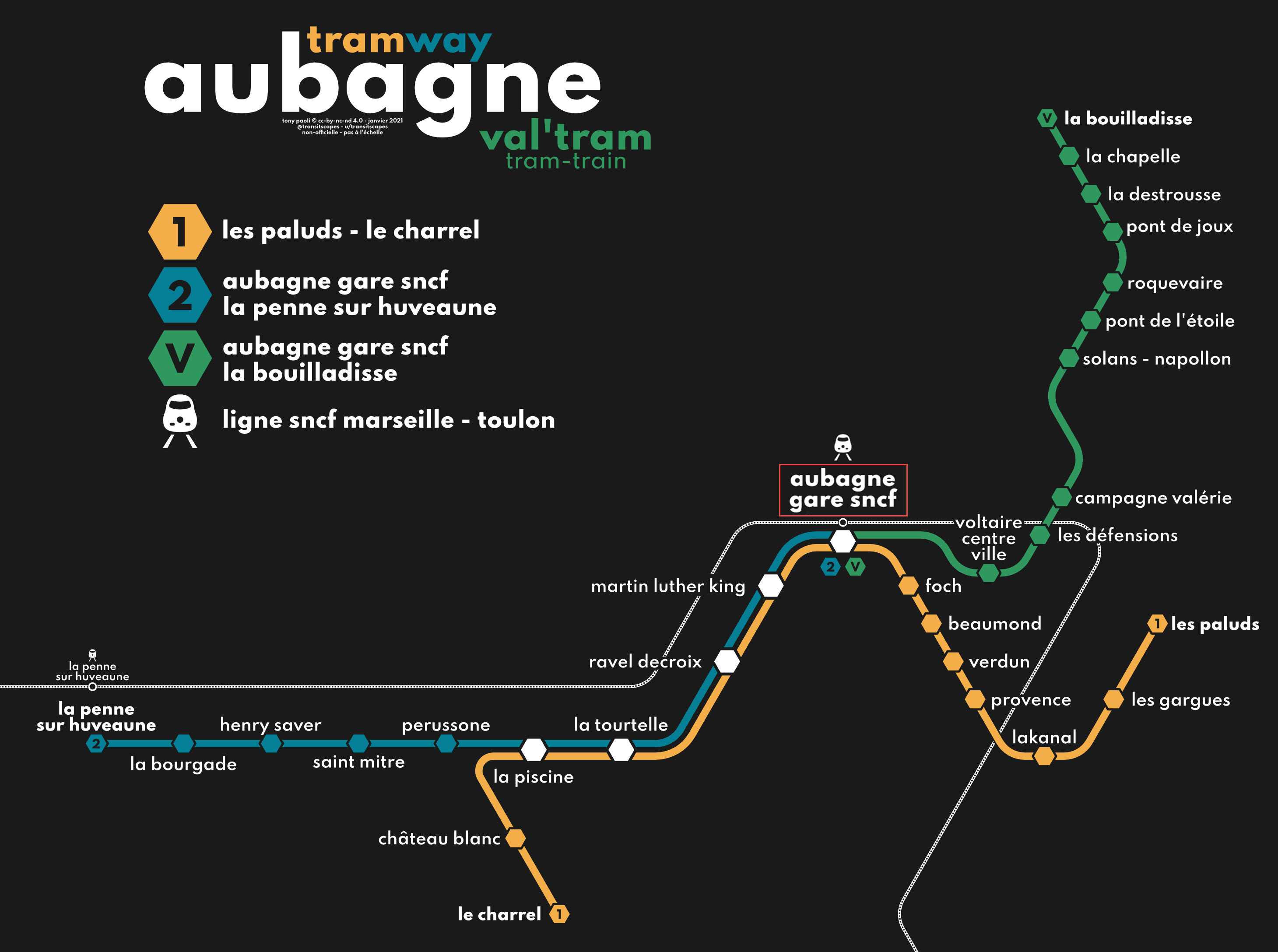
The town is unique in the sense that it has a light rail / tram system - pretty much unheard of in a town of that size. The system runs from Gare D'Aubagne on the north end, to Le Charrel on the south end - a ride of about 1.81 mi (2.91 km). There are plans to extend the system, but so far, the extension has not materialized.
Acknowledgements:
Fr. Latreille
peters452002
Rld_G.
Baptiste
Serge F.
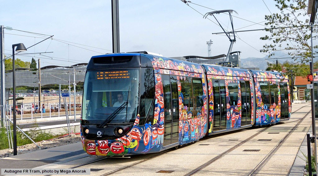
Mega Anorak
Google Maps
Open Railway Map
Bing Maps
Wikipedia
Websites and other additional information sources of interest for the area:
https://en.wikipedia.org/wiki/Aubagne_tramway
http://www.subways.net/france/aubagne.htm
https://en.wikipedia.org/wiki/Aubagne_station
https://en.wikipedia.org/wiki/Marseille%E2%80%93Ventimiglia_railway
https://en.wikipedia.org/wiki/Category:Railway_stations_in_France_opened_in_1858
https://foursquare.com/v/gare-sncf-daubagne/4b72d3e6f964a520998a2de3/photos
From Marseille, take the A50 east about 10 miles. On the west side of Aubagne, the road splits and D501 heads north(ish), take that to the first exit and get off at D@, at the traffic circle, take the first exit, which takes you over the tracks, and curves around a couple of times. D2 eventually acquires the name Av. Antide Boyer. When you get the the light rail tracks at Rue du Doct Barthélémy, take a left onto Rue de Doct Barthelemy.
Maps
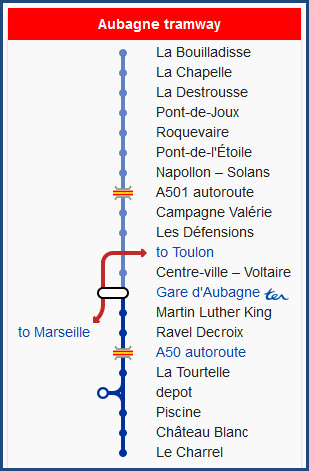
This is probably an early version of the system with preliminary names for the stations:
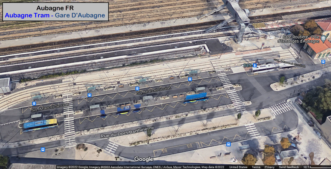
GPS Coordinates: 43.29604, 5.56650
Sq. Marcel Soulat, 13400 Aubagne, France
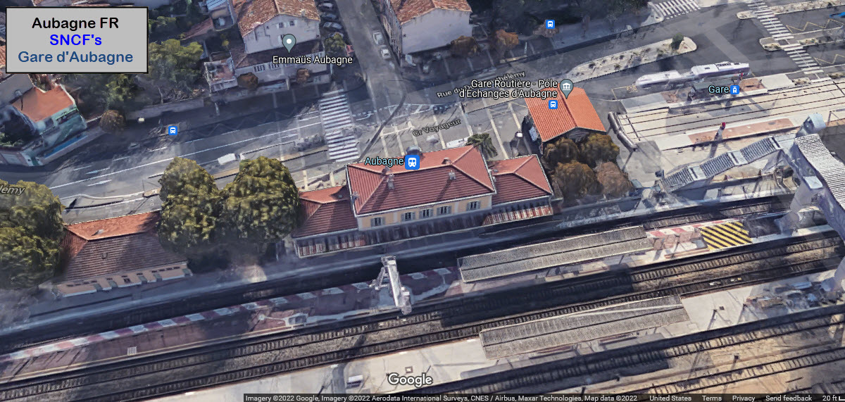
Gare d'Aubagne is a railway station serving the town of Aubagne, Bouches-du-Rhône department, southeastern France. It is situated on the Marseille–Ventimiglia Railway. The station will be the centre of a planned 9 km tram network. I'm not finding much information on the station. Since the line from Marseille to Aubagne was built in 1858, it appears that the station was opened in 1858 (according to the page above).
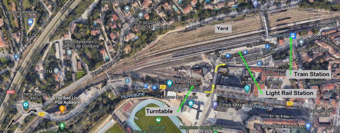
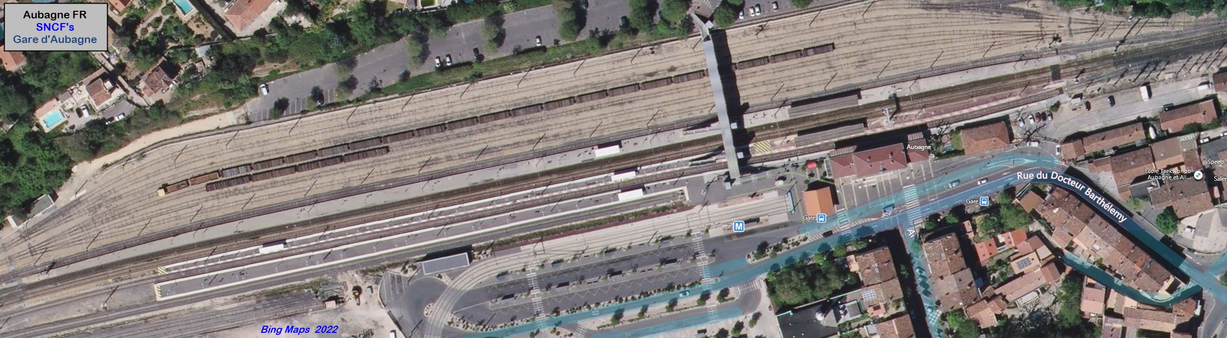
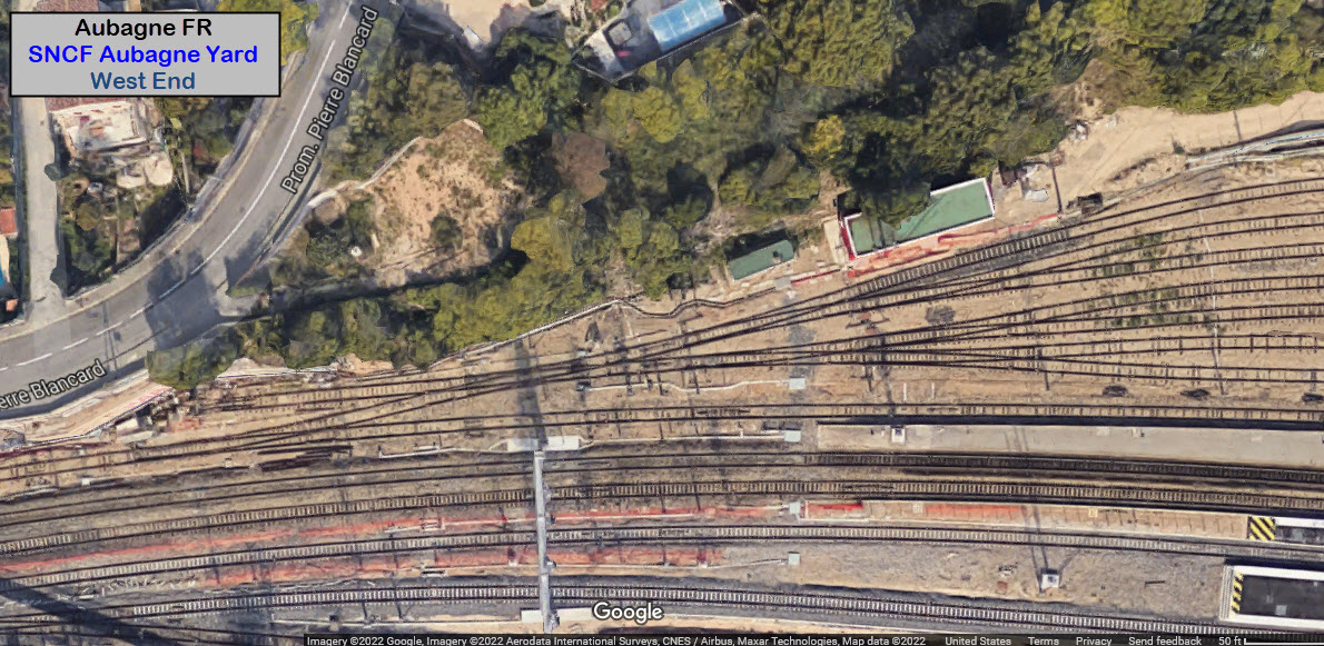
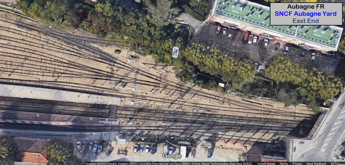
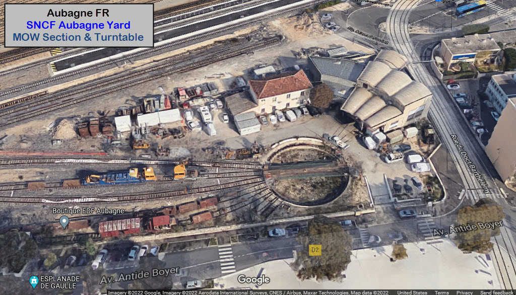
The station complex and the adjoining yard (on the north side of the station) has 11 tracks in it, and (probably) four of them are used for the station and it's passenger trains. South of the passenger tracks is a small MOW yard with a turntable.
North of the yard, is a parking lot, which is accessable via a walkway over the yard. May be a good spot for pictures, depending on the condition of the windows.
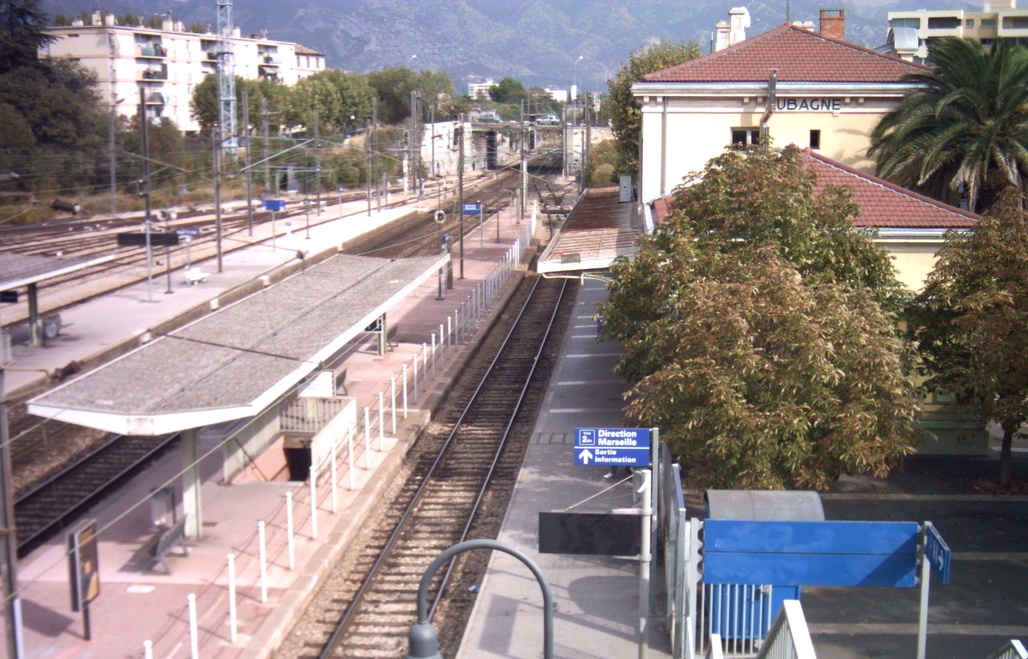
OCT2007, looking east, photo by Fr. Latreille via Wikipedia
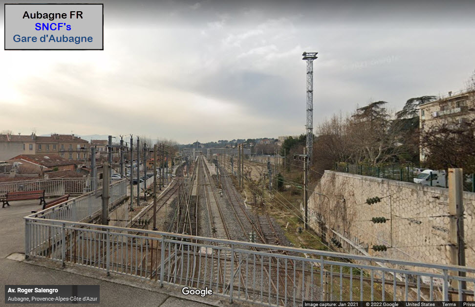
Looks like this small "park" on the overpass on Av Roger Salengro is a good spot for elevated pictures.
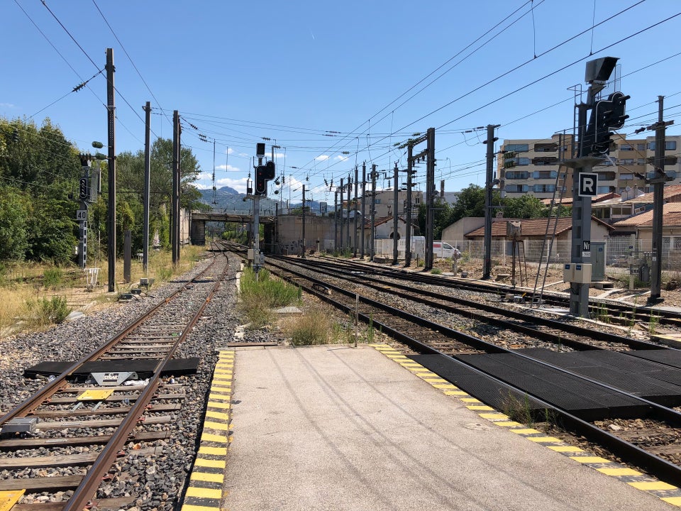 photo by Rld_G./2018
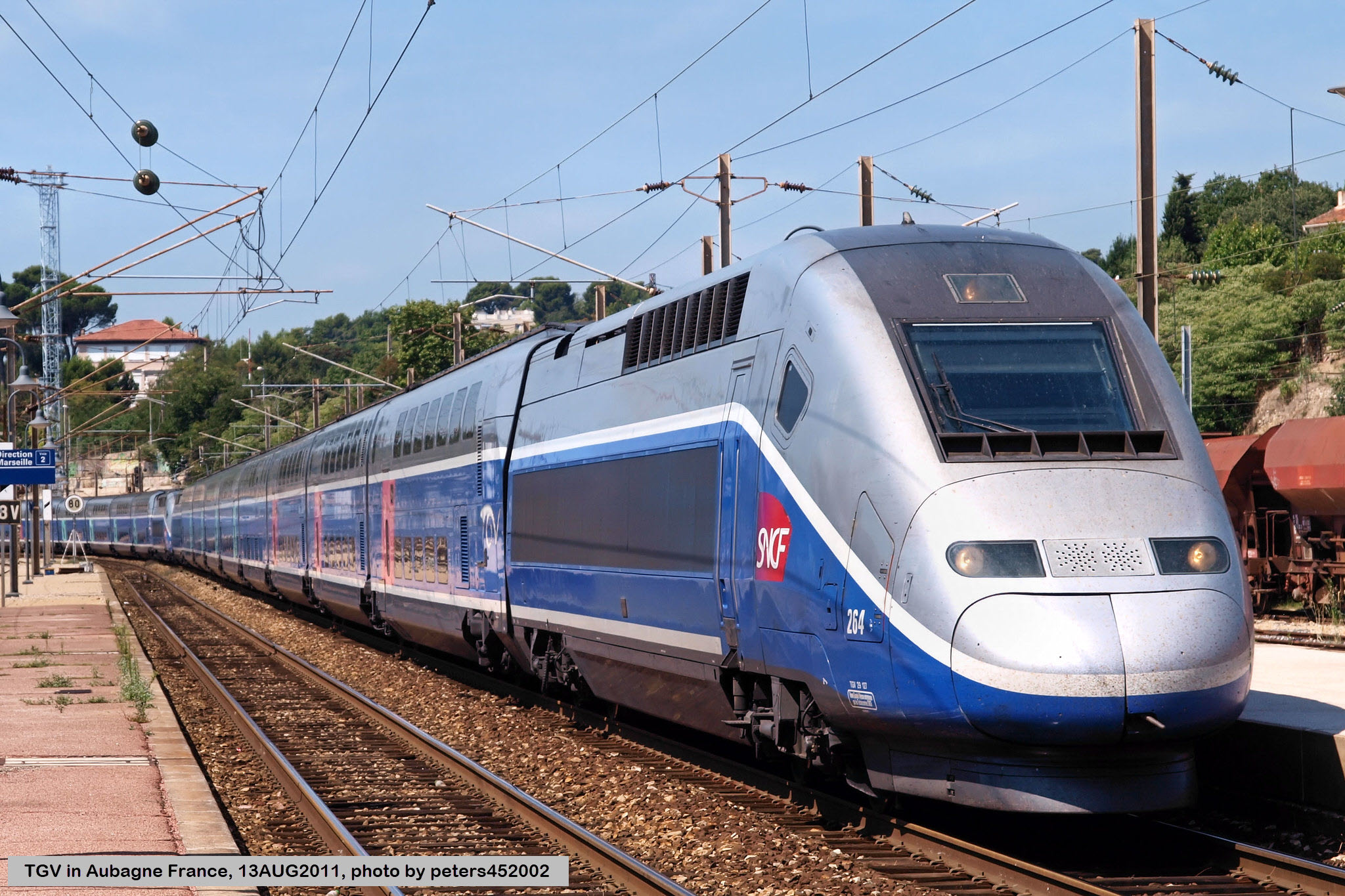 photo by peters452002/2011
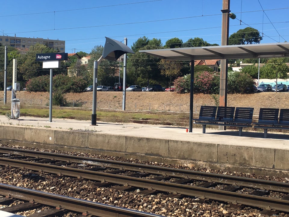 photo by Serge F./2016
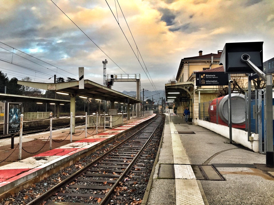 photo by Baptiste, 2017
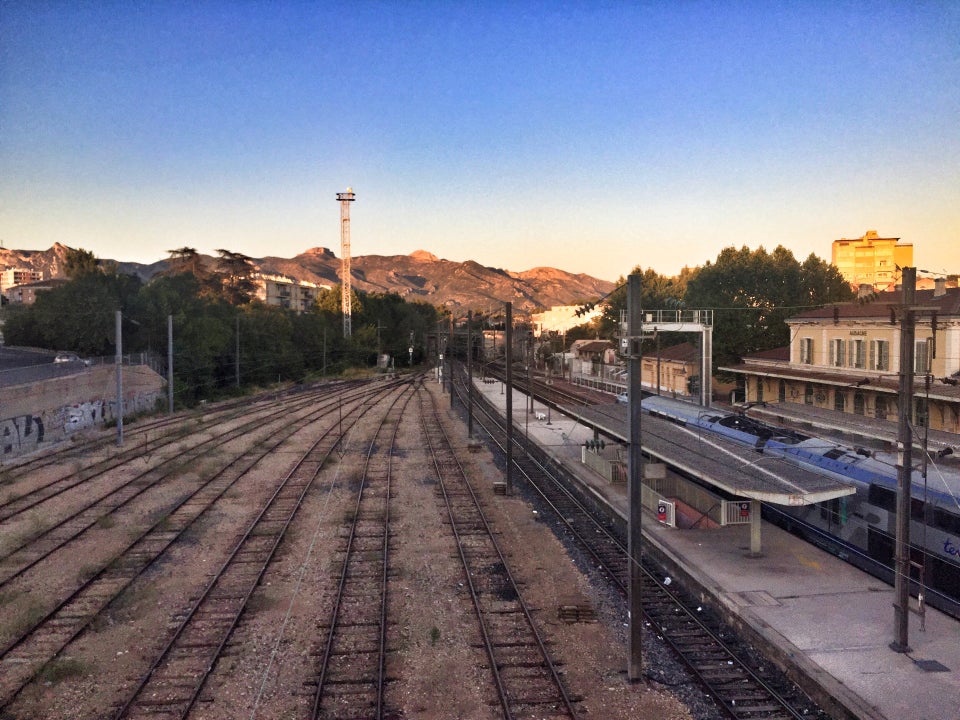 photo by Baptiste, 2016
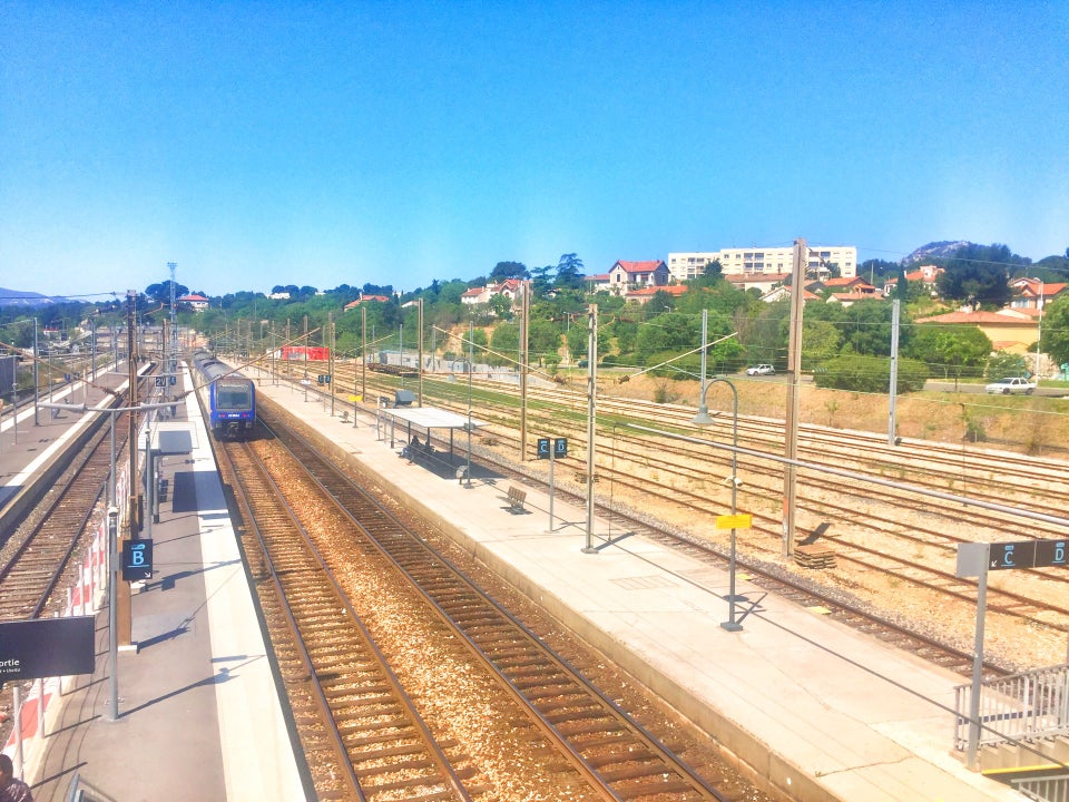 photo by Baptiste, 2016
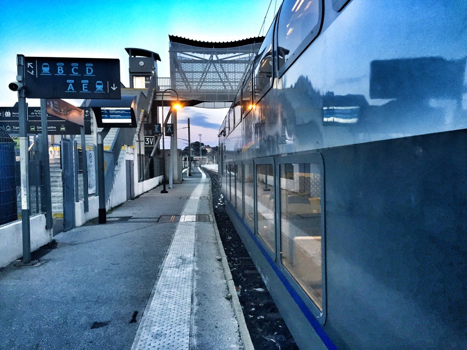 photo by Baptiste, 2016
The freight portion of the yard looks like it has seven tracks in it, with a double slip switch when coming in from the west side. To the south, and easily accessable from the streets, is a small maintenace yard with a turntable, and three sections of the old roundhouse still standing.
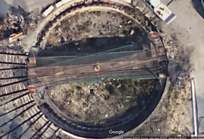
I have to believe this is a double exposure... if not, it's an interesting design :-)
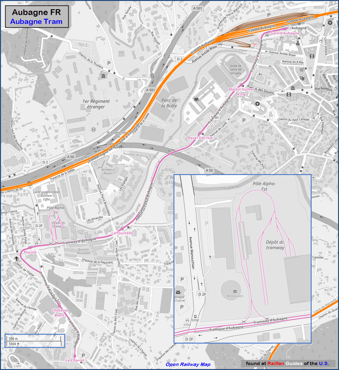
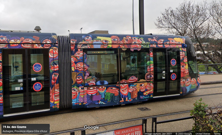
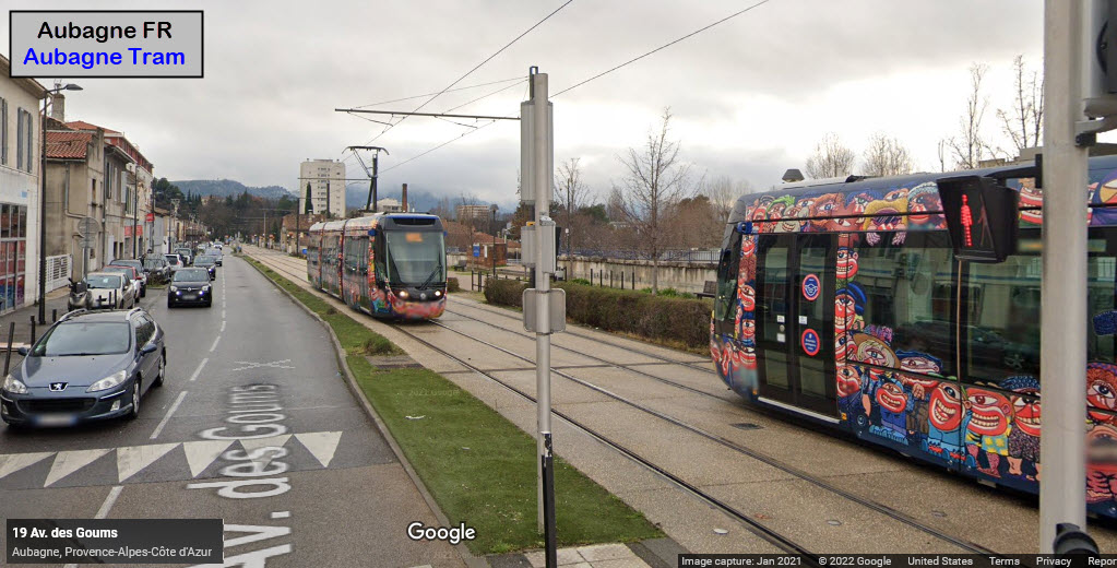
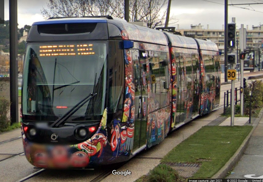
Most of this page is about the light rail/tram system of Aubagne.
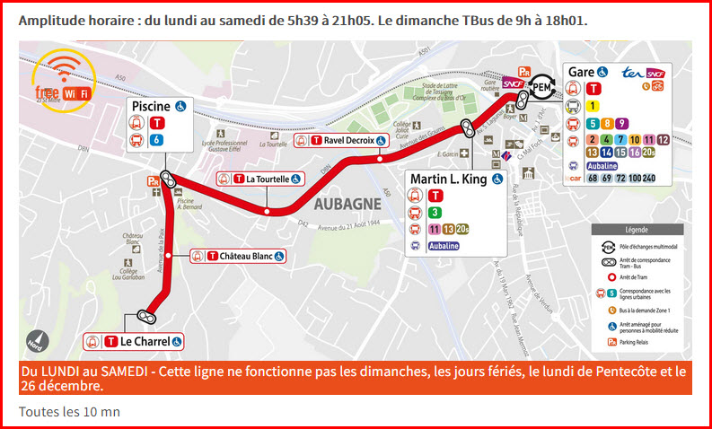
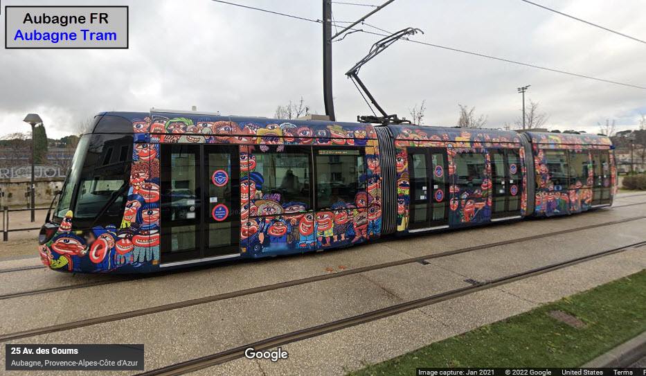
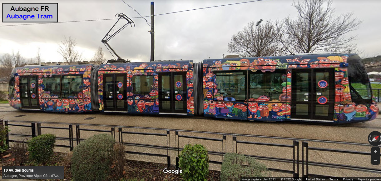
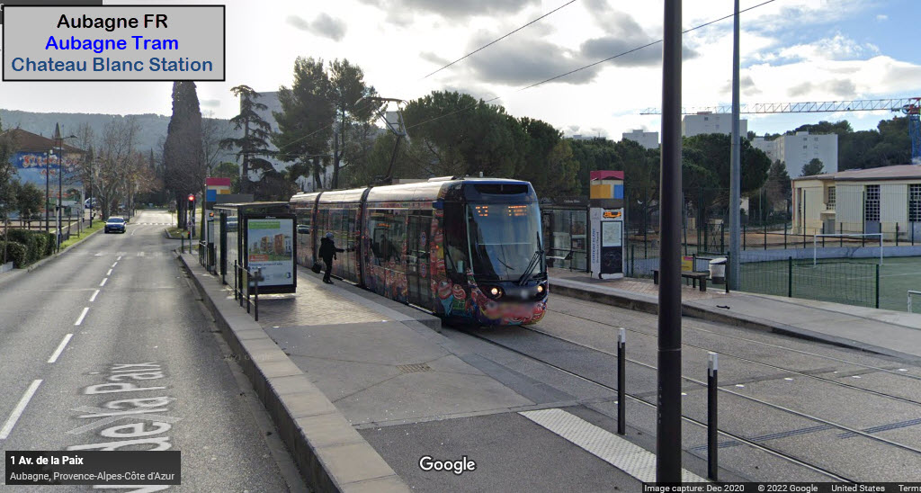
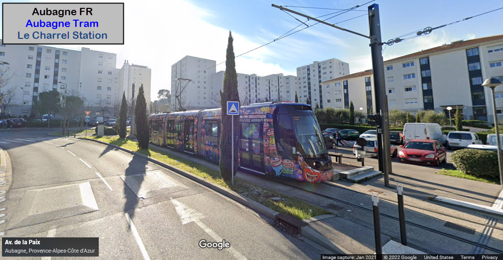
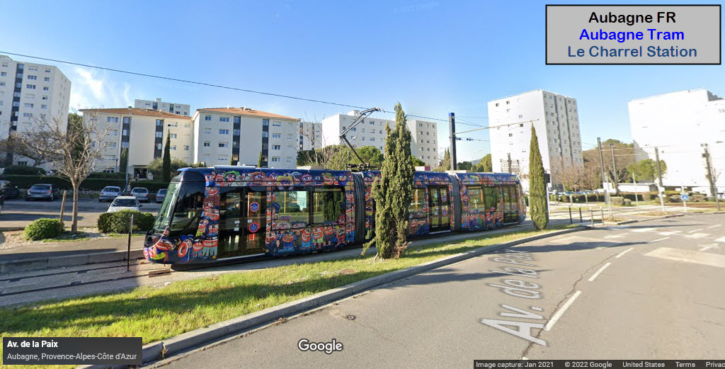
Construction on the Aubagne Tram started in February 2013. Phase 1 opened for service on September 1, 2014 (Le Charrel - Pôle d'échange d'Aubagne) i.e. connecting with the SNCF station). Phases 2 and 3 were supposed to open in 2016 and 2019. The tram includes a fleet of compact Citadis LRV's. The trams have been painted with brightly colored "monsters" that are designed to frighten small children. It is all part of the Tramway Aubagne's safety program. Line/phase 1 is complete and runs from the station to Le Charrel. Line 2 will run from the station to La Penne-sur-Huveaune - Construction was supposed to start in 2012 for an opening from 2014 or so.
So, let's dive into the tram system.......
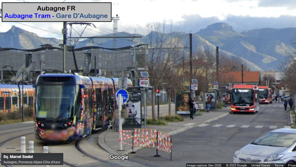
Gare D'Aubagne
GPS Coordinates: 43.29568, 5.56278
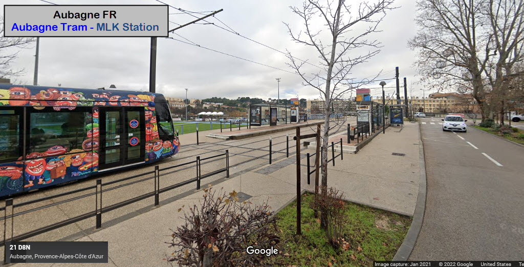
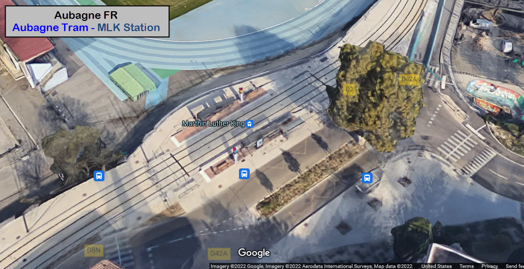
Martin L. King
GPS Coordinates: 43.29298, 5.56497
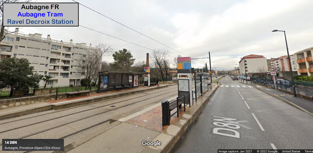
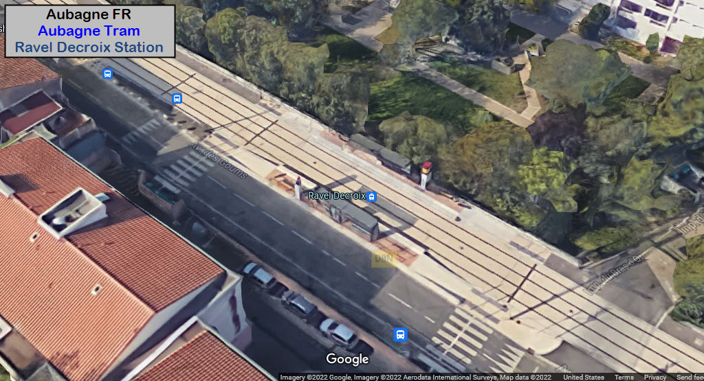
Ravel Decroix
GPS Coordinates: 43.29048, 5.55992
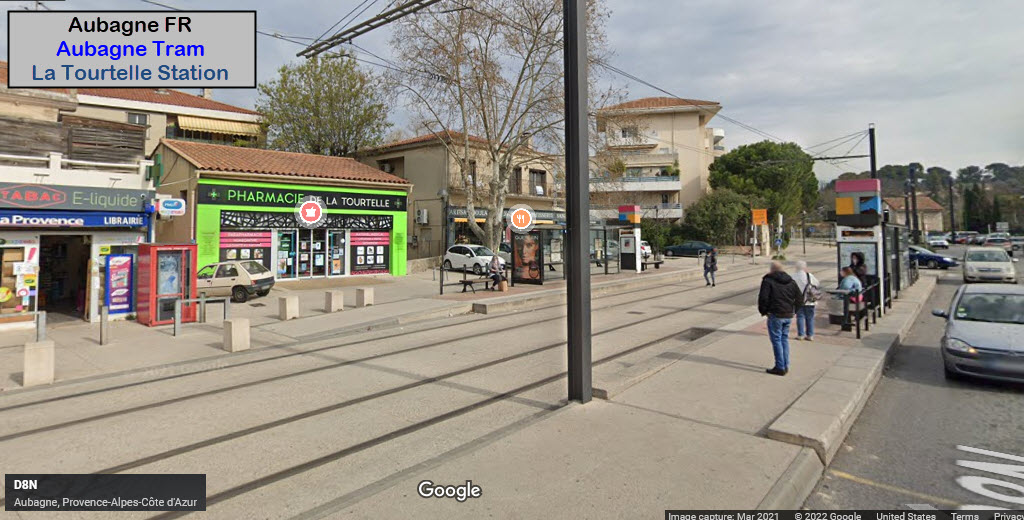
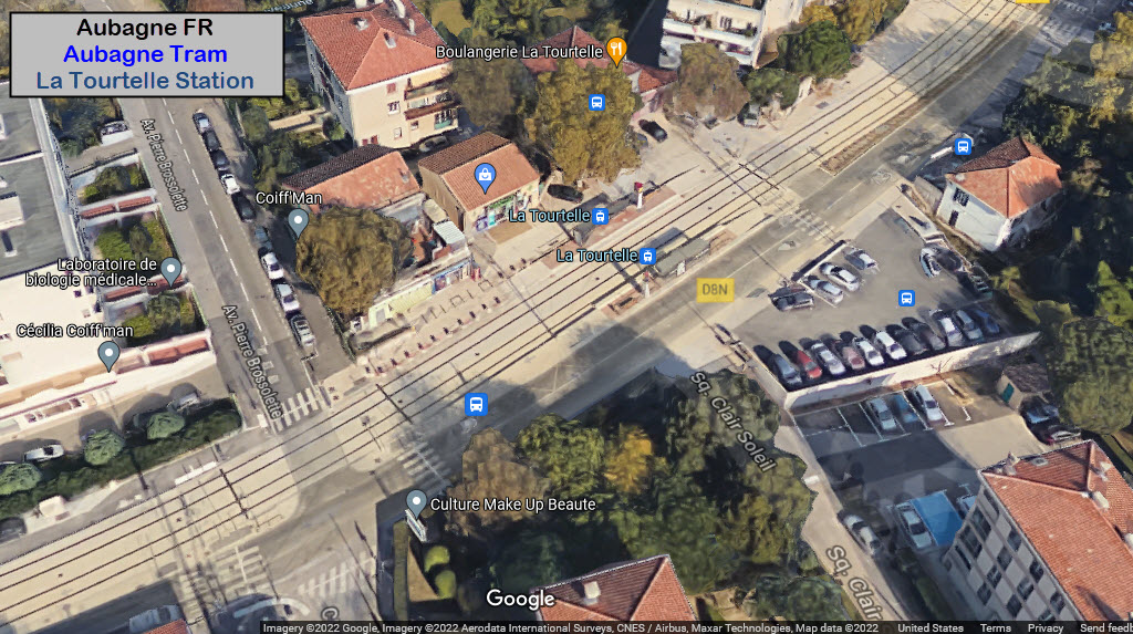
La Tourtelle
GPS Coordinates: 43.28568, 5.55449
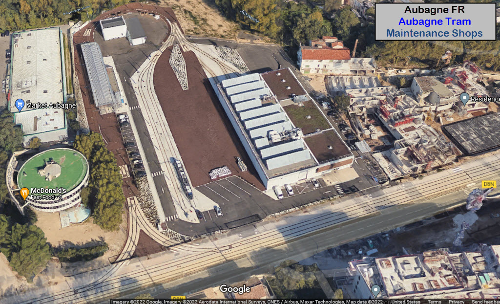
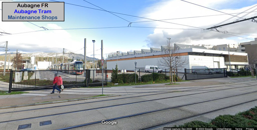
Maintenance Shops
GPS Coordinates: 43.28536, 5.555047
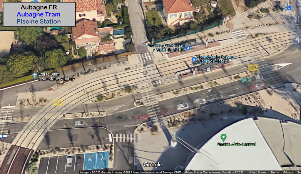
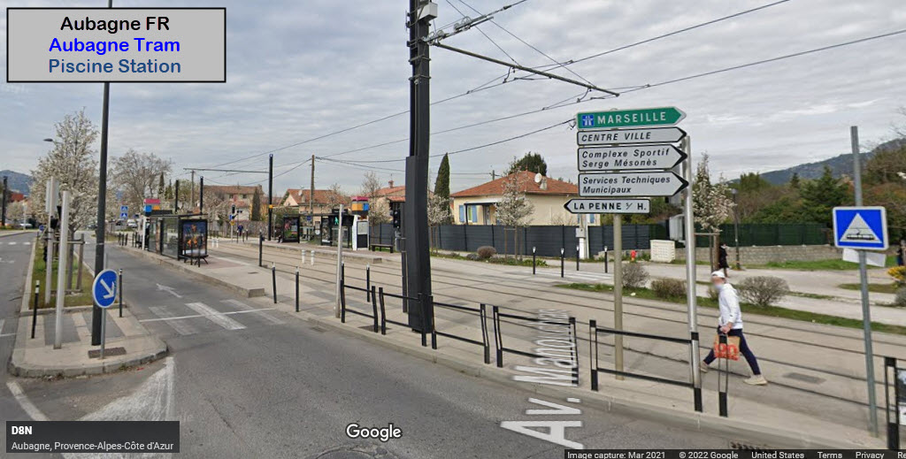
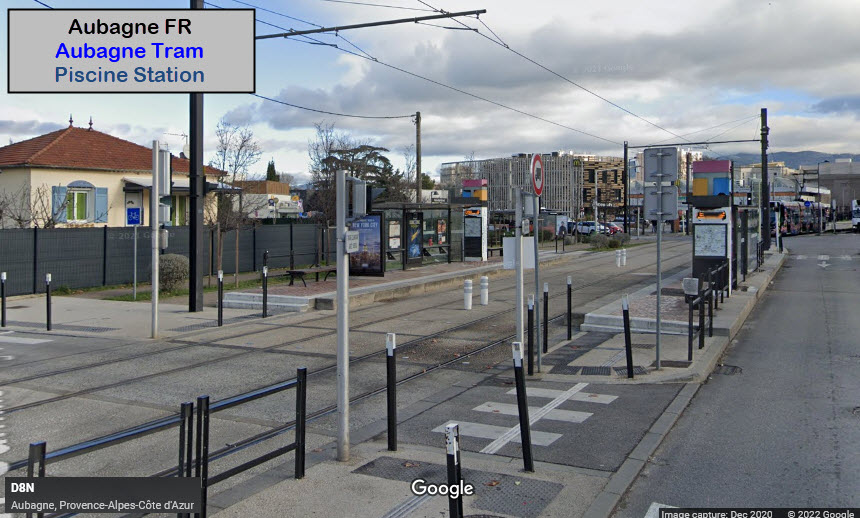
Piscine
GPS Coordinates: 43.28470, 5.54803
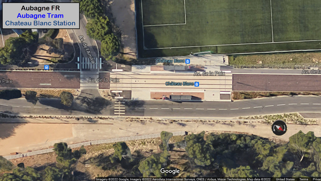
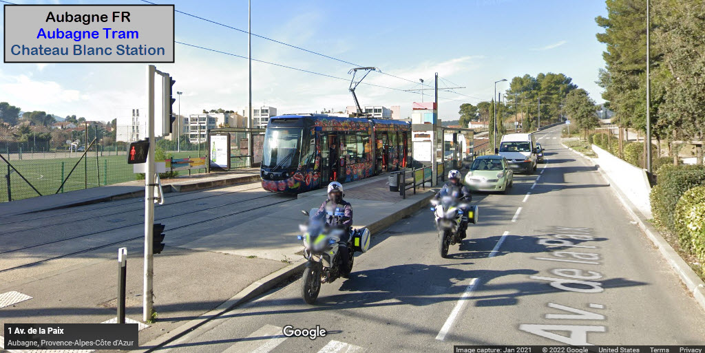
Chateau Blanc
GPS Coordinates: 43.28170, 5.55011
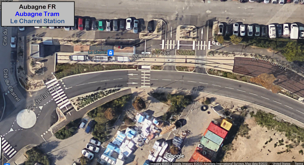
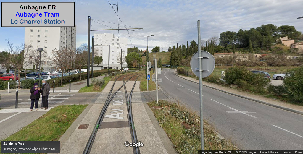
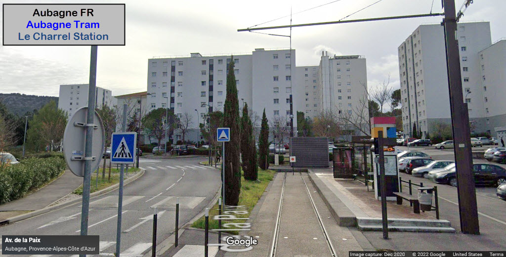
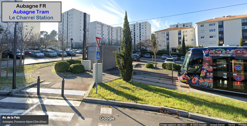
Le Charrel
GPS Coordinates: 43.27923, 5.55115
This is the last station on the south end of the line. The station only has one track in it.
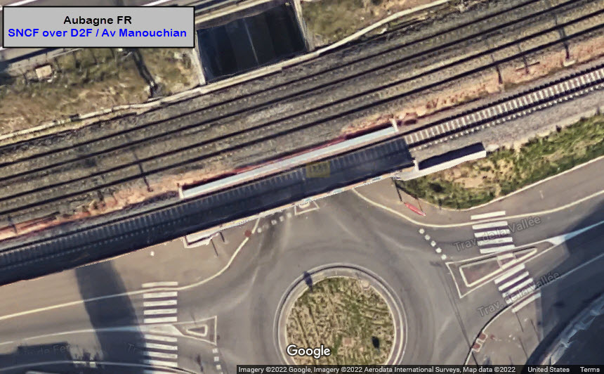
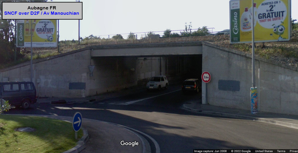
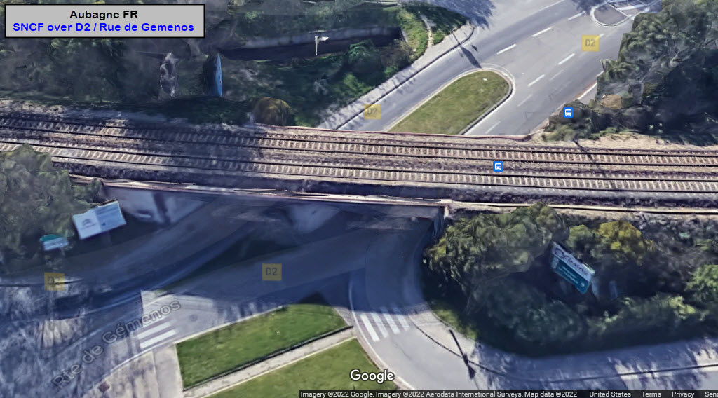
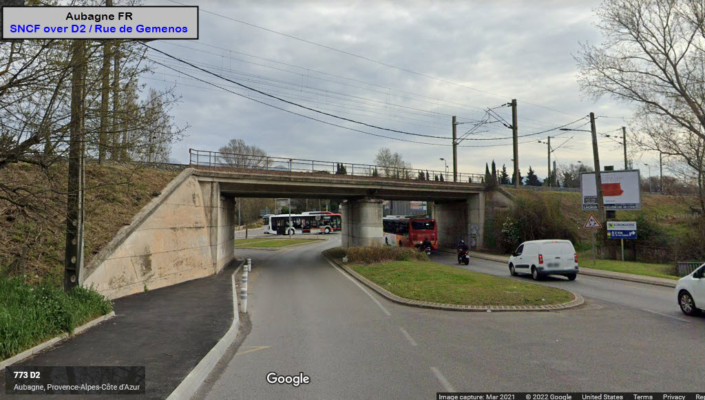
GPS Coordinates: 43.28792, 5.54797, on the west side of town
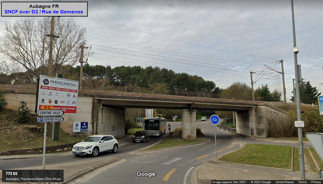
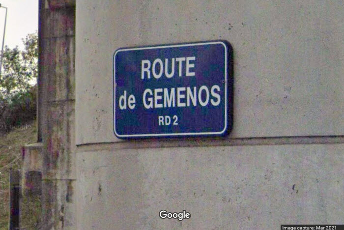
One newer span, two older ones, both look like steel girder bridges.
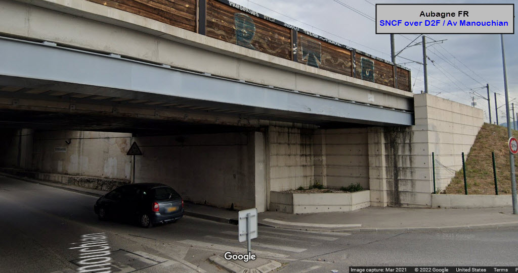
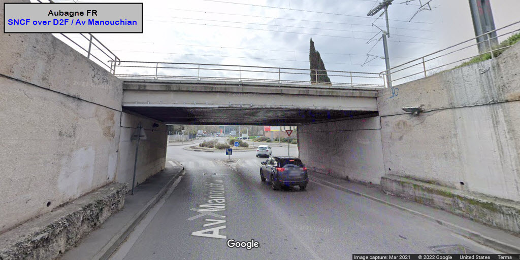
GPS Coordinates: 43.29632, 5.58277, on the east side of town
Tram / Light Rail Bridges
There are none, as the entire system is at street/surface level.
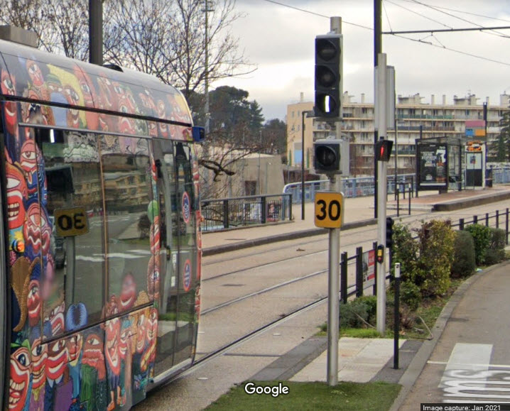
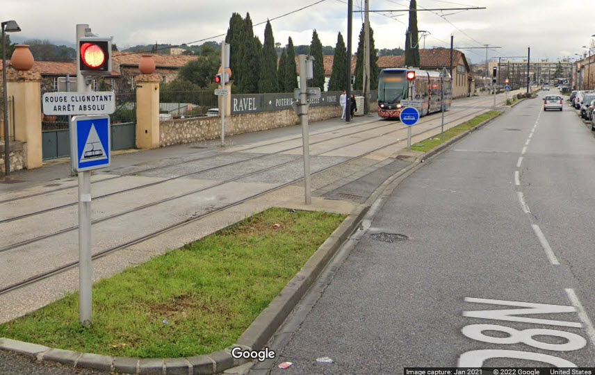
Bar signals for controlling the trains are housed in a standard traffic light housing.
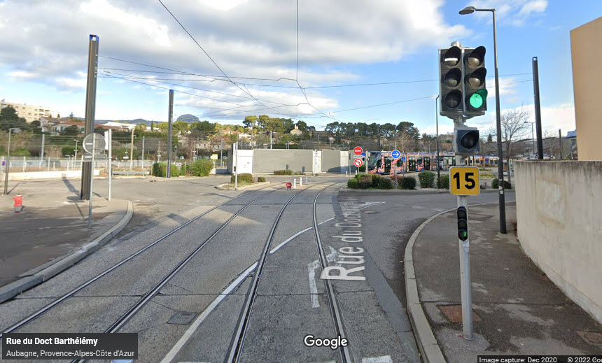
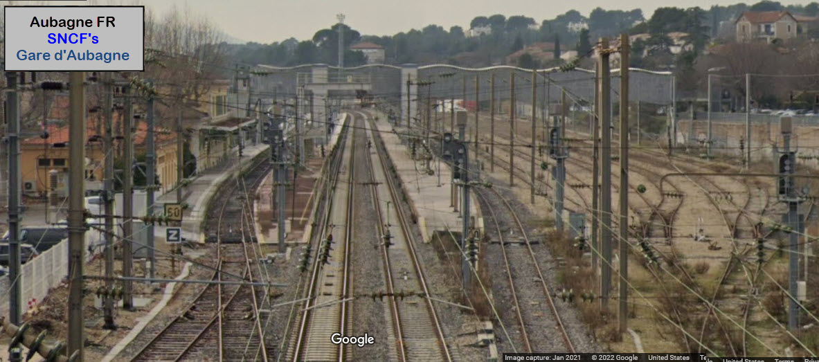
Signal going into the station at Gare d'Aubagne.
The Marseille - Ventimiglia Railway
From Wikipedia: The Marseille–Ventimiglia railway (French: Ligne de Marseille-Saint-Charles à Vintimille; Italian: Ferrovia Marsiglia-Ventimiglia) is a French- Monégasque-Italian 259-kilometre-long (161 mi) railway line. It opened in several stages between 1858 and 1872. It is used for passenger (express, regional and suburban) and freight traffic as the primary railway line serving the French Riviera; a new high-speed line, the LGV Provence-Alpes-Côte d'Azur, is planned for opening around 2035 to offer quicker travel times between Marseille, Toulon, Cannes and Nice.
History: The Marseille–Ventimiglia railway was built and used by the Chemins de fer de Paris à Lyon et à la Méditerranée. The first section that was opened in 1858 led from Marseille to Aubagne. The line was extended to Toulon in 1859 and to Les Arcs in 1862. Cagnes-sur-Mer was reached in 1863 and Nice in 1864. The line was extended to Monaco in 1868 and to Menton in 1869. Finally in 1872 the section to Ventimiglia was opened.
Main stations on the line: Marseille-Saint-Charles, Marseille-Blancarde, Aubagne, La Ciotat, Toulon, Fréjus, Cannes, Juan-les-Pins, Antibes, Nice-Saint-Augustin, Nice-Ville, Nice-Riquier, Monaco-Monte-Carlo (underground), Menton and Ventimiglia IT. end wiki
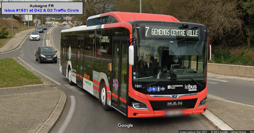
I need at least one bus picture here - at the D42 and D2/Rue de Gemenos traffic circle:
Disclaimers:
I love trains, and I love signals. I am not an expert. My webpages reflect what I find on the topic of the page. This is something I have fun with while trying to help others.
Please Note: Since the main focus of my two websites is railroad signals, the railfan guides are oriented towards the signal fan being able to locate them. For those of you into the modeling aspect of our hobby, my indexa page has a list of almost everything railroad oriented I can think of to provide you with at least a few pictures to help you detail your pike.
If this is a railfan page, every effort has been made to make sure that the information contained on this map and in this railfan guide is correct. Once in a while, an error may creep in :-)
My philosophy: Pictures and maps are worth a thousand words, especially for railfanning. Text descriptions only get you so far, especially if you get lost or disoriented. Take along good maps.... a GPS is OK to get somewhere, but maps are still better if you get lost! I belong to AAA, which allows you to get local maps for free when you visit the local branches. ADC puts out a nice series of county maps for the Washington DC area, but their state maps do not have the railroads on them. If you can find em, I like the National Geographic map book of the U.S..... good, clear, and concise graphics, and they do a really good job of showing you where tourist type attractions are, although they too lack the railroads. Other notes about specific areas will show up on that page if known.
Aerial shots were taken from either Google or Bing Maps as noted. Screen captures are made with Snagit, a Techsmith product... a great tool if you have never used it!
By the way, floobydust is a term I picked up 30-40 years ago from a National Semiconductor data book, and means miscellaneous and/or other stuff.
Pictures and additional information is always needed if anyone feels inclined to take 'em, send 'em, and share 'em, or if you have something to add or correct.... credit is always given! Please be NICE!!! Contact info is here
Beware: If used as a source, ANYTHING from Wikipedia must be treated as being possibly inaccurate, wrong, or not true.
RAILFAN GUIDES HOME
RAILROAD SIGNALS HOME
NEW 1/26/2022, JAN28/30/2022
Last Modified 30-Jan-2022